Council Minutes - Section B: Reports - 22 October 2013
Contents | Previous Page: Section A - Procedural Matters | Next Page: Section C - Notice of Motion
Contents | Previous Page: Section A - Procedural Matters | Next Page: Section C - Notice of Motion
Reports tabled at the Ordinary Meeting of Council on Tuesday date held at City Hall, Little Malop Street in Geelong.
Amendment C246 Lara West Growth Area – Consideration of Panel Report and Adoption
Domestic Animal Management Plan 2013-2017 – Dogs in Public Places Policy 2013-2017
Geelong Municipal Public Health and Wellbeing Plan 2013-2017
General Signage (Including Electoral Advertising Signs) on Road Reserves and Council Land
Amendment C247 and Planning Permit 366/2011: 12-20 Fairbairn Drive, Corio – Adoption
Portfolio: |
Planning - Cr Macdonald |
Source: |
Economic Development, Planning and Tourism |
General Manager: |
Peter Bettess |
Index Reference: |
Reformed Zones |
The purpose of this report is to seek Council support for a planning scheme amendment to implement the reformed residential zones for Victoria into the Greater Geelong Planning Scheme.
The Minister for Planning has released the final details on the reform of Victoria’s residential planning zones.
The Residential 1, 2 and 3 zones are to be replaced with the Residential Growth Zone, General Residential Zone and Neighbourhood Residential Zone.
The new residential zones will give more certainty about the type of development that can be expected in any residential area and give Councils better tools to identify areas where existing urban character will be protected and areas where appropriate increased urban densities can occur.
Councils have been given until 1st July 2014 to implement the new zones, at which time the current zones, Residential 1, Residential 2 and Residential 3 Zones will no longer be available. The Minister for Planning will apply the General Residential Zone to all residential land where Councils have not finalised a translation.
Council’s Housing Diversity Strategy provides a policy basis to apply the new zones.
It is recommended that Council apply all three new zones across the City’s residential areas by applying:
the Residential Growth Zone to Increased Housing Diversity Areas;
the General Residential Zone to Incremental Change Areas and all other Residential 1 Zoned land; and
the Neighbourhood Residential Zone to parts of Newtown, Drumcondra and North Shore.
The proposed application of the new residential zones is shown on the maps in Appendix 1 to this report.
A standard planning scheme amendment is recommended which will provide for community consultation during a public exhibition phase.
Cr Heagney moved, Cr Ellis seconded -
That Council resolves to:
Support the preparation and exhibition of an amendment to the Greater Geelong Planning Scheme to implement the reformed residential zones for Victoria in the format outlined in this report and generally as detailed in Appendix 1, 2 and 3 to this report.
Request the Minister for Planning authorise the preparation of an amendment as detailed in this report and generally as outlined in Appendix 1, 2 and 3 to this report.
Carried.
The reformed residential zones will give more certainty about the type of development that can be expected in any residential area and give Councils better tools to identify areas where existing urban character will be protected and areas where appropriate urban densification can occur.
Three new residential zones have been created, each with specific roles:
Residential Growth Zone (RGZ) – Enables new housing growth and diversity;
General Residential Zone (GRZ) – Respect and preserve urban character while enabling modest housing growth and housing diversity; and
Neighbourhood Residential Zone (NRZ) – Restricts housing growth in areas identified for urban preservation.
The zones were introduced into the Victorian Planning Provisions in July this year. Councils have been given until 1st July 2014 to implement the new zones, at which time the current zones, Residential 1, Residential 2 and Residential 3 Zones will no longer be available.
If Council does not pursue a planning scheme amendment to apply the three zones it is likely that the State Government will apply the General Residential Zone across all residential areas, which may undermine Council’s existing housing policies.
To implement the new zones a review of the existing policy framework and assessment as to how this aligns with the new residential zones has been undertaken. Council adopted a Housing Diversity Strategy in 2007 and its recommendations were implemented into the Greater Geelong Planning Scheme in 2010.
Council’s Housing Diversity Strategy and the G21 Regional Growth Plan (adopted by Council in August 2012) both outline issues facing the municipality in relation to housing diversity and providing for population growth. An aging population and a growing demand for more diversity in housing with a greater demand for smaller households, means that the City needs to ensure it provides for appropriately located infill opportunities. Infill development also makes more efficient use of existing infrastructure including community services.
A detailed implementation report has been prepared which outlines relevant policies, further work undertaken and justifies application of the new zones in detail. A summary of the review and key issues is outlined below.
Housing Diversity Strategy
The Housing Diversity Strategy (HDS) directs the density of housing change that can be expected in different parts of the municipality by defining a hierarchical approach which guides density and the type of development that can be expected in different areas. The Strategy identifies Key Development Areas, Increased Housing Diversity Areas and Incremental Change Areas.
An assessment has been undertaken of how the principles outlined for each of the new zones align with the policy direction for the areas defined in the Housing Diversity Strategy.
Key Development Areas
Key Development Areas (KDA) are for the most part defined as large existing and future development areas that have the potential to accommodate significant amounts of new medium and higher density housing, including mixed use development. A zoning regime to realise these policy objectives is established for the majority of these areas with the application of the Activity Centre Zone for Central Geelong commercial areas, Mixed Use Zone for Fyans/West Fyans Structure Plan Areas and Urban Growth Zone for Armstrong Creek.
The majority of residential areas in the Central Geelong KDA are zoned Residential 2. It is recommended that these be translated to the Residential Growth Zone. The Central Geelong Urban Design Guidelines provide recommendations in relation to development in these residential areas. These recommendations need to be reviewed to consider an appropriate translation into the planning scheme. It is recommended that this further work be documented in the planning scheme.
A large vacant site located adjacent to the Waurn Ponds Shopping Complex is a nominated KDA and is currently zoned Residential 1, the most appropriate zone to apply is the Residential Growth Zone given the clear alignment of purpose between KDA’s and the RGZ.
Increased Housing Diversity Areas
Increased Housing Diversity Areas (IHDA’s) are areas that have been identified due to their proximity to activity centres, train stations and town centres. The IHDA boundaries are based on walkable catchments of either 400m (five minute walk) or 800m (ten minute walk). The HDS aims to provide for a mix of high, medium and conventional density housing in these areas, with the density of development being highest within the commercial core of the area and lower at the edge of the area.
The existing planning policy acknowledges that neighbourhood character in the Increased Housing Diversity Areas will adapt and evolve over time, particularly within and on the edges of activity centres, where land use and development will intensify.
The purpose of the IHDA’s can be met by applying the Residential Growth Zone and using local policy to provide more explicit direction around the design and built form of medium density housing in these areas.
Council’s Municipal Strategic Statement recommends as further work the need to undertake more detailed planning to identify planning controls which will deliver increased housing density. This further work has been undertaken in order to inform implementation of the reformed residential zones, a detailed discussion on this further work is provided later in this report.
The Residential Growth Zone allows small scale commercial uses including Shop, Food and drink premises, Medical centre and Place of worship without a permit if conditions limiting their location and scale are met. In relation to food and drink premises and shop the condition for an as of right use include that the land must be located within 100 metres of a commercial zone or Mixed Use Zone and must adjoin, or have access to, a road in a Road Zone and must have the same street frontage as the land in the commercial zone or Mixed Use Zone. A medical centre up to 250sqm is as of right, however it is noted that the car parking provisions of the planning scheme are still required to be met or if they cannot be a planning permit would be required to waive requirements.
Council’s local planning policy in relation to discretionary uses in residential areas is proposed to be amended to include that where these uses are permit required that they are discouraged in residential areas.
Incremental Change Areas
Incremental Change Areas are residential areas in which new development is in keeping with the municipality’s traditional suburban character and where only incremental change is expected. These areas are zoned Residential 3 currently and require the provision of larger private open space areas compared to the ResCode standard. These additional requirements ensure that the change that is experienced is in keeping with the existing character of these areas.
It is recommended that all Residential 3 zoned areas have the General Residential Zone applied. This zone is recommended as opposed to the Neighbourhood Residential Zone as this zone and Councils Housing Diversity Strategy recognise that modest housing growth will occur as opposed to the Neighbourhood Residential Zone which is recommended for areas where change is limited. The requirement for backyards larger than the ResCode standard in medium density developments will be retained in a schedule to the General Residential Zone.
Further work – Increased Housing Diversity Areas Study
An Increased Housing Diversity Area Study has been completed, which included a street by street survey of existing conditions, a desktop analysis of relevant policy and a detailed assessment of existing lot sizes and density, building heights, street setbacks, site coverage, public realm quality, constraints and opportunities. This work has informed preparation of key design recommendations for each IHDA.
Generally the Study found that there is significant opportunity for increased housing diversity within all of the IHDA’s. Housing diversity can be achieved in all of the IHDAs by encouraging a mix of residential building typologies including infill (detached), semi-detached, attached, terraced and low-rise apartments.
The recommendations generally encourage innovative architecture, high quality, site responsive medium density housing development sympathetic to unique characteristics of sites. Recessive elements for buildings three storeys or more are encouraged in appropriate locations within all of the urban IHDAs, and a building height limit of three storeys (10.5 metres) in coastal IHDAs is encouraged to maintain a canopied or coastal vegetation character. Tree planting was identified as being a significant attribute for the future preferred character of all IHDAs.
It is recognised that housing at higher densities can have a greater impact on neighbourhood character than traditional detached housing. As housing density intensifies it is important that design quality improves to ensure a positive contribution to the neighbourhood is achieved.
Well designed, site responsive, contemporary medium density housing will replace the existing housing stock and intensify development patterns overtime in the IHDA’s. The intensity of redevelopment will be highest around the activity centre core and lower at the edge of the IHDA with this principle being embedded in the Housing Diversity Strategy.
It was noted that some IHDAs had larger or more areas with development constraints such as precincts with a heritage overlay, or design considerations such as boundary edge areas surrounded by heritage places. However, all had high opportunity areas and an ability to accommodate change across each IHDA.
It is recommended that a Local Planning Policy be introduced in order to manage the change within these areas in relation to built form and character outcomes, as well as balance the constraints such as heritage places, significant vegetation, topography and public spaces within each IHDA. The proposed policy reiterates that these areas are changing and have an evolving character.
The Residential Growth Zone provides the ability to vary ResCode standards in order to assist with realising policy objectives. It is recommended that ResCode standards are varied in relation to minimum street setback, site coverage and private open space for coastal and urban IHDAs.
Geelong West/Newtown area
Further work clauses in the MSS identify the need to:
implement the Newtown Heritage Study Review 2008;
conduct a Heritage Review in the Ashby precinct in Geelong West and
review the application of appropriate zones/overlays, consistent with the principles of the Housing Diversity Strategy, surrounding the neighbourhood centres of Pakington Street Newtown, Pakington Street Geelong West, Aberdeen Street Newtown and Shannon Avenue Manifold Heights.
Council previously determined that the heritage studies needed to be completed prior to any IHDAs being nominated in the Geelong West / Newtown Areas. The Ashby and Newtown Heritage Reviews have both been completed and implemented into the planning scheme. As part of the current work to implement the new zones a detailed review of this area has been undertaken. Recommendations in relation to the various areas are detailed below.
The complexity of opportunities and constraints in this area require a unique approach to determining the areas appropriate for increased housing diversity.
This area is only a short distance from Central Geelong, the inner Geelong Stations and the Waterfront. It is well positioned to take advantage of the employment and recreation opportunities afforded by these areas. Within the review area there is also a plethora of retail, education and civic services. The retail centres within the review area are:
|
Centre |
Facilities |
Centre type – Retail Strategy |
|
Pakington Street – Geelong West |
Two supermarkets; sub-regional catchment for fashion, civic and entertainment uses |
Community Centre |
|
Pakington Street – Newtown |
Fashion and cafes; no supermarket |
Neighbourhood Centre |
|
Shannon Avenue – Geelong West / Manifold Heights |
Two supermarkets; some commercial; takeaway restaurants |
Neighbourhood Centre |
|
Aberdeen Street – Newtown |
Supermarket, hotel, medical centre |
Neighbourhood Centre |
The methodology used to identify increased housing diversity areas by the Housing Diversity Strategy was the establishment of a hierarchy of centres based on an assessment of the walkable catchment of the respective centres; 400m for neighbourhood centres and 800m for sub-regional centres.
The number of centres within close proximity, the variety of housing stock and complexity of constraints in this area requires a unique approach to ensure that a rational and balanced planning outcome is achieved.
The Pakington Street Geelong West centre is identified in the Retail Strategy as a Community Centre – that is somewhere between a sub-regional centre and neighbourhood centre. Since the preparation of the Retail Strategy in 2006 the Pakington Street centre has grown to include a second full line supermarket and draws a sub-regional catchment for its offer of high quality fashion and café culture.
For the purposes of assessing the walkable catchments it is appropriate to consider 400m from each of the neighbourhood centres and 800m from Pakington Street, Geelong West.
Pakington Street Geelong West
The inner urban character of Geelong West and Pakington Street and its proximity to Central Geelong make it a popular location for many different households. The range of services and centres within close proximity make this pocket of Geelong West suitable to accommodate housing growth.
Whilst the average lot size (420 sqm) and corresponding residential density are comparably high in the Geelong context, there is still capacity to redevelop many underutilised sites and opportunities to extend and develop existing heritage properties consistent with the policy objectives of the existing heritage overlays.
It is recommended that Geelong West be included in the Residential Growth Zone (RGZ). Whilst the heritage significance of some precincts will limit the capacity within these areas there are many sites and streets that offer the opportunity to deliver new housing in this popular location. Some variations to the open space and front setback ResCode provisions will further encourage new development in this area that is consistent with the area’s inner urban feel.
There is a small pocket of housing adjoining Church Street that is outside the walkable catchment of one of the retail centres however it is recommended that these areas be included in the RGZ due to the multitude of services and centres available to these areas and the need to provide logical boundaries to the new planning zones.
Aberdeen Street Newtown and Shannon Avenue Manifold Heights
The 400m walking catchment of Shannon Avenue and Aberdeen Street centres are recommended for the RGZ consistent with the approach taken with other comparable neighbourhood centres in the municipality. Both centres serve the local shopping needs of nearby residents.
It is recommended that these centres be identified as IHDAs and included in the Incorporated Document for Key Development and Increased Housing Diversity Areas. DDO14 should be removed from this area consistent with the planning controls in place for IHDAs.
The area west of Bostock Avenue is recommended for the General Residential Zone – Schedule 1. This area has a consistent character of single detached dwellings in generous garden settings. New development in this area should provide additional open space to ensure consistency with the existing character of the area.
Pakington Street Newtown
Within the suburb of Newtown there is a distinct pocket of housing located on the Newtown Hill. This area is one of two areas identified in the City of Newtown Urban Conservation Study as having ‘regional’ rather than just ‘local’ significance. The significance of the area is distinguished by fine housing reflecting the lifestyles and tastes of some of Geelong’s wealthier families during the last century and containing many significant buildings of architectural merit. The large garden settings and the well established street trees also contribute to the unique character of this area. Given the significance of this area the Neighbourhood Residential Zone is recommended. Outside the Newtown Hill area there is more variety in the housing stock and streetscapes and there are examples of similar housing stock elsewhere in Geelong. While there are a number of heritage precincts they are of local significance only. These areas have also seen a higher proportion of new development over recent years providing a greater mix of housing stock within the area, including heritage precincts. The General Residential Zone is recommended for these areas.
The 400m walking catchment of the Newtown – Pakington St centre is not recommended for RGZ like other neighbourhood centres. Whilst it is a popular and vibrant café and fashion strip the centre does not offer nearby residents the daily shopping needs that would be expected at a neighbourhood centre. However there still remains opportunity for new housing within this area and the General Residential Zone is recommended.
Latrobe Terrace frontage
There is a broad range of building types and uses within the Residential 1 and Residential 2 zoned land fronting LaTrobe Terrace. This road is a six lane arterial road which is not ideally suited to residential development given the amenity issues associated with high traffic levels. Over the years a number of offices, medical centres and food and drink uses have emerged.
The application of RGZ on LaTrobe Terrace is recommended. Most of the strip is developed, including many substantial heritage properties. The RGZ offers a broader range of non-residential uses allowable with a permit which would be appropriate in this busy corridor. The alternative to facilitate non-residential uses would be an extensive expansion of the mixed use or commercial zones that could undermine planning for other centres. The application of the RGZ provides a good balance of flexibility for landowners and guidance that can be provided by council through the permit process.
Other Recommendations
Hamlyn Heights – Vines Road Increased Housing Diversity Area
This area was nominated as a potential IHDA in the Housing Diversity Strategy in 2007. Since this time the centre has further developed with expansion of the community and education facilities, new and expanded retail development and streetscape upgrades.
It is recommended that a 400m walking catchment around the centre be recognised as an Increased Housing Diversity Area and this be included in the Incorporated Document in the for Key Development and Increased Housing Diversity Areas.
It is recommended that this area have the same zoning regime applied as other IHDAs with the Residential Growth Zone being applied and the DDO14 be removed from the IHDA.
Translation of all other land zoned Residential 1
There is a range of land zoned Residential 1 in the municipality. These areas include land located outside Increased Housing Diversity Areas that are not located within the Residential 3 Zone and include both newer residential estates and established residential areas.
It is recommended that the General Residential Zone be applied in these areas.
Ocean Grove
A number of issues have been raised over recent years by Council’s planners and the community with the application and operation of the Significant Landscape Overlay Schedule 7 – Ocean Grove Coastal Area (SLO7). The review into the implementation of the reformed residential zones has considered how the policy objectives of the Housing Diversity Strategy, SLO7 and application of the reformed residential zones should be managed.
The objectives of the SLO7 are to provide a balance between roof tops and vegetation when viewed from a distance, encourage development that seeks to maximise views and encourage space for planting and the retention of vegetation.
The Ocean Grove IHDA is located around and supports the Town Centre. It is clear Council policy to promote housing density and change in this area through the Housing Diversity Strategy, Ocean Grove Structure Plan and Ocean Grove Town Centre Urban Design Framework (currently being prepared). The application of the Residential Growth Zone is considered to best reflect these policy directions.
As part of the review the boundary of the IHDA has been revisited to ensure that any areas of particularly significant character are not unduly affected by new development. There are a number of areas that display exceptional landscape characteristics that are articulated in the SLO7. The area south of the properties fronting Orton Street should not be included in the IHDA and should be included as an Incremental Change Area. These areas typically interface with coastal vegetation reserves, stands of remnant vegetation or are highly visible from public viewing locations. The scale and character of new development in these areas should be carefully considered to ensure that the significant vegetation and landscape characteristics are maintained.
To deliver a balanced approach in the Ocean Grove IHDA the objectives of the Housing Diversity Strategy and SLO7 both need to be considered. The SLO7 does potentially impact on the capacity of the Ocean Grove IHDA to deliver the housing change anticipated in an IHDA. However, a review of the area has shown it is delivering housing change, increases in density and quality architectural styles when compared to other IHDA’s. To this end it is recommended that the SLO7 be retained with improvements to remove the exemption for a permit to remove tea tree where it is indigenous to the area, include only relevant decision guidelines and include application requirements which require the need for a design response including a view impact analysis.
North Shore
The Neighbourhood Residential Zone (NRZ) is recommended for the residential pocket in North Shore. The NRZ can be used in areas where constraints and natural or other hazards restrict housing growth. The maximum number of dwellings on a lot in the NRZ may not exceed two.
The North Shore residential area is constrained by the proximity of port activities and industrial zoned land and the need to manage potential conflicts between port uses and the amenity of existing residences. These issues were considered in the adopted Port Structure Plan 2007 and the Environmental Significance Overlay 5 (ESO5) – Port of Geelong Environs.
The Structure Plan recognises the economic importance of the Port and the need to manage the interface between port and sensitive residential uses. A key direction of the Plan is to minimise future amenity conflict in the Port and interface area. The ESO5 was introduced in 2012 to manage potential conflicts between land in the port environs and the adjoining Port of Geelong. Land within this overlay should not be developed for any purpose that might compromise the long term protection and expansion of port operations infrastructure and associated storage facilities.
The use of the NRZ in North Shore and its restrictions on the number of dwellings allowed on a lot are consistent with these directions.
Drumcondra
Like the Newtown Hill area discussed earlier the Geelong West Urban Conservation Areas Study has identified the Drumcondra area as having substantially high quality homes with a number of dwellings designed by local notable architects Buchan Laird, Seeley King and Everett. The area is significant for its almost exclusively detached housing, wide streets with footpaths and street tree plantings, allotment sizes which allow side boundary and generous front setbacks with substantial gardens and consistent materials and styles with rich architectural detailing. For these reasons the Neighbourhood Residential Zone is recommended.
Residential Character Study: Character Precinct Brochures (2001)
The existing Residential Character Study: Character Precinct Brochures prepared in 2001 have been reviewed as part of the work to implement the new zones. The need for a review of the brochures is identified in the planning scheme.
This review has been completed as part of the new zone translation and as a result it is recommended the Study be removed as a reference document in the Planning Scheme for the reasons outlined below.
The Study surveyed the residential character of each part of Geelong, described that character through words and photographs and produced guidelines in the form of brochures to maintain, enhance and improve the character of each part of the municipality. The Study acknowledged the challenges of identifying and describing residential character in Geelong given the diversity of townships and suburbs in the municipality.
The Study dates back to 2001 and development over the last 12 years has seen some significant changes to townships and suburbs across the municipality. More contemporary architecture, two storey forms, prevalence of garaging, reduced front setbacks and an increase in housing typologies mean the existing and preferred character statements do not necessarily reflect what is occurring in 2013. A key criticism of the brochures is that they are generic given the large areas they cover.
The need for developments to have regard to neighbourhood character is embedded in the planning scheme with reference to this within state and local planning policy, notably ResCode which guides the assessment of medium density housing includes neighbourhood character as a specific objective that needs to considered.
More detailed discussion is provided in relation to this recommendation in the implementation report on reformed residential zones.
Urban Growth Zoned Areas
Key growth areas in the municipality are zoned Urban Growth Zone (UGZ) include Armstrong Creek and a current proposal to apply the zone to the Lara west growth area.
The UGZ is impacted by the new zones as the applied zones will need to be amended to refer to the new residential zones. It is proposed that this is resolved as part of a separate amendment process.
Summary of Recommendations
Appendix 1 to this report provides a summary of the translation and maps identifying the proposed zone changes.
Appendix 2 to this report provides a summary of changes required to the Greater Geelong Planning Scheme to implement the recommendations.
Appendix 3 to this report provides a copy of the key policy changes including proposed new zones and schedule, new local planning policy for Increased Housing Diversity Areas and amended Incorporated Document “Key Development and Increased Housing Diversity Areas.”
The following table provides a summary of the proposed implementation of the reformed residential zones:
|
Proposed Zone |
Local areas |
Design and siting - ResCode variations |
Maximum building height |
Maximum no. of dwellings on a lot |
|
Residential Growth Zone (no schedule) |
|
None specified |
Should be no higher than 13.5 metres |
None specified |
|
Residential Growth Zone Schedule 1 |
|
|
Should not exceed 13.5 metres |
None specified |
|
Residential Growth Zone Schedule 2 |
|
|
Must not exceed 10.5 metres |
None specified |
|
General Residential Zone (no schedule) |
|
None Specified |
Should not exceed 9 metres |
None specified |
|
General Residential Zone Schedule 1 |
|
|
Must not exceed 9 metres |
None specified |
|
Neighbourhood Residential Zone (no schedule) |
|
None specified |
Must not exceed 8 metres |
Two dwellings |
|
Neighbourhood Residential Zone Schedule 1 |
|
|
Must not exceed 8 metres |
Two dwellings |
In order to implement the new zones it is recommended that Council undertake a standard planning scheme amendment process enabling public consultation during statutory exhibition of the amendment.
Some Councils across Victoria have requested the Minister to approve a 20(4) amendment in order to implement the new zones. This process does not provide for public consultation. Given the additional strategic work that has been undertaken to inform the proposed translation into the Greater Geelong Planning Scheme, it is considered appropriate that a standard planning scheme amendment process be undertaken.
This report has positive environmental implications in relation to encouraging a more sustainable urban form with medium density housing being located near activity centres, town centres and train stations. The new zones provide for greater clarity in relation to the policy difference for various residential areas, which will provide for better outcomes in terms of directing medium density housing to locations where .
This report does not result in any additional financial implications for Council.
Current approved budget will cover costs associated with a planning scheme amendment.
The recommendations of this report comply with State Planning Policy in relation to the Practice Note for applying the new residential zones prepared by the Department of Transport, Planning and Local Infrastructure. As outlined in this report the recommendations are based on Council’s adopted Housing Diversity Strategy which is implemented in the Greater Geelong Planning Scheme.
The recommendations of this report are consistent with City Plan in relation to promoting a sustainable built environment, sustainable land use and development, increased public transport use, liveable neighbourhoods, quality urban design and built environment and the conservation of historic buildings.
Officers involved in the drafting of this report own property affected by the proposed planning scheme amendment and therefore have an indirect interest in relation to the recommendations of this report.
There are risks associated with Council not resolving a position in relation to implementing the new residential zones, as the Government has stated that it intends to remove the existing zones from the Victorian Planning Provisions on 1st July 2014. Therefore Council must implement the new zones prior to this date.
As outlined in this report, a statutory public exhibition process will be undertaken as part of the standard amendment process, which will provide for community consultation.
The recommendations of this report provide for managed residential growth in the municipality. Increased density and infill housing is directed to areas that are well serviced which provide good opportunities to meet the demands for smaller households. Incremental change areas provide a balance of providing a mix of housing stock while maintaining the garden character of identified areas. A range of housing is important to provide for the different housing needs in our community.
Human rights relative to the subject matter of this report, such as “ratepayers property rights and a right to a fair hearing” have been considered. The amendment process provides an opportunity for submissions and an opportunity for a fair hearing.
This report recommends that Council undertake a planning scheme amendment in order to implement the new zones. As part of this process a statutory public consultation process will be undertaken, this will give the opportunity for submissions to be made by parties impacted by the amendment.
Portfolio: |
Planning – Cr Macdonald |
Source: |
Economic Development, Planning and Tourism – Strategic Implementation |
General Manager: |
Peter Bettess |
Index Reference: |
Application: Amendment C246 |
This report considers the Panel Report to Amendment C246 and recommends adoption of the Amendment.
Amendment C246 proposes to rezone 390 hectares of land on the western fringe of Lara to the Urban Growth Zone, accompanied by a Precinct Structure Plan, Native Vegetation Precinct Plan and Development Contributions Plan.
The Amendment is referred to as the Lara West Growth Area or Lara West Precinct and bounded by Bacchus Marsh Road, Patullos Road, O’Halloran’s Road and Windermere Road.
Public exhibition of the Amendment commenced on 16 November 2012 and closed on 24 December 2012, with late submissions accepted up to 31 January 2013.
Council received 53 submissions, 19 of which did not support the Amendment or raised concerns. Key issues included planning for land uses changes within close proximity to the APA gas pipeline, the preferred location for a Neighbourhood Activity Centre, pressure on existing infrastructure in Lara, directly affected landowner objections and adverse stormwater drainage impacts.
Council resolved on 12 March 2013 to refer the submissions to an Independent Planning Panel appointed by the Minister for Planning.
A Panel Hearing occurred over 7 days in late April and early May 2013. Council was represented at the Hearing by Maddocks Lawyers.
The Panel concluded that the Amendment has strong strategic planning justification, including the development of a Neighbourhood Activity Centre within the Lara West Precinct. The Panel made findings about transport, drainage, development contributions and directly affected landowner concerns, as well as improvements to the content of the Amendment C246 documents.
The Panel provided an extensive discussion on the APA high-pressure gas pipeline located in the Precinct and its impacts on land use planning. Both the Panel and Council relied on the advice of Energy Safe Victoria – the independent technical regulator for gas and pipeline safety.
The Panel has recommended that the Precinct Structure Plan be adopted subject to refinement of sites marked for schools and community facilities so that they are located outside the Pipeline Measurement Length (as defined in AS2885). The Panel also recommends that future buyers of land within the Pipeline Measurement Length are notified at the time of purchase.
Council officers recommend that the Amendment be adopted as outlined in this report.
Cr Ansett moved, Cr Fisher seconded -
That Council:
adopts Amendment C246 in the form as outlined in Appendix 6 and Appendix 9 of this report;
submits the adopted Amendment with the prescribed information to the Minister for Planning requesting approval; and
writes to the Department of Transport, Planning and Local Infrastructure requesting that the Department investigate the need for an overlay control to recognise high pressure gas pipelines and their ‘pipeline measurement lengths (as defined in AS2885)’ in planning schemes, to protect them from encroachment by inappropriate residential development or sensitive land uses and to ensure appropriate conditions are placed on land use and development within ‘pipeline measurement lengths (as defined in AS2885)’.
Carried.
Amendment C246 has been prepared by the Greater Geelong City Council which is the planning authority for this Amendment. The Amendment was initiated by the major landowners in the Lara West Precinct, Lara Lakes Pty Ltd.
The Lara West Precinct covers an area of 390 hectares and is bounded by Bacchus Marsh Road, Patullos Road, O’Halloran’s Road and Windermere Road. Appendix 1 is an aerial map of the area.
The Amendment seeks to rezone the land for urban use. This new community will accommodate approximately 11,000 people and is supported by a range of services including retail and employment precincts, Council community centres, sporting facilities, parklands and open space trails and essential infrastructure.
The Minister for Planning authorised the preparation and exhibition of Amendment C246 on 25 September 2012. Public exhibition occurred between 16 November 2012 and 24 December 2012, with late submissions accepted up to 31 January 2013.
The exhibited Amendment proposed to:
Rezone the land from the Farming and Rural Living zones to the Urban Growth Zone.
Apply a new schedule to Clause 37.07 (Urban Growth Zone).
Amend Clause 21.13 Lara to update the implementation actions to reflect the completion of the Lara West Precinct Structure Plan.
Remove the Land Subject to Inundation Overlay from the Precinct.
Apply a new schedule to Clause 45.06 (Development Contributions Plan Overlay).
Amend Clause 81.01 to incorporate:
The Lara West Precinct Structure Plan, June 2012.
The Lara West Growth Area Native Vegetation Precinct Plan, June 2012.
The Lara West Development Contributions Plan, 2012.
A total of 53 submissions were received; 33 offering no objection or support, 1 requesting further information and 19 objecting. ‘In principle support’ submissions which then raised detailed concerns were treated as an objection.
Key issues raised in the objecting submissions included: the preferred location for a Neighbourhood Activity Centre (NAC) in planning for growth in western Lara, directly affected landowner objections, further pressures on Lara’s infrastructure and adverse stormwater drainage impacts.
APA GasNet Australia (Operations) Pty Ltd (APA) lodged a submission requesting modifications to the Precinct Structure Plan to safeguard the high-pressure gas pipeline it owns and operates. The Precinct is traversed by the pipeline (refer to the map in Appendix 1). The Department of Primary Industries submitted that it was seeking advice from Energy Safe Victoria as to whether the Plan provided sufficiently for human safety in the siting of residential areas in proximity to the pipeline.
The APA gas pipeline issue is extensively addressed in the ‘Discussion’ section of this report.
Council resolved on 12 March 2013 to refer the submissions to an Independent Planning Panel appointed by the Minister for Planning. A Panel Hearing occurred over 7 days in late April and early May 2013. Council was represented at the Hearing by Terry Montebello from Maddocks Lawyers.
Nine submitters appeared at the Panel Hearing. The proponent was represented by Harwood Andrews, who called a number of expert witnesses. The developer of the adjacent Manzeene Village project (Dacland Pty Ltd) was represented by a Barrister who also called witnesses – primarily to argue that the preferred location for a NAC in western Lara should be on the Manzeene Village land.
Officers from both Energy Safe Victoria (ESV) and the Department of Primary Industries (DPI) gave evidence at the hearing about the APA gas pipeline, Australian Standard (AS) 2885 and the relationship with land-use planning. Officers from Public Transport Victoria, the Department of Environment and Primary Industries (DEPI) and the Catholic Education Office appeared in support of the Amendment.
One of the landowners of the larger farming properties proposed for rezoning was represented at the hearing by TGM Pty Ltd. The owners of 180 Patullos Road submitted that the proposed design for the Patullos / Elcho / O’Hallorans Road intersection should be reconsidered to reduce the area of land required for acquisition.
A three person Panel, chaired by Mr William O’Neil, conducted the hearing. The Panel provided its report to Council on 19 July 2013.
The Panel has found that the Lara West Precinct Structure Plan and accompanying Amendment C246 documentation has strong strategic planning justification. The Panel also concludes that there is planning policy support for the development of a NAC within the Lara West Precinct.
The Panel concluded that the rezoning of the Patullos Road Area to the Urban Growth Zone is strategically justified and supported, as are the requirements for the preparation of Masterplans for the West Gateway and Patullos Road Areas prior to the granting of a permit to subdivide.
The Panel has accepted the location of land uses identified in the hearing version Urban Structure Plan, Revision V, 02 May 2013 (shown in Appendix 2), subject to further refinements.
Appendix 3 shows the final Future Urban Structure Plan to be adopted. This is the plan that will form part of the Lara West Precinct Structure Plan to be incorporated into the planning scheme. This plan will also appear in the Schedule 4 to the Urban Growth Zone.
The Panel also recommends that notice for newcomers buying into the area about the existence of the pipeline is reasonable. This recommendation is supported.
A copy of the Panel Report’s Consolidated List of Recommendations is in Appendix 4. A table listing all of the recommendations, a summary Council response and adopted Council position is in Appendix 5.
Appendix 6 contains the Amendment documents to be adopted. These are the planning controls to be inserted into the Greater Geelong Planning Scheme, subject to approval by the Minister for Planning.
A full copy of the final Incorporated Documents - Precinct Structure Plan, Native Vegetation Precinct Plan and Development Contributions Plan – are located at the end of this report in Appendix 9.
The issues raised during the Panel Hearing, the Panel’s recommendations and Council officer’s response are outlined below using the headings from the Panel Report.
Section 5: The strategic basis for the Amendment
The Panel noted that Council, the proponent (Lara Lakes Pty Ltd) and Dacland Pty Ltd (Manzeene Village developer), all agreed in principle with the need to provide future land supply opportunities for the Lara Township. Accordingly, the Panel believes the Amendment has strong strategic planning justification including support of the Lara Structure Plan.
The Panel did not support the notion put by Dacland that the Manzeene Avenue land should be developed prior to the Lara West land. The Panel found that the additional residential land supply provided for by the Lara West Precinct Structure Plan will provide housing opportunities in the west of the Lara Township in response to demand, and such development is unlikely to compromise the realisation of housing opportunities elsewhere in the township.
Council Officer Response
The findings of the Panel are consistent with the policy position of Council and supported.
Section 6: The high-pressure gas pipeline
Summary findings
The Panel states that the protection of the pipeline and the easement and the encroachment of more intense land uses and development within its vicinity under the proposed Lara West Precinct Structure Plan is a matter for careful consideration.
In the Executive Summary the Panel concludes that:
Based on ESV’s advice, the location of the NAC on C246 Hearing Version Draft 2, Revision V, 02 May 13 of the LWPSP Urban Structure Plan is acceptable for planning purposes.
The C246 Hearing Version Draft 2, Revision V, 02 May 13 of the LWPSP Urban Structure Plan should be further amended to ensure that sites marked for schools and community facilities are entirely outside the 554 m pipeline measurement length.
A new referral requirement to ESV should be included in the UGZ Schedule to require all permit applications to be referred to it for use, development or subdivision of land within the gas easement pipeline measurement length.
A condition should be placed on subdivision permits within the 554 m pipeline measurement length that requires a Section 173 Agreement be registered on land titles.
Council Officer Response
There is relatively little information about this State significant asset, and for the purposes of providing proper context and disclosure, Chapter 6: The high-pressure gas pipeline is copied in full in Appendix 7. The location of the pipeline is shown in Appendix 1.
Terry Montebello for Council made it very clear to the Panel that Council is reliant on bodies such as ESV and DPI (now the Department of State Development, Business and Innovation) in relation to this matter. Council does not have the necessary expertise where it comes to the pipeline issue. The conclusions of the Panel are discussed in detail below.
Appropriate terminology to describe the pipeline and its buffer requirements
The Panel adopted the term ‘heat flux zone’ to describe the distance from the pipeline of relevant land uses for a full bore rupture of the pipe leading to ignition of the escaping gas.
Council Officer Response
Subsequent to the Panel Hearing, advice about this term was sought from ESV. Steve Cronin, Manager Performance Standards, Gas and Pipeline Infrastructure Safety, responded:
“The term used in the industry standard (AS2885) is ‘measurement length’. This, unfortunately, is not a very descriptive term, which is why I believe APA introduced the colloquialism ‘heat flux zone’ to the C246 Panel. However, for your purposes, I suggest you use ‘pipeline measurement length’ to identify the relevant distance from the pipeline within which the area of concern falls. There is no defined term that refers to this area of land – the standard uses the phrase: ‘the land within the pipeline measurement length on either side of the pipeline’.
Also, if it’s helpful you could add: ‘(as defined in AS2885)’ – whilst you could also refer to AS2885 Part 1, section 4.3.2, I’m conscious that the standard does get reviewed from time to time, and a word search of an electronic copy may be more helpful in the long term than pointing to the clause number”.
As a result, this report, and relevant C246 Amendment documentation to be implemented into the Greater Geelong Planning Scheme will use the term: ‘Pipeline Measurement Length (as defined in AS2885)’ or ‘Pipeline Measurement Length’.
Location of sporting fields and stadium site
The Panel is of the view that the location of these facilities is reasonably flexible, that there is no overriding requirement that they be co-located with the NAC and that consideration could be given to relocating them to a location outside the 554 m ‘pipeline measurement length’. The Panel did not include this finding as a formal recommendation because the AS2885 location class categories do not define these uses.
Council Officer Response
Council officers do not agree that the location of these facilities is ‘reasonably flexible’. While it is agreed that contemporary growth areas planning does not require sporting facilities to be co-located with a NAC, the objective here is to establish a sense of place and synergy in the Lara West Precinct by siting key community and commercial uses on the main internal East-West Connector Street.
Because the ‘pipeline measurement length’ extends beyond the main East-West Connector Street for nearly all its length, if the Panel’s view was accepted, the sporting fields could not be located on this road.
The proposed location of the sporting fields and stadium site interlinks with public open space trails along the primary drainage corridor and electricity transmission easement. The stadium site is strategically located as part of the Secondary School Site and adjacent to the sporting fields to maximise use and enable cost sharing between Council and the Department of Education. This large, central area of open space will also contribute to the existing ‘open bushland feel’ character of Lara and reinforces the important role that sport and recreation plays in the community.
In considering the views of the Panel, Council officers wrote to ESV seeking clarification on this matter, particularly in relation to AS2885. In its response, ESV raises no objection to the proposed location of the sporting fields. A copy of the ESV response is shown in Appendix 8.
Council officers do not support the relocation of the sporting fields and stadium site.
Location of the schools and community centres
The Panel has recommended that the hearing version Urban Structure Plan, Revision V, 02 May 2013, be adopted subject to further refinement to ensure that sites marked for schools and community facilities are entirely outside the 554 m ‘pipeline measurement length’. The Panel considers that the layout of the road and drainage network is flexible enough to allow this adjustment.
Council Officer Response
Council officers question the ‘flexibility’ of the road and drainage network. In the Revision V Plan, both primary schools and the two community centres have been relocated to the north side of the main East-West Connector Street. Schools and community centres are now only marginally in the ‘pipeline measurement length’ – the non-government primary school site is completely outside.
Council’s and the proponent’s overriding objective has been to relocate the schools and community centres clear of the ‘pipeline measurement length’, as opposed to retaining the exhibited locations and attempting to further mitigate the risk of pipeline rupture. This has largely been achieved.
In considering the views of the Panel, Council officers wrote to ESV seeking clarification, particularly in relation to AS2885. In its response, ESV raises no objection to the proposed location of the schools or community centres. A copy of the ESV response is shown in Appendix 8.
Based on the advice from ESV, Council officers are comfortable with the location of the school and community centre sites being located marginally within the ‘pipeline measurement length’ as shown on the Future Urban Structure Plan to be adopted.
Notification to future land buyers
During the course of the Hearing the Panel raised the question of whether or not there should be a mechanism to advise purchasers of property within the Pipeline Measurement Length (as defined in AS2885) of its existence. The Panel ultimately recommended amending the Urban Growth Zone Schedule to include a condition on subdivision permits within the 554 m Pipeline Measurement Length that requires a Section 173 Agreement be registered on land titles.
Council Officer Response
Council officers sought legal advice from Maddocks as to the appropriateness of the use of an Agreement for such a purpose and the proposed Panel wording.
In an email letter dated 02/08/2013 Maddocks advised that the use of an Agreement under section 173 of the Planning and Environment Act 1987 is an appropriate mechanism of giving notice. Maddocks also recommended that the wording of section 4.4 to the Urban Growth Zone Schedule as suggested by the Panel be revised.
The Panel recommendation to notify land buyers by use of an Agreement registered on title is supported. The Panel’s suggested wording for inclusion in the Urban Growth Zone Schedule will be changed to the wording recommended by Maddocks.
Section 7: The Neighbourhood Activity Centre
The majority of the 7 day Hearing was consumed by discussion on the most appropriate location for a NAC in planning for growth in western Lara. Dacland argued that its Manzeene Village site, on the corner of Patullos Road and O’Hallorans Road, was the most appropriate location. Dacland has been in discussions with Woolworths and says a retail centre anchored by a supermarket can be delivered in the short-term, will not impact on the Lara Town Centre, and provides a significant net community benefit. Dacland proposed that the Lara West Precinct Structure Plan be amended to downgrade the NAC to a Local Activity Centre.
The proponent rejected this argument, submitting that there is strong strategic justification for a NAC in the Lara West Precinct. Economic evidence by the proponents’ expert is that a supermarket would be supportable at the LWP in about 2020. The evidence also finds that the proposed NAC location, central to the Precinct, provides sufficient distance (4 km) to the Lara Town Centre to ensure that they are not directly competing within the same core catchment area.
Council, in closing, submitted that the NAC site identified in the Lara West Precinct is appropriate due to its central position within a large proposed population base and also within a walkable catchment co-located with community and recreational facilities and medium density housing. Council reiterated that it does not support the early establishment of the Lara West Precinct NAC let alone a Manzeene Village NAC, until there is full utilisation of the Town Centre. Council concluded that there is no amendment for Manzeene Village which includes an activity centre.
The Panel considered all the evidence and submissions and finds:
There is planning policy support for the development of a NAC within the Lara West Precinct. The location is generally consistent with relevant activity centre and precinct structure plan guidelines.
The projected population of the Lara West Precinct area will ultimately support the proposed composition of the NAC including a full-line supermarket, specialty shops, community facilities and non-retail commercial uses.
It is unlikely that the NAC will be developed prior to 2020. The Panel considers this timing will provide the opportunity for the Town Centre to develop and consolidate its retail role.
The proposed NAC location as shown in Hearing Version Draft 2 Revision V is satisfactory and should provide the basis for future detailed design in accordance with the guidelines provided within the Lara West Precinct Structure Plan and accompanying planning scheme provisions.
Council Officer Response
The findings of the Panel are consistent with the policy position of Council and supported. Officers agree that the NAC is unlikely to be developed by 2020.
It is noted that Amendment C285 Manzeene Village was recently on exhibition and proposes to rezone all land to the General Residential Zone. There is no Commercial 1 Zone component to the Amendment to provide for a NAC.
Section 8: Transport and Movement
The Panel heard evidence and submissions on a number of traffic and transport issues. The Panel noted that concerns about traffic problems well beyond the Lara West Precinct would be addressed by Council in its review of the Lara Transport Management Plan. Public Transport Victoria (PTV) submitted that they are planning a bus route through the Lara West Precinct and requested a number of modifications to the PSP which are supported by Council.
Council advised the Panel that, consistent with the views of PTV, the main East-West Connector Street should be extended to Manzeene Avenue. PTV submitted at the hearing saying that an easterly extension would provide “the best opportunity in terms of directness, safety and catchment for a future bus route planned to service the Lara West Precinct and the Manzeene Village site”. PTV suggested that an arrow be shown on the Precinct Structure Plan. This was opposed by Dacland.
Dacland provided expert evidence to argue why their site is a more logical choice for a future NAC on traffic engineering grounds. The Panel did not support this view and found that it is appropriate for the NAC to be located in the Lara West Precinct. The Panel also said that a location on the main East-West Connector Street, extended to Manzeene Avenue will facilitate bus access to the Centre and co-located facilities. The Panel regarded this as a very important attribute in an area that is likely to have a relatively low level of public transport service for some time.
The Panel heard submissions from the landowner of 180 Patullos Road regarding loss of some of their land for the upgrading of the Elcho Road / Patullos Road intersection. The landowner suggested that alternative designs should be considered. The Panel noted that no traffic evidence had been produced that casts doubt on the proposed design and accepts the need for signalisation as part of the Lara West Precinct Structure Plan. The Panel made no finding to the matter of the extent of the acquisition of land to be dealt with under Amendment C290.
Council Officer Response
The findings of the Panel are consistent with the policy position of Council and supported.
Consistent with the Panel’s and PTV’s views to extend the Lara West Precinct main East-West Connector Street east, Amendment C285 Manzeene Village supports continuing this road through to Manzeene Avenue and exiting at Kees Road.
Amendment C290 exhibition period has closed and a submission from the landowners of 180 Patullos Road was received. The submission is currently under consideration.
Section 9: Drainage
The proponent’s drainage expert, Mr Craigie, gave evidence about the proposed stormwater management strategy. Mr Craigie described the objectives of the strategy and noted that the site’s flat topography is such that the 1% (1 in 100 year) flood is extensive and flows down gently sloped, wide depressions towards Hovells Creek in the east, at a depth less than 110 mm.
The Corangamite Catchment Management Authority urged that the current Land Subject to Inundation Overlay (LSIO) be retained until post-development 1% AEP flood extent is confirmed. Council submitted that the LSIO need not be retained as the new Urban Growth Zone schedule and Precinct Structure Plan will fulfil this role, which was supported by the Panel.
Submissions by both Dacland and the landowner of Property 8 in the Lara West Precinct Structure Plan raised concerns about the exclusion of drainage costs in the Development Contributions Plan (DCP). Council highlighted that through an extensive consultation process with its engineers, the proponent and Dacland, it was determined that the drainage design will be a developer-funded item. Mr Tobin for Lara Lakes opposed the inclusion of drainage items within the DCP.
The Panel accepted the evidence of Mr Craigie about the objectives underpinning the drainage strategy. The Panel noted that detailed design and costing of the system will be a significant engineering task that the Panel understands will be the responsibility of the various owners through whose land the drainage system passes. The Panel’s view is that until the drainage design is further advanced and costed, it is not possible to include drainage in the DCP.
Council Officer Response
The findings of the Panel are consistent with the policy position of Council and supported.
Section 10: Development Contributions
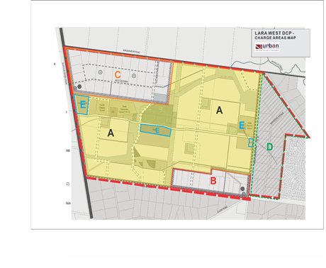
Council gave evidence to the Panel to support the DCP, providing an overview of the Development Contributions Plan Principles and the rationale for the identification of the five different charge areas and apportionment of costs. Mr Anderson, Council’s DCP expert witness stated that the Lara West Development Contributions Plan delivers an infrastructure funding regime that is fair, affordable and aligns with the vision for the growth area in providing a best practice sustainable development.
Mr Montebello, for Council, noted that a number of the concerns raised by Dacland to the exhibited DCP had been resolved prior to the hearing, subject to minor changes agreed by both parties. Mr Anderson, in response the Panel’s request, following the hearing forwarded a consolidated list of proposed changes to the Amendment documentation, all of which was supported by both the proponent and Dacland.
Mr Marshall for G & L Wilks (Property 8 landowner) submitted that drainage should be included as an infrastructure item to be funded by the DCP. This was not supported by the Panel. The Panel has supported the suggestion by the Catholic Education Office to modify the schedule to the Development Contributions Plan Overlay (DCPO) to make it explicit that land for the development of non-government schools is exempt from the overlay.
The Panel concluded that:
The development and community infrastructure to be funded by the Lara West DCP is appropriate and that the cost apportionment has occurred generally in accordance with relevant DCP guidelines and Ministerial Directions.
Minor corrections are required to the Lara West DCP and the Schedule to the DCPO to rectify errors in exhibited documentation concerning demand unit calculation, cost apportionment and project scope.
The per hectare DCP levy for each of the five charge areas within the Lara West DCP will be comparable to levies of other recently approved DCPs in like settings.
Council Officer Response
The findings of the Panel are consistent with the policy position of Council and supported.
Section 11: Other issues
Retention of Patullos Road Area for Rural Living
Some of the landowners in this area oppose the rezoning, preferring to retain their existing rural outlook, amenity and lifestyle. The landowner at 245 Patullos Road supports the rezoning. In its submission, Mr Montebello for Council acknowledged that the country setting of the area is a feature which many existing residents would like to see retained. Mr Montebello submitted that the rezoning outcome has followed a rigorous strategic planning process which was supported by the C198 Panel, Lara Structure Plan and ultimately the Municipal Strategic Statement.
The Panel found that the rezoning of the Patullos Road area to the Urban Growth Zone is strategically justified and supported. The Panel noted that existing landowners are not obliged to develop their land at conventional lot densities or actively participate in the Master Planning process and that the Precinct will be developed over a 30 year period.
Council Officer Response
The findings of the Panel are consistent with the policy position of Council and supported.
West Gateway Masterplan
One of the landowners within the West Gateway Area submitted that the provisions are unduly restrictive. Of particular concern is the requirement that a Masterplan must be prepared to the satisfaction of the responsible authority prior to being able to grant a permit to subdivide land. The submission requests that the Urban Growth Zone clause should be amended to allow existing and future land owners to subdivide their land into no more than two parts and that this subdivision can occur before a Masterplan of the West Gateway Area has been prepared.
The Panel did not support this request as it would potentially compromise the future long term development and integration of the land with the wider Precinct. The Panel said that there is no time frame or any mechanism to compel any landowner to be part of a future Masterplan process that would see this land developed into conventional residential use. The panel also noted that these findings equally apply to the Patullos Road Area.
Council Officer Response
The findings of the Panel are consistent with the policy position of Council and supported.
Section 12: Changes to the Lara West Precinct Structure Plan
The Panel noted that in response to submissions made during the exhibition of the amendment, the Council endorsed a number of changes to the Lara West Precinct Structure Plan. Further changes to the Plan were suggested during the course of the Hearing which are outlined in Chapter 12 of the Panel Report. Changes were suggested by Council, the proponent, ESV, the Catholic Education Office, DEPI, PTV, the landowner of Property 8 in the Lara West Precinct and Dacland Pty Ltd.
The Panel considers that the changes recommended and supported by Council all generally contribute to improving the clarity and direction of the Lara West Precinct Structure Plan. The Panel identified ensuring consistency of legends in the various plans and the preparation of an Urban Design Framework for the Employment Precinct as further improvements.
The Panel pointed out that the relocation of the eastern community facilities would result in the loss of a small patch of native vegetation, and that DEPI advised that this patch could be offset. DEPI also advised that a consequent change should be made to the Native Vegetation Precinct Plan.
With regard to design parameters or standards for use and development within the gas pipeline measurement length, the Panel stated it evident that ESV should develop appropriate processes and guidelines to deal with these matters into the future, as this Amendment has highlighted ‘gaps’ in the planning system.
The Panel endorsed Council’s approach to the submission by the Catholic Education Office. That is, because the Catholic Education Office has no current interest in the land and therefore no commitment to the provision of a school at the designated site, it should not be designed as ‘Non Government (Catholic) School’ on the plan. The Panel also did not support the Catholic Education Office request to add an additional paragraph in the Lara West Precinct Structure Plan.
The Panel supported the approach of PTV and Council to show an arrow on the plan that a future road link (i.e. the main East-West Connector Street) could be achieved between the Lara West Precinct and Manzeene Village. Dacland did not support this change, recommending that any ‘connection’ should be offset by 60-100 metres to ensure safety considerations.
Mr Marshall for the landowner of Property 8 requested that direct access to the site from O’Halloran’s Road, to better assist development, should be shown on the plan. This was supported by the Panel.
Overall, the Panel found that the changes recommended improve the clarity of the document and do not materially transform the scope of nature of the Lara West Precinct Structure Plan.
Council Officer Response
The findings of the Panel are supported.
Section 13: Other Proposed Changes to Planning Controls
During the Hearing, submitters requested other various changes to the Amendment. In Chapter 13 of its report, the Panel discusses and makes recommendations about the changes. The changes and the proposed controls are outlined below:
Municipal Strategic Statement (MSS)
The Panel supported the changes to Clause 21.13 of the MSS as exhibited by Council. No party objected to these changes.
Council Officer Response
The findings of the Panel are supported.
Urban Growth Zone Schedule
In its submission Council advised the Panel of a number of early changes to the Schedule. Also, during the course of the hearing other changes put forward by Council, Mr Tobin and Mr Tweedie were discussed in detail during a ‘without prejudice’ session on the last day. These changes are referred to on pages 92-94 of the Panel Report.
The majority of the changes proposed were supported by all parties. The Panel said the changes will contribute to improving the clarity and transparency of the Schedule and have updated information where required.
The Panel then addressed outstanding issues.
Mr Tobin for Lara Lakes Pty Ltd suggested that the pipeline measurement length should be depicted on the Lara West Precinct Structure Plan and not shown on Map 1 to the Schedule. The Panel disagreed, recommending that “Map 1 be amended to show the location of the high-pressure gas pipeline and pipeline measurement lengths – the 324 m and 554 m zones”.
Mr Tobin suggested that there was no need for an Urban Design Framework for the Employment Precinct as this would place an unreasonable burden on the landowner. The Panel disagreed, saying the requirement for an Urban Design Framework is consistent with the approach adopted for the NAC.
The Panel was satisfied with Council’s revisions to Clause 3.1 Environmental Assessment. Mr Tobin proposed that the clause be amended so that a site assessment is not required for land identified in the SMEC report, Phase 1 Environmental Assessment, Proposed Lara Lakes Estate, Area 4, July 2011, as preliminary assessment works had been undertaken. The Panel did not support this amendment.
Mr Tobin suggested a new section to Clause 4.0 Conditions and requirements for permits, to require a Construction Management Plan for all buildings and works proposed in the pipeline measurement length. Council disagreed, submitting that the new referral provision in Clause 3.3 would ensure that ESV would consider these issues. The Panel agreed with Council.
Mr Tweedie for Dacland, proposed a number of changes in relation to the NAC. Mr Tweedie proposed to re-name the NAC to a Local Activity Centre - Area 1 and the eastern centre to be re-named Local Activity Centre - Area 2. Both Council and Mr Tobin disagreed. The Panel did not support Mr Tweedie’s position concluding that the proposal is not appropriate nor a good planning process or outcome.
The Panel requested that Council address the potential impact of the application of the new zones introduced by the Minister for planning and how they would affect Clause 2.2 ‘Applied zone provisions’.
Council Officer Response
The findings of the Panel are generally supported. Appendix 5 includes the Schedule 4 to the Urban Growth Zone for adoption.
Regarding the new zones, Council advised the Panel that the proposed Business 1 Zone for the NAC and Local Activity Centre would be translated to the Commercial 1 Zone, and that the Employment Precinct would be translated to the Commercial 2 Zone. Land shown as ‘Residential conventional’ and ‘Residential medium density’ will have the General Residential Zone applied.
The Panel’s recommendation that “Map 1 be amended to show the location of the high-pressure gas pipeline and pipeline measurement lengths – the 324 m and 554 m zones” appears to be an error and should only refer to the ‘554 m zone’. Reference to the ‘554 m zone’ only is consistent with the Panel Report recommendation 14.2 and the Appendix C draft schedule.
Land Subject to Inundation Overlay (LSIO)
The Panel highlighted that much of the northern boundary of the Precinct area is included in the LSIO and that the amendment proposes to remove the overlay. Mr Montebello for Council referred the Panel to Mr Craigie’s investigation and report that found that the area subject to flooding was not confined to the area in the LSIO, but covered a far more extensive area.
Over the course of the Hearing, the exhibited Amendment documents were modified to require a referral of applications for development to the relevant Catchment Management Authority if the site were identified to be subject to flooding in Plan 19 of the incorporated Lara West Precinct Structure Plan. Both Mt Craigie and the Corangamite Catchment Management Authority (CMA) recommended that the LSIO be retained.
Council submitted that a referral to the Corangamite CMA on the basis of the identification of land subject to flooding identified in an Incorporated Document is a satisfactory approach. The Panel agreed with Council’s approach and concluded that the deletion of the LSIO from the Planning Scheme Maps 12 is appropriate.
Council Officer Response
The findings of the Panel are consistent with the policy position of Council and supported.
Development Contributions Plan Overlay
Mr Montebello for Council submitted that the Development Contributions Plan Overlay is the most appropriate planning tool in which to identify and cost infrastructure items that are to be provided within a precinct plan area.
This position was not disputed by any parties to the Panel. The Panel noted that where issues were raised, they were matters of cost and apportionment and addressed in Section 8 of the Report.
Council Officer Response
The findings of the Panel are consistent with the policy position of Council and supported.
Clause 52.01 Public open space contribution and subdivision
At the Directions Hearing, Mr Montebello for Council advised the Panel that a minor change to the Amendment was required to include the Lara West Urban Growth Area in the Schedule to Clause 52.01 ‘Public open space contribution and subdivision’.
No other parties objected and the proposal was supported by the Panel.
Council Officer Response
In reviewing this change recommended by Council at the Hearing, officers realised it was made in error. The Schedule to Clause 52.01 currently requires the subdivision of land zoned for residential purposes to provide a 10% open space contribution (for 10 or more lots). As a result, the Schedule does not need to be amended.
Incorporated Documents
The Panel agreed that the Lara West Growth Area Native Vegetation Precinct Plan is the appropriate tool to address the identification, removal and offset provision for any native vegetation within the precinct plan area. The Panel supported minor changes to the Amendment documents requested by the Department of Environment and Primary Industries.
The Panel recommended that the Lara West Growth Area Native Vegetation Precinct Plan Incorporated Document be amended by:
Changing all references to the Department of Sustainability and Environment to the Department of Environment and Primary Industries;
Permitting a native vegetation offset to be provided for the relocated eastern park (relocated to the west on the East-West Connector Street and the eastern community centre relocated to the exhibited park site); and
Updating references in light of the changes to the native vegetation framework contained in Reforms to Victoria’s native vegetation permitted clearing regulations released on 22 May 2013 by the Minister for Environment and Climate Change.
Council Officer Response
The findings of the Panel are consistent with the policy position of Council and supported.
Matters arising after receiving the Panel Report
APA GasNet Letter
On 3 September 2013 Council received a letter from Hall & Wilcox Lawyers acting for APA GasNet. The letter notes that APA and ESV made submissions to the Panel considering the draft Lara West Precinct Structure Plan on the potential implications of urban encroachment on its existing high pressure gas pipeline.
The letter states that APA endorses the recommendations in the C246 Panel Report and considers there is merit in the Victoria Planning Provisions incorporating a specific pipeline notification overlay. The letter goes on to say that APA queries whether the proposed section 173 agreement is appropriate, however intends to take this up as part of broader submissions to the Department of State Development, Business and Innovation (DSDBI) and the Minister for Planning.
Finally, APA requests in the letter that it be named as the referral authority referred to in the proposed referral provisions to be contained in the urban growth zone schedule, instead of ESV. Hall & Wilcox were instructed that ESV shares that position. The letter says that as the pipeline licensee, APA is responsible for regulatory and statutory compliance and is the most appropriate body to assess the potential impact of proposed land uses or developments in the pipeline’s vicinity.
Council officers acknowledge the support received from APA during the amendment process and similarly endorses the Panel’s recommendations subject to changes outlined in this report. Officers note that the Council resolution includes writing to the Minister’s department to investigate the need for an overlay control to recognise the gas pipeline and its measurement length.
Regarding the referral provisions in the Amendment documentation, officers sought direction on this issue from Earth Resources Regulation Victoria, a division of DSDBI.
Advice was provided by Rachel Carney, Program Manager - Planning, Earth Resources Regulation:
“Currently all referrals relating to pipelines should be sent to DSDBI who operate under the Minister administering the Pipelines Act 2005. This method referencing is used under Part 3 of the Planning and Environment Regulations 2005 which relates to the notice of planning scheme amendments. ESV also operate under the same Minister but a current Memorandum of Understanding between the two gives DSDBI the responsibility of dealing with all matters relating to the Planning and Environment Act 1987. This may change in the future, but by referencing the Minister rather than a specific Government Department Branch, such changes can occur without requiring amendments to planning schemes.
DSDBI and ESV are currently in discussions as to whether it is appropriate to include licensees as referral agencies and in this case request that any referral / notice takes place as requested above”.
As a result of this advice, both the Schedule to the Urban Growth Zone and the Lara West Precinct Structure Plan will substitute referral/notice provisions to ESV and/or APA with the ‘Minister administering the Pipelines Act 2005’.
Additional change to the Greater Geelong Planning Scheme
In finalising the Amendment documents to be implemented into the Planning Scheme, it has come to the attention of officers that an amendment should also be made to the Schedule to Clause 66.04 Referral of permit applications under local provisions.
This clause specifies a person or body as a referral authority (under section 55 of the Planning and Environment Act) if a local provision in the scheme contains a referral requirement. Importantly, the clause also says that if the requirement is not included in the schedule to this clause, it is not a referral requirement under section 55 of the Act.
The proposed Schedule 4 to the Urban Growth Zone in section 3.0, contains referral provisions for native vegetation, the high-pressure gas pipeline and flood mitigation. To ensure applications are appropriately referred to the relevant bodies under section 55 of the Act, the schedule to Clause 66.04 has been amended. This change does not transform Amendment C246 but properly utilises the Victoria Planning Provisions.
The Lara West Precinct Structure Plan and the Lara West Native Vegetation Precinct Plan forms part of the Amendment and will be incorporated into the Greater Geelong Planning Scheme.
These documents are underpinned by extensive technical assessment and review and include a range of objectives and requirements to reduce environmental impacts and support sustainable development.
The Development Contributions Plan (DCP) is the primary mechanism for funding infrastructure to service the new growth area. The growth area requires in the order of $40M of infrastructure of which the DCP will fund approximately $36M.
Council will be responsible for managing the funds collected through the DCP and either directly delivering the required infrastructure or making arrangements for developers to construct infrastructure as “works in lieu”.
Clause 11.02 ‘Urban Growth’ of the State Planning Policy Framework requires planning authorities to ensure that sufficient residential land is available to meet forecast demand.
The Lara West Growth Area is identified as ‘Future residential’ in the Lara Structure Plan and Clause 21.13 of the Greater Geelong Planning Scheme. Clause 21.13 supports the rezoning when a review of lot supply indicates rezoning is necessary to continue to achieve at least 15 years lot supply taking into consideration any infill opportunities that will not be realised in the short term.
The Amendment documentation includes an assessment of land supply in Lara which finds that there is between 7 and 12 years supply. The assessment is considered accurate and provides sufficient strategic merit to rezone the land at this time.
The land is also identified in the G21 Regional Growth Plan for planned urban growth.
The Amendment supports the Growing our Economy and Sustainable Built and Natural Environment strategic directions of City Plan.
The rezoning will maintain an appropriate supply of residential land in northern Geelong, and facilitate significant, long term investment in an area identified in Council’s Municipal Strategic Statement for growth.
The Lara West Precinct Structure Plan and Development Contributions Plan promote development of a sustainable built environment. This will be achieved by delivering community and retail facilities, integrated management of stormwater and open space, and an efficient transport and movement network.
No Council officer involved in the report has any direct or indirect interest, in accordance with section 80(C) of the local Government Act.
There are no notable risks associated with implementing the recommendations contained in this report.
Councils are required to ensure a sufficient supply of land is available in designated growth areas for residential, commercial and other community uses, including affordable housing close to jobs, transport and services.
The Lara West Growth Area will be a fully planned community that promotes affordable housing. The scale of development, staged over many years, will also be a significant economic and employment generator for the Geelong region.
The Amendment will not impact on any basic rights, freedoms and responsibilities as set out in the Charter. Planning legislation ensures an open community consultation process occurs, enabling people to freely express their views and if necessary obtain a fair hearing before an Independent Panel.
Council officers have written to submitters and landowners to the Amendment to advise of the Panel recommendations, and included the Panel Report Executive Summary. Submitters and landowners will be notified of the final decision of Council and the Minister for Planning.
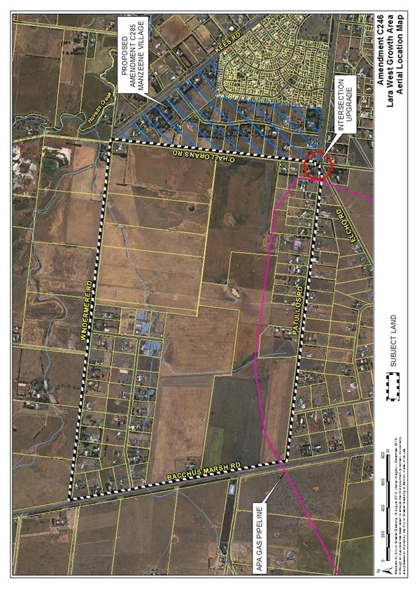
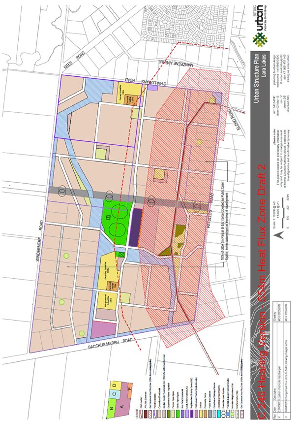
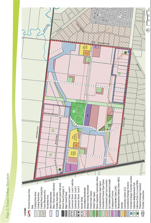
14.1 Amendment C246 and Exhibited Documentation
The Panel recommends that the Lara West Precinct Structure Plan, Lara West Native Vegetation Precinct Plan, Lara West Development Contributions Plan and the documentation forming Planning Scheme Amendment C246 to the Greater Geelong Planning Scheme be adopted as exhibited subject to the modifications below.
(i) Modifications to more than one document
Adopt the Urban Structure Plan - Revision V, 02 May 2013 (Hearing Document 26) as Plan 5: Future Urban Structure in the LWPSP and as Map 1 – Lara West Precinct Structure Plan in the UGZ Schedule subject to the following further refinements:
Identify / show the location of the 554 metre “heat flux zone”;
Modify the footprint of sites marked for schools and community facilities so that they are entirely outside the 554 metre “heat flux zone”; and
Improve the legibility of the legend and achieve consistency in terminology within the LWPSP.
(ii) Schedule to the Urban Growth Zone
Replace the exhibited version of the Schedule to the Urban Growth Zone with the Panel Recommended UGZ Schedule contained in Appendix C of this report.
(iii) Change to Clause 52.01
Amend the Schedule to Clause 52.01 ‘Public open space contribution and subdivision’ by including the following words in the column ‘Type of location of subdivision’:
See Lara West Urban Growth Area Diagram 4
and by including the following words in the column ‘Amount of contribution for public open space’:
10% (unencumbered).
(iv) Changes to the Lara West Precinct Structure Plan
Amend Plan 4 – Precinct Features of LWPSP to indicate both the 554 m and the 324 m “heat flux zones”.
Amend Plans 5, 15 and 16 to include an ‘arrow’ pointing east, at the eastern end of the east/west connector street to indicate a possible future connection with land to the east.
Amend Plans 5, 6, 7, 8, 14, 15 and 16 to show a connector street to provide access to Property 8 from O’Hallorans Road between the East-West Connector Street and the stormwater retarding basin.
Include the new Section 2.5 ‘APA Gas Easement and Pipeline’, in accordance with the draft submitted by Council on 12 April 2013, with further modification to include the following as the final paragraph:
The APA assessment identified a “heat flux zone” as being land up to 554 m from the pipeline where certain intense or sensitive land uses should be excluded and residential density should not exceed 30 lots per hectare. Any permit application for the use, development or subdivision of land within the “heat flux zone” as shown in the Lara West Precinct Structure Plan must be referred to Energy Safe Victoria for consideration and its advice will be taken into account in the decision.
Subject to acceptance by APA and ESV, following Table 2 ‘Summary – Residential Lot Yield Analysis’, include Figures 1 and 2 Subdivision Design Concepts, generally in accordance with Mr Milner’s Options 1 and 2, submitted in his evidence to the Panel.
Delete the planning and design guidelines for the Employment Precinct at Section 4.5.1 and include a new subsection at Section 4.5.4 ‘Urban Design Framework’ that provides the requirements of a UDF for the Employment Precinct. Suggested wording:
Employment Precinct
An urban design framework for the employment precinct should:
Provide for activated ground floor street frontages;
Demonstrate the how buildings will be articulated to avoid blank walls along street frontages;
Provide an overall landscape concept for the whole employment precinct;
Set out provisions for pedestrian and bicycle movement throughout the precinct;
Provide guidelines for the provision of service areas for deliveries and waste disposal and access for large vehicles to minimise the impact on the amenity of adjoining uses; and
Demonstrate how the employment precinct will visually and physically connect with the surrounding neighbourhoods.
Amend dot point 3 of Section 4.5.3 ‘Planning and Design Guidelines: Activity Centres and Employment’ to require an Urban Design Framework Plan to be prepared for the Employment Precinct prior to any building and works. Suggested wording is:
Before development starts an urban design framework must be completed for the employment precinct to the satisfaction of the responsible authority.
In addition to the inclusion of the non-contested additional 2 dot points to Section 4.7.3, Planning and Design Guidelines: Utilities and Energy, include the following as the 5th dot point:
Any permit application for the use, development or subdivision of land within the ‘heat flux zone’ as shown on Plan 4 or in the Lara West Precinct Structure Plan, must be referred to Energy Safe Victoria for consideration and its advice taken into account in the decision.
Amend the LWPSP to reflect the following changes proposed by Council or the proponent in response to submissions and evidence that were not opposed:
Amend Map 5 ‘Future Urban Structure’ and other relevant plans to show the location of the eastern most park swapped with the eastern community centre to ensure the community centre is outside the heat flux zone. (Note: This will also require a change to the native vegetation precinct plan as the park in the current location has a small patch of native vegetation that will require an offset to be provided).
Amend Plans 5, 7, 8, 14, 15 and 16 to include an annotation that the road network in the rural residential areas of West Gateway and Patullos Road is ‘indicative only’.
Replace Section 2.1 ‘Heritage’ with the following wording:
There is one previously registered Aboriginal heritage site within the boundary of the LWP. The site comprises a single isolated artefact identified during monitoring of excavation of a gas pipeline trench. The existence of this site of relatively low significance is not envisaged to impact on future development. The presence of other areas of cultural heritage sensitivity external to but within close proximity of the boundary of the LWP, particularly in the north (within the Windermere Road and powerline easement intersection) and to the north-east of the LWP will trigger the need to prepare a Cultural Heritage Management Plan, prior to the development of affected lands.
IV. Amend Section 3.1.1 Sense of Place and Community to include the following wording:
Public art within the LWP will provide opportunities for local communities (and broader audiences) to relate in new ways to the natural and built environment. Art is an important element in the urban fabric, providing interest and opportunity for a deeper connection with place, environment, storytelling, way finding and community identity.
Amend Section 3.1.3 Accessible and Vibrant Activity Centres, to include the following wording:
The NAC shall create a range of public art opportunities to enhance sense of place, interpret heritage and landscape and promote the identity and character of the LWP.
Amend the text within Section 3.2, the Land Use Budget at Table 1, and the Summary Residential Lot Yield Analysis at Table 2 to reflect the impact of the gas pipeline.
Amend Section 4.1.3 Planning and Design Guidelines: Image and Character to include the following additional dot points:
Public art is encouraged and where provided should meet the requirements of the responsible authority;
Planning for public art needs to identify opportunities of different types for artists to respond to the design of new development, its context and the makeup of the community.
Amend dot points 3 and 4 of Section 4.2.3 ‘Planning and Design Guidelines: Subdivision and Housing’ to replace the word ‘must’ with ‘should’.
Amend Section 4.3.3 to acknowledge the preference for school site to be serviced by three street frontages.
Amend Plan 12, ‘Landscape Master Plan’ to show the extension of shared pathways in the gas pipeline easement.
Amend the guidelines that must be met in Section 4.6.3 Planning and Design Guidelines for Transport and Movement as follows:
Include the following as the 4th dot point – Any planning permit granted for development that increases traffic to the Bacchus Marsh Road/West Gateway intersection will include a condition to require an intersection upgrade, as appropriate.
Insert at the end of the 5th dot point – (i.e. all lots will not have direct access to Windermere Road).
Insert a new 7th dot point to read – Where applicable, shared paths associated with any Connector Level 1 road category should be located on the side which is adjacent to the drainage reserve to create links with surrounding off-road shared paths.
Modify the 9th dot point to change the reference from ‘Director of Public Transport’ to ‘Public Transport Victoria’,
Amend the guidelines that should be met in Section 4.6.3 Planning and Design Guidelines for Transport and Movement as follows:
Insert as the 4th last dot point – Future Windermere Road intersection design should be consistent with the future Lara Transport Study.
Amend Plan 17, ‘Public Transport’, to identify the western, north-south collector road as a potential bus route.
Update the titles of all Figures in section 4.6.3 to reflect correct numbering.
Amend the O’Hallorans Road Cross Section – Connector Road Category 4 (new Figure C1) and the Patullos Road Cross Section – Connector Road Category 4 (new Figure C2) to include a 2.5m shared path.
Amend the ‘Connector Roads Level 1 with bus’ cross section (new Figure D2), so that footpaths on both sides of the road are 2.5 metres wide, and a minimum road reservation of 25.4 metres.
Amend the ‘Connector Street – Level 2’ cross section (new Figure D3) to show 7 metre bus clearance and 2.5 metre shared path.
Amend Section 4.7.2 Implementation Utilities and Energy to include the following as the 4th dot point:
Figure A: APA Gas Easement and Pipeline (example cross section)
Amend Section 4.7.3, Planning and Design Guidelines: Utilities and Energy to include the following as dot points 4 and 5:
Any development (including roads, earthworks, landscaping, wetlands etc) within 60 metres of the powerline transmission easement must be referred to SPI Powernet for approval prior to the commencement of any works on site,
All permit applications for multi-lot or multi-lot staged subdivision in the south of the east-west connector road must be referred to ESV.
Replace references to the Department of Sustainability and Environment with the Department of Environment and Primary Industries.
(v) Changes to the Lara West Precinct Native Vegetation Precinct Plan
Amend the Lara West Growth Areas Native Vegetation Precinct Structure Plan Incorporated Document by:
Changing all references to the Department of Sustainability and Environment to the Department of Environment and Primary Industries;
Permitting a native vegetation offset to be provided for the relocated eastern park (relocated to the south side of the east/west connector street and the eastern community centre relocated to the park site); and
Updating references in light of the changes to the native vegetation framework contained in, Reforms to Victoria's Native Vegetation Permitted Clearing Regulations released on 22 May 2013 by the Minister for Environment and Climate Change.
(vi) Changes to Lara West Development Contributions Plan and Schedule 5 to the DCPO
Realign the boundary of Charge Area B in all LWDCP Maps to reflect the actual boundary of the Patullos Road area as identified in Plan 5 of the PSP.
Modify the Project Sheet for DI_C_2 (Western Multipurpose Community Centre – Construction) in Appendix 2 of the LWDCP by:
Deleting the references to “and childcare” and “maternal and child health” from the project description;
Adding the words “Youth Resource Centre (self-contained)” to the project description; and
Deleting the reference to Charge Area “B” in the apportionment of costs entry.
Exclude the 20 metre wide APA gas easement from the extent of the Net Developable Area in the LWDCP and ensure that the change to the NDA flows right through all LWDCP calculations.
Amend the various tables in the LWDCP and Schedule 5 to the DCP Overlay to reflect the correct calculations and inputs for all projects and charge areas as set out in ‘Table B’ of Hearing Document 9 (Mr Anderson’s addendum explanatory report).
Modify the text in Clause 5 of Schedule 5 to the DCP Overlay so the sentence reads:
The Development Contributions Plan applies to all land in the Lara West Main Catchment Area, other than land required for the development of non-government schools, for a period of 20 years.
14.2 Other Recommendations
That the Department of Transport, Planning and Local Infrastructure investigate the need for an overlay control to recognise high pressure gas pipelines and their “heat flux zones” in planning schemes, to protect them from encroachment by inappropriate residential development or sensitive land uses and to ensure appropriate conditions are placed on land use and development within “heat flux zones”.
|
Panel Recommendation |
Summary Council Response |
Adopted Council Position |
Panel Report: Chapter 14 Rec # |
|
General |
|||
The Panel recommends that the Lara West Precinct Structure Plan, Lara West Native Vegetation Precinct Plan, Lara West Development Contributions Plan and the documentation forming Planning Scheme Amendment C246 to the Greater Geelong Planning Scheme be adopted as exhibited subject to the modifications below. |
Supported subject to changes outlined in this report. |
As per Panel recommendation subject to changes outlined in this report. |
1 |
|
Lara West Precinct Structure Plan |
|||
|
Adopt theUrban Structure Plan - Revision V, 02 May 2013 (Hearing Document 26) asPlan 5: Future Urban Structure in the LWPSP and asMap 1 – Lara West Precinct Structure Plan in the UGZ Schedule subject to the following further refinements:
|
|
The plan will be amended to show the ‘pipeline measurement length’, as will the legend. |
2
|
Amend Plan 4 – Precinct Features of LWPSP to indicate both the 554 m and the 324 m “heat flux zones”. |
Supported. |
As per recommendation. |
5 |
Amend Plans 5, 15 and 16 to include an ‘arrow’ pointing east, at the eastern end of the east/west connector street to indicate a possible future connection with land to the east. |
Supported. |
As per recommendation. |
6 |
Amend Plans 5, 6, 7, 8, 14, 15 and 16 to show a connector street to provide access to Property 8 from O’Hallorans Road between the East-West Connector Street and the stormwater retarding basin. |
Supported. |
As per recommendation. |
7 |
|
Include the new Section 2.5 ‘APA Gas Easement and Pipeline’, in accordance with the draft submitted by Council on 12 April 2013, with further modification to include the following as the final paragraph:
|
Supported. |
As per recommendation. |
8 |
Subject to acceptance by APA and ESV, following Table 2 ‘Summary – Residential Lot Yield Analysis’, include Figures 1 and 2 Subdivision Design Concepts, generally in accordance with Mr Milner’s Options 1 and 2, submitted in his evidence to the Panel. |
APA GasNet Australia (Operations) Pty Ltd supports the Panel’s recommendations to include Option 1 and 2 into the LWPSP, however express a preference for Option 2. ESV supports the position of APA. |
Include Rob Milner’s Option 2 in the LWPSP. |
9 |
Delete the planning and design guidelines for the Employment Precinct at Section 4.5.1 and include a new subsection at Section 4.5.4 ‘Urban Design Framework’ that provides the requirements of a UDF for the Employment Precinct. Suggested wording:
|
Supported. |
As per recommendation. |
10 |
Amend dot point 3 of Section 4.5.3 ‘Planning and Design Guidelines: Activity Centres and Employment’ to require an Urban Design Framework Plan to be prepared for the Employment Precinct prior to any building and works. Suggested wording is:
|
Supported. |
As per recommendation. |
11 |
In addition to the inclusion of the non-contested additional 2 dot points to Section 4.7.3, Planning and Design Guidelines: Utilities and Energy, include the following as the 5th dot point:
|
Supported. |
As per recommendation. |
12 |
|
Amend Map 5 ‘Future Urban Structure’ and other relevant plans to show the location of the eastern most park swapped with the eastern community centre to ensure the community centre is outside the heat flux zone. (Note: This will also require a change to the native vegetation precinct plan as the park in the current location has a small patch of native vegetation that will require an offset to be provided). |
Supported. Note: the community centre will remain marginally within the pipeline measurement length as per ESV advice. |
Amend Map 5 to relocate the eastern most park and amend the Lara West Native Vegetation Precinct Plan to reflect this additional offset requirement. |
13.l |
|
Amend Plans 5, 7, 8, 14, 15 and 16 to include an annotation that the road network in the rural residential areas of West Gateway and Patullos Road is ‘indicative only’. |
Supported. Additional text will also be inserted in the Lara West PSP Section 4.6Transport and Movement. |
Following Section 4.6.2, last dot point, insert the following: “Note: the road network in the Patullos Road Area and the West Gateway Area is indicative only and subject to detailed design within the PSP area generally, and more specifically, at the master planning stage for the individual Areas”. |
13.ll |
|
Replace Section 2.1 ‘Heritage’ with the following wording: There is one previously registered Aboriginal heritage site within the boundary of the LWP. The site comprises a single isolated artefact identified during monitoring of excavation of a gas pipeline trench. The existence of this site of relatively low significance is not envisaged to impact on future development. The presence of other areas of cultural heritage sensitivity external to but within close proximity of the boundary of the LWP, particularly in the north (within the Windermere Road and powerline easement intersection) and to the north-east of the LWP will trigger the need to prepare a Cultural Heritage Management Plan, prior to the development of affected lands. |
Supported. |
As per recommendation. |
13.lll |
|
Amend Section 3.1.1 Sense of Place and Community to include the following wording: Public art within the LWP will provide opportunities for local communities (and broader audiences) to relate in new ways to the natural and built environment. Art is an important element in the urban fabric, providing interest and opportunity for a deeper connection with place, environment, storytelling, way finding and community identity. |
Supported. |
As per recommendation. |
13.lV |
Amend Section 3.1.3 Accessible and Vibrant Activity Centres, to include the following wording: The NAC shall create a range of public art opportunities to enhance sense of place, interpret heritage and landscape and promote the identity and character of the LWP. |
Supported. |
As per recommendation. |
13.V |
Amend the text within Section 3.2, the Land Use Budget at Table 1, and the Summary Residential Lot Yield Analysis at Table 2 to reflect the impact of the gas pipeline. |
Supported. |
As per recommendation. |
13.Vl |
Amend Section 4.1.3 Planning and Design Guidelines: Image and Character to include the following additional dot points: Public art is encouraged and where provided should meet the requirements of the responsible authority; Planning for public art needs to identify opportunities of different types for artists to respond to the design of new development, its context and the makeup of the community. |
Supported. |
As per recommendation. |
13.Vll |
Amend dot points 3 and 4 of Section 4.2.3 ‘Planning and Design Guidelines: Subdivision and Housing’ to replace the word ‘must’ with ‘should’. |
Supported. |
As per recommendation. |
13.Vlll |
Amend Section 4.3.3 to acknowledge the preference for school sites to be serviced by three street frontages. |
Supported. |
As per recommendation. |
13.lX |
Amend Plan 12, ‘Landscape Master Plan’ to show the extension of shared pathways in the gas pipeline easement. |
Supported. |
As per recommendation. |
13.X |
Amend the guidelines that must be met in Section 4.6.3 Planning and Design Guidelines for Transport and Movement as follows:
|
Supported. |
As per recommendation. |
13.Xl |
Amend the guidelines that should be met in Section 4.6.3 Planning and Design Guidelines for Transport and Movement as follows: Insert as the 4th last dot point –Future Windermere Road intersection design should be consistent with the future Lara Transport Study |
Supported. |
As per recommendation. |
13.Xll |
Amend Plan 17, ‘Public Transport’, to identify the western, north-south collector road as a potential bus route. |
Supported. |
As per recommendation. |
13.Xlll |
Update the titles of all Figures in section 4.6.3 to reflect correct numbering. |
Supported. |
As per recommendation. |
13.XlV |
Amend the O’Hallorans Road Cross Section – Connector Road Category 4 (new Figure C1) and the Patullos Road Cross Section – Connector Road Category 4 (new Figure C2) to include a 2.5m shared path. |
Supported. |
As per recommendation. |
13.XV |
Amend the ‘Connector Roads Level 1 with bus’ cross section (new Figure D2), so that footpaths on both sides of the road are 2.5 metres wide, and a minimum road reservation of 25.4 metres. |
Supported. |
As per recommendation. |
13.XVl |
Amend the ‘Connector Street – Level 2’ cross section (new Figure D3) to show 7 metre bus clearance and 2.5 metre shared path. |
Supported. |
As per recommendation. |
13.XVll |
Amend Section 4.7.2 Implementation Utilities and Energy to include the following as the 4th dot point:
|
Supported. |
As per recommendation. |
13.XVlll |
Amend Section 4.7.3, Planning and Design Guidelines: Utilities and Energy to include the following as dot points 4 and 5:
|
Supported in part. The second dot point is not required. |
Delete the second dot point from the PSP. Note, this dot point was replaced by Panel Report recommendation 14.12. |
13.XlX |
Replace references to the Department of Sustainability and Environment with the Department of Environment and Primary Industries. |
Supported. |
As per recommendation. |
13.XX |
|
Schedule to the Urban Growth Zone |
|||
Replace the exhibited version of the Schedule to the Urban Growth Zone with thePanel Recommended UGZ Schedule contained in Appendix C of this report. |
Supported subject to minor changes from Maddocks Lawyers, DSDBI, ESV and DEPI. |
Refer to the UGZ Schedule 4 in Appendix 5. |
3 |
|
Lara West Native Vegetation Precinct Plan |
|||
|
Amend the Lara West Growth Areas Native Vegetation Precinct Structure Plan Incorporated Document by:
|
Supported. |
As per recommendation. |
14 |
|
Lara West DCP and Schedule to the DCPO |
|||
|
Realign the boundary of Charge Area B in all LWDCP Maps to reflect the actual boundary of the Patullos Road area as identified in Plan 5 of the PSP. |
Supported. |
As per recommendation. |
15 |
Modify the Project Sheet for DI_C_2 (Western Multipurpose Community Centre – Construction) in Appendix 2 of the LWDCP by:
|
Supported. |
As per recommendation. |
16 |
Exclude the 20 metre wide APA gas easement from the extent of the Net Developable Area in the LWDCP and ensure that the change to the NDA flows right through all LWDCP calculations. |
Supported. |
As per recommendation. |
17 |
Amend the various tables in the LWDCP and Schedule 5 to the DCP Overlay to reflect the correct calculations and inputs for all projects and charge areas as set out in ‘Table B’ of Hearing Document 9 (Mr Anderson’s addendum explanatory report). |
Supported. |
As per recommendation. |
18 |
|
Modify the text in Clause 5 of Schedule 5 to the DCP Overlay so the sentence reads:
|
Not supported. |
Non-Government school are exempt from payment of Development Contribution in all Development Contribution Plans across the State of Victoria. This is implemented by a Minister direction date 25 January 2012. This position is also consistent with all of Council’s other DCPs. |
19 |
|
Clause 52.01 to the Greater Geelong Planning Scheme |
|||
|
Amend the Schedule to Clause 52.01 ‘Public open space contribution and subdivision’ by including the following words in the column ‘Type of location of subdivision’:
and by including the following words in the column ‘Amount of contribution for public open space’:
|
Not supported. |
The Schedule to Clause 52.01 currently requires the subdivision of land zoned for residential purposes to provide a 10% open space contribution (for 10 or more lots). As a result, the Schedule does not need to be amended. |
4 |
|
Other Recommendations |
|||
That the Department of Transport, Planning and Local Infrastructure investigate the need for an overlay control to recognise high pressure gas pipelines and their “heat flux zones” in planning schemes, to protect them from encroachment by inappropriate residential development or sensitive land uses and to ensure appropriate conditions are placed on land use and development within “heat flux zones”. |
Supported. |
Included in the resolution is for Council to write to the DTPLI as recommended by the Panel. |
20 |
The planning authority for this amendment is the City of Greater Geelong Council.
The Greater Geelong Planning Scheme is amended as follows:
The Planning Scheme Maps are amended by a total of 3 attached map sheets.
Zoning Maps
Amend Planning Scheme Map Nos. 11, 12, 17 and 18 in the manner shown on the attached 1 map marked “Greater Geelong Planning Scheme Amendment C246”.
Overlay Maps
Delete Planning Scheme Map Nos. 12LSIO-FO, 17LSIO-FO and 18LSIO-FO in the manner shown on the 1 attached map marked “Greater Geelong Planning Scheme Amendment C246”.
Insert new Planning Scheme Map Nos. 11DCPO, 12DCPO, 17DCPO and 18DCPO in the manner shown on the 1 attached map marked “Greater Geelong Planning Scheme Amendment C246”.
The Planning Scheme Ordinance is amended as follows:
In Local Planning Policy Framework – replace Clause 21.13 with a new Clause 21.13 in the form of the attached document.
In Zones – Clause 37.07, insert a new Schedule in the form of the attached document.
In Overlays – Clause 45.06, insert a new Schedule 5 in the form of the attached document.
In Particular Provisions – Clause 52.16, replace the Schedule with a new Schedule in the form of the attached document.
In General Provisions – Clause 61.03, replace the Schedule with a new Schedule in the form of the attached document.
In Referral and Notice Provisions – Clause 66.04, replace the Schedule with a new Schedule in the form of the attached document.
In Incorporated Documents – Clause 81.01, replace the Schedule with a new Schedule in the form of the attached document.
End of document
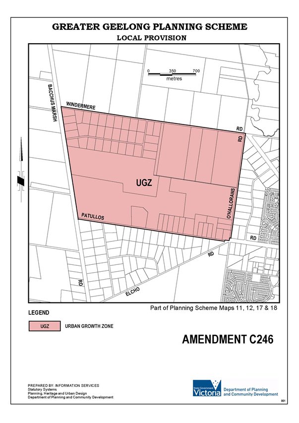
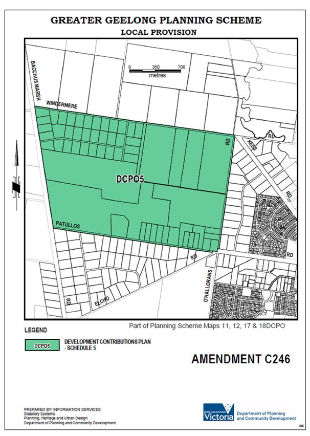
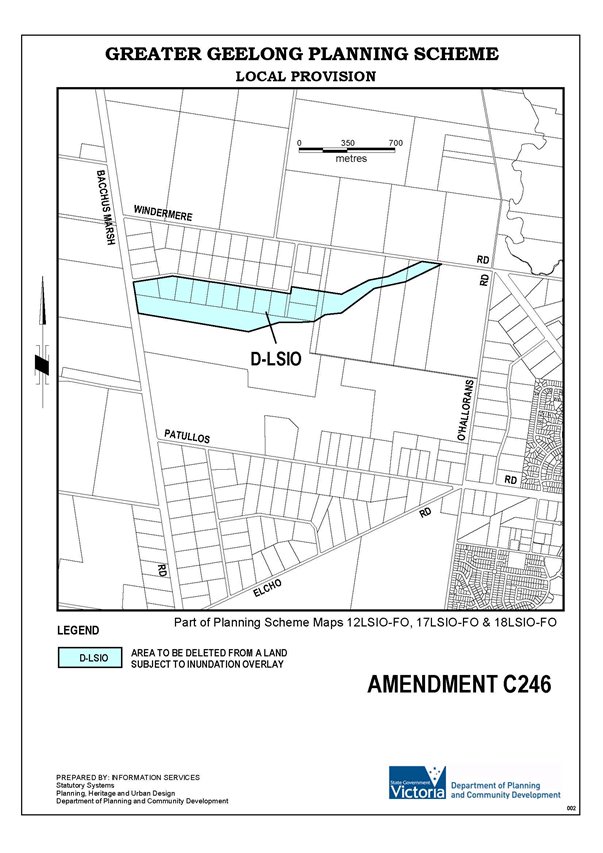
“Insert Date” |
Shown on the planning scheme map as UGZ4 | |
Lara West Precinct Structure Plan (2013) |
||
1.0 |
The Plan |
|
--/--/---- |
Map 1 shows the future urban structure proposed in the incorporatedLara West Precinct Structure Plan (September 2013). | |
Map 1 – Lara West Precinct Structure Plan |
||
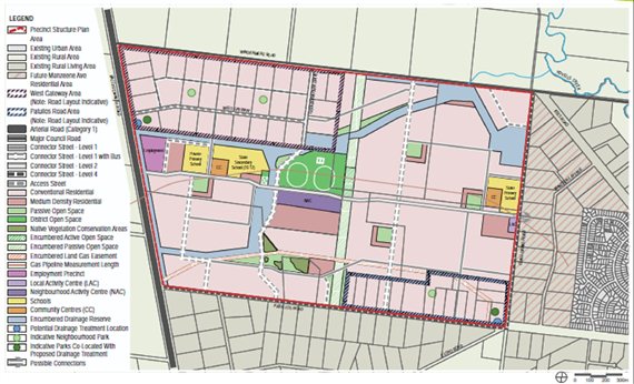 |
||
2.0 |
Use and development | |
--/--/---- |
||
2.1 |
The land | |
--/--/---- |
The provisions specified in this schedule only apply to land in the Lara West Precinct (Map 1) that is zoned UGZ. | |
2.2 |
Applied zone provisions | |
--/--/---- |
The provisions of the following zones in this scheme apply to the use and subdivision of land, construction of a building and construction and carrying out of works, by reference to Map 1 of this schedule. | |
LAND SHOWN ON MAP 1 OF THIS SCHEDULE |
APPLIED ZONE PROVISIONS |
|
Residential conventional |
Clause 32.08 - General Residential Zone |
|
Residential medium density |
Clause 32.08 - General Residential Zone |
|
Activity Centre - Neighbourhood Activity |
Clause 34.01 - Commercial 1 Zone |
|
Activity Centre - Local Activity |
Clause 34.01 - Commercial 1 Zone |
|
Community facilities |
Clause 32.04 - Mixed Use Zone |
|
Education centre |
Clause 32.08 - General Residential Zone |
|
Public open space - Unencumbered |
Clause 36.02 - Public Park and Recreation Zone |
|
Public open space - encumbered |
Clause 36.02 - Public Park and Recreation Zone |
|
Habitat conservation area |
Clause 36.02 - Public Park and Recreation Zone |
|
Lara West watercourse and floodway |
Clause 36.02 - Public Park and Recreation Zone |
|
Retarding Basins |
Clause 36.02 - Public Park and Recreation Zone |
|
Employment Precinct |
Clause 34.02 - Commercial 2 Zone |
|
Private school |
Clause 32.01 - General Residential Zone |
|
2.3 |
Specific provisions - Use of land | |
--/--/---- |
The use of land must be generally in accordance with theLara West Precinct Structure Plan. The following provisions apply to the use of land. |
|
USE |
CONDITION |
|
Display home on land shown as residential in Map 1 of this schedule |
Despite any requirement under Clause 52.06, car parking must be provided to the satisfaction of the Responsible Authority. |
|
Shop on land shown as Employment Precinct in Map 1 of this schedule |
Must provide for convenience services in conjunction with other Employment Precinct uses and must not include a supermarket. |
|
Child care centre on land shown as Activity Centre - Neighbourhood Activity |
Must have written approval of the Minister administering the Pipelines Act 2005. |
|
|
Education centre on land shown as Activity Centre - Neighbourhood Activity |
Must have written approval of the Minister administering the Pipelines Act 2005. |
|
2.4 |
Specific provisions - West Gateway Area | |
--/--/---- |
A permit must not be granted to use or subdivide land or construct a building and carry out works within the West Gateway Area in theLara West Precinct Structure Plan, until a Masterplan of the West Gateway Area has been prepared to the satisfaction of the responsible authority.
The Masterplan shall guide the future subdivision, use and development of land within the West Gateway Area. The objective of this provision is to ensure development occurs generally in accordance with theLara West Precinct Structure Plan, and to require a range of detailed planning issues to be resolved prior to the commencement of development of the Area. The Masterplan must show or address the following:
A permit may be granted before a Masterplan has been prepared to the satisfaction of the responsible authority for the following:
Except with the consent of the responsible authority, a permit must be consistent with any Masterplan of the West Gateway Area which has been prepared to the satisfaction of the responsible authority under this provision. This provision des not apply to land required as part of the integrated stormwater management for the Lara West Precinct. |
|
2.5 |
Specific provisions - Patullos Road Area |
|
--/--/---- |
A permit must not be granted to use or subdivide land or construct a building and carry out works within the Patullos Road Area in theLara West Precinct Structure Plan, until a Masterplan of the Patullos Road Area has been prepared to the satisfaction of the responsible authority. The Masterplan shall guide the future subdivision, use and development of land within the Patullos Road Area. The objective of this provision is to ensure development occurs generally in accordance with theLara West Precinct Structure Plan, and to require a range of detailed planning issues to be resolved prior to the commencement of development of the Area. The Masterplan must show or address the following:
A permit may be granted before a Masterplan has been prepared to the satisfaction of the responsible authority for the following:
Except with the consent of the responsible authority, a permit must be consistent with any Masterplan of the Patullos Road Area which has been prepared to the satisfaction of the responsible authority under this provision. This provision des not apply to land required as part of the upgrade to the Patullos/Elcho/O’Hallorans Road intersection. |
|
2.6 |
Specific provisions - Neighbourhood Activity Centre |
|
--/--/---- |
A permit must not be granted to use or subdivide land, or to construct a building or construct and carry out works within the land identified as the Neighbourhood Activity Centre in the incorporatedLara West Precinct Structure Plan until an urban design framework for the Neighbourhood Activity Centre has been prepared to the satisfaction of the responsible authority.
Unless the responsible authority agrees, the urban design framework must include all of the land in the Neighbourhood Activity Centre and must address and respond to Section 4.5 of the incorporatedLara West Precinct Structure Plan and any other relevant part of the incorporatedLara West Precinct Structure Plan as appropriate. The urban design framework may be amended to the satisfaction of the responsible authority. |
|
2.7 |
Specific provisions - Employment Area |
|
--/--/---- |
A permit must not be granted to use or subdivide land, or to construct a building or construct and carry out works within the land identified as the Employment Precinct in the incorporatedLara West Precinct Structure Plan until an urban design framework for the Employment Precinct has been prepared to the satisfaction of the responsible authority. Unless the responsible authority agrees, the urban design framework must include all of the land in the Employment Precinct and must address and respond to Section 4.5 of the incorporatedLara West Precinct Structure Plan and any other relevant part of the incorporatedLara West Precinct Structure Plan as appropriate. The urban design framework may be amended to the satisfaction of the responsible authority. |
|
2.8 |
Specific provisions - Buildings and works |
|
--/--/---- |
A permit is not required for the construction or carrying out of buildings and works associated with a display home on a lot over 300 square metres. | |
2.9 |
Specific provisions - Resolution of doubt |
|
--/--/---- |
If any doubt arises as to whether a provision specified in this schedule applies to land, a permit may be granted for any use or development if the responsible authority is satisfied that the use or development is in accordance with the incorporatedLara West Precinct Structure Plan. | |
3.0 |
Application requirements |
|
--/--/---- |
||
3.1 |
Environmental Assessment |
|
--/--/---- |
An application for a permit must be accompanied by site assessment of the land by a suitably qualified environmental professional including:
|
|
| 3.2 | Subdivision | |
--/--/---- |
An application for subdivision must be accompanied by a site analysis and design response as detailed in Clause 56.01. In addition, the site analysis and design response must show or address the following to the satisfaction of the responsible authority.
If the responsible authority is satisfied that an application requirement is not relevant to the assessment of an application, the responsible authority may waive any of the above requirements. |
|
3.3 |
Referral |
|
--/--/---- |
Native Vegetation High Pressure Gas Pipeline Flood Mitigation |
|
4.0 |
Conditions and requirements for permits |
|
--/--/---- |
Any permit must contain conditions and requirements as appropriate which give effect to any relevant part of the incorporatedLara West Precinct Structure Plan. | |
4.1 |
Conditions for subdivision or building and works permits where land is required for community facilities, public open space, road widening and drainage |
|
--/--/---- |
Public open space and community facilities Public open space must be provided in accordance with Plan 5 - Future Urban Structure and Table 1 - Summary Land Use Budget in the incorporatedLara West Precinct Structure Plan, or in any approved Masterplan as required under clause 2.4 and 2.5 of this schedule, prior to the issue of a Statement of Compliance (or as otherwise agreed with the responsible authority). These contributions are subject to an equalisation for unencumbered open space. Any public open space provided at the applicants request in addition to that reflected in Plan 5 - Future Urban Structure and Table 1 - Summary Land Use Budget in the incorporatedLara West Precinct Structure Plan, or in any approved Masterplan as required under clause 2.4 and 2.5 of this schedule, must be transferred to or vested in Council at no cost to Council and is not subject to compensation. Road widening Drainage Requirements for Native Vegetation |
|
4.2 |
Conditions for subdivision permits that allow for the creation of a lot of less than 300 square metres |
|
--/--/---- |
Conditions for subdivision permits that allow for the creation of a lot of less than 300 square metres Any permit for subdivision that allows the creation of a lot less than 300 square metres must contain the following conditions:
Where a building envelope plan is proposed and/or required, any permit for subdivision must contain the following conditions:
|
|
4.3 |
Conditions and requirements for all permits |
|
--/--/---- |
Environmental Audit either:
or
If a statement by an environmental auditor is provided rather than a certificate of environmental audit and the statement indicates that the environmental conditions of the relevant land are suitable for a sensitive use subject to conditions, the owner of the land must enter into an agreement with the responsible authority under Section 173 of the Planning and Environment Act 1987 before any development commences on the relevant land to provide for;
|
|
4.4 |
Conditions and requirements for all permits for subdivision of land within the high-pressure gas pipeline measurement length (as defined in AS2885) |
|
--/--/---- |
The owner of the land must enter into an agreement with the responsible authority under Section 173 of the Planning and Environment Act 1987 before any development commences on the relevant land to provide for:
The wording of any agreement must be in a form acceptable to the Minister administering the Pipelines Act 2005. |
|
5.0 |
Advertising signs |
|
--/--/---- |
Despite the provisions of Clause 52.05, a permit may be granted to display an advertising sign that promotes the sale of land or dwellings, whether or not the advertising sign is located on the land for sale. |
|
6.0 |
Decision guidelines |
|
|
--/--/---- | Before deciding on an application to subdivide, use and/or develop land the responsible authority must consider, as appropriate:
|
|
7.0 |
References |
|
|
--/--/---- |
Lara West Precinct Structure Plan, September 2013 Lara Lakes Heritage Due Dilligence Study and Implications for Development (October, 2011) prepared by Andrew Long and Associates Pty Ltd Lara West Flora and Fauna Assesment (April, 2012) prepared by Brett Lane and Associated Pty Ltd Lara West Native Vegetation Precinct Plan (September 2013) prepared by Brett Lane and Associated Pty Ltd Lara West Surface Water Management Strategy (June, 2012) prepared by Neil M Craigie Pty Ltd Phase 1 Environmental Site Assessment (July, 2011) prepared by SMEC Pty Ltd Lara West Infrastruture Services Report (September, 2012) prepared by SMEC Urban Pty Ltd Small Lot Housing Code Standards, GAA, August 2011 |
|
|
--/--/20-- C--- |
Shown on the planning scheme map as DCPO5 LARA WEST DEVELOPMENT CONTRIBUTIONS PLAN |
||||
1.0 |
Area covered by this development contributions plan |
||||
|
--/--/20-- C--- |
This Development Contributions Plan (DCP) applies to the Lara West DCP Main Catchment Area. This area is shown in the Lara West DCP and partially as DCPO5 in the Greater Geelong Planning Scheme maps. The Main Catchment Area and individual Charge Areas are shown below. |
||||
| 2.0 | Summary of costs | ||||
|
--/--/20-- C--- |
Item |
Total cost $ |
Time of provision |
Actual cost attributable to development $ |
Proportion of cost attributable to development % |
|
Land Acquisition |
$1,215,700 |
Refer to DCP |
$1,215,700 |
100% |
|
|
Roads and intersections |
$8,208,800 |
Refer to DCP |
$8,208,800 |
100% |
|
|
Trails |
$291,200 |
Refer to DCP |
$291,200 |
100% |
|
|
Open Space |
$9,842,090 |
Refer to DCP |
$6,329,449 |
64% |
|
|
Community - DIL |
$15,635,297 |
Refer to DCP |
$15,635,297 |
100% |
|
|
Community – CIL |
$4,026,990 |
Refer to DCP |
$4,026,990 |
100% |
|
|
Strategic Planning and DCP |
$1,318,000 |
Refer to DCP |
$1,318,000 |
100% |
|
|
TOTAL |
$40,538,077 |
|
$37,025,436 |
91% |
|
| Note: Contributions are listed in July 2012 values. Under the DCP the contributions are to be adjusted following annual indexation. These figures exclude GST. | |||||
| 3.0 | Demand Units |
||||
|
--/--/20-- C--- |
The Development Contributions Plan apportions cost based on demand units. In this DCP one demand unit is equal to one hectare of net developable land within the Lara West DCP Main Catchment Area (for the Development Infrastructure Levy), and one demand unit is equal to one dwelling within the Main Catchment Area (for the Community Infrastructure Levy). |
||||
|
Charge Area |
Demand Units (Development Infrastructure Levy) |
Demand Units (Community Infrastructure Levy) |
|||
|
Charge Area A |
195.19 |
3,020 |
|||
|
Charge Area B |
15.33 |
230 |
|||
|
Charge Area C |
48.37 |
726 |
|||
|
Charge Area D |
37.22 |
558 |
|||
|
Charge Area E |
7.84 |
0 |
|||
|
TOTAL |
303.95 |
4,534 |
|||
| 4.0 | Summary of contributions | ||||
|
--/--/20-- C--- |
Charge Area |
DIL per ha |
CIL per dwelling |
||
|
Charge Area A |
$125,542.63 |
$888.12 |
|||
|
Charge Area B |
$83,941.92 |
$888.12 |
|||
|
Charge Area C |
$81,263.50 |
$888.12 |
|||
|
Charge Area D |
$80,421.16 |
$888.12 |
|||
|
Charge Area E |
$36,110.67 |
None specified |
|||
Note: Contributions are listed in July 2012 values. Under the DCP the contributions are to be adjusted following annual indexation. These figures exclude GST. The Development Contribution for each demand unit must be adjusted as follows:
|
|||||
| 5.0 | Land or development excluded from development contributions plan | ||||
|
--/--/20-- C--- |
The Development Contributions Plan applies to all land in the Lara West Main Catchment Area for a period of 20 years. Note: This schedule sets out a summary of the costs and contributions prescribed in the development contributions plan. Refer to the incorporated development contributions plan for full details |
||||
| 21.13 | LARA |
|
05/04/2012 C225 |
Key issues and influences |
|
11/08/2011 |
Lara is a township designated for urban growth and is strategically located between Geelong and Melbourne with excellent road, rail, seaport and airport links. The rural landscape setting is important to the character of the town. Key environmental, cultural and landscape features need to be protected and managed. The Hovells and Serindip Creek systems have a propensity to flood and in low lying areas there is a lack of overland flood conveyance and grade for drainage systems putting constraints on development in these areas. Retail and commercial expansion is required to meet the needs of local residents and to reduce the high level of escape expenditure. There is a strong reliance on the private motor car as a form of transport and active and public transport infrastructure and services need to be improved. The Geelong Ring Road Employment Precinct, Avalon Airport and nearby land provide significant opportunities for employment and economic growth. |
| 21.13-2 | Objectives |
|
05/04/2012 C225 |
Strategies
|
| 21.13-3 | Implementation |
|
--/--/2013 C246 |
These strategies will be implemented by: Applying Zones and Overlays Apply the Residential 1 and Low Density Residential zones to identified residential infill areas with appropriate Development Plan Overlay and Development Contribution Plan Overlay controls (or similar mechanisms). Ensure future development for subdivision and use of land affected by the Lara West Precinct Structure Plan is generally consistent with the outcomes identified in this plan. Apply the Urban Floodway Zone, Land Subject to Inundation Overlay and the Special Building Overlay to identified areas as a matter of urgency. Apply appropriate zone/s required to facilitate commercial, retail and community development in the Lara town centre. Further Work Carry out the following further flooding and drainage work for Lara:
Support the preparation of an Avalon Airport Environs Study to consider the application of an Airport Environs Overlay. Support the preparation of an environmental assessment of land within the vicinity of Avalon Airport to determine opportunities and constraints. Support the detailed assessment of the proposed intermodal transport facility in the context of employment, road, rail and freight planning for this part of Victoria. |
References Lara Structure Plan, City of Greater Geelong, April 2011. Lara Structure Plan Retail Development Issues, Tim Nott Retail Analysis + Strategy, March 2009 Lara Town Centre Urban Design Framework, David Lock Associates, March 2006. Lara West Precinct Structure Plan, SMEC Urban, September 2013 |
|
| 21.13-4 | Lara Structure Plan map |
|
11/08/2011 C198 |
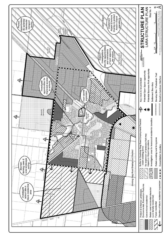 |
| SCHEDULE TO CLAUSE 52.16 | |||
| 1.0 | Native vegetation precinct plan |
||
|
12/09/2013 C243 Proposed C246 |
Name of plan |
||
|
Armstrong Creek East Native Vegetation Precinct Plan, May 2010 |
|||
|
Armstrong Creek North East Industrial Precinct Native Vegetation Precinct Plan, May 2010 |
|||
|
Native Vegetation Precinct Plan, Geelong Ring Road Employment Precinct, March 2013 |
|||
|
Lara West Growth Area Native Vegetation Precinct Plan, September 2013 |
|||
|
|
SCHEDULE TO CLAUSE 61.03 | ||
|
23/05/2013 C275 Proposed C246 |
Maps comprising part of this scheme:
|
||
| SCHEDULE TO CLAUSE 66.04 | |||
07/03/2013 |
Referral of permit applications under local provisions | ||
|
Clause |
Kind of application |
Referral authority |
|
|
Clause 5.0 of Schedule 3 to 42.01 (ESO) |
An application required under Schedule 3 to Clause 42.01. |
Secretary to the Department of Environment and Primary Industries | |
|
Clause 5.0 of Schedule 4 to 42.01 (ESO) |
An application required under Schedule 4 to Clause 42.01. |
Secretary to the Department of Environment and Primary Industries |
|
|
Clause 5.0 of Schedule 3 to 37.07 (UGZ) |
An application for the removal of ‘retained vegetation’ identified in the Armstrong Creek West Native Vegetation Precinct Plan, November 2012 |
Secretary to the Department of Environment and Primary Industries |
|
|
Clause 5.0 of Schedule 3 to 37.07 (UGZ) |
An application on land shown to be subject to flooding in a 1 in 100 year event as detailed in Plan 19 in the Armstrong Creek West Precinct Structure Plan, September 2012 |
Catchment Management Authority |
|
|
Clause 3.0 of Schedule 4 to 37.07 (UGZ) |
Any permit application for land containing native vegetation identified to be retained in the Lara West Native Vegetation Precinct Plan, or land that is identified within the NVPP as an offset site. |
Secretary to the Department of Environment and Primary Industries |
|
|
Clause 3.0 of Schedule 4 to 37.07 (UGZ) |
Any permit application for the use, development or subdivision of land within the high pressure gas pipeline measurement length (as defined in AS2855) as shown in the incorporated Lara West Precinct Structure Plan. |
Minister administering the Pipelines Act 2005 |
|
|
Clause 3.0 of Schedule 4 to 37.07 (UGZ) |
Any permit application for land that is shown to be subject to flooding in a 1 in 100 year event as detailed on Plan 19 (Flood Boundary for Existing Conditions Q100) in the incorporated Lara West Precinct Structure Plan. |
Catchment Management Authority |
|
| SCHEDULE TO CLAUSE 81.01 | |||
| 12/09/2013 C240 Proposed C246 |
Referral of permit applications under local provisions | ||
|
Name of document |
Introduced by: |
||
|
14 Shepherd Court, North Geelong, Cotton On Office Redevelopment, July 2011 |
C257 |
||
|
Advertising Sign Guidelines, City of Greater Geelong, November 1997. |
NPS1 |
||
|
Armstrong Creek East Native Vegetation Precinct Plan, May 2010 |
C206 |
||
|
Armstrong Creek East Precinct Structure Plan, May 2010 Amended November 2011. |
C214 |
||
|
Armstrong Creek East Precinct Development Contributions Plan, Version 4.1 Alternate Version November 2011. |
C214 |
||
|
Armstrong Creek North East Industrial Precinct Development Contributions Plan, May 2010. |
C207 |
||
|
Armstrong Creek North East Industrial Precinct Growling Grass Frog Conservation Management Plan, May 2010. |
C207 |
||
|
Armstrong Creek North East Industrial Precinct Native Vegetation Precinct Plan, May 2010. |
C207 |
||
|
Armstrong Creek North East Industrial Precinct, Precinct Structure Plan, May 2010. |
C207 |
||
|
Armstrong Creek Urban Growth Plan Framework Plan, November 2008, Updated September 2012 |
C240 |
||
|
Armstrong Creek West Precinct Development Contributions Plan, February 2013 |
C240 |
||
|
Armstrong Creek West Precinct Development Contributions Plan, February 2013 |
C240 | ||
|
Armstrong Creek West Precinct Native Vegetation Precinct Plan, November 2012 |
C240 |
||
|
Armstrong Creek West Precinct Structure Plan, September 2012 |
C240 |
||
|
Australian Standard AS 2021-1994, Acoustics - Aircraft Noise Intrusion - Building Siting and Construction. Standards Association of Australia 1994. |
NPS1 |
||
|
Environmental Weeds, City of Greater Geelong, September 2008 |
C129(Part 1) |
||
|
Geelong City Urban Conservation Study Vol. 1 Restoration and Infill Guidelines, Commercial and Civic Buildings, Graeme Butler for the City of Geelong, 1993 |
C258 |
||
|
Geelong Library and Heritage Centre Redevelopment, March 2013 |
C287 |
||
|
Geelong Ring Road – Section 4C Incorporated Document, June 2010. |
C232 |
||
|
Geelong TAC Office Development, October 2006. |
C142 |
||
|
Heritage and Design Guidelines, City of Greater Geelong, 1997. |
NPS1 |
||
|
Key Development and Increased Housing Diversity Areas, July 2009, updated 2012. |
C254 |
||
|
Jetty Road Urban Growth Area Development Contributions Plan, September 2011 |
C230 |
||
|
Lara West Precinct Structure Plan, September 2013 |
C246 |
||
|
Lara West Growth Area Native Vegetation Precinct Plan, September 2013 |
C246 |
||
|
Lara West Development Contributions Plan, September, 2013 |
C246 |
||
|
Melbourne Geelong Interconnection Project, June 2010. |
C229 |
||
|
Native Vegetation Precinct Plan, Geelong Ring Road Employment Precinct, March 2013 |
C243 |
||
|
Newtown Heritage Study Review Report, Volume 3, City of Greater Geelong, 2008 |
C191 |
||
|
New Station Estate Restructure Plan, July 2010 |
C187 |
||
|
Rail Infrastructure Projects (comprising the Rail Gauge Standardisation Project, the Regional Fast Rail Project and the Fibre Optic Project), December 2002. |
VC17 |
||
|
Rail Upgrades at Geelong Port Project, May 2010. |
C211 |
||
|
Rippleside Comprehensive Development Plan, February 2000. |
C2 |
||
|
Rippleside Urban Design Guidelines, June 2000. |
C2 |
||
|
Thirteenth Beach Golf Resort Barwon Heads, Barwon Heads Comprehensive Development Plan, Land Design Partnership, Anthony Cashmore & Associates and the Planning Group, May 2001 amended September 2006. |
C54 |
||
|
Waterfront Geelong Design and Development Code, Keys Young, July 1996 |
NPS1 |
||
|
West Fyans-Fyans Street Precinct Structure Plan, June 2009 |
C205 |
||
6.1 What is the issue?
The land is traversed by a high-pressure gas pipeline owned and operated by APA Gasnet Australia (Operations) Pty Ltd. The 500 mm pipeline operates at 10,200 kPag and is one of three main natural gas pipelines supplying Melbourne. It is within a 20 metre wide easement and is underground with a cover of at least 1.2 metres. APA intends to install additional pipes within the easement (Submission 6).
The protection of the pipeline and the easement and the encroachment of more intense land uses and development within its vicinity under the proposed LWPSP is a matter that needs careful consideration.
6.2 Policy context of the issue
State Policy deals specifically with gas pipelines at Clause 19.03-6 of the planning scheme. Its aim is to plan for the development of pipelines subject to the Pipelines Act 2005 to ensure that gas is safely delivered at minimal risk to people, other critical infrastructure and the environment.
Strategies to achieve this are:
- Recognise existing transmission-pressure gas pipelines in planning schemes and protect from further encroachment by residential development or other sensitive land uses, unless suitable additional protection of pipelines is provided.
- Plan new pipelines along routes with adequate buffers to residences, zoned residential land and other sensitive land uses and with minimal impacts on waterways, wetlands, flora and fauna, erosion prone areas and other environmentally sensitive sites.
- Provide for environmental management during construction and on-going operation of pipeline easements.
6.3 Background
The significance of the pipeline emerged late in the LWPSP and Amendment C246 process. There is no reference to it Clause 21.13 of the planning scheme, which deals with planning for Lara and includes the Lara Structure Plan map. It does not appear to have been considered by the Panel that reported on Amendments C73 and C198 in 2010 (Document 14) and recommended in favour of the structure plan. It is not included in the Lara Structure Plan report adopted by Council in 2011 (Document 11).
In March 2012 the Council alerted the proponent’s planners and engineers (SMEC Urban) to the existence of the pipeline and recommended contact with APA (Document 5). SMEC Urban’s infrastructure services report of September 2012 referred to the pipeline and noted that it “must be given due weight when considering subdivision design and layout alternatives for the overall development site” Similar words were used in the exhibited LWPSP. Clause 4.7.3 of the exhibited plan, proposed to be included as a reference document under the Schedule to the UGZ, also refers to a requirement that subdivision permits include a condition requiring the installation of infrastructure to the satisfaction of APA and a requirement that development must retain and protect the existing easement.
In response to the exhibited amendment APA submitted that the major pipeline investments it was planning could be put at risk and that the encroachment of urban uses could impose operational constraints on the pipeline and “raise uncertainty about its long term land use role” (Submission 6). APA also said:
High pressure gas transmission lines have potential to cause catastrophic damage in the case of explosion. Gas lines of this nature are maintained and constantly monitored to ensure their integrity. The likelihood of explosion is extremely remote. Accordingly, there is no current requirement to provide additional buffers to safeguard against this unlikely outcome. APA have recommended, however that potential risks be considered in land use planning. It has been suggested that uses such as schools and hospitals be sited away from pipelines if possible.
APA advises that Energy Safe Victoria and Department of Primary Industries are reviewing the risks associated with development within the heat flux zones around transmission pipelines.
The DPI (Submission 50) advised that it was seeking ESV’s advice as to whether the LWPSP provided sufficiently for human safety in the siting of residential areas in proximity to the pipeline.
Following the APA submission there were discussions between the Council, proponent and APA and a “Safety Management Workshop” including representatives of APA, Council, SMEC Urban and the proponent was held on 7 March 2013 as part of the preparation of a Safety Management Study by APA.
On 26 March 2013 the Department of Primary Industries (DPI) wrote to Council advising that it had received information in relation to the pipeline from Energy Safe Victoria but ESV was not yet satisfied that safety standards would be met and in particular, that the “as low as reasonably practicable” (ALARP) principle would be met in respect of risk. DPI further advised that there were ongoing discussions between APA and the proponent about managing risks that would result from the proposed land use changes. It indicated that once the ALARP principle has been demonstrated, ESV and DPI “will be in a position to support” Amendment C246.
At the Directions Hearing on 28 March 2013 a draft revised LWPSP map dated 28 February 2013 and labelled “for discussion” was tabled by Mr Tobin indicating a 320 m buffer either side of the gas pipeline.
Accordingly the Panel directed the proponent to circulate the outcome of meetings with Energy Safe Victoria and Department of Primary Industries regarding satisfying the ALARP principle and its proposed “Hearing Version” of the LWPSP by close of business on 12 April 2013.
In response Mr Tobin advised by letter dated 12 April that APA had met with ESV on 9 April and that ESV requested further revision of APA’s draft Safety Management Study (SMS). The proponent believed that the likely final outcome of the SMS would confirm a requirement for a 320 metre “Gas Pipeline Heat Flux Zone” rather than a reduced zone as was expected to be the case at the time of the Directions Hearing. APA and ESV would not support residential use (at a density higher than 30 dwellings per hectare) school, employment or activity centre uses within this zone. A new draft LWPSP map was provided with amendments accommodating a 320 metre Heat Flux Zone (“C246 Hearing Version”, being Revision S dated 12 April 2013).
On 12 April 2013, in response to the Panel’s directions, the Council provided a revised draft of Schedule 4 to the UGZ and draft revisions to the LWPSP report.
In response to the Panel’s Directions ESV advised the Panel on 17 April that APA’s advice was that the area to which the ALARP principle should be applied is 550 m from the pipeline, that it had not yet received APA’s final report and that “any presumption of likelihood of ESV and DPI support for the Amendment is inappropriate”.
APA provided a copy of its final Safety Management Study Report to ESV and the Panel on 26 April 2013. APA did not choose to be heard or call evidence in support of its written submissions.
6.4 Evidence and submissions
In its letter to the Panel of 26 April enclosing its Safety Management Study Report, APA said it had assessed the exhibited LWPSP and “expresses the need to reduce risk to the public to an acceptable level by locating medium density (greater than 30 dwellings per hectare) and Sensitive land uses preferably 554m away from the existing pipeline and not within 324m of the pipeline”.
APA’s report says that a Safety Management Study (SMS) was carried out in accordance with Australian Standard AS 2885.1-2012. This standard requires that the current pipeline safety management study for each pipeline be updated for any changes in the pipeline’s operating environment. This was done by considering threats resulting from the land use and development changes proposed under the LWPSP. Generic threats, such as corrosion, are covered by the most recent study performed on the entire pipeline and “did not present a significant risk at this location”.
APA says that the pipeline’s design and construction is on the basis that the subject area has a Residential (T1) rating in accordance with AS 2885.1-2012. That is, the land within the “measurement length” (see below) of the pipeline:
… is developed for community living. Residential applies where multiple dwellings exist in proximity to each other and dwellings are served by common public utilities. Residential includes areas of land with public infrastructure serving the residential use; roads, railways, recreational areas, camping grounds/caravan parks, suburban parks, small strip shopping centres. Residential land use may include isolated higher density areas provided they are not more than 10% of the land use. Land used for other purposes but with similar population density shall be assigned Residential location class.
High Density (T2) is a higher rating location classification defined by AS 2885.1-2012 as:
Land that is developed for high density community use. High Density applies where multi storey development predominates or where large numbers of people congregate in the normal use of the area. High density includes areas of public infrastructure serving the high density use; roads, railways, major sporting and cultural facilities and land use areas of major commercial developments; cities, town centres, shopping malls, hotels and motels.
NOTE: In residential and high density areas the societal risk associated with loss of containment is a dominant consideration.
Within these primary classifications, a location can also be classified as a “Sensitive use (S)” location under AS 2885.1-2012 leading to requirements additional to those of the primary classification. The Standard defines this classification as:
The sensitive use location class identifies land where the consequences of a failure may be increased because it is developed for use by sectors of the community who may be unable to protect themselves from the consequences of a pipeline failure. Sensitive uses are defined in some jurisdictions, but include schools, hospitals, aged care facilities and prisons. Sensitive use location class shall be assigned to any portion of pipeline where there is a sensitive development within a measurement length. It shall also include locations of high environmental sensitivity to pipeline failure.
The “measurement length” is the distance from the pipeline of relevant land uses and is based on the radius of the 4.7 kW/m2 heat radiation contour calculated under AS 2885.1-2012 for “full bore rupture” of the pipe leading to ignition of the escaping gas. The SMS puts this distance as up to 554 m from the pipeline. The effect of exposure to such heat will cause pain in 15 to 20 seconds and injury after 30 seconds exposure (at least second degree burns will occur).
The SMS also refers to the heat radiation contour of 12.6 kW/m2 as bringing a significant chance of fatality for extended exposure and high chance of injury. It puts this distance as up to 324 m from the pipeline.
The SMS included an “SMS Action Item List” based on the hazards identified exhibited plan relating to detailed design and construction management.
Mr Radojkovic of the Department of Primary Industries drew the Panel’s attention to the responsibility of the Minister for Energy and Resources in administering the Pipelines Act 2005. The Minister is a prescribed Minister under regulation 8 of the Planning and Environment Regulations, 2005. As such he may require that an amendment not be approved by the Minister for Planning under Section 35(4) of the Planning and Environment Act, 1987 if he is of the opinion that the amendment may unreasonably prejudice the use of a pipeline permitted under the Pipelines Act.
In forming its recommendation to its Minister, DPI seeks the advice of Energy Safe Victoria. Mr Cronin of ESV drew the Panel’s attention to the provisions of the Pipelines Act 2005, which requires a licensee (APA in this instance) to construct and operate pipelines in accordance with AS 2885 Parts 1, 2 and 3. In relation to land use planning he cited Section 4.7.4 of AS 2885.1-2012:
Where there are changes in land use planning (or land use) along the route of existing pipelines to permit Residential, High Density, Industrial, or Sensitive development or Heavy Industrial development in areas where these uses were previously prohibited, a safety assessment shall be undertaken and additional control measures implemented until it is demonstrated that the risk from a loss of containment involving rupture is ALARP.
The assessment is to include consideration of measures including reduction of pipeline pressure, upgrading of pipe to “no rupture”, pipeline relocation, modification of the land use to separate people from the pipeline and physical and procedural protection measures that are effective in controlling threats capable of causing rupture of the pipeline.
Mr Cronin pointed out that “ALARP is achieved when the cost of further risk reduction measures is grossly disproportionate to the benefit gained from the reduced risk that would result” from implementing an alternative.
Mr Cronin confirmed that ESV understood the pipeline as having been designed to meet Residential (T1) conditions.
In response to the Panel’s requests for clarification, ESV provided further written advice to the Panel dated 3 May 2013. In relation to the residential densities applicable to the T1 and T2 categories defined by AS 2885.1-2012 and the basis for them ESV advised:
The basis for differentiation is population density, and the numbers of people that would be killed or injured in the event of a full bore rupture or other loss of containment. The standard does not provide a numerical delineation of population densities between ‘T1’ and ‘T2’ land use classifications.
APA has advised ESV that it considers a residential development of 30 lots per hectare in this case to be consistent with the ‘T1’ definition. ESV is satisfied with this advice.
In relation to the Hearing Version of the LWPSP map, ESV was asked to state its position with respect to:
- The form of envisaged urban development within the 'heat flux zone' shown on the plan (marked at 320 m from the pipe); and
- The location of schools and the Neighbourhood Activity Centre.
ESV responded:
The pipeline has been designed consistent with ‘T1’ type land use within the 'pipeline measurement' area (in this case within 554m of the pipeline) …
The Standard identifies schools as 'Sensitive' land use…
ESV has been advised by APA that the Neighbourhood Activity Area was treated as ‘T2’ by the participants of the Safety Management Study …
As stated at the hearing, ESV's position is that it would be prudent planning from a safety perspective to attempt to locate any 'Sensitive' or 'T2' land use further than 554m from the pipeline.
Further, APA has calculated that in the event of a full bore rupture, a distance of 324m from the pipeline in this case is consistent with "a thermal radiation level of 12.6 kW/m2 [which] represents the threshold of fatality, for normally clothed people, resulting in third degree burns after 30 seconds exposure."‘ ESV does not consider it appropriate that any 'Sensitive' or ‘T2’ land use should be planned within 324m of the pipeline.
However, with regard to the area between 324m and 554m from the pipeline, and given that "ALARP is achieved when the cost of further risk reduction measures is grossly disproportionate to the benefit gained from the reduced risk that would result", ESV acknowledges the possibility that the principle of ALARP could be met with 'Sensitive' or 'T2' land use between 324m and 554m from the pipeline. Also, ESV recognises that ALARP may be demonstrated differently for 'Sensitive' and for ‘T2' land use given the different sectors of the community using the land.
ESV acknowledges that given the range of activities that could be permitted for the Neighbourhood Activity Centre and its proposed location between 324m and 554m from the pipeline, it would be feasible to achieve the ALARP principle, provided that the detailed design for the Centre has regard to a safety assessment carried out in collaboration with the pipeline licensee.
It is not clear to ESV from the version of the Precinct Structure Plan exhibited at the panel hearing how ALARP would be met for the schools that are shown to be within 554m of the pipeline. However, in an update of the Precinct Structure Plan that has been provided to ESV (revision V, or Draft 2), in which the schools are predominantly beyond 554m from the pipeline, the locations of the schools would be able to meet the ALARP principle given the physical constraint posed by drainage ditches to the north.
At the hearing ESV was asked questions about “credible” and “non-credible” threats of pipeline rupture as assessed in the SMS. ESV advised:
In the Standard, the term 'non-credible' when related to pipeline rupture has a specific meaning based on calculations of the extent of the damage to the pipeline resulting from threats to the pipeline identified as credible at the time of the safety assessment. In this instance the calculation was done on the basis of the threat of external interference from an excavator creating a puncture. Such an approach is consistent with industry practice.
It should not be assumed that the overall likelihood of full-bore pipeline rupture from all causes (which could include the action of horizontal boring or the use of 'trench rippers') throughout the operational life of the pipeline (likely to be another sixty-plus years), is non-credible in the commonly used sense. Particularly given the changes in drilling, boring, digging and other excavation technology that may take place in that time.
Mr Tobin described the proponent’s response to the submissions of APA and subsequent discussions with APA, which led to the Hearing Version (Version S) of the LWPSP map (Document 10). This version of the LWPSP and the proponent’s various expert evidence statements were prepared on the basis that APA and ESV “had not formally resolved their position with respect to the buffer area” and the proponent’s understanding that APA’s requirement was “likely to be 320-metre heat flux zone either side of the pipeline”.
The changes to the exhibited LWPSP map included in the Hearing Version of the map were:
- the identification of the gas pipeline easement and the 320m “heat flux zone”;
- relocation of the Employment Precinct to the northern side of the East-West Connector Road adjacent to Bacchus Marsh Road;
- realignment of roads to reduce the number of crossing points of the gas pipeline;
- positioning of the NAC, school and community facility sites beyond the “heat flux zone”;
- the reconfiguration of medium density housing and open space; and
- a notation that within the “heat flux zone”, medium density housing is less than 30 lots per hectare.
In relation to the actions recommended in Appendix B of the SMS, Mr Tobin submitted that these could be accommodated in the LWPSP document, the UGZ schedule and in detailed design.
During the course of the Hearing Mr Tobin submitted a further version of the LWPSP map, C246 Hearing Version – 554m Heat Flux Zone Draft 2 (Version V, 2 May 2013). This version relocates schools and community facilities generally beyond a distance of 554 metres from the pipeline. However, the district open space / sports fields and neighbourhood and local activity centres remain within the 554 m “heat flux zone”.
In response to the Panel’s question about whether the Amendment properly responds to Clause 19.03-6 of the SPPF, Mr Tobin submitted:
… the objective talks of minimal risk, not no risk. That a proposal of any kind is absent any risk is rarely possible. Certainly it is not the basis upon which the pipe has already been constructed through a rural residential area to the south.
Regarding the strategy of protecting pipelines from further encroachment by residential development or other sensitive land uses, unless suitable additional protection of pipelines is provided, Mr Tobin submitted:
Again, the words are not premised on no residential encroachment, only that encroachment which is absent suitable protection (as regards the pipe).
Mr Montebello submitted for the Council that while it is regrettable that the pipeline issue was not identified earlier:
… the impact on the PSP is not critical nor structural given that the Australian Standard seems to somewhat curiously concern itself with the density of population rather than population per se. It is observed that the approach taken in the SMS appears to be a conservative assessment and although it makes reference to a preferable 554 metre buffer, the analysis seems a tad casual.
It remains to provide some recognition of this issue in the planning framework being put in place. Council submits that Schedule 4 to the Urban Growth Zone should be amended to reflect the gravity of the issues under consideration. This could be best done by including a referral process for any application within the buffer area which ought to ensure that there is an appropriate consideration of any actual proposal.
In relation to the Dacland proposal for a NAC within the 324 m heat flux zone Mr Montebello submitted that it is “not possible in the context of the impact of the gas pipeline”.
In closing submissions for the Council, Ms Eastaugh said that the revisions to the LWPSP made by the proponent in the course of the Hearing demonstrate:
While it may be possible to take other protective measures, it is also practical and relatively easy to comply with the Australian Standard by moving sensitive uses out of the 554 metre heat flux zone without causing any significant impact on the structure of the growth area. It also shows that it is possible to keep the activity centre elements out of the 324 metre heat flux zone. …
Accepting that the defined T1 uses are not an issue (according to the Australian Standard) because the pipeline was constructed to T1 standards, then the conventional and even medium density residential use of land is not inconsistent with clause 19 of the SPPF.
Ultimately, Council is reliant on bodies such as ESV and DPI in relation to this matter. Council does not have the necessary expertise where it comes to the pipeline issue.
Nevertheless Council only gave in-principle support to these changes because it had not had an opportunity to consider the various changes in detail. In this regard, in Council’s closing submission, Mr Anderson indicated that the process has been “a bit on the run” and therefore “Council was not in a position to put a stamp on the Plan with finality”. Mr Anderson also noted that internal referrals had not occurred in relation to the shifting of the open space.
Mr Tweedie submitted on behalf of Dacland Pty Ltd that the pipeline is a significant planning issue for the amendment, which the Council and proponent have not satisfactorily addressed and that the amendment “should not proceed further” until this has happened. In relation to Clause 19.03-6 he submitted:
… like all policy strategies, there is a need to balance this need for protection against the costs to the community of doing so. Ultimately, what is required is an assessment of the relative costs of protection against the relative benefits.
This, in turn, requires a rigorous and informed process of risk assessment. In Dacland’s view, the assessment of risks associated with the pipeline has, to date, been neither rigorous, nor well informed. It has also not been a fair or a transparent process.
Part of this is as a consequence of the unsatisfactory way in which information has been provided to the Panel and other parties.
Mr Tweedie cited the fact that the final SMS was not circulated until 4.00pm on the last business day before the Hearing and that:
- the author of the SMS has not been identified, and the contents and conclusions of the SMS are unable to be tested.
- APA have not attended the Panel; and
- ESV has expressed concerns about the SMS, and whether or not any “sensitive use” can locate within 554 metres of the pipeline.
In relation to AS 2885 Mr Tweedie submitted:
… the proper interpretation of the Standard is that it does not operate as a planning tool to prohibit or regulate land use. Rather, it is a standard by which pipeline operators manage the risk of construction and operation of their pipelines in accordance with their obligations under the Pipelines Act 2005 under the regulatory control of ESV.
In relation to the Council submission that Dacland’s NAC site is “not possible” because of the gas pipeline, Mr Tweedie submitted that the Panel is not is a position to make such a finding because this would be unfair and because the:
material before the Panel implies that the development of the Manzeene Avenue NAC is possible; provided a suitable SMS that assesses the proposed land uses and justifying that outcome is prepared
which Dacland is confident can be done.
Notifying Land Buyers
During the course of the Hearing the Panel raised the question of whether or not there should be a mechanism to advise purchasers of property within the “heat flux zone” of the proximity of the high-pressure gas pipeline. Mr Tobin opposed any notice mechanism for the following reasons:
- The construction standard accommodates residential use.
- The pipeline has co-existed since 1999 without incident with residents and other land users.
- “Sensitive” uses will be at appropriate distances from the pipeline.
- No party’s use of the land will alter as a result of such notice.
- An administrative burden will be imposed on the Responsible Authority and other authorities.
- May lead to a need for additional approvals and delay.
- There is no planning scheme Overlay available.
- It “fails a test of broad relevance”.
- The Calder Raceway example referred to by Mr Milner is one where there is a potential amenity impact and “notification is a means of managing the expectations of persons entering the area” but “the pipeline will have no day to day amenity impact”.
- There is adequate control over subdivision of land affected by the pipeline easement.
- The easement will be transferred to council and landscaped appropriately.
- Until that happens the easement is registered on title.
In his written evidence Mr Milner said that the implications of the gas pipeline were not properly understood until recently. Accordingly he recommended:
… that arising from the experience in this matter, it would be appropriate for the City of Greater Geelong and the Department of Planning and Community Development to review how the relevant strategic and statutory planning tools can be used to properly draw attention to major infrastructure such as this.
At the Hearing Mr Milner further said that the way the pipeline issue had arisen in this case reflected a shortcoming of the Victorian planning system that the Panel should draw attention to.
In his verbal evidence Mr Milner said that ideally there should be a planning scheme overlay on the area affected by the pipeline to give effect to a required buffer. It would then be part of a vendor’s statement of the matters affecting land being sold, issued under Section 32 of the Sale of Land Act.
In relation to the amendments to the exhibited LWPSP Mr Milner said:
Despite the revisions to the plan, l am satisfied that its impact has not unreasonably and detrimentally impacted upon the urban design framework that is at the heart of the LWSP. The important relationships of the location of the activity centre, its abuttal to the regional open space, the location and integration of the public transport route, and the co-location with community facilities has not been fundamentally disturbed.
Finally I note that the easement passes through proposed residential areas as well as along drainage and open space corridors. The design and treatment of this easement warrants more careful detailing. The diagram at Attachment 2 should be included in the LWSP to illustrate how this may be achieved.
The diagram referred to by Mr Milner was accepted by the Council.
Changes to the draft UGZ4 relating to the pipeline
At the request of the Panel the Council circulated a post-Hearing (20 May 2013) draft of the UGZ4 consolidating changes agreed by the Council and proponent. Those changes relevant to the gas pipeline are discussed below in the following section of this report.
6.5 Discussion and Findings
The Panel agrees with the Council that it is unfortunate that the significance of the pipeline did not become apparent early in the planning process for the area. Indeed it is an issue that deserved consideration at the Lara structure planning stage.
The Panel also agrees with Mr Milner that this reflects a shortcoming in the planning system that deserves attention. In accordance with Clause 19.03-6 it would be appropriate to “recognise existing transmission-pressure gas pipelines in planning schemes” in a formal way, perhaps with high-pressure gas pipeline routes and associated “heat flux zones” marked on scheme maps with a dedicated Overlay control. This would require an amendment to the Victoria Planning Provisions.
The submissions of APA Gasnet (Operations) Pty Ltd were a critical element in the material before the Panel because they included the outcome of analyses reportedly conducted in accordance with Australian Standard AS 2885 and are put to justify controlling the type of land uses and the development intensity around the pipeline. The material put by APA, the owner and operator of the pipeline, was not supported by independent evidence and was not able to be tested by the Panel because APA did not appear.
Because of this state of affairs the Panel understands the frustrations of Mr Tweedie with the SMS submitted by APA. In particular, the Panel asked ESV at the Hearing about the basis for attributing a density of 30 lots per hectare to Residential T1 locations. The response at the Hearing was that this was understood to be the advice of a pipeline-engineering consultant advising APA. Given that many suburban areas are developed at a much lesser density than this and that the Growth Areas Authority aims to achieve 15 lots per hectare for PSPs it is responsible for, it would be worth understanding the basis for assigning a density of 30 lots per hectare in T1 areas.
However, the Panel does not agree with Mr Tweedie’s submission that the amendment should not proceed. This is because the Panel gives considerable weight to the views of Energy Safe Victoria (ESV), the independent regulator responsible for electricity, gas and pipeline safety in Victoria under the Energy Safe Victoria Act 2005. The Panel notes ESV’s acceptance of APA’s assertion that the pipeline has been designed for “Residential (T1)” conditions and that this means development at up to 30 lots per hectare. Indeed the Panel has the comfort of relying on the veto powers of the Minister for Pipelines Energy and Resources should he feel that the encroachment of higher population density activities under the LWPSP threatens the pipeline.
Given ESV’s submissions, the Panel is of the view that the LWPSP can proceed with suitable modifications.
Firstly, while it would be preferable for the NAC (as a “T2” location) to be located outside the 554 m “Heat Flux Zone”, the advice of ESV that it may be possible to site the NAC between the 324 m and 554 m radii subject to a safety assessment of the detail design, allows the Panel to conclude that the NAC configuration in Revision V of the LWPSP map may be acceptable. However, it must be acknowledged that the development of the NAC site nominated by this plan could prove impossible for safety or cost reasons once detailed plans are prepared and assessed. The Panel is not in a position to judge the likely outcome of this process.
Secondly, it is the Panel’s view that all Sensitive uses should preferably be at least 554 m from the pipeline. This should include all land set aside on the LWPSP for education centres, childcare centres, child and maternal health centres, residential aged care facilities, libraries and hospitals (if any). However, given the statements of ESV it appears that such facilities might be approved within the NAC (if beyond the 324 m “measurement length”), depending upon their character and design. Accordingly, the proponent’s suggestion that some child care and education uses might be included in the NAC, supported by the Council, should not be ruled out. The Panel envisages that suitable siting and design of such facilities within a commercial centre building may be possible.
In relation to the configuration of the school sites shown on Revision V of the LWPSP map, the Panel does not accept that site constraints are such that any part of the school sites should be within 554 m of the pipeline. ESV’s opinion about this was that the locations of the schools would be able to meet the ALARP principle given the “physical constraint posed by drainage ditches to the north”. However, Mr Craigie’s evidence was that the engineering design of these drainage facilities is flexible. Similarly, the Panel considers that layout of the proposed road system is flexible enough to facilitate the further minor reshaping of the school sites so that no portion of them are within 554 m of the pipeline. Therefore the Panel can see no compelling reason why the design of the LWPSP should not be modified by adjusting the layout rather than compromising the preferred set back distance for schools.
The Panel also has some concern that under the latest version of the LWPSP map about half of the sporting fields and the stadium site remain within the 554 m “Heat Flux Zone”. These facilities may fall within the ambit of the “High Density (T2)” location class under AS 2885.1, which includes “major … sporting facilities” where considerable numbers of people may gather in the open. Unfortunately, what is meant by “major sporting facilities” under the standard is unclear as there is no clarification of the term in the code. However, the Panel observes that there is little practical difference between a schoolyard and a sports field used for junior sport except perhaps in the frequency of use. The Panel is of the view that the location of these facilities is also reasonably flexible, that there is no overriding requirement that they be co-located with the NAC and that consideration could be given by the Council and proponent to relocating them to a location outside the 554 m “Heat Flux Zone”.
Unfortunately the urban designers for the proponent (SMEC Urban) were not called to give evidence so the Panel was not in a position to assess the reasoning and assumptions behind the proposed layout of the LWPSP in its various drafts. Therefore the Panel is unable to properly consider the viability of moving various elements around as a way of reducing risk. However, the site is a very large flat area without many other constraints so the Panel feels there is likely to be more than one design solution possible.
Where does this leave the draft LWPSP map? The Panel’s opinion is that the version tabled by the proponent on Day 4 of the Hearing (Revision V, Document 26) is a suitable basis for the maps to be included in the LWPSP and the UGZ Schedule subject to minor amendments to ensure that sites marked for schools and community facilities are entirely outside the 554 metre heat flux zone.
Mr Milner’s suggested plans
The indicative plans of lots fronting the pipeline easement proposed by Mr Milner and accepted by the Council may be acceptable to ESV and APA but this has not been tested. It is noted for example that one of these sketches shows the creation of lot access driveways across the easement, which may be problematic. The Panel finds that these plans should only be included in the LWPSP if ESV and APA agrees.
Dacland’s Manzeene Avenue site
The Panel makes no finding as to the effect of the high pressure gas pipeline on the NAC site proposed by Dacland, although it notes that in the context of this hearing, ESV’s position is that it does not consider it appropriate that ‘T2’ land uses, which include areas of major commercial development, town centres and shopping malls should be accommodated within 324 m of the pipeline. Considerations arising from the proximity of the pipeline to the Manzeene Avenue site are a matter for Council, ESV, DPI, APA and Dacland in their assessment of the amendment requested by Dacland for the Manzeene Avenue area (C285).
Changes to the draft UGZ Schedule relating to the pipeline
The Council’s post-Hearing (20 May 2013) draft of the UGZ Schedule includes the following suggestions relevant to the pipeline.
Council proposed a requirement in Part 2.5 that the Masterplan for the Patullos Road Area address the treatment of the pipeline following consultation with ESV and the pipeline licensee. The proponent agreed with this. The Panel supports the change.
It was agreed between the Council, the proponent and Dacland that a new referral requirement (Part 3.5) should include:
Any permit application for the use, development or subdivision of land within the gas easement heat flux zones as shown in the Lara West Precinct Structure Plan must be referred to Energy Safe Victoria.
The Panel agrees with this and supports indicating both the 554 m and the 324 m “Heat Flux Zones” on Plan 4 LWPSP. Map 1 shown in the post-Hearing draft Schedule does not show the heat flux zones and does not reflect the latest changes suggested by the proponent. The Panel finds that it should be modified to show both heat flux zones.
The proponent suggested that Table 2 in Part 2.3 include the uses “child care centre” and “education centre” if on land in the Neighbourhood Activity Centre with the condition “must have the written approval of the operator of the gas pipeline”. This was supported by Council with the proviso that Energy Safe Victoria should approve in addition to or in replacement of the pipeline operator. While there is a clear preference for such sensitive uses to be outside the 554 m “Heat Flux Zone”, the Panel agrees with this provision for the NAC (assuming it remains within the 554 m “Heat Flux Zone”).
The proponent suggested that Part 4.0 (Conditions and requirements for permits) should include:
Any planning permit for subdivision of land containing the pipeline easement, building or works within or abutting the easement must include the following condition:
Prior to the commencement of any works a construction management plan must be prepared to the satisfaction of the responsible authority, having regard to the comments of the gas pipeline operator (who must be provided with a copy of the CMP). The CMP must include a description of all machinery to be used, the nature and specification of proposed works and reporting mechanisms prior during and after the works.
The Council disagreed with this because it does not have the expertise to assess the risks associated with the pipeline. It relies on the referral to ESV and says that the requirements of a Construction Management Plan should be left to Energy Safe Victoria and APA. The Panel agrees with the Council that the need for and content of a construction management plan should be left to ESV.
In Section 6.0 Decision Guidelines of the Schedule Dacland suggested a new dot point, with the support of the proponent:
For any applications within the gas easement heat flux zone as shown on Map 1: any risks associated with the operation of the high pressure gas pipeline.
This, the Council says, is the purpose of the referral provisions and should be left to Energy Safe Victoria and APA. The Panel suggests that the following dot point be added instead:
For any applications within the gas easement heat flux zone as shown in the Lara West Precinct Structure Plan, the views of Energy Safe Victoria.
Changes to the LWPSP
On 12 April 2013 the Council circulated proposed changes to the LWPSP in accordance with the Panel’s Directions. These changes are supported subject to the following modifications:
- Plan 4: Precinct Features to be updated to show the 554 m heat flux zone.
- A new section headed 2.5 APA Gas Easement and Pipeline to be included as proposed except for the last paragraph which should be modified as follows:
The APA assessment identified a “Heat flux Zone” as being land up to 554 m from the pipeline where certain intense or sensitive land uses should be excluded and residential density should not exceed 30 lots per hectare. Any permit application for the use, development or subdivision of land within the “Heat Flux Zone” as shown in the Lara West Precinct Structure Plan must be referred to Energy Safe Victoria for consideration and its advice will be taken into account in the decision.
- The new last dot point proposed for section 4.7.3 should be amended to reflect referral of applications to ESV in accordance with the agreed change to the Schedule.
Notifying Land Buyers
While the proximity of high voltage power lines may or may not influence prospective property buyers in their location choice, the power lines are highly visible. On the other hand an underground pipeline passing through a 20 m easement may not be noticed even one or two lots away. Furthermore, the “Heat Flux Zone” extends for 554 m from the pipeline. For these reasons, the Panel believes some form of notice for newcomers buying into the area about the existence of the pipeline is reasonable. Indeed formal pre-purchase notice may help avoid post-sale disputes between purchasers and the developer or Council.
The reasons advanced by Mr Tobin for opposing notice arrangements are not accepted by the Panel. While the Panel agrees that the pipeline’s design, construction and operation may render the risk to residents within the 554 m “Heat Flux Zone” acceptable to the pipeline operators and regulators, prospective land purchasers should be informed of the existence of the pipeline. They should be enabled to make their decision to invest and live in the area in the full knowledge that the pipeline exists and the risk is assessed as minimal by the relevant authorities.
The Panel does not agree with Mr Tobin that the provision of such information would lead to further approvals or delays and it need not lead to any added administrative burden of any significance to authorities. Nor does the Panel agree that some form of notice to purchasers would fail the test of relevance. In the Panel’s opinion the provision of such information would meet an objective of planning in Victoria “to balance the present and future interests of all Victorians”. It is in no-one’s interest that land purchasers be ignorant of the presence of the pipeline or the risks associated with it.
Furthermore the Panel notes that under AS 2885.3, as part of the management of external interference threats, a pipeline licensee is required to have regular communication with the community and stakeholders “to raise and reinforce awareness of the presence of a pipeline and the constraints with respect to the use of land on and near the pipeline”. The licensee is also required to place signs on the route of the pipeline. Notification of buyers at the time of purchase would complement these requirements. This could be achieved by a condition on subdivision permits within the 554 m “Heat Flux Zone” requiring a Section 173 Agreement registered on land titles. The wording of the notice should be developed by the responsible authority in consultation with ESV, APA and the proponent with the aim of ensuring an understanding of the nature of the hazard presented by the pipe. A provision to give effect to this could be included in Part 4 of the Schedule and is so recommended.
By way of summary, the Panel finds:
- Based on Energy Safe Victoria’s advice, the Panel accepts that the location of the NAC on C246 Hearing Version Draft 2, Revision V, 02 May 13 of the LWPSP Urban Structure Plan between the 324 m and 554 m heat flux radii is acceptable for planning purposes, and that further safety assessments are still required in detailed design.
- The C246 Hearing Version Draft 2, Revision V, 02 May 13 of the LWPSP Urban Structure Plan should be further amended to ensure that sites marked for schools and community facilities are entirely outside the 554 m heat flux zone and that this outcome is achievable with minor modification to the road and drainage layout.
- A new referral requirement to Energy Safe Victoria should be included in the UGZ Schedule to require all permit applications to be referred to it for use, development or subdivision of land within the gas easement heat flux zones.
- It is in no-one’s interest that prospective land purchasers are ignorant of the presence of the pipeline or the risks associated with it and therefore notice for newcomers buying into the area about the existence of the pipeline is reasonable. To achieve this, the Panel considers that a condition should be placed on subdivision permits within the 554 m “Heat Flux Zone” that requires a Section 173 Agreement be registered on land titles. The wording of the notice should be developed by the responsible authority in consultation with ESV, APA and the proponent with the aim of ensuring an understanding of the nature of the hazard presented by the pipe.
- The Department of Transport, Planning and Local Infrastructure should investigate the need for an Overlay control to recognise high-pressure gas pipelines and their heat flux zones in planning schemes.
6.6 Recommendations
The Panel recommends:
Changes to both the LWPSP and the UGZ Schedule
- Adopt the “Urban Structure Plan - Revision V, 02 May 2013” (Hearing Document 26) as “Plan 5: Future Urban Structure” in the LWPSP and as Map 1 – Lara West Precinct Structure Plan in the UGZ Schedule subject to further refinement to ensure that sites marked for schools and community facilities are entirely outside the 554 metre “heat flux zone”.
Changes to the LWPSP
- Amend Plan 4 – Precinct Features of LWPSP to indicate both the 554 m and the 324 m “heat flux zones”.
- Amend the final paragraph of the 12 April 2013 version of the proposed section 2.5 of LWPSP headed APA Gas Easement and Pipeline to:
The APA assessment identified a “heat flux zone” as being land up to 554 m from the pipeline where certain intense or sensitive land uses should be excluded and residential density should not exceed 30 lots per hectare. Any permit application for the use, development or subdivision of land within the “heat flux zone” as shown in the Lara West Precinct Structure Plan must be referred to Energy Safe Victoria for consideration and its advice will be taken into account in the decision.
- Amend Section 4.7.3 of the LWPSP to include the following:
Any permit application for the use, development or subdivision of land within the “heat flux zone” as shown in the Lara West Precinct Structure Plan must be referred to Energy Safe Victoria for consideration and its advice will be taken into account in the decision.
Changes to the UGZ Schedule
- Amend the Schedule so that any permit application for the use, development or subdivision of land within the “heat flux zone” must be referred to Energy Safe Victoria and its views must be considered in determining the application.
- Amend the Schedule so that the Masterplan for the Patullos Road Area must address the treatment of the high-pressure gas pipeline following consultation with ESV and the pipeline licensee.
- Amend the Schedule to include the following:
Condition for subdivision of land within the high-pressure gas pipeline heat flux zones as shown in the Lara West Precinct Structure Plan.
The owner of the land must enter into an agreement with the responsible authority under Section 173 of the Planning and Environment Act 1987 before any development commences on the relevant land to provide for:
- the giving of notice by the owner in a form approved by Energy Safe Victoria to all prospective owners of the location of the high pressure gas pipeline easement and its heat flux zones; and
- the responsible authority's reasonable legal costs and expenses of drafting, reviewing and registering the agreement and of assessing, negotiating and recording any proposed amendment to the agreement, to be borne by the owner of the relevant land.
That the Department of Transport, Planning and Local Infrastructure investigate the need for an Overlay control to recognise high-pressure gas pipelines and their “heat flux zones” in planning schemes, to protect them from encroachment by inappropriate land uses and to ensure appropriate conditions are placed on land use and development within “heat flux zones”.
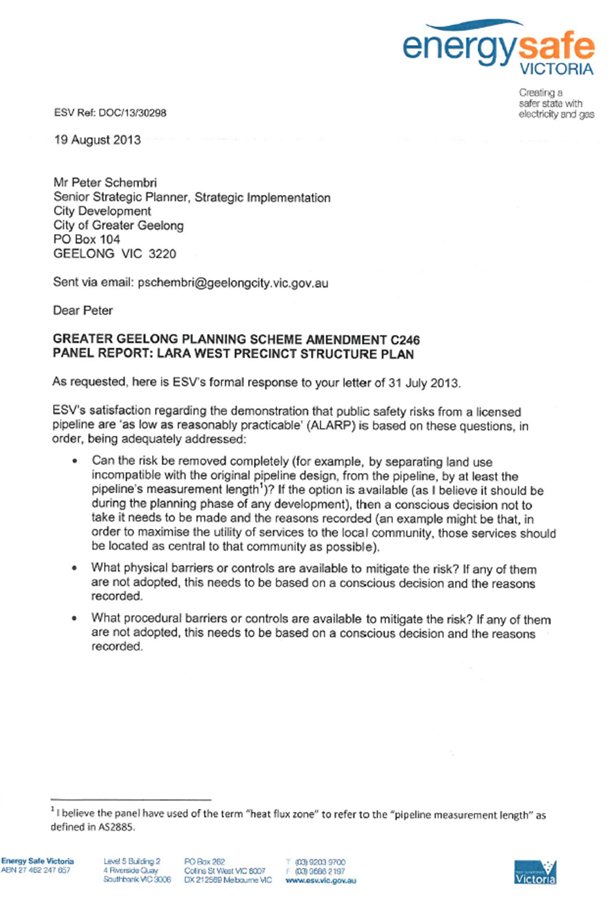
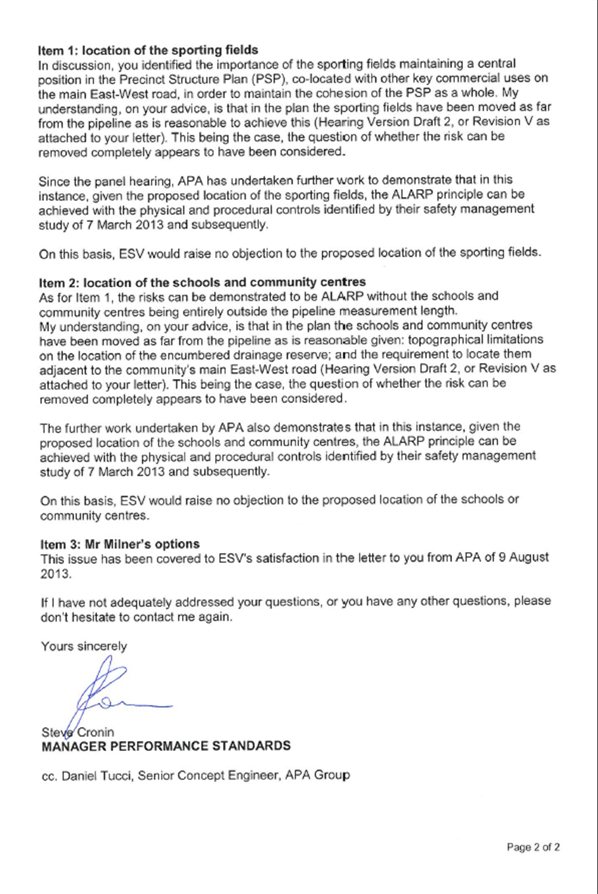
Lara West Precinct Structure Plan, September 2013
Lara West Growth Area Native Vegetation Precinct Plan, September 2013M
Lara West Development Contributions Plan, September, 2013
Appendix 9 Documents
Available Upon Request
Telephone: 5272 4244
Portfolio: |
Planning- Cr Macdonald |
Source |
Economic Development, Planning and Tourism- Strategic Implementation |
General Manager: |
Peter Bettess |
Index Reference: |
Application: C298 |
The purpose of this report is to seek Council support to prepare and exhibit Amendment C298 to the Greater Geelong Planning Scheme under Section 96A of the Planning & Environment Act 1987.
Amendment C298 is a Council initiated amendment submitted under section 96A of the Planning and Environment Act 1987 and is a combined amendment and planning permit application.
The amendment affects land at 400 Melbourne Rd, North Geelong, forming part of Deppeler Park (also known as Seagull Paddock). The affected land (3278 sq. metres) includes a McDonalds restaurant and associated access and car parking arrangements. (See Appendix 1 for site location plan).
The site is currently zoned Public Park and Recreation Zone and is not affected by any overlay. (See Appendix 2 for existing zoning plan).
The amendment seeks to rezone the land from Public Park and Recreation Zone to Commercial 2 Zone and apply the Environmental Audit Overlay (See Appendix 3).
The planning permit application seeks to subdivide the land from the balance of the Deppeler Park Reserve, remove the Reserve Restriction from the land to be subdivided and include a carriageway easement in favour of the new lot to be created (See Appendix 5).
The City of Greater Geelong Council owns the affected land. Council leases the land to McDonalds Australia Ltd. McDonalds Australia Ltd. has occupied the site since the 1980’s.
The purpose of the combined application is to ‘tidy-up’ the site in planning (zoning and subdivision) terms, which will assist with the future sale of the site (See associated Sale report that forms part of this Council meeting agenda) and provide the future owner with a commercially usable and developable site.
The combined planning scheme amendment and planning permit application will result in a good planning outcome.
Cr E Kontelj moved, Cr Fisher seconded -
That Council resolves to:
Support the preparation and exhibition of Amendment C298 to the Greater Geelong Planning Scheme to:
Rezone the affected land (3278 sq. metres) at 400 Melbourne Road, North Geelong, from Public Park and Recreation Zone to Commercial 2 Zone.
Apply the Environmental Audit Overlay to the affected land to be rezoned.
Consider the application for a planning permit to:
Subdivide the land (3278 sq. metres) containing the McDonalds Restaurant and associated access and car parking facilities from the balance of the Reserve No.1 on Plan of Subdivision 424106U (Vol 10497 Fol 507);
Remove the Reserve restriction from Reserve No.1 on Plan of Subdivision 424106U (Vol 10497 Fol 507) for the land to be subdivided.
Include a carriageway easement in favour of the land to be subdivided for the entire length of the northern boundary.
Request the Minister for Planning to authorise the preparation and exhibition of Amendment C298 and Planning Permit 782/2013.
Carried.
Amendment C298 is a combined planning scheme amendment and planning permit application submitted to Council under s96A of the Planning and Environment Act 1987.
Council proposes to rezone, subdivide and sell the land which is occupied by the McDonalds restaurant. Prior to selling the land, it is proposed to ‘tidy-up’ the land through the rezoning and subdivision process, thereby, ensuring the appropriate controls are implemented.
The amendment proposes to rezone an area of 3278 sq. metres from Public Park and Recreation Zone to Commercial 2 Zone and apply the Environmental Audit Overlay over the land to be rezoned (See Appendix 3);
The planning permit application is for the subdivision of the land containing the McDonalds restaurant (3278 sq. metres) from Reserve No.1 on Plan of Subdivision 424106U (Vol 10497 Fol 507), remove the Reserve restriction from Reserve No 1 of Plan of Subdivision 424106U (Vol 10497 Fol 507) as it applies to the lot to be subdivide, and include a carriageway easement in favour of the land to be subdivided for the entire length of the northern boundary (62.2m) extending north to the face of the kerb. (See Appendix 4 Existing Title and Appendix 5 Draft Plan of Subdivision.)
The existing zoning of the land is Public Park and Recreation Zone. Commercial 2 Zone and Industrial 1 Zone land lies to the north, Road Zone 1 to the east, Public Park and Recreation Zone to the south and west. (See Appendix 2.)
The affected land is roughly square in shape and relatively flat. It contains a McDonalds restaurant and associated access and car parking arrangements.
The affected land is owned by Council. McDonalds Australia Ltd. Has leased the land to be subdivided from Council since the 1980’s. The lease is a ground lease with options up until 2048.
The land forms part of a wider Reserve and being part of Deppeler Park (also known as Seagull Paddock). The wider reserve is approximately 7.4ha. The broader parkland area fronting the Melbourne Road has a lake formed by a weir on Cowies Creek and walking paths, a major sewer pumping station owned by Barwon Water and a McDonalds restaurant.
The land in the Cowies Creek or Deppeler Park area is identified in the 2009 Qualitative Assessment of former Geelong landfill sites. It is likely that the subject land was a former landfill site between the late 1950’s and early 1970’s. The former landfill is provided with a ‘low risk’ assessment by the 2009 Qualitative Assessment mainly due to its relative isolation from residential land uses and the length of time the landfill site has been closed.
The justification for the proposed rezoning and subdivision application is confirmed through the conflicting nature of the current use of the land in the Public Park and Recreation Zone and also, through the process of preparing Council owned land for sale.
The use of the land as a food and drink premises conducted by/on behalf of a private operator conflicts with the underlying purpose of the Public Park and Recreation Zone (PPRZ). A purpose of the PPRZ is:
“To recognise areas for public recreation and open space.”
The PPRZ is the main zone for public open space and public recreation areas. Generally, land in the PPRZ is overseen by a public land manager, for example, a Council, and any use is conducted on their behalf.
Ministerial Direction on The Form and Content of Planning Schemes advises that:
“A planning scheme may only include land in a Public Use Zone, a Public Park and Recreation Zone or a Public Conservation Zone and Resource Zone if the land is Crown land, or is owned by, vested in or controlled by a Minister, government, public authority or municipal council.”
The land is in Council ownership but it is not available for public use or as a park and it has been leased to McDonalds since the 1980’s. Should the land be sold to a private buyer whilst in the PPRZ, this would conflict with the Ministerial Direction.
To reflect the historic use of the land and to accord with the best practice advice provided by the Department of Transport, Planning and Local Infrastructure (DTPLI) for the sale of public land, consideration must be given to the appropriate zone for the land. Clause 34.02 Commercial 2 Zone is the most appropriate zone.
A purpose of the Commercial 2 Zone is:
“To develop commercial areas for offices, appropriate manufacturing and industries, bulky goods retailing, other retail uses, and associated business and commercial services.”
The Commercial 2 Zone allows the current use of the land subject to obtaining a planning permit. Given the McDonalds restaurant is an established use, a permit is not required for the use in this instance. The Commercial 2 Zone is considered the most appropriate zone in the context of the current use of the site and the likely uses and development that Council would support in the future.
In addition to the above, the Best Practice Note (Page 7) advises that consideration be given to the highest and best use of the land being proposed for sale, whether subdivision would be appropriate, an environmental report where there is possible contamination, where contaminated, a strategy for remediation is prepared. Fundamentally, the preparation of land for sale should be cost-effective and be consistent with the nature of the land being proposed for sale as well as the circumstances which have led to the proposed sale.
The introduction of the Environmental Audit Overlay is in line with the above State Government guidance and with Ministerial Direction No. 1 Potentially Contaminated. Direction No.1 requires that planning authorities when preparing amendments to satisfy themselves that the environmental conditions of the land proposed to be used for a sensitive use defined as residential use, a child care centre, a pre-school centre or a primary school, or agriculture or public open space, are or will be, suitable for that use.
The proposed Environmental Audit Overlay recognises the previous use of the land for landfill and will ensure that the requirement of the Greater Geelong Planning Scheme and Ministerial Direction No. 1 are met before the commencement of a sensitive use or any associated building or works. In the case of the proposed Commercial 2 Zone, a sensitive use could potentially be an “Education Centre”- a primary school.
The permit to subdivide the land from the Reserve and remove the Reserve restriction is a logical proposal and will facilitate the sale of the land. The subdivision of the land will form a new lot for the McDonalds site, including a carriageway easement over the Reserve land to the north in favour of the proposed lot, thereby ensuring continued rights of access (See Appendix 5).
Internal referrals were sent to Council’s Engineering (Drainage) Unit, Environmental Health and Recreation and Open Space. A number of comments were received by these units, which have informed the initial assessment of the application. VicRoads was also notified and offered no objection.
Council provides the following reasons of justification for the proposed rezoning:
Deppeler Park has no immediate association with a residential area and will continue in its current role as a landscaped former land fill site with walking trails and wetland.
There is no identified shortage of open space;
The size of land owned by Council in the Deppeler Park area will be reduced by approximately 1.8% following the sale of the lot to be created.
The land to be sold has not been used for public park purposes since the restaurant was constructed in 1980 and is unlikely to revert to a park in the future.
The Council has sold parts of Deppeler Park in recent years to various owners and authorities. Council has no plans to sell other parts of the Park.
The combined planning scheme amendment and planning permit application is considered a logical proposal and will lead to a good planning outcome. It will assist Council to sell Council owned land that is considered to have a better financial outcome over leasing the property.
It is noted that this Council report, which seeks support to prepare and exhibit the combined planning scheme amendment and planning permit application, is supported by a Sale report prepared by Council. The Sale report discusses the detailed financial implications for the affected land.
The amendment and planning permit are unlikely to create any adverse environmental issues. The amendment process will ensure that on-site environmental conditions are suitable for sensitive land uses by introducing a planning control, namely the Environmental Audit Overlay.
There will be associated planning scheme amendment costs (amendment fees, panel costs and representation as required) as part of the implementation process given this is a Council initiated amendment. Exact costs for specific stages of the amendment process are difficult determine at present. Nonetheless, this can be accommodated within the existing department budget.
Amendment C298 is consistent with the State and Local Planning Policy Frameworks, that comprise part of the Greater Geelong Planning Scheme, as outlined below.
The State Planning Policy Framework is relevant to the assessment of this proposal in so far as it discusses the use of contaminated and potentially contaminated land, at Clause 13.03-1 of the Greater Geelong Planning Scheme. Clause 13.03-1 states that the objective is:
“To ensure that potentially contaminated land is suitable for its intended future use and development, and that contaminated land is used safely.”
The strategy for Clause 13.03-1 requires applicants to provide adequate information on the potential for contamination to have adverse effect on the future land use, where the subject land is known to have been used for industrial, mining or the storage of chemicals, gas, wastes or liquid fuel.
The Local Planning Policy Framework is of limited relevance to the planning scheme amendment.
The introduction of Clause 45.03 Environmental Audit Overlay to the land is considered a logical proposal. The purpose of the Environmental Audit Overlay is:
“To ensure that potentially contaminated land is suitable for a use which could be significantly adversely affected by any contamination.”
Clause 45.03 requires:
Before a sensitive use (residential use, child care centre, pre-school centre or primary school) commences or before the construction or carrying out of buildings and works in association with a sensitive use commences, either:
A certificate of environmental audit must be issued for the land in accordance with Part IXD of the Environment Protection Act 1970, or
An environmental auditor appointed under the Environment Protection Act 1970 must make a statement in accordance with Part IXD of that Act that the environmental conditions of the land are suitable for the sensitive use.
The planning scheme amendment will be carried out in accordance with the Planning and Environment Act 1987.
The amendment aligns with the City Plan’s strategic direction, How We Do Business, and the priority relating to “Responsible and Sustainable financial management”. The amendment will assist Council in maintaining a strong financial position by rezoning, subdividing and selling the subject land.
No Council officers or contractors involved in the proposed rezoning and planning permit have a direct or indirect interest in matters contained in this report.
There are no significant notable risks that would arise as a consequence of the combined planning scheme amendment and planning permit.
Consideration has been given to the previous use of the site, which formed part of a landfill between the 1950’s and 1970’s. It is proposed that the Environmental Audit Overlay will be applied to the affected land to ensure that if a sensitive use is proposed in the future, the requirements of the Greater Geelong Planning Scheme and Ministerial Direction No.1 Contaminated Land, will be complied with, where relevant.
The preparation of the planning scheme amendment is in accordance with the requirements of Ministerial Direction No.1.
The planning scheme amendment is unlikely to result in any adverse social impacts on adjoining land uses. The site has been used by McDonalds Australia Ltd. since the 1980’s and will remain in commercial use as a consequence of the proposed rezoning from Public Park and Recreation Zone to Commercial 2 Zone. One of the purposes of the Commercial 2 Zone is to ensure that uses do not affect the safety and amenity of adjacent, more sensitive uses.
The amendment will not impact on any basic rights, freedoms, responsibilities as set out in the Charter. Planning legislation ensures an open community consultation process occurs enabling people to freely express their views and if necessary, obtain a fair hearing before an Independent Planning Panel.
Should Council support the preparation and exhibition of the combined planning scheme amendment and planning permit, Council officers will request authorisation from the Minister for Planning to exhibit the application. The exhibition period will be for a minimum 30 days and will provide members of the public an opportunity to make a submission and be heard by an Independent Planning Panel, should it be necessary. The notice of exhibition for Amendment C298 will be published in the local newspapers and Government gazette.
Consultation with relevant referral authorities will also be undertaken during the exhibition of the application.
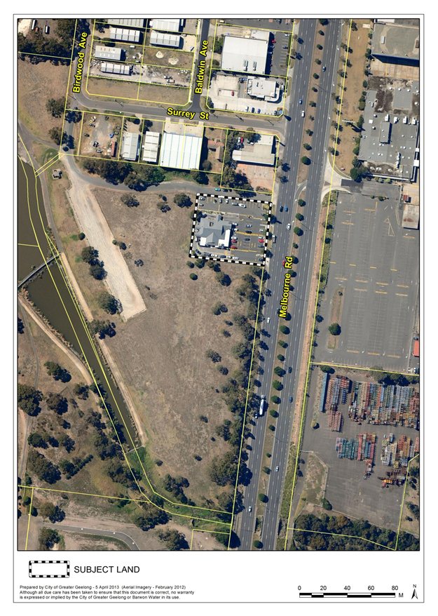
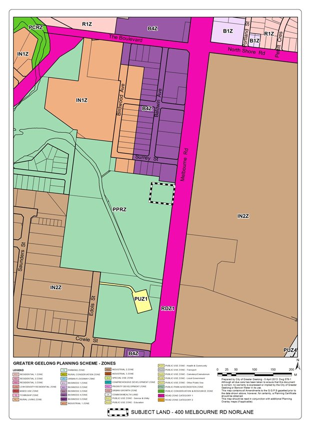
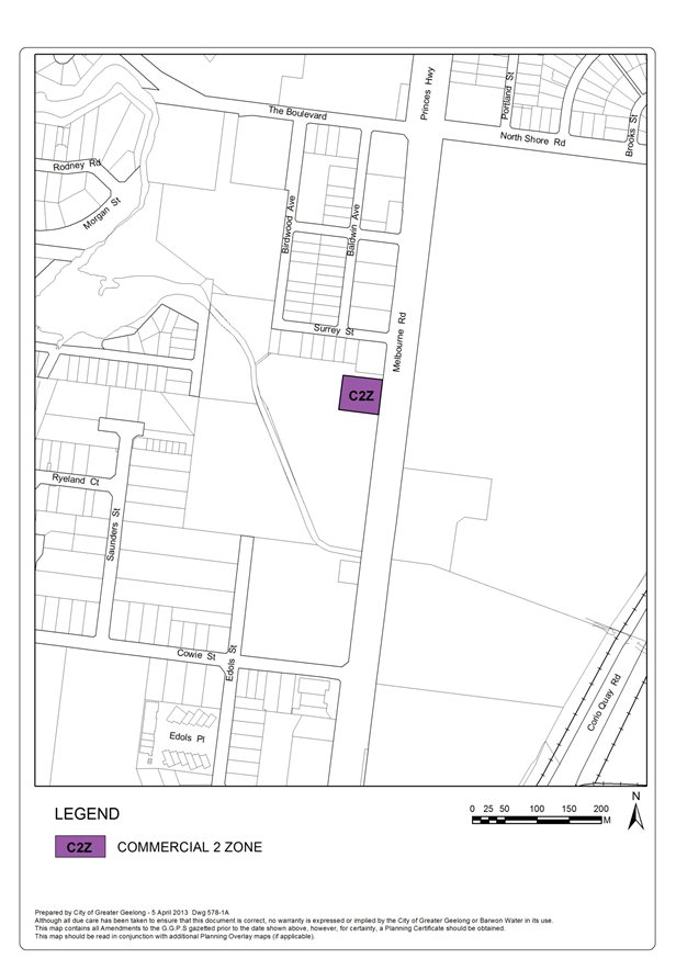
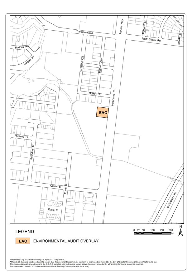
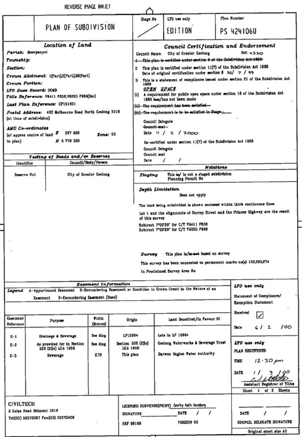
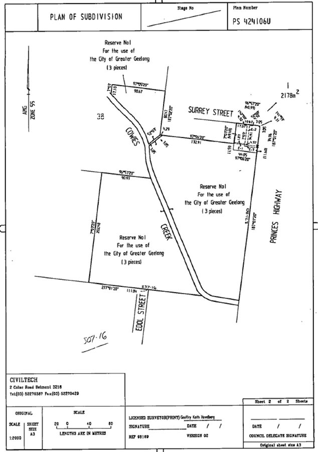
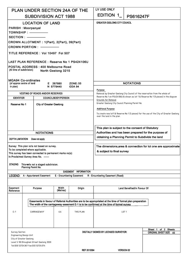
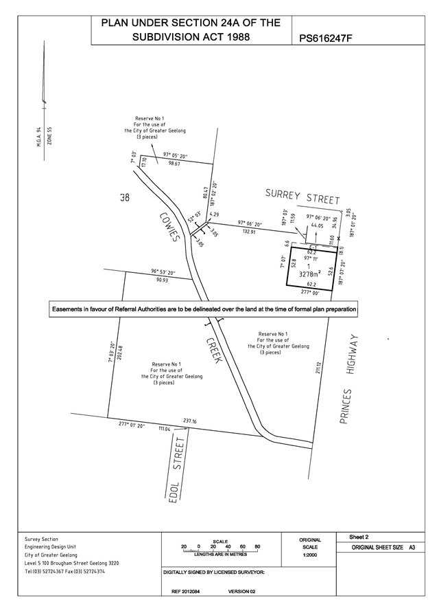
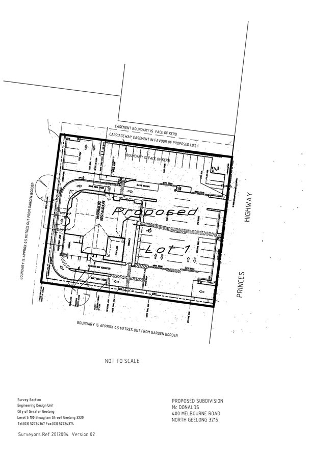
Portfolio: |
Finance - Cr S Kontelj |
Source: |
Corporate Services - Property Management |
General Manager: |
Jeff Wall |
Index Reference: |
Subject: Land Sales |
The purpose of this report is to recommend that the Council sell the McDonald’s restaurant land at 400 Melbourne Road, North Geelong subject to the land being rezoned and subdivided.
The Council is the owner of land at 400 Melbourne Road, North Geelong being Deppeler Park (Seagull Paddock). A McDonald’s restaurant is located on the Melbourne Road frontage and it is recommended that the land containing the restaurant be subdivided and sold.
The land is zoned Public Park and Recreation Zone and an application to rezone the land to Business 4 Zone and subdivide a lot of area 3,278m2 has been lodged.
McDonald’s Australia has occupied the site since 1980 and the current ground lease has options until 2048 with the tenant paying a current annual rent of $87,592. The tenant owns and maintains all improvements on the land.
The land in the Deppeler Park area is identified in a 2009 Qualitative Assessment of former Geelong landfill sites and it is likely that the land proposed to be sold was a former landfill site between the late 1950’s and early 1970’s.
The sale of the land currently zoned as a public park is justified as the land has not been used for a public park since 1980 and is not likely to be used for this purpose in future. Deppeler Park is surrounded by industrial and commercial uses and the sale of the land will reduce the park area by 1.8%.
A financial analysis of the options of either leasing (holding) or selling the property has been carried out which indicates that in present day value selling the property is either comparable to or more advantageous than continuing to lease the property.
Prior to selling the land Council is required to give public notice of its intention to do so under s189 of the Local Government Act and allow for the hearing of submissions. If submissions are received they will be heard by the Submissions Review Panel and a further report will be put to Council. If no submissions are received the land will be sold subject to approval of the rezoning.
Cr E Kontelj moved, Cr Fisher seconded -
That Council:
Commence the procedures to sell land of 3,278m2 (“the land”) located at 400 Melbourne Road, North Geelong on the following terms and conditions:
The land be sold by public auction;
The land being subdivided and rezoned prior to sale;
The price being no less than a certified valuation of the land obtained no more than 6 months prior to the date of sale;
Other appropriate terms and conditions; and
Commence the procedures under section 189 of the Local Government Act 1989 (“the Act”) to sell the land and that public notice of and the right of a person under section 223 of the Act to make a submission in relation to the proposed sale be given in the Geelong Advertiser and Geelong Independent; and
Appoint the Submissions Review Panel to hear and report to the Council on any submissions in relation to the proposed sale; and
Sell the land if no submissions are received; and
Authorise the General Manager – Corporate Services to execute the Contract of Sale; and
Sign and seal the Transfer of Land.
* Cr S Kontelj entered the meeting room at 7:32pm
Carried.
The Council is the owner of land at 400 Melbourne Road, Norlane containing the McDonald’s restaurant. The land is part of Reserve No 1 on PS424106U consisting of approximately 7.4ha and being part of Deppeler Park (also known as Seagull Paddock).
Deppeler Park consists of approximately 17.8 ha of open space and waterway extending from Cowie Street in the south to The Boulevard in the north and is adjoined on all sides by industrial and commercial land uses. The waterway is formed by a weir on Cowies Creek and the park contains walking paths, a major sewer pumping station owned by Barwon Water and a McDonald’s Restaurant. The walking paths terminate a lineal trail extending some 2.7 km upstream along Cowies Creek to beyond the Ring Road.
The McDonald’s facility consists of a single building housing a café, restaurant and drive through plus 49 on site car parking spaces. Separate points of access and egress are provided to and from the Melbourne Road and a single point of access and egress is provided to the internal road to Deppeler Park to the north of the facility (refer to Attachment 1).
McDonald’s Australia has occupied the site since 1980 under a ground lease which was renewed in 2003 when the restaurant was reconstructed. The existing lease has options up until 2048 and the current rent is $87,592 per year and McDonald’s owns all improvements on the land.
The land is zoned Public Park and Recreation Zone.
Subject to the land being rezoned, the Reserve restriction being removed from the title and the land being rezoned to Business 4 Zone with an Environmental Audit Overlay, it is recommended land of 3,278m2 containing the McDonald’s restaurant be sold by public auction. An application has been lodged with the Council’s Planning Department to subdivide the restaurant land from the balance of the Council’s Reserve and to have the land rezoned.
The justification for the recommended sale of the land takes into account the following:
Deppeler Park has no immediate association with a residential area and will continue in its current role as a landscaped former land fill site with walking trails and wetland.
There is no identified shortage of open space in the area.
The size of land owned by Council in the Deppeler Park area will be reduced by approximately 1.8% following the sale of the lot to be created.
The land to be sold has not been used for public park purposes since the restaurant was constructed in 1980 and is unlikely to revert to a park in the future.
The land in the Cowies Creek or Deppeler Park area is identified in a 2009 Qualitative Assessment of former Geelong landfill sites and it is likely that the land proposed to be rezoned and sold was a former landfill site between the late 1950’s and early 1970’s. The former landfill is provided with a low risk assessment by the 2009 Quantitative Assessment mainly due to its relative isolation from residential land uses and the length of time the landfill site has been closed.
Providing the land remains appropriately capped and any works penetrating the ground are appropriately managed and controlled, any potential adverse environmental effects can be effectively managed.
There is no significant native vegetation present on the land to be sold.
The sale of the land will result in a reduction of annual rental income being replaced by a single payment of the sale proceeds. The sale proceeds will be accounted for as general revenue.
A financial analysis of the options of either leasing (holding) or selling the property has been carried out which indicates that in present day value selling the property is either comparable to or more advantageous than continuing to lease the property.
Under the Local Government Best Practice Guideline for the Sale and Exchange of Land, the Council is required to ensure that “prior to being offered for sale, property should be appropriately zoned. This will ensure that the ultimate use of the land is determined by that zone and the highest possible sale price is achieved.”
Under the same Guideline land is required to be sold by a public process and the recommended sale by public auction meets this requirement.
Section 189 of the Local Government Act (“LG Act”) requires that Council obtain a certified valuation dated not more than six months prior to the sale of the land being the date of the contract of sale. Prior to sale a certified valuation of the land will be obtained and the final sale price will not be less than the Council’s valuation.
The Council is also required to give public notice of its intention to sell the land and consider any submissions received. If any submissions are received they will be heard by the Submissions Review Panel followed by a report to Council. If no submissions are received the land will be sold by public auction.
Under the lease between the Council and McDonald’s Australia the land may be sold by public auction. If the land is sold by any other means then McDonald's Australia has the right to purchase the land at a price not greater than and on terms no less favourable than those offered by another purchaser.
The Property Strategy Advisory Committee has considered this report.
The recommendation supports the action priority relating to Responsible and Sustainable Financial Management where the sale of assets no longer required will support the identified progress indicators.
No officers or contractors involved in the preparation of this report have a direct or indirect interest in matters to which this report relates.
The risks associated with the subdivision and sale of this land are able to be managed following normal management procedures and processes.
There are no social implications associated with the recommendations of this report.
The recommendations of this report will have no effect on the human rights of individuals.
Sport and Recreation does not consider that the site has any future recreation value.
Aerial View of the Land Proposed to be Sold
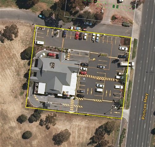
Portfolio: |
Women in Community Life – Cr Farrell (Interim) |
Source: |
Community Services |
General Manager: |
Jenny McMahon |
Index Reference: |
Subject: Advisory Committees / Women in Community Life Advisory Committee |
To seek Council approval to appoint the recommended applicants a position on the Women in Community Life Advisory Committee.
In July 2013 Council approved the establishment of the Women in Community Life Advisory Committee. Applications were sought through a publically advertised process.
15 expressions of interest were received for a position on the Women in Community Life Advisory Committee.
The Advisory Committee membership will comprise representation from organisations and individuals, with the Portfolio holder as chairperson, supported by Cr Jan Farrell as Council’s nominated representative.
Advisory Committee members are expected to be active and to report, share, and promote actions and deliberations from and to the organisations which they are connected to.
Cr Farrell moved, Cr Irvine seconded -
That Council appoints the following applicants to the Women in Community Life Advisory Committee:
Amanda Hyland - Individual applicant (Geelong West)
Antonia Halloran-Lavelle - Organisation representative, Zena Women’s Services
Christine Couzens - Organisation representative, Geelong Trades Hall
Davina Montgomery - Individual applicant (Leopold)
Dianne Pont - Individual applicant (Norlane)
Hannah Teesdale - Individual applicant (Lara)
Helen Curmi - Individual applicant (Geelong)
Jennifer Wills - Individual applicant (Portarlington)
Justine Devonport - Organisation representative, YWCA Victoria
Priscilla Pescott - Individual applicant (Belmont)
Prof. Shurlee Swain - Individual applicant (Geelong)
Chelsea Hatherall - Individual applicant (Geelong West)
Carried.
In July 2013 Council approved the establishment of the Women in Community Life Advisory Committee.
The Women in Community Life Advisory Committee is being established to provide advice to Council on matters relating to women’s participation, representation and leadership in community life.
Specifically, the Committee has been established to:
Identify barriers to women’s participation in the civil, civic and political life of the Geelong Community.
Increase opportunities and access for women to participate in leadership and decision making committees and processes.
Increase active participation of women in community groups and networks.
Be inclusive, representative and encouraging of women of all demographics.
Invite comment and feedback from individuals, community groups and organisations on strategies that address local based priorities for increased women’s participation.
Provide advice on current or emerging gaps in gender equity in women’s participation, representation and leadership.
Promote open and transparent policies, processes and practices, and highlight the right of all persons to take part in public life, particularly women.
Build on existing links between agencies and community groups.
The Advisory Committee membership will comprise representation from organisations and individuals, with the Portfolio holder as chairperson, supported by Cr Jan Farrell as Council’s nominated representative, with support from a Council officer.
Advisory Committee members are expected to be active and to report, share, and promote actions and deliberations from and to the organisations which they are connected to.
Following a municipal wide recruitment process during July and August 2013, Council received 15 applications. The Committee Terms of Reference proposes a membership of 8-10 people.
All applications were assessed against key selection criteria which were clearly identified in the Applicant Information Pack. This pack was distributed to all applicants.
The applicants recommended for appointment have met all of the selection criteria and have been able to demonstrate their capacity to be active members, have strong community networks and a passion for furthering equality and participation of women in civic and community life.
The recommended applicants represent a range of ages, experiences and backgrounds, ensuring a diversity in the make up of the Committee.
While the Terms of Reference nominates 10 members as the maximum number, it is recommended that 12 of the applicants be appointed. This will ensure a good number of participants are involved assuming some members may be unable to attend and that the committee is representative of the general community as possible. There is representation from across the City (geographically), age range and experience.
Not applicable.
There are no financial implications linked to this report. All activities undertaken will be within current budget allocations.
The appointments are made in accordance with the criteria set out in the Committee Terms of Reference adopted by Council in July 2013.
The Advisory Committee aligns with City Plan through:
Community Wellbeing
The Committee will advise Council on barriers to women’s participation, emerging women’s issues, aspirations and initiatives so as to further gender equity in the Geelong community.
How we do business
The Committee will move between being proactive and responsive in matters, depending on the matter being raised.
Feedback on the development of policies and planning that impact on the women and community life through consultative processes will be documented in Consult and reported against in Corvu.
No Council officer involved in the preparation of this report has a direct or indirect interest in the matter to which the report relates.
Not applicable.
The Advisory Committee will provide an opportunity for Council to show active support in increasing participation of women in community and civic life.
The rights listed in the Human Rights Charter promote the principles of freedom, respect, equality and dignity. These principles are incorporated in the Victorian Local Government Women’s Charter.
The Community Services Division is responsible for all communication relating to this report.
Portfolio: |
Community Development – Cr Fisher |
Source: |
Community Services / Health & Local Laws |
General Manager: |
Jenny McMahon |
Index Reference: |
Subject: Domestic Animal Management Plan |
To inform Council of the results of the public submissions received in response to the Draft Domestic Animal Management Plan and Proposed Dogs in Public Places Policy, and to seek endorsement for the adoption of the Plan and gazetting of the Policy.
An extensive community feedback and survey process was undertaken in June 2012 to inform the development of the new Domestic Animal Management Plan (DAM Plan) 2013-2017. 568 responses were received.
On the 23 April 2013 Council resolved to place the Draft Domestic Animal Management Plan 2013-2017 and the Proposed Dogs in Public Places Policy (DPPP) for community consultation for a period of four weeks.
40 submissions from individuals and organisations were received during this period.
The majority of submissions were supportive of the proposed actions of the plan, particularly the mandatory desexing of cats. However many raised concerns regarding the potential costs to individuals for the desexing of animals, a perceived lack of enforcement for existing dog control orders, especially relating to “off-leash” areas and dog litter. A summary of the submissions is at Appendix 1.
A high profile issue from an animal welfare environmental and neighbourhood amenity perspective is proposed to require mandatory desexing for all new cat registrations, and desexing of all current (registered) cats within the four year period of the plan. Options to provide low-cost desexing will be explored and reported to Council.
All public open space areas shall be designated as “on-leash/controlled areas” (public open space areas include roads, footpaths, beaches, reserves, parks, playgrounds and other Council lands and buildings), unless otherwise designated by signage.
The revised DAM plan and DPPP (see Appendix 2 and 3) provides for improved risk management which will require additional resources or a reallocation of resources if it is to deliver the level of compliance expected by the community, particularly in regards to “off-leash” areas. The community has strongly indicated that a visible enforcement presence is critical to the success of the plan.
The importance of community partnerships was also identified, and during the life of the plan Council will seek assistance from veterinarian associations and clinics, local trainers and behaviourists and dog/cat clubs in the design and delivery of actions under the plan.
Cr Fisher moved, Cr Ansett seconded -
That Council:
adopt the Domestic Animal Management Plan 2013-2017 and the Dogs in Public Places Policy 2013-2017, with any additional expenditure to be referred to future budgets;
in accordance with S.10A of the Domestic Animals Act 1994 require all newly registered cats to be desexed, and for all existing (registered) cats to be desexed within the four year life of the Domestic Animal Management Plan 2013-2017.
Carried.
In accordance with Section 68A of theDomestic Animals Act 1994, every Council must prepare a Domestic Animal Management Plan (DAM Plan), to promote animal welfare, responsible ownership of dogs and cats and to protect the environment. This plan must be updated every four years.
In addition, a revised Dogs in Public Places Policy (DPPP) was developed, which provides detailed information regarding the dog orders in the City of Greater Geelong. This is particularly relevant to the extensive “Off-leash – supervised” areas where owners are expected to maintain effective voice control over their dog.
Council has consulted extensively with the community, within Council, with experts and land managers.
The following details the results of the public submissions and explores further the key issues.
Results of public submissions
Forty submissions were received from individuals and organisations. The majority of submissions were supportive of the proposed actions of the plan, particularly the mandatory desexing of cats. However many raised concerns about the potential costs to individuals for the desexing of animals, a perceived lack of enforcement for existing dog control orders, especially relating to “off-leash” areas, and dog litter. A summary of the most commonly raised issues is presented in Figure 1, and a summary listing of all submissions is at Appendix 1.
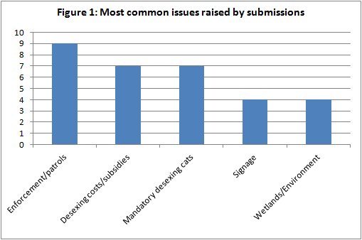
Definitions:
Enforcement/patrols – the need for an increased visible presence of Council Officers to enforce the off-leash provisions and increase compliance with dog litter removal.
Desexing costs/subsidies – concerns regarding the costs to individuals for desexing, and support for a subsidy or discount for those on low-incomes.
Mandatory desexing cats – support for the mandatory desexing of cats.
Signage– the need to ensure that locations subject to dog control orders are clearly signed, including the meaning of “off-leash – supervised”, where dogs are required to be under effective voice control at all times, and restrained when approaching other dogs or people.
Wetlands/Environment – concerns regarding the environmental impact of off-leash dogs in environmentally sensitive areas. The importance of appropriate signage and enforcement by Council Officers were highlighted as measures to reduce these concerns.
Ensuring the effectiveness of the Dogs in Public Places Policy.
An enhanced compliance strategy will be developed for the implementation of the DPPP. Times and frequencies of patrols to identify dogs at large, prevent dog attacks and ensure compliance with the Dog Control Orders will be extended. Enforcement activities of the animal management team will be publicised through CoGG’s Facebook page and CoGG publications to increase their visibility to the community.
Emerging opportunities exist for the development of mobile applications to enable residents to obtain quick and accurate information relating to dog orders and other animal management issues. These will be explored further as part of future budget processes.
By adopting the revised DPPP, amendments will be required to existing signage/stencils and new signage will be required at specific locations.
Mandatory Desexing of Cats
The DAM Plan introduces the mandatory desexing of all new cat registrations, and the desexing of all registered cats over the four year period of the plan. This is to address the over-population of cats in the community, and high rates of impoundments. The feasibility of offering a low-cost/subsidised desexing program to assist with compliance with mandatory desexing will be investigated. Certain classes of dogs and cats are exempt from desexing requirements, including those registered with applicable organisations such as registered breeders or where veterinary advice exists that the health of the animal may be compromised by the procedure.
Partnerships
It was also recognised that the development of partnerships with local veterinary clinics, animals trainers/behaviourists and community groups has the potential to significantly “value-add” to Council’s animal management regime, particularly in regards to the promotion of responsible pet ownership.
Bark control collars
CoGG has previously purchased a number of electronic bark control collars. Bark Count Collars will improve the investigation of dog barking complaints by providing reliable quantitative data to officers of the frequency and nature of barking in order to establish whether a nuisance exists.
Dog Park Scoping Study
Dedicated and fenced dog parks are becoming increasingly common in local government areas of Australia. They can range from simple fenced areas to facilities with elaborate exercise and enrichment equipment and furniture for owners. This scoping study will examine the factors which should be considered in the placement and operation of such parks,and identify areas in CoGG which may be suitable for their development.
Dog Patrols on Non-CoGG Managed Land
Council has in place dog control orders with two agencies Corangamite Catchment Management Authority (CCMA) and Barwon Coast Committee of Management (BCCM), and is currently liaising with the Bellarine Bayside Foreshore Committee of Management (BBFCM) on developing dog control orders that ensure safety and meet community expectations.
Council is continuing to work with the BBFCM and the BCCM to develop dog control orders that are in harmony with the CoGG orders outlined in the DPPP.
Council currently offers dog patrols and enforcement to CCMA and BCCM on a “user pays” system. The levels and frequency of patrols has been minimal and would appear to not meet the community’s expectations of adequate coverage in this regard. There is scope in this area for Council to take a proactive prevention-based approach by increasing animal patrols in partnership with the agencies. This may include authorising officers from those agencies to undertake certain activities and duties to assist our officers with investigations.
Environmental considerations have been canvassed during the development of this plan. The risk of off-leash dogs accessing wetlands and waterways and interfering with wildlife was noted in a small number of submissions. These included instances where dogs had been witnessed accessing sensitive habitats and harassing water birds, while not under the effective supervision of their owners.
Under the DPPP, dogs are not permitted to enter waterways or wetlands, or to approach wildlife. Signage in these areas will clearly state these requirements. The proposed enhanced compliance strategy, involving weekend and after-hours patrols will enforce these provisions. Information from the community may assist Animal Control Officers to target “hot spots” of non-compliance.
Favourable outcomes should be achieved with the promotion that any CoGG litter bin being suitable for the disposal of dog litter when contained within a package or bag.
The majority of actions arising from the DAM Plan and DPPP will be based on existing internal processes and funding. Community consultation identified several areas which may require additional expenditure, specifically the need for an increased compliance presence from Council Officers in the community, and signage which reflect the dog control orders. With the significant expansion of areas declared under dog control orders, there will be the need for the review of existing signage, the installation of additional signage and the identification of an appropriate asset manager. Community understanding of the dog control orders will also be enhanced through the development of a smartphone application, which will detail the orders and conditions for specific locations, and will add business functionality for registration renewals and the reporting of dog incidents.
The revised DAM plan and DPPP (see Appendix 2 and 3) provides for improved risk management which will require additional resources or a reallocation of resources if it is to deliver the level of compliance expected by the community, particularly in regards to “off-leash” areas.
Any additional cost implications will be factored into future budgets. An indicative listing of current and proposed future operational activities and expenditure is presented in Table 1.
|
Table 1: Indicative Activities and Expenditure - DAMP 2013-2017 |
|
|
Current Funded Program Activities |
Funding type |
Year 1 (2013/14) |
Year 2 (2014/15) |
Year 3 (2015/16) |
Year 4 (2016/17) |
Totals |
|
Signage |
Discretionary |
40,000 |
|
|
|
40,000 |
|
Information materials |
Discretionary |
23,000 |
|
|
|
23,000 |
|
|
|
|
|
|
|
|
|
Activities/Funding Arising from Proposed DAMP 2013-2017 |
|
|
|
|
|
|
|
Additional patrols (1 EFT & Vehicle) |
Recurrent |
|
90,000 |
92,700 |
95,481 |
278,181 |
|
Animal management app |
Discretionary |
|
25,000 |
2,000 |
2,000 |
29,000 |
|
Scoping study for dog parks |
Discretionary |
|
15,000 |
|
|
15,000 |
|
Online impoundment billboard |
Discretionary |
|
10,000 |
5,000 |
5,000 |
20,000 |
|
Additional signage for dog control orders |
Capital |
|
50,000 |
10,000 |
10,000 |
70,000 |
|
Asset management (signage upkeep) |
Capital |
|
5,000 |
5,000 |
5,000 |
15,000 |
|
|
|
|
|
|
|
427,181 |
Specific reports and budgets will be developed for Council as part of the annual and long-term budgeting process for activities covered in the ensuing years of this plan.
Council is required to have a Domestic Animal Management Plan under the Domestic Animal Act 1994. Council’s are responsible for the implementation of actions from the plan, and for enacting the requirements of the Act to protect the safety of the community and maintaining the welfare of cats and dogs.
While many of the actions from this plan align across all four of Council’s strategic directions, it most closely aligns with the strategic priority of Community Wellbeing:
Healthy lifestyles – encouraging recreation in public open space, facilitating and enjoying the benefits of companion animals through responsible pet ownership;
Connected, creative and strong communities – increased social mixing and interaction by the provision of clear and fair local laws and orders for public open space; and
Healthy environments – provision of safe, hazard and nuisance free environments.
No Officer involved in the production of this report and associated plans and policies have a Direct or Indirect Interest in these matters.
Extensive community consultation has been undertaken to ensure that, on balance, requirements contained within the plan and policy are consistent with community views.
Council may be subject to reputational risk if the requirements of the Dogs in Public Places Policy is not seen by the community as being effectively enforced.
The proposed changes to the DPPP represent a responsible approach by Council in effectively managing dogs in public places as so to minimise risk exposure.
The majority of survey respondents and public submissions were supportive of the plan and policy. The promotion and management of responsible pet ownership in the community has tangible social benefits, including increased social mixing, increased outdoor exercise and psychological wellbeing.
The DAM Plan and DPPP have been considered in light of the Victorian Charter of Human Rights and Responsibilities, and are consistent with these rights and principles.
The plan and policy have received 568 survey responses from the community, and 40 written submissions. Copies of the final plan will be printed and made available to the community. The final plan will also be placed on Council’s website. Information resources from the plan and in support of the policy will be printed and made available through Customer Service Centres, community stakeholders and the website. Key aspects of the plan will be promoted in media and in information forwarded to all registered pet owners.
The education and enforcement activities which stem from the plan and the policy will be promoted using the CoGG social media resources and through regular communication channels such as CityNews.
Portfolio: |
Governance - Cr Harwood (Acting Mayor) |
Source: |
Office of Chief Executive Officer |
Chief Executive Officer: |
Stephen Griffin |
Index Reference: |
CT Management |
To release the Public Report of the independent Financial Sustainability Review undertaken by CT Management Group and confirm implementation actions.
CT Management was appointed to undertake a high level Financial Sustainability Review of Council and to provide recommendations on the overall efficiency and economy of its operations.
The review methodology included interviews with the Mayor and Councillors, Chief Executive Officer, General Managers and Managers. Staff were also provided an opportunity to complete a survey and to identify areas where they considered improvements could be achieved.
The City is a financially sustainable organisation. Council has choices, if the current expenditure requirement is to be maintained then rate revenue will need to increase or operating and capital expenditure will need to decrease.
CT Management confirms that Council is challenged with the dual pressure of managing growth, and renewing its aging infrastructure and maintaining an affordable and acceptable service level across 120 services
Benchmarking and comparative analysis demonstrate positive financial indicators across revenue, expenditure, capital and balance sheet ratios.
The Four Priority findings from this review are the need for:
Greater emphasis on Strategic Asset Management;
A review of the Strategic Resource Plan, 10 year long term financial plan and 10 year Capital Works Program;
Introduction of Service Planning to enable comparative choices to be made about the range of services and level of services provided and operating costs; and
Revision of the Budget process incorporating the outcomes of Service Planning and improved capital evaluation processes.
A number of activities relevant to the Four Priority findings have commenced in order to influence the 2014/2015 budget process and beyond.
Cr Harwood moved, Cr S Kontelj seconded -
That Council:
receives the Financial Sustainability Review – Public Report (Appendix 1;)
endorses the Key Actions being undertaken in response to the Financial Sustainability Review key findings.
Carried.
At the completion of a quotation process consultants CT Management Group were appointed to undertake a high level Financial Sustainability Review.
The consultants brief detailed that a key objective for Council is to maintain a financially sustainable position whilst keeping future rates and charges increases at affordable levels. In the medium term Council will also be challenged with managing a number of emerging budget issues that include:
Funding Defined Benefit Superannuation Shortfalls
Grants Commission reductions
Increased demand for service and running/maintenance costs for new facilities
Waste Collection, processes and remedial costs
Growth of subdivision assets
These issues add to the complexity of ensuring Council applies its resources in the most efficient manner and in the right areas. To assist with these decision processes Council sort the independent strategic review of the overall efficiency and economy of its operations.
The review was to provide information to assist consideration of whether a more detailed examination will be undertaken to focus on special operations, services, processes or projects.
Scope of Consultancy
The review and assessment of Council operations from an overall financial sustainability perspective was to include:
Whether Council is employing the appropriate amount of resources to achieve service level objectives set by Council.
Opportunities for improved efficiencies in organisation cost structures and cost management.
Potential service improvements and opportunities for operational efficiencies that can be considered.
The effectiveness of the Budget process for determining operational expenditure, disbursements and capital expenditure allocations.
Current Procurement procedures - in the context of legislative requirements - to ensure value for money outcomes.
How services and the overall performance of Council compares with other like sized Council around Australia
Methodology
The review included interviews with the Mayor and Councillors, Chief Executive Officer, General Managers and Managers. Staff were also provided the opportunity to complete a survey and to identify areas where they believed improvement could be achieved.
CT Management also prepared Functional Span Maps and Activity Statements as a foundation to support future service planning.
Analysis was also undertaken to identify potential underutilised assets, services that are not commonly provided by Victorian Councils and surplus land.
Recommendations have identified resource allocation changes aimed at improving internal effectiveness and efficiency.
Financial Sustainability Review Findings
The Financial Sustainability Review has confirmed that the City of Greater Geelong is challenged with the dual pressure of managing growth and renewing its ageing infrastructure and maintaining an affordable and acceptable service level across a vast array of approximately 120 services. The City is going through a transition with priority investment in new infrastructure in growth areas required to service demand. This outlay is competing with the measurable need to reinvest and renew current infrastructure to underwrite ongoing service provision.
The review has determined that the City of Greater Geelong is a financially sustainable organisation. The Council has choices: if the current expenditure requirement is to be maintained the rate revenue will need to increase, or operating and capital expenditure will need to decrease.
Benchmarking and comparative analysis demonstrate positive financial indicators across revenue, expenditure, capital and balance sheet ratios. Council is in a strong position to make decisions to secure its long term future.
The Four Priority findings from this review are the need for:
Greater emphasis on Strategic Asset Management;
A review of the Strategic Resource Plan, 10 year long term financial plan and 10 year Capital Works Program;
Introduction of Service Planning to enable comparative choices to be made about the range of services and level of services provided and operating costs; and
Revision of the Budget process incorporating the outcomes of Service Planning and improved capital evaluation processes.
As part of the review CT Management identified potential one off capital savings through potential asset sales of between $27 million and $56 million, with potential recurrent savings and income sources of between $2.4 million and $6.7 million.
It was acknowledged that a number of savings and efficiencies would require community consultation with respect to the impact of any potential changes in service levels arising from any decisions.
Savings and efficiencies are targets over the life of City Plan.
A copy of the CT Management Financial Sustainability Review – Public Report is provided as Appendix 1.
An extract from the conclusion (Page 25 Financial Sustainability Review – Public Report) confirms the following:
“This has been an intensive review of the financial sustainability of the City of Greater Geelong and the recommendations are designed to improve the City’s sustainability. We have modelled our results in our Long Term Financial Plan and look forward to reviewing these with Council and Management. Overall, management was dedicated to the delivery of this project and was supportive throughout. Significant amounts of information were made available in a timely manner by all participants –there is a culture committed to continuous improvement and quality service delivery amongst management.”
Financial Sustainability Review Implementation – Key Actions
A number of activities relevant to the four priority findings have commenced in order to influence the 2014/2015 budget process and beyond.
Strategic Asset Management
Funding for maintenance of ageing infrastructure is a major cost pressure for Councils nationally. For Council to address this issue there needs to be a review of the existing approach with an emphasis on a longer term perspective.
This will involve determining what assets are required to sustain the defined range and level of service provision and explore opportunities to rationalise assets holdings over the medium to long term. Refer CT Management commentary on potential asset sales.
Council also needs to reassess the level of asset renewal investment versus new asset creation in order to reduce the renewal gap which is currently estimated at $19m.
Service Planning
As development and growth will continue to occur within the municipality so will the community demand for services. These growth issues are important and significant from a financial, strategic and resource management perspective. A detailed service planning project will enable Council to make meaningful decisions about the level of operating costs which are sustainable and the range and level of services it wishes to provide to the community. Armed with this information Council will be able to consult with the community and determine where their priorities are with respect to the services provided.
The completion of service plans will not only update Council’s 10 year financial plan, but they will enable comparative choices to be made about the range and levels of services provided by Council and their associated operating costs.
The timeframe for completion of the Service Planning Project is approximately 4 to 6 months.
Long Term Financial Planning, Budget Process and Project Management
While Council currently has a 10 year financial plan, CT Management recommends its revision based on integrating the outcomes of the proposed service planning reviews and strategic asset management review which encapsulates deliberations on renewal versus new and the potential disposal of surplus assets etc. Savings arising from these reviews will enable redirection of funds to meet the increasing demand for services required by the community.
CT Management also recommends a review of the community priorities funding program of $7.2m, to include Council policy and guidelines that manage the allocation of budget expenditure with a consistent approach that generates high levels of community engagement.
In terms of Council’s budget process CT Management has recommended further refinement particularly in the areas of project development, capital evaluation and whole of life costing and community priorities. From a project development perspective, roles and responsibilities need to be clarified in respect to the various stages of a project e.g. planning, development and delivery of capital works, with the objective of realising savings.
In terms of capital evaluation CT Management has recommended enhancements to the concept and business case preparation with the view to obtaining more accurate whole of life costing of proposed projects, including ongoing maintenance obligations.
A review of the project development process will also be undertaken by relevant Officers.
Procurement
While the review confirmed that Council has well developed policies and processes necessary to carry out best practice procurement. CT Management recommended the development of an organisation wide procurement strategy that aligns with City Plan objectives. It also recommended introduction of best and final offers with short listed tenderers, for some larger projects.
There are no environment implications associated with the review. Any decision to achieve one off savings or recurrent reductions will need to assess environmental impacts.
The Financial Sustainability Review determined that Council is a finically sustainable organisation that needs to make strategic choices if the current expenditure requirements are to be maintained.
The review implementation will have a substantial impact on Council’s medium to long term financial planning process.
Any review and or change in the level of service provision will need to be cognisant of statutory or regulatory requirements.
How we do business.
No officer involved in the preparation of this report has a direct or indirect interest.
All services are currently risk assessed.
Any change to service levels will take into consideration the social implications of any proposed changes.
The service level reviews will consider the main principles of equity, fairness, dignity and respect.
All staff have been advised of the findings of the Financial Sustainability Review and a copy of the Public Report will be made available to the public.
The implementation of the key actions emanating from the review will involve Staff, Council and Public consultation as required.
Portfolio: |
Community Development – Cr Fisher |
Source: |
Community Services - Aged and Disability Services |
General Manager: |
Jenny McMahon |
Index Reference: |
Subject: Municipal Public Health Plan |
The purpose of this report is for Council to formally adopt the Municipal Public Health and Wellbeing Plan 2013-2017 (see Appendix 1) for submission to the Minister for Health by the due date of 31 October 2013.
The purpose of the Municipal Public Health and Wellbeing Plan 2013-2017 is to demonstrate how Council will work to improve the health and wellbeing of the community over the next four years.
The Public Health and Wellbeing Act 2008 legislates that all Victorian Councils prepare and adopt a Municipal Public Health and Wellbeing Plan within 12 months of Council elections.
The draft Municipal Public Health and Wellbeing Plan was released for public consultation from 27 August to 25 September 2013.
The Municipal Public Health and Wellbeing Plan 2013-2017 as proposed meets the requirements of the Public Health and Wellbeing Act 2008.
During the consultation period, one submission was received which was in favour of the Plan, and no changes were requested.
Cr Fisher moved, Cr Irvine seconded -
That Council adopt Health the Municipal Public Health and Wellbeing Plan 2013-2017 and forward to the Minister for Health.
Carried.
The Municipal Public Health and Wellbeing Plan builds on the work of previous Council health and wellbeing plans; most recently the 2009-2013 Geelong Health and Wellbeing Plan and fulfils the requirements of the Public Health and Wellbeing Act 2008.
Council, at its meeting on 27 August 2013, approved the draft Municipal Public Health and Wellbeing Plan 2013-2017 being released for public comment for a period of four weeks. The public comment period closed on 25 September 2013.
The Municipal Public Health and Wellbeing Plan 2013-2017 aligns with:
City Plan 2013-2017;
The Victorian Public Health and Wellbeing Plan 2011-2015;
G21 Region Public Health and Wellbeing Strategy (currently in draft);
Geelong Region Physical Activity Strategy (currently in draft).
The Municipal Public Health and Wellbeing Plan 2013-2017 is a plan of action for the next four years as well as demonstrating how the Council already works to improve health and wellbeing.
The plan operates on three levels:
Guiding principles for health and wellbeing planning – the core values and philosophy that have been used to develop this plan and will guide future decisions.
Improving how we do business in health and wellbeing – actions designed to improve Council’s ability to address local health and wellbeing needs.
Health and wellbeing priorities – the key health behaviours Council aims to address in partnership with the community and stakeholders. These are:
Accessible and nutritious food;
Physical activity and active communities;
Social inclusion and community connectedness;
Reducing harm from alcohol, drugs and problem gambling;
Reducing tobacco use.
An Action Guide has been developed for each health and wellbeing priority and the ‘improving how we do business’ section of the plan.
Actions will become part of departmental business plans and will be reported to Council on an annual basis to satisfy the legislative requirement regarding the ongoing monitoring and review of the plan.
During the public comment period, copies of the draft plan were made available at all City of Greater Geelong Customer Service Centres and via Geelong Australia website.
One submission was received during this period from Leisure Networks Chief Executive Officer, Libby Mears, who offered her congratulations and articulated Leisure Networks commitment to “working in partnership at a strategic and operational level in community health promotion initiatives with the City of Greater Geelong”. No changes were requested.
With the conclusion of the public comment period, it is recommended that Council formally adopt the Municipal Public Health and Wellbeing Plan 2013-2017. Once adopted by Council the plan is required to be submitted to the Minister for Health by the 31 October 2013 to meet the requirements of the Public Health and Wellbeing Act 2008.
The Municipal Public Health and Wellbeing Plan 2013-2017 has been developed to meet the requirements of the Climate Change Act 2010, which is in accordance with the Public Health and Wellbeing Act 2008.
There are a number of actions contained within Council’s Climate Adaptation Strategy that will have significant implications for the Municipal Public Health and Wellbeing Plan 2013-2017, particularly in relation to vulnerable communities.
Any financial implications arising from the Geelong Municipal Public Health and Wellbeing Plan will be referred for consideration to future budgets.
The Municipal Public Health and Wellbeing Plan 2013-2017 fulfils the requirement of the Public Health and Wellbeing Act 2008. That is, all Victorian Councils prepare and adopt a Municipal Public Health and Wellbeing Plan within 12 months of Council elections.
The plan also meets the requirements of the Climate Change Act 2010 by having ‘regard to climate change’.
Other Acts and regulations that are implicated in the plan include the Food Act 1984 and the Tobacco Act 1987 (see page 8 of the Plan for a more comprehensive list).
The Municipal Public Health and Wellbeing Plan 2013-2017 is aligned to City Plan 2013-2017 in that its vision mirrors that of the Community Wellbeing strategic direction and all actions seek to address the City Plan’s three strategic priorities for Community Wellbeing: Healthy Lifestyles, Healthy Environments and Connected, Creative and Strong Communities.
A diagram articulating how the plan aligns both with City Plan and other strategies and plans that guide the work of Council in health and wellbeing is contained on page 12 of the Plan.
No officer involved in the preparation of this report has any direct or indirect interest relative to the advice provided in the report.
Beyond the need to meet the statutory requirements of the Public Health and Wellbeing Act 2008 and the Climate Change Act 2010, the City of Greater Geelong has a funded requirement to VicHealth through the BE ACTIVE initiative to ensure that the VicHealth Physical Activity Framework has been considered in the development of the Municipal Public Health and Wellbeing Plan.
The purpose of the Municipal Public Health and Wellbeing Plan 2013-2017 is to demonstrate how the Council will work to improve the health and wellbeing of the local community over the next four years. A major approach to helping the organisation deliver on its Community Wellbeing priorities as outlined in City Plan is to work on the social determinants of health (as discussed on page 7 of the Plan).
The guiding principles section of the plan articulates the core values and philosophy that have underpinned the development of the plan and intended to guide the work of Council in all areas. It captures the need to explicitly consider issues relating to diversity, equity and community participation and empowerment.
The Municipal Public Health and Wellbeing Plan 2013-2017 will be produced into a full version and a summary version suitable for community use and made available via the Geelong Australia website and at Customer Service Centres by the end of November.
During the public exhibition period, copies of the draft plan were made available at all City of Greater Geelong Customer Service Centres and online, with the consultation period then being promoted in the following ways:
Media release
City News
‘Have Your Say’ sections of the Geelong Australia website
Direct email to relevant stakeholder groups
CAOS Newsletter
Greater Geelong Childhood and Education e-bulletin.
Portfolio: |
Governance - Cr Harwood (Acting Mayor) |
Source: |
Corporate Services - Corporate Strategy |
General Manager: |
Jeff Wall |
Index Reference: |
Subject: Corporate Strategy Annual Reports |
The Annual Report 2012-2013 was submitted to the Minister for Local Government as per the requirement of the Local Government Act 1989, Section 131.
As per the Local Government Act 1989, the purpose of this report is for the Council to receive the Annual Report 2012-2013.
Section 131 of the Local Government Act 1989 requires that the Council submit its Annual Report to the Minister for Local Government within 3 months of the end of the financial year.
The Annual Report for 2012-2013 has been prepared and a copy was provided to the Minister on 27th September 2013.
The Annual Report has been prepared to comply with Section 131 of the Local Government Act 1989 that requires inclusion of the following:
A report on the Council’s operations during the financial year,
Audited Standard Statements for the financial year,
Audited Financial Statements for the financial year,
A copy of the Performance Statement for the year (prepared under Section 132),
A Copy of the report on the Performance Statement for the year (prepared under Section 133), and
Any other matter required by the regulations.
In accordance with the requirements of Section 132 of the Local Government Act 1989 and Clause 12 and 16 of the Local Government (Finance and Reporting) Regulations 2004 the nominated Principal Accounting Officer of Council, 2 Councillors and the Chief Executive Officer have signed the Performance Statement, Standard and Financial statements.
The Performance Statement, Standard and Financial Statements have been finalised and the Auditor General’s Report on the Performance Statement, Standard and Financial Statements has been received.
After the Annual Report has been submitted to the Minister, Council is required [(under Section 131 (10)] to give public notice that the Annual Report has been prepared and can be inspected at Council Offices.
Section 134 of the Local Government Act 1989 also requires the Council to consider the Annual Report at a meeting of Council and that 14 days public notice must be given of this meeting.
On 28 September 2013 a public notice was published in local newspapers advising of the availability of the Annual Report for viewing and the intention to discuss the Annual Report at the Council meeting on the 22 October 2013.
Cr S Kontelj moved, Cr E Kontelj seconded -
That Council receives the 2012-2013 Annual Report (Appendix 1) in accordance with Section 131 of the Local Government Act 1989.
Carried.
Council approved “in principle” the Financial Statement of Accounts, Standard Statement and Performance Statements and authorised the signing of the Accounts subject to Auditor General requirements on 27 August 2013.
The Auditor-General has signed the accounts and issued his report stating that the accounts fairly present the financial position of the Council and comply with accounting requirements.
A copy of the Annual Report together with the Audited Performance Standard Statements and Financial Statements was provided to the Minister for Local Government on 27 September 2013.
Under Section 134 of the Local Government Act 1989, the Council must consider the annual report at a meeting of Council as soon as practicable after the Annual Report has been sent to the Minister.
The Annual Report is a comprehensive review of highlights and achievements for 2012-2013 financial year.
Under the Local Government Act the Council is required to give public notice when the Annual Report is available for public inspection and is also required to provide 14 days notice of when it will be considered at a Council Meeting.
On Saturday, 28 September 2013 Council gave public notice that:
Council had prepared the Annual Report for the financial year to 30 June 2013 and that copies containing the following information contained within the Annual Report were available from the Council’s website and Customer Service Centres:
A report on Council’s operations during the year,
The Audited Standard Statements for the financial year,
Audited Financial Statements for the financial year,
A copy of the Performance Statement for the year, and
A copy of the report on the Performance Statement for the year.
The Annual Report, including the Performance and Financial and Standard Statements, is to be received at the Council meeting to be held on Tuesday, 22 October 2013 commencing at 7:00 p.m.
The Annual Report addresses the City’s achievements in the Sustainable Built and natural Environment strategic direction and reports on actions undertaken in 2012-2013 and progress indicators.
The Annual Report includes a copy of the City’s Audited “Standard Statements” and “Financial Statements” that has been the subject of a previous report to Council.
No impact to budget.
The recommendation and procedures outlined in this report conform to the requirements of the Local Government Act and Regulations.
Council has given public notice that the Annual Report 2012-2013 is available for public inspection and provided 14 days notice of a meeting to consider the report.
City Plan 2009-2013 (20121-2013 Update) is the guiding document for the 2012-2013 Annual Report. The Annual Report provides and update on the achievements under the Community Wellbeing, Growing the Economy and Sustainable Built and natural Environment strategic directions.
There are no direct or indirect interests.
There are no identified risks arising from this report.
The Annual Report provides a report to the community on the Actions and Initiatives undertaken during the reporting period.
In addition to the Statutory Financial Reporting, the Annual Report provides information to the community on how the resources of the City have been allocated between the Social, Environment and Economic needs of the community.
This information is presented in the City’s adopted Planning Framework of the three strategic directions being:
Community Wellbeing
Growing the Economy
Sustainable Built and Natural Environment
The 2012-2013 Annual Report will be made available to the community in a number of formats satisfying accessibility requirements:
Hard copies will be available for viewing at all Customer Service Centres
Electronic versions in MS Word, MS Excel, PDF and eText (for the visually impaired) will be available on Council’s website
Hard copies can be requested and mailed out on request
All images in the final design version that feature staff or members of the community have had photo releases signed.
The Council’s Annual Report 2012-2013 is a primary communication document that has been made available for public inspection in draft form.
A printed publication is currently being prepared and will be distributed to leaders within the community.
A copy of the report will also be accessible via the City’s internet site and at Council’s Customer Service Centres.
Portfolio: |
Governance - Cr Harwood (Acting Mayor) |
Source: |
Corporate Services - Administration and Governance |
General Manager: |
Jeff Wall |
Index Reference: |
Subject - Policy Development |
To adopt various changes to the Councillor Code of Conduct and the Councillors’ Facilities and Expenses Policy, and to revoke the Information Technology Policy.
The attached policies have been reviewed and updated in accordance with the requirements of the Local Government Act 1989. As part of the review, the Information Technology Policy is proposed to be revoked as a Council Policy and is intended to become a Management Policy.
Section 76C(2) of the Local Government Act 1989 requires the newly elected Council to review the Councillor Code of Conduct within 12 months of a general election. The main changes to the Code of Conduct relate to the roles of the Directly Elected Mayor and Deputy Mayor, and also to the dispute resolution process. Refer to Appendix 1.
The Councillors’ Expenses and Facilities Policy has been amended to incorporate the relevant provisions of the City of Greater Geelong Act 1983. Further, amendments to the Meetings, Conference and Other Attendances section provide greater clarity in relation to the financial limits imposed. The policy now provides for Councillors to receive study support for study which is relevant to their Council duties. The Outward Mail section further clarifies the use of Council letterhead, which must not be used to express the personal views of any Councillor, or for electioneering purposes in accordance with s55D(4) of the Local Government Act 1989. Refer to Appendix 2.
The existing Information Technology Policy supports the achievement of Council’s objectives in a secure computing and communications environment. It is considered that this Policy would be better defined as a Management Policy and be subject to the approval of the CEO. Accordingly, this report revokes the Council Policy, the objectives of which have been incorporated in a Management Policy.
Cr Heagney moved, Cr Irvine seconded -
That Council:
Endorse the amended Code of Conduct Policy – CPL40.7 and Councillors’ Expenses and Facilities Policy – CPL45.2.
Revoke the Information Technology Council Policy – CPL560.1.
Carried.
In accordance with the requirements of the Local Government Act 1989, a newly elected Council must review the Councillor Code of Conduct within 12 months of a general election. In addition, the Councillors’ Expenses and Facilities Policy has been updated and the Information Technology Policy is proposed to be revoked as a Council Policy.
Councillor Code of Conduct
The Code of Conduct governs working relationships. The changes outline the roles and responsibilities of the Directly Elected Mayor and Deputy Mayor and also amend the dispute resolution process. The following provides a summary of the content of the Code:
Introduction – a commitment to good governance, discharging responsibilities and working together.
Conduct Principles – community expectations and principles to be observed as specified by the Act.
Values and behaviours – a general statement regarding expected behaviour.
Roles & Responsibilities - relationships with the community, Council staff, and also within the group of elected members.
Dispute resolution – a mechanism to address any breaches of the Code.
Sanctions – internal sanctions for minor breaches and also an avenue for independent review of allegations of serious misconduct.
The Code specifically addresses the Councillor Conduct Principles, as set out in s76C(3) of the Local Government Act 1989. The Code articulates the values and behaviours expected of Councillors, along with the roles and responsibilities of the Mayor, Deputy Mayor, Councillors, the Chief Executive Officer and staff. It also includes a robust dispute resolution process.
Councillors’ Expenses and Facilities
The Councillors’ Expenses and Facilities Policy has been amended to incorporate the relevant provisions of the City of Greater Geelong Act 1983. There are further amendments to the Meetings, Conference and Other Attendances section which govern attendances and impose a $3,500 annual limit. The annual limit is proposed to be increased in accordance with any movement in the General Consumer Price Index. The amendments also recognise the role of the Mayor in representing Council at various meetings and functions, and exclude such attendances from the $3,500 annual limit.
Functions or training arranged by the MAV, VLGA, ALGA, ALGWA, State, Federal or Local Government Authorities will not be subject to the $3,500 limit. However, such attendances will be determined by the Mayor or Chief Executive Officer. The Outward Mail section clarifies the use of Council letterhead, which must not be used to express the personal views of any Councillor, or for electioneering purposes.
The policy also extends Council’s existing Study Leave Policy to Councillors in order to provide support which is consistent with that provided to Council staff, up to an annual limit of $2,000.
Information Technology
The existing Information Technology Policy supports the achievement of Council’s objectives in a secure computing and communications environment. It is considered that this Policy would be better defined as a Management Policy and be subject to the approval of the CEO. Accordingly, this report revokes the Council Policy, the objectives of which have been incorporated in a Management Policy.
Not applicable.
Payment of councillor expenses and the costs of providing support and resources form part of the annual budget review.
The policy review complies with the requirements of the Local Government Act 1989 and forms part of the governance framework established by Council.
In accordance with Council’s strategic objective ‘How We Do Business’, Council has provided a transparent process for the review of these Council Policies.
No officer involved in the preparation of this report has an interest in relation to the information provided.
Updating and adopting these policies is in accordance with good governance principles and aims to mitigate Council and Councillor’s exposure to reputational risk.
Councillors are elected to represent and serve their community. Good governance practices provide the community with confidence in Council leadership by providing transparency and accountability in the decision-making processes and in Council’s ability to ensure good corporate governance within the municipality.
All Human Rights have been considered as part of the drafting process of this report, none of which apply.
Council policies are published on Council’s CityWeb and Geelong Australia websites.
Portfolio: |
Governance - Cr Harwood, Acting Mayor |
Source: |
Corporate Services - Administration & Governance |
General Manager: |
Jeff Wall |
Index Reference: |
Subject: Municipal Association of Victoria |
To approve Council’s proposed Motion for the upcoming Municipal Association of Victoria (MAV) State Council Meeting.
The MAV State Council Meeting will be held on 25 October 2013 and Councils have been requested to submit motions for consideration.
Decisions made at the meeting constitute policy direction of the MAV for the immediate future.
The State Council meeting primarily involves Council appointed representatives. Cr Richards will be attending on behalf of the City of Greater Geelong.
Cr Heagney moved, Cr Ansett seconded -
That Council approve the proposed Motion set out in Appendix 1 for submission to the MAV State Council Meeting on 25 October 2013.
Carried.
At the MAV State Council Meeting, there is an opportunity for Councils to submit motions for consideration. If supported, the motions form part of the policy direction of the Association. The MAV requested input from Councils, with a closing date of 8 October 2013.
Motions must be of state-wide significance to Local Government and must be accompanied by background information which provides the rationale behind the motion.
Nil.
There are no financial implications in presenting motions to the MAV State Council. However, if some of the proposals achieve success, financial benefits may result.
If supported by the MAV State Council, the issues raised by Council will have the backing of the MAV, the role of which includes lobbying other levels of government to promote the views of Local Government.
In accordance with Council’s strategic objective ‘How We Do Business’, Council has taken up the opportunity to advocate for improvement to the administration of the Domestic Animal Act1994 via its proposed Motion.
No officers involved in the preparation of this report have any direct or indirect interest in the matter.
There are no risks associated with submitting the proposed Motion to the MAV State Council.
Nil.
The preparation of this report included a consideration of all Human Rights, none of which apply.
Council’s proposed Motion will be canvassed with other Councils through State Council, and if endorsed, will be pursued with the State or Federal Government by the MAV.
Portfolio: |
Enterprise Geelong - Cr Harwood |
Source: |
Enterprise Geelong |
Executive Director: |
Russell Walker |
Index Reference: |
Subject Biotech Industry |
To seek Council approval for the Acting Mayor, Cr Harwood, to participate in a delegation to Missouri and Georgia, USA in November 2013.
The BioGeelong network was established in 2005 with key stakeholders coming together to strengthen and support the growth of the bio-technology industry in Geelong.
Since the establishment of BioGeelong, the City has developed a successful formula to promote and attract significant biotechnology industry investment. This is evidenced with the establishment of the Geelong Centre for Emerging Infectious Disease (GCEID).
An invitation has been extended to the Acting Mayor Cr Bruce Harwood to form part of a delegation including CSIRO, Deakin University and AAHL personnel to attend a Bio Science meeting in Kansas, Missouri 14th – 16th November and Atlanta, Georgia USA 18th – 21st November 2013.
The purpose of the meeting is to build relationships and knowledge in the bio science industry sector. This is a great opportunity for the City, as Atlanta is a world renowned region for bio science and advanced manufacturing.
Cr Heagney moved, Cr E Kontelj seconded -
That Council having regard to the Councillors’ Expenses and Facilities Policy authorise the Acting Mayor, Cr Harwood to:
attend Bio Science meetings, Kansas. USA;
attend Bio Science Economic Development meetings in Atlanta and Athens, Georgia, USA;
visit the Centre for Diseases Control, Atlanta, USA;
explore opportunities of a Sister City relationship with Athens-Clark County, Atlanta, Georgia. USA.
Carried Unanimously.
Division Requested:
For: Crs Ansett, Ellis, Farrell, Fisher, Harwood, Heagney, Irvine, E Kontelj, S Kontelj
Against: Nil.
Previous delegations to North Carolina and attendance at the World Bio Science conference in Atlanta Georgia USA provided extensive information in relation to the importance of bio science developments within the world and the opportunities for the Geelong region.
A number of world leading bio science countries and industries met with and some of those relationships remain today.
The visit to Atlanta greatly assisted in strengthening Bio Geelong and Council’s commitment to bio science as a future industry. This is reflected in the City’s partnership with AAHL, CSIRO, Deakin University and the realisation of the Geelong Centre for Emerging Infectious Disease at Barwon Health.
The invitation to return to Atlanta Georgia in November 2013 again strengthens the City’s commitment to the bio science industry and willingness to partner with other regions offering genuine commercial development opportunity.
The Mayor of Athens Clarke County, Georgia, Nancy Denson has also put forward a proposal to consider a sister city relationship with the City of Greater Geelong.
The delegation is to consist of Professor Martyn Jeggo, Director, Geelong Centre for Emerging and Infectious Disease; Dr. Julie-Anne White, CEO, Bio Geelong and Dr John Lowenthal, CSIRO. The purpose of the meeting is to build relationships with a view to engaging in the transfer of personnel and knowledge in the bio science industry sector. This represents a great opportunity for the Geelong region as Atlanta is a world renowned region for bio science and advanced manufacturing.
This invitation to return to Atlanta Georgia in November 2013 again strengthens COGG’s existing commitment to the bio science industry and willingness to partner with other regions offering genuine development opportunity.
There is an offer from Mayor Nancy Denson of Athens Clarke County, Georgia, to consider a sister city relationship with Athens Clarke County. The City Of Greater Geelong does not actually have any formal international “Sister City” relationships. The City does have a “Friendship City” relationship with Lianyungang, Jiangsu Province, China that commenced in 1991 with the previous Shire of Corio. There has been no tangible interaction since amalgamation.
The second ”Friendship City” relationship is with Izumiotsu City, Osaka, Japan which commenced in 1990 as a result of the City having a strong manufacturing sector in woollen blankets. Recent interaction with the Osaka community is via the Great Ocean Road marathon which is completed in May each year. While there is no economic interaction, winners of the event travel to the respective countries to compete in the Marathon.
The offer of forming a genuine “Sister City” relationship with Athens Clarke County, Georgia, has considerable merit. There is genuine economic and social benefit to be gained as both cities are heavily engaged in the bio science sector and both looking to advance knowledge and opportunity to realise commercial growth. This relationship has great potential to build both cities profiles within the bio science industry and exploit opportunities that may be presented in various commercial fields.
A copy of the proposed members of the delegation and who they will be meeting with in the USA along with expected outcomes can be found in Attachment 1.
There are no identified environmental implications arising from this activity.
The cost of the Mayor attending the delegation would be approximately $5,300.
Attendance is governed by the Councillor Expenses and Facilities policy.
This proposal aligns with City Plan’s Growing the Economy.
No officer in the preparation of this report had a direct or indirect interest.
There are no identified risks arising from this report.
This delegation is aimed at further promoting and enhancing Geelong’s Biotechnology industry which will lead to enhanced social and economic outcomes for Geelong with potential for new job creation and sustainable economic growth.
Biotechnology is intended to improve the quality of human life.
Outcomes of the USA delegation will be the subject of a report to Council.
Professor Martyn Jeggo
Australian Animal Health Laboratory (AAHL)
(Former AAHL Director and GCEID Representative)
AAHL is Australia’s national animal health and diagnostic laboratory
AAHL is a world-leading animal health centre with global networks
World reference laboratory for diagnostics and at the forefront of research
300 staff and $65M p/a budget, highest level of bio-containment
Increasing focus on zoonotic diseases and One Health
Cr Bruce Harwood
Acting Mayor, Greater Geelong City Council
Chairman, BioGeelong
Dr Julie-Anne White
CEO Bio Geelong.
BioGeelong is an industry connection to focus and drive Geelong’s Biotech future.
Diseases in both wildlife and production animals (zoonotic diseases) are posing increasingly significant risks to human health, the economy and the environment
The Geelong Centre for Emerging Infectious Diseases (GCEID) is a collaborative, multidisciplinary One Health initiative to provide a coordinating mechanism for research in emerging infectious diseases
GCEID is a collaboration between AAHL, Deakin University and Barwon Health
Collaborative Research Agreement between AAHL and Deakin University:
School of Medicine
School of Life and Environmental Sciences
Sharing of facilities, co-supervision of students, joint research funding.
Mr John Lownethal
Theme Leader, One Health. Biosecurity Flagship. CSIRO AAHL
CSIRO Flagships focus on National Research Priorities by forming large-scale multidisciplinary partnerships and world-class expertise to tackle the “big” issues
Biosecurity is a National Priority and is defined as the management of risks to the economy, the environment, and the community, of pests and diseases entering, emerging, or spreading
One Health will be a key focus and priority for the Biosecurity Flagship
Zoonotic viruses pose a great threat:
They are highly unpredictable in terms of host range and speed of spread
75 per cent of emerging viruses in humans are likely to come from animals and originate in South-East Asia
Safeguarding against them requires global engagement and leadership
International One Health Research Collaborations involving AAHL and the Biosecurity Flagship are in place:
International One Health Institute – joint venture with Duke/NUS (Singapore)
University of Georgia - Athens
Kansas State University (Biosecurity Research Institute)
Others under discussion (UK, China)
The Delegation will meet with the following in the USA:
The University of Georgia:
Jane E. Gatewood, Ph.D.
Director, International Partnerships
Ralph A. Tripp, Ph.D.
Professor and GRA Chair in Vaccine and Therapeutic Development
Dept. Infectious Diseases, College of Veterinary Medicine
Comments from Ralph Tripp:
"We at the University of Georgia (UGA) have a Venture Labs program where new companies are formed from UGA-based research... Other Georgia universities have similar programs and entities. Much of this is driven by the Georgia Research Alliance (GRA).
“In my discussions with folks I know who are CEO/CSOs and several have expressed interest to know more about the padsite and availability in Geelong.”
Unified Government of Athens-Clarke County, Georgia:
Andy Herod
District 8 Commissioner, (Mayor Pro Tempore 2011 and 2012
Sean McMillan
Director of Economic Development (UGA – Atlanta)
Athens-Clarke County:
Nancy Denson, Mayor
Pat Allen Director of Community Relations
Ryan Moore Director of Athens Economic Development Department
Potential benefits and opportunities:
A clearer understanding of links between UGA and Deakin University, the relationship of this with KSU and how student exchanges and other linked arrangements might work
Interactions with Medical School
Student placements
Research and training
A clear of idea how UGA identifies and assist innovative science reach to the market place. The arrangements, the funding and the training that operates in this space
Spin off companies - how USA companies might be "enticed" to relocate to Geelong and any contribution GCEID can make to this endeavor
Georgia Research Alliance and UGA Bio-Business Centre
Through the EID workshop, a better idea of the EIDs that concern the USA and the research being undertaken to tackle these risks
Discuss possible exchange for EID fellowships/PhD students
Gain some understanding of the One Health model of research in particular capabilities around rapid diagnostics
Research training – post graduate
Grant proposals
Develop FCF Cluster grant proposal (One-Health: Deakin/UGA/Duke)
Explore Fulbright etc
High level contacts with the UGA - the first day meetings
Meetings with the Biobusiness Centre Director
Meetings with the Georgia Research Alliance
Meetings with the companies that are interested in start up ventures in Geelong
Opportunities for potential Sister City relationship between Geelong and Athens (Georgia, Atlanta):
Collaborative Research – zoonotic diseases
Avian Influenza, Swine Flu and Hendra virus
Technology transfer and training in biosecurity containment
Students – links between Deakin University and University of Georgia
Consideration of ‘Sister City’ status
Similar demographics
Regional – semi-rural lifestyle, but progressive
Similar population size and “feel”
Agricultural focus
Major University presence
New Medical Schools
Biotechnology / animal health focus
AAHL-University of Georgia Research agreement in place
Commitment to Biosecurity and One-Heath
Portfolio: |
Governance – Cr Harwood |
Source: |
Community Services / Health and Local Laws |
General Manager: |
Jenny McMahon |
Index Reference: |
Community Relations / Signage |
To amend Council’s existing Policy on Electoral Advertising signs on Road Reserves and Council Land to ensure consistency with the Road Management Act 2004
Council’s current General Signage Policy has been reviewed post the Federal Government election.
Existing provisions under the General Local Law do not specifically encompass “electoral” advertising.
To ensure Council is able to continue to protect community safety and amenity, it is recommended that Council implement Section 66 and 67 of the Road Safety Management Act 2004 for Council land and road reserves only, as Council is not responsible for enforcing activities on roads that are controlled by Vic Roads.
Cr Fisher moved, Cr E Kontelj seconded -
That Council amend and adopt the Electoral Advertisement Signs on Road Reserves and Council Land Policy, to be re-titled ‘Placement of General Signage (Including Electoral Advertising Signs) on Road Reserves and Council Land Policy’.
Carried.
Council’s current controls relating to the placement of electoral advertising on road reserves and Council land rests under Council’s General Local Law 2005.
The current controls have been reviewed following the recent Federal election campaign.
During past electoral events, Council officers have been able to gain voluntary compliance to issues regarding the placement of electoral advertising signs, particularly on Council land.
However, it is important that appropriate controls are in place in the event voluntary compliance is unable to be achieved.
Whilst the existing provision under Council General Local Law covers general matters relating to the display of ‘advertising signs’, the display of electoral advertising signs falls outside the scope, definitions and intent of the General Local Law 2005.
To ensure Council is able to continue to protect community safety and amenity it is recommended that Council implement Section 66 and 67 of the Road Safety Management Act 2004, as the most appropriate legislation to deal with such matters. The Road Safety Management Act 2004 which makes it an offence for “ a person without the written consent of the relevant coordinating road authority to – place any structure, device or hoarding for the exhibition of an advertisement or place any advertisement for exhibition on or over a road, or, place any sign or bill on or over a road or on a pole , bus shelter, traffic sign, tree or other object or infrastructure on a road reserve.”.
In accordance with this Act, dual authority exists whereby Council and Vicroads are the nominated coordinating road authorities for those roads designated under Section 36 and 37 of the Act. Council is not responsible for processing applications or enforcing activities on roads that are controlled by Vicroads.
In assessing any application to display signage, including electoral signage, consideration needs to be given towards the objectives of the Act, that being community safety and protection to all users of roads and road reserves for which Council is responsible. The Road Management Act includes footpaths, service roads, pathways and other ancillary areas such as rest stops, reserves, look outs, emergency stopping areas etc
Furthermore the Road Management Act 2004 gives the authorised officer the power to instruct the person to remove any structure, devise, hoarding, advertisement, sign or bill, and should the person fail to do so the Act goes on to empower the authorised officer to either, remove and sell the structure, devise, hoarding, advertisement, sign or bill and use the proceeds of the sale to offset the cost of any expenses in connection to the removal or obliterate the structure, devise, hoarding, advertisement, sign or bill.
On the spot penalties for both offences are 3 penalty units ($344.00). The maximum penalty in the event of the matter proceeding to the Magistrates Court is 10 penalty units ($1,444.00) apply to both offences.
In the case of signs on Councils footpaths, both the Road Management Act and Councils General Local Law apply as ‘roads’ are defined under the Road Management Act to include footpaths but not vice versa. However the scope and intent of the signage provisions of the General Local Law (supported by the Footpath Trading and Activity Policy) are limited to enabling businesses to utilise a portion of council land immediately in front of the business to promote and attract customers into that business premises. It is not aimed at attracting gatherings, congregations that are not business related that may impede, obstruct or limit the pedestrian thoroughfare and/or create other distractions/disturbances.
It is recommended that within its policy, Council place particular emphasis on considerations that protect the safety and local amenity of the community. As a result, a permit or consent under the Road Management Act would not be issued save and except for matters that provide and promote for public safety and well being. The placement of any sign on Council land or roads is assessed with respect to detrimental impact against one or more of the following;
Distract drivers and/or pedestrians;
Impact on traffic flow or traffic management of any particular area;
Obstruct the line of sight of either drivers or pedestrians;
Impacting on the intended use of public spaces (i.e. emergency lanes, highways, clearways etc);
Create a disturbance to nearby businesses;
Incite or antagonise other persons by virtue of the message displayed;
Attract people to congregate or gather so as to create a disturbance and/or hinder a business to conduct their operations in a normal unimpeded manner; or
Activities that fall outside the scope and intent of the General Local relating to signs on footpaths (i.e. to advertise a business, goods, services, an event or competition with the intent of attracting customers into a business)
Applications that fail to satisfy Council’ authorised officers in regards to the abovementioned criteria will not be approved.
There are no environmental implications associated with the recommendations and implementations of this report
There are no financial implications associated with the recommendations and implementation of this report.
The content of this report and subsequent recommendation ensures that the appropriate legislation is used to regulate such activities as supported by Councils Electoral Advertising Signs on Road Reserves and Council Land Policy.
The content of this report and recommendation is consistent in its alignment with the City Plan.
There are no conflicts of interest in the preparation of this report and recommendations.
In adopting this report and its recommendations enables Council to mitigate potential risks in regards to public safety, in particular where the placement advertising signs on roads creates a sighting and visual; distraction to motorists and pedestrians.
It is important that Council maintains local amenity and ensures the safety of the local community.
Consideration has been given in regards to the human rights charter and in particular the rights of a person to make application under the Road Management Act 2005 to place any structure, device or hoarding for the exhibition of an advertisement or place any advertisement for exhibition on or over a road, or, place any sign or bill on or over a road or on a pole, bus shelter, traffic sign, tree or other object or infrastructure on a road reserve. In the context of the Road Management Act, Council’s Policy provides circumstances where a permit or consent may or may not be granted subject to a range of safety and amenity criteria.
The primary stakeholders effected by this report are candidates who as part of their campaign for election to Local, State or Federal politics. Upon this report and the recommendations being adopted, the current pre election campaign literature will be updated to reflect the requirements of the Road Management Act.
Portfolio: |
Planning – Cr Macdonald |
Source: |
Economic Development, Planning and Tourism – Strategic Implementation |
General Manager: |
Peter Bettess |
Index Reference: |
Application: Amendment C247 & PP366/2011
|
This report responds to submissions to Amendment C247 and recommends adoption of the Amendment.
Amendment C247 proposes to rezone 0.8 hectares of vacant residential land adjacent to the Corio ALDI to the Commercial 1 Zone.
The rezoning is accompanied by a planning permit (PP366/2011) for shops, associated business identification signage and partial reduction of car parking and loading requirements.
The Amendment will also require changes to the Retail Activity Centre Hierarchy Map and Table at Clause 21.07-8 of the Greater Geelong Planning Scheme, and changes to Clause 52.28-3 to prohibit the use of gaming machines.
The Minister for Planning authorised the Amendment on 13 June 2013 and exhibition occurred from 18 July 2013 to 19 August 2013.
Three submissions were received. VicRoads submitted that it does not object to the rezoning and a local resident endorsed the development, believing it will enhance the area.
A submission was also received from Earth Resources Regulation Victoria drawing attention to the proximity of the site to a high-pressure gas pipeline. There are concerns that the site could be used for as-of-right ‘sensitive’ uses such as a child care centre, which is incompatible with Australian Standard 2885.
The proponent, in consultation with Council and Earth Resources Regulation Victoria, has agreed to enter into a Section 173 Agreement to ensure the regulator is notified prior to any ‘sensitive’ uses commencing on the land. The Agreement will be registered on title as part of this Amendment.
The Amendment is consistent with the Corio Norlane Structure Plan and planning policy, and will improve the retail and service offer available to residents in Rosewall and Corio, as well as providing investment and job opportunities.
The Amendment can now be adopted with no need to refer the Amendment to an Independent Planning Panel.
Cr Fisher moved, Cr Ansett seconded -
That Council:
adopts Amendment C247 in the form as outlined in Appendix 3 of this report;
submits the adopted Amendment with the prescribed information to the Minister for Planning requesting approval;
recommend to the Minister that a Permit be granted pursuant to Section 96G of the Planning and Environment Act 1987 (Planning Permit No. 366/2011 is contained in Appendix 4); and
sign and seal a Section 173 Agreement accompanying the Amendment to ensure notification to the Minister administering the Pipelines Act 2005 for any proposed ‘sensitive’ uses on the site.
Carried.
Amendment C247 and Planning Permit 366/2011 has been prepared by the Greater Geelong City Council which is the planning authority for this Amendment. The Amendment was initiated by Spiire Australia on behalf of Ceremari Pty Ltd.
The 0.8 hectare site (12-20 Fairbairn Drive, Corio) is vacant residential land mainly used as an informal pedestrian access to the Corio ALDI store by nearby residents. An aerial map of the area is shown in Appendix 1.
The Planning Scheme Amendment proposes to rezone the land from the Residential 1 Zone to the Commercial 1 Zone (C1Z). Since the time of exhibition of the Amendment, the Minister for Planning has implemented new zones in the Victoria Planning Provisions. As a consequence, the C1Z has replaced the former Business 1 Zone.
The rezoning necessitates an amendment to the Retail Centre Hierarchy Map and Table at Clause 21.07-8 of the Greater Geelong Planning Scheme to show a new Rosewall Neighbourhood Activity Centre. Amendment will also be made to Clause 52.28-3 to prohibit the installation or use of gaming machines on the site.
The planning permit will allow the construction of the Neighbourhood Shopping Centre generally in accordance with the submitted plans, as well as partial dispensation from car parking and loading requirements, and associated signage. The exhibited development plan is shown in Appendix 2.
The Shopping Centre will contain 3,267 sq m gross floor area, comprising a major tenant of 1,020 sq m of leasable floor area and 11 smaller tenancies totalling 1,950 sq m leasable floor area. Other features of the single storey buildings include;
94 on-site car parking spaces, including 4 disabled spaces and 12 bicycle parks;
Landscaping as part of the development using Water Sensitive Urban Design and stormwater drainage principles;
Vehicle access and exit via a new crossover on Broderick Road and a secondary access and exit via a new crossover on Fairbairn Drive, as well as road improvements to Broderick Road, Fairbairn Drive and Pearce Street; and
Perimeter footpath and a formal pedestrian link to the ALDI Store.
Council resolved to exhibit the Amendment at its 13 November 2012 meeting. The report that accompanied the Council resolution discussed the strategic basis for the rezoning and concluded that there is sufficient planning policy support.
The report identified the Corio Norlane Structure Plan as an adopted Council policy that supports rezoning the land for commercial use. The Structure Plan is currently with the Minister for Planning awaiting implementation into the Greater Geelong Planning Scheme via a new local strategy in the Municipal Strategic Statement. In the meantime, the Planning Panel that heard submissions to Amendment C268 for a Masters Store on Bacchus Marsh Road in Corio has referred to the Structure Plan as “a seriously entertained document” requiring consideration.
Authorisation (A02443) for this Amendment was received from the Minister for Planning on 13 June 2013. Exhibition of Amendment C247 and Planning Permit 366/2011 took place between 18 July 2013 and 19 August 2013 with notices in local newspapers and the Government Gazette. Notice of the Amendment was sent to relevant Ministers under the Planning and Environment Act 1987 and to surrounding residents and nearby commercial property owners.
It is noted that the Commercial 1 Zone (C1Z) has replaced the Business 1 Zone in the Victoria Planning Provisions following exhibition of the Amendment. The purpose of the C1Z includes creating vibrant mixed use commercial centres for retail, office, business, entertainment and community uses.
Submissions were received from VicRoads and Earth Resources Regulation Victoria (ERRV). Because the submissions either did not object to the Amendment, or have been mutually resolved, the Amendment does not need to be heard by an Independent Planning Panel.
One submission was received from a local Rosewall resident who supported the proposal, saying it will enhance the whole area.
Council is now able to adopt the Amendment and forward it to the Minister for Planning seeking approval. The Amendment to be adopted is in Appendix 3.
The Planning Permit recommended to be issued is in Appendix 4.
The VicRoads and ERRV submissions are addressed as follows:-
VicRoads
VicRoads did not object however said Council should consider including within the ‘draft’ planning permit conditions, the provision of an analysis of the Princes Highway – Broderick Road intersection, to ensure the intersection will not be adversely affected by the proposed changes in land use.
Following further discussions between Council, Spiire and VicRoads, the roads authority is now satisfied that the proposed development will have no adverse effects on the signalised intersection. No additional permit conditions are required.
Earth Resources Regulation Victoria (ERRV)
ERRV of the Department of State Development, Business and Innovation (DSDBI) has submitted that the site is located approximately 275 metres from a high-pressure gas pipeline (PL181). ERRV state that “in consultation with Energy Safe Victoria it is advised that Sensitive uses are sited in excess of 347m from the pipeline”.
The submission however does not say that the Amendment land cannot be developed as planned.
The regulator has concerns regarding some of the more ‘sensitive’ uses that would be permitted under the proposed Commercial 1 Zone. In response, the proponent sought legal advice from Harwood Andrews. Harwood Andrews has advised that: “the Department’s concerns regarding sensitive ‘as of right’ uses under the Commercial 1 Zone can be readily addressed through a voluntary section 173 agreement registered on the land subject to the Amendment”.
This advice was passed on to ERRV, who provided a supplementary submission, dated 9 September 2013. Through consultation with Energy Safe Victoria, ERRV confirm that the proposed Section 173 Agreement would provide an appropriate mechanism to ensure ‘sensitive’ uses are assessed by DSDBI.
The supplementary submission then clarified the ‘as of right’ uses that DSDBI consider as ‘sensitive’ in the Commercial 1 Zone. These are: Child care centre; Education centre; and Accommodation (specifically, Group accommodation, Residential village, Retirement village and an Aged care facility). The submission also directs that the appropriate reference for notification is the Minister administering the Pipelines Act 2005.
Council officers support this approach and recommend that Council sign and seal a Section 173 Agreement for registration on title as part of this Amendment.
The site is currently vacant and in a state of disrepair. There is no native vegetation present. The development will significantly improve the functionality of the site, better manage and treat stormwater runoff and establish a landscaped setting.
The development will not result in any financial implications for Council, other than the usual resources required to process the amendment and planning permit.
Costs associated with preparing and registering the proposed Section 173 Agreement will be paid by the proponent.
The Amendment is considered to be consistent with Clause 11.02-2 Activity centre planning and Clause 17.01.1 Business of the State Planning Policy Framework by making provision for a conveniently located neighbourhood activity centre to serve the needs of Geelong northern suburb residents.
The rezoning and development, together with the established ALDI Store, will entrench the site as a genuine neighbourhood centre consistent with the Geelong Retail Strategy.
Clause 22.03 of the Local Planning Policy Framework outlines a set of criteria against which applications for new retail floor space must be assessed, including out-of-centre proposals. It is considered that the proposal responds appropriately to this criteria, in that it is consistent with the urban context of the area, will not significantly impact on local amenity and will result in a net community benefit.
The Amendment supports the Growing our Economy strategic direction of City Plan.
The development will provide investment and jobs during the construction phase, and opportunities for new enterprises and services to establish at the centre when completed.
No Council officer involved in the report has any direct or indirect interest, in accordance with section 80(C) of the local Government Act.
There are no notable risks associated with implementing the recommendations contained in this report.
The Amendment will result in an overall net community benefit by improving the retail and service offer to local residents, and consolidating the new outlets with the established ALDI Store to create a true neighbourhood activity centre.
The development will significantly improve the visual amenity of the immediate area and provide sort after investment and job opportunities for a community in need of urban renewal.
The Amendment will not impact on any basic rights, freedoms and responsibilities as set out in the Charter. Planning legislation ensures an open community consultation process occurs, enabling people to freely express their views and if necessary obtain a fair hearing before an Independent Panel.
The Amendment was exhibited in accordance with the Planning and Environment Act 1987, including a notice in City News, letters to surrounding land owners and residents, and a hard copy of the Amendment documents at the Customer Service Centre in Corio Village Shopping Centre.
The applicant, landowner and submitters have been engaged by Council to resolve matters arising from the exhibition of the Amendment. The concerns of Earth Resources Regulation Victoria were formally addressed by the preparation of a Section 173 Agreement.
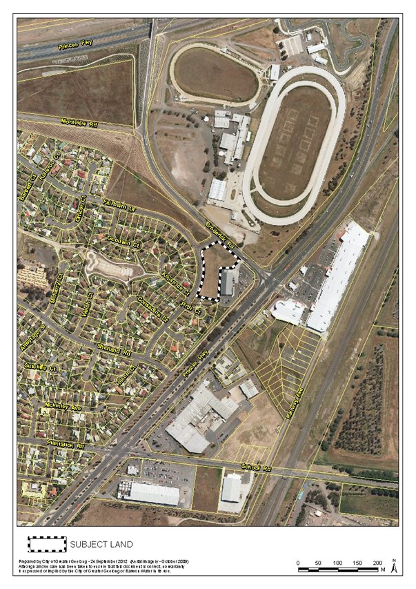
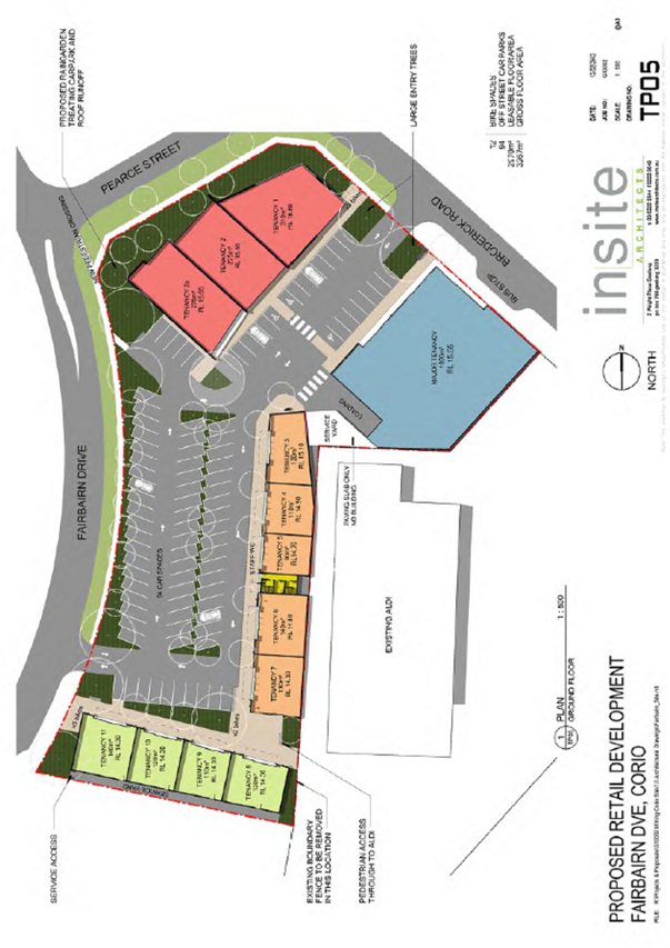
The planning authority for this amendment is the Greater Geelong City Council.
The Greater Geelong Planning Scheme is amended as follows:
The Planning Scheme Maps are amended by a total of 1 attached map sheet.
Zoning Maps
Replace Planning Scheme Map No. 26 in the form of the 1 attached map marked “Greater Geelong Planning Scheme, Amendment C247”.
The Planning Scheme Ordinance is amended as follows:
In Local Planning Policy Framework – replace Clause 21.07 with a new Clause 21.07 in the form of the attached document.
In Particular Provisions – Clause 52.28, replace Schedule 52.28-3 with a new Schedule 52.28-3 in the form of the attached document.
End of document
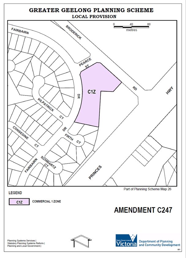
21.07 |
Economic development and employment | ||
| 21.07-1 | Key issues and influences | ||
Economic Role and Function Geelong is the largest regional city in Victoria and the primary service and employment hub for the G21 Geelong Region Alliance. The City’s infrastructure base includes Avalon Airport, the Geelong Port and major road and rail connections to Metropolitan Melbourne and Victoria’s western regions. The provision of high quality living, working and recreational environments is critical to attracting and retaining highly skilled people and the businesses in which they work. Industry There is a need to provide support for ongoing employment and economic development in the Geelong region. There is a need to provide a diverse range of appropriately located, well serviced industrial land which meets the needs of a range of industry types and minimises land use conflicts. Traditional manufacturing industries will continue to be key economic and employment drivers in the municipality, however at the same time the City’s economy will need to focus on emerging industry sectors that underpin economic development, prosperity and employment growth in the new economy. The changing nature of industrial development means that most industrial development now requires high amenity land that offers a high quality environment for workers and visitors. There is a need to support industry through the maintenance and improvement of infrastructure including the road, rail, Avalon Airport, deep water port and associated facilities. The extractive industry operations in the municipality make a vital contribution to the building and construction industries and are of major economic importance to the Geelong region. Retail The City of Greater Geelong Retail Activity Centre Hierarchy has been established to articulate the role and function fulfilled by centres of different sizes. The retail hierarchy supports the primacy of Central Geelong as the focus of retail activity in the region. There is a need to ensure a mix of commercial uses in activity centres. The retail hierarchy will be enhanced through high quality urban design and improved pedestrian and public transport accessibility. There is increasing development pressure for sites located away from activity centres, particularly for bulky goods and other large format retail development types that seek large sites with the capacity for significant car parking. Greater Geelong exhibits a number of factors that contribute to an increased vulnerability to problem gambling which requires sensitive consideration of their location. Rural Agricultural production is modest, but locally important and economically significant for landowners. There is potential for growth in agricultural production, particularly aquaculture. Farming activity and the rural landscape are very significant elements to the identity, image and liveability of the City of Greater Geelong. Farming and rural landscapes form non urban breaks and are a critical element to the settlement strategy, tourism function and lifestyle of the region. Farming and agriculture are important and valued activities in the northern area of the municipality, particularly in the Anakie area. Rural land in a number of urban fringe areas accommodates a range of uses and developments which require buffers from residential areas. The City’s rural areas contain important environmental assets. Tourism Tourism is a key part of the economy of the Geelong region. The region includes major tourism destinations such as the Bellarine Peninsula and the coast. Tourism activities in rural and coastal areas must be carefully managed so as not to compromise the natural environment and/or agricultural activities. |
|||
| 21.07-2 | Industry | ||
Objectives
Strategies
|
|||
| 21.07-3 | Retail | ||
Objectives
Strategies
|
|||
| 21.07-4 | Economic growth sectors | ||
Objective
Strategies
|
|||
| 21.07-5 | Rural Areas | ||
Objectives
Strategies
|
|||
| 21.07-6 | Tourism in rural areas | ||
Objectives
Strategies
|
|||
| 21.07-7 | Implementation | ||
| 19/07/2012 C187 | These strategies will be implemented by:
Using policy and the exercise of discretion Where appropriate, referring applications for the development of land in the Heales Road Industrial Estate to Worksafe. Using the Discretionary Uses in Residential Areas Policy at Clause 22.01. Using the Sexually Explicit Adult Entertainment Venues, Adult Sex Bookshops and Adult Cinemas Policy at Clause 22.02. Using the Assessment Criteria for Retail Planning Applications Policy at Clause 22.03. Using the Agriculture, Rural Dwellings and Subdivision Policy at Clause 22.05. Using the Tourism Development in Rural Areas Policy at Clause 22.06. Using the Racing Dog Keeping and Training Policy at Clause 22.07. Using the Materials Recycling Policy at Clause 22.08. Using the Gaming Policy at Clause 22.57. Applying zones and overlays Applying the Rural Activity Zone to major tourism proposals in accordance with Clause 22.06 – Tourism Development in Rural Areas. Applying Schedule 1 to the Urban Growth Zone to the Armstrong Creek North East Industrial Precinct area in accordance with the North East Industrial Precinct, Precinct Structure Plan, May 2010. Applying Schedule 1 to the Development Contributions Plan Overlay to the Armstrong Creek North East Industrial Precinct area in accordance with the North East Industrial Precinct, Precinct Structure Plan, May 2010. Further work Support the development of a masterplan for the Avalon Airport site. Implement Coastal Spaces Landscape Assessment Study (Department of Sustainability and Environment, 2006). As a priority, commence an investigation into the future residential and industrial land use needs for Geelong, as a basis for future growth area planning that would include:
References Heales Road Industrial Estate Framework Plan, MacroPlan Australia and the City of Greater Geelong, 2007. Armstrong Creek Urban Growth Plan, City of Greater Geelong, 2006. City of Greater Geelong Retail Strategy, Essential Economics and Hansen Partnership, 2006. City of Greater Geelong Economic Development Strategy, City of Greater Geelong, 2005. Geelong Seafood Industry Strategy, City of Greater Geelong, 2003 . City of Greater Geelong Rural Land Use Strategy, City of Greater Geelong, 2007. Coastal Spaces Landscape Assessment Study, Department of Sustainability and Environment, 2006. North East Industrial Precinct, Precinct Structure Plan, May 2010. North East Industrial Precinct, Development Contributions Plan, May 2010 Greater Geelong Gaming Policy Framework, City of Greater Geelong, 2007. |
||
| 21.07-8 | City of Greater Geelong Retail Activity Centre Hierarchy | ||
|
--/--/2013 |
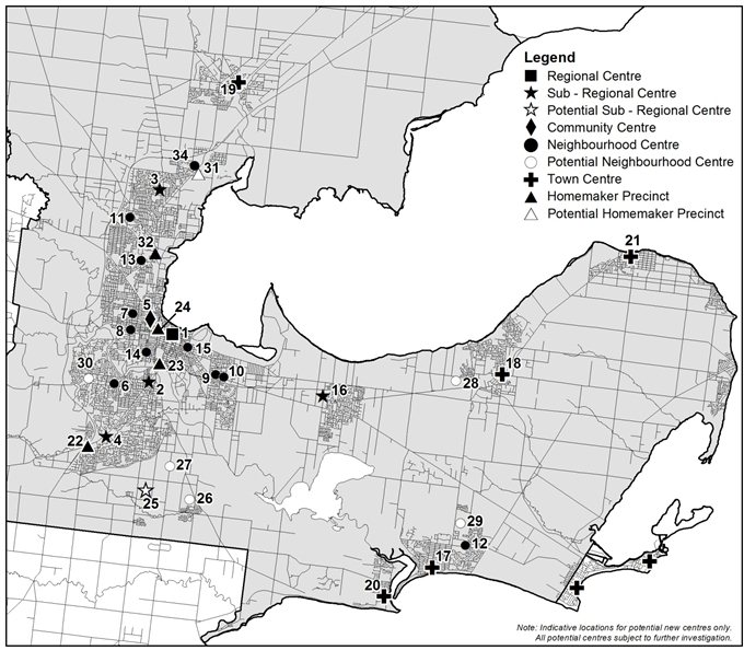 |
||
|
City of Greater Geelong Retail Activity Centre Hierarchy |
|||
|
Level in Hierarchy |
Identified Centres |
Indicative floorspace and example key tenants |
|
|
Regional Centre |
Central Geelong (1) |
More than 100,000 sqm Department store, discount store(s), mini major(s), supermarkets(s) and extensive range of specialties |
|
|
Sub-regional Centres |
Belmont (2), Corio Village (3), Waurn Ponds (4) Leopold (16) |
15,000 sqm to 35,000 sqm Discount department store(s), mini major(s) supermarket(s) and specialties |
|
|
Community Centre |
Pakington Street (Geelong West) (5) |
10,000 sqm to 25,000sqm Supermarket(s), mini major(s) and specialties |
|
|
Neighbourhood Centres |
Highton (6), Shannon Avenue (Geelong West) (7), Shannon Avenue (Newtown) (8), Bellarine Village (9), Newcomb Central (10), Bell Post (11), Ocean Grove marketplace (12), Separation Street (13), Pakington Street (Newtown) (14), Geelong East (15), Rosewall (34) |
2,500 sqm to 25,000 sqm Supermarket (small or full line), primarily convenience oriented specialties |
|
|
Town Centres |
Ocean Grove (Town Centre) (17), Drysdale (18), Lara (19), Barwon Heads (20), Portarlington (21) |
1,500 sqm to 15,000 sqm Supermarket, mini major(s), specialties |
|
|
Homemaker Precincts |
Waurn Ponds (22), Moorabool/Fyans (23), Geelong West (24), North Geelong (32) |
5,000 sqm to 50,000 sqm Large restricted retail type tenants |
|
|
Potential Subregional Centres |
Armstrong Creek (25) |
|
|
|
Potential Neighbourhood Centres |
Armstrong Creek East (26), Armstrong Creek Horseshoe Bend Rd (27), Jetty Road Growth Area (28), Ocean Grove north east growth corridor (29), Wandana Heights (30) |
|
|
|
Potential Homemaker Precincts |
Corio (31) |
|
|
| 21.07-9 | Geelong Ring Road Employment Precinct Framework Plan map | ||
19/07/2012 C187 |
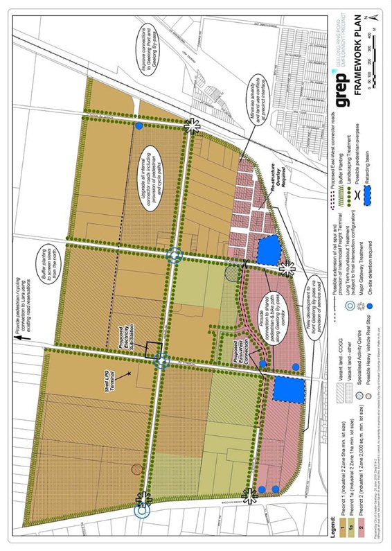
|
||
SCHEDULE TO CLAUSE 52.28-3 |
|||
|
--/--/2013 C247 |
Prohibition of a gaming machine in a shopping complex | ||
|
Name of shopping complex and locality |
Land description |
||
|
Market Square Shopping Centre, Geelong |
62 Malop St, Geelong |
||
|
Bay City Plaza Shopping Centre, Geelong |
95 - 121 Malop St, Geelong |
||
|
Waurnvale Shopping Centre (Town and Country Shopping World), Grovedale |
Land on the southwest corner of Princes Highway and Pioneer Rd, Grovedale, also known as 173 - 199 Pioneer Rd, Grovedale |
||
|
Bellarine Village Shopping Centre, Newcomb |
Land on the northwest corner of Bellarine Highway and Glenwood St, Newcomb, also known as 27-37 Bellarine Highway, Newcomb |
||
|
Meadowvale Village Shopping Centre, Norlane |
Land on the east side of Anakie Rd, Norlane (south of Bosbury St) also known as 290-306 Anakie Rd, Norlane |
||
|
Corio Village Shopping Centre, Corio |
Land bounded by Bacchus Marsh Rd, Purnell Rd, Goulburn Ave and Gellibrand St, Corio. also known as 83A Purnell Rd, Corio |
||
|
Grovedale Shopping Centre, Grovedale |
Land on the southwest corner of Heyers Rd and Burdoo Drive, Grovedale, also known as 79 Heyers Rd, Grovedale |
||
|
Drysdale Village Shopping Centre, Drysdale |
Land south of Wyndham St, Drysdale bounded by Wyndham St, Eversley St, Palmerston St, and Portarlington Rd, and land north of Wyndham St, Drysdale, bounded by Wyndham St, Carolanne Drive, Clifton Springs Rd and the commencement of the existing Residential 1 zone boundary |
||
|
Newcomb Shopping Centre, Newcomb |
Land on the northeast corner of Bellarine Highway and Wilsons Rd, Newcomb, also known as 71 Bellarine Highway, Newcomb |
||
|
The Centreway, Lara |
Land on the east and west sides of The Centreway, Lara, east of Waverley Rd |
||
|
Leopold Shopping Centre, Leopold |
Land on the corner of Bellarine Highway and Melaluka Road, Leopold. |
||
|
Rosewall Shopping Centre (Fairbairn Drive and Aldi Supermarket, Corio) |
12-20 Fairbairn Drive Corio and part of 465 Princes Highway, Corio, also known as Lot 1 on PS423406M. |
||
|
Jetty Road Neighbourhood Activity Centre |
South-west corner of the land at 148-166 Jetty Road, Drysdale |
||
|
PLANNING
|
|
Permit No.: 366/2011 |
GRANTED UNDER DIVISION 5 OF PART 4 OF THE PLANNING AND ENVIRONMENT ACT 1987 |
||
| Address of the land: | 12-20 Fairbairn Drive, Corio | |
| THE PERMIT ALLOWS: | Development of the Land for Shops, Associated Business Identification Signage and Partial Reduction of Car Parking, Loading and Bicycle Facility Requirements | |
THE FOLLOWING CONDITIONS APPLY TO THIS PERMIT:
Amended Plans
Prior to the commencement of the development, three (3) copies of amended plans to the satisfaction of the Responsible Authority must be submitted to and approved by the Responsible Authority. When approved, the plans will be endorsed and will then form part of the permit. The plans must be drawn to scale with dimensions and must be generally in accordance with the plans submitted on 10 August 2012 but modified to show:
Disabled spaces to conform to standard AS 2890.6;
Deletion of zebra crossing from the plans and replaced with an informal crossing;
Details of all plant and equipment, including detail of screening and noise attenuation;
Details of all roadworks;
A landscape plan in accordance with the requirements of condition 13 of this permit;
Fully dimensioned floor, elevation and site plan;
Interface treatment measures along the southern boundary, including fencing, wall treatment, location of services, landscaping and any other form of treatment which responds to the adjoining sensitive uses;
Materials and colour schedule;
A fully dimensioned signage plan including materials, colour, details of supporting structures, method of illumination and indicative location of future business identification signage for each premises;
Dimensions of loading bays, car spaces and bicycle facilities;
Location of waste and recycling storage areas and collection points.
Endorsed Plans
The development as shown on the endorsed plan(s) must not be altered without the written consent of the Responsible Authority.
The location and details of signs, as shown on the endorsed plans must not be altered without the written consent of the Responsible Authority unless exempt under the provisions of the Greater Geelong Planning Scheme.
Prior to the occupation of the development all buildings and works must be completed in accordance with the endorsed plans unless otherwise approved in writing by the Responsible Authority.
Engineering
Prior to works commencing an Environmental (Construction) Management Plan (EMP) must be submitted and must address control of site emissions during construction and the defects liability period to the satisfaction of the Responsible Authority. The plans must include measures to be taken to ensure that no polluted water and/or sediment laden runoff is to be discharged directly or indirectly into stormwater drains or watercourses during the construction period. The EMP must be prepared in accordance with the EPA – Guideline for Environmental Management, Doing it Right on Subdivisions, Publication 960, September 2004.
Prior to the commencement of works, engineer designed roadworks and drainage construction plans must be submitted to and approved by the Responsible Authority. The plans must show but are not limited to:
Road construction of the Broderick Road frontage and Pearce Street frontage including drainage, road widening, surfacing and kerb and channel. Footpath is required along all frontages.
The recommendations relating to road construction and treatment as listed in the Traffic and Car Parking Assessment dated July 2012 by Ceremira Pty Ltd.
Prior to the commencement of the development hereby approved, engineer designed drainage plans must be submitted to and approved by the Responsible Authority. These plans must show that the design for the drainage system complies with relevant City of Greater Geelong Standards, Australian Rainfall and Runoff, Australian Standards (in particular AS 3500), WSUD Engineering Procedures: Stormwater- CSIRO, and any other approved technical publications relevant to the development, demonstrating that the system caters for the development in accordance with the following design criteria:
Site run-off must be limited to equivalent pre-developed levels for rainfall events of up to the 10 year ARI event;
An appropriate on site detention system must be designed and installed to limit site run-off to designated levels;
Runoff from Hard Standing Areas must be treated to achieve current best practice pollutant removal targets by connection to an appropriate Water Treatment Facility, with capacity to treat at least a 3 month ARI storm event, unless approved otherwise by the Responsible Authority. The Water Treatment Facility must be maintained to the satisfaction of the Responsible Authority;
all to the satisfaction of the Responsible Authority.
Prior to the occupation of the development, roadworks and drainage must be constructed in accordance with the approved plans and specifications to the satisfaction of the Responsible Authority, and must include:
ealed pavement with kerb and channel;
Concrete footpaths; and
Underground stormwater drainage.
Unless otherwise approved in writing by the Responsible Authority, prior to the commencement of the development, the developer must submit for certification, a plan showing the creation of a 3m wide easement in favour of the relevant authority, over the existing 1275mm drainage pipe. The easement must be formally created prior to occupation.
Prior to the occupation of the development, the developer must:
construct the site stormwater drainage system including any hard stand treatment facility in accordance with the approved drainage plans;
construct vehicular crossings via relevant Council Permit. Any redundant crossing is to be replaced with kerb and channel, to match existing. All power poles and drainage pits within road reserve are to be at least one meter clear of driveways and kerb and channel to the satisfaction of Responsible Authority;
construct the car park including accessways, surfaced with an all-weather sealed coat in accordance with the endorsed plans;
linemark the car park and accessways in accordance with the endorsed plan;
all to the satisfaction of the Responsible Authority.
All stormwater runoff must be collected on site and discharged to the underground drainage system in the South East Corner of the site, or other nominated point approved by the Responsible Authority, to the satisfaction of the Responsible Authority.
Traffic and Car Parking
Prior to the occupation of the development, unless otherwise agreed in writing by the Responsible Authority, road widening works in Broderick Road and Pearce Street must be undertaken in accordance with plans submitted to and approved by the Responsible Authority. The plans must show, but not be limited to:
Widening of Broderick Road to provide a deceleration lane/left turn lane to enter the Broderick Road vehicle crossing and Pearce Street;
Widening and kerb and channel works of the development side of Pearce St;
Provision of linemarking and signage in Broderick Rd;
Relocation of the bus stop and provision of an indented bus bay and associated infrastructure, to the satisfaction of Public Transport Victoria;
Provision of concrete splitter islands/pedestrian refuges at each end of Pearce St and associated linemarking and signage;
Removal of the concrete splitter islands and delineator in Fairbairn Drive near the Pearce Street intersection;
Provision of linemarking and raised reflective pavement markers, and signage, in Fairbairn Drive;
Provision of a detailed Functional Layout Plan to show all proposed changes within the road reserves;
Provision of footpath across all road frontages including connections to existing footpaths which may result in additional works beyond the immediate site frontage.
(Note: With the written consent of the Responsible Authority, the works may be deferred for an agreed time period to enable performance monitoring to establish extent of upgrade works required in consultation with Council’s Traffic Engineering Unit. An Agreement under Section 173 of the Planning & Environment Act may be required to satisfy this condition).
Unless otherwise approved by the Responsible Authority, prior to the commencement of the use, the areas set aside for the parking of vehicles, access lanes and pedestrian paths as shown on the endorsed plans must be:
constructed;
properly formed to such levels that they can be used in accordance with the plans;
surfaced with an all weather seal coat.
drained;
line marked to indicate each car space and all access lanes;
clearly marked to show the direction of traffic along access lanes and driveways;
to the satisfaction of the Responsible Authority.
Car spaces, access lanes, pedestrian paths and driveways must be kept available for these purposes at all times
Landscaping
Prior to the commencement of the development, three (3) copies of a landscape plan prepared by a suitably qualified or experienced, person to the satisfaction of the Responsible Authority, must be submitted to and approved by the Responsible Authority. The plan(s) must be drawn to scale and show:
A survey (including botanical names) of all existing vegetation to be retained and/ or removed;
Details of surface finishes of pathways and driveways;
A planting schedule of all proposed trees, shrubs and ground covers including botanical names, common names, pot sizes, sizes at maturity, and quantities of each plant;
Landscaping and planting within all open areas of the site;
Street works, including provision of street trees to the satisfaction of Council’s Parks Unit;
Opportunities for rainwater harvesting and water reuse.
When approved, the plan will be endorsed and form part of the permit, all to the satisfaction of the Responsible Authority.
Note: Council’s Parks Unit should be contacted to discuss appropriate street tree species and location. Please contact Tim Osborne on 5272 4827.
Prior to the occupation of the development, the landscaping works as shown on the endorsed plans must be carried out and completed to the satisfaction of the Responsible Authority.
The landscaping shown on the endorsed plans must be maintained to the satisfaction of the Responsible Authority.
Note: All completed landscaping works within the street and/or reserve must be inspected by Council’s Parks Unit. To arrange an inspection please contact Tim Osborne on 5272 4827.
Lighting and Signage
Prior to the commencement of the use, low intensity lighting must be provided to the satisfaction of the Responsible Authority to ensure that car park areas and pedestrian accessways are adequately illuminated during evening periods without any loss of amenity to occupiers of nearby land to the satisfaction of the Responsible Authority.
Any outdoor and/or security lighting provided must be designed to prevent adverse light spill on adjoining land or road reserve to the satisfaction of the Responsible Authority.
Outdoor lighting and signage must be designed, baffled and located to the satisfaction of the Responsible Authority to prevent any adverse effect on adjoining land or road reserve.
Except with the prior consent of the Responsible Authority, all internally illuminated signage must be turned off no later than 30 minutes after closing or by 12:00am midnight (which ever is sooner) and must not be turned on until 30 minutes prior to opening the following morning or no earlier than 5:00am (whichever is later).
Waste Management Plan
Prior to the commencement of the development, a waste management plan must be submitted to and approved by the Responsible Authority. The plan must provide details of a regular garbage collection service to each of the uses on the subject land, including information regarding the type of refuse bins, type/size of trucks, means of accessing bins and frequency of refuse collection, to the satisfaction of the Responsible Authority. Once approved, the plan must be implemented to the satisfaction of the Responsible Authority.
Provision must be made on the land for the storage and collection of garbage and other solid waste. This area must be graded, drained and screened from public view, to the satisfaction of the Responsible Authority and in accordance with the endorsed plans.
All waste material must be regularly removed from the site to the satisfaction of the Responsible Authority.
Public Transport Victoria
Before the development starts, amended plans must be submitted to and approved by the Responsible Authority. When approved, the plans will be endorsed and will then form part of the permit. The plans must be drawn to scale with dimensions and three copies must be provided. The plans must be generally in accordance with the plans submitted with the application but modified to show:
The existing bus stop on Broderick road removed and a new stop constructed on the south-western side of Broderick Road, between Pearce Street and the car park entrance of Beckley Park
A concrete hard stand area for passengers
A pole, flag and timetable box to Metlink’s requirements
Designed in accordance with the VicRoad’s Bus Stop Guidelines February 2006, and the DOT Public Transport Guidelines for Land Use and Development
Deemed compliant with the Disability Discrimination Act – Disability Standards for Accessible Public transport 2002
Direct and safe pedestrian access to a pedestrian path
Detail any remedial work required to the road pavement to provide a suitable turn in area to the satisfaction of Public Transport Victoria.
Unless otherwise agreed in writing with Public Transport Victoria, before the development starts, the bus stop and associated infrastructure as shown on the endorsed plans, must be constructed at a cost born by the permit holder to the satisfaction of Public Transport Victoria and deemed compliant with the Disability Discrimination Act – Disability Standards for Accessible Public Transport 2002
The permit holder must take all reasonable steps to ensure that disruption to bus operations is kept to a minimum during construction. Foreseen disruptions to bus operations must be communicated with mitigation measures to Public Transport Victoria and bus operators one (1) week prior.
Amenity
The amenity of the area must not be detrimentally affected by the use or development through the:
Transport of materials, goods or commodities to or from the land;
Appearance of any building, works or materials;
Emission of noise, artificial light, vibration, odour, fumes, smoke, vapour, steam, soot, ash, dust, waste water, waste products, grit or oil;
Presence of vermin;
to the satisfaction of the Responsible Authority.
Screening and Materials Storage
With the exception of guttering, rainheads and downpipes, all pipes, fixtures, fittings, vents, plant and equipment servicing any building on the land must be concealed in service ducts or otherwise hidden from view to the satisfaction of the Responsible Authority.
Materials or goods stored in the open on the site must be screened from view of adjoining properties, roads and reserves, to the satisfaction of the Responsible Authority.
The service yard along the southern boundary must not be used to store any goods, materials or refuse in order to avoid impacts to the adjoining sensitive uses, to the satisfaction of the Responsible Authority.
Loading Areas and Deliveries
The loading and unloading of goods from vehicles must only be carried out on the land within the designated loading bay(s) and must not disrupt the circulation and parking of vehicles on the land.
The loading bay area(s) must remain available for this purpose at all times to the satisfaction of the Responsible Authority.
Except with the prior written consent of the Responsible Authority, deliveries to the shops must only occur between the hours of:
7.00am – 10.00pm daily (with no restriction to the number of deliveries);
Deliveries to the premises must be in accordance with EPA Publication 1254 (Noise Control Guidelines 2008) or as amended.
Emissions
All external plant and equipment must be acoustically treated or placed in soundproof housing to reduce noise to a level satisfactory to the Responsible Authority.
Noise levels emanating from the premises must not exceed those required to be met under the State Environment Protection Policy (Control of Noise from Commerce, Industry and Trade), No. N-1.
Security systems must be of the silent type, to the satisfaction of the Responsible Authority.
Dust control measures must be implemented to prevent emissions which may cause nuisance to adjoining properties to the satisfaction of the Responsible Authority.
Permit Expiry
This permit will expire if one of the following circumstances applies:
The development of the building(s) hereby approved has not commenced within two (2) years of the date of this permit
The development of the building(s) hereby approved is not completed within four years of the date of this permit.
Approval for the signage allowed under this permit expires 15 years from the date of issue.
The Responsible Authority may extend the periods referred to if a request is made in writing before the permit expires or within three (3) months afterwards.
Engineering Notes
Construction of the civil works are to be inspected by Council Representative at various stages. An appropriate fee equivalent to 3.25% of total cost of civil works (a minimum fee of $100 applies if the 3.25% amount is less than $100) excluding GST, is to be paid to Council for design, checking and supervision. Relevant evidential documentation of the cost is to be provided.
All internal property drainage must be designed and constructed to satisfy AS/NZS 3500.
As the site is subject to flooding, the applicant is advised that all floors should be set above the applicable site flood level. The engineering department should be contacted for advice on the applicable flood level.
The consultant must contact Council’s Engineering department at the time of design for proposed finished surface levels at the boundary of the site fronting Pearce Street and Fairbairn Drive. An appropriate design level could help in providing flood protection to the development.
Portfolio: |
Sport & Recreation - Cr Irvine |
Source: |
Projects, Recreation & Central Geelong |
General Manager: |
Dean Frost |
Index Reference: |
Subject: Events |
Cr Farrell moved, Cr Irvine seconded -
That in accordance with Section 89 (2) (d) of the Local Government Act 1989, this contractual matter be considered at the conclusion of all other business at which time the meeting be closed to members of the public.
Carried.
Contents | Previous Page: Section A - Procedural Matters | Next Page: Section C - Notice of Motion