
Council Minutes - Section B: Reports - 10 December 2013
Contents | Previous Page: Section A - Procedural Matters | Next Page: Section C - Notice of Motion
Contents | Previous Page: Section A - Procedural Matters | Next Page: Section C - Notice of Motion
Reports tabled at the Ordinary Meeting of Council on Tuesday date held at City Hall, Little Malop Street in Geelong.
Rezoning Application 302-306 Aberdeen Street, Manifold Heights
Amendment C295 – Rezoning 162-180 Hood Road, Portarlington – Adoption
Delegation to the Chief Executive Officer – Drysdale Landfill Earthworks and Cell Lining Works
In accordance with 11C(2) of the City of Greater Geelong Act 1993, Council must elect a Deputy Mayor upon the office becoming vacant.
Accordingly, nominations are called for the position of Deputy Mayor for a twelve month period.
Cr Richards moved, Cr Irvine seconded –
That Council elect a Deputy Mayor for the period of twelve months.
Carried.
Cr Richards moved, Cr Macdonald seconded -
That Cr Bruce Harwood be nominated as Deputy Mayor for the period of twelve months.
There being no further nominations, Cr Harwood was declared elected as Deputy Mayor of the City of Greater Geelong for a twelve month period.
Cr Harwood briefly addressed the meeting and took his place at the table.
Portfolio: |
Planning - Cr Macdonald |
Source |
Economic Development, Planning and Tourism - City Development |
General Manager: |
Peter Bettess |
Index Reference |
Application: 289 |
The purpose of this report is to adopt Amendment C289.
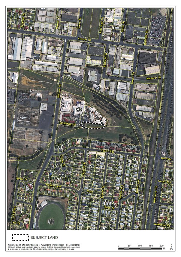
Amendment C289 proposes to rezone land in Weddell Road, North Geelong to provide for the completion of the Multicultural Aged Care Services (MACS) facility.
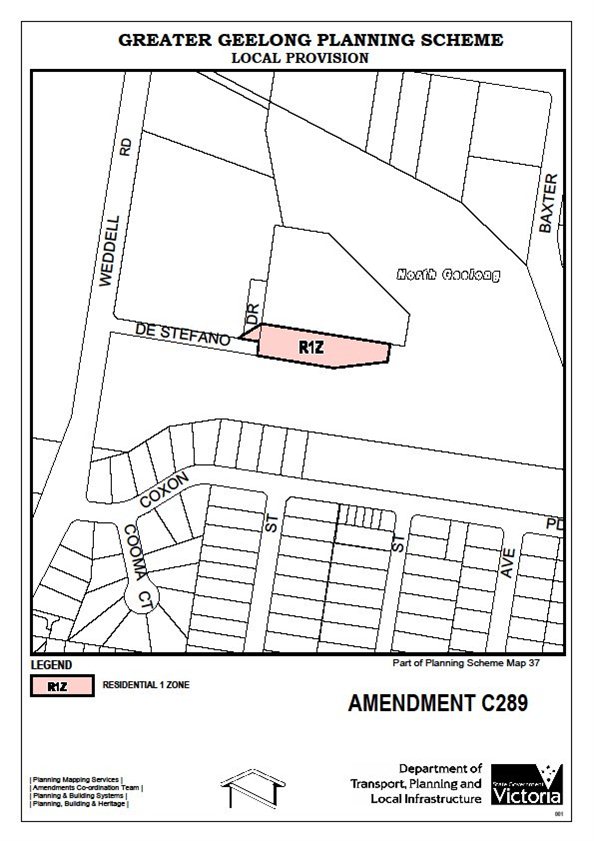
Amendment C289 will rezone an area of 2,413 square metres (being purchased from the City of Greater Geelong) from Public Park and Recreation Zone to Residential 1 Zone – consistent with the balance of the adjoining land in the Multicultural Aged Care Village abutting to the north.
The Amendment is combined with a planning permit application PP29/2013 for a two lot subdivision and buildings and works associate with the existing residential area care facility. This will provide for the concurrent excision for the adjoining land and its consolidation into the MACS title.
The subject land is a drainage reserve and MACS has negotiated to purchase a small portion of the land to consolidate with their title.
The proposal will complete the development of Stage B of the aged care facility.
Authorisation (A02598) for this Amendment was issued on 27 August 2013 under Section 35B of the Planning and Environment Act 1987.
The combined Amendment and draft planning permit were exhibited between 3 October 2013 and 4 November 2013.
No submissions have been received about the Amendment and draft planning permit.
As there are no submissions and no changes to the exhibited permit and amendment, Council is able to proceed to adoption without changes.
Concurrent with the planning exhibition, advertising of the proposed sale of the Council land has taken place. There have been no submissions. The land can be transferred to MACS for the agreed price when the subdivision is registered.
It is recommended the Amendment be adopted and forwarded to the Minister for Planning seeking approval.
Cr Macdonald moved, Cr E Kontelj seconded -
That Council:
Adopts Amendment C289 in the form as outlined in Appendix 2 of this report:
Submits the adopted Amendment together with the prescribed information to the Minister for Planning requesting approval; and
Recommends to the Minister that a Permit be granted pursuant to Section 96G of the Planning and Environment Act 1987 (Planning Permit No. 29/2013 is contained in Appendix 3).
Carried.
Amendment C289 and Planning Permit 29/2013 have been prepared by the City of Greater Geelong Council which is the planning authority for this Amendment. The Amendment was initiated by Fadgyas Planning Associated on behalf of MACS.
The land affected by the amendment and planning permit application is land adjoining the southern boundary of 100 Weddell Road, North Geelong. An aerial map of the area is shown in Appendix 1.
The Planning Scheme Amendment proposes to rezone the land from PPRZ to R1Z.
The amendment is required to:
Enable the completion of the MACs Jordan Wing as planned, and the associated outbuildings (storage/maintenance sheds) and site works (parking, landscaping, and pathways); and
Recognise the most appropriate zoning of land purchased from the Council for the proposal i.e. Residential 1 Zone, to subdivision the land purchased and consolidate it into land owned by MACS.
The Planning Permit will allow for a two lot subdivision and buildings and works associated with the existing aged care facility. More specifically, the planning permit will:
Subdivide an area of 115 square metres from De Stefano Drive (shown as R1 on Lot 2 of PS 328825 V), and 2,298 square metres from lot 2 on PS 313723 N, and consolidate them into PC 374212 K (created in Stage 2A approved by Council in November 2012).
Provide for the completion of the last 6 residential suites of the proposed Jordan Wing (24 residential suites approved by Council in November 2012), ancillary maintenance shed and storage sheds, car parking and site works, including a retaining wall also on the southern and eastern boundaries of the subdivided area.
Council resolved to exhibit the Amendment under delegation on 7 August 2013. The report that accompanied the delegated resolution discussed the strategic basis for the rezoning and concluded that there is sufficient planning policy support. The proposal is consistent with the relevant municipal strategies applicable to urban consolidation, housing choice and urban character. The proposal will sit comfortably within its retirement/aged care context and creates no adverse impacts for the nearest residential area to the south.
The State planning policy relevant to aged care facilities (clause 16.02-3) strongly supports this proposal.
A small portion of the subject land is affected by the Special Building Overlay (SBO). There is no flood conveyance or storage impact on the adjoining reserve arising from this rezoning and planning permit application as all buildings will be undertaken outside of the SBO area.
Authorisation (A02598) for this Amendment was received from the Minister for Planning on 29 August 2013. Exhibition of Amendment C289 and Planning Permit 29/2013 took place between 3 October 2013 and 4 November 2013 with notices in local newspapers and the Government Gazette. Notice of the Amendment was sent to relevant Ministers under the Planning and Environment Act 1987.
No submissions have been received about the Amendment. Council is now able to adopt the Amendment and forward it to the Minister for Planning seeking approval. The Amendment to be adopted is in Appendix 2.
The Planning Permit recommended to be issued is in Appendix 3.
There are no environmental implications arising from this amendment.
The planning permit application has been prepared to avoid development on land affected by the Special Building Overlay.
Council has reached agreement to sell the land to MACS. Following completion of the rezoning, the sale can be effected.
The amendment implements the objectives of Planning in Victoria by addressing the Planning and Environment Act 1987, the SPPF and the LPPF.
The Amendment supports the Community Wellbeing strategic direction of City Plan, in particular the proprieties of connected, creative and strong communities and through the ongoing provision of wellbeing services and activities.
In accordance with section 80© of the local Government Act no Council officers have any direct or indirect interest in the matters to which this amendment relates.
There is no risk associated with this Amendment.
The amendment is positive in terms of social considerations. MACS already operates a large aged care facility at the site which currently supports 8 independent living units and 131 high and low care beds with associated on-site car parking for staff and visitors. The demand for accommodation at this facility has necessitated on-going incremental expansions/upgrades, intended to be undertaken in 2 stages.
Stage 1 provided for the refurbishment and limited expansion of the Borrela Wing and the re-establishment of the primary car parking area to the northern part of the site, to be accessible form Weddell Road rather than De Stefano Drive. It is nearing completion.
Stage 2 provides for the construction of the new 30-bed high care Jordan Wing. Planning approval is being undertaken in 2 stages due to the need to finalise land acquisition from the Council and to rezone a small area of reservation to a more appropriate residential zone. Stage 2A (comprised of 24 beds – the majority of the new wing) was approved in November 2012, and this application for Stage 2B will facilitate the completion of this project.
The Amendment will not impact on any basic rights, freedoms and responsibilities as set out in the Charter. Planning legislation ensures an exhibition process for planning scheme amendments.
The Amendment was exhibited in accordance with the Planning and Environment Act 1987, including notices in City News section of the Geelong Advertiser, The Independent and Geelong News newspapers, letters to prescribed Ministers and relevant authorities, online and hard copy of the Amendment documents at the Council offices at Brougham Street. No letters were sent to local landowners and residents due to the significant separation between the subject site and the nearest residences, the substantial Council landownership around the subject site and the minor nature of the proposal.
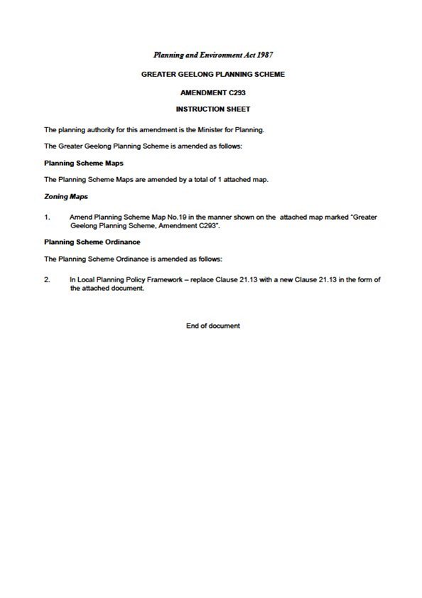
The planning authority for this amendment is the City of Greater Geelong
The Greater Geelong Planning Scheme is amended as follows:
The Planning Scheme Maps are amended by a total of one attached map.
Zoning Maps
Amend Planning Scheme Map No.37 in the manner shown on the attached map marked “Greater Geelong Planning Scheme, Amendment C289”.
End of document
PLANNING |
Permit No.: 29/2013 |
GRANTED UNDER DIVISION 5 OF |
|
ADDRESS OF THE LAND: |
100 Weddell Road, NORTH GEELONG |
THE PERMIT ALLOWS: |
TWO (2) LOT SUBDIVISION AND BUILDINGS AND WORKS ASSOCIATED WITH THE EXISTING RESIDENTIAL AGED CARE FACILITY GENERALLY IN ACCORDANCE WITH THE ENDORSED PLANS |
Endorsed Plans
The development as shown on the endorsed plans must not be altered without the written consent of the Responsible Authority.
Landscaping
Before the development starts, a landscape plan to the satisfaction of the Responsible Authority must be submitted to and approved by the Responsible Authority. This plan must be prepared by a qualified Landscape Architect who is a member of the Australian Institute of Landscape Architects, or a person with a suitable background in horticultural science or an allied field to the satisfaction of the Responsible Authority. When approved, the plan will be endorsed and will then form part of the permit. The plan must be drawn to scale with dimensions and three copies must be provided. The plan must show:
Details of surface finishes of pathways and driveways
A planting schedule of all proposed trees, shrubs and ground covers, including botanical names, common names, pot sizes, sizes at maturity, and quantities of each plant.
Landscaping and planting within all open areas of the site.
Prior to the occupation of the units, the landscaping as shown on the endorsed plans must be completed to the satisfaction of the Responsible Authority.
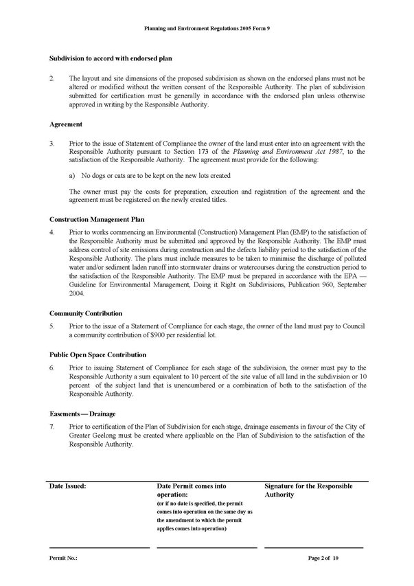
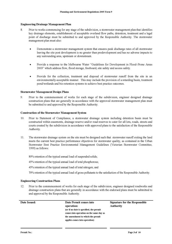
80% retention of the typical annual load of suspended solids;
45% retention of the typical annual load of total phosphorous;
45% retention of the typical annual load of total nitrogen; and
70% retention of the typical annual load of gross pollutants.
Prior to the commencement of works, an Environmental (Construction) Management Plan (EMP) must be submitted to and approved by the Responsible Authority and must address control of site emissions during construction and the defects liability period to the satisfaction of the Responsible Authority. The plans must include measures to be taken to ensure that no polluted water and/or sediment laden runoff is to be discharged directly or indirectly into stormwater drains or watercourses during the construction period.
Car parking and access
Unless otherwise approved by the Responsible Authority, prior to the occupation of the development, the areas set aside for the parking of vehicles, access lanes and pedestrian paths as shown on the endorsed plans must be:
constructed;
properly formed to such levels that they can be used in accordance with the plans;
surfaced with an all weather seal coat.
drained;
line marked to indicate each car space and all access lanes;
clearly marked to show the direction of traffic along access lanes and driveways;
to the satisfaction of the Responsible Authority.
Car spaces, access lanes, pedestrian paths and driveways must be kept available for these purposes at all times.
The location of the retaining walls, maintenance sheds and all other infrastructure must be located outside the Special Building Overlay in accordance with the following plans submitted for Stage 2B with the application:
Proposed Site Plan: Job No. 09-825, Sheet TP02, reference R7 dated 14-05-2013.
Proposed Enlarged Site Plan: Job No. 09-825, Sheet TP03, reference R7 dated 14-05-2013.
Proposed Retaining Wall and Parking Plan: Job No. 09-825, Sheet TP08, reference R7 dated 14-05-2013.
Strictly no material is permitted to be imported into the Special Building Overlay.
Drainage
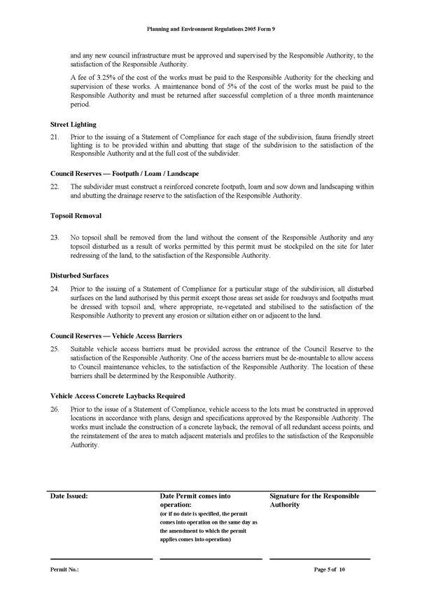
The site must be drained to the satisfaction of the Responsible Authority and no concentrated storm water may drain or discharge from the land to adjoining properties.
Endorsed Plan
The layout and site dimensions of the proposed subdivision as shown on the endorsed plan shall not be altered or modified without the written consent of the Responsible Authority. There are no requirements to alter or modify the endorsed plan if a plan is certified under the provisions of the Subdivision Act 1988 that is generally in accordance with the endorsed plans.
Creation of Easements
The Plan of Subdivision submitted for certification must include all easements deemed necessary to protect existing or future drainage lines within the subject site, and any easements required between the subject site and the nominated legal point of discharge must be created to the satisfaction of the Responsible Authority.
Servicing Authorities
The owner of the land must enter into agreements with the relevant authorities for the provision of water supply, drainage, sewerage facilities, electricity, and gas services to each lot shown on the endorsed plan in accordance with the authority’s requirements and relevant legislation at the time.
All existing and proposed easements and sites for existing or required utility services and roads on the land must be set aside in the plan of subdivision submitted for certification in favour of the relevant authority for which the easement or site is to be created.
The plan of subdivision submitted for certification under the Subdivision Act 1988 must be referred to the relevant authority in accordance with Section 8 of that Act.
The owner of the land must enter into agreements with:
a telecommunications network or service provider for the provision of telecommunication services to each lot shown on the endorsed plan in accordance with the provider’s requirements and relevant legislation at the time; and
a suitably qualified person for the provision of fibre ready telecommunication facilities to each lot shown on the endorsed plan in accordance with any industry specifications or any standards set by the Australian Communications and Media Authority, unless the applicant can demonstrate that the land is in an area where the National Broadband Network (NBN) will not be provided by optical fibre.
Prior to Statement of Compliance
Before the issue of a Statement of Compliance for any stage of the subdivision under the Subdivision Act 1988, the owner of the land must provide written confirmation from:
a telecommunications network or service provider that all lots are connected to or are ready for connection to telecommunications services in accordance with the provider’s requirements and relevant legislation at the item; and
a suitably qualified person that fibre ready telecommunications facilities have been provided in accordance with any industry specifications or any standards set by the Australian Communications and Media Authority, unless the applicant can demonstrate that the land is in an area where the National Broadband Network will not be provided by optical fibre.
Prior to the statement of compliance, the developer must construct:
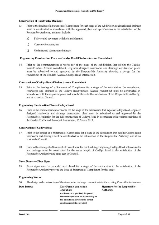
the site stormwater system including connections into the existing outfall drain in De Stefano Drive, or other nominated point/s as approved by the Responsible Authority in accordance with the approved drainage plans. The stormwater connection(s) must be in accordance with City of Greater Geelong Standard Drawings, and endwalls and rock beaching must be installed to the satisfaction of the Responsible Authority.
the Water Sensitive Urban Design features in accordance with the approved plans to the satisfaction of the Responsible Authority.
the car park including accessways, surface with an all-weather sealed coat and linemark the car and accessways in accordance with the approved plans to the satisfaction of the Responsible Authority.
Development Expiry
This permit as it relates to the development of buildings will expire if one of the following circumstances applies:
The development of the buildings hereby approved has not commenced within two (2) years of the date of this permit.
The development of the buildings hereby approved is not completed within four (4) years of the date of this permit.
The Responsible Authority may extend the periods referred to if a request is made in writing before the permit expires or within six (6) months afterwards.
Subdivision Expiry
This permit as it relates to subdivision will expire if one of the following circumstances applies:
The plan of subdivision has not been certified within two (2) years of the date of this permit.
A statement of compliance is not issued within five (5) years of the date of certification.
The Responsible Authority may extend the periods referred to if a request is made in writing before the permit expires or within six (6) months afterwards.
Engineering Notes:
Construction of the site stormwater connection/s is to be inspected by Council Representative at various stages. An appropriate fee equivalent to 3.25% of total cost of civil works, excluding GST (a minimum fee of $100 applies if the 3.25% amount is less than $100), is to be paid to Council for inspection. Relevant evidential documentation of the cost is to be provided.
All internal property drainage must be designed and constructed to satisfy AS/NZS 3500.
The Responsible Authority has issued a permit. The permit was granted by the Minister administering the Planning and Environment Act 1987 under section 96I of that Act.
The permit operates from a day specified in the permit being a day on or after the day on which the amendment to which the permit applies comes into operation.
A permit for the development of land expires if -
the development or any stage of it does not start within the time specified in the permit; or
the development requires the certification of a plan of subdivision or consolidation under the Subdivision Act 1988 and the plan is not certified within two years of the issue of a permit, unless the permit contains a different provision; or
the development or any stage is not completed within the time specified in the permit, or, if no time is specified, within two years after the issue of the permit or in the case of a subdivision or consolidation within 5 years of the certification of the plan of subdivision or consolidation under the Subdivision Act 1988.
A permit for the use of land expires if -
the use does not start within the time specified in the permit, or if no time is specified, within two years after the issue of the permit; or
the use is discontinued for a period of two years.
A permit for the development and use of land expires if -
the development or any stage of it does not start within the time specified in the permit; or
the development or any stage of it is not completed within the time specified in the permit, or, if no time is specified, within two years after the issue of the permit; or
the use does not start within the time specified in the permit, or, if no time is specified, within two years after the completion of the development: or
the use is discontinued for a period of two years.
If a permit for the use of land or the development and use of land or relating to any of the circumstances mentioned in section 6A(2) of the Planning and Environment Act 1987, or to any combination of use, development or any of those circumstances requires the certification of a plan under the Subdivision Act 1988, unless the permit contains a different provision-
the use or development of any stage is to be taken to have started when the plan is certified; and
the permit expires if the plan is not certified within two years of the issue of the permit.
The expiry of a permit does not affect the validity of anything done under that permit before the expiry.
Any person affected may apply for a review of -
a decision of the responsible authority refusing to extend the time within which any development or use is to be started or any development completed; or.
a decision of the responsible authority refusing tot extend the time within which a plan under the Subdivision Act 1988 is to be certified, in the case of a permit relating to any of the circumstances mentioned in section 6A(2) of the Planning and Environment Act 1987; or.
the failure of the responsible authority to extend the time within one month after the request for extension is made.
An application for review is lodged with the Victorian Civil and Administrative Tribunal.
An application for review must be made on an Application for Review form which can be obtained from the Victorian Civil and Administrative Tribunal, and be accompanied by the applicable fee.
An application for review must state the grounds upon which it is based.
An application for review must also be served on the Responsible Authority.
Details about applications for review and the fees payable can be obtained from Victorian Civil and Administrative Tribunal.
Portfolio: |
Planning - Cr Macdonald |
Source: |
Economic Development, Planning and Tourism - City Development |
General Manager: |
Peter Bettess |
Index Reference: |
Application: C293 and 1185/2013 |
The purpose of this report is to consider the Ministerial Amendment C293 and accompanying planning permit 1185/2013 proposing a residential rezoning and subdivision in Caddys Road Lara which is on exhibition for submissions until 9 December 2013. The report provides a summary of the proposal, a history of the Caddys Road area and recommends Council’s submission to the Minister for Planning about the proposal.
The Minister for Planning has prepared Amendment C293 to the Greater Geelong Planning Scheme. The amendment has been prepared by the Minister at the request of TGM Consulting on behalf of L.Bisinella Developments Pty Ltd.
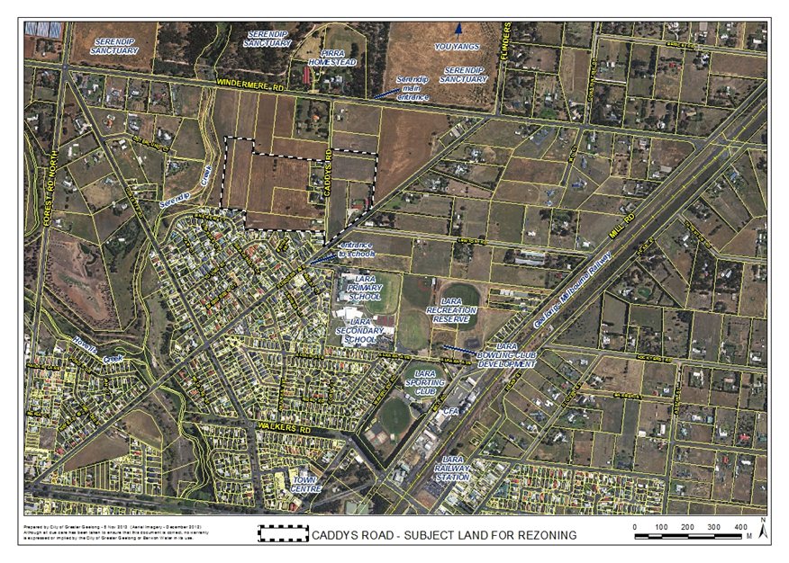
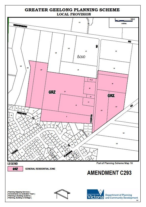
The land affected by the Amendment is 5, 15, 21, 23, 1/23, 25, 33, 40 and 50 Caddys Road, 147 – 153 and 155 – 163 Windermere Road and 121 and 131 Flinders Avenue, Lara (referred to in this report as the Caddys Road area).
Amendment C293 proposes to rezone the land from Rural Living Zone to General Residential Zone and alters the Lara Structure Plan Map in the Municipal Strategic Statement (MSS) to correspond with the rezoning.
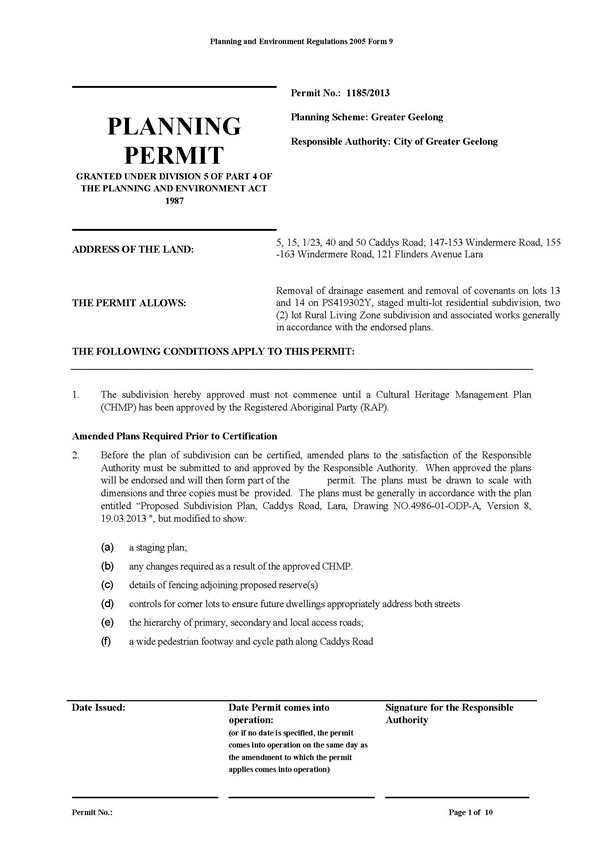
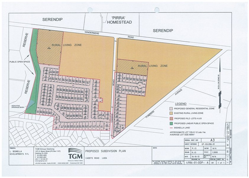
The amendment is accompanied by a planning permit application 1185/2013 to subdivide the land into 150 residential lots and 2 rural living lots and remove two covenants and a drainage easement from lot 13 and 14 on PPS419302Y.
The land affected by the planning permit application is 5, 15, 21, 1/23, 40 and 50 Caddys Road and 147 – 153 and 155 – 163 Windermere Road and 121 Flinders Avenue, Lara. This is a lesser area than the land proposed for rezoning.
Amendment C293 is supported by Council’s strategy for Lara to rezone land in the Caddys Road area for conventional residential development to take advantage of its proximity to established residential areas and easy access to a range of community facilities/services. However, the extent of land to be rezoned by Amendment C293 is lesser than mandated in Council policy in order to provide a larger buffer to Serendip Sanctuary to the north.
More detail for planning permit 1185/2013 and the proposed subdivision layout needs to be provided up front now before a suitable subdivision layout can be determined. Officers consider that further information about drainage, open space, road connections, native vegetation and access is required, and that the application of a Development Plan Overlay to the site as part of the amendment would greatly assist the subdivision layout and amenity of the area for future residents.
Cr Macdonald moved, Cr Ansett seconded -
That Council resolves to:
endorse the response detailed in Appendix 5 to be sent to the State Government as Council’s submission to Amendment C293 and planning permit 1185/2013;
authorise the Coordinator Strategic Implementation and other relevant officers to represent Council at the Directions and Panel Hearing for the proposal;
highlight to the State Government and Minister for Planning Council’s support of the 200 metre set back proposal.
Carried.
Combined amendment and planning permit application
The Minister for Planning, in response to an application by L.Bisinella Developments Pty Ltd, has prepared Amendment C293 to the Greater Geelong Planning Scheme.
The land affected by the Amendment is 5, 15, 21, 23, 1/23, 25, 33, 40 and 50 Caddys Road, 147 – 153 and 155 – 163 Windermere Road and 121 and 131 Flinders Avenue, Lara.
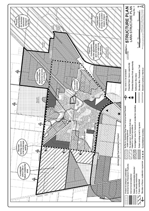
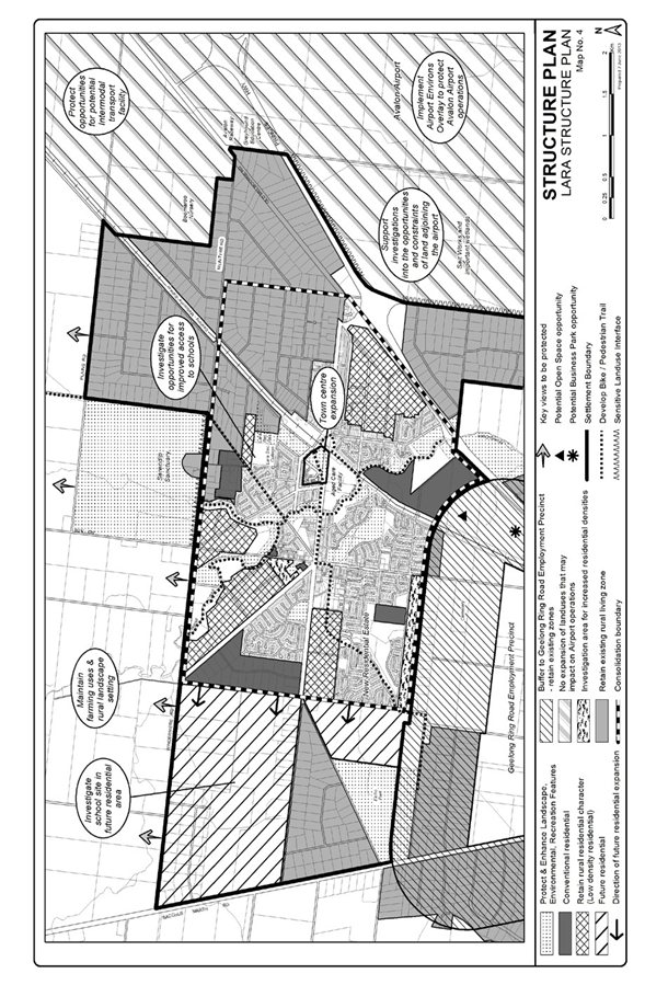
The amendment proposes to rezone the land from Rural Living Zone to General Residential Zone and alter the Lara Structure Plan map at Clause 21.13-4 of the Municipal Strategic Statement to correspond with the extent of the rezoning.
Concurrent with the preparation of the planning scheme amendment, a planning permit application is also made pursuant to Section 96A(i) of the Planning and Environment Act 1987 which proposes:
A multi-lot residential subdivision of 150 conventional size lots.
Creation of two Rural Living zone lots and associated works.
Removal of two covenants and a drainage easement on lots 13 and 14 on PS419302Y.
The land affected by the planning permit application is 5, 15, 21, 1/23, 40 and 50 Caddys Road and 147 – 153 and 155 – 163 Windermere Road and 121 Flinders Avenue, Lara. This is a lesser area than the land proposed for rezoning.
The amendment represents only part of the land proposed for rezoning as part of the previous Caddys Road C73 Amendment, which was refused by the Minister for Planning in November 2011. It is a reduced extent seeking to rezone approximately 19 hectares of land rather than the 36 hectares previously supported by Council.
A key feature of this proposal is a 200 metre setback or buffer distance from Windermere Road, with the land within this setback to be retained in the Rural Living Zone and not available for conventional residential development. This has been undertaken in response to the concerns raised by the Minister for Planning in refusing the rezoning of the 36 hectares at Caddys Road under previous Amendment C73.
Appendix 1 contains an aerial locality plan of the Caddys Road area.
Appendix 2 contains the exhibited amendment documents.
Appendix 3 contains the proposed planning permit.
Appendix 4 contains the proposed residential subdivision layout.
Appendix 5 contains the proposed submission about Amendment C293 and planning permit 1185/2013.
History of the Caddys Road area
There is a long and comprehensive history to the Caddys Road area with the following a very brief overview. Residential development possibilities in the Caddys Road area began with the 1996 Urban Growth Strategy that recommended Council undertake a review of the Lara Structure Plan to investigate the opportunities for achieving further areas of urban growth, in particular investigating the opportunities for re-subdivision of Rural Living Zones closest to the town centre.
In March 2003 the first application was made for rezoning of the Caddys Road land from Rural Living to Residential 1 and was known as Amendment C73. This was deferred pending completion of the Lara Structure Plan, which subsequently was released for public comment in early 2004. The Structure Plan did not support the rezoning of the Caddys Road area. Amendment C123 was prepared to introduce the policy from the Structure Plan into the Municipal Strategic Statement (MSS). This amendment was considered by an Independent Panel which found there to be a strong case for the Caddys Road area to be considered for residential development in the short to medium term, and recommended that Council commence a review of the Lara Structure Plan in late 2007/early 2008 and that the Caddys Road area be considered as a high priority for residential development.
Council undertook this review of the Lara Structure Plan and determined that the Caddys Road land should be rezoned to conventional residential and that the area was contained within Lara’s settlement boundary.
At this time amendment C73 (Caddys Road) was reignited and C198 (Lara Structure Plan) supported the rezoning of all the ‘Caddys Road land’, with a 50 metre public land buffer along the southern side of Windermere Road. Following exhibition of these amendments and in response to the community opposition to the Caddys Road land rezoning, Council determined to not support residential rezoning and development in the Caddys Road area. The independent panel hearing the submissions on C73 and C198 found no strategic reason or environmental grounds on which C73 should not proceed. Council subsequently reversed its position, supporting rezoning and residential development in the Caddys Road area and adopted both amendments in April 2011. Amendment C198 was approved by the Minister for Planning in August 2011 and surprisingly, C73 was refused by the Minister in November 2011.
Amendment C293 becomes the latest response to this history of the Caddys Road area.
Exhibition and Panel Hearing process for C293
The application is being exhibited between 7 November and 9 December 2013. A Directions Hearing is to be convened on 19 December 2013 with an Independent Panel Hearing to commence on 28 January 2014. These are unusually tight timeframes for a fully exhibited planning scheme amendment.
Council’s role in the process
The Minister for Planning is the Planning Authority for this amendment. Council has a role as a submittor and due to the very tight timelines, will need to make its submission immediately after Council’s consideration of the proposal.
The City of Greater Geelong submission is detailed in Appendix 5 which addresses these matters accordingly.
Submission Summary
Strategic response to Amendment C293
There is a good strategic foundation for residential rezoning in this area. The approved 2011 Lara Structure Plan nominates the Caddys Road area to be rezoned from Rural Living to Residential 1 Zone (this is being replaced by the new General Residential Zone). The Structure Plan also directs conventional residential development to Caddys Road (amongst other locations). These strategies are contained in clause 21.13-4 of the Municipal Strategic Statement.
Residential rezoning and subdivision in the Caddys Road area is supported by sound strategic planning at the state and local level. The Caddys Road land benefits from close proximity to established residential areas, relatively few infrastructure constraints and easy access to a range of community facilities, and should be rezoned to Residential.
Amendment C293 however does not fulfil the full potential of Councils adopted strategy for rezoning and development of the whole of the Caddys Road area except for a 50 metre buffer strip fronting Windermere Road. This has been supported by officers over an extended period.
Council and the Panel for Amendment C73 concluded that there would be little impact of full residential development of the Caddys Road area on Serendip Sanctuary and that subject to an appropriate buffer (50 metre open space reserve along Windermere Road), the Sanctuary and conventional residential development could co-exist next to one another.
The Amendment provides for a residential development at a range of densities within the Lara Urban Growth Boundary whilst providing for the maintenance of the rural surrounds of Lara. Whilst the proposed lot density of the subdivision at approximately 12 lots per hectare is below Council’s policy of 15 lots per hectare, it is consistent with that of the existing residential areas to the south. The density is somewhat compromised by the land ownership pattern and restriction of the permit to land owned by L.Bisinella Development Pty Ltd. This is especially evident with 121 Flinders Avenue included in the permit but not the adjoining 131 Flinders Avenue, creating very large lots fronting Caddys Road.
Unlike Amendment C73, this amendment does not include a Development Plan Overlay (DPO) to guide how the area will develop. This is considered to be a deficiency in the proposal and points to a lack of detail up front that is necessary for Council to understand and be comfortable with the development outcome.
Given the rezoning includes other land owners, which are not part of the permit for subdivision, and that there is land outside the 200 setback from Windermere Road that is not being rezoned now, a Development Plan Overlay should be applied so that all the issues (drainage, access, open space, vegetation, etc) can be considered at the one time.
This will provide a more comprehensive and strategic approach to the development of the area, and is consistent with Council’s approach to urban growth planning in other areas of Lara and the wider municipality.
Response to Planning Permit and subdivision layout
The exhibited planning permit and proposed subdivision layout has not adequately dealt with a number of issues on drainage, flooding, native vegetation, open space, road widening and access, and connectivity to surrounding land. The provision of more detail up front would assist Council in responding to the proposal and determining a suitable and final subdivision layout.
The application is unclear about how any native vegetation is to be dealt with by the proposal.
The proposed subdivision layout provides poor integration with surrounding properties as there are road connections to land that is remaining within the Rural Living Zone and none to the land that is part of the rezoning to General Residential Zone. A DPO would outline how the connectivity to the surrounding area would be achieved.
The absence of the Development Plan Overlay or an Outline Development Plan does not provide Council and the community with information about how the land to be subdivided will connect with the balance of the land to be rezoned, nor with land further to the east that could be subject of rezoning in the future.
The exhibited amendment and draft planning permit application are short on detail that Council considers necessary to fully assess the final development outcome of the residential subdivision. Council requests that this information be provided upfront now in order to make a fully informed assessment of the proposal and for the benefit of presentation to a future Independent Panel Hearing.
Council will not accept flood storage in newly created road reserves.
The alignment of the western boundary of the proposed General Residential Zone and the proposed open space along the Serendip Creek needs some adjustment to better respond to actual site conditions, a revised 1% flood extent and areas of unsafe flow velocities.
Amendment C293 and planning permit application 1185/2013 have been prepared to respond to the Minister for Planning’s concerns about the impact of conventional residential development on the integrity of Serendip Sanctuary to the north.
There are no financial implications associated with Council making a submission about this combined amendment and planning permit.
Amendment C293 and planning permit application 1185/2013 are generally consistent with Council’s policy for increased urban development within the Lara settlement boundary. The Caddys Road location is identified as an infill opportunity for conventional residential development as it is close to the town centre, schools, recreation facilities and proximate to the Lara Railway Station.
Making a submission about a planning issue within the municipality does not conflict with City Plan. The Sustainable Built and Natural Environment and Community Wellbeing strategic directions encompass good planning outcomes to benefit the existing and future community of the municipality. Rezoning of land in Caddys Road Lara is consistent with City Plan.
No officer involved in the preparation or drafting of this report has any direct or indirect interest in matters contained within the report.
As Council is not the planning authority for this amendment, it is imperative that Council make a submission to the amendment and planning permit application to have a say about the proposal and to influence the planning outcome.
There are no impacts on the community well being as a result of the recommendations in this report.
Council has been afforded the opportunity to make a submission about the Amendment in accord with the Planning and Environment Act 1987. Planning legislation ensures an open community consultation process occurs, enabling people to freely express their views and if necessary obtain a fair hearing before an Independent Panel. It is expected that the Minister will refer all submissions about this Amendment to an Independent Panel for review prior to making a final decision.
Council will need to make its submission about this proposal immediately as the exhibition period closed on Monday 9 December.
As a submittor Council will be invited to be a party to the subsequent Directions and Independent Panel Hearings that will be conducted on 19 December 2013 and 28 January 2014 respectively.
Council’s submission will be a publicly available document.
21.1305/04/201211/0 |
LARA |
21.13-1 |
KEY ISSUES AND INFLUENCES |
11/08/2011 |
Lara is a township designated for urban growth and is strategically located between Geelong and Melbourne with excellent road, rail, seaport and airport links. The rural landscape setting is important to the character of the town. Key environmental, cultural and landscape features need to be protected and managed. The Hovells and Sereindip Creek systems have a propensity to flood and in low lying areas there is a lack of overland flood conveyance and grade for drainage systems putting constraints on development in these areas. Retail and commercial expansion is required to meet the needs of local residents and to reduce the high level of escape expenditure. There is a strong reliance on the private motor car as a form of transport and active and public transport infrastructure and services need to be improved. The Geelong Ring Road Employment Precinct, Avalon Airport and nearby land provide significant opportunities for employment and economic growth. |
21.13-2 |
OBJECTIVES |
05/04/2012 |
|
STRATEGIES |
|
|
|
21.13-3 |
IMPLEMENTATION |
11/08/2011 |
These strategies will be implemented by: |
APPLYING ZONES AND OVERLAYSApply the Residential 1 and Low Density Residential zones to identified residential infill areas with appropriate Development Plan Overlay and Development Contribution Plan Overlay controls (or similar mechanisms). Support a precinct planning approach to the ‘future residential’ area west of O’Hallorans Road and apply appropriate zones and/or overlay/s Apply the Urban Floodway Zone, Land Subject to Inundation Overlay and the Special Building Overlay to identified areas as a matter of urgency. Apply appropriate zone/s required to facilitate commercial, retail and community development in the Lara town centre. |
|
FURTHER WORKCarry out the following further flooding and drainage work for Lara:
Support the preparation of an Avalon Airport Environs Study to consider the application of an Airport Environs Overlay. Support the preparation of an environmental assessment of land within the vicinity of Avalon Airport to determine opportunities and constraints. Support the detailed assessment of the proposed intermodal transport facility in the context of employment, road, rail and freight planning for this part of Victoria. |
|
REFERENCESLara Structure Plan, City of Greater Geelong, April 2011. Lara Structure Plan Retail Development Issues, Tim Nott Retail Analysis + Strategy, March 2009 Lara Town Centre Urban Design Framework, David Lock Associates, March 2006. |
|
21.13-4 |
LARA STRUCTURE PLAN MAP |
11/08/2011 |
 |
 |

Portfolio: |
Planning - Cr Mcdonald |
Source: |
Planning and Tourism |
General Manager: |
Peter Bettess |
Index Reference: |
Leopold Bay Access Project |
The Leopold Structure Plan includes a requirement for further work to investigate access to the Corio Bay. Earlier this year the Council resolved to request a report on a brief for a project to “investigate access to Port Phillip Bay including the investigation of land uses (other than urban development) in the area north of Portarlington Road”.
In preparing the report on the brief, it became apparent that a more comprehensive review was required to properly address the issue. This report outlines the work to date and the future work required to assess options for further consideration of land use north of the Portarlington Road within this study area.
The resolution was in response to the Structure Plan which specifies no urban development north of Portarlington Road as part of the future growth scenarios under the Structure Plan for Leopold.
The initial step in responding to this resolution of Council was to undertake consultation with interested parties in Leopold to ascertain the specific level of interest in obtaining bay access and to understand other relevant issues in the consideration of change in land use north of Portarlington Road.
There was an extensive consultation effort across Leopold in relation to the Leopold Structure Plan, with 481 submissions received to notices in the local newspapers. These submissions covered a range of issues which have ultimately assisted in determining a course of action in respect to this currently farming zoned land north of the Portarlington Road.
Having undertaken this level of consultation (on a non statutory basis), it was considered that it was more appropriate to progress the consideration of the detailed issues relating to the area north of Portarlington Road to better inform the report to Council on the brief.
In the meantime the Minister for Planning has introduced new rural zones which provide some flexibility which generally applies to the subject land. The zones do not provide resolution to the specific land use challenges which resulted in Council’s original resolution.
There are effectively 3 options which could be pursued to provide public access to the Bay at Leopold. Option 1 - pursue public access via walking track and or public boating ramp with no associated additional land use; Option 2 – Facilitate a standard assessment process for a proponent driven planning scheme amendment to develop a private marina and tourism development on one of the sites to allow bay access to be formally established; Option 3 – Undertake a large scale review of the area north of Portarlington Road to consider the suitability of land for further intensive (potential urban) development. Any use of the area for this purpose would require the Structure Plan, which came into effect in May 2013, to be reviewed and changed.
Option 3 is the preferred option as it will address the issues in a comprehensive way. A broad land capability analysis for the entirety of rural land adjacent to existing Leopold will inform future Structure Plan directions. This is in recognition of the continued strong growth of Leopold over the last decade, and the now commitment to a sub-regional activity centre to service the town and broader Bellarine region.
Cr Macdonald moved, Cr Ellis seconded -
That Council:
Undertakes a broad land use capability and land constraint analysis on all rural zoned area adjacent to Leopold to inform potential growth options and future structure plan review and to assist in providing direction in relation to realising public access to the bay.
The direction in relation to bay access shall provide detailed recommendations in respect to preferred methodology to pursue bay access in an area approximate to Leopold, and provide clear direction in relation to long term land use in the event that urban development is not considered appropriate.
Pursue funding through the Victorian Regional Growth Plan Fund to match committed budget from Council to undertake the land capability/land constraint project.
*Cr Ansett entered the meeting room at 7:45pm
Carried.
The Leopold Structure Plan directs Council to investigate options for public access to the Bay. The investigation area is between Clifton Avenue and Grand Scenic Drive. A map of the study area is shown on Appendix 1. The existing beach at this location is degraded and narrow. The water off the coast is shallow. It is approximately 100 metres from the high water mark to the low water mark and a further 100 metres from the low water mark to the minus 1 metre bathymetric contour.
Local residents report that fishermen netting in the bay results in the accumulation of sea grass along the beach, which as it decays emits an offensive odour.
The study area is currently used for a variety of land uses including two caravan parks, rural living housing, farming and a nursery.
There is no public land in this area with private freehold extending up to the high water mark. In order for public access to be provided, Council could consider a number of options including compulsory acquisition, purchasing of land by agreement or alternatively negotiating an open space contribution as part of a broader subdivision of the area. The latter would be prohibited under the current zoning of the land and is inconsistent with the policy in the Structure Plan.
In March 2013 the City sought input from the community on how access to the Bay should be obtained. This included requests for comment on what types of activities should be provided for, what infrastructure would be require, environmental constraints and the willingness to pay for facilities.
481 submissions were received, 473 supportive submissions, 420 of which were the proforma letter prepared by a landowner in the area and 9 objecting submission 3 of which were proforma submissions. On site meetings were also held with a number of landowners in the study area.
Meetings with the landowner, his planning consultant and with the Leopold Angling and Aquatic Club were also held.
The Leopold Angling and Aquatic Club is in the process of preparing a planning permit application to develop the site for a boat club with boat storage and use of the existing shed as a club room. It is understood that the club is being “gifted” 0.4 hectare of land by the owner. The site at 711-729 Portarlington Road is in the centre of the study area. It has considerable planning history having been the subject of enforcement proceedings at VCAT following the construction of a canal from Corio Bay without approval being obtained.
A planning permit to develop part of the site as a caravan park was granted in 2007. This use has not commenced.
More recently, a planning discussion paper prepared by a planning consultant indicates that the preferred development outcome on this site would be a retirement village.
This site was also considered by the Independent Panel appointed by the Minister for Planning to consider submissions to amendment C254 which related to the Leopold Structure Plan. The proposal at that time was to develop the land for a tourist and leisure park, water front housing, low density residential development and retirement village and the development of a marina with up to 10 hectares of public land at the foreshore. The Panel did not support this proposal it concluded “The Panel therefore does not support any development north of Portarlington Road. The Panel does not support any notation on the plan identifying that the land be the subject of further investigation as it sees no merit in developing this area for urban or tourist related purposes.” The recommendation of the Panel was “The Leopold Structure Plan not identify any development north of Portarlington Road.”
From a policy perspective, it is clear that providing access to the Bay is supported but allowing any development north of Portarlington Road would require a change in local planning policy, however it would still be inconsistent with State Planning Policy.
Existing conditions
The land north of Portarlington Road has a number of constraints which would have to be addressed. The land slopes down towards the Bay and Council’s engineering unit is undertaking flood modelling of the area with preliminary information indicating that much of this area is subject to inundation from drainage during a 1 in 100 year event.
The impacts of rising sea levels are being explored through the third pass assessment currently being undertaken for the Bellarine Peninsula, the second pass information released by the State Government shows that the foreshore in this area will be impacted. The draft Victorian Coastal Strategy is planning for sea level rise of 0.4 metres by 2070. The existing State Planning Policy Framework requires planning for sea level rise of not less than 0.8 metres and seeks to ensure that future development is not put at risk.
Road access into the area is from the Portarlington Road via Grand Scenic Drive, Alexander Avenue or Clifton Avenue. Moss Road is an unconstructed road which could also serve to provide access if constructed. The Portarlington Road is a significant barrier separating the subject area from the rest of the Leopold. At this location it is a four lane divided highway with a 100kmph speed limit. Depending on the nature of any development in this area, a traffic management report may be required, particularly to examine how access to the area can be managed from the Portarlington Road.
The environmental values of this area would need to be ascertained through the development of flora and fauna assessments.
The cultural heritage values of this area would have to be examined as part of any proposal to develop this land, it is likely that a comprehensive cultural heritage management plan would be required.
A comprehensive flood study should be undertaken to examine the existing drainage capacity in the area and to examine any likely inundation impacts from sea level rise to be examined in a Coastal Hazard Vulnerability Assessment.
Non-urban development
Council’s resolution seeks to ‘request that the project brief for investigating public access to Port Phillip Bay includes the investigation of land uses (other than urban development) in this area, north of Portarlington Highway’.
There is no planning scheme or industry definition of ‘urban development’. Council’s Municipal Strategic Statement (MSS) directs housing, retail and commercial and community uses that would reasonably be expected in an ‘urban’ setting to existing settlements or designated growth areas.
A discussion paper prepared by planning consultants acting for a landowner proposes developing the land for a retirement village (see attachment 1).
Specifically in relation to retirement accommodation clause 21.06 – 3 of the MSS requires ‘retirement accommodation to be located within urban areas, preferably within close proximity to existing or proposed activity centres and public transport facilities’.
On the basis of the MSS directions in relation to housing, retirement accommodation, retail and commercial uses for the purposes of this review the following planning scheme land use definitions will be considered as uses that in the appropriate locations be considered non-urban development:
Tourism based uses: camping and caravan park, group accommodation, host farm, backpackers lodge, function centre, residential hotel, leisure and recreation, pleasure boat facility.
Options to provide access to the Bay:
Three options have been identified which would meet Council’s objective of providing public access to the Bay; these are discussed in more detail below.
Public access via walking track or public boat ramp with no associated other land uses.
Providing access would require Council to compulsory acquire land along the foreshore. Alternatively Council may be able to purchase land by mutual agreement. Either option will result in significant cost.
A loop trail would be the most desirable form of access and would more than likely effect more than one landowner. Consultation with landowners revealed mixed views about the potential for public access via acquisition of property with concerns about the impacts on security and amenity. Decisions on the most appropriate form of infrastructure to be provided would need to be made; these could include toilets, bbqs or a playground in association with the walking trail. Infrastructure costs would be borne solely by Council.
Development of a boat ramp into the Bay would incur further costs. The indicative cost for a three lane boat ramp is in the order of $880,000 which includes two breakwaters and layup pontoons.
Road access to any boat ramp would be an additional cost as would other facilities such as sealed car parks for trailer car parking, fish cleaning facilities, wash down areas and CCTV surveillance. Connection of services including power, water and sewerage would be an additional cost.
The cost of ongoing maintenance of a boat ramp in such a location would be in the order of $20,000 to $30,000 per annum, excluding costs of maintaining access roads and landscaping. By comparison, the maintenance costs at Clifton Springs are $40,000. Further dredging of the channel would also be required at regular intervals to maintain access. The dredging at Clifton Springs is undertaken every 5-8 years at a cost of approximately $200,000.
Approval would need to be sought from the State Government for such a proposal including consent under the Coastal Management Act.
The Boating Coastal Action Plan did not identify a need for additional boating facilities at this location. A new facility at Leopold will result in investment and maintenance funding being diverted from existing facilities at Limeburners (8km) and Clifton Springs (7km). An option to recover costs could be to introduce a user pays system for the boat ramp, although this would likely be unpopular and unlikely to yield a return given the availability of free facilities elsewhere.
Under this option all costs associated with access to the Bay would be incurred by Council. The costs relate to land purchase/acquisition, service connection, infrastructure provision and ongoing maintenance. The initial capital expenditure would be in excess of one million dollars. There is no provision for this facility in the 2013/14 budget or in the long term financial plan.
Facilitate a standard assessment process for a proponent driven planning scheme amendment to develop a private marina and tourism development in the area.
Such an option would require Council to change its policy position on the development of tourism uses in rural locations which applies to all rural areas on the Bellarine Peninsula and throughout the rest of the municipality. The policy at Clause 22.06 indicates that Council would only support a tourism development in a rural area where the tourism use is ancillary to a farming activity. Similarly a tourism development which may be similar in form to urban development would be inconsistent with the Leopold Structure Plan which was included in the planning scheme in May 2013.
Further an assessment against the State Planning Policy Framework would have to be undertaken. The Panel which considered the Leopold Structure Plan noted that the Victorian Coastal Strategy directs development along the coast to within defined coastal settlement boundaries.
Providing public access to the Bay may be difficult to negotiate as part of a private marina and tourism development in this area, however this has not been tested at this point.
Undertake a large scale review of the area north of Portarlington Road to consider the suitability of the land for urban development and negotiate a public open space contribution along the foreshore.
Undertaking a land capability assessment to examine the suitability of this land for urban development would assist in determining whether the area is capable of being developed for uses other than rural uses and would assist in the analysis to determine what land uses could be suitable at this location. There are a number of physical constraints in this area but a thorough, independent analysis has not been undertaken for the entire area.
The physical constraints include flooding both from sea level rise and drainage from the wider catchment, potential coastal acid sulphate soils, native vegetation management, distance from reticulated services such as water and sewerage, physical separation due to the Portarlington Road and potential areas of cultural heritage significance.
The size of the study area is approximately 290 hectares. Given the physical constraints on the land, it is likely that a considerable portion (potentially half) of the area would not be suitable for any form of urban development. When the costs of servicing any new development are considered it may be that urban development may not be economically viable in this area. It would thus be inappropriate to rezone this area for urban development. This would therefore fail to meet Council’s objective of providing access to the Bay.
As with Option 2, if Council wished to support urban development north of Portarlington Road it would require a change in planning policy for Leopold. A new structure plan would have to be development to replace that which was introduced into the planning scheme in May 2013.
If the land capability assessment was complete, the inputs could be used as an input into the next review of the structure plan. This would provide a greater opportunity for a more strategic approach to the development of the area as a whole.
If urban development was found to be possible and Council considered it appropriate, Council could negotiate with the developer to require a public open space contribution along the foreshore, however this would have to take account of sea level rise as open space should not be encumbered by flooding.
A further point to address is the appropriateness of locating housing on the northern side of the Portarlington Road given its dislocation from the community services including schools, kindergartens, and shops to the south. It is likely that some duplication of existing service would be required.
If this area was to be developed for residential development, changes to the Portarlington Road would likely be required including changes to the speed limit, road widening to include slip lanes and the introduction of traffic signals. The views and approval of VicRoads would have to be sought as part of the analysis of the suitability of this area for residential development.
Given the availability of land in Leopold and elsewhere in Geelong, including the identification of additional investigation areas for growth in the medium to long term at Lovely Banks and Batesford South as part of the G21 Regional Growth Plan, there is no shortage of land for residential development. Housing affordability in Leopold compares favourably with other growth areas in Geelong.
The structure plan may also consider residential development to the east which provides a more straightforward development front given its contiguity with existing housing developments, availability of existing services and the lack of flooding/sea level rise constraints.
This third option would not provide public access to the Bay in the short term.
Bellarine Localised Planning Statement
The State Government has identified four locations which will be the subject of local planning statements. The Bellarine Peninsula is one of the four identified locations. It is understood the areas were identified as areas proximate to urban settlements which are currently facing considerable development pressures and therefore require additional policy protection to retain their distinct landscape characteristics. The timing for the development of the Localised Planning Statement is unclear at this time, but is anticipated to be finalised in 2014.
Other assessment processes
The three options outlined above will require a range of other assessment processes by other levels of government. These processes could be pursued by Council or by a development proponent. This may include:
amendment to the Greater Geelong Planning Scheme-DTPLI
consent under the Coastal Management Act by DEPI
crown land lease for access across the Bay by DEPI
an Environment Effects Statement by DEPI/DoE
Consideration of Options
The objective of Council’s resolution was to investigate means to facilitate public access to the Bay at Leopold. Three options which could achieve this objective are presented. There are costs associated with each option.
From the community consultation undertaken to date it is clear that there is wide support from the community for a project to pursue bay access. However an overriding concern in this area is the potential impacts of sea level rise. Council will have to consider the potential investment in public infrastructure at this location and the likely lifespan of that infrastructure when the anticipated rise in sea levels are realised. Similarly Council must assess the risks associated with allowing a tourist or urban development on this land.
Given the significant risks due to sea level rise, a fourth “do nothing” option should be considered. Obviously this would not meet the objective of the project for creating access to the Bay, however given the significant costs of Option 1, the significant risks associated with Options 2 and 3 it is concluded that providing access to the Bay at this location may not be technically feasible.
It is considered desirable to undertake a holistic land capability/constraint mapping exercise for areas immediately adjacent existing urban Leopold in order to inform future growth directions, which will be necessary in subsequent structure plans. It is on this basis that it is recommended that option 3 be adopted, in a broader manner to encompass all land adjacent to existing urban Leopold to assess its capability to accommodate any future urban development.
The Leopold Structure Plan has not to date provided for long term growth options and it is considered that this level of investigation of the land capability/constraint mapping would provide a useful resource to inform future Council decisions.
This exercise will further have the benefit of identifying more intensive uses within the area immediate foreshore and in this way assist in informing next steps in potential bay access. It is recommended that any brief be developed for this work include a very specific requirement to provide direction in relation to desirability/acceptability of land use within the immediate proximity of the foreshore and clear direction in relation to or non support for private proponents to pursue bay access.
Environmental implications will be considered through any future process associated with the development of this land. Sea level rise is being examined further through the third pass assessment currently underway and due for completion in early 2014.</span>
The Leopold Strategic Planning Project is allocated $100,000 in the 2013/14 budget. It is recommended that this be augmented with an application for matching funding from the State Government’s Regional Growth Fund if Option 3 is pursued. Option 1 involves the construction and operation of a public boat ramp with associated infrastructure, land purchase/acquisition and servicing costs which would have to be considered as part of Council’s budget considerations for the 2014/15 financial year or subsequent years.
Options 2 would result in limited financial implications as Council has appropriate resources in place to respond to proponent driven planning scheme amendment requests.
Any planning scheme amendment or planning policy change will be subject to the required statutory process as required under the provisions of the Planning and Environment Act, 1987.
The option recommended is considered appropriate and in line with the Council's statutory obligations, as the constraint mapping and capability analysis will appropriately inform any Council decisions in relation to the Structure Plan for Leopold and any growth associated with this key town on the Bellarine Peninsula.
Further, the G21 Regional Growth Plan which Council has adopted provides direction in relation to the necessity to provide for some level of growth on the Bellarine Peninsula and for Structure Planning to guide this. The decision in this respect to pursue the option for a full land capability and constraint analysis does limit Council to a particular position in relation to any future structure Planning.
This report aligns with the directions of the Sustainable and Build Environment theme in City Plan.
No Council officer involved in the drafting of this report has any direct or indirect interest, in accordance with Section 80C of the Local Government Act in the land to which this report relates.
Future development in this area would take account of risks associated with rising sea levels. A coastal hazard vulnerability assessment would be required prior to decisions being made on the type of development to be allowed in the area.
Social considerations would be addressed in any planning scheme amendment process and as part of any action under the Land Acquisition and Compensation Act.
We have taken into consideration the human rights relative to the subject matter of this report, including rate-payers property rights and a right to a fair hearing.
Consultation on public access to the Bay was undertaken in March 2013 as detailed in the report. In proceeding with the recommended approach there will be a further level of engagement and consultation undertaken to inform any future recommendations to Council. Any future planning scheme amendment change will be subject to the statutory one month exhibition period.
Portfolio: |
Arts and Culture - Cr Heagney |
Source |
Community Services – Arts and Culture |
General Manager: |
Jenny McMahon |
Index Reference |
Subject: Arts and Culture |
The purpose of this report is to provide Council with information on a funding application for a Business Case for consideration of the development of the Geelong Gallery and the potential options currently identified for this purpose.
The Geelong Gallery’s collection of historical and contemporary art is widely acknowledged as one of the finest and most valuable held by a regional gallery in Australia. The Gallery continues to provide the region’s residents and visitors with outstanding exhibition and education programmes.
The Geelong Gallery forms a pivotal component of Geelong’s Cultural Precinct and has been identified as having the greatest potential as a cultural tourism attractor for the Precinct and Central Geelong.
The Geelong Cultural Precinct Masterplan, jointly funded by the City of Greater Geelong and the State Government (December 2007), identified five key components in need of development: the Geelong Performing Arts Centre (GPAC), the Geelong Library and Geelong Heritage Centre, the Geelong Gallery, the old Courthouse building and the urban realm.
The Masterplan is gradually being implemented. The Old Courthouse was significantly upgraded and re-inaugurated in 2012 while the Geelong Library and Geelong Heritage Centre and GPAC undertook Business Cases to identify and analyse options for their development. The Business Cases resulted in preferred options for development for both facilities. Stage One of GPAC’s development is complete (upgrade of the Playhouse) with the integrated Geelong Library & Heritage Centre to commence construction shortly.
A preliminary Options Paper was prepared for the Gallery in 2010 which identified five possible options: Do nothing; expand within existing footprint; expand into City Hall; expand into one floor of the GLHC; or develop a new gallery on a greenfield site.
A new option has also recently been identified – the possible expansion into a new wing constructed on the civic plaza immediately adjacent to City Hall and the Gallery.
A Business Case is now required to fully analyse the needs, demands and options for the Gallery’s potential development. A submission under the State Government’s Regional Growth Plan - Developing Stronger Regions Programme - has therefore been submitted by Council in partnership with the Geelong Gallery.
Cr Heagney moved, Cr Richards seconded –
That Council note the submission for funding under the Regional Growth Fund for a Business Case for the Geelong Gallery.
Carried.
Established in 1896, the Geelong Gallery was officially opened in the current heritage building 1915, and was erected as a memorial to the late George M. Hitchcock. The first additions to the Gallery occurred in 1928 when the Henry P. Douglas Gallery was opened, followed by the H.F. Richardson Gallery in 1937. The main entrance to the gallery was relocated to Little Malop Street with the opening of the J.H. McPhillimy Gallery in 1938. Further expansion followed in 1956 then in 1971 with an adaptation of its Little Malop Street frontage. A further upgrade to parts of the building was undertaken in 2001.
The Geelong Cultural Precinct Masterplan (December 2007) recognised the Precinct had significant potential as a major contributor to Central Geelong with associated cultural, social and economic benefits to the G21 region. Five key components for development were identified: the Geelong Performing Arts Centre (GPAC), the Geelong Library and the Geelong Heritage Centre, the Geelong Gallery, the old Courthouse building and the urban realm.
As part of the Masterplan development a Precinct vision was formed: “to create a cultural precinct that enlivens the cultural life of the people of Greater Geelong, the G21 region and its visitors, that is widely regarded as a quality destination providing a high level of cultural offerings through a range of exciting, inclusive and engaging activities, events and facilities.”
Since the Masterplan was developed the Old Courthouse Building has been upgraded and inaugurated in 2012 now providing first class facilities for Courthouse Arts and Back to Back Theatre Company as well as the Courthouse Café. Business Cases have been completed for the Geelong Performing Arts Centre (GPAC) and the Geelong Library and Heritage Centre (GLHC). GPAC’s Stage One – Refurbishment of the Playhouse ($3M) has been completed with the new integrated GLHC due to commence construction shortly following financial commitment from Council ($20M - $15M Capital, $5M Collection and Car parking), Federal ($10M) and State ($15M).
The Gallery forms a pivotal component of Geelong’s Cultural Precinct. Its collection of historical and contemporary art is widely acknowledged as one of the finest and most valuable held by a regional gallery in Australia. The Gallery provides the region’s residents and visitors with outstanding exhibition and education programmes. It attracts close to 70,000 visitors annually and has a reputation of excellence for its exhibition programme standards. It has been identified as having the greatest potential as a tourism attractor for the Precinct and Central Geelong. However the Gallery is seriously restricted by its current physical limitations of space and layout. This means opportunities to develop major exhibitions (in dimension and scope) are severely constrained. Its curatorial reputation is very highly regarded at a national and international level so exhibitions which could attract large audiences are well within its professional capacity.
The Gallery is experiencing a range of other physical challenges including insufficient storage for its existing collection, inadequate space for the proper care and maintenance of its collection, a poor loading dock and substandard and minimal administration areas. Over recent years only works of art that are considered to be of prime importance have been able to be accepted due to the storage constraints.
Temporary solutions to the Gallery’s most urgent needs have been addressed partially in the design of the new GLHC. The loading bay servicing the facility will also provide vastly improved conditions for the Gallery. Additional storage for temporary exhibition crates and display furniture has also been created and most importantly, an additional exhibition space of 220sq metres will be accessible to the Gallery with the two buildings being linked. Some temporary compromises have been made by the GLHC to allow the Gallery to utilise this space, however, the space will be required to revert back fully to the GLHC in future years.
A preliminary Options Paper was prepared for the Gallery in 2010 which identified five possible options: Do nothing; expand within existing footprint; expand into City Hall; expand into one floor of the GLHC; or develop a new gallery on a greenfield site.
A new option has also recently been identified – the possible expansion into a new wing constructed on the civic plaza immediately adjacent to City Hall and the Gallery.
A Business Case is now required to fully analyse the needs, demands and options for the Gallery’s potential development.
The opportunity to apply for funds to develop a Business Case has recently emerged under the State Government’s Regional Growth Plan - Developing Stronger Regions Programme. A partnership between Council and the Geelong Gallery in the development of the Business Case is considered to give the best opportunity of success to secure this funding. An allocation has been made from Council to the Gallery of $60,000 for Business Planning in the previous financial year with the Gallery Foundation providing $20,000. Project Management costs would be in the order of $20,000 making the application to the Regional Growth Plan (dollar for dollar) $100,000.
The process of developing a Business Case would include a review of current environmental issues as well as consideration of best practice for future development. Council’s Sustainable Buildings Policy would be referenced along with other relevant documents such as the (currently draft) Environment Management Strategy.
Current budget allocations enable a submission to be lodged under the State Government’s Regional Growth Plan with project management to be provided by Council.
Income of $100,000 will be sought from the State Government.
Expenditure of $100,000 is made up of $60,000 from Council’s previous budget allocation to the Geelong Gallery, $20,000 from Geelong Art Gallery Incorporated and $20,000 for project management.
The total Business Case budget is anticipated to be $200,000.
Outcomes of the Business Case would determine future budget requirements.
The Geelong Art Gallery is located on Crown Land with a lease period of 999 years due to expire on the 16th June 2854. The Building is a Council asset, operated by the Geelong Art Gallery Incorporated, as a body associated for artistic and cultural purposes. The Board is elected each year at the Annual General Meeting. The Board operates under a Charter. Councillor Michelle Heagney, Portfolio Holder for Arts & Culture is currently Council’s representative on the Geelong Gallery Board.
The development of a Business Plan aligns with multiple City Plan Strategic Directions and Priorities:
Community Wellbeing
Connected, creative and strong communities
Growing Our Economy
Support existing businesses and encourage new and emerging growth sectors
A successful and vibrant City Centre
A leading city for tourism, arts, culture and events
How We Do Business
Lead by advocating and collaborating on issues important to the Greater Geelong community
The Business Case would respond to key principles embodied in multiple Council strategies, including:
Implementation of the Cultural Precinct Masterplan
Council’s current Cultural Strategy Creativity +
Geelong Major Events Strategy
Geelong Otway Tourism Strategic Plan.
There is no officer direct or indirect interest in this project.
As the City’s most significant tourism draw-card, and custodian of a nationally significant collection of works of art, consideration of the Geelong Gallery’s development is crucial. No major development has occurred since 1971 with some additional upgrading of the facility in 2001.
In order to safeguard the Collection on behalf of the Geelong community, to maximise its tourism potential and to vastly improve the visitor experience a rewarding one, it is essential to establish the best option for the Geelong Gallery’s future development.
The Gallery has an outstanding reputation as a leading regional gallery to maintain. To do so it must be able to continue to develop its exhibition and educational/public programmes and activities, particularly to attract the tourism market and to substantially develop its educational activities. The physical constraints, making the hosting or development of large-scale temporary exhibitions extremely challenging, put at risk the Gallery’s other operations. This leads to increasing pressure on high performance in these areas.
Galleries play a significant role in the cultural, social, educational and economic development of the community. The Geelong Gallery plays an important role in the collection, conservation and exhibition of the Region’s material heritage as expressed in works of art. The Gallery’s programmes are similarly a significant contributor to community wellbeing in terms of programmes and the unique amenity of gallery spaces. The reputation of the Gallery, as one of the finest regional galleries in Australia, is a source of civic pride. The Galleries exhibitions, educational and public programmes as well as curatorial services are highly valued and sought-after resources. The opportunities that the Gallery provides for our emerging and established artists are vital to the Region’s cultural development. The Gallery contributes to the amenity and attraction of Central Geelong and, as one of the City’s major cultural attractions in the Cultural Precinct, contributes significantly to cultural tourism.
Opportunity to consider and plan for the Geelong Gallery’s future development is therefore crucial.
This report has no direct impact on the human rights of the residents of the City of Greater Geelong.
It is anticipated significant consultation would occur with key stakeholders and community as part of the development of the Geelong Gallery Business Case.
Portfolio: |
Heritage - Cr Ansett |
Source: |
Planning Strategy |
General Manager: |
Peter Bettess |
Index Reference: |
Council Reports 2013 |
This report seeks Council’s endorsement of the Lara Heritage Review Vol 1, 2 and 3, 2013 prepared by Authentic Heritage Services Pty Ltd and support for the preparation of a planning scheme amendment to introduce the recommendations into the Greater Geelong Planning Scheme.
In March 2012 Council passed a motion to review the Outer Areas Heritage Study in relation to Lara in order to determine which places still have a level of heritage significance that may be appropriate for heritage protection through a planning scheme amendment.
Phase 1 of the project commenced in June 2012. RBA Architects reviewed the Study and recommended that 26 places be included in the heritage overlay, 14 places be subject to further investigation and 15 places did not warrant inclusion in the heritage overlay.
Phase 2 of the project commenced in October 2012 by Authentic Heritage Services Pty Ltd with the preparation of individual citations for each of the properties recommended for a heritage overlay and further investigations on individual properties where additional information was required.
Phase 2 recommended 32 sites be included in the Heritage Overlay (including 10 places to have external paint controls and 6 places to have tree controls), include 3 new ruin sites and update information 5 existing ruin sites on the Victorian Heritage Inventory, prepare incorporated plans for 1 site and update the Greater Geelong Planning Scheme to reflect the changes.
In May 2013 the recommendations from phase 2 where placed on informal public exhibition including letters to individual land holders.
As a result of public exhibition 9 submissions were received. Of these 4 objected, 3 supported with minor changes, 1 requested an additional site be considered and 1 requested a correction be made.
Council officers have reviewed the submissions and responses to the submissions are detailed in this report.
Subject to minor changes it is recommended Council pursue a planning scheme amendment to implement the findings of the Lara Heritage Review.
Cr Ansett moved, Cr Macdonald seconded -
That Council:
notes the Lara Heritage Review Report Vol 1, 2 and 3 2013;
supports the preparation and exhibition of an amendment to the Greater Geelong Planning Scheme to implement the findings of the Lara Heritage Review Report Vol 1, 2 and 3 2013 as outlined in this report;
requests the Minister for Planning authorise the preparation of an amendment as detailed in this report;
submits to the Victorian Heritage Inventory the assessments recommended in this report.
Carried.
Council undertook the Outer Areas Heritage Study between 1998-2000. The Study comprises of 16 volumes and was prepared by Authentic Heritage Services Pty Ltd.
Volume 12 of the Study details sites in the township of Lara and its surrounds. To date these sites have not been included in the planning scheme.
In March 2012 Council passed a motion to review the Outer Areas Heritage Study in relation to Lara. In June 2012 Council engaged RBA consultants to undertake phase 1 of the review. RBA determined that:
26 sites had at least local heritage significance and being worthy of planning scheme protection;
14 sites had heritage significance however further historical research and/or site inspection was required to determine if individual heritage protection is warranted; and
15 sites did not have heritage significance worthy of planning scheme protection.
Council engaged Authentic Heritage Services Pty Ltd to undertake phase 2 of the review. This included the preparation of individual citations for each of the 26 properties recommended for in the heritage overlay and further research and individual citations if required for the 14 properties identified further assessment.
The resulting phase 2 report ‘Lara Heritage Review 2013 Vol 1, 2 and 3’ and subsequent public exhibition, submissions and response to submissions is discussed below.
The ‘Lara Heritage Review 2013 Vol 1, 2 and 3’ prepared by Authentic Heritage Services Pty Ltd made the following recommendations:
Include these sites as places of local significance with heritage overlay:
Anakie
785 Bacchus Marsh Road, Anakie – House (Site 36).
450 Staceys Road, Anakie – Roselea (Site 54).
Lara
125 Buckingham Street, Lara – Laurence Park (Sites 42 & 43).
29 Curletts Road, Lara – Holy Trinity Church of England Tower & Lintel Stone (Site 4).
85 Curletts Road, Lara – Cottage (Site 5).
1B Flinders Avenue, Lara – Pioneers’ Memorial Cairn (Site 8).
1B Flinders Avenue, Lara – Lara Uniting Church Complex (Sites 7 & 9).
450 Flinders Avenue, Lara – The Pines (Site 12).
31-45 Forest Road South, Lara – Limella Cottage (Site 18).
49-51 Forest Road South, Lara – Cottage (Site 19).
110-120 Forest Road South, Lara – Lake Bank Hotel (Site 20).
155 Forest Road South, Lara – Clover Hill (Site 21).
80 Gebbies Road, Lara – Cottage Complex (Site 47).
30 Hicks Street, Lara – Cottage & Dairy Outbuilding (Site 24).
295 Patullos Road, Lara – Lochnaben (Site 52).
170 Peak School Road, Lara – Tallaranie Homestead (Site 26).
8 Rennie Street, Lara – Former Shire Engineer’s Residence (Site 28).
Cnr Walker & Rennie Streets, Lara – Bills Trough (Site 56).
Walkers Road, Lara – Avenues of Honour, Cypresses & Memorial Gates & Fencing (Sites 31 & 32).
14 Walkers Road, Lara – Waverley (Site 33).
11 Waverley Road, Lara – Lara Community Centre (former Presbyterian Church) (Site 34).
10 Windermere Road, Lara – Glenoe (Site 35).
Little River
25 Branch Road, Little River – Former Duck Ponds Parsonage & School (Site 2).
Lovely Banks
75 Staceys Road, Lovely Banks – Kia Ora (Site 53).
Include these ruins on the Victorian Heritage Inventory:
220 Hams Lane, Anakie – Lara Hill House & Outbuilding Ruins (Site 38).
60 Branch Road, Lara – Cottage Ruins (Site 3).
270 Peak School Road, Lara – Dairy Ruin (Site 25).
Include updated assessments for these existing ruins already on the Victorian Heritage Inventory:
575 Flinders Avenue, Lara – Cottage Ruins (Site 13).
25 Blairs Road, Lara – Ruins (formerly Blairgowrie) (Site 39).
105 Blairs Road, Lara – Lime Burning Site (Site 41).
120 Duggans Road, Lara – House & Outbuilding Ruins (Site 44).
370 Windermere Road, Lara – Ruins (Site 40).
Include additional heritage controls in the Schedule to the Heritage Overlay for external paint controls:
125 Buckingham Street, Lara – Laurence Park (Sites 42 & 43).
29 Curletts Road, Lara – Holy Trinity Church of England Tower & Lintel Stone (Site 4).
85 Curletts Road, Lara – Cottage (Site 5).
1B Flinders Avenue, Lara – Pioneers’ Memorial Cairn (Site 8).
1B Flinders Avenue, Lara – Lara Uniting Church Complex (Sites 7 & 9).
110-120 Forest Road South, Lara – Lake Bank Hotel (Site 20).
155 Forest Road South, Lara – Clover Hill (Site 21).
80 Gebbies Road, Lara – Cottage Complex (Site 47).
Cnr Walker & Rennie Streets, Lara – Bills Trough (Site 56).
25 Branch Road, Little River – Former Duck Ponds Parsonage & School (Site 2).
Include additional heritage controls in the Schedule to the Heritage Overlay for tree controls, given that trees are considered to contribute to significance of these places:
125 Buckingham Street, Lara – Laurence Park (Sites 42 & 43).
31-45 Forest Road South, Lara – Limella Cottage (Site 18).
49-51 Forest Road South, Lara – Cottage (Site 19) (as a result of submissions amended to include 51 only and no tree controls)
110-120 Forest Road South, Lara – Lake Bank Hotel (Site 20).
80 Gebbies Road, Lara – Cottage Complex (Site 47).
Walkers Road, Lara – Avenues of Honour, Cypresses & Memorial Gates & Fencing (Sites 31 & 32).
Prepare Incorporated Plans for the following places:
29 Curletts Road, Lara – Holy Trinity Church of England Tower & Lintel Stone (Site 4). The Incorporated Plan could exempt other fabric (apart from the Church Tower and Lintel Stone) from the need for planning permit under the heritage overlay for any buildings and works (no longer required as heritage overlay has just been applied to the Tower and Lintel Stone)
1B Flinders Avenue, Lara – Lara Uniting Church Complex (Sites 7 & 9). The Incorporated Plan could exempt the later 20th century Church building from the need for planning permits for external alterations that are 2 m clear of the historic buildings. The owners were notified in writing of this option but did not respond. For this reason the incorporated plan is not being applied in this instance and the standard heritage overlay control will apply.
Include as Reference Documents in Clause 22.09 of the Greater Geelong Planning Scheme the following documents:
Lara Heritage Review Phase 2, 2013 Volumes 1, 2 and 3
As a result of the public exhibition of the Lara Heritage review which occurred between May – July 2013 nine submissions were received.
Of these submissions:
4 objected to their property being identified for a heritage overlay
3 supported the inclusion of a heritage overlay subject to some changes
1 requested an additional site be considered for a heritage overlay
1 requested a site address be updated as the nominated address was incorrect.
A summary of the submissions and corresponding recommendations is provided in Appendix 1. The Lara Heritage Review 2013 Vol 1, 2 and 3, citations and maps have been updated to reflect the changes.
It is recommended the Lara Heritage Review proceed to a formal planning scheme amendment process to introduce the recommendations into the Greater Geelong Planning Scheme. This includes introducing a reference to the Review in the Cultural Heritage clause 22.09 ‘References’ section and updating the schedule to the Heritage Overlay in clause 43.01 to include the recommendations discussed earlier in this report. This process includes a formal exhibition period and another opportunity for submissions to be considered.
There are no environmental implications as a result of implementing the Lara Heritage Review recommendations.
There will be associated planning scheme amendment costs as part of the implementation process given this is a Council initiated amendment. This can be accommodated within the existing budget for planning policy and Council initiated amendments.
The introduction of a heritage overlay over identified places in Lara in the Greater Geelong Planning Scheme is consistent with State and Local Planning Policy Frameworks. The planning scheme amendment will be carried out in accordance with the Planning and Environment Act 1987.
Protection of the City’s significant heritage places makes a positive contribution to the built environment.
No Council officers involved in the development of the review and preparation of this report have a direct or indirect interest in the issue, in accordance with Section 80(c) of the Local Government Act, to which this report relates.
There is considered to be a limited risk in implementing the review recommendations. The recommendations will result in a planning control (heritage overlay) being applied to places that have been identified as having heritage significance. Given the relatively small number of places being added there are considered to be no ongoing resourcing issues.
The introduction of a heritage overlay over identified places in Lara in the Greater Geelong Planning Scheme will ensure the cultural and social history of Lara is adequately protected; this will be beneficial for the identity of the township and the community.
There are no issues in relation to the Human Rights Charter with the implementation of Review and proposed amendment process.
All submitters have been acknowledged in writing. The progress of this review will be communicated to stakeholders via the planning scheme amendment process which includes a public exhibition period. Those properties that are directly affected by the amendment will be contacted individually as part of the planning scheme amendment.
Site/Address |
Submission Summary |
Officer Response |
Site 5
|
|
|
Site 53
|
|
|
Site 54
|
|
|
Site 13 130 Branch Road, Lara |
|
|
Site 52
|
|
|
Site 22
|
|
|
Site 34 11 Waverley Road, Lara |
|
|
Site 20 120 Forest Road South, Lara |
|
|
Site 19
|
|
|
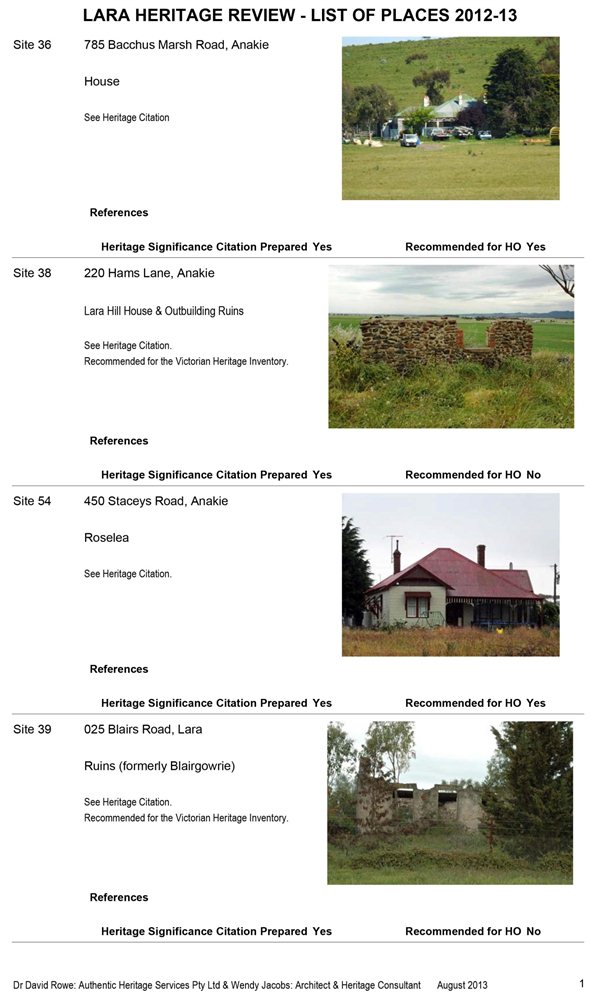
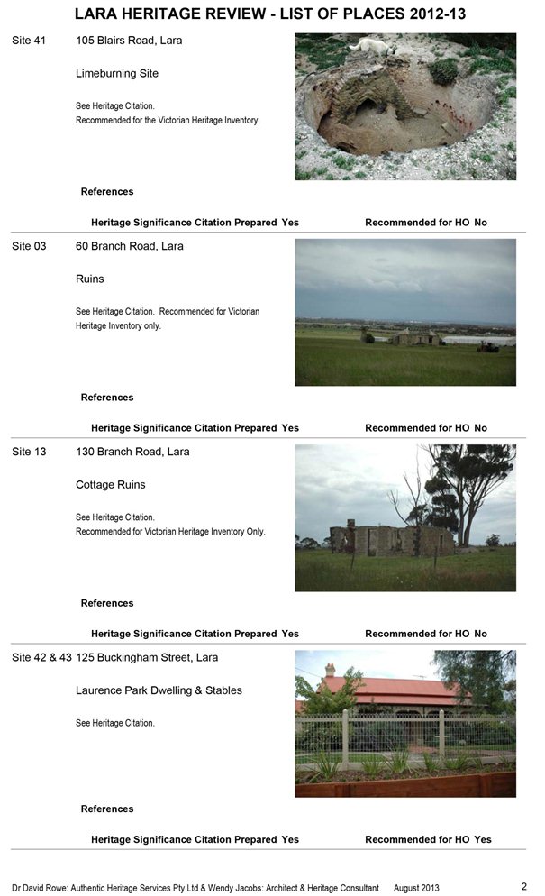
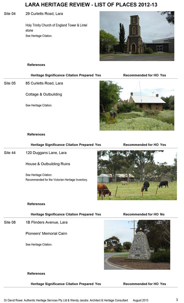
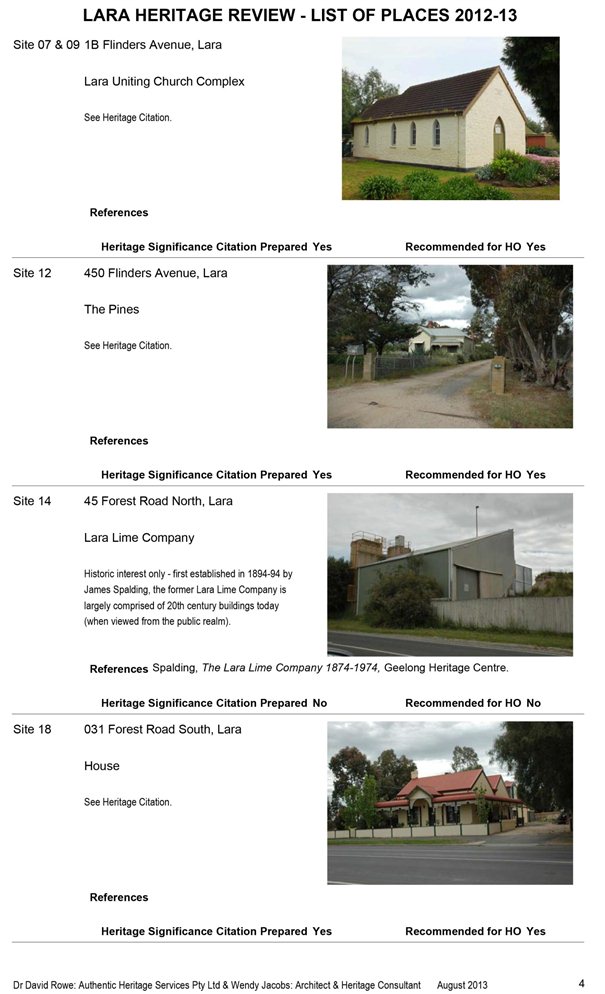
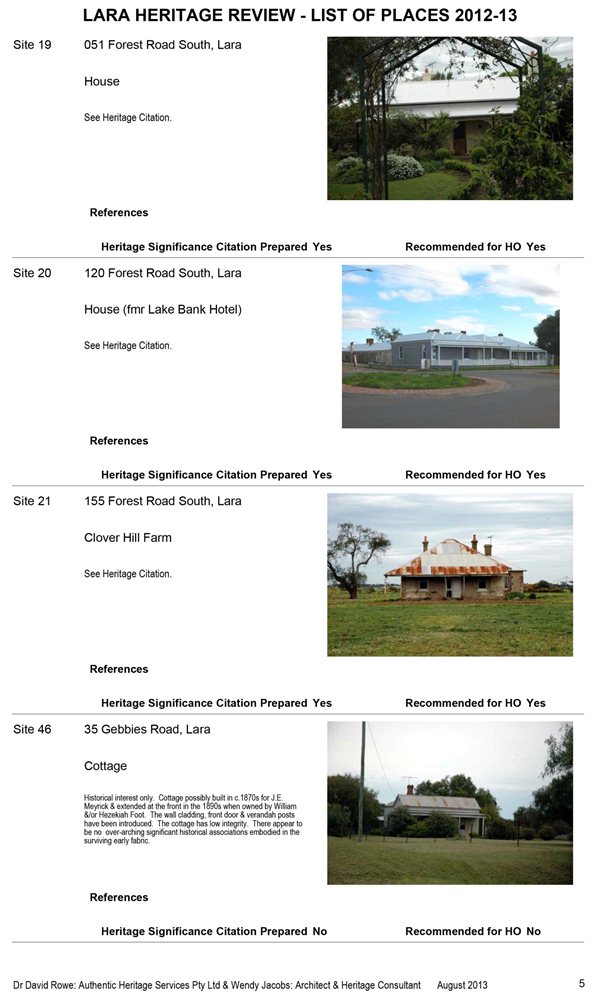
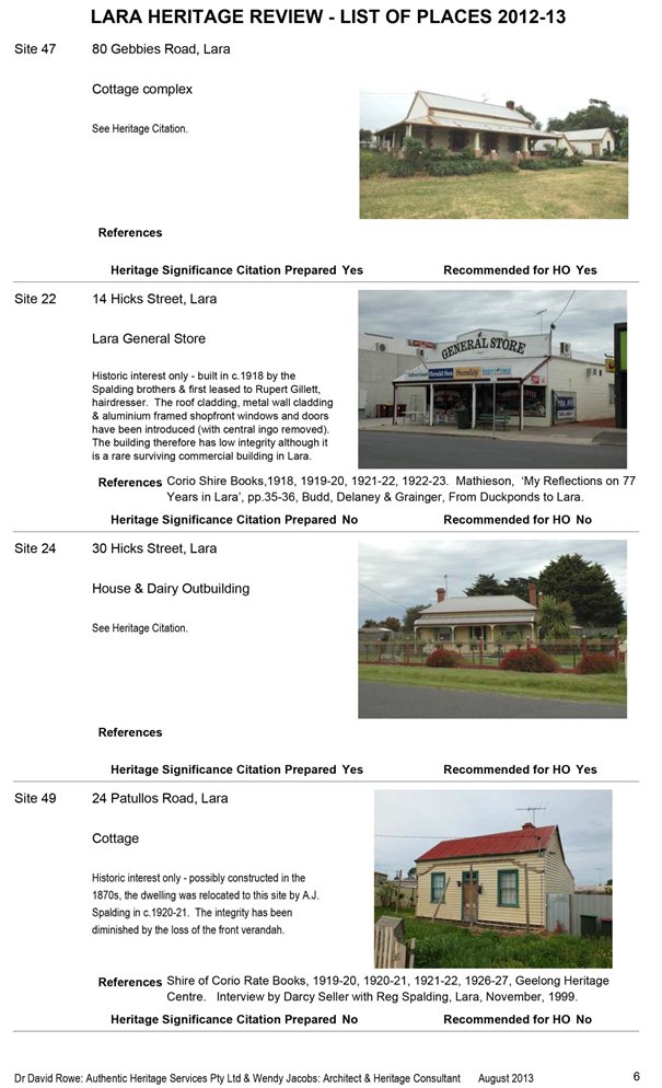
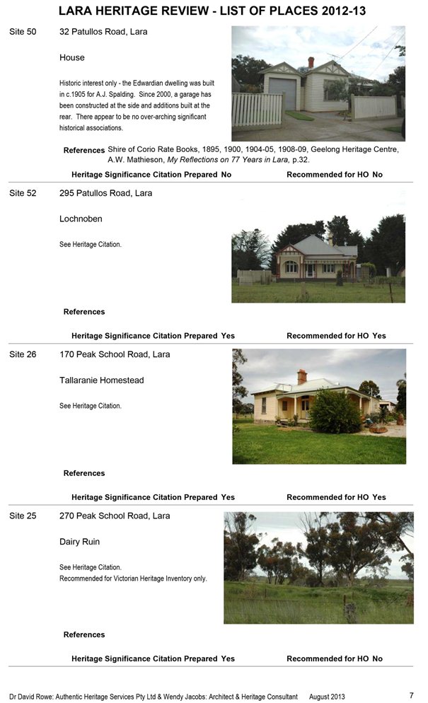
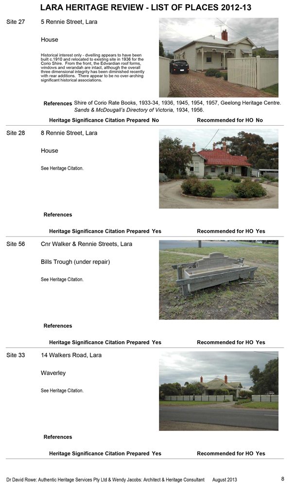
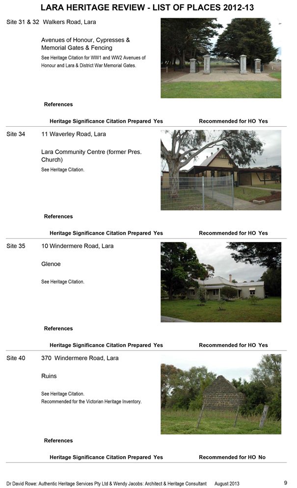
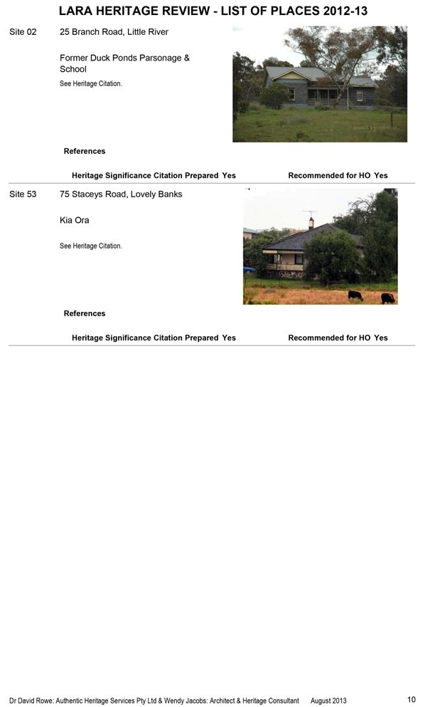
Portfolio: |
Environment and Sustainability - Cr Richards |
Source: |
City Services - Environment and Waste Services |
General Manager: |
Gary Van Driel |
Index Reference: |
Environment |
To seek Council endorsement to publicly exhibit the draft Environment Management Strategy.
Strategic direction for Councils environment and sustainability programs has been derived from the Environment Management Strategy 2006-2011 (EMS).
A new draft Environment Management Strategy has been developed.
The development of the draft Strategy has been overseen by an Advisory Committee consisting of Council, community groups and government departments and agencies.
Input for the new draft Strategy has been sought from Council staff, community and government departments and agencies.
A community survey was undertaken with 175 individuals and community groups responding to questions about the regions environmental future. The respondents provided over 7000 comments to the various questions.
A staff survey was undertaken with 72 staff providing 781 comments to the questions.
A biodiversity and landscape protection workshop was attended by 26 environment groups as well as government departments and agencies, attracting over 50 attendees in total.
A clean technology workshop was attended by representatives from industry, business and educational sectors, including peak bodies such as the Geelong Manufacturing Council.
A series of draft strategies have been provided to key stakeholders, including the Advisory Committee seeking feedback and refinement of the draft Strategy.
The draft Strategy is now recommended to be placed on public exhibition for a six week period enabling the wider community the opportunity to assess the Strategy and provide comments.
Cr Richards moved, Cr Harwood seconded -
That Council:
notes Development of the next Environment Management Strategy;
notes the community consultation undertaken to-date including high level of interest from environment and other groups;
support the public exhibition of the draft Environment Management Strategy for a six week period.
Carried.
The City of Greater Geelong has acknowledged the importance of environmental management for many years and this led to Council adopting its first Environmental Management Strategy in 1999. Council re-confirmed its commitment to sustainability and sound environmental management in Geelong by adopting the Environment Management Strategy 2006-2011 (EMS). This EMS covered many topics and listed Achievements’, ‘Objectives’, ‘Targets’ and ‘Actions’ for each of the topics. Topics within the EMS included;
Council Policy, Programs & Planning
Education and Partnerships
Biodiversity Management
Sustainable Agriculture
Coastal and Marine
Waterways and Wetlands
Air Quality
Resource Use
Waste, Recycling and Reuse
Urban Settlements
In addition to the two EMS documents (1999 as well as 2006-2011) Council has adopted various additional strategies which were either identified as priority actions within the two EMS documents and/or further assist with setting strategic environment and sustainability directions. These strategies include;
Biodiversity Strategy
Geelong Wetland Strategy
Greenhouse Response
Climate Change Adaptation Strategy
The Environment Management Strategy 2006-2011 identified 223 actions, involving a large number of key participants, with the City taking the lead role in directing and facilitating environmental reform. To-date approximately 75% of the actions within this EMS have been implemented. Work is ongoing to continue to implement actions within the EMS 2006-2011 including development and implementation of a Sustainable Buildings Policy, Pest Plant and Animal Strategy, reducing corporate greenhouse emissions, enhancing relationships with key stakeholders and incorporating sustainability throughout the organisation via the ‘EcoChallenge’ program.
Since the development of City’s Environment Management Strategy 2006-2011 issues have arisen that were not given adequate consideration in the strategy, for instance climate change. In addition Council has undertaken considerable amounts of strategic work in other areas which need to be incorporated into the next Environment Management Strategy. With the expiry of Council’s EMS 2006-2011 work began in 2012 on the development of Councils next Environment Management Strategy. It is anticipated that this document will continue many of the actions and strategic directions set out in the previous document as they continue to be relevant and ongoing.
Environment Management Strategies (EMS) are seen as a strategic vehicle by which local governments can plan and prioritise the development and delivery of services and support for environment programs to enhance sustainable environmental, economic and social outcomes. In particular, environmental management strategies facilitate local government’s ability to work in partnership with the community to improve environment and community outcomes by;
increasing support for environment programs
improving access to services, support and opportunities for participation
providing a framework and facilitate integration between various Council and community environment initiatives
increasing the responsiveness of services and efficient use of other resources, by identifying service integration and collaboration opportunities
promoting environment areas and programs as important to local communities
maximising resources and undertaking long-term planning for environment programs including the development and evaluation of services, activities and facilities which enable Council to make more informed and strategic decisions about future needs and priorities
providing a mechanism to respond locally to national, state and regional environmental objectives; and
providing a framework for monitoring and reporting around environmental issues and outcomes.
Following an Expression of Interest process, Russell Fisher, Managing Director of Sustainability in Mind was selected to assist with the preparation of Strategy. Russell has extensive experience in the environmental and education fields, including development of environment strategies for Councils and state government departments as well as previously holding roles such as President of Environment Victoria and board member of the Alternative Technology Association.
An Advisory Committee was created to oversee and provide assistance and direction with the development of the new Strategy. The Committee consists of;
A Councillor, being the Environment Portfolio Councillor, or his or her proxy, should the Portfolio Councillor be absent
General Manager City Services
Manager - Environment and Waste Services
One representative from each of the following authorities: Department of Sustainability & Environment (DSE), Department of Primary Industries (DPI), Environment Protection Authority (EPA), Barwon Water, Sustainability Victoria & Corangamite Catchment Management Authority (CCMA)
One representative from the Geelong Environment Council
One representative from the Geelong Field Naturalists Club
One representative from the Geelong Sustainability Group
One representative from the Barwon Regional Waste Management Group
One representative from the Wathaurung Aboriginal Corporation
One of the first tasks for the consultant was the development of a Discussion Paper. The purpose of the Paper was to gain input from the Advisory Committee (and subsequently staff and broader community) on the following topics and questions raised in the paper;
Role of Council
State of the Greater Geelong Environment
Future Trends & Issues
Council’s Approach to Environmental Sustainability
Implications for Strategic Directions
Extensive consultation has occurred to-date. A Council staff survey was undertaken in July/August 2012. The purpose of the survey was to canvass staff views on how their work is connected to environmental issues, and what information and support is needed by staff to contribute to Council’s overall environmental efforts. Seventy-two staff responded, providing 781 comments/answers to the questions.
A community survey was undertaken in November 2012 which asked respondents to answer a series of questions relating to the regions environment future. The survey sought to identify community concerns, what local environment features the community values, ideas and opportunities as well as what is currently working. One hundred and seventy five individuals and community groups responding to questions about the regions environmental future. The respondents provided over 7000 comments/answers to the questions.
A biodiversity and landscape protection workshop was held in late November 2012. The workshop was attended by 26 environment groups as well as government departments and agencies, attracting over 50 attendees in total. The primary objectives of the workshop were to;
Identify key trends & issues affecting land use, land management & biodiversity in the COGG
Assess implications of these and identify clearly the role of Council
Identify ideas for strategic direction for Council and priorities for action and innovation
A clean technology workshop, organised in conjunction with Councils Planning Strategy and Economic Development unit, was held in December 2012. This was attended by representatives from industry, environment, business and educational sectors, including peak bodies such as the Geelong Manufacturing Council. The primary objectives of this workshop were to;
Learn about the strategic trends and issues for clean technology innovation
Focus on opportunities for clean tech innovation in CoGG
Develop action plans for network clusters for clean tech industries, services and green buildings
Further consultation has been undertaken by via facilitated meetings with key community groups, such as the Barwon Heads Sustainability Group.
The surveys, workshops and meetings have provided a wealth of information upon which the draft Environment Management Strategy has been developed. Major topics of concern, interest and/or action identified to-date include;
Reducing pollution and greenhouse gas emissions
Preserving and protecting biodiversity
Sustainable development
Waste disposal and recycling
The need for partnerships across environment groups, agencies etc
Air quality
Food security (growing food locally)
Maintain and expand open space
A series of draft strategies have been provided to the Advisory Committee seeking feedback and refinement of the draft Strategy. The general feedback has been that the Committee is happy with the document. Changes that have been made (or will be examined) to the draft Strategy following feedback include;
Greater emphasis on biodiversity to reflect the importance of this to the public and as a result of only 5% of the original extent of pre European settlement vegetation remaining.
Ongoing examination as to whether the Strategy can be incorporated as a referral document in the Planning Scheme.
That the notion of Intrinsic values be added to ensure that flora and fauna and biodiversity is not valued solely for what it contributes to the economy or standard of living.
Consider a stewardship program to deliver extension services using the Trust for Nature program as a model.
The new draft Strategy incorporates the environmental sustainability principles from One Planet Living (www.oneplanetliving.org). These are an internationally recognised set of principles increasingly being adopted by local governments across the world. The ten One Planet principles provide a practical and measurable framework that allow Councils to examine the environmental sustainability challenges we face and to develop action plans that enable us to live and work within a fair share of the earth’s resources.
The ten principles are;
 |
Zero carbon |
Making buildings more energy efficient and delivering all energy with renewable technologies |
 |
Zero waste |
Reducing waste, reusing where possible, and ultimately sending zero waste to landfill |
 |
Sustainable transport |
Encouraging low carbon modes of transport to reduce emissions, reducing the need to travel |
 |
Sustainable materials |
Using sustainable healthy products, with low embodied energy, sourced locally, made from renewable or waste resources |
 |
Local and sustainable food |
Choosing low impact, local, seasonal and organic diets and reducing food waste |
 |
Sustainable water |
Using water more efficiently in buildings and in the products we buy; tackling local flooding and watercourse pollution |
 |
Land use and wildlife |
Protecting and restoring biodiversity and natural habitats through appropriate land use and integration into the built environment |
 |
Culture and community |
Reviving local identity and wisdom; supporting and participating in the arts |
 |
Equity and local economy |
Creating bioregional economies that support fair employment, inclusive communities and international fair trade |
 |
Health and happiness |
Encouraging active, sociable, meaningful lives to promote good health and well-being |
The implementation of the new EMS will have considerable environment and sustainability benefits for the community as well as natural and built environments.
It is envisaged that implementation of the new EMS will assist Council efforts to;
Increase community awareness, confidence and knowledge of energy and water conservation and waste minimisation
Preserve and enhance biodiversity
Reduce sources of carbon and other greenhouse gas emissions
Ensure compliance with relevant policy and legislation
Improve marine and freshwater habitats
Improve urban and rural water quality
Enhance sustainability features of new urban developments
Assist maintenance and development of sustainable agriculture
Improve air quality
Once completed the new EMS will have a range of actions, it is anticipated that many of these will be built into normal business operations. Any additional funding for specific actions can be considered by EMT and Council through normal budget processes.
It is important that the EMS is updated to take into account new State and Federal policy and legislation. A new EMS is likely to identify areas of further policy development to be undertaken by Council.
The development and maintenance of the EMS is an important component of meeting Council’s Corporate Plan (City Plan 2013-2017) objectives, in particular ‘Partnering with our community to protect and enhance our natural ecosystems and to encourage sustainable design and reduced resource consumption.’
No officer has a direct or indirect interest in this report.
Audit Advisory members are to be cognisant of the requirement to complete primary and secondary returns upon being elected to the committee. This will ensure a breach of the Local Government Act 1989 is avoided.
A review of the AAC Terms of Reference and Internal Audit Charter documents will be undertaken every three years or when the need arises.
N/A
N/A
The updated documents will be made available on the Cityweb.
Portfolio: |
Environment and Sustainability - Cr Richards |
Source |
City Services - Environment and Waste Services |
General Manager: |
Gary Van Driel |
Index Reference: |
Subject: Council Reports 2013 |
The purpose of this report is to provide a summary for Council of the Victorian Coastal Strategy which the Victorian Coastal Council has issued for comment until December 4, 2013. The report provides an explanation of the Strategy and recommends the specifics of a submission to be lodged to the Draft Strategy.
The Victorian Coastal Strategy sets the framework for how we plan and manage the coast. The Coastal Management Act 1995 requires the Strategy to provide for the long-term planning of the Victorian coast for protection of significant environmental features, direction for future use, identify suitable areas for development and ensure sustainable use of natural resources.
The purpose of the Strategy are: 1. To provide guidance for agencies and statutory decision-making along the coast and marine and estuarine environments, 2. Establish a framework for the development and implementation of other plans such as Coastal Action Plans and Coastal Management Plans and a coastal context for the development of related strategies like Regional Catchment Strategies, planning schemes and Regional Waterway Strategies, 3. Engage the community to value the coast and marine environment and to participate in its planning and management.
The Victorian Coastal Strategy introduces a Hierarchy of Principles: 1 Value and Protect – Provide for the protection of significant environmental and cultural values, 2 Plan and Act – Undertake integrated planning for the future and provide clear direction for the future), 3 Use and Enjoy – Ensure the sustainable use of natural coastal resources and ensure development on the coast is located within existing modified and resilient environments where the demand for development is evident and the impact can be managed.
The Strategy further outlines six key issues, each with detailed specific directions. The issues are:
Build capacity to adapt to a changing climate and increased coastal hazards.
Financing coastal infrastructure and management.
Managing population growth and impact of increased visitation along the coast.
Improve understanding of the value of natural resources.
A more integrated and holistic approach for planning and managing the coastal and marine environments.
Ensure a balance between local community, regional and state wide decision making authority.
Cr Richards moved, Cr Ellis seconded -
That Council endorse the response detailed in Appendix 7-1 to be sent to the Victorian Coastal Council as Council’s submission to the draft Victorian Coastal Strategy 2013.
Carried.
The Victorian Coastal Strategy sets the framework for how we plan and manage the coast. The Coastal Management Act 1995 requires the Strategy to provide for the long-term planning of the Victorian coast for protection of significant environmental features, direction for future use, identify suitable areas for development and ensure sustainable use of natural resources.
The Strategy sets out long-term vision, identifies key issues and principles, establishes policies to guide decision making.
The purpose of the Strategy is to:
Provide guidance for agencies and statutory decision making along the coast in marine and estuarine environments.
Establish a framework for the development and implementation of plans such as Coastal Action Plans and Coastal Management Plans and coastal elements of Regional Catchment Strategies and Regional Waterway Strategies, and planning schemes.
Engage with the community to designate values on coastal assets and participate in planning and management.
Coastal Planning and Management Framework
The Coastal Management Act 1995 (the Act) establishes the legislative framework for planning and managing the coast of Victoria. The Act enables a four tiered approach with policies, plans and tools at a state, regional, local and site level.
The broader land use planning system is also important for the implementation of the Strategy, Coastal Action Plans and Coastal Management Plans. The relationship between these policies and plans is through:
State Planning Policy Framework
Sections of the local planning schemes
Planning and Environment Act 1987
The Coastal Settlement Framework included in previous VCS is largely removed and captured in Regional Growth Plans.
KEY ISSUES
The Victorian Coastal Council has identified and prioritised six issues that it aims will be implemented over the next five years, these are:Build capacity to adapt to a changing climate and increased coastal hazards.
Financing coastal infrastructure and management.
Managing population growth and impact of increased visitation along the coast.
Improve understanding of the value of natural resources.
A more integrated and holistic approach for planning and managing the coastal and marine environments.
Ensure a balance between local community, regional and state wide decision making authority.
The Victorian Coastal Strategy establishes a hierarchy of principles, these are Value and Protect, Plan and Act, Use and Enjoy.
Value and Protect, includes:
Appreciating and valuing the coast
Cultural heritage
Marine environments
Wetlands and estuaries
Onshore environments
Catchments and water quality
Plan and Act, includes:
Supporting community participation
Sustainable coastal settlements
Coastal Hazards and Natural Coastal Processes
Balancing decision making
Research and knowledge sharing
Emergency management
Use and Enjoy, includes:
Sitting and design of buildings and infrastructure on the coast
Visitation and tourism
Access on the coast
Boating and water based activities
Sustainable ports
Fishing and aquaculture
Coastal energy resources
There are a number of internal Council Divisions and Departments as well as a range of external stakeholders.
Internal:
The VCS has the potential to impact a range of Council departments from multiple divisions and it is important that feedback be provided on the draft Strategy.
External:
The City of Greater Geelong associates itself with a number of organisations, in particular Municipal Association of Victoria (MAV) and Association of Bayside Municipalities (ABM). These organisations have informally approached Council to provide a coordinated response to the draft VCS, however Council has opted to provide separate comment.
Department of Environment and Primary Industries (DEPI), Environment Protection Authority (EPA), Barwon Water, Sustainability Victoria, Parks Victoria & Corangamite Catchment Management Authority (CCMA)
Central Coastal Board
Port Authorities / industry
Barwon Coast Committee of Management
Bellarine Bayside Coast Committee of Management
Association of Geelong & District Angling Clubs
Geelong Environment Council
Wathaurung Aboriginal Corporation
The Strategy suggests that coastal managers use revenue generated from coastal reserves and facilities to fund coastal protection works, maintain native vegetation and control weeds.
The Strategy suggests that coastal managers establish business models to assist with funding coastal protection works, establishing and maintaining facilities and infrastructure. Due to the nature of the coastal areas that Council manages there are limited opportunities to raise revenue. The only foreshore camping / caravan park managed by Council is the Breamlea Holiday Park which incurs a cost for Council to operate. The most obvious opportunity lies with Council’s boat launching facilities which currently can be used free of charge.
The Strategy states that the Crown does not have an obligation to reduce the impacts of coastal hazards, sea level rise and other natural processes on private property, however State Planning Policy that is in part formulated through strategies such as the VCS directs planning decisions made by Council. This has the potential to implicate Council in terms of litigation, approvals are granted based on planning policies that are directed by the adoption of recommendations that are part of the VCS.
This report aligns to City Plan in that within the Sustainable Built and Natural Environment it states that over the next four years we will see ongoing services and new initiatives to enhance and protect natural areas and ecosystem health. We will undertake environmental protection and management programs for coastal protection and management. The report also aligns with Community well being, in particular healthy environments.
No council officers involved in this project or report have declared a direct or indirect interest in this matter.
Moderate risks have been identified for Council in the Draft VCS, these include:
There are no clear policy directions associated with the introduction of an additional sea level rise benchmark of 0.4m by 2070, this may introduce more uncertainty and further complicate planning matters.
The VCS identifies a policy for decision making that may implicate Council in terms of legal liability due to the fact that in that in the past Council has approved planning applications in areas potentially vulnerable to coastal hazards.
The move from localised CAPs to regional CAPs will place greater need on the revision of Coastal Management Plans, all of CoGGs CMP are due for review in the next 1-2 years.
A range of actions which identify Local Government as lead agents for implementing state strategy directions.
Community expectations in terms of coastal access and recreational opportunities are not always met.
There are no adverse social implications as a result of Council making a submission to the Victorian Coastal Strategy. It is considered important that a submission addressing the above mentioned issues be lodged to ensure that the broader social, community benefits, which might flow from the Victorian Coastal Strategy are taken into consideration in its final adoption.
There is no requirement for any further consideration by Council in relation to the Human Rights Charter, with consultation and engagement the responsibility of the State Government in respect to the Victorian Coastal Strategy.
The Council’s submission in relation to the Victorian Coastal Strategy should be broadly communicated to stakeholders and interested parties across Geelong to ensure that Council’s position in relation to the Strategy is clearly understood.
The City of Greater Geelong notes the release of the Draft Strategy “Victorian Coastal Strategy” and welcomes the opportunity to provide a submission.
The City of Greater Geelong recognises that the Victorian Coastal Council has undertaken a comprehensive piece of work which will provide clear and detailed guidance for government, local government and other stakeholders to manage the Victorian coastal jurisdiction, and offers clear recognition of the role that Local Government and Foreshore Committees of Management play in Victoria.
The Draft Victorian Coastal Strategy 2013 fails to adequately address emerging issues with very little reference to planning and adaptation.
The learning’s from the three previous Victorian Coastal Strategies have not been articulated and there is a lack of commentary on how some of these issues have been addressed.
The Hierarchy of principles appear to be too simplistic and do not provide sufficient detail in relation to equity and emphasising the coast as a limited resource.
This section relates to setting sea level rise benchmarks associated with timeframe projections, however there are no clear policy directions associated with the 0.4m by 2070 benchmark. The City of Greater Geelong is concerned that this benchmark in addition to the other two, which have been adopted as part of planning policy, may introduce more uncertainty and further complicate planning matters. We request that the existing two benchmarks remain unchanged and the third identified in this draft of the VCS is omitted.
The City of Greater Geelong suggests that the results of the IPCC Fifth Assessment Report be considered given that its release is imminent.
The desired outcome, dot point 1, “Natural Coastal Processes are adopted as the preferred form of defence against possible impacts of a changing climate,” is unclear and requires further explanation in relation to its context and in reference to the associated benefits.
The desired outcome, dot point 2, “New development (and alterations to existing development) avoids areas subject to coastal hazards and does not interfere with natural coastal processes.” We suggest that this outcome also consider using a risk management approach, in particular to alterations in relation to existing development.
With increases in Victoria’s permanent coastal population of more that 100,000 over the past 10 years along with increased of tourism and visitation as well as the temporary resident population being up to five times higher that the permanent population during peak holiday season, the City of Greater Geelong suggests that the VCS place greater emphasis on this key issue.
The VCS recognises that a growth in visitors to the coast can result in increased economic activity and create local jobs, what it fails to recognise is the fact that many business are almost totally dependent on peak times to cover outgoings for the majority of the year and that jobs are not sustainable all year round.
The City of Greater Geelong suggests that the VCS explore a range of ways coastal land managers can manage this seasonal “boom / bust” cycle and identify appropriate and compatible activities along our coast and promote innovative access strategies.
The fact that the VCS identifies that research on the capacity of entities to fund coastal management actions and future adaptation is required is welcomed.
It is the view from State Government that committees of management, including Local Government, are able to finance coastal management actions from revenue received from users of foreshore camping grounds and boat launching facilities, this is not the case within the City of Greater Geelong where the only foreshore camping / caravan park we manage is the Breamlea Holiday Park which incurs a cost for Council to operate.
The high cost to Coastal Committees of Management of managing the upgrades of coastal caravan parks and camping areas to meet demand in context of private provider decline was a major infrastructure funding issue identified in the G21 Regional Growth Plan – Implementation Plan.
Council does not charge for the use of its boat launching facilities and would like to see a recommendation in the VCS that the review of the Boating Coastal Action Plan endorse a consistent approach across the state in terms of scheduling fees.
Action 1 – not sure if local government should be the lead agent for scheme changes relating to cultural heritage identification.
The vast area of Victoria’s marine jurisdiction and complexity associated with the ecosystems these support warrants greater attention, this appears to be beyond the capacity of the VCS to address in the detail required.
Policy 8 for Policy for Decision Making "The Crown does not have an obligation to reduce the impacts of coastal hazards, sea level rise and other natural processes on private property."
This policy concerns the City of Greater Geelong as it may implicate Council in terms of legal liability due to the fact that in that in the past Council has approved planning applications in areas potentially vulnerable to coastal hazards.
With the move from locality based Coastal Action Plans to a regional approach at a higher strategic level the City of Greater Geelong anticipates that additional work will fall to Council in terms of preparing coastal management plans.
Coastal land that is capable of developing sustainable revenue streams in the Geelong region is generally under the management of two foreshore committees of management. The City of Greater Geelong has limited opportunities to develop business models other than some land it manages adjacent to industrial port operations.
This section fails to identify appropriate business models that align with operations and / or industries that land managers are able to derive a revenue stream.
Action 1 under– question whether LG should be the lead in identifying tourist development sites within Regional CAP’s and subsequently implementing them in scheme if much of the land involved will be crown land.
Portfolio: |
Planning - Cr Macdonald |
Source |
Economic Development, Planning and Tourism |
General Manager: |
Peter Bettess |
Index Reference |
Council Reports 2013 |
This report seeks Council’s endorsement of the Low Density Residential Zone Review and support for the preparation of a planning scheme amendment to introduce the recommendations into the Greater Geelong Planning Scheme.
In July 2013 the Planning Minister introduced changes to planning controls in all Victorian Planning Schemes including zone reform.
The reforms included amending the Low Density Residential Zone (LDRZ) to allow a reduction in the minimum lot size from 0.4 hectares to 0.2 hectares in areas where sewer is available.
Officers have prepared a report on the various LDRZ areas in the municipality and have made recommendations in relation to the appropriateness of a 0.2 hectare minimum lot size in areas with reticulated sewerage.
The LDRZ is generally applied to areas on the fringes of existing townships in the municipality that are constrained for conventional residential development by environmental or infrastructure limitations, particularly drainage.
The Greater Geelong municipality has approximately 1076 LDRZ lots across 19 different areas. Fifteen of these areas have access to sewer. Within these areas a total of 592 lots are over 0.4 hectares.
The review found that there are significant drainage issues within many of the LDRZ areas. Therefore to allow the minimum subdivision area to be reduced to 0.2 hectares across all sewered LDRZ areas within Geelong would have significant drainage impacts for the broader drainage catchment.
Other issues affecting the further subdivision of LDRZ areas include flooding and the potential loss of significant vegetation.
Of the 15 areas with connection to sewer, 5 of them are recommended to have the minimum subdivision area reduced to 0.2 hectares.
Cr Nelson moved, Cr Macdonald seconded -
That Council:
receives the Low Density Residential Zone review report;
supports the preparation and exhibition of an amendment to the Greater Geelong Planning Scheme to implement the findings of the Low Density Residential Zone review report, including to:
specify minimum subdivision areas of 0.4 hectares for land identified in Table 1 of this report, with a variation to specify area 19, City View Drive, Wandana Heights as having a 0.4 hectare minimum subdivision area and;
make changes to Clause 22.04 Discretionary Uses in Rural Living and Low Density Residential Areas to improve decision making;
requests the Minister for Planning authorise the preparation of an amendment as detailed above.
Carried.
In June 2011 the Planning Minister commissioned the Victorian Planning System Ministerial Advisory Committee to examine all aspects of the planning system, including possible zone reform.
Council made a submission to DPCD in April 2013 formally requesting that ‘the schedule to the LDRZ for Greater Geelong be amended to limit subdivision to 0.4 hectares for all lots’ as an interim measure to allow Council to undertake a proper investigation to fully test and assess the merits of reducing the lot size in particular locations.
The government released ‘Reformed Residential Zones for Victoria – A discussion paper on reforming Victoria’s Planning Zones’ in July 2013. This report considered the advisory committee’s recommendations and individual submissions and proposed to introduce various zone changes, including changes to the LDRZ into the Victoria Planning Provisions.
The reforms amended the Low Density Residential Zone (LDRZ) to allow a reduction in the minimum lot size from 0.4 hectares to 0.2 hectares in areas where sewer is available. A schedule to the LDRZ was also introduced which allows Council to designate the areas where a 0.4 hectare minimum should be maintained.
Officers have prepared a report on the various LDRZ areas in the municipality and have made recommendations in relation to the appropriateness of a 0.2 hectare minimum lot size in areas with reticulated sewerage and where there no other constraints.
The LDRZ is generally applied to areas on the fringes of existing townships in the municipality that are constrained for conventional residential development by environmental or infrastructure limitations, particularly drainage. The proposed change from a 0.4ha to a 0.2ha minimum subdivision area with reticulated sewerage could have a significant impact on these areas.
The Greater Geelong municipality has approximately 1076 LDRZ lots across 19 different areas. Fifteen of these areas have access to sewer. Within these areas a total of 592 lots are over 0.4 hectares. The revised LDRZ provisions would allow a permit to be sought to further subdivide each lot into a minimum of 0.2 hectares. Refer to attachment 1 for a map showing the location of LDRZ areas within the municipality.
This review aims to assist Council in understanding how a reduction in the minimum lot size might impact upon Low Density Zoned land within the municipality. The review provides justification to maintain or reduce the minimum lot size within the LDRZ areas. A report detailing this review can be found at Appendix 8-1.
Each area has been reviewed in the context of existing State and Local Planning Policy, zoning and overlay controls, known drainage and flooding issues, fire prone land, existing lot sizes including the ability to further subdivide and the location of significant vegetation. The review also considered existing policy directions for each area where they have been included within the Planning Scheme or Structure Plans.
The review found that there are significant drainage issues within many of the LDRZ areas. The drainage infrastructure for these areas has typically been designed to accommodate average lots sizes of 0.4 hectares. Drainage often consists of earth swales or cut off drains, directing overland flows to similar low capacity table drains in the road reserve. Increases in hard surface areas through additional dwellings, buildings, paving, driveways etc due to increased lot density can result in significant increases in site coverage, resulting in increased runoff and additional demand on the drainage system.
Therefore to allow the minimum subdivision area to be reduced to 0.2 hectares across all sewered LDRZ areas within Geelong would have significant drainage impacts for the broader drainage catchment areas.
Other issues affecting the further subdivision of LDRZ areas include flooding and the potential loss of significant vegetation.
Of the 15 areas with connection to sewer 5 of them are recommended to have the minimum subdivision area reduced to 0.2 hectares. Table 1 below identifies the recommended minimum subdivision area for each LDRZ area.
AREA NO. |
LOCATION |
|
|
|
Barwon Heads |
|
|
|
1 |
Stephens Parade |
|
|
|
|
Clifton Springs |
|
|
|
2 |
Tanderra Crt |
|
|
|
|
Drysdale |
|
|
|
3 |
|
|
4 |
Huntingdon Street |
|
|
|
|
Lara |
|
|
|
5 |
Archimedes Ave |
|
|
|
6 |
Kees Rd |
|
|
|
7 |
McHarrys Rd |
|
|
|
|
Leopold |
|
|
|
8 |
Barrabool Cres |
|
|
|
9 |
Canowindra Way |
|
|
|
10 |
Melaluka Rd |
|
|
|
|
Moolap |
|
|
|
11 |
Coppards Road – East |
|
|
|
12 |
Coppards Road - West |
|
|
|
13 |
Wilashal Pl |
|
|
|
|
Ocean Grove |
|
|
|
14 |
Bonnyvale Rd |
|
|
|
15 |
Belle Vue Dr |
|
|
|
16 |
Coolamon Cl |
|
|
|
17 |
Woodlands |
|
|
|
|
Portarlington |
|
|
|
18 |
Smythe St |
|
|
|
|
Wandana Heights |
|
|
|
19 |
City View Dr |
|
|
Table 1 – Overall Recommendations
The proposed changes to the schedule of the LDRZ would help to minimise any environmental Impacts on drainage catchment by limiting any increase in lot density to only areas with capacity to accommodate an increase in stormwater flows. The minimum lot size in areas with significant vegetation will remain at 0.4 hectares to ensure there is a minimal loss of vegetation.
The recommendations of this report will form the basis of a Council initiated planning scheme amendment to make changes to the LDRZ and associated planning policy. There will be future costs associated with conducting a planning scheme amendment process which can be accommodated within the existing planning scheme amendments budget.
This review has been initiated by the State Government’s Residential Zone Review process. This report has considered the proposed changes to the LDRZ in the context of State and Local Planning Policy. The proposed recommended changes to the LDRZ are considered to be consistent with both State and Local Planning Policy.
The changes to the LDRZ will increase the number of LDRZ lots within Geelong, increasing additional residential land supply. Supporting an increase in lot density in a number of existing LDRZ areas will help to reduce urban sprawl and maintain an appropriate supply of larger life style type properties without significantly impacting on the environment or Council assets.
No Council officers involved in the development of the review and preparation of this report have a direct or indirect interest in the issue, in accordance with Section 80(c) of the Local Government Act, to which this report relates.
There is considered to be a limited risk in implementing the review recommendations. The recommendations will result in changes to planning controls including changes to the LDRZ schedule and associated planning policy.
The planning scheme amendment is unlikely to result in any adverse social impacts on adjoining land owners. A planning permit will be required to subdivide land. Council and adjoining land owners will be given an opportunity to assess any adverse amenity impacts on the surrounding area.
There are no issues in relation to the Human Rights Charter with the implementation of Review and proposed amendment process.
This review will form the basis of a planning scheme amendment. As part of the planning scheme amendment, affected properties will be notified of the proposed changes to the LDRZ and will be given an opportunity to make a submission to the amendment process.
Map 1 – Location of the Low Density Residential Zone in Geelong and on the Bellarine Peninsula
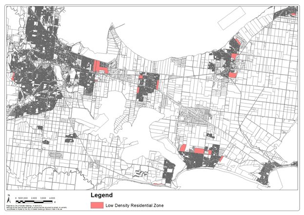
Map 2 – Location of the Low Density Residential Zone in Lara
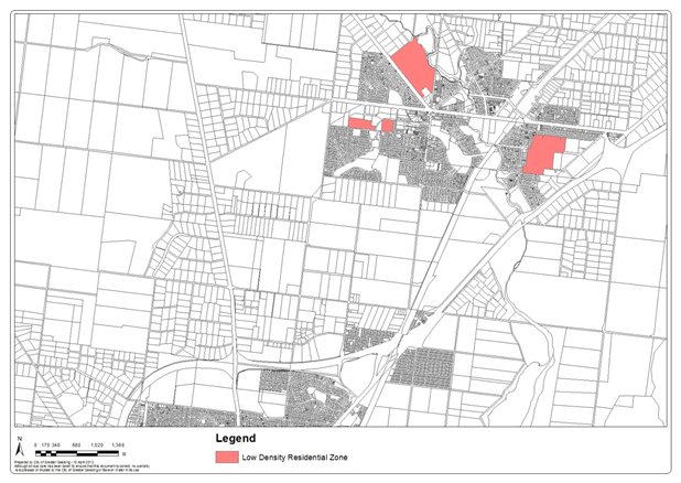
Portfolio: |
Governance – Cr Lyons (Mayor) |
Source: |
Office of Chief Executive Officer |
General Manager: |
Stephen Griffin |
Index Reference: |
Commitees: Committee for Geelong |
To acknowledge the Committee for Geelong‘s Annual Report for 2012 and to review Council’s membership.
In 2001 Council was a foundation member of the Committee for Geelong.
Since that time Council continued to be a member, first as Foundation Member and more recently as an Executive Member until the membership expired on 14 November 2013.
The Committee for Geelong’s has recently announced changes to its corporate structure.
Councils membership has expired as at 14 November 2013.
Cr Harwood moved, Cr Ansett seconded -
That Council:
receives the Committee for Geelong’s Annual Report 2012;
notes the implications of the proposed changes to the Committee for Geelong’s corporate structure for members; and
advises the Committee for Geelong that there will no longer be a need for Council to continue its membership of the Committee under their new corporate structure.
Carried.
Division Requested:
For: Crs Ansett, Ellis, Farrell, Fisher, Harwood, Heagney, Irvine, E Kontelj, S Kontelj, Lyons, Macdonald, Nelson, Richards
Against: Nil
Formed in 2001, the Committee for Geelong now aims to develop Geelong’s social, economic cultural and environmental prosperity, focussing on establishing the ‘foundations on which the region can thrive’.
Members include local businesses, individuals, local governments, and representatives of community organisations.
Council was a foundation member and has maintained membership until 14 November 2013.
A copy of the Committee for Geelong’s December 2012 Annual Report is attached. The report includes:
A report from the Chair
A report from the Executive Director
A list of the members of the Executive Board and Board.
Details regarding events, delegations and visits.
There are no financials provided with the report.
Council’s membership expired on 14th November 2013.
Following the upcoming Annual General Meeting of the Committee for Geelong, a Special General Meeting is being held where the membership will resolve whether to convert their Association to a public company limited by guarantee named Committee for Geelong Limited and adopt the constitution presented.
The proposed Objects of the Company are as follows:
The Company will have an independent group of member organisations who wish to work together to leverage the economic potential of the Geelong region to achieve the best long-term outcomes enabling Geelong to become a world-class city. The Company will make connections and create opportunities to help deliver positive social outcomes for Geelong and develop a vital, inclusive, progressive, smart and sustainable Geelong for the future.
The principal purposes for which the Company is formed are to act as a catalyst for economic development and innovation, the development of infrastructure and capacity and civic leadership and advocacy in Geelong, using the skills, experience, interests and networks of its Members to stimulate projects that will benefit Geelong and its citizens and to otherwise carry on the works and purposes of the Committee for Geelong Inc,…………..
The proposed Constitution also notes that current members of Committee for Geelong Inc will become members of Committee for Geelong Limited. It states that members will be drawn from the Geelong region and have an interest in furthering the objects of the company. It further suggests it is contemplated that Member Representatives will be persons of standing in the community of Geelong who by their expertise and standing shall be in a position to further the objects of the Company.
In the proposed Constitution, the Strategy and Policy Committee will have responsibility for the business and affairs of the Company, including appointing the Chief Executive Officer (formerly the Executive Director), and is made up of the Directors of the Company, the Member Representative of any Executive Member and at least six other Member Representatives as the Committee may determine who are elected at the Annual General Meeting of the Company. It is the Strategy and Policy Committee that determines the annual membership fee and levels of membership.
In the proposed Constitution, Members’ liability is limited and every Member undertakes to contribute to the assets of the Company in the event of it being wound up, to pay for the debts and liabilities of the Company, and not exceeding fifty dollars. No profits or otherwise can be shared by Members.
There are 4 levels of membership as follows:
Executive Members
Available to individuals and senior management of businesses within the Geelong region
ember of the Committee Board
Invitation to “Board Room” briefings
Opportunity to Chair a Taskforce
Cost of annual membership $22,000 + GST
Ordinary Members
Available to individuals and senior management of businesses within the Geelong region
Invitation to “Board Room” briefings
Opportunity to join a taskforce
Eligible for election to Board
Cost of annual membership $3,300 + GST
Local Government Members
Available to City of Greater Geelong, Surf Coast and Golden Plains Shires and Borough of Queenscliffe
Occasional invitation to “Board Room” briefings
Opportunity to join a taskforce
Eligible for election to Board
Cost of annual membership quoted as $11,000 +GST
Community Members
Available to not-for-profit organisations, expressions of interest will be sought
Invitation to “Board Room” briefings
Opportunity to join a taskforce
Eligible for election to Board
Cost of annual membership is a Voluntary Contribution – not open.
Council’s membership was originally as a Foundation Member. This was then changed to Executive Member. Council has remained an Executive Member until membership ceased in November this year.
Attached is a summary of Committee for Geelong activities relevant to the last 10 months provided by the Executive Director.
Not applicable.
Depending on the level of membership Council selects, the financial implications are as follows:
| Executive Member | $22,000+GST |
| Ordinary Member | $3,300+GST |
| Local Government Member | $11,000+GST |
As a Member of Committee for Geelong Limited, Council’s liability should not exceed fifty dollars.
The Objects of Committee for Geelong Limited are aligned with the strategic directions of Council’s City Plan.
No Council officers involved in the preparation of this report have any direct or indirect interest in Council’s membership of the Committee for Geelong.
To ensure transparency regarding Council’s membership, the Committee for Geelong’s Annual Report is tabled every year at Council and the Executive Director is available at any time to report on activities and outcomes.
Representatives of Council are members of a number of bodies which advocate on particular issues and / or for the region. The Committee for Geelong is one such body.
There are no known breaches of the Human Rights Charter in assuming membership of the Committee for Geelong.
The City’s membership would be communicated to relevant stakeholders.
The CfG is an independent group of member organisations, working together to leverage the economic potential of the Geelong region. The CfG works to achieve the best long-term outcomes for the region, enabling Geelong to become a world-class city. The CfG makes connections and creates opportunities to help deliver positive social outcomes and develop a vital, inclusive, progressive, smart and sustainable Geelong region for the future. Over the last twelve years, the CfG has worked closely with CoGG in pursuit of these objectives.
Over the past ten months the CfG has been involved in the activities listed below. The CfG believes much of this work has been directly beneficial to the Council:
Visit from the British High Commissioner and British Consul General in January
In February, we hosted international guest speaker Bryan Raine who delivered a keynote presentation on Economic Regeneration at a CfG members’ lunch. The CfG facilitated detailed discussions between Bryan and the Mayor, Portfolio holder for Enterprise Geelong and senior officers in advance of the establishment of Enterprise Geelong.
Also in February, the CfG received the Leaders for Geelong 2011-13 projects. Much of this work has provided input to CoGG such as the LfG ‘Revitalising Central Geelong’ project. We understand that one of the LfG Alumni who co-developed this specific LfG project is now co-ordinating the Central Geelong Task Force work. We are pleased to note that there are two participants on the LfG program from CoGG this year
In April, the CfG met with the Minister for Immigration and Citizenship. Following consultation with CoGG, we provided a detailed briefing on skilled migration and lobbied for the Minister's Gazettal approval for CoGG to become the Regional Certifying Body for the Geelong Region. We understand that this change has since been made.
In June an international delegation of Ambassadors and Consuls General visited Geelong to further their knowledge of the region. The CfG worked closely with CoGG and Geelong Otway Tourism on the visit.
Also in June, the CfG highlighted the opportunity for Geelong to be a host City for regional G20 meetings in 2014. We briefed the Mayor and senior officers and sent a joint CfG/CoGG letter to the Prime Minister to ensure that Geelong was considered
We also worked with CoGG and other CfG members to bring the Minister for Defence, Science and Personnel to Geelong to discuss establishing a Geelong Defence Cluster
The CfG also completed its work chairing the Vision 2 Operational CfG; the project has since been handed over to CoGG. We look forward to an ongoing dialogue about this, including the use of the Vision 2 logo.
In August, CfG developed ‘Geelong is Transforming: Economic Status Report’, a jointly commissioned paper with Villawood and CoGG.
Also in August, the CfG hosted a combined Annual Dinner and Leaders for Geelong graduation, with CEO of Tennis Australia Craig Tiley as keynote speaker. The subject was ‘attracting major events to Geelong’ and the CfG ensured that the Chairman of GME was seated on the top table with VIPs including the keynote speaker, state politicians and the now new federal member for Corangamite.
We also worked with CoGG and other stakeholders to co-ordinate the development and release of the Geelong Port and Land Freight Infrastructure strategy.
In September, the CfG co-ordinated a delegation to Canberra comprising representatives from the TAC and CoGG. This was to provide a presentation to NDIS agency staff encouraging them to move to Geelong.
More recently, the CfG completed its work with the Project Steering Group of the G21 Regional Growth Plan. At the Executive Briefing, the CfG advocated for significant projects to be considered for inclusion such as a Rail Policy for Geelong and the potential for a recreation/tourist lake at Batesford Quarry.
In addition, we have contributed financially to the Future Proofing Geelong Sustainability Directory.
In the coming months we will co-host a Mayoral election forum with GBN and the Geelong Chamber of Commerce.
We will also co-host a Chairman’s lunch on the growing interest in Geelong and have invited CoGG to participate.
Over the last few months we have worked alongside CoGG and other stakeholders to develop a paper on the future of Manufacturing in Geelong. Significantly, the CfG matched the same dollar contribution to the paper as CoGG, which later prompted others to also fund.
The CfG has continued its support of the establishment of an International Ambassadors program. Following various meetings on this issue, we await feedback from senior CoGG officers on the potential for an MOU to further develop the program.
In the future, the CfG will focus on: Economic Development & Innovation, Regional Infrastructure & Capacity, Civic Leadership & Advocacy. The CfG looks forward to CoGG’s continuing involvement in its work.
Portfolio: |
Planning - Cr Macdonald |
Source |
Economic Development, Planning and Tourism - City Development |
General Manager: |
Peter Bettess |
Index Reference |
Application: C302 |
The purpose of this report is to seek Council approval to proceed with the preparation and exhibition of Planning Scheme Amendment C302, subject to authorisation being obtained from the Minister for Planning.
An application has been made by ERM Australia consultants on behalf of Coles Group Property, owner of the subject land.
The application is for a rezoning only of land (in part) at 302-306 Aberdeen Street, Manifold Heights, from Residential 1 Zone to Commercial 1 Zone and to remove the Design and Development Overlay (Schedule 14) which also applies to the land.
The site is currently occupied by a disused service station and located on the north-west corner of the Shannon Avenue and Aberdeen Street intersection.
The zoning of the site is unusual in that half of the title (that half fronting Shannon Avenue) is in the Commercial 1 Zone while the rear portion is in the Residential 1 Zone. DDO14 applies to the residentially zoned portion of the site.
It is accepted practice for zoning boundaries to follow title boundaries. This anomaly has featured in the new format Greater Geelong Planning Scheme since its inception in July 2000. The rezoning application seeks to correct this anomaly in the site’s zoning.
A previous combined rezoning and planning permit application for a packaged liquor shop at the subject site was rejected by Council at its 24 November 2009 Council meeting due to concerns about the availability of liquor on all four corners of the Shannon Avenue/Aberdeen Street intersection.
The same company continues to own the subject land today but have indicated they are no longer proceeding with the liquor outlet.
This application seeks to only partially rezone the land. No permit application accompanies the amendment request.
It is recommended that Council resolve to exhibit the proposed amendment, subject to obtaining the authorisation of the Minister for Planning.
Cr S Kontelj moved, Cr Macdonald seconded -
That Council resolves to support the preparation and exhibition of Amendment C302 to the Greater Geelong Planning Scheme to rezone land (in part) situated at 302-306 Aberdeen Street, Manifold Heights, from Residential 1 Zone to Commercial 1 Zone and delete Design and Development Overlay – Schedule 14 from the part to the rezoned, subject to the authorisation of the Minister for Planning being obtained.
Carried
On 7 August 2013 Council received a planning scheme amendment request from ERM Australia on behalf of Coles Group Property. The application proposed to rezone a portion of the land at 302-306 Aberdeen Street, Manifold Heights, from Residential 1 to Commercial 1 Zone and remove the Design and Development Overlay – Schedule 14 (DDO14) applying to the land.
The subject site consists of one title across the land and common practice is for zoning boundaries to follow title boundaries. Therefore the subject land is considered to have an anomaly in this instance.
A previous combined Planning Scheme Amendment (C209) and Planning Permit Application (PP793/2009 for a proposed packaged liquor shop) at the subject site was considered by Council on 24 November 2009. Council did not support the then officer recommendation to support the combined amendment/permit, rather resolving to reject the proposal. It was of concern to the Council at that time that the combined rezoning and planning permit would permit liquor outlets on all four corners of the Shannon Avenue and Aberdeen Street intersection.
This application does not seek approval for a packaged liquor shop – only the correction of the zoning anomaly is sought.
Subject Site and Locality
The subject land is located at 302-306 Aberdeen Street, Manifold Heights. It has an area of approximately 2,190 square metres and is located at the north western corner of the Shannon Avenue and Aberdeen Street intersection. The site is currently occupied by a discussed service station and warehouse which occupies the majority of the site. There is also a small portion of vacant land within the north western corner of the site.
The land surrounding the site is characterised by a mix of land uses, including retail, residential and commercial development. Built form varies throughout the area with low rise residential development within the existing urban areas and a range of single and double storey buildings associated with commercial/retail uses along Aberdeen Street and Shannon Avenue.
The site is part of the Shannon Avenue retail neighbourhood shopping centre and the abutting land to the north is developed with a drive through coffee outlet. To the west and north west are residential dwellings. To the south across Aberdeen Street is the Great Western Hotel, and a major supermarket and associated car parking is located to the South East. East of the site across Shannon Avenue is a range of commercial and retail uses including a medical and pathology centre. Appendix 1 shows the location of the site and locality. Appendix 2 shows the existing zoning of the area and Appendix 3 shows the proposed rezoning and deletion of DDO14.
Anomalous Zoning
The zoning of the site is an anomaly as over half the title (that fronting Shannon Avenue) is in the Commercial 1 Zone while the rear portion is in the residential 1 Zone. A review of the history of the site reveals that the current zoning configuration dates back to the Geelong Region Interim Development Order maps of 1975-1981 and has remained unchanged since then. A planning permit was also issued in June 1979 allowing for the installation of underground petrol storage tanks. The portion of the land zoned Residential 1 Zone has been used for commercial purposes for a considerable period of time.
The existing zoning arrangement is considered to be anomalous and the 890 square metres of land proposed to be rezoned will facilitate the orderly planning of the area. The deletion of the Design and Development Overlay Schedule 14 is appropriate as it only applies to dwellings over 7.5 metres in areas with access to views.
Consistency with the Retail Strategy
The Greater Geelong Retail Strategy (June 2006) is a reference document in the Planning Scheme and provides a hierarchy of preferences for the location of new retail development. Preference is given to sites located within existing identified activity centres. If no sites are available within existing activity centres, the next preference is for ‘edge-of-centre’ sites. Given the subject site is in two zones, the proposed rezoning can be classified as both ‘in-centre’ and ‘out-of-centre’ development, and will extend the Commercial 1 zoned land west to the title boundary.
Despite this proposal intending to correct a zoning anomaly, it is relevant to establish that the site is appropriate for commercial zoning and future use. The rezoning is considered to be consistent with the principles and actions identified in the Retail Strategy, including supporting the retail hierarchy, to consolidate activities in Centres, to consolidate the network of local convenience centres and to ensure continuity of retail frontage where possible.
The Retail Strategy identifies the role of the Shannon Avenue centre in the hierarchy as a ‘Neighbourhood Centre’ which is defined as a “centre which provides for weekly (or more frequent) grocery shopping based around supermarket tenant. These centres have an indicative retail floor space range of 2,500m2 to 10,000m2. Future directions for this level of centre include: to retain the focus for convenience shopping facilities which are supported by the surrounding residential neighbourhood; where possible, promote main road frontage, accessibility by public transport and by cycling and walking; and encourage development in such a way that the visual functional environment of the centre is improved, so that they become vibrant focal points for the local communities they serve.
The Retail Strategy defines the site as the ‘Shannon Avenue (Newtown) Neighbourhood Centre’, being located approximately 3km to the west of the Central Geelong at the intersection of Shannon Avenue and Aberdeen Street. The centre is described as containing approximately 4,100m2 of retail floor space, anchored by a Safeway supermarket (currently branded as Woolworths) and as primarily a convenience-based retail destination for local residents.
Main features and issues for this centre are stated: “The primary issue for this centre is the maintenance of a convenience retail offer in view of the competition from nearby larger centres at Pakington Street and to the north at Shannon Avenue (Geelong West). The supermarket remains a key to the function of this centre because of the customer traffic it generates for the other smaller traders in the centre”. It is considered that the proposed rezoning is consistent with the role and function of the Shannon Avenue (Newtown) Neighbourhood Centre as outlined in the Strategy.
The proposed increase in retail floor space is well within the designated range for a Neighbourhood Centre and will assist in maintaining the viability and competitiveness of the centre.
The Strategy acknowledges that the retail sector plays an important role in generating jobs and incomes, and that significant population growth is forecast for the Geelong region. Policies to promote higher density living close to activity centres and the identification of the Fyansford area for infill urban growth (located 2km to the west of the site) further support the need for new retail floor space as well as to enable the redevelopment and improvement of existing retail floor space.
Traffic/Road issues
Officers indicate that there are no specific requirements for the rezoning of part of the land. VicRoads has outlined requirements for any future planning permit application for use and development of the site, in particular for access to and egress from the site off the two major roads of Aberdeen Street and Shannon Avenue. These will need to be considered as part of any future permit application.
It is noted that no on-street car parking will be allowed for outside of the site in either of the adjoining major roads.
Future use of the site
This application does not seek approval for a packaged liquor shop (as previously applied for). Importantly, it is noted that under the provisions of Clause 52.27 of the Planning Scheme which relates to ‘licensed premises’, planning approval is required for a packaged liquor shop. This is a changed planning provision since the previous proposal was rejected by Council.
No representations from the applicant have been made about future use of the subject land.
The rezoning is supported from both an administrative perspective through the correction of an anomalous zoning situation and from a planning policy perspective through the support of the Retail Strategy.
The applicant sought to correct the anomaly in the zoning of the subject land pursuant to Section 20(2) of the Planning and Environment Act 1987. In accordance with the provisions of Section 20(2) of the Act, the Minister may grant an exemption from the notice requirements if the Minister considers that compliance with any part of those requirements is unwarranted, or that the interests of Victoria or any part of the Victoria make such an exemption appropriate. Although the subject land is considered to have and anomalous zoning, officers, given the history of the recent combined application for the land, support following the usual notification requirements for an amendment to correct this.
The proposed rezoning has no environmental implications. The previous combined amendment and permit application included the on-site environmental assessment conducted by Douglas Partners to provide an indication of the contamination status of the soils and groundwater. Based on the 32 soil samples taken across the site, no remedial earthworks are considered necessary and the existing soils are considered suitable for future commercial/retail use. A series of groundwater sampling was also conducted, with the Douglas Partners confirming that ground water condition of the site is no considered to warrant active remediation.
The EPA has commented that in light of this environmental site assessment the rezoning will not have any further impact on the beneficial uses of the site. It recommends that prior to any future development that Council reassess the suitability of the sire for the given application as a result of the findings of the Douglas Partners Report.
Officers confirm that noise from any future use impacting on adjacent residential use and any contaminated land from previous service station use, can be addressed with the planning permits for such use.
There are no financial implications for Council arising from adopting the recommendations of this report.
State Planning Policy Framework
The State Planning Policy Framework generally encourages the development of a range of land uses which are complementary to surrounding areas. The proposed amendment seeks to rectify an anomaly in the zoning of this property to reflect the anticipated (previous and ongoing) future land use. This transparency of land use is consistent with the goals of the SPPF at clause 10.02 which seeks ‘to provide for the fair, orderly, economic and sustainable use and development of land’.
The proposal to rezone this portion of the site is also consistent with the ‘Activity Centre’ objectives of Clause 11.01 and 11.04-2 by clarifying the intent of this land parcel which will enable ‘appropriately located’ commercial land uses to utilise the site within an existing activity centre. In turn, this will provide certainty to the community and the local economy thereby meeting the requirements of Clause 17.01.
Local Planning Policy Framework
The rezoning will reflect and further support the status of land as a part of the Shannon Avenue (Newtown) Neighbourhood Centre by enabling the western portion of the site to be used for commercial land use purposes (an intention clearly contemplated in the past use of the site as a petrol station and its current designation under Clause 21.07.
The clarification of land use will further promote and enhance the development potential of the site for a commercial purpose, consistent with the objectives of a Neighbourhood Centre (Clause 21.07)
The increase in commercial land are (approximately 890m2) will be negligible on the broader context of the neighbourhood centre which currently contains approximately 4,100 square metres of retail floor space. The rezoning will not significantly alter how the land has previously been used (i.e. commercial).
The amendment aligns with the City Plan’s strategic direction, Growing our Economy, and the priority relating to ‘support existing businesses and encourage new and emerging growth sectors’. The amendment will rezone land which will facilitate sustainable development of an existing retail centre.
No Council officers involved in the proposed rezoning have a direct or indirect interest in matters contained in this report.
No risks have been identified regarding the rezoning of this land.
No adverse social impacts are expected to result from this amendment.
The proposal does not impact on any human rights and responsibilities set out in the Charter. Planning legislation ensures an open community consultation process occurs enabling people to freely express their views and if necessary obtain a fair hearing before an Independent Panel.
Officers held a pre-application meeting with the proponent on 26 June 2013 about the proposal to rezone the subject land that is in two zones. Officers provided comment on the plan and recommended that the zoning was anomalous and agreed to consider an application to rezone the land to Commercial 1 Zone.
Following receipt of the application, officer sought referral comments from internal Council departments and external referral agencies. To date there have been no significant strategic concerns raised. It is proposed that the Amendment be exhibited in accordance with the provisions of the Planning and Environment Act to provide for full public comment (and potentially referral to a Panel appointed by the Minister for Planning).
It is intended that direct written notification be provided to all adjoining and nearby property owners potentially affected by the Amendment
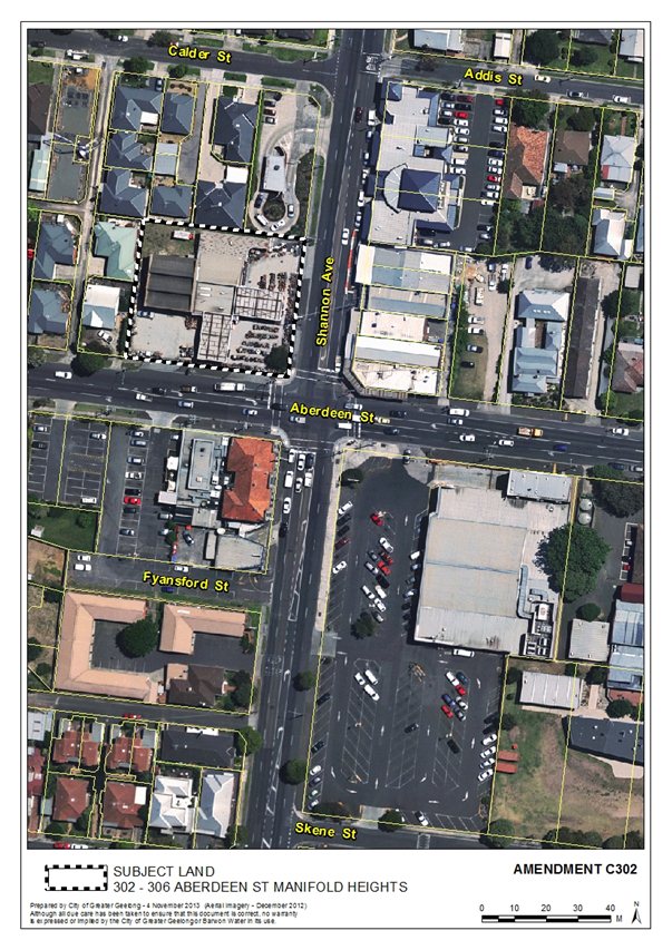
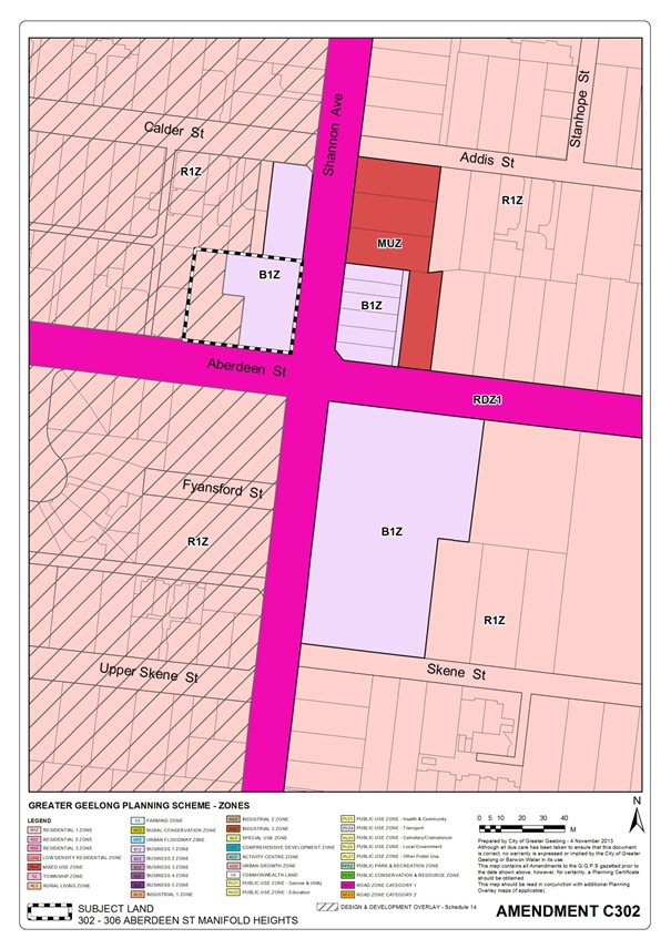
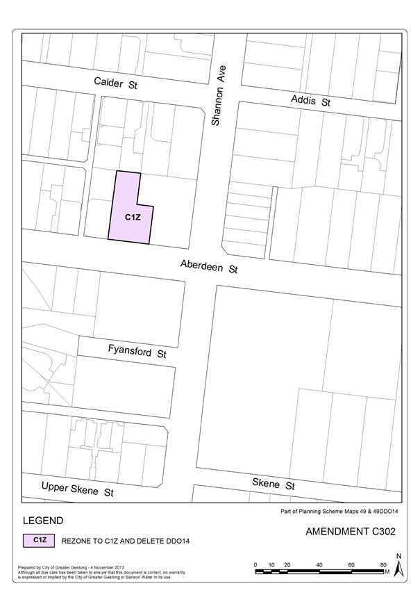
Portfolio: |
Planning – Cr Macdonald |
Source |
Economic Development, Planning and Tourism |
General Manager: |
Peter Bettess |
Index Reference |
C304 |
The purpose of this report is to advise Council of the proposed expansion of the Marngoneet Correctional Centre and to seek Council support for a Ministerial Amendment to facilitate the expansion.
The Department of Justice are proposing to expand the Marngoneet Correctional Centre (MCC) through the construction of a 216 bed Annex to the north of the existing MCC.
Under the Greater Geelong Planning Scheme the site is located within the Special Use Zone Schedule 9 (SUZ9 - Correctional Programs Centre at Lara) and is covered by the Environmental Significance Overlay Schedule 4 (ESO4 - Grasslands within the Werribee Plain Hinterland).
A planning permit is only triggered under the ES04. The other approval for the project is the preparation of a modified Correctional Facility Development Plan under the SUZ9 which provides for the Minister for Planning to approve after consulting with Council.
A request has been received from the Department of Justice seeking Council’s support for the Minister for Planning to amend the Greater Geelong Planning Scheme to exempt the need for a planning permit under the ESO4. The Amendment would see the Minister prepare, adopt and approve the Amendment without public exhibition.
It is recommended that Council support this request as the site does not contain the biodiversity assets that the ESO4 is trying to protect. After community engagement by the Department of Justice, Council will be given an opportunity to review and provide comment on the proposed modified Correctional Facility Development Plan before it is submitted to the Minister for Planning for approval.
Cr Macdonald moved, Cr Ansett seconded -
That Council:
supports the preparation of Planning Scheme Amendment (C304) to the Greater Geelong Planning Scheme to remove the need for a planning permit under the Environmental Significance Overlay Schedule 4 (ESO4 - Grasslands within the Werribee Plain Hinterland) to construct a building or construct or carry out works and remove, destroy or lop vegetation within the Special Use Zone Schedule 9 (SUZ9 - Correctional Programs Centre at Lara);
supports the amendment being processed as a Section 20(4) Ministerial Amendment under the Planning and Environment Act 1987; and
write to the Minister for Planning advising support for the Amendment.
Carried.
The Marngoneet Correctional Centre (MCC), located to the immediate north of the Barwon Prison, is proposing to expand by way of the construction of a new Restricted Minimum Security Precinct Annex. Known as the MCC Annex, it will be a stand-alone facility that provides accommodation for 216 prisoners while still being under the MCC management structure.
Under the Greater Geelong Planning Scheme, the property is located within a Special Use Zone Schedule 9 (SUZ9 - Correctional Programs Centre at Lara) and is covered by Environmental Significance Overlay Schedule 4 (ESO4 - Grasslands within the Werribee Plains Hinterland).
A planning permit is not required for the works under the SUZ9. The approval process will be via a Development Plan that, according to the SUZ9, is approved by the Minister for Planning after consultation with Council.
A planning permit is triggered under the ESO4 for the construction of the facility (buildings and works). The Department of Justice is seeking Council’s support in requesting that the Minister for Planning amend the ESO4 to remove this land (both the MCC and Barwon Prison) from this Overlay via a Ministerial Planning Scheme Amendment.
The MCC Annex is proposed to be located to the north of the existing Marngoneet Correctional Centre (MCC) near the intersection of Bacchus Marsh and Peak School Roads Lara. A copy of the proposed located for the expansion is in Appendix 1. The key elements of the proposed MCC Annex include:
it will have a footprint of approximately 6.5ha;
the male prisoner accommodation will be provided as six bed single storey cottage style units with six units grouped together as one building;
a secure perimeter 4.5m high fence with a 900mm anti-climb offset cowl on top; and
a new carpark for staff and visitors is proposed within the front setback. Vehicle access to the carpark will be provided through the existing MCC carpark.
It is expected that the MCC Annex would employ approximately 40 new staff.
In March 2003 the Greater Geelong Planning Scheme was amended to rezone the land from a Rural Zone to Special Use Zone Schedule 9 (SUZ9 – Correctional Programs Centre at Lara) via Planning Scheme Amendment C69.
Under the SUZ9 a planning permit is not required for the use of the land (for Corrective Institution) or for buildings and works associated with a correctional program centre. Instead, A Correctional Facility Development Plan is required to be prepared, in accordance with the purpose of the zone, which includes the following information:
site plans showing the location, type, design, height and colour of all buildings and works including fencing, security lighting, car parking acres and access to/egress from the site;
storm water management;
details of emergency management plans;
details of principal view corridors into the site;
details, including plans, of the proposed landscaping treatment
details of any public address systems, alarms etc that may be audible beyond the boundary; and
details of the waste disposal system.
The original Correctional Facility Development Plan was approved by the Minister for Planning in December 2003 after consultation with Council.
The Department of Justice will need to modify the approved Development Plan to allow for the MCC Annex. The modified Development Plan will be submitted to the Minister for Planning for approval after consulting with Council. The consultation with Council Officers has commenced in terms of determining the information required to be submitted with the modified Development Plan.
The site, including the existing Barwon and Marngoneet Prisons, is covered by Environmental Significance Overlay Schedule 4 (ESO4 – Grasslands within the Werribee Plain Hinterland). Under the ESO4 a planning permit is triggered for the construction of any buildings and works on the site, including removing, destroying or lopping vegetation.
A request from the Department of Justice was received on 9 October 2013 seeking Council support to allow the Minister for Planning to undertake an amendment to the Greater Geelong Planning Scheme pursuant to Section 20(4) of the Planning and Environment Act 1987 to exempt the property from requiring a planning permit under the ESO4 provisions. This exemption would be similar to that which exists for the Avalon Airport (SUZ11) and the Lara Energetic Materials Manufacturing Plant (SUZ12).
It is considered appropriate that this site is exempt from requiring a planning permit under the ESO4. The objectives of this Overlay relate to the protection of native vegetation and native fauna habitat of the Victorian Volcanic Plain. The Department of Environment and Primary Industries (DEPI) has confirmed that the site does not contain the biodiversity assets that the ESO4 is trying to protect. Therefore, there is no value added by requiring a planning permit under the ESO4.
There will be no environmental implications for Council in supporting a Ministerial Amendment as outlined in this report. Matters such as storm water management (including water quality management), vegetation retention/removal and landscaping will all be considered as part of the modified Correctional Facility Development Plan.
There are no financial implications on Council.
In supporting the planning scheme amendment to change the Environmental Significance Overlay Schedule 4 (ESO4) as outlined in this report will mean that the proposed MCC Annex will not require a planning permit. It will also mean that any other future buildings and works to the existing Barwon Prison, Marngoneet Prison or MCC Annex will not trigger the need for a planning permit under the ESO4.
Under the Special Use Zone Schedule 9 (SUZ9) a modified Correctional Facility Development Plan will still need to be prepared in consultation with Council before being submitted to the Minister for Planning for approval.
The construction of the Marngoneet Correction Centre (MCC) Annex aligns with the City Plan’s strategic directions for Growing or Economy and Sustainable Built and Natural Environment.
No Council Officers involved in the preparation of this report have any direct or indirect interest in the matter to which this report relates in accordance with Section 80(C) of the Local Government Act.
There are no risks associated with supporting a Ministerial Amendment to the Greater Geelong Planning Scheme to remove the need for a planning permit under the ESO4.
There are no anticipated impacts on the community in terms of safety, security, education, health, recreations etc as a result of implementing the recommendations contained in this report.
The amendment will not impact on any basic rights, freedoms or responsibilities as set out in the Human Rights Charter.
The Department of Justice will be undertaking Community Information Session(s) with the local community to inform and receive feedback on the proposed MCC Annex. Notification of the session(s) will be via advertisements in the local newspaper and an information brochure would also be produced as part of the consultation process.
The Department of Environment and Primary Industries (DEPI) have provided their support to remove this site from the permit requirements of the ESO4 as the site does not contain the biodiversity assets that the ESO4 protects.
External authorities, such as the Environment Protection Authority (EPA) and VicRoads, will be consulted with as part of the approval process for the modified Development Plan.
Portfolio: |
Planning – Cr Macdonald |
Source: |
Economic Development, Planning and Tourism – Strategic Implementation |
General Manager: |
Peter Bettess |
Index Reference: |
Application: C295 Rezoning 162-180 Hood Road Potarlington |
The amendment will re-zone the land occupied by the Portarlington Golf Course Driving Range to make it consistent with the zoning of the balance of the Golf Course.
Amendment C295 was lodged by The Planning Group (TPG) on behalf of Portarlington Golf Course Inc.
The Amendment will re-zone land from Farming Zone (FZ) to Special Use Zone 3 (SUZ3).
The Amendment will bring the zoning of the existing driving range into conformity with that of the balance of the golf course.
Exhibition of the amendment and Planning Permit resulted in the receipt of a total of 3 submissions. All submissions were from public authorities which did not object to the Amendment.
As the Amendment has been exhibited and no objecting submissions were received, Council can decide to adopt the amendment, without the need to request the Minister to appoint a Planning Panel.
It is recommended that the Amendment be adopted as described in this report and forwarded to the Minister.
Cr Macdonald moved, Cr Ellis seconded -
That Council:
Adopt Amendment C295 in the form as outlined in Appendix 1 (A) – (B) to this report; and
Submit the adopted Amendment together with the prescribed information to the Minister for Planning requesting approval.
Carried.
Amendment C295 is proposed to create consistency in zoning across the entire golf course operation, including both the course and the driving range.
The proposed change in zoning will have no significant effect given that the driving range is a long standing existing section 2 use.
An aerial photo showing the area to which the change to the SUZ3 will apply and its relationship to the balance of the golf course and surrounding land is provided at Appendix 1(C).
Under the provisions of Schedule 3 to the Special Use Zone (Private Golf Courses) any future development of the site or change to the use would not be exempt from the notice requirements of Section 52(1)(a), (b) and (d), the decision requirements of Section 64(1), (2) and (3) and the review rights of Section 82(1) of the Act.
The re-zoning is consistent with the Portarlington Structure Plan map at clause 21.14-5 of the planning scheme, which supports the improvement of golf course facilities.
The Amendment was referred to relevant Government Departments and Statutory Authorities as part of the exhibition process, as required by Section 19 of Division 1 of Part 3 of the Planning and Environment Act 1987. The responses received are included in Appendix 2 (a) – (c).
Authorisation to exhibit the Amendment was sought under delegation by Council officers – i.e. without a report to Council. Following receipt of Authorisation from the Minister for Planning, the Amendment and Planning Permit were exhibited from 3 November 2013 to 4 November 2013.
Notice of the amendment and Planning Permit were given to owners and occupiers of affected land and to relevant authorities and Ministers in accordance with the requirements of the Planning and Environment Act 1987.
Three (3) submissions were received in response from the following public Authorities:
The Corangamite Catchment Management Authority (CCMA);
The Environment Protection Authority (EPA); and.
VicRoads.
The responses received are included in Appendix 2 (a) – (c).
No submissions were received from members of the public.
As no objecting submissions were received Council is able to adopt the amendment and refer the amendment and planning permit to the Minister for approval.
The changes to the planning scheme will not have any adverse environmental implications. In particular, there will be no adverse impact to surrounding residents as it is not proposed to alter the form of operation of the driving range.
The changes to the planning scheme will have no adverse financial implications for Council.
The amendment is considered to be consistent with State and Local planning policies as set out in the Explanatory Report, which forms part of the amendment documentation.
The Amendment supports: the Community Wellbeing Strategic Direction of City Plan, in particular the priority of ‘Healthy lifestyles’.
No Council officers involved in the preparation of this report have a direct or indirect interest, in accordance with Section 80(c) of the Local Government Act, to the matters to which this amendment relates.
There are no risks to Council associated with the application of the revised planning controls.
The amendment will facilitate a number of positive social and economic outcomes including:
Ensuring adequate supply of recreational facilities in Portarlington;
Provision of economic development and employment;
The maintenance of a rural break to Indented Head; and,
The better utilization of existing community infrastructure, services and facilities.
The Amendment will not impact on any basic rights, freedoms and responsibilities as set out in the Charter. Planning legislation ensures an open community consultation process occurs enabling people to freely express their views and if necessary obtain a fair hearing before an Independent Panel.
Amendment C295 has been through a formal exhibition process, as a result of which no objecting submissions were received.
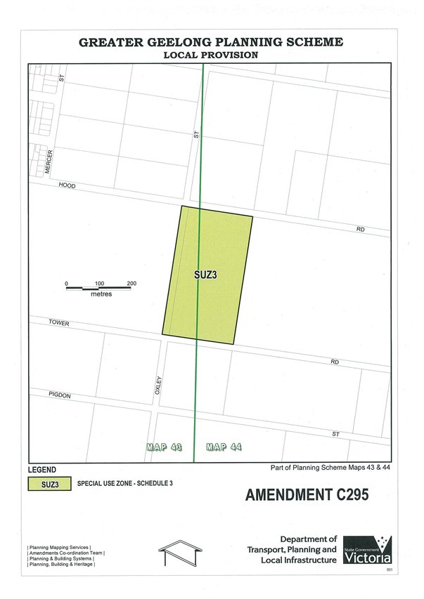
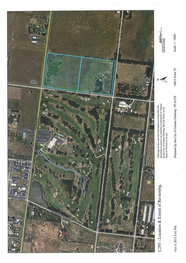
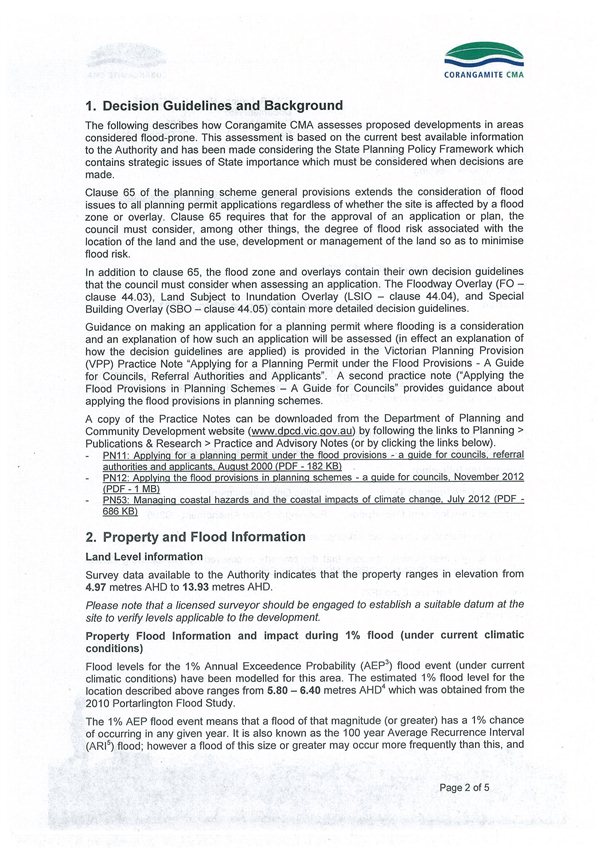
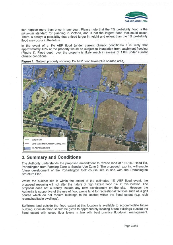
Portfolio: |
Infrastructure, Parks & Gardens – Cr Ellis |
Source |
Projects, Recreation & Central Geelong – Sport & Recreation |
General Manager: |
Dean Frost |
Index Reference |
Subject: Parks, Gardens, Reserve & Foreshore/ Tracks and Trails / Bellarine Rail Trail |
The purpose of this report is to advise Council of the activities of the Bellarine Rail Trail Advisory Committee (BRTAC).
The BRTAC was formed to assist Council with the management and development of the Bellarine Rail Trail. There is a requirement in the BRTAC Terms of Reference to report to Council on an annual basis.
The BRTAC membership is made up of a Councillor, a Council Officer, representatives from relevant statutory authorities, special interest groups and community representatives.
The major activities that the BRTAC has supported Council in delivering over the past 12 months include:
The development and adoption of the Bellarine Rail Trail Development Plan Stage 3 & 4;
The successful delivery, in partnership with the Rotary Club of Highton Kardinia, of the Bellarine Rail Trail Family Fun Day event;
Re-vegetation and conservation activities; and
General trail maintenance and management.
Over the next 12 months the BRTAC will focus on supporting the following activities:
The ongoing implementation of the Bellarine Rail Trail Development Plan; and
The continuation of re-vegetation and conservation activities.
Cr Ellis moved, Cr Macdonald seconded -
That Council notes the annual report and activities of the Bellarine Rail Trail Advisory Committee.
Carried.
The BRTAC was formed in 2004 to assist Council with the management and development of the Bellarine Rail Trail.
The BRTAC currently has 10 members comprising of the following representatives:
Cr Macdonald was appointed by Council as the Chairperson of the Advisory Committee
A Council Officer appointed by Council to act as the Executive Officer of the Advisory Committee
A representative from the Department of Environment and Primary Industry
A representative from the Geelong Steam Preservation Society
Two representatives from the Friends of Bellarine Rail Trail Inc
Four community representatives including representation from the Swan Bay Integrated Catchment Management Committee, Bicycle Users Geelong, Bellarine Landcare and a local community member.
The BRTAC meets on a quarterly basis.
The purpose of this report is to inform Council of this Committees major activities and discussions since its last Council report.
The following points outline the major activities the Bellarine Rail Trail Advisory Committee (BRTAC) has provided guidance on since its last report to Council.
The ongoing implementation of the Bellarine Rail Trail Development Plan
This plan was developed to identify priority capital improvements to the Rail Trail to guide decision-making by both advisory and operational staff in the development of associated work plans for the trail. Over the last 12 months priority has focused on the resurfacing, and improvement of drainage, of sections of the gravel trail path between Portarlington-Queenscliff Road, Point Lonsdale and Andersons Road, Drysdale. This work has contributed to a significant improvement in the usability of the facility and have been well received and utilised by traditional and new rail trail users.
The development and adoption of the Bellarine Rail Trail Development Plan Stages 3 & 4
As the capital improvements identified in the Bellarine Rail Trail Development Plan Stages 1 & 2 had been completed the development of Stages 3 & 4 of this plan was undertaken to identify future facility improvement priorities. Subject to funding becoming available the following works have been identified as priorities for consideration within the next 12 months:
The development and installation of additional interpretive signage along the trail to provide details of the historical and environmental significance of the rail corridor;
The sealing of the trail path between Curlewis Road, Curlewis and the Drysdale Railway Station; and
The improvement of drainage infrastructure and the path surface between Drysdale Railway Station and Fellows Road, Queenscliff.
Bellarine Rail Trail Family Fun Day
The Bellarine Rail Trail Family Fun Day is run on an annual basis with the most recent event occurring on Sunday 3 March 2013. The purpose of the Family Fun Day is to promote the Bellarine Rail Trail and encourage greater utilisation of this community recreation facility.
The attendance of this year’s event was estimated to be approximately 1100 people of which there were 370 young children and 120 adults who participated in the associated fun run activities. People in attendance consisted primarily of families from within the City of Greater Geelong and tourists visiting the Bellarine Peninsula.
Grant Income
On 9th October 2013 Regional Development Victoria announced a contribution of $300,000 for trail upgrades. Works from this fund will include asphalting a 2.5km section of the trail between Drysdale and Geelong, installation of a pedestrian and cyclist crossing over Jetty Road in Drysdale as well as new park furniture and shelter along the trail.
Grant Expenditure
The Friends of the Bellarine Rail Trail received the following grants from Council:
$2,500 for the purchase of plants and equipment for the enhancement of the environment under Council’s Park Stewardship program.
The Friends of Bellarine Rail Trail also receive approximately $7000 of in-kind support from the City of Greater Geelong (CoGG) on an annual basis. The majority of CoGG’s in-kind support is for garden bed preparation, mulch supply and administrative support.
Re-vegetation and Conservation Activities
The following Groups have undertaken re-vegetation and conservation activities along the Rail trail: Bellarine Landcare; Swan Bay Integrated Catchment Management Committee; and The Friends of the Bellarine Rail Trail.
The Bellarine Rail Trail Vegetation Management Plan is used as the reference document that guides these and other community plantings.
Re-vegetation work completed by the Friends of Bellarine Rail Trail requires special acknowledgement. During the 2012-13 financial year this group planted approximately 4,600 plants and contributed more than 1,300 volunteer hours to the improvement of the Rail Trail. Key activities of this group included the establishment of garden beds and the planting and maintaining of trees, shrubs and grasses along the length of the Trail between South Geelong and Drysdale. In addition to re-vegetation, the Friends of Bellarine Rail Trail have also constructed and installed a number of seats and picnic tables along the trail.
Public reserves such as old railway easements have been less impacted by direct land clearance typical of the public and private lands that they commonly intersect with. The rail trail supports remnant indigenous vegetation and by virtue of its public land status has become the focus of community interest whether for conservation or recreational purposes.
Activities to enhance the Bellarine Rail Trail’s value as a community asset have traditionally centred on infrastructure improvements (picnic facilities, signage, pathway formation etc.) as well as weed control and re-vegetation works. The establishment and continuing use of The Bellarine Rail Trail Vegetation Management Plan has promoted the greater focus on activities that consider the principles of conservation as well as re-vegetation. The relationships between the BRTAC and environmental interest groups have continued to strengthen for the betterment of the Bellarine Rail Trail and the promotion of environmental considerations in the management of this facility.
As a general rule, public reserves such as old railway easements have been less impacted by direct land clearance typical of the public and private lands that they commonly intersect with. The rail trail supports remnants of indigenous vegetation and by virtue of its public land status, has become the focus of community interest whether for conservation or recreational purposes.
In the 2012-13 Council Budget a total of $23,000 was allocated for the development and promotion of the Trail. Of this figure $17,000 was used to fund minor facility upgrade works and $6,000 was used to fund the delivery of the Bellarine Rail Trail Family Fun Day.
In the 2013-14 Council Budget a further $23,366 has been allocated to the development and promotion of the Trail.
In addition, on 9th October 2013 Regional Development Victoria announced a contribution of $300,000 for trail upgrades. Works from this fund will include asphalting a 2.5km section of the trail between Drysdale and Geelong, installation of a pedestrian and cyclist crossing over Jetty Road in Drysdale as well as new park furniture and shelter along the trail.
Any other significant capital projects requiring Council contribution are subject to consideration through Council’s Budget process and through application for grants and sponsorship.
There is a requirement in the BRTAC Terms of Reference to report to Council on an annual basis.
The Bellarine Rail Trail provides recreational opportunities, tourism visitation benefits and natural environment protection benefits that support Council’s Community Wellbeing, Growing Our Economy and Sustainable Built and Natural Environment objectives.
No Council staff or persons engaged in the BRTAC have a direct or indirect interest in the matters considered within the report.
Activities of the Committee are carried out in accordance with the Committee’s Terms of Reference.
The purpose of the BRTAC is to assist Council with the management and development of the Bellarine Rail Trail through the effective use of community skills, knowledge and resources.
The continuing development of the Rail Trail helps promote Geelong and the Bellarine Peninsula as a legitimate cycling destination for local residents and tourists alike as well as providing an essential link between rural residents and community infrastructure.
The annual Bellarine Rail Trail Family Fun Day acts to promote physical activity and to strengthen the profile of the Rail Trail.
This report has no direct impact on the human rights of the residents of the City of Greater Geelong.
The activities of the committee are communicated via distribution of minutes to all committee representatives. Each committee representative is responsible for reporting committee activities to their respective organisations.
Portfolio: |
Environment & Sustainability – Cr Richards |
Source |
Projects, Recreation & Central Geelong / Capital Projects |
General Manager: |
Dean Frost |
Index Reference |
Project: C13859 – 2012/13 Drysdale Landfill – Construction of Cell 6 |
The purpose of this report is to seek Council consent to delegate to the Chief Executive Officer the power to accept or reject tenders for the Drysdale Landfill Cell 6 Stage 1 Bulk Out Works and Cell 4A lining works tender.
The Drysdale landfill is owned and operated by the City of Greater Geelong Council and is regulated by Environment Protection Authority (EPA) Victoria through the City of Greater Geelong Council Corporate Licence, No. CL67880.
Construction of Landfill Cell 4A to EPA approved design specifications was completed recently and Council has commenced the normal process of obtaining EPA approval to undertake waste filling operations using the Cell. The Cell has a forecast operational life of 23 months.
Although complete for initial landfill operational use, Cell 4a requires planned wall lining works constructed incrementally to contain waste and leachate to satisfy EPA Victoria Publication 788.1 Best Practice Environmental Management Siting, Design, Operation and Rehabilitation of Landfills and EPA Victoria Publication 1323.2 Landfill Licensing Guidelines.
A new engineered below ground cell, Cell 6, is required to be constructed at the landfill to accommodate the on-going waste disposal operations of Council at the completion of waste filling operations at Cell 4A. Design documentation is currently being reviewed by the EPA accredited Design Auditor and once approved will be forwarded to the EPA for endorsement. The construction of Cell 6 cannot commence until the EPA issue a notice to Council advising it may do so.
According to construction programming, for Cell 6 to be completed prior to the filling of Cell 4A, Council needs to commence works in January 2014. As endorsement by the EPA is pending, construction is proposed to be undertaken in two (2) stages to allow Council to meet the critical completion date. A two-stage construction process will also benefit value for money contracting as expertise can be procured for each stage. Stage 1 will comprise general bulk out works and Stage 2 will comprise the construction of the Cell.
An allocation of $4,000,000 exists for Cell 6 Stage 1 works as part of the 2013/14 budget. A further allocation of $2,900,000 is identified in the Long Term Financial Plan in the 2014/15 financial year for Cell 6 Stage 2 works. Current estimates suggest that the 2014/15 budget will need to be amended to $4,900,000.
Lining works for Cell 4a are not budgeted and are expected to cost between $1.5M and $2M over the remaining life of the cell.
The requirement for these works has occurred as the result of recent changes required in the management of land filling operations.
Cell 6 Stage 1 and Cell 4A wall lining works have been tendered and a procurement evaluation panel has been arranged to evaluate the tender submissions.
The Capital Projects and Contracts & Purchasing departments are exploring prudent and expeditious mechanisms to complete the tender process so that works may commence in January 2014.
Cr Richards moved, Cr S Kontelj seconded -
That Council:
delegate to the Chief Executive Officer its powers and functions to accept or reject a tender and sign the contract documents for the construction and associated works of the Drysdale Landfill Cell 6 Stage 1 Bulk Out Works provided the tender is within Council’s Stage 1 approved budget.
delegate to the Chief Executive Officer its powers and functions to accept or reject a tender and sign the contract documents for the Cell 4A lining works; acknowledging that these works are not currently budgeted.
seek a report which details the long term capital works investment required at the Drysdale landfill and which provides an analysis of fees and charges associated with the disposal of waste at the site.
Cr Heagney left the meeting room at 8:59pm
Carried.
The Drysdale Landfill has been in operation since 1983 and cell development is phased in accordance with the original Works Approval plan. The landfill cells are below ground structures built to stringent technical requirements and processes.
Construction of Cell 4A at Drysdale Landfill is complete and subject to final compliance reporting by the Environmental Auditor and subsequent EPA endorsement of operational use, the Cell can be used for landfill operations at the site.
The construction of Cell 4A is complete as per the EPA approved design, however, its future use beyond an initial 2-3 month operational period is reliant on planned wall lining works constructed incrementally to contain waste and leachate to the satisfaction of EPA Victoria Publication 788.1 Best Practice Environmental Management Siting, Design, Operation and Rehabilitation of Landfills and EPA Victoria Publication 1323.2 Landfill Licensing Guidelines. The works include the incremental construction of a western clay separation bund and a south wall compacted clay and geotextile liner.
A volumetric assessment of potential airspace generation and airspace consumption forecasting for Cell 4A, based on historic compaction rates and forecast tonnages, has been undertaken to forecast the timelines for the waste disposal operational phase and the completion of cell waste filling operations. The Cell is forecast to have an operational life of 23 months.
Cell 6 is the next below ground landfill cell to be constructed for future ongoing waste disposal operations of Council. Council must design and construct the Cell in accordance with the specification and processes of the aforementioned EPA documents.
Cell 6 design documents have been submitted to the EPA accredited Design Auditor for review. The Design Auditor will forward the accepted design documents to the EPA for endorsement and subsequent issue of notice to Council that a ‘Construction of a New Cell may Commence’, in accordance with EPA Publication 1323.2 Landfill Licensing Guidelines. It is anticipated Council will receive such notice in December 2013.
According to construction programming as summarised in Figure 1 below, for Cell 6 construction to be completed prior to the filling of Cell 4A, to allow continuous waste operations, Council must commence works in January 2014.
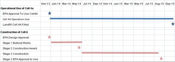
Figure 1 – Drysdale Landfill Cell 4A cell consumption and Cell 6 Construction
As EPA endorsement of Cell 6 design documentation is pending, construction is proposed to be undertaken in two (2) stages to allow Council to complete the Cell prior to the filling of Cell 4A. A two-stage construction process will also allow Council to procure construction phasing expertise and therefore provide value for money contracting.
It is intended Stage 1 comprise general below ground bulk out works and Stage 2 comprise the construction of the Cell following EPA endorsement of the design.
Stage 1 - below ground bulk out earthworks, include:
bulk earthworks and cart/stockpile within landfill site;
construction of erosion and sediment control methods; and
miscellaneous works including provision of bunds, drainage and access.
Stage 2 (subject of a separate tender process and Council report) will comprise cell lining and leachate collection system construction, including:
site re-grading and detailed trim;
construction of erosion and sediment control methods;
construction of Compacted Clay Liner (CCL);
installation of Geosynthetic Clay Liner (GCL);
installation of High Density Polyethylene (HDPE) Geomembrane Liner;
installation of Geotextile Cushion;
installation of Leachate collection lines;
installation of Leachate Drainage Blanket;
installation of Geotextile Filter; and
miscellaneous works including provision of bunds, drainage and access.
Stages 1 and 2 will also include Cell 4A incremental construction of a western clay separation bund and a south wall compacted clay and geotextile liner.
Cell 6 Stage 1 works and Cell 4A wall lining works are currently subject to a public tender process. A procurement evaluation panel has been arranged to evaluate all tender submissions.
The Capital Projects and Contracts and Purchasing departments are exploring prudent and expeditious mechanisms to achieve construction deadlines, noting that the construction contract amount will be beyond officer delegations.
Any environmental implications associated with Cell 6 Stage 1 bulk out works will arise from the execution of the works and the reporting and monitoring of the works for compliance.
Cell 4a works must be constructed according to the EPA endorsed Drawings, Technical Specification and Construction Quality Assurance Plan. A Construction Phase Audit report shall be prepared and submitted to the EPA through the Environmental Auditor process, in accordance with the EPA Publication ‘1323.2 Landfill Licensing Guidelines’.
The appointed Contractor is required to prepare and implement a Construction Environmental Management Plan (CEMP) and Erosion Sediment Control Plan (ESCP).
The construction of Cell 6 Stage 1 is funded from a budget allocation of $4,000,000 in the 2013/14 financial year.
A further allocation of $2,900,000 is identified in the Long Term Financial Plan in the 2014/15 financial year. Current estimates suggest that the 2014/15 budget will need to be amended to $4,900,000.
Cell 4A lining works are not funded in 2013/14 budget. If these works proceed they will need to be funded through the broader capital works program. This will mean that adjustments will need to be made as part of the 2014/15 budget process to ensure that all capital works can be completed.
The revised capital cost estimates of Cell 6 and Cell 4A will be factored into 2014/2015 Waste Disposal gate charges and the proposed Garbage charge.
The works must comply with Performance Requirements as prescribed in the City of Greater Geelong Council Corporate License No. CL67880.
Against the above background and timeframe to assess tender submissions and appoint a contractor, there will no opportunity to report to Council in the normal manner and meet construction critical dates.
Approval of this report and the works will allow Council to achieve its target of ‘minimising our environmental footprint’, which is contained in our sustainable and natural environmental strategy area.
No Council officers involved have a direct or indirect interest in this matter.
There is a plausible risk that if Council does not commence Cell 6 Stage 1 works in January 2014, it will not be able to complete the construction of Cell 6 prior to the filling to capacity of Cell 4A. Failure to meet this timeframe will cause Council to transport waste to other landfill located outside of the City of Greater Geelong municipal area.
The major work related risk is the construction of compliant works. It is considered that these risks can be managed through established construction processes, adequate supervision and standard testing.
There are no known social implications associated with this project.
It is not evident or likely that this report would negatively impact any of the rights contained in the Charter of Human Rights.
The recommended tenderer will be required to liaise closely with various stakeholders in conjunctions with the Project Manager and any other Council appointed nominees, during the project.
A contract progress meeting shall be held weekly on site to facilitate project communication between the parties to the contract and the internal and external stakeholders.
Portfolio: |
Finance – Cr S Kontelj |
Source |
Corporate Services - Financial Services |
General Manager: |
Jeff Wall |
Index Reference |
Financial Management \ Financial Reporting 2013-2014 |
The Quarterly Financial Report for the period ending 30 September 2013 is prepared as a requirement of Section 138 of the Local Government Act 1989.
Council approved amendments to the adopted Budget on 27 August 2013 and variances are reported based on comparing actuals to amended budget.
The recurrent operating surplus for the three-month period is $3.2M, being $6.8M favourable to amended budget and reflects favourable performance and timing issues.
The non-recurrent surplus for the three month period is $4.9M, being ($5.3M) unfavourable to budget with unfavourable Recognition of Infrastructure.
Capital expenditure for the year to date is $17.6M against a year to date projection of $16.9M, which is ($0.7M) overspent to projection.
The cash and investment balance of $53.5M is ($4.8M) unfavourable to budget.
Cr S Kontelj moved, Cr Richards seconded -
That the Quarterly Financial Management Report to 30 September 2013 be endorsed by Council.
Cr Heagney re-entered the meeting room at 9:01pm
Carried.
The report is prepared as a requirement of Section 138 of the Local Government Act 1989 which requires that at least every three months a statement be presented to Council comparing the budget with the actual revenue and expense for the financial year-to-date.
Operating
The September Management reports are provided in the following table to report year-to-date performance and full-year projection performance versus budget.
Summary |
||||||
|
|
YTD |
YTD |
YTD Var |
FY Proj |
FY |
FY Var |
|
Recurrent Surplus/(Deficit) |
3.19 |
(3.64) |
6.83 |
(17.91) |
(17.93) |
0.02 |
|
Non-Recurrent Surplus/(Deficit) |
4.96 |
10.26 |
(5.30) |
48.19 |
47.28 |
0.91 |
|
Net Surplus/(Deficit) |
8.15 |
6.62 |
1.53 |
30.28 |
29.35 |
0.93 |
|
Capital Expenditure |
17.65 |
16.93 |
(0.72) |
100.24 |
98.85 |
(1.39) |
|
Closing Net Cash |
53.55 |
58.36 |
(4.81) |
|
51.23 |
|
The Adopted Budget was amended by Council on 27 August 2013 to include Carryover Capital and discretionary projects, plus other Capital and recurrent amendments.
The impact on the Recurrent Expenditure Budget is ($16.92M), consisting of carryover discretionary projects funded in 2012-2013, plus other budget amendments including adjustment for early receipt of first two quarters Grants Commission funding in June 2013.
The impact on Non Recurrent income was $1.60M for carryover of capital income from 2012-2013 projects, plus other budget amendments.
The amended capital expenditure budget included an additional $40.39M to complete 2012-2013 Projects, including Corio Landfill Rehabilitation, Ocean Grove Integrated Children’s Centre, Leopold Community Hub and Barwon Heads Early Learning Centre.
Other budget amendments reduced total budget by $0.69M.
1. Recurrent Variance Commentary |
||||||
|
|
YTD |
YTD |
YTD Var |
FY Proj |
FY |
FY Var |
|
Recurrent Income |
68.76 |
67.40 |
1.36 |
265.81 |
265.59 |
0.22 |
|
Recurrent Expenditure |
65.57 |
71.04 |
5.47 |
283.72 |
283.52 |
(0.20) |
|
Recurrent Surplus/(Deficit) |
3.19 |
(3.64) |
6.83 |
(17.91) |
(17.93) |
0.02 |
YTD Variance - $6.83M Favourable |
||||||
The following major variances to budget contributed to this result:
Recurrent Income
|
|
$ |
|
General Rates and Charges – Favourable rates generation and supplementary rates YTD, expected to be partly offset by objections in full year. |
0.39 |
|
Government Grants Main favourable variances consist of:
|
0.51 |
|
User Charges Main unfavourable variances consist of:
Offset by:
|
(0.17) |
|
Other Fees & Charges Favourable mainly due to :
|
0.22 |
|
Sundry Income Favourable due mainly to Reimbursements & Recoveries $251K – higher than budgeted Fire Services Levy funding $137K (offset by expenditure), Simonds Stadium $51K (offset by expenditure) and Sundry Income $93K. |
0.28 |
|
Interest on Investments Higher than budgeted cash balances. |
0.13 |
|
Recurrent Income Sub-total |
$1.36M |
Recurrent Expenditure
|
|
$ |
|
Employee Related Expenditure – Favourable salary costs $1,195K mainly relating to unfilled vacancies. Partially offset by unfavourable supplementary labour costs ($420K) (see external services). |
1.11 |
|
General Works: Materials $359K favourable with the main variances being Road Making Materials $160K (phasing only), Ground Maintenance Materials $144K (ground renovations yet to commence), Other $55K. Plant / Equip / Vehicle Costs $283K favourable with the main variances being Fuels, Oils & Greases $93K, External Plant & Equipment Hire $149K (all phasing only), Other $41K. External Services is $1,870K favourable mainly due to:
|
2.51 |
|
Administration costs $636K favourable mainly due to :
|
0.64 |
|
Professional Services costs $266K favourable mainly due to:
|
0.27 |
|
Utility costs are $398K favourable mainly due to Water usage costs $254K (seasonal factors) and Electricity $131K (phasing only). |
0.40 |
|
Depreciation costs $671K favourable (phasing only). |
0.67 |
|
Gain/(Loss) on Sale of Plant and Equipment ($127K) unfavourable. |
(0.13) |
|
Recurrent Expenditure Sub-total |
$5.47M |
| Full Year Recurrent Projection – $0.02M favourable to Amended Budget | |
|
The main projection changes are favourable / (unfavourable): |
$M |
|
Grants Commission decrease |
(0.08) |
|
Recycling Income reduction |
(0.12) |
|
Transfers from Capital to Recurrent |
(0.13) |
|
Fire Services Levy Funding |
0.11 |
|
Council Election Fines Received (unbudgeted) |
0.08 |
|
Transfers from Recurrent to Capital |
0.08 |
|
Other |
0.08 |
|
|
$0.02M |
2. Non Recurrent Variance Commentary |
||||||
|
|
YTD |
YTD |
YTD Var |
FY Proj |
FY |
FY Var |
|
Non-Recurrent Surplus/(Deficit) |
4.96 |
10.26 |
(5.30) |
48.19 |
47.28 |
0.91 |
YTD Variance – ($5.30M) unfavourable |
||||||
|
|
$ |
|
|
Capital Grants & Income ($10K) unfavourable. |
(0.01) |
|
|
Recognition of Infrastructure ($6,584K) unfavourable. |
(6.58) |
|
|
Developer Contributions $436K favourable. |
0.44 |
|
|
Gain/(Loss) on Sale of Property - $15K favourable. |
0.01 |
|
|
Loss on Disposal of Infrastructure - $843k favourable |
0.84 |
|
3. Capital Expenditure Commentary |
||||||
|
|
YTD |
YTD |
YTD Var |
FY Proj |
FY |
FY Var |
|
Capital Expenditure |
17.65 |
16.93 |
(0.72) |
100.24 |
98.85 |
(1.39) |
YTD Variance – ($0.72M) unfavourable |
||||||
The capital program is ($0.72M) overspent compared to Projection year to date, with the major project variances as follows:
|
|
|
$M |
|
|
Drysdale Landfill Cell 4A – additional expenditure. |
(0.57) |
|
|
Kerb & Channel Replacement Program – project ahead of schedule. |
(0.34) |
|
|
Footpath Replacement Program – project ahead of schedule. |
(0.32) |
|
|
NES Drainage Basin Acquisition – unbudgeted expenditure. |
(0.23) |
|
|
Drysdale Landfill Cell 6 – behind budget schedule. |
0.49 |
|
|
Ocean Grove Integrated Children’s Centre – behind budget schedule. |
0.58 |
|
|
Other |
(0.33) |
|
|
|
($0.72M) |
4. Cash and Investments |
||||||
|
|
YTD |
YTD |
YTD Var |
FY Proj |
FY |
FY Var |
|
Closing Net Cash |
53.55 |
58.36 |
(4.81) |
|
51.23 |
|
YTD Variance – ($4.81) unfavourable |
||||||
The month end cash and investments balance was $53.55M. This was ($4.81M) unfavourable to budget, mainly due to revised timing of budgeted loans of ($15.80M), offset by favourable recurrent surplus $6.83M and receipt of rates (Fire Services Levy) $3.50M (to be paid to SRO in October).
Council has future commitments for $24.5M, which are fully cashed back:
| Long Service Leave | $17.1M |
| Statutory Reserves | $ 1.0M |
| Refundable Deposits | $ 4.3M |
| Income in Advance | $ 1.3M |
| Asset Development | $ 0.3M |
| Carbon Tax Future Liability | $ 0.5M |
| Total | $24.5M |
The Landfill Provision balance is currently $18.6M.
There are no environmental implications arising from this report.
As detailed in the attached report.
The report is provided in accordance with requirements under the Local Government Act 1989.
This report contributes to responsible and sustainable financial management as aligned in Council’s City Plan objective on How We Do Business.
Council staff preparing this report have no direct or indirect interest.
There are no risk implications arising from this report.
There are no social implications arising from this report.
There are no known positive or negative effects.
The attached report is provided for information and public record and is available from the Council Governance or Financial Reporting units.
Portfolio: |
Enterprise Geelong – Cr Harwood |
Source |
Enterprise Geelong |
Executive Director: |
Russell Walker |
Index Reference |
Subject: Land Sales |
Cr Macdonald moved, Cr Harwood seconded -
That in accordance with Section 89 (2) (d) of the Local Government Act 1989, this contractual matter be considered at the conclusion of all other business at which time the meeting be closed to members of the public.
Carried.
Portfolio: |
Governance - Cr Lyons (Mayor) |
Source |
Corporate Internal Auditor and Ombudsman |
Chief Executive Officer: |
Stephen Griffin |
Index Reference |
Audit CG - Internal |
Cr Macdonald moved, Cr Harwood seconded -
That in accordance with Section 89 (2) (h) of the Local Government Act 1989, this report be considered at the conclusion of all other business, at which time the meeting be closed to members of the public.
Carried.
Contents | Previous Page: Section A - Procedural Matters | Next Page: Section C - Notice of Motion
