
Council Minutes - Section B: Reports - 10 February 2015
Contents | Previous Page: Section A - Procedural Matters | Next Page: Section C - Assembly of Councillors
Contents | Previous Page: Section A - Procedural Matters | Next Page: Section C - Assembly of Councillors
Reports tabled at the Ordinary Meeting of Council on Tuesday date held at City Hall, Little Malop Street in Geelong.
Amendment C266 Pt 2 Canterbury Road West, Lara – Consideration of Panel Report and Adoption
Amendment C306 Curletts Road Area, Lara – Consideration of Submissions and Adoption
Amendment C280 Ash Road (West) Rezoning – Consideration of Submissions
Transfer of Council Land Policy Review and Advice to Interested Parties
The Esplanade, Indented Head – Proposed Footpath Construction SRC337 – Declaration of Charge
Portfolio: |
Planning - Cr Heagney |
Source: |
Planning and Tourism - Strategic Implementation |
General Manager: |
Peter Bettess |
Index Reference: |
Subject: Council Reports 2015 |
This purpose of this report is to enable Council to consider the Panel Report regarding Planning Scheme Amendment C266 Pt 2 and draft Planning Permit 780/2013. The Report recommends adoption of the Amendment with a request that the Minister issue the Planning Permit in accordance with the recommendations of the Planning Panel.
An Amendment request was made by TGM Group Pty Ltd on behalf of Point Cook Pty Ltd, the owner of the land at 60-68 Canterbury Road West, Lara.
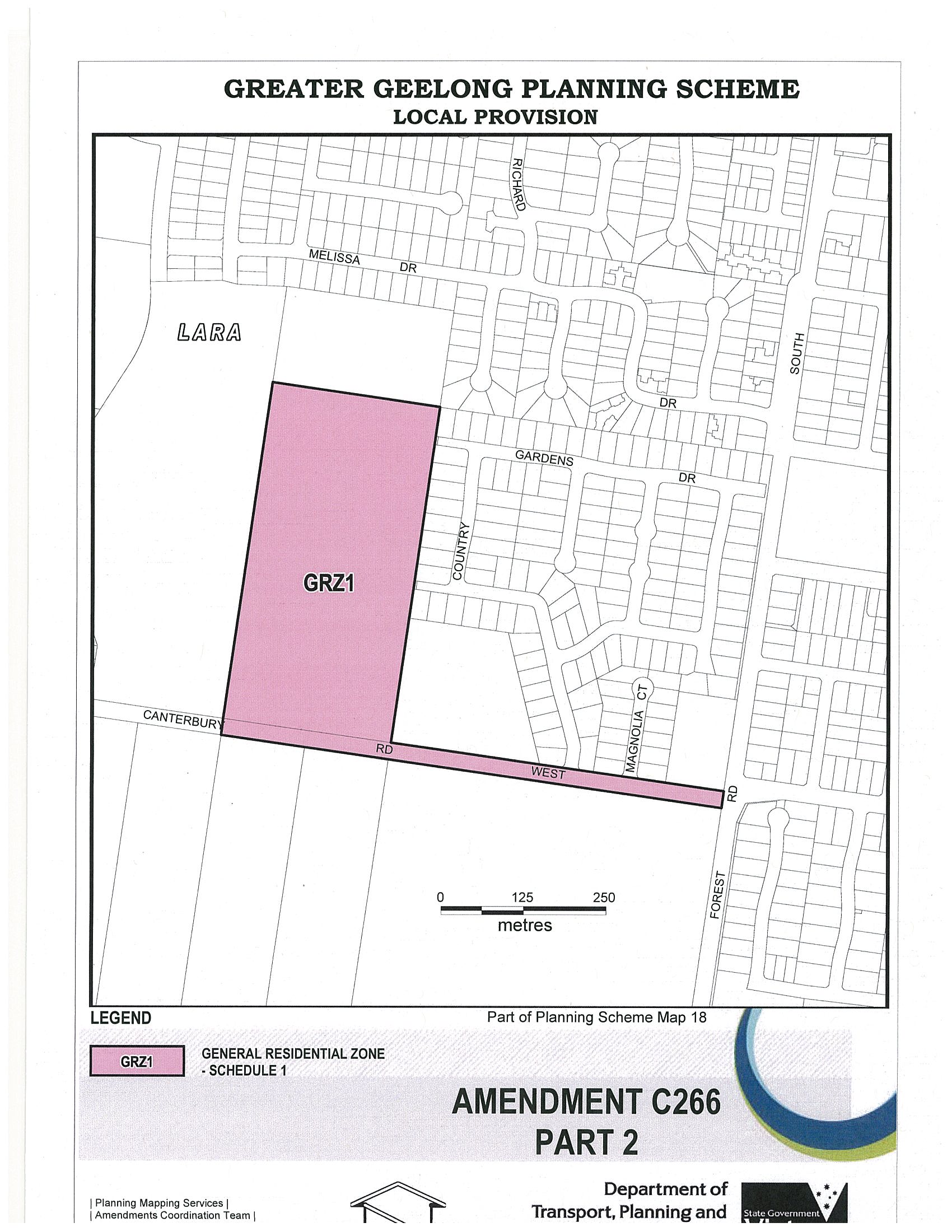
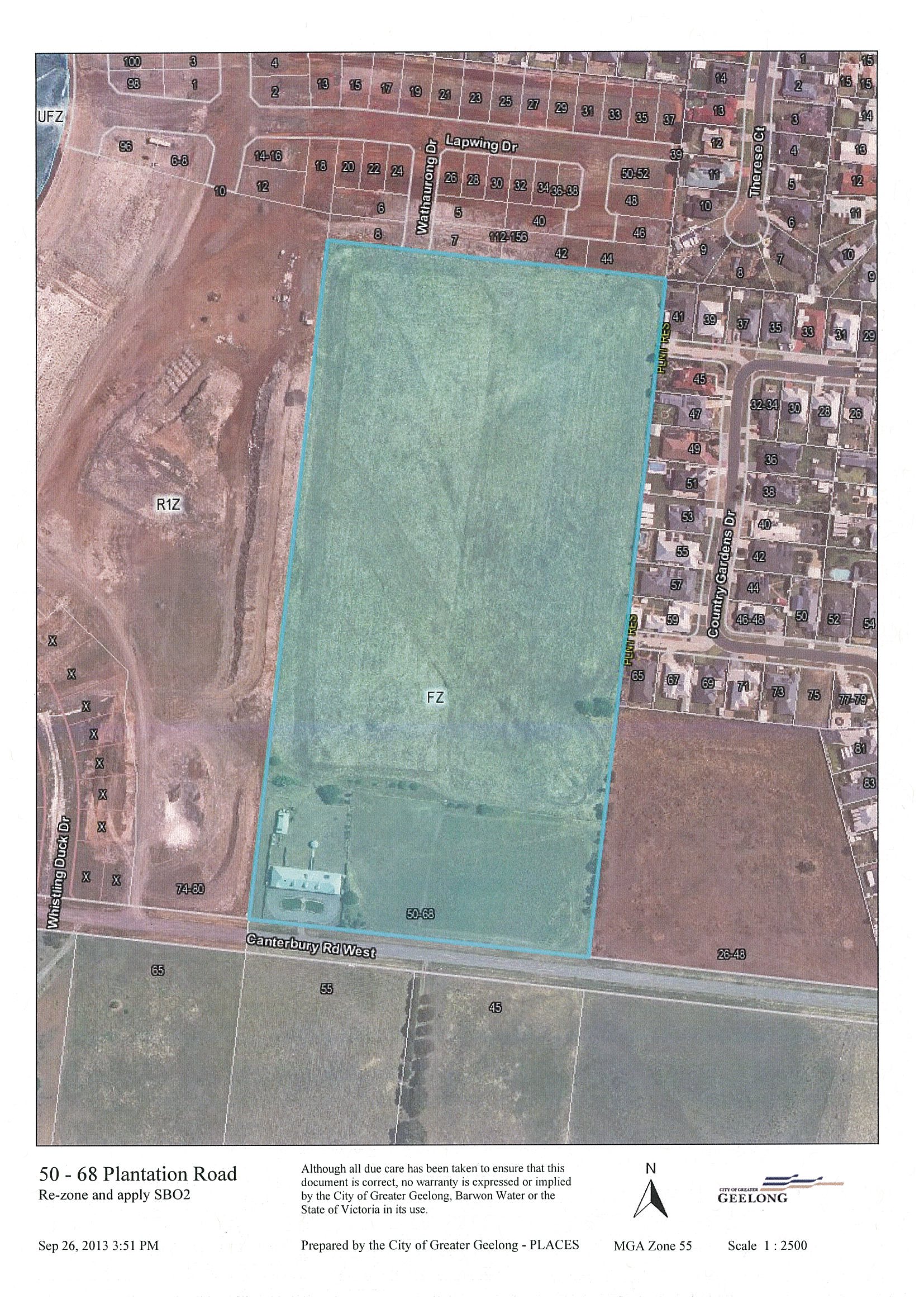
The Amendment proposes to rezone the proponents land from Farming zone (FZ) to General Residential zone, Schedule 1 (GRZ1).
In addition to the re-zoning the amendment also sought to apply the Special Building Overlay (SBO) together with a Schedule to the SBO (SBO2) to the re-zoned land and adjoining vacant General Residential zone (GRZ) Schedule 1 land at 26 – 48 Canterbury Road West.
As no objecting submissions were received to the application of the SBO and introduction of the new SBO2 Schedule, that aspect of the amendment request was adopted by Council as C266 Part 1.
As one submission was received objecting to the re-zoning this matter and the permit for subdivision were referred to a Planning Panel for consideration.
Consistent with the findings of the Planning Panel, this report recommends that Council adopt the amendment and request the Minister for Planning to approve the Amendment and issue a Planning permit for the subdivision of the land.
Cr Heagney moved, Cr Ansett seconded -
That Council resolves to:
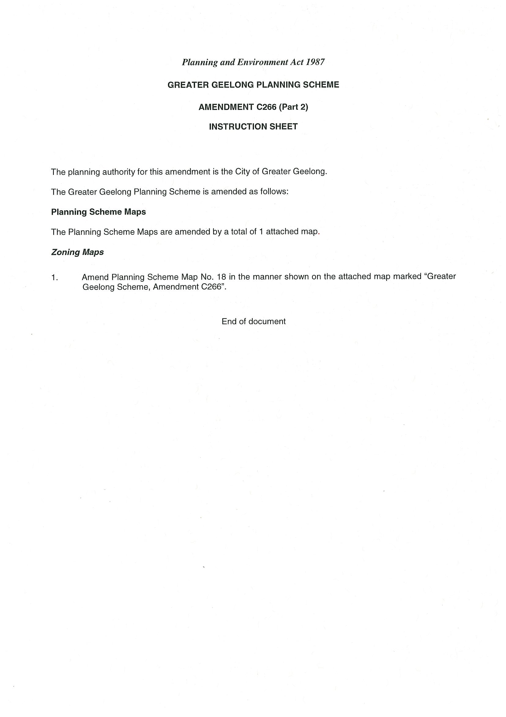
adopt Amendment C266 Part 2 in the form as outlined in Appendix 1 of this report;
submit the adopted Amendment with the prescribed information to the Minister for Planning requesting approval; and
recommend to the Minister for Planning that:
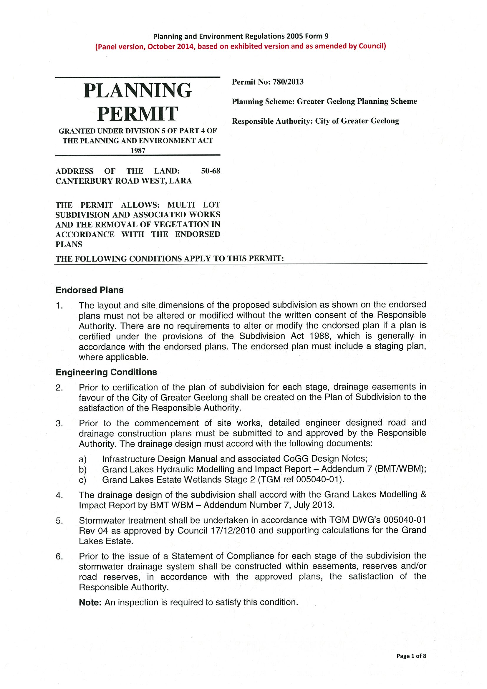
Planning Permit 780/2013 be approved in the form outlined in Appendix 3 to this Report; and
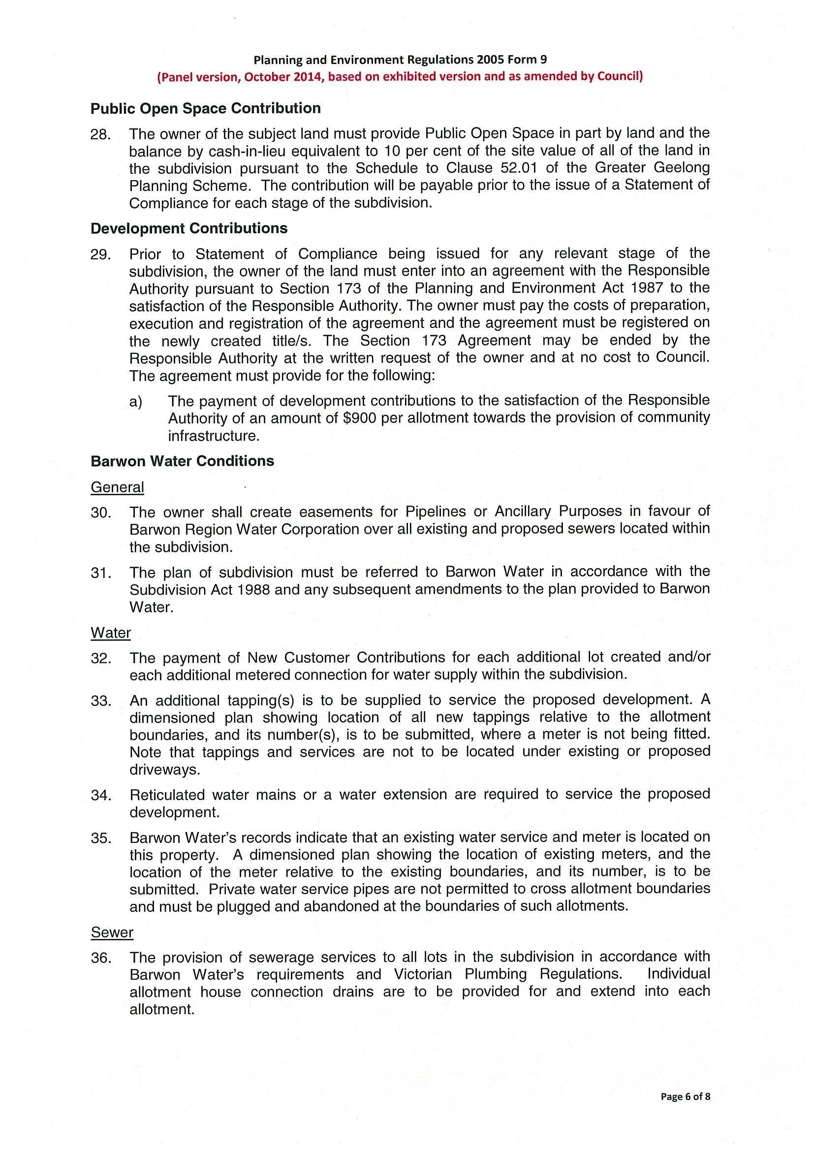
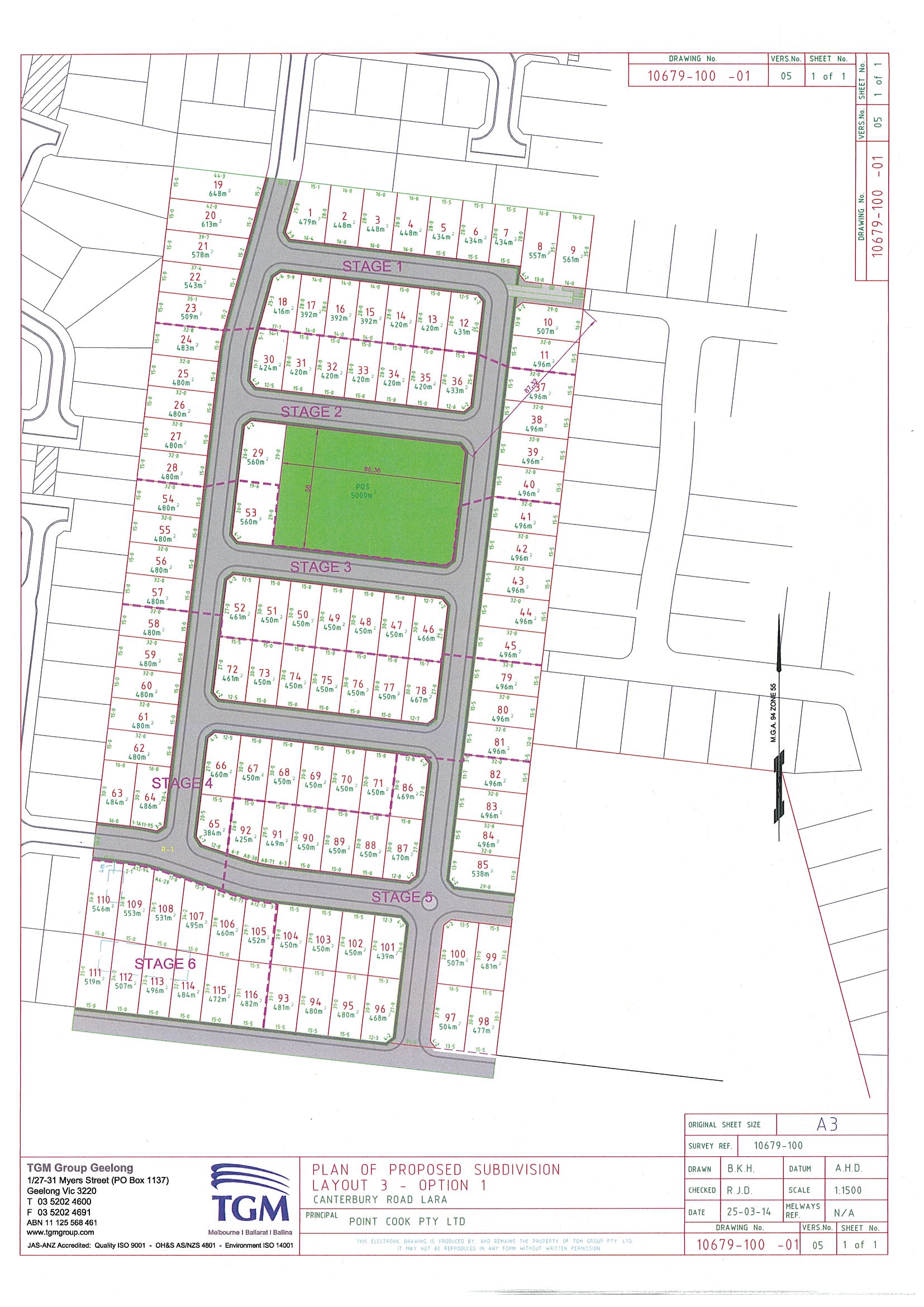
the Plan included as Appendix 4 be endorsed as the Endorsed Plan required by permit condition 1.
Carried.
As previously indicated, Amendment C266 (Part 1) applied the Special Building Overlay (SBO) and a new Schedule 2 to the Overlay (SBO2) to 50 – 68 Canterbury Road and adjoining General Residential zone (GRZ) land to the east, at 26 – 48 Canterbury Road West.
The application of the SBO and schedule was based on a flood and drainage study undertaken to establish that these lots could be successfully drained and developed in an integrated manner with the ‘Grand Lakes Estate’ to the west of 50 – 68 Canterbury Road West.
Having established that the land can be drained in this manner and applied the SBO to the land to control minimum floor heights consistent with the findings of the drainage study, it is now appropriate to re-zone 50 – 68 Canterbury Road West (see Attachment 2) consistent with its central location in a long identified residential growth area.
A total of 8 submissions were received to the amendment. Submissions from the Corangamite Catchment Management Authority, Barwon Water, VicRoads, the Country Fire Authority and the Environment Protection Authority did not object to the Amendment or Draft Planning Permit. Two supporting submission, were received, one from the proponents on behalf of the owner of 50 – 68 Canterbury Road West, which also suggested several changes to the detailed wording of conditions in the draft permit, and one from the owner of 26 – 48 Canterbury Road West.
In addition 1 submission objecting to the re-zoning and draft planning permit was also received.
Issues raised by submittor:
The objecting submission raised the following concerns:
Was told when purchasing the property that the land could not be developed as it was on a flood plain.
Will lose view and privacy.
Did not receive notice of the subdivision.
The round-about at the corner of Forest Road and Canterbury Road will not cope with the additional traffic.
Forest Road is already too busy since the Grand Lakes development was constructed.
Lot sizes are too small.
Inadequate shops and other infrastructure.
Inadequate transport services and services for youth.
Officers’ response as presented to the Planning Panel:
The objector’s property adjoins 26 – 48 Canterbury Road West, which is already located in the GRZ (Schedule 1).
The draft permit for subdivision does not apply to this land, but to 50 – 68 Canterbury Road West.
The re-zoning and planning permit for subdivision of 50 – 68 Canterbury Road West will not impact on the objector’s property, which already abuts land in the GRZ.
As the draft permit for subdivision is being considered in combination with a planning scheme amendment there is no provision for the erection of a notice on the land to which the permit applies.
In assessing the extent of notification required Council officers determined to notify:
All owners and occupiers of land adjoining or located opposite the land to be re-zoned.
This did not include the objectors land, which is neither opposite nor adjoining 50 – 68 Canterbury Road West, and
The owners and occupiers of all properties affected by the proposed Special Building Overlay.
Again this did not include the objector’s property, which is not included within the SBO.
While it is appreciated that the views expressed in relation to traffic, lot sizes, transport and infrastructure are genuinely held by the objector there are sound planning reasons for supporting the re-zoning and subdivision of the land in the manner set out in the Amendment and draft planning permit.
In particular, the permit application was accompanied by detailed reports which have been assessed by Council’s Statutory Planning Unit as complying with the requirements of Clause 56 of the Planning Scheme for subdivisions in excess of 60 lots or more, including the requirements in relation to minimum lot sizes. The conditions contained in the draft permit reflect the assessments of Council officers of the application for subdivision.
Panel Findings:
Consistent with the submissions of Council officers and the Planning Consultant representing both the proponent and the owner of the adjoining vacant residential land, the Panel found:
Visual and amenity issues.
“The Panel observes that the subject land adjoins other residential land already located in the General Residential Zone and has been earmarked for residential rezoning in Lara Structure Plan. The lot sizes meet the relevant planning guidelines and draft permit conditions reflect this. It is a logical infill inclusion to the surrounding area.
The Panel concludes that there is no visual or residential amenity reason to reject this proposal.”
Traffic issues.
“The Panel was advised that the traffic analysis took into account the development of all of the residential land north of Canterbury West Road.
No evidence was provided to the contrary and the observation of the Panel on and near the site did not cause it to have any alarm about the level of traffic moving through the roundabout.
The Panel observed traffic movement on the morning of 1 October 2014 as part of its site inspections, and there appeared to be no issue with movement or congestion at that time.
The Panel concludes that there is no traffic reason to reject this proposal.”
Planning Permit Conditions.
Following exhibition of the amendment and staged subdivision plan, revised draft permit conditions were agreed between Council Officers and the proponent.
These revised conditions and the staging plan were presented to the Planning Panel for its consideration with the support of both Council officers and the proponent.
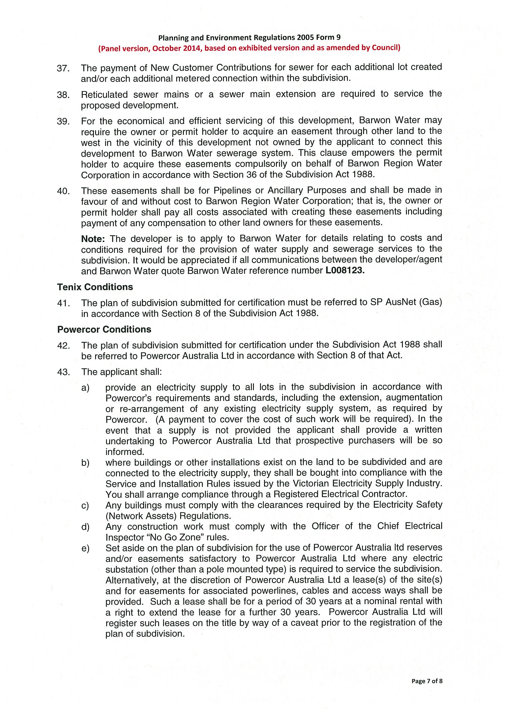
The Planning Panel recommended that Planning Permit 780/2013 be issued in accordance with the agreed revised conditions, which are included as Appendix 3 of this report.
The amendment will not have any adverse effects on the environment.
There are no financial implications for the Council.
No impact to budget.
The Panel found that, consistent with the advice of Council officers and the submission of the proponent, the Amendment is supported by the following clauses in the SPPF:
Clause 11.02-1 Supply of land – this clause seeks to ensure ongoing supply of residential land supported by infrastructure.
Clause 11.02-2 Planning for growth areas – this clause seeks to limit the impact of urban development on non-urban areas by allowing development to take place within a designated township boundary.
Clause 15.01-1 Urban design – this clause aims to create urban environments that are safe, functional and provide good quality environments with a sense of place and cultural identity.
Clause 15.03-2 Aboriginal Cultural Heritage – this clause seeks to ensure the protection and conservation of places of Aboriginal cultural heritage significance.
Clause 16.01-1 Integrated Housing – this clause is focused on ensuring housing developments are integrated with infrastructure and services, regardless of their location.
Clause 19.03 Stormwater – this clause is focused on managing stormwater from the site through incorporating water-sensitive urban design techniques and integrating stormwater treatment into the landscape.
The Amendment supports the following local planning objectives:
Clause 21.06-2 Urban growth – provision of a mix of housing suited to the needs of a diverse range of household types
Clause 21.06-3 Urban consolidation – the encouragement of urban consolidation and a range of development densities
Clause 21.06-4 Neighbourhood character – development of land that seeks to ensure development appropriately responds to the existing character of the area
Clause 21.08 Development and community infrastructure – the need to provide for the efficient use of services and conservation of water
Clause 21.08-5 Accessibility – the need to facilitate the development of access opportunities for all members of the community
Clause 21.13 Lara – the proposal accords with this policy as:
The rezoning, subdivision and residential development of the subject land will maintain a compact urban form
The rezoning will ensure an adequate supply of residential zoned land
The proposed rezoning provides opportunity to integrate with the surrounding residential area
It will provide efficient and convenient integrated movement opportunities for vehicles, cyclists and pedestrians
It ensures sequential zoning and development in accordance with the Lara Structure Plan 2011
It will locate residential land close to educational, community and recreational facilities.
The recommendations are consistent with the City Plan’s strategic directions Growing our Economy and Sustainable Built and Natural Environment. In particular, both the amendment and permit facilitate sustainable development in accordance with an adopted township Structure Plan and promote sustainable design and development.
No officers involved in this report have any direct or indirect interest In accordance with Sec 80 (c) of the Local Government Act.
No risks have been identified as being associated with implementing the recommendation contained in this report.
The Amendment is not expected to generate any adverse social impacts.
The proposal will ‘infill’ the remaining area on the north side of Canterbury West Road to achieve a good residential planning outcome.
The Amendment will not impact on any basic rights, freedoms and responsibilities as set out in the Charter. Planning legislation ensures an open community consultation process occurs, enabling people to freely express their views and if necessary obtain a fair hearing before an Independent Panel, as has occurred in this instance.
The Amendment was exhibited in accordance with the Planning and Environment Act 1987, including direct notification to all adjoining landowners and occupiers.
Portfolio: |
Planning - Cr Heagney |
Source: |
Planning & Tourism - Strategic Implementation |
General Manager: |
Peter Bettess |
Index Reference: |
Council Reports 2015 |
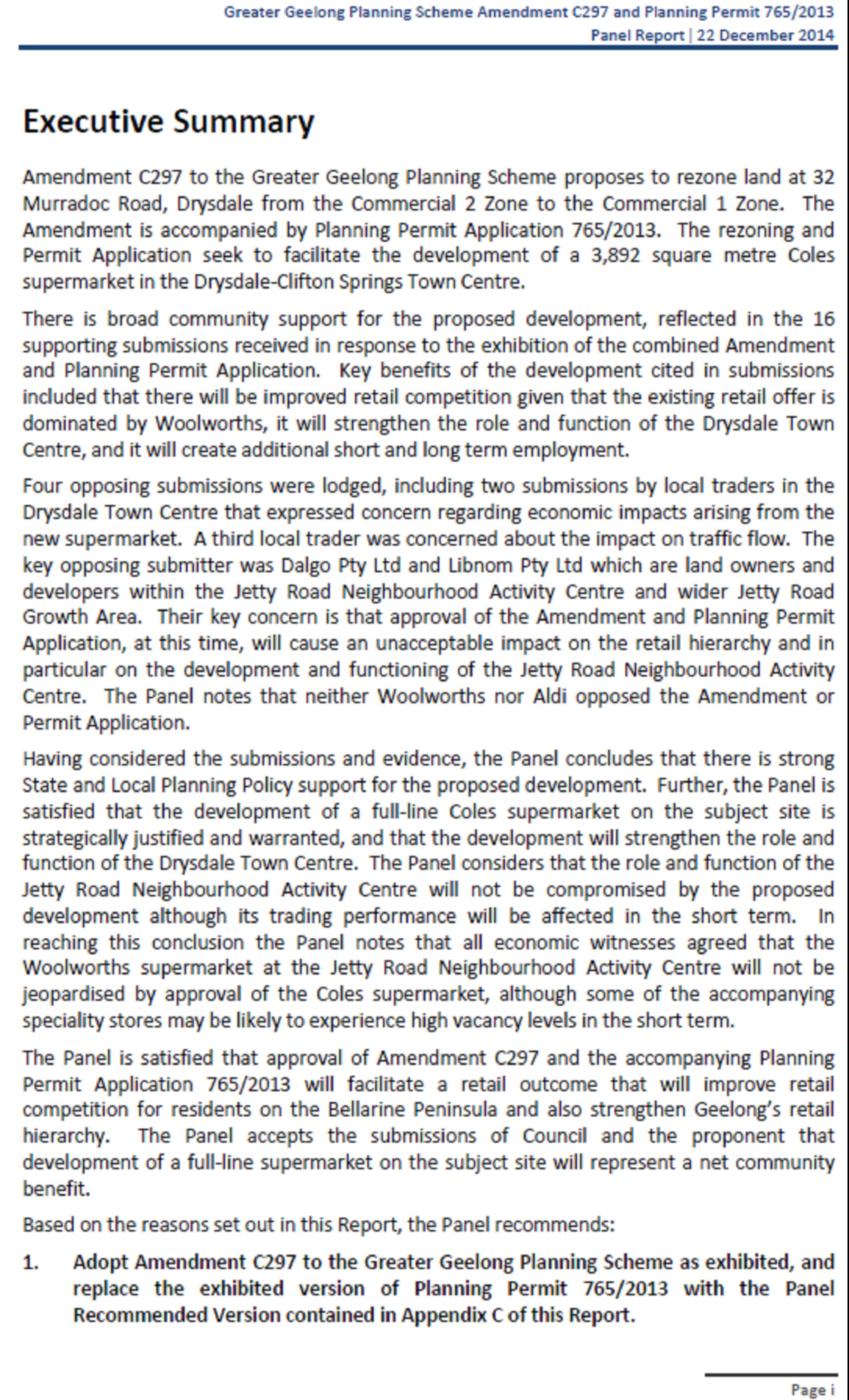
This report considers the Panel Report to Amendment C297 and Planning Permit 765/2013 and recommends adoption of the Amendment and approval of the Permit.
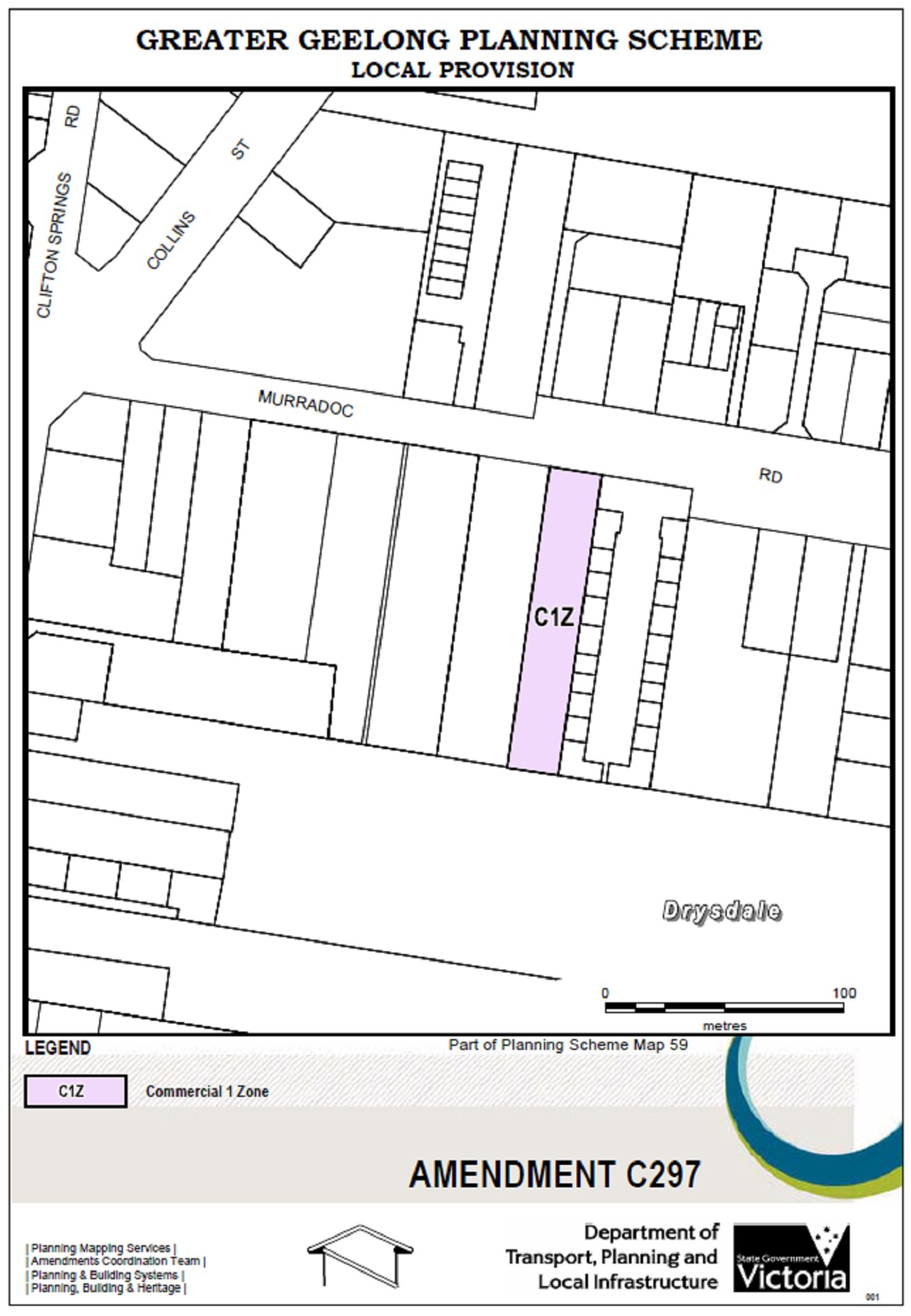
Amendment C297 seeks to rezone vacant land at 32 Murradoc Road, Drysdale, from the Commercial 2 Zone to the Commercial 1 Zone.
The Amendment is combined with a planning permit to construct a full-line Coles supermarket at 24-26, 28-30 and 32 Murradoc Road, Drysdale.
Public exhibition of the Amendment commenced on 3 July 2014 and closed on 4 August 2014 and included an information session at the Springdale Neighbourhood Centre.
Council received 20 submissions, 16 in support or not objecting and 4 opposing the Amendment. The contentious issue is whether or not there is sufficient economic and policy justification for another supermarket in Drysdale at this time and consequential impacts to local traders and Jetty Road developers.
Council resolved on 23 September 2014 to refer the submissions to an Independent Planning Panel appointed by the Minister for Planning. The Panel Hearing was held on 25, 26 and 27 November 2014.
The Panel concluded that the proposal is strongly supported by State and Local Planning Policy, is strategically justified and warranted, and will strengthen the role and function of the Drysdale Town Centre. The Panel was satisfied that the existing road network will adequately accommodate traffic generated by the new supermarket.
The Panel considers that the role and function of the Jetty Road Neighbourhood Activity Centre will not be compromised although its trading performance will be affected in the short term.
Overall the Panel recommended that Amendment C297 be adopted as exhibited, and that minor revisions are made to the draft Planning Permit.
The Panel’s recommendations are supported. The Amendment can now be adopted and together with the Permit, forwarded to the Minister for approval.
Cr Heagney moved, Cr Ellis seconded -
That Council resolves to:
adopt Amendment C297 in the form as outlined in Appendix 1 of this report;
recommend to the Minister for Planning that Planning Permit 765/2013 be granted pursuant to Section 96G of the Planning and Environment Act 1987 (the Planning Permit is in Appendix 2 of this report); and
submit the adopted Amendment together with the prescribed information to the Minister for Planning requesting approval.
Carried.
On 28 June 2013 a combined Planning Scheme Amendment request and Planning Permit application was lodged by Environmental Resources Management (ERM) Australia on behalf of Coles Property Group, pursuant to Section 96A of the Planning and Environment Act 1987.
It is proposed to rezone the land at 32 Murradoc Road, Drysdale, from the Commercial 2 Zone to the Commercial 1 Zone and obtain a planning permit (765/2013) to construct a full-line supermarket on 24-26, 28-30 and 32 Murradoc Road, Drysdale. The site is vacant and sits along side the Drysdale ALDI store. The titles are owned by Coles.
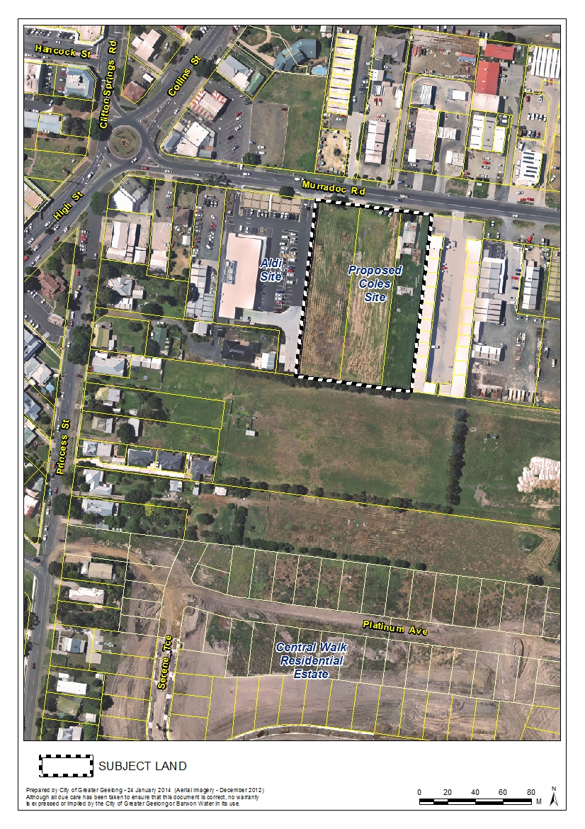
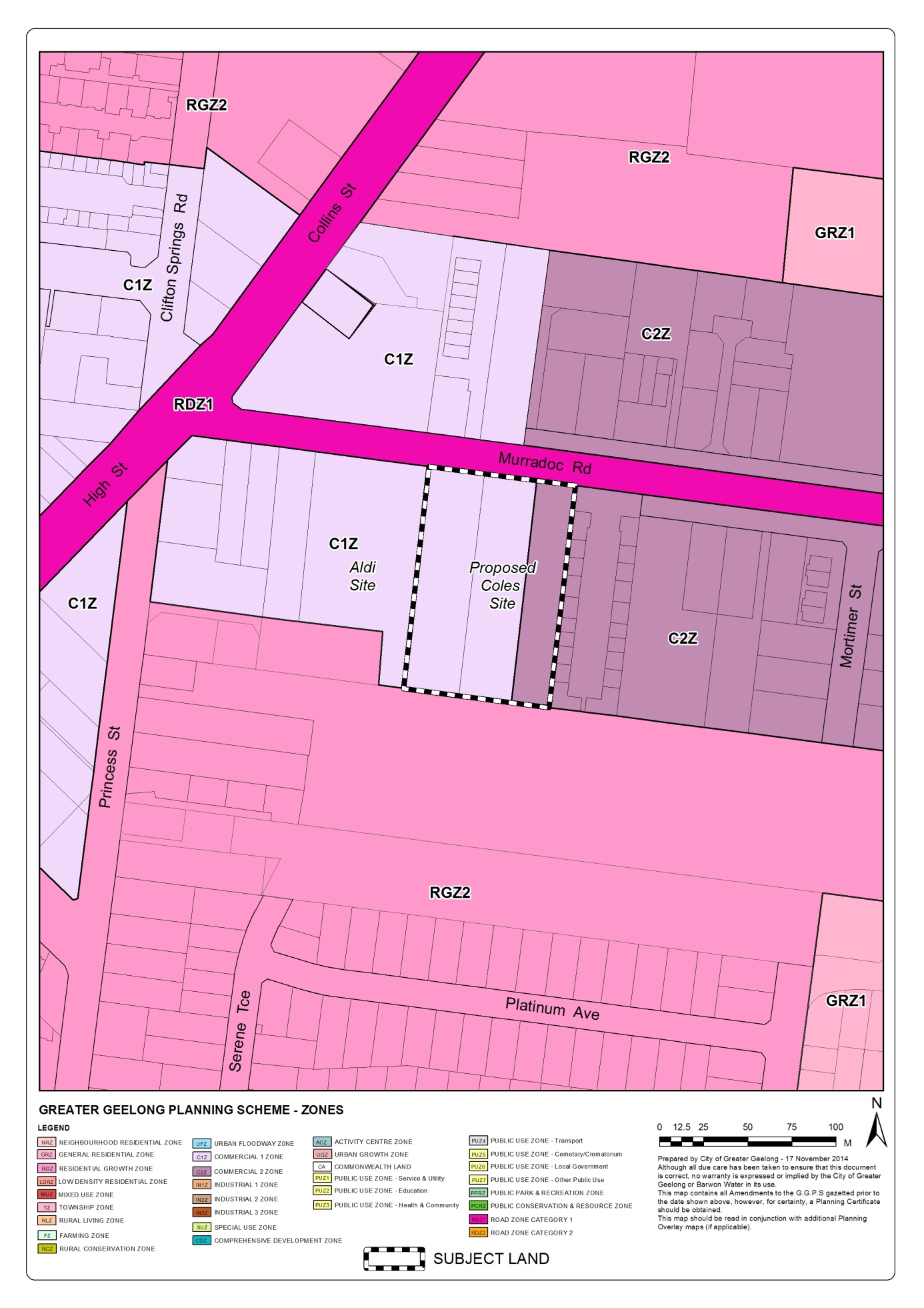
Appendix 3 is an aerial map of the immediate area and Appendix 4 shows the existing zoning.
In addition to the buildings and works, the permit is to allow the display of identification signage, a reduction of car parking requirements, the alteration of access to a road in a Road Zone Category 1 and to create a carriageway easement.
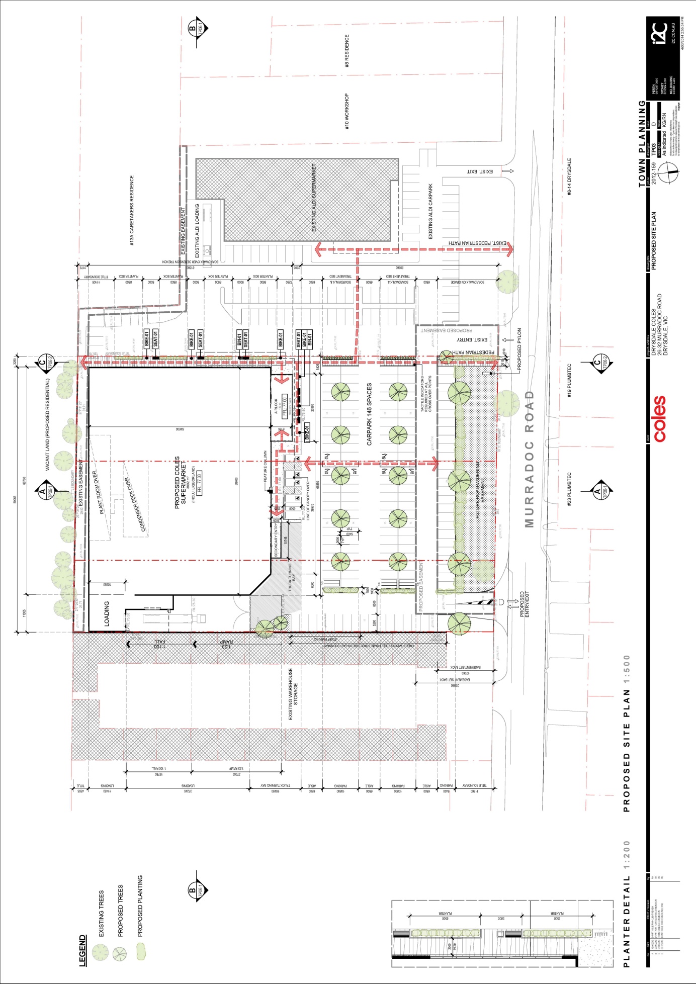
The development plan (Appendix 5) shows that the proposed Coles supermarket, including a Liquorland, will have a total floor area of 3,892 square metres supported by 146 car parking spaces. The car parking layout is integrated with the adjacent ALDI store, as are entry/exit arrangements off Murradoc Road. A 2 metre wide dedicated pedestrian boardwalk is located parallel to the supermarket and parking areas to allow passage through the site.
Public exhibition of Amendment C297 commenced on 3 July 2014 and closed on 4 August 2014. An information session was also held at the Springdale Neighbourhood Centre.
Council received 20 submissions, 16 in support or not objecting and 4 opposing the Amendment and Permit. Council resolved on 23 September 2014 to refer the submissions to an Independent Planning Panel appointed by the Minister for Planning. A Panel Hearing occurred over 3 days on 25, 26 and 27 November 2014.
The contentious issue to be addressed by the Panel was whether or not there is sufficient economic and policy justification for another supermarket in Drysdale at this time, and consequential impacts on local traders and Jetty Road developers.
A two person Panel chaired by Planning Panels Chief Member Kathryn Mitchell conducted the Hearing. There were three parties in attendance: Greater Geelong represented by Council officers; Coles Property Group (proponent) represented by Susan Brennan Senior Counsel; and Dalgo P/L and Libnom P/L (primary objector and owner of land in the Jetty Road Urban Growth Area) represented by Nick Tweedie Senior Counsel. All parties called expert witnesses to give economic evidence at the Hearing.
The Panel provided its report to Council on 22 December 2014.
The key findings are:-
There is strong State and Local Planning Policy support.
The development of a full-line Coles supermarket on the subject site, at this time, is strategically justified and warranted.
Based on the economic evidence presented and tested during the Hearing, the Panel is satisfied that approval of the proposed Coles supermarket will strengthen the role and function of the Drysdale Town Centre.
Further, the Panel is satisfied that the role and function of the Jetty Road NAC will not be compromised by the development of the proposed Coles supermarket in the Town Centre although the trading performance of the Woolworths supermarket at Jetty Road may likely be affected in the short term.
The Panel notes that all economic witnesses agreed that the Woolworths supermarket at the Jetty Road NAC will not be jeopardised by approval of the Coles supermarket, although some of the accompanying specialty stores are likely to experience high vacancy levels in the short term.
The Panel is satisfied that the existing road network will adequately accommodate traffic generated by the proposed supermarket on the subject land, and that the Application responds appropriately to traffic and urban design initiatives identified in the Drysdale Urban Design Framework.
The Panel accepts the submissions of Council and the proponent that development of a full‐line supermarket on the subject site will represent a net community benefit.
A copy of the Panel Report’s Executive Summary is in Appendix 6.
The Panel’s findings and recommendations are supported. The Panel has recommended minor revisions to the planning permit which are accepted. The Amendment can now be adopted and together with the Permit forwarded to the Planning Minister for approval.
There are no environmental implications as a result of the Amendment or Permit.
No impact to budget.
Zone provisions
The Amendment will rezone the land at 32 Murradoc Road to the Commercial 1 Zone (C1Z), in line with the remainder of the development site.
The purpose of the C1Z is to create vibrant mixed use commercial centres for retail, office, business, entertainment and community uses. The use of the land for a supermarket in the C1Z is an ‘as-of-right’ use in the Greater Geelong Planning Scheme. A permit is required for buildings and works.
State Policy Clause 11.01-2 Activity Centre Planning
The objective of this policy is to encourage the concentration of major retail, residential, commercial, administrative, entertainment and cultural developments into activity centres which provide a variety of land uses and are highly accessible to the community.
Strategies include the undertaking of strategic planning for the use and development of land in and around the activity centres and to give clear direction in relation to preferred locations for investment.
The Drysdale Town Centre is the service hub for the northern Bellarine and the addition of the Coles supermarket will strengthen its role. The recent Drysdale UDF identifies the subject land for a new supermarket within this precinct.
State Policy Clauses 15.01-1 Urban design and 15.01-2 Urban design principles
These policies promote good urban design that creates a safe and functional environment. The proposed development is considered to generally accord with the design principles listed in Clause 15.01-2 by incorporating the following features:
An integrated car parking layout and access arrangements with the adjoining ALDI store, including the creation of a carriageway easement.
A dedicated north-south 2 metre wide unencumbered boardwalk to provide convenient pedestrian and cycle access from Murradoc Road, through the Coles site, to the newly developing residential estate to the rear.
A contemporary building design with clear glazing and entry façade fronting Murradoc Road and glazing along the western elevation (fronting the pedestrian walkway).
A site stormwater management plan that captures and treats runoff and 100 year ARI overland flows by using a bio-retention lineal treatment system under the boardwalk.
A 12 metre wide open landscaped setback from Murradoc Road consistent with the neighbouring ALDI store and Drysdale UDF guideline.
Sheer concrete eastern boundary wall and loading bay to visually offset the existing industrial warehouse building on the adjoining property to the east and minimise amenity impacts.
Landscaping and lighting to ensure the site provides adequate safety, surveillance and visual amenity.
Clause 15.01-2 also states that planning authorities should emphasise urban design policies and frameworks for key locations or precincts. Both the Design and Development Overlay Schedule 33 Drysdale Town Centre and the Drysdale UDF are directly applicable to this proposal and the proposal is considered to be compliant.
Municipal Strategic Statement Clause 21.07 Economic Development
The strategy notes that the City of Greater Geelong Retail Activity Centre Hierarchy has been established to articulate the role and function fulfilled by centres of different sizes. A key objective is to facilitate the development of vibrant and viable retail activity centres in accordance with the retail hierarchy.
The proposed Coles supermarket will strengthen the role and function of the Drysdale Town Centre. Town Centres are identified in the Hierarchy as the focus for convenience shopping and community facilities serving the surrounding township and rural hinterland. Neighbourhood centres play an important role in providing for the regular shopping needs of residents of their respective surrounding catchments.
Municipal Strategic Statement Clause 21.14 The Bellarine Peninsula
Drysdale/Clifton Springs is recognised as a hub for development and service provision on the Bellarine. One of the strategies for Drysdale/Clifton Springs is to reinforce the Drysdale Town Centre as the primary retail centre including the development of an additional supermarket on the south side of Murradoc Road.
The map at Clause 21.14-10 identifies the site for rezoning to the Commercial 1 Zone.
Another strategy is to support the development of the Jetty Road Urban Growth Area. A number of stages for residential subdivision have been approved and constructed or are under construction. Likewise, land has been rezoned to the Commercial 1 Zone for a neighbourhood activity centre.
Local Policy Clause 22.03 Assessment Criteria For Retail Planning Applications
This local policy sets out retail assessment criteria which are to be used as a basis for considering applications for new or expanded retail floor space. The information submitted to support the Amendment and Permit, supported by the independent economic impact assessment commissioned by Council, is considered appropriate.
The Amendment supports the ‘Growing our Economy’ strategic direction of City Plan, by improving competition and choice for consumers, providing investment and jobs during the construction phase, and securing long term local employment opportunities.
In accordance with Section 80(c) of the Local Government Act Peter Bettess, General Manager, Planning and Tourism, declares an indirect financial interest in that he owns Woolworths and Westfarmers shares.
There are no notable risks associated with implementing the recommendation contained in this report.
The proposed Coles supermarket is considered to result in a net community benefit by improving retail competition – particularly in the fresh food and groceries sector, reducing escape expenditure and securing additional employment opportunities for local residents.
The Amendment will not impact on any basic rights, freedoms and responsibilities as set out in the Charter. Planning legislation ensures an open community consultation process occurs, enabling people to freely express their views and if necessary obtain a fair hearing before an Independent Panel.
Council officers have written to the Amendment submitters to advise them of the release of the Panel Report. Submitters will be notified of the final decision of Council and the Minister for Planning.
The planning authority for this amendment is the Greater Geelong City Council.
The Greater Geelong Planning Scheme is amended as follows:
The Planning Scheme Maps are amended by a total of 1 attached map.
Zoning Maps
Planning Scheme Map No 59 is amended in the manner shown on the attached map marked “Greater Geelong Planning Scheme, Amendment C297”.
End of document
| PLANNING PERMIT |
Permit No. | 765/2013 |
| Planning Scheme | Greater Geelong Planning Scheme | |
| Responsible Authority | Greater Geelong City Council | |
| ADDRESS OF THE LAND | 24-32 MURRADOC ROAD, DRYSDALE | |
| THE PERMIT ALLOWS | BUILDINGS AND WORKS TO CONSTRUCT A SUPERMARKET, REDUCTION OF THE STANDARD CAR PARKING REQUIREMENTS, ERECTION AND DISPLAY OF BUSINESS IDENTIFICATION SIGNAGE (INCLUDING ILLUMINATED SIGNAGE), CREATION OF EASEMENT AND CREATION AND ALTERATION OF ACCESS TO A ROAD IN A ROAD ZONE, CATEGORY 1 GENERALLY IN ACCORDANCE WITH THE ENDORSED PLANS |
|
| THE FOLLOWING CONDITIONS APPLY TO THIS PERMIT: | ||
Prior to the commencement of the development, three (3) copies of amended plans to the satisfaction of the Responsible Authority must be submitted to and approved by the Responsible Authority. When approved, the plans will be endorsed and will then form part of the permit. The plans must be drawn to scale with dimensions and must be generally in accordance with the plans dated 12 December 2013 but modified to show:
Any acoustic measures for the rooftop condenser recommended by the acoustic report in Condition 5.
An arrangement of materials to provide further articulation along the southern elevation of the building and decrease in the overall height of the wall to a maximum of 7.0 metres.
Provision of at least 15 bicycle parking spaces, including 6 spaces for staff, and provision of a staff change room with shower facilities.
Lockable gate and fence controlling access to the area between the southern boundary and the southern elevation of the building (adjacent to the pedestrian path).
Location of lighting within the car park and the entire length of the pedestrian pathway.
Plans showing the treatment of the southern elevation including landscaping.
The development and creation of easement as shown on the endorsed plans must not be altered without the written consent of the Responsible Authority.
Prior to works commencing, detailed engineer designed drainage plans must be submitted to the Responsible Authority for approval. The plans must show all proposed works internal and external to the site and demonstrate compliance with relevant Council and Australian Standards and include, unless otherwise approved by the Responsible Authority:
On-site detention to limit site discharge to equivalent pre-development rates for storm, events up to and including the critical 20-year ARI event;
Treatment measures (WSUD) to achieve current best practice pollutant removal targets;
Provision for overland flow through the site, with the capacity for a 1% AEP peak flow of 0.54m3/s and that the proposed finished floor level of the supermarket (including the access points to the supermarket) have a minimum of 300mm freeboard above the applicable 1% AEP peak flow flood level;
Connection to the existing easement drain located on the southern boundary; Interim arrangements for the discharge of major flows to the abutting land to the south;
Any alterations to linemarking and signage within the road reserves; and
Concrete footpath across the Murradoc Road frontage;
to the satisfaction of the Responsible Authority
Prior to the works commencing, a detailed Construction Management Plan must be submitted to the Responsible Authority. The plan must have regard to relevant EPA publications and CCF Environmental Guidelines for Civil Construction, and must detail measures to ensure:
Only clean rainwater is discharged to Council’s stormwater drainage system;
No solid waste, sediment, sand soil, clay or stones from the site enters the stormwater drainage system, adjoining properties or accumulates on abutting roads;
Waterways and Council assets are protected from adverse impact. Details of action to be undertaken should damage occur must be provided;
All machinery and equipment is cleaned on site, not on adjacent roads or footpaths; and
All litter is contained on site.
All development works must be carried out in accordance with the endorsed Construction Management Plan, to the satisfaction of the Responsible Authority.
Prior to works commencing, an acoustic report prepared by a suitably qualified acoustic engineer must be submitted to the Responsible Authority. The report must outline the appropriate level of acoustic abatement required to ensure no unreasonable detriment occurs to the adjacent residential interface as a result of the rooftop condenser and loading and deliveries to the satisfaction of the Responsible Authority.
Prior to the works commencing, tree protection zones must be established around the large Eucalypt tree at the front of the site within the road reserve and the planted trees within the adjoining property to the south. The tree protection zones must be suitably fenced, along the alignment of the drip line of the trees to the satisfaction of the Responsible Authority.
Within the tree protection zones there must be no vehicular or pedestrian access, trenching or soil excavation, storage of waste, all to the satisfaction of the Responsible Authority. The tree protection zones must be maintained throughout the development phase, to the satisfaction of the Responsible Authority.
Prior to the occupation of the development, the applicant must enter into an agreement under Section 173 of the Planning and Environment Act 1987 with the Responsible Authority. The agreement must be in a form to the satisfaction of the Responsible Authority, and the applicant must be responsible for the expense of the preparation and registration of the agreement, including the Responsible Authority’s reasonable costs and expense (including legal expenses) incidental to the preparation, registration and enforcement of the agreement. The agreement must contain covenants to be registered on the Title of the property so as to run with the land, and must provide for the following:
That public access through the site from Murradoc Road to the residential land to the south will be available at all times, in the form of the pedestrian path shown on the endorsed plans.
That the path will be maintained in a safe and traversable state, including the installation of signage indicating access through to the adjoining residential area, provision of lighting and pruning of adjacent plantings to a low level.
The agreement will be registered on Title in accordance with Section 181 of the Planning and Environment Act 1987.
Unless otherwise approved by the Responsible Authority, prior to the occupation of the development, the areas set aside for the parking of vehicles, access lanes and pedestrian paths as shown on the endorsed plans must, to the satisfaction of the Responsible Authority:
Be constructed;
Be properly formed to such levels that they can be used in accordance with the plans;
Be surfaced with an all weather seal coat;
Be drained;
Be line marked to indicate each car space and all access lanes;
Be clearly marked to show the direction of traffic along access lanes and driveways;
Have signage installed for all designated staff car parking spaces, as shown on the endorsed plans;
Have line markings (or some other treatment, as appropriate) undertaken to indicate pedestrian priority at the points where the pedestrian pathways cross the vehicle access ways; and
Be lit.
Prior to the occupation of the development, all drainage and road construction works internal and external to the site must be completed in accordance with the endorsed plans, at the developer’s full cost, to the satisfaction of the Responsible Authority.
Prior to the occupation of the development, a footpath must be constructed adjacent to the site on Murradoc Road, in accordance with engineering plans approved by the Responsible Authority, to the satisfaction of the Responsible Authority.
Prior to the occupation of the development all vehicle crossings shall be constructed in accordance with Council specifications. Any redundant crossings must be removed and necessary reinstatement works undertaken to match the surrounding construction in the street, to the satisfaction of the Responsible Authority.
Prior to the occupation of the development, the internal pedestrian path must be constructed to the southern boundary. A temporary barrier must be installed at the southern boundary to restrict pedestrian movement to the residential land to the south until such time that the land to the immediate south is developed.
Prior to the occupation of the development, the landscaping works as shown on the endorsed plans must be carried out and completed to the satisfaction of the Responsible Authority.
Prior to the occupation of the development, a waste management plan must be submitted to and approved by the Responsible Authority. The plan must provide details of a regular garbage collection service to each of the uses on the subject land, including information regarding the type of refuse bins, type/size of trucks, means of accessing bins and frequency of refuse collection, to the satisfaction of the Responsible Authority. Once approved, the plan must be implemented to the satisfaction of the Responsible Authority
Prior to occupation of the development all external walls on or facing property boundaries must be cleaned and finished to the satisfaction of the Responsible Authority.
Prior to the occupation of the development, an appropriate acoustic screen shall be constructed around the loading and deleveries deliveries area as per the recommendation of the report of a suitably qualified acoustic engineer, as required by condition 5 and to satisfaction of the Responsible Authority.
Prior to the occupation of the development an articulated vehicle operational management plan, that specifies access arrangements and delivery times, is to be prepared to the satisfaction of the Responsible Authority.
Waste and compactor collection must only take place between the following hours:
7.00am and 8.00pm (Monday to Saturday)
9.00am and 8.00pm (Sundays and Public Holidays).
Car spaces, access lanes, pedestrian paths and driveways must be kept available for these purposes at all times.
With the exception of guttering, rainheads and downpipes, all pipes, fixtures, fittings, vents, plant and equipment servicing any building on the land must be concealed in service ducts or otherwise hidden from view to the satisfaction of the Responsible Authority.
Noise levels emanating from the premises must not exceed those required to be met under the State Environment Protection Policy (Control of Noise from Commerce, Industry and Trade), No. N-1.
The location and details of the signage, including those of the supporting structure, as shown on the endorsed plans, must not be altered without the written consent of the Responsible Authority.
All sign(s) must be constructed and maintained to the satisfaction of the Responsible Authority.
The signage hereby permitted must not contain any flashing or intermittent flashing light.
The signage hereby permitted must be located wholly within the boundaries of the land.
The signage lighting must be designed, baffled and located so as to prevent any adverse effect on adjoining properties or roads to the satisfaction of the Responsible Authority.
Unless otherwise approved in writing by the Responsible Authority, within three (3) months of the date of Issue of this permit, Lot 3 on Plan of Subdivision 604121W, Lot 4 on Plan of Subdivision 604121W and Lot 1 on Title Plan 001878J, must be consolidated under the Subdivision Act 1988 to the satisfaction of the Responsible Authority.
The redundant vehicle crossovers shall be removed with kerb and channel reinstated to the satisfaction of VicRoads.
The proposed crossovers shall be constructed in accordance with the submitted plans (Ref No. 2012-159 Drawing No.TP03) to the satisfaction of VicRoads and the Responsible Authority.
This permit will expire if one of the following circumstances applies:
The development is not commenced within two (2) years of the date of this permit.
The creation of the carriageway easement is not registered on Title within two (2) years of the date of this permit.
The development is not completed within four (4) years of the date of this permit.
The Responsible Authority may extend the periods referred to if a request is made in writing within six (6) months of the date of expiry.
Unless otherwise extended in writing by the Responsible Authority, this permit, as it relates to signage expires fifteen (15) years from the date of issue, at which time the signage and all supporting structures must be removed and the site made good to the satisfaction of the Responsible Authority.
Portfolio: |
Planning - Cr Heagney |
Source: |
Planning and Tourism - Strategic Implementation |
General Manager: |
Peter Bettess |
Index Reference: |
Application: C306 |
The purpose of this report is for Council to consider submissions and adopt Amendment C306 to the Greater Geelong Planning Scheme.
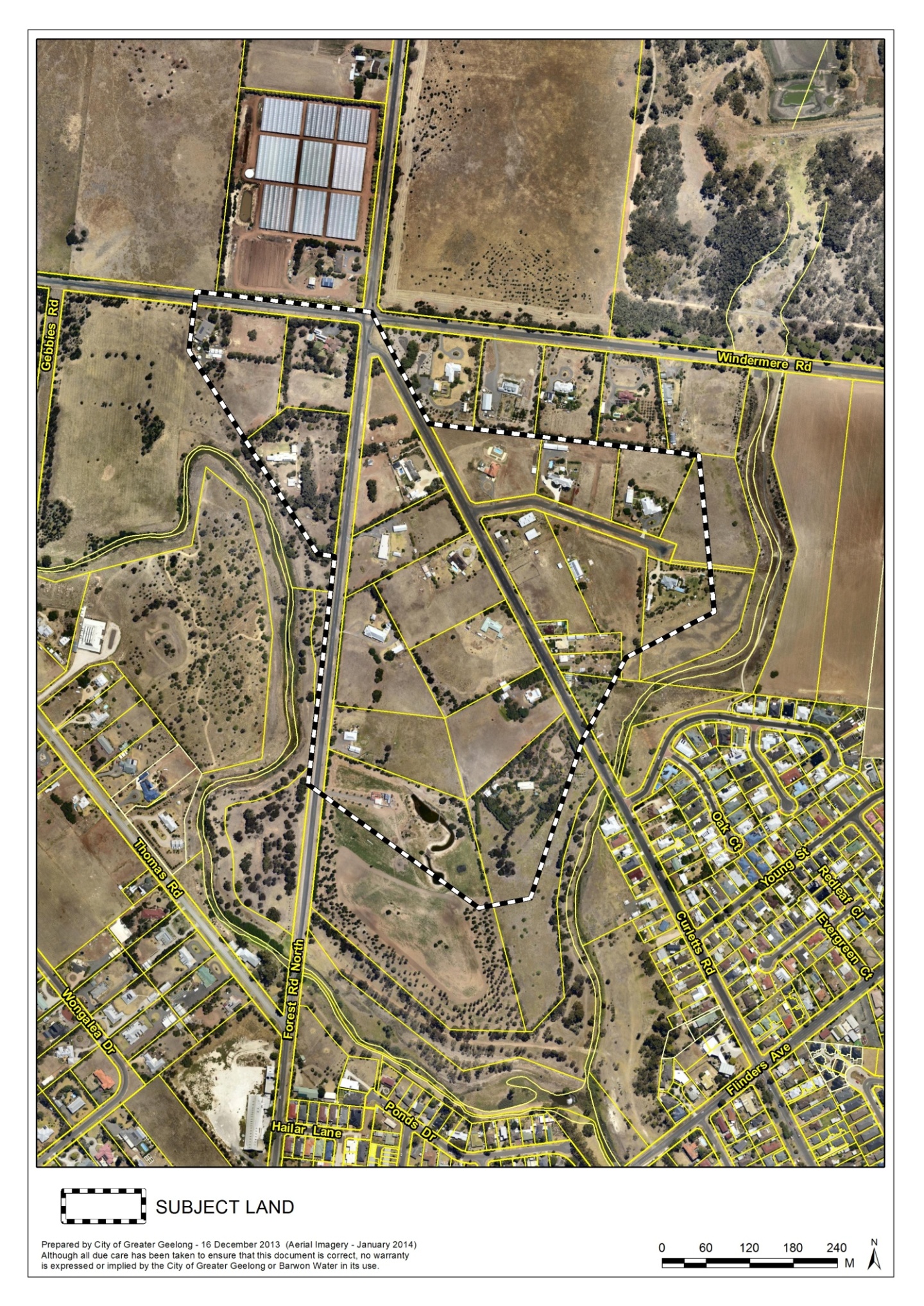
Amendment C306 proposes to rezone land in the Curletts Road, Forest Road North, Osterlund Court and Winderemere Road area of Lara (the “Curletts Road area”) from Rural Living Zone to Low Density Residential Zone and apply the Design and Development Overlay to the land to be rezoned. Appendix 1 shows the subject land.
The Amendment has been requested by TGM Group (Planning Consultants) on behalf of multiple landowners in the Curletts Road area.
Strategic justification for the Amendment is confirmed by the adopted Lara Structure Plan April 2011 and the State and Local Planning Policy Frameworks contained in the Greater Geelong Planning Scheme.
The Low Density Residential Zone is the most appropriate zone in order to retain the rural-edge feel of the area and due to the inability of the area to connect to the reticulated sewerage network, including other site constraints such as drainage and flooding.
A Design and Development Overlay (DDO) is being applied to guide the subdivision of the land.
On 22 July 2014, Council resolved to support the public exhibition of Amend¬ment C306 and it was exhibited from 18 September to 20 October 2014.
A total of 9 submissions were received including: two in support (subject to changes), three objections, and four that did not object or provided comments.
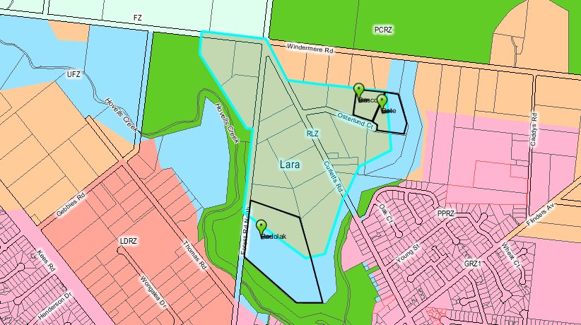
The three objecting submissions were from landowners within the proposed rezoning area who did not wish their properties to be included (see map in Appendix 2). Council officers have reviewed these submissions and recommend removing the objectors’ properties from the amendment.
The two supporting submissions requested changes to the DDO to remove the requirement to “Avoid the use of battleaxe lots and common access driveway”. Council officers have made some change to the DDO (Appendix 3) to make it more flexible and the changes have been accepted by the submitters.
The submissions have now been resolved and are not required to be referred to an Independent Panel. Council officers recommend that the amendment be adopted with the changes as detailed in this report.
Cr Heagney moved, Cr Ansett seconded -
That Council:
adopts Amendment C306 as outlined in Appendix 4 of this report;
submits the adopted Amendment with the prescribed information to the Minister for Planning requesting approval; and
advises the Minister’s department that it supports the land being rezoned to Low Density Residential Zone (Schedule 1) with a minimum lot size of 0.4 ha in the event that Amendment C309 is approved prior to Amendment C306.
Carried.
Amendment C306 resulted from an application by TGM Group on behalf of multiple landowners in the Curletts Road area. TGM submitted the application to Council in November 2013.
The area subject to Amendment C306 (as exhibited) is shown in Appendix 1 and includes 25 properties as follows:
10, 20, 30, 40, 46, 50, 50, 60 Oster¬lund Court
72-76, 75, 78, 80, 82, 84, 85, 95, 105,125 Curletts Road
90, 110, 120, 130, 145 Forest Road North
235, 245 Windermere Road
The subject land, as shown in Appendix 1, is in the Rural Living Zone (RLZ) and is approximately 31ha in area. For the most part, existing lots contain a residential dwelling and associated outbuildings.
A number of lots are affected by two zones, being the RLZ and the Urban Floodway Zone. These properties are generally located at the eastern and southern extent of the subject land
The amendment proposes to rezone the properties from RLZ to Low Density Residential Zone (LDRZ).
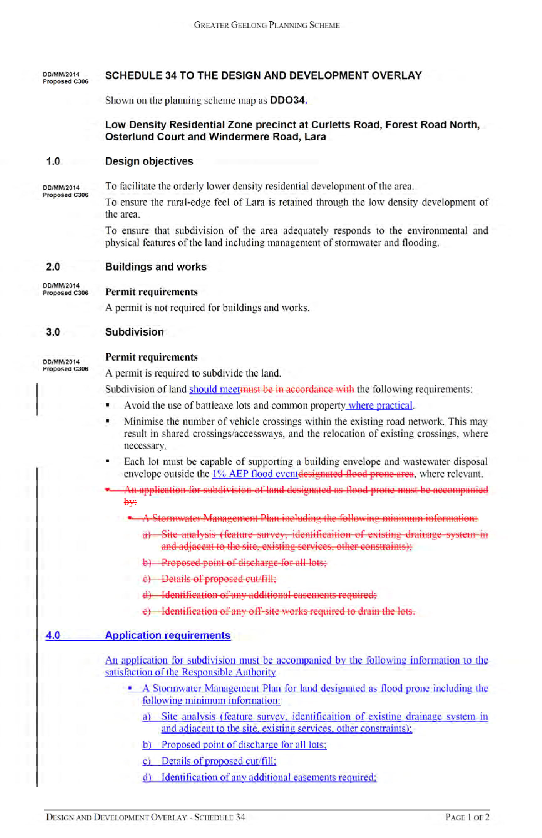
The amendment will also apply a Design and Development Overlay (DDO34). This will help coordinate the subdivision design of the land for low density residential development.
The rezoning will enable landowners to subdivide their properties to a minimum lot size of 4,000 sq.metres (0.4ha).
Future permit applications for subdivi¬sion will need to respond to the design objectives and requirements of the Design and Development Overlay Schedule 34.
The design objectives include:
To subdivide in an orderly man¬ner reflective of the purpose of the zone.
To acknowledge the rural-edge character of the area.
To ensure that subdivision responds to environmental and physical fea¬tures of the land.
Amendment C306 was placed on exhibition from 18 September to 20 October 2014. Notices were placed in the Geelong Advertiser, the Independent and sent to all relevant public authorities and prescribed Ministers. Letters were sent to the landowners subject to the amendment and some adjoining properties.
As a result of public exhibition a total of 9 submissions were received including: two in support (subject to changes), three objections, and four that did not object or provided comments. A summary of all the submissions and a Council officer response is in Appendix 5.
The following section discusses the key issues raised in the submissions that either objected or requested changes:
Removal of properties from Amendment
The three objecting submissions were from landowners within the proposed rezoning area who did not wish their properties to be included. These properties are on the edge of the proposed Low Density Residential Zone area and two are also partially affected by the Urban Floodway Zone (see map in Appendix 2). The subject properties are:
30 Osterlund Court
40 Osterlund Court
90 Forest Road North
Council officers have reviewed these submissions and recommend removing the properties from the amendment. The properties have little prospect for subdivision and are on the edge of the rezoning area next to Rural Living Zone properties (RLZ). Council officers believe retention in the RLZ is a realistic and acceptable planning outcome given the site constraints.
A letter was sent to the three landowners on 9 December 2014 advising that their land will be removed from the amendment. A follow up phone call was made to submitter number 7 who owns the property at 90 Forest Road North. His submission also referred to an adjoining property. The submitter confirmed that if his property is taken out of the amendment this satisfies his submission.
Changes to Design and Development Overlay (DDO) Requirements
The two supporting submissions requested changes to the DDO to remove the requirement to “Avoid the use of battleaxe lots and common access driveway”. Council officers have agreed to make some changes to the DDO to make it more flexible and the changes have been accepted by the submitters. Appendix 3 shows the changes that were made to the DDO Schedule including some additional changes made by Council officers to make the document more useable.
The requirement to “Avoid Battleaxe Lots” has been changed to include “should” instead of “must” and “where practical”.
Section 23 of the Planning and Environment Act 1987 details how a planning authority must consider submissions, as follows:
After considering a submission which requests a change to the amendment, the planning authority must—
change the amendment in the manner requested; or
refer the submission to a panel appointed under Part 8; or
abandon the amendment or part of the amendment.
The Amendment has been changed to satisfy the submissions and Council is now able to adopt the amendment as recommended in this report.
Of relevance to Amendment 306 is a Council initiated amendment (C309) which proposes to implement into the Planning Scheme the outcomes of the Low Density Residential Zone (LDRZ) Review 2013. C309 applies to land currently in the Low LDRZ across the municipality. As exhibited, C309 proposes to rezone LDRZ land to either Schedule 1 (minimum lot size 0.4ha) or Schedule 2 (minimum lot size 0.2ha).
In the event that C309 is approved prior to this amendment (C306), it will be necessary for the State Government to change the rezoning map to include the Curletts Rd properties in the LDRZ Schedule 1. An additional resolution (number 3) is recommended to deal with this matter.
The intensification of residential land use on the subject land is considered a good environmental outcome as it better utilises rural living land close to existing services.
The Amendment does contain some native vegetation but not to an extent that would preclude the rezoning and subdivision of the affected land.
Part of the affected land is designated flood prone under the Building Regulations 2006. The effect of this comes into force where a landowner seeks to obtain a building permit. The DDO also deals with this matter by way of implementing design requirements to be considered through the assessment of a permit application for subdivision.
The exclusion of properties along Windermere Road opposite the Serendip Sanctuary generally aligns with the principal of creating a setback between the sanctuary and increased residential use of land to the south.
There are no other notable environmental implications
There are no notable financial implications involved in the processing of the planning scheme amendment.
The Amendment complies with the State provisions of the Greater Geelong Planning Scheme, including:
Clause 11 Settlement, Clause 15 Urban Design and Clause 19.03 Stormwater.
The Amendment is consistent with the Local provisions of the Scheme including the following policies:
Clause 21.05-7 Flooding- ensures the future subdivision of the land does not impact the function of flood prone land.
Clause 21.06-2 Urban growth- ensures development occurs within designated settlement boundaries.
Clause 21.06-3 Urban consolidation- provides for the consolidation of existing urban areas in a manage way and to encourage an appropriate range of development densities.
Clause 21.08-5 Accessibility- ensures access to existing facilities for all members of the community.
Clause 21.13 Lara- in so far as implementing the Directions of the Lara Structure Plan which supports the rezoning of the subject land to Low Density Residential Zone.
The report aligns with the City Plan’s strategic direction Sustainable Built and Natural Environment. This direction seeks to protect and enhance natural ecosystems and to encourage sustainable design and reduced resource consumption.
No Council officers have any direct or indirect interest, in accordance with Section 80(c) of the Local Government Act to which this Amendment relates.
There are no notable risks that would inhibit the use of the land for low density residential purposes.
It is noted that the land is currently identified as Bushfire Prone. However, the land is not affected by the Bushfire Management Overlay (BMO).
There are no foreseeable negative social implications arising from the rezoning of the subject land.
The Amendment will not impact on any basic rights, freedoms, and responsibilities as set out in the Charter. Planning legislation ensures an open community consultation process occurs enabling people to freely express their views and if necessary, obtain a fair hearing before an Independent Planning Panel.
The Amendment has been exhibited in accordance with the provisions of the Planning and Environment Act. Further written and verbal communication has been undertaken with submitters to resolve issues raised in the submissions.

The planning authority for this amendment is the Greater Geelong City Council.
The Greater Geelong Planning Scheme is amended as follows:
The Planning Scheme Maps are amended by a total of 2 attached map sheets.
Zoning Maps
Amend Planning Scheme Map No 18 in the manner shown on the attached map marked “Greater Geelong Planning Scheme, Amendment C306”.
Overlay Maps
Amend Planning Scheme Map No 18DDO in the manner shown on the attached map marked “Greater Geelong Planning Scheme, Amendment C306”.
The Planning Scheme Ordinance is amended as follows:
In Overlays – Clause 43.02, insert a new Schedule 34 in the form of the attached document.
End of document
Portfolio: |
Planning - Cr Heagney |
|
Source |
Planning and Tourism - City Development |
|
General Manager: |
Peter Bettess |
|
Index Reference |
Application: C280 |
The purpose of this report is to consider the submissions received about Amendment C280 which proposes rezoning the land in Ash Road (west) Leopold, to recommend some changes to the exhibited amendment and to refer the submissions to an Independent Panel for review.
Amendment C280 resulted from an application made by St Quentin Consulting on behalf of Paisley Manor Pty Ltd owners of the land at 90-108 Ash Road Leopold to rezone 10 properties totalling 25 hectares from Farming Zone to General Residential Zone (Schedule 1) together with an accompanying Development Plan Overlay. The subject land is west of Ash Road, immediately east of the near fully developed Estuary Estate.
The Development Plan Overlay (DPO) Schedule has been prepared based on a draft outline development plan. The exhibited documentation also included a draft Shared Infrastructure Funding Plan (SIFP) and accompanying model Section 173 Agreement to formalise equitable developer contribution arrangements among all landowners.
Amendment C280 was placed on public exhibition from 9 October to 10 November 2014. A total of 22 submissions were received of which 6 were from public authorities offering no objection, 6 from residents of the adjoining residential and rural living areas raising amenity and health issues, and 9 from landowners in the rezoning area supporting the rezoning of the land but raising concerns about the form of the DPO, SIFP and outline development plan. One nearby landowner has objected to the rezoning of all but the applicants land.
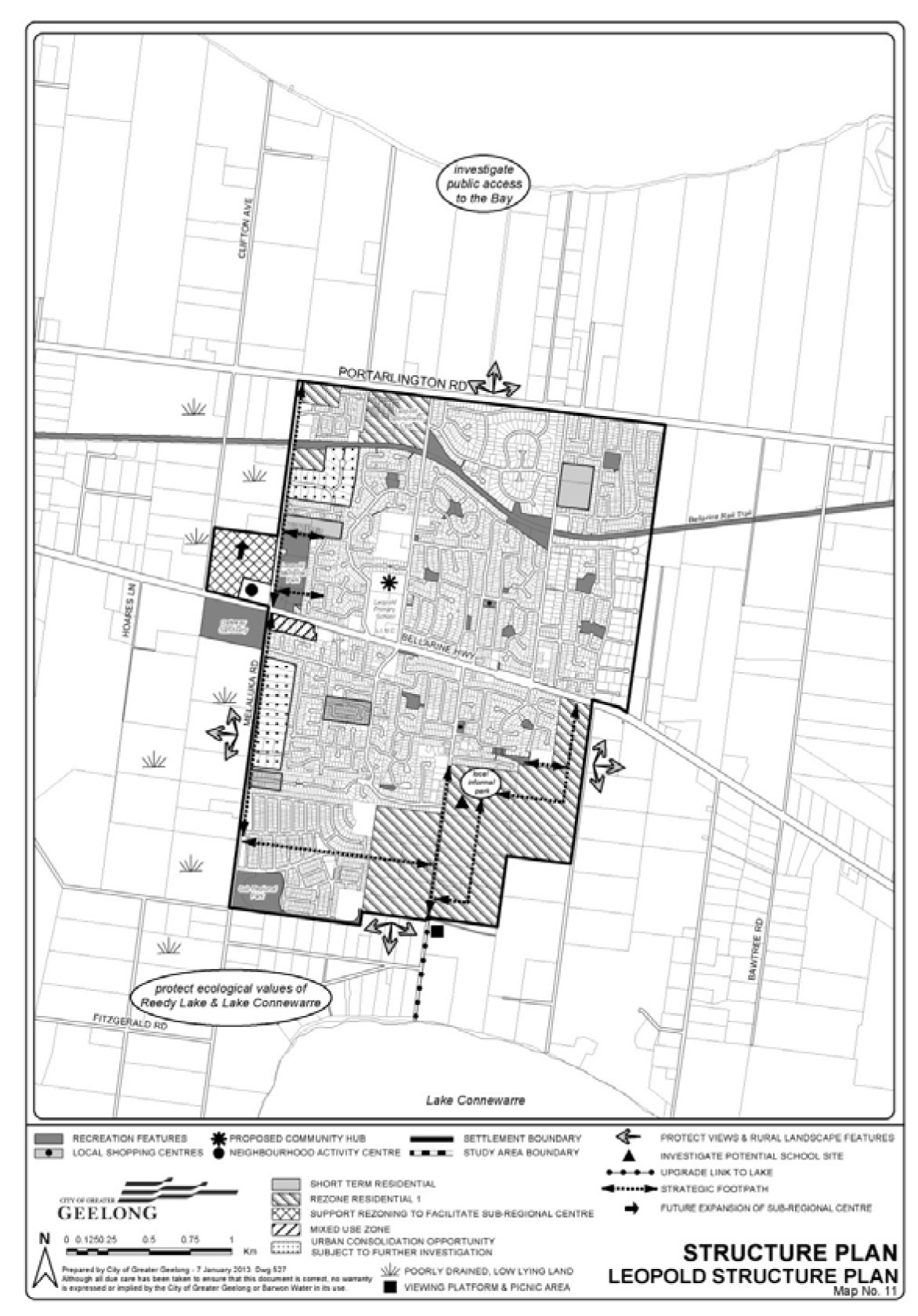
The rezoning of this area is consistent with Council’s adopted planning policy for Leopold. Its development provides for a continuation of the urban growth front across the southern edge of the township.
To address some of the points of submission, it is recommended that Council support changes to the amendment. Changes include the size and location of open space; reconfiguring the northern drainage basin and adding extra land to allow Walkers Road to become the main connector road.
As there are objecting submissions which are unable to be resolved it is necessary to refer all the submissions to an Independent Panel appointed by the Minister for Planning.
Cr Heagney moved, Cr Irvine seconded -
That Council having considered all submissions to Amendment C280 to the Greater Geelong Planning Scheme, resolves to -
support changes to the amendment to:
reduce the size of the southern co-located public open space area
reduce the width of the southern pathway/buffer reserve
delete the small park for the protection of a River Red Gum Tree
make some changes to the DPO about roads adjoining public open space and drainage reserves
seek to re-size the northern drainage basin reserve to fit onto one current landholding
remove the properties at 130 and 132 Ash Road from the SIFP
include the full cost of acquisition of the property at 132 Ash Road in the SIFP to allow sufficient land for the Walkers Road upgrade and intersection
re-position the northern open space so that a minimum of 0.6 hectare is located on the land at 90-108 Ash Road
make some changes to the Outline Development Plan and the SIFP to reflect changes in response to the submissions
and make some minor modifications to the DPO Schedule to require sealed transitions in upgrades to Ash Road at the time of subdivision of adjacent land, to address the design of basins for mosquito breeding reduction, address flooding contingencies during construction of the drainage infrastructure.
request the Minister for Planning to appoint an Independent Panel under Part 8 of the Planning and Environment Act 1987;
refer all submissions to the Panel; and
submit to the Panel its response to the submissions generally as outlined in this report.
Carried.
An application has been made by St Quentin Consulting on behalf of the owner of 90-108 Ash Road (Paisley Manor Pty Ltd), Leopold to rezone 10 properties totalling 25ha from Farming Zone to General Residential together with an accompanying Development Plan Overlay. The subject land is west of Ash Road immediately south of existing residential development and to the east of the developing Estuary Estate in Leopold. The applicant’s land holding comprises 5.9 hectares or approximately 23.6% of the proposed rezoning area. In pre-application meetings, officers requested the applicant to address all land on the western side of Ash Road within the town’s settlement boundary in the rezoning application. The land is in ten different ownerships and is used for residential, rural living and agricultural purposes.
Appendix 1 shows the land subject of the rezoning application and existing zonings. It has been substantially cleared of native vegetation apart from a few scattered remnant trees and some intact indigenous vegetation. Appendix 2 is an aerial photo of the subject land and surrounding area.
The application was accompanied by specialist planning, vegetation, aboriginal cultural heritage, traffic and engineering reports together with a draft outline development plan for the area.
Since this application was originally submitted to Council there have been ongoing discussions and negotiations with the applicant about the draft outline development plan and delivery by the developer(s) of the necessary community infrastructure in a timely manner. In this area these arrangements have been complicated by the number of individual property owners (ten) and the need to fairly apportion developer contribution costs among the individual landowners.
Identified shared infrastructure requirements include:
Provision of 2 stormwater retarding basins
Provision of 2 local parks, continuation of a shared pathway reserve to the south and a pocket park for remnant tree protection (minimum 10% of the overall area)
Upgrade of the queuing right hand turn lane on the Bellarine Highway at the intersection with Ash Road.
A shared pathway along Ash Road.
$900 per dwelling community infrastructure levy.
A Draft Shared Infrastructure Funding Plan (SIFP), which was prepared by the applicant in consultation with Council, sets out the shared developer contribution arrangements apportioning the costs equitably amongst the ten landowners. Officers reviewed these costs against industry standards and Council experience and provided input to the preparation of the final draft. The SIFP, along with an accompanying template Section 173 Agreement to formalise these arrangements, were exhibited as part of the amendment documentation.
It is intended that the Section 173 Agreements with the individual landowners be signed prior to the adoption of the Amendment.
Appendix 3 is a copy of the exhibited Amendment C280.
Amendment C280 was placed on public exhibition between 9 October and 10 November 2014. Notices were placed in the Geelong Advertiser and set to all affected landowners and occupiers and all relevant public authorities.
As a result of the exhibition of the Amendment Council has received a total of 22 submissions were received of which 6 were from public authorities offering no objection, 6 from residents of the adjoining residential and rural living areas raising amenity and health concerns, and 9 from landowners in the rezoning area supporting the rezoning of the land but raising concerns about the form of the DPO, SIFP and outline development plan. One nearby landowner has objected to the rezoning of all but the applicants land.
Appendix 1 is a schedule which summarises all submissions received. One landowner within the rezoning area did not make a submission.
The following section of this report discusses the key themes of the submissions followed by the officer’s response to them.
Objection to the rezoning proposed by Amendment C280;
The distribution and amount of open space across the rezoning area;
The alignment of the collector road – extension and widening of Walkers Road;
Size and siting of drainage assets;
Changes to the Development Plan Overlay Schedule 33;
Concern about Existing Dam (on Maroulis Land);
Consultation Process;
Inclusions and exclusion of items in the Shared Infrastructure Funding Plan and land valuations; and
Management of boundary issues such as fencing and construction management.
Objection to the rezoning proposed by Amendment C280
One resident of The Avenue, Leopold and co-executor of the land at 191 Ash Road, to the south of the rezoning area, has objected to all the properties to the south of 90-108 Ash Road being rezoned to Residential. The submitter’s concerns include the loss of the rural flavour and open rural feel of this part of Leopold as it slopes down towards Lake Connewarre. The submitter instead submits that the land should be rezoned to Rural Living, meaning it will still be subdivided into smaller lots for these landowners and that it will be more sympathetic to the rural nature of the area.
Officer Response
A 94 hectare area of south/east Leopold was identified in the 2006 Leopold Structure Plan as Area 4 as a future residential development opportunity and growth location for Leopold. This designation has continued in the January 2013 Leopold Structure Plan with recommendations to rezone the area to Residential 1 Zone and accompanying relevant overlays. Clause 21.14-2 of the Municipal Strategic Statement (MSS) within the Planning Scheme has the specific strategy for Leopold of:
“Support the development of the Ash Road Growth Area and other areas identified for residential development on the Structure Plan map.”
From a strategic planning viewpoint there is strong State and Council policy justification to support this proposed rezoning. Retention of the rural feel of the area through the application of the Rural Living Zone is inconsistent with policy and is not supported.
The distribution and amount of open space across the rezoning area;
Most of the submissions from owners of the land subject of the amendment have commented upon the amount and distribution of open space across the rezoning area. Submissions state that there is sufficient open space in this area of Leopold so none is required to be provided here, whilst others have opposed the proposed positioning of open space across the area. Submissions have commented that the open space to the north of Walkers Road disproportionately affects smaller landholders, favouring the proponent applicant with the largest land parcel. For the area to the south of Walkers Road, a submitter argues that the open space should not be co-located with the drainage reserve but rather should be located on neighbouring properties to allow it to be surrounded by roads on four sides and to be more fairly apportioned across other landowners. For the open space buffer along the southern boundary of the site, one submitter questions the need for it at all, whilst another (Tract) considers it to be too big and should be reduced from a 15 metre wide strip to a 6 metre wide strip.
Officer Response
Officers have reviewed the open space needs for the area taking into consideration the provision of open space in surrounding developments and the proposal to locate a 2 hectare district park in the next growth area to the east of Ash Road through to Mollers Lane. Advice from open space planning is that a 1 hectare size park is still required in the rezoning area to the north of the Walkers Road to provide for local and easy access for future residents. The future location of the district park is not yet planned and the upgrade to Ash Road to provide access to the residential development planned for both sides will provide a barrier to easy access.
Southern Open Space
Officers have considered the amount of open space provision to the south of Walkers Road and have concluded that the southern open space can be reduced to 0.5 hectare as it is to be co-located with the southern drainage basin. This represents a reduction of 0.351 hectares of open space. Whilst there is a well argued point by Tract Consultants on behalf of the owners of 160-172 Ash Road to move the southern open space northwards to be more centrally located to the area south of Walkers Road, officers support retaining it in the exhibited position. Co-locating the open space with the southern drainage reserve allows for a substantial reduction in the area of open space required as the 2 parcels will effectively operate as a single, seamless park. If a stand alone park was required, this would need to be one hectare in size; in the collocated context, it is only required to be 0.5 hectares. The requirements of clause 56.05-2 of the Planning Scheme also direct that open space should be “integrated with floodways and encumbered land that is accessible for public recreation” and be “integrated with urban water management systems, waterways and other water bodies”. Co-locating open space also provides benefits and efficiencies for maintenance, provides a greater sense of space and amenity for users and extends the area available for use. The drainage basin is intended to only store water for relatively short periods of time after rain, with its main function to retard the flow to the outlet. It is not intended to operate as a permanent water body and be wet all the time. Designed with safety in mind these spaces are safe for children to visit and use. A suggestion was made by the owners of the southern most property for offsetting this open space to the north so that 6 ‘prime’ development lots could be achieved between the basin reserve, the open space reserve and the pathway/buffer reserve. Officers are not supportive of this proposal as it would not neatly meet the requirements of the Planning Scheme for open space to be suitably dimensioned and dilutes the effect and benefits of the co-location.
Southern Buffer
The southern boundary open space pathway is performing a ‘linking function’ and a buffer to the rural area to the south, but will not have any drainage function like the link way on the southern side of the Estuary Estate. For this reason, it is recommended that the land area be reduced to a 10 metre wide strip rather than the exhibited 15 metre wide strip. This represents a reduction of 0.134 hectares metres of open space, whilst still maintaining sufficient space for landscaping, a 2.5metre wide shared path and grassed area to the road kerb. It is noted that the shared path on the southern boundary of the Estuary Estate meanders within the reserve, hence uses a large portion of its 15m width. Retaining a wider reserve than that requested by the submitter will also ensure consistency in urban design outcomes.
Pocket Park
Officers support the deletion of the 594 m2 pocket park for the River Red Gum tree north of Walkers Road as the tree has been removed from the site. It therefore no longer requires a public open space reserve.
Northern Open Space
It is recommended that the northern open space be relocated so that at least 0.6 hectare is located on the proponent’s land at 90-108 Ash Road with the balance located on the land at 110-116 Ash Road. This will reduce the amount of open space affecting this latter property and will remove it completely from the land at 118-128 Ash Road. The intent of this change to the amendment is for 10% of the applicant’s land to be provided as open space so that a park can be delivered on site when this land develops. This park can be delivered in two stages, with the balance to be provided when land to the south develops. The effect of this change is that at the start of subdivision in this area a reasonable sized park will be able to be delivered with the balance provided as the next land parcels develop.
As a collective, these changes result in a reduction of open space across the rezoning area of 0.5444 hectares. This will increase the development area for landowners; reduce the open space costs in the SIFP whilst maintaining adequate open space provision for the future residents of the area.
The alignment of the collector road – extension and widening of Walkers Road
Some submitters oppose the proposal to continue the Estuary Boulevard eastward to join with a widened Walkers Road and intersecting with Ash Road. This proposal will seriously impact on the two smallest properties within the rezoning area with the required road widening affecting not only the properties, but also parts of the house structures. Another submitter, owner of the land at 118-126 Ash Road, also opposes this route for loss of land from their property for the road widening when alternatives are available.
Suggested alternatives (including diagrams) for routing this collector road through the rezoning area have been put forward by 2 submitters. These would involve diverting the through road further to the south, with Walkers Road either being truncated into a court bowl or extended and curved in a north westerly direction to meet a planned north south road adjacent to the northern drainage basin.
The submission from Mr Szakiel has raised issue about the proposed DPO Schedule making provision for separate development plans to be approved north and south of Walkers Road.
Officer Response
The route of the through collector road was established in the planning work done for the Estuary Estate a few years ago. In the first information session for Amendment C280, the continuation of the Estuary Boulevard through to join up with Walkers Road was outlined. At the time of exhibition the landowners of the 2 smallest properties alerted to the fact that the widening of Walkers Road to a 22 metre road reservation would significantly impinge on their properties and houses. The through route is still the favoured option as it will also provide an opportunity to continue the road further eastwards as part of the future development east of Ash Road towards Mollers Lane. The ‘curved’ nature of the Estuary Boulevard has been implemented to respond to the topography of that land, and there is not the corresponding need in this development area to do the same. It is reasonable to continue Estuary Boulevard along the straight route joining with and using an existing road reservation for the route.
Officers have investigated how a widened road could be achieved within the existing road reservation at the point closest to Ash Road. Engineering advice is that it is not possible to achieve a two lane road, verge and shared pathway in the current space of 15 metres, even leaving out on-street parking lanes.
To achieve the through route along the exhibited alignment will necessitate the acquisition of either of the small properties at 130 and 132 Ash Road.
The owner of 132 Ash Road is willing to consider his property being purchased in the future to allow Walkers Road to connect to Ash Road. As a result the cost of acquisition of 132 Ash Road will be added to the Shared Infrastructure Funding Plan.
The provision for separate development plans to be prepared for the areas north and south of Walkers Road is reasonable; it leaves a question about how the upgrade and extension to Walkers Road will be delivered. To remove any concern about this, it is proposed to require the first stage development plan to include a strategy for delivering an upgraded Walkers Road to a collector road standard.
Size and siting of drainage assets
Two submissions address the issue of the size and siting of the drainage reserves in this area. Firstly, the submission from an owner adjoining the proposed site of the northern basin (S. & R.McCurdie) expresses serious concerns about the location of the basin and its integrity over the long term as it is in proximity to his house.
Secondly, Tract has also submitted that the southern basin is unnecessarily oversized and should be reviewed, requesting that it be re-designed based on the 2008 SMEC Urban Pre-development Drainage design which recommended a Q100 value (flow rate for the 1 in 100 year flood event) of 1.170 cumecs (cubic metres per second). This would in turn reduce size of the southern basin and its reserve area.
Officer Response
Northern Basin Location
It is not unusual for a detention basin to be located upstream and adjacent to existing housing, provided some basic precautions are taken in siting, design and construction. The northern basin has been designed to accommodate flows generated by the 1% Annual Excedence Probability (AEP) rainfall event in line with industry best practice. It is difficult to absolutely guarantee overflow will never occur as there is always a chance, however slight, that a greater than 1% AEP rainfall event will occur. In such an event, the risk of flooding to established housing is minimised through the structural design of the basin walls and by providing a spillway directed toward the road network.
Detention basins can hold significant amounts of water, hence are subjected to the same risk assessment as dams. Seepage and groundwater conditions are expected to be no different than if the submitter adjoined an area of open space.
The overall drainage design must ensure there is no adverse impact on adjoining properties by, amongst other criteria, limiting run-off from the development site to rates no greater than pre-development.
Size of Southern Basin
The Estuary Drainage Master Plan and the drainage infrastructure constructed as part of the Estuary Estate allowed for an undeveloped (i.e. farmland) 100 year ARI flow rate of 1.17 cumecs from catchment D (area of 12.5 hectares). Approximately half of catchment D is to be developed with the balance to remain rural with this area outside the current Leopold settlement boundary. Q100 flows from the rural land will not drain into the proposed southern basin but will drain directly into the corridor on the southern boundary of the Estuary Estate. The approach taken by Peter Berry is that a flow rate of 0.585 cumecs can be attributed to the rural land, by simply halving the calculated flow rate for undeveloped catchment D. The permissible discharge rate from the basin must therefore be 0.585 cumecs so that the total Q100 flow from developed and undeveloped land is no greater than 1.17 cumecs.
Whilst this is a conservative and simple approach, the proposed basin sizing is supported by engineering officers.
Changes to the Development Plan Overlay Schedule 33
The submission from Tract has sought the DPO Schedule to be changed to contain some commentary supporting reduced road widths adjacent to public open space or drainage reserves, and for open space to be bounded on at least three sides by streets to provide an improved urban design outcome for the new residential area.
DEPI has submitted that it is not clear how their suggested approach for the phased construction of stormwater infrastructure elements has been dealt with or whether it will be addressed more directly at the subdivision stage.
Officer Response
Road Reserve Widths
Officers agree in part with the submission by Tract consultants that road reserve widths can be reduced to 13 metres where the land abuts open space. This is supported for the roads abutting the pathway/buffer reserve, the northern drainage basin and the co-located southern drainage basin and open space, and is provided that services are still located within the road reserve and not within the open space. Officers disagree with this for the northern open space where it is mid-block and changing the road reserve width 3 times along a single length of road is not supported.
Roads Surrounding Open Space
The draft outline development plan and accompanying DPO Schedule 33 have provided for the minimum from the City of Greater Geelong’s Sustainable Communities (Infrastructure Development Guidelines – October 2010) which encourage new public reserves to have at least two/three street frontages. It is unfortunate that this is expressed in this way as it promotes a bare minimum standard that planners believe to be less than ideal. It is the strong preference of strategic and open space planning officers for open space reserves to be bounded on four sides and this is likely to be reflected in the current review of the Guidelines, at the least, the requirement for three street frontages as a minimum is expected to be strengthened. With the changes to the open space distribution to the north of Walkers Road, there will be scope for the open space there to be bounded on three sides by roads and this will result in an improved urban design outcome for the area. Officers support the suggested wording proposed in the Tract submission, “Public open space areas, including the basin reserves, with street frontages on at least three boundaries. Where spaces are located adjacent to existing boundaries not fronting a street, open space areas including the basin reserves may provide not less than two street frontages. Where possible, open space should not be bordered by back fences;”.
Construction priority for southern basin
Officers support the points made by Tract to prioritise the construction of the southern water basin and to minimise development until the southern water basin is constructed. These are already reflected in the SIFP Table 5, in which the basin must be constructed at the time of the first subdivision in the catchment. This can be reinforced in the DPO Schedule.
Construction management
DEPI has expressed concern that experience elsewhere is that where stormwater detention basins have flooded following heavy rain during construction, prior to the basins being connected to discharge facilities. This flooding has delayed completion of the basins themselves, and floodwater treatment and disposal has posed challenges for developers. It is their belief that this arises from contemporary construction phasing approaches associated with water sensitive urban stormwater systems. This situation is particularly of concern to DEPI as the receiving waters will be Reedy Lake/Lake Connewarre which is a RAMSAR site.
As the development plan and planning permit approvals processes address the construction environment management plans (CEMP) as standard conditions, the DPO Schedule has not included the requirement for a construction management plan. Any development will need to be undertaken in accordance with EPA and other development guidelines and comply with current construction management techniques. A small addition to the Stormwater Management Plan section of the DPO Schedule can be made to include a requirement that the development outlines in detail the construction and maintenance requirements of the drainage basins, in particular while development is proceeding and to incorporate contingency measures for floodwater treatment where flooding occurs prior to all infrastructure being connected.
Concern about Existing Dam (on Maroulis Land)
Tract has also outlined concerns about the size of the southern drainage basin and the interim liability of the existing farm dam on properties developing to the west in the Estuary Estate. Concerns have also been raised by Tract on behalf of the Maroulis family that development in the Estuary Estate adjacent to a current dam on their property could be vulnerable to flooding from the dam, particularly as it sits above the newly developing properties and was not designed for the >1% ARI event. As this is the location of the proposed southern drainage basin, which is not disputed, there is concern that the current dam is not designed to cater for the 1% ARI event and that if any land south of Walkers Road is developed prior to the upgrade of the dam to a suitable standard that it will further endanger the properties currently being developed to the west within the Estuary Estate. Tract is seeking Council to add wording to the DPO33 to ensure that the required Integrated Water Management Plan has due regard for the potential impacts downstream of the developing properties in the southern catchment, including:
Prioritising the construction of the southern water basin…
Minimising development… until the southern water basin is constructed
Further, Tract seeks that Council puts in place the following actions:
writing to the owners in the Estuary Estate outlining the risks and hazards associated with the dam..and how Council is mitigating this…
halting construction of these neighbouring properties until the southern drainage basin is constructed
Officer Response
It is noted there are concerns relating to the capacity of the existing dam on the southern property to handle 1% AEP flows. The open space strip on the southern boundary of the Estuary Estate functions as an overland flow path for major flows and appears to have been configured to accept run-off from the dam’s spillway. If the owner is aware of structural and/or design deficiencies, under provisions of the Water Act it is the owner’s responsibility to rectify such deficiencies and maintain a safe structure. Notice of exhibition of the Amendment and copy of the draft outline development plan was sent to all abutting landowners within the Estuary Estate; so they would be aware of the location of the southern drainage basin and the collocated open space.
Officers have held discussions in the past with landowner Mr Maroulis about the issue of his dam adjacent to the neighbouring properties in the Estuary Estate and are aware of his concerns. No conditions were required to be placed onto the planning permit addressing this issue or halting/delaying the construction of nearby properties. The design of the Estuary Estate has allowed for both an overflow from the existing dam and a designated flow path when the southern drainage basin is constructed and this provides a path for any excess water.
Consultation Process
Some submissions from landowners in the rezoning area have been critical of the lack of engagement between the applicant, Council and them during the preparation and consideration of the rezoning application. Fadgyas Planning Associates specifically asked for submissions to not just be referred straight to a Panel, but rather for Council to consider changes to the amendment first in acknowledgement of the lack of consultation during the preparation of the amendment for exhibition. Other submitters wanted to have engagement and more say in the development of the draft outline development plan earlier in the process rather than during the exhibition period of the amendment, and have expressed frustration that the planning costs are being shared in the SIFP but not the contribution to the development of the plan.
Officer Response
Working with an applicant across an area encompassing a number of landowners has been difficult to negotiate. The outline development plan prepared by the applicant shows all the appropriate infrastructure such as open space, drainage and key roads. The location of these items was partially dictated by topography and the logical extension of the development form within the Estuary Estate. With the exception of open space there is not a great deal that could have been changed or influenced if the process had been done differently.
This was not a precinct structure plan exercise or a strategic planning process that Council was dealing with; rather officers have been dealing with an applicant of a rezoning application. There have been other more successful approaches to rezoning land across multiple smaller land ownerships such as Manzeene Avenue in Lara and Trethowan Avenue in Ocean Grove. In both those cases a lot of work was put in by a single or small grouping of landowners working together to get the majority on board with the rezoning application and process and whilst time consuming, have yielded the benefit of a smoother and less acrimonious amendment process. It is fair to comment that officers would be reluctant to undertake this process again where a single landowner made a rezoning application for a wider area with multiple other landowners.
The parameters of the development were outlined to all landowners at the very first information session held in April 2011, including the location of drainage basins, need for 10% open space, continuation of pedestrian access from Estuary Estate and Walkers Road continued to join with Estuary Estate. These have not fundamentally changed since that time, but an “enquiry by design” early on in the process may have been of benefit in engaging the landowners.
Inclusions and exclusion of items in the Shared Infrastructure Funding Plan and land valuations
Some submissions have sought changes to the items that have been included and excluded from the SIFP.
Submissions from Tract and Simon Carter have requested that planning costs be removed as they believe the applicant had committed to funding these as part of the application to rezone.
The submissions from Simon Carter and Gwen Prosser request that the costs of the through collector road also be included in the SIFP like the costs to upgrade the Ash Road/Bellarine Hwy intersection have been included. It is submitted that this is ‘shared’ infrastructure for the whole development and that the burden should not just fall onto the adjoining landowners.
The submission from Tract also requests that half of the cost of the roads abutting public open space be included in the SIFP as had been flagged in the Peter Berry Stormwater and Services Report accompanying the application.
Tract further submits that the SIFP be clarified to ensure that indexation is appropriately informed by revised land valuations and that generally this section of the SIFP be revised to clarify its intent.
Tract has challenged the Westlink Consulting Valuation Report that supports the SIFP, in particular the assumption that the land to the south of the rezoning area is likely to develop at a later stage and therefore has been attributed a lesser per hectare valuation rate of $750,000 compared with the $900,000 for the northern most property (the applicant’s land). This in turn affects the contribution calculations.
The inclusion of the $900 community infrastructure contribution in the SIFP is opposed by Tract, submitting that this should be paid only at the building permit approval stage for dwellings within the area.
The submission from Kaz Szakiel has commented that the costings for the development are wrong as the planned subdivision relied upon in the supporting Stormwater Management Strategy and Services Report by Peter Berry and associates is superseded by the proposed outlined development plan. It is his submission that the DCP updated and it and the amendment be re-exhibited. Similarly the submission from Simon Carter questions the amount of the costings for some items as being excessive.
Officer Response
Planning Costs
Planning costs are a normal and reasonable cost to include in a SIFP or the alternative of a development contributions plan. The two submitters that have raised this issue have reiterated verbally to officers that the applicant made the commitment at the pre-application information session and that all landowners agreed to this. This is not a universal recollection amongst all landowners so can not be verified and Council does not have any evidence in writing that this was agreed amongst all the landowners. Despite this, the nature of the application changed during the consideration process as it was determined that the development could not be delivered without a SIFP. In this context the costs of preparing the SIFP, its supporting documents, and the S173 Agreement are to be shared by all parties.
The applicant has advised that planning costs included in the SIFP include:
Costs in preparing the Amendment request:
Sub-Consultant costs including Traffic – Cardno, Archaeology – Terra Culture (Heritage Assessment Report), Culture Heritage Management Plan (CHMP) Ecology & Heritage (note: specifically excludes 21-29 Walkers Rd), Wathaurung Aboriginal Corporation costs of reviewing and approving CHMP, Arboriculture – Shepard Tree Management, Ecology – Ecology and Heritage, Drainage and stormwater management – Peter Berry, Preparation of Shared Infrastructure Plan – Urban Enterprise, Landscape design – Mexted Rimmer
Projected applicant future costs (including an estimate of cost of representation at Panel)
Projected Sub-Consultant costs
All landowners will be deriving a benefit from the rezoning application that has been undertaken by one of the landowners, and it is common for both the benefit and cost to be shared.
Road Construction Costs
Officers do not support the inclusion of half the costs associated with the construction of roads adjacent to public reserves. The layout as proposed in the outline development plan is dictated by contemporary and proper design that incorporates safety, amenity, aesthetics and casual surveillance into new residential areas, and into the design and location of open space. As noted earlier in this report, it is agreed to reduce the road widths of roads adjacent to open space, especially on the southern most lot in recognition of the costs of developing roads next to public open space and drainage reserves.
Community Infrastructure Contribution
Officers support the retention of the $900 community infrastructure contribution per residential lot within the SIFP and to be paid at the time of subdivision in lump sum amounts. This is considered more efficient and providing certainty of funding for Council and avoids the drip-feed of hundreds of $900 amounts over several years.
Land Valuations
Officers will consult with Westlink Consulting about the assumptions used in the preparation of the valuations.
Clarifications
With the changes proposed to this amendment to respond to the submissions it will be necessary to revise the SIFP and the draft outline development plan. This will be done prior to a Panel Hearing and communicated back to the submitters. Further changes may also be necessary as a result of any Independent Panel recommendations.
The costings prepared for the draft SIFP have been internally tested by officers and are within the range of costings for other urban growth areas and developments. The initial subdivision plan included in the Peter Berry Report has certainly changed compared with the exhibited draft outline development plan, but it is deemed to be conservative in its design, and any differences between the two versions are considered to be marginal in the context of modelling.
The SIFP should be a very clear and unambiguous document and will be checked by officers to confirm its clarity. A verbal suggestion arising from a meeting with Fadgyas Planning Associates was to review the draft Section 173 Agreement to use more plain English language so that it more capable of being understood by the landowners who will be asked to sign it. This is a reasonable suggestion and officers will work with Maddocks lawyers to improve the language and legibility of the final Agreements.
Management of boundary issues such as fencing and construction management
Submissions from residents and landowners surrounding the rezoning area have made comments about the impact of the development on their security, privacy and health through the management of dust, rubbish and mosquitoes. These submissions have requested the developer to pay for the installation of either timber paling fences or chain wire mesh fencing along the southern boundary of the pathway/buffer reserve.
Experience during development of the Estuary Estate over the past few years has led some submitters to seek Council to nominate a specific person to which complaints and concerns about issues during construction can be directed to. Dust suppression and control of rubbish during high wind events is sought through limits on development and noise to be controlled through strict hours of operation.
Two submitters have commented about the need to control the means of mosquitoes breeding in the drainage basins, as this is of great concern to public health with the proximity of the basins to surrounding residents.
Officer Response
Construction Amenity Impacts
With any major subdivision development dust will be generated. Development Plan approvals and planning permits for subdivision contain standard conditions for construction management plans to be prepared and implemented during the subdivision construction phase. These are to demonstrate how the construction site is to be managed and off-site impacts avoided. The plans are monitored by Council’s subdivision inspectors who are regularly out in field to monitor and ensure that contractors are doing the right thing and abiding by their obligations. Construction management plans are developed according to the site constraints, access, local issues, and local conditions and are site specific. For dust suppression, water carts are required to be on site, work is to be planned around forecast weather events, avoiding the stripping of all on-site vegetation at once and hydro-mulching are the commonly used techniques included in construction management plans. There has been ongoing improvement in this process for Council in recent years. Council has an after hours call number for any complaints where operators are not adhering to the agreed plan. This goes to a specific Unit, Infrastructure Management Unit, rather than a specific person as requested by the submitters. Contact is also available through the enforcement officers within Statutory Planning.
Saturday construction is allowed for but with a later start time, and EPA Guidelines set out the parameters for noise emissions.
Mosquito Breeding
More constructed wetlands or drainage basins are being developed within residential estates and if not carefully managed, they can become mosquito breeding sites. Generally, mosquitoes will breed if there is shallow water with no wave action, so wetlands with steeper edges and deepish, open water generally do not breed. Mosquitoes will breed also around pockets of vegetation that remain wet or marshy, so limiting the marsh like vegetation, would be good preventative measure.
Council’s experience is that a lot of the constructed wetlands around Geelong, whatever their purpose, do not breed mosquitoes in the first few years after development as they are generally constructed well. The problems happen after a few years as the site becomes unmaintained, and the vegetation grows to limit the wave action and access to the wetland for monitoring and maintenance. The wetland system on Melaluka Rd Leopold is a good example of this.
If the site is for a water catchment basin, that only fills after heavy rainfall, they generally do not breed mosquitoes unless it is a really wet year and the site remains full of water for a long period of time.
Council monitors and treats mosquito breeding sites for mosquito larvae on a regular basis around Leopold and the rest of the Bellarine Peninsula. The major mosquito breeding sites are in the large wetland areas of Lake Connewarre, Reedy Lake and Swan Bay, and these are the targets of Council’s aerial treatment program.
Council also monitors various wetlands and drainage basins around Geelong and treats them by ground based methods with larvicides as needed, this includes many sites in Leopold. This rezoning area could be added to Council’s list to monitor, but obviously, it will be best if the site did not breed mosquitoes in the first place.
Guidelines are available on how to design and construct major drainage elements to minimise mosquito risk. The Development Plan Overlay will be changed to include requirement for the design and construction of the drainage basins to include measures to discourage mosquito breeding.
Bio retention elements are designed to retain water for no longer than 72 hours, insufficient time to allow mosquito breeding. Open drainage channels and basin bottoms are graded so that water drains toward an outlet and is not held for long enough to become stagnant. If wet patches do remain in other areas, this will be no worse than in parkland areas or backyards.
Fencing along the Southern Boundary
Officers do not support the installation of solid timber paling fences along the southern boundary of the shared pathway/buffer reserve. The existing reserve abutting the southern edge of the Estuary Estate has been developed without the installation of solid fencing, rather favouring the standard rural post and wire fencing. This reserve is to be landscaped with vegetation to provide screening between the private land and the reserve, whilst maintaining casual surveillance. Experience in Armstrong Creek growth area is that passive open space between residential and farming areas is not fenced with solid fencing. Management of fencing during subdivision construction, particularly for any land south of Walkers Road, will be a matter for consideration in a construction management plan. Change to the amendment is not recommended.
Other Matters
Submitters to the south of the rezoning area have raised the need to upgrade and seal Como Road and the need to continue the footpath along Ash Road south of the rezoning area to the Lake Connewarre lookout.
DEPI has noted that the since the rezoning application was prepared, Amendment VC105 has come into effect and given this, DEPI recommends that the ‘Flora and Fauna Assessment, and Net Gain Analysis Ash Road, Leopold’ prepared by Ecology Partners (July 2011) to support the rezoning be revised to conform to current standards. Whilst not vital to support the Amendment, an early revision will ensure that native vegetation information and required offsets will meet the Native Vegetation Policy Permitted clearing of native vegetation – Biodiversity assessment guidelines (DEPI 2013).
Officer Response
Como Road has a partial seal only at the eastern end where it meets Ash Road. Further works to upgrade Como Road are unlikely to be a priority for Council as other road upgrades across Geelong are more pressing in need. Should traffic conditions change for Como Road as development of the southern part of the rezoning area progresses, Council can evaluate priorities at that time, but for development in the northern area, any changes to Como Road are unnecessary. Owners in Como Road have the option of working together as a group and lobbying for a special rate and charge scheme to be prepared for a road upgrade at any time.
It is a long term view to extend the footpath along Ash Road south of the rezoning area to connect with the Lake Connewarre lookout. This will however require a critical mass of people in the area and it is premature to undertake this now.
Officers agree with the recommendation of DEPI on the need to update the environment report accompanying the rezoning application to ensure that it capable of being implemented in accordance with the new native vegetation policies. This can be undertaken post the independent panel hearing.
As the receiving waters for this area is Reedy Lake and Lake Connewarre which is part of a RAMSAR wetland, approval from the Federal Department of Environment is required under the Environment Protection and Biodiversity Conservation Act 1999 (EPBC Act). The applicant has separately lodged an application with the Commonwealth with reference to potential impacts to listed RAMSAR wetlands. The assessment under that Act is progressing but no time frame for approval has been given. It is not anticipated there will be any significant implications for the rezoning as this process was similarly undertaken for the adjoining Estuary Estate a few years ago. Any conditions/requirements from a Commonwealth approval could be accommodated within the DPO Schedule prior to its adoption.
It is proposed to construct two retarding/bio retention basins in the area having regard to water sensitive urban design guidelines. The system will direct the 1 in 100 year stormwater runoff to these basins which will retard outflows and treat the water before discharging downstream.
Several remnant trees that are in poor condition will be lost as part of this development. Offsets for lost native vegetation will be required offsite as part of the DPO.
The Development Plan Overlay schedule includes requirements relating to protection of remnant vegetation and management of stormwater to prevent downstream pollution.
The Leopold Structure Plan states that: “Land on the Bellarine Peninsula including Leopold has a history of potato growing and in some cases this included the use of dieldrin and DDT. Council must be satisfied there are no contamination issues with the land in accordance with Ministerial Direction No. 1 – Potentially Contaminated Land. An Environmental Audit Overlay may be required as part of a rezoning proposal to satisfy this requirement.”
A technique that has been used in the Jetty Road growth area in Drysdale/Clifton Springs includes a requirement in the Development Plan Overlay for the contamination issues to be addressed prior to the approval of a development plan. This technique avoids the use of an Environmental Audit Overlay as part of the rezoning process.
The draft Shared Infrastructure Funding Plan (SIFP) identifies all the capital financial requirements for the provision of infrastructure across the Ash Road west growth area. The draft SIFP details the specifics of the development contributions to relevant infrastructure and spread across all properties affected by the amendment. In exceptional circumstance if developers are unable to deliver the works in-kind, development contributions will be collected by Council and works delivered by Council.
The costs associated with a Panel Hearing will be met by the proponent of the Amendment.
The Amendment is consistent with the State Planning Policy implementing the objectives and strategies of Clause 11 Settlement, (in particular Urban Growth Clause 11.02, Open Space Clause 11.03 and Regional Development Clause 11.05), Clause 12.01 Biodiversity, Clause 15 Built Environment & Heritage, Clause 16 Housing and Clause 19 Infrastructure.
The Amendment also is consistent with the Local Planning Policy Framework, in particular Clause 21.06 Settlement & Housing identifies Leopold as one of the City’s designated primary urban growth areas. Clause 21.14 The Bellarine Peninsula sets out objectives and strategies for development of the Peninsula and each of the towns as contained in the adopted Structure Plans. The proposed rezoning is consistent with the adopted 2013 Leopold Structure Plan and as such is consistent with Clause 21.14 of the LPPF, both advocating that the area be rezoned for conventional residential development.
The Amendment is also consistent with a range of other environmental, infrastructure, developer contributions and open space policies contained in the MSS.
The Amendment supports the Growing our Economy and Sustainable Built and Natural Environment strategic directions of City Plan.
The rezoning will maintain the supply of residential land in Leopold, and will facilitate investment in an area identified in Council’s Municipal Strategic Statement for growth.
The Development Plan Overlay Schedule and Shared Infrastructure Funding Plan promote development of a sustainable built environment. This will be achieved by delivering local parks, integrated management of stormwater and open space, additions to the Leopold Strategic Footpath network and development contributions for community infrastructure.
No Council Officers have any direct or indirect interest, in accordance with Section 80 (c ) of the Local Government Act to which this Amendment relates.
The Amendment is accompanied by a Shared Infrastructure Funding Plan that will either have developers build and provide the infrastructure as the area develops or if all endeavours to achieve this are exhausted, provide the equivalent funds to Council to provide and construct at a later time. There is a risk that developers may not deliver the infrastructure and that Council will need to undertake this.
The Leopold Structure Plan, which supports this Amendment, has addressed the social implications of identifying areas for future growth.
Development of the subject land will add to the Leopold Strategic Footpath Network, provide local open space and is proximate to the sub-regional sporting facilities developed in the Estuary Estate.
A community infrastructure contribution of $900 per residential lot will also be gained with allocation to infrastructure in the Leopold area.
The response to the submissions has considered the impacts of the Amendment on the existing property owners and their residences and changes have been made to reduce the areas of conflict.
The proposal does not impact on any human rights and responsibilities set out in the Charter. Planning legislation ensures an open community consultation process occurs enabling people to freely express their views on an Amendment and if necessary, obtain a fair hearing before an Independent Panel.
The Amendment has been exhibited in accordance with the provisions of the Planning and Environment Act 1987 to provide for full public comment. A key element of the exhibition process included written notification to all landowners affected by the Amendment. At the conclusion of the exhibition period, officers contacted all landowners within the rezoning that had not made a submission to enquire whether one would be forthcoming and to also explain that for them to be a party to any Independent Panel Hearing, they should lodge a submission. Two landowners took up this suggestion and made submissions.
Follow up meetings have been held with all submitters whose land is being rezoned by this Amendment to discuss their submissions and possible changes to respond to their submissions.
If Council accepts the recommendation contained in this report, submitters will be provided with an opportunity to appear before and Independent Panel appointed by the Minister for Planning.
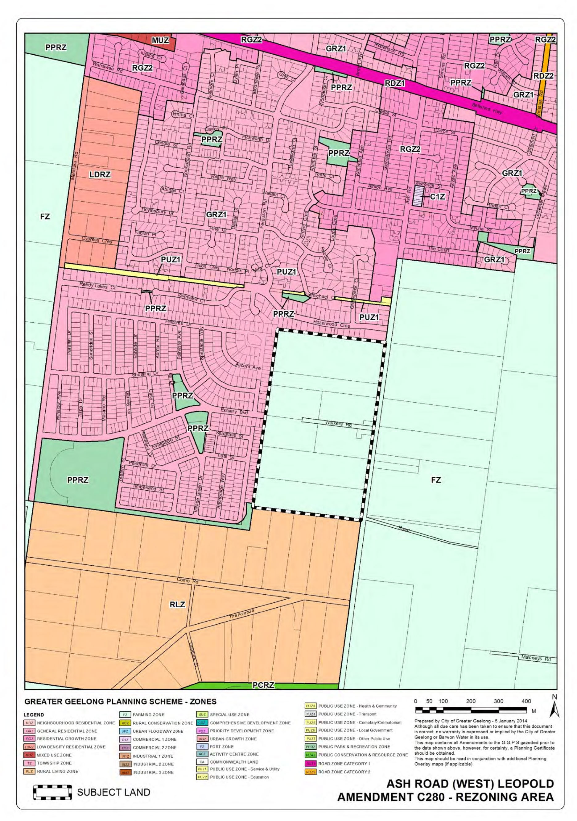
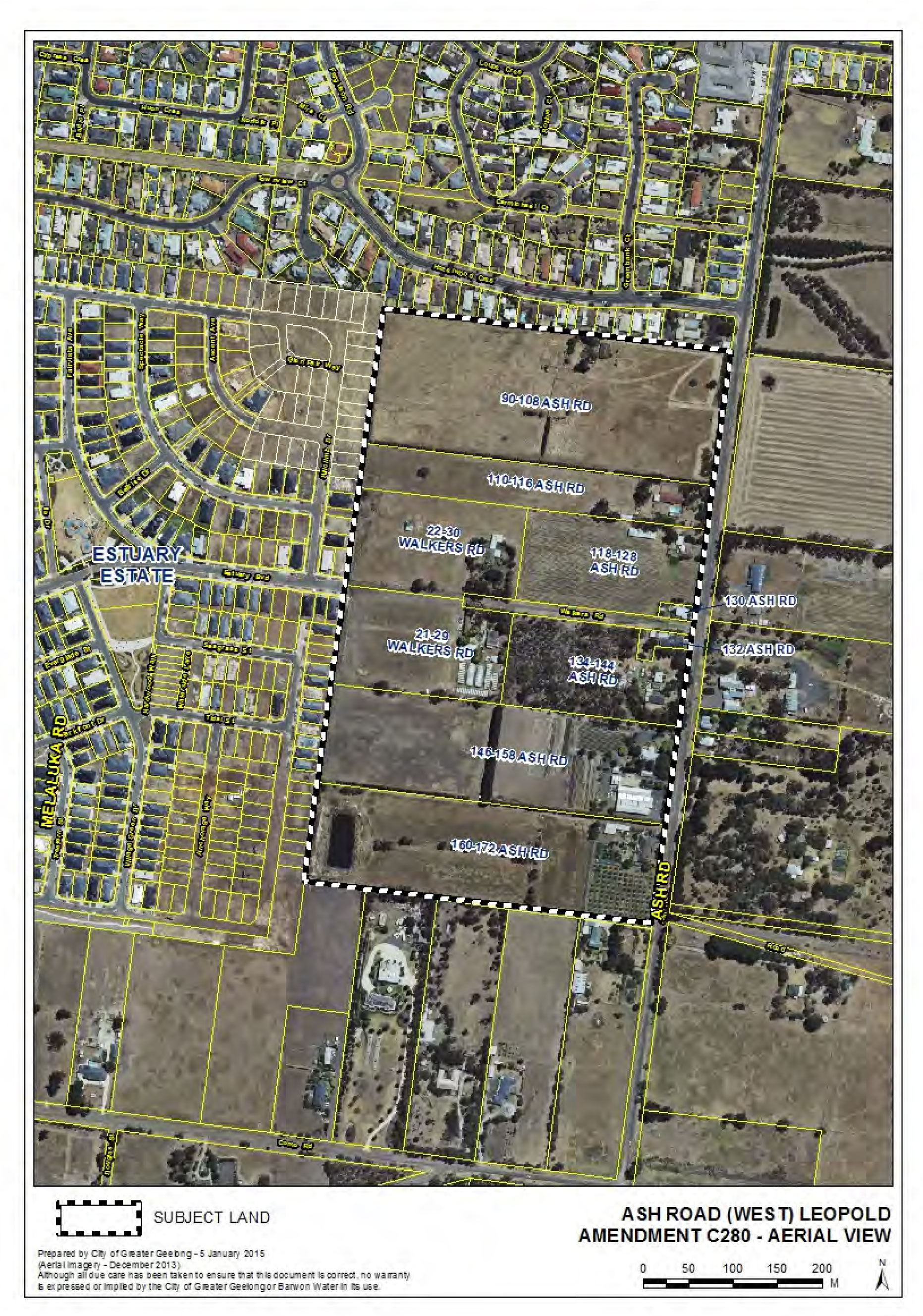
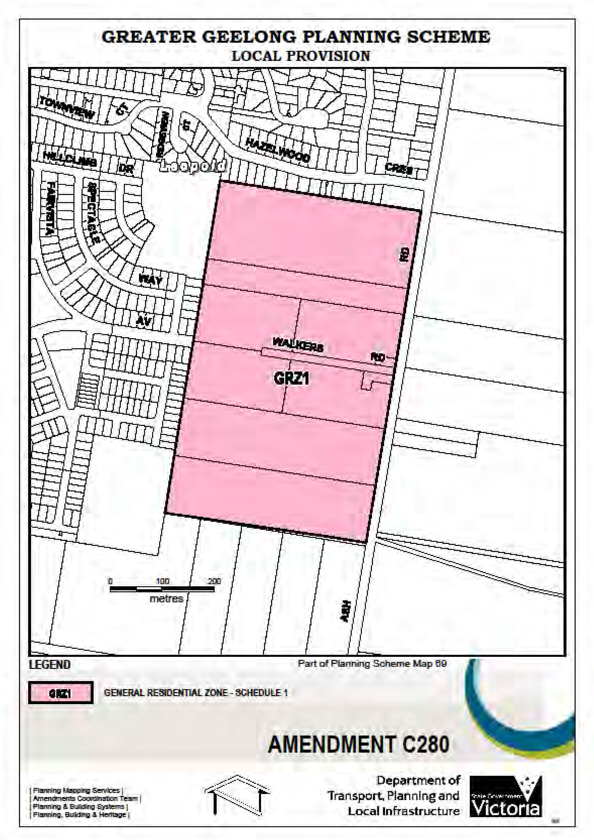
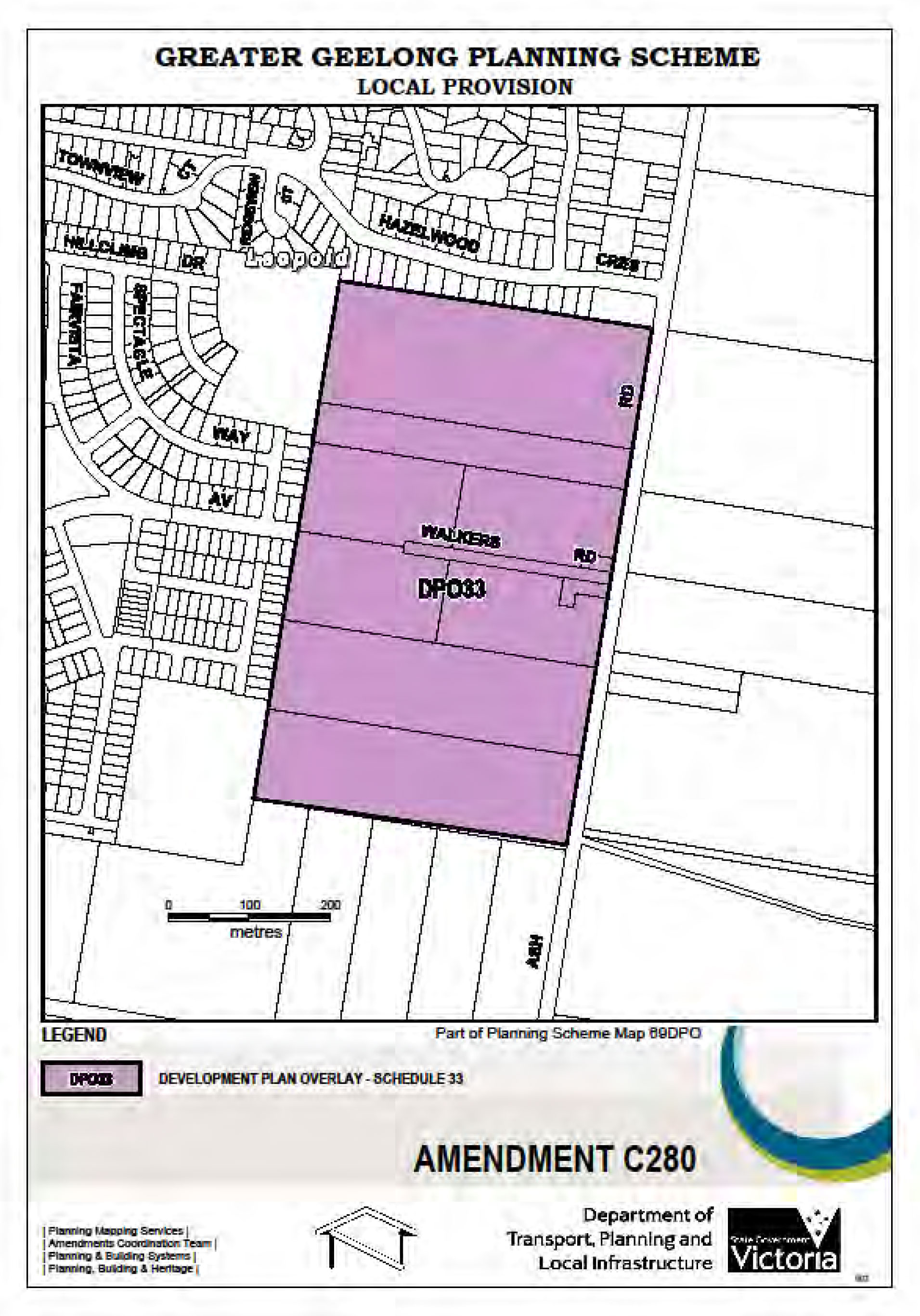
SCHEDULE 33 TO THE DEVELOPMENT PLAN OVERLAY |
|
| __ / __/ 20__ | Shown on the planning scheme map as DPO33 ASH ROAD WEST, LEOPOLDThis Schedule applies to the area on the west side of Ash Road. The aim of this Schedule is to ensure that development occurs in accordance with broad development principles as shown in the Ash Road West Outline Development Plan 2014 and to ensure delivery of essential community infrastructure as set out in the Ash Road Final Shared Infrastructure Funding Plan. |
1.0 |
Requirement before a permit is granted |
| __ / __/ 20__ | A permit may be granted before a development plan has been approved for the following:
|
2.0 |
Conditions and requirements for permits |
| __ / __/ 20__ | A permit must contain conditions or requirements which give effect to the provisions and requirements of the approved Development Plan, Ash Road Final Shared Infrastructure Funding Plan. A permit for subdivision as it relates to 21-29 Walkers Road must contain a condition for the preparation of a Cultural Heritage Management Plan. A permit for subdivision must include conditions relating to:
A permit for subdivision must contain a condition which requires the owner to enter into an agreement with the Responsible Authority pursuant to Section 173 of the Planning and Environment Act 1987 to provide development contributions for:
as outlined in the approved Development Plan and Ash Road Shared Infrastructure Funding Plan. |
3.0 |
Requirements for development plan |
| __ / __/ 20__ | Separate development plans may be prepared and approved for land to the north and south of Walkers Road. The Development Plan can be implemented in stages. The Development Plan may be amended with the approval of the responsible authority. The Development Plan must be generally in accordance with the Ash Road West Outline Development Plan as shown in clause 4.0 and include the following: An Urban Design Masterplan that includes:
A Road Network and Traffic Management Plan that includes:-
The Road Network and Traffic Management Plan must be accompanied by a Road Safety Audit prepared by an appropriately qualified person and must address any safety issues raised by the Audit. An Integrated Water Management Plan that takes an integrated approach to stormwater and drainage management, is designed with reference to the whole of the catchment and includes:
An Open Space and Landscape Masterplan that includes:
A Biodiversity Assessment that includes the application requirements of Clause 52.17 and the Permitted clearing of native vegetation – Biodiversity assessment guidelines (Department of Environment and Primary Industries, September 2013). An Environmental Assessment that must include:
A Final Shared Infrastructure Funding Plan (to be identified as the Ash Road Final Shared Infrastructure Funding Plan) which updates as necessary the Draft Shared Infrastructure Funding Plan. |
4.0 |
Ash Road West Outline Development Plan |
| __ / __/ 20__ | 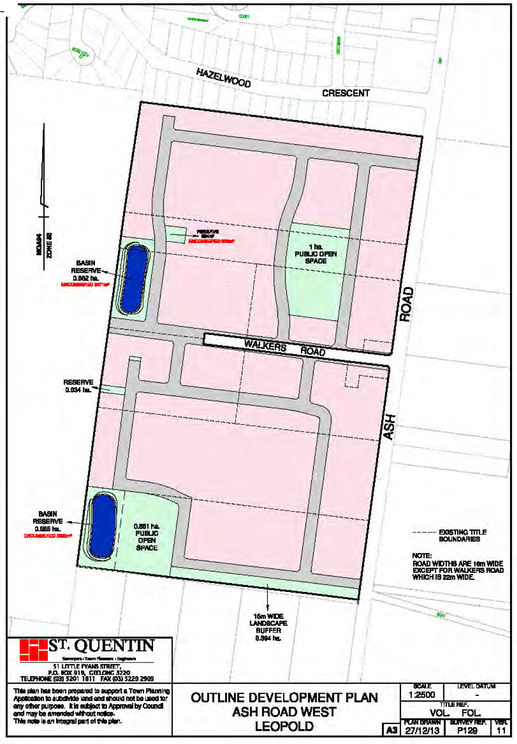 |
Portfolio: |
Planning - Cr Heagney |
Source: |
Planning and Tourism - City Development |
General Manager: |
Peter Bettess |
Index Reference: |
Application: C309 |
This report considers the Panel Report on Amendment C309 and recommends adoption of the amendment with changes.
The Amendment proposes to implement into the Planning Scheme the outcomes of the Low Density Residential Zone (LDRZ) Review 2013.
The Amendment applies to land in the Low Density Residential Zone (LDRZ) across 19 sites in the municipality. As exhibited, the amendment proposes to rezone each of these sites to either LDRZ1 (minimum lot size 0.4ha) or LDRZ2 (minimum lot size 0.2ha).
The Amendment also amends Clause 22.04 Discretionary Uses in Rural Living and Low Density Residential Zones to change the title, widen the application of the policy, and add a new objective and policy.
Council initiated the Amendment following State Government reforms to the residential zones which amended the default subdivision size for land in the LDRZ which is connected to reticulated sewerage to 0.2ha, previously 0.4ha.
Amendment C309 was placed on public exhibition from 19 June to 21 July 2014. Forty seven submissions were received of which 8 either supported or offered no objection and 39 of which objected to the Amendment.
Council considered the submissions at its meeting on 23 September 2014 supporting changes to the exhibited amendment to include the Cityview Drive area in Wandana Heights, the Cypress Court area in Leopold and the southern part of the Huntingdon Street area in Drysdale in LDRZ2 and to include the Tanderra Court area in Clifton Springs in LDRZ1 rather than LDRZ2.
With these changes supported, Council resolved to refer the unresolved submissions to an Independent Panel appointed by the Minister for Planning.
Having considered the amendment, submissions and presentations put to it, the Panel has recommended the Amendment be adopted with changes supported by Council.
Cr Heagney moved, Cr Ellis seconded -
That Council:
adopt Amendment C309 in the form outlined in Appendix 2 of this report; and
submit the adopted Amendment with the prescribed information to the Minister for Planning requesting approval.
Carried.
Council is the proponent for Amendment C309 and initiated the Amendment following reforms to the residential zones which amended the default subdivision size for land in the LDRZ which is connected to reticulated sewerage to 0.2ha, previously 0.4ha. The Victoria Planning Provisions (VPPs) allow for Councils to include schedules to apply to the LDRZ for a different minimum subdivision size where special circumstances apply.
Council assessed all areas of LDRZ across the municipality in its Low Density Residential Zone Review 2013, and recommended which areas could be included in the new minimum subdivision area of 0.2ha, and which would be in 0.4ha because of other special circumstances.
Each area was reviewed in the context of planning policy, planning scheme provisions, known drainage and flooding issues, fire prone land, existing lot sizes including the ability to further subdivide and the location of significant vegetation
The Review found that there are significant drainage issues within many of the LDRZ area. The drainage infrastructure for these areas has typically been designed to accommodate average lot sizes of 0.4ha, with infrastructure in these areas often consisting of earth swales or cut off drains, directing overland flows to similar low capacity table drains in the road reserve. Increases in hard surface areas through additional dwellings, buildings, paving, driveways etc can result in increased runoff and additional demand on the drainage system. Other issues affecting further subdivision of LDRZ areas include flooding and the potential loss of significant vegetation.
Of the 15 areas with access to sewer the Review recommended five to have the minimum subdivision area reduced to 0.2ha. Council later resolved to apply the LDRZ1 to the City View Drive area in Wandana Heights, and the exhibited Amendment consequently shows four areas proposed in the LDRZ2.
Amendment C309 was placed on exhibition between 19 June and 21 July 2014. Notices were placed in the Geelong Advertiser, the Independent and sent to all relevant public authorities and prescribed Ministers.
As a result of the exhibition of the Amendment the Council received a total of 47 submissions. Of these, 8 either supported the Amendment or offered no objection, and the balance were opposed to the Amendment.
The key issues raised in objecting submissions included concern that areas connected to reticulated sewerage were not being included in LDRZ2, that retention of the LDRZ1 in some areas was an inefficient use of land, that the Wandana Heights area should be include in LDRZ2 as recommended by Council’s Review, and that the Tanderra Court area should not be in included in LDRZ2 but rather in LDRZ1. The majority of opposing submissions were from resident landowners of the Tanderra Court area.
The issues raised in the submissions were considered by Council at its meeting on 23 September 2014. After considering the submissions, Council resolved to make changes to the Amendment. These changes included applying LDRZ2 to the Cityview Drive area in Wandana Heights, the Cypress Court area in Leopold and the southern part of the Huntingdon Street area in Drysdale, and to apply LDRZ1 to the Tanderra Court area in Clifton Springs. These post-exhibited changes resolved 35 of the 39 objecting submissions.
Council resolved to refer all unresolved submissions to an Independent Panel appointed by the Minister for Planning.
The issues raised by the remaining submitters were as follows:
Barrabool Crescent area, Leopold – the land complies with the criteria for LDRZ2, and drainage issues can be managed by design.
Coppards Road West area, Moolap – land is appropriate for higher density development and drainage issues can be dealt with.
Belle Vue Drive area, Ocean Grove – LDRZ1 is an inefficient use of land and infrastructure, disputes that there are drainage constraints and disputes there are streetscape or vegetation impact constraints.
A Directions Hearing on 20 October 2014 was conducted at Council offices in Geelong. This was followed by the Panel Hearing on 11 November 2014.
The Panel submitted its report to Council on 27 November 2014.
The Panel drew the following conclusions on the areas of dispute as follows:
Barrabool Crescent area, Leopold
“The Panel notes that the Leopold Structure Plan envisages higher density residential development in this area. Any such rezoning would need to be the subject of a separate planning scheme amendment.
The Panel accepts Council’s submission that future urban consolidation in this area at General Residential Zone densities is likely to be more viable if larger lot sizes are retained in the short term. Further subdivision now to 0.2ha lots would likely compromise future subdivision layouts, resulting in lower lot yields. Solutions to drainage issues are also likely to be more feasible if shared over a greater number of lots.”
“The Panel concludes that the land in the Barrabool Crescent area, Leopold should be zoned LDRZ1.”
Coppards Road West area, Moolap
“The Panel notes the significant cost of providing drainage infrastructure in the Coppards Road West area and accepts Council’s advice that this is a barrier to further subdivision.”
“The Panel concludes that the land in the Coppards Road West area, should be zoned LDRZ1.”
Belle Vue Drive area, Ocean Grove
“Based on the information presented to the Panel by Mr Payne, the Panel believes that Council may have overstated the potential number of lots that could realistically be subdivided if the area was in the LDRZ2. The extent of drainage issues that would arise from any further subdivision of this area is not clear. The Panel has not been presented with any evidence that there would be an impact on ‘significant environmental or landscape attributes’ if the land was to be zoned LDRZ2.
The Panel notes that Council is currently reviewing structure plans in this area, and believes that it would be appropriate to include a review of the Belle Vue Drive area, and potentially other LDRZ areas north of Ocean Grove, to investigate more fully what the impacts on drainage, vegetation and landscape attributes would be if the area was further subdivided.
In the meantime, the LDRZ1 should be applied.”
“The Panel concludes that the land in the Belle Vue Drive area, Ocean Grove should be zoned LDRZ1.
The Panel concludes that there is insufficient information at this time to determine whether this area, and other LDRZ areas north of Ocean Grove, have potential for further subdivision. Council should consider further investigation of this issue in any review of structure plans for the area.”
The Panel report recommends that the Amendment including the changes supported by Council be adopted. Its overall conclusions are that:
“The Panel has reviewed the work undertaken by Council to review each of the 19 areas of LDRZ land in the City of Greater Geelong and is satisfied that the LDRZ1 or LDRZ2 have been appropriately applied in each case, taking into account the post-exhibition changes proposed by Council.
Based on the reasons as set out in Chapters 3, 4 and 5, the Panel finds that each of the ‘disputed’ areas should remain in the LDRZ1, at least until further work demonstrates that a different zone or schedule is more appropriate.”
The Panel goes on to recommend:
“that Amendment C309 to the Greater Geelong Planning Scheme be adopted as exhibited subject to the following changes as proposed post-exhibition by Council and as shown in Appendix B of this report:
Include the City View Drive area of Wandana Heights in the LDRZ2
Include the Cypress Court area of Leopold in the LDRZ2 (southern part of Melaluka Road area)
Include the southern part of the Huntingdon Street area in Drysdale in the Low Density Residential Zone 2
Include the Tanderra Court area in Clifton Springs in the LDRZ1”
A copy of the Panel’s report has previously been circulated to all Councillors. Appendix 1 is the Executive Summary of the Panel’s report.
The Panel’s recommendations are supported and reflect the changes to the amendment that Council supported in response to the submissions. Appendix 2 is the Amendment recommended for adoption, including the changes recommended by the Panel.
The proposed changes to the schedule of the LDRZ will help to minimise any environmental impacts on drainage catchments by limiting any increase in lot density to only areas with capacity to accommodate an increase in storm water flows. The minimum lot size in areas with significant vegetation will remain at 0.4 hectares to ensure there is minimal loss of vegetation.
There are no financial implications arsing from adoption of this amendment.
The Panel has supported the amendment including the post-exhibition changes supported by Council.
The changes to the LDRZ will increase the number of LDRZ lots within Geelong, increasing additional residential land supply. An increase in some of the LDRZ areas will help to reduce urban sprawl and maintain an appropriate supply of larger life style blocks without significantly impacting on the environment or Council assets.
No Council officers have any direct or indirect interest, in accordance with Section 80(c) of the Local Government Act to which this Amendment relates.
The adoption of this amendment is considered to be low risk.
Amendment C309 is unlikely to result in any adverse social impacts on adjoining land owners. A planning permit will be required to subdivide land, at which time any amenity impacts on the surrounding area will be assessed.
The proposal does not impact on any human rights and responsibilities set out in the Charter. Planning legislation ensures an open community consultation process enabling people to freely express their views and if necessary obtain a fair hearing before an Independent Panel.
The Amendment has been exhibited in accordance with the provisions of the Planning and Environment Act and exemptions provided by the Minister for Planning. All submitters were provided with an opportunity to submit written submissions to an Independent Panel appointed by the Minister for Planning.
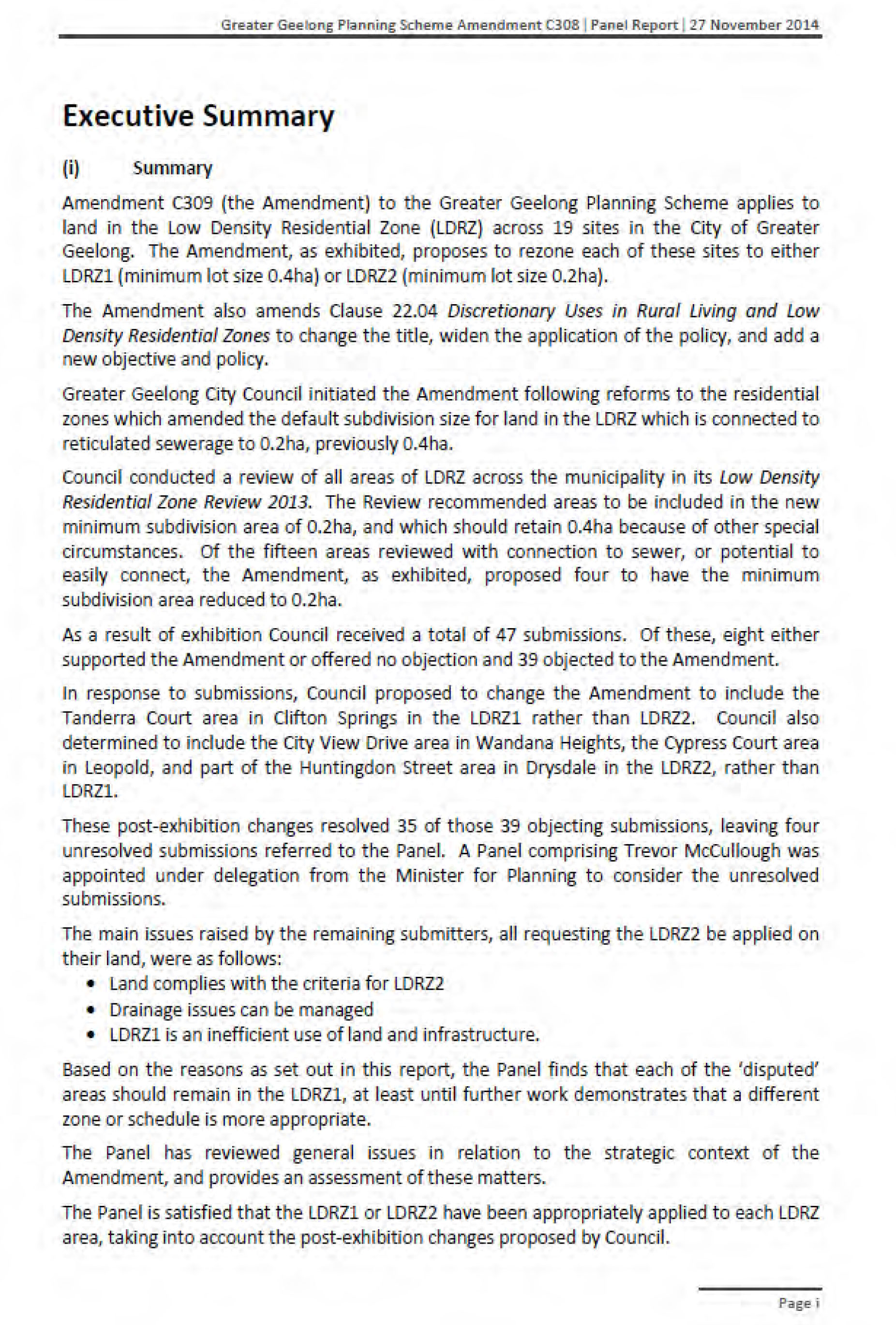

The planning authority for this amendment is Greater Geelong City Council.
The Greater Geelong Planning Scheme is amended as follows:
The Planning Scheme Maps are amended by a total of 15 attached maps.
Zoning Maps
Planning Scheme Map Nos.18, 19, 41, 42, 43, 47, 56, 57, 59, 60, 69, 81, 82, 87 and 88 are amended in the manner shown on the 15 attached maps marked “Greater Geelong Planning Scheme, Amendment C309”.
The Planning Scheme Ordinance is amended as follows:
In Local Planning Policy Framework – replace Clause 22.04 with a new Clause 22.04 in the form of the attached document.
In Zones – Clause 32.03, replace Schedule (unnumbered) with a new Schedule 1 in the form of the attached document.
In Zones – following Clause 32.03, insert a new Schedule 2 in the form of the attached document.
End of document
22.04 |
USE AND DEVELOPMENT |
||
28/01/2010 Proposed |
This policy applies to use and development applications in the Rural Living and Low Density Residential Zones.
Policy BasisThe Rural Living Zone provides for residential use in a semi-rural environment and provides the opportunity to establish small hobby farms. There are expectations that the amenity of rural living areas will be high, at least the same as for any other form of residential zone. The Low Density Residential Zone provides for low density residential development on lots with an area of around 0.4 hectares. The zone has been provided at selected locations as a means of preserving identified environmental characteristics such as high-quality vegetation or to ensure effective disposal of either wastewater or stormwater drainage. Low density residential locations are often constrained by servicing issues. The Rural Living Zone and the Low Density Residential Zone are similar in that they are not intended as locations to accommodate large-scale urban uses which accommodate large numbers of people and generate traffic and car parking demand. These sorts of urban uses should be directed to urban zones. Rural living and low density residential areas are also unsuitable for activities that can cause severe amenity problems, particularly through noise nuisances, such as animal boarding. Such uses are likely to require large land holdings and greater separation from nearby dwellings to ensure that there is no intrusion on neighbours that is detrimental to their amenity. Accordingly these uses are more suitable to establishing in the Farming Zone. The density of development in the Rural Living Zone and Low Density Residential Zone is typically low with only one dwelling on each allotment. Further intensification of the dwelling density in these zones is inconsistent with the purpose of the zones and may lead to expectations for smaller lot subdivision which is not supported. Objectives
PolicyWhere a permit is required for a use or development including subdivision, it is policy to:
|
||
SCHEDULE 1 TO THE LOW DENSITY RESIDENTIAL ZONE |
|||
| 15/07/2013 | Shown on the planning scheme map as LDRZ1. |
||
|
Land |
Area |
|
Minimum subdivision area (hectares). |
All land |
0.4ha |
|
|
|||
Dimensions above which a permit is required to construct an outbuilding |
|||
None specified |
|||
|
|||
SCHEDULE 2 TO THE LOW DENSITY RESIDENTIAL ZONE |
|||
| 15/07/2013 | Shown on the planning scheme map as LDRZ2. |
||
|
Land |
Area |
|
Minimum subdivision area (hectares). |
All land |
0.2ha |
|
|
|||
Dimensions above which a permit is required to construct an outbuilding |
|||
None specified |
|||
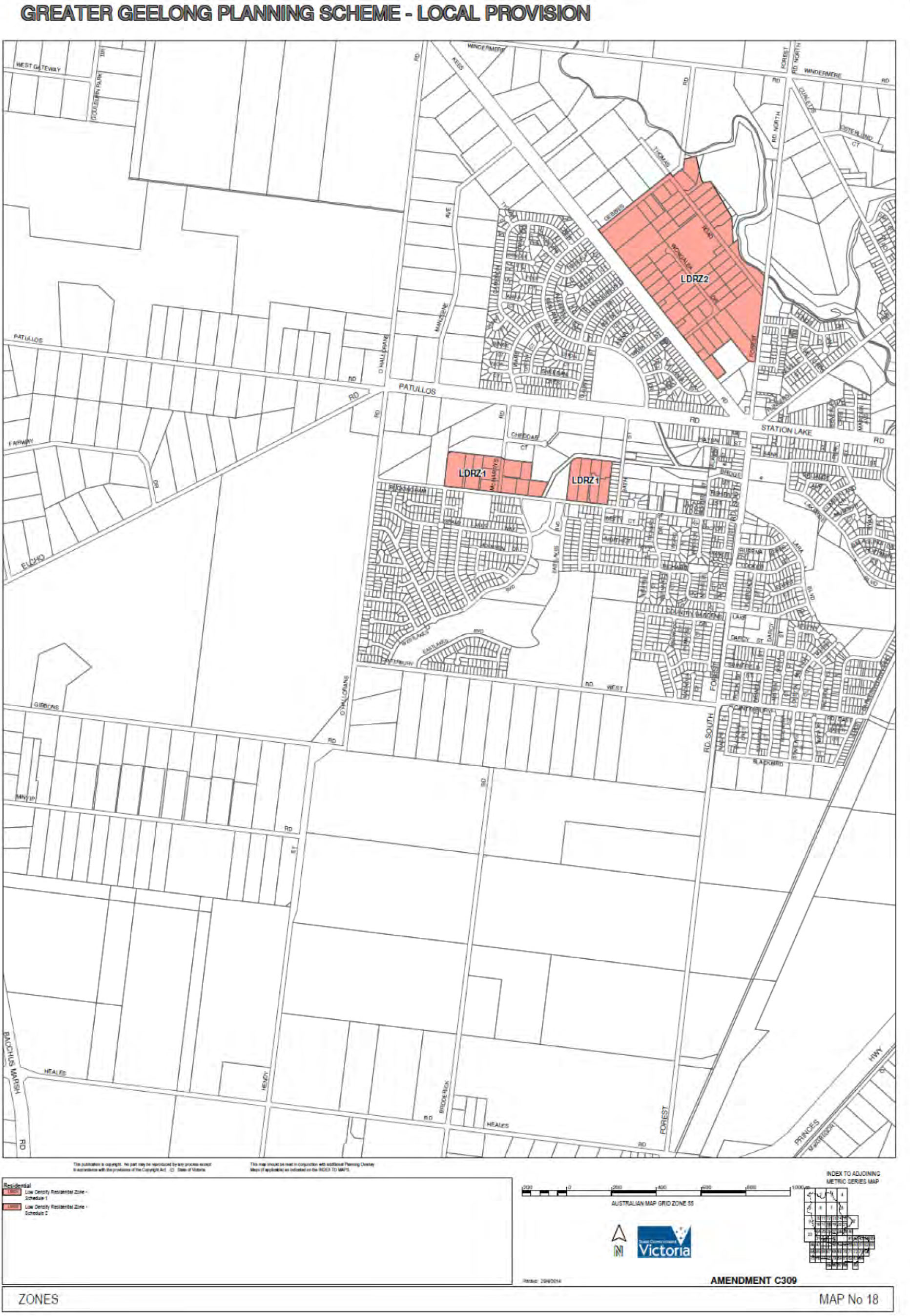
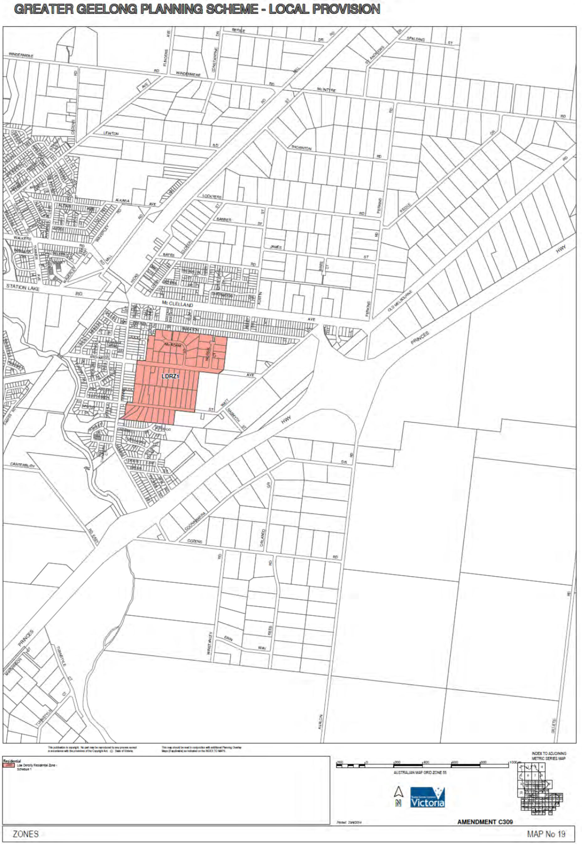
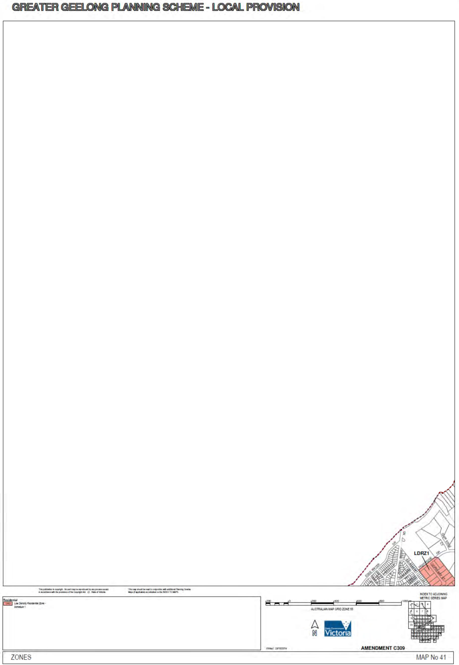
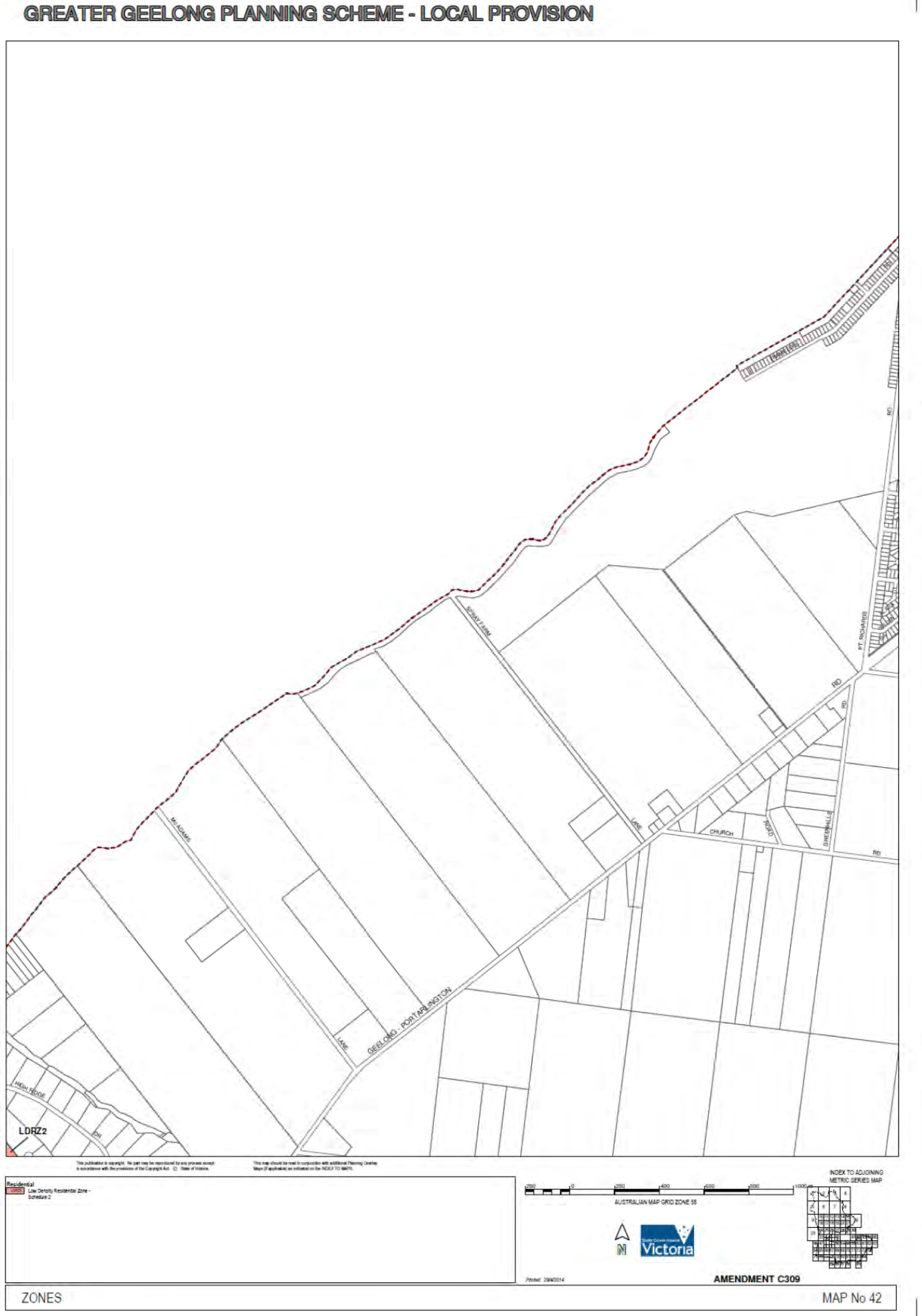
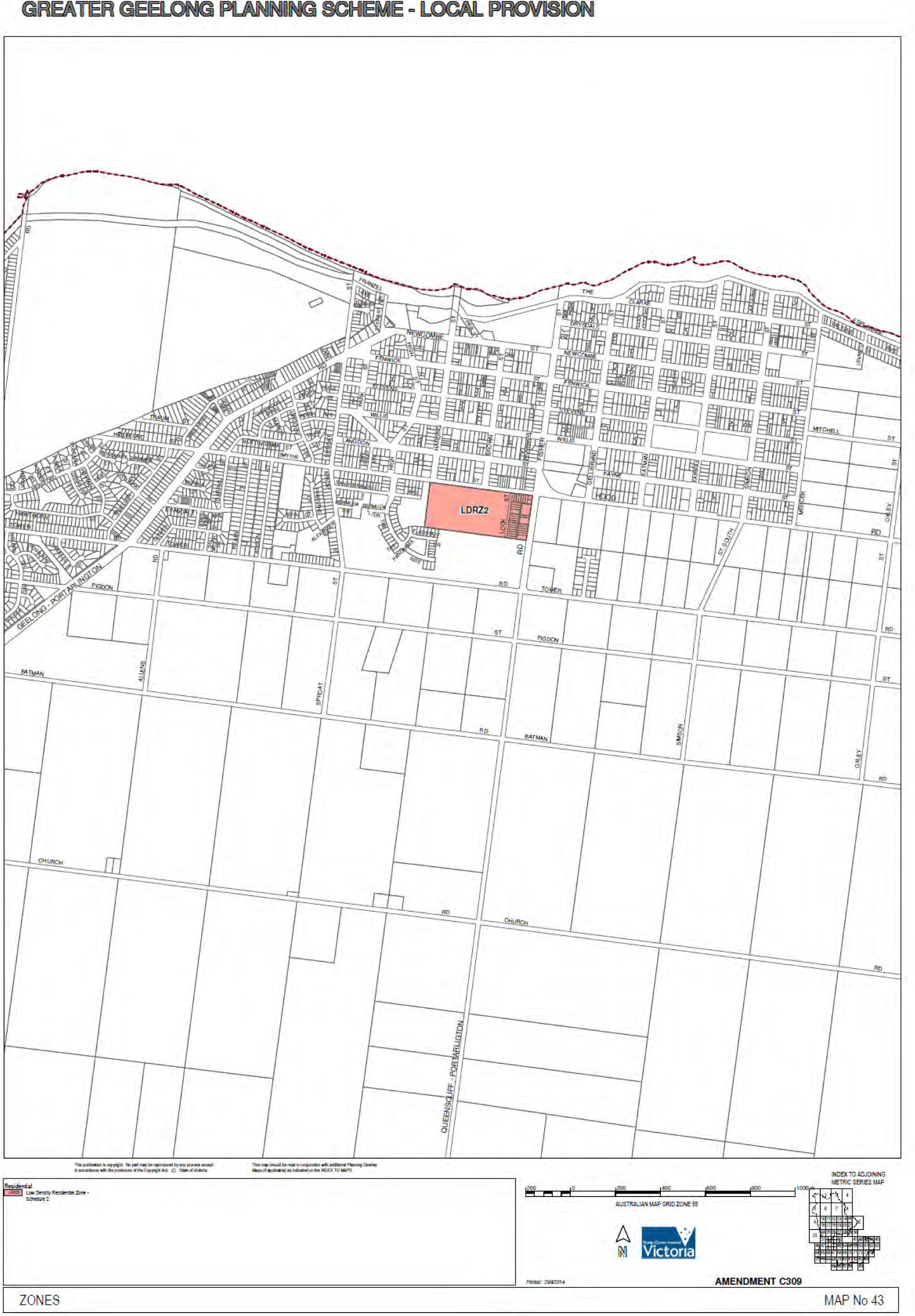
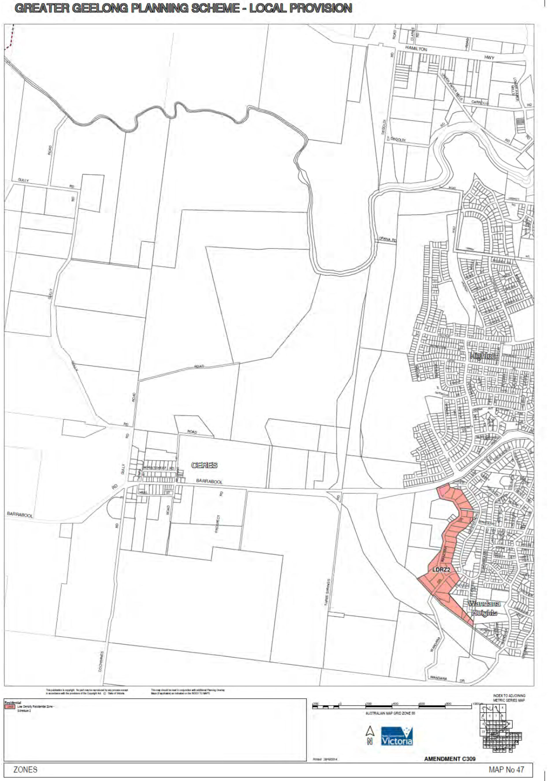
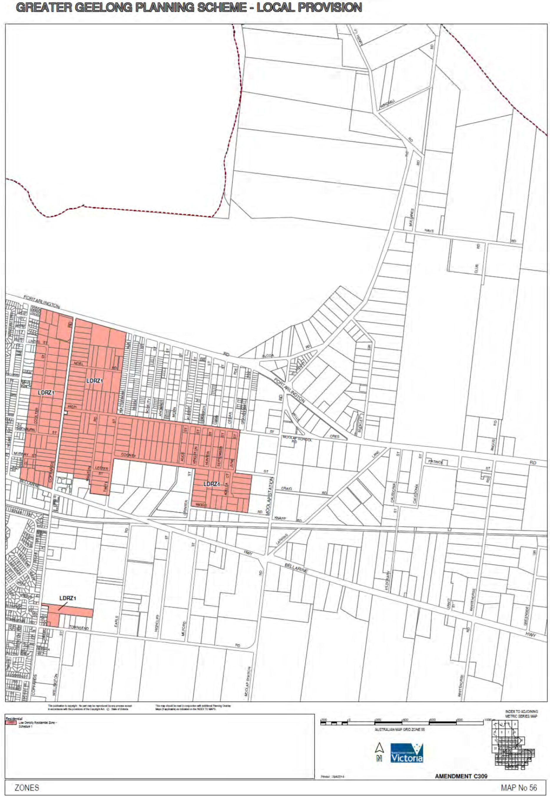
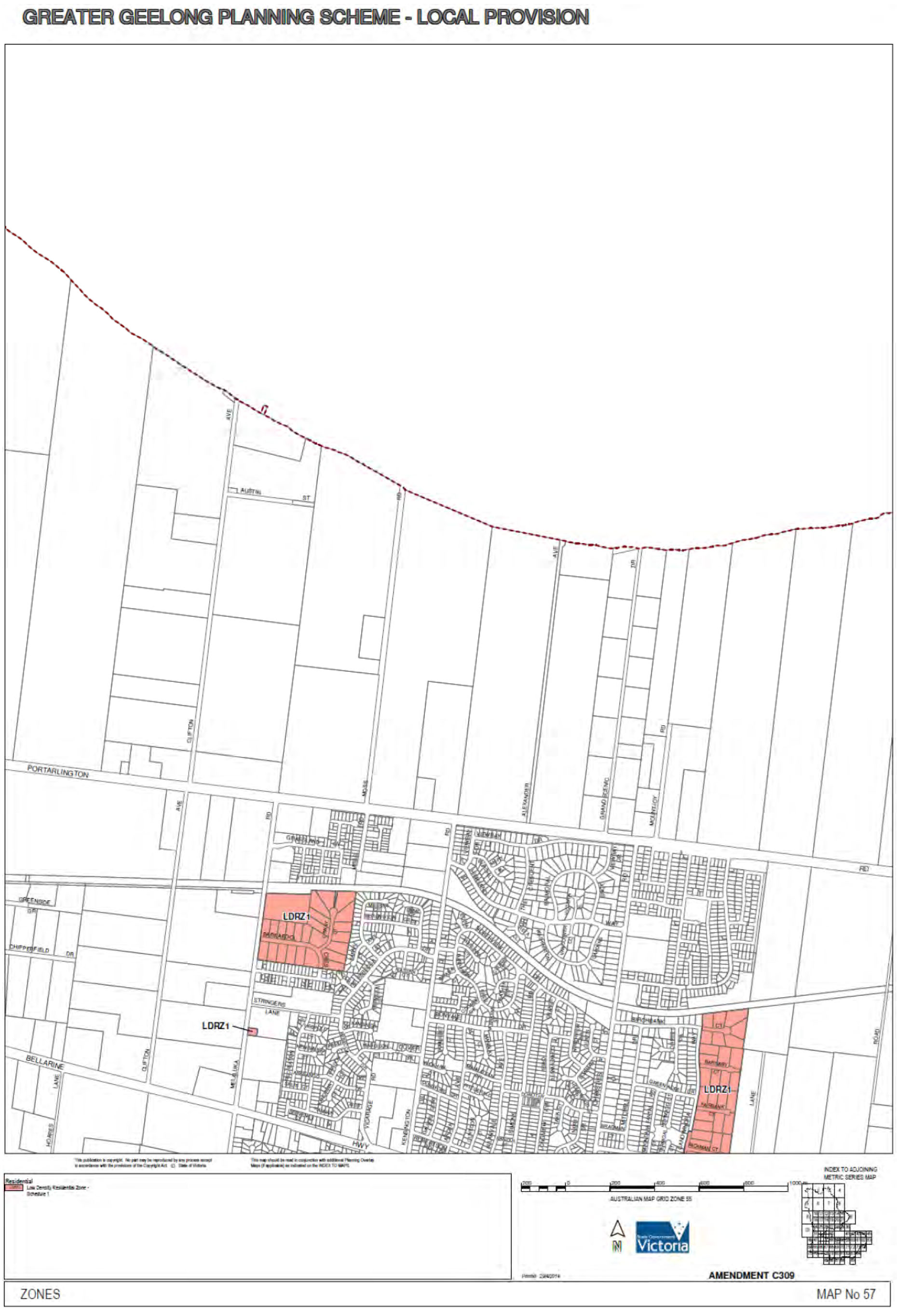
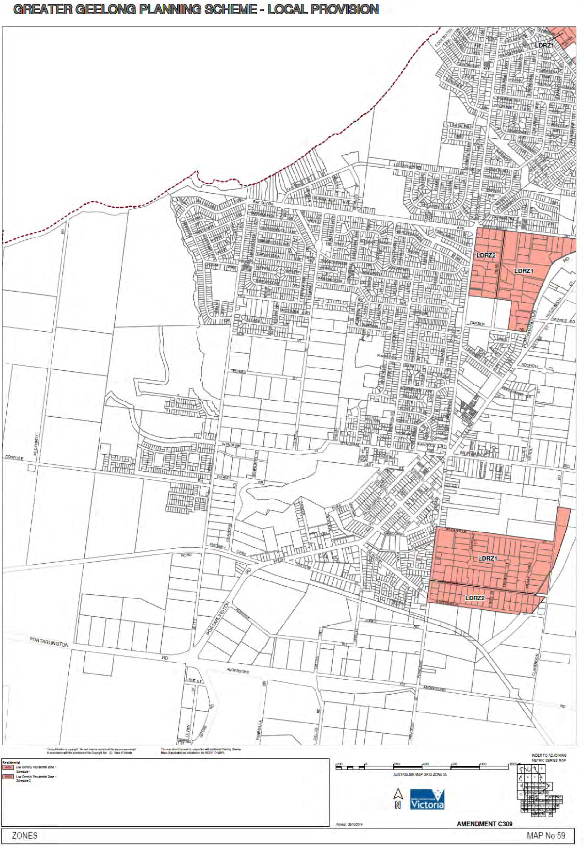
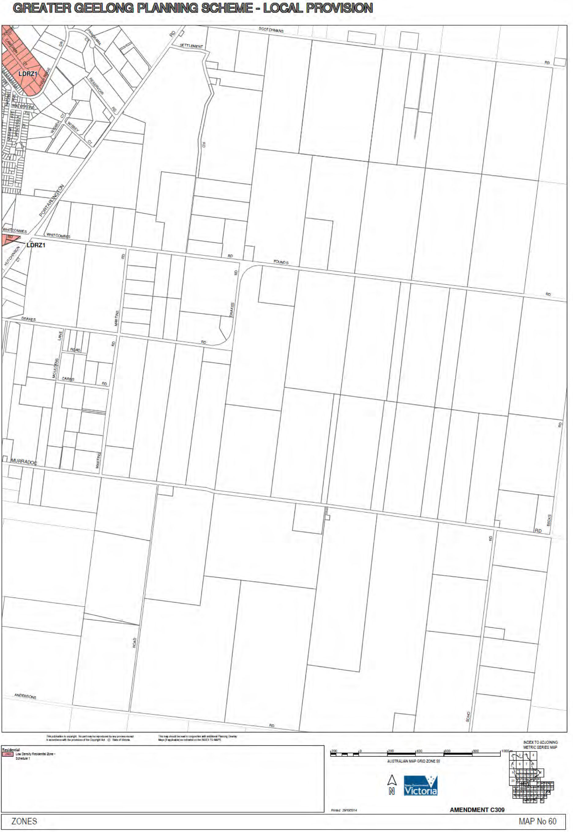
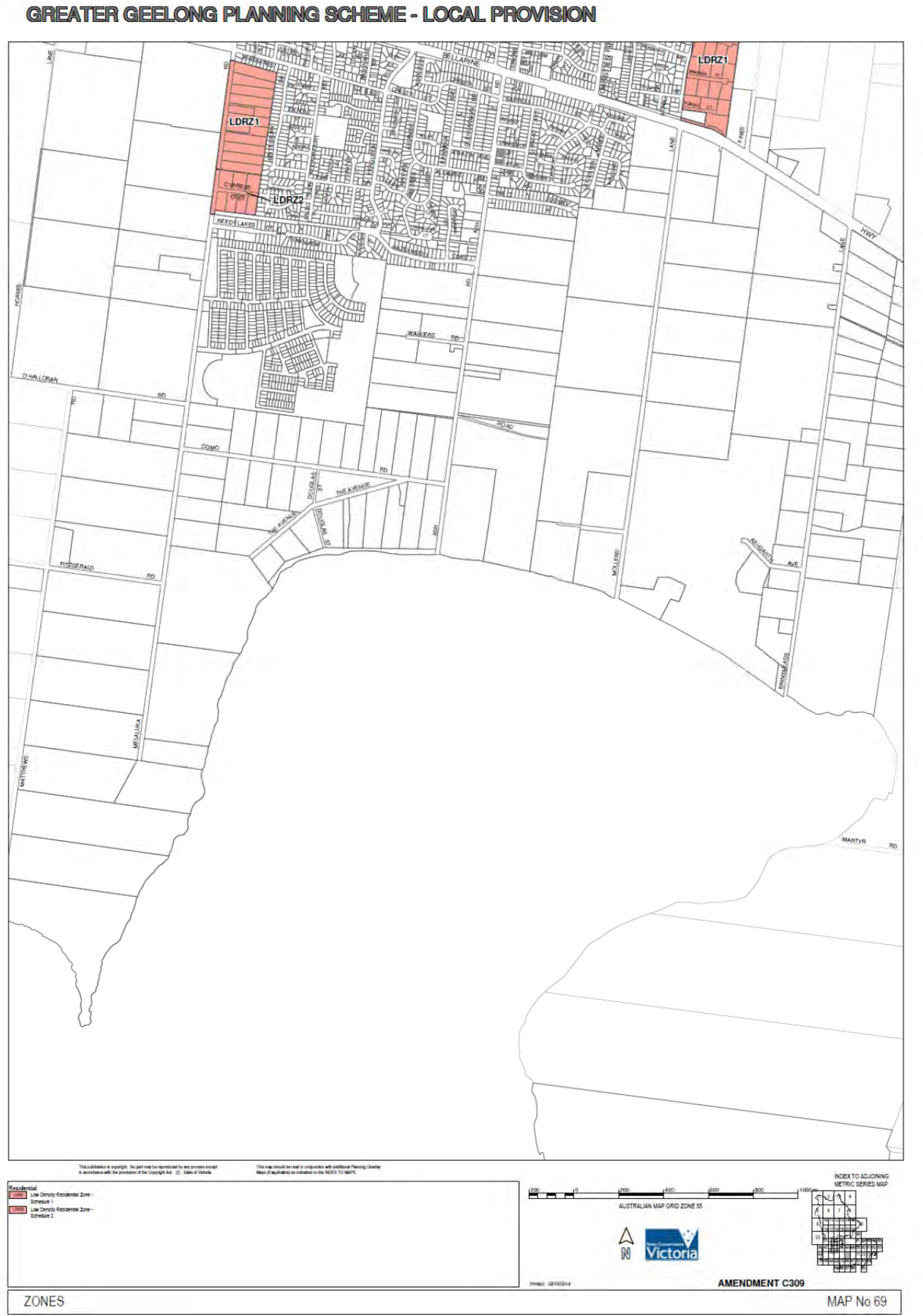
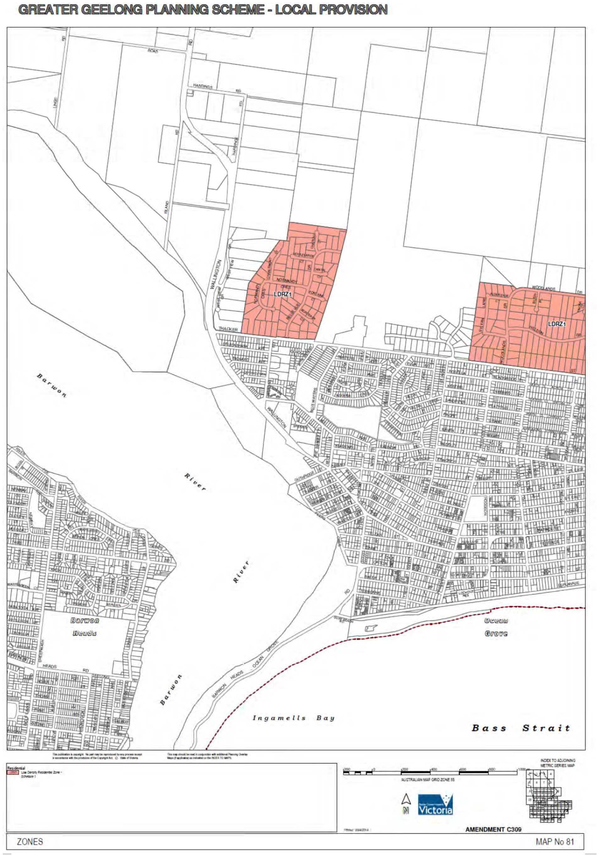
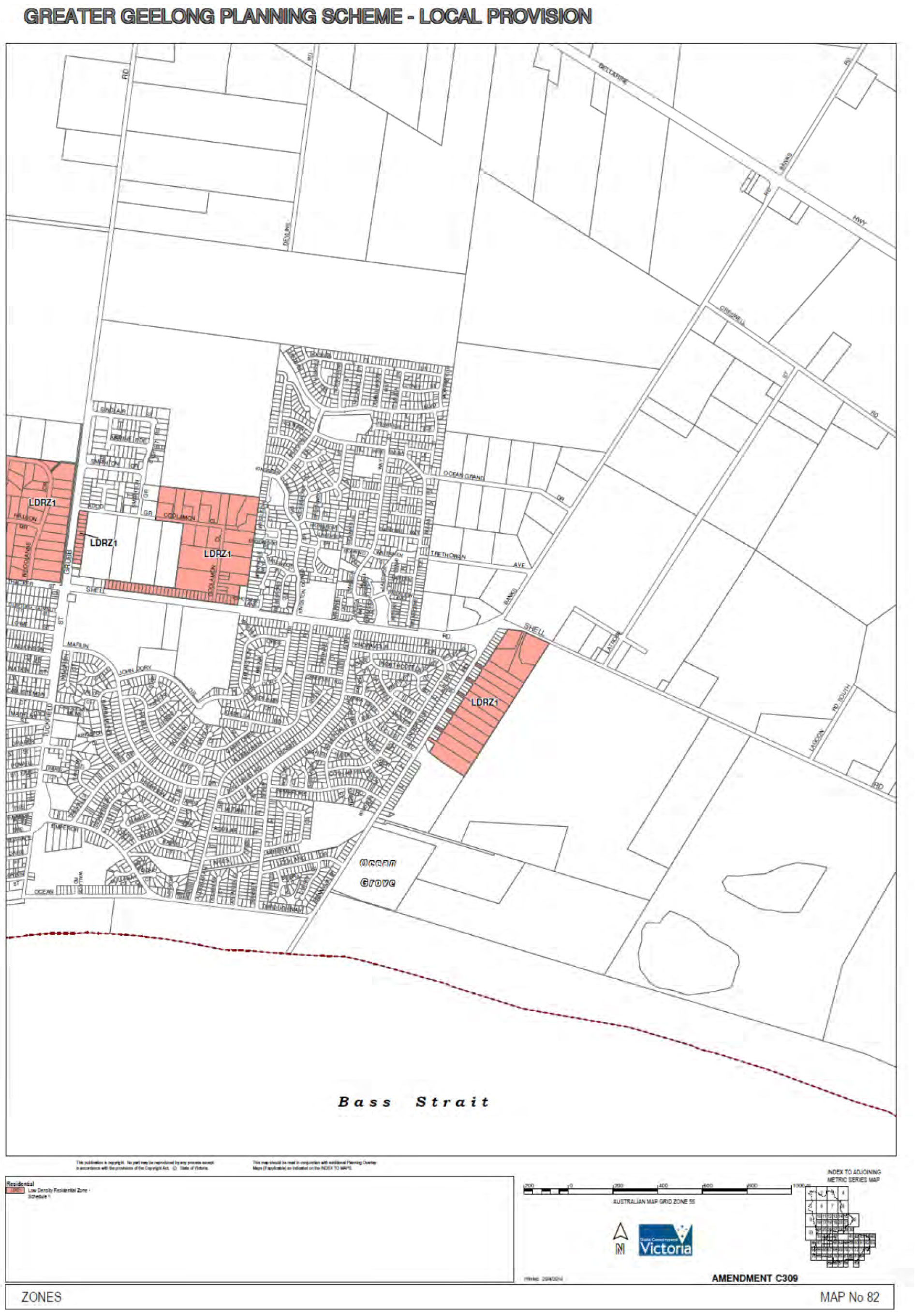
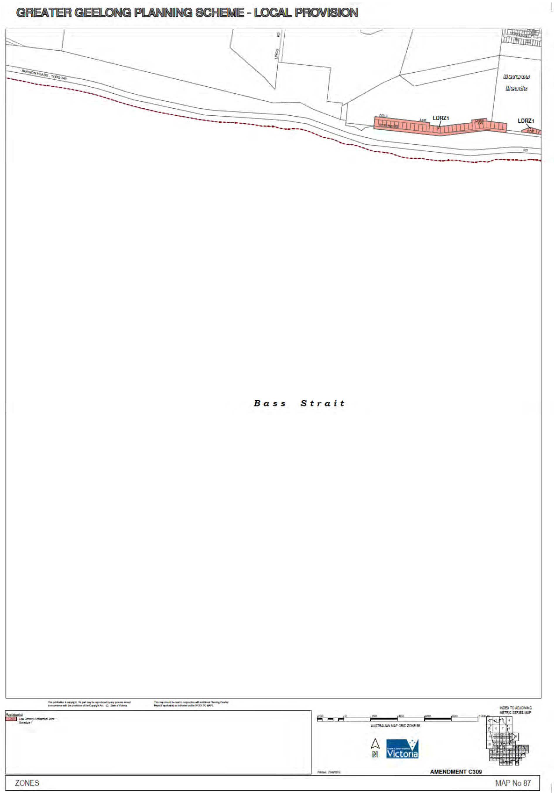
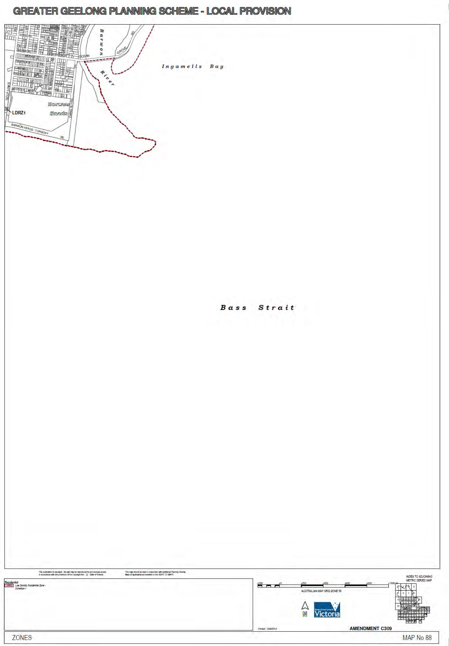
Portfolio: |
Planning - Cr Heagney |
Source: |
Planning and Tourism - Planning Strategy |
General Manager: |
Peter Bettes |
Index Reference: |
Council Reports 2015 |
The purpose of this report is to provide Council with an update on the Managing Future Growth project. This project seeks to set a framework for the future planning and delivery of the two Further Investigation Areas identified in the G21 Regional Growth Plan and known as Lovely Banks and Batesford South.
The G21 Regional Growth Plan (RGP) identified two Further Investigation Areas (FIAs) to be examined for their potential to provide capacity for the region’s population to grow beyond 500,000. The two areas are west and north of the Geelong Ring Road at Lovely Banks and Batesford South. The RGP noted that these areas would only be required in the longer term. This is reflected in Clause 11 of the State Planning Policy Framework which describes the areas as “long term growth options”.
In September 2014 Council considered a report on the scope of the Managing Future Growth Project. Three key tenets of work were proposed to be undertaken; financial impacts of the development of the two FIAs on Council’s budget, methodology to deliver land for development in the FIAs, and an investigation of how development could be financed to ensure that infrastructure provision does not lag behind population growth. By resolution of Council, the scope was broadened to include a focus on the identification of boundaries for the FIAs.
In October 2014, in the lead up to the State election, the former Minister for Planning prepared, adopted and approved without notice an amendment to the Greater Geelong Planning Scheme to rezone land at Lovely Banks from Farming Zone to Urban Growth Zone. The zoning of land at Batesford South was not changed.
The Minister’s decision was based on his desire to provide diversity in growth fronts across Geelong and to ensure that Geelong is positioned to accommodate redirected population growth from Melbourne.
Consequently, the scope of Council’s Managing Future Growth project has changed. The priority now is to concentrate on analysing the land capability of the area within the boundary of the Urban Growth Zone at Lovely Banks. This will demonstrate which areas can be developed and which areas are constrained and may not be capable of being developed due to drainage or environmental constraints. It will also explore the need for safety buffers around the high pressure gas pipeline and how access might be provided in and around the area.
The scope of the project has now extended beyond what was funded in the 2014/15 budget. Council will need to look to the State Government to provide the necessary funding support to undertake strategic planning for the area.
Within Lovely Banks, infrastructure will be required such as schools, roads and public transport which will also need to be provided by the State Government.
In addition to the planning work and infrastructure provision, Council should also encourage the State to support the wider community through greater investment in the economy to grow the employment base locally to ensure that jobs are created in Geelong, enabling new residents in Lovely Banks to live and work in Geelong.
Cr Heagney moved, Cr Irvine seconded -
That Council:
note the revised scope of the Managing Future Growth project to focus on:
analysis of the land capability of the area within the Urban Growth Zone at Lovely Banks enable subsequent framework plan development; and
define Council’s future financial obligations to service development in the two FIAs identified in the G21 Regional Growth Plan; and
continue to examine potential growth area boundaries of the Western FIA (Batesford/Bell Post Hill) to enable future framework planning as a next project phase within budget capacity.
seek funding assistance from the State Government for completion of the Managing Future Growth Project; and
engage with State Government to explore opportunities to secure funds to deliver State Government infrastructure in the FIAs and to secure greater investment in the local economy to ensure job creation in Geelong keeps pace with population growth given Geelong’s role to accommodate redirected growth from Melbourne.
Carried.
The Managing Future Growth project was initially funded as part of Council’s 2014/15 budget, to develop a strategic delivery plan for the two FIAs identified in the G21 Regional Growth Plan for long term growth. This was intended to provide Council with an understanding of the financial obligations that it would face if the FIAs were developed and explore funding options. The key aim was to enable Council to make informed decisions about how and when land is released without placing unsustainable financial pressures on its budget and explore funding options. The focus on financial issues only was considered appropriate at that time as Clause 11 of the State Planning Policy Framework identifies the two FIAs as “long term growth options” and the analysis of land supply shows that the G21 Region has between 20-30 years of residential land supply.
The context of the project changed substantially when the Minister for Planning wrote to Council in May 2014 to seek Council’s support for the acceleration of land delivery in these areas. Council’s response noted that further strategic planning work was required before an Urban Growth Zone could be applied as stipulated in the G21 Regional Growth Plan Implementation Plan. The response highlighted that unlike Melbourne, the absence of a Growth Areas Infrastructure Contribution (GAIC) means that the benefit of the uplift in value of the land following rezoning does not accrue to the Geelong community.
Council’s view was that if the Urban Growth Zone was applied it would need to include clear policy statements around timing to ensure that Council is able to fund the necessary infrastructure and to ensure that the planning studies identified in the G21 Regional Growth Plan Implementation Plan are completed prior to any precinct structure planning process being undertaken.
The Minister for Planning’s response acknowledged the issues raised by Council but also raised the role of regional cities and the government’s view that “Geelong must play an increasingly important ‘second city’ role in redirecting growth to regional Victoria”. The response also noted the potential of the Metropolitan Planning Authority (MPA) to assist.
In light of the correspondence received from the Minister, a revised scope of works for the Managing Future Growth project was documented in a report to Council on 23 September 2014. This proposed three key components:
Define Council’s future financial obligation to service development in the two Further Investigation Areas;
Define the best methodology to deliver land for development consistent with the objectives in the G21 Regional Growth Plan Implementation Plan; and
Investigate how development could be financed, to ensure infrastructure investment doesn’t lag behind population growth and ensure Council has the capacity to service development.
Council resolved to note the three components of the project but also to extend the scope to prioritise the definition of boundaries of the future growth areas. This would require a level of land capability analysis not previously envisaged or budgeted for.
In October 2014 the Minister for Planning wrote to Council to advise that he had used his powers of intervention and prepared, adopted and approved without public notice Amendment C322 to the Greater Geelong Planning Scheme which rezoned land in Lovely Banks from Farming Zone to Urban Growth Zone. This amendment is different to other amendments as Council had not requested the rezoning, nor had a third party requested the rezoning. The Minister’s letter noted that he expected “that council’s Managing Future Growth Project will inform any adjustments of the area I have rezoned through preparation of a detailed Growth Area Framework Plan”.
The Minister provided Council with a copy of his reasons for intervention which detail why he chose to rezone the land (see Attachment 1). It refers to:
the opportunity presented by the two FIAs to diversify the local housing market to the north and west of Geelong;
the strategy to rebalance Victoria’s population growth from Melbourne to rural and regional Victoria; and
the opportunity to add to the supply of urban growth areas.
The constraints on the land at Lovely Banks were also detailed including the major south-west gas pipeline, the need for buffers to existing industry and the potential presence of significant grassland habitat. The Minister concluded that his action was appropriate as further assessment of these issues and an opportunity for consultation with stakeholders will occur in the planning process which follows the rezoning, through the preparation of a Framework Plan and detailed precinct structure planning.
No changes were made to the planning controls of the FIA at Batesford South. Neither the explanatory report nor the Minister’s reasons for intervention explained why Lovely Banks was chosen to be rezoned and the FIA at Batesford South was excluded. Landowners and their representatives from the Batesford South area have met with Council officers to discuss their desire to see their land holdings rezoned. In the future it is possible that Council may receive requests for planning scheme amendments to rezone land for all or part of the Batesford South area. Further reports to Council would be prepared in this event.
The Lovely Banks FIA is now further advanced in the planning process than the Batesford South FIA as a result of the Minister’s decision. The G21 Regional Growth Plan Implementation Plan cautioned against allowing both FIAs to develop simultaneously. It states that “there is a high risk associated with allowing the FIAs to develop as growth areas at the same time. Developing both areas would require substantial upfront infrastructure including separate sewerage treatment plants, which is not financially sustainable”.
The scope of the Managing Future Growth project has been revised as a direct consequence of the Minister’s decision. The Managing Future Growth project must now address:
the land capability of the area within the Urban Growth Zone at Lovely Banks; and
financial implications of development in both FIAs
Land Capability at Lovely Banks
Analysing the land capability of the area within the Urban Growth Zone has been added to the scope and is now the major priority. This was specifically identified in the Minister's correspondence when he rezoned the land. The key aspects to focus on are identified in the G21 Regional Growth Plan Implementation Plan Background Report. The main objectives are to determine the extent of significant vegetation, the likelihood of endangered species being present, examining flooding and drainage issues, the need for safety buffers around the gas pipeline which traverses the site and how access might be provided in and around the area given its limited frontage to existing roads. Council will require external technical assistance to undertake this work. A consultant’s brief to procure the necessary expertise to undertake the technical assessments is being prepared. This will be done in accordance with the standard procurement process shortly. This work will inform the preparation of a Framework Plan as it will define land that can be developed and other areas which need to remain undeveloped to retain significant vegetation or provide for other uses such as storm water detention.
Financial Analysis
The financial impacts component of the project remains unchanged within the project scope. This work is being undertaken in-house using the knowledge gained through the implementation of the Development Contributions Plans (DCPs) in the Armstrong Creek Urban Growth Area. This work will analyse Council’s infrastructure funding commitments across all growth areas in the municipality. Using the benchmarks established in Armstrong Creek the project will define the future costs of infrastructure for both FIAs and the timing of when it is likely to be required and thus expenditure incurred. The project will present high and low growth scenarios to demonstrate the potential variations in timing between when Council is required to deliver infrastructure and when the cost of delivery is recouped through a DCP. This work will be developed in a way to ensure it provides a valuable input into the development of the Integrated Infrastructure Delivery Plans for both FIAs in the future.
The financial analysis will provide Council with a clear picture of the cost of making land available in the FIAs. This information will assist Council in developing a policy position on the timing of making land available for development in the FIAs. The previous report to Council on this project noted that the current liability for Armstrong Creek and Jetty Road to cover Council’s portion of the DCP is $19 million (2013 dollar value). Regional infrastructure such as the planned library and aquatic centre and indoor sports facility in the Armstrong Creek town centre are not provided for in the DCP and are likely to cost Council a further $20million.
This cost of growth in all growth areas is set to rise over time as:
Council is precluded by legislation from indexing part of the revenue in a DCP;
When land acquisitions are required to provide open space, Council has no control over when compensation claims are lodged and the rising cost of land results in higher amounts of compensation payable; and
The “up scaling” of basic infrastructure secured through the DCP is required to meet community expectations.
The costs detailed above only include areas where a DCP was applied (Armstrong Creek and Jetty Road in Clifton Springs). The multiple growth fronts across Geelong at Lara, Leopold, Ocean Grove and St Leonards will also require significant investment in infrastructure for those communities.
Planning Process
The application of the Urban Growth Zone has defined the planning process to deliver land in Lovely Banks, this component of the project has thus been finalised. The Minister’s letter noted that a Framework Plan should be prepared with more detailed precinct structure planning to follow. This accords with Ministerial Direction number 12 and the Urban Growth Zone VPP Practice Note which set out the roadmap to plan growth areas.
The first step is to undertake land capability analysis. This will be followed by preparation of a Framework Plan for the area and an Integrated Infrastructure Delivery Plan as part of the next (as yet unfunded) project phase. Subsequent to this, detailed Precinct Structure Plans and Development Contribution Plans will be completed. This will involve engagement at various stages with a wide range of stakeholders including the community in the area and will be considered by Council at the usual milestones.
Resourcing
Whilst the scope of the project has been extended the resources available for the project have not increased.
It is recommended that Council request funding assistance from the State Government to assist in undertaking this project. Funding for financial analysis was provided as part of Council’s 2014/15 budget. Land capability analysis was not funded in the 2014/15 budget. The land capability analysis was considered unnecessary at that time as all of the evidence around lot supply and the adopted policy at Clause 11 of the State Planning Policy Framework indicated that the FIAs were not required for around 20 years.
It is noted that a budget bid to undertake a Framework Plan and an Integrated Infrastructure Plan for Lovely Banks and land capability analysis for Batesford South has been made for the 2015/16 financial year.
It is also recommended that Council encourage the State Government to explore opportunities for new mechanisms to fund their infrastructure obligations in Lovely Banks, particularly for road upgrades, new schools, public transport and health facilities. The absence of the Growth Areas Infrastructure Contribution in regional areas may have negative impacts on the provision of these essential services by the State Government.
Another key issue which Council could raise with the State Government is the need for investment in the local economy in Geelong. Plan Melbourne aspires to create 20 minute neighbourhoods whereby residents can access all of their every day needs within 20 minutes travel time from home. This includes shops, parks, community services and employment options. The State Government has made it clear that it sees the role of Geelong as accommodating redirected population growth from Melbourne. Therefore the principle of providing jobs within 20 minutes of home should also be aspired to for residents in Geelong.
A targeted campaign to increase employment opportunities in Geelong would require investment and support from the State Government. Whilst there may be some employment prospects for Lovely Banks residents in the GREP these may be limited if industries locating there are not labour intensive. A sustainable, socially cohesive community in Lovely Banks will only be realised if local job opportunities are available. Geelong, not Melbourne should be the primary location of employment for the majority of new residents.
Environmental implications will be considered in detail through the land capability analysis at Lovely Banks. Planning controls to protect the environment will be included in future amendments to the Greater Geelong Planning Scheme if found to be necessary.
The G21 Regional Growth Plan-Implementation Plan recommends that the principles of zero carbon, zero waste, sustainable water and sustainable transport be embedded in planning for the FIA’s.
Funding for the Managing Future Growth Project was allocated in the 2014/15 budget to determine Council’s future funding obligations in delivering growth in the two FIAs.
The scope of the project has changed considerably as detailed in the body of this report. The current budget allocation is insufficient to complete the land capability analysis for Lovely Banks, thus it is intended that the Council approach the State Government to request additional funding for this work.
The financial analysis undertaken in the project will define the future funding obligations which Council will face when the FIAs are developed. It will also define the funding obligations Council is already liable for at the other growth fronts in Lara, Armstrong Creek, Leopold, Ocean Grove, St Leonards, and Clifton Springs.
Future budget proposal.
As detailed in the body of this report, land development in the FIAs will have significant impacts on Council’s budget as infrastructure will be required for new residents. The amount and the timing of this is yet unknown. They will be subject to future budget proposals.
Budget proposals will be considered as part of the 2015/16 process for further planning work to be undertaken in the FIAs. This includes:
the development of a Framework Plan for Lovely Banks;
the preparation of an Integrated Infrastructure Delivery Plan for Lovely Banks; and
land capability analysis in Batesford South.
Council’s adopted policy position on the FIAs is that they are the long term options for Geelong’s growth. Proposals to advance development in the FIAs would necessitate a change to this policy which would be given statutory effect via an amendment to the planning scheme. This would also necessitate a change to the State section of the VPPs which designate the FIAs as long term growth options.
Undertaking the Managing Future Growth project will inform Council’s position on how and when to proceed with the FIAs. The project will address the legal and statutory requirements including the development contribution scheme, issues around the GAIC and define a roadmap which would deliver development land in a co-ordinated well planned manner.
The Managing Future Growth project aligns with the directions of the Sustainable and Built Environments themes in City Plan.
No Council officer involved in the drafting of this report has any direct or indirect interest, in accordance with Section 80(C) of the Local Government Act in the land to which this report relates.
The key risks in the Managing Future Growth project are related to the need to responsibly manage Council’s budget and appropriately service growth areas without impacting on the service delivery to existing communities. These are the core elements of the project.
The land capability analysis for Lovely Banks will define constraints on development of the area, this will ensure that risks are managed through for example creating buffers between the high pressure gas pipeline and new residential areas.
Social considerations have been considered recognising the need to provide land for housing and employment and Councils duty of care to deliver liveable communities not just subdivisions. Providing appropriate community infrastructure will be a key part of the Managing Future Growth project.
Councils engagement with the State Government to attempt to secure investment in infrastructure and the local economy is also important to provide employment options close to where people live.
We have taken into consideration the human rights relative to the subject matter of this report, including rate-payers property rights and the right to a fair hearing.
The rezoning of land at Lovely Banks to Urban Growth Zone by the Minister for Planning was not subject to public consultation. The Managing Future Growth project will involve targeted consultation with key stakeholders where appropriate, this will include service providers, land owners, other growth area councils and the State Government. Information about the rezoning of Lovely Banks will be communicated at that time.
Cr Heagney declared an Indirect Interest by Close Association in Agenda Item 7 –Future of Council’s Long Day Child Care Centres in that her children attend one of the Council run Centres and left the meeting room at 7:28pm.
Portfolio: |
Community Development – Cr Fisher |
Source: |
Community Services – Family Services |
Act/General Manager: |
Linda Quinn |
Index Reference: |
Subject: Community Services – Long Day Care |
The purpose of this report is to inform Council regarding the outcome of an independent examination of the financial sustainability of Council’s six stand-alone long day child care centres.
High quality child care in the City of Greater Geelong provides an important source of support for working families and early learning and development opportunities for young children.
Council presently operates six stand-alone long day child care centres which are marketed as ‘City Learning and Care’. These centres provide a total of 376 licensed places or approximately 9 per cent of the current supply of long day child care available across the municipality.
Council’s centres collectively provide early childhood education and care for approximately 800 families and 950 individual children each year. The six centres also provide paid employment for almost 160 staff, 92 per cent of whom are local residents.
The families using Council child care centres access the services for a variety of reasons, including principally, supporting employment and/or engagement in further education (82 per cent), or to provide respite, and enhance children’s early development (12 p-er cent).
The overall cost of operating the six long day care centres is approximately $8.0 million per annum (gross amount). Council contributes approximately $1.5 million per annum to support the operating costs of the six long day care centres. The balance of annual revenue comprises federal government funding of $2.6 million; and parent fees $4.3 million.
An independent analysis conducted by ACIL Allen Consulting identifies Council’s six long day child care centres as making a significant contribution to the Geelong economy, and also playing an important role in supporting the early development of young children, especially those who are most vulnerable and at risk.
ACIL Allen Consulting estimates the benefits of Council’s six child care centres to the Geelong economy to be $46.2 million annually in economic and social terms - $21.4 million related to enabling increased workforce participation; and $24.8 million from improved long-term outcomes to young children. (A copy of the analysis conducted by ACIL Allen Consulting is attached for further reference and consideration, Appendix 1 (previously provided with Briefing papers).
The report provided by ACIL Allen Consulting endorses a continuing role for Council in the future provision of local early childhood education and care.
Cr Fisher moved, Cr Farrell seconded -
That Council:
notes the report prepared by ACIL Allen Consulting on the Economics of Council’s existing child care provision (Appendix 1);
continues to operate long day child care centres as part of the local early childhood service provision;
receives a further report by the end of March 2015 exploring options for the long term financial sustainability of Council’s stand alone centre based long day childcare centres.
Carried.
The review of Council’s future strategic directions completed by CT Management in 2013, recommended a more detailed examination be conducted into the future economic sustainability of Council’s existing six stand-alone long day child care centres.
In April 2014 ACIL Allen Consulting was engaged to undertake an economic cost-benefit analysis of Council’s child care centres and provide a range of potential options for the future of these centres.
Council currently operates six stand-alone child care centres providing services to 800 families and approximately 950 individual children each year. These centres are identified below:
Centre |
Address |
License Capacity |
| City Learning and Care – Belmont |
12-14 Reynolds Road |
49 |
City Learning and Care – Corio |
116-120 Purnell Road |
60 |
City Learning and Care – Drysdale |
21-27 Eversley Road |
40 |
City Learning and Care – Newtown |
245-249 Pakington Street |
150 |
City Learning and Care – Norlane |
9-14 Sparks Road |
36 |
City Learning and Care – Whittington |
19 Worden Court |
41 |
Note: The list above does not include Council’s Integrated Children’s Centres at Ocean Grove and Leopold which also include provision for child care.
Council’s existing six stand-alone long day child care centres have an annual gross expenditure of approximately $8.0 million per annum and attract approximately $2.6 million in federal funding each year. Parent fees contribute approximately $4.3 million per annum leaving an average annual cost to Council of $1.1 million to $1.5 million (depending if capital depreciation costs are added).
ACIL Allen Consulting estimate that “for a deficit of $1.1 million to $1.5 million annually, Council could expect its investment to generate $46.2 million annually in economic and social benefits.” (Refer: Appendix 1, Section 5 Conclusion, page 35)
A range of other ‘non-quantifiable benefits have also been identified by the consultants from ACIL Allen Consulting including:
Supporting the implementation of Council’s policies especially in relation to vulnerable children, access to services, and encouraging a mixed economy of service provision.
Maintaining capacity to accommodate and respond to changes that may occur within the provision of local services and child care market.
Fulfilling community expectations and opportunity for choice regarding the child care options available.
Council’s six stand-alone child care centres comprise slightly over 9.0 per cent of the total current combined market of local long day child care places available across Greater Geelong.
Council’s existing Children’s Services Policy supports the provision of a mixed economy of children’s services including those directly managed by Council alongside those provided by other levels of government, community organisations, and commercial businesses. The policy also indicates that: “Council will endeavour to provide and maintain a market share of long day care provision across the municipality at 20 per cent of the total service provision.”
To reduce the cost to Council in operating the existing child care centres, ACIL Allen Consulting identified that either:
a significant increase in revenue through parent fees is required, and/or
a reduction in costs.
Given the highly regulated service environment and market sensitivity to child care affordability the consultants acknowledge that either of the options referred to above are likely to be difficult to achieve.
Alternatively, the consultants acknowledge that changing both the scope and scale of the existing services, through transition into integrated children’s centres is likely to achieve positive long term economic and social benefits, as evidenced by what has been achieved to date through the new Boorai Centre in Ocean Grove, and also the surplus generated through the operation of Ariston City Learning and Care (Ariston CLAC), Newtown (estimated to be $83,539 in 2014-15 including rent but not including insurance and building depreciation) compared with smaller centres.
The report by Allen Consulting consequently recommends future Council investment in the provision of early childhood education and care service be directed toward the development of integrated children’s centres.
The provision of strong and effective support to children and families in the early years of children’s development and family formation is widely recognised as having significant positive benefits and implications for children, families and the community. “The international evidence regarding short, medium, and long-term benefits of participation in quality early childhood education and care is compelling.”
Over the past 30 years, there has been a marked increase in demand for child care services. This has occurred as a result of significant labour market and demographic changes including increased workforce participation amongst women, as well as changing family, economic and industry requirements.
Child care is increasingly seen as being critical to enabling families to balance paid work with their family responsibilities. It is therefore essential to consider the provision of child care within both an economic and social context.
There are currently 42 centre-based (long day care) child care centres located within the City of Greater Geelong, providing a total capacity of 4,082 licensed places. Of the 42 services located in the City of Greater Geelong providing long day child care, 21 new centres have been constructed since 2005.
ACIL Allen Consulting estimate the total value derived from all child care centres in the Greater Geelong LGA through enabling participation of women in the workforce is approximately $470.4 million per annum.
Diversity across the local market in the provision of child care enables families to have optimal choice amongst a range of child care options that can be more responsive and relevant to differing individual needs and preferences for child care. Multiplicity of service provision including: not-for-profit; public; and commercial provision, also enables a more secure and competitive market to be delivered and maintained, rather than having to address issues that can result from monopolisation and/or dependency on commercialised service provision alone.
These issues include: monopolisation reducing competition and diversity; prevailing commercialisation overriding sound social planning and service development priorities; profits derived from businesses based interstate being diverted away from reinvestment in the local community; reduced supply security and access for some groups in the community; and poor partnership engagement.
Provision of centre-based long day child care across the City of Greater Geelong is becoming increasingly concentrated amongst a number of large commercial companies based in other states.
Forty-five percent of local long day child care places are currently controlled and operated by a total of six companies. This market concentration creates a number of potential issues and challenges for Council in planning services, and ensuring adequate availability of quality child care places to meet the needs of the local population.
Australian and international evidence indicates that reliance on the for-profit market to provide sustained early childhood education and care is potentially problematic and considered to be strongly influenced by a number of ‘volatile factors’ that are largely driven by economic determinants rather than social priorities.
In April 2014 ACIL Allen Consulting Pty Ltd was engaged to undertake an economic analysis of Council’s existing six stand-alone child care centres and provide options for the future financial sustainability of these services.
ACIL Allen Consulting is the largest Australian owned, independent, economic, public policy, and public affairs management consulting firm in Australia.
The economic and social review of Council’s stand-alone long day child care centres aimed to provide sound evidence to inform development of a future service provision model that would deliver a more sustainable financial outcome.
The review specifically focused on Council’s six existing stand-alone centre-based long day child care centres (as referred above) and did not include Council’s new integrated child and family centres.
Consultants were requested to undertake an economic analysis to examine the following issues and priorities:
The economic benefits associated with provision of child care based on existing international and Australian evidence.
The cost-benefit and economic contribution of Council’s existing child care provision to Geelong’s economy and provision of social support.
The cost of Council child care provision compared with average industry benchmarks.
The economic sustainability of Council’s existing child care provision.
The economic impact of potential future changes to Council provision of child care.
Potential implications associated with Councils withdrawal from the market on the future planning, development and security of the supply of child care places across the municipality.
The report prepared by ACIL Allen Consulting identifies Council’s stand-alone child care centres as providing a significant contribution to the Geelong economy, and also playing an important role in supporting the early development of young children, especially those who are most vulnerable and at risk.
The six centres accommodate almost 800 families and 950 children each year and employ almost 160 staff. Families access the education and care services provided for a variety of reasons, with the majority using child care to support employment and/or participation in further education (82 per cent). Ten per cent of families using child care in Council’s centres are Council employees.
The potential for increased participation by women in the workforce and the implications this has for the Australian economy, especially through return to work, has been consistently and strongly linked to the availability and accessibility of quality child care services.
The broad economic benefits derived through the provision of child care to the Australian economy and increased productivity is supported and validated by extensive international research evidence, including a recently published report by Price Waterhouse Coopers ‘Putting a value on Early Childhood Education and Care in Australia’; and current investigations by the Australian Productivity Commission into Australian Childcare and Early Childhood Learning.
This research (including robust longitudinal studies) have strongly supported the need for improved public and private investment into early childhood education and care, and have consistently identified the significant economic and social dividends that are likely to be achieved as a result of enhanced investment.
There is wide recognition of the important role that provision of early childhood education and care plays in supporting vulnerable children and families. In some of Council’s stand-alone child care centres the proportion of children on protective orders is between 25-40 per cent. Single parent families constitute 17 per cent of all families currently enrolled in Council’s six stand-alone child care centres with the proportion in some centres as high as 38-50 per cent (Norlane and Whittington).
The typical cost benefit ratio applied to improving health and education outcomes for young children through participation in quality early childhood education and care is about 3 to 1, which would indicate that Council’s six stand-alone child care centres would generate approximately $24.8 million annually in improved long term outcomes for young children.
Environmental Implications
Increasing evidence identifies a wide range of environmental factors that directly impact on children’s early development, health and well-being. These factors can have both immediate and cumulative affects on children, with increasing evidence that links children’s health conditions to adverse environmental factors.
Consideration of various environmental factors and implications will feature as important considerations within the program planning and implementation of recommendations contained within this report.
Council’s existing six long day child care centres have an annual budget of approximately $8.0 million per annum and attract approximately $2.6 million in federal funding each year. Parent fees contribute approximately $4.3 million per annum leaving an average annual cost to Council of $1.1 to 1.5 million (depending if capital depreciation costs are added).
Against the costs to Council to operate these centres, are the significant economic and social benefits which they generate for the Geelong economy, which have been estimated by ACIL Allen Consulting to be approximately $21.4 million in relation to enabling workforce participation and $24.8 million in response to improved long-term outcomes for young children.
ACIL Allen Consulting have based their economic analysis of Council’s existing child care provision on sound international economic and social evidence. As a result, the consultants conclude that “for a deficit of $1.1 million to $1.5 million annually, Council could expect its investment to generate $46.2 million annually in economic and social benefits.” (Section 5 Conclusion, page 35)
The consultants further indicate that to enable Council’s existing stand-alone child care centres to reduce costs to Council and operate on a financially sustainable basis, would require either a significant increase in income generated from parent fees or an overall reduction in costs.
Income and costs associated with operating Council’s child care centres are highly sensitive to the broader market and regulatory environments, including affordability for local families and government policy in relation to the level and structure of rebates and child care benefits paid to families.
In order to reduce the overall cost to Council and achieve improved positive financial position, ACIL Allen Consulting propose that Council’s future investment in early childhood education and care be directed toward the development of integrated child and family centres. (Refer: Appendix 1, page 22).
Council’s role in supporting provision of local child care is consistent with obligations under Section 3E (a); (b); (c); and (d) of the Victorian Local Government Act 1989.
The provision of early childhood education and care services is regulated by a range of legislated requirements and service standards including the following:
Education and Care Services National Regulations (2011)
Children Youth and Family Act (2005)
Education and Care Services National Law (2010)
Information Privacy Act (2000)
Health Records Act (2001)
Public Health and Wellbeing Regulations (2009)
Victorian Early Years Learning and Development Framework (2010)
Disability Discrimination Act (1992)
Occupational Health and Safety Act (2004)
City of Greater Geelong Enterprise Agreement (No.7) 2011 (and relevant industrial awards).
The planning and regulatory role of Local Government in relation to the provision of services for the community is also legislated in the Victorian Planning and Environment Act (1987) and the Health Act (1958) and acknowledged within the MAV/DEECD Partnership Agreement.
Provision of high quality early childhood education and care services and addressing disadvantage aligns with a range of existing Council strategies, policies and plans that inform Council’s role in the provision of children’s services and facilities. These include:
City Plan (2013–2017). An objective in the plan’s priority ‘Connected, Creative and Strong Communities’ is “promoting and providing opportunities for education and lifelong learning”, whilst the ‘Healthy Lifestyle’ priority includes an objective in relation to “investing in prevention and improved health across all communities in Greater Geelong”;
Municipal Public Health and Well-being Plan (2013-2017) states that “We will provide safe and vibrant physical environments and infrastructure to support healthy living and connected communities.”
Municipal Early Years Plan (2013-2017). “The provision of quality and accessible services and infrastructure is crucial to enabling the City of Greater Geelong to fulfil its vision for the municipality and achieve it goals to improve outcomes for young children.”
Children’s Services Policy; “Council supports the provision of a mixed economy of children’s services including those directly managed by Council alongside those provided by other levels of government, community, and commercially based organisations.
Council recognises that the provision and management of Centre Based Long Day Care plays an important role in the fostering and promoting development of children’s education, health, and well being while also supporting their families.
Council will endeavour to provide and maintain a market share of long day care provision across the municipality at 20 per cent of the total service provision.
Municipal Children’s Services Infrastructure Plan (2013-2030). Relevant recommendations contained in this report are also consistent with and reflected in the Municipal Children’s Services Infrastructure Pan (2013-2030).
Pursuant to Section 80(c) of the Local Government Act 1989, no Council staff involved in the preparation of this report, have a direct or indirect interest in the matter to which this report relates.
Families, communities and businesses need to be confident that they will have access to the services and infrastructure that is responsive to and adequately supports their needs and requirements.
This includes access to child care, kindergartens, health services, education facilities, etc. Provision of child care and access for parents has direct implications for local workforce participation and the local economy as evidenced by ACIL Allen Consulting.
Potential risks to Council and its public reputation in relation to the matters contained in this report will be mitigated through appropriate consultation and planning with relevant stakeholders and the community.
There is compelling international evidence regarding the benefits of children’s participation in quality early childhood education and care. There has also been a marked increase in demand for child care services to enable parents to participate in the workforce while also ensuring appropriate quality care is provided for their children.
Provision of quality child care has direct implications for the economic and social development of the municipality.
Feedback from the community through regular surveys suggests there is strong support for Council’s role in the provision of centre-based long day child care. There is also strong evidence that supports the importance of a ‘mixed-economy’ of child care provision including a range of providers and options being available for families and children.
The United Nations Convention on the Rights of the Child (CRC) requires governments to take all appropriate measures to “render appropriate assistance to parents and legal guardians in the performance of their child-rearing responsibilities”.
The United Nations CRC, in conjunction with the Human Rights Charter, upholds the rights of children to receive appropriate support and assistance, which protects their welfare, health and well-being.
Human rights have been considered in the development of this report, particularly in relation to the ‘right to protection of families and children’ and the ‘right to take part in public life’.
Council’s Family Services Department will be responsible for the communication and implementation of decisions arising from this report.
Further consultation will be required with key stakeholders subject to any decisions undertaken by Council in response to the recommendations contained within this report.
Cr Heagney re-entered the meeting room at 7.35pm.
[Back to Top]
Portfolio: |
Sport & Recreation - Cr Irvine |
Source: |
Projects, Recreation & Central Geelong - Sport & Recreation |
Act/General Manager: |
Paul Jane |
Index Reference: |
Subject: Tennis |
To brief Council on the G21 Regional Tennis Strategy and seek support to release the strategy for public comment.
The G21 Regional Tennis Strategy provides a framework for the development of tennis participation, governance and facilities throughout the G21 region in the next 10 years.
The strategy is a collaborative planning project between Tennis Australia, Tennis Victoria, Sport & Recreation Victoria and the local government authorities in the G21 region.
The vision of the strategy is:
By 2025 the G21 region will be Victoria’s fastest growing and most accessible region for tennis.
The five strategic priorities identified within the strategy are:
Priority 1: Structure of tennis - Develop an aligned and collaborative structure to manage tennis.
Priority 2: Participation - Grow tennis, its range of activities and its year round appeal.
Priority 3: Facility provision and renewal - Reposition the tennis facility mix to align with future needs and demand.
Priority 4: Club support & development - Support clubs and venues to grow their capacity and improve management and operations.
Priority 5: Servicing and delivery - Promote tennis and provide resources (human and financial) to support change.
Cr Irvine moved, Cr Farrell seconded -
That Council approve the release of the draft G21 Regional Tennis Strategy (Appendix 1) for public comment for a period of six weeks in line with G21 partner Councils.
Carried.
Tennis is a highly popular sport that engages people across all age groups, genders and locations, but the way in which the sport is accessed is continually changing.
The “golden age” of tennis during the 1960-70s saw an increase in the number of participants and facilities across the region, with membership at a local tennis club and weekend competition being the primary way to access the sport. The majority of facilities throughout the region were established during this period and reflect the how communities have historically played tennis.
While traditional formats for participating in tennis are still prevalent, community expectations are changing the way that participants want to engage with the sport.
Research undertaken by Tennis Australia as part of the Tennis 2020 report indicates that trends in how our communities are accessing tennis are changing away from the traditional club competition model. Of current participants, 66% would prefer a pay-for-play model as opposed to a club membership, with only 10% of people that have participated in tennis in the past 12 months being members of a club. The major drivers of tennis participation are social interaction (41% of participants) and fitness (28%).
This research also identified that there is a significant latent demand for tennis, with high numbers of people that are not currently playing tennis being interested in engaging in the sport.
The way that our communities want to play tennis are changing, but tennis competitions, facilities and governance continues to provide traditional methods for accessing the sport.
Participation in tennis in the G21 region is predominantly accessed through association/club competitions and programs. There are currently four active tennis associations within the region:
Tennis Geelong – provides competition within the City of Greater Geelong, Golden Plains and Surf Coast Shires.
Bellarine Peninsula Tennis Association – provides competition throughout the Bellarine Peninsula, central and southern areas of the City of Greater Geelong and across the Surf Coast Shire.
Polworth & District Tennis Association – predominately serves the Colac Otway Shire with senior and junior tennis competitions
Buninyong & District Tennis Association – serves the townships in the northern area of the Golden Plains Shire.
A limited number of clubs also provide “pay for play” activities including the Geelong Lawn Tennis Club, Colac Lawn Tennis Club, Centre Court Indoor and Colac Indoor Sports Centre. Participation opportunities within the region are generally traditional in nature, with weekend competition formats being the primary form of organised competitive activity.
As at 2012/13, 55% of tennis clubs operating within the G21 region were affiliated with Tennis Victoria. Registered members in tennis across the G21 region declined by 982 (or 22%) between 2010/11 and 2012/13, with only six Tennis Victoria affiliated clubs reporting more than 100 members in 2012/13.
On 1 July 2014 Tennis Victoria, in conjunction with Tennis Australia, introduced a new affiliation model for all Victorian tennis clubs based on the number of courts rather than per member. Since its inception, registered memberships in the G21 region (as at August 2014) grew by 166 to 2986 registered members. Club affiliations are expected to continue to increase throughout the region via the new affiliation model.
The G21 region provides a high number of tennis facilities and courts – 105 operational tennis venues and 402 tennis courts. The G21 region’s court to population ratio of 1 to 730 substantially exceeds the industry benchmark of one court to 1500 head-of-population. While the number of courts in the region is high, the mix of facilities is deficient in large community venues and over-serviced with local and public access venues.
There are currently two regional scale venues (16+ court facilities) in the region - the Geelong Lawn Tennis Club (the existing Tennis Australia designated Regional Tennis Centre for the region) and the Colac Lawn Tennis Club. This provides a deficiency in large community venues (12+ courts) compared with other prominent tennis regions across Victoria.
Only eight venues across the G21 region have eight or more courts – six of which are located in the City of Greater Geelong, one in Colac and one in Anglesea.
Public access (generally 3 courts or under) and local (generally 4-7 courts) tennis venues account for 92% of the 104 tennis venues through the G21 region. These venues have historically been developed to meet local needs and township settlement patterns. Small tennis venues provide for organised competition, but generally lack the critical mass to provide for broader programs and non-traditional formats of tennis participation such as Hot Shots and Cardio Tennis.
Governance of tennis in the G21 region is currently disjointed, with limited alignment between the activities of the Barwon Region Tennis Network, tennis associations, clubs and coaches. The overarching governance structure of tennis throughout Regional Victoria is currently being reviewed by Tennis Victoria.
The draft G21 Regional Tennis Strategy (Appendix 1 – previously forwarded with briefing papers) has been prepared to guide the development of tennis within the G21 region. Key sport, government and community stakeholders were engaged to identify issues and opportunities influencing planning, provision and growth of tennis in the G21 region.
An Issues and Opportunities Paper was developed as the first stage of project to provide the strategic context for the recommendations within the strategy. Information was collated under the following seven key themes:
Policy and planning – policy and planning inconsistencies across the region impact on access to appropriate facilities and opportunities to participate in tennis.
Regional structure – participation/competition pathways and governance at a regional level have limited alignment.
Tennis participation – traditional competition formats provide for existing participants, but additional opportunities for competition, coaching, social and fitness options will increase participation, particularly among people that are not currently engaged with the sport.
Coaching – offering coach education opportunities locally and connecting coaches to clubs throughout the region will encourage increased participation and development of the coaching industry.
Club development – a range of club development initiatives are currently available to clubs, but ad hoc coordination and promotion has limited take-up across the region.
Facility provision and asset management – the G21 region has a high court to population ratio and facilities are generally in satisfactory condition. Gaps in the provision of facility types (large community and district level facilities) and facility components (sports lighting) present limitations in facility provision and the ongoing sustainability of tennis clubs.
Servicing and delivery – Coordination between government, agencies and the sport needs improvement to ensure clubs and associations are serviced effectively and efficiently.
Following the completion of the Issues and Opportunities Paper, the Draft G21 Regional Tennis Strategy was developed under the following strategic framework:
Vision
Strategic priorities and objectives
Key strategies – actions within each strategic priority
Municipal action plans
The Draft G21 Regional Tennis Strategy creates a strategic framework for the development of tennis throughout the region over the next 10 years. The vision of the G21 Regional Tennis Strategy is:
By 2025 the G21 region will be Victoria’s fastest growing and most accessible region for tennis.
The strategic priorities and associated objectives are:
Priority 1 – Structure of tennis
Objective: Develop an aligned and collaborative structure to manage tennis.
The strategy recommends a restructure of tennis governance for the G21 region. The development of a collaborative structure that includes competition development, administration, pathway development, event support, coach development, schools coordination and club development initiatives is vital to growing tennis participation.
Tennis Victoria is currently undertaking a comprehensive review of country tennis governance structures which will influence the structure of governance in the G21 region.
Priority 2 – Participation
Objective: Grow tennis, its range of activities and its year round appeal.
Participation in tennis throughout the G21 region is currently inconsistent, with many activities and opportunities to play driven by a small number of clubs, coaches and private operators. Change in participation opportunities is critical to the engagement of new participants into the sport. A greater focus on providing the right mix of activities to meet community trends and demands is required.
Participation trends indicate a decrease in registered members and competition participants, but increased engagement in other forms of tennis such as Hot Shots (junior program), Cardio Tennis and social participation formats.
Priority 3 – Facility provision and renewal
Objective: Reposition the tennis facility mix to align with future needs and demand.
The project team visited every tennis facility in the G21 region to develop a detailed inventory of all assets based on condition and suitability against current standards.
The general provision of tennis courts across the G21 region exceeds standard industry benchmarks and ratios. Court numbers meet minimum recommended numbers to the projected population, but location, quality, condition and type of venue provision no longer meets the requirements of clubs, participants and programs.
Clear gaps exist in the regional facility hierarchy, with low numbers of large community (12-15 courts) and district level (8-11 courts) facilities, and high numbers of local (4-7 courts) and public access (1-3 courts) facilities. This facility mix impacts the capacity of the region to build sustainable clubs and integrated competitions, as well as deliver tournaments and events.
The strategy recommends few new courts (predominantly at Armstrong Creek), rather prioritising upgrades to infrastructure at existing facilities. A select number of existing venues with limited organised activity or residential catchment are also recommended to be decommissioned.
The provision of additional sportslighting at tennis facilities is prioritised within the strategy to meet current and future demands for night competitions and social tennis.
Priority 4 – Club support & development
Objective: Support clubs and venues to grow their capacity and improve management and operations.
Tennis clubs in the G21 region have access to a range of state, regional and local club support resources, but collectively they have not taken up these opportunities to full capacity.
The G21 region has historically had low levels of affiliation to Tennis Victoria (55% prior to July 2014), but recent reforms to the affiliation model are encouraging more clubs within the region to align with the peak body for tennis.
Connecting clubs to the support offered by Tennis Victoria through affiliation is vital to ensuring the future sustainability of the sport within the region.
Priority 5 – Servicing and delivery
Objective: Promote tennis and provide resources (human and financial) to support change
The servicing of tennis across the G21 region is performed by a range of local, regional and state level stakeholders. Local and regional operations are currently supported by Tennis Victoria via their Community Tennis Officer program, the local tennis coach network, tennis associations and the Barwon Regional Tennis Network.
Tennis Victoria has recently employed an additional Country Community Tennis Officer to service the Barwon, Glenelg and Central Highlands areas.
Critical Actions
Each priority area includes a range of key strategies to achieve the listed objectives. Four of the key strategies have been identified as critical for immediate action to position tennis to grow in a sustainable manner over the next 10 years. The four critical strategies are:
Restructure tennis governance in the G21 region – the region requires a collaborative governance structure that includes competition development, administration, pathway development, event support, coach development, schools coordination and club development initiatives.
Strategically invest in tennis court lighting to grow participation – While the region has a relatively high number of courts, increasing the number of courts with tennis court lighting will provide new opportunities to participate in wider range of activities and increase the hours of operation at tennis venues.
Support the sustainability of tennis via the new national affiliation model - The new National Affiliation Model shifts affiliation from a per member basis to a set annual club affiliation fee based on the club’s number of courts. This will see clubs pay less for affiliation, thus incentivising clubs to affiliate to the peak body and increasing their levels of support.
Adopt the strategy into organisational work plans and budgets - Current levels of servicing require improvement and future investment by government and peak sporting bodies in order to deliver on the many actions identified within this strategy. Increased numbers of affiliated clubs via the new national affiliation model will also increase service level expectations across the region.
Municipal action plans
A key component of the G21 Regional Tennis Strategy is the municipal action plan for each of the five municipalities within the region.
Municipal Action Plans have been developed in conjunction with Council officers and considered existing local sports development plans, strategies, Council policies and preferred future directions for each individual Council. The action plans are designed to align and integrate with existing Council policies and capital programs, identify key priorities and recommendations for tennis infrastructure.
Each Municipal Action Plan provides:
Municipal overview
Tennis development priorities
Infrastructure recommendations – 10 year program
An estimated $2,475,200 is required to implement the facility development recommendations from the municipal action plan for City of Greater Geelong. Council’s annual hard surface renewal program (tennis and netball) of $247,000 pa is sufficient for court renewal recommendations within the strategy. The implementation of capital upgrade recommendations within the strategy will be subject to Council’s annual budgetary process.
There are no direct environmental implications arising from this report.
There are no immediate financial implications arising from this report. Funding for the implementation of the regional strategy will be sought through a range of funding opportunities and Council’s existing budgetary process.
The strategy recommends that the existing hard court renewal budget be kept at the current levels to ensure that the cyclical renewal of tennis courts can be maintained.
An estimated $2,475,200 is required to implement the facility development recommendations from the municipal action plan for City of Greater Geelong. Council’s annual hard surface renewal program (tennis and netball) of $247,000 pa is sufficient for court renewal recommendations within the strategy. The implementation of capital upgrades recommendations within the strategy will be subject to Council’s annual budgetary process.
There are no policy, legal or statutory implications arising from this report.
This report is aligned to the community well-being objective of City Plan. The provision of sport and recreation facilities promotes healthy lifestyle through physical activity.
No Council officers involved in the preparation of this report are known to have a direct or indirect interest in matters to which this report relates.
There are no notable risks associated with this report.
Tennis provides many benefits including bringing communities together, reducing social isolation, increasing community pride, developing social capital and improving physical and mental health. This strategy provides clear direction for all stakeholders to ensure that tennis will grow across the region.
Public access courts are provided in many of the region’s smaller townships, promoting healthy physical activity and social connection in more isolated areas. The draft Regional Strategy identifies opportunities to provide an improved level of service across the region.
This report has no impact on compliance with the Human Rights Charter.
The development of this draft Regional Strategy has been a collaborative effort of a number of partner organisations including Tennis Australia, Tennis Victoria, Sport & Recreation Victoria, G21 and the five G21 local government authorities.
A project steering group was developed to provide technical advice and input from a local perspective. Project stakeholders including associations, clubs, coaches, and schools were consulted in the analysis and scoping stage of developing the issues and opportunities paper.
Consultation activities including workshops with the project reference groups, targeted discussions with local government authorities, surveys of clubs, coaches and schools, and facility audits were undertaken in the development of the draft Regional Strategy.
Portfolio: |
Infrastructure, Parks and Gardens - Cr Ellis |
Source: |
Projects, Recreation & Central Geelong |
Act/General Manager: |
Paul Jane |
Index Reference: |
Subject: Parks, Gardens, Reserve & Foreshore/ Tracks and Trails |
The purpose of this report is to advise Council of the activities of the Bellarine Rail Trail Advisory Committee (BRTAC) as required by the Terms of Reference of this Committee.
The BRTAC was established to provide input into Council planning and decision making processes relating to the management and development of the Bellarine Rail Trail.
BRTAC membership consists of a Councillor, a Council Officer, representatives from relevant statutory authorities, special interest groups and community representatives.
The major activities that the BRTAC has supported Council to deliver over the past 12 months include:
The continuing implementation of the Bellarine Rail Trail Development Plan.
The successful delivery of the Bellarine Rail Trail Family Fun Day event.
Revegetation and conservation activities.
General trail maintenance and management.
The successful delivery of $400,000 worth of capital improvements to the Bellarine Rail Trail.
Over the next 12 months the BRTAC will focus on supporting the following activities:
The ongoing implementation of the Bellarine Rail Trail Development Plan.
The continuation of revegetation and conservation activities.
Cr Ellis moved, Cr Farrell seconded -
That Council notes the Annual Report and activities of the Bellarine Rail Trail Advisory Committee.
Carried.
The BRTAC was established as an advisory committee in 2004 to provide input into Council planning and decision making processes relating to the management and development of the Bellarine Rail Trail. The BRTAC currently meets on a quarterly basis.
The adopted terms of reference of the BRTAC require an annual report detailing the activities of the Committee is prepared for Councils consideration.
The BRTAC currently has 11 members comprising of the following representatives:
Cr Macdonald was appointed by Council as the Chairperson of the Advisory Committee.
A Council Officer appointed by Council to act as the Executive Officer of the Advisory Committee.
A representative from the Department of Environment and Primary Industry.
A representative from the Geelong Steam Preservation Society.
Two representatives from the Friends of Bellarine Rail Trail Inc.
Five community representatives including representation from the Swan Bay Integrated Catchment Management Committee, Bicycle Users Geelong, Bellarine Landcare, Country Fire Authority and a local community member.
The purpose of the report is to inform Council of the Committees major activities and discussions since its last Council Report 10 December 2013.
The following points outline the major activities that the BRTAC has provided guidance on since its last report to Council on the 10 December 2013.
Capital Improvement Works
The Bellarine Rail Trail Development Plan prioritises capital improvement works to the Rail Trail to guide decision-making by both advisory and operational staff in the development of associated work plans.
The following capital improvement works identified within this plan have been completed within the past 12 months at a cost of $400,000:
Sealing of approximately 3.6 kilometres of trail pathway between High Street, Drysdale and Geelong-Portarlington Road, Curlewis.
Construction of a picnic shelter between Jetty Road, Drysdale and Geelong-Portarlington Road, Curlewis.
Realignment and improvement of trail road crossing infrastructure at the trail intersection with High Street, Drysdale.
These works were funded by Council budgetary allocations of $100,000 and Regional Development Victoria funding of $300,000.
The following capital improvement works have confirmed funding and will be completed within the next 12 months at a projected cost of $275,000:
Installation of pedestrian/cyclist road crossing lights at the trail intersection with Jetty Road, Drysdale.
Improvement works on trail chicanes/vehicle access infrastructure between Geelong and Drysdale.
These works will be funded by Council budgetary allocations of $275,000.
Bellarine Rail Trail Family Fun Day
The Bellarine Rail Trail Family Fun Day is annual event run by the Rotary Club of Highton Kardinia on behalf of the City of Greater Geelong. The purpose of the Family Fun Day is to promote the Bellarine Rail Trail and encourage greater utilisation of this community recreational asset.
The most recent of these events was held on Sunday 23 March 2014. Those attending this event included 300 children and 350 adults who participated in event fun run activities along the trail. A further 550 people attended the event as fun run spectators, or as participants in other event activities and amusements located within the Drysdale Railway Station Reserve. People in attendance consisted primarily of families from within the City of Greater Geelong and tourists visiting the Bellarine Peninsula.
Grant Development
The City of Greater Geelong has received the following grants since the last BRTAC report to Council:
In January 2014 Council received a $300,000 grant through the Regional Development Victoria “Putting Locals First” grant program. These funds will be used in conjunction with a Council budgetary allocation of $255,000 to fund trail infrastructure improvements identified with the Bellarine Rail Trail Development Plan.
The implementation of the works committed to in the associated grant agreement commenced during the 2013-14 Financial Year and will be completed in the 2014-15 Financial Year.
Revegetation and Conservation Activities
The following groups have undertaken revegetation and conservation activities along the Rail Trail during 2014:
Bellarine Landcare
Greening Australia
Swan Bay Integrated Catchment Management Committee
The Friends of the Bellarine Rail Trail (FoBRT)
The Bellarine Rail Trail Vegetation Management Plan is used as the reference document that guides these and other community planting activities along the Rail Trail.
The revegetation work of the Friends of Bellarine Rail Trail in particular should be acknowledged. During 2014 this group planted approximately 3,000 plants and contributed more than 1,600 volunteer hours to the improvement of the Rail Trail. The key activities of this group include the establishment of garden beds and the planting and maintaining of trees, shrubs and grasses along the length of the Trail between South Geelong and Drysdale.
The groups identified above are working with the CoGG to confirm work plans for the continuation of revegetation and conservation activities in 2015. These activities will focus on the improvement of the Rail Trail environment in urban development areas such as Jetty Road, Drysdale.
Public reserves such as old railway easements have been less impacted by direct land clearance typical of the public and private lands which they commonly intersect with. The rail trail supports remnant indigenous vegetation and by virtue of its public land status has become the focus of community interest for conservation and recreational purposes.
Activities to enhance the value of the Bellarine Rail Trail as a community asset have traditionally centred on infrastructure improvements (picnic facilities, signage, pathway formation etc.) as well as weed control and revegetation works. The establishment and continuing use of The Bellarine Rail Trail Vegetation Management Plan has promoted the greater focus on activities which consider the principles of conservation as well as revegetation.
The relationships between the BRTAC and environmental interest groups have continued to strengthen for the betterment of the Bellarine Rail Trail and the promotion of environmental considerations in the management of this facility.
In the 2013-14 Council Budget, a total of $23,366 was allocated for the development, maintenance and promotion of the Trail. Of this figure, $17,000 was used to fund minor facility upgrade works and $6,366.00 was paid to fund the delivery of the Bellarine Rail Trail Family Fun Day.
In the 2014-15 Council Budget, $23,367 is allocated to the development, maintenance and promotion of the Trail.
Significant capital projects requiring Council contribution are subject to consideration through Council’s Budget process and through application for grants and sponsorship
Current approved budget.
The following budget allocations were allocated within Council’s 2014-15 budget:
$120,000 to undertake remedial improvements works on trail chicanes/vehicle access infrastructure between Geelong and Drysdale.
$175,000 confirmed via a Developer Contribution Plan (DCP) to install pedestrian/cyclist road crossing lights at the trail intersection with Jetty Road, Drysdale.
In addition to these funds a Regional Development Victoria grant will provide Council with income of $300,000 for the 2014-15 Financial Year. The $255,000.00 Council funding contribution required as part of this grant agreement is drawn from the $175,000.00 DCP figure noted above and $80,000.00 drawn from existing Council operational budgets.
There is a requirement in the BRTAC terms of reference to report to Council on an annual basis.
The Bellarine Rail Trail provides recreational opportunities, tourism visitation benefits and natural environment protection benefits which support the following City Plan noted objectives:
Community Wellbeing
Growing Our Economy
Sustainable Built and Natural Environments
No Council staff or persons engaged in the BRTAC have a direct or indirect interest in the matters considered within the report.
Activities of the Committee are carried out in accordance with the Committee’s terms of reference.
The purpose of the BRTAC is to assist Council with the management and development of the Bellarine Rail Trail through the effective use of community skills, knowledge and resources.
The continuing development of the Rail Trail helps promote Geelong and the Bellarine Peninsula as a legitimate cycling destination for local residents and tourists alike, as well as providing an essential link between rural residents and community infrastructure.
The annual Bellarine Rail Trail Family Fun Day promotes physical activity and strengthens the profile of the Rail Trail.
This report has no direct impact on the human rights of the residents of the City of Greater Geelong.
The activities of the Committee are communicated via distribution of minutes to all committee representatives. Each committee representative is responsible for reporting committee activities to their respective organisations.
Portfolio: |
Governance - Cr Lyons (Mayor) |
Source: |
Strategy & Performance - Administration & Governance |
Act/General Manager: |
Dean Frost |
Index Reference |
Council Reports 2015 |
To assign portfolio responsibilities to individual Councillors for 2015.
The allocation of portfolio responsibilities has evolved over a period of time, reflecting the changing structure of the Council and the focus of individual councillors.
It continues to be an effective and efficient approach for the City, given the size and complexity of the municipality.
The Mayor, as the elected leader, retains overall responsibility as spokesperson on behalf of Council.
Cr Heagney moved, Cr Irvine seconded -
That Council adopts the Portfolio structure set out in Appendix 1.
Cr Nelson moved, Cr S Kontelj seconded –
That the report be deferred.
Lost.
Cr Nelson moved, Cr S Kontelj seconded –
That Council adopts the portfolio structure set out in Appendix 1, except that Cr Nelson be appointed the Portfolio holder for Tourism.
Cr Farrell moved, Cr Richards seconded –
That the Amendment be put.
The Amendment was put and lost.
Division requested:
For: Crs Harwood, S Kontelj, Nelson, E Kontelj
Against: Crs Ansett, Ellis, Lyons, Heagney, Fisher, Richards, Farrell, Irvine
The motion was put and carried.
Portfolio responsibility provides the Council with the benefit of having individual Councillors, who are informed regarding issues relating to their portfolios.
Consequently, the portfolio holder is generally in a strong position to provide leadership and direction on policy development and strategic planning in their area of responsibility.
The portfolio role includes:
Informing the Mayor and Council on matters relating to their particular portfolio.
Being informed of policy reviews and also policy development positions to put to the various decision making bodies.
Assisting other elected representatives to develop an understanding of matters being considered by Council and enabling the Portfolio Councillor to lead discussions on relevant items.
Facilitating the briefing of other councillors in specialist areas within the portfolio.
The portfolio system has evolved over a period of time, reflecting the changing structure of the Council and the focus of individual councillors.
The Mayor, as the elected leader, retains overall responsibility as spokesperson on behalf of the Council. The allocation of portfolios enables councillors to provide leadership and direction on policy development and strategic planning in their area of responsibility, and to act as spokesperson on portfolio issues.
The portfolio system is reliant on portfolio holders providing adequate advice to fellow councillors informally, or by presenting information through Councillor Briefings.
Close liaison should also be maintained between the portfolio councillor and ward councillors in circumstances where portfolio issues specifically impact on a particular ward.
Proposed portfolios for 2015 are set out in Appendix 1.
The assignment of a portfolio to individual councillors is seen to provide the most effective means for Council to be made aware of the environmental issues being considered.
There are no financial implications arising from this report.
The portfolio structure is reviewed annually and has served Council well to date.
All portfolios align with City Plan objectives of Community Wellbeing, Growing the Economy, Sustainable and Built Environment and also How We Do Business.
No officer involved in the preparation of this report had a direct or indirect interest.
No significant risks are anticipated. Portfolio holders should always confirm the accuracy of any information before commenting to the media. Councillors are encouraged to consult with the Chief Executive Officer or relevant General Manager for clarification.
The assignment of a portfolio to individual councillors is considered to provide the most effective means for Council to be made aware of the community needs being considered by Council, and adopted by City Plan.
No human rights are impacted by the contents of this report. Most portfolios align with the principles of the Human Rights Charter.
Once Council has decided on its preferred position, an appropriate communication action will be developed and implemented.
Portfolio: |
Governance – Cr Lyons (Mayor |
Source: |
Strategy & Performance – Property Management |
Act/General Manager: |
Dean Frost |
Index Reference |
Subject: Policies and Procedures |
The purpose of this report is to recommend that Council adopt the attached Council Policy and Sale, Exchange, Transfer and Use of Council Land – Advice to Interested Parties, to replace other existing policies relating to sales and assets management.
The sale of Council land is guided by the Local Government Act 1989 (“the Act”) and the Local Government Best Practice Guideline for the Sale, Exchange, Transfer and Use of Council Land of Council Land (“the Guideline”). In addition, the Council has three existing policies relating to property asset management and land sale procedures.
To assist in the sale, exchange and transfer of Council land process it is recommended that a new Sale, Exchange, Transfer and Use of Council Land – Policy (“Policy”) be adopted (Attachment 1), and an Advice to Interested Parties (“Advice”) (Attachment 2) be posted on Council’s website providing advice on the process to interested parties. The Policy and Advice are intended to replace the three existing policies.
The key elements included in the Policy and Advice are –
Recognition of the Sale of Land Matrix and its application as a planning document.
Incorporation of the provisions of the Act and the Guideline as policy.
The separation of land sales from other Council roles and responsibilities.
When roads, reserves or easements are created, even though the Council remains the owner of the underlying land, compensation is due to the Council.
Sales of Council land are contractual and based on commercial principles.
Council aims to recover all reasonable costs.
Overall guidance on the processes involved.
Cr Heagney moved, Cr Farrell seconded -
That Council:
adopt the Sale, Exchange, Transfer, and Use of Council Land Policy attached to this report;
replace the existing policies relating to land sales and property asset management with the Sale, Exchange, Transfer and Use of Council Land Policy attached to this report; and
post the attached Sale, Exchange, Transfer and Use of Council Land – Advice to Interested Parties on Council’s website.
Carried.
Council owns and controls a substantial amount of property either as the freehold owner, as a public authority owning reserves or acting as a committee of management for Crown land. Council also leases land from other owners and even has the ability to sell land it does not own as in the case of discontinued private roads.
The sale or disposal of land, along with the purchase of land, is an integral part of Council’s property asset management cycle as it aims to match the provision of property with its operational and other objectives, and ensure that its holdings are used and managed efficiently.
The two main guiding documents for the sale of land by Local Government in Victoria are the Local Government Act 1989 (“the Act”) and the Local Government Best Practice Guideline for the Sale, Exchange and Transfer of Land (“the Guideline”). Council is bound by the provisions of the Act and the Guideline updated in 2009. These documents provide the overall framework within which Council conducts land sales.
Land that is in a form that can be sold on the market is sold through a pubic process such as auction, EOI, tender or listing and all such sales methods are conducted through widely known and accepted processes. A number of sales however are conducted off market where the purchaser is usually and adjoining owner and the process less well unknown and understood.
With land purchases there are no specific statutory or policy guidelines provided by Government or the Council however, since purchases have similarities to land sales in reverse, there does exist sufficient structure within the Act or Guideline to assist land purchases and ensure that are carried out transparently and in the best interests of ratepayers.
In addition to the Act and Guideline there is a need for the Council to adopt a framework setting out how it will deal with land sales, particularly where the Council is approached by other private owners to purchase Council land. The recommended Sale, Exchange, Transfer and Use of Council Land – (“Policy”) in Attachment 1 is intended to satisfy Council’s policy framework for land transactions. The Sale, Exchange, Transfer and Use of Council Land – Advice to Interested Parties (“Advice”) in Attachment 2 provides complementary to the Act and Guideline and assistance to purchasers about the processes, costs and circumstances surrounding land sales.
The recommended Advice is based on experience gained from dealing with approaches made to Council to purchase land or land interests and, through its adoption by Council, is intended to provide greater transparency to the process and reinforce how Council will manage its land interests.
There have been recent instances where purchasers have taken the view that they can purchase or assess Council’s land for their benefit at discounted value or without compensation based among other things on an interpretation of Council’s wider roles and responsibilities. By adopting the Advice and making it publically available, it will allow improved understanding both externally and internally as to how it is intended to manage land sales, particularly where sales occur off market.
Some of the key aspects of the Policy and Advice include:
Recognition of the Sale of Land Matrix and its application as a planning document to the budget process. It will also form the basis of quarterly reporting on land sales progress.
Incorporation of the provisions of the Act and Guideline (2009) into the Policy. The Guideline which is published by the Government to guide local government in the sales process is adopted in full.
The separation of land sales from other Council roles and responsibilities.
Provide a budget context for land transactions.
When roads, reserves or easements are created, even though the Council remains the owner of the underlying land, compensation is due to the Council as land owner resulting from the restriction placed on the use of Council’s land, its subsequent reduction in value and accounts for the value gained by the purchaser.
Sales of Council land are contractual and based on commercial principles. The price of land is determined having regard to the valuation and if appropriate, negotiations can be assisted through a conference of valuers. Council has no obligation to provide its valuation to purchasers.
Council aims to recover all reasonable costs incurred in selling land, particularly where it is approached by the purchaser and the land requires preparation prior to sale.
Advice and guidance on the processes involved.
It is recommended that the following existing polices and procedures relating asset management and transactions be deleted as they are either no longer required due to the introduction of the Policy and Advice, or have no relevant application.
Property Strategy Advisory Committee. The Committee last met in January 2014 and its role has been taken up by the full Council.
Property Asset Management Transactions (Procedure).
Property Asset Management Transactions (Policy). Both these documents are superseded by the proposed Advice.
The environmental implications of any land sale are assessed on a case by case basis and managed accordingly depending on the risks involved.
The proceeds from the sale of the land are non recurrent or capital income for which provision is normally made in the current budget. As property assets are disposed of the written down value is adjusted on the asset register.
Both the Act and Guideline provide a framework for conducting land sales for all Local Governments in Victoria. Since 2008 the Guideline has provided a valuable framework for sales and purchases.
The adoption of the Policy and Advice will complement the Act and Guideline and assist proper management of land sales and purchases.
The recommendation supports the action priority relating to Responsible and Sustainable Financial Management where the sale of assets no longer required will support the identified progress indicators.
Council staff and contractors disclose any interest they may have in land sales and purchases as required.
There are sometimes heightened levels of risks relating to some land sales and purchases and risk management procedures are applied as appropriate in order manage such risks.
Social considerations relating to land sales and purchases are assessed on a case by case basis.
The human rights considerations relating to land sales and purchases are assessed on a case by case basis.
Consultation and communication occurs for any sale of land through the giving of notice of intention to sell land under s189 of the Act. Note that legal advice is that the creation of easements over Council land does not constitute a sale of land for the purposes of s189 of the Act.
SALE, EXCHANGE, TRANSFER AND USE OF COUNCIL LAND POLICY |
Document No: |
CPL535.1 |
Approval Date: |
Draft |
|
Approved By: |
Council |
|
Review Date: |
|
|
Responsible Officer: General Manger, Corporate Services |
Version No |
01 |
Authorising Officer: |
Chief Executive Officer |
|
To outline the general principles Council will apply in the sale, exchange, transfer and use of Council land.
Applies to all Councillors and employees and contractors of the City of Greater Geelong.
This policy does not extend to the sale of land for non-payment of rates which is covered by Council’s Debt Management – Sale of Property policy.
Local Government Act 1989.
Local Government Best Practice Guideline on the Sale, Exchange and Transfer of Land (June 2009). Found on the Department of Transport Planning and Local Infrastructure website.
Sale of Land Matrix.
Sale, Exchange, Transfer and Use of Council Land of Council Land – Advice to Interested Parties
Sale of land means the sale, exchange, transfer and use of Council land. Sale of Council land occurs whether or not the title transfers to a purchaser.
Council must have regard to the following general practices and procedures when selling land:
All sales must comply with the provisions of the Local Government Act 1989 and the Local Government Guideline on the Sale, Exchange and Transfer of Land (June 2009) and this Policy.
A property sales matrix will be prepared and maintained:
For adoption by Council as part of the annual budget process:
To form the basis of annual quarterly reporting on sales:
To take a longer term view of properties for potential sale that are not longer required.
The Council will prepare and make available publically a document entitled Sale, Exchange, Transfer and Use of Council Land – Advice to Interested Parties which provides further information on the sale of land processes.
Land may be exchanged with other owners and provision should be made in the budget for both the sale and purchase of the land involved in the exchange. Exchanges of land usually involve simultaneous settlement of contracts of sale.
Land sales should wherever possible be conducted through a public process. A public process includes:
Public auction
Public tender
Expression of Interest or public registration
Listing through a real estate agent
Land sales must be in the community’s best interest and maximise community benefit.
Generally land sales should occur at not less than the market value.
When selling land at less than market value the Council:
may consider environmental, social, community and other objectives and the alignment with Council’s strategic directions; and
will make the reasons for the sale known to the pubic.
Minor property transactions of less than $150,000 will be approved under delegation by the CEO providing:
the land if transferred is not zoned for public recreation, open space or conservation purposes:
the Ward Councillor is consulted prior to giving notice of intention to sell the land.
Quality Records shall be retained for at least the period shown below.
| Record | Retention/Disposal Responsibility | Retention Period | Location |
| Master schedule for property transactions | Property Advisor | As per PROV | Dataworks |
Nil
In the advice the term “sale” includes the sale, exchange, transfer and use of Council land whether or not the title transfers to a purchaser or consideration or compensation is paid.
Council is often approached to sell land or an interest in land. Land is not normally sold unless it is surplus to requirements or the purchaser has a particular requirement that is acceptable to Council.
If the land is being marketed by an agent potential purchasers contact the agent concerned.
If you are interested in land in the Geelong Ring Road Employment Precinct (GREP) contact the GREP Project Officer on 5272 4049. The primary point of contact for all other Council land transactions is the Property Adviser in the Council’s Corporate Strategy and Property Management Department – phone 5272 4296. All negotiations for the sale of land including price and other contract conditions are the responsibility of the Property Adviser.
At your initial point of contact you will be advised of the likelihood or otherwise of the land in which you are interested being able to be sold, the process and time required and the likely costs you will have to meet. Estimates of the land value generally cannot be provided before the valuation is obtained.
Most transaction enquiries relate to minor land sales where an owner wants to purchase an adjoining lane or piece of Council land. Initial contact is made with the Property Adviser by phone at which time a desktop review can occur of the relevant land parcel prior to detailed discussion. Only a small number of enquiries for land sales proceed to settlement.
Property transactions can include the sale of freehold land or an interest in land including easements and reserves for services or rights of way.
When purchasers seek an easement, drainage reserve or road reserve over Council land to serve their own development projects, once created the title to the land remains in Council’s ownership. Purchasers are required to pay for such encumbrances due to the restriction on use and development that the encumbrance introduces on the Council’s land.
The Council has the power to discontinue and sell roads usually to an adjoining owner and where the freehold title to the road is privately owned or Council owned. If the road is Crown land the Council only manages the discontinuance process and the land is sold by the Government.
Where land is surplus to requirements it is normally sold on the market through an agent or a public process run by Council. Whether sold thorough an agent or directly by the Council a marketing plan will be implemented.
Sometimes Council sells land directly to a purchaser usually where there is no other likely purchaser, the purchaser is a public agency or where there is a desired outcome to satisfy development, social or employment objectives.
When selling land the Council must comply with s189 of the Local Government Act 1989 which specifies the public notification and valuation requirements.
Council has also adopted the Local Government Guideline for the Sale and Exchange of Land (“the Guideline”) which is a government guideline for Victorian Councils providing information on the practices used when transacting land. This is a public document available at the Department of Transport, Planning and Local Infrastructure website.
Prior to selling land Council publishes a notice of intention to sell land in both the Geelong Independent and Geelong Advertiser and any person may make a submission. Before proceeding with the sale Council is required to consider all submissions and if required, hear any submissions. The notice of intention to sell land is not the action of selling the land but is a community consultation process that must be completed before the land is sold or placed on the market.
When land is sold on the market the purchaser is normally not required to pay any of Council’s costs apart from normal adjustments at settlement.
When a purchaser approaches the Council to purchase land that may or may not be in a transferable form, and the purchaser is usually required to pay all Council’s costs. Such costs in addition to an application fee may include valuation, survey, publishing, approvals, legal and registration costs.
Where land is required to be subdivided prior to transfer service authorities may make requirements for works which may involve substantial costs and the purchaser will be required to pay these costs.
Depending on what is required to prepare land for sale, the costs can be high and may in some cases exceed the value of the land. It is important that purchasers understand early in the process the potential costs prior to agreeing to purchase land.
Purchasers may employ their own consultants including surveyors, engineers and planners at their cost to manage any approvals and subdivisions required to finalise a sale of land.
When selling land the Council is acting as a land owner and will have regard to the community’s interest in the land. The Council’s relationship with the purchaser is contractual and based on commercial principles.
The agreed price of the land will be determined having regard to a certified valuation of the land. The Council’s instructions to the valuer will depend on the circumstances and will be consistent with the Guideline which provides for the highest and best use approach. As a general rule the Council does not provide its valuation report to the land purchaser.
Land value and perception of land value can vary widely depending on the valuation brief and sales evidence.
Ultimately the price of the land to be sold will be determined by Council acting in the best interests of all ratepayers. There may be occasions where a dispute about the price of land arises between the parties where, if agreed by Council, a conference of the respective party’s valuer’s may occur. This conference aims to better inform the parties of the nature of the considerations that determined the price, and assist agreement to be achieved.
If following a conference of valuers there remains a lack of agreement on the price and there remain good reasons to pursue the sale, the Council may at its discretion agree to a determination process using an appointed independent valuer. The parties will agree on the process having regard to accepted commercial property dispute resolution procedures including the method of appointment of determining valuer, the appointed valuer acting as an expert not an arbitrator, costs and other relevant considerations.
The Council may have other statutory roles which function in parallel with the land sale process including acting as a planning, drainage and road authority, implementing special rates schemes, charging municipal rates or providing building approvals. Council’s contractual and statutory roles are separate and purchasers involved in Council’s statutory processes are encouraged to make early contact with the Property Adviser when land or land interests are required.
Straight forward transactions can take 6-9 months from initial contact through to settlement. Land sales requiring planning amendments, planning permits, subdivisions and works may take longer.
Minor land sales with consideration of less than $150,000 excl GST are approved by the Chief Executive Officer under delegation providing the land is not open space and there are no submissions received following the notice of intention to sell land. The Ward Councillor is informed of and comments on sales proposed to be approved by the CEO.
Otherwise all other transactions are approved by resolution of the full Council.
Purchasers will not be able to gain access to Council land prior to settlement. If you are an unauthorized occupant of Council land you will be required to enter into an occupancy agreement prior to proceeding with the sale process.
Above ground services infrastructure which require the creation of dedicated reserves should not be located on recreation and environment reserves. If such infrastructure is approved purchasers will be required to provide, implement and maintain appropriate landscaping plans and works.
Service managers are internal departments with operational responsibility for land and are consulted prior to selling land. Sales are referred to service managers by the Property Adviser.
When you purchase land from the Council you may be required to consolidate that land with your principle title. This may be achieved by a s173 agreement attached to the land to be sold or as an action post settlement.
Lanes can be convenient connection points within neighborhoods. If lanes are through lanes or join other roads or lanes the Council does not generally allow all or part of the lane to be discontinued. Such lanes include those that are fenced off or the subject of unauthorised occupation.
The Council will not offer advice about adverse possession or other occupation rights to land owners who have unauthorised occupation of Council land.
Portfolio: |
Infrastructure – Cr Ellis |
Source: |
City Services - Engineering Services |
Act/General Manager: |
Jenny McMahon |
Index Reference |
Special Rates and Charges; The Esplanade, Indented Head |
This report seeks a resolution by Council to declare the charges to partially fund the construction of a footpath along The Esplanade between Jubilee Avenue and Batman Road, Indented Head.
It is proposed to construct 285 lineal meters of 1.5 metre wide footpath to provide for pedestrian access along The Esplanade, Indented Head (See Plan – Appendix 4).
There are sixteen (16) properties abutting the proposed footpath that will receive special benefit. There are no Council owned properties in the scheme.
The total estimated project cost is $102,240. This includes direct funding by Council estimated at $7,779 for the reestablishment of existing crushed rock driveways to match new footpath levels. The net scheme cost is estimated to be $94,461.
A Benefit Ratio of 0.35 has been calculated in accordance with Section 163 of the Local Government Act, which equates to a Council contribution to the scheme of $61,313 and property owner contribution of $33,148.
Council considered a separate report on 13 May 2014 and resolved to advertise an intention to declare the Special Charge Scheme.
The scheme was advertised on 24 May 2014 and 4 objections were received during the submissions period however no property owners requested to be heard in support of their submission at a panel hearing.
A panel hearing was held on 30 October 2014 where the submissions were considered. The advice of the panel was to proceed with the scheme as presented.
The scheme has been prepared in accordance with the Special Rate and Charges provisions of the Local Government Act 1989 along with the 2004 Ministerial Guidelines and Council’s Special Rates and Charges Policy.
Cr Ellis moved, Cr Nelson seconded -
That Council:
resolves to declare the Special Charge Scheme as follows:
a special charge be declared for a period of five (5) years until the work has been completed and the scheme finalised.
the special charge be declared for the purpose of defraying any expenses incurred by Council in relation to the construction of footpath on The Esplanade, between Jubilee Avenue and Batman Road, Indented Head which project:
will provide proper pedestrian access, improved pedestrian safety and enhancement to the general amenity for each of the properties included in the scheme;
Council considers is or will be a special benefit to those persons required to pay the special charge (and who are described in succeeding parts of this Resolution); and
arises out of Council’s function of planning for and providing infrastructure for property owners.
the total cost of project, be recorded as $102,240(Schedule A).
it be recorded that, for the purposes of Section 163 (2A) of the Local Government Act 1989 (The Act), the special charge proceeds will not exceed the amount calculated in accordance with the prescribed formula (R x C = S), the:
‘benefit ratio’ I being calculated at 0.35 represents the special benefits to all persons liable to pay the special charge;
‘total cost’ I of performing the function described in part 1 (b) of this resolution based on estimated cost be recorded as $94,461; and
‘maximum levy’ (S) be recorded as $33,148.
the following be specified as the area for which the special rate is so declared:
the area within municipal district of Council highlighted in the plan attached to this Resolution (Appendix 4).
the following be specified as the land in relation to which the special charge so declared:
land within the area shown on the plan.
the following be specified as the criteria which form the basis of the special charge so declared:
ownership of any land described in Part 1(e) of this Resolution.
the following be specified as the manner in which the special charge so declared will be assessed and levied:
Each lot has been allocated a single access unit;
The total cost is divided equally on a frontage share basis;
The special charge will be levied by sending a notice to the person who is liable to pay, pursuant to section 163(4) of the Act.
having regard to the preceding parts of this Resolution but subject to Section 166 (1) of the Act, it be recorded that;
the owners of the land described in column 2 & 3 of Schedule C to the resolution are estimated liable for the respective amounts set out in column 5 of Schedule C; and
such owners may, subject to any further resolution of Council pay the special charge in the following manner;
the charge will become due and payable within one month of the issue of the notice requesting payment pursuant to Section 167 (3) of the Act;
interest will not be charged for six months after the issue of the notice provided the person liable makes timely payment in accordance with any repayment arrangements that may be agreed on by Council; and
In accordance with Section 172 of the Act, the interest rate payable on the special charge which has not been paid by the specific date is set at Council’s overdraft rate, reviewed every three months (provided that it shall not exceed the rate fixed by the Governor in Council by Order for the purposes of Section 172 (2A) in which case the rate of interest shall be the maximum rate fixed by the Governor in Council by Order for the purposes of this section).
authorise the Chief Executive Officer to levy the Special Charge in accordance with Section 163 (4) of the Act.
Carried.
On 13 May 2014, Council resolved to give notice of its intention to declare a Special Charge Scheme for the construction of a footpath between Jubilee Avenue and Batman Road, Indented Head
During the subsequent submissions period, four (4) objections were received from the affected property owners representing a 25% response rate. Although none of the objectors requested to be heard at a panel hearing, the panel hearing was held on 30 October 2014 in order for the panel members to consider and discuss the objections. All affected property owners were invited to the hearing.
After considering all submissions and deliberating post panel hearing, the submissions review panel advised to proceed with the scheme as presented.
A summary of concerns highlighted in the submissions and corresponding considerations by the Council panel members include:
The area has an aesthetic value which is a natural extension of the foreshore topography;
This is a common argument in this form of Special Charge Scheme. Although the argument is of a personal nature that is understandable, it is considered that the construction of footpaths within a residential area takes priority in terms of public liability and risk mitigation for Council.
Enjoy the “beachy” country town character;
As per above
There is a good path along the waterfront;
The path along the waterfront is not Council owned and is unsealed. It is not conducive for disability access and does not provide direct access for the property owners along The Esplanade.
Scheme had a lack of consultation and is discriminatory; and
Consultation was carried out with the Northern Bellarine Walkable Coast Community group in 2009 and 2010. Consultation with the Locomote Walking Group has been ongoing since this time and was followed up with the formal consultation process associated with the scheme in 2014.
It is considered that the scheme is non discriminatory as these schemes are used extensively throughout the municipality and utilised by many other Victorian Council’s.
A new footpath poses safety and security issues.
This is considered to be an opinion not necessarily reflective of the remaining property owners or wider community.
The provision of a sealed pathway surface provides a permanent and safe means of access. During the course of construction and the manufacture and procurement of materials, energy is expended resulting in some greenhouse gas emissions. This ceases when construction is complete.
The project does not create waste with the exception of some excavated material.
The proposal does not affect any natural habitats.
The proposal will not require removal of vegetation.
The project is a one off capital cost and there will be minimal ongoing maintenance costs. If approved, the scheme could proceed this financial year.
Financial details are as follows:
Maximum scheme levy to Property Owners (income) |
$33,148 |
Scheme levy to Council |
$61,313 |
Direct Funding by Council to re-establish crushed rock driveways. |
$7,779 |
Total Project Cost |
$102,240 |
From the table above, the total net cost to Council for this project is estimated to be $69,092.
The scheme has been prepared in accordance with the Special Rate and Charge provisions of the Local Government Act 1989 along with the 2004 ministerial guidelines and Council’s Special Rates and Charges Policy.
This report aligns with the City Plan as follows:
Sustainably Built and Natural Environment.
Support our Community to live sustainably – Encourage increased use of alternatives to car transport and seek efficient traffic movement throughout the municipality.
Advocate for and promote sustainable design and development – Promoting sustainable design and retrofitting.
Acknowledge the community’s desire to have their say and be involved in planning for the future of Greater Geelong.
No Council Officer involved with this process has any direct or indirect interest in the properties.
Provision of a sealed pathway will provide safer walking and cycling conditions for pedestrians and cyclists by minimising the risk of personal injuries through conflict with vehicles and the elimination of uneven and slippery surfaces.
There are no identified risks for Council in resolving to declare the charges for this scheme.
The provision of properly sealed and drained pathways is aligned to Council’s City Plan as described above and provides improved connectivity and safety for pedestrians and cyclists. It is further considered that the footpaths will enhance the general amenity of the area.
In developing this report to Council, the subject matter has been considered to determine if it raises any human rights issues. In particular, whether the scope of any human right established by the Victorian Charter of Human Rights and Responsibilities is in any way limited, restricted or interfered with by the recommendations contained in this report. It is considered that the subject matter does not raise any adverse human rights issues.
It is further considered that the construction of the footpaths upholds the right to freedom of movement (Section 12 of the Human rights Charter) by enhancing a person’s ability to move freely within the area they choose to live.
Community consultation for the proposed footpath construction was carried out at the Northern Bellarine Walkable Coastal Community workshops of 2009/2010. Consultation with the Locomote Walking Group was included during this period and is ongoing.
On 21 May 2014, Council officers wrote to the affected property owners to provide advice on Council’s Intention to declare the scheme including the proposed newspaper advertisement date. The letter also included an invitation for submissions. The scheme was formally advertised in the Geelong Advertiser on Saturday 24 May 2014.
No property owners were in attendance at the submissions panel hearing of 30 October 2014 however the panel considered four (4) written submissions in deliberations post hearing.
Further correspondence will be sent to all affected property owners should Council resolve to declare the charges for the scheme.
The works for the construction of footpaths in The Esplanade, Indented Head which consist of excavation, footpath, reinstatement of nature strip and driveways, miscellaneous construction works, legal advice and professional services associated with survey, engineering design, drafting, supervision and administration of the project all as included in the cost estimate shown below.
ESTIMATED TOTAL COST OF FOOTPATH CONSTRUCTION |
|||||
ITEM |
DESCRIPTION |
QUANTITY |
UNIT |
RATE $ |
AMOUNT $ |
1.00 |
GENERAL |
|
|
||
1.01 |
Initial site establishment and set up, decamping and site cleanup and other fixed costs up to time of completion of works. |
1 |
ITEM |
$10,300.00 |
$10,300.00 |
1.02 |
Traffic management costs. |
1 |
ITEM |
$3,000.00 $ |
3,000.00 |
1.03 |
Setting out of works. |
1 |
ITEM |
$1,000.00 |
$1,000.00 |
1.04 |
Service / Cable locations |
1 |
ITEM |
$1,000.00 |
$1,000.00 |
1.05 |
Internal supervision fee (COGG construction) |
1 |
ITEM $ |
3,000.00 |
$3,000.00 |
2.00 |
EARTHWORKS & DEMOLITION |
|
|
||
2.01 |
Excavation and disposal of all materials to limits of work as indicated on plan, including trimming for new road pavement, excavation of soft spots and removal of concrete. |
124.8 |
m3 |
$60.00 |
$7,486.50 |
2.02 |
Trimming / Removal and disposal of trees/shrubs as per plan. |
5 |
ITEM |
$500.00 |
$2,500.00 |
3.00 |
PAVEMENT WORKS |
|
|
||
3.01 |
100mm compacted depth Class 1 20mm crushed rock, supplied, spread and compacted. |
|
M3 |
$120.00 |
$0.00 |
4.00 |
DRAINAGE |
|
|
||
|
PITS |
|
|
||
4.01 |
Adjust existing Junction Pit lid to match finished surface level. |
1 |
No. |
$770.00 |
$770.00 |
5.00 |
CONCRETE WORKS: ` |
|
|
||
|
PAVING |
|
|
||
5.01 |
75mm concrete paving with SL62 mesh including crushed rock bedding and reinstate nature strip. |
247.30 |
m2 |
$105.00 |
$25,966.50 |
5.02 |
125mm concrete paving with SL62 mesh including crushed rock bedding and reinstate nature strip. |
185.20 |
m2 |
$110.00 |
$20,372.00 |
6.00 |
LANDSCAPING |
|
|
||
6.01 |
Top soiling and seeding nature strips, medians and outer separators. |
254 |
m2 |
$8.00 |
$2,032.00 |
SUB-TOTAL |
$77,427 |
||||
10% Contingency |
$7,743 |
||||
Design |
$3,871 |
||||
Project administration |
$5,420 |
||||
CONSTRUCTION COST ESTIMATE |
$94,461 |
||||
ESTIMATED COST FOR DRIVEWAY REINSTATEMENT |
|||||
ITEM |
DESCRIPTION |
QUANTITY |
UNIT |
RATE $ |
AMOUNT $ |
1.00 |
GENERAL |
|
|
|
|
| 1.02 |
Traffic management costs. |
1 |
ITEM |
$1,000 |
$1,000 |
2.00 |
PAVEMENT WORKS |
|
|
||
2.01 |
100mm compacted depth Class 1 20mm crushed rock, supplied, spread and compacted. |
50.6 |
m3 |
$120 |
$6,072 |
SUB-TOTAL |
$7,072 |
||||
| 10% CONTINGENCY | $707 |
||||
CONSTRUCTION COST ESTIMATE |
$7,779 |
||||
A |
Purpose |
|
||||
To construct a footpath in The Esplanade, Indented Head to provide all weather pedestrian access for property owners and the wider community. |
|
|||||
B |
Coherence |
|||||
The works will provide a physical pathway connection between Jubilee Avenue and Batman Road and will provide a special benefit to adjoining and remote properties. |
|
|||||
C |
Total Cost C |
|
||||
| Total Estimated cost of works – footpath construction |
$102,240.00 |
|||||
Direct funding by Council to reinstate driveways |
$7,779.00 |
|||||
TOTAL COST |
$94,461.00 |
|||||
D |
Identify Special Beneficiaries |
|||||
16 properties with frontages to the proposed footpath are considered to receive access and amenity benefits. |
|
|||||
E |
Properties to include |
|||||
The 16 abutting properties receive both access and amenity benefits. Therefore: |
|
|||||
Total Special Benefits out of the scheme |
TSB (out) |
= |
|
0 |
|
|
F |
Estimate of Total Special Benefits |
|
||||
| For this scheme it is considered that the greater proportion of benefit is for pedestrian access given the purpose of the scheme. Therefore it is estimated that 80% of the benefits relate to access and 20% to amenity. Estimated pedestrian use of the paths is 80% for the wider community and 20% for abutting property owners. Amenity benefits are based on frontage with 93% of the footpaths fronting benefiting properties. TSB (in) is therefore calculated as follows: |
||||||
TSB (in) = 80% X 20%(access) + 20% X 93% (amenity) |
|
= |
|
34.6% |
|
|
G |
Estimate of Total Community Benefit –TCB |
|||||
| It is considered that people in the community will receive a benefit from the works as the pathway is used to access other areas considering the walkable nature of the area. There is no amenity benefits considered for the wider community. TCB is calculated as follows: | ||||||
| TCB = 80% X 80% (access) = | 64% |
|||||
H |
Calculate “Benefit Ratio” – R |
|
|
|
|
|
Benefits Ratio = |
TSB (in) |
= |
34.6 |
0.351 |
|
|
TSB (in) + TSB (out) + TCB |
34.6 + 0 + 64 |
|||||
I |
Maximum Total Levy (S) |
|||||
Maximum Total Levy S = R X C |
$33,147.57 |
|||||
Council Contribution to Special Charge Scheme |
$61,313.43 |
|||||
COLUMN 1 |
COLUMN 2 |
COLUMN 3 |
COLUMN 4 |
COLUMN 5 |
Prop Key |
Address |
Legal Details |
Total Frontage (m) |
Footpath Cost |
| 250803 |
289 The Esplanade, Indented Head |
Lot 3 LP 26830 |
18.40 |
$1,723.44 |
250804 |
290 The Esplanade, Indented Head |
Lot 4 LP 26830 |
19.26 |
$2,330.63 |
250805 |
291 The Esplanade, Indented Head |
Lot 1 LP 42116 |
15.63 |
$2,099.61 |
250806 |
292 The Esplanade, Indented Head |
Lot 2 LP 42116 |
15.47 |
$2,089.43 |
250807 |
293 The Esplanade, Indented Head |
Lot 1 TP 616630 |
18.40 |
$2,275.90 |
250808 |
294 The Esplanade, Indented Head |
Lot 1 TP 226281 |
15.47 |
$2,089.43 |
250809 |
295 The Esplanade, Indented Head |
Lot 3 LP 42116 |
19.32 |
$2,334.45 |
331040 |
1/296 The Esplanade, Indented Head |
Lot 1 PS 531149 |
13.03 |
$1,934.15 |
331041 |
2/296 The Esplanade, Indented Head |
Lot 2 PS 531149 |
5.69 |
$1,467.03 |
331841 |
1/297 The Esplanade, Indented Head |
Lot 1 PS 533316 |
12.07 |
$1,873.05 |
331842 |
2/297 The Esplanade, Indented Head |
Lot 2 PS 533316 |
12.30 |
$1,887.69 |
250812 |
298 The Esplanade, Indented Head |
Lot 6 LP 42116 |
16.26 |
$2,139.71 |
265682 |
299 The Esplanade, Indented Head |
Lot 7 LP 42116 |
16.70 |
$2,167.71 |
250813 |
300 The Esplanade, Indented Head |
Lot 8 LP 42116 |
16.70 |
$2,167.71 |
250814 |
301 The Esplanade, Indented Head |
Lot 9 LP 42116 |
16.93 |
$2,182.35 |
250815 |
302 The Esplanade, Indented Head |
Lot 10 LP 42116 |
28.80 |
$2,385.29 |
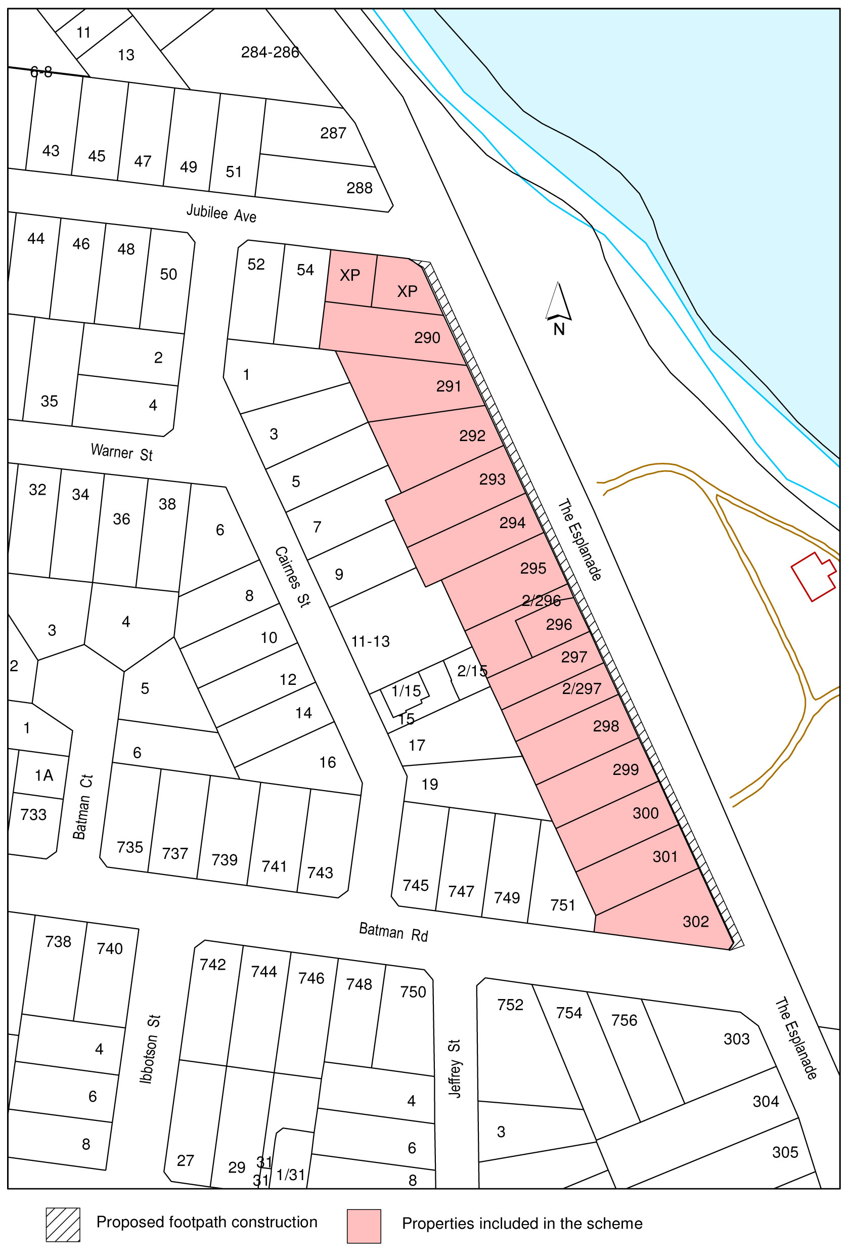
Stage |
Status |
Description |
Approval to prepare scheme |
✓ |
Decision made to prepare scheme following consideration of surveys of residents and feed back from the community via the Northern Bellarine Walkable Community and Locomote Walking groups. Council may then place the project in the budget system or proceed immediately to prepare a scheme. Scheme preparation involves survey, design and preparation of an apportionment of costs. |
Intention to Declare Scheme |
✓ |
Report to Council providing information on scheme including advice of impending advertising of scheme and declaration of charge. Seeks Council approval by resolution to proceed with process. 13 May 2014 |
Advertisement |
✓ |
The scheme is advertised in the local newspaper and all allotted property owners are notified by mail. This advertisement indicates Council’s intention and notification to ‘declare’ a scheme in a month’s time. 24 May 2014 |
Submissions |
✓ |
From the time of advertising property owners have 28 days (as set down by the Local Government Act) to lodge submissions, either in support or opposition to the scheme. |
Submissions Review Panel Hearing |
✓ |
A Submissions Review Panel is convened (quorum of three Councillors) and meets to consider submissions. Some submissions are written only, and other submitters may wish to be heard before the Panel. The Panel makes a recommendation to Council regarding the scheme. 30 October 2014 |
Declaration Report |
✓ |
Any time 28 days after advertising the scheme and after the Submissions Review Panel has met and considered submissions, Council considers a report and may proceed to “declare” the charges in accordance with its advertised intent. Subsequent to this the Finance Manager issues the levy notices and there is a formal charge placed on the property. This is the final step in the process for Council to make a decision on the scheme. |
Appeal |
Property owners may lodge an application for review with the Victorian Civil and Administrative Tribunal (VCAT) within one month of issue of the levy notice. An appeal is listed, heard and determined by the Tribunal and this process generally takes three to four months. Decisions made by VCAT are binding on all parties. |
|
Construction |
Council may then proceed to construct the works. Invoices are issued seeking payment of the estimated cost within one month of commencement. |
|
Final Cost Report |
At the completion of the works the scheme is “finalised” taking into account actual costs incurred and payments are adjusted accordingly. |
Portfolio: |
Infrastructure – Cr Ellis |
Source: |
City Services - Engineering Services |
Act/General Manager: |
Jenny McMahon |
Index Reference: |
Special Rates and Charges; The Esplanade, Indented Head |
This report seeks a resolution by Council to declare the charges to:
Sub Scheme 1 - Partially fund the construction of a footpath along the west side of The Esplanade between No 270 The Esplanade and Walpole Avenue, Indented Head. (See plan – Appendix 4).
Sub Scheme 2 - Partially fund the construction of new kerb and channel and vehicle laybacks between properties 270 and 274 The Esplanade, Indented Head.
It is proposed to construct 200 lineal metres of 1.5 metre wide footpath to provide for pedestrian access along The Esplanade, Indented Head. Further work includes a Council funded modified intersection layout for Pigdon Street and The Esplanade which includes new kerb and channel and drainage provision.
It is further proposed that the section of The Esplanade adjacent to properties 270, 271 and 272 The Esplanade be widened. The proposed work will also include new kerb and channel and vehicle laybacks. This work will provide 40 metres of new kerb and channel section and complete the ‘missing link’ in kerbing for The Esplanade North of Pigdon Street.
There are ten (10) properties abutting the proposed works that will receive special benefit. There are no Council owned properties in the scheme.
The Scheme has been divided into two sub schemes. Sub Scheme 1 relates to the proposed footpath and intersection modification works at Pigdon Street and Sub Scheme 2 relates to new kerb and channel works and vehicle laybacks for five properties from No 270 to 274 The Esplanade inclusive.
The total estimated project cost is $133,530 for Sub Scheme 1 and $9,754 for Sub Scheme 2. A detailed breakdown of costs is presented in the financial implications section of this report.
A Benefit Ratio of 0.34 for Sub Scheme 1 and 0.53 for Sub Scheme 2 has been calculated in accordance with Section 163 of the Local Government Act (Schedule B).
Property owners are considered to receive benefit from the works by way of improved pedestrian and vehicular access and general amenity improvement including pedestrian and vehicular safety.
Council considered a separate report on 22 July 2014 and resolved to advertise an ‘intention to declare’ the scheme.
The scheme was advertised on Saturday 2 August 2014 and five (5) objections were received. A submissions panel hearing was subsequently held on 30 October 2014 where four (4) property owners representing three (3) properties made verbal presentations to the panel in support of their submissions.
The Sub Scheme’s have been prepared in accordance with the Special Rate and Charges provisions of the Local Government Act 1989 along with the 2004 Ministerial Guidelines and Council’s Special Rates and Charges Policy.
Cr Ellis moved, Cr Nelson seconded -
That Council:
resolves to declare the Special Charge Scheme consisting of two Sub Schemes in accordance with Section 163 (1A) of the Local Government Act 1989 (The Act), as follows:
the Special Charge is declared for a period of five (5) years commencing upon completion of the works and scheme finalisation.
the Special Charge be declared for the purpose of defraying any expenses incurred by Council in relation to the construction of the footpath and kerb and channel on The Esplanade between No 270 The Esplanade and Walpole Avenue, Indented Head which project:
will provide:
Sub Scheme 1 - proper pedestrian access, improved intersection layout, improved pedestrian safety and enhancement to the general amenity for each of the properties included in the scheme;
Sub Scheme 2 – proper vehicular access including improved drainage and vehicular safety.
Council considers is or will be a special benefit to those persons required to pay the special charge (and who are described in succeeding parts of this Resolution); and
arises out of Council’s function of planning for and providing infrastructure for property owners.
the total cost of project for Sub Scheme 1, be recorded as $133,530. The total cost of project for Sub Scheme 2, be recorded as $9,753.94.
it be recorded that, for the purposes of Section 163 (2A) of the Act, the special charge proceeds will not exceed the amount calculated in accordance with the prescribed formula (R x C = S), the:
‘benefit ratio’ (R) being calculated at 0.34 for Sub Scheme 1 and 0.53 for Sub Scheme 2 represents the special benefits to all persons liable to pay the special charge (Schedule B);
‘total cost’ (C) of performing the function described in part 1 (b) of this resolution based on estimated cost be recorded as $62,651 for Sub scheme 1 and $7,654 for Sub Scheme 2; and
‘maximum levy’ (S) be recorded as $21,484 for Sub Scheme 1 and $4,018 for Sub Scheme 2.
the following be specified as the area for which the special rate is so declared:
the area within municipal district of Council highlighted in the plan attached to this Resolution (Appendix 4).
the following be specified as the land in relation to which the special charge so declared:
land within the area shown on the plan.
the following be specified as the criteria which form the basis of the special charge so declared:
ownership of any land described in Part 1(e) of this Resolution.
the following be specified as the manner in which the special charge so declared will be assessed and levied:
Each lot receives a primary access and amenity benefit;
The maximum levy is divided:
Sub Scheme 1 - 50% on access and 50% amenity on a frontage share basis;
Sub Scheme 2 – on a frontage share basis.
The special charge will be levied by sending a notice to the person who is liable to pay, pursuant to section 163(4) of the Act.
having regard to the preceding parts of this Resolution but subject to Section 166 (1) of the Act, it be recorded that;
the owners of the land described in column 2 & 3 of Schedule C to the resolution are estimated liable for the respective amounts set out in column 8 of Schedule C; and
such owners may, subject to any further resolution of Council pay the special charge in the following manner;
the charge will become due and payable within one month of the issue of the notice requesting payment pursuant to Section 167 (3) of the Act;
interest will not be charged for six months after the issue of the notice provided the person liable makes timely payment in accordance with any repayment arrangements that may be agreed on by Council; and
in accordance with Section 172 of the Act, the interest rate payable on the special charge which has not been paid by the specific date is set at Council’s overdraft rate, reviewed every three months (provided that it shall not exceed the rate fixed by the Governor in Council by Order for the purposes of Section 172 (2A) in which case the rate of interest shall be the maximum rate fixed by the Governor in Council by Order for the purposes of this section).
authorise the Chief Executive Officer to levy the Special Charge in accordance with Section 163 (4) of the Act.
Cr Irvine left the meeting room at 8:18pm
Cr Irvine re-entered the meeting room at 8:20pm
Carried.
At its meeting of 22 July 2014, Council resolved to give notice of its intention to declare a Special Charge Scheme for the construction of a footpath and kerb and channel along The Esplanade between No 270 The Esplanade and Walpole Avenue, Indented Head.
During the submissions period, 3 submissions (all objections) were received. One of the submissions had three signatories so effectively 5 submissions in total were received. A submissions panel hearing was subsequently held on 30 October 2014 where four (4) property owners representing three (3) properties made verbal presentations to the panel in support of their submissions.
A summary of concerns highlighted in the submissions and corresponding considerations by the Council panel members include:
A footpath will not be used;
This was considered to be an opinion not necessarily reflective of the remaining property owners or wider community.
A footpath will detract from the natural coastal and rural nature of the area;
This is a common argument in this form of Special Charge Scheme. Although the argument is of a personal nature and understandable, it is considered that the construction of footpaths in a residential area takes priority in terms of public liability and risk mitigation for Council.
There is already a well used path along the foreshore;
This pathway is managed by the foreshore committee of management and is unsealed in nature which is not conducive for disability access. Although a high value pathway for recreation purposes, this pathway does not abut any residential properties therefore cannot be used for direct access.
A footpath is not wanted or needed;
This is considered to be an opinion not necessarily reflective of the remaining property owners or wider community.
Kerb and Channel and footpath will make access into properties more difficult and unsafe whilst reversing watercraft trailers; and
It is considered that the new kerb and channel (including crossover provision) will not have any adverse affect on the ability to manoeuvre in front of the properties.
The kerb and channel will encourage all day parking for beach users.
It is illegal to park in this area due to the double line marking along the road. The new kerbing is not expected to influence parking to any extent.
After considering all submissions and deliberating post panel hearing, the submissions review panel advised to proceed with the scheme as presented.
The provision of a sealed pathway surface provides a permanent and safe means of pedestrian access. During the course of construction and the manufacture and procurement of materials, energy is expended resulting in some greenhouse gas emissions. This ceases when construction is complete.
The project does not create waste with the exception of some excavated material. The proposal does not affect any natural habitats. The proposal will not require removal of vegetation.
The project is a one off capital cost and there will be minimal ongoing maintenance costs. If approved, the project could proceed this financial year.
Financial details are as follows:
Sub Scheme 1 - Footpath |
|
|---|---|
Maximum scheme levy to property owners (income) |
$21,484 |
Scheme levy to Council |
$41,167 |
Direct funding by Council to reinstate gravel driveway, construct new kerb and channel for intersection modification at Pigdon Street and reinstatement of asphalt pavement. |
$70,879 |
Total cost Sub Scheme 1 |
$133,530 |
|
|
Sub Scheme 2 – Kerb and channel and laybacks |
|
Maximum scheme levy to property owners (income) |
$4,018 |
Scheme levy to Council |
$3,636 |
Direct cost to property owners for vehicle laybacks |
$2,100 |
Total cost Sub Scheme 2 |
$9,754 |
|
|
Total Project Cost |
$143,284 |
From the table above, the total net cost to Council for this project is estimated to be $115,682.
The two Sub Schemes have been prepared in accordance with the Special Rate and Charge provisions of the Local Government Act 1989 along with the 2004 ministerial guidelines and Council’s Special Rates and Charges Policy.
This report aligns with the City Plan as follows:
Sustainably Built and Natural Environment
Support our Community to live sustainably – Encourage increased use of alternatives to car transport and seek efficient traffic movement throughout the municipality.
Advocate for and promote sustainable design and development – Promoting sustainable design and retrofitting.
Acknowledge the community’s desire to have their say and be involved in planning for the future of Greater Geelong.
No Council Officer involved with this process has any direct or indirect interest in the properties.
Provision of a sealed pathway will provide safer walking and cycling conditions for pedestrians and junior cyclists by minimising the risk of personal injuries through conflict with vehicles and the elimination of uneven and slippery surfaces. Provision of a modified intersection layout at Pigdon Street and The Esplanade will provide safer driving conditions and offer better protection for pedestrians.
There are no identified risks for Council in making its declaration of the scheme.
The provision of properly sealed and drained pathways is aligned to Council’s City Plan as described above and provides improved connectivity and safety for pedestrians and cyclists. It is further considered that the footpaths will enhance the general amenity of the area.
The provision of the modified intersection layout and road widening works will provide safety improvements for both pedestrian and vehicular traffic and provide overall amenity improvements for the area.
In developing this report to Council, the subject matter has been considered to determine if it raises any human rights issues. In particular, whether the scope of any human right established by the Victorian Charter of Human Rights and Responsibilities is in any way limited, restricted or interfered with by the recommendations contained in this report. It is considered that the subject matter does not raise any adverse human rights issues.
It is further considered that the construction of the footpaths upholds the right to freedom of movement (Section 12 of the Human rights Charter) by enhancing a person’s ability to move freely within the area they choose to live.
Community consultation for the proposed footpath construction was carried out at the Northern Bellarine Walkable Coastal Community workshops of 2009/ 2010. Consultation with the Locomote Walking Group was included during this period and is ongoing.
On 30 July 2014, Council officers wrote to the affected property owners and the Locomote Walking Group to provide advice on Council’s Intention to declare the scheme including the proposed newspaper advertisement date. The letter also included an invitation for submissions.
The scheme was formally advertised in the Geelong Advertiser on Saturday 2 August 2014 and a follow up letter of 4 August 2014 included a copy of the advertisement in accordance with the requirements of the Act.
A submissions panel hearing of 30 October 2014 gave all affected property owners the opportunity to speak to the panel in support of their submissions.
Further correspondence will be sent to all affected property owners should Council resolve to declare the charges for the scheme.
The works for the construction of footpaths in The Esplanade, Indented Head which consist of excavation, footpath, kerb and channel, road widening, intersection realignment, reinstatement of nature strip and driveways, miscellaneous construction works, legal advice and professional services associated with survey, engineering design, drafting, supervision and administration of the project all as included in the cost estimate shown below.
SUB SCHEME 1 COST ESTIMATE - FOOTPATH CONSTRUCTION |
|||||
ITEM |
DESCRIPTION |
QUANTITY |
UNIT |
RATE $ |
AMOUNT $ |
1.00 |
GENERAL |
|
|
|
|
1.01 |
Initial site establishment and set up, decamping and site cleanup and other fixed costs up to time of completion of works. |
1.0 |
ITEM |
$6,317.00 |
$6,317.00 |
1.02 |
Traffic management costs. |
1.0 |
ITEM |
$3,000.00 |
$3,000.00 |
1.03 |
Setting out of works. |
1.0 |
ITEM |
$540.00 |
$540.00 |
1.04 |
Service / Cable locations |
1.0 |
ITEM |
$700.00 |
$700.00 |
1.05 |
Internal supervision fee (COGG construction) |
1.0 |
ITEM |
$3,340.00 |
$3,340.00 |
2.00 |
EARTHWORKS & DEMOLITION |
|
|
|
|
2.01 |
Excavation and disposal of all materials to limits of work as indicated on plan, including trimming for new road pavement, excavation of soft spots and removal of concrete. |
57.9 |
m3 |
$60.00 |
$3,476.13 |
2.02 |
Trimming / Removal and disposal of shrubs as indicated on plan. |
1.0 |
ITEM |
$1,000.00 |
$1,000.00 |
3.00 |
DRAINAGE |
|
|
|
|
| 3.01 | Adjust existing Junction Pit lid to match finished surface level. | 1 |
No. |
$770.00 |
$770.00 |
4.00 |
CONCRETE WORKS: ` |
|
|
|
|
|
KERBING |
|
|
|
|
4.01 |
Concrete pram crossing 1.5m wide, including fine crushed rock bedding. |
4.0 |
No. |
$250.00 |
$1,000.00 |
|
PAVING |
|
|
|
|
4.02 |
75mm concrete paving with SL62 mesh including crushed rock bedding and reinstate nature strip. |
193.3 |
m2 |
$105.00 |
$20,295.45 |
4.03 |
125mm concrete paving with SL62 mesh including crushed rock bedding and reinstate nature strip. |
78.6 |
m2 |
$110.00 |
$8,649.30 |
4.04 |
Tactile Ground Surface Indicator Tiles, supplied and placed. 3.0 m2 $250.00 $750.00 |
||||
5.00 |
LANDSCAPING |
|
|
|
|
5.01 |
Top soiling and seeding nature strips. |
265.2 |
m2 |
$8.00 |
$2,121.60 |
6.00 |
SIGNING AND LINE-MARKING |
|
|
|
|
6.01 |
Relocate existing permanent sign and post as per plan. |
1.0 |
No |
$250.00 |
$250.00 |
SUB-TOTAL |
$52,209.48 |
||||
10% CONTINGENCY |
$5,220.95 |
||||
Design |
$3,132.57 |
||||
Project administration |
$2,088.38 |
||||
CONSTRUCTION COST ESTIMATE |
$62,651.38 |
||||
SUB SCHEME 2 COST ESTIMATE - KERB AND CHANNEL AND VEHICLE LAYBACKS |
|||||
ITEM |
DESCRIPTION |
QUANTITY |
UNIT |
RATE $ |
AMOUNT $ |
1.00 |
GENERAL |
|
|
|
|
1.01 |
Initial site establishment and set up, decamping and site cleanup and other fixed costs up to time of completion of works. |
1.0 |
ITEM |
$941.00 |
$941.00 |
1.02 |
Traffic management costs. |
1.0 |
ITEM |
$500.00 |
$500.00 |
1.03 |
Setting out of works. |
1.0 |
ITEM |
$70.00 |
$70.00 |
2.00 |
EARTHWORKS & DEMOLITION |
||||
2.01 |
Excavation and disposal of all materials to limits of work as indicated on plan, including trimming for new road pavement, excavation of soft spots and removal of concrete. |
5.4 |
m3 |
$60.00 |
$321.30 |
2.02 |
Saw-cutting of concrete and/or Asphalt paving. |
22.4 |
m |
$10.00 |
$223.50 |
2.03 |
Saw-cut of concrete kerb and channel |
1.0 |
ITEM |
$10.00 |
$10.00 |
2.04 |
Removal and disposal of 125mm thick concrete as per plan. |
4.2 |
m2 |
$60.00 |
$251.40 |
3.00 |
CONCRETE WORKS: |
||||
|
KERBING |
||||
3.01 |
B2 Barrier kerb and channel 450mm wide, including fine crushed rock bedding. |
24.3 |
m |
$136.00 |
$3,302.08 |
3.02 |
Concrete layback for vehicle crossing 3.0m - 3.75m wide, including bedding & formwork. |
5 |
No. |
$350.00 |
$1,750.00 |
|
PAVING |
||||
3.04 |
125mm concrete paving with SL62 mesh including crushed rock bedding and reinstate nature strip. |
6.9 |
m2 |
$110.00 |
$759.00 |
SUB-TOTAL $8128.28 |
|
||||
10% CONTINGENCY $812.83 |
|||||
Design $487.70 |
|||||
Project administration $325.13 |
|||||
CONSTRUCTION COST ESTIMATE $9,753.94 |
|
||||
COUNCIL FUNDED INTERSECTION WORKS |
|||||
ITEM |
DESCRIPTION |
QUANTITY |
UNIT |
RATE $ |
AMOUNT $ |
1.00 |
GENERAL |
|
|
|
|
1.01 |
Initial site establishment and set up, decamping and site cleanup and other fixed costs up to time of completion of works. |
1.0 |
ITEM |
$6,182.00 |
$6,182.00 |
1.02 |
Traffic management costs. |
1.0 |
ITEM |
$500.00 |
$500.00 |
1.03 |
Setting out of works. |
1.0 |
ITEM |
$390.00 |
$390.00 |
1.04 |
Service / Cable locations |
1.0 |
ITEM |
$300.00 |
$300.00 |
1.05 |
Internal supervision fee (COGG construction) |
1.0 |
ITEM |
$3,000.00 |
$3,000.00 |
2.00 |
EARTHWORKS & DEMOLITION |
||||
2.01 |
Excavation and disposal of all materials to limits of work as indicated on plan, including trimming for new road pavement, excavation of soft spots and removal of concrete. |
105.8 |
m3 |
$60.00 |
$6,349.53 |
2.02 |
Saw-cutting of concrete and/or Asphalt paving. |
278.1 |
m |
$10.00 |
$2,781.30 |
2.03 |
Saw-cut of concrete kerb and channel |
34.0 |
ITEM |
$10.00 |
$340.00 |
3.00 |
PAVEMENT WORKS |
||||
3.01 |
150mm compacted depth Class 1 20mm crushed rock, supplied, spread and compacted. |
39.4 |
m3 |
$120.00 |
$4,725.72 |
3.02 |
200mm compacted depth Class 3 40mm crushed rock, supplied, spread and compacted. |
52.5 |
m3 |
$100.00 |
$5,250.80 |
3.03 |
100mm compacted depth Class 1 20mm crushed rock, supplied, spread and compacted. |
11.8 |
m3 |
$120.00 |
$1,420.32 |
3.04 |
30mm compacted depth 10mm nominal size type N Asphalt spread and compacted including emulsion prime & grit using a paver. |
262.5 |
m2 |
$35.00 |
$9,188.90 |
4.00 |
DRAINAGE
|
||||
|
PIPE |
||||
4.01 |
Connect existing household storm water to kerb and channel. Including excavation, supply and placement of kerb adapters. |
6.0 |
No. |
$250.00 |
$1,500.00 |
4.02 |
100mm dia Sub-Soil drains including excavation, supply, placement and provision of approved backfill. |
100.0 |
m |
$48.00 |
$4,800.00 |
|
PITS |
||||
4.03 |
900mm x 600mm SEP, less than 1.5m deep with Gatic type cover, supplied and placed including excavation, placement of approved fine crushed rock bedding and back-filling with approved material. |
1.0 |
No. |
$1,400.00 |
$1,400.00 |
4.04 |
Modify ex 900mm x 600mm SEP to 900mm x 1200mm SEP, less than 1.5m deep with Gatic type cover, supplied and placed including excavation, placement of approved fine crushed rock bedding and back-filling with approved material. |
1.0 |
No. |
$1,400.00 |
$1,400.00 |
4.05 |
Tap into existing drainage pit or pipe. |
1.0 |
No. |
$385.00 |
$385.00 |
5.00 |
CONCRETE WORKS: ` |
||||
|
KERBING |
||||
5.01 |
B2 Barrier kerb and channel 450mm wide, including fine crushed rock bedding. |
52.2 |
m |
$136.00 |
$7,101.92 |
5.02 |
Concrete layback for vehicle crossing 3.0m - 3.75m wide, including bedding & formwork. |
1 |
No. |
$350.00 |
$350.00 |
6.00 |
DEMOLITION |
||||
6.01 |
Remove and dispose existing SEP and abandon ex 300mm dia RCP backfill with approved materials as per plan. |
1 |
No. |
$1,200.00 |
$1,200.00 |
7.00 |
SIGNING AND LINE-MARKING |
||||
7.01 |
Line-marking |
1.0 |
ITEM |
$500.00 |
$500.00 |
SUB-TOTAL : $59,065.49 |
|
||||
10% CONTINGENCY : D |
$5,906.55 |
||||
Design |
$3,543.93 |
||||
Project administration |
$2,362.62 |
||||
CONSTRUCTION COST ESTIMATE |
$70,878.59 |
||||
A |
Purpose |
|||||
|
To construct a footpath in The Esplanade, Indented Head to provide all weather pedestrian access for property owners and the wider community. The project also includes intersection modification works to improve vehicular and pedestrian safety. |
|||||
B |
Coherence |
|||||
|
The works will provide a physical pathway connection between Pigdon Street and Walpole Avenue and will provide a special benefit to adjoining and remote properties. |
|||||
C |
Total Cost C |
|||||
|
Total Estimated cost of works |
$133,529.96 |
||||
|
Direct funding by Council to reinstate gravel driveways, new kerb and channel for intersection modification at Pigdon Street and asphalt pavement reinstatement |
$70,878.59 |
||||
|
TOTAL SCHEME COST of Footpath Construction |
$62,651.37 |
||||
D |
Identify Special Beneficiaries |
|||||
|
10 properties with frontages to the proposed footpath are considered to receive access and amenity benefits. |
|||||
E |
Properties to include |
|||||
|
The 10 abutting properties receive both access and amenity benefits. Therefore: |
|||||
|
Total Special Benefits out of the scheme TSB (out) |
|
|
= |
0 |
|
F |
Estimate of Total Special Benefits |
|||||
|
For this scheme it is considered that the greater proportion of benefit is for pedestrian access given the purpose of the scheme. Therefore it is estimated that 80% of the benefits relate to access and 20% to amenity. Estimated pedestrian use of the paths is 80% for the wider community and 20% for abutting property owners. Amenity benefits are based on frontage with 87% of the footpaths fronting benefiting properties and 13% within Council's road reserves. TSB (in) is therefore calculated as follows: |
|||||
|
TSB (in) = 80% X 20%(access) + 20% X 87% (amenity) |
|
|
= |
33.4% |
|
G |
Estimate of Total Community Benefit -TCB |
|||||
|
It is considered that people in the community will receive a benefit from the works as the pathway is used to access other areas considering the walkability study for the area. There are no amenity benefits considered for the wider community. TCB is calculated as follows: |
|||||
|
TCB = 80% X 80% = 64% |
|||||
H |
Calculate "Benefit Ratio" - R
|
|||||
|
Benefits Ratio = |
TSB (in) |
= |
33.4 |
0.343 |
|
TSB (in) + TSB (out) + TCB |
|
33.4 + 0 + 64 |
||||
I |
Maximum Total Levy (S) |
|||||
|
Maximum Total Levy S = R X C |
$21,484.15 |
||||
|
Council Contribution to Special Charge Scheme |
$41,167.22 |
||||
A |
Purpose |
|
||||
|
To construct kerb and channel including vehicle laybacks in The Esplanade, Indented Head to provide a wider pavement and improved vehicular access for property owners. |
|||||
B |
Coherence |
|||||
|
The works will provide the missing link in road pavement construction between No 270 The Esplanade and the Pigdon Street intersection. Two properties at No 273 and 274 The Esplanade will also receive new vehicle laybacks. |
|||||
C |
Total Cost C |
|||||
|
Total Estimated cost of kerb and channel works including vehicle laybacks |
$9,753.94 |
||||
|
Direct funding by property owners for vehicle laybacks |
$2,100.00 |
||||
Total cost for kerb and channel work |
$7,653.94 |
|||||
D |
Identify Special Beneficiaries |
|||||
|
5 properties with frontages to The Esplanade are considered to receive access and amenity benefits. The community will also receive benefit by way of a wider road pavement, improved road drainage and safety. |
|||||
E |
Properties to include |
|||||
|
The 5 abutting properties receive both access and amenity benefits. Therefore: |
|||||
|
Total Special Benefits out of the scheme |
|
TSB (out) |
= |
0 |
|
F |
Estimate of Total Special Benefits |
|||||
|
For this scheme component it is considered that the benefit is for vehicular access and property amenity. It is estimated that 50% of the benefit relates to access and 50% to amenity. Estimated use of the wider road pavement is 95% for the wider community and 5% for abutting property owners. Amenity benefits are based on frontage with 100% of the new kerb and channel and laybacks fronting benefiting properties. TSB (in) is therefore calculated as follows: |
|||||
|
TSB (in) = 50% X 5%(access) + 50% X 100% (amenity) |
|
|
= |
52.5% |
|
G |
Estimate of Total Community Benefit -TCB |
|||||
|
It is considered that people in the community will receive a benefit from the works as the new road pavement is used to access other areas and provides improved safety. There are no amenity benefits considered for the wider community. TCB is calculated as follows: |
|||||
|
TCB = 95% X 50% |
|
|
= |
47.5% |
|
H |
Calculate "Benefit Ratio" - R
|
|||||
|
Benefits Ratio = |
TSB (in) |
= |
52.5 |
0.525 |
|
|
TSB (in) + TSB (out) + TCB |
52.5 + 0 + 47.5 |
||||
I |
Maximum Total Levy (S) |
|||||
|
Maximum Total Levy S = R X C |
$4,018.32 |
||||
|
Council Contribution to Special Charge Scheme |
$3,635.62 |
||||
COLUMN 1 |
COLUMN 2 |
COLUMN 3 |
COLUMN 4 |
COLUMN 5 |
COLUMN 6 |
COLUMN 7 |
COLUMN 8 |
Prop Key |
Address |
Legal Details |
Apportionable frontage |
Footpath Cost |
Kerb costs |
Layback costs |
Total Cost |
311634 |
270 The Esplanade, Indented Head |
Lot 1 PS435184 |
10 |
$1,947.98 |
$1,736.09 |
$420.00 |
$4,104.07 |
| 311635 |
271 The Esplanade, Indented Head |
Lot 2 PS435184 |
8.74 |
$1,861.77 |
$1,605.34 |
$420.00 |
$3,887.11 |
311636 |
272 The Esplanade, Indented Head |
Lot 3 PS435184 |
7.66 |
$1,155.99 |
$676.89 |
$420.00 |
$2,252.88 |
250791 |
273 The Esplanade, Indented Head |
Lot 9 TP827456 |
12.96 |
$1,518.62 |
$420.00 |
$1,938.62 |
|
250792 |
274 The Esplanade, Indented Head |
Lot 1 TP1408 |
16.76 |
$2,410.51 |
$420.00 |
$2,830.51 |
|
250793 |
275 The Esplanade, Indented Head |
Lot 10 TP827456 |
16.76 |
$2,410.51 |
$2,410.51 |
||
250794 |
276 The Esplanade, Indented Head |
Lot 1 TP118689 |
16.76 |
$2,410.51 |
$2,410.51 |
||
250795 |
277 The Esplanade, Indented Head |
Lot 11 TP827456 |
16.76 |
$2,410.51 |
$2,410.51 |
||
250796 |
278 The Esplanade, Indented Head |
Lot 12 TP827456 |
24.4 |
$2,933.24 |
$2,933.24 |
||
250797 |
279 The Esplanade, Indented Head |
Lot 1 TP14712 |
26.2 |
$2,424.51 |
$2,424.51 |
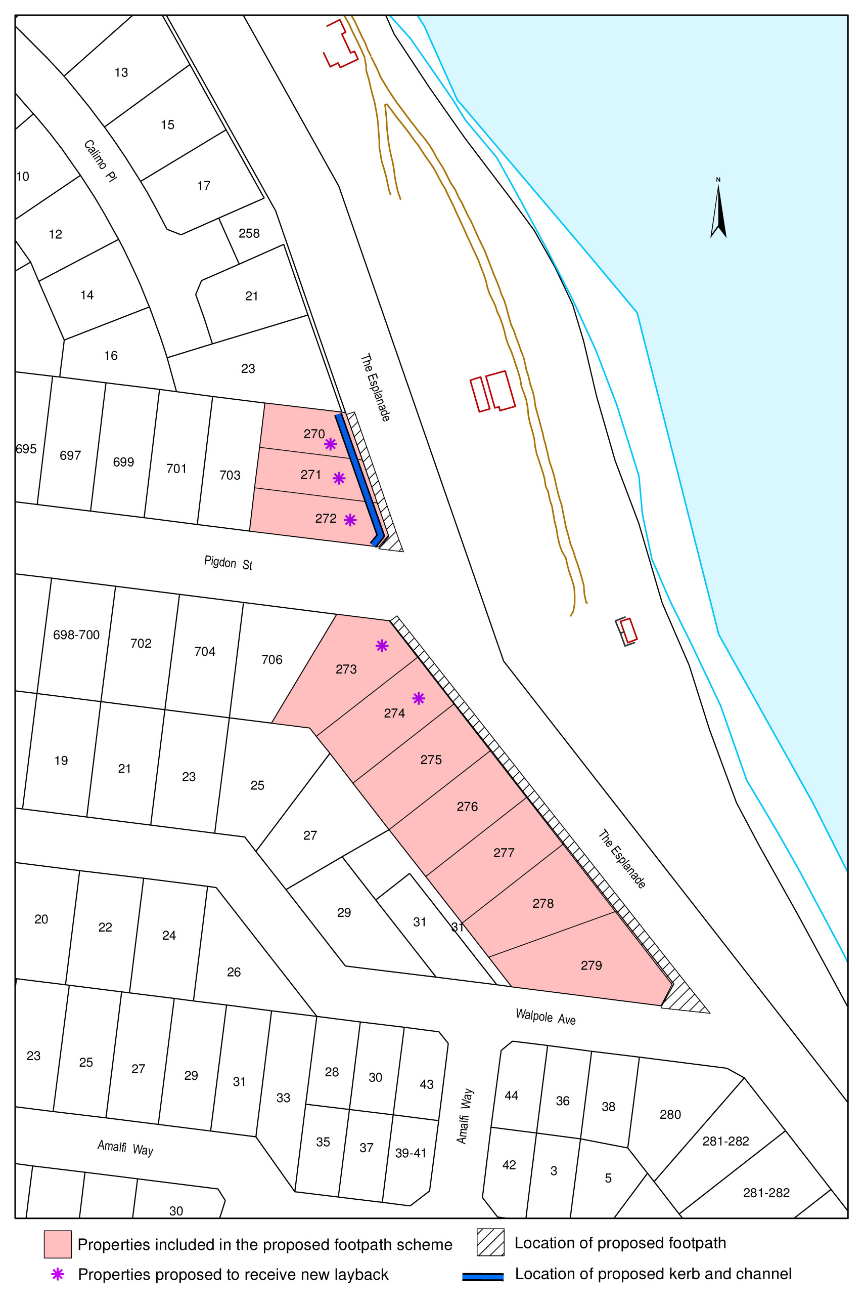
Stage |
Status |
Description |
Approval to prepare scheme |
✓ |
Decision made to prepare scheme following consideration of surveys of residents and feed back from the community via the Northern Bellarine Walkability Study. Council may then place the project in the budget system or proceed immediately to prepare a scheme. Scheme preparation involves survey, design and preparation of an apportionment of costs. July 2014 |
Intention to Declare Scheme |
✓ |
Report to Council providing information on scheme including advice of impending advertising of scheme and declaration of charge. Seeks Council approval by resolution to proceed with process. 22 July 2014 |
Advertisement |
✓ |
The scheme is advertised in the local newspaper and all allotted property owners are notified by mail. This advertisement indicates Council’s intention and notification to ‘declare’ a scheme in a month’s time. 2 August 2014 |
Submissions |
✓ |
From the time of advertising property owners have 28 days (as set down by the Local Government Act) to lodge submissions, either in support or opposition to the scheme. |
Submissions Review Panel Hearing |
✓ |
A Submissions Review Panel is convened (quorum of three Councillors) and meets to consider submissions. Some submissions are written only, and other submitters may wish to be heard before the Panel. The Panel makes a recommendation to Council regarding the scheme. 30 October 2014 |
Declaration Report |
✓ |
Any time 28 days after advertising the scheme and after the Submissions Review Panel has met and considered submissions, Council considers a report and may proceed to “declare” the charges in accordance with its advertised intent. Subsequent to this the Finance Manager issues the levy notices and there is a formal charge placed on the property. This is the final step in the process for Council to make a decision on the scheme. |
Appeal |
|
Property owners may lodge an application for review with the Victorian Civil and Administrative Tribunal (VCAT) within one month of issue of the levy notice. An appeal is listed, heard and determined by the Tribunal and this process generally takes three to four months. Decisions made by VCAT are binding on all parties. Construction Council may then proceed to construct the works. Invoices are issued seeking payment of the estimated cost within one month of commencement. |
Final Cost Report |
|
At the completion of the works the scheme is “finalised” taking into account actual costs incurred and payments are adjusted accordingly. |
Cr E Kontelj declared an Indirect Interest by Close Association in Agenda Item 14 – Consideration of Tender Submission for Tender T1400054 – Supply and Delivery of Quarry and Associated Products in that some of the tender submitters are significant customers of his employer and left the meeting room at 8:22pm.
Portfolio: |
Infrastructure Parks & Gardens - Cr Ellis |
Source: |
City Services - Infrastructure Operations |
Act/General Manager: |
Jenny McMahon |
Index Reference: |
Project T1400054 |
To provide Council with the requisite information to facilitate the approval of the tender Evaluation Panel’s recommendation in relation to the provision of Supply & Delivery of Quarry and associated Products.
Council has sought tenders for the supply and delivery of Quarry and associated Products throughout the municipality for a period of two (2) years with a further three (3), one (1) year options available at the discretion of Council. The service is planned to commence immediately following the awarding of this contracted service. The Contract shall operate on a scheduled rates basis.
The supply associated with this Contract incorporates the supply and delivery of the following quarry products for use in construction and maintenance related activities undertaken by Council. The products include Crushed Rock, Scalpings, Granite Sand, Gravel and Bedding Sand.
Council will appoint a panel of contractors for the supply and delivery of Quarry and associated Products throughout the municipality.
A total of ten (10) companies have provided tender submissions for the supply and delivery of Quarry and associated Products. Tender submissions include an extensive schedule of rates for a range of Council Quarry and associated Product requirements throughout the municipality.
The estimated annual value of the works program associated with this contract $1,500,000.
A detailed evaluation of all tender submissions has been undertaken by an evaluation panel of Council officers, as identified in the body of this report.
The tender submissions for Menheere Enterprises Pty Ltd T/as Menheere Bros and PJT McMahons Excavations were not considered as they were deemed non conforming
Following an evaluation of each of the submissions the following suppliers have been recommended for inclusion to the panel of preferred suppliers:-
Barro Group Pty Ltd T/As Mountain View Quarries
DP & JL Dunoon Pty Ltd Trading As Newcomb Sand & Soil Supplies
Geelong Quarries Pty Ltd
Hillview Sand Pty Ltd
Holcim (Australia) Pty Ltd
Hume Earthmoving Pty Ltd
Local Mix Quarries Pty Ltd
Cr Ellis moved, Cr Richards seconded -
That Council:
accept the tender submission/s from:
Barro Group Pty Ltd T/as Mountain View Quarries
DP & JL Dunoon T/as Newcomb Sand & Soil Supplies
Geelong Quarries Pty Ltd
Hillview Sand Pty Ltd
Holcim (Australia) Pty Ltd
Hume Earthmoving Pty Ltd
Local Mix Quarries Pty Ltd
for Tender No T01400054 – Panel arrangement for Supply and Delivery of Quarry and Associated Products for the associated schedule of rates (exclusive of GST); and
sign and seal the contract documents.
Carried.
The City of Greater Geelong invited tenders for the supply and delivery of Quarry and associated Products via public advertisement in Tenderlink, the Geelong Advertiser and The Age.
At the close of tenders the following tender submissions were received:
Tenderer |
Barro Group Pty Ltd T/as Mountain View Quarries |
DP & JL Dunoon T/ as Newcomb Sand & Soil Supplies |
Geelong Quarries Pty Ltd |
Hillview Sand Pty Ltd |
Holcim (Australia) Pty Ltd |
Hume Earthmoving Pty Ltd |
Local Mix Quarries Pty Ltd. |
Menheere Enterprises Pty Ltd T/as Menheere Bros |
PJT McMahons Excavations |
Creswick Quartz Limited |
All tenders have been submitted exclusive of GST.
The tender submissions were evaluated by a panel consisting of:
Gary Van Driel |
General Manager City Services |
David Goldie |
Manager Infrastructure Operations |
Joshua King |
Co-ordinator Construction |
Boris Schanjko |
Co-ordinator Maintenance |
Adrian Rainbow |
Procurement Contract Officer (Non-voting Member) |
Stage One – Mandatory Criteria
Mandatory requirements apply to this Tender are:
Must comply with OH&S requirements detailed in the tender schedule |
All submissions complied with the mandatory criteria above.
However two tenderers, Menheere Enterprises Pty Ltd T/as Menheere Bros and PJT McMahons Excavations, failed to provide laboratory analysis results for their tendered products of no longer than six (6) months old as required for this tender. Their submissions were therefore deemed non-conforming.
The remaining tenderers proceeded to the second stage of the evaluation.
Stage Two –Comparative Criteria
Tender submissions were assessed based on the respondent’s performance or tender response in the following areas:
Criteria |
Weighting |
Product proposed – record of delivery to specification, quality & performance of product |
30% |
Relevant experience and track record, past performance over last 3 years |
25% |
Proposed plant & equipment levels |
10% |
Flexibility and responsiveness |
10% |
Economic contribution to the Geelong Region |
2% |
Quality management |
23% |
|
100% |
In relation to economic contribution, Council’s current procurement policy states that, “A weighting percentage up to a maximum value of 10% will be assigned to this criteria element. The percentage applied to any procurement will be determined by the quotation or tender evaluation panel.” On this occasion the panel’s rationale for setting the contribution to the Geelong Region at 2% was that sourcing and delivering the material is in a narrow local market within practical distance from Geelong. It is cost prohibitive for Melbourne suppliers to respond as haulage costs alone would make any submission uncompetitive. As a result only local suppliers responded. Respondents include three companies that operate quarries from Werribee, Point Wilson and Stonehaven(Golden Plains). All other respondents stockpile material at yards.
The tenderers who ranked highest in the comparative criteria assessment while providing an acceptable value for money pricing submission were rated suitable for inclusion on the Supply and Delivery of Quarry and Associated Products panel (refer below).
Recommended Panel Of Suppliers
Tenderer |
Ranking |
Barro Group Pty Ltd T/As Mountain View Quarries |
1 |
Holcim (Australia) Pty Ltd |
2 |
Hillview Sand Pty Ltd |
3 |
DP & JL Dunoon Pty Ltd Trading As Newcomb Sand & Soil Supplies |
4 |
Local-Mix Quarries |
5 |
Hume Earthmoving Pty Ltd |
6 |
Geelong Quarries Pty Ltd |
7 |
In order to provide a full range of products to Council it is preferred to appoint all the above tenderers to a panel under a formal contract arrangement in which there are no guaranteed volume quantities.
The recommended tenderers satisfied all requirements and adequately addressed all the above listed evaluation criteria.
The Evaluation Panel is satisfied that all the recommended tenderers will be able to successfully provide this service to Council.
Creswick Quartz Limited was the lowest ranking of all the tenderers at the conclusion of comparative criteria assessment. It was determined that the higher ranking recommended tenderers satisfied all Councils Quarry and associated Products requirements. Therefore Creswick Quartz Limited were not recommended to be included on the contracted panel.
Any environmental implications associated with this contract will arise from the execution of this service / works. It is considered that these are the responsibility of the Contractor and will be managed through the contract documentation.
The funding for this service will be drawn from budget allocations within the City Services -Operations capital, recurrent and maintenance works.
The requirements of Section 186 of the Local Government Act have been complied with for this tender. There are no other policy, legal or statutory implications associated with this tender process.
The provision of this service has a positive impact on all key City Plan objectives.
No officers or contractors involved in the preparation of this report have a direct or indirect interest in matters to which this report relates.
There are not considered to be any risks associated with the acceptance of this tender that cannot be managed through the contract conditions.
There are no social implications that will arise from the acceptance of this tender.
There are no Human Rights Charter implications that will arise from the acceptance of this tender.
There are no communication issues associated with the acceptance of this tender.
Cr E Kontelj re-entered the meeting room at 8:23pm
Contents | Previous Page: Section A - Procedural Matters | Next Page: Section C - Assembly of Assembly of Councillors
