
Council Minutes - Section B: Reports - 12 May 2015
Contents | Previous Page: Section A - Procedural Matters | Next Page: Section C - Assembly of Councillors
Contents | Previous Page: Section A - Procedural Matters | Next Page: Section C - Assembly of Councillors
Reports tabled at the Ordinary Meeting of Council on Tuesday date held at City Hall, Little Malop Street in Geelong.
Combined Amendment C261 and Planning Permit 1163/2013 130-150 Forest Road South, Lara - Adoption
Private Sporting Infrastructure Capital Co-Contribution Policy
Portfolio: |
Finance – Cr Lyons (Mayor), Cr Farrell, Cr E Kontelj |
Source: |
Strategy and Performance - Administration and Governance |
General Manager: |
Dean Frost |
Index Reference: |
Subject: Budget Financial Year 2015-2016 |
To declare any conflicts of interest that Councillors may have with the 2015-2016 Budget.
The proposed 2015-2016 Budget contains items in which a Councillor has indicated they have a conflict of interest.
The Local Government Act 1989 exempts a Councillor from a conflict of interest when Council has previously approved the matter in which the Councillor has an interest, including funding, and the Councillor has disclosed the conflict of interest at the time the matter was approved by Council.
Any items proposed for inclusion in the Budget in which a Councillor has indicated a conflict of interest are to be dealt with by separate resolution.
Once all declarations have been made and the item which is the subject of any declaration is determined by Council, all Councillors are able to vote on Agenda Item 2, being the Proposed 2015-2016 Budget.
Declarations are made under the General, Disbursement and Capital categories for the 2015-2016 Budget.
Cr Farrell moved, Cr E Kontelj seconded -
That Councillors who have a Conflict of Interest in items proposed for the inclusion in the 2015-2016 Budget declare the nature of that interest:
General
Victorian Local Governance Association (VLGA) membership
Cr Farrell declared an indirect interest in that she works as a contractor for the Victorian Local Governance Association (VLGA) Membership.
Cr Farrell left the meeting room at 7:23pm
Cr Heagney moved, Cr Macdonald seconded -
That funding of VLGA Annual Membership be approved for inclusion in the 2015-2016 Council Budget.
Carried.
Cr Farrell returned to the meeting room at 7:23pm
Managing Future Growth Batesford South Study
Cr Heagney declared an indirect interest due to her close association with a ratepayer who has significant property interests in the area.
Cr Heagney left the meeting room at 7.24pm
Cr Ansett moved, Cr Farrell seconded -
That funding of D65A12 Managing Future Growth Batesford South Study for $100,000 be approved for inclusion in the 2015-2016 Council Budget.
Cr Heagney returned to the meeting room at 7:24pm
Disbursements 2015-2016
St Albans Breakwater Cricket Club
Cr Irvine declared an indirect interest in that he is the president of the St Albans Breakwater Cricket Club.
Cr Irvine left the meeting room at 7:25pm
Cr Fisher moved, Cr Ellis seconded -
That funding of D66A31 St Albans Breakwater Cricket Club for $35,000 be approved for inclusion in the 2015-2016 Council Budget
Cr Irvine returned to the meeting at 7:25pm
Capital 2015-2016
Composting Site Setup Works
Cr Harwood declared an indirect interest in that he undertakes consultancy work for a company that is assisting Council in establishing a green organics site.
Cr Harwood left the meeting room at 7:25pm
Cr Nelson moved, Cr Richards seconded -
That funding of C16303 Composting Site Setup Works for $250,000 be approved for inclusion in the 2015-2016 Council Budget.
Cr Harwood returned to the meeting at 7.26pm
Geelong Soccer Club Facilities Upgrade
Cr E Kontelj declared an indirect interest due to his close association with a committee member.
Cr E Kontelj left the meeting room at 7:26pm
Cr Irvine moved, Cr Fisher seconded -
That funding of C16840 Geelong Soccer Club Facilities Upgrade for $250,000 be approved for inclusion in the 2015-2016 Council Budget.
Cr E Kontelj returned to the meeting at 7:27pm
Town Centre Tree Lighting
Cr Lyons declared a direct interest in that he owns property in the CBD that may be impacted by the continuation of the lighting and decoration program.
Cr Heagney declared a direct interest in that she owns property in the CBD that may be impacted by the continuation of the lighting and decoration program.
Cr Macdonald moved, Cr Richards seconded –
That Cr Harwood be nominated to Chair the Meeting in the absence of the Mayor and Cr Heagney.
Carried.
Cr Lyons vacated the Chair and left the meeting room at 7:29pm
Cr Heagney left the meeting room at 7:29pm
Cr Harwood assumed the Chair at 7:29pm.
Cr Farrell moved, Cr Irvine seconded - That funding of C16849 Town Centre Tree Lighting for $300,000 be approved for inclusion in the 2015-2016 Council Budget.
Cr Lyons returned to the meeting and assumed the Chair at 7:29pm.
Cr Heagney returned to the meeting at 7:29pm.
Carried.
In developing the 2015-2016 Budget an extensive range of activities and initiatives have been considered for funding. Councillors who may have a conflict of interest in any items to be considered are required to disclose the nature of any conflict of interest.
The Local Government Act 1989 requires a Councillor to declare any conflict of interest in relation to matters to be considered by Council and to leave the meeting for the duration of discussion and vote on that matter.
A number of Councillors have indicated conflicts of interest in items contained within the proposed budget and to facilitate disclosure the following are suggested as categories for disclosure:
General - any item proposed for funding with the Budget but not specifically contained within a schedule to the Budget.
Disbursements 2015-2016 – any items within the Disbursements schedule to the Budget.
Capital Projects 2015-2016 – any items within the Capital Projects schedule to the Budget.
There are no environmental implications relative to this report.
Financial implications are addressed in the 2015-2016 Proposed Budget.
This report has been prepared to address requirements of the Local Government Act 1989, specifically section 79C (2) which deal with conflicts of interests in the Budget adoption process.
Aligns to How We do Business in City Plan.
No officer involved in the preparation of this report has an interest relative to the advice provided.
The declaration of any interests ensures transparency.
There are no social considerations relative to this report.
This report has no impact on Human Rights.
Councillors have been consulted in the preparation of this report and the report is available as a public document.
Portfolio: |
Finance – Cr Lyons (Mayor), Cr E Kontelj and Cr Farrell |
Source: |
Strategy and Performance – Financial Services |
General Manager: |
Dean Frost |
Index Reference: |
Financial Management / Budget – Financial Year 2015/2016 |
Adopt the Proposed 2015-2016 Budget to allow for a 28 day public submission period prior to adoption of the final budget by 30 June 2015.
The Proposed 2015-2016 Budget has been prepared in accordance with the requirements of the Local Government Act 1989 (LGA) and the Best Practice Guidelines that were developed by a Local Government industry taskforce.
The Proposed Budget (Appendix 1) includes:
The Budgeted Statements of Comprehensive Income, Cash Flows, Balance Sheet, Capital Works, Changes in Equity and Human Resources.
The Strategic Objectives to be undertaken during the financial year and Service Performance Outcome Indicators in relation to each Strategic Objective;
The relationship between the activities and initiatives in contributing to achieving the strategic objectives specified in the City Plan, and
Details of the activities and initiatives to be funded in the budget.
As required under the LGA a schedule declaring the differential rates and charges (Appendix 2) has been provided for public scrutiny and comment.
The Rating Strategy for 2015-2016 contains the Council Policy, Procedure, rate assistance and information on the City’s approach to the raising of property rates updated to reflect the outcome of Council’s budget deliberations.
Cr Farrell moved, Cr E Kontelj seconded -
That Council:
Pursuant to Section 127 of the LGA, the Council:
Receive and consider the Proposed 2015-2016 Budget document, (Appendix 1), which includes the Budgeted Statements of Comprehensive Income, Cash Flows, Balance Sheet, Capital Works, Changes in Equity and Human Resources.
Receive and consider the Four Year Strategic Resource Plan (Appendix 1, Section 3) including Budgeted Statements of Comprehensive Income, Cash Flows, Balance Sheet, Capital Works, Changes in Equity and Human Resources (under Section 126 of the LGA).
Receive and consider the Rates, Municipal Charge, Waste Collection and Recycling charge and other income (required to meet the appropriate financial requirements as proposed in the 2015-2016 Budget package).
Receive and consider the proposed declaration of Rates and Charges (Appendix 2), for the purpose of:
public scrutiny and comment, and
inclusion within the Rating Strategy 2015-2016 of Rate waivers under section 171of the LGA as detailed therein.
inclusion within the Rating Strategy 2015-2016 of Rate rebates, under section 169 of the LGA as detailed therein.
Receive and consider Councillor allowances in accordance with the notification published under section 73B of the LGA in the Victorian Government Gazette on 6 November 2014.
Advertise the Proposed Budget and make it available for inspection at Customer Service Centres and the Council website. The advertisement be placed in the Geelong Advertiser on Wednesday, 13 May 2015 inviting written submissions from the public by 5pm on Tuesday, 9 June 2015.
Appoint a Budget Submissions Panel to hear submissions made in relation to the Budget, Differential Rating, and Councillor allowances, such Panel to:
consist of councillors each of whom shall have voting rights, with the quorum being three members;
meet on Friday, 12 June 2015 to consider any written submissions and to hear any person who wishes to address the Panel in support of a submission; and
report to Council in relation to the submissions that have been received and any recommended amendments to the Proposed Budget.
After considering the report of the Budget Submissions Panel, adopt the budget, declare the rates, and also adopt the Councillor allowance, the Deputy Mayor allowance and also the Mayoral allowance, at a Council Meeting to be held on Tuesday, 23 June 2015.
Advertise the adoption of the budget, declaration of the rates, and Councillor allowances, following the Council meeting on 23 June 2015.
Cr Ansett left the meeting room at 7:38pm for the evening.
Cr Fisher left the meeting room at 7:39pm.
Cr Fisher re-entered the meeting room at :.41pm.
Carried.
In accordance with Section 127 of the LGA, Council is required to prepare a budget for each financial year and must ensure that it contains:
The budgeted statements in the form and containing the matters required by the regulations;
A description of the activities and initiatives to be funded in the budget.
A statement as to how the activities and initiatives described under paragraph (b) will contribute to achieving the strategic objectives specified in the Council Plan;
Separately identified Strategic Objectives to be undertaken during the financial year and service performance outcome indicators in relation to each Strategic Objective;
Any other details required by the regulations.
In addition, Council must ensure the budget considers the following:
The information the Council is required to declare under section 158(1);
If the Council intends to declare a differential rate under section 161, the details listed in section161(2), and
If the Council intends to declare a differential rate under section 161A, the details listed in section 161(2).
The Proposed 2015-2016 Budget for the financial year commencing 1 July 2015, as reviewed during recent Councillor Budget sessions, has been completed.
The Proposed 2015-2016 Budget document (Appendix 1) has been prepared on the basis of the Best Practice Guidelines as developed by a Local Government industry taskforce and issued to all municipalities across Victoria. The Proposed Budget document has been developed under the following sections:
Overview,
Budget Analysis,
Budget Strategies and
Appendices, including Activities and Initiatives linked with City Plan.
In accordance with the LGA, the Proposed 2015-2016 Budget also includes clear linkages to Council’s Proposed “City Plan 2013-2017, (2015-2016 Update)”, and its supporting Key Strategies and Actions.
Specific inclusions in the Proposed Budget are a summary by Strategic Directions:
The activities and initiatives to be funded in the Budget.
How the activities and initiatives will contribute to achieving the strategic objectives, and,
The service performance outcome indicators in relation to each strategic objective.
In addition, a component of the Proposed Budget is the setting of Rates and Charges. The Declaration of Rates and Charges for 2015-2016 is attached (Appendix 2). The formal Rating Strategy document will be updated that reflects Council’s statements of policy, procedure, general information and historical trends.
Council has declared a special rate in respect of the central business district of Geelong applicable to non-residential, non-exempt properties. The special rate is the Central Activities Area (CAA) Rate and is in addition to other rates and charges. The purpose of the special rate is to promote the CAA as a commercial shopping precinct using events, marketing and media.
Mayor and Councillor Allowances
The LGA regulates the allowance payable to the Mayor and Councillors of Local Governments in Victoria.
By notice in the Government Gazette published on 6 November 2014 the Minister for Local Government implemented an annual adjustment of allowances payable to Mayor, Deputy Mayor and Councillors effective from 1 December 2014. For the City of Greater Geelong the Mayoral Allowance is $187,414.73, the Deputy Mayoral Allowance is $58,673.39 and for Councillors $30,881. These allowances have been provided for in the 2015 2016 Budget.
Rating Strategy 2015-2016
The Rating Strategy document will be updated to reflect the outcome of Council’s Budget deliberations.
Rates and Charges are the major source of Council revenue accounting for 62% of the total Council revenue annually. An increase in rate income is required to meet the objectives of Council aspirations and community expectations for new infrastructure.
The proposed rate increase for 2015-2016 at 4.5% is consistent with the previous years Strategic Resource Plan which advocated sustainable rate increases over the next four years, required to fund new initiatives and maintain existing service levels.
The State Government has announced that Local Government rates will be capped to CPI from the 2016-2017 financial year.
Current Year Rate Increases
Changes proposed for 2015-2016 are:
Rates and Charges on a residential property will increase overall by 4.45%, including rate in $ movement 4.5%, Municipal Charge movement 3%, and Waste Collection Service Charge 4.77%. The residential rate has been set at $0.002832 per $ of CIV valuation.
Vacant Land rate in the dollar will remain at 145% of residential in order to encourage building activity and development.
The Waste Collection Service charge is calculated based on a fee for service, including direct, indirect and overhead costs. The charge is impacted by cost estimates of EPA levy $28.75 per tenement. The charge for 2015 2016 will increase from $246.50 to $258.25 or 4.77%.
The Municipal Charge represents a fee on all rateable assessments as a contribution to the fixed and unavoidable costs of governance. The Municipal Charge is to increase from $91.55 to $94.30 or 3%.
The Farm rebate will remain at 34% and represents a cost to Council of $1.289M.
The Housing Support Waiver for eligible Charitable Housing will be maintained for 2015 2016 and is available upon application.
A rates waiver introduced for the New Corio Estate from 2013-2014 recognising this inappropriate subdivision and Planning Scheme Amendment C243 will be maintained.
The pensioner concession will increase from $208.00 in accordance with movement in CPI for Melbourne as advised by the Australian Bureau of Statistics to an estimated $212.70 (to be confirmed in May 2015).
The transitional rebate introduced in 2010-2011 for nominated charitable housing properties was reduced to 25% in 2014-2015 and has been withdrawn from 2015-2016.
Petroleum and Automobile differentials have been aligned to the same rate in the dollar. Council’s adopted Statement of Principle is to reduce the gap between the rate in the dollar for these differentials and the industrial differential. For 2015-2016 Petroleum and Automobile differential have moved from 367% to 322% relative to residential.
These increases are required in order to fund increases to recurrent expenditure, and the continuing capital works program.
Residential Rates and Charges
The average Capital Improved Value of residential properties within the municipality has increased from $375,674 to $377,721.
The total increase in rates and charges for the average property with a capital improved value of $377,721 is $60.55 or 4.45%.
This increase is made up of $46.05 for General Rates, $2.75 for Municipal Charge and $11.75 for the Waste Collection Service.
Residential Properties |
2014-2015 Rates on Average CIV $ |
2015-2016 Budget Rates on Average CIV $ |
Increase % |
General Rates CIV x Rate in $ |
1023.60 |
1069.65 |
4.50% |
Municipal Charge |
91.55 |
94.30 |
3.00% |
Waste Collection Service |
246.50 |
258.25 |
4.77% |
Total Rates and Charges |
1,361.65 |
1,422.20 |
4.45% |
Rate Waiver
Council declares a waiver under Section 171 of the LGA for residential land and farm land properties where the valuation of the assessment has increased between the 2012 valuation and the 2014 valuation by 50% or more and that increase is purely attributable to market factors, not attributable, in whole or in part, to improvements made to the assessment by the owner (or occupier). The amount of the waiver be set at:
between 25% and 49.99% of the general rates payable for the 2015-2016 financial year, increasing pro rata according to the valuation increase, for valuation increases between 50% and 59.99%; and
50% of the general rate payable for the 2015-2016 financial year for valuation increases of 60% or more.
The waiver is designed to mitigate the rates shock of a valuation increase and is only claimable once in a two year valuation cycle.
Council declare a Housing Support waiver under section 171 of the LGA of 100% of general rates and municipal charge for the following types of housing. Transitional, Emergency, Crisis Housing, Housing for Legatees or War Widows provided by the Geelong Legacy Club or provided by RSL, and supported Housing for disabled people. This waiver recognises that these properties provide specific needs within the community. Application can be made to Council to have land classified as being eligible for the waiver.
The New Corio Estate is an old and inappropriate subdivision within an established farming zone in Corio. Since the land is zoned as farming land it cannot be developed for residential use with no services available for the area. There is no prospect of these services becoming available in the future. In addition, environment reports in recent years have shown that the land contains significant native vegetation which Council is obligated to protect for future generations. Council adopted Planning Scheme amendment C243 which formally protects the native vegetation and provides some certainty over the future of the land. This amendment was approved by the Minister of Environment and Climate Control on 30 April 2013.
From 2013-2014 Council declared a waiver under section 171 of the LGA of 100% of general rates and municipal charge for privately owned properties in the New Corio Estate. This rates assistance waiver recognises the financial burden associated with ownership of the land and the encumbrances that prevents property owners from making any demands on Council services now and into the future.
Rate Rebates
Council has declared a Farm rebate to support the continuation of broad acre farming at 34% of general rates.
Rate Structure
Council has 12 rating or tariff groups with the application of differential rates to each of these groups in accordance with Section 161 of the LGA. The finalised Ministerial Guidelines for Differential Rating were gazetted on 26 April 2013 and came into effect from 1 July 2013. The intention of the Guidelines is to provide clarity, consistency and transparency.
Council needs to consider the objectives, the suitable uses and the types of classes of land when introducing a differential rate. The Guidelines establish three groups of types and classes of land categories for differential rates – those which are considered ‘appropriate’, those which must be ‘carefully considered’ by a council and those which would ‘not be appropriate’.
Fire Services Property Levy
The Fire Services Property Levy Act 2012 (FSPL) came into effect from 1 July 2013 and requires Local Government to bill, receipt and collect FSPL on rateable and non-rateable properties. The FSPL is billed on the annual rate notice in accordance with legislative requirements.
The FSPL rates applicable for 2015-2016 will be released in May 2015. The levy amount to be remitted to the State Revenue Office in 2015-2016 will be approximately $23.4M.
The Proposed Budget identifies the sources and allocation of the resources to implement the many environmental initiatives that impact on the community as outlined with Council’s 2013 2017 City Plan, (2015-2016 Update).
The budget has been prepared in accordance with the direction provided by Council. Changes in rates, fees and charges have been structured to meet the financial requirements as proposed for the 2015-2016 financial year.
Expenditure includes the continuation of Council services to the community.
The Budget includes a recurrent operating surplus of $0.7M.
The gross capital expenditure of $94.9M includes new funding of $13.7M on Infrastructure Leisure, $24.8M on roads, footpaths, kerb and channel and drains and $21.9M on buildings.
New loans of $27.9M are proposed for 2015-2016 including $14.9M deferred loans from 2014 2015. The projected total amount of borrowings as at 30 June 2016 is $81.7M.
The Annual budget is prepared to comply with the requirements of the Local Government Act 1989 and the Local Government (Planning and Reporting) Regulations 2014.
The annual budget process also recognises the need to align the Annual Budget to the direction and allocation of resources identified within the proposed City Plan update.
This report contributes to responsible and sustainable financial management as aligned in Council’s City Plan objective on How We Do Business.
No Council officers involved in the preparation of this report have a direct or indirect interest in any matter to which this report relates.
Under Section 130 of the Local Government Act Council must adopt the Annual Budget by 30 June each year commencing 2015-2016 Budget.
On 28 October 2014 Council adopted a budget timetable to include community consultation, meetings of the executive and Council to prepare the 2015-2016 Budget/City Plan update. The timetable provides a framework to manage risk in order for Council to meet its statutory obligations and avoid adverse implications if the process is delayed. These include:
A lack of internal control to monitor the financial position of the City into the new financial year.
Delays in commencing (and therefore completion) of projects identified within the Annual Budget.
Delaying the issuing of the first rate instalment notices (due in early September).
The Proposed Budget identifies the sources and allocation of resources to implement the many social initiatives that impact on the community as outlined with Council’s 2013–2017 (2015-2016 Update) City Plan.
There are no known positive or negative effects.
A Public Notice is scheduled to be published in the Geelong Advertiser on Wednesday, 13 May 2015 advising that the Proposed 2015-2016 Budget will be available for public scrutiny and inviting written submissions to be made.
Following the closing date for the written submissions, it is proposed to convene a Budget Submissions Panel on Friday, 12 June 2015 to review any submissions that have been received and put forward to Council a report on any recommended amendments to the Proposed Budget.
Council is scheduled to meet on Tuesday, 23 June 2015 at which time the report from the Budget Submissions Panel will be considered.
Public Notice of the adopted budget and declaration of rates and charges will be advertised following the Council Meeting.
Amount Intended to be raised by General Rates, Municipal Charge, and Annual Service Charge for the period 1 July 2015 - 30 June 2016.
An amount of $190,839,558 be declared as the amount which Council intends to raise by General Rates, Municipal Charge and the Annual Service Charge, which amount is calculated as follows:
General Rates $153,337,132
Municipal Charge $10,799,024; and
Annual Service Charge $26,703,402.
General Rates
2.1 A general rate be declared for the period 1 July 2015 to 30 June 2016.
2.2 It be further declared that the general rate be raised by the application of differential rates.
2.3 A differential rate be respectively declared for rateable land having the respective characteristics specified below, which characteristics will form the criteria for each differential rate so declared.
2.3.1. Farm Land – means any land which:
is not less than 2 hectares in area; and
is used predominantly for the business of grazing (including agistment), dairying, pig-farming, poultry farming, fish farming, tree farming, bee-keeping, viticulture, horticulture, fruit growing or the growing of crops of any kind or for any combination of those activities; or
satisfies the criteria for municipal purpose benefit for large holdings to the extent that it is, for example, land that is predominantly used and maintained for heritage, cultural or environmental purposes, or land that is held as natural bushland under a trust for nature covenant, or land that is held under some other type of similar formal undertaking.
To avoid doubt, 'business' for the purposes of identifying Farm Land has the same meaning as that given to it by section 2(1) of the Valuation of Land Act 1960 for the same purpose, being a business that:
has a significant and substantial commercial purpose or character; and
seeks to make a profit on a continuous or repetitive basis form its activities on the land; and
is making a profit from its activities on the land, or that has a reasonable prospect of making a profit from its activities on the land if it continues to operate in the way that it is operating.
2.3.2 Residential Land - means any land:
that is used exclusively for residential purposes; or
on which a habitable building is erected, which building is unoccupied, and which is zoned residential under the Greater Geelong Planning Scheme.
2.3.3 Vacant Land - means any land:
that does not have the characteristics of Farm Land; and
on which no building is erected, save for any uninhabitable shed or shelter, the size of which does not exceed 5% of the total area of the land.
2.3.4 Petroleum Production Land – means any land that is:
used primarily for the production or conveyance of petroleum and/or petroleum by-products; and
is described as such in Schedule A.
2.3.5 Industrial Land – means any land that:
does not have the characteristics of
Vacant Land; or
Commercial Land; or
Petroleum Production Land; or
Automobile Manufacture Land; and
is used predominantly for industrial purposes, which includes manufacturing, repairing, servicing, processing and reprocessing.
2.3.6 Commercial Land – means any land that:
does not have the characteristics of:
Farm Land; or
Industrial Land; or
Petroleum Production Land; or
Automobile Manufacture Land; and
is used predominantly for the sale of goods or services or other commercial purposes; or
on which a habitable building is erected, which building is unoccupied, and which is zoned other than residential under the Greater Geelong Planning Scheme.
2.3.7 Aluminium Production Land –
The Aluminium Production Land differential rate has been discontinued from 2015-2016, given there are no applicable rateable properties. This follows the closure of the Alcoa smelter in December 2014.
2.3.8 Automobile Manufacture Land – means any land that is:
used primarily for the manufacture of automobiles or automobile products;
and
is described as such in Schedule A.
2.3.9 Mixed Use Land – means any land that:
has the characteristics of Residential Land combined with the characteristics of Commercial Land or Industrial Land; and
is used partly for residential purposes and partly for commercial and/or industrial purposes.
2.3.10 The Point – Residential Land - means any land that:
is used exclusively for residential purposes; or
on which a habitable building is erected, which building is unoccupied, and which is zoned residential under the Greater Geelong Planning Scheme; and
is described as such in Schedule A.
2.3.11 The Point – Vacant Land - means any land:
that does not have the characteristics of Farm Land; and
on which no building is erected save for any small uninhabitable storage shed or shelter, the size of which does not exceed 5% of the total land area; and
is described as such in Schedule A.
2.3.12 The Point – Commercial Land - means any land that:
does not have the characteristics of:
Farm Land; or
Industrial Land; and
is used predominantly for the sale of goods or services, or other commercial purposes; or
on which a habitable building is erected, which building is unoccupied, and which is zoned other than residential under the Greater Geelong Planning Scheme; and
is described as such in Schedule A.
2.4 A rate pursuant to the Cultural and Recreational Lands Act 1963 be declared for rateable land having the respective characteristics specified below.
2.4.1 Cultural and Recreational Land -
Any land which -
has the characteristics of Recreational land as defined by the Cultural and Recreational Lands Act 1963; and
is described as such in Schedule A.
2.5 Each differential rate and Cultural and Recreation Lands Rate will be determined by multiplying the Capital Improved Value of each rateable land (categorised by the characteristics described in paragraph 2.3 and 2.4 by the relevant percentages indicated in the following table:
CATEGORY |
% |
Farm Land |
.002832 (or .2832 percent of Capital Improved Value). |
| Residential Land |
.002832 (or .2832 percent of Capital Improved Value). |
Vacant Land |
.004107 (or .4107 percent of Capital Improved Value). |
The Point Residential Land |
.002832 (or .2832 percent of Capital Improved Value). |
The Point Vacant Land |
.004107 (or .4107 percent of Capital Improved Value). |
The Point Commercial Land |
.005908 (or .5908 percent of Capital Improved Value). |
Petroleum Production Land |
.009133 (or .9133 percent of Capital Improved Value). |
Industrial Land |
.007881 (or .7881 percent of Capital Improved Value). |
Commercial Land |
.005908 (or .5908 percent of Capital Improved Value). |
Automobile - Production Land |
.009133 (or .9133 percent of Capital Improved Value). |
Mixed Use Land |
.004333 (or .4333 percent of Capital Improved Value). |
Cultural and Recreational |
.001846 (or .1846 percent of Capital Improved Value). |
2.6 It be recorded that Council considers that each differential rate will contribute to the equitable and efficient carrying out of Council functions; and that
2.6.1 the respective objectives of each differential rate be those specified in Schedule B;
2.6.2 the respective types or classes of land which are subject to each differential rate be those defined in Schedule B;
2.6.3 the respective uses and levels of each differential rate in relation to those respective types or classes of land be those described in Schedule B; and
2.6.4 the relevant
uses of; and
geographical locations of; and
planning scheme zonings of; and
types of buildings on the respective types or classes of land be those identified in Schedule B; and
2.7 It be confirmed that no amount is fixed as the minimum amount payable by way of general rate in respect of each rateable land within the municipal district.
Rebates
3.1 Farm Rebate
For 2015 2016 Council declare a rebate under section 169 of the LGA of 34% for all land classified and rated as farm land. Properties defined as farms will be entitled to a rebate recognising that there is a benefit to the community in encouraging the retention of large lot primary producing holdings. An application can be made to Council to have land classified as Farm land.
Waivers
4.1 Rates Assistance Waivers
1.1. Council declares a waiver of general rates under Section 171 of the LGA for the class of persons comprised of ratepayers in respect of assessments which are categorised as Residential Land or Farm Land where the valuation of the assessment has increased, between the 2012 valuation and the 2014 valuation, by 50% or more and that increase is purely attributable to market factors, not attributable, in whole or in part, to improvements made to the assessment by the owner (or occupier). The amount of the waiver is set at:
4.1.1 between 25% and 49.99% of the general rates payable for the 2015-2016 financial year, increasing pro rata according to the valuation increase, for valuation increases between 50% and 59.99%; and
4.1.2. 50% of the general rates payable for the 2015-2016 financial year for valuation increases of 60% or more.
4.1.3. The waiver is designed to mitigate the rates shock of a valuation increase and can only be claimed in respect of an assessment once in a two year valuation cycle.
4.2 Council declares a Housing Support waiver of 100% of general rates and municipal charge under section 171 of the LGA for the class of persons comprised of ratepayers in respect of assessments which contain the following types of housing:
4.2.1 transitional, emergency or crisis housing;
4.2.2 housing for Legatees or War Widows, provided by the Geelong Legacy Club or provided by RSL; and
4.2.3 supported housing for disabled people.
This waiver recognises that these properties provide for specific needs within the community. Application can be made to Council to have land classified as being eligible for the waiver.
4.3 New Corio Estate (Inappropriate Subdivision)
For 2015-2016 financial year, Council declares a waiver of 100% of general rates and municipal charge under Section 171 of the LGA for the class of persons comprised of ratepayers in respect of assessments which are in private ownership within the inappropriate subdivision known as New Corio Estate. This rates assistance waiver recognises the financial burden associated with ownership of this land. Land within the New Corio Estate is zoned as farming land and the area has been determined to be an inappropriate subdivision due to the difficulty of providing utilities and drainage and due to its distance from other residential areas. The Minister for Environment and Climate Change has approved a native vegetation plan for this land in support of natural temperate grassland of the Victorian Volcanic Plains. The waiver recognises the ongoing encumbrances on the land that prevent owners from making any demands on Council services now and into the future.
Municipal Charge
5.1 An annual municipal charge be declared for the period commencing 1 July 2015 to 30 June 2016.
5.2 The purpose of the municipal charge is to recover some of the administrative costs of the Council.
5.3 The charge be the sum of $94.30 for each rateable property in the municipality.
5.4 Applications for exemption for farm land in accordance with section 159 of the LGA, is to be made within two months from the date of issue of annual rate notice.
Annual Service Charge
6.1 An Annual Service Charge be declared for the period commencing 1 July 2015 to 30 June 2016.
6.2 The Annual Service Charge be declared for the collection and disposal of refuse.
6.3 The Annual Service Charge be $258.25 for each rateable land and non-rateable land (or part) in respect of which the Annual Service Charge may be levied.
6.4 The criteria specified below, be the criteria, which form the basis of the Annual Service Charge, so declared:
Geographic existence within those areas of the municipal district in which Council provides a domestic refuse collection and disposal service. The charge will be raised irrespective of whether the service is used or not.
Central Activities Area Rate
Council has declared a special rate in respect of the central business district of Geelong applicable to non-residential, non-exempt properties. The special rate is the Central Activities Area (CAA) Rate and is in addition to other rates and charges. The purpose of the special rate is to promote the CAA as a commercial shopping precinct using events, marketing and media.
2015 2016 represents the final year of the Special Rate and Charge scheme. The scheme provides a 2.5% increase to raise $824,510 ($804,400 in 2014-2015). The rate in dollar for 2015-2016 is set at $0.0006478 and $0.0002024 for Cultural and Recreation (Cultural and Recreation properties are charged a reduced CAA rate, in accordance with the ratio of the recreation rate to the commercial rate).
Incentives
No incentives be declared as the incentives to be given by Council for the payment of General Rates, Municipal Charge and the Annual Service Charge (described earlier in this document) before the dates fixed for their payment under Section 167 of the LGA.
Consequential
9.1 Notwithstanding anything said in any earlier Resolution of Council, the Geelong Advertiser be chosen, as the newspaper in which the public notice will appear.
9.2 The Responsible Officer of Council be authorised to levy and recover the General Rates, Municipal Charge and the Annual Service Charge described earlier in accordance with the LGA.
Interest
Interest on unpaid rates and charges will be charged in accordance with Section 172 of the LGA. Interest will be charged at the penalty interest rate of 10.5% for 2015-2016. In proven cases of hardship where Council allows rates to be deferred, interest will be charged at 5.82% for 2015 2016.
Petroleum Production Land
All that land generally bounded more or less by Princes Highway, Shell Parade, Corio Bay Foreshore, Wharf Road, Station Road and neighbouring land.
Automobile Manufacture Land
All that land generally bounded more or less by Cowies Creek, Melbourne Road, North Shore Road and Geelong – Melbourne Railway, excluding the land known as 60-80 North Shore Road being the Ford Research and Development Facility.
All that land generally bounded more or less by Sea Beach Parade, St Georges Road, Geelong-Melbourne Railway and neighbouring southern land.
The Point Residential Land
All the residential land formerly described in Certificate of Title Volume 11423 Folio 073 and 074 and also described in Lot C PS 638301 and PS 722214.
The Point Vacant Land
All the vacant land formerly described in Certificate of Title Volume 11423 Folio 073 and 074 and also described in Lot C PS 638301 and PS 722214.
The Point Commercial Land
All the commercial land formerly described in Certificate of Title Volume 11423 Folio 073 and 074 and also described in Lot C PS 638301 and PS 722214.
Cultural and Recreational Land
Any land reserved under the Cultural and Recreational Lands Act 1963 including the following:
Ratepayer Name |
Property Address |
Bareena Bowling Club Incorporated |
89 Noble Street, Newtown VIC 3220 |
Drumcondra Bowling Club |
9 Glenleith Court, Geelong VIC 3220 |
Geelong Race Course Trustees |
99 Breakwater Road, Breakwater VIC 3219 |
Geelong Agricultural and Pastoral Society |
79 Breakwater Road, Breakwater VIC 3219 |
Royal Geelong Yacht Club |
25 Eastern Beach Road, Geelong VIC 3220 |
Eastern Park Bowling Club Inc |
51-55 Garden Street, East Geelong VIC 3219 |
Geelong Football Club Incorporated |
360-380 Moorabool Street, South Geelong VIC 3220 |
East Geelong Golf Club |
Eastern Park Circuit, East Geelong VIC 3219 |
Highton Bowling Club Inc |
204 Roslyn Road, Highton VIC 3216 |
Barwon Heads Golf Club Incorporated |
Golf Links Road, Barwon Heads VIC 3227 |
Belmont Bowling Club Incorporated |
16-36 Reynolds Road, Belmont VIC 3216 |
Geelong Lawn Tennis Club Incorporated |
12-20 Sommers Street, Belmont VIC 3216 |
Geelong Bowls Club Incorporated |
4-10 Sommers Street, Belmont VIC 3216 |
Beckley Park Committee of Management Inc |
40 Broderick Road, Corio VIC 3214 |
Bell Park Sport and Rec Club Inc |
68 Calvert Street, Hamlyn Heights VIC 3215 |
St Leonards Golf Club Inc |
79-175 Harvey Road, St Leonards VIC 3223 |
Clifton Springs Golf Club Incorporated |
86-88 Clear Water Drive, Clifton Springs VIC 3222 |
Clifton Springs Bowling Club |
Clifton Street, Clifton Springs VIC 3222 |
Drysdale Bowling and Croquet Club inc |
19-29 Collins Street, Drysdale VIC 3222 |
Lonsdale Golf Club |
31-69 Fellows Road, Point Lonsdale VIC 3225 |
Portarlington Bowls Club Incorporated |
Harding Street, Portarlington VIC 3223 |
Portarlington Golf Club |
92-160 Hood Road, Portarlington VIC 3223 |
Leopold Sportsmans Club Inc |
131-139 Kensington Road, Leopold VIC 3224 |
Ocean Grove Bowling Club |
16-24 The Terrace, Ocean Grove VIC 3226 |
St Leonards Bowling Club |
1274 Murradoc Road, St Leonards VIC 3223 |
Curlewis Golf Club Incorporated |
1201-1419 Portarlington Road, Curlewis VIC 3222 |
Australian Croatian Sporting Centre |
15 Gibbons Road, Lara VIC 3212 |
Bell Park Sports Club Inc |
515 Ballarat Road, Batesford VIC 3221 |
Geelong West Bowling Club Incorporated |
12 Bowlers Avenue, Geelong West VIC 3218 |
Barwon Rowing Club Inc |
2 Barwon Terrace, South Geelong VIC 3220 |
Geelong Grammar School Rowing |
6 Barwon Terrace, South Geelong VIC 3220 |
Geelong Rowing Association |
8 Barwon Terrace, South Geelong VIC 3220 |
Corio Bay Rowing Club |
10 Barwon Terrace, South Geelong VIC 3220 |
East Geelong Uniting Church Tennis Club Inc |
39 Denman Street, East Geelong VIC 3219 |
East Geelong Recreation Reserve Committee |
137-139 McKillop Street, Geelong VIC 3220 |
Portarlington Sailing Club |
219 Point Richards Road, Portarlington VIC 3223 |
Indented Head Boat Club |
The Esplanade, Indented Head VIC 3223 |
Indented Head Yacht Club |
The Esplanade, Indented Head VIC 3223 |
St Leonards Yacht Club and Motor Squadron |
Lower Bluff Road, St Leonards VIC 3223 |
Geelong Watersports Club Incorporated |
493-499 Wilsons Road, St Albans Park VIC 3219 |
Geelong College Rowing Club |
4 Barwon Terrace, South Geelong VIC 3220 |
Geelong Pistol Club |
70-80 Williams Road, Mount Duneed VIC 3216 |
Geelong Table Tennis Association |
84-88 Church Street, North Geelong VIC 3215 |
Western Beach Boat Club Incorporated |
74-90 Western Foreshore Road, Geelong VIC 3220 |
Lagoon Boat Club Inc |
Foreshore Road, Corio VIC 3214 |
Lara Sporting Club Incorporated |
4 Walkers Road, Lara VIC 3212 |
Western District Car Club |
55 Beach Road, Avalon VIC 3212 |
Corio Bay Sailing Club |
Foreshore Road, Corio VIC 3214 |
North Shore Sports and Community Club Inc |
39 Rose Avenue, Norlane VIC 3214 |
Herne Hill Bowls Club Inc |
180 McCurdy Road, Fyansford VIC 3221 |
Norlane Bowling Club Incorporated |
26-36 St Georges Road, Corio VIC 3214 |
Lara Bowling Club Inc |
10 Alkara Avenue, Lara VIC 3212 |
Barwon Heads Bowling Club |
18 Geelong Road East, Barwon Heads VIC 3227 |
Geelong and Dist Angling Club and Fish Protect Society |
9 Yuille Street, Geelong West VIC 3218 |
Seabrae Boat Owners Club Inc |
302 Clifton Avenue, Leopold VIC 3224 |
Properties granted Cultural and Recreational Rate status include any other not-for-profit clubs or associations having similar characteristics and objectives to Cultural and Recreational land as defined which is extended to include indoor sporting, recreational and cultural activities.
To be considered, each property should have limited venue hire, restricted liquor licensing provisions and have little impact on neighbouring amenity.
Ratepayer Name |
Property Address |
Geelong Bridge Club |
148-152 Portarlington Road, Newcomb Vic 3219 |
Austrian Club Geelong Incorporated |
258 Plantation Road, Lovely Banks Vic 3221 |
Serbian Parish Youth Club |
256 Plantation Road, Lovely Banks, Vic 3221 |
Polish Community Association in Geelong |
35 Ryrie Street, Geelong Vic 3220 |
Geelong Speedway Drivers Club Inc |
1/4 Wood Street, South Geelong VIC 3220 |
Wood Street Public Recreation Reserve COM Inc. |
2/4 Wood Street, South Geelong VIC 3220 |
Wood Street Public Recreation Reserve COM Inc. |
3/4 Wood Street, South Geelong VIC 3220 |
Geelong Transport Drivers Social Club Inc |
4/4 Wood Street, South Geelong VIC 3220 |
Croatian Community Centre of Geelong (Inc) |
172-178 Cox Road, CORIO VIC 3214 |
Association of Ukrainians - Victoria |
16-21 Monastery Court, Lovely Banks VIC 3213 |
Farm Land
Rating Objectives:
To ensure that all rateable land makes an equitable and efficient financial contribution to the cost of carrying out the functions of Council generally, including the:
construction and maintenance of public infrastructure;
development and provision of health and community services; and
provision of general support services.
To encourage and support the business of primary production and, where appropriate, expand the business of primary production.
These objectives will be met by setting the Farm Land differential at 100% of the Residential Land differential and by the provision of a farm rebate under Section 169 of the LGA.
Types and Classes
Rateable land having the relevant characteristics described previously in 2.3.1
Use and Level of Differential Rate
The differential rate will be used to fund some of those items of expenditure described in the Budget adopted by Council.
The level of the differential rate less the applicable rebate is the level, which Council considers it necessary to achieve the objectives specified above.
Geographic Location
Wherever located within the municipal district.
Use of Land
Any use permitted under the Greater Geelong Planning Scheme.
Planning Scheme Zoning
The zoning applicable to each rateable land within this category, as determined by consulting maps referred to in the Greater Geelong Planning Scheme.
Types of Buildings
All buildings which are now constructed on the land or which are constructed prior to 30 June 2016.
Residential Land
Rating Objective:
To ensure that all rateable land makes an equitable and efficient financial contribution to the cost of carrying out the functions of Council generally, including the:
construction and maintenance of public infrastructure;
development and provision of health and community services; and
provision of general support services.
Types and Classes
Rateable land having the relevant characteristics described previously in 2.3.2
Use and Level of Differential Rate
The differential rate will be used to fund some of those items of expenditure described in the Budget adopted by Council.
The level of the differential rate is the level which Council considers is necessary to achieve the objectives specified above.
Geographic Location
Wherever located within the municipal district.
Use of Land
Any use permitted under the Greater Geelong Planning Scheme.
Planning Scheme Zoning
The zoning applicable to each rateable land within this category, as determined by consulting maps referred to in the Greater Geelong Planning Scheme.
Types of Buildings
All buildings which are now constructed on the land or which are constructed prior to 30 June 2016.
Vacant Land
Rating Objectives:
To ensure that all rateable land makes an equitable and efficient financial contribution to the cost of carrying out the functions of Council generally, including the:
construction and maintenance of public infrastructure;
development and provision of health and community services; and
provision of general support services.
To encourage the prompt development of vacant land to attract new residents and businesses to the City of Greater Geelong.
To discourage untimely and unnecessary divisions of land.
These objectives will be met by setting the Vacant Land differential at 145% of the Residential Land differential.
Types and Classes
Rateable land having the relevant characteristics described previously in 2.3.3
Use and Level of Differential Rate
The differential rate will be used to fund some of those items of expenditure described in the Budget adopted by Council.
Geographic Location
Wherever located within the municipal district.
Use of Land
Any use permitted under the Geelong Regional Planning Scheme.
Planning Scheme Zoning
The zoning applicable to each rateable land within this category, as determined by consulting maps referred to in the Geelong Regional Planning Scheme.
Types of Buildings
No building must be located on the land or constructed prior to 30 June 2016 save for any uninhabitable shed or shelter that does not exceed more than 5% of the total area of the land.
Petroleum Production Land
Rating Objective:
To ensure that all rateable land makes an equitable and efficient financial contribution to the cost of carrying out the functions of Council generally, including the:
construction and maintenance of public infrastructure;
development and provision of health and community services; and
provision of general support services.
The Petroleum Production Land differential is set at 322% of the Residential Land differential with the intention that the Petroleum Production Land differential be at the Industrial Land rate differential from 2017-2018.
Types and Classes
Rateable land having the relevant characteristics described previously 2.3.4
Use and Level of Differential Rate
The differential rate will be used to fund some of those items of expenditure described in the Budget adopted by Council.
Geographic Location
As described in Schedule A.
Use of Land
Any use permitted under the Greater Geelong Planning Scheme.
Planning Scheme Zoning
The zoning applicable to each rateable land within this category, as determined by consulting maps referred to in the Greater Geelong Planning Scheme.
Types of Buildings
All buildings which are now constructed on the land or which are constructed prior to 30 June 2016.
Industrial Land
Rating Objective:
To ensure that all rateable land makes an equitable and efficient financial contribution to the cost of carrying out the functions of Council generally, including the:
construction and maintenance of public infrastructure;
development and provision of health and community services; and
provision of general support services.
Types and Classes
Rateable land having the relevant characteristics described previously in 2.3.5
Use and Level of Differential Rate
The differential rate will be used to fund some of those items of expenditure described in the Budget adopted by Council.
Geographic Location
Wherever located within the municipal district.
Use of Land
Any use permitted under the Greater Geelong Planning Scheme.
Planning Scheme Zoning
The zoning applicable to each rateable land within this category, as determined by consulting maps referred to in the Greater Geelong Planning Scheme.
Types of Buildings
All buildings which are now constructed on the land or which are constructed prior to 30 June 2016.
Commercial Land
Rating Objective:
To ensure that all rateable land makes an equitable and efficient financial contribution to the cost of carrying out the functions of Council generally, including the:
construction and maintenance of public infrastructure;
development and provision of health and community services; and
provision of general support services.
Types and Classes
Rateable land having the relevant characteristics described previously in 2.3.6
Use and Level of Differential Rate
The differential rate will be used to fund some of those items of expenditure described in the Budget adopted by Council.
Geographic Location
Wherever located within the municipal district.
Use of Land
Any use permitted under the Greater Geelong Planning Scheme.
Planning Scheme Zoning
The zoning applicable to each rateable land within this category, as determined by consulting maps referred to in the Greater Geelong Planning Scheme.
Types of Buildings
All buildings which are now constructed on the land or which are constructed prior to 30 June 2016.
Aluminium Production Land
The Aluminium Production Land differential rate has been discontinued from 2015-2016, given there are no applicable rateable properties. This follows the closure of the Alcoa smelter in December 2014.
Automobile Manufacture Land
Rating Objective:
To ensure that all rateable land makes an equitable and efficient financial contribution to the cost of carrying out the functions of Council generally, including the:
construction and maintenance of public infrastructure;
development and provision of health and community services; and
provision of general support services.
The Automobile Manufacture Land differential is set at 322% of the Residential Land differential with the intention that it will be at the Industrial Land differential rate from 2017-2018.
Types and Classes
Rateable land having the relevant characteristics described previously in 2.3.8
Use and Level of Differential Rate
The differential rate will be used to fund some of those items of expenditure described in the Budget adopted by Council.
Geographic Location
As described in Schedule A.
Use of Land
Any use permitted under the Greater Geelong Planning Scheme.
Planning Scheme Zoning
The zoning applicable to each rateable land within this category, as determined by consulting maps referred to in the Greater Geelong Planning Scheme.
Types of Buildings
All buildings which are now constructed on the land or which are constructed prior to 30 June 2016.
Mixed Use Land
Rating Objective:
To ensure that all rateable land makes an equitable and efficient financial contribution to the cost of carrying out the functions of Council generally, including the:
construction and maintenance of public infrastructure;
development and provision of health and community services; and
provision of general support services.
Types and Classes
Rateable land having the relevant characteristics described previously in 2.3.9
Use and Level of Differential Rate
The differential rate will be used to fund some of those items of expenditure described in the Budget adopted by Council.
Geographic Location
Wherever located within the municipal district.
Use of Land
Any use permitted under the Greater Geelong Planning Scheme.
Planning Scheme Zoning
The zoning applicable to each rateable land within this category, as determined by consulting maps referred to in the Greater Geelong Planning Scheme.
Types of Buildings
All buildings which are now constructed on the land or which are constructed prior to 30 June 2016.
The Point – Residential Land
Rating Objectives:
To ensure that all rateable land makes an equitable and efficient financial contribution to the cost of carrying out the functions of Council generally, including the:
construction and maintenance of public infrastructure;
development and provision of health and community services;
provision of general support services; and
management of environmentally sensitive land.
To ensure that, following the development of the Point Land, and transfer to Council of the management of environmentally sensitive land, including the provision of a range of services around an existing waterway, constructed lake and canal system, an equitable and efficient financial contribution to the cost of Council's management responsibilities will be made by the ratepayers in respect of that land.
Types and Classes
Rateable land having the relevant characteristics described previously in 2.3.10
Use and Level of Differential Rate
The differential rate will be used to fund some of those items of expenditure described in the Budget adopted by Council.
Geographic Location
As described in Schedule A.
Use of Land
Any use permitted under the Greater Geelong Planning Scheme.
Planning Scheme Zoning
The zoning applicable to each rateable land within this category, as determined by consulting maps referred to in the Greater Geelong Planning Scheme.
Types of Buildings
All buildings which are now constructed on the land or which are constructed prior to 30 June 2016.
The Point – Vacant Land
Rating Objectives:
To ensure that all rateable land makes an equitable and efficient financial contribution to the cost of carrying out the functions of Council, generally including the:
construction and maintenance of public infrastructure;
development and provision of health and community services;
provision of general support services; and
management of environmentally sensitive land.
To ensure that, following the development of the Point Land, and transfer to Council of the management of environmentally sensitive land, including the provision of a range of services around an existing waterway, constructed lake and canal system, an equitable and efficient financial contribution to the cost of Council's management responsibilities will be made by the ratepayers in respect of that land.
Types and Classes
Rateable land having the relevant characteristics described previously in 2.3.11
Use and Level of Differential Rate
The differential rate will be used to fund some of those items of expenditure described in the Budget adopted by Council.
Geographic Location
As described in Schedule A.
Use of Land
Any use permitted under the Greater Geelong Planning Scheme.
Planning Scheme Zoning
The zoning applicable to each rateable land within this category, as determined by consulting maps referred to in the Greater Geelong Planning Scheme.
Types of Buildings
All buildings which are now constructed on the land or which are constructed prior to 30 June 2016.
The Point – Commercial Land
Rating Objectives:
To ensure that all rateable land makes an equitable and efficient financial contribution to cost of carrying out the functions of Council, generally including the:
construction and maintenance of public infrastructure;
development and provision of health and community services;
provision of general support services; and
management of environmentally sensitive land.
To ensure that, following the development of the Point Land, and transfer to Council of the management of environmentally sensitive land, including the provision of a range of services around an existing waterway, constructed lake and canal system, to ensure that an equitable and efficient financial contribution to the cost of Council's management responsibilities will be made by the ratepayers in respect of that land.
Types and Classes
Rateable land having the relevant characteristics described previously in 2.3.12
Use and Level of Differential Rate
The differential rate will be used to fund some of those items of expenditure described in the Budget adopted by Council.
Geographic Location
As described in Schedule A.
Use of Land
Any use permitted under the Greater Geelong Planning Scheme.
Planning Scheme Zoning
The zoning applicable to each rateable land within this category, as determined by consulting maps referred to in the Greater Geelong Planning Scheme.
Types of Buildings
All buildings which are now constructed on the land or which are constructed prior to 30 June 2016.
Cultural and Recreational Land
Has the characteristics of Recreational land as defined by the Cultural and Recreational Lands Act 1963.
Types and Classes
Rateable land having the relevant characteristics described previously in 2.4.1
Use and Level of Differential Rate
The differential rate will be used to fund some of those items of expenditure described in the Budget adopted by Council.
Geographic Location
As described in Schedule A.
Use of Land
Any use permitted under the Greater Geelong Planning Scheme.
Planning Scheme Zoning
The zoning applicable to each rateable land within this category, as determined by consulting maps referred to in the Greater Geelong Planning Scheme.
Types of Buildings
All buildings which are now constructed on the land or which are constructed prior to 30 June 2016.
Portfolio: |
Governance - Cr Lyons (Mayor) |
Source: |
Strategy and Performance - Corporate Strategy |
General Manager: |
Dean Frost |
Index Reference: |
Subject: Corporate Strategy |
City Plan 2013-2017 has been reviewed as per section 125(7) of the Local Government Act 1989. This report is to advise Council of the proposed amendments/update.
Following the October 2012 Council Election, Council was required to prepare a new Council Plan and have it submitted to the Minister for Local Government by 30 June 2013 as per the Local Government Act 1989. Section 125(7) also provides that at least once in each financial year, a Council must consider whether the current Council Plan requires any adjustment in respect of the remaining period of the Council Plan.
City Plan 2013-2017 (2015-2016 Update) contains the following amendments:
As in previous years, City Plan has been updated to include the 2015-2016 City Plan Actions under each priority within each strategic direction.
The Strategic Resource Plan has also been updated to include the proposed 2015-2016 Annual Budget as the base year.
A revised Mayor’s message has also been included explaining that City Plan 2013-2017 has been reviewed.
The Council Funding Priorities have been removed from this document and will form a document of its own. As these priorities can be reviewed, updated, changed or replaced at any time during the Council’s term, it is not feasible to have them in the City Plan. Also, it is not a requirement for these to appear in the Council Plan under the Local Government Act 1989.
Two indicators have been removed:
‘Percentage of infants breast fed at 12 months of age’ (accurate data is only collected up to six months of age and data at Victorian level is not collected).
‘Employers assisted with Skilled Migration Support Services’ (program is no longer being undertaken).
The remainder (and majority) of City Plan 2013-2017 remains unchanged.
A draft ‘City Plan 2013-2017 (2015-2016 Update)’ has been developed and will be available at Customer Service Centres and on Council’s website as per section 125(11) of the Local Government Act 1989.
Pursuant to section 125(10) of the Local Government Act 1989, the Minister will be notified of these adjustments and receive a copy of the updated City Plan.
Public submissions on the revised City Plan are not required as per the Local Government Act 1989. These are only required when the new Council Plan is prepared post a general Council election.
Cr E Kontelj moved, Cr Harwood seconded -
That Council:
note that in accordance with section 125(7) of the Local Government Act 1989, City Plan 2013-2017 has been reviewed and as a result:
2015-2016 Draft City Plan Actions have been added under each Strategic Direction/Priority;
Strategic Resource Plan has been updated using the draft 2015-2016 Annual Budget as the base year; and
Revised message from the Mayor.
note the adjustments to City Plan 2013-2017 (2015-2016 Update) (as per Appendix 1-1) and take the necessary steps to advise the Minister of these adjustments pursuant to section 125(10) of the Local Government Act 1989.
Carried.
The Local Government Act 1989 requires that a Council must prepare and approve a Council Plan within the period of six months after each general election or by the next 30 June, whichever is later.
Section 125 of the Local Government Act also prescribes that a Council Plan must include:
The strategic objectives of the Council,
Strategies for achieving the objectives for at least the next four years,
Strategic indicators for monitoring the achievement of these objectives,
A Strategic Resource Plan, and
Any other matter prescribed by the regulations.
In subsequent years, councils are required to, at least once in each financial year; consider whether the current Council Plan requires any adjustment in respect of the remaining period of the Council Plan.
The Council’s performance and results in achieving the strategic indicators of the City Plan are required to be reported in the Council’s Annual Report.
City Plan 2013-2017 was developed to reflect the results of the extensive community engagement which was undertaken, Council’s current priorities and the supporting resource allocation.
The framework for the City Plan 2013-2017 incorporates the planning framework based on the on the Quadruple Bottom Line framework and features four strategic directions (Community Wellbeing, Growing our Economy, Sustainable Built and Natural Environment and How We Do Business), supporting internal objectives and the Council’s Vision, Mission, Values and Behaviours section.
City Plan identifies the key priorities, strategies and progress indicators that are currently planned over the said four-year period, as well as detailed actions associated with implementing this four-year City Plan.
The priorities under each of the four strategic directions are as follows:
Community Wellbeing
Healthy lifestyles
Healthy environments
Connected, creative and strong communities
Growing our Economy
Support existing businesses and encourage new and emerging growth sectors
Facilitate major infrastructure and investment to enable economic growth
A prosperous and innovative Geelong
A successful and vibrant city centre
Greater Geelong is a leading city for tourism, arts, culture and events
Sustainable Built and Natural Environment
Enhance and protect natural areas and ecosystem health
Support our community to live sustainably
Advocate for and promote sustainable design and development
Minimise our environmental footprint
How We Do Business
Lead by advocating and collaborating on issues important to the Greater Geelong community
Efficient and customer focused organisation
Responsible and sustainable financial management
Informed and engaged community
Motivated and skilled staff in a safe work environment
All the actions within City Plan have been developed collaboratively across the organisation and support the long-term social, environmental and economic benefits for the community articulated through the Vision, Mission and Objectives established by the Council.
City Plan 2013-2017 (2015-2016 Update) has been reviewed pursuant to section 125(10) of the Local Government Act 1989. It contains the following amendments:
As in previous years, City Plan has been updated to include the 2015-2016 City Plan Actions under each priority within each strategic direction.
The Strategic Resource Plan has also been updated to include the proposed 2015-2016 Annual Budget as the base year.
A revised Mayor’s message has also been included explaining that City Plan 2013-2017 has been reviewed.
The Council Funding Priorities have been removed from this document and will form a document of its own. As these priorities can be reviewed, updated, changed or replaced at any time during the Council’s term, it is not feasible to have them in the City Plan. Also, it is not a requirement for these to appear in the Council Plan under the Local Government Act 1989.
Two indicators have been removed:
‘Percentage of infants breast fed at 12 months of age’ (accurate data is only collected up to six months of age and data at Victorian level is not collected).
‘Employers assisted with Skilled Migration Support Services’ (program is no longer being undertaken).
The remainder (and majority) of City Plan 2013-2017 remains unchanged.
A draft ‘City Plan 2013-2017 (2014-2015 Update)’ has been developed and will be available at Customer Service Centres and on Council’s website as per section 125(11) of the Local Government Act 1989.
Pursuant to section 125(10) of the Local Government Act 1989, the Minister will be notified of these adjustments and receive a copy of the updated City Plan.
City Plan 2013-2017 (2015-2016 Update) outlines the objectives and strategies to deliver the environmental benefits to the community. Details of these can be found within the Sustainable Built and Natural Environment Strategic Direction.
City Plan 2013-2017 (2015-2016 Update) includes Council’s four-year financial strategy and plan. The proposed 2015-2016 Annual Budget is the base year in the Strategic Resource Plan in this revised City Plan.
The Local Government Act 1989 requires that a Council must prepare and approve a Council Plan within the period of 6 months after each general election or by the next 30 June, whichever is later.
Section 125(2) of the Local Government Act also prescribes that a Council Plan must include:
The strategic objectives of the Council,
Strategies for achieving the objectives for at least the next four years,
Strategic indicators for monitoring the achievement of these objectives,
A Strategic Resource Plan, and
Any other matter prescribed by the regulations.
If a Council makes an adjustment to the Council Plan, the Council must within 30 days of making the adjustment advise the Minister of the details of the adjustment to the Council Plan.
The draft City Plan 2013-2017 (2015-2016 Update) complies with the Local Government Act, 1989.
Not applicable.
There is no direct or indirect officer interest to which this report relates.
Failing to notify the Minister of any adjustments would result in non-compliance.
City Plan 2013-2017 (2015-2016 Update) outlines the objectives and strategies to deliver the social benefits to the community.
City Plan 2013-2017 (2015-2016 Update) will be made available on Council’s website and on request at Council’s Customer Service Centres. There are no known positive or negative effects.
City Plan 2013-2017 (2015-2016 Update) will be available for inspection at Council’s Customer Service Centres and on Council’s Internet site (www.geelongaustralia.com.au).
Public submissions on the revised City Plan are not required as per the Local Government Act 1989, these are only required when the new Council Plan is prepared post a general Council election.
The Minister will be notified of any amendments to City Plan following review each subsequent year.
Portfolio: |
Governance - Cr Lyons (Mayor) |
|
Source |
Strategy and Performance |
General Manager: |
Dean Frost |
|
Index Reference |
Corporate Strategy Planning |
Council at its meeting on 24 June 2014 adopted the 2014-2015 Update of City Plan 2013-2017, which outlines the Strategic Directions and Priorities planned by the Council over the four-year period, and the Annual Business Plan Actions planned for the coming 12 months.
This report is the progress report to Council of the organisations achievements against these actions.
Attachment A details the status and provides commentary against the Annual Business Plan actions (previously provided with Briefing papers). The key to the status of actions is:
On Schedule: |
Green |
171 |
Completed: |
Black
|
29 |
Major Issue: |
Red |
1 |
Minor Issue: |
Yellow |
26 |
Not Started: |
White |
5 |
Total Actions |
|
232 |
Cr Harwood moved, Cr E Kontelj seconded -
That Council receives and notes the City Plan Progress Report to 31 March 2015.
Carried.
Council at its meeting on 24 June 2014 adopted the 2014-2015 Update of City Plan 2013-2017 which outlines the Strategic Directions and Priorities planned by the Council over the four-year period, and the Annual Business Plan Actions planned for the coming 12 months.
Community Wellbeing
Healthy Together Geelong: to enhance health, wellbeing and quality of life of Greater Geelong Communities.
Growing Our Economy
Securing Geelong’s economic future.
A Sustainable Built and Natural Environment
Partnering with our community to protect and enhance our natural ecosystems and to encourage sustainable design and reduced resource consumption.
How We Do Business
We will focus on developing and maintaining effective working relationships to deliver Council’s strategic directions and cost effective services that meet the changing needs of the community.
This report and attachment indicates the status of the actions in City Plan 2013-2017 for the 2014-2015 financial year as at 31 March, 2015.
The attachment provides status and comments for each of the 232 actions within the four strategic directions.
There has been significant progress in the March quarter towards achieving the actions in 2014-2015 including:
Community Wellbeing
Status Summary:
On Schedule: |
78 |
Completed: |
14 |
Major Issue: |
1 |
Minor Issue: |
13 |
Not Started: |
4 |
|
Hundreds of young children started education programs at the four new child care and family centres throughout the region. The new centres located in Barwon Heads, Grovedale, Leopold and Norlane are designed to be ‘one-stop-shops’ for families, enabling them to access all the services they need in one central location. The new Ocean Grove Community Hub incorporating the relocated Ocean Grove Neighbourhood Centre, will open in April in time for the start of term two.
The Municipal Children’s Services Infrastructure Plan 2013-2030 was endorsed by Council on 24 March 2015. The document will guide Council planning decisions regarding future infrastructure development and asset management of existing Council buildings that provide children’s services. Council has 62 buildings that accommodate more than 200 different children’s services such as maternal and child health, child care, kinder, playgroups and family support. The plan will be used to plan for the next 15 years, and to strengthen Council’s ability to secure funding and resources in the future.
The Emergency Management Plan 2015-2017 was adopted by Council on 10 March, 2015. The Plan outlines the agreed arrangements for preparing for and recovering from emergencies affecting the municipality. Council’s role in emergency management – both during and after an emergency event is critical to the ongoing wellbeing of the affected communities.
The Women in Community Life Advisory Committee are calling for applicants to help advise Council on women’s participation, representation and leadership in Geelong. Applicants will help inform Council on barriers to women’s participation, emerging women’s issues, aspirations and initiatives to help ensure gender equality in the Geelong Community. The Committee recently hosted an International Women’s Day event where the finalists of the inaugural 2015 Women in Community Life Award were recognised.
Cultural Diversity Week was held during this quarter with two major events taking place on 19 and 20 March, 2015. The Multi Faith forum held at Simonds Stadium was attended by over 100 people, whilst approximately 300 people attended the annual Mayoral Welcome to New Arrivals to Geelong event.
The City’s Learn to Swim programs achieved outstanding results in term one. The programs attracted 6,509 enrolments across the four indoor leisure centres (Leisurelink, Waterworld, Splashdown and Bellarine Aquatic and Sports Centre), the highest ever term one results. This is a three per cent increase on the previous year.
The arts community gathered to celebrate the launch of the three new online resources: Arts Atlas, Geelong Arts and Culture Trails and Connecting Memory. The three digital resources were developed with the aim of opening up new audiences and networks to the region’s artists. Over 100 artists have already registered their own page. It is a free digital platform for all types of artists to promote their work.
Preparations for the STREETFACE project as part of National Youth Week (6-19 April) are well underway. This innovative public arts project will see Geelong buildings covered with giant portraits of 16 local youths. Each person featured in STREETFACE has a great story, whether it is working in the UN, volunteering in East Timor, overcoming disability or preserving Aboriginal language. STREETFACE first commenced in 2010 and was originally a project between Diversitat and the City of Greater Geelong.
The City of Greater Geelong held its first ever local Midsumma event as well as participating in the Pride March at Midsumma in St Kilda. The City of Greater Geelong was joined by six local governments in the west of Melbourne to host Midsumma Go West. The festival is a high profile arts and cultural festival for gay, lesbian, bisexual, trans, intersex and queer (LGBTIQ) people and their friends and supporters. The Geelong community was brought together and celebrated the LGBTIQ community with an afternoon of book readings and an evening of movies aimed at mid teens.
City of Greater Geelong is the first Council in Australia to introduce an integrated awareness raising campaign on the Kids in Hot Cars issue in partnership with Kidsafe Victoria. As part of the campaign, signs will be installed through Council run facilities, together with an extensive education and social media campaign.
Growing Our Economy
Status Summary:
On Schedule: |
44 |
Completed: |
6 |
Major Issue: |
0 |
Minor Issue: |
4 |
Not Started: |
1 |
|
The March quarter is the peak events season for the municipality with a number of major events held, bringing in valuable economic benefit and showcasing our regions. Events included the Scarf Festival 2015, The Cadel Evans Great Ocean Road Race, Victorian Open Golf Tournament, Great Australian Beer Festival, Pako Festa, Australian International Airshow, Festival of Sails, Day on the Green, Geelong Nightjar in The City (market), Portarlington Mussel Festival, Suicide Awareness Week, Ironman 70.3 Geelong, Motor City Music Festival, Camp Quality Convoy and Australia Day Children’s Free Fun Day to name a few.
The 2015 Australian International Airshow event injects $20 million into the Geelong economy and $100 million into the Victorian economy. Business deals worth more than $1.25 billion were announced at the 2015 Australian International Airshow. The successful biennial event recorded an attendance record of 169,251.
The Cadel Evans Great Ocean Road Race was a hugely successful event with a total of 85,000 in attendance, a fantastic result for an event in its first year. The Cadel Evans Great Ocean Road Race comprised of an elite women’s race and public participation ride on Saturday 31 January and an elite men’s race on Sunday 1 February 2015. The Sunday race was the last professional race of Cadel Evan’s 20 year career.
The Geelong Central Action Plan continues to be implemented. Projects and activities such as the following occurred this quarter:
Food Truck Fridays will continue until November after completing a successful six month trial in Central Geelong. Consultation via Central Geelong Action Plan has indicated a strong desire for the Pop Up Street vendors to continue and the City of Greater Geelong are now calling for expressions of interest from unique and quality food truck operators.
VicRoads and the City of Greater Geelong are continuing positive discussions with the trucking and transport industry on freight movement within the Geelong CBD. Transport operators and industry representatives explored options for alternative truck routes now that Mercer and Malop Street have full-time bans. Council is continuing to monitor vehicle and transport movements through the Geelong CBD and the surrounding network due to the truck restrictions on Malop Street.
Council has introduced The Central Geelong Major Heritage Fund to support the restoration of heritage building facades, which will improve the quality and attractiveness of streets within Central Geelong. Applications for grants under the new Central Geelong Major Heritage Fund opened on 21 March and close on 15 May 2015. The fund is a Grants Program for one-off capital improvements offering dollar for dollar funding. $125,000 worth of grants are available this financial year.
Geelong’s push to become the hub for all Mercedes-Benz military business in Australia has been taken to Canberra. A commitment from Mercedes-Benz was tabled to establish an Integration Facility in Geelong. If Geelong’s bid is successful, the $600 million Land 121 Phase 5B project will create at least 150 jobs in Geelong, assembling 1,100 military training vehicles for the Australia Army.
An extensive community consultation and an expression of interest process resulted in the historic Portarlington Rotunda continuing to be used for community purposes. The consultation process gathered 99 responses with the majority of these strongly supporting the rotunda to be used for community purposes. The Portarlington Community Association who are a strong and active part of the town will take over the lease in April and operate the premises as a Community Information Centre. Tourism Greater Geelong and The Bellarine will provide visitor guides and maps, however the centre will not be managed through the Visitor Information Centre structure.
Council has partnered with the Department of Economic Development, Jobs, Transport and Resources to prepare an implementation plan for the Portarlington Harbour redevelopment. The implementation plan, incorporating a business case, will articulate the social and economic justification for the harbour redevelopment and identify opportunities for private sector investment. The redevelopment of the harbour would be an economic driver for the entire Bellarine Peninsula, creating employment in the growing aquaculture industry and generating further opportunities for leisure and tourism.
Sustainable Built and Natural Environment
Status Summary:
On Schedule: |
22 |
Completed: |
3 |
Major Issue: |
0 |
Minor Issue: |
8 |
Not Started: |
0 |
|
The ‘Rethink Your Rubbish’ program continues to be a success with various initiatives held during this quarter. A free chemical drop off day was held on 14 February with 428 people dropping off over 6,500 kilograms of unwanted chemicals. More than 70 per cent of participants were first time users of the service.
‘Recycle for free’ is an initiative to encourage the public to drop off items such as televisions, computer equipment, household batteries, small electrical appliances and more.
Clean Up Australia Day’s 25th anniversary was celebrated nationally during this quarter. In our municipality three days were allocated for Clean Up Australia in February and March (Business Clean Up Day – Tuesday 24 February, Schools Clean Up Day – Friday 27 February and Clean Up Australia Day – Sunday 1 March 2015). In the Geelong area there were 36 registered sites and the City of Greater Geelong provided 23 skips to help keep our parks, waterways, beaches and rural areas clean.
The Sustainable Living Festival was a great success in February attracting approximately 10,000 people. More than 80 local events were run by community groups and small businesses around Geelong. The three week program is to encourage people to lead a more sustainable lifestyle. Tim Silverwood, a high profile activist visited 13 schools, met with coast conservation groups and presented at the Smarter Living Big Weekend at GPAC in February as part of the Festival.
The Geelong Active Streets program is also part of the Festival and is a creative and vibrant cycling and walking event. It promotes the message that walking and riding for transport is better for the environment and better for our community. Another feature of the festival was free energy efficiency workshop for business and commercial building owners hosted by the City of Greater Geelong.
Work commenced on pedestrian and cycling paths near Queens Park Golf Course in this quarter. The works will enable bank stabilisation and re-vegetation including planting of local indigenous species. The works and native tree re-planting are part of the overall environment management plan for the length of the river.
Geelong sporting clubs have been invited to apply for grants to assist with funding for an Energy Assessment Report. Energy Assessment Reports determine current energy use as well as carbon emissions, and make recommendations on how energy use can be reduced for clubs. Future Proofing Geelong are funding up to 50 per cent of the costs of these assessments through its Energy Assessment Grants Program for 2014-2015.
How We Do Business
On Schedule: |
27 |
Completed: |
6 |
Major Issue: |
0 |
Minor Issue: |
1 |
Not Started: |
0 |
|
Social media continues to be a key communication channel for Council to inform and engage with the community. The City of Greater Geelong and Geelong Mayor's Facebook and Twitter accounts are monitored seven days a week. Between the two pages, Facebook currently has 49,500 likes and Twitter 107,450 followers.
A number of corporate training programs have been undertaken by Council staff during this quarter including Engage in Council, Plain English, Stepping up to Leadership, Assertive Communication, Dataworks, First Aid Level 2, OHS Training and Manage Conflict through Negotiation.
The revised Special Rates and Charges Policy was adopted by Council in February. The significant change was made to the Contributions Guidelines of the existing document. The changes highlighted the mandatory use of the Benefit Ratio Calculation (BRC) contained in the Local Government Act 1989.
The BRC determines the percentage of funding that comes from the benefiting property owners and from Council. The BRC takes into account the benefit that the new infrastructure will provide to the wider community. In general terms, the higher the community benefit, the lower the Benefit Ratio becomes, this in turn reduces the property owner’s contribution to a scheme.
Parking in Central Geelong has become more user-friendly with a series of upgrades now completed. Motorists can now use an ‘app’ enabling them to pay for their parking via their phones. Council has been implementing a graduated process of upgrading its parking machines throughout Central Geelong. This involved the modification of 252 existing machines and the installation of 25 new machines.
All seasonal bookings for outdoor sporting facilities are now online and accessible directly by the community. Clubs have traditionally been required to complete paper based booking forms for all seasonally allocated facilities. The online booking system will improve data collection, reporting, record management and invoicing processes. The booking system uses the myGeelong functionality of Council’s website as the user interface.
There are several actions under the Sustainable Built and Natural Environment Strategic Direction within City Plan that aim to enhance and protect natural areas and ecosystem health, support our community to live sustainably, advocate for and promote sustainable design and development, and minimise our environmental footprint.
Council’s Annual Budget provides the Resource Plan to support the initiatives identified within the adopted Annual Business Plan.
Council’s external auditors will undertake a Performance Audit of the planned Key Strategic Activities and prepare a report as part of the ‘sign off’ of the Annual Accounts.
This report is the quarterly progress report of the organisation’s achievements against the adopted City Plan 2013-2017, 2014-2015 actions.
There is no conflict of interest to be disclosed.
The risks arising from the actions are managed within the framework of the Council’s adopted Policies, Procedures and Risk Management strategies.
Several of the actions identified within City Plan are aimed at improving the quality of life for the residents in the City of Greater Geelong. This is particularly the case for actions within the Community Wellbeing Strategic Direction.
This report provides an update on the implementation of City Plan 2013-2017 and will be made available on Council’s website and on request at Council’s Customer Service Centres as part of the Council meeting minutes. There are no known positive or negative effects.
A comprehensive report on the 2014-2015 City Plan actions will be published in the City of Greater Geelong Annual Report by 30 September 2015, which will be submitted to the Minister for Local Government and available to the public in hard copy and on the Council’s website (www.geelongaustralia.com.au).
Portfolio: |
Planning - Cr Michelle Heagney |
Source: |
Planning and Tourism - Strategic Implementation |
General Manager: |
Peter Bettess |
Index Reference: |
Amendment C261 and Planning Permit 1163/2013 |
The purpose of this report is to consider the submissions about Amendment C261 which is a Combined Amendment/Planning Permit to enable a residential development in Forest Road South, Lara and to adopt the Amendment.
Amendment C261 resulted from an application made by TGM Group P/L on behalf of L Bisinella Developments P/L for a combined Planning Scheme Amendment/Planning Permit on a vacant 15.48 ha site at the south west corner of Canterbury Road West and Forest Road South, Lara.
The exhibited Amendment proposes the rezoning of the land from Farming Zone to part General Residential Zone Schedule 1 (GRZ1), part Public Use Zone 6 and part Public Park and Recreation Zone. The permit would approve a conventional 108 lot subdivision on the northern half of the site and removal of native grassland. Most of the southern half of the land has been set aside for a retarding basin and open space.
The proposal is generally consistent with State and Council planning policies. The Lara Structure Plan designates land on the south side of Canterbury Road West as “investigation area for increased residential densities” which applies to the northern half of the subject land. The town’s settlement boundary runs through the subject land with its southern half falling within the non-urban buffer to the Geelong Ring Road Employment Precinct.
Amendment C261 was placed on public exhibition from 9 October 2014 until 10 November 2014. A total of five submissions have been received, one from the applicant and four from public authorities.
The applicant lodged an initial submission seeking removal of the 0.5 ha neighbourhood park. However following subsequent negotiations between the owner and the Council the applicant has agreed to provide an unencumbered 0.5 ha park in accordance with the arrangements outlined in this report. Other issues raised in the applicant’s initial submission have also been successfully resolved.
All public authority issues have also been successfully addressed as described in this report.
As no outstanding issues remain, this Amendment can now be adopted.
Cr Heagney moved, Cr E Kontelj seconded -
That Council resolves to:
adopt Amendment C261 in the form as outlined in Appendix 6 of this report;
submit the adopted Amendment with the prescribed information to the Minister for Planning requesting approval;
recommend to the Minister for Planning that Planning Permit 1163/2013 be approved in the form outlined in Appendix 7 of this report; and
sign and seal the accompanying Section 173 Agreement (Appendix 5 of this report).
Carried.
Amendment 261 resulted from an application made by TGM Group P/L on behalf of L. Bisinella Developments P/L for a combined Planning Scheme Amendment/Planning Permit on land situated at 130-150 Forest Road South, Lara, pursuant to section 96A of the Planning and Environment Act.
The exhibited Amendment proposes the rezoning of the vacant 15.48 hectare site from Farming Zone to part General Residential Zone Schedule 1 (GRZ1), part Public Use Zone 6 and part Public Park and Recreation Zone. The permit would approve a conventional 108 lot residential subdivision on the northern half of the site and removal of some native grassland. Most of the southern half of the land has been set aside for a retarding basin and open space which will be transferred to Council’s ownership. A remnant portion of the land along the Forest Road frontage does not form part of the subdivision development proposal and will remain in the ownership of L. Bisinella Developments.
Appendix 1 shows the exhibited zoning as described above and Appendix 2 shows the conceptual future development of the site. An aerial photo of the subject land and the surrounding area is Appendix 3.
At its meeting on 12 August 2014 the Council resolved to exhibit the combined Amendment C261/draft permit 1163/2013. The Council report addressed the main issues requiring consideration in the assessment of this proposal which can be briefly summarised as follows:-
Strategic Planning
The Lara Structure Plan (clause 21.13-4 of the MSS) provides strategic support for the residential zoning of the northern half of the site, with the southern half falling within the buffer area to the Geelong Ring Road Employment Precinct.
Open Space
Council officers indicated to the applicant that as part of the 10% open space provision requirement an unencumbered 0.5 hectare neighbourhood park must be provided. It was also indicated that Council would be prepared to accept areas around the perimeter of the proposed retarding basin as part of the open space network provided it is satisfied it will constitute usable and functional open space. The applicant proposes to construct a 2.5 metre wide shared path around the edge of the basin.
The open space arrangements which provide for a 0.5 ha unencumbered open space together with the recreational use of land surrounding the retarding basin satisfy the open space/recreational requirements for the proposed subdivision.
Public Acquisition Overlay
A Public Acquisition Overlay (PAO) to provide for the potential future widening of Forest Road affects the whole eastern edge of the subject land. Whilst the subdivision application showed two residential lots and a local road within the PAO, permit conditions require amended plans to show the future subdivision layout avoiding the PAO area.
Stormwater Management
The subject land and surrounding area is generally flat with grades of approx 1:100. It drains naturally to the north-west into Grand Lakes but there is a localised entrapped low area on the subject land and adjoining properties which plays an important flood storage role. The subject land is also subject to significant sheet flows from the rural and industrial land to the south.
The applicant was also requested, as part of their detailed investigations and modelling, to consider the potential future development of all of the properties on the south side of Canterbury Road South.
The 1% AEP Modelled flood extents are similar in nature to the Grand Lakes Estate and adjoining Amendment C266 land (Point Cook P/L) in that flooding is contained in some of the road reserves.
Whilst the site sits within the same floodplain as Grand Lakes and the major drainage infrastructure forms an extension to the Grand Lakes waterway, the proposed local subdivision road network is only marginally affected by a 1:100 flood event. The subdivision permit includes conditions requiring finished levels of residential lots to ensure inundation cannot occur.
The planning permit also includes a number of detailed conditions relating to construction of storm water and road infrastructure to give effect to concept designs prepared by the applicant’s engineering consultants.
The proposed retarding basin site comprises a detention basin with a relatively flat base totalling 3.7 ha which will be subject to intermittent inundation. The surrounding sloping sides of the basin and remnant flat areas which will be outside the 1 in 100 year flood event comprise a further 1.89 ha. A wetland area through which the retarding basin will discharge storm water will occupy another 0.77 ha.
Vegetation Removal
The planning permit allows the removal of native grassland identified in the applicant’s Vegetation Assessment Report and includes conditions requiring the provision of offsets for its removal.
Amendment C261 was placed on public exhibition from 9 October 2014 until 10 November 2014. Notices were placed in the Geelong Advertiser and Independent and sent to all adjoining and opposite landowners and occupiers and all relevant public authorities.
As a result of the exhibition of the Amendment the Council received 5 submissions, one from the applicant and four from public authorities. These submissions are summarised in Appendix 4.
The next section of the report addresses the issues raised in the submissions:
Applicant’s Submission
The applicant lodged an initial submission seeking removal of the 0.5 ha neighbourhood park on the grounds that the storm water retention basin and wetland reserve would satisfy Council’s 10% open space requirement. The initial submission also sought the following changes to the accompanying permit:
Deletion of reference to removal of nature vegetation in light of evidence that it is exempt from the permit requirement; and
Removal of a condition requested by VicRoads referring to compensation payable for future Forest Road widening.
Council officers consider that an unencumbered 0.5 ha landscaped neighbourhood park incorporating a children’s playground must be provided as the minimum open space requirement to serve future residents.
Following further negotiations between Council officers and the applicant, and in an effort to avoid the need for a potentially time consuming and costly Panel hearing, Bisinella Developments has agreed to provide the unencumbered 0.5ha park as described above. In addition Bisinella Developments propose that the stormwater retention basin be constructed and grassed in a manner which also makes it suitable as an informal recreation area, further enhancing the open space provision of the area.
To give effect to these arrangements and provide the applicant with some flexibility in the detailed design of the storm water basin and the 0.5 ha park, Bisinella Developments are seeking removal of the exhibited Public Park and Recreation zone (PPRZ) from the Amendment to be replaced by a Section 173 Agreement requiring provision of the park. In the short term the land to be used for the park will remain in the Farming zone and the PPRZ will be applied when its exact boundaries are established. Council officers support these changes. The proposed S173 Agreement, signed by the applicant, is Appendix 5.
Following exhibition of the Amendment the applicant has submitted evidence, confirmed by Council’s Environment Unit, that the native grassland on the subject land is considered to be “re-growth” which has naturally established and is less than 10 years old. In these circumstances the exemption from a permit requirement as contained in Clause 52.17 applies. The permit to accompany the Amendment has been amended to remove reference to native vegetation removal.
The applicant has decided to withdraw its objection to one of the VicRoads permit conditions as contained in their initial submission.
Public Authority Submissions
Barwon Water
Barwon Water’s only concern is that the residential subdivision needs to be designed such that residential lots and local roads do not impact on its 12 metre wide water supply easement along the west side of Forest Road South. This easement falls within the existing Public Acquisition Overlay (PAO). The permit includes conditions to meet VicRoads requirements that the PAO setback be retained, also addressing Barwon Water’s concern.
APA GasNet
APA raised the issue of the existence of a high pressure gas pipeline to the south of the subject land. It has subsequently indicated it has no objection to the proposed development proceeding in accordance with the draft permit.
Department of Primary Industries (now Department of Environment, Land, Water and Planning)
DEPI submitted that the vegetation assessment report submitted with the application required a further review to assess the existence of remnant vegetation.
No permit is required for vegetation removal for the reasons set out in the above section of this report.
The Department acknowledges the changed circumstances since it wrote its submission and has no objection to the amendment now proceeding.
Public Transport Victoria (PTV)
PTV raises no objections to the amendment and has sought the inclusion of additional permit conditions requiring the developer to construct new bus stops on both sides of Forest Road South.
The additional conditions have been included in the permit and agreed to by the applicant.
As there are now no outstanding issues to be resolved this Amendment can now be adopted. Appendix 6 is the modified Amendment C261 being recommended for adoption as described in this report. Appendix 7 is Permit 1163/2013 to be recommended to the Minister for Planning for approval incorporating the changes arising from the consideration of issues raised by the applicant and public authorities. The changes made to the exhibited permit are highlighted.
The Amendment gives effect to recommendations of the Lara Structure Plan which has addressed the wider environmental implications of development of the town.
A Vegetation Assessment report accompanying the application rates the site as having local significance for biodiversity conservation which does not present limitations to development.
All the costs associated with the development and the provision of additional services to the area will be met by the developer. The Council will become responsible for the ongoing maintenance of the new retarding basin and neighbourhood park.
The proposed Amendment is considered to be generally consistent with a range of State and Council planning policies in the Planning Scheme. In particular, this area has been identified for investigation for future residential growth in the adopted Lara Structure Plan as described in this report.
The Lara Structure Plan (a reference document in the MSS) aims to ensure adequate levels of open space are provided within new residential areas to cater for the recreation needs of the community. To achieve this outcome it directs that a 10% unencumbered open space contribution be made as part of residential rezoning applications, unless otherwise negotiated.
Amendment C261 supports both the Growing our Economy and Sustainable Built and Natural Environment strategic directions of City Plan, particularly insofar as it is facilitating sustainable development in accordance with an adopted township Structure Plan.
No Council officers have any direct or indirect interest, in accordance with Section 80 (c) of the Local Government Act.
No risks have been identified in adopting Amendment C261 and the accompanying planning permit as being recommended by this report.
Whilst the subject land is located on the edge of the town, it is located on a public bus route and is within easy walking distance to Lara Lake primary school. It adjoins existing and developing residential areas and will have good access to the town’s open space network.
Amendment C261 does not impact on any basic rights, freedoms and responsibilities as set out in the Charter. Planning legislation ensures an open Community Consultation process enabling people to freely express their views and obtain a fair hearing before an Independent Panel.
Full public notification of the Amendment was given in accordance with the provisions of the Planning and Environment Act. All adjoining and nearby property owners received direct notification of the exhibition of the Amendment. No owners or occupiers in the surrounding area have made a submission to Amendment C261.
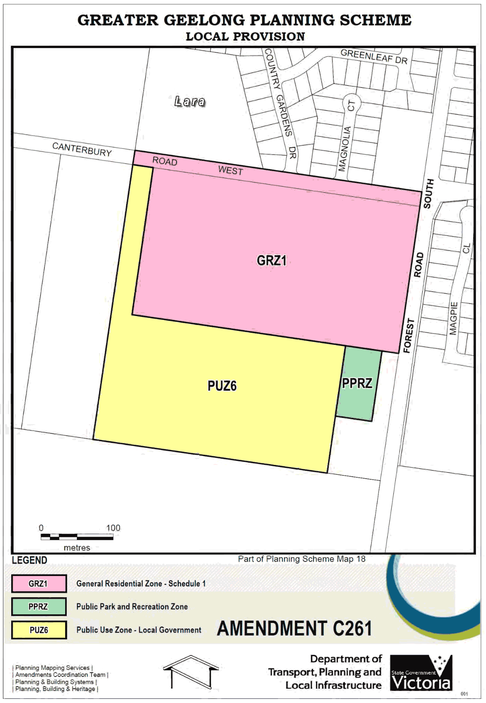
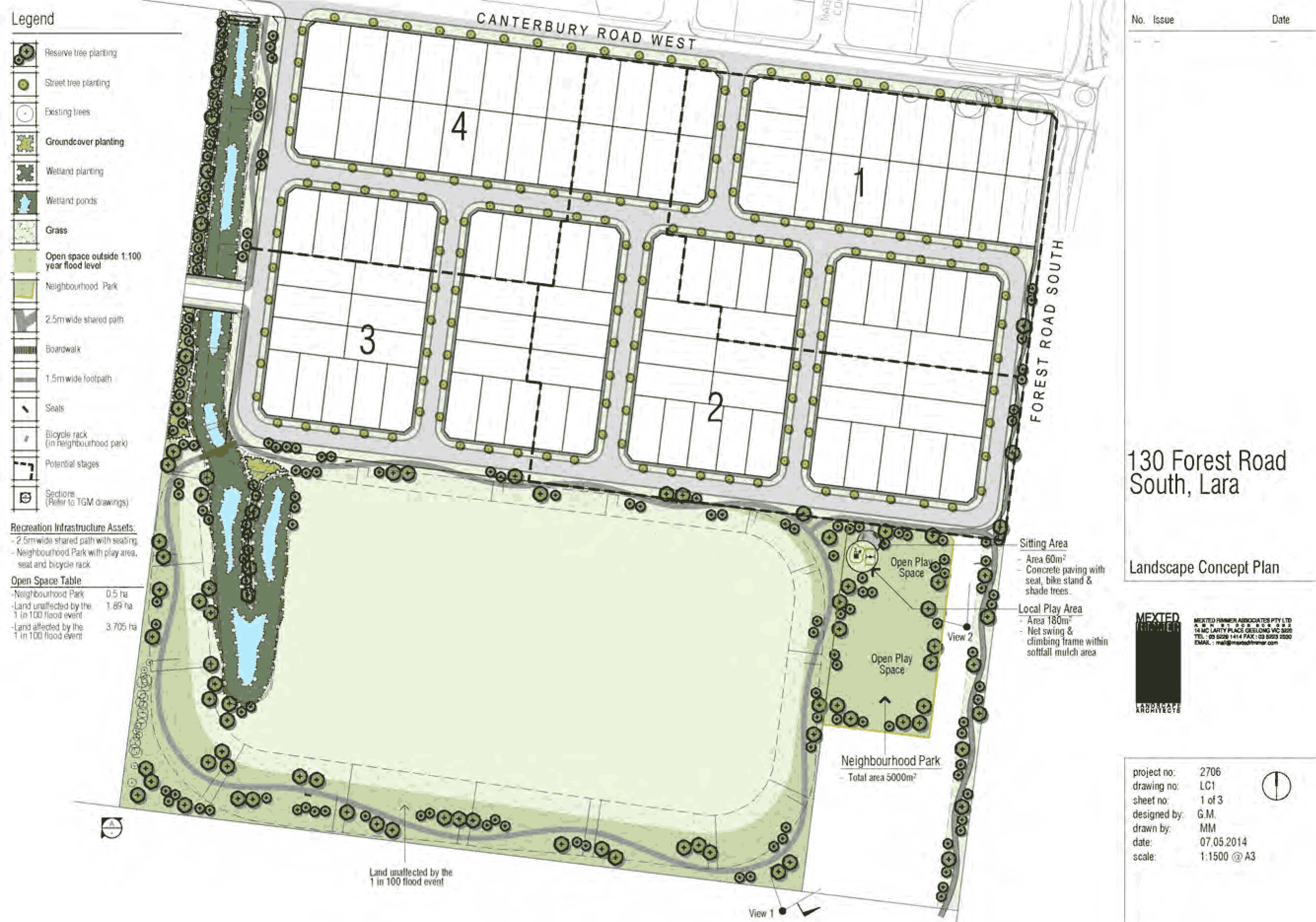
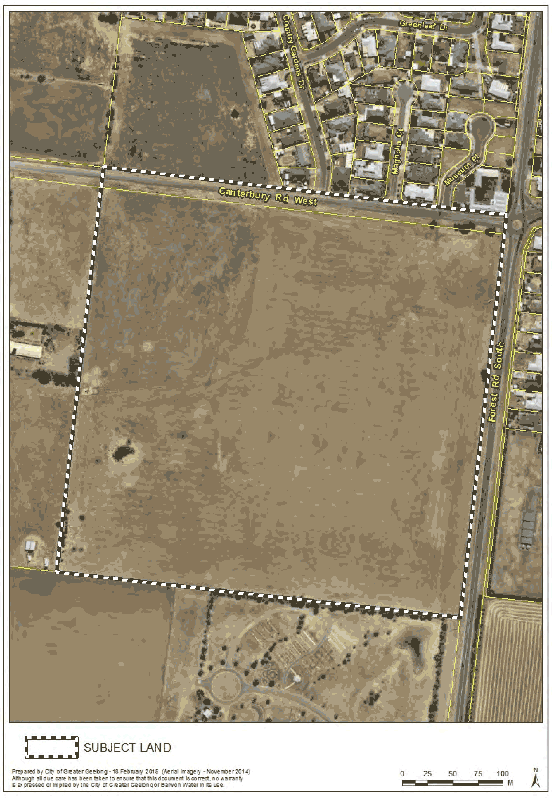
No |
Name/Company |
Attn: |
Address |
Suburb |
Type |
Summary of Submission |
1 |
APA GasNet Australia |
Lachlan Marshall |
P O Box 4204 |
DANDENONG |
No objection |
APA advises a high pressure gas pipeline runs parallel to and approx 430 metres south of the southern boundary of the subject land. APA has a direct interest in the design and development of any land within 550 metres of the pipeline to ensure the risk to life and property is reduced in the event of a rupture of the pipeline. It requested further discussion with Council Officers. Following further advice provided to APA by Council, it has confirmed “that APA GasNet has no objection to the development proceeding” as provided for in the draft permit. |
2 |
Barwon Water |
Rhys Bennett |
P O Box 659 |
|
No Objection |
All service upgrades to be funded by the developer. Conditions to be included on the permit have been provided. Barwon Water has a 12 metre easement containing the Northern Water Supply Feeder main and requires the proposed residential subdivision to be relocated such that residential lots and a service road avoid the easement (which falls within the VicRoads PAO) |
| 3 | DEPI (now DELWP) | Geoff Brooks | P O Box 103 | GEELONG VIC 3220 | Further Review | DELWPI has reviewed the vegetation assessment report submitted with the application and considers it fails to provide adequate evidence that the native vegetation on the site is not a remnant patch which requires assessment under current decision-making arrangements. Suggests the report requires further review. |
4 |
Public Transport Victoria |
Richard McAliece |
P O Box 4724 |
MELBOURNE VIC 3001 |
No Concerns |
PTV has no concerns about the rezoning changes. Requests additional permit condition to improve public transport access requiring provision of new bus stops on both sides of Forest Road South, adjacent to the subject land. |
5 |
TGM Group on behalf of L Bisinella Development P/L |
Chris Marshall |
P O Box 1137 |
GEELONG VIC 3220 |
|
Generally supports the amendment and draft permit which is consistent with the Lara Structure Plan. The initial submission requested deletion of the 0.5 ha neighbourhood park on the basis the adjoining storm water detention basin and wetland reserve is sufficient to comply with Council’s open space requirements. The initial submission provided evidence that the subject land has been cropped within the past 10 years. On this basis, deletion of reference to Native Vegetation removal from the permit and conditions 30 and 31 which apply to it are sought. The initial submission also objects to the VicRoads’ condition which seeks to prevent compensation payable for the Forest Road widening (subject to existing PAO) Submits condition should be deleted. The applicant has subsequently submitted, in an effort to avoid the need for a Panel Hearing, it will provide the 0.5 ha unemcumbered park as sought by Council. It regards deletion of the exhibited PPRZ to provide increased design flexibility, with the 0.5 park requirement to be implemented by means of a Section 173 Agreement. The applicant has subsequently withdrawn its initial objection to the VicRoads condition. |
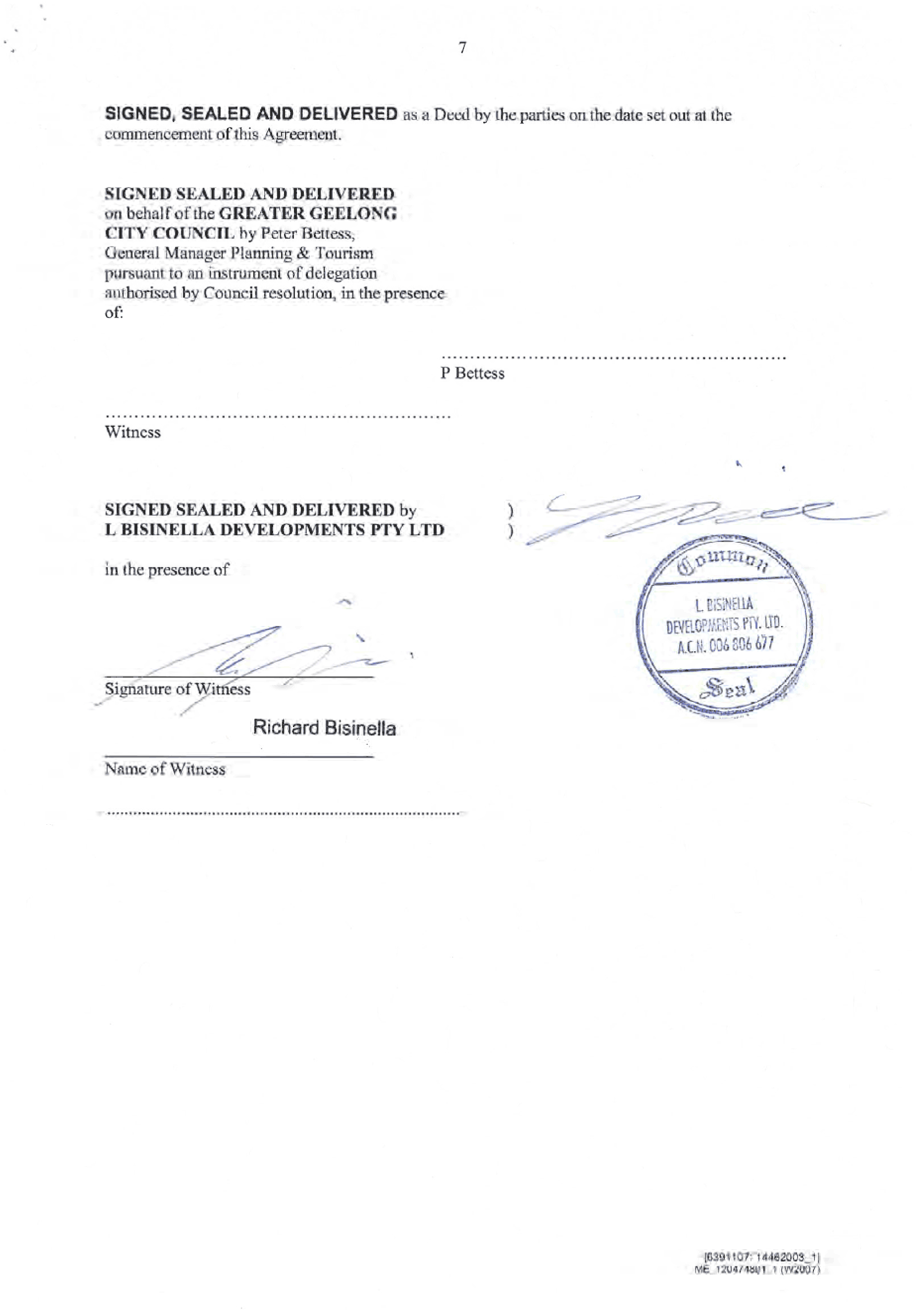
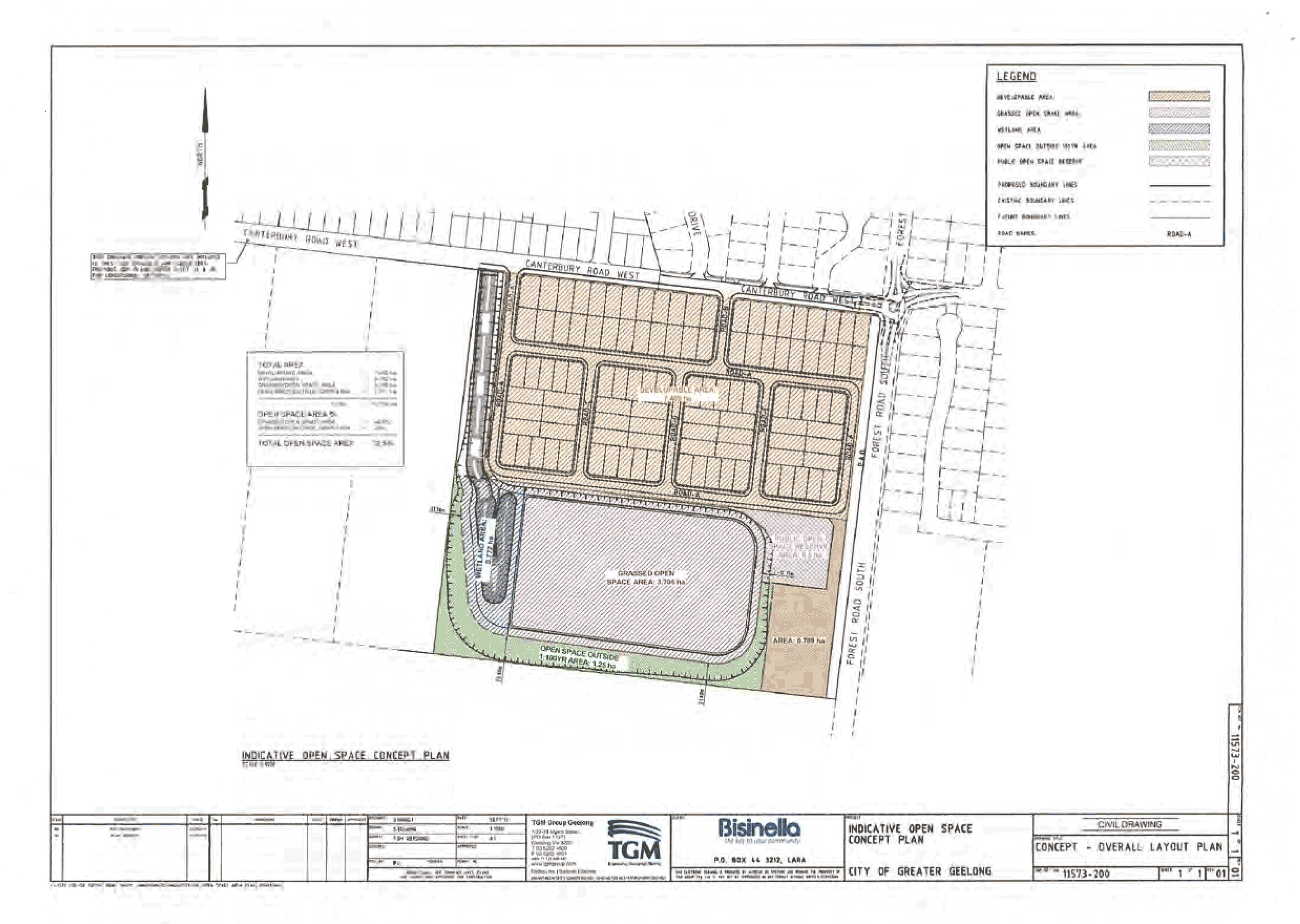
The planning authority for this amendment is Greater Geelong Planning Scheme
The Greater Geelong Planning Scheme is amended as follows:
The Planning Scheme Maps are amended by a total of 1 attached map.
Zoning Maps
Planning Scheme Map No18 in the manner shown on the attached map marked “Greater Geelong Scheme, Amendment C216.”
End of document
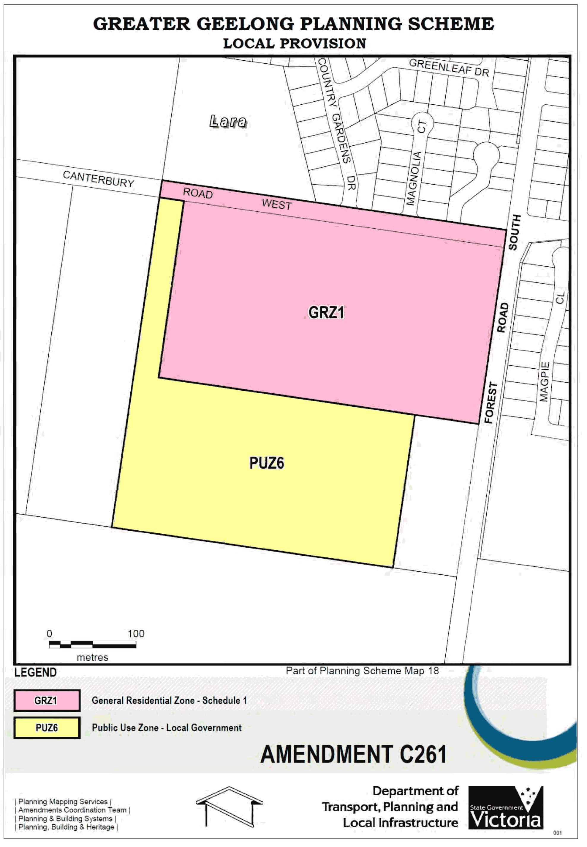
PLANNING |
Permit No. |
1163/2013 |
Planning Scheme |
Greater Geelong Planning Scheme |
|
Responsible Authority |
Greater Geelong City Council |
|
ADDRESS OF THE LAND |
130-150 FOREST ROAD SOUTH, LARA |
|
THE PERMIT ALLOWS |
STAGED MULTI LOT SUBDIVISION GENERALLY IN ACCORDANCE WITH THE ENDORSED PLANS |
|
THE FOLLOWING CONDITIONS APPLY TO THIS PERMIT: |
||
Prior to the certification of the first stage of the Plan of Subdivision, amended plans to the satisfaction of the Responsible Authority must be submitted to and approved by the Responsible Authority. When approved the plans will be endorsed and will then form part of the permit. The plans must be drawn to scale with dimensions and three copies must be provided. The plans must be generally in accordance with the plans submitted with the application, but modified to show:
The plan of subdivision layout revised to incorporate the requirements of VicRoads conditions 30 and 31.
The .5ha Public Open Space in accordance with the requirements of the S173 Agreement accompanying Amendment C261.
The layout and site dimensions of the proposed subdivision as shown on the endorsed plan(s) shall not be altered or modified without the written consent of the Responsible Authority. There are no requirements to alter or modify the endorsed plan if a plan is certified under the provisions of the Subdivision Act 1988 that is generally in accordance with the endorsed plans.
Prior to commencement of works for each stage of the subdivision, a Construction Management Plan must be submitted to and approved by Council’s Engineering Services and Environment departments and must address items including (but not be limited to) the following:
The protection of all existing vegetation and waterways;
Show access locations for construction vehicles;
All appropriate control of site emissions during construction and the defects liability period;
A staging plan for all construction phases including indicative dates for commencement and completion;
Intended access for construction vehicles;
Engineering assessment of assets that will be impacted on by construction and recommended techniques to minimise any adverse impact;
Details of actions to be implemented to in the event of damage to abutting assets;
Details of where construction personnel will park;
Hours/days of construction, including deliveries. (Note: These hours must be consistent with the Environment Protection Authority (EPA) legislation/guidelines);
Phone numbers of on-site personnel or other supervisory staff to be contactable in the event of issues arising on site;
Details of site cleanliness and clean up regimes;
Location of material storage;
Dust suppression management;
Details of measures to be maintained during the housing construction phase of development to prevent sediment entering downstream drainage infrastructure;
Any other measures that are consistent with the following Environmental Protection Authority publications: ‘Environmental Management Guidelines for Major Construction Sites’, ‘Construction Techniques for Sediment and Pollution Control’ and ‘Doing it Right on Subdivisions’
All development and works must be carried out in accordance with the Construction Management Plan endorsed under this permit, all to the satisfaction of the Responsible Authority. Any non-compliance identified by the Responsible Authority must be rectified immediately at no cost to Council.
Excavated material shall not be carted off the site except with the written approval of the Responsible Authority.
No material shall be brought onto the site for use as filling within the subject area under this Permit, unless with the written approval of the Responsible Authority. Prior to any approval being issued by the Responsible Authority for imported filling to be used on the site, the applicant must submit for approval to the Responsible Authority, samples of proposed filling, details of the source of the filling, details of proposed traffic routes to be traversed, soil testing results and reports in regard to the presence of contaminants in the filling, and the suitability of filling to be placed on site.
All areas to be filled shall be stripped of vegetation and any top soil shall be removed and stockpiled for reuse over the filled areas. Only approved filling material shall be placed on the site. The filling shall be placed in maximum 150 mm layers, or as approved otherwise by the Responsible Authority, and compacted to the applicable level for filling on allotments and within future roadways in accordance with AS3798, to the satisfaction of the Responsible Authority.
At the completion of the bulk earthworks, and at completion of the works for each stage, all disturbed areas shall be hydro mulched with an approved seed and fertilizer mixture to the satisfaction of the Responsible Authority to suppress dust, and minimise erosion, unless approved otherwise by the Responsible Authority.
All works must be undertaken in accordance with the recommendations of any geotechnical reports.
Prior to the commencement of site works for any stage of the subdivision, the developer is required to submit detailed drainage construction plans to the Responsible Authority for approval. The plans shall generally be in accordance with the TGM Concept Design (Ref 11573-200) and Grand Lakes Regional Hydraulic Modelling and Impact Report – Addendum 8 (BMT WBM, Nov 2013) and include, but not limited to:
Details of pits and pipes sizes;
Finished and existing surface levels;
Creation of appropriate easements;
Detention basin(s) including any required drainage reserves, water quality treatment; and, Connection to the legal point of discharge in accordance with the Drainage Masterplan. The Consulting Engineer must show that the design for the drainage system complies with the requirements of the Infrastructure Design Manual and any other relevant standards. Site run-off shall be limited to equivalent pre-developed levels for rainfall events up to and including the critical 100 year ARI event. An appropriate on site detention system shall be designed to limit site run-off to the pre-developed levels to the satisfaction of the Responsible Authority.
The stormwater drainage system on the site must be designed such that stormwater run-off exiting the land meets the current best practice performance objectives for stormwater quality as follows:
80% retention of the typical annual load of suspended solids;
45% retention of the typical annual load of total phosphorous;
45% retention of the typical annual load of total nitrogen; and
70% retention of the typical annual load of gross pollutants.
Details of access requirements for maintenance vehicles into the stormwater detention basins and wetlands.
Note: Detailed Design Plans for any stage that result in flood levels on existing properties being adversely affected by the proposed works will not be approved for construction.
Prior to the commencement of site works for any stage of the subdivision, the developer is required to submit detailed roadwork construction plans to the Responsible Authority for approval. The plans shall generally be in accordance with the TGM Concept Design (Ref 11573-200) and Grand Lakes Regional Hydraulic Modelling and Impact Report – Addendum 8 (BMT WBM, Nov 2013) and include, but not limited to:
Fully sealed pavement with kerb and channel for new internal roads;
Construction of Canterbury Road so that the minimum road width is 10m;
Any external roadworks and treatments;
Concrete footpaths;
Line-marking and signage installation.
Note: Detailed Road Plans for any stage that result in flood levels on existing properties being adversely affected by the proposed works will not be approved for construction.
Prior to certification of the Plan of Subdivision for each stage, easements for the purposes of ‘Drainage’ must be set aside in favour of the City of Greater Geelong, to the satisfaction of the Responsible Authority.
The plan of subdivision submitted for certification for each stage of the development shall nominate a minimum finished floor level for each lot, to the satisfaction of the Responsible Authority. The FFL shall be a minimum of 300mm above top of kerb or the 1% AEP flood extent as depicted in fig 7-7 of ‘Grand Lakes Regional Hydraulic Modelling and Impact Report – Addendum 8’ (BMT WBM, Nov 2013).
Prior to the issuing of a Statement of Compliance for the relevant stage of the subdivision, road and drainage works, including basin(s), must be constructed in accordance with the approved plans and specifications to the satisfaction of the Responsible Authority.
Prior to the issuing of a Statement of Compliance for the relevant stage of subdivision, relevant street sign/s must be erected to the satisfaction of the Responsible Authority.
Prior to the issuing of a Statement of Compliance for the relevant stage of subdivision, street lighting must be provided within the site and along external frontages in accordance with the relevant Australian Standard(s), unless otherwise agreed in writing by the Responsible Authority and unless it can be demonstrated that existing street lighting is sufficient for public safety to the satisfaction of the Responsible Authority.
Prior to works commencing for each stage of the subdivision, an Independent Road Safety Audit must be carried out for the internal and external intersection treatments at the detailed design stage by a suitably qualified auditor in accordance with Austroads “Road Safety Audit” (2002). The findings of the Independent Road Safety Audit must then be formally responded to and implemented by the subdivider with the results submitted to the Responsible Authority for approval.
A Local Area Traffic Management (LATM) plan must be developed prior to the lodgement of Stage 1 construction drawings in conjunction with Council’s Traffic Engineering unit. The developed LATM plan must include indicative lot numbering and street names to coincide with the internal street network and any modifications to intersections.
Prior to the commencement of works, a landscape master plan (incorporating a street tree master plan) for the permit area, prepared by a person suitably qualified or experienced in landscape design, must be approved by the responsible authority. When approved, the plan will be endorsed and will then form part of the permit. The plan must be drawn to scale with dimensions and three hard copies plus an electronic copy must be provided. The plan must show and include the following to the satisfaction of the responsible authority:
A survey (including location, size and botanical name) of all existing vegetation on the land;
Any vegetation that is approved to be retained, removed and/or lopped, including details of tree protection zones;
The landscaping theme and graphical concepts to be developed for the subdivision and reserve;
The species to be used for and general layout of all street tree planting;
A species list of all proposed vegetation including aquatic vegetation of local provenance;
The areas which will be available for landscaping;
A play space in the public open space reserve;
Footpath and on-road bicycle linkages through the permit area and public reserves, indicative connections to nearby open space and indicative connections to the external path network;
The location and indicative design of drainage and/or WSUD infrastructure within public reserves;
Maintenance vehicle access points;
The style and location of fencing, which is to be visually permeable, to all private property that directly abuts a reserve (except road reserve).
Prior to Statement of Compliance being issued for each relevant stage of the subdivision, landscape plans to the satisfaction of the Responsible Authority for all landscape works in that particular stage of subdivision must be submitted to and approved by the Responsible Authority. When approved, the plans will be endorsed and will then form part of the permit. The plan must be drawn to scale with dimensions and three hard copies plus an electronic copy must be provided. The plan must be consistent with the endorsed landscape master plan and provide detailed planting, construction and specification details for all of the proposed landscaping works on public reserves and road reserves. The landscape plan must show the following to the satisfaction of the responsible authority:
A survey (including location, size and botanical name) of all existing vegetation on the land;
The proposed Q10 and Q100 events extent;
Any tree(s) proposed for retention within a road reserve or public open space for any stage of the development must be independently assessed by a suitably qualified arborist which details suitability for retention and ongoing management recommendations for the tree(s). The detailed landscape response for the area in which the tree(s) are located must be informed by the arboricultural assessment;
The layout of new planting in all road reserves and municipal reserves;
The layout and zonation detail of new aquatic planting in waterways and any constructed water bodies in municipal reserves;
A detailed planting schedule of all proposed terrestrial trees, shrubs, and groundcovers including botanical names, common names, pot sizes, sizes at maturity and quantities of each plant;
A detailed planting schedule of all proposed aquatic planting including botanical names, common names, supply sizes, sizes at maturity, zonation detail, planting densities and quantities of each plant with a note that plants must be sourced from local provenance material;
The proposed layout, materials and finishes of paths, areas of pavement, structures, play spaces, fences, maintenance access gates and street furniture;
Detailed planting and construction drawings including site contours and any proposed changes to existing levels including any structural elements such as retaining walls;
Additional supporting information, such as certified structural designs or building forms;
A playground design complying with AS4685:2004 Playground Equipment Safety and AS/NZS4422:1996 Playground Surfacing;
All proposed street tree planting using semi-advanced trees with a minimum container size of 45 litres;
The maintenance schedule for all proposed landscaping, including hard and soft landscaping elements;
Bicycle parking to support cycling routes throughout the subdivision; and,
Details of access requirements for maintenance vehicles into the stormwater detention basins, wetlands and public open space areas where relevant.
Utility service substations, kiosk sites and the like must not be located on any land identified as public open space or land to be used for any municipal purpose unless otherwise agreed by the responsible authority.
The landscaping works shown on the approved landscape plan for each stage must be carried out and completed to the satisfaction of the Responsible Authority prior to the issue of a Statement of Compliance for that stage, or any other time when agreed in writing by the Responsible Authority and suitably bonded to the satisfaction of the Responsible Authority.
Prior to the issue of practical completion of landscaping works, or any other time as agreed in writing by the Responsible Authority, the following must be provided to the Responsible Authority:
Building permits and structural engineering compliance where necessary;
Landscaping maintenance plan including playground inspection regime and asset listing;
As-built landscaping plans in PDF and GIS-ready AutoCAD (DXF) format; and
An independent playground auditor’s report with evidence of rectification of any identified defects. The report must relate to all playground equipment, fitness equipment, natural play elements, soft fall areas and edging to ensure that all aspects of the playground construction meet Playground Standards AS/NZS4422 1996 and AS4685 parts 1-6 2004 and is in good working order and safe condition.
Prior to Statement of Compliance being issued for any relevant stage of the subdivision, any reserve or land set aside for public open space or any tree reserve or the like must be graded, top dressed and sown to grass to the satisfaction of the Responsible Authority unless otherwise agreed in writing by the Responsible Authority and suitably bonded to the satisfaction of the Responsible Authority.
Unless otherwise agreed in writing by the Responsible Authority, a maintenance bond must be submitted to the Responsible Authority at the time of application for practical completion of landscaping works.
Note 1: The incomplete landscape works bond or bank guarantee must be 125 per cent of the estimated cost of incomplete landscape works; the maintenance bond or bank guarantee must be 100 per cent of the estimated cost of maintenance of landscape works for a two (2) year period.
Note 2: A practical completion inspection is required to satisfy this condition and must be organised by the permit holder with two weeks’ notice given for onsite inspections. The incomplete landscape works bond will be returned on award of practical completion.
All works forming part of the endorsed landscaping plans must be maintained for a minimum period of 24 months, to the satisfaction of the Responsible Authority. The maintenance period will commence on the date of issue of the Statement of Compliance for all, or a particular stage, or a subdivision only where the landscaping works have been completed to the satisfaction of the Responsible Authority. Where the landscape works are bonded or covered by a bank guarantee, the maintenance period will commence from the time that the landscape works have been awarded Practical Completion by the Responsible Authority. During this time, any dead, diseased or damaged plants, landscaped areas and hard landscape elements are to be repaired or replaced by the permit holder and at no cost to Council. Handovers will not be accepted during the summer period between 1 December and 1 March each year.
The landscape maintenance bond will be returned on acceptance handover.
Prior to the issue of a Statement of Compliance for each stage, a community infrastructure charge of $900.00 per residential lot created must be paid in relation to any plan of subdivision which creates a residential lot.
The owner of the land must enter into agreements with:
A telecommunications network or service provider for the provision of telecommunication services to each lot shown on the endorsed plan in accordance with the provider’s requirements and relevant legislation at the time; and,
A suitably qualified person for the provision of fibre ready telecommunication facilities to each lot shown on the endorsed plan in accordance with any industry specifications or any standards set by the Australian Communications and Media Authority, unless the applicant can demonstrate that the land is in an area where the National Broadband Network (NBN) will not be provided by optical fibre.
Before the issue of a Statement of Compliance for any stage of the subdivision under the Subdivision Act 1988, the owner of the land must provide written confirmation from:
A telecommunications network or service provider that all lots are connected to or are ready for connection to telecommunications services in accordance with the provider’s requirements and relevant legislation at the item; and,
A suitably qualified person that fibre ready telecommunications facilities have been provided in accordance with any industry specifications or any standards set by the Australian Communications and Media Authority, unless the applicant can demonstrate that the land is in an area where the National Broadband Network will not be provided by optical fibre.
The Plan of Subdivision must set aside the area of the Public Acquisition Overlay - Schedule 3 for future road widening of Forest Road South.
Any buildings and works must be setback 2 metres from the Public Acquisition Overlay’s western boundary.
No compensation is payable under part 5 of the Planning and Environment Act 1987 in respect of anything done under this permit.
The plan of subdivision submitted for certification under the Subdivision Act 1988 shall be referred to Powercor Australia Ltd in accordance with Section 8 of that Act.
The applicant shall provide an electricity supply to all lots in the subdivision in accordance with Powercor’s requirements and standards, including the extension, augmentation or re-arrangement of any existing electricity supply system, as required by Powercor ( A payment to cover the cost of such work will be required). In the event that a supply is not provided the applicant shall provide a written undertaking to Powercor Australia Ltd that prospective purchasers will be so informed.
The applicant shall, where buildings or other installations exist on the land to be subdivided and are connected to the electricity supply; they shall be bought into compliance with the Service and Installation Rules issued by the Victorian Electricity Supply Industry. You shall arrange compliance through a Registered Electrical Contractor.
Any Buildings must comply with the clearances required by the Electricity Safety (Network Assets) Regulations.
Any construction work must comply with Energy Safe Victoria’s “No Go Zone” rules.
The applicant shall set aside on the plan of subdivision for the use of Powercor Australia ltd reserves and/or easements satisfactory to Powercor Australia Ltd where any electric substation (other than a pole mounted type) is required to service the subdivision.
Alternatively, at the discretion of Powercor Australia Ltd a lease(s) of the site(s) and for easements for associated powerlines, cables and access ways shall be provided. Such a lease shall be for a period of 30 years at a nominal rental with a right to extend the lease for a further 30 years. Powercor Australia Ltd will register such leases on the title by way of a caveat prior to the registration of the plan of subdivision.
The applicant shall provide easements satisfactory to Powercor Australia Ltd, here easements have not been otherwise provided, for all existing Powercor Australia Ltd electric lines on the land and for any new powerlines required to service the lots and adjoining land, save for lines located, or to be located, on public roads set out on the plan. These easements shall show on the plan an easement(s) in favour of Powercor Australia Ltd for ‘Powerline Purposes’ pursuant to Section 88 of the Electricity Industry Act 2000.
The applicant shall obtain for the use of Powercor Australia Ltd any other easement external to the subdivision required to service the lots.
The applicant shall adjust the position of any existing easement(s) for powerlines to accord with the position of the line(s) as determined by survey.
The applicant shall obtain Powercor Australia Ltd’s approval for lot boundaries within any area affected by an easement for a powerline and for the construction of any works in such an area.
The applicant shall provide to Powercor Australia Ltd, a copy of the version of the plan of subdivision submitted for certification, which shows any amendments which have been required.
The plan of subdivision submitted for certification must be referred to SP AusNet (Gas) in accordance with Section 8 of the Subdivision Act 1988.
General
The owner shall create easements for Pipelines or Ancillary Purposes and or reserves in favour of Barwon Region Water Corporation on the plan of subdivision in accordance with Barwon Water’s Land Development Manual, without cost to Barwon Water, over existing and proposed water and sewerage infrastructure within the land. If further easements or reserves are required following design of water and sewerage infrastructure these must be added to the plan of subdivision prior to seeking baron Water’s consent to the issue of a statement of compliance of the subdivision.
The plan of subdivision must be referred to Barwon Water in accordance with the Subdivision Act 1988 and any subsequent amendments to the plan provided to Barwon Water.
Water
The provision and installation of individual water services to all lots in the subdivision in accordance with Barwon Water’s requirements and Victorian Plumbing Regulations. Note that tappings and services are not to be located under existing or proposed driveways.
The payment of New Customer Contributions for each additional lot created and/or each additional metered connection for water supply within the subdivision.
Reticulated water assets are required to service the proposed development.
Barwon Water’s records indicate that an existing water service and meter is located on this property. A dimensioned plan showing the location of existing meters, and the location of the meter relative to the existing boundaries, and its number, is to be submitted. Private water service pipes are not permitted to cross allotment boundaries and must be plugged and abandoned at the boundaries of such allotments.
Sewer
The provision of sewerage services to all lots in the subdivision in accordance with Barwon Water’s requirements and Victorian Plumbing Regulations. Individual allotment house connection drains are to be provided for and extend into each allotment.
The payment of New Customer Contributions for sewer for each additional lot created and/or each additional metered connection within the subdivision.
Reticulated sewer mains or a sewer main extension are required to service the proposed development.
Unless otherwise agreed in writing with Public Transport Victoria, prior to certification of the plan of subdivision for the first stage, amended plans to the satisfaction of Public Transport Victoria must be submitted to and approved by the Responsible Authority. When approved, the plans will be endorsed and will then form part of the permit. The plans must be drawn to scale with dimensions and three copies must be provided. The plans must be generally in accordance with the plans submitted with the application but modified to show bus stops to be constructed:
On either side of Forest Road South, adjacent to the subdivision;
Containing a concrete hard stand for passengers with tactile ground surface ' indicators (based upon PTV standard drawings STD_0064, STD_0065, STD_0066 or STD_0067);
With a barrier kerb for the 9.2m prior to the bus flag position (situated as per PTV standard drawings and barrier kerb built to VicRoads standard design);
Containing a bus stop pole, flag and timetable case to PTV requirements (as per PTV standard drawings STD_0062 and STD_0063).
Compliant with the Disability Discrimination Act — Disability Standards for Accessible Public Transport 2002;
Be provided with connecting path or ramps (if required) built between the bus stop hardstand and the nearby public footpath.
Prior to the issue of a Statement of Compliance for the first stage of the subdivision, all works outlined on the endorsed plans associated with the bus stops on Forest Road South must be completed to the satisfaction of Public Transport Victoria at the full cost of the permit holder.
Hydrants
Operable hydrants, above or below ground must be provided to the satisfaction of CFA.
The maximum distance between these hydrants and the rear of all building envelopes (or in the absence of the building envelope, the rear of all lots) must be 120m and hydrants must be no more than 200m apart.
Hydrants must be identified as specified in ‘Identification of Street Hydrants for Firefighting purposes’ available under publications on the Country Fire Authority web site (www.cfa.vic.gov.au)
Roads
Roads must be constructed to a standard so that they are accessible in all weather conditions and capable of accommodating a vehicle of 15 tonnes for the trafficable road width.
The average grade must be no more than 1 in 7 (14.4%) (8.1 degrees) with a maximum of no more than 1 in 5 (20%) (11.3 degrees) for no more than 50 meters. Dips must have no more than a 1 in 8 (12%) (7.1 degree) entry and exit angle.
Roads must have a minimum trafficable width of:
5.5m if parking is prohibited on one or both sides of the road.
7.3m where parking is allowable on both sides of the road.
This permit will expire if one of the following circumstances applies:
The first stage of the plan of subdivision has not been certified within two years of the date of this permit.
All stages of the plan of subdivision have not been certified within five years of the date of this permit.
A statement of compliance is not issued within five years of the date of certification of a particular stage of subdivision.
The Responsible Authority may extend the periods referred to if a request is made in writing before the permit expires or within six (6) months afterwards.
Notes:
The design and construction of civil infrastructure to become council assets must be approved and supervised by council. A fee of 3.25% of the cost of the works is to be paid to council for the checking and supervision of these works.
A maintenance bond of 5% of the cost of the works is to be paid to council and will be returned after successful completion of a 12 month maintenance period.
The developer is to apply to Barwon Water for details relating to costs and conditions required for the provision of water supply and sewerage services to the subdivision. It would be appreciated if all communications between the developer/agent and Barwon Water quote Barwon Water reference number L010609.
All buildings and works must be in accordance with Cultural Heritage Plan #12670 approved on the 14 April 2014 by the Wathaurung Aboriginal Corporation.
Cr Ellis declared an Indirect Interest by a Conflicting Duty in Agenda Item 6 – C274 HO1600 Heritage Review, Batman Park, Indented Head in that he is a Board Member of the Bellarine Bayside Foreshore Committee, and left the meeting room prior to discussion at 8:02pm.
Portfolio: |
Planning – Cr Heagney |
Source: |
Planning and Tourism - Strategic Implementation |
General Manager: |
Peter Bettes |
Index Reference: |
Council Reports 2015 |
This report acknowledges submissions to Amendment C274 and recommends adoption of the Amendment, including changes to accommodate issues raised in submissions.
The amendment will:
adopt the Batman Park and Boat Sheds, The Esplanade, Indented Head, Heritage Review, August 2013, and introduce it as an incorporated document in the schedule to Clause 81; and
amend the schedule to Clause 43.01 in accordance with the recommendations of the Batman Park and Boat Sheds, The Esplanade, Indented Head, Heritage Review, August 2013. This includes:
the deletion of the four individual Heritage Places within Batman Park;
the listing of all of all of the identified land as a Heritage Place and
The introduction of an incorporated plan within the listing in the heritage schedule.
Cr Heagney moved, Cr Harwood seconded -
That Council:
Adopt the Batman Park and Boat Sheds, The Esplanade, Indented Head Heritage Review, August 2013, as exhibited, with the changes identified in Appendix 4 to this report;
Adopt the Batman Park Indented Head Incorporated Plan, February 2015, in the form contained at Appendix 2 to this report;
Adopt Amendment C274 in the form as outlined in Appendix 1 (A) – (E) to this report; and
Submit the adopted Amendment together with the prescribed information to the Minister for Planning requesting approval.
Carried.
As part of the 2012-2013 budget process a Councillor initiated allocation of $10,000 was set aside to undertake a review of the heritage overlays at Batman Park and adjoining public land at Indented Head.
On the basis of this allocation, in 2013 Council engaged Dr David Rowe to undertake a review of the heritage overlays which apply to parts of Batman Park and some of the boat sheds within the park.
The report is titled Batman Park and Boat Sheds, The Esplanade, Indented Head, Heritage Review, August 2013.
As part of the review process Council consulted with the following groups and individuals:
Indented Head Boatshed Tenants;
Indented Head Community Association;
Indented Head Yacht Club
Bellarine Bayside Foreshore Committee of Management Inc
Amendment C274 seeks to implement the findings of the heritage review.
The Report was modified in a manner consistent with the submissions received prior to the Exhibition of the Amendment.
A table describing the changes sought is contained at Appendix 4.
Authorisation to exhibit the Amendment was sought under delegation by Council officers – i.e. without a report to Council – and, following receipt of Authorisation from the Minister for Planning, the Amendment was exhibited from 6th February 2014 to 18th March 2014. Notice of the amendment was given to owners and occupiers of properties on The Esplanade, opposite the land affected by the Amendment, to relevant authorities and Ministers in accordance with the requirements of the Planning and Environment Act 1987.
Submissions were received from the following six (6) public Authorities / organisations:
The Country Fire Authority (CFA);
The Corangamite Catchment Management Authority (CCMA)
St Quentin Consulting Pty Ltd, on behalf of Bellarine Bayside Foreshore Committee of Management Incorporated (Bellarine Bayside)
The Environment Protection Authority (EPA).
VicRoads;
The then Department of Environment and Primary Industries (DEPI), now Department of Environment, Land, Water and Planning (DELWP);
The Wathaurung Aboriginal Corporation (Wadawurrung)
These submissions are included as Appendix 3(A) – (G).
Consistent with the extensive community consultation which occurred prior to exhibition, no submissions were received from members of the public.
Responses fall into two categories.
No objection responses, received from:
CFA,
CCMA,
EPA and
VicRoads.
Submissions seeking detailed changes to the controls proposed by the amendment. Received from:
Bellarine Bayside Committee of Management (the managers of the land);
DEPI (representing the landowner); and
Wadawurrung (Wathaurung Aboriginal Corporation)
Both Bellarine Bayside and DEPI were concerned that the HO covers a larger area and triggers the need for permits for a broad range of buildings and works – many of which aren’t related to heritage.
The Wadawurrung were concerned that insufficient recognition was given to Aboriginal heritage and to its protection under the Heritage Overlay.
Council officers have met with these three parties and an incorporated plan under the Heritage Overlay has been prepared which addresses the matters raised to the satisfaction of each organisation.
In particular, the additional exemptions allowed under the Incorporated Plan will facilitate Bellarine Bayside to go about their normal management activities without a requirement to apply for planning permits unless the heritage elements identified in the Report and the Incorporated plan are impacted by the proposed works.
As all of the objecting submitters have provided advice in writing that their concerns have been addressed, Council may adopt the Amendment without the need for a Planning Panel to be appointed to consider submissions.
The changes to the planning scheme will not have any adverse environmental implications.
The changes to the planning scheme will have no adverse financial implications for Council.
The amendment is considered to be consistent with State and Local planning policies as set out in the Explanatory Report, which forms part of the amendment documentation.
The report and recommendations are consistent with the ‘Built and Natural Environment and Community Wellbeing’ elements of City Plan.
Officer Direct or Indirect Interest
No Council officers involved in the preparation of this report have a direct or indirect interest, in accordance with Section 80(c) of the Local Government Act, to the matters to which this amendment relates.
There are no risks to Council associated with the adoption of the revised heritage controls and the inclusion of the Batman Park and Boat Sheds, The Esplanade, Indented Head, Heritage Review, August 2013 as an incorporated document in the planning scheme or with the adoption of the planning scheme amendment.
No adverse impacts on the community have been identified as arising from the adoption of this amendment.
The recommendations raised in this report recognise and respect those groups connected to Batman Park and environs, including both earlier generations of post contact settlers and pre and post contact activity by the traditional owners of the land.
Amendment C274 has been the subject of community consultation as part of the heritage review, in addition to the formal exhibition process, as a result of which suggestions contained in supporting submissions have been incorporated into the amendment and matters of concern contained in three objecting submissions have been addressed in the revised amendment documentation to be adopted to the satisfaction of the submitters.
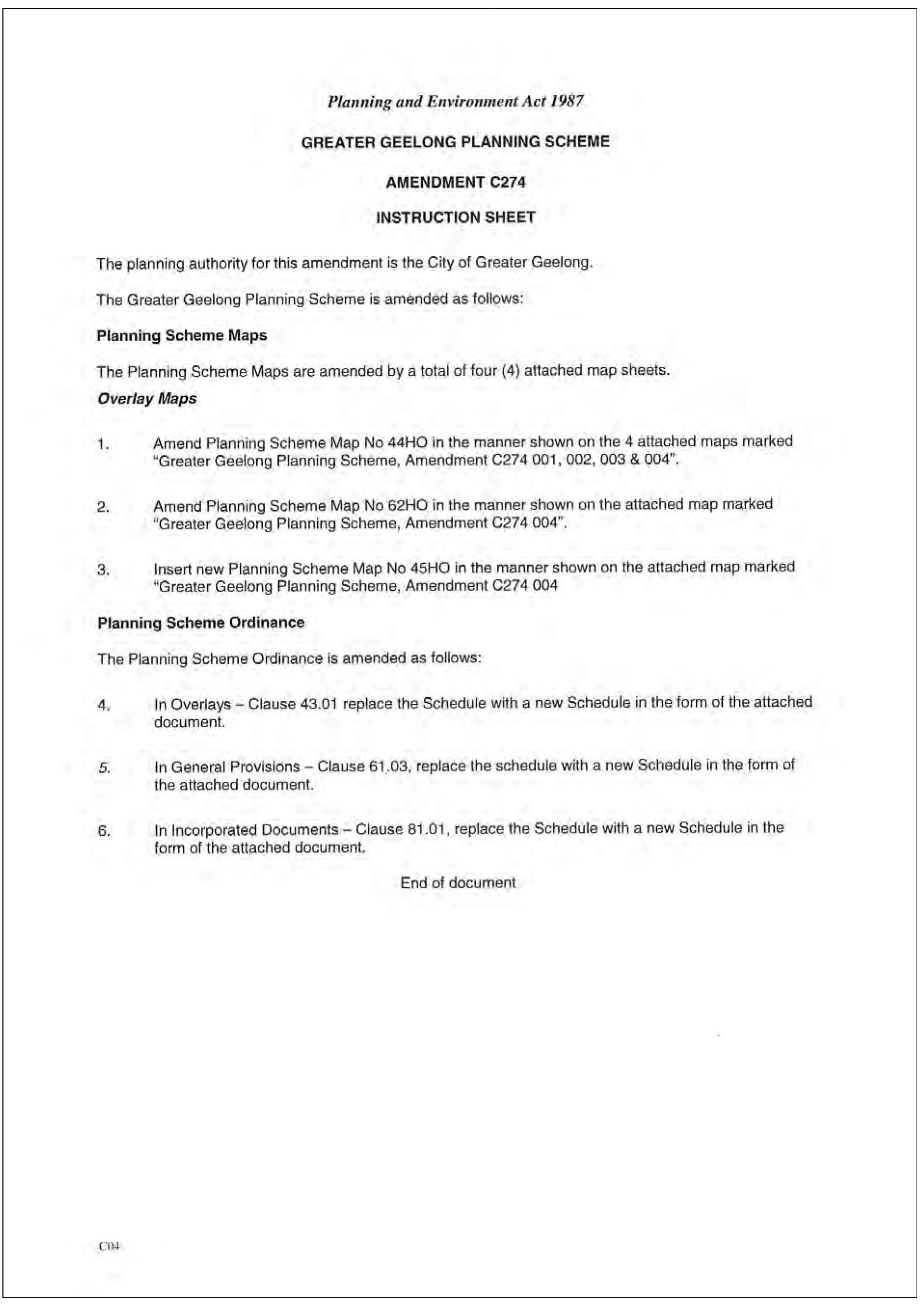
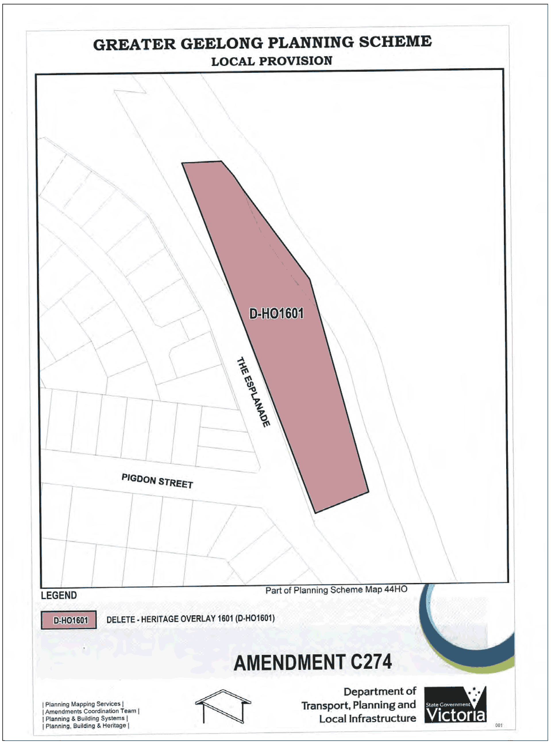
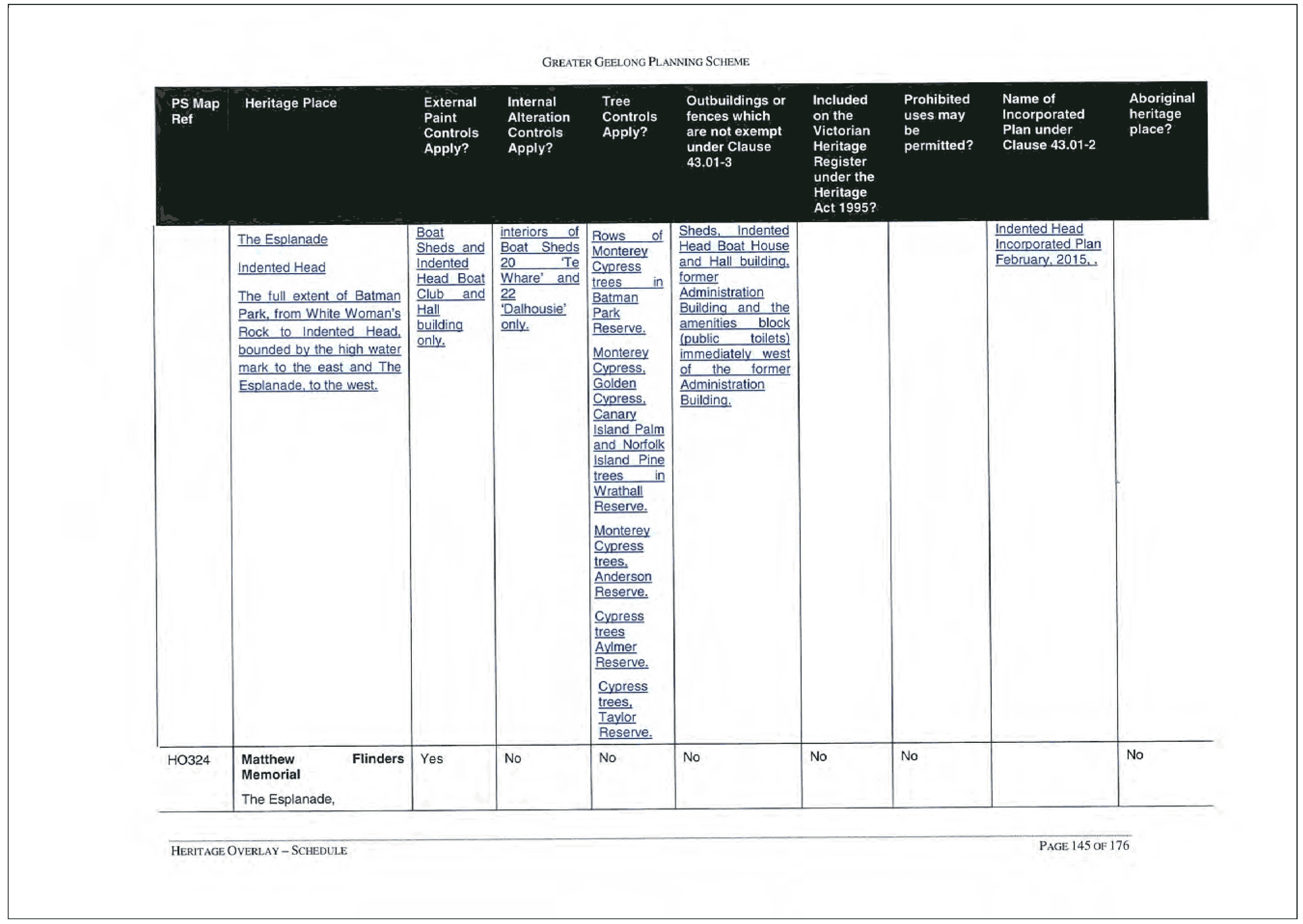
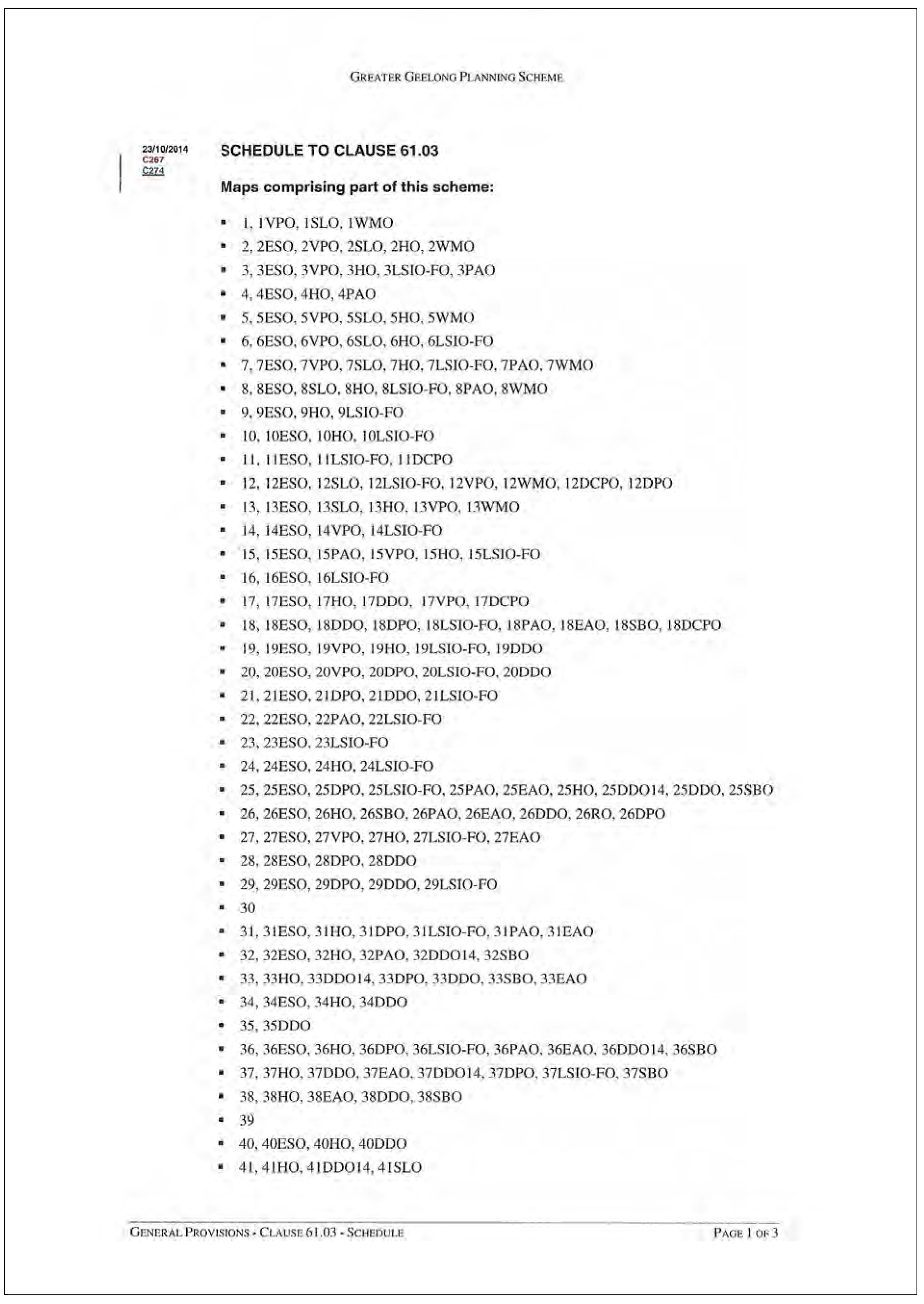
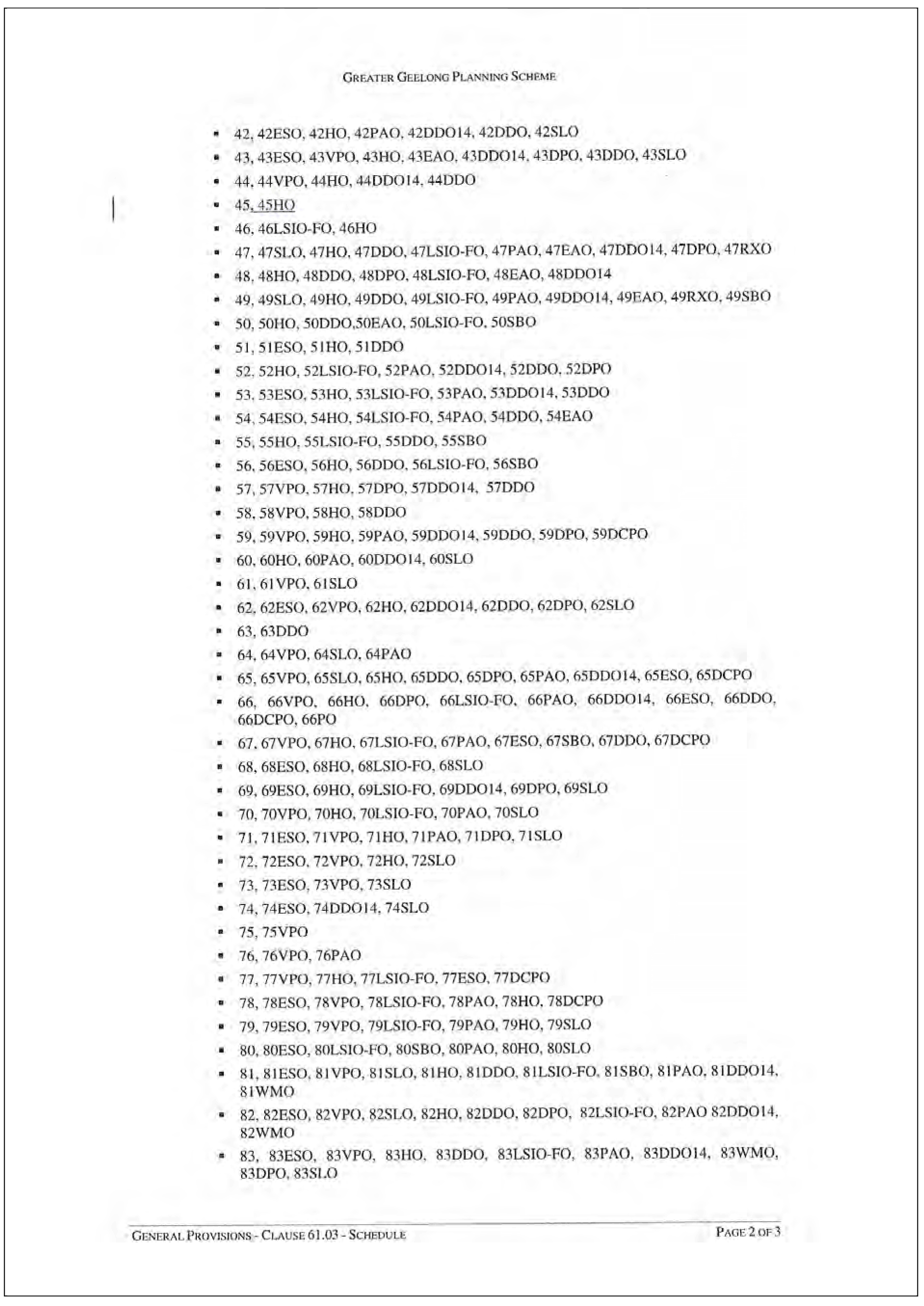

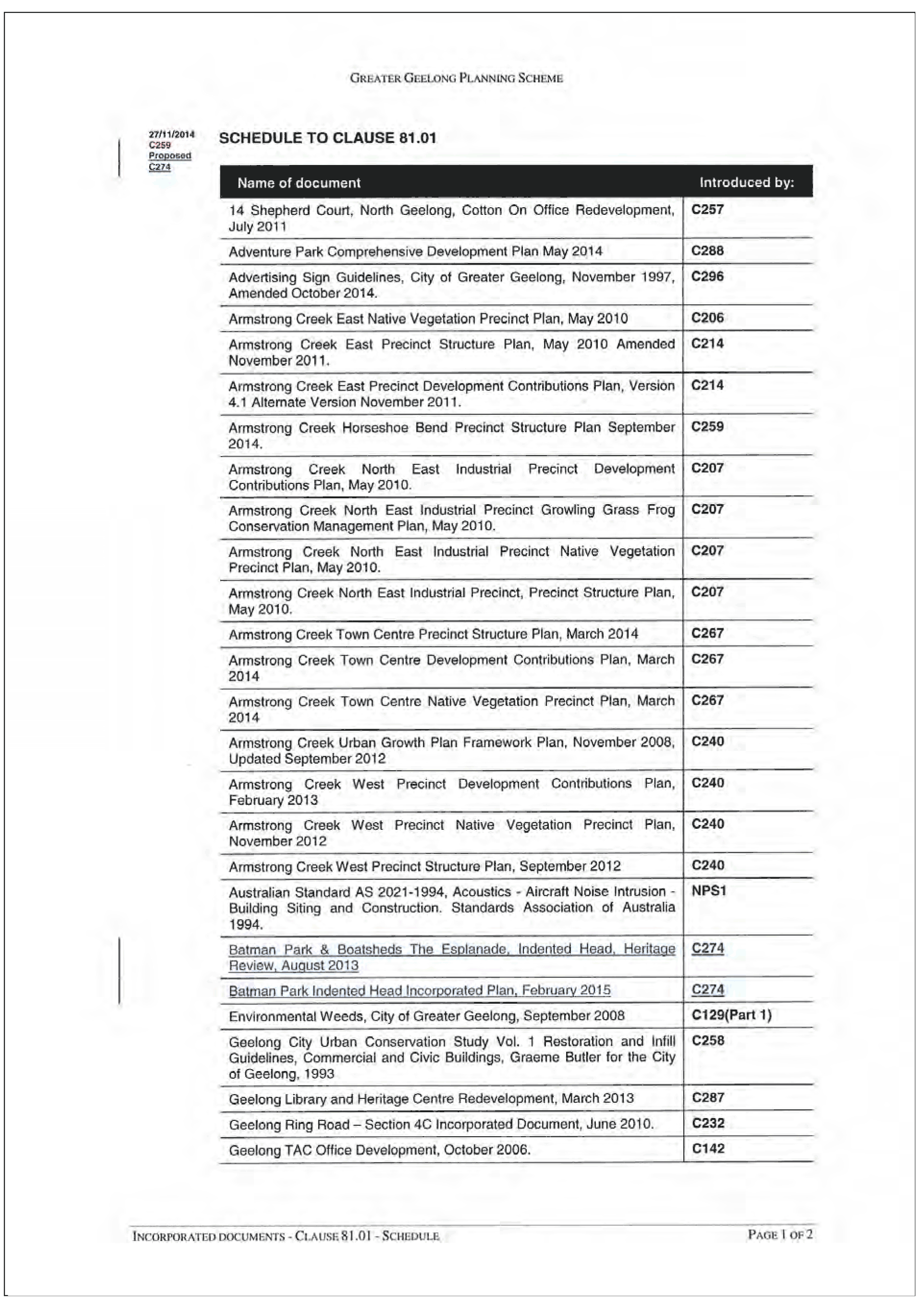
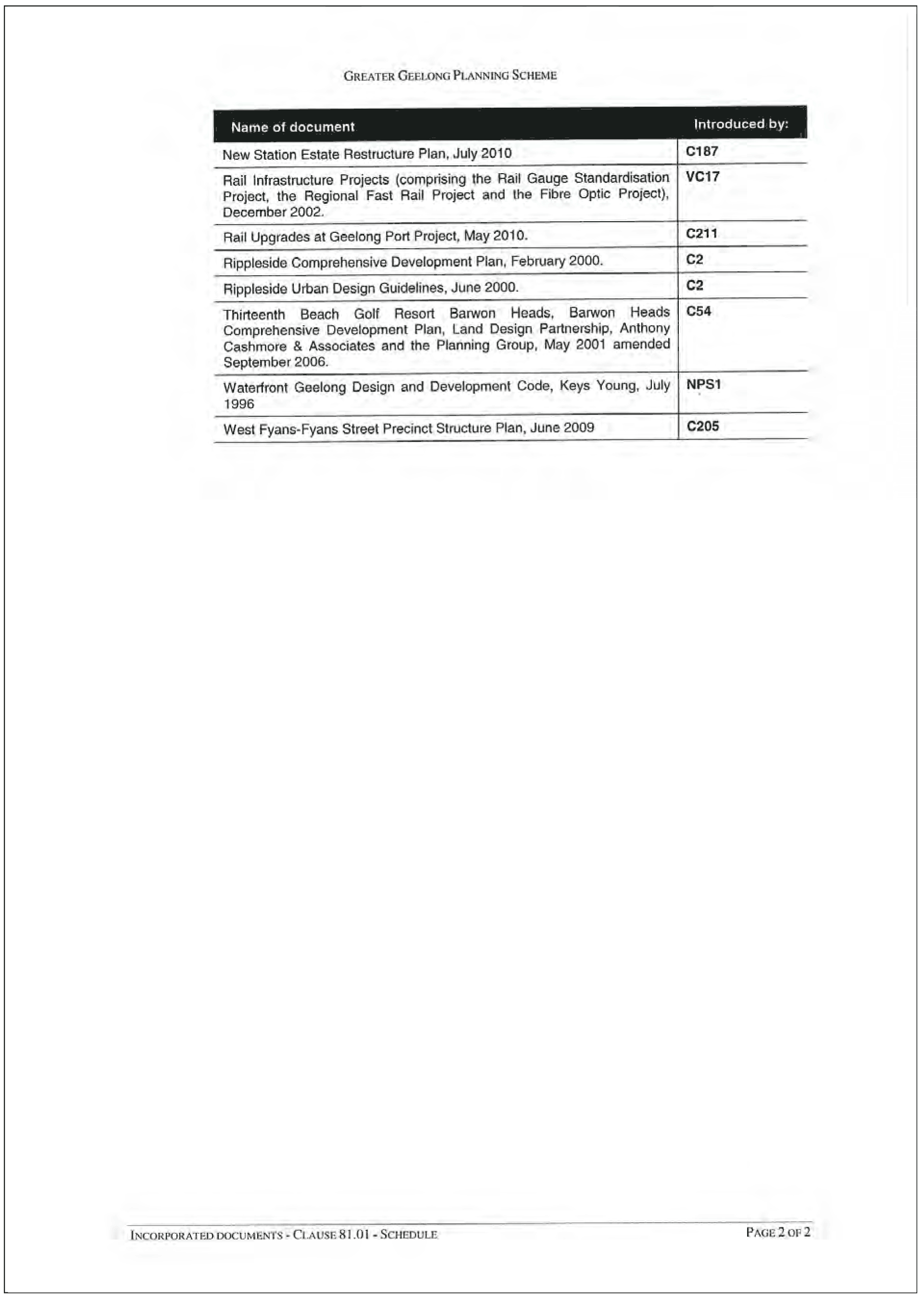
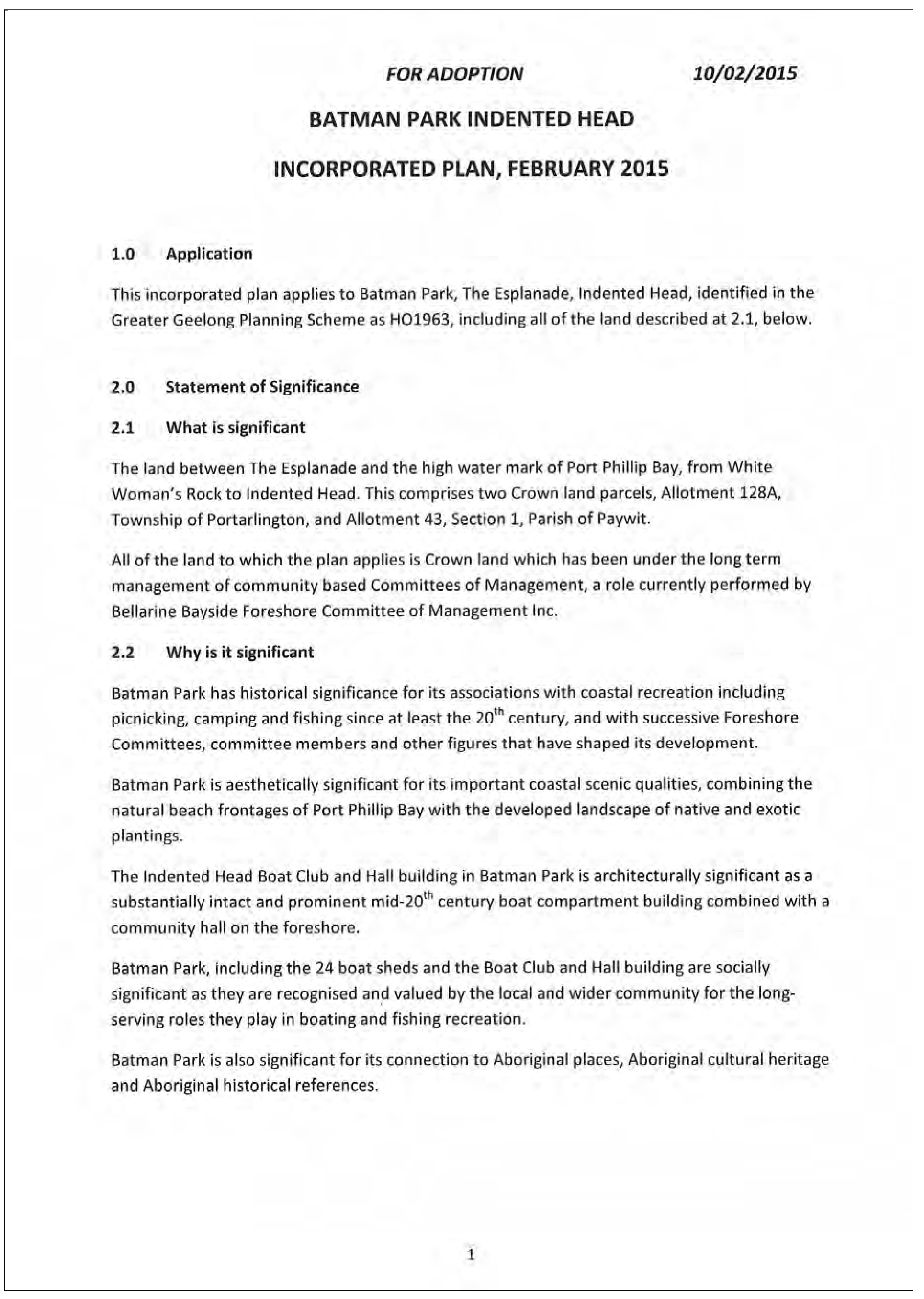
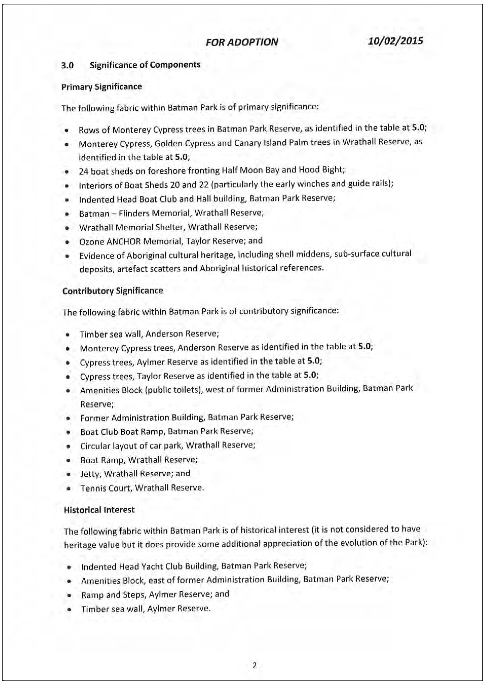
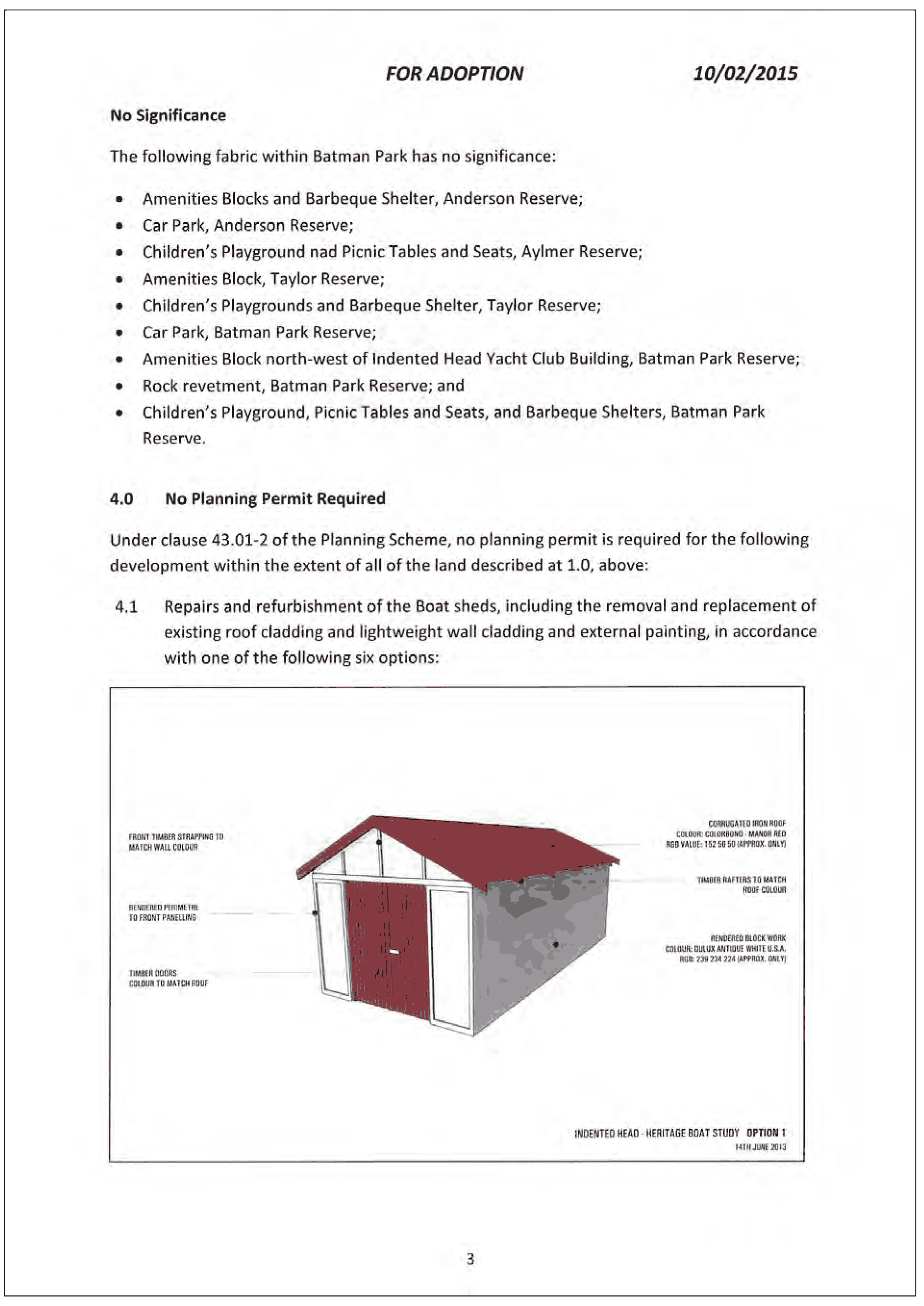
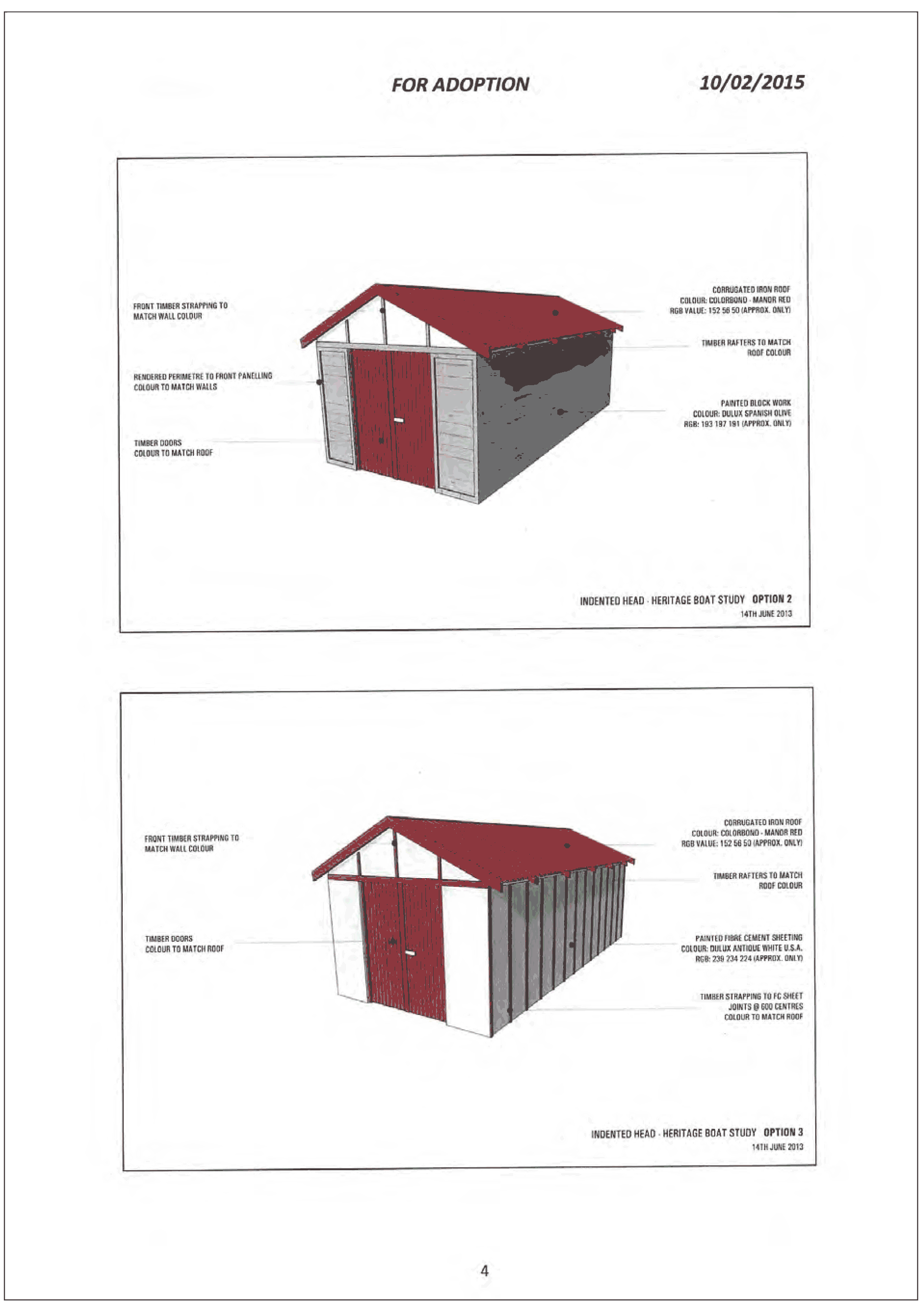
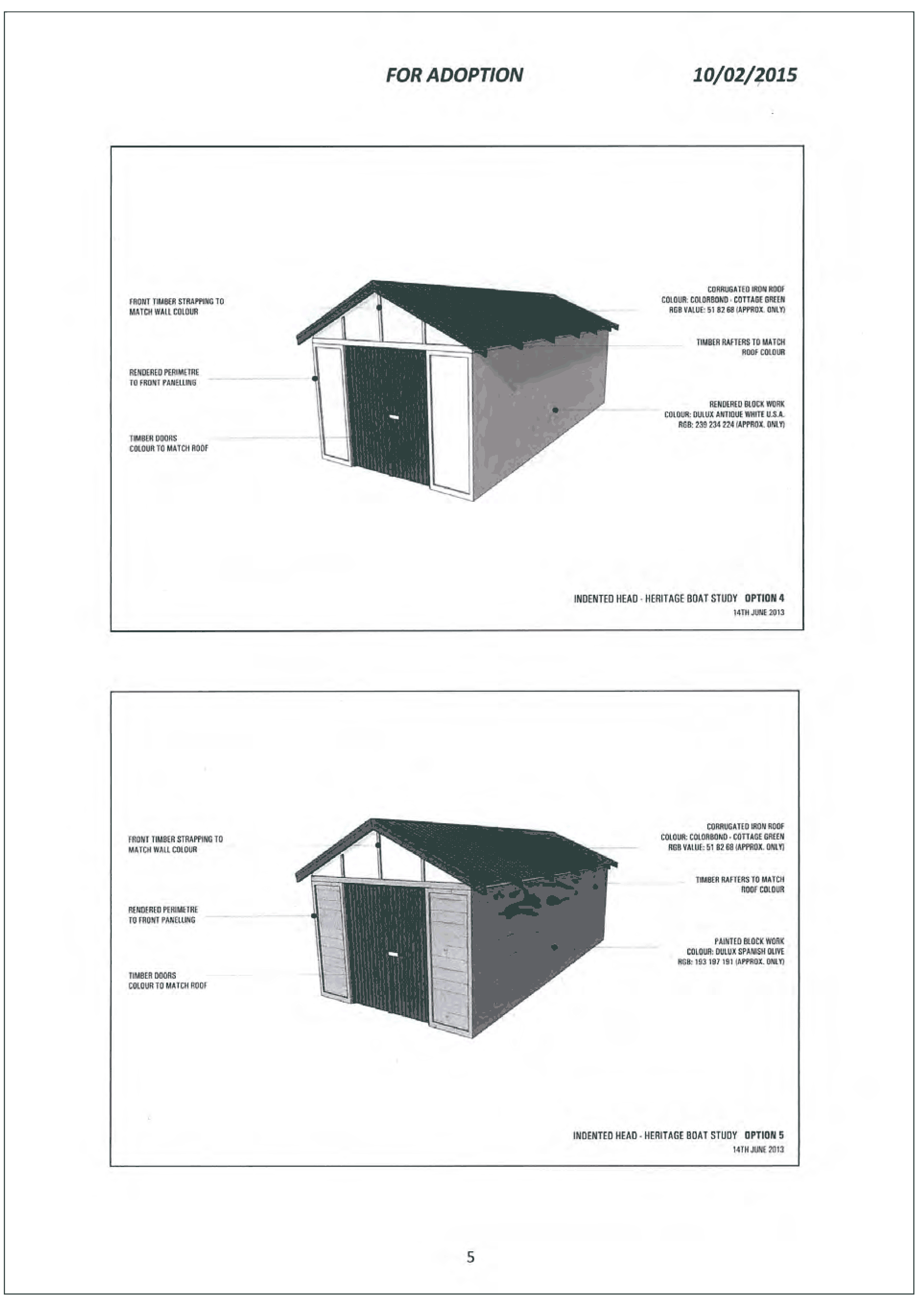
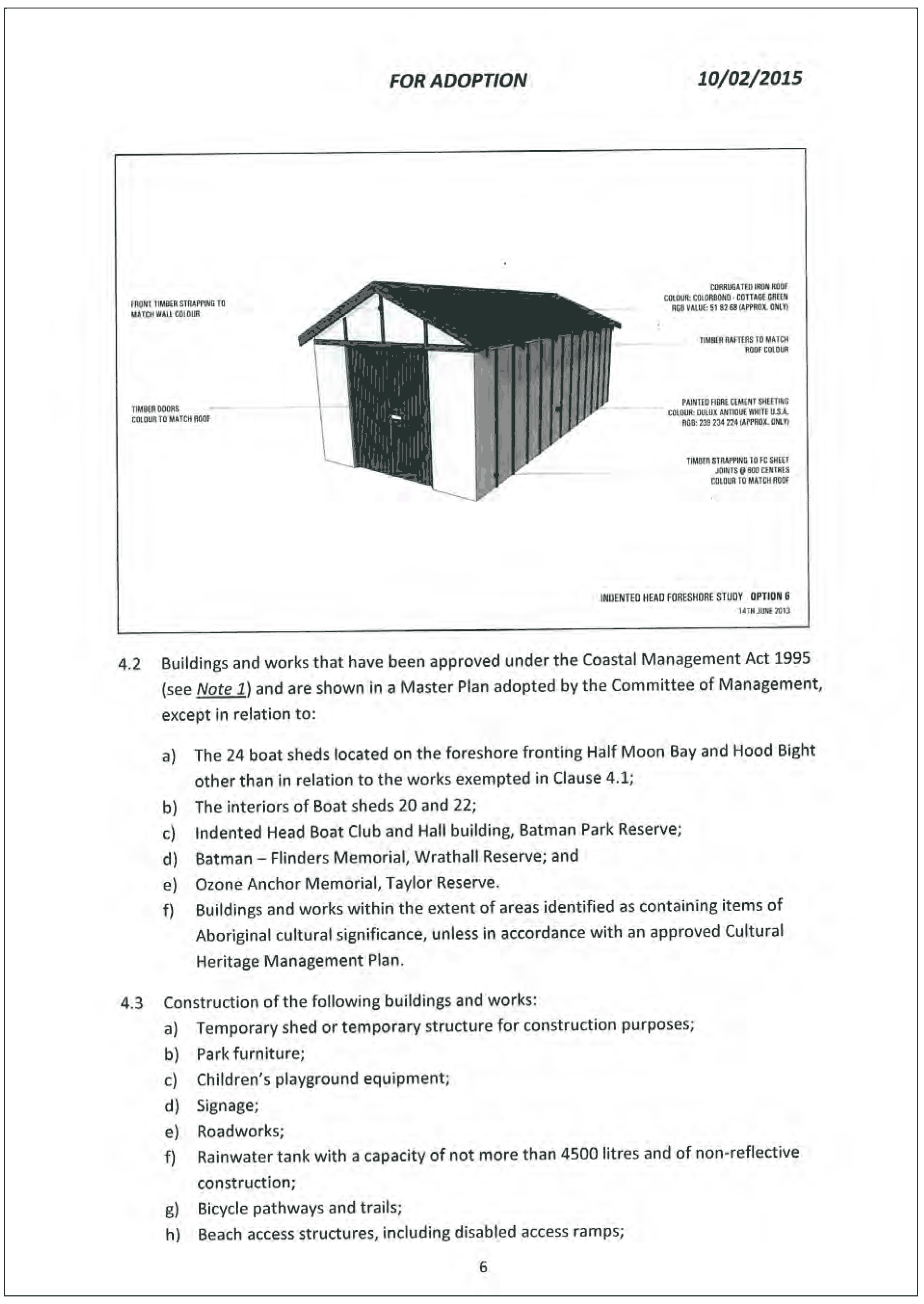
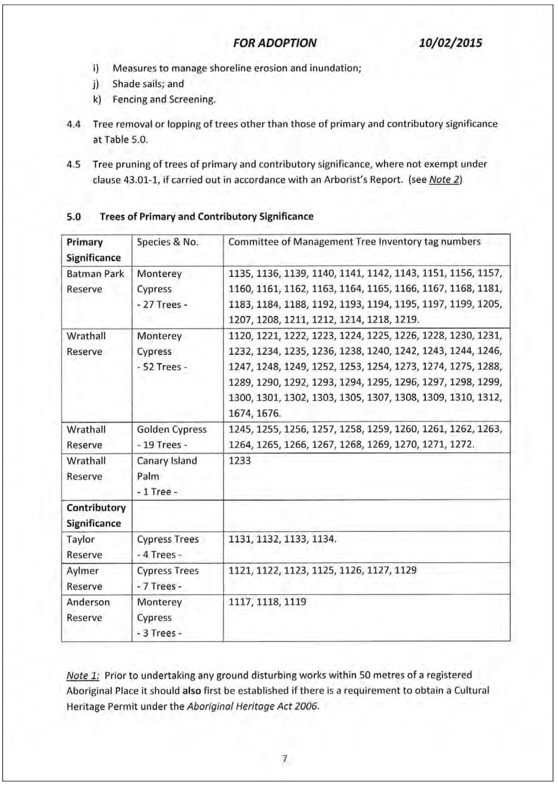
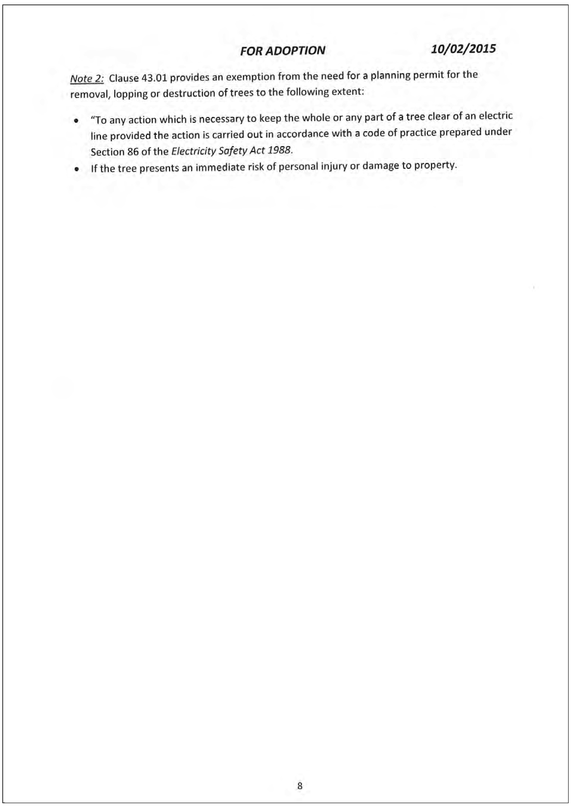
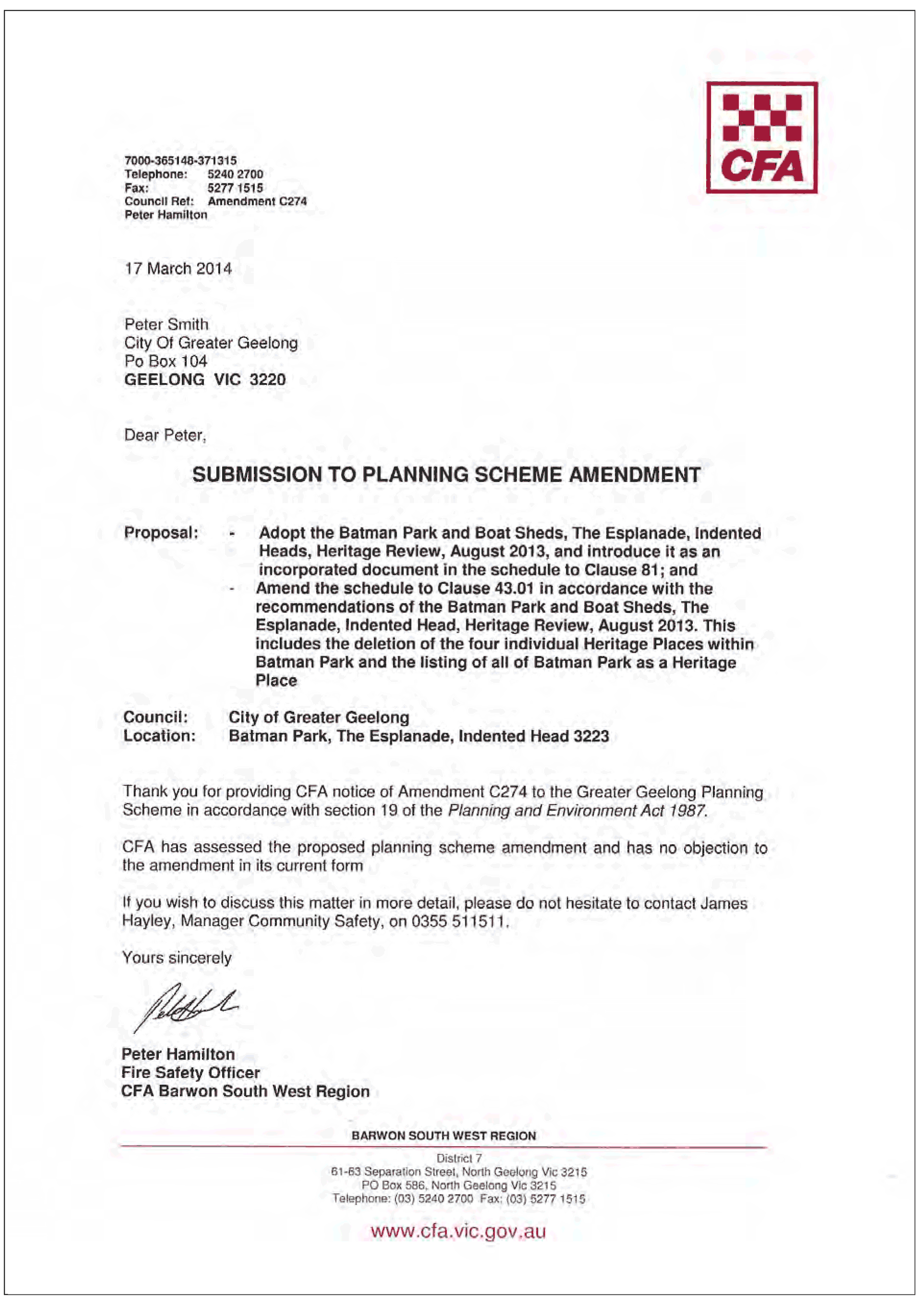
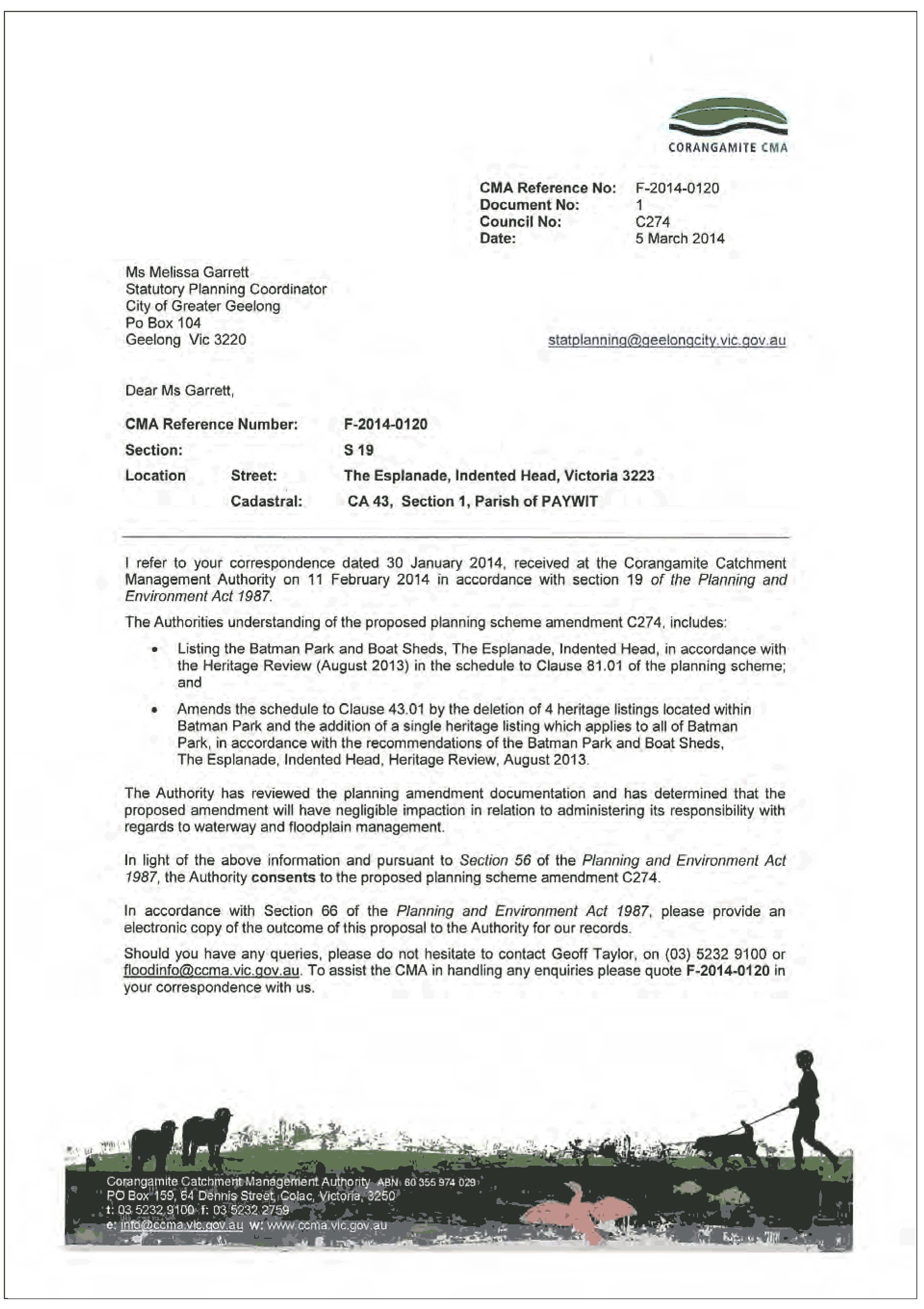

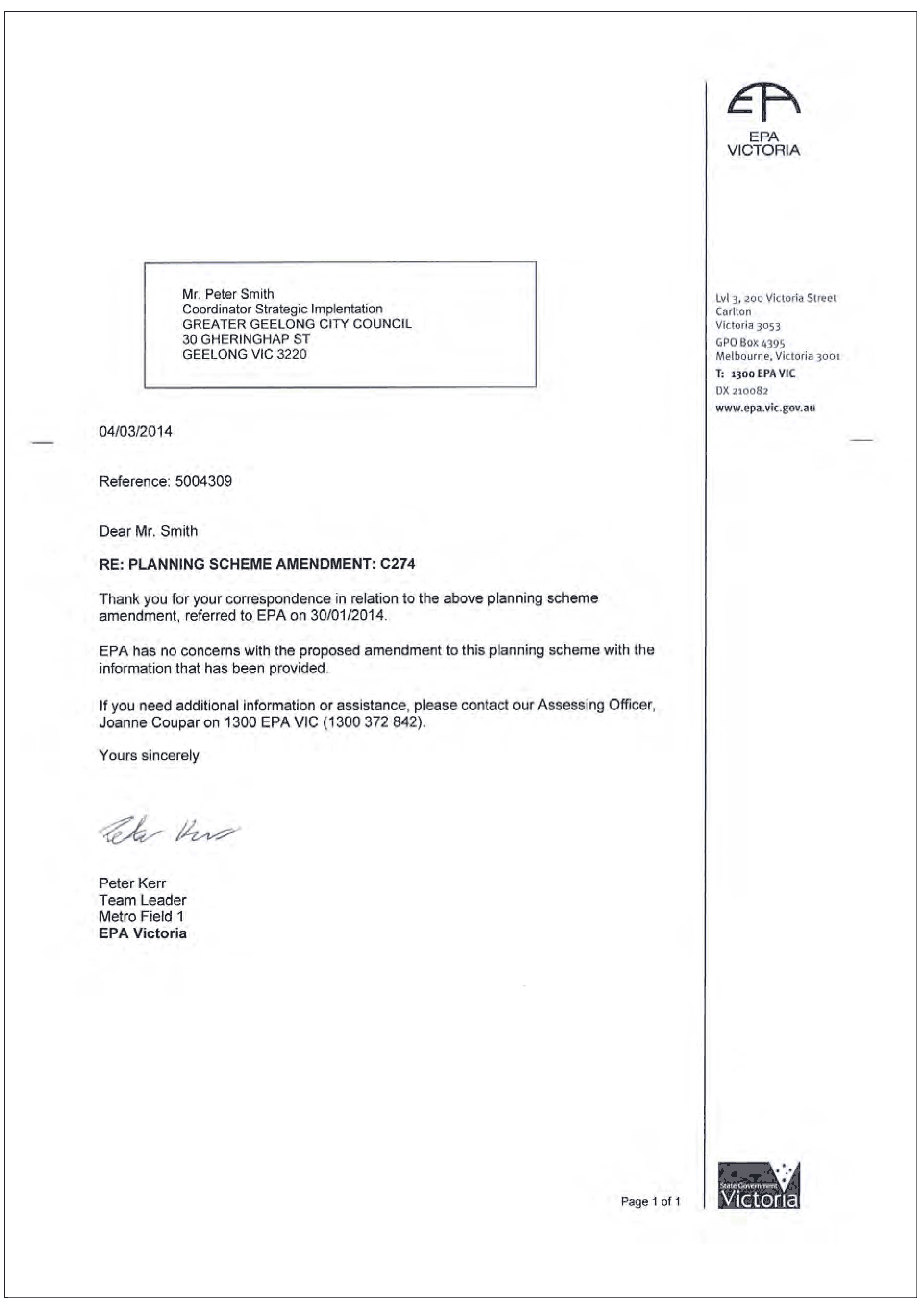
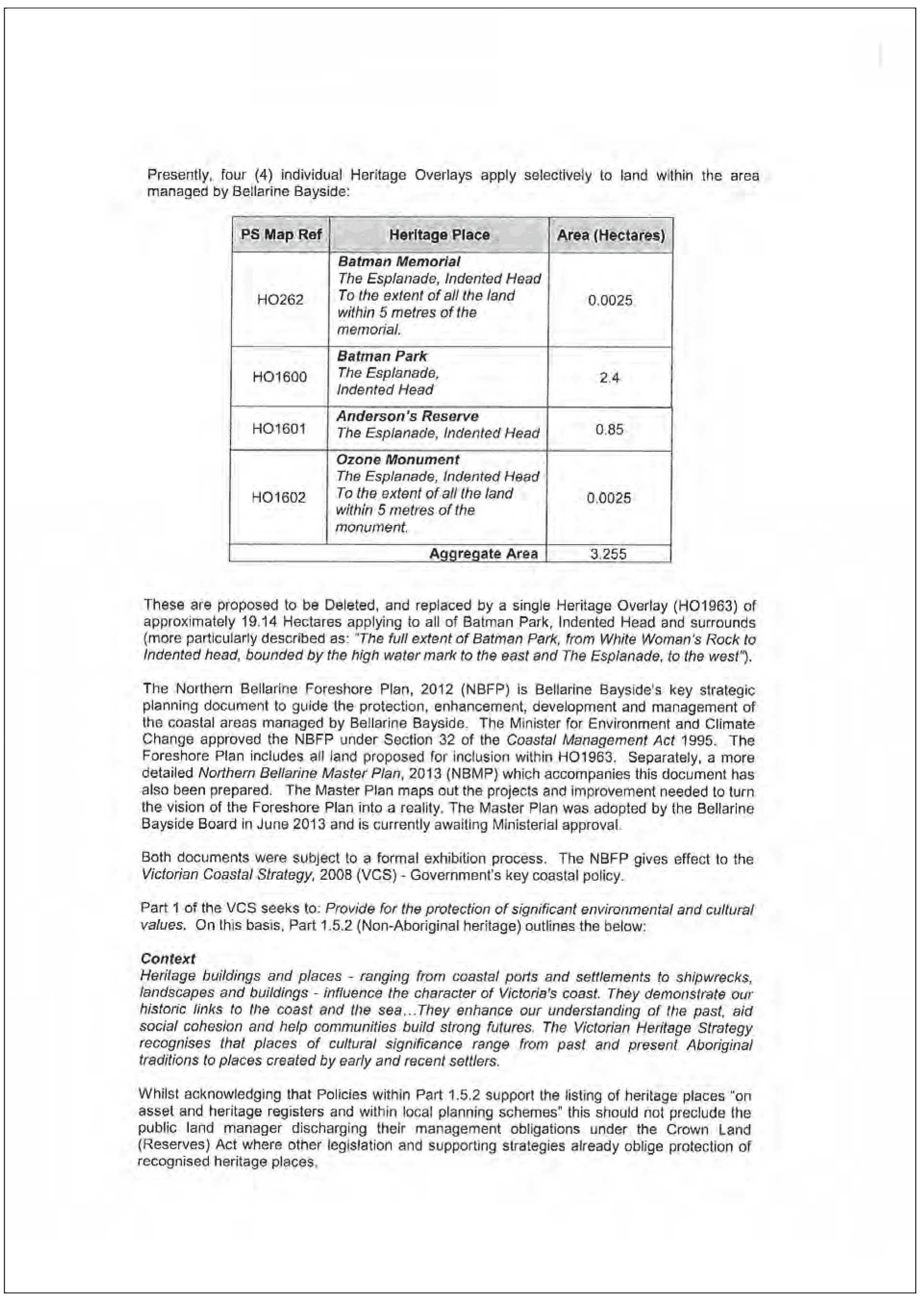
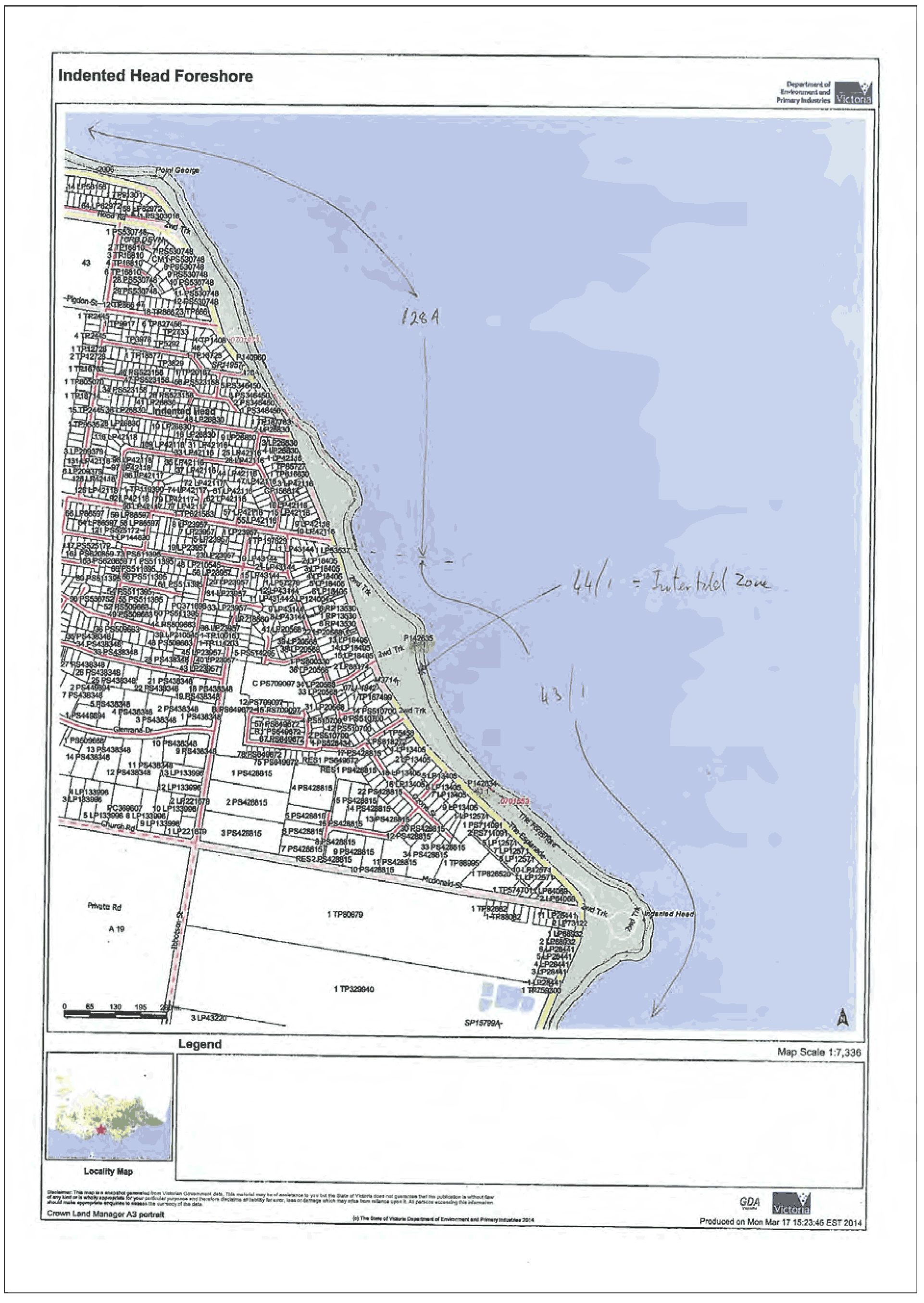
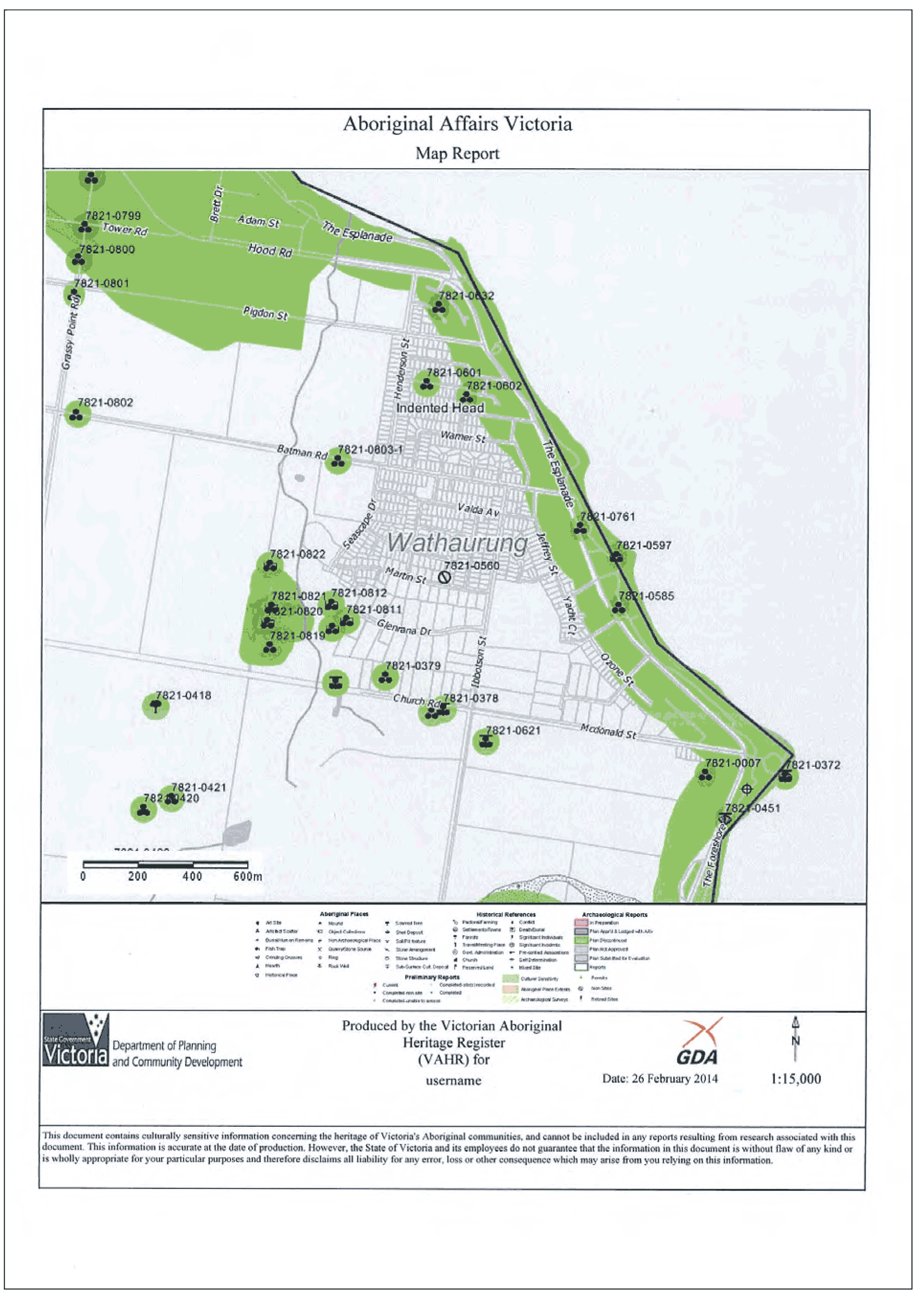
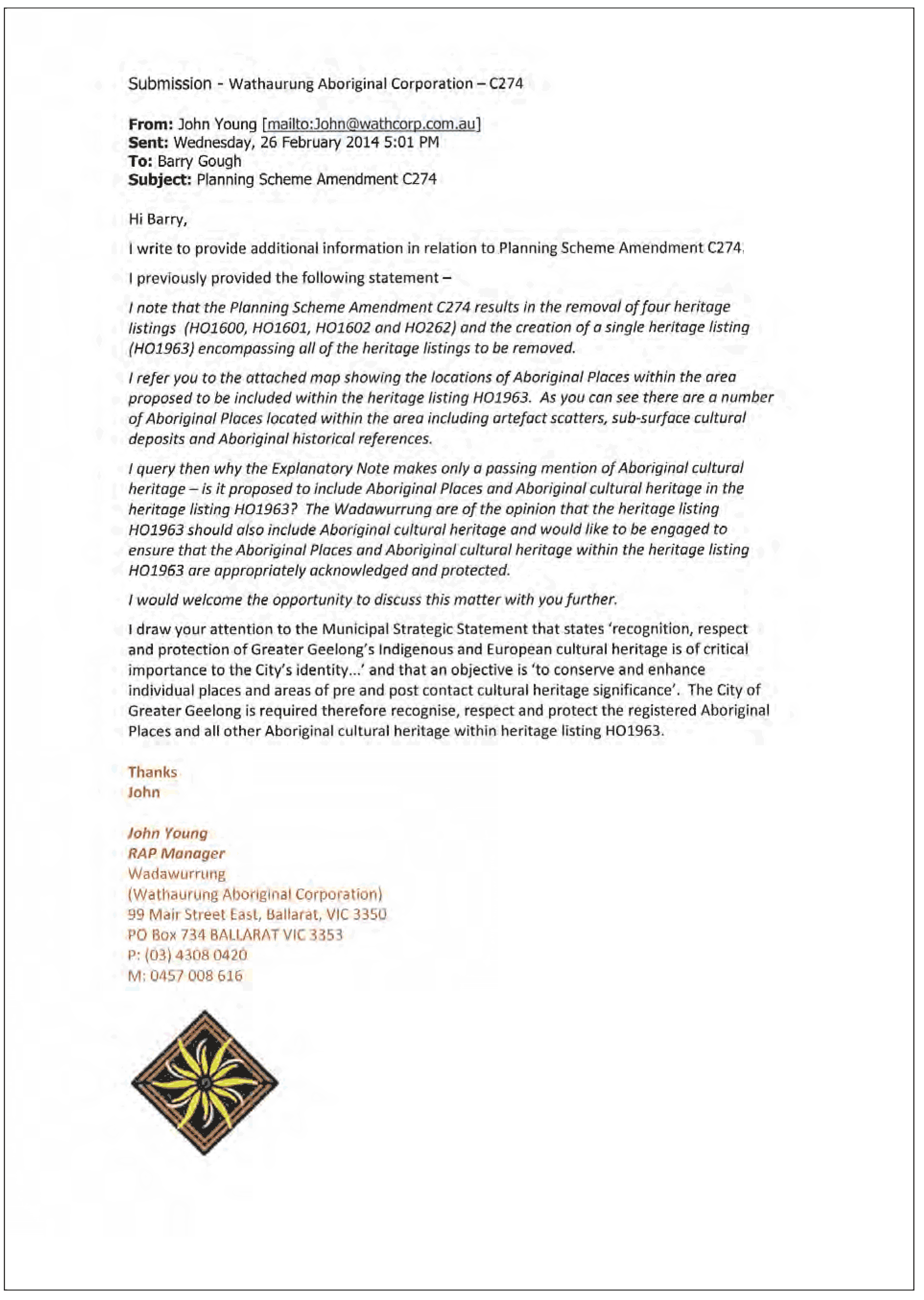
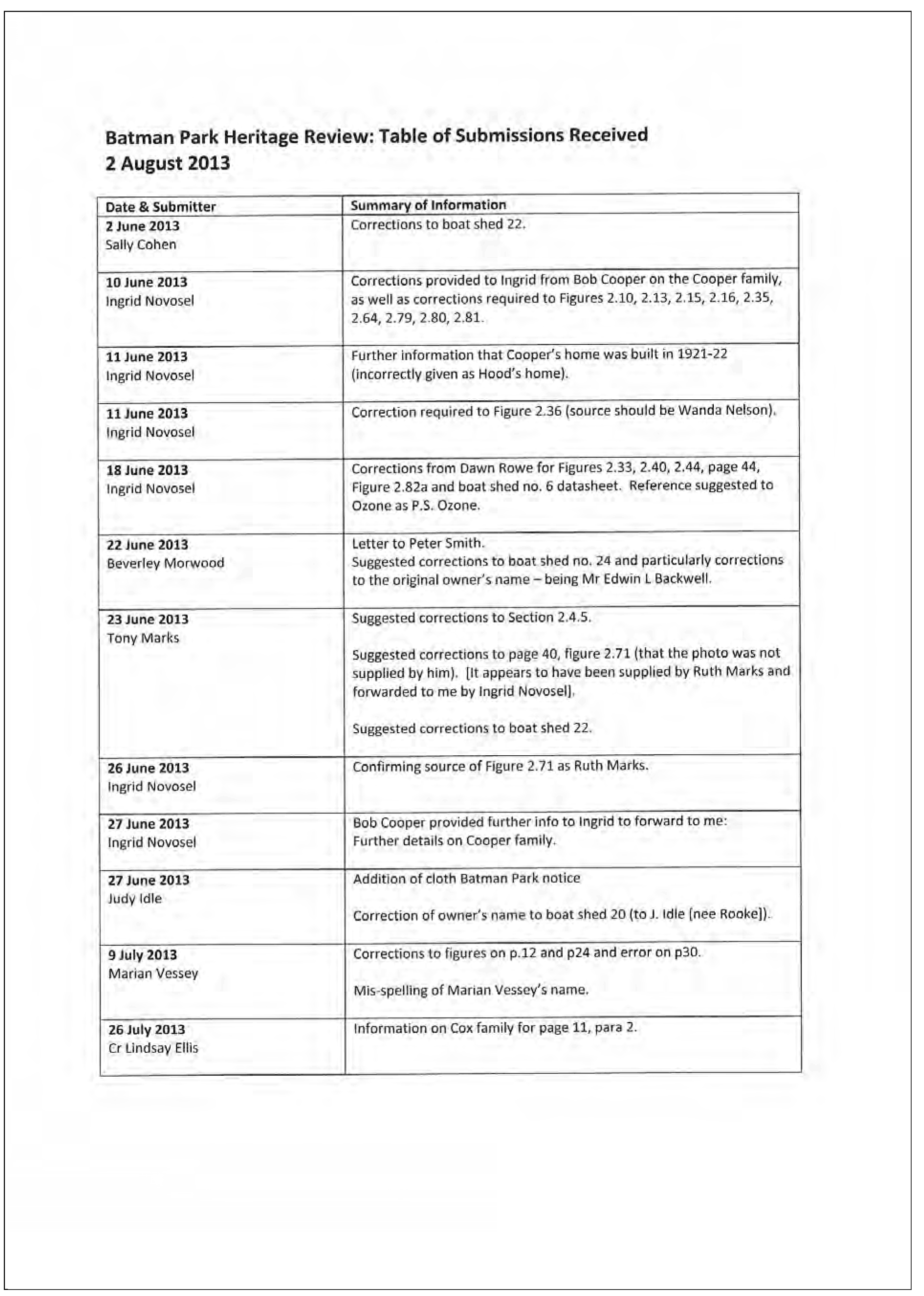
Cr Ellis re-entered the meeting room at 8:03pm
Portfolio: |
Sport and Recreation – Cr Irvine |
Source: |
Projects, Recreation and Central Geelong |
Act/General Manager: |
Jenny McMahon |
Index Reference: |
Subject: Leisure and Recreation Facilities / Recreation Facility Issues |
To seek endorsement for a Private Sporting Infrastructure Capital Co-contribution Policy for capital works on sporting infrastructure not on Council owned or managed land.
Council regularly receives requests from owner/operator(s) of sport and recreation facilities not on Council owned or managed land regarding opportunities for sporting infrastructure capital works support.
The City of Greater Geelong has a mix of publicly and privately owned/managed sport and recreation facilities throughout the municipality.
Council does not currently have a framework to provide financial support for capital works projects at privately owned/managed sport and recreation facilities.
The Co-contribution Policy provides Council and the community with a clear direction as to the level of contribution it may provide to eligible sporting infrastructure projects.
An application for funding must be received via Council’s annual budgetary process and demonstrate strong community benefit.
Private clubs that are the recipient of Council funds must agree to appropriate mechanisms to protect the community investment.
All requests for Council funding will be subject to approval through Council’s annual budget process.
Cr Harwood moved, Cr Irvine seconded -
That Council endorse the Private Sporting Infrastructure Capital Co-contribution Policy (Appendix 1), with the following amendments:
Private facilities will be considered alongside council owned facilities when considered for State funding opportunities;
Private facilities will be considered in Council’s strategic planning for sport, in order to support any funding contribution from other bodies;
Sporting clubs that can demonstrate hardship may apply for exemption from the contribution policy funding ratio. In applying for exemption, clubs must agree to an audit of their finances and administration.
Carried.
The City of Greater Geelong provides a vast array of facilities for community sport and recreation. Many of these facilities play a dual purpose in providing sport and recreation opportunities for surrounding communities and providing open space which the community is free to use outside of formal sports bookings. Council subsidises fees paid for facilities by sporting clubs to ensure that community sport is accessible and to encourage active, healthy communities through the provision of sport and passive open space.
Council has not generally provided subsidies for capital works projects on sporting infrastructure not on Council owned or managed land due to the significant financial cost that would be incurred and limitations of ongoing community access.
Sport and recreation facilities that have been established on private or non-Council managed land are generally the result of a local sporting club/organisation having a desire to establish a facility for their specific purpose. The sporting club/organisation has then subsequently bought or have been gifted a parcel of land to establish a facility. Land ownership has generally (but not exclusively) been in non-residential areas (ie rural, industrial).
At Council’s Ordinary meeting held 28 October 2014 a ‘Privately Managed Sport and Recreation Facilities’ report was presented to determine Council’s position on providing financial assistance to privately owned and/or managed sport and recreation facilities. Council resolved to:
continue to invest in the capital renewal and prioritise the maintenance of Council owned and/or managed sport and recreation facilities;
consider requests from privately owned/managed not for profit sport and recreation clubs and organisations for contribution to capital works that demonstrate community benefit;
direct officers to develop a co-contribution policy that sets out Council’s criteria for contributing funds for capital projects on properties and facilities privately owned/managed by not for profit sport and recreation clubs and organisations whereby Council may contribute an amount up to, or equal to funds contributed by the organisation and/or State and Federal Government;
private clubs that are the recipient of Council funds agree to appropriate organisational wind-up clauses or contractual arrangements to protect Councils investment; and
present a policy for adoption by February 2015.
This report recommends a Private Sporting Infrastructure Capital Co-contribution Policy that provides Council with a clear direction as to the level of contribution it may provide to eligible sporting infrastructure projects that are approved through Council’s annual budget process. Council regularly receives requests from owner/operators of sport and recreation facilities not on Council owned or managed land regarding opportunities for sporting infrastructure capital works support that may include:
Capital Replacement - includes the replacement of assets or facilities at the end of their life-cycle with like-for-like replacement.
Capital Improvement - refers to enhancing an existing asset to provide a higher level of service that will increase the life of the asset beyond what it had originally been.
New Works - includes the construction of a new asset where one never existed.
For the purposes of this report the term private facilities refers to sport and recreation facilities not on Council owned or managed land that are:
Owned and managed by not-for-profit sporting clubs either on their own land or Crown Land;
Not based on a commercial business model (for-profit).
Sport and recreation facilities within the City of Greater Geelong provide a wide range of participation opportunities for residents and visitors to the municipality. While the majority of sport and recreation facilities are owned and/or managed by Council, a small number of facilities are privately owned and/or managed by sporting clubs or other management authorities. From time to time, funding for minor capital works and community grants have been made available to clubs operating within private facilities, however no ongoing financial commitments toward capital works have been provided by Council.
The Private Sporting Infrastructure Capital Co-contribution Policy will provide clubs and organisations on privately owned or managed land with clear funding mix guidelines and allow them to plan effectively to implement their project proposal.
The policy encourages a variety of contribution sources so the cost for an eligible sporting infrastructure project is shared and not seen as the sole responsibility of one organisation. The policy also acknowledges the importance of the local contribution from clubs and organisations both in terms of cash, voluntary labour and donated materials.
Maintenance related projects will not be considered.
Facility Categories and Land Ownership/Management
While the majority of sport and recreation facilities within the municipality are located on Council owned and/or managed land, there are a range of facility ownership and management models across the municipality not on Council owned or managed land. The following assets are considered eligible:
Privately owned – Not-for-profit sporting club owns and manages the sport and recreation facilities on their own land.
Crown land (direct lease and Coastal Committee of Management) – Sporting club has the same responsibility as a privately owned club, but does not own the land. This includes Coastal Committee’s of Management where maintenance is shared between the Committee of Management and the sporting club.
The following assets are not considered eligible:
Department of Education and Early Childhood Development (joint use) – Already receive a specified level of support from Council via the joint use agreement where a gap in public provision exists.
Department of Education and Early Childhood Development (direct tenancy to club) – Facilities primarily for school use. Tenancy arrangements managed by the school directly. Maintenance responsibility remains with the school/DEECD.
Tertiary institutions (Deakin) – Facilities hired directly to sporting clubs. Asset maintenance is the responsibility of the land owner.
For-profit business - Facilities based on a for-profit commercial business model are not considered eligible which include indoor stadiums, golf courses, aquatic facilities and private businesses such as equestrian schools.
Based on the information above, the asset base of private facilities within the municipality that may be considered for capital works support are:
Sport |
Facility Type |
Amount |
Description |
Soccer |
Pitches |
7 |
7 x turf |
Pavilions |
4 |
3 x large, 1 x medium |
|
Tennis |
Courts |
31
|
13 x lawn, 12 x en tout cas, 6 x hard-court, 1 x synthetic grass |
Pavilions |
2 |
1 x large, 1 x medium |
|
AFL |
Ovals |
1 |
1 x turf |
Pavilions |
1 |
1 x medium |
|
Netball |
Courts |
2 |
2 x hard courts |
Lawn Bowls |
Greens |
18 |
8 x turf, 10 x synthetic grass |
Pavilions |
8 |
6 x large, 2 x medium |
Benchmarking of Local Government Authorities
Benchmarking of current practices regarding local government support of private facilities was undertaken with Mitchell Shire, City of Whittlesea, City of Casey, Surfcoast Shire, Cardinia Shire, Colac Otway Shire, Hume City Council, City of Greater Bendigo, Warrnambool City Council and the City of Wodonga. The outcomes of the benchmarking exercise produced a clear position across all municipalities:
All Councils indicated that they have private sport and recreation facilities within their municipalities.
All Councils indicated that they do not provide re-current support in the way of maintenance or financial contributions.
Sporting clubs at private sport and recreation facilities are eligible to apply for grants as they become available.
Warrnambool City is the only Council with a Capital Co-contribution Policy that includes private facilities and these applicants must demonstrate the extent to which community access is provided.
Key Rationale
The following information outlines the key rationale considered in developing the policy:
Contribution to the Open Space Network
If Council contribute funds for capital works projects on privately owned and/or managed land, the expectation would be that these facilities are made available for community access outside of scheduled training and competition. This would have a positive impact on the provision of open space and access to reserves for the wider community.
Tenancy and Public Access
Public access to privately owned sport and recreation facilities is at the discretion of the owner/operator and resident sporting clubs are not required to enter into tenancy agreements with Council for the seasonal use of facilities. While priority will be given to funding applications which demonstrate a commitment to facilities being readily available for community use it should be noted that ongoing access can not be guaranteed.
Facility Ownership
Private facilities may be sold by the owner/s at any time, with Council having limited control over the sale of a privately owned or managed asset. The risk of contributing significant resources to a private facility that could be sold by it’s owner/s at any time is generally seen as prohibitive to contributing capital improvement resources.
The policy recommends that clubs and organisations that are successful in securing Council support take full responsibility for the ongoing maintenance of any capital project improvements and enter into a formal Project Funding Agreement that outlines commitments of all parties to the project and agree to organisational wind-up clauses or contractual arrangements to protect Council’s investment for the term of the asset life.
Community access to private facilities raises issues related to public liability and Council’s inability to ultimately control facilities that are being provided by the owner/operator. The public liability risk is considered minimal as the policy does not include maintenance requests and applies to capital works projects only.
Capital Cost to Council
The financial cost of capital works is generally seen as the most significant obstacle to Council committing to ongoing capital support for privately owned/managed facilities.
The following estimated capital costs relate to the private asset categories considered in the policy:
Sport |
Facility |
Components |
Capital |
Lifespan |
Soccer |
Turf field |
One hectare turf, sportlights, irrigation, goals, player shelters and fencing (410 metres). |
$450,000 - $550,000 |
15 - 25 years |
Tennis |
Court enclosure |
Two-court enclosure with sportslights, acrylic hard-court surface, nets, posts, fencing and one shelter. |
$117,000 - $143,000 |
15 - 25 years |
AFL |
Oval |
1.5 hectare turf, sportslights, irrigation, goals, player shelters and fencing. |
$512,000 - $625,000 |
15 - 25 years |
Netball |
Court |
Two-court enclosure with sportlights, acrylic hard-court surface, goals, fencing and one shelter. |
$124,000 - $151,000 |
15 - 25 years |
Lawn Bowls |
Green Replacement |
Single green enclosure with four sportslights, one synthetic surface, one shelter and fencing (170m) |
$130,000 - $158,000 |
10 - 15 years |
All |
Pavilion (Small) |
250 square metres |
$750,000 |
35 - 50 years |
Pavilion (Medium) |
500 square metres |
$1,500,000 |
35 - 50 years |
|
Pavilion (Large) |
1000 square metres |
$3,000,000 |
35 - 50 years |
|
All |
Miscellaneous |
2000 square metres of car park, one water tank, one storage shed. |
$126,000 - $154,000 |
25 - 35 years |
The capital works cost on sporting infrastructure not on Council owned or managed land is based on the following assumptions:
Turf field provision based on a “B” ground rating, with sportslighting to meet the relevant competition standard.
Tennis court provision based on acrylic hard-court surface, with sportslighting to meet the relevant competition standard.
Netball court provision based on acrylic hard-court surface, with sportslighting to meet the relevant competition standard.
Lawn Bowls green replacement provision based on synthetic grass surface, with sportslighting to meet the relevant competition standard.
Capital replacement of the pavilions is estimated at $3,000 per square metre.
A lifespan of 10 years is assumed for all facilities, based on the assumption that existing private facilities are partially through their life-cycle and scheduled maintenance undertaken may not be to standards required for a public facility.
The financial implication of Council assuming entire responsibility for capital works on sporting infrastructure not on Council owned or managed land is projected at:
$4 – 4.4 million annually ($45,875,500 - $47,762,500 over the next 10 years)
It should be noted that not all private facilities will be applying for funding in any given year and submissions will be evaluated via Council’s annual budgetary process and ranked according to urgency. Council contributions to successful community concept projects will be subject to approval through Council’s annual budget process.
Assessment Criteria
Projects are required to demonstrate a strong community benefit and is assessed against the following criteria:
The project must be of a capital works nature.
Partnership projects with other community organisations are encouraged.
Priority will be given to projects where there is a strong financial and/or in-kind contribution.
Projects need to align with the strategic directions of Council’s City Plan 2013-2017.
Council’s Recreation and Open Space Unit will rank submissions as mandatory, critical, high, medium or low priority in-line with Council’s annual budget process.
The community value of a project that is not on Council owned or managed land will also be considered in-line with the Department of Transport, Planning and Local Infrastructure‘s Community Facility Funding criteria that considers to what extent the project:
Responds to community need and is supported by local, regional or state sporting association planning
Clearly identifies the project scope including schematic plans
Consults and collaborates with project stakeholders
Demonstrates what the project will achieve.
Contribution Framework
The recommended contribution framework for capital works on sporting infrastructure not on Council owned or managed land is:
Council to contribute up to one-third (1/3) of the total project cost, with the club/organisation to contribute a minimum two-thirds (2/3) of the total project cost including any other funding sources.
Considerations
All requests for Council funding will be subject to approval through Council’s annual budget process.
Groups that occupy private land must demonstrate the extent to which facilities will be will be made available for community access outside of scheduled training and competition.
In-kind contributions should be calculated in line with the Department of Transport, Planning and Local Infrastructure’s Voluntary Labour and In-kind Support Proforma, and must be no greater than 25% of the total project cost.
Clubs and organisations that are successful in securing funds are required to:
Take full responsibility for the ongoing maintenance of any capital project improvements.
Enter into a formal project funding agreement with Council that outlines commitments of all parties to the project and agree to sale of asset, organisational wind-up clauses or contractual arrangements to protect Council’s investment for the term of the asset life.
There are no environmental implications relating to this report.
Council contributions to capital works projects will be subject to approval through Council’s annual budget process.
The following Council policies have implications for the recommendations of this report:
Fees and Charges for Outdoor Sporting Facilities – Council’s policy on fees and charges for outdoor sporting facilities are currently being reviewed as part of the Sustainable Sports Strategy. This policy does not refer to private sporting facilities, as Council does not currently maintain or manage facilities in private ownership or management.
Open Space Policy – refers to Council’s role in developing the open space network based on strategic planning and community needs. While private sporting facilities contribute to the open space network, their location is not based on strategic planning or broader community needs.
Council’s Open Space Strategy is currently being reviewed, with gaps in open space provision to be determined as part of the planning process. A preliminary review suggests that private facilities provide limited value in the provision of publicly accessible open space.
This report is aligned to the Community Well-Being objective of City Plan. The provision of sport and recreation facilities promotes healthy lifestyle through physical activity.
Council prioritises the development of sport and recreation facilities within Council owned and managed reserves, however investing in private facility infrastructure improvements will also contribute to providing community well-being outcomes, including physical activity, social connectedness, mental health, inclusion and accessibility.
No persons engaged in the writing of this report have a direct or indirect interest in the matters considered within the report.
Should Council agree to contribute funds toward private sport and recreation facilities within the municipality, a number of risks would require consideration:
Financial – there are significant cost implications for Council to renew facilities in accordance with relevant facility standards.
Wind-up Clause – within the formal project funding agreement that commits the applicant to organisational wind-up clauses that will protect Council’s investment for the term of the asset life.
Sale of Asset Clause – applicant commits to paying back Council a portion of funds relative to the useful life of the asset i.e. an asset useful life calculated at ten years would have a straight-line depreciation set at 10% annually, therefore if sold at year five then 50% of Councils contribution is to be refunded.
Liability – the policy recommends that successfully funded applicants take full responsibility for the ongoing maintenance and liability arising from injury or loss connected with any capital works.
Occupational Health and Safety – providing funding for capital works on private property raises OHandS issues for Council. As facilities would remain in 100% private ownership, compliance with relevant OHandS policies and procedures may be difficult to ensure.
Access – privately owned facilities could be sold by the owner(s) at any time, subject to public access agreements that could be established between Council and the owner(s).
Sport and recreation plays a key role in the health of our community. Whilst the physical health of the community is the most apparent benefit, sport and recreation promotes increased mental health, social connection and community leadership. Sporting clubs at private sport and recreation facilities provide similar community benefits as those on Council-owned land, but Council has limited ability to influence club activities through tenancy agreements and licensing.
This report has no impact on compliance with the Human Rights Charter.
No formal consultation process has been undertaken relating to this report. From time to time, Council receives requests from owner/operator(s) of sport and recreation facilities not on Council owned or managed land regarding opportunities for sporting infrastructure capital works support.
The current position is that Council does not provide capital works or maintenance support for privately owned or managed sport and recreation facilities.
Portfolio: |
Governance - Cr Lyons (Mayor) |
Source: |
Strategy and Performance - Financial Services |
General Manager: |
Dean Frost |
Index Reference: |
Council Reports 2015 |
To update the Terms of Reference for Special Committees of Council (as defined by Section 86 of the Local Government Act 1989) to reflect changes to the City of Greater Geelong Act 1993 (The Act).
Section 11E of the City of Greater Geelong Act 1993 (The Act) gives the Mayor the power to appoint Councillors to certain committees. Specifically, section 11(E)(I)(b) of the Act allows for the Mayor to appoint Councillors to chair special committees of Council. The special committee must have at least one Councillor as part of the membership.
By virtue of the Mayoral appointment to Chair, the Councillor will automatically become a Committee member even if they had not previously been a member of that special committee.
Existing Terms of Reference (TOR) for Council special committees have been reviewed to ensure compliance with the Act and the TOR for Central Geelong Task Force Special Committee contains some other minor amendments.
Cr Heagney moved, Cr Nelson seconded -
That Council endorses the updated Terms of Reference for Special Committees for:
Bellarine Multi Arts Facility (Potato Shed)
Central Geelong Task Force Special Committee
Central Geelong Marketing Committee (no Mayoral appointment to Chair 2015)
Development Hearing Panel
Geelong Major Events
Performance Review – Chief Executive
Planning Committee
Carried.
This report updates Council’s Special Committee Terms of Reference to ensure compliance with Section 11E of the City of Greater Geelong Act 1993 (The Act).
The Act gives the Mayor the power to appoint Councillors to certain committees.
The Mayor’s power to appoint Councillors under section 11E (1) (b) is limited to their appointment:
as chairpersons to Special Committees of Council (i.e. those established under s86 of the Local Government Act).
The Mayor may also choose not to appoint a Chair to a special committee and may at any time remove a member from the Chair position.
Section 86 of the Local Government Act 1989 provides for Council to appoint any additional Councillor(s).
Existing Terms of Reference have been reviewed and updated to reflect changes to the Act, for the following special committees:
Bellarine Multi Arts Facility (Potato Shed)
Central Geelong Task Force Special Committee (no Mayoral appointment to Chair 2015)
Central Geelong Marketing Committee
Development Hearing Panel
Geelong Major Events
Performance Review – Chief Executive
Planning Committee.
There are no environmental implications associated with the contents of this report.
Funding arrangements (where in place) are provided within Council’s budget parameters. There are no specific implications in updating the Terms of Reference for Special Committees.
Terms of Reference have been updated to ensure compliance with the Act.
Special Committee (s86) Meetings are open to the public, except where matters of a confidential nature, as prescribed by the Act, are to be considered. These committees may be delegated various responsibilities by the Council, including the expenditure of monies and entering into contracts.
Special Committees align with the City Plan objectives of Community Wellbeing, Growing the Economy, Sustainable and Built Environment, and also How We Do Business.
No officer involved in the preparation of this report had a direct or indirect interest.
By adopting and reviewing the Terms of Reference of the special committees any perceived risk is minimised and ensures adherence to regulatory requirements. The operations of the committees in this report are designed to offer transparency and to ensure good governance procedures are in place.
Appointments to special committees allow the Chair and committee members to gain expertise in a variety of social considerations in a forum which is readily accessible and open to the community.
No human rights are impacted by the contents of this report. Committees will generally align with the principles of the Human Rights Charter.
Updated terms of reference and minutes of special committees are available on Council’s website or upon request. All relevant areas of Council were consulted in updating their Terms of Reference.
Cr Nelson declared an Indirect Interest in Agenda Item 9 – Highton Drainage/Flood Study as he owns a property in the flood overlay zone and left the meeting room prior to discussion at 8:12pm.
[Back to Top]
Portfolio: |
Infrastructure, Parks and Gardens – Cr Ellis |
Source: |
City Services – Engineering Services |
General Manager: |
William Tieppo |
Index Reference: |
Flood/Drainage Management – Flood Mitigation |
This report seeks Council adoption of the Final Report of the Highton Drainage/Flood Study, following the public consultation undertaken in July and August 2014.
The significant drainage related flooding problems within the catchment at Highton, Wandana Heights and Belmont are related to the size of the catchment and nature of the drainage systems. Generally the drainage systems within the catchment are substandard, having been designed using the much lower standards that were the accepted practice at the time of the most significant development, i.e. from the 1950’s to the 1970’s.
The City commissioned the Highton Drainage/Flood Study as part of the ongoing program of studies. Studies are prioritised based on the assessed seriousness of flooding within particular catchments.
The Study found that at least 2318 properties within the study area are affected by the 100 year Average Recurrence Interval flood event, with at least 35 of these properties subject to above-floor flooding of habitable buildings.
The Executive Summary of the Study is included as Appendix 1. The Study effectively concludes that physical constraints make it very expensive and in some locations unfeasible; to ‘retrofit’ the required drainage infrastructure to achieve the industry recognised 100 year Average Recurrence Interval flood protection.
After considering three structural mitigation options, the Study recommends further investigation into the feasibility of localised flood mitigation measures in order to reduce the flood risk for properties that have been the subject of previous drainage/flooding requests for service, which have identified capacity deficiencies.
The Study also recommends designation under the Victorian Building Regulations 2006 of flood-prone areas shown on the Study’s flood mapping (refer to Appendix 2). Designation by Council enables control of floor levels via building permits and disclosure of flood status within statutory information certificates.
It is proposed that a future planning scheme amendment be undertaken to incorporate the relevant flood zone/overlay into the Greater Geelong Planning Scheme. This would enable control of development via assessment of planning permit applications in accordance with best practice guidelines for development within or upstream of flood-prone areas.
Cr Ellis moved, Cr Fisher seconded -
That Council:
note the report for the Mitigation Options as outlined in the Highton Drainage/Flood Study Final Report;
endorse the Final Report and Flood Extent Map produced by the Highton Drainage/Flood Study as contained in Appendix 1 (Executive Summary) and Appendix 2 (Flood Extent Map);
designate that land identified within the Highton Drainage/Flood Study and shown in Appendix 2 (Flood Extent Map) as likely to be inundated by a 100 year Average Recurrence Interval flood event, as liable to flooding pursuant to Regulation 802(2) of the Building Regulations 2006; and
commence the amendment process to incorporate the relevant flood zones and overlays into the Greater Geelong Planning Scheme, based on the flood mapping produced by the Highton Drainage/Flood Study.
Carried.
The Highton catchment that was studied is known as the Kardinia Creek catchment, named after the creek that has now been piped. This catchment covers a significant urbanised area within the suburbs of Highton, Wandana Heights and Belmont (refer to Attachment 1 for Study Area). The catchment drains to the Barwon River via an outfall located west of Shannon Avenue.
In total the Kardinia Creek catchment has an area of approximately 1,050 ha, with 60% of this area urbanised. The rural portion of the catchment is located upstream of the urbanised portion, with the Geelong Ring Road generally comprising the boundary between the urban and rural portions.
The Kardinia Creek catchment has some serious and frequent drainage-related or ‘stormwater’ flooding. The severity of flooding (significant risk or hazard) within the catchment is reflective of the size, topography, development density and age (up to 60 years) of the contributing catchment, i.e. significant developed catchment with pre-1980 drainage systems. A pre-1980 drainage system typically has underground drainage with limited capacity (lower order minor storms) and a lack of clear overland flow paths for surcharge or excess flows.
Given the scale and complexity of the flooding within the Kardinia Creek catchment, specialist consulting engineers BMT WBM Pty Ltd were engaged to undertake a detailed drainage/flood study.
The Draft Final Report of the Highton Drainage/Flood Study was placed on public exhibition for 4 weeks during July and August 2014. Forty six written submissions and 66 verbal submissions/enquiries were received. The major issues of concern and the City’s responses are listed within Attachment 2. Following the consideration of submissions, the Final Report was prepared. A copy of the executive summary of the Final Report of the Highton Drainage/Flood Study is appended as Appendix 1.
The drainage/flood study or flood management plan consists of the analysis and production of flood maps, identification and modelling of flood mitigation options, preparation of cost estimates, feasibility analysis, identification of preferred options and development of a strategy.
Computer modelling was used to assess the extent and depth of flooding over the flood mapping area for both the existing conditions and for each of the mitigation options under consideration.
The study estimated that at least 35 properties would suffer from internal flooding of habitable buildings in the event of a 100-year Average Recurrence Interval flood under existing conditions.
As flooding events tend to occur on a random basis, the cost of flood damage is generally expressed as an average annual amount that can be expected to be incurred in the long term. The annualised cost of flood damage for existing conditions within the Highton catchment is estimated at $389,000 pa. This annualised cost was estimated using the ANUFLOOD and Rapid Appraisal Method, which take account of potential tangible losses such as damage to infrastructure, buildings and contents, loss of production, etc.
In addition to the flood damage assessment, the flood hazard or risk to public safety associated with particular events was quantified. Flood hazard is generally measured using Melbourne Water’s criteria for ‘safe’ flood depth and velocity, with the safety of children as the primary concern. Some of the flooding within the catchment was found to be hazardous or unsafe.
The study proposed the following three major flood mitigation scheme options for consideration:
Scheme 1: Augmentation of the existing Barrabool Road Upper, Barrabool Road Lower and Wandana Drive Retarding Basins to increase potential storage volume, including works to improve diversion of overland flows into the retarding basins. New pipe, with connecting side entry pits, laid along Mt Pleasant Road, to provide extra flow conveyance.
Scheme 2: The excavation of the Highton Recreation Reserve to provide storage of high flows diverted from the piped system along Barrabool Road. This scheme is designed to reduce the surcharging of the pipe system downstream of the Reserve. In addition a new pipe on the east side of Belle Vue Avenue, from south of Roslyn Road, to alleviate flooding along Belle Vue Avenue.
Scheme 3: A combination of the retarding basin works from Scheme 1 and the works from Scheme 2.
An additional ‘do nothing’ (structural) scheme was considered as Scheme 4.
The study found that Scheme 1 with capital cost of $6.69 million would alleviate internal above floor flooding of at least 2 of the 35 affected properties for the 100 year Average Recurrence Interval flood event, i.e. $3.35 million capital cost per protected property. The benefit to some of the remaining flood affected properties includes a varying reduction in flood levels and duration of flooding. The Benefit Cost Ratio for this option was estimated as 0.01.
The Benefit Cost Ratio (BCR) is a measure of the benefit of implementing a project, in consideration of direct and tangible costs.
A Benefit Cost Ratio greater than one indicates that the total economic benefit received over the lifetime of the project exceeds the cost of undertaking the works. A Benefit Cost Ratio less than one indicates that the costs exceed the benefits over the lifetime of the project.
Scheme 2 with capital cost of $21.10 million would alleviate internal flooding of at least 5 of the 35 affected properties for the 100 year Average Recurrence Interval flood event, i.e. $4.22 million capital cost per protected property. The benefit to the remaining flood affected properties again includes a varying reduction in flood levels and duration of flooding. The Benefit Cost Ratio for this option was estimated as 0.01.
Scheme 3 with capital cost of $27.25 million would alleviate internal flooding of at least 6 of the 35 affected properties for the 100 year Average Recurrence Interval flood event, i.e. $4.54 million capital cost per protected property. The benefit to the remaining flood affected properties again includes a varying reduction in flood levels and duration of flooding. The Benefit Cost Ratio for this option was estimated as 0.01.
Following an assessment of economic, environmental, social, feasibility and performance factors, Scheme 4 (‘do nothing scheme) is considered to be the preferred mitigation option, in conjunction with an education and awareness program, development controls and further investigation into property-specific measures to manage flood risk. The other potential schemes (structural) were found to have very low BCR’s with high capital costs per floor saved; in the order of $4 million in capital cost. This reflects the high cost of ‘retrofitting’ major drainage works into an established urban area.
The study was deliberately limited to an examination of improvements to the drainage system and broad scale improvements to reduce the extent and public safety risk of flooding within the affected areas. It did not provide a detailed examination of property specific measures such as flood proofing. These are options that may be considered further, as to date the City has only investigated provision of community benefit infrastructure to deal with the problems on a catchment-wide basis.
The study analysed flood behaviour and produced flood mapping that needs to be incorporated into the City’s flood-prone areas information system in accordance with the City’s statutory obligations under Regulation 802 of the Victorian Building Regulations 2006. Council’s designation of the new flood mapping is requested in this report to Council following the public exhibition and subsequent consideration of submissions. Designation enables control of minimum floor levels via building permits and disclosure of flood status of flood affected properties within Land Information Certificates and other statutory information certificates. A planning scheme amendment to create flood overlays normally follows the designation of flood mapping by Council.
The overall flood management strategy recommended in the Highton Drainage/Flood Study comprises the following:
Further investigation into the feasibility of localised flood mitigation measures (structural), such as lifting footpaths and/or underground drainage augmentation, in order to reduce the flood risk for properties that have been the subject of previous drainage/flooding requests for service, which have identified capacity deficiencies. These investigations would be undertaken in accordance with the priority ranking established by the City's prioritisation method for drainage investigation/design work.
Further investigation into the feasibility of property-specific measures to manage flood risk. Potential measures include flood-proofing of individual or groups of buildings/properties by landowners, and property buy-back with on-sell following modifications (where feasible) with conditions known to purchaser.
Education and awareness program to inform landowners how to minimise the magnitude of damage in a flood event.
Development controls via designation of areas as liable to flooding in accordance with Building Regulations 2006 and use of flood zones/overlays within the Greater Geelong Planning Scheme.
Recognition that further development within the catchment has the potential to increase flood risk to people and property. Assessment of rezoning proposals to include application of principle of zero adverse flood impact on adjacent, upstream and downstream areas. Assessment of development and subdivision applications to include application of best practice guidelines for development within or upstream of flood-prone areas.
Best practice environmental management for stormwater runoff to be encouraged as part of development and subdivision applications in order to reduce runoff and improve water quality, where not a statutory requirement.
The designation of an area as being liable to flooding does not result in any significant adverse environmental impacts.
The proposed flood management strategy for the Highton catchment recommends that best practice environmental management for stormwater runoff be encouraged as part of development and subdivision applications in order to reduce runoff and improve water quality, where not a statutory requirement.
The overall flood management strategy recommended in the Highton Drainage/Flood Study comprises further investigatory work and non-structural measures, which in the main are covered by departmental operating budgets. Project specific funding may need to be sought to enable flood zones/overlays to be prepared and implemented within the Greater Geelong Planning Scheme.
The City has various statutory responsibilities for drainage management and flood management as set out in the Local Government Act 1989, Local Government Regulations 1990, Planning and Environment Act 1987, Building Regulations 2006, Water Act 1989, Subdivision Act 1988 and Emergency Management Act 1986. The study complies with these statutory obligations.
The study is also consistent with the Victoria Flood Management Strategy and the COGG Flood Management Plan.
The flood data produced by the studies will assist the City in meeting its statutory obligations with regard to flood data within the catchment. Regulation 802(2) of the Victorian Building Regulations 2006 provides Council with the powers to ‘designate’ land liable to flooding. Regulation 802(3) provides that consent must be obtained from Council for an application to build on land liable to flooding.
Section 229 of the Local Government Act and Regulation 2.10 of the Victorian Building Regulations provide for the issue of information certificates containing prescribed information, including the flood status of properties.
The flood data will also assist in improving the quality of the flood risk assessment within the Municipal Emergency Management Plan.
The proposed flood management strategy has the overall objective of addressing flooding problems resulting from inadequacies in the Council’s drainage system within the Highton catchment and enabling Council to meet its obligations in tort to extend its duty of care to the community. The legal implications of not providing appropriate drainage infrastructure or flood management strategies, and not implementing appropriate development controls, are mainly related to liability for subsequent flood damages.
The flood management strategy recommended in the final report is also considered to be consistent with any other relevant Council policies.
The Highton Drainage/Flood Study aligns with City Plan, mainly within the strategic directions of Sustainable Built and Natural Environment (drainage and flood management strategies and plans) and Community Wellbeing (emergency response).
There are no officer direct or indirect interests with respect to this report.
Failure to manage its drainage responsibilities in a reasonable manner and to provide reasonable main drainage infrastructure or flood management strategies, all circumstances considered, may expose the City to litigation for the cost of resultant flood damages. It may be possible to establish the City’s liability if a flooding problem has occurred over a significant period of time, and the City has been aware of the problem and not taken ‘reasonable’ measures, given all the circumstances, to remedy the problem. In the case of flooding problems within the Highton catchment, the City could be vulnerable if the proposed flood management strategy was ignored and no action planned, given the long history of flooding.
Council also has a significant risk exposure through its statutory obligations under the Victorian Building Regulations to:
designate land as liable to flooding where it reasonably knows it to be prone to flooding;
specify minimum floor levels in consultation with the relevant floodplain management authority, the Corangamite Catchment Management Authority; and
refuse consent to building applications where there is likely to be a danger to life, health or safety due to flooding.
This drainage/flood study is a key step toward minimising Council’s exposure to risks within the Highton catchment.
The frequency and duration of flooding in the Highton catchment has an adverse social impact on business owners, employees, customers, visitors and residents. The drainage/flood study has considered social factors in the identification and assessment of mitigation options.
With regard to the designation of flood mapping, Council has a responsibility to the community to provide the best possible information on areas that are flood-prone. Providing flood-prone areas information is generally stating the fact relating to a natural event. Such information is also important in managing response and recovery operations during flooding emergencies.
No human rights are adversely affected by the contents of this report.
The Draft Final Report of the Highton Drainage / Flood Study was placed on public exhibition with an invitation for submissions. The general public was advised of the exhibition via a public notice, and owners of properties affected by the 100 year Average Recurrence Interval flood event within the study area – approximately 2300 properties - received individual letters with explanatory fact sheets.
Forty six written submissions and 66 verbal submissions/enquiries were received. Each written submission was provided with a written response. Verbal submissions/enquiries were answered by phone or face-to-face. The major issues of concern and the City’s responses are listed within Attachment 2.
This consultation is not a substitute for the future and formal planning scheme amendment to incorporate the relevant flood zone/overlay into the Greater Geelong Planning Scheme, where again the community would be able to make submissions.
An education and awareness program is proposed to inform landowners how to minimise the magnitude of damage in a flood event.
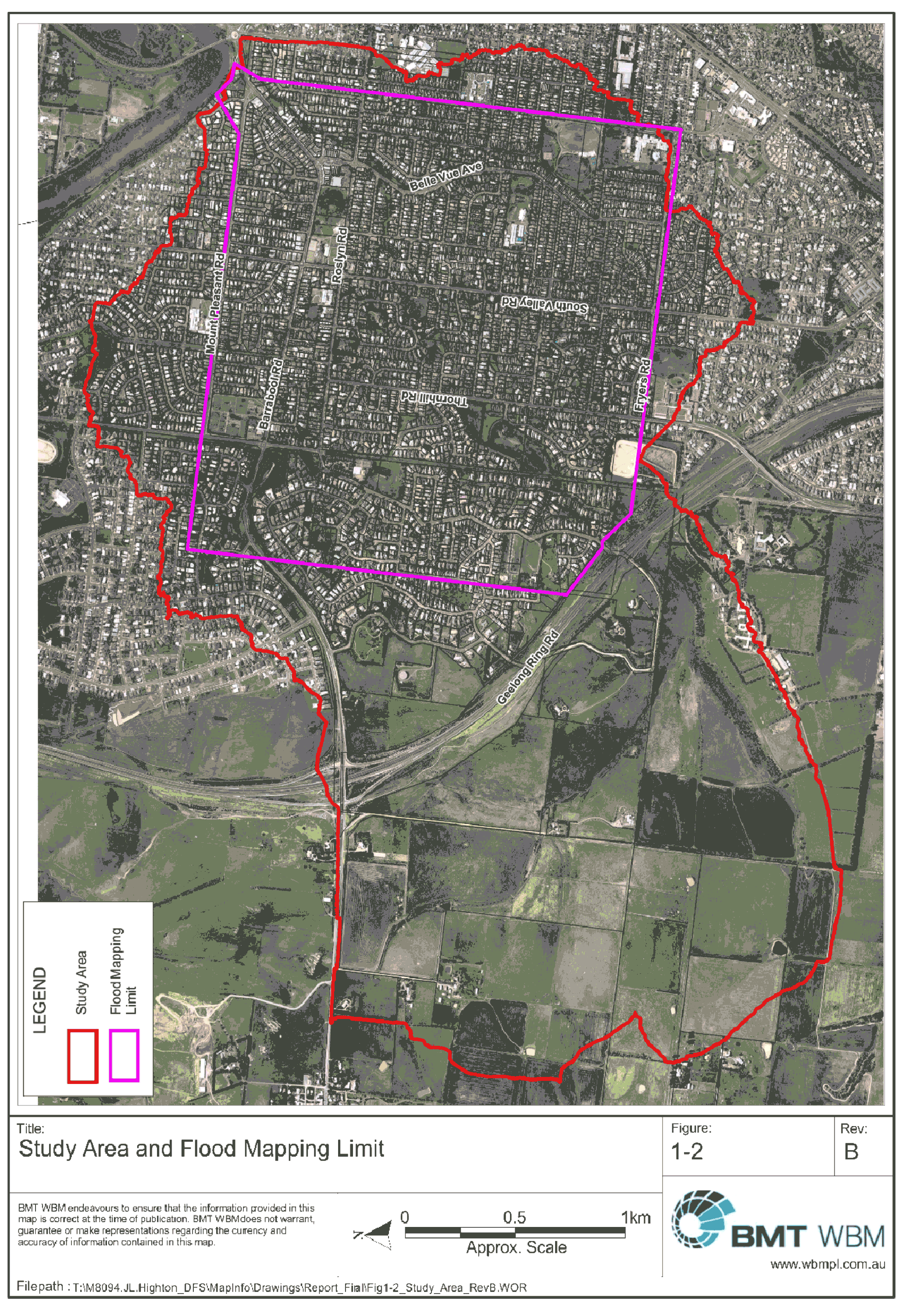
Forty six written submission and 66 verbal submissions or enquiries were received. Some of the submitters acknowledged that their properties or roads had experienced flooding in the past in a manner consistent with the Study’s flood-mapping.
The major issues of concern raised by owners of affected properties are listed below with the relevant responses:
How can my property be considered subject to flooding when it has never flooded (e.g. November 1995 flood event)?
Response:
It cannot be assumed that flooding has not previously or will not occur at any given property, on the basis that there are no records of flooding or flooding to the extent identified by the mapping of the 1 in 100 year or 100 year Average Recurrence Interval (ARI) overland flows.
There is no evidence that the 1 in 100 year or 100 year ARI flood event for the catchment or sub-catchments studied has occurred within living memory. When reliable rainfall figures from a suitably located pluviograph have been available, proper analysis has indicated that actual storms were less than the critical event for 1 in 100 year flooding within the catchment or sub-catchments.
Flooding of the Barwon River in November 1995 was due to riverine flooding rather than stormwater or drainage related flooding due to runoff from local catchment exceeding capacity of drainage systems.
Where do the flood waters affecting my property come from?
Response:
In general the flood water consists of stormwater runoff from higher land within the sub-catchment upstream of your property. Flood water is the portion of runoff that can not be accommodated within the drainage system due to lack of capacity, i.e. runoff flow from upstream that exceeds the capacity of the drainage system. Easement and property drainage systems are not designed to capture and convey 100 year ARI runoff.
How can my property flood when it is “on top of a hill”?
Response:
In all such cases, a check of topography and existing drainage systems has confirmed that the properties in question are located on the side of a hill with a large enough upstream sub-catchment and substandard drainage systems (property, easement and street), allowing surface flows to be generated within private property. Even modern property or easement drainage systems are not designed to capture and convey 100 year ARI runoff.
I don’t consider the sheet flow of stormwater (on the surface) within my property to be ‘flooding’.
Response:
This type of inundation is considered to be flooding within the relevant best practice guidelines, strategies and legislation.
I don’t believe the flood mapping is accurate.
Response:
The flood mapping is based on industry best practice computer modelling techniques, which have been carried out by reputable specialist consulting engineers. The modelling outcomes were also validated against available records of real time flood events. The flood mapping at the location in question is considered to be credible. (A significant number of locations under question were sampled and analysed in detail using alternative best practice methods).
Why is my property considered to be liable to flooding when the neighbouring property is not?
Response:
The difference in flood status is normally due to the hydrological and hydraulic routing of overland flows across the terrain and the location of the relevant properties within the terrain relative to the overland flows. The “flood-free” properties tend to have a higher elevation. A decision was also made to clip shallow flood depths from the initial flood mapping in order to have flood extents that equated to a real flood risk or material flood damages. This has removed the flood extent from some lots.
Are flood mitigation works proposed?
Response:
The drainage/flood study found that major drainage works could not be justified, and recommended further investigation into the feasibility of localised flood mitigation measures, such as lifting footpaths and/or underground drainage augmentation, in order to reduce the flood risk for properties that have been the subject of previous drainage/flooding requests for service that have identified capacity deficiencies rather than blockages. These investigations would be undertaken in accordance with the priority ranking established by the City's prioritisation method for drainage investigation/design work.
Will my rates increase as a result of the study’s recommendations?
Response:
The Study does not propose major drainage works. (In recent years the Council has fully funded major drainage works).
Shouldn’t the City fix up the drainage system rather than spend money on study?
Response:
The limited expenditure on the Study would have little or no beneficial impact if diverted to improving council drainage systems, given costs involved. The Study is also required to identify effective mitigation measures in a holistic manner for the complex drainage system, rather than wasting funds on ineffective works or works that transfer problems from one location to another.
Will the designation affect my house insurance?
Response:
The Insurance Council of Australia has advised Melbourne Water that most home insurance policies, which provide coverage for storm damage, include cover for damages resulting from overland flows. Residents are advised to check with their insurance companies, but the nature of flooding, i.e. drainage-related rather than waterway, would need to be disclosed to the insurer.
As with any type of insurance cover, a premium is applied for flooding based on the insurance company’s assessment of flood risk as it applies to a property. Some insurance companies have indicated that they would be prepared to re-assess the premium following evidence being provided by the property owner that the flood risk has been over-estimated by the company. Property owners also have the option of ‘shopping around’ for an insurance company that is more competitive with respect to premiums.
Designation of my property will result in significant addition construction costs in the event of any new building works.
Response:
The freeboard requirements for floors of habitable buildings on designated properties can impact on slab-on-ground construction costs, particularly when compared with common practices that are non-compliant with the Building Regulations requirements for minimum floor heights on non-designated properties. There may be a marginal increase in construction costs when a waffle raft slab system is used instead of a conventional slab system. The additional expenditure however results in improved property drainage and reduced flood risk.
Is the information being gathered by Council going to affect property values or saleability?
Response:
It is important to note that designation of an area as liable to flooding does not cause or change the likelihood of flooding, but recognises the existing condition of land.
The designation will not be described on title, but will be disclosed in Land Information Certificates issued under the Local Government Regulations, and for building permits under the Building Regulations.
The value of any property is determined by the complex interplay of many different factors such as demand/supply, location, streetscape and amenity, and it is difficult to assign what effect if any, the identification of land as liable to flooding may have on the value of a property. Devaluation of properties (identified as being liable to flooding) is considered unlikely once the nature of flooding is explained and taken into account
If the value of my property is adversely affected by the flood mapping information, is there compensation available?
Response:
There is no reason for payment of compensation, as nothing has changed about the likelihood of a severe storm occurring or the path that overland flow will take. The City now has accurate information which, in many cases, may already be known by people who have lived at a property for many years.
There is also no case for compensation for subdivision of flood-prone land or construction of dwellings without elevated floors as subdivision and building permit applications were assessed in accordance with the planning scheme provisions and the building regulations, respectively, which were in place at that time
Why was designation or a flood overlay not applicable to my property prior to purchase?
Response:
The City’s knowledge of actual flooding within the catchment studied has tended to be anecdotal in nature and therefore it was not suitable for designation of the 1 in 100 year flood extent, as required under State Government legislation. Reliable and credible flood data relating to the 1 in 100 year flood event is needed and this data can only be derived from a detailed flood study such as the Highton Drainage/Flood Study.
The proposed flood overlay on the Planning Scheme is a future planning scheme amendment, as recommended in the Study. The planning scheme amendment generally follows designation by Council under the Building Regulations 2006.
Will the flooding information and planning scheme overlay controls stop redevelopment of my property?
Response:
Generally not. The information will only be used to ensure that any future development of your property is carried out in a manner that recognises the location of areas that may be subject to flooding. Requirements for any proposed development will depend upon the flooding characteristics of the land such as depth and velocity, and the nature of the development proposed. Both Corangamite Catchment Management Authority and Council officers can provide preliminary advice on any likely requirements that will need to be met.
It should be noted that development controls, apart from minimum floor levels, are only applicable in a statutory context once the flood overlay is created within the planning scheme. The overlay creation requires a planning scheme amendment where again submissions from the public are invited.
I object to the flood status of my property being disclosed on a Land Information Certificate
Response:
The City is obligated under State Government legislation to disclose the flood status of a property that is considered to be liable to flooding as defined in the Building Regulations 2006.
Can’t wording on Land Information Certificates be altered to provide property specific information such as impact of 1 in 100 year flood event or that flooding is stormwater flooding that is insurable?
Response:
Wording used on Land Information Certificates reflects State Government legislative requirements.
I believe flooding of my property is due to blocked drains and pits.
Response:
Flooding is due mainly to lack of hydraulic capacity within older drainage systems that were designed to the lower standards that were applicable at that time, as well as the lack of easement drainage in some areas.
The City’s Infrastructure Operations Unit endeavours to check critical council drainage assets for blockages or obstructions, in order to maximise use of capacity that may be available.
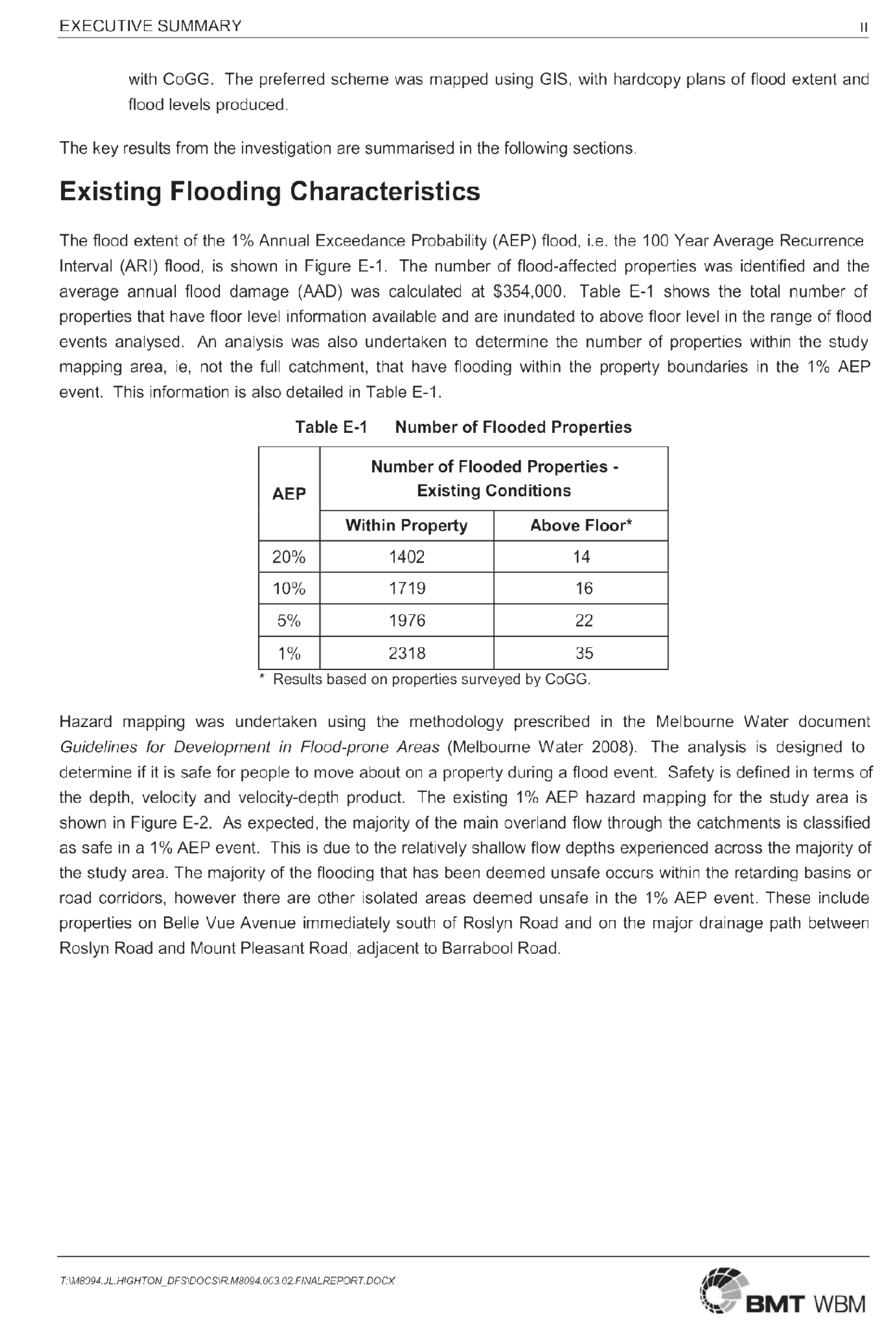
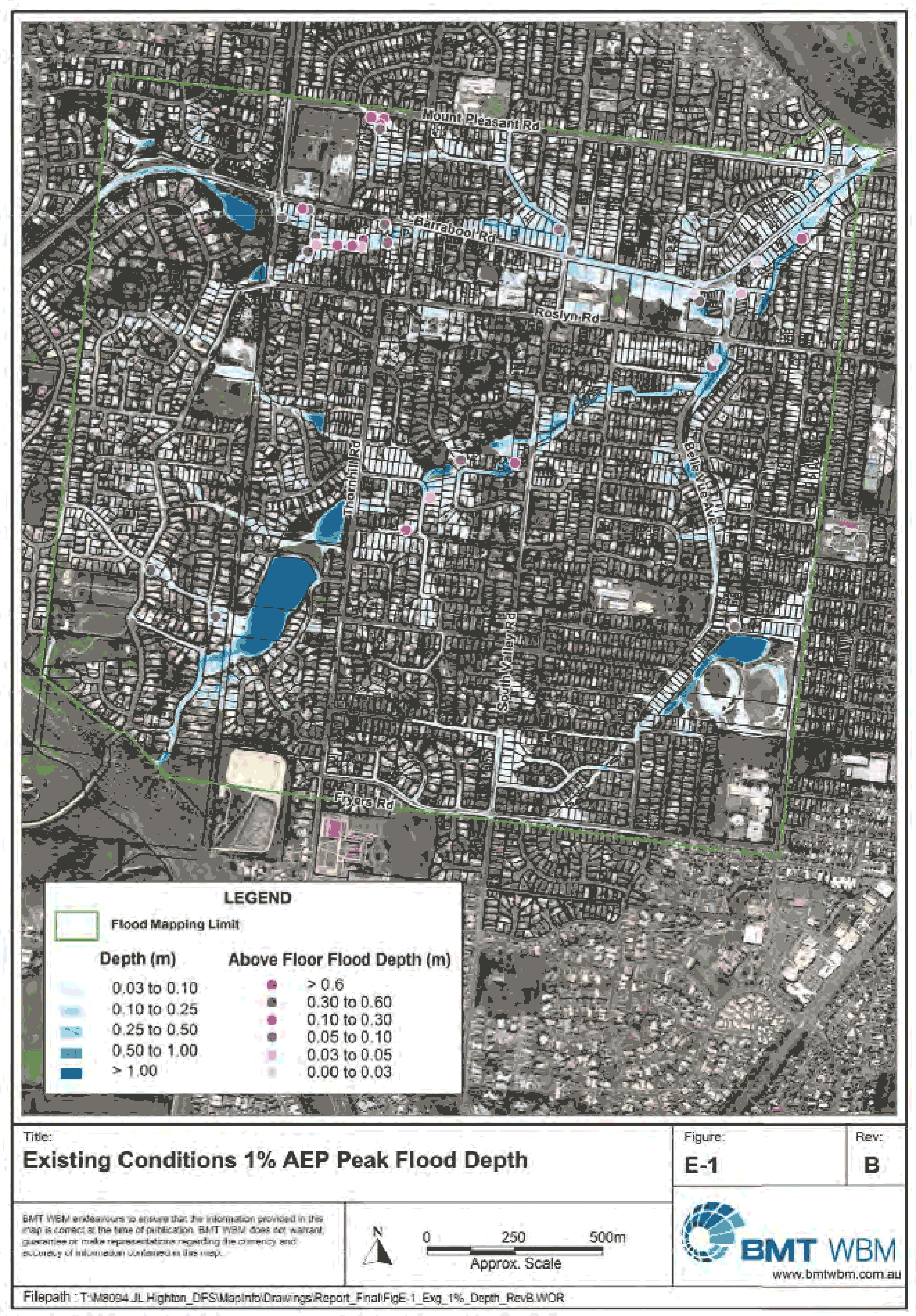
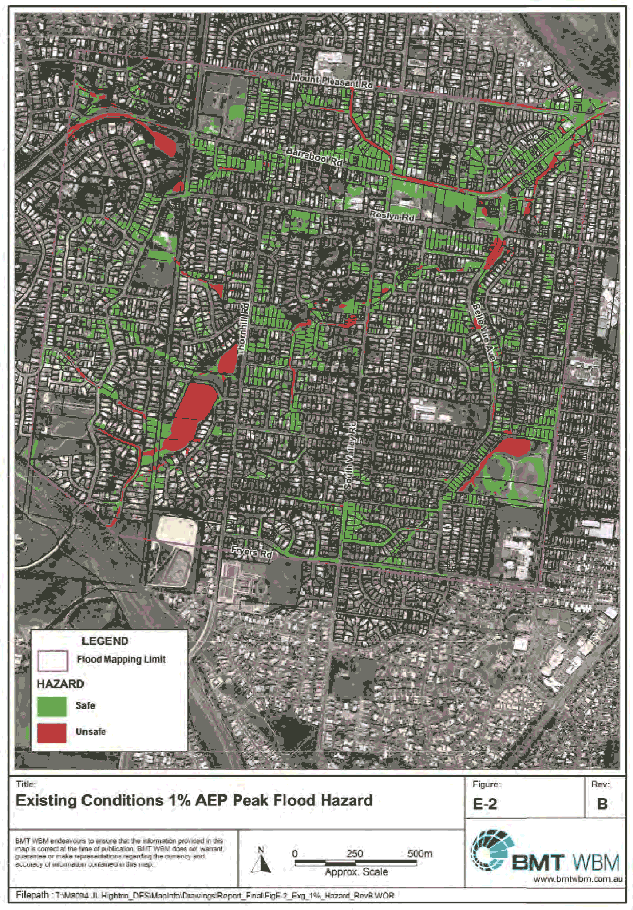
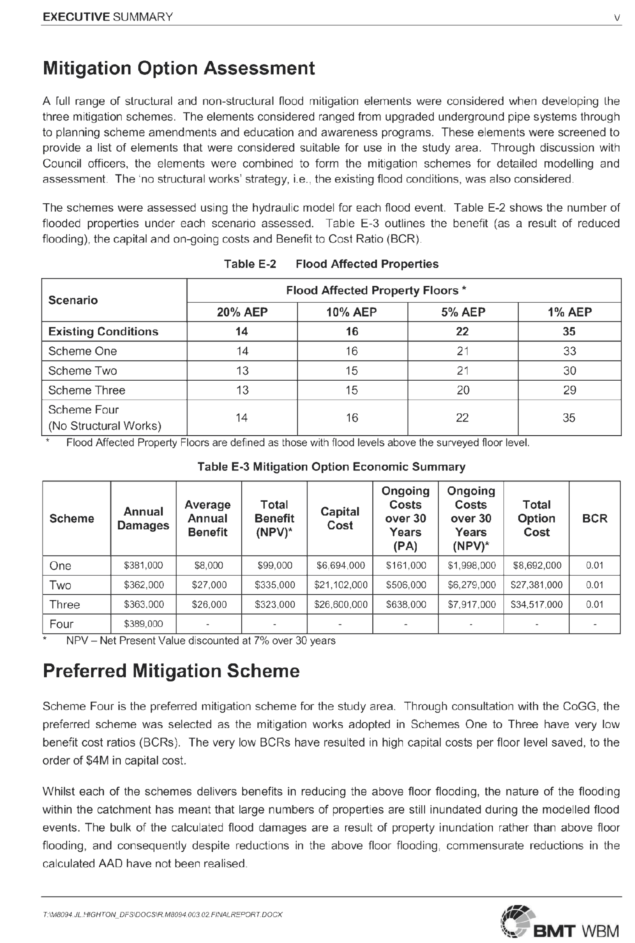
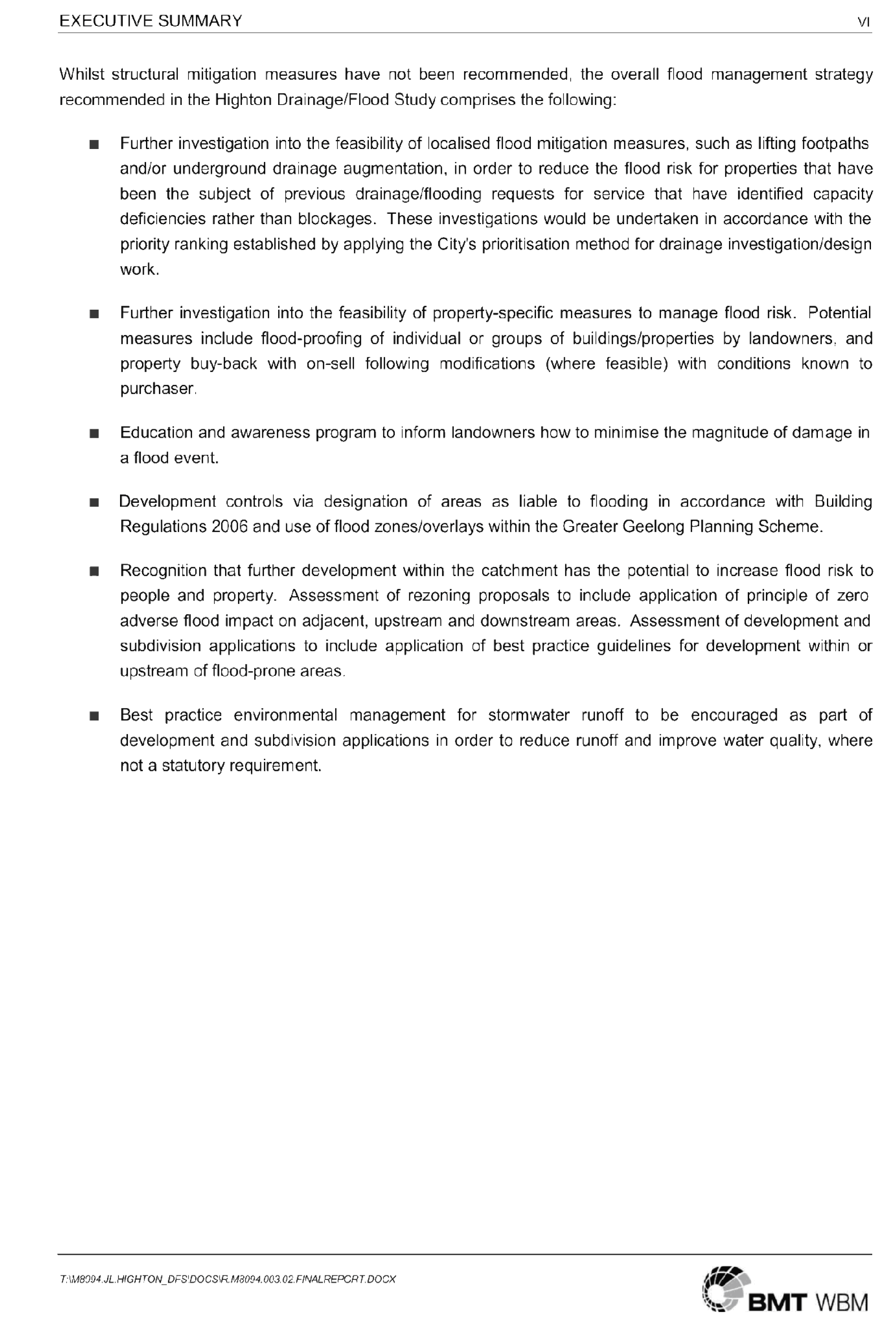
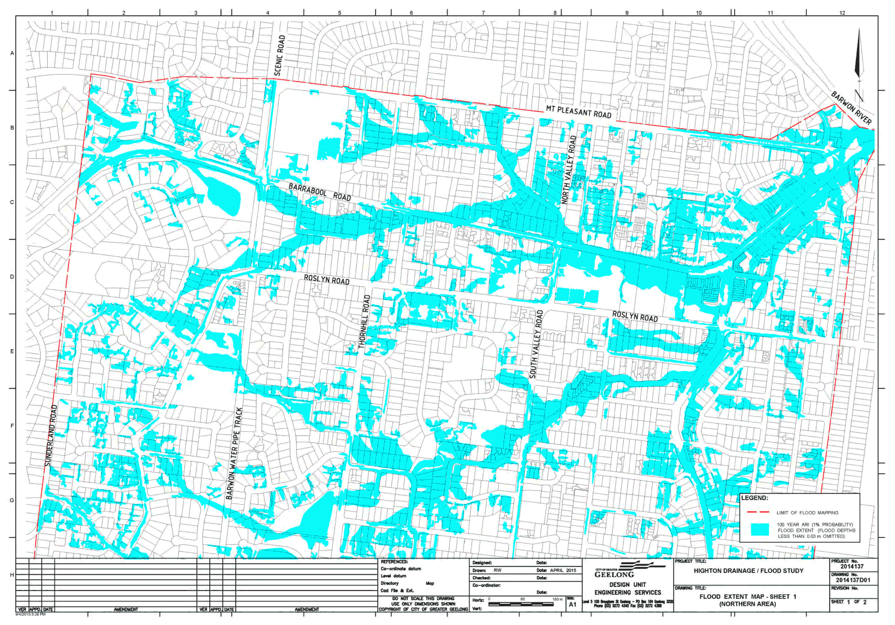
Contents | Previous Page: Section A - Procedural Matters | Next Page: Section C - Assembly of Councillors
