
Contents | Previous Page: Section A - Procedural Matters | Next Page: Section C - Notice of Motion
Reports tabled at the Ordinary Meeting of Council on Tuesday date held at Portarlington Cricket and Football Club, 4-46 Province Boulevard in Highton.
Adoption of Amendment C334 - Incremental Change Area Review 2015
Workplace and Council Culture Program - City of Greater Geelong
Montpellier Drive, Highton - Proposed Footpath Construction SRC345 - Intention to Declare
Lease of Ocen Grove Golf Club - 9 Guthridge Street, Ocean Grove
Revocation of Flood Prone Area Designation of New Lots at Warralily, Stages 69, 77 and 81
Revocation of Flood Prone Area Designation of New Lots at Warralily, Stages 101 and 104
Revocation of Flood Prone Area Designation of New Lots at Lara Central, Lara Stage 3
Tender and Award of Industrial Subdivision, Innovation Drive, Corio
Portfolio: |
Planning – Cr Heagney |
Source: |
Planning and Development – City Development |
General Manager: |
Peter Bettess |
Index Reference: |
Application: Amendment C334 |
This report considers the Independent Panel Report and Recommendation on Amendment C334 and recommends adoption of the Amendment.
Amendment C334 seeks to implement the Incremental Change Areas Review 2015 by making the following changes to the Greater Geelong Planning Scheme:
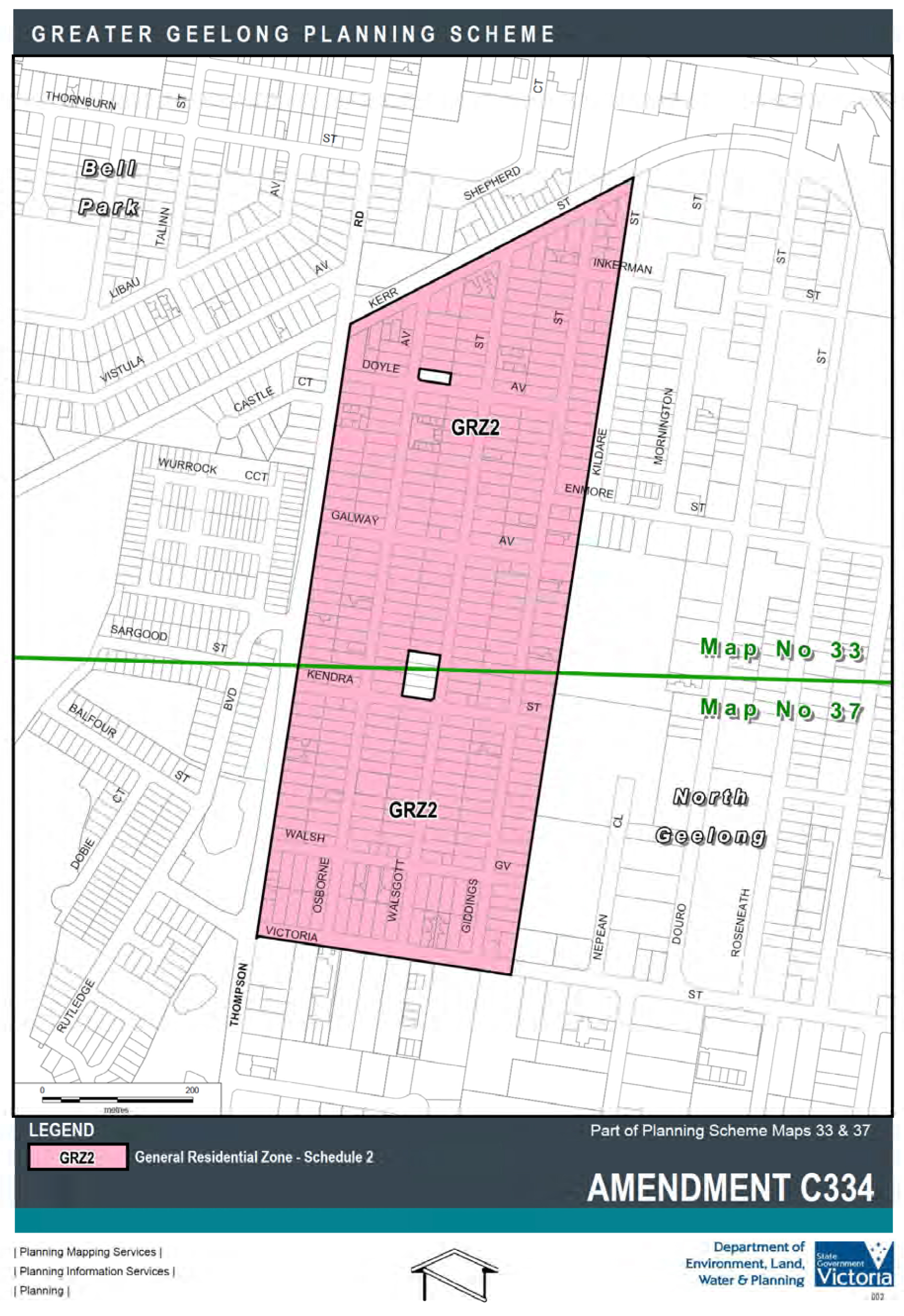
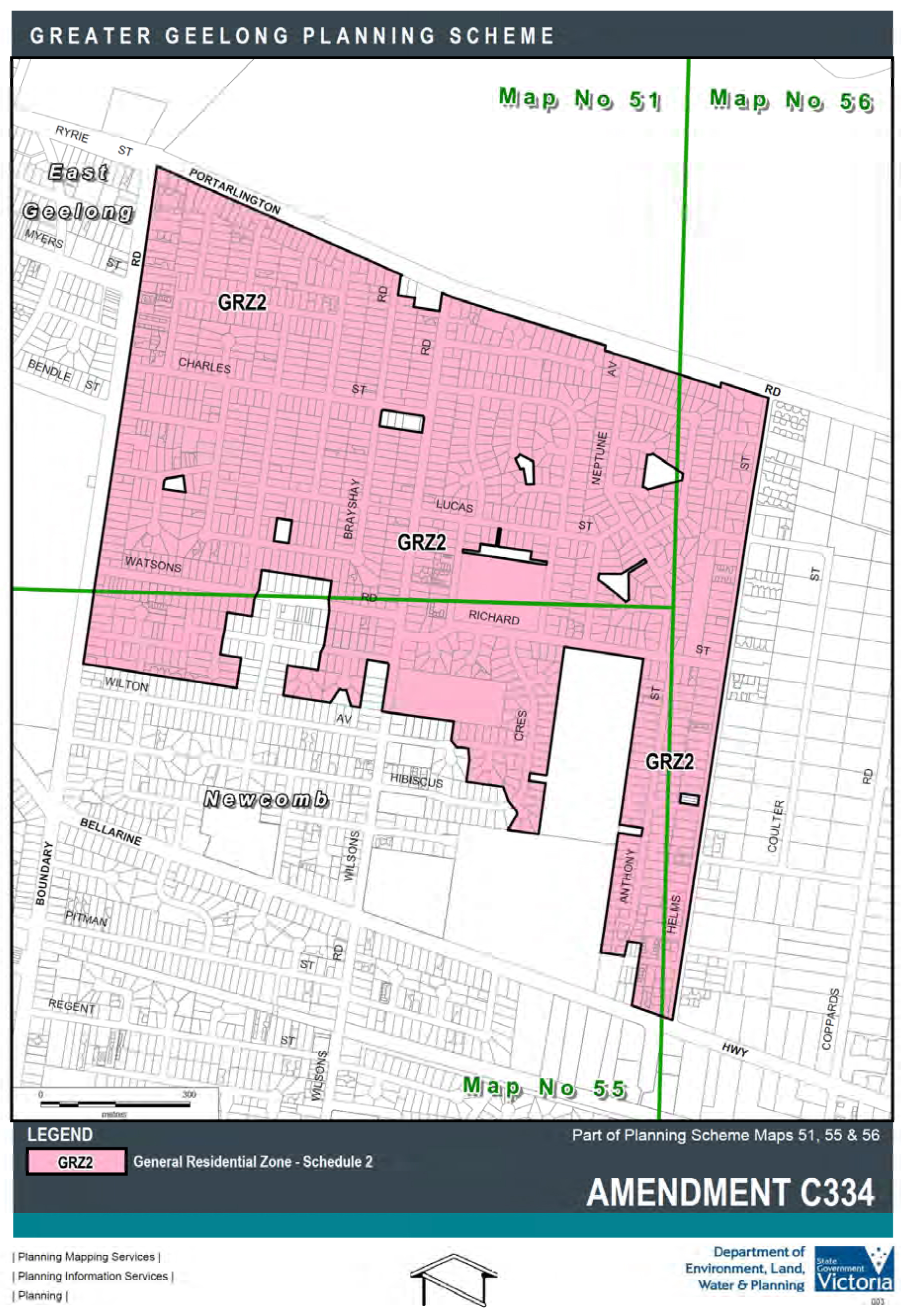
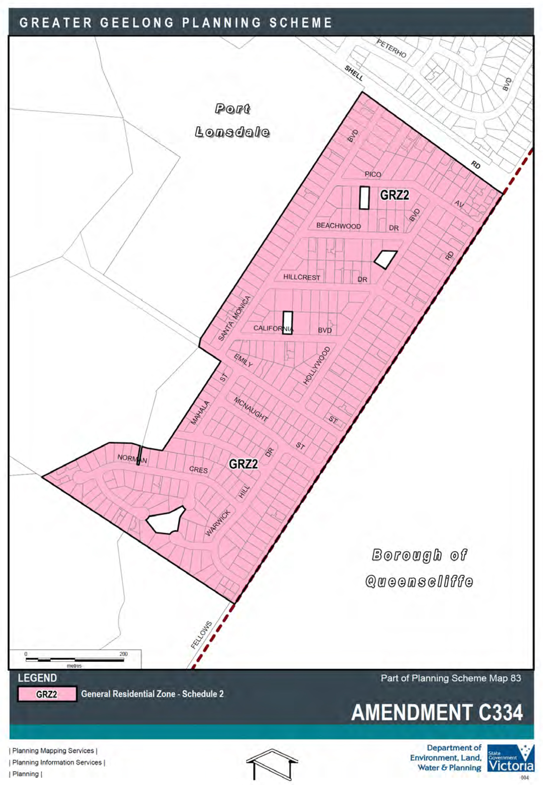
Rezoning land within identified garden character areas in Bell Post Hill, North Geelong, Newcomb and Point Lonsdale from General Residential Zone – Schedule 1 (GRZ 1) to General Residential Zone – Schedule 2 (GRZ 2).
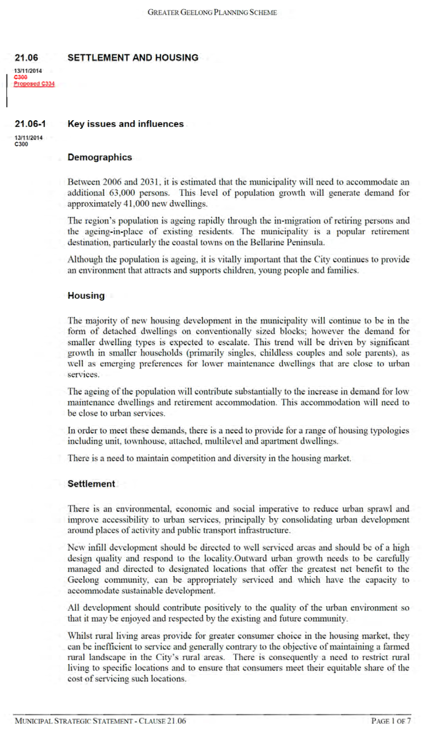
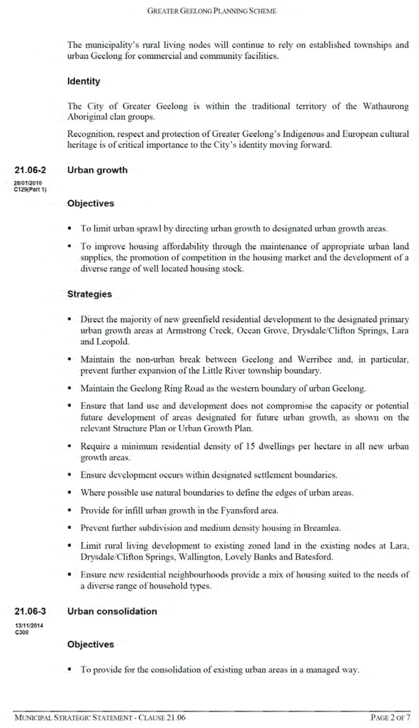
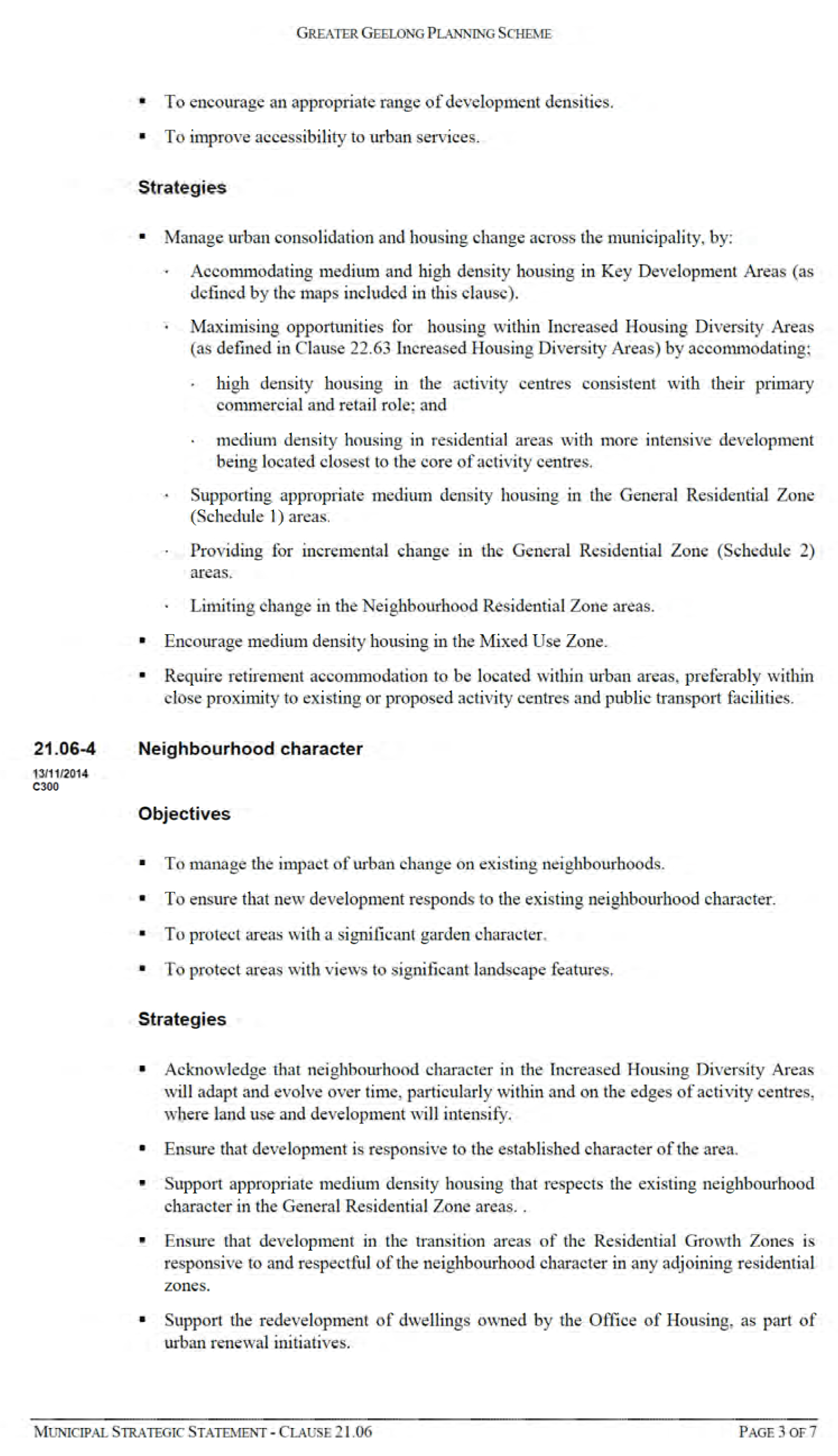
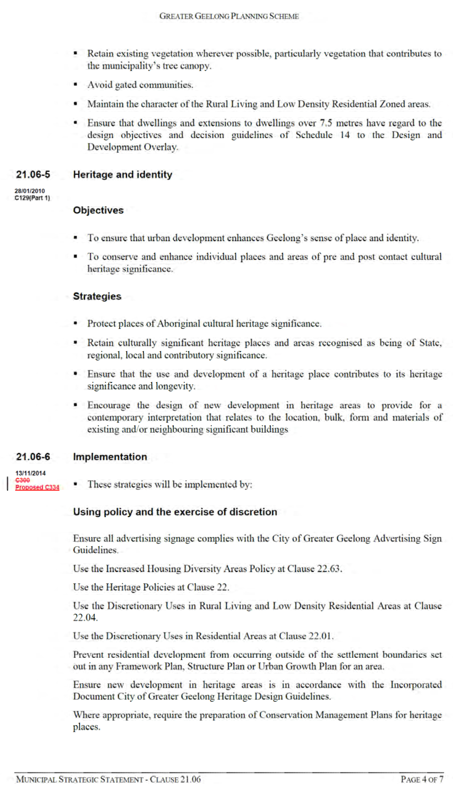
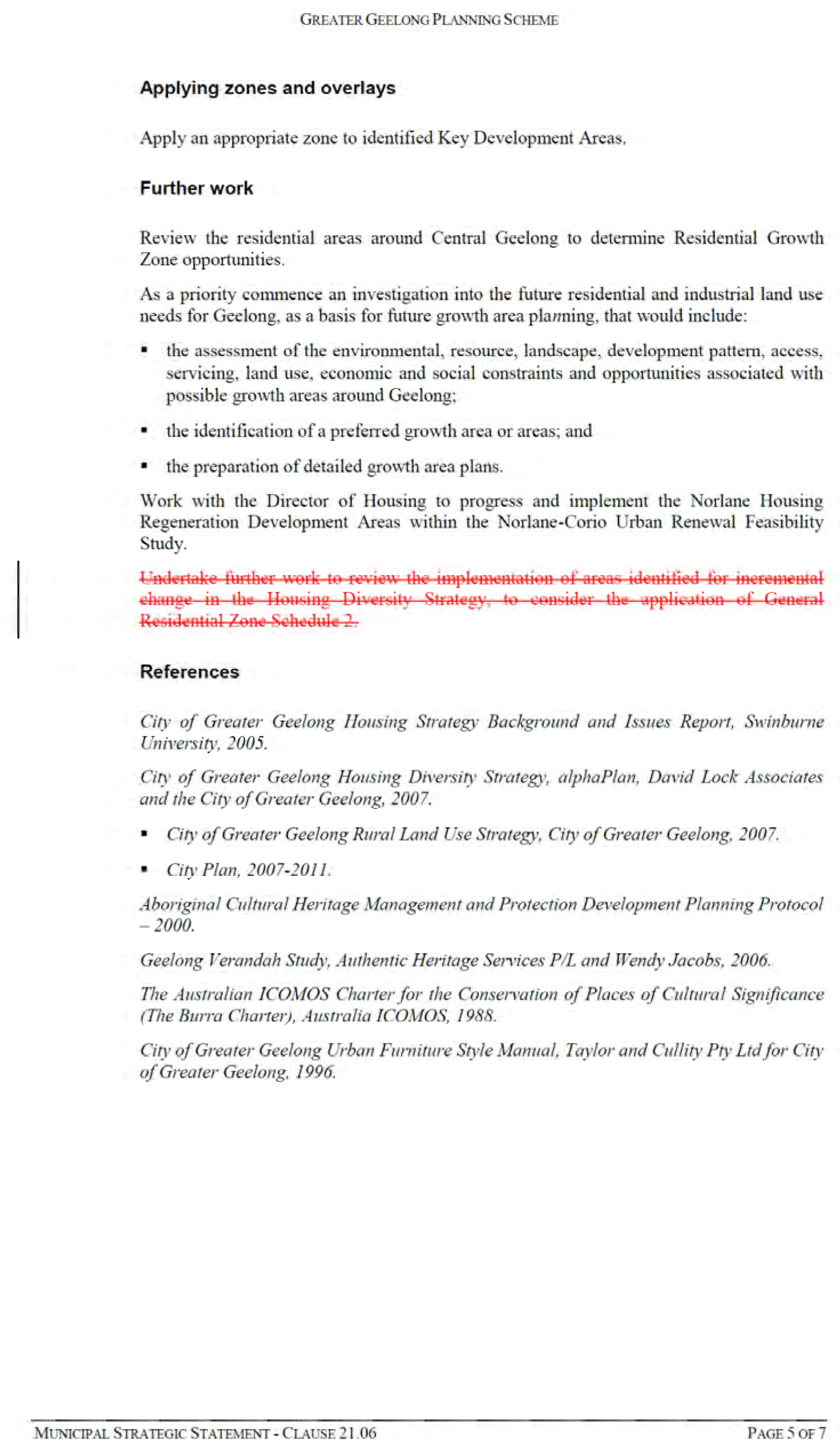
Amending Clause 21.06 by removing the further work requirement to review the implementation of areas identified for incremental change in the Housing Diversity Strategy to consider the application of GRZ 2.
Council considered the Incremental Change Areas Review and adopted the Review’s recommendations at its meeting of 28 April 2015.
GRZ 2 aims to better protect the existing neighbourhood character by varying requirements relating to private open space, building height, landscaping and subdivision application requirements.
Amendment C334 was placed on public exhibition between 2 July and 3 August 2015. A total of 27 submissions were received. 11 submissions supported the Amendment, 10 objected to the Amendment and 6 only made comment on the Amendment.
The majority of the objecting submissions relate to decreased development potential and property values and/or to the justification for the Amendment.
On 27 August 2015, Council considered the submissions under delegation and resolved to refer the submissions to an Independent Panel appointed by the Minister for Planning. Council officers considered the submissions and did not recommend any modifications to the exhibited Amendment.
The Panel Hearing was held on 26 October 2015. None of the submitters requested to be heard by the Panel.
The Panel Report was received on 24 November 2015. The Panel recommended that Amendment C334 be adopted as exhibited.
The Panel concluded that the Amendment is well founded and that the extensive strategic work undertaken by Council in identifying the subject areas justified the preparation of this Amendment.
The Panel suggested that the term “suburban garden character” probably better defines the character of the four identified areas.
The Panel concluded that the areas which are subject of the Amendment have a “suburban garden character” worth protecting. It therefore supported the requirements of the GRZ 2 that will encourage new development that reflects this character.
The Panel indicated that it was not provided with evidence to support concerns that the Amendment would lead to reduced property values, and that it believes moderate growth will still be possible in providing a range of dwelling types.
The Panel considered that the boundaries proposed by the Amendment are appropriate and should be adopted as exhibited.
The Panel’s recommendation is supported and the Amendment can now be adopted as outlined in this report.
Cr Heagney moved, Cr Harwood seconded -
That Council :
adopt Amendment C334 in the form outlined in Appendix 2 of this report; and
submit the adopted Amendment with the prescribed information to the Minister for Planning requesting approval.
Carried.
In 2007 Council adopted a Housing Diversity Strategy (HDS). The HDS identified three development fronts to deliver housing diversity across Geelong: Key Development Areas, Increased Housing Diversity Areas and Incremental Change Areas. Amendment C129, gazetted in January 2010, implemented the Housing Diversity Strategy, applying the former Residential 3 Zone to incremental change areas that had a garden character.
Amendment C300, gazetted in November 2014, applied the new suite of residential zones introduced by the previous State Government. Incremental Change Areas were zoned either GRZ 1 or GRZ 2, generally following the zoning that was introduced by Amendment C129. In considering submissions on Amendment C300, Council supported including a further work requirement in Clause 21.06-6 of the Planning Scheme to undertake further work to review the implementation of areas identified for incremental change in the Housing Diversity Strategy, to consider the application of General Residential Zone Schedule 2.
Council officers prepared the Incremental Change Areas Review 2015, undertaking a review of existing GRZ 1 areas to determine if any areas had a garden character. There were two stages in the review process, a desktop assessment using available data, followed by a more detailed assessment involving site visits and qualitative assessment. The review identified four garden character areas and recommended their rezoning from GRZ 1 to GRZ 2. Council adopted this recommendation at its meeting of 28 April 2015.
Amendment C334 seeks to implement the Incremental Change Area Review 2015 by making the following changes to the Greater Geelong Planning Scheme:
rezoning land within the identified garden character areas in Bell Post Hill, North Geelong, Newcomb and Point Lonsdale from GRZ 1 to GRZ 2; and
amending Clause 21.06 by removing the further work requirement to review the implementation of areas identified for incremental change in the Housing Diversity Strategy to consider the application of GRZ 2.
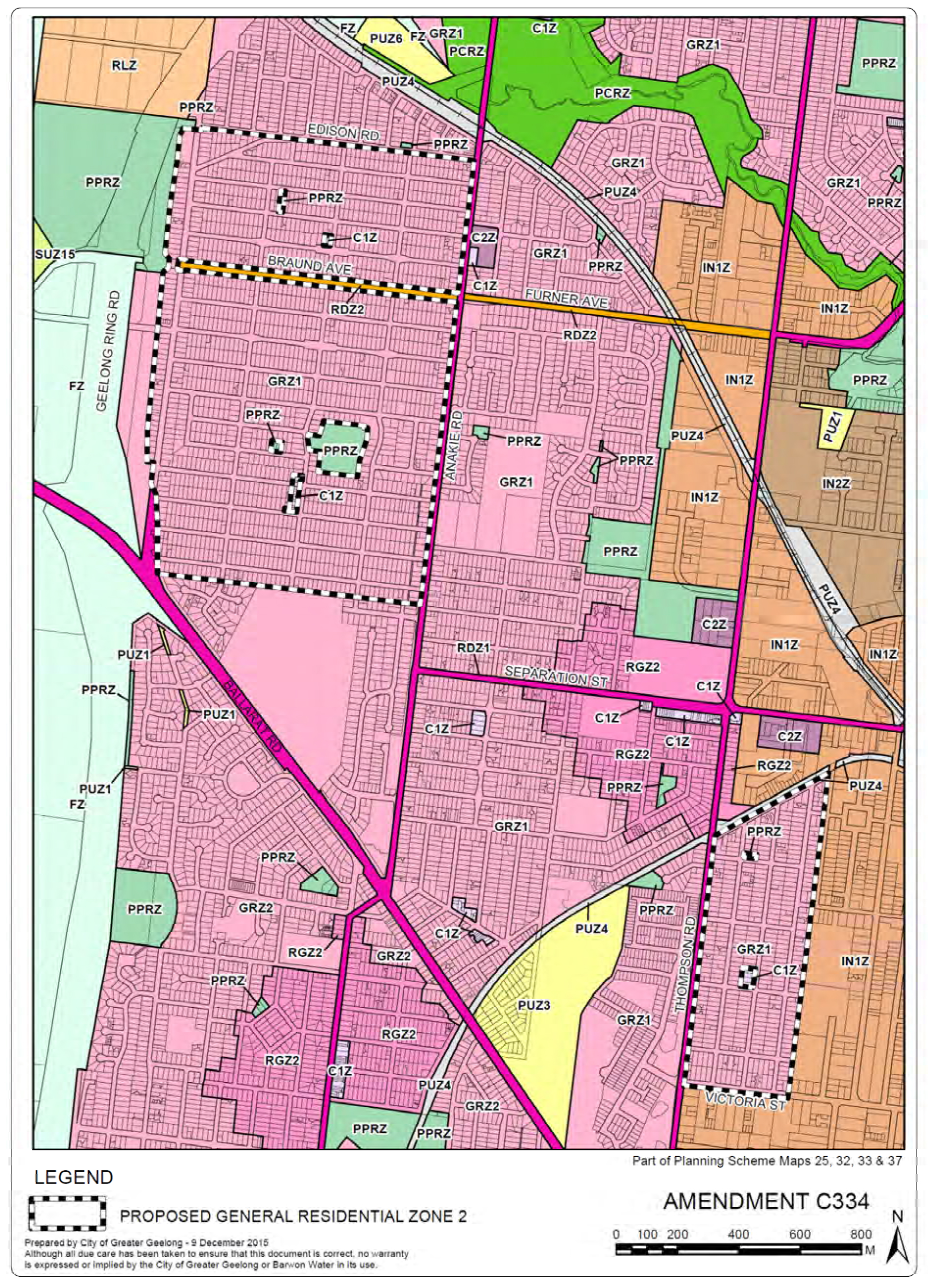
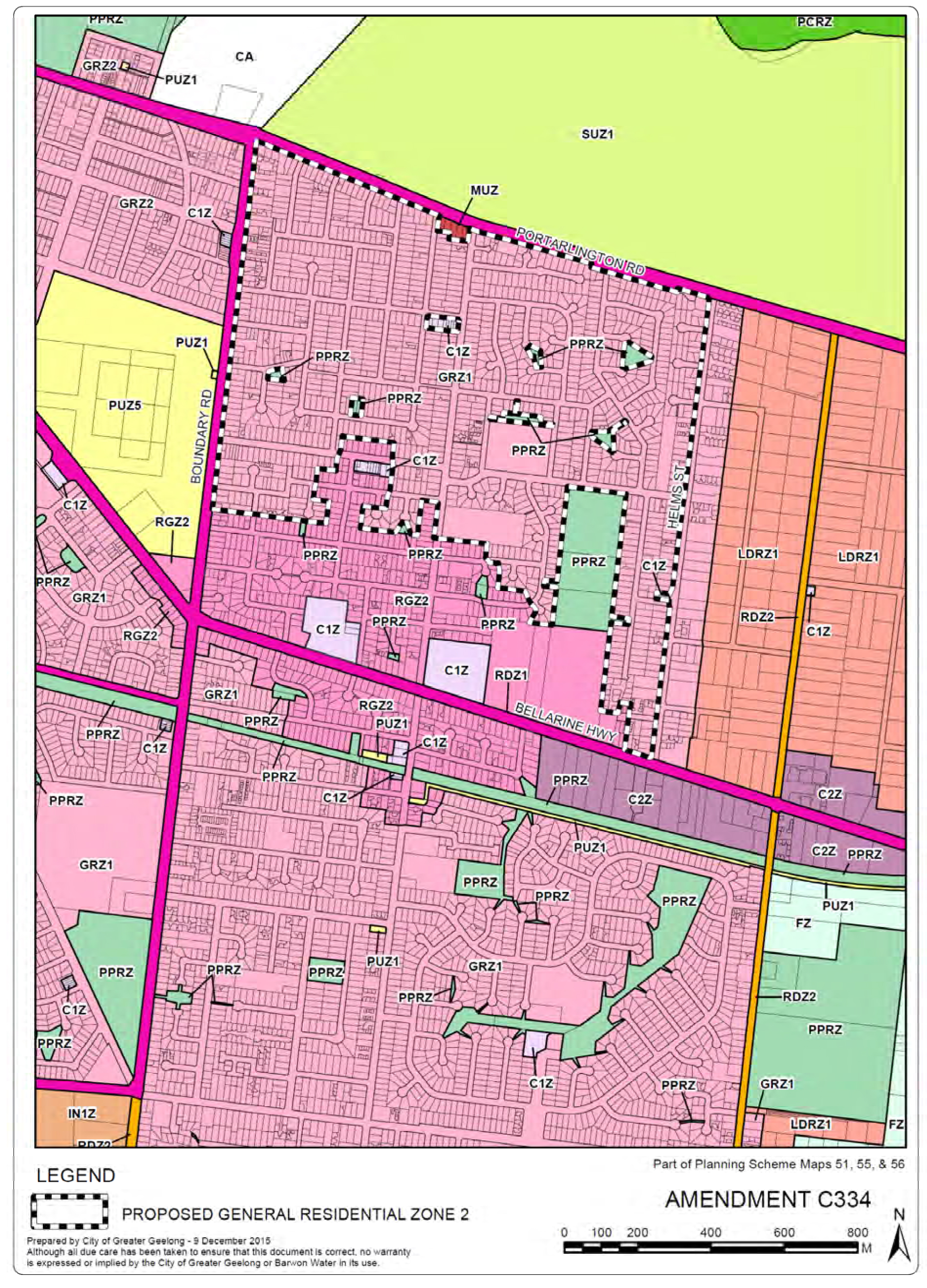
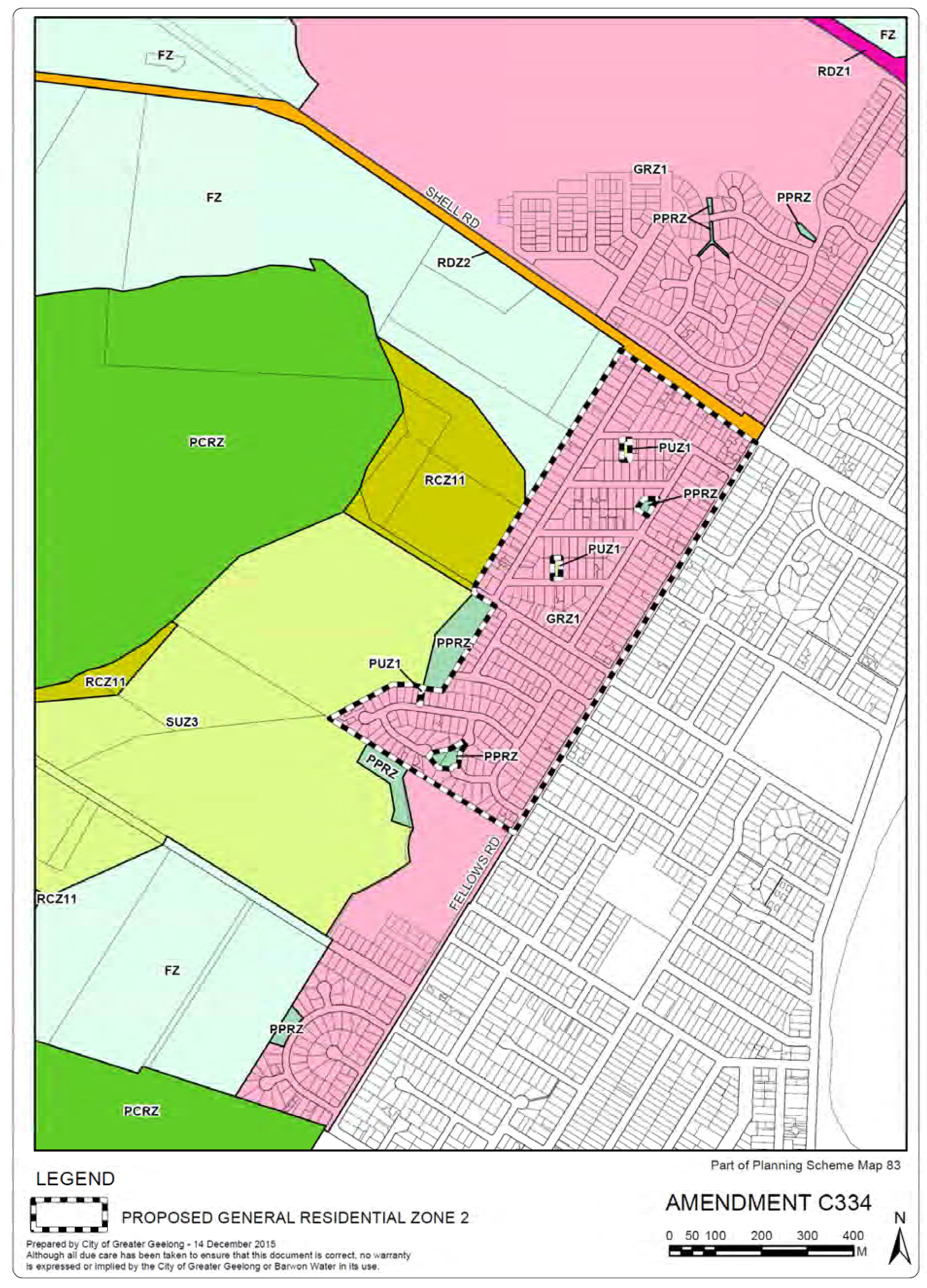
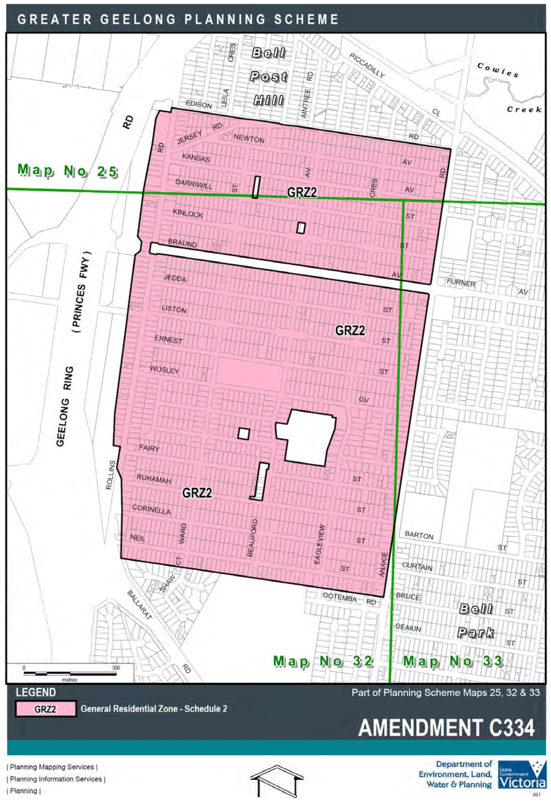
Appendix 1 shows the areas being rezoned.
Exhibition details
The Amendment was exhibited from 2 July 2015 to 3 August 2015.
Notice of the Amendment was mailed to all landowners affected by the Amendment. 3727 letters were mailed out; duplicate letters were not sent where a landowner owned multiple properties in the same identified garden character area.
The Amendment was exhibited in local newspapers and on Council’s website. The Amendment received over 1200 views on the website. Council staff answered over 150 telephone queries and around 30 front counter queries on the Amendment. A public information session held at the Council’s Brougham Street office on the evening of 15 July 2015 was attended by 15 people.
The table below indicates how many letters were mailed out and how many submissions were received from each identified garden character area. For submissions received, this is based on the location of the property owned by the submitter; in some instances the submitter resides elsewhere.
Property |
Mailout |
Support |
Comment |
Object |
Total |
Bell Post Hill |
1575 |
6 |
2 |
3 |
11 |
North Geelong |
440 |
1 |
0 |
3 |
4 |
Newcomb |
1303 |
1 |
1 |
4 |
6 |
Point Lonsdale |
409 |
2 |
1 |
0 |
3 |
Other |
- |
1 |
2 |
0 |
3 |
TOTAL |
3727 |
11 |
6 |
10 |
27 |
A total of 27 submissions were received, comprising 11 submissions of support, 10 objections and 6 submissions making comment only. The number of objections represents 0.27% of the letters mailed out.
Issues raised in the objections included:
Amendment decreases development potential and/or property values (7 submissions)
Amendment is unwarranted (4)
Amendment will prevent necessary and/or desirable redevelopment (3)
Oppose the landscaping requirement for a canopy tree per dwelling (2)
Council should concentrate on planting trees in nature strips (2)
Area(s) do not have garden character (2)
Land on Helms Street, Newcomb is near many townhouse/multiple dwelling developments, particularly on the eastern side of Helms Street (2).
Independent Panel
On 27 August 2015, Council considered the submissions under delegated authority and resolved to refer the submissions to an Independent Panel appointed by the Minister for Planning. Council officers considered the submissions and did not recommend any modifications to the exhibited Amendment.
The Panel Hearing was held at Council’s Offices on 26 October 2015. None of the submitters requested to be heard by the Panel. A one person Panel, Gaye McKenzie, conducted the Hearing. The Panel submitted its report to Council on 24 November 2015.
Panel Report
The Panel recommended that Amendment C334 be adopted as exhibited.
The Panel Report conveys the following findings and conclusions:
The Amendment is supported by, and implements the relevant sections of the State and Local Planning Policy Frameworks. The Amendment is well founded and is strategically justified.
The extensive strategic work undertaken by Council in identifying the subject areas justifies the preparation of this Amendment.
The Panel suggested that the term “suburban garden character” probably better defines the character of the identified areas.
The areas which are subject of the Amendment have a “suburban garden character” worth protecting. It therefore supports the requirements of the GRZ 2 that will encourage new development that reflects this character. In supporting the application of GRZ 2, and noting the discretionary nature of the open space controls, the Panel believes that there may be instances when consideration may be given to reducing them, based on the merits of an individual proposal.
The issue of how GRZ 2 may affect the value of individual sites is not on the Panel is able to consider. From the broader community perspective, the Amendment may have a positive economic effect, because new single dwellings and multi-dwellings will contribute to the “suburban garden character” of the street and the area they are within.
The Amendment may contribute to greater diversity of dwelling types, including smaller one storey dwellings and double storey dwellings. The Panel was not provided with evidence to support concerns that the Amendment would lead to reduced property values, and believes moderate growth will still be possible in providing a range of dwelling types.
The boundaries proposed by the Amendment are appropriate and should be adopted as exhibited. Specifically, the Panel agrees that Thompson Road is the logical boundary for the North Geelong GRZ 2 area and supports the choice of Helms Street as the eastern boundary of the Newcomb GRZ 2 area.
With respect to a submission indicating Bell Park should be included in GRZ 2, the Panel noted that the area was investigated but rejected for inclusion in GRZ 2, and in any case cannot consider this matter as it is not part of the Amendment.
Officer response
The conclusions and recommendation of the Panel are supported.
The term “garden character” is not defined in the Greater Geelong Planning Scheme. The reference by the Panel to “suburban garden character” rather than “garden character” may better explain the characteristics that the Review sought to identify and GRZ 2 zoning seeks to protect not only the presence of gardens, but a spacious form of development based on site coverage and the setting or space around most dwellings providing opportunity for gardens, as well as the presence of nature strips, footpaths and street trees throughout the majority of an area. In any case, there is no reference to “garden character” in Schedule 2 to the General Residential Zone and hence no need for any further amendment to the Greater Geelong Planning Scheme to introduce the term “suburban garden character”.
The Amendment will have positive environmental impacts. Increased private open space requirements for two or more dwellings on a lot may marginally reduce stormwater runoff compared to development under GRZ 1. In addition, GRZ 2 requires planting of one canopy tree per new dwelling for applications for two or more dwellings on a lot.
There are no budget implications arising from this Amendment.
The amendment is consistent with State Planning Policy in:
Clause 11.02-1 (Settlement – Supply of urban land), which indicates that planning for urban growth should consider neighbourhood character and landscape considerations.
Clause 16.01-4 (Housing diversity), which seeks to provide for a range of housing types to meet increasingly diverse needs and encourages well-designed medium density housing which respects the neighbourhood character.
The amendment is consistent with the Local Planning Policy Framework in:
Clause 21.06-3 (Urban consolidation), which seeks to provide for incremental change in GRZ2 areas.
Clause 21.06-4 (Neighbourhood character), which seeks to manage the impact of urban change on existing neighbourhoods and to protect areas with a significant garden character.
Clause 21.06-6 (Implementation – Further work), which identifies the need to review the implementation of areas identified for incremental change in the HDS, to consider the application of GRZ 2.
The Amendment is consistent with City Plan’s Sustainable Built and Natural Environment priority to enhance and protect natural areas and ecosystem health, in that it increased private open space requirements for two or more dwellings on a lot may marginally reduce stormwater runoff compared to development under GRZ 1.
No Council Officers involved in the preparation of this report have any direct or indirect interest in the matter to which this report relates, in accordance with Section 80 (c) of the Local Government Act.
There are no notable risks associated with implementing the recommendation contained in this report.
The Amendment will have minimal social impacts. Maintaining the suburban garden character of these areas may contribute to residents’ satisfaction with their environment.
The Amendment will not impact on any basic rights, freedoms and responsibilities as set out in the Charter. Planning legislation ensures an open community consultation process occurs, enabling people to freely express their views and if necessary obtain a fair hearing before an Independent Panel. Submitters had that opportunity in this case.
The Independent Panel report has been publicly released with a copy provided to submitters.
The planning authority for this amendment is Greater Geelong Planning Scheme
The Greater Geelong Planning Scheme is amended as follows:
Planning Scheme Maps
The Planning Scheme Maps are amended by a total of 4 attached maps.
Zoning Maps
Planning Scheme Map Nos. 25, 32, 33, 37, 51, 55, 56 and 83 are amended in the manner shown on the attached maps marked “Greater Geelong Planning Scheme, Amendment C334”.
Planning Scheme Ordinance
The Planning Scheme Ordinance is amended as follows:
In Local Planning Policy Framework – replace Clause 21.06 with a new Clause 21.06 in the form of the attached document.
End of document
Portfolio: |
Central Geelong - Cr Heagney |
Source: |
Investment and Attraction / Events, Central Geelong & Waterfront |
Acting General Manager: |
Paul Jane |
Index Reference: |
Special Rates and Charges – Central Geelong & Waterfront |
This report seeks a resolution by Council to declare a Special Rate Scheme for Central Geelong Marketing effective from 1 July 2016.
The purpose is to commence the implementation of a new five (5) year term of the Central Geelong Marketing Special Rate to enable the continuation of the current marketing program for business promotion.
A fourth round of the Special Rate Scheme is proposed along with a Committee constituted under Section 86 of the Local Government Act. The Central Geelong Marketing Committee (CGMC), made up of 13 business and stakeholder representatives, fully supports the new programs to be delivered in addition to the core program and recommends the continuation of the Special Rate Scheme in Central Geelong.
Funds are applied to marketing and promotional activities, business development, training, evaluation, administration and miscellaneous activities delivering significant benefits to Central Geelong commercial property owners and businesses.
Between 2011 and 2015, the CGMC program delivered 2046 activities to over 328,000 people.
When analysed with REMPLAN (the agreed economic modelling tool of G21 and COGG), flagship activities between 2011-2015 delivered $53.45M of Total Economic Output (TEO) within the Geelong region, an average of $13.36M per annum. The projected TEO for 2011-2016 is $65M and demonstrates a $1:$19 return on investment.
The rate will lapse if not re-initiated by Council and all the programs, benefits and activities will cease.
The proposed Special Rate would raise $1,045,122 in 2016/2017 for delivery of base program with the four new activities to encourage increased spend from outside the Greater Geelong region. These amounts would be increased by the Consumer Price Index (CPI) each year over the life of the Special Rate.
The new program will deliver the four new activities from Year 1 continuing throughout the lifespan of the Special Rate. These include:
Professional Service Campaign (Metropolitan Melbourne West);
TV campaign (Metropolitan Melbourne West);
Signage - Banners, Bus, Train, Tram advertising (Metropolitan Melbourne); and
Central Geelong Workers Engagement Program.
These activities will promote and market Central Geelong to Metropolitan Melbourne and regional Victoria with a particular focus on encouraging increased visitation from the Melbourne Metropolitan West area residents resulting in increased business activity and benefit in Central Geelong.
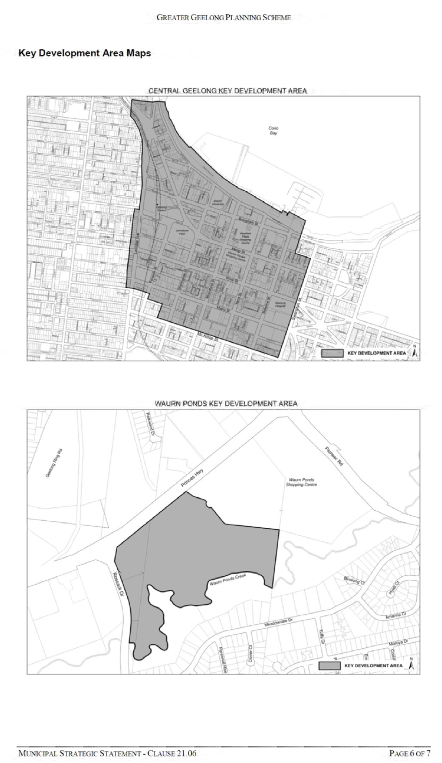
The area to be rated is bound by McKillop Street, Bellerine Street, the Waterfront, Cavendish Street and Fenwick Street. This is unchanged from the previous Special Rate Schemes.
There are 1492 properties in the area proposed to be rated and the rate proposed for year one (1) (2016/2017) of the five (5) year scheme is 0.0008211 cents of the Capital Improved Value (CIV). Non rateable properties and properties used exclusively for residential purposes have been excluded from the rate.
This report seeks a resolution by Council to declare a Special Rate for the establishment and administration of CGMC and its associated activities.
Cr Heagney moved, Cr Harwood seconded -
That the report be deferred.
Carried.
Portfolio: |
Central Geelong - Cr Heagney |
Source: |
Investment & Attraction / Events, Central Geelong & Waterfront |
Acting General Manager: |
Paul Jane |
Index Reference: |
Central Geelong Marketing / Christmas in Central Geelong |
To update Council on the outcome of the 2015 Christmas in Geelong Program, and seek direction on the 2016 installation of the Iconic Floating Christmas Tree.
The 2015 Christmas in Geelong program generated 213,500 visits with a Total Economic Output of $15.6 M.
The key attraction was the Iconic Floating Christmas Tree with 123,000 visits. Central Geelong Marketing organised and sponsored activities that attracted 44,900 visits. The City Hall Projections attracted 31,000 visits.
Council sponsored Christmas events for 2015 included Denis Walter Carols by the Bay, Gala Parade and Geelong Carols by Candlelight. These events attracted an additional 30,000 visitors to Central Geelong and the Waterfront during the Christmas period.
The Geelong Advertiser reported on 6 January 2016 that Central Geelong traders had reported having a ‘bumper’ Christmas trading period. The 749 surveys and pedestrian counting data undertaken as part of delivering the range of Christmas activities, indicate that the range of Council and Central Geelong Marketing activities, events and marketing have played a significant part in this success.
Social Media accounted for 63% as a source of information about activities such as the Christmas in Geelong program. Others were radio, family and friends, newspapers and signage,
37% of responses said that the Christmas in Geelong program activities were good for creating a sense of community and good for families. 41% of responses said that the activities were good for Geelong’s economy and City promotion opportunities.
With Council’s current commitment to the ongoing installation of the Iconic Floating Christmas Tree ending in 2015 consideration now needs to be given to its installation for future years.
Council needs to commit to the Iconic Floating Christmas Tree early in 2016 to allow marketing specialists to work with potential sponsors to identify and enter into potential sponsorship arrangements for the Iconic Floating Christmas Tree.
The annual cost of installation for the Iconic Floating Christmas Tree is likely to rise to $500,000 from 2016.
Cr Heagney moved, Cr Farrell seconded -
That the report be deferred.
Carried.
Portfolio: |
Women in Community Life – Cr Farrell |
Source: |
Community Life – Community Development |
General Manager: |
Linda Quinn |
Index Reference: |
Women in Community Life |
The purpose of this report is to seek Council endorsement to appoint the members of the Women in Community Life Advisory Committee (WICLAC / the Committee) for the next two years (January 2016 – December 2017).
Established in November 2013, the role of WICLAC is to provide advice to Council on matters relating to women in community life. The mission statement of the Committee is to achieve equality, inclusion and respect for women in Greater Geelong.
The three key themes that frame the work and direction of WICLAC are advocacy; raising awareness, education and training.
The Committee is comprised of ten to twelve general members, plus two City of Greater Geelong Councillors and Council officers (nonvoting). The Committee is chaired by the Women in Community Life portfolio holder.
Committee members are appointed for a two year term with the capacity to nominate for a further two year term.
The current members have just completed the initial two year term. Participation of the Committee has been active with members engaging in monthly meetings and working together to develop and implement events and activities.
Seven members have nominated to remain for a second term, two members who filled casual vacancies from June 2015 also nominated to remain. The remaining three vacancies were put forward for public expressions of interest.
Positions were publically advertised over a two week period in November 2015. A sub-committee of WICLAC assessed the applications against the Committee’s key directions and vision.
Cr Farrell moved, Cr Heagney seconded -
That Council:
appoints the following people as members of the Women in Community Life Advisory Committee (WICLAC) for a two year term to December 2017:
• Sarah Batson |
new |
• Rosan Chakir |
casual vacancy first term |
• Christine Couzens |
second term |
• Robyn Davis |
casual vacancy first term |
• Kate Georges |
new |
• Maeve Kennedy |
new |
• Davina Montgomery |
second term |
• Dianne Pont |
second term |
• Hannah Teesdale |
second term |
• Jennifer Wills |
second term |
• Justine Devonport |
second term |
• Prof. Shurlee Swain |
second term |
endorses the current Council Portfolio holder as continuing chairperson for the Women In Community Life Advisory Committee;
nominates Cr Kylie Fisher to the Women In Community Life Advisory Committee.
Cr E Kontelj left the meeting room at 8:16pm
Cr E Kontelj re-entered the meeting room at 8:18pm
Carried.
n July 2013, Council established the Women in Community Life Advisory Committee (WICLAC / the Committee), with the first meeting being held in November 2013.
The role of the Committee is to provide advice to Council on matters relating to women in community life. The mission statement of the Committee is to achieve equality, inclusion and respect for women in Greater Geelong.
The three key themes that frame the work and direction of WICLAC are advocacy; raising awareness, and education and training.
Committee membership term is for two years with the opportunity to nominate for a further two years.
The current members have just completed a two year term. Participation of the Committee has been active with members engaging in monthly meetings and working together to develop and implement events and activities.
Seven members have nominated to remain for a second term, two members who filled casual vacancies from June 2015 also nominated to remain. The remaining three vacancies were put forward for public expressions of interest. Positions were advertised in City News, Women in Community Life Facebook page and local professional and members’ networks. Applications were open from Friday 5 November 2015 and accepted until close of business Friday 20 November 2015.
A sub-committee of WICLAC assessed the applications against the Committee’s key directions. The resulting recommendations are now put forward for appointment to the Committee.
All Committee members are encouraged to actively participate in monthly meetings, sub-committee meetings and subsequent activities and events. Committee members are expected to provide feedback, share, and promote the actions and deliberations of the Committee within organisations, networks, and/or the wider community. The active membership participation of the last two years has resulted in successful events and activities, which have contributed to achieving equality, inclusion and respect for women in Greater Geelong.
The proposed Committee membership for the next term has representation from across the municipality and includes a diversity of ages and personal and professional experience.
Proposed WICLAC membership January 2016 – December (2017):
• Sarah Batson |
new |
• Rosan Chakir |
casual vacancy first term |
• Christine Couzens |
second term |
• Robyn Davis |
casual vacancy first term |
• Kate Georges |
new |
• Maeve Kennedy |
new |
• Davina Montgomery |
second term |
• Dianne Pont |
second term |
• Hannah Teesdale |
second term |
• Jennifer Wills |
second term |
• Justine Devonport |
second term |
• Prof. Shurlee Swain |
second term |
The Terms of Reference identifies that Council will nominate two representatives to the Committee. One Council representative will be the Women in Community Life portfolio holder who will chair the Committee. The second Council representative will be nominated by Council. The Terms of Reference also identify that other Councillors of CoGG are welcome to participate as non-voting members.
The mission statement of the Committee, to achieve equality, inclusion and respect for women in Greater Geelong, is supported by the Victorian Local Government Women’s Charter.
Not applicable.
There are no changes to the current budget. A budget of $20,000 to support activities to achieve the WICLAC mission has been proposed for consideration in the 2016–2017 budget.
The Committee is in line Council’s position as a signatory to the Victorian Local Government Women’s Charter. There are no statutory implications.
WICLAC aligns with the ‘Community Wellbeing’ and ‘How we do Business’ objectives of City Plan. The Committee is under the Councillor Women in Community Life portfolio.
No Council officer involved in the preparation of this report has a direct or indirect interest in the matter to which the report relates.
Not applicable.
The strategic direction and activities of WICLAC enhance the health and wellbeing of local communities, in particular, matters relating to women and their participation, representation and leadership in community and civic life.
WICLAC clearly aligns with and is supported by the Human Rights Charter (HRC). Principles of freedom, respect, equality and dignity are promoted by the HRC, and these are incorporated in the Victorian Local Government Women’s Charter, which is a guiding document to the Committee.
The Community Life Division, Community Development Department is responsible for communication relating to this report.
Portfolio: |
Sport and Recreation – Cr Irvine |
Source: |
Community Life |
General Manager: |
Linda Quinn |
Index Reference: |
C15848 - Splashdown Aquatic Play Upgrade |
To seek direction from Council in relation to Project C15848 – Splashdown Aquatic Play Upgrades.
As part of the 2015/16 budget Council allocated $350,000 towards the upgrade and installation of an interactive water play structure and other features to the current toddlers pool area at Splashdown.
The scope of the project changed following the development of the Tender specification and alteration to the filtration design due to water capacity demands. The final technical specification includes an additional “stand alone” new plant, balance tank and association filtration infrastructure.
The change to scope has resulted in an additional cost of $346,000.
Planning for the project is well underway and was intended to commence in April 2016, however with a significant budget shortfall the project has been delayed until additional funding has been secured.
The Mayor vacated the Chair at 8:24pm
Cr Harwood assumed the Chair at 8:24pm
Cr Irvine moved, Cr Heagney seconded -
That Council place Project C15848 on hold pending a submission for additional funding as part of the 2016/17 budget process.
Carried.
As part of the 2015/16 budget Council allocated $350,000 towards Project C15848 Splashdown Aquatic Play Upgrades. The technical specification for the aquatic play design was completed in October 2015. During the development of the specification the original scope and filtration design had to change due to the water capacity demands and inability to connect the new system to the existing plant room.
The original budget allocation was based on installing a structure to the existing toddler pool filtration system. The structure cost estimate was $220,000 from White Water West and an allowance of $130,000 for plumbing and plant room connection.
The final technical specification included an additional “stand alone” new plant, heating, balance tank and association filtration infrastructure.
The Contract was advertised and Tenders closed on Wednesday 2 December 2015. There was interest from five (5) companies during the compulsory site tour prior to the Tender closing. Only one (1) Tender was received at a cost of $696,000.
A decision was made at the Tender Evaluation to put the project on hold subject to seeking further funding in the 2016/17 budget process.
The original project budget of $350,000 was based on previous advice received from design consultants. The water play upgrades were intended to integrate and operate within the existing plant filtration system. Based on the final technical specification and associated design changes the project now requires a total budget of $696,000. A Budget Concept for 2016/17 has been submitted seeking the additional $346,000 for this project to proceed.
The Splashdown Aquatic Play upgrades have been in the planning phase for two (2) years as the first stage of the Splashdown Master Plan. With the growing trend of adding water play structures, splash pads and aquatic activities within Leisure Centre’s across Australia over the past five (5) years, this project was aimed at enhancing the aging pool hall facilities at Splashdown. The facility is now 30 years old and had minimal changes over that period.
The aim with adding aquatic play attractions is to enhance the existing facility functionality, improve the appeal to families, and Learn to Swim clients and bring the facility in line with our other indoor facilities which now have water play structures or splash pads. The community expectations for the service provision of water play has changed significantly over the last 10 years and this project would enable Splashdown to remain competitive in the casual aquatic and Learn to Swim markets.
The addition of aquatic play will increase water costs with the addition of second balance tank to supply the new equipment and features. Backwash waste water is diverted to the Grinter Reserve storm water dam. The heating and circulation can be provided through the highly efficient cogeneration plant located on site.
If Council wish to proceed with the full project scope in accordance with the budget description, an additional $346,000 budget will be required for 2016/17.
There will be a minor increase to water costs in the operating budget which needs further analysis based on the final design installed.
External capital funding will be investigated in 2016 through the Sport and Recreation Victoria Better Pools funding program.
There is no policy, legal or statutory implication associated with acceptance of this report.
This project supports the strategic direction of Community Wellbeing. The primary goal is to drive more participation and physical activity.
No Council Officers involved in this project or report have declared a direct or indirect interest in this matter.
A detailed project risk profile has been developed and is being maintained by the Project Manager.
Sport, Recreation and Leisure opportunities play a key role in the health of our community. This project provides children and families with greater opportunities to increase regular physical activity and participation. Splashdown is an important destination for residents within many of our disadvantaged suburbs. It plays a key role to promote social inclusion, improve mental health, water safety and community connections.
It is not evident or likely that this project would negatively impact any of the rights contained within the Charter of Human Rights. The new attraction would improve opportunities for local residents to have access to healthy lifestyle activities.
There has been no media or announcements regarding the start date of the project so there will not be issues with further delays as funding is sourced.
A comprehensive engagement and communication plan is part of the project delivery once funding is confirmed.
Portfolio: |
Sport and Recreation - Cr Irvine |
Source: |
Community Life - Sport and Recreation |
General Manager: |
Linda Quinn |
Index Reference: |
Subject: Sport and Recreation Grants and Funding |
To purpose of this report is to seek Council endorsement to develop an application for the Victorian Government’s Country Football and Netball Program (CFNP) towards the upgrade of Anakie Reserve.
Sport and Recreation Victoria’s (SRV) funding programs provide a significant opportunity for Council to secure funding for sport and recreation projects within the municipality.
This report outlines the projects shortlisted by Council officers and provides detail of the project recommended for submission to the CFNP.
Applications opened on 22 September 2015 and are due to SRV by 11 February 2016.
Council is eligible to submit up to three (3) projects up to a maximum total grant of $100,000. Only Councils can apply for funding under the CFNP.
The selected project has $630,000 identified within Council’s Strategic Resource Plan
The selected project is also the preferred project of AFL Barwon
The selected project is considered to have the best opportunity for success given its alignment to the funding criteria set by Sport & Recreation Victoria
The selected project has the highest overall rating as the poorest facility currently not funded for any improvements within the G21 AFL Barwon Regional Strategy
Cr Irvine moved, Cr Ansett seconded -
That Council:
endorse the development of a submission to Sport and Recreation Victoria’s Country Football and Netball Program (Application Guidelines attached as Appendix 1) for the Anakie Football and Netball Club - Change Facility Upgrade;
pending the outcome of the application, refer the projected Council contribution to the 2016-17 Budget for consideration.
Cr Macdonald left the meeting room at 8:30pm
Cr Macdonald re-entered the meeting room at 8:33pm
Carried.
The Mayor re-entered the meeting room at 8.37 and resumed the Chair.
Each year, the Victorian Government allocates funding for sport and recreation projects through a number of SRV grant programs.
Generally, these funding programs encourage:
Better planning of sport and recreation facilities;
Innovative sport and recreation facilities;
Accessible, inclusive, high-quality and suitable sport and recreation facilities;
Increasing communities’ access to leisure opportunities;
Addressing gaps in local facility provision; and
Strengthening communities through sport and recreation participation.
The Country Football and Netball Program is a response to the Parliamentary Rural and Regional Services and Development Committee’s Inquiry into Country Football Report, tabled in State Parliament in December 2004.
Improving football and netball facilities in rural, regional and outer metropolitan areas will support the regional and rural way of life and ensure the sustainability of country football and netball into the future.
The G21 and AFL Barwon Regional Strategy 2015 (the Strategy) recognised the CFNP for its significant investment into facility development in the region and reinforced its importance in supporting local government and state sporting associations to address the football and netball infrastructure gap. A critical action from the Strategy is for local governments and the state and local sporting associations to actively lobby SRV for continuation of the CFNP.
The details of the CFNP for 2016-17 are:
Grant Program/ Category |
Who can apply |
No. of Applications |
Maximum Amount per Grant |
Maximum Total Project Cost |
Funding Ratio** (minimum) |
Country Football and Netball Program |
Local Government Authorities |
Up to three (3) seeking a maximum total of $100,000 | $100,000 | No limit | 1.5 State : 1 Local |
** Funding ratio is specific for regional cities
Football and netball clubs in Greater Geelong municipality were invited to submit projects via an Expression of Interest process through the Geelong Australia website. A total of nine (9) expressions of interest were received.
The full application must be developed and submitted to SRV by 11 February 2016. Successful applications are eligible for funding in the 2016-17 financial year.
Any project which has commenced prior to the announcement of funding will not be eligible and cannot be considered for submission to SRV.
In assessing the nine (9) expressions of interest submitted by football and netball clubs, Council officers have used the assessment criteria in the application guidelines (Appendix 1), along with discussion with the local SRV and AFL Barwon representatives.
The G21 AFL Barwon Regional Strategy is the principal strategic document for football and netball in the region and has also been used to assist in the assessment of submissions. The Strategy has ranked the current facility conditions at sporting reserves within the Greater Geelong area to address gaps in facility provision and to form a comparison between all local football and netball clubs within the municipality.
This report outlines not only Council’s recommended project for submission to SRV, but other highly-rated projects considered during the evaluation. The high calibre of the applications made for an extremely competitive assessment process.
The CFNP Guidelines state, Councils may apply for the maximum grant amount ($100,000) for up to three (3) projects. The expressions of interest received each sought the full $100,000; therefore City of Greater Geelong will submit only one project for 2016-17.
In evaluating the Expressions of Interest, due consideration was given to projects which provide the greatest benefit to the community, have met the assessment criteria for the funding program and were recognised as a high priority action in the G21 AFL Barwon Regional Strategy.
The highest-rated projects are listed below, with further detail of the recommended project at Anakie Reserve following.
Project |
Total project cost |
Grant amount requested |
Existing Council contribution 2015-16 |
Council contribution required in 2016-17 |
Local funding sources |
Noted in Council’s Strategic Resource Plan |
Recommended for submission |
Anakie Football and Netball Club: Change facility upgrade |
$1,177,000 |
$100,000 |
$70,000 for design |
$1,077,000 |
- |
Yes |
Yes |
St Albans Football and Netball Club: Courts |
$328,400 |
$100,000 |
- |
$173,665 |
$54,735 (club in-kind) |
No |
No |
St Joseph’s Football and Netball Club: Netball rooms |
$500,000 |
$100,000 |
- |
$400,000 |
$150,000 (club cash and club in-kind) |
No |
No |
Preferred Application
After carefully assessing submissions, the project proposed to be submitted to SRV for funding consideration is outlined below:
Project: Anakie Football and Netball Club change facility upgrade
Description: Upgrade to the Anakie Football and Netball Club change rooms and amenities at Anakie Reserve. This project includes the construction of new football change rooms and amenities and the construction of netball change rooms. The project will create new, modern facilities that are in line with current standards. It rates poorly in comparison to other sporting clubs across the municipality and has an identified greater need for redevelopment. The upgrade to the facility will also benefit the wider community including tennis, cricket, community groups and its use as a fire refuge venue if required.
A concept design, including quantitative survey has now been completed which provides a solid understanding of the costs associated with the proposed project, those of which have been reflected within this report. Detailed design will be undertaken to ensure the project can be completed within the prescribed timeframes. Throughout the detailed design phase of the project, Officers will work closely with the Club to ascertain any in-kind funding contributions available.
This project is aligned to the G21 AFL Barwon Football Strategy in which it is rated as requiring substantial improvement. Anakie Reserve has the highest overall rating as the poorest facility within the municipality of those which do not have planned upgrades.
Total project cost: |
$1,177,000 |
External funding sources: |
$100,000 |
Council contribution required 16-17: |
$1,077,000 |
The above option is preferred to achieve the best outcome for the community and the sporting club. This project is also very well aligned to the original intent of the CFNP in that it supports the regional and rural way of life and ensures the sustainability of country football and netball into the future.
Council’s Strategic Resource Plan identified a previous allocation of $630,000 to the Anakie Football Netball Club. However following further detailed planning undertaken by Council, additional funds are required to deliver the standard of facility necessary to ensure modern, accessible and compliant amenities.
There are no foreseeable environmental implications associated with this report. Environmentally sustainable design initiatives are incorporated into the design.
There are no immediate financial implications associated with adopting the recommendations of this report.
Should the funding submission to SRV be successful, Council will be expected to make a commitment to the project in the 2016-17 financial year, to be determined via the budget development process.
Future budget proposal.
The total Council contribution required in 2016-17 is $1,077,000.
The project has an existing identified amount of $630,000 listed in Council’s Strategic Resource Plan.
There are no legislative or legal ramifications associated with the adoption of this report.
The recommended project will align to the City Plan’s priority of Community Wellbeing, encouraging healthy lifestyles and connected communities through active recreation and participation in sport.
No Council Officers engaged in the creation of this report have a direct or indirect interest in the matter to which this report relates to.
There are no immediate risks associated with this report. A component of the project will entail relevant risk management and Occupational Health and Safety.
The expected population growth within the municipality necessitates the increased and improved provision of community sport facilities that provide a social outlet for the local community.
Participation in sport and recreational activities has long been recognised as an important contributor to community health and well being. Benefits of physical activity are well documented and include improved health, development of social skills, increased community connectedness and enhanced self-esteem.
The recommendations contained within this report have no impact on Councils compliance with the Human Rights Charter.
Council Officers facilitated an Expression of Interest process inviting sporting clubs to apply. Furthermore, Council’s Sport and Recreation department have consulted existing strategic plans to guide the recommendation for this project.
Portfolio: |
Governance – Cr Lyons (Mayor) |
Source: |
Strategy & Performance - Governance |
General Manager: |
Dean Frost |
Index Reference: |
Delegations |
To update the delegations from council to members of Council staff and appoint Verity Bright, Town Planner, as an authorised officer under the Planning and Environment Act 1987.
Section 98 of the Local Government Act 1989, section 188 of the Planning and Environment Act 1987, section 58A of the Food Act 1984 and other legislation empowers Council to delegate its powers duties and functions to appropriate Council officers
Whilst most delegations to staff are in the form of sub-delegation from the Chief Executive Officer, there are a small number that require specific delegation from Council.
Updated delegations reflect recent legislative amendments that are advised by Maddocks lawyers bi-annually.
Cr E Kontelj moved, Cr Harwood seconded -
In the exercise of the powers conferred by section 98(1) of the Local Government Act 1989 (the Act) and the other legislation referred to in the attached instrument of delegation, Greater Geelong City Council (Council) resolves that -
There be delegated to the members of Council staff holding, acting in or performing the duties of the offices or positions referred to in the attached Instrument of Delegation to members of Council staff (Appendix 1), the powers, duties and function set out in that instrument, subject to the conditions and limitations specified in that instrument.
The instrument comes into force immediately the common seal of Council is affixed to the instrument.
On the coming into force of the instrument all previous delegations to members of Council staff (other than the Chief Executive Officer) are revoked.
The duties and functions set out in the instrument must be performed, and the powers set out in the instruments must be executed, in accordance with any guidelines or policies of council that it may from time to time adopt.
Government Act 1989 and under section 147(4) of the Planning and Environment Act 1987 Greater Geelong City Council (Council) resolves that:
The member of Council staff referred to in the Instrument of Appointment and Authorisation (Appendix 2) is appointed and authorised as set out in the instrument.
This instrument come into force immediately the common seal of Council is affixed to the instrument.
Carried.
These delegations are based on a model developed and maintained by Maddocks Lawyers who are engaged to provide an update service and include legislative changes up to December 2015.
The delegation model is based on:
Delegations from Council to the CEO
Delegations from Council to members of Council staff
Sub-delegation from the CEO to Council staff.
This report addresses delegations from Council to members of staff and for the appointment of and Authorised Officer under the Planning and Environment Act 1987.
The proposed delegations of Council to members of staff detail sections of Acts and Regulations and nominate officers by position title to undertake specific powers, duties and functions on behalf of Council.
Delegations were last approved by Council in October 2015.
The changes in the December update were minor amendments, including:
Amendments to the Planning & Environment Act 1987, to provide for a new system for levying and collecting contributions towards the provision of infrastructure and to establish delegations for Council to exercise all the powers, duties and functions of a referral authority with the establishment of the Geelong Authority
Road Management (Works and Infrastructure) Regulations 2005 have been replaced by Road Management (Works and Infrastructure) Regulations 2015
Planning and Environment (Fees) Further Interim Regulations 2005 have been replaced by the Planning and Environment (Fees) Further Interim Regulations 2015
Attachment 1 to the Instrument of Delegation sets out the complete schedule of the relevant powers, duties and functions being delegated.
Attachment 2 lists the changes from the previously endorsed Council to Staff delegations.
The Planning and Environment Act 1987 regulates enforcement and is reliant on authorised officers acting on behalf of the Responsible Authority (Council).
Verity Bright has recently been employed by the Council are required to be authorised under the Planning and Environment Act 1987.
Appendix 2 sets out the Instrument of Appointment and Authorisation under the Planning and Environment Act 1987.
There are no environmental implications relative to this report.
There are no financial implications relative to this report.
The delegation and authorisation schedules have been prepared in accordance with the Maddocks lawyer’s model.
How we do business.
No officer involved in the preparation of this report has a direct or indirect interest.
A properly prepared system of delegations and authorisations minimises the likelihood of officers acting outside their powers and exposing Council to unacceptable risk. Regular review of the delegations ensures accountability and responsibility for decisions when the decision makers are identified. Delegations and authorisations can be subject to legal scrutiny in courts and tribunals.
There are no social considerations relative to this report.
No Human Rights are affected by the contents of this report.
All delegations and authorisations are published on Council’s internal website, Cityweb. Managers are consulted on the updates to the changes in legislation that effect their areas of responsibility.
In exercise of the power conferred by section 98(1) of the Local Government Act 1989, and the other legislation referred to in the Schedule (Attachment 1), Greater Geelong City Council ("Council") by this instrument:
delegates each duty and/or function and/or power described in columns 1 and 2 of the Schedule (and summarised in column 3 of the Schedule) to the member of Council staff holding, acting in or performing the duties of the office or position described opposite each such duty and/or function and/or power in column 4 of the Schedule;
delegates each duty and/or function and/or power described in columns 1 and 2 of the Schedule (and summarised in column 3 of the Schedule) to any member of Council staff to whom a member of Council staff listed in column 4 of the Schedule reports;
declares that a delegate is not authorised by this Instrument of Delegation to:
3.1 determine any planning permit application which any Councillor requests be referred to the Development Hearings Panel, Planning Committee or Council and such request is made before the delegate has made a decision on the permit application; or
3.2 exercise the power conferred by the Planning and Environment Act 1987 to determine upon any application in cases where six or more objections to the grant of the permit have been made.
3.3 refuse a permit under Section 52(1A) of the Planning and Environment Act 1987.
declares that–
4.1 this Instrument of Delegation is authorised by a resolution of Council passed on 27 January 2016 and
4.2 the delegation authorised by a resolution of Council passed on 15 October 2015 is revoked; and
4.3 the delegation:
4.3.1 comes into force immediately the common seal of Council is affixed to this Instrument of Delegation;
4.3.2 remains in force until Council resolves to vary or revoke it;
4.3.3 is to be exercised in accordance with the exceptions, conditions and limitations set out in the Schedule and with the guidelines or policies which Council from time to time adopts.
4.3.4 must be exercised in accordance with any guidelines or policies which Council from time to time adopts; and
4.4 the delegate must not determine the issue, take the action or do the act or thing:
4.4.1 if the issue, action, act or thing is an issue, action or thing which Council has previously designated as an issue, action, act or thing which must be the subject of a Resolution of Council; or
4.4.2 if the determining of the issue, taking of the action or doing of the act or thing would or would be likely to involve a decision which is inconsistent with a
policy; or
strategy adopted by Council; or
4.4.3 if the determining of the issue, the taking of the action or the doing of the act or thing cannot be the subject of a lawful delegation, whether on account of section 98(1)(a)-(f) (inclusive) of the Act or otherwise; or
4.4.4 the determining of the issue, the taking of the action or the doing of the act or thing is already the subject of an exclusive delegation to another member of Council staff.
THE COMMON SEAL of GREATER |
) |
|
GEELONG CITY COUNCIL was affixed |
) |
|
hereto in the presence of: |
) |
|
|
|
|
|
|
|
Mayor |
|
|
|
|
|
|
|
|
Chief Executive Officer |
|
|
|
|
|
Date: / / |
|
|
By this instrument of appointment and authorisation Greater Geelong City Council -
under section 147(4) of the Planning and Environment Act 1987 - appoints the officers listed below to be authorised officers for the purposes of the Planning and Environment Act 1987 and the regulations made under that Act; and
under section 232 of the Local Government Act 1989 authorises the officers listed in Attachment 1 generally to institute proceedings for offences against the Acts and regulations described in this instrument.
Verity Bright – Town Planner
It is declared that this instrument -
comes into force immediately upon its execution;
remains in force until revoked.
This instrument is authorised by a resolution of the Greater Geelong City Council on 27 January 2016.
THE COMMON SEAL of GREATER |
) |
|
GEELONG CITY COUNCIL was affixed |
) |
|
hereto in the presence of: |
) |
|
|
|
|
|
|
|
Mayor |
|
|
|
|
|
|
|
|
Chief Executive Officer |
|
|
|
|
|
Date: / / |
|
|
Portfolio: |
Governance - Cr Lyons (Mayor) |
Source |
Chief Executive Office |
Chief Executive Officer: |
Kelvin Spiller |
Index Reference |
Subject: People and Organisational Development |
To update Council of actions taken, and actions recommended, to address the issues identified in the Susan Halliday and EY Sweeny (Ernst and Young) reports with the City of Greater Geelong’s workplace culture.
In early 2015 the then CEO, Dr Gillian Miles, instigated a review into the workplace culture of the City of Greater Geelong.
The review included an employee survey and a broad ranging review of workplace culture, conducted by EY Sweeny and Susan Halliday, respectively.
The EY Sweeny Qualitative Report and Culture Review were made public in October 2015.
Susan Halliday has agreed to continue working with the organisation on three action plans to address the outcomes of the review; Organisation Action Plan, Councillor Action Plan, Community Action Plan.
Cr Heagney moved, Cr Richards seconded -
That Council notes the progress being made by the organisation to address culture concerns.
Carried.
n 2015 the City of Greater Geelong conducted a Workplace Culture Review and have commenced addressing the issues highlighted.
The review highlighted several themes that included; concerns about raising complaints; inappropriate and unprofessional conduct of some councillors; lack of support from some managers and supervisors, concerns about some councillors breaching their code of conduct; Council failing to operate as a team; conflicts of interest; favouritism; gender equality; and Council engagement with the community.
Public commentary on social media and the disparate views on local media in general were also highlighted.
Through this process the organisation also looked at its policies. These policies were reviewed by Susan Halliday and WorkSafe Victoria, generally they have been described as ‘adequate to manage and prevent workplace bullying’. Susan Halliday has described them as needing to be more contemporary and proactive with a foundation in positive duty.
There is an established network of support for employees to raise concerns or make a complaint about any negative behaviour they experience in the workplace.
We also have an Employee Assistance Program that is available for our employees, councillors, and their families to assist with any negative experience they are having at work or personally.
To create a more positive workplace culture and ensure Council can deliver on the expectations of the community, three action plans will be developed and implemented.
The CEO has committed the organisation to develop three actions plans to address the outcomes from the Culture Review:
Organisation Action Plan
Councillor Action Plan
Community Action Plan
The following are some of the actions that have already been taken or commenced from the Organisation Action Plan:
Knowledge growth, including the continued roll out of Bullying and Harassment prevention training across the organisation.
Reinforcement of the concept of positive duty and development of a positive duty plan.
Continued monitoring and registering of complaints and behavioural themes across the organisation.
Culture Change Program – including a refresh of Councils Mission and Purpose statements as well as Values and Behaviours.
Monthly leadership forums to ensure leaders stay focussed on culture and positive leadership.
Appointment of Leadership and Culture Coordinator to ensure ongoing strategic development of cultural improvement and interventions.
Leadership capability assessment and development needs analysis.
Regular and ongoing CEO workplace visits where the CEO and senior leaders engage directly with employees on Positive Duty.
Organisation Action Plan developed and implementation commenced.
Development of annual Employee Opinion Survey, roll out April 2016.
The following are some of the actions that are proposed in the draft Councillor Action Plan:
Review of the Councillor Code of Conduct
Councillor knowledge growth, including; positive duty; employment law; conduct; governance; and social media
Development of social media protocols
Review of the portfolio system
Improvement to support strategies for councillors, including communication
Introduction of monitoring systems, such as diversity audits and performance assessment
The Community Action Plan is yet to be developed.
There are no known environmental implications
A budget proposal has been submitted to commit $200,000 in 2016/17 for the implementation of the action plans.
It is anticipated there will be some alterations to policies, to ensure they are in alignment with best practice.
The actions outlined in this report are aligned with Council’s commitment to providing a safe environment for staff and good governance practice.
There are no known conflicts of interest for the person preparing this report.
The actions outlined in this report will minimise the risk to Council.
The actions outlined in this report will ensure that safety and wellbeing concerns are being addressed.
The actions outlined in this report will ensure those who work with and interact with Council are abiding by the Human Rights Charter.
The actions outlined in this report will take into account good consultation practice and transparent and appropriate communication.
Portfolio: |
Finance - Cr Lyons (Mayor), Cr Farrell & Cr E Kontelj |
Source: |
Strategy & Performance – Property & Procurement |
General Manager: |
Dean Frost |
Index Reference |
Lease of Land |
To recommend that Council lease of part of the land at 29-39 Peninsula Drive, Drysdale (rear of Potato Shed) to the Catholic Archdiocese of Melbourne for the purpose of locating temporary classrooms to support St Ignatius College’s building program.
At its meeting on the 28 April 2015, Council resolved to sell approximately 2.6ha of land in Peninsula Drive, Drysdale at the rear of the Potato Shed to the Roman Catholic Trust Corporation (RCTC) for expansion of St Ignatius Secondary College.
Sale of the land was to be conditional upon the RCTC selling to Council 2,500m2 of its land in Murradoc Road, St Leonards for a future children’s services centre. At its meeting on 28 July 2105, Council noted that the RCTC was unable to agree to the sale of the St Leonards land, and the sale of the Peninsula Drive land was abandoned. There has been no further progress on the possible sale of St Leonards land to the Council.
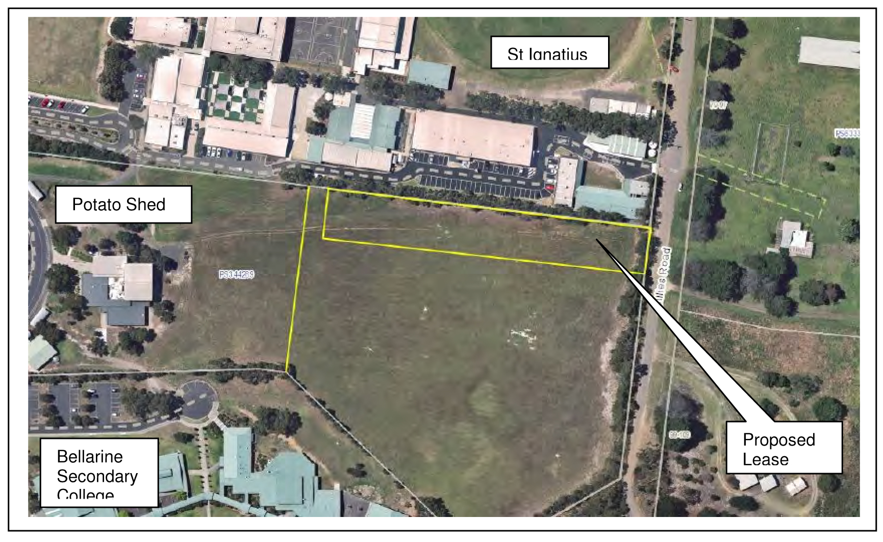
Saint Ignatius College has now applied to lease land of area 4,250m2 from Council at the rear of the Potato Shed (refer to attached diagram). The purpose of the lease is to locate temporary classrooms on the leased land while construction proceeds on a Year 9 Learning Centre and a Sport Hall on the main campus. Part of the leased area near Gillies Road is intended to be used for storage of unused portable classrooms awaiting disposal.
The rent for the leased area will be $3,500pa, and the proposed lease term is 3 years.
The proposed lease does not impinge on Council’s masterplan for the eventual expansion of the Potato Shed, or the Potato Shed’s operations.
Cr Farrell moved, Cr Ellis seconded -
That Council enters into a lease with the Catholic Archdiocese of Melbourne for part of the land at 29-39 Peninsula Drive, Drysdale as follows:
Lease area of 4,250m2 as indicated on the attached diagram;
Rent to $3,500 pa;
Lease term of 3 years; and
Other appropriate terms and conditions including:
tenant is to provide a satisfactory landscaping plan which addresses visual impact of the lease area viewed from the balance of the Council’s land and the landscaping is to be implemented and maintained by the tenant;
access to the leased property is via school owned land and/or Gillies Road.
Carried.
Council is the owner of approximately 45ha of undeveloped vacant land in the vicinity of Grubb Road and Peninsula Drive, Drysdale which was part of a larger parcel of land purchased by the former Shire of Bellarine for urban development purposes. Previously parts of the larger parcel have been sold to the Roman Catholic Trust Corporation and Department of Education for the schools currently located on Peninsula Drive.
Council’s multi arts facility, the Potato Shed, is located on a 5.010ha Reserve on the eastern side of Peninsula Drive between the schools and includes a bus interchange and car park.
The rest of Council’s land to the east and south of Peninsula Drive is either vacant or leased to various users. The Bellarine Secondary College (Minister of Education) currently holds 2 leases from Council for a total area of 8.8ha to the south of its campus currently paying $2,488 pa in rent.
Council’s land is zoned Special Uses Zone 13 being a zone that allows for a range of civic, community, education and recreation activities. This zone was introduced in 2011 under amendment C194 to the Planning Scheme. Previously the land was more widely zoned for general urban development including residential development, and while the current zone considerably restricts permitted uses it continues to recognize educational use.
The Catholic Archdiocese of Melbourne approached Council in 2011 to purchase land at the rear of the Potato Shed, Drysdale to expand St Ignatius College.
At its meeting on the 28 April 2015, Council resolved to sell approximately 2.6ha of land in Peninsula Drive, Drysdale at the rear of the Potato Shed to the RCTC for expansion of St Ignatius Secondary College.
Sale of the land was to be conditional upon the RCTC selling to Council 2,500m2 of its land in Murradoc Road, St Leonards for a future children’s services centre. At its meeting on 28 July 2105, Council noted that the RCTC was unable to agree to the sale of the St Leonards land, and sale of the Peninsula Drive land was abandoned. There has been no further progress on the possible sale of the St Leonards land to Council.
St Ignatius has now approached Council to lease of 4,250m2 of land adjacent to its site for the purpose of locating temporary classrooms to support its building program (refer to attached diagram).
St Ignatius College is seeking to implement a building program which will in part replace existing re-locatable classrooms with permanent buildings. The School has two building projects planned being a Year 9 Learning Centre and a Sports Hall. These projects were originally planned for privately owned land east of Gillies Road, however that site contained significant asbestos contamination and was considered unsuitable. Council was then approached to sell the land at the rear of the Potato Shed.
Given the need to continue with the building program the proposed buildings are being “cramped” onto the existing School campus through multi storey construction for the Year 9 Learning Centre and occupation of existing synthetic tennis courts for the proposed Sports Hall.
The proposed lease area (indicated on the attached diagram) has dimensions of 25m by 170m and an area of 4,250m2. Ideally the School was seeking to occupy the site for temporary classrooms from 1 February 2016, however due to delays in arranging a lease, students will be occupying specialist classrooms until such time as the lease is formalised and temporary classroom are available.
Council’s intentions for the vacant land in the Peninsula Drive area, have in recent years been expressed in 2 strategic plans being the Drysdale Clifton Springs Sports master plan and The Potato Shed master plan. The eastern portion of Council’s Reserve containing the Potato Shed, accommodating the land proposed to be leased, has not been designated for any purpose under either of the master plans and the lease of the land to St Ignatius College will not affect the implementation of the master plans.
Initially it is planned to relocate 6 classrooms plus one teacher’s office onto the proposed lease area and these buildings will be located on the western or downhill half of the lease area. This location allows for at grade access to the existing campus and provides sufficient room for the temporary classrooms clear of an existing drainage swale in this location.
The eastern half of the proposed lease area at the Gillies Road end will be used for storage of unused temporary classrooms awaiting disposal.
The proposed lease area will be fenced into the existing campus and all temporary classrooms will be finished with verandas and pergolas.
The proposed lease term is 3 years which covers the two building projects proposed by the School. Any further building work beyond this lease term will be the subject of another lease request.
The School anticipates continued growth and retains an interest in the eventual purchase of the Council’s vacant land.
There are no environmental implications associated with the lease of the land. Electricity will be provided to the leased area and all bathrooms and other facilities will be located on the main campus.
The rent, which has been set on the advice of the Council’s valuer, will be $3,500pa adjusted by CPI each 12 months.
Section 190 of the Local Government Act (“LG Act”) specifies lease terms relating to terms, rent and improvements which trigger the requirement to advertise the lease and hear any submissions. The lease as proposed does not require advertising.
The lease of the land will provide support for St Ignatius College’s building program and allow the school to meet its projected demands for education.
No officers or contractors involved in the preparation of this report have a direct or indirect interest in matters to which this report relates.
The risks associated with the lease of this land are able to be managed following normal management procedures and processes.
With the lease of the land to the Archdiocese, Council still has sufficient land in around the Potato Shed and to the west of Peninsula Drive to cater for the medium to long term community and sporting needs of Drysdale and the wider Peninsula.
No human rights will be affected by the recommendation of this report.
Comments on the proposed lease have been received from both the Potato Shed committee of management and the Bellarine Secondary College. The comments are included in Attachment 2 to this report.
“10.2 St Ignatius Lease of Council Land
It was agreed that the following be distributed in relation to item 10.2:
In recognition of the model of collaboration and partnership established by the Potato Shed Committee of Management between Council, Bellarine Secondary College and St Ignatius College Geelong, the committee acknowledged In principle support for the lease of the land on the following conditions:
It is critical to protect the vision of the Potato Shed master plan and its surrounding open space for activities
the relocatable classrooms would need to be moved as far east toward Gillies road as possible, recognising the physical constraints of the swale drain
that access and amenity would need to be resolved to the satisfaction of the committee
that the Principal of Bellarine Secondary College presents the proposal to the School Council for comment (November 25th 2015) and feedback from the school council is provided to the committee
that the term would be limited to five years
that an extraordinary meeting be held if necessary or a circular motion be distributed if further discussion is not required
Comments from Bellarine Secondary College Principal as referred from a Council officer.
“They are concerned about the impact on the Potato Shed and about how the buildings will look.
They are also concerned about this becoming a fixture for more than 5 years.
They are ok with 5 years but felt that St Ignatius should be making more appropriate plans for anything longer.
They were also keen to see the landscaping and visual impact of the buildings.”
Portfolio: |
Finance - Cr Lyons (Mayor), Cr Farrell, Cr Kontelj |
Source: |
Strategy & Performance - Property & Procurement |
General Manager: |
Dean Frost |
Index Reference: |
Land Sales |
The purpose of this report is to recommend that Council commence the procedures to exchange land with Mira Ira Nominees Pty Ltd (“the developer”) at Batman Road, Indented Head.
Mira Ira Nominees Pty Ltd (“the developer”) has been developing the Seabreeze residential estate at Indented Head for a number of years, and as development moves to the west it is approaching land of high ecological significance which contains a non perennial watercourse.
Council is the owner of a 3.917ha municipal reserve adjacent to the Seabreeze residential estate which remains undeveloped for any active purpose, and is higher land of lower ecological significance. Refer to Attachment 1.
Both Council’s land and the balance of the developer’s land are zoned General Residential Zone 2.
Talks between the developer and Council have been proceeding for a number of years to try to avoid the possibility of residential development encroaching on the land of high ecological significance. These talks have been based on an exchange of land between the parties.
Council obtained an ecological assessment in 2014 of Council’s and the developer’s land which identifies a large area of land of high ecological value. Refer to Attachment 3. The land of high ecological value is one of the two most significant parcels of remnant vegetation remaining in private ownership on the Bellarine Peninsula.
It is recommended that Council enter into a land exchange agreement (‘the agreement”) with the developer which will see Council transferring 3.917ha of its land to the developer in exchange for approximately 13.6ha of the developer’s land for a payment to Council of $95,000 being the difference in valuations between the land to be exchanged. Refer to Attachment 2. The agreement will contain conditions which are outlined in the body of the report.
The potential exchange of land has been discussed with some members of the Indented Head Community Association who have indicated support for the land exchange. The potential exchange of land was mentioned and supported in the 2005 Bellarine Peninsula Recreation and Leisure Needs Study.
A management plan will be prepared to provide a framework for the future management and use of the land of high ecological value.
Since the agreement involves Council selling its land, Council is required to give public notice of its intention to do so under s189 of the Local Government Act and allow for the hearing of submissions. If submissions are received they will be heard by the Submission Hearing Panel and a further report will be put to Council. If no submissions are received the land exchange agreement will be executed and following subdivision, the respective land parcels will be exchanged.
Cr Ellis moved, Cr E Kontelj seconded -
That Council:
enters into an exchange of land agreement (“the agreement”) with Mira Ira Nominees Pty Ltd (“the developer”) to exchange Council reserve at 690 Batman Road, Indented Head for approximately 13.6ha of the developers land on the following conditions;
The land being exchanged for a payment to Council of $95,000 plus GST;
The developer obtaining planning approval to develop the land it will own follow the exchange;
Removal of the reserve restriction from Council’s land;
Other appropriate terms and conditions; and
notes that a management plan for land to be owned by Council will be prepared in consultation with the relevant stakeholders to guide the future use and management of the land;
commence the procedures under sections 189 and 223 of the Local Government Act 1989 to sell Council’s land and that public notice of and the right of a person under s223 of the Act to make submissions be given in the Geelong Independent and Advertiser; and
appoint the Submissions Review Panel to hear and provide a report to the Council on any submissions received; and
in the event that no submissions are received, enter into the agreement and note that the General Manager – Strategy and Performance will execute the agreement.
Cr Heagney left the meeting room at 8:55pm
Cr Heagney re-entered the meeting room at 8:57pm
Carried.
Mira Ira Nominees Pty Ltd (“the developer”) is the developer of the Seabreeze Estate at Indented Head which has been undergoing a staged residential development for a number of years. The developer’s land remaining undeveloped (refer to Attachment 1) is zoned General Residential Zone 2 and there are no overlays or planning controls formally recognising the significant ecological values of parts of that land.
An ecological assessment of both the Council’s and the developer’s land was undertaken for the Council in 2014. Refer to Attachment 3 for a plan of the ecological assessment.
In summary that assessment identified significant fauna and flora including:
Plains grassy woodland;
Grassy woodland;
Plains freshwater sedge wetland (EPBC Act listed).
Latham’s Snipe was observed in the wetland which is a threatened fauna species. 32 native birds and 2 native frog species were also observed.
In 1988 at the commencement of development of the land, an area of 3.917 ha was set aside as a reserve for municipal purposes with frontage to Batman Road. Apart from routine mowing of the reserve which has been recently introduced, it has never been developed or used for any active recreational purpose.
For over 10 years discussions have been held between the Council and the developer about the future of the municipal reserve and the land with significant ecological values including the possibility of a land exchange.
The Bellarine Peninsula Recreation and Leisure Needs Study (2005) recommended that the Council should actively pursue a land exchange where the developer would obtain the municipal reserve and the Council would obtain the land of ecological significance.
Following the ecological assessment in 2014, discussions with the developer have proceeded to the point where there is in-principle agreement to exchange the municipal reserve of 3.917ha for approximately 13.6ha of the developer’s ecological land (refer to plan in Attachment 2). As indicated on the plan, the developer will retain some of its land which will be added to the Council’s land to leave a parcel of 5.7ha in the developer’s ownership.
The land exchange agreement will incorporate the following conditions:
The land will be exchanged between the parties for $95,000 payment to Council.
Minor adjustments to the boundary between the developable and non developable areas may occur depending on final development design.
Simultaneous settlement of contracts of sale for the parcels of land to be exchanged.
Removal of the reserve restriction on the municipal reserve and the land to be owned by the respective parties being subdivided as required.
The developer obtaining planning approval for residential development of areas it will own by an agreed date on conditions reasonably satisfactory to the developer.
Council complying with the provisions of sections 189 and 223 of the Local Government Act.
Each party will be liable to pay any GST payable in respect of the land transferred to that party.
Cost arrangements.
The proposed land exchange is considered beneficial for the following reasons:
The exchange occurs at valuation.
Public ownership of land of significant ecological value will ensure that ecological values are preserved and enhanced.
The exchange avoids potentially difficult residential development to the west of the watercourse which would require a crossing of the watercourse creating an isolated pocket of urban development. Future development of the township is expected to occur to the north of rather than the west of this land.
Allows sufficient land for the future management of the watercourse through the land of high ecological significance, providing a flow path for a significant upstream water catchment.
No rezoning of land is required prior to settlement, however Council intends to consider appropriate zonings for land it will own following settlement.
Attachment 3 provides a plan showing the ecological features of the land proposed to come into Council’s ownership.
The proposed land exchange presents an opportunity for Council to own and preserve one of the two most significant parcels of remnant vegetation that remain in private ownership on the Bellarine Peninsula. Parts of the land of lesser ecological value may be able to be used for alternative more active recreation use as appropriate.
A management plan for the land to be owned by Council will be prepared which will recommend appropriate capital works and annual maintenance programs. There is also an opportunity for community involvement in on going management of the land.
There are no major capital works required for future management purposes although works compromising fencing, walking trails and signage are anticipated. Recurrent costs will be mainly weed control and slashing.
Consideration for the land exchange is a $95,000 payment to the Council. Council has obtained two valuations of the land it is selling and purchasing and those valuations indicate that the value of the land Council is selling is worth either $90,000 or $100,000 more than the developer’s land being purchased. In the circumstances it is appropriate proceed with the land exchange for a consideration of $95,000 being the average of the differences in the valuations obtained.
Estimates for capital and recurrent costs for Council in relation to the ownership of the land of high ecological significance are:
Preparation of management plan |
$17,000 |
Fencing, gates, paths |
$35,000 |
Other including signage, community event |
$7,300 |
Annual maintenance including mowing |
$15,000 |
The exchange of land involves an agreement to sell and purchase land. For the sale of the municipal reserve the reserve restriction needs to be removed from the title and a planning permit is required to do this.
Council is also required to give notice of intention to sell land under s189 of the Local Government Act, and any submissions received will be heard by the Submissions Review Panel and a further report will be put to Council.
There are no procedures under the Local Government Act for purchase of the land of ecological significance by the Council.
Council is required to obtain a valuation for the sale of the land, and the two valuations which have been obtained are dated 7 August 2015 and 17 November 2015.
The proposed exchange of land is consistent with objectives of the Enhance and Protect Natural Areas and Ecosystem Health priority in City Plan 2013/17.
No officers or contractors involved in the preparation of this report have a direct or indirect interest in any matters to which this report relates.
There are no significant risks for Council in the ownership and management of the land of high ecological value.
Ownership of the land by Council provides an opportunity for community involvement in the improvement and management of the land, which has the potential to provide both active and passive recreational opportunities along with the protection and enhancement of land of high ecological significance.
The recommendations of this report and the subsequent exchange of land have no implications relating to the Human Rights Charter.
Public consultation will occur when the proposed transfer of the property is advertised under s189 of the Local Government Act. The exchange of land is supported by the Council’s Recreation and Open Space and Environment Departments.
Portfolio: |
Sport & Recreation – Cr Irvine |
Source: |
Projects, Recreation & Central Geelong |
General Manager: |
Dean Frost |
Index Reference: |
C16830 – Grovedale Tennis Club Facilities Upgrade |
Purpose
The purpose of this report is to seek direction from Council on project C16830 – Grovedale Tennis Club Facilities Upgrade.
As part of the 2015/16 budget Council allocated $550,000 towards an upgrade of the Grovedale Tennis Pavilion and for the installation of lighting on two courts.
The project budget included a club contribution of $50,000.
A project estimate has identified that the total cost of the project is in excess of the project budget.
A value management process has been undertaken in partnership with the tennis club and a more modest pavilion upgrade can be completed within the available budget. However the court lighting component of the project is not able to be delivered.
Cr Richards moved, Cr Irvine seconded -
That Council proceed with the delivery of a pavilion upgrade and refer the lighting upgrade component of the project to a future budget process.
Carried.
The Grovedale Tennis Club (Club) through a community concept proposal as part of the 2015/16 budget requested Council consider funding a pavilion and lighting upgrade.
The existing clubrooms are inadequate to cater for the large number of the community members using the facilities each week.
The installation of competition lighting on an additional two courts will enable increased participation in night tennis.
A renovation of the clubrooms will reduce the pavilions maintenance requirements and provide facilities at a standard expected of a public building.
Although the Grovedale Tennis Clubrooms is not identified as a high priority in the Regional Tennis Strategy for upgrade, it is acknowledged that the tennis facilities are inadequate to meet the demand due to current membership numbers.
The Grovedale Tennis Club is part of the Grovedale Sporting Club located on Burdoo Reserve. The Burdoo Reserve has recently had an extensive social room extension, providing options for amenities adjacent to the tennis car park.
Six of the 8 existing courts are currently illuminated for night tennis and this component of the works can reasonably be differed until future budget provision exists.
There are no environment implications
If Council wish to proceed with the full project scope in accordance with the budget description, an additional $55,000 budget allocation will be required.
There are no policy, legal or statutory implications associated with acceptance of this report.
This project supports strategic directions in our Community Wellbeing and Sustainable Built & Natural Environment areas.
No council officers involved in this project or report have declared a direct or indirect interest in this matter.
A detailed project risk profile has been developed and is being maintained by the project manager.
Sport and recreation plays a key role in the health of our community. While the physical health of the community is the most apparent benefit, sport and recreation promotes increased mental health, social connection and community leadership.
The provision of Court lighting on two courts will support increased participation in night tennis, and cater for casual public use of the courts.
The renovation and extension of the pavilion will ensure that the community is provided with facilities that allow them to participate in sport and provides an opportunity for social interaction.
It is not evident or likely that this report would negatively impact any of the rights contained in the Charter of Human Rights.
There are no communication issues or requirements associated with acceptance of the proposed recommendation.
Portfolio: |
Infrastructure – Cr Ellis |
Source: |
City Services - Engineering Services |
General Manager: |
William Tieppo |
Index Reference: |
Special Rates and Charges |
This report seeks a resolution by Council to consider an intention to declare a Special Charge Scheme to partially fund the construction of a footpath in Montpellier Drive and Reigate Road, Highton. (See plan – Appendix 4).
It is proposed to construct 440 meters of 1.5 metre wide footpath to provide for improved pedestrian access along Montpellier Drive and Reigate Road, Highton. The access is considered to be an important safety initiative for pedestrian movements around the Montpellier Primary School.
There are 20 residential properties abutting the proposed footpath that will receive special benefit. There are no Council owned properties in the scheme.
The total estimated project cost is $158,729. This includes direct funding by Council estimated at $27,905 for the reinstatement of driveways, a supporting concrete retaining wall and contribution to porous pavement around established nature strip trees.
A Benefit Ratio of 0.32 has been calculated in accordance with Section 163 of the Local Government Act, which equates to a Council contribution to the scheme of $88,960 and property owner contribution of $41,864.
Property owners are considered to receive benefit from the works by way of improved pedestrian access and general amenity including pedestrian safety improvements.
The scheme has been prepared in accordance with the Special Rate and Charges provisions of the Local Government Act 1989, the 2004 Ministerial Guidelines, Council’s Special Rates and Charges Policy and community engagement guidelines.
Cr Nelson moved, Cr Ellis seconded -
That Council:
Gives notice of its intention to declare a Special Charge Scheme in accordance with Section 163 (1A) of the Local Government Act 1989 (The Act), as follows:
The Special Charge is declared for a period of five (5) years commencing upon completion of the works.
The Special Charge be declared for the purpose of defraying any expenses incurred by Council in relation to the construction of the footpath on Montpellier Drive and Reigate Road, Highton which:
Will provide proper pedestrian access, improved pedestrian safety and enhancement to the general amenity for each of the properties included in the scheme;
Council considers is or will be a special benefit to those persons required to pay the special charge (and who are described in succeeding parts of this Resolution); and
Arises out of Council’s function of planning for and providing infrastructure for property owners.
The total cost of project, be recorded as $158,729 (Schedule A).
It be recorded that, for the purposes of Section 163 (2A) of the Act, the special charge proceeds will not exceed the amount calculated in accordance with the prescribed formula (R x C = S), the:
‘benefit ratio’ (R) being calculated at 0.32 represents the special benefits to all persons liable to pay the special charge (Schedule B);
‘total cost’ (C) of performing the function described in part 1 (b) of this resolution based on estimated cost be recorded as $130,824; and
‘maximum levy’ (S) be recorded as $41,863.68
the following be specified as the area for which the special rate is so declared:
the area within municipal district of Council highlighted in the plan attached to this Resolution (Appendix 4).
the following be specified as the land in relation to which the special charge so declared:
land within the area shown on the plan.
the following be specified as the criteria which form the basis of the special charge so declared:
ownership of any land described in Part 1(e) of this Resolution.
the following be specified as the manner in which the special charge so declared will be assessed and levied:
Each lot receives an access and amenity benefit;
The maximum levy is divided equally on an access and frontage share basis;
The special charge will be levied by sending a notice to the person who is liable to pay, pursuant to section 163(4) of the Act.
having regard to the preceding parts of this Resolution but subject to Section 166 (1) of the Act, it be recorded that;
the owners of the land described in column 1 of Schedule C to the resolution are estimated liable for the respective amounts set out in column 8 of Schedule C; and
such owners may, subject to any further resolution of Council pay the special charge in the following manner;
the charge will become due and payable within one month of the issue of the notice requesting payment pursuant to Section 167 (3) of the Act;
interest will not be charged for six months after the issue of the notice provided the person liable makes timely payment in accordance with any repayment arrangements that may be agreed on by Council; and
in accordance with Section 172 of the Act, the interest rate payable on the special charge which has not been paid by the specific date is set at Council’s overdraft rate, reviewed every three months (provided that it shall not exceed the rate fixed by the Governor in Council by Order for the purposes of Section 172 (2A) in which case the rate of interest shall be the maximum rate fixed by the Governor in Council by Order for the purposes of this section).
Authorise Council’s Chief Executive Officer to levy the Special Charge in accordance with Section 163 (4) of the Act.
Carried.
*Cr Nelson left the meeting room for the evening at 9:02pm.
Existing footpaths are in place in Lansbury Crescent to the north, Cheam Walk and Lambhill Crescent to the west and Mount Pleasant Road to the south. The construction of the Montpellier Drive and Reigate Road footpaths will provide a new link with these footpaths and improved the pedestrian network around the Montpellier Primary School. It is further considered that the new footpaths will improve pedestrian safety for abutting property owners and the surrounding community.
Requests from residents and the wider community have been received by Council over the years for the need of a footpath along Montpellier Drive. A footpath here is considered to be a complimentary link to the surrounding footpaths and will improve pedestrian access around the Montpellier Primary School.
An attempt at a Special Charge scheme was made in 2005 but this scheme was not presented to Council at the time.
The affected property owners were advised of a new scheme proposal via a mail out in June 2015. The mail out included an explanatory letter, the cost estimate, estimated charges to property owners, a plan and a Special Rates and Charges Brochure. The mail out also included a survey and out of the 20 properties affected by the scheme, 12 property owners responded.
The results included two (2) yes votes for the proposed footpath and ten (10) no votes.
When considering the Benefit Ratio for this footpath scheme, it is reasonable that a majority of cost be apportioned to the community benefit when considering the proximity of the Montpellier Primary School. With a calculated Benefit Ratio of 0.32, a majority of funding for this scheme would be coming from Council. The average cost per property is estimated at $2,093 which compares favourably to other recent schemes.
Since the initiation mail out, the scheme has been reviewed. The direct funding by Council has been increased due to the specialised porous paving to be used to protect the root systems of the established nature strip trees.
It is considered reasonable that Council pay the difference in costs over the standard concrete costs for this type of pavement. The result of this review saw a reduction to charges of an average $660 per property.
Of the survey results, there is a majority of objection to the scheme. Of those opposing the scheme, concerns raised and corresponding officer considerations include:
Cost per metre is unfair. Cannot afford this. Cost is greater than the benefit.
These are some property owners’ feelings on the charge impost. Four (4) property owners’ stated financial reasons as their primary concern. The rationale for the special charge and cost allocations were explained in the initiation mail out. Since this time however, a revision of the scheme has been carried out as detailed previously and estimated charges have been reduced by an average of $660 per property or 24%.
This is Council owned land and a public schooling area.
This is a view stated by one of the affected property owners implying that Council should be paying for the footpath.
The new footpath will kill the tree on the nature strip.
All potentially affected trees have been identified during the design process. A unique porous paving treatment has been specified at these locations in order to preserve and protect the root systems of these trees but allow a solid flat surface for pedestrian access.
The footpath needs to be on the other side of the street to link up with the footpath in Cheam Walk.
The footpath in its planned location has a crossing provision in Reigate Road to enable this connection and provides a direct link to Culzean Crescent.
The green vegetation looks much nicer than the concrete.
This is an opinion of one of the affected owners.
The path should be a total circuit walk of Montpellier Drive. What about putting the footpath along the central median strip.
A complete circuit footpath is considered too excessive when considering the purpose of the scheme. A central median footpath would not provide direct access to properties and may not be as well utilised.
Cost apportionment for the scheme has been divided into access and amenity benefits. It is considered that all abutting properties with direct frontages to the proposed new footpath, regardless of size and shape, receive the same access benefit. Corner properties have received a reduced access benefit due to their double frontage. These properties may potentially be charged for future footpath schemes along their second frontage.
50% of the total benefit has been apportioned to access given the purpose of the scheme. The access benefit includes the provision of an all weather sealed surface that reduces the risk of accidents caused by uneven and slippery surfaces. A new footpath also eliminates the nuisance affect of dust and mud. In simple terms, a new footpath improves accessibility for all abutting properties.
The remaining 50% of benefit is attributed to amenity and this can best be described as the benefit the pathway provides to an abutting property by way of improved aesthetics, safety, enjoyment, comfort and property value.
The amenity benefit is based on the actual footpath frontage to a property when existing driveway extents are taken into consideration. This is known as the apportion-able frontage and is shown at Column 4 of Schedule C.
The provision of a sealed pathway provides a permanent and safe means of access. During construction and the manufacture and procurement of materials, energy is used resulting in some greenhouse gas emissions. This stops when construction is complete.
The project does not create waste with the exception of some excavated material.
The proposal does not affect any natural habitats.
The proposal may require some nature strip and property trees and shrubs to be trimmed but removal of vegetation is not expected. A specialised porous pavement is to be used around the root zones of some of the more established trees within the nature strip. This will protect and preserve the tree roots.
The project is a one off capital cost and there will be minimal ongoing maintenance costs. If approved, the scheme could proceed this financial year. Funding is currently allocated in C15310 Montpellier Drive Footpath ($42,599) and C02303 Footpath Construction Program ($116,130).
Financial details are as follows:
Maximum scheme levy to Property Owners (income) |
$41,864 |
Scheme levy to Council - $88,960 |
$116,865 |
Direct Funding by Council to reinstate driveways and construct a supporting retaining wall - $27,905 |
|
Total Project Cost |
$158,729 |
From the table above, the total net cost to Council for this project is estimated to be $116,865.
The scheme has been prepared in accordance with the Special Rate and Charge provisions of the Local Government Act 1989, the 2004 ministerial guidelines, Council’s Special Rates and Charges Policy and community engagement guidelines.
This report aligns with the City Plan as follows:
Sustainably Built and Natural Environment
Support our Community to live sustainably – Encourage increased use of alternatives to car transport and seek efficient traffic movement throughout the municipality.
Advocate for and promote sustainable design and development – Promoting sustainable design and retrofitting.
Acknowledge the community’s desire to have their say and be involved in planning for the future of Greater Geelong.
In preparing this report, no Council officer has any direct or indirect interest in the properties affected by the scheme.
Provision of a sealed footpath will provide safer walking conditions for pedestrians by minimising the risk of personal injuries through conflict with vehicles and the elimination of uneven and slippery surfaces.
There are no identified risks for Council in making its intention to declare the scheme.
The provision of properly sealed and drained footpath is aligned to Council’s City Plan as described above and provides improved connectivity and safety for pedestrians. It is further considered that the footpath will enhance the general amenity of the area.
In developing this report to Council, the subject matter has been considered to determine if it raises any human rights issues. In particular, whether the scope of any human right established by the Victorian Charter of Human Rights and Responsibilities is in any way limited, restricted or interfered with by the recommendations contained in this report. It is considered that the subject matter does not raise any adverse human rights issues.
It is further considered that the construction of the footpath upholds the right to freedom of movement (Section 12 of the Human rights Charter) by enhancing a person’s ability to move freely within the area they choose to live.
Community consultation for the footpath construction Special Charge Scheme has been carried out as follows:
30 June 2015 – Initiation letter including a concept plan, cost estimate, apportionment of charges, Special Rates and Charges brochure and survey to property owners.
Some phone calls have been received in response to the initiation mail out. Further correspondence will be sent to all affected property owners should Council resolve to make its intention to declare the Special Charge Scheme.
The works for the construction of a footpath in Montpellier Drive and Reigate Road, Highton which consist of excavation, concrete footpath, reinstatement of nature strip, miscellaneous construction works, legal advice and professional services associated with survey, engineering design, drafting, supervision and administration of the project all as included in the cost estimate shown below.
SCHEME - FOOTPATH CONSTRUCTION |
|||||
ITEM |
DESCRIPTION |
QUANTITY |
UNIT |
RATE $ |
AMOUNT $ |
1.00 |
GENERAL |
|
|
|
|
1.01 |
Initial site establishment and set up, decamping and site cleanup and other fixed costs up to time of completion of works. |
1 |
ITEM |
$13,000.00 |
$13,000.00 |
1.02 |
Traffic management costs. |
1 |
ITEM |
$4,800.00 |
$4,800.00 |
1.03 |
Setting out of works. |
1 |
ITEM |
$500.00 |
$500.00 |
1.04 |
Service/Cable locations |
1 |
ITEM |
$1,000.00 |
$1,000.00 |
1.05 |
Internal supervision fee (COGG construction) |
1 |
ITEM |
$7,000.00 |
$7,000.00 |
2.00 |
EARTHWORKS & DEMOLITION |
|
|
|
|
2.01 |
Excavation and disposal of all materials to limits of work as indicated on plan, including trimming for new road pavement, excavation of soft spots and removal of concrete. |
20 |
m3 |
$60.00 |
$1,200.00 |
2.02 |
Saw-cut of concrete and asphalt paving |
1 |
ITEM |
$250.00 |
$250.00 |
2.03 |
Remove/Trim of overhanging branches and replacement of trees and disposal as per plan. |
1 |
ITEM |
$1,000.00 |
$1,000.00 |
3.00 |
PAVEMENT WORKS |
|
|
|
|
3.01 |
Supply, place and compaction of 20mm Class 2 FCR in pavement area in front of kerb and channel to 300mm deep including, 30mm compacted depth 10mm nominal size type N Asphalt spread and compacted including emulsion prime & grit. |
7.00 |
m2 |
$155.00 |
$1,085.00 |
3.02 |
Porous paving construct sub & top surface layers including edging, supplied, spread and compacted. 106 m2 $280.00 $29,680.00 |
|
|
|
|
4.00 |
CONCRETE WORKS: ` KERBING |
|
|
|
|
4.01 |
Reinforced Concrete Retaining Wall and Footing with F62 mesh including 75mm compacted depth Class 3 FCR bedding and reinstate nature strip. |
5 |
m |
$410.00 |
$2,050.00 |
4.02 |
Concrete pram crossing 1.5m wide, including fine crushed rock bedding. 2 No. $250.00 $500.00 |
|
|
|
|
|
PAVING |
|
|
|
|
4.03 |
125mm (25 Mpa) concrete paving with SL72 mesh including crushed rock bedding and reinstate nature strip. |
531 |
m2 |
$125.00 |
$66,375.00 |
4.04 |
Remove existing concrete paving and construct 125mm (25 Mpa) concrete paving with SL72 mesh including crushed rock bedding and reinstate nature strip. |
19 |
m2 |
$146.00 |
$2,774.00 |
5.00 |
SERVICES |
|
|
|
|
5.01 |
Alteration to Telecommunication Assets |
1 |
ITEM |
$500.00 |
$500.00 |
6.00 |
LANDSCAPING |
|
|
|
|
6.01 |
Top soiling and seeding nature strips. |
70 |
m2 |
$8.00 |
$560.00 |
SUB-TOTAL : |
$132,274 |
||||
10% CONTINGENCY: |
$13,227 |
||||
Design |
$6,614 |
||||
Administration |
$6,614 |
||||
CONSTRUCTION COST ESTIMATE |
$158,729 |
||||
COUNCIL FUNDED WORKS – Driveway re-establishment, Retaining Wall and porous pavement |
|||||
ITEM |
DESCRIPTION |
QUANTITY |
UNIT |
RATE $ |
AMOUNT $ |
1.00 |
GENERAL |
|
|
|
|
1.01 |
Initial site establishment and set up, decamping and site cleanup and other fixed costs up to time of completion of works. |
1 |
item |
$1,000.00 |
$1,000.00 |
1.02 |
Traffic management costs. |
1 |
item |
$500.00 |
$500.00 |
1.03 |
Internal supervision fee (COGG construction) |
1 |
item |
$500.00 |
$500.00 |
2.00 |
PAVEMENT WORKS |
|
|
|
|
2.01 |
Porous paving construct sub & top surface layers including edging, supplied, spread and compacted. |
106 |
m2 |
$155.00 |
$16,430 |
3.00 |
CONCRETE WORKS: ` |
|
|
|
|
3.01 |
Reinforced Concrete Retaining Wall and Footing with F62 mesh including 75mm compacted depth Class 3 FCR bedding and reinstate nature strip. |
5 |
m |
$410.00 |
$2,050.00 |
3.02 |
Remove existing concrete paving and construct 125mm (25 Mpa) concrete paving with SL72 mesh including crushed rock bedding and reinstate nature strip. |
19 |
m2 |
$146.00 |
$2,774.00 |
SUB-TOTAL : |
$23,254 |
||||
10% CONTINGENCY: |
$$2,325 |
||||
Design |
$1,395 |
||||
Administration |
$930 |
||||
CONSTRUCTION COST ESTIMATE |
$27,905 |
||||
A |
Purpose |
|||||
|
To construct a footpath in Montpellier Drive and Reigate Road, Highton to provide all weather pedestrian access for property owners and the wider community. |
|
||||
B |
Coherence |
|||||
|
The works will provide a physical pathway connection between Mt Pleasant Road and Lansbury Crescent, between Reigate Road and Culzean Crescent and will provide a special benefit to adjoining and remote properties. |
| ||||
C |
Total Cost C |
|||||
|
Total Estimated cost of works - footpath construction |
$158,729.00 |
||||
|
Direct funding by Council to rebuild concrete driveways, a new reinforced concrete retaining wall and contribution towards porous paving |
$27,905 |
||||
|
|
TOTAL COST |
$130,824 |
|||
D |
Identify Special Beneficiaries |
|||||
|
20 properties with frontages to the proposed footpath are considered to receive access and amenity benefits. |
| ||||
E |
Properties to include |
|||||
|
The 20 abutting properties receive both access and amenity benefits. Therefore: |
| ||||
|
Total Special Benefits (in) is apportioned to 20 properties |
| ||||
|
There are no Council owned properties in the scheme. Therefore: |
| ||||
|
Total Special Benefits out of the scheme |
TSB (out) = |
0 |
| ||
F |
Estimate of Total Special Benefits |
|||||
|
For this scheme it is considered that the greater proportion of benefit is for pedestrian access given the purpose of the scheme. Therefore it is estimated that 80% of the benefits relate to access and 20% to amenity. Estimated pedestrian use of the paths is 85% for the wider community and 15% for abutting property owners. Amenity benefits are based on frontage with 100% of the footpaths fronting benefiting properties. TSB (in) is therefore calculated as follows: |
|
||||
|
TSB (in) = 80% X 15%(access) + 20% X 100% (amenity) |
= |
32% |
|
||
G |
Estimate of Total Community Benefit -TCB |
|||||
|
It is considered that people in the community will receive a benefit from the works as the pathway is used to access other areas. There are no amenity benefits considered for the wider community. TCB is calculated as follows: |
|
||||
|
TCB = 80% X 85% |
= |
68% |
|
||
H |
Calculate "Benefit Ratio" - R |
|||||
|
Benefits Ratio = |
TSB (in) |
= |
32 |
0.32 |
|
|
|
TSB (in) + TSB (out) + TCB |
|
32 + 0 + 68 |
|
|
I |
Maximum Total Levy (S) |
|
||||
|
Maximum Total Levy S = R X C |
$41,863.68 |
||||
|
Council Contribution to Special Charge Scheme |
$88,960.32 |
||||
|
COLUMN 1 |
COLUMN 2 |
COLUMN 3 |
COLUMN 4 |
COLUMN 5 |
COLUMN 6 |
COLUMN 7 |
COLUMN 8 |
|
PROPERTY ADDRESS |
FRONTAGE |
ALLOWANCE |
APPORTIONABLE |
ACCESS BENEFIT |
UNIT ACCESS BENEFIT |
AMENITY BENEFIT |
ESTIMATED |
1 |
2 Montpellier Drive, HIGHTON VIC 3216 |
16.48 |
2.30 |
14.18 |
1.00 |
$1,268.60 |
$781.00 |
$2,049.60 |
2 |
4 Montpellier Drive, HIGHTON VIC 3216 |
16.00 |
4.04 |
11.96 |
1.00 |
$1,268.60 |
$658.63 |
$1,927.22 |
3 |
6 Montpellier Drive, HIGHTON VIC 3216 |
16.00 |
2.90 |
13.10 |
1.00 |
$1,268.60 |
$721.40 |
$1,989.99 |
4 |
8 Montpellier Drive, HIGHTON VIC 3216 |
19.20 |
2.52 |
16.68 |
1.00 |
$1,268.60 |
$918.53 |
$2,187.13 |
5 |
10 Montpellier Drive, HIGHTON VIC 3216 |
19.20 |
0.00 |
19.20 |
0.50 |
$ 634.30 |
$1,057.28 |
$1,691.58 |
6 |
12 Montpellier Drive, HIGHTON VIC 3216 |
18.29 |
0.00 |
18.29 |
0.50 |
$ 634.30 |
$1,006.94 |
$1,641.24 |
7 |
14 Montpellier Drive, HIGHTON VIC 3216 |
22.86 |
3.76 |
19.10 |
1.00 |
$1,268.60 |
$1,051.65 |
$2,320.24 |
8 |
16 Montpellier Drive, HIGHTON VIC 3216 |
18.29 |
4.40 |
13.89 |
1.00 |
$1,268.60 |
$764.67 |
$2,033.27 |
9 |
18 Montpellier Drive, HIGHTON VIC 3216 |
24.38 |
4.40 |
19.98 |
1.00 |
$1,268.60 |
$1,100.32 |
$2,368.92 |
10 |
20 Montpellier Drive, HIGHTON VIC 3216 |
16.31 |
0.00 |
16.31 |
0.50 |
$ 634.30 |
$897.85 |
$1,532.15 |
11 |
22 Montpellier Drive, HIGHTON VIC 3216 |
20.47 |
0.00 |
20.47 |
0.50 |
$ 634.30 |
$1,127.21 |
$1,761.51 |
12 |
24 Montpellier Drive, HIGHTON VIC 3216 |
24.38 |
4.80 |
19.58 |
1.00 |
$1,268.60 |
$1,078.30 |
$2,346.89 |
13 |
25 Montpellier Drive, HIGHTON VIC 3216 |
26.57 |
4.10 |
22.47 |
1.00 |
$1,268.60 |
$1,237.11 |
$2,505.71 |
14 |
26 Montpellier Drive, HIGHTON VIC 3216 |
21.34 |
5.38 |
15.96 |
1.00 |
$1,268.60 |
$878.54 |
$2,147.13 |
15 |
27 Montpellier Drive, HIGHTON VIC 3216 |
22.86 |
4.95 |
17.91 |
1.00 |
$1,268.60 |
$986.12 |
$2,254.72 |
16 |
28 Montpellier Drive, HIGHTON VIC 3216 |
21.33 |
0.00 |
21.33 |
0.50 |
$ 634.30 |
$1,174.32 |
$1,808.62 |
17 |
29 Montpellier Drive, HIGHTON VIC 3216 |
19.81 |
4.23 |
15.58 |
0.50 |
$ 634.30 |
$857.95 |
$1,492.24 |
18 |
262 Mt Pleasant Road, HIGHTON VIC 3216 |
38.10 |
2.50 |
35.60 |
0.50 |
$ 634.30 |
$1,960.14 |
$2,594.43 |
19 |
44 Reigate Road, HIGHTON VIC 3216 |
29.04 |
3.70 |
25.34 |
1.00 |
$1,268.60 |
$1,395.49 |
$2,664.09 |
20 |
46 Reigate Road, HIGHTON VIC 3216 |
26.24 |
3.02 |
23.22 |
1.00 |
$1,268.60 |
$1,278.39 |
$2,546.99 |
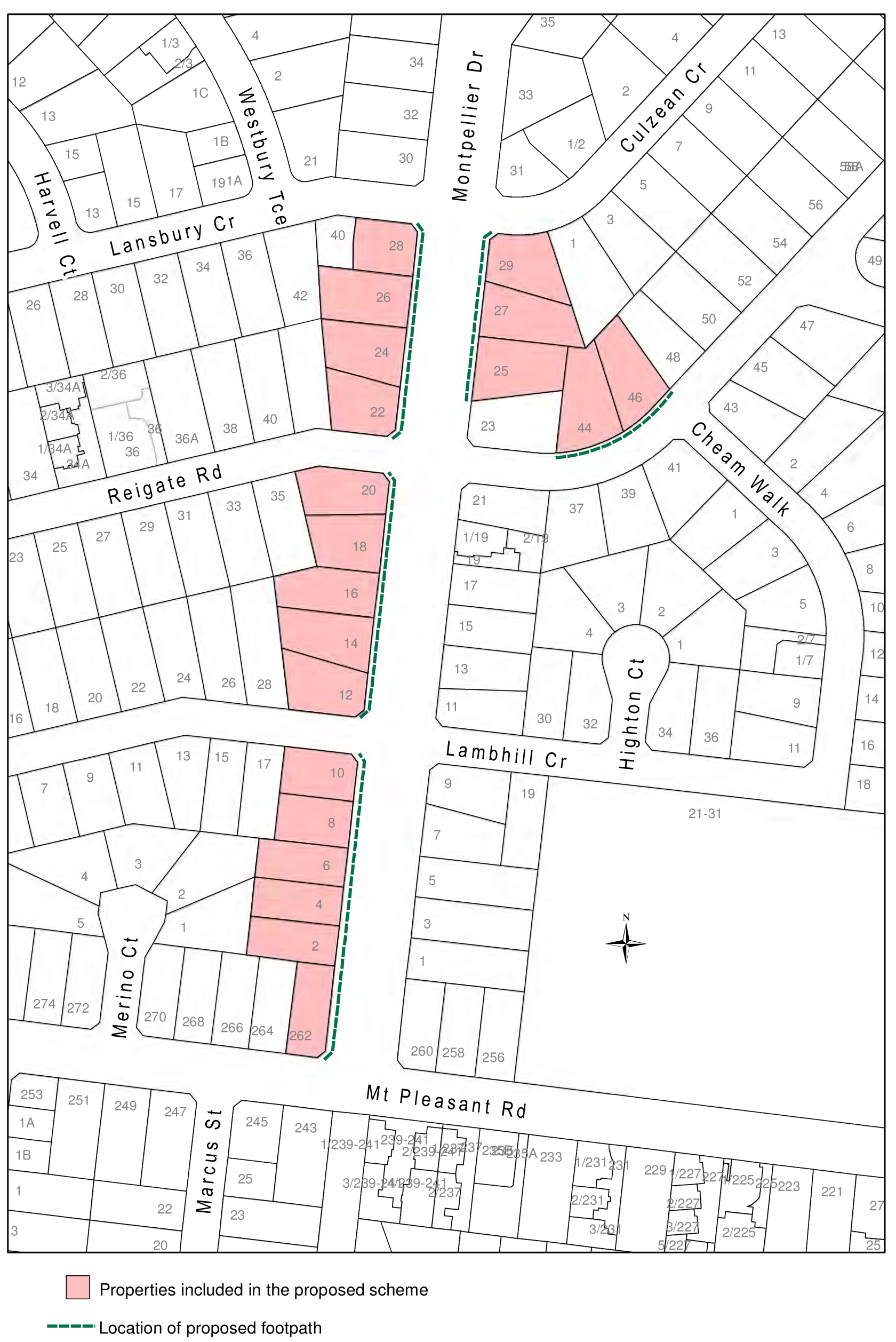
(Section 163 – Local Government Act 1989)
Stage |
Status |
Description |
Approval to prepare scheme |
✓ |
Decision made to prepare scheme following consideration of surveys of residents and feed back from the community. Council may then place the project in the budget system or proceed immediately to prepare a scheme. Scheme preparation involves survey, design and preparation of an apportionment of costs. June 2015 |
Intention to Declare Scheme |
✓ |
Report to Council providing information on scheme including advice of impending advertising of scheme and declaration of charge. Seeks Council approval by resolution to proceed with process. |
Advertisement |
|
The scheme is advertised in the local newspaper and all allotted property owners are notified by mail. This advertisement indicates Council’s intention and notification to ‘declare’ a scheme in a month’s time or at a subsequent meeting. |
Submissions |
|
From the time of advertising property owners have 28 days (as set down by the Local Government Act) to lodge submissions, either in support or opposition to the scheme. |
Submissions Review Panel Hearing |
|
A Submissions Review Panel is convened if required (quorum of three Councillors) and meets to consider submissions. Some submissions are written only, and other submitters may wish to be heard before the Panel. The Panel makes a recommendation to Council regarding the scheme. |
Declaration Report |
|
Any time 28 days after advertising the scheme and after the Submissions Review Panel has met and considered submissions, Council considers a report and may proceed to “declare” the charges in accordance with its advertised intent. Subsequent to this the Finance Manager issues the levy notices and there is a formal charge placed on the property. This is the final step in the process for Council to make a decision on the scheme. |
Appeal |
|
Property owners may lodge an application for review with the Victorian Civil and Administrative Tribunal (VCAT) within one month of issue of the levy notice. An appeal is listed, heard and determined by the Tribunal and this process generally takes three to four months. Decisions made by VCAT are binding on all parties. |
Construction |
|
Council may then proceed to construct the works. Invoices are issued seeking payment of the estimated cost within one month of commencement. |
Final Cost Report |
|
At the completion of the works the scheme is “finalised” taking into account actual costs incurred and payments are adjusted accordingly. |
Portfolio: |
Finance – Cr Lyons (Mayor), Cr Farrell and Cr E Kontelj |
Source: |
Strategy & Performance – Property & Procurement |
General Manager: |
Dean Frost |
Index Reference: |
Subject: Lease of Land |
The purpose of this report is to recommend that Council enters into a Lease with the Ocean Grove Golf Club for a term of 50 years.
On Saturday, 3 October, 2015 Council advertised a notice under s190 of the Local Government Act 1989 (Vic) (“Act”) of its intention to enter into a lease with the Ocean Grove Golf Club (“Club”) for a period of 50 years at a commencing rent of $973.44 (“Lease”).
One submission was received from Mr Dale Park requesting to be heard pursuant to s223 of the Act.
On Tuesday, 17 November, 2015 a Submissions Hearing Panel under s223 of the Act was convened and Mr Park addressed the Panel.
Mr Park’s oral submission centred on the safety of the 18th hole, the lack of a capital improvement plan by the Club as to its proposed capital improvements and the perceivably low rental proposed to be charged to the Club.
Cr Farrell moved, Cr Ansett seconded -
That Council:
enter into a Lease with the Ocean Grove Golf Club for a term of 50 years at a commencing rental of $973.44 subject to:
Council officers making appropriate enquiries as to the safety of the location of the 18th hole; and
the Club, prior to entering into the Lease, provide Council with a capital improvement plan for the works it proposes to carry out at the Premises.
notifies Mr Park of Council’s decision and the reasons for that decision.
Cr E Kontelj moved, Cr Richards seconded –/p>
That the report be deferred.
Carried.
On Saturday, 3 October, 2015 Council advertised a statutory notice under s190 of the Act advising of its intention to grant the Lease to the Club for the premises situated at 9 Guthridge Street, Ocean Grove (Premises). The commencing rental for the Lease would be $973.44.
The Club has occupied the Premises for many years. A synopsis of their occupation and leasing history is as follows:
1 March 1993 – Lease for 25 years at $100.00 per annum (clubrooms only)
5 May 1999 – Deed of Variation of Lease entered into for an extension of the clubrooms area.
1 July 1999 – Ground Lease entered into for 9 years (2 further options of 5 years) – golf course area
12 November 2008 - Deed of Renewal and Variation of Lease fully executed (1 July 2008 to 30 June 2013 – 1 further option of 5 years)
6 July 2009 – Club puts request in to purchase land which was subsequently denied
5 July 2010 – Consent to works granted for shed extension.
11 April 2012 – Consent given to put solar panels on maintenance shed.
11 September 2012 – Club writes seeking a 21 year lease clubrooms lease which expires in 2018.
31 Jan/Feb 2013 – Service Manager requests combining of lease for Clubrooms and grounds.
9 February 2013 –New combined Lease advertised on 9 February 2013 - no submissions received
30 June 2013 – Surrender of existing lease and new combined lease signed. (1 July 2013 to 30 June 2034 for 21 years no further options)
28 February 2014 –Lease documents and Surrender of Lease docs sent to Club for signing.
26 March 2014 – Lease and Surrender Documents finalised and copy sent to Club for their records.
2014/2015 – Club requests to purchase grounds and clubrooms from Council in order to use the freehold title as security for obtaining financial accommodation for the refurbishment of the clubrooms
Purchase request is denied and a 50 year lease is offered as an alternative, which would surrender the existing lease arrangement and provide the Club with a new 50 year tenure which could be used as security for financial accommodation.
The Club’s current tenure, which Council is bound to, sees them occupying the Premises under the current lease arrangement until 30 June, 2034.
Mr Park’s an oral submission before the Panel focused on three main points:
that the current location of the 18th hole is not safe and that he is aware of two particular occasions of golf-ball strike on members of the public;
the Lease should be supported by a capital improvement plan by the Club which details the works that are to be carried out by the Club to improve the Premises so as to warrant the grant of a long-term lease;
The rent should be increased to $30,000.00 plus GST after the first year of the term and increased thereafter by 4%.
Mr Park’s written submission was more expansive than his oral submission to the Panel and included discussion on the following points (in addition to the three referred above):
The ecological diversity of the Premises and the surrounding area;
The Club’s financial disclosures in its end of your financial reporting and their lack of perceived external income;
The lack of market rental being charged to the Club for its tenure;
Justification for a long-term lease (other than from a capital improvement perspective);
The perceived non-adherence or inconsistency of the Club’s tenure with the Bellarine Peninsula Strategic Plan 2006-2016.
Discussions have been had internally with Council’s Leisure Services Unit to request that they carry out appropriate investigations to determine the safety aspects of the 18th hole, particularly, its location and vicinity to the boundary fence of the Premises, the ability of that fence to retain errant golf balls within the Premises and away from the abutting car park. Members of the community use that car park on a daily basis and Mr Park alluded to two personal instances where members of his family have been victims of golf-ball strike.
Mr Park was also concerned at the lack of information perceivably provided by the Club to warrant its request for a long-term lease of 50 years. He would like to see a capital improvement plan provided by the Club which articulates the level of proposed expenditure, the scope of the proposed works and the proposed time line for carrying out those works. To date, it does not appear that information has been provided to Council in any great detail. Discussions have previously been focused on a proposed sale of the Premises to the Club so that the Club could use the freehold title to the Premises as security for financial accommodation from a lender. The sale of the Premises was not supported and a long-term lease of 50 years was seen as a positive compromise, which would give the Club the ability to mortgage the proposed new Lease and to amortise its costs over a longer period.
Regarding the rental, Council currently has 5 other leases with golf clubs in the municipality. Three of those have annual rentals of less than $1,000.00 per annum. The other two both have rental over $30,000.00 per annum however, one of those has commercial sub leases in place where it derives commercial income and the second has gaming and entertainment licenses to derive income from. Therefore, the proposed commencing rental for the new Lease to the Club of $973.44 is inline with leases to other golf clubs within the municipality which have the same operational limits in terms of income derivation. The rent for the new Lease would be increased by 4% annually inline with other similar tenures.
The recommendations of this Report have no environmental implications.
There are no financial implications with the proposed Lease. The proposed Lease income has been account for in the current budget process.
No impact to budget.
Council has complied with its obligations under ss190 and 223 of the Local Government Act 1989 regarding the proposed Lease.
The recommendation supports the action priority relating to Responsible and Sustainable Financial management.
No officers involved in the preparation of this report have a director interest in the matters to which this report relates.
There are no risk associated with entering into the proposed Lease.
The effects on the Club and the Ocean Grove community have been taken into account in writing this report.
The recommendations in this Report has no implications relating to the Human Rights Charter.
The Club and Mr Park have been kept informed as to the status of this matter.
Portfolio: |
Infrastructure, Parks & Gardens – Cr Ellis |
Source: |
City Services – Engineering Services |
General Manager: |
William Tieppo |
Index Reference: |
Subject: Drainage - Floods |
The purpose of this report is to present a revision to the flood mapping for existing conditions produced within the stages of the development of Warralily, Stages 69, 77 and 81.
The flood mapping is subject to a revision due to the subdivision and development at 568 – 612 Torquay Road and 82 – 110 Stewarts Road, Mount Duneed. Prior to subdivision the parent lot was considered to be liable to flooding. This development site, which is also known as Warralily, Stages 69, 77 and 81, achieves flood immunity for newly created lots for flood events up to and including the 100 year Average Recurrence Interval (ARI) event due to approved internal earthworks.
The earthworks undertaken have resulted in the floodwaters from the 100 year ARI event being contained within the boundaries of the road network.
Council has a statutory obligation under the Building Regulations 2006 to designate land as liable to flooding where it reasonably knows it to be prone to flooding. Conversely, there is an obligation to remove the encumbrance of designation from land that is no longer considered to be flood-prone.
It should be noted that designation is separate to the creation of flood overlays within the Planning Scheme, which generally follows designation. In the case of this development, the planning scheme amendment to create post-development flood zones or overlays is proposed after the design of the proposed precincts.
The current designated flood mapping (refer to Attachment 1) was designated by Council at its meeting of 12 December 2006, under the provisions of the Building Regulations 2006. Designation of land as liable to flooding enables the control of floor levels for acceptable building permit applications, or refusal of consent to building applications where there is likely to be a danger to life, health or safety due to flooding. Designation also enables disclosure of flood status within statutory information certificates.
Cr Ellis moved, Cr Richards seconded -
That Council revoke the Council designation of 12 December 2006 of flood affected land Warralily, Stages 69, 77 and 81 as liable to flooding pursuant to Regulation 802(2) of the Building Regulations 2006.
Carried.
Designation of land as liable to flooding under Regulation 802 of the Building Regulations 2006 enables the control of floor levels for acceptable building permit applications, or refusal of consent to building applications where there is likely to be a danger to life, health or safety due to flooding. Designation also enables disclosure of flood status within statutory information certificates such as the Land Information Certificate and Building Information Request Form.
The subject of this report is the residential land at Warralily, Mount Duneed fronting 568 – 612 Torquay Road and 82 – 110 Stewarts Road, Mount Duneed. Prior to subdivision the parent lot was used primarily as farmland.
The subdivision at 568 – 612 Torquay Road and 82 – 110 Stewarts Road, Mount Duneed was named Warralily by the developer. The current designated flood extent affects multiple residential lots within the Estate Stages 69, 77 and 81.
Overland flows that may occur within the subdivision during the 100 year ARI flood event are now contained within road and drainage reserves in accordance with accepted best practice for development within flood-prone areas. Best practice requires that any overland flows within residential areas satisfy public safety criteria with respect to velocity and depth of flow.
Council has a statutory obligation under the Building Regulations 2006 to designate land as liable to flooding where it reasonably knows it to be prone to flooding. Conversely, there is an obligation to remove the encumbrance of designation from land that is no longer considered to be flood-prone.
Attachment 1 shows the existing flood designation. Attachment 2 shows the change in flood mapping at 568 – 612 Torquay Road and 82 – 110 Stewarts Road, Mount Duneed after construction of the subdivision.
The revocation of flood-prone areas designation and designation of revised flood data does not result in any known adverse environmental impacts.
The removal of a minimum floor level requirement for new dwellings may result in a minor reduction in energy and material usage during construction. In addition, concrete slab-on-ground construction, which is normally used for a non-elevated floor, achieves the minimum energy rating more readily than a timber floor on stumps.
The costs of proceeding to revoke the existing designation and to designate the revised flood mapping at 568 – 612 Torquay Road and 82 – 110 Stewarts Road, Mount Duneed, in accordance with the requirements of the Building Regulations 2006, are provided for within the annual recurrent budget.
The City has various statutory responsibilities for drainage management and flood management (prevention, response and recovery) as set out in the Local Government Act 1989, Local Government Regulations 1990, Planning and Environment Act 1987, Building Regulations 2006, Water Act 1989, Subdivision Act 1988 and Emergency Management Act 1986.
Regulation 802(2) of the Building Regulations 2006 provides Council with the powers to ‘designate’ land liable to flooding. Regulation 802(3) provides that consent must be obtained from Council for an application to build on land liable to flooding.
Section 27 of the Interpretation of Legislation Act 1984 provides the power for Councils to ‘repeal or amend a subordinate instrument made in the exercise of that power’.
Section 807 of the Building Regulations 2006 requires Council to update the municipality’s designated special area maps at the Building Control Commission in the event of alterations to a designated special area. Designated special areas include areas designated as being liable to flooding.
Section 229 of the Local Government Act and Regulation 326 of the Building Regulations provide for the issue of information certificates containing prescribed information, including the flood status of properties.
The revised flood data for 568 – 612 Torquay Road and 82 – 110 Stewarts Road, Mount Duneed will assist the City in meeting its statutory obligations with regard to flood data.
The revised flood data will also assist in fulfilling the recommendations of the Municipal Emergency Management Committee adopted by Council in November 1998 (i.e. mapping of 1 in 100 year flood levels)
The recommendations of this report are consistent with City Plan, in relation to Growing our Economy and promoting a sustainable built environment, sustainable land use and development.
There are no officer direct or indirect interests with respect to this report.
Council also has some risk exposure with any failure to disclose the flood-prone status of a property in a Land Information Certificate.
The designation of the flood data produced by the flood study is a key step toward minimising Council’s exposure to these risks.
Council has a risk exposure through its statutory obligations under the Building Regulations 2006 to:
designate land as liable to flooding where it reasonably knows it to be prone to flooding;
specify minimum floor levels in consultation with the relevant floodplain management authority (CCMA); and
refuse consent to building applications where there is likely to be a danger to life, health or safety due to flooding.
Council also has some risk exposure with any failure to disclose the flood-prone status of a property in a Land Information Certificate.
The designation of the flood data produced by the flood study Armstrong Creek UGP project is a key step toward minimising Council’s exposure to these risks.
Conversely, there is an obligation to remove the encumbrance of designation from land that is no longer considered to be flood-prone.
Designation of land as being liable to flooding can result in extra construction costs and concerns regarding saleability, in some cases.
Council has a responsibility to the community to provide the best possible information on areas that are flood-prone.
We have taken into consideration the human rights relative to the subject matter of this report, which improves protection of private property.
A revocation of designation does not warrant public consultation as it constitutes the removal of an encumbrance on land.
Relevant Council databases and flood maps will be revised and updates sent to the Corangamite Catchment Management Authority and Building Control Commission.
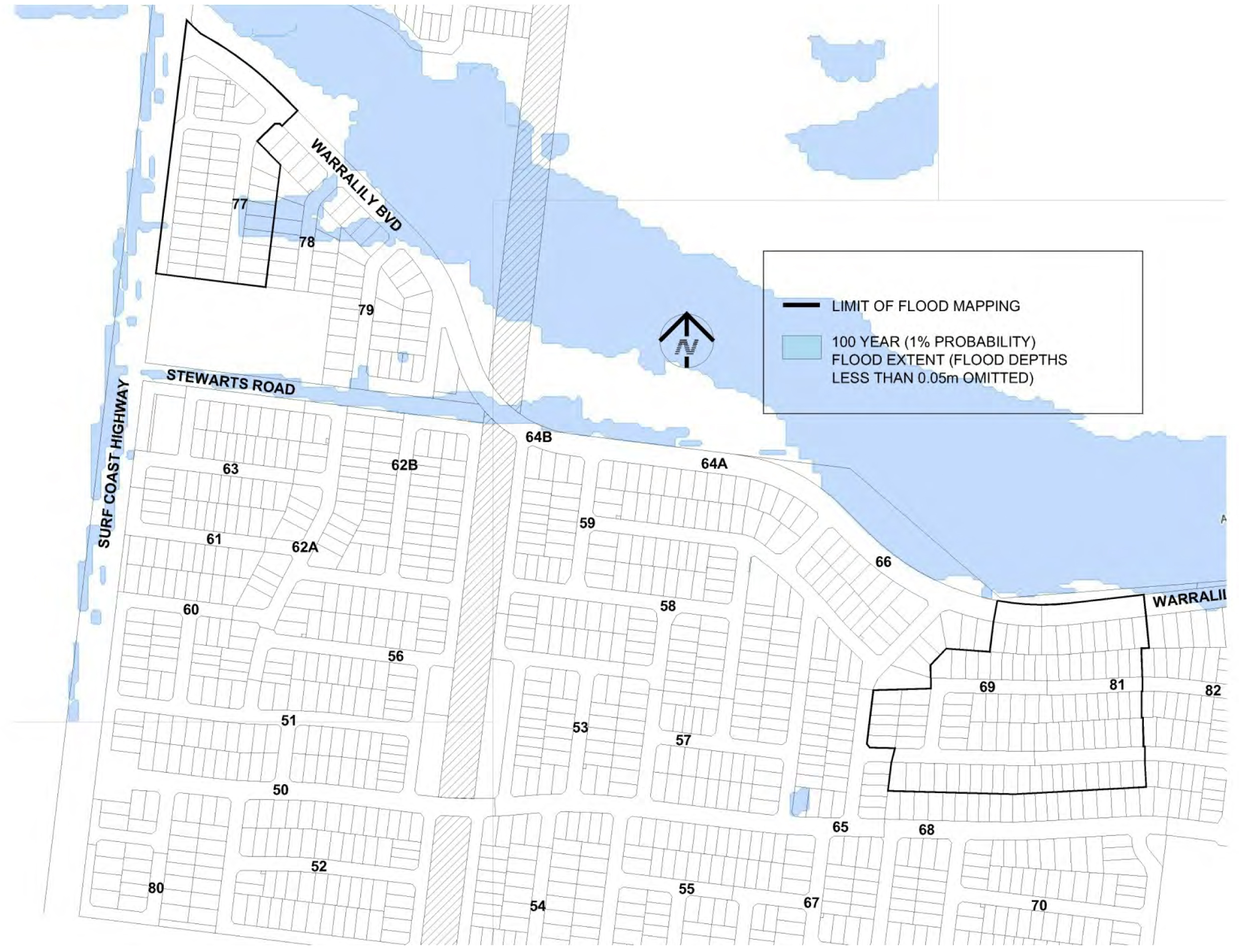
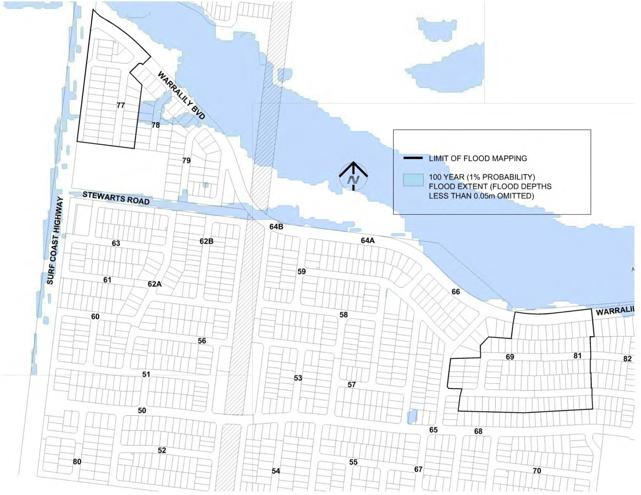
Portfolio: |
Infrastructure, Parks & Gardens – Cr Ellis |
Source: |
City Services – Engineering Services |
General Manager: |
William Tieppo |
Index Reference: |
Subject: Drainage – Floods |
The purpose of this report is to present a revision to the flood mapping for existing conditions produced within the stages of the development of Warralily, Stages 101 and 104.
The flood mapping is subject to a revision due to the subdivision and development at 2 – 80 Lake Road, Armstrong Creek. Prior to subdivision the parent lot was considered to be liable to flooding. This development site, which is also known as Warralily, Stages 101 and 104, achieves flood immunity for newly created lots for flood events up to and including the 100 year Average Recurrence Interval (ARI) event due to approved internal earthworks.
The earthworks undertaken have resulted in the floodwaters from the 100 year ARI event being contained within the boundaries of the road network.
Council has a statutory obligation under the Building Regulations 2006 to designate land as liable to flooding where it reasonably knows it to be prone to flooding. Conversely, there is an obligation to remove the encumbrance of designation from land that is no longer considered to be flood-prone.
It should be noted that designation is separate to the creation of flood overlays within the Planning Scheme, which generally follows designation. In the case of this development, the planning scheme amendment to create post-development flood zones or overlays is proposed after the design of the proposed precincts.
The current designated flood mapping (refer to Attachment 1) was designated by Council at its meeting of 12 December 2006, under the provisions of the Building Regulations 2006. Designation of land as liable to flooding enables the control of floor levels for acceptable building permit applications, or refusal of consent to building applications where there is likely to be a danger to life, health or safety due to flooding. Designation also enables disclosure of flood status within statutory information certificates.
Cr Ellis moved, Cr Richards seconded -
That Council revoke the Council designation of 12 December 2006 of flood affected land Warralily, Stages 101 and 104 as liable to flooding pursuant to Regulation 802(2) of the Building Regulations 2006.
Carried.
Designation of land as liable to flooding under Regulation 802 of the Building Regulations 2006 enables the control of floor levels for acceptable building permit applications, or refusal of consent to building applications where there is likely to be a danger to life, health or safety due to flooding. Designation also enables disclosure of flood status within statutory information certificates such as the Land Information Certificate and Building Information Request Form.
The subject of this report is the residential land at Warralily, Armstrong Creek fronting 2 - 80 Lake Road, Armstrong Creek. Prior to subdivision the parent lot was used primarily as farmland.
The subdivision at 2 - 80 Lake Road, Armstrong Creek was named Warralily by the developer. The current designated flood extent affects multiple residential lots within the Estate Stages 101 and 104.
Overland flows that may occur within the subdivision during the 100 year ARI flood event are now contained within road and drainage reserves in accordance with accepted best practice for development within flood-prone areas. Best practice requires that any overland flows within residential areas satisfy public safety criteria with respect to velocity and depth of flow.
Council has a statutory obligation under the Building Regulations 2006 to designate land as liable to flooding where it reasonably knows it to be prone to flooding. Conversely, there is an obligation to remove the encumbrance of designation from land that is no longer considered to be flood-prone.
Attachment 1 shows the existing flood designation. Attachment 2 shows the change in flood mapping at 2 - 80 Lake Road, Armstrong Creek after construction of the subdivision.
The revocation of flood-prone areas designation and designation of revised flood data does not result in any known adverse environmental impacts.
The removal of a minimum floor level requirement for new dwellings may result in a minor reduction in energy and material usage during construction. In addition, concrete slab-on-ground construction, which is normally used for a non-elevated floor, achieves the minimum energy rating more readily than a timber floor on stumps.
The costs of proceeding to revoke the existing designation and to designate the revised flood mapping at 2 - 80 Lake Road, Armstrong Creek, in accordance with the requirements of the Building Regulations 2006, are provided for within the annual recurrent budget.
The City has various statutory responsibilities for drainage management and flood management (prevention, response and recovery) as set out in the Local Government Act 1989, Local Government Regulations 1990, Planning and Environment Act 1987, Building Regulations 2006, Water Act 1989, Subdivision Act 1988 and Emergency Management Act 1986.
Regulation 802(2) of the Building Regulations 2006 provides Council with the powers to ‘designate’ land liable to flooding. Regulation 802(3) provides that consent must be obtained from Council for an application to build on land liable to flooding.
Section 27 of the Interpretation of Legislation Act 1984 provides the power for Councils to ‘repeal or amend a subordinate instrument made in the exercise of that power’.
Section 807 of the Building Regulations 2006 requires Council to update the municipality’s designated special area maps at the Building Control Commission in the event of alterations to a designated special area. Designated special areas include areas designated as being liable to flooding.
Section 229 of the Local Government Act and Regulation 326 of the Building Regulations provide for the issue of information certificates containing prescribed information, including the flood status of properties.
The revised flood data for 2 - 80 Lake Road, Armstrong Creek will assist the City in meeting its statutory obligations with regard to flood data.
The revised flood data will also assist in fulfilling the recommendations of the Municipal Emergency Management Committee adopted by Council in November 1998 (i.e. mapping of 1 in 100 year flood levels).
The recommendations of this report are consistent with City Plan, in relation to Growing our Economy and promoting a sustainable built environment, sustainable land use and development.
There are no officer direct or indirect interests with respect to this report.
Council also has some risk exposure with any failure to disclose the flood-prone status of a property in a Land Information Certificate.
The designation of the flood data produced by the flood study is a key step toward minimising Council’s exposure to these risks.
Council has a risk exposure through its statutory obligations under the Building Regulations 2006 to:
designate land as liable to flooding where it reasonably knows it to be prone to flooding;
specify minimum floor levels in consultation with the relevant floodplain management authority (CCMA); and
refuse consent to building applications where there is likely to be a danger to life, health or safety due to flooding.
Council also has some risk exposure with any failure to disclose the flood-prone status of a property in a Land Information Certificate.
The designation of the flood data produced by the flood study Armstrong Creek UGP project is a key step toward minimising Council’s exposure to these risks.
Conversely, there is an obligation to remove the encumbrance of designation from land that is no longer considered to be flood-prone.
Designation of land as being liable to flooding can result in extra construction costs and concerns regarding saleability, in some cases.
Council has a responsibility to the community to provide the best possible information on areas that are flood-prone.
We have taken into consideration the human rights relative to the subject matter of this report, which improves protection of private property.
A revocation of designation does not warrant public consultation as it constitutes the removal of an encumbrance on land.
Relevant Council databases and flood maps will be revised and updates sent to the Corangamite Catchment Management Authority and Building Control Commission.
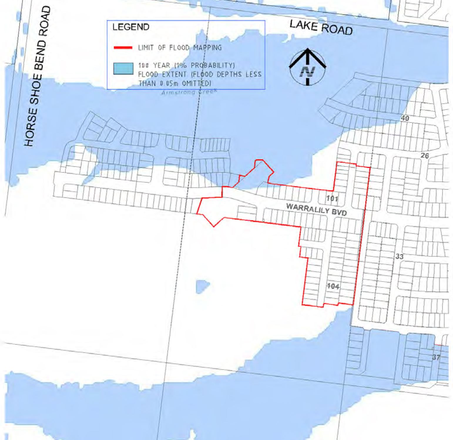
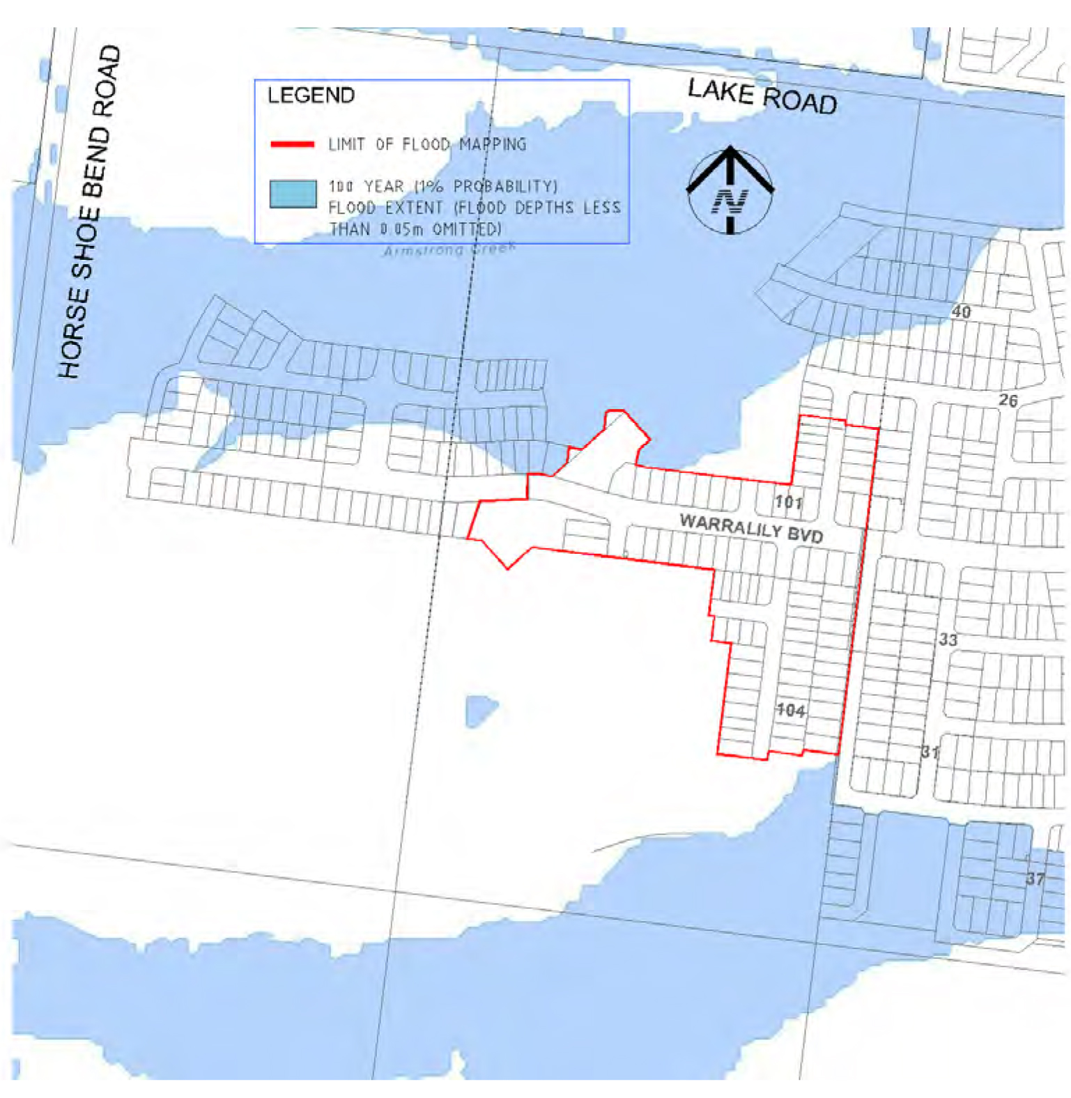
Portfolio: |
Infrastructure, Parks & Gardens – Cr Ellis |
Source: |
City Services – Engineering Services |
General Manager: |
William Tieppo |
Index Reference: |
Subject: Drainage - Floods |
The purpose of this report is to present a revision to the flood mapping for existing conditions produced within the early stages of the development of the Armstrong Creek Urban Growth Plan (UGP).
The flood mapping is subject to a revision due to the subdivision and development at 75 Airport Road, Mount Duneed and 192 – 237 Boundary Road, Mount Duneed. Prior to subdivision the parent lots was considered to be liable to flooding. This development site, which is also known as Armstrong Villawood Stages 17, 18, 28 and 29, achieves flood immunity for newly created lots for flood events up to and including the 100 year Average Recurrence Interval (ARI) event due to approved internal earthworks including the reshaping of Armstrong Creek.
The earthworks undertaken have resulted in the floodwaters from the 100 year ARI event being contained within the boundaries of the Armstrong Creek reserve.
Council has a statutory obligation under the Building Regulations 2006 to designate land as liable to flooding where it reasonably knows it to be prone to flooding. Conversely, there is an obligation to remove the encumbrance of designation from land that is no longer considered to be flood-prone.
It should be noted that designation is separate to the creation of flood overlays within the Planning Scheme, which generally follows designation. In the case of the Armstrong Creek UGP area, the planning scheme amendment to create post-development flood zones or overlays is proposed after the design of the proposed precincts.
The current designated flood mapping (refer to Attachment 1) was designated by Council at its meeting of 12 December 2006, under the provisions of the Building Regulations 2006. Designation of land as liable to flooding enables the control of floor levels for acceptable building permit applications, or refusal of consent to building applications where there is likely to be a danger to life, health or safety due to flooding. Designation also enables disclosure of flood status within statutory information certificates.
Cr Ellis moved, Cr Richards seconded -
That Council revoke the Council designation of 12 December 2006 of flood affected land as highlighted as Stages 17, 18, 28 and 29 on Armstrong Creek Urban Growth Plan Flood Map dated 29 November 2006 as liable to flooding pursuant to Regulation 802(2) of the Building Regulations 2006.
Carried.
As part of the development of the Armstrong Creek Urban Growth Plan (UGP) a flood study was undertaken by specialist consulting engineers to identify the extents of the 100 year Average Recurrence Interval flood event for existing conditions. Following a public exhibition phase, the resultant flood mapping (refer to Attachment 1) was designated by Council at its meeting of 12 December 2006, under the provisions of the Building Regulations 2006.
Designation of land as liable to flooding under Regulation 802 of the Building Regulations 2006 enables the control of floor levels for acceptable building permit applications, or refusal of consent to building applications where there is likely to be a danger to life, health or safety due to flooding. Designation also enables disclosure of flood status within statutory information certificates such as the Land Information Certificate and Building Information Request Form.
The subject of this report is the residential land at Armstrong Creek fronting Airport Road and Boundary Road. At the time of the flood study the subject land comprised of two larger lots. Prior to subdivision the parent lot was used primarily as farmland.
The subdivision at 75 Airport Road, Mount Duneed and 193 – 237 Boundary Road, Mount Duneed was named Armstrong Villawood Estate by the developer. The current designated flood extent affects multiple residential lots within the Armstrong Villawood Estate Stages 17, 18, 28 and 29.
Overland flows that may occur within the subdivision during the 100 year ARI flood event are now contained within road and drainage reserves in accordance with accepted best practice for development within flood-prone areas. Best practice requires that any overland flows within residential areas satisfy public safety criteria with respect to velocity and depth of flow.
Council has a statutory obligation under the Building Regulations 2006 to designate land as liable to flooding where it reasonably knows it to be prone to flooding. Conversely, there is an obligation to remove the encumbrance of designation from land that is no longer considered to be flood-prone.
Attachment 1 shows the existing flood designation. Attachment 2 shows the change in flood mapping at 75 Airport Road, Mount Duneed and 193 – 237 Boundary Road, Mount Duneed after construction of the subdivision.
The revocation of flood-prone areas designation and designation of revised flood data does not result in any known adverse environmental impacts.
The removal of a minimum floor level requirement for new dwellings may result in a minor reduction in energy and material usage during construction. In addition, concrete slab-on-ground construction, which is normally used for a non-elevated floor, achieves the minimum energy rating more readily than a timber floor on stumps.
The costs of proceeding to revoke the existing designation and to designate the revised flood mapping at 75 Airport Road, Mount Duneed and 193 – 237 Boundary Road, Mount Duneed, in accordance with the requirements of the Building Regulations 2006, are provided for within the annual recurrent budget.
The City has various statutory responsibilities for drainage management and flood management (prevention, response and recovery) as set out in the Local Government Act 1989, Local Government Regulations 1990, Planning and Environment Act 1987, Building Regulations 2006, Water Act 1989, Subdivision Act 1988 and Emergency Management Act 1986.
Regulation 802(2) of the Building Regulations 2006 provides Council with the powers to ‘designate’ land liable to flooding. Regulation 802(3) provides that consent must be obtained from Council for an application to build on land liable to flooding.
Section 27 of the Interpretation of Legislation Act 1984 provides the power for Councils to ‘repeal or amend a subordinate instrument made in the exercise of that power’.
Section 807 of the Building Regulations 2006 requires Council to update the municipality’s designated special area maps at the Building Control Commission in the event of alterations to a designated special area. Designated special areas include areas designated as being liable to flooding.
Section 229 of the Local Government Act and Regulation 326 of the Building Regulations provide for the issue of information certificates containing prescribed information, including the flood status of properties.
The revised flood data for 75 Airport Road, Mount Duneed and 193 – 237 Boundary Road, Mount Duneed will assist the City in meeting its statutory obligations with regard to flood data.
The revised flood data will also assist in fulfilling the recommendations of the Municipal Emergency Management Committee adopted by Council in November 1998 (i.e. mapping of 1 in 100 year flood levels).
The recommendations of this report are consistent with City Plan, in relation to Growing our economy and promoting a sustainable built environment, sustainable land use and development.
There are no officer direct or indirect interests with respect to this report.
Council has a risk exposure through its statutory obligations under the Building Regulations 2006 to:
designate land as liable to flooding where it reasonably knows it to be prone to flooding;
specify minimum floor levels in consultation with the relevant floodplain management authority (CCMA); and
refuse consent to building applications where there is likely to be a danger to life, health or safety due to flooding.
Council also has some risk exposure with any failure to disclose the flood-prone status of a property in a Land Information Certificate.
The designation of the flood data produced by the flood study Armstrong Creek UGP project is a key step toward minimising Council’s exposure to these risks.
Conversely, there is an obligation to remove the encumbrance of designation from land that is no longer considered to be flood-prone. Designation of land as being liable to flooding can result in extra construction costs and concerns regarding saleability, in some cases.
Council has a responsibility to the community to provide the best possible information on areas that are flood-prone.
We have taken into consideration the human rights relative to the subject matter of this report, which improves protection of private property.
The current designation was undertaken following a public exhibition in October 2006 with notification of affected property owners. These owners were sent letters and fact sheets with an invitation for submissions.
A revocation of designation does not warrant public consultation as it constitutes the removal of an encumbrance on land.
The owners of properties affected by the revocation will be notified so they are aware that disclosure of flood status on a Section 32 Vendors Statement is no longer required.
Relevant Council databases and flood maps will be revised and updates sent to the Corangamite Catchment Management Authority and Building Control Commission.
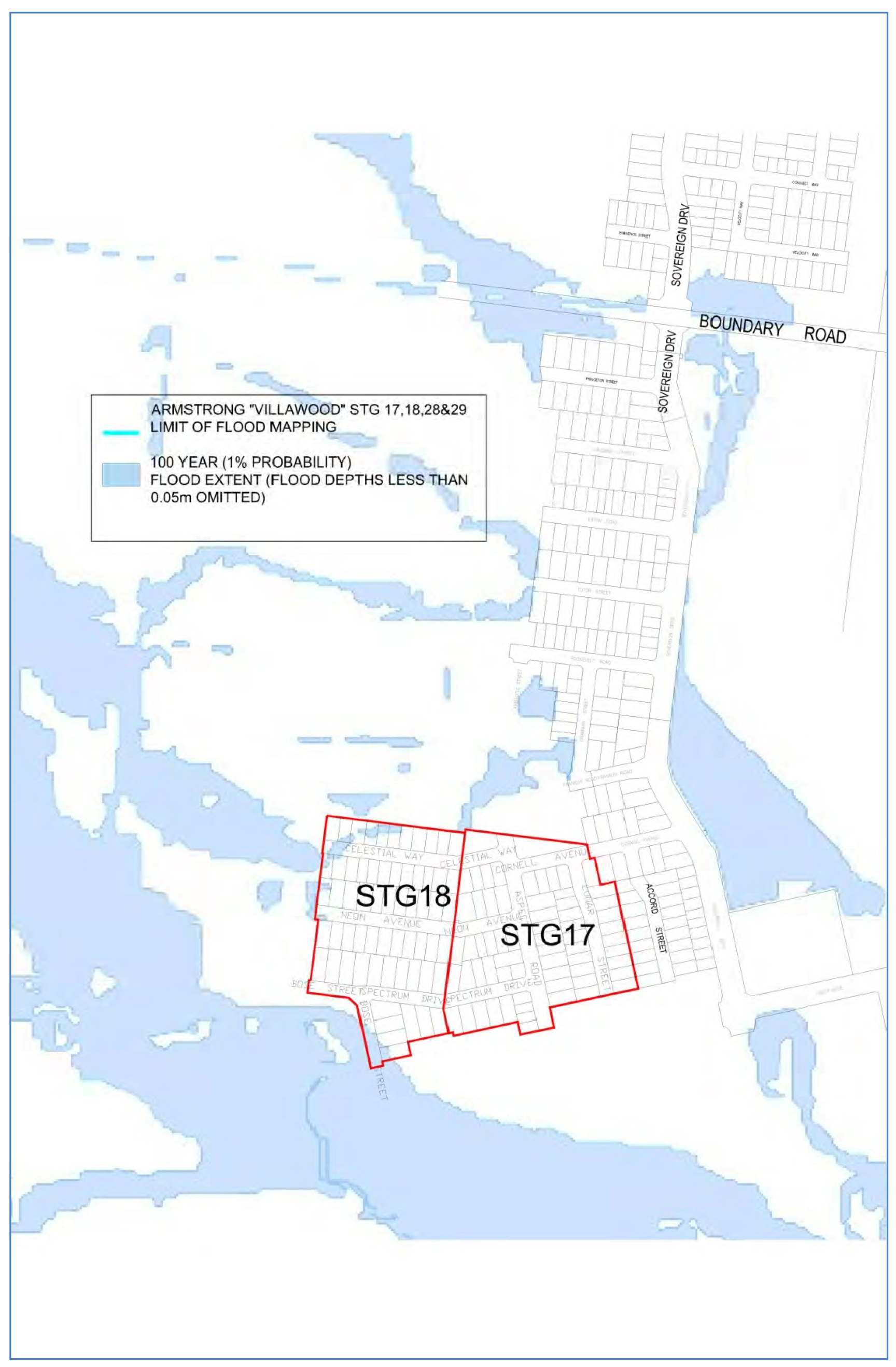
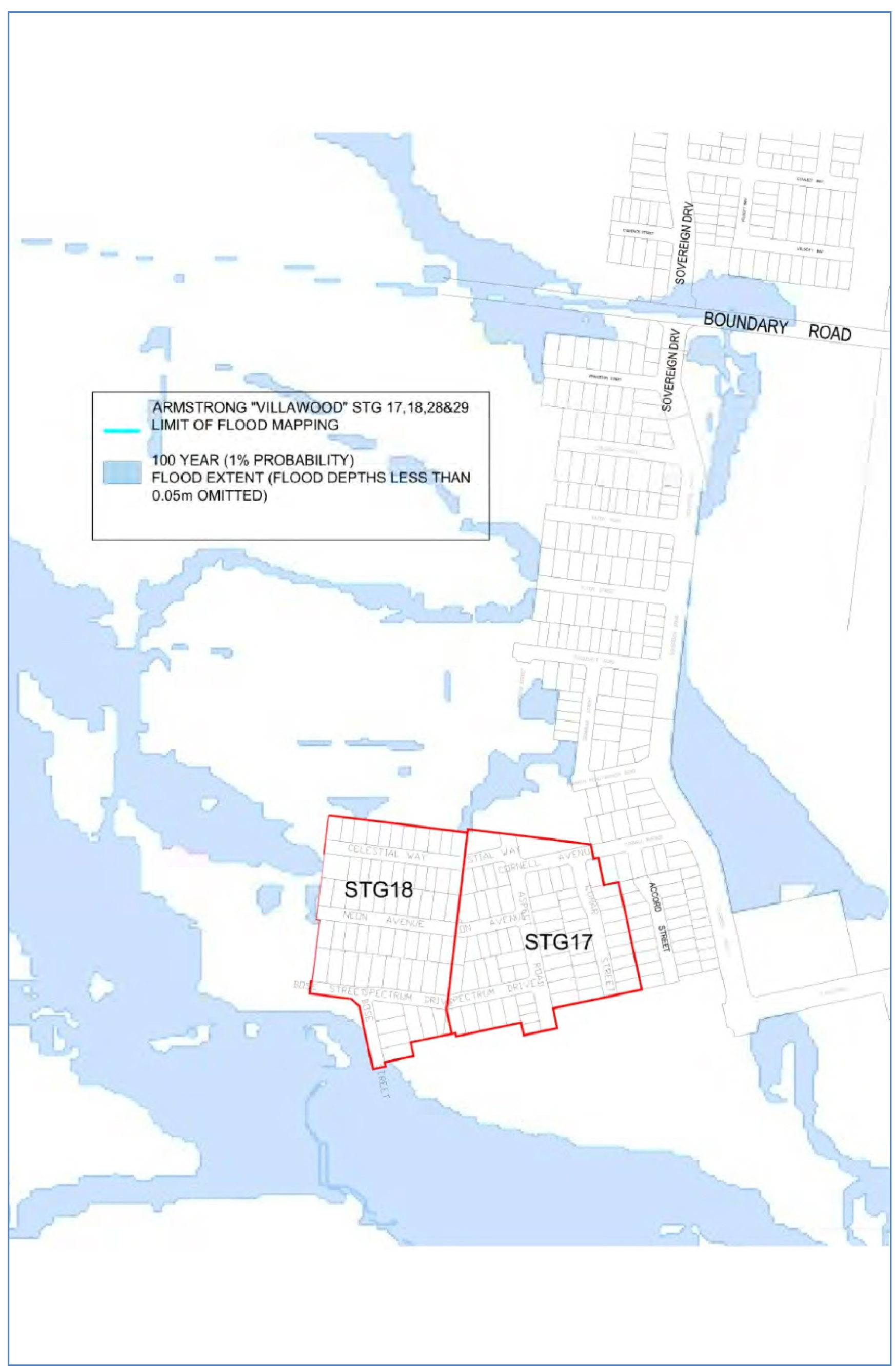
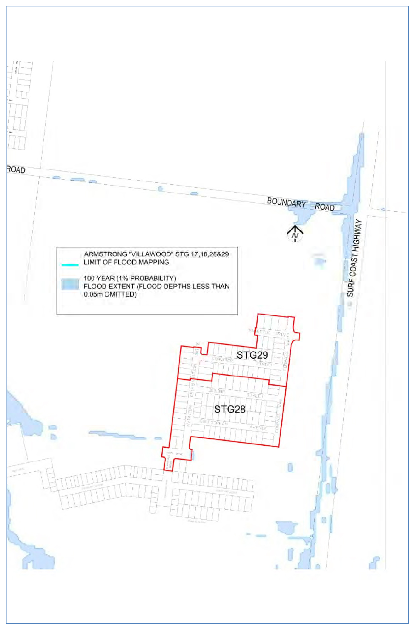
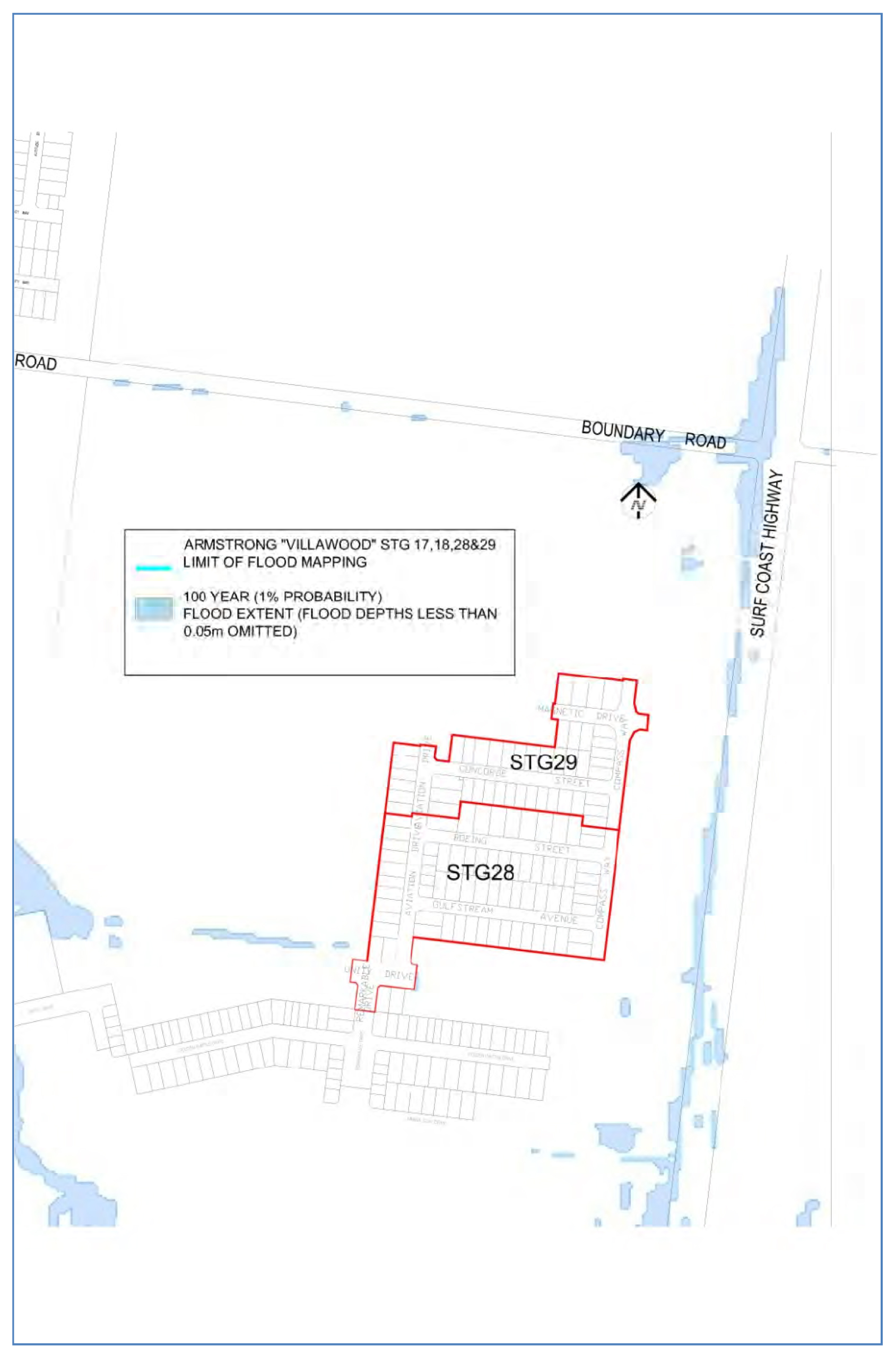
Portfolio: |
Infrastructure, Parks & Gardens – Cr Ellis |
Source: |
City Services – Engineering Services |
General Manager: |
William Tieppo |
Index Reference: |
Subject: Drainage - Floods |
| Report to: | Council |
The purpose of this report is to present a revision to the flood mapping for existing conditions produced within the stages of the development of Lara Central, Lara.
The flood mapping is subject to a revision due to the subdivision and development at 40 and 50, 5 and 55 Caddys Road, Lara. Prior to subdivision the parent lot was considered to be liable to flooding. This development site, which is also known as Lara Central, Stage 3, achieves flood immunity for newly created lots for flood events up to and including the 100 year Average Recurrence Interval (ARI) event due to approved internal earthworks.
The earthworks undertaken have resulted in the floodwaters from the 100 year ARI event being contained within the boundaries of the road network.
Council has a statutory obligation under the Building Regulations 2006 to designate land as liable to flooding where it reasonably knows it to be prone to flooding. Conversely, there is an obligation to remove the encumbrance of designation from land that is no longer considered to be flood-prone.
It should be noted that designation is separate to the creation of flood overlays within the Planning Scheme, which generally follows designation. In the case of Lara Central, the planning scheme amendment to create post-development flood zones or overlays is proposed after the design of the proposed precincts.
The current designated flood mapping (refer to Attachment 1) was designated by Council at its meeting of 26 October 2004, under the provisions of the Building Regulations 2006. Designation of land as liable to flooding enables the control of floor levels for acceptable building permit applications, or refusal of consent to building applications where there is likely to be a danger to life, health or safety due to flooding. Designation also enables disclosure of flood status within statutory information certificates.
Cr Ellis moved, Cr Richards seconded -
That Council revoke the Council designation of 26 October 2004 of flood affected land Lara Central, Stage 3 as liable to flooding pursuant to Regulation 802(2) of the Building Regulations 2006.
Carried.
Designation of land as liable to flooding under Regulation 802 of the Building Regulations 2006 enables the control of floor levels for acceptable building permit applications, or refusal of consent to building applications where there is likely to be a danger to life, health or safety due to flooding. Designation also enables disclosure of flood status within statutory information certificates such as the Land Information Certificate and Building Information Request Form.
The subject of this report is the residential land at Lara Central, Lara fronting 40 and 50, 5 and 55 Caddys Road, Lara. Prior to subdivision the parent lot was used primarily as farmland.
The subdivision at 40 and 50, 5 and 55 Caddys Road, Lara was named Lara Central by the developer. The current designated flood extent affects multiple residential lots within the Estate Stage 3.
Overland flows that may occur within the subdivision during the 100 year ARI flood event are now contained within road and drainage reserves in accordance with accepted best practice for development within flood-prone areas. Best practice requires that any overland flows within residential areas satisfy public safety criteria with respect to velocity and depth of flow.
Council has a statutory obligation under the Building Regulations 2006 to designate land as liable to flooding where it reasonably knows it to be prone to flooding. Conversely, there is an obligation to remove the encumbrance of designation from land that is no longer considered to be flood-prone.
Attachment 1 shows the existing flood designation. Attachment 2 shows the change in flood mapping at 40 and 50, 5 and 55 Caddys Road, Lara after construction of the subdivision.
The revocation of flood-prone areas designation and designation of revised flood data does not result in any known adverse environmental impacts.
The removal of a minimum floor level requirement for new dwellings may result in a minor reduction in energy and material usage during construction. In addition, concrete slab-on-ground construction, which is normally used for a non-elevated floor, achieves the minimum energy rating more readily than a timber floor on stumps.
The costs of proceeding to revoke the existing designation and to designate the revised flood mapping at 40 and 50, 5 and 55 Caddys Road and 121 Flinders Avenue, Lara, in accordance with the requirements of the Building Regulations 2006, are provided for within the annual recurrent budget.
The City has various statutory responsibilities for drainage management and flood management (prevention, response and recovery) as set out in the Local Government Act 1989, Local Government Regulations 1990, Planning and Environment Act 1987, Building Regulations 2006, Water Act 1989, Subdivision Act 1988 and Emergency Management Act 1986.
Regulation 802(2) of the Building Regulations 2006 provides Council with the powers to ‘designate’ land liable to flooding. Regulation 802(3) provides that consent must be obtained from Council for an application to build on land liable to flooding.
Section 27 of the Interpretation of Legislation Act 1984 provides the power for Councils to ‘repeal or amend a subordinate instrument made in the exercise of that power’.
Section 807 of the Building Regulations 2006 requires Council to update the municipality’s designated special area maps at the Building Control Commission in the event of alterations to a designated special area. Designated special areas include areas designated as being liable to flooding.
Section 229 of the Local Government Act and Regulation 326 of the Building Regulations provide for the issue of information certificates containing prescribed information, including the flood status of properties.
The revised flood data for 40 and 50, 5 and 55 Caddys Road, Lara will assist the City in meeting its statutory obligations with regard to flood data.
The revised flood data will also assist in fulfilling the recommendations of the Municipal Emergency Management Committee adopted by Council in November 1998 (i.e. mapping of 1 in 100 year flood levels).
The recommendations of this report are consistent with City Plan, in relation to Growing our Economy and promoting a sustainable built environment, sustainable land use and development.
There are no officer direct or indirect interests with respect to this report.
Council also has some risk exposure with any failure to disclose the flood-prone status of a property in a Land Information Certificate.
The designation of the flood data produced by the flood study is a key step toward minimising Council’s exposure to these risks.
Council has a risk exposure through its statutory obligations under the Building Regulations 2006 to:
designate land as liable to flooding where it reasonably knows it to be prone to flooding;
specify minimum floor levels in consultation with the relevant floodplain management authority (CCMA); and
refuse consent to building applications where there is likely to be a danger to life, health or safety due to flooding.
Council also has some risk exposure with any failure to disclose the flood-prone status of a property in a Land Information Certificate.
The designation of the flood data produced by the flood study Armstrong Creek UGP project is a key step toward minimising Council’s exposure to these risks.
Conversely, there is an obligation to remove the encumbrance of designation from land that is no longer considered to be flood-prone. Designation of land as being liable to flooding can result in extra construction costs and concerns regarding saleability, in some cases.
Council has a responsibility to the community to provide the best possible information on areas that are flood-prone.
We have taken into consideration the human rights relative to the subject matter of this report, which improves protection of private property.
A revocation of designation does not warrant public consultation as it constitutes the removal of an encumbrance on land.
Relevant Council databases and flood maps will be revised and updates sent to the Corangamite Catchment Management Authority and Building Control Commission.
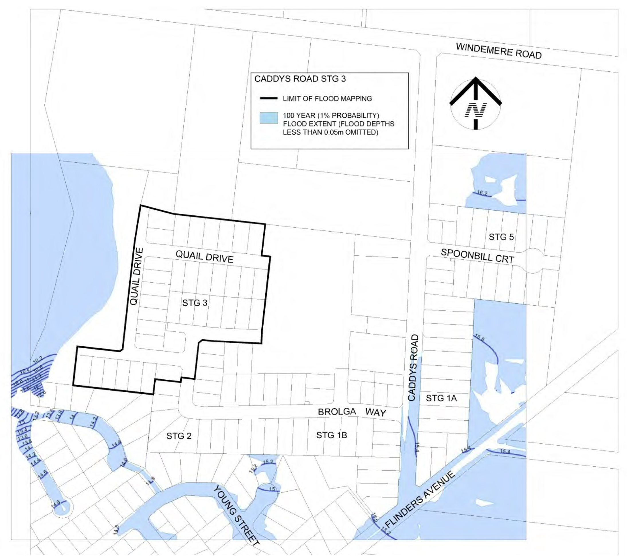
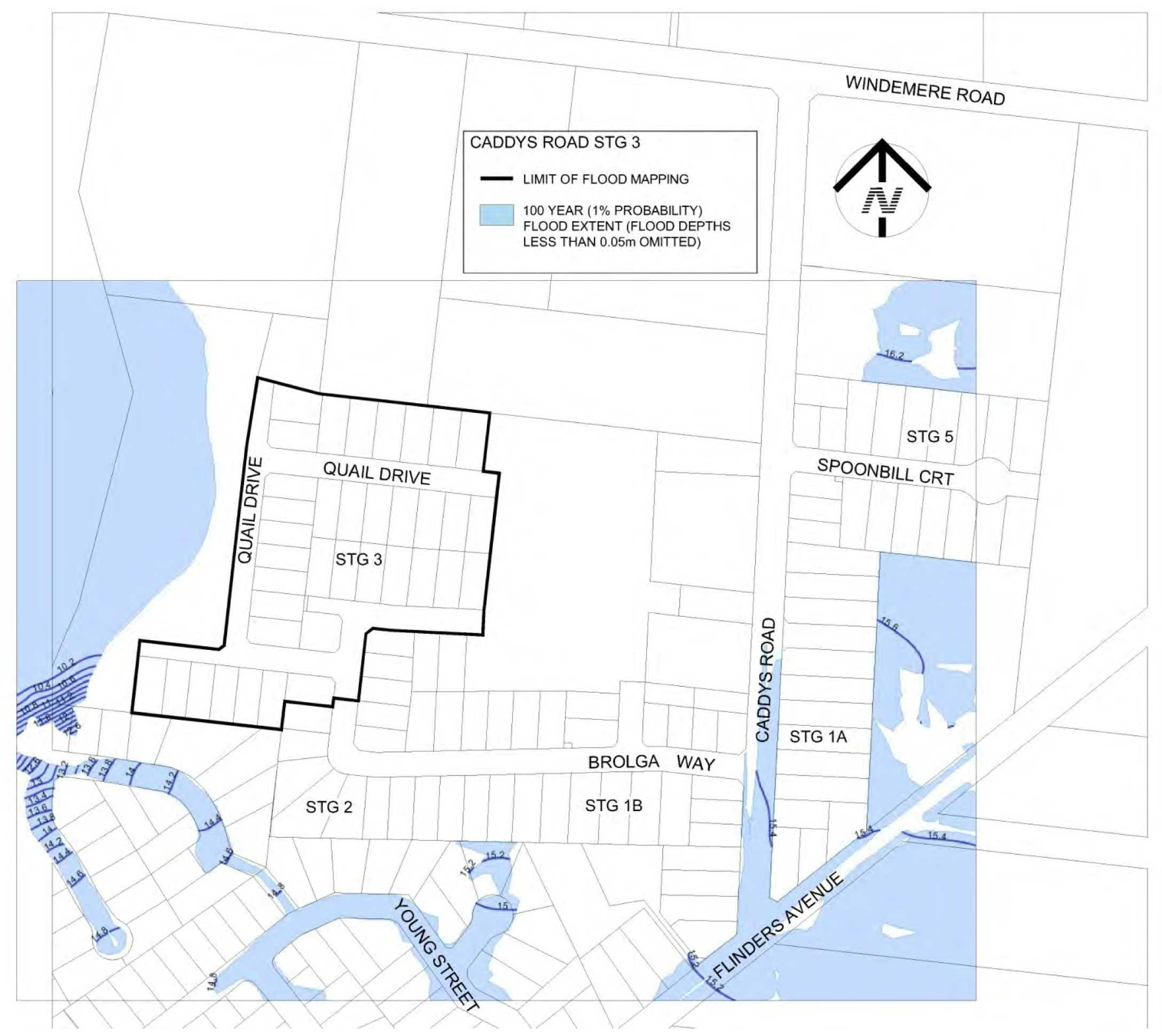
Portfolio: |
Infrastructure - Cr Ellis |
Source: |
City Services - Engineering Services |
General Manager: |
William Tieppo |
Index Reference: |
Council Reports 2016, Special Rates and Charges |
The purpose of this report is to seek a resolution by Council to declare a special charge to property owners for road construction in Portarlington (See Plan – Appendix 4).
Council resolved its Intention to Declare a Special Charge for the construction of the Portarlington North East Group of roads at it’s meeting of 17 February 2015.
During the submission period, Council received 16 submissions (all objections) to the proposal from a possible 502 properties.
A submissions panel was established and heard from submitters at a hearing held on 27 October 2015. Although three (3) of the property owners requested to be heard, a total of 19 property owners made verbal presentations to the panel.
After considering all of the submissions both written and verbal, the panel has recommended the scheme proceed with two changes. These changes are detailed in the ‘discussion’ heading of this report.
The proposed works include sealing all unsealed portions of roads bounded by Fisher, Clarke, Mercer and Hood Streets, Portarlington. (See Plan Appendix 4). There is 8.5 km of roads to be sealed and there are 502 individual properties benefiting from the scheme.
The proposed works include road construction only with no additional kerb and channel or formal underground drainage works. Council funded works include intersection safety improvements, roadside drainage improvements, road sealing works in excess of a standard 7.6 metre road width and intersection lighting improvements.
The cost of the project is summarised as follows:
• Total project cost - |
$4,424,517 |
• Amended property owner’s contribution - |
$3,368,546 |
• Amended Council contribution - |
$1,055,971 |
The scheme has been prepared in accordance with the special rate and charge provisions of the Local Government Act 1989, along with Council’s Special Rates and Charges Policy.
Cr Ellis moved, Cr Macdonald seconded -
That Council:
Resolves to declare the Special Charge Scheme as follows:
The Special Charge is declared for a period of five (5) years commencing upon completion of the works and scheme finalisation.
The special charge be declared for the purposes of reducing costs to Council in relation to the construction of roads for all local unsealed streets bounded by Fisher, Clarke, Mercer and Hood Streets, Portarlington which:
will provide proper sealed road access, improved nature strip drainage and enhancement to the general amenity for each of the properties included in the scheme;
Council considers will be a special benefit to those persons required to pay the special charge (and who are described in succeeding parts of this Resolution); and
arises out of Council’s function of planning for and providing infrastructure for property owners.
it be recorded that, for the purposes of Section 163 (2A) of the Act, the special charge proceeds will not exceed the amount calculated in accordance with the prescribed formula (R x C = S), the:
'benefit ratio’ (R) being calculated at 0.87 represents the special benefits to all persons liable to pay the special charge; and
‘total cost’ (C) of performing the function described in Part b of this Resolution based on estimated cost be recorded as $3,888,839 as amended.
‘maximum levy’ (S) total amount of the special charge be levied and be recorded as $3,368,546 as amended.
the following be specified as the area for which the special rate is so declared:
the area within municipal district of Council highlighted in the plan attached to this Resolution (“the area”).
the following be specified as the land in relation to which the special charge so declared:
All land within the area shown on the plan.
the following be specified as the criteria which form the basis of the special charge so declared:
Ownership of any land described in Part e of this Resolution.
the following be specified as the manner in which the special charge so declared will be assessed and levied:
The costs to be apportioned based on access and amenity benefits.
The special charge will be levied by sending a notice to the person who is liable to pay, pursuant to section 163(4) of the Act.
having regard to the preceding parts of this Resolution but subject to Section 166 (1) of the Act, it be recorded that:
the owners of the land described in column 2 and 3 of Schedule C to the Resolution are estimated liable for the respective amounts set out in column 7 of Schedule C; and
such owners may, subject to any further resolution of Council pay the special charge in the following manner:
the charge will become due and payable within one month of the issue of the notice requesting payment pursuant to Section 167 (3) of the Act;
interest will not be charged for six months after the issue of the notice provided the person liable makes timely payment in accordance with any repayment arrangements that may be agreed on by Council; and
in accordance with Section 172 of the Act, the rate of interest which is payable on the special charge which has not been paid by the specified date is set at Council’s overdraft rate, reviewed every three months (provided that it shall not exceed the rate fixed by the Governor in Council by Order for the purposes of Section 172 (2A) in which case the rate of interest shall be the maximum rate fixed by the Governor in Council by Order for the purposes of this section).
Authorise Council’s Chief Executive Officer to levy the Special Charge in accordance with Section 163(4) of the Act.
Carried.
On 17 February 2015, Council resolved to give notice of its intention to declare a Special Charge Scheme for the construction of roads in the north east section of Portarlington.
During the subsequent submission period, 16 objections were received from the potential 502 affected properties. Of these, three property owners requested to speak to the panel members.
Council held the panel hearing on Tuesday 27 October 2015. Of the three (3) property owners who requested to be heard, two (2) were absent from the hearing. Approximately 50 people were in attendance and once the formal presentation was complete, the meeting was open for comment from the floor. A further 18 property owners addressed the panel and although some were opposed to the roads, there was a slight majority of people in support of the scheme. Some presenters simply wanted some further explanation and some had related concerns about drainage issues.
After considering all submissions, both verbal and written, the panel has recommended the scheme proceed with two changes of which are detailed below.
The submissions panel has recommended the scheme proceed with two changes. After hearing from property owners there was a common belief from unit owners that their charges were too high. The first change to the scheme has seen a reduction in front unit charges of a multi unit development site.
In the original scheme these properties received a full benefit due to their full access benefit and frontage to the new road. The amended scheme has reduced the amenity charge for these units which results in a $905 reduction to their charge. The same principle has been applied to smaller properties that have been subdivided from a parent lot.
The result of the first change increased the charge to the remaining property owners. To counteract this adverse affect, the second change to the scheme is to increase Council’s contribution by $109,000. This fund injection maintains the current charges for all remaining properties in the scheme and is considered to be a reasonable compromise. The revised funding implications are shown below and at Appendix 2.
The road infrastructure proposal provides proper sealed access, improved drainage and a generally safer environment for pedestrian and vehicular traffic. Dust is eliminated and storm water runoff is less contaminated with silt prior to final discharge into the Bay.
It is anticipated that minimal vegetation removal will be required to complete the project.
During the course of construction and the manufacture and procurement of materials, there is some energy use and greenhouse gas emissions. This stops when construction is complete.
The project does not create waste with the exception of some excess spoil. The proposal does not affect any natural habitats.
The project has a one off capital cost and there will be minimal ongoing maintenance costs. Funding for this scheme will be considered in the 2016/17 budget process.
A breakdown of costs is as follows:
Estimated amended scheme cost to property owners |
|
$3,368,546 |
Estimated scheme cost to Council - |
$520,293 |
$1,055,971 |
Estimated direct cost to Council for improved roadside drainage, intersection safety and lighting - |
$426,678 |
|
Additional scheme cost to Council post panel hearing considerations - |
$109,000 |
|
Total Project Cost |
|
$4,424,517 |
The total revised estimated net cost to Council for this project is $1,055,971.
The scheme has been prepared in accordance with the Special Rate and Charge provisions of the Local Government Act 1989 along with Council’s Special Rates and Charges Policy.
This report aligns with the City Plan as follows:
Community Wellbeing:
Healthy Lifestyles – Facilitating and promoting physical activity.
Healthy Environments – Safe, hazard and nuisance free environments.
Sustainably Built and Natural Environment
Enhance and protect natural areas and ecosystem health
Support our Community to live – Encourage increased use of alternatives to car transport.
Advocate for and promote sustainable design and development – Promoting sustainable design and retrofitting and acknowledging the communities desire to have their say.
No Council Officer involved with this process has any direct or indirect interest in the properties.
Provision of sealed roads will provide safer driving conditions for motorists with a defined and more standard road profile. Walking conditions for pedestrians will also be enhanced by minimising the risk of personal injuries through conflict with vehicles. The improved drainage will reduce the hazards associated with water over roads and the affects of nuisance flooding to property. There are no identified risks for Council in making its intention to declare the scheme.
The provision of properly sealed and drained roadways is aligned to Council’s City Plan as described above and provides improved connectivity and safety for motorists and pedestrians.
In developing this report to Council, the subject matter has been considered to determine if it raises any human rights issues. In particular, whether the scope of any human right established by the Victorian Charter of Human Rights and Responsibilities is in any way limited, restricted or interfered with by the recommendations contained in this report. It is considered that the subject matter does not raise any adverse human rights issues.
It is further considered that the construction of the Portarlington Roads upholds the right to freedom of movement (Section 12 of the Human rights Charter) by enhancing a person’s ability to move freely within the area they choose to live.
Community consultation of the road construction Special Charge Scheme has been carried out as follows:
2012 -2013 – Establishment and monthly meetings held with Community Reference Panel.
12 May 2013 – Public meeting (open forum with over 150 attendees) held at the Portarlington Community Hall. This meeting disclosed all information in relation to the proposed scheme including scope of work, cost apportionment and Benefit Ratio Calculation.
May 2013 – Update letter, information sheet and property owner survey.
19 July 2013 – Update letter to property owners disclosing results of survey.
16 May 2014 – Update letter to property owners on revised timing of the scheme.
December 2014 – Update letter to property owners on upcoming ‘Intention to Declare’ a scheme.
3 March 2015 – Letter to owners on advertisement of the scheme.
May 2015 – Various response letters acknowledging receipt of submissions
7 October 2015 – Panel Hearing invitation letter
10 November 2015 – Update letter advising of outcome of Panel Hearing.
Many phone calls, emails and letters have been received and responded to during the consultation process.
Further correspondence will be sent to all affected property owners should Council resolve to make its Declaration of charges.
The works for the construction of roads in Portarlington which consist of excavation, drainage improvements, intersection improvements, reinstatement of nature strips, legal advice and professional services associated with survey, engineering design, supervision and administration of the project as included in the cost estimate as shown below.
ESTIMATED TOTAL COST OF ROAD CONSTRUCTION |
|||||
ITEM |
DESCRIPTION |
QUANTITY |
UNIT |
RATE $ |
AMOUNT $ |
1.00 |
GENERAL |
|
|
|
|
1.01 |
Initial site establishment and set up, decamping and site cleanup and other fixed costs up to time of completion of works. |
1.00 |
Item |
$90,000.00 |
$90,000.00 |
1.02 |
Traffic management costs. |
1.00 |
Item |
$72,000.00 |
$72,000.00 |
1.03 |
Setting out of works. |
1.00 |
Item |
$9,000.00 |
$9,000.00 |
1.04 |
Service / Cable locations |
1.00 |
Item |
$6000.00 |
$6,000.00 |
2.00 |
EARTHWORKS & DEMOLITION |
|
|
|
|
2.01 |
Excavation and disposal of all materials to limits of work as indicated on plan, including trimming for new road pavement, excavation of soft spots and removal of concrete. |
18868.00 |
m3 |
$45.00 |
$849,060.00 |
2.02 |
Placement and consolidation of engineered fill with approved materials in preparation for new works. |
631.00 |
m3 |
$30.00 |
$18,930.00 |
2.03 |
Trimming / Removal and disposal of trees. |
|
Item |
|
|
2.04 |
Saw-cutting of Asphalt paving. |
897.00 |
m |
$10.00 |
$8,970.00 |
2.05 |
Saw-cut of concrete kerb and channel |
30.00 |
m |
$10.00 |
$300.00 |
3.00 |
PAVEMENT WORKS |
|
|
|
|
3.01 |
250mm compacted depth Class 1 20mm crushed rock, supplied, spread and compacted. |
15781.70 |
m3 |
$105.00 |
$1,657,078.50 |
3.02 |
30mm compacted depth 10mm nominal size type N Asphalt spread and compacted including emulsion prime & grit using a paver. |
8199.89 |
m2 |
$25.00 |
$204,997.35 |
3.03 |
7mm Primer Seal, supplied and placed. |
54398.52 |
m2 |
$8.00 |
$435,188.19 |
3.04 |
Prepare existing pavement for sealing. |
54398.52 |
m2 |
$1.00 |
$54,398.52 |
4.00 |
SERVICES |
|
|
|
|
4.01 |
50mm dia UPVC conduits, supplied and laid including back-filling of trench. |
200.00 |
m |
$70.00 |
$14,000.00 |
5.00 |
LANDSCAPING |
|
|
|
|
5.01 |
Top soiling and seeding nature strips, next to kerb replacement |
46.00 |
m2 |
$8.00 |
$368.00 |
6.00 |
SIGNING, LINE-MARKING AND FENCING |
|
|
|
|
6.01 |
Erection of new permanent signs and posts
D4-2-1. |
12.00 |
No |
$250.00 |
$3,000.00 |
6.02 |
Relocation of existing signs and posts (Give way & Stop). |
40.00 |
No |
$150.00 |
$6,000.00 |
6.03 |
Repaint or install new line-marking 30m long intersection approach lines, repaint or install new statcon line marking at all intersections bounded by, The Esplanade, Fisher St, Hood Road and Mercer St |
42.00 |
Item |
$1.00 |
$42.00 |
6.04 |
R.R.P.M. Two way direction, supplied and placed. |
90.00 |
No |
$12.00 |
$1,080.00 |
6.05 |
Supply and placement of Guide Posts and delineators. |
200.00 |
No |
$80.00 |
$16,000.00 |
7.00 |
PROVISIONAL ITEMS |
|
|
|
|
7.01 |
Excavation and stockpiling of suitable existing road material for re-use of in place of lower subgrade FCR (price is cost saving over import of new quarry product) |
4500.00 |
m3 |
- |
$30.00 |
SUB-TOTAL |
$3,446,413 |
||||
10% Contingency |
$344,641 |
||||
Design |
$103,392 |
||||
Project Administration |
$103,392 |
||||
CONSTRUCTION COST ESTIMATE |
$3,997,839 |
||||
ESTIMATED COST FOR DRAINAGE IMPROVEMENTS, KERB AND CHANNEL REPLACEMENT AND STREET LIGHTING |
|||||
ITEM |
DESCRIPTION |
QUANTITY |
UNIT |
RATE $ |
AMOUNT $ |
1.00 |
GENERAL |
|
|
|
|
1.01 |
Initial site establishment and set up, decamping and site cleanup and other fixed costs up to time of completion of works. |
1 |
Item |
$10,000.00 |
$10,000.00 |
1.02 |
Traffic management costs. |
1 |
Item |
$8,000.00 |
$8,000.00 |
1.03 |
Setting out of works. |
1 |
Item |
$1,000.00 |
$1,000.00 |
2.00 |
DRAINAGE |
|
|
|
|
|
PIPES |
|
|
|
|
2.01 |
Connection of existing household storm-water discharge drains including excavation, supply, placement and provision of approved backfill to drainage pits. |
2 |
No. |
$250.00 |
$500.00 |
2.02 |
300mm dia RC pipe, supplied, laid and jointed including excavation, placement of approved fine crushed rock bedding and back-filling with approved FCR. (19) |
6 |
m |
$160.00 |
$960.00 |
2.03 |
375mm dia RC pipe, supplied, laid and jointed including excavation, placement of approved fine crushed rock bedding and back-filling with approved FCR. (11-12,24) |
13.45 |
m |
$180.00 |
$2,421.00 |
2.04 |
525mm dia RC pipe, supplied, laid and jointed including excavation, placement of approved fine crushed rock bedding and back-filling with approved FCR. |
8 |
m |
$275.00 |
$2,200.00 |
|
BOX CULVERTS |
|
|
|
|
2.05 |
300x150 RC box culverts, supplied, laid and jointed including excavation, placement of approved fine crushed rock bedding and backfilling with approved material. (18) |
2.4 |
m |
$275.00 |
$660.00 |
|
PITS: SEP |
|
|
|
|
2.06 |
900mm x 600mm SEP, less than 1.5m deep with Gatic type cover, supplied and placed including excavation, placement of approved fine crushed rock bedding and back-filling with approved material. (12) |
1 |
No. |
$1,400.00 |
$1,400.00 |
|
PITS : JP |
|
|
|
|
2.07 |
900mm x 600mm junction pit, less than 1.5m deep with Gatic cover, butted to driveable endwall supplied and placed including excavation, placement of approved fine crushed rock bedding and back-filling with approved material. (25) 1 No. $2,100.00 $2,100.00 |
|
|
|
|
2.08 |
900mm x 600mm junction pit, less than 1.5m deep with Grated cover, supplied and placed including excavation, placement of approved fine crushed rock bedding and back-filling with approved material. (23,24) 2 No. $1,600.00 $3,200.00 |
|
|
|
|
2.09 |
1200mm x 900mm junction pit 1.50m to 2.00m deep with Gatic type cover, supplied and placed including excavation, placement of approved fine crushed rock bedding and back-filling with approved material. (11,16) |
2 |
No. |
$2,000.00 |
$4,000.00 |
2.10 |
1200mm x 900mm junction pit 1.5m to 2.00m deep with sloped grated cover, supplied and placed including excavation, placement of approved fine crushed rock bedding and back-filling with approved material. (15) |
1 |
No. |
$2,500.00 |
$2,500.00 |
2.11 |
Supply and fit "Bates" modified driveable endwall to existing pipe. (30,31) |
2 |
No. |
$750.00 |
$1,500.00 |
2.12 |
Modify existing DSE.pit raise lids to match new level and convert to double grated. (18,19,21,32) |
4 |
No. |
$1,375.00 |
$5,500.00 |
2.13 |
Modify existing pit to match finished surface level (22,26,28,29,31) |
3 |
No. |
$450.00 |
$1,350.00 |
2.14 |
Modify existing pit to match finished surface level and supply and fit Grated Class D cover. (8,10,13,14,17,30) |
8 |
No. |
$770.00 |
$6,160.00 |
2.15 |
Rural vehicle crossing 300mm diam. RC pipe, 3.6m wide with VicRoads driveable endwalls as per SD00603, supplied, laid and jointed including excavation, placement of approved FCR bedding and backfill. |
40 |
No. |
$2,500.00 |
$100,000.00 |
2.16 |
Supply and install 300mm diam. RC pipe, with single VicRoads driveable endwalls as per SD00603, supplied, laid and jointed including excavation, tap into existing pit, placement of approved FCR bedding and backfill. |
|
|||
8.4m long (1) |
1 |
Item |
$2,094.00 |
$2,094.00 |
|
2.4m long (2,6,7,8) |
4 |
Item |
$1,134.00 |
$4,536.00 |
|
4.8m long (3) |
1 |
Item |
$1,518.00 |
$1,518.00 |
|
7.2m long (5,17) |
2 |
Item |
$1,902.00 |
$3,804.00 |
|
2.17 |
Supply and install 375mm diam. RC pipe, with VicRoads driveable endwalls as per SD00603, supplied, laid and jointed including excavation, tap into existing pit, placement of approved FCR bedding and backfill. |
|
|
|
|
| 11.5m long (4,16) | 2 |
Item |
$2,844.00 |
$5,688.00 |
|
2.18 |
Extend existing 300mm diam. RC pipe approx 1.2m, with Bates style driveable endwalls, supplied, laid and jointed including excavation. (33,34) |
2 |
Item |
$950.00 |
$1,900.00 |
3.00 |
CONCRETE WORKS KERBING: ` |
|
|
|
|
3.01 |
Remove existing concrete kerb and construct B2 Barrier kerb and channel 450mm wide and reinstate nature strip. |
46 |
m |
$100.00 |
$4,600.00 |
4.00 |
SERVICE AUTHORITIES |
|
|
|
|
4.01 |
Addition of street light pole including footing. |
20 |
No |
$10,000.00 |
$200,000.00 |
SUB-TOTAL |
$377,591 |
||||
10% Contingency |
$37,759 |
||||
Design |
$11,328 |
||||
CONSTRUCTION COST ESTIMATE |
$426,678 |
||||
A |
Purpose |
|
||||
|
To construct roads in Portarlington bounded by Fisher Street, The Esplanade, Mercer Street and Hood Street to provide a sealed access for all property owners. |
|
||||
B |
Coherence |
|
||||
|
The works are located in the North East section of Portarlington. The works will provide a special benefit to adjoining properties. |
|
||||
C |
Total Cost C |
|
||||
|
Total Estimated cost of works - Spray seal road construction, roadside drainage and intersection safety improvements including signage |
$4,424,517.00 |
||||
|
Direct funding by Council for intersection safety and drainage improvements |
$426,678.00 |
||||
|
Direct funding by Council post submissions panel considerations |
$109,000.00 |
||||
|
TOTAL COST |
$3,888,839.00 |
||||
D |
Special Beneficiaries |
|
||||
|
501 properties with frontages to the proposed roads to be constructed are considered to receive access and amenity benefits. |
|
||||
E |
Estimate of Total Special Benefits out of the scheme -TSB (out) |
|
||||
|
There are three (3) crown land parcels and three (3) crown land reserves that are considered to receive special benefit but are out of the scheme. The access and amenity benefits to these parcels equate to 118 BU when considered in isolation. |
|
||||
|
Properties Excluded TSB (out) |
|
= |
118 BU |
|
|
F |
Estimate of Total Special Benefits in the scheme - TSB (in) |
|
||||
We will consider the total benefits to each property in terms of Benefit Units (BU). The construction of the Portarlington North East road network is considered to provide special benefit to the abutting properties in terms of access (1.0BU) and amenity(1.0BU). Not all properties receive a full benefit. There are 502 allotments receiving benefit from the scheme at a total of. 929.875 BU |
|
|||||
Properties Included TSB (in) |
|
= |
929.875 BU |
|
|
|
| G | Estimate of Total Community Benefit -TCB |
|
||||
It is considered that people in the community will receive a benefit from the works as the roads are used to access other areas. There are no amenity benefits considered for the general community. Based on the number of properties (205 to the East of Mercer Street), it is considered that these properties will gain a reduced access benefit. The access benefit has been allocated at 0.125BU per property representing a Total Community Benefit of 205 X 0.125 = 25.625 BU |
|
|||||
|
TCB |
= |
25.625 BU |
|
|
|
| H | Calculate "Benefit Ratio" - R |
|
|
|
|
|
Benefits Ratio = |
TSB (in) |
= |
929.875 |
0.866 |
|
|
|
TSB (in) + TSB (out) + TCB |
|
929.875+118+25.625 |
|
|
|
| I | Maximum Total Levy (S) |
|
||||
Maximum Total Levy S = R X C |
$3,368,546.03 |
|||||
Council Contribution to Special Charge Scheme |
$520,292.97 |
|||||
COLUMN 1 |
COLUMN 2 |
COLUMN 3 |
COLUMN 4 |
COLUMN 5 |
COLUMN 6 |
COLUMN 7 |
Prop Key |
Address |
Legal Details |
Amenity Benefit BU |
Access Benefit BU |
Total |
Charges |
264714 |
1/19 Batman Street, Portarlington |
Lot 1 SP 25528 |
0.5 |
0.5 |
1 |
$3,623 |
264715 |
2/19 Batman Street, Portarlington |
Lot 2 SP 25528 |
0.75 |
0.5 |
1.25 |
$4,528 |
244536 |
28 Batman Street, Portarlington |
Lot 4 LP 34989 |
1 |
1 |
2 |
$7,245 |
244537 |
30 Batman Street, Portarlington |
Lot 5 LP 34989 |
1 |
1 |
2 |
$7,245 |
329810 |
34 Batman Street, Portarlington |
Lot 2 PS 536904 |
0.75 |
1 |
1.75 |
$6,340 |
244524 |
35 Batman Street, Portarlington |
Lot 21 LP 55642 |
1 |
1 |
2 |
$7,245 |
244538 |
36 Batman Street, Portarlington |
Lot 2 TP 885632, Lot 1 TP 885632 |
1 |
1 |
2 |
$7,245 |
244525 |
37 Batman Street, Portarlington |
Lot 20 LP 55642 |
1 |
1 |
2 |
$7,245 |
244539 |
38 Batman Street, Portarlington |
Lot 1 TP 17281 |
1 |
1 |
2 |
$7,245 |
244526 |
39 Batman Street, Portarlington |
Lot 19 LP 55642 |
1 |
1 |
2 |
$7,245 |
244540 |
40 Batman Street, Portarlington |
Lot 9 LP 98789 |
1 |
1 |
2 |
$7,245 |
244527 |
41 Batman Street, Portarlington |
Lot 18 LP 55642 |
1 |
1 |
2 |
$7,245 |
244541 |
42 Batman Street, Portarlington |
Lot 10 LP 98789 |
1 |
1 |
2 |
$7,245 |
244528 |
43 Batman Street, Portarlington |
Lot 1 TP 281749 |
1 |
1 |
2 |
$7,245 |
244529 |
45 Batman Street, Portarlington |
CA 2 Sec 4 |
1 |
1 |
2 |
$7,245 |
335010 |
1/47 Batman Street, Portarlington |
Lot 1 PS 603702 |
0.75 |
1 |
1.75 |
$6,340 |
335011 |
2/47 Batman Street, Portarlington |
Lot 2 PS 603702 |
0.5 |
1 |
1.5 |
$5,434 |
244531 |
49 Batman Street, Portarlington |
Lot 1 TP 261786 |
1 |
1 |
2 |
$7,245 |
338697 |
63 Batman Street, Portarlington |
Lot 2 PS 605410 |
0.75 |
1 |
1.75 |
$6,340 |
338696 |
1/63 Batman Street, Portarlington |
Lot 1 PS 605410 |
0.75 |
1 |
1.75 |
$6,340 |
335492 |
65 Batman Street, Portarlington |
Lot 1 PS 606271 |
1 |
1 |
2 |
$7,245 |
345541 |
66 Batman Street, Portarlington |
Lot 2 PS 636046 |
0.75 |
1 |
1.75 |
$6,340 |
247593 |
2 Clarke Street, Portarlington |
Lot 1 LP 62821 |
0.125 |
0.25 |
0.375 |
$1,358 |
247594 |
4 Clarke Street, Portarlington |
Lot 2 LP 62821 |
0.25 |
0.25 |
0.5 |
$1,811 |
247595 |
6 Clarke Street, Portarlington |
Pt CA 3 Sec 5A |
0.25 |
0.25 |
0.5 |
$1,811 |
247596 |
8 Clarke Street, Portarlington |
Pt CA 4 Sec 5A |
0.25 |
0.25 |
0.5 |
$1,811 |
247597 |
10 Clarke Street, Portarlington |
Lot 1 TP 125038 |
0.25 |
0.25 |
0.5 |
$1,811 |
247598 |
12 Clarke Street, Portarlington |
Lot 1 LP 119236 |
0.25 |
0.25 |
0.5 |
$1,811 |
247599 |
1/14 Clarke Street, Portarlington |
Lot 1 RP 15269 |
0.125 |
0.25 |
0.375 |
$1,358 |
247600 |
2/14 Clarke Street, Portarlington |
Lot 2 RP 15269 |
0.125 |
0.25 |
0.375 |
$1,358 |
247601 |
16 Clarke Street, Portarlington |
Lot 4 LP 21207 |
0.25 |
0.25 |
0.5 |
$1,811 |
247602 |
18 Clarke Street, Portarlington |
Pt CA 10 Sec 5A |
0.25 |
0.25 |
0.5 |
$1,811 |
247603 |
20 Clarke Street, Portarlington |
Pt CA 10 Sec 5A |
0.25 |
0 |
0.25 |
$906 |
247604 |
22 Clarke Street, Portarlington |
Pt CA 1 Sec 6A |
0.125 |
0.25 |
0.375 |
$1,358 |
247605 |
24 Clarke Street, Portarlington |
Lot 1 TP 614654 |
0.25 |
0.25 |
0.5 |
$1,811 |
267514 |
1/26 Clarke Street, Portarlington |
Lot 1 SP 29348 |
0.125 |
0.25 |
0.375 |
$1,358 |
267515 |
2/26 Clarke Street, Portarlington |
Lot 2 SP 29348 |
0.125 |
0.25 |
0.375 |
$1,358 |
267516 |
3/26 Clarke Street, Portarlington |
Lot 3 SP 29348 |
0.125 |
0.25 |
0.375 |
$1,358 |
247607 |
28 Clarke Street, Portarlington |
Lot 1 TP 837887 |
0.25 |
0.25 |
0.5 |
$1,811 |
247608 |
30 Clarke Street, Portarlington |
Lot 1 TP 243124 |
0.25 |
0.25 |
0.5 |
$1,811 |
247609 |
32 Clarke Street, Portarlington |
Lot 1 LP 48221 |
0.25 |
0.25 |
0.5 |
$1,811 |
247610 |
34 Clarke Street, Portarlington |
Lot 1 LP 88568 |
0.25 |
0.25 |
0.5 |
$1,811 |
247611 |
36 Clarke Street, Portarlington |
Lot 1 TP 322631 |
0.25 |
0.25 |
0.5 |
$1,811 |
247612 |
38 Clarke Street, Portarlington |
Lot 1 TP 663834 |
0.25 |
0.25 |
0.5 |
$1,811 |
337779 |
40 Clarke Street, Portarlington |
Lot 1 PS 608405 |
1 |
0.25 |
1.25 |
$4,528 |
247614 |
42 Clarke Street, Portarlington |
Lot 1 TP 82204 |
1 |
1 |
2 |
$7,245 |
350152 |
61A Clarke Street, Portarlington |
Lot 1 PS 703213 |
0.5 |
1 |
1.5 |
$5,434 |
350153 |
61 B Clarke Street, Portarlington |
Lot 2 PS 703213 |
0.75 |
1 |
1.75 |
$6,340 |
247624 |
62 Clarke Street, Portarlington |
Pt CA 1 Sec 8A |
1 |
0.25 |
1.25 |
$4,528 |
247588 |
63 Clarke Street, Portarlington |
Pt CA 8 Sec 36A |
1 |
1 |
2 |
$7,245 |
247625 |
64 Clarke Street, Portarlington |
Lot 1 TP 235047, Lot 1 TP 836665 |
1 |
1 |
2 |
$7,245 |
247589 |
65 Clarke Street, Portarlington |
Lot 2 LP 148542 |
1 |
1 |
2 |
$7,245 |
247626 |
66 Clarke Street, Portarlington |
Pt CA 4 Sec 8A |
1 |
1 |
2 |
$7,245 |
266626 |
67 Clarke Street, Portarlington |
Lot 2 LP 207173 |
1 |
1 |
2 |
$7,245 |
247627 |
68 Clarke Street, Portarlington |
Lot 1 TP 320576 |
1 |
1 |
2 |
$7,245 |
247590 |
69 Clarke Street, Portarlington |
Lot 2 LP 39101 |
1 |
1 |
2 |
$7,245 |
247628 |
70 Clarke Street, Portarlington |
Lot 1 LP 71585 |
1 |
1 |
2 |
$7,245 |
247591 |
71 Clarke Street, Portarlington |
Lot 1 LP 115344 |
1 |
1 |
2 |
$7,245 |
247629 |
72 Clarke Street, Portarlington |
Lot 2 LP 71585 |
1 |
1 |
2 |
$7,245 |
318418 |
73 Clarke Street, Portarlington |
Lot 2 PS 507449 |
1 |
1 |
2 |
$7,245 |
323812 |
1/74 Clarke Street, Portarlington |
Lot 1 PS 514360 |
0.75 |
1 |
1.75 |
$6,340 |
323813 |
2/74 Clarke Street, Portarlington |
Lot 2 PS 514360 |
0.5 |
1 |
1.5 |
$5,434 |
247592 |
75 Clarke Street, Portarlington |
Pt CA 2 Sec 36A |
1 |
1 |
2 |
$7,245 |
247631 |
76 Clarke Street, Portarlington |
Lot 1 LP 93922 |
1 |
1 |
2 |
$7,245 |
333154 |
78 Clarke Street, Portarlington |
Lot 1 PS 537758 |
0.5 |
0.5 |
1 |
$3,623 |
269925 |
22 Drysdale Street, PORTARLINGTON |
Lot 3 PS 302058 |
0.25 |
0 |
0.25 |
$906 |
249717 |
39 Drysdale Street, PORTARLINGTON |
Lot 1 TP 8593 |
1 |
1 |
2 |
$7,245 |
249718 |
41 Drysdale Street, PORTARLINGTON |
Pt CA 4 Sec 6A |
1 |
1 |
2 |
$7,245 |
203223 |
42-44 Drysdale Street, PORTARLINGTON |
CA 1 Sec 11A |
0.5 |
0.5 |
1 |
$3,623 |
249719 |
1/43 Drysdale Street, PORTARLINGTON |
Lot 1 PS 545802 |
0.75 |
1 |
1.75 |
$6,340 |
332103 |
2/43 Drysdale Street, PORTARLINGTON |
Lot 2 PS 545802 |
0.5 |
1 |
1.5 |
$5,434 |
249720 |
45 Drysdale Street, PORTARLINGTON |
Pt CA 6 Sec 6A |
1 |
1 |
2 |
$7,245 |
352712 |
47 Drysdale Street, PORTARLINGTON |
Lot 2 LP 88568 |
1 |
1 |
2 |
$7,245 |
355227 |
49 Drysdale Street, PORTARLINGTON |
Lot 1 TP 323277 |
1 |
1 |
2 |
$7,245 |
249750 |
50 Drysdale Street, PORTARLINGTON |
Lot 1 LP 146674, Pt CA 6 Sec 11A |
1 |
1 |
2 |
$7,245 |
249751 |
52-54 Drysdale Street, PORTARLINGTON |
Lot 2 LP 24708, Lot 1 LP 24708 |
1 |
1 |
2 |
$7,245 |
329600 |
55 Drysdale Street, PORTARLINGTON |
Lot 2 PS 530751 |
0.75 |
1 |
1.75 |
$6,340 |
249752 |
56 Drysdale Street, PORTARLINGTON |
Lot 3 LP 24708 |
1 |
1 |
2 |
$7,245 |
249721 |
1/57-59 Drysdale Street, PORTARLINGTON |
Lot 1 PS 515822 |
0.75 |
1 |
1.75 |
$6,340 |
324529 |
2/57-59 Drysdale Street, PORTARLINGTON |
Lot 2 PS 515822 |
0.5 |
1 |
1.5 |
$5,434 |
324530 |
3/57-59 Drysdale Street, PORTARLINGTON |
Lot 3 PS 515822 |
0.5 |
1 |
1.5 |
$5,434 |
324531 |
4/57-59 Drysdale Street, PORTARLINGTON |
Lot 4 PS 515822 |
0.5 |
1 |
1.5 |
$5,434 |
324532 |
5/57-59 Drysdale Street, PORTARLINGTON |
Lot 5 PS 515822 |
0.75 |
1 |
1.75 |
$6,340 |
249753 |
58 Drysdale Street, PORTARLINGTON |
Lot 4 LP 24708 |
1 |
1 |
2 |
$7,245 |
353402 |
61A Drysdale Street, PORTARLINGTON |
Lot 2 PS 709262 |
0.75 |
1 |
1.75 |
$6,340 |
353401 |
61B Drysdale Street, PORTARLINGTON |
Lot 1 PS 709262 |
0.5 |
1 |
1.5 |
$5,434 |
348553 |
62 Drysdale Street, PORTARLINGTON |
Lot 2 PS 700752 |
0.75 |
1 |
1.75 |
$6,340 |
344498 |
1/63 Drysdale Street, PORTARLINGTON |
Lot 2 PS 628320 |
0.75 |
1 |
1.75 |
$6,340 |
344499 |
2/63 Drysdale Street, PORTARLINGTON |
Lot 1 PS 628320 |
0.5 |
1 |
1.5 |
$5,434 |
351481 |
Unit 1/64 Drysdale Street, PORTARLINGTON |
Lot 1 PS 722487 |
0.75 |
1 |
1.75 |
$6,340 |
351482 |
Unit 2/64 Drysdale Street, PORTARLINGTON |
Lot 2 PS 722487 |
0.5 |
1 |
1.5 |
$5,434 |
351483 |
Unit 3/64 Drysdale Street, PORTARLINGTON |
Lot 3 PS 722487 |
0.5 |
1 |
1.5 |
$5,434 |
265574 |
65 Drysdale Street, PORTARLINGTON |
Lot 1 TP 124894 |
1 |
1 |
2 |
$7,245 |
264709 |
66 Drysdale Street, PORTARLINGTON |
Lot 8 LP 141378 |
1 |
1 |
2 |
$7,245 |
249754 |
68 Drysdale Street, PORTARLINGTON |
Lot 1 TP 607999 |
1 |
1 |
2 |
$7,245 |
249755 |
70 Drysdale Street, PORTARLINGTON |
Lot 1 PS 440557 |
1 |
1 |
2 |
$7,245 |
249756 |
72 Drysdale Street, PORTARLINGTON |
Lot 3 LP 98580 |
1 |
1 |
2 |
$7,245 |
249757 |
74 Drysdale Street, PORTARLINGTON |
Lot 4 LP 98580 |
1 |
1 |
2 |
$7,245 |
249722 |
1/75-77 Drysdale Street, PORTARLINGTON |
Lot 1 RP 7194 |
0.5 |
0.5 |
1 |
$3,623 |
249723 |
2/75-77 Drysdale Street, PORTARLINGTON |
Lot 2 RP 7194 |
0.5 |
0.5 |
1 |
$3,623 |
249724 |
3/75-77 Drysdale Street, PORTARLINGTON |
Lot 3 RP 7194 |
0.5 |
0.5 |
1 |
$3,623 |
249725 |
4/75-77 Drysdale Street, PORTARLINGTON |
Lot 4 RP 7194 |
0.5 |
0.5 |
1 |
$3,623 |
249758 |
76 Drysdale Street, PORTARLINGTON |
Lot 5 LP 98580 |
1 |
1 |
2 |
$7,245 |
249726 |
79 Drysdale Street, PORTARLINGTON |
Lot 1 TP 222307 |
1 |
1 |
2 |
$7,245 |
249727 |
81 Drysdale Street, PORTARLINGTON |
Lot 1 TP 346243 |
1 |
1 |
2 |
$7,245 |
340833 |
82-86 Drysdale Street, PORTARLINGTON |
Lot 1 PS 621516 |
0.5 |
0.5 |
1 |
$3,623 |
249728 |
83 Drysdale Street, PORTARLINGTON |
Pt CA 5 Sec 8A |
1 |
1 |
2 |
$7,245 |
249729 |
85 Drysdale Street, PORTARLINGTON |
Lot 6 LP 71585 |
1 |
1 |
2 |
$7,245 |
249730 |
87 Drysdale Street, PORTARLINGTON |
Lot 5 LP 71585 |
1 |
1 |
2 |
$7,245 |
267214 |
88-100 Drysdale Street, PORTARLINGTON |
PC 353636 |
5.5 |
5.5 |
11 |
$39,848 |
249731 |
89 Drysdale Street, PORTARLINGTON |
Lot 4 LP 71585 |
1 |
1 |
2 |
$7,245 |
337780 |
14 Fairfax Street, PORTARLINGTON |
Lot 2 PS 608405 |
0.75 |
1 |
1.75 |
$6,340 |
251072 |
15 Fairfax Street, PORTARLINGTON |
Pt CA 1 Sec 7A, Pt CA 2 Sec 7A |
1 |
1 |
2 |
$7,245 |
346282 |
16 Fairfax Street, PORTARLINGTON |
Lot 1 TP 202460 |
1 |
1 |
2 |
$7,245 |
355036 |
17A Fairfax Street, PORTARLINGTON |
Lot 2 PS 702058 |
0.5 |
1 |
1.5 |
$5,434 |
355035 |
17B Fairfax Street, PORTARLINGTON |
Lot 1 PS 702058 |
0.75 |
1 |
2 |
$7,245 |
251085 |
18 Fairfax Street, PORTARLINGTON |
CP 154298 |
1 |
1 |
2 |
$7,245 |
329599 |
19 Fairfax Street, PORTARLINGTON |
Lot 1 PS 530751 |
0.75 |
1 |
1.75 |
$6,340 |
251087 |
20 Fairfax Street, PORTARLINGTON |
Pt 1 LP 51751 |
1 |
1 |
2 |
$7,245 |
348552 |
21 Fairfax Street, PORTARLINGTON |
Lot 1 PS 700752 |
1 |
1 |
2 |
$7,245 |
251088 |
22 Fairfax Street, PORTARLINGTON |
Lot 1 LP 70225 |
1 |
1 |
2 |
$7,245 |
264703 |
23 Fairfax Street, PORTARLINGTON |
Lot 2 LP 141378 |
1 |
1 |
2 |
$7,245 |
251089 |
24 Fairfax Street, PORTARLINGTON |
Lot 2 LP 70225 |
1 |
1 |
2 |
$7,245 |
264704 |
25 Fairfax Street, PORTARLINGTON
|
Lot 3 LP 141378 |
1 |
1 |
2 |
$7,245 |
251090 |
26 Fairfax Street, PORTARLINGTON |
Lot 7 LP 24708 |
1 |
1 |
2 |
$7,245 |
264705 |
27 Fairfax Street, PORTARLINGTON |
Lot 4 LP 141378 |
1 |
1 |
2 |
$7,245 |
256620 |
1/28 Fairfax Street, PORTARLINGTON |
Lot 2 LP 217109 |
0.5 |
0.5 |
1 |
$3,623 |
256619 |
2/28 Fairfax Street, PORTARLINGTON |
Lot 2 LP 217109 |
0.5 |
0.5 |
1 |
$3,623 |
264706 |
29 Fairfax Street, PORTARLINGTON |
Lot 5 LP 141378 |
1 |
1 |
2 |
$7,245 |
264707 |
31 Fairfax Street, PORTARLINGTON |
Lot 6 LP 141378 |
0.5 |
1 |
1.5 |
$5,434 |
251091 |
32 Fairfax Street, PORTARLINGTON |
Lot 3 LP 93775 |
1 |
1 |
2 |
$7,245 |
251092 |
34 Fairfax Street, PORTARLINGTON |
Lot 4 LP 93775 |
1 |
1 |
2 |
$7,245 |
342411 |
35 Fairfax Street, PORTARLINGTON |
Lot 2 PS 631332 |
0.75 |
1 |
1.75 |
$6,340 |
251093 |
36 Fairfax Street, PORTARLINGTON |
Lot 5 LP 93775 |
1 |
1 |
2 |
$7,245 |
342412 |
37 Fairfax Street, PORTARLINGTON |
Lot 3 PS 631332 |
0.75 |
1 |
1.75 |
$6,340 |
315142 |
39 Fairfax Street, PORTARLINGTON |
Lot 4 PS 449690 |
0.75 |
1 |
1.75 |
$6,340 |
315141 |
41 Fairfax Street, PORTARLINGTON |
Lot 3 PS 449690 |
0.75 |
1 |
1.75 |
$6,340 |
331127 |
45 Fairfax Street, PORTARLINGTON |
Lot 1 PS 543306 |
0.75 |
1 |
1.75 |
$6,340 |
264401 |
47 Fairfax Street, PORTARLINGTON |
Lot 2 LP 205825 |
1 |
1 |
2 |
$7,245 |
264402 |
49 Fairfax Street, PORTARLINGTON |
Lot 3 LP 205825 |
1 |
1 |
2 |
$7,245 |
267281 |
51 Fairfax Street, PORTARLINGTON |
Lot 1 LP 212800 |
1 |
1 |
2 |
$7,245 |
267282 |
53 Fairfax Street, PORTARLINGTON |
Lot 2 LP 212800 |
1 |
1 |
2 |
$7,245 |
267283 |
55 Fairfax Street, PORTARLINGTON |
Lot 3 LP 212800 |
1 |
1 |
2 |
$7,245 |
346848 |
60 Fairfax Street, PORTARLINGTON |
Lot 2 PS 645789 |
0.75 |
1 |
1.75 |
$6,340 |
346849 |
62 Fairfax Street, PORTARLINGTON |
Lot 3 PS 645789 |
0.75 |
1 |
1.75 |
$6,340 |
251076 |
69 Fairfax Street, PORTARLINGTON |
Lot 1 LP 116459 |
1 |
1 |
2 |
$7,245 |
355052 |
70 Fairfax Street, PORTARLINGTON |
Lot 1 PS 639951 |
1 |
1 |
2 |
$7,245 |
251077 |
71 Fairfax Street, PORTARLINGTON |
Lot 2 LP 116459 |
1 |
1 |
2 |
$7,245 |
355053 |
72 Fairfax Street, PORTARLINGTON |
Lot 2 PS 639951 |
1 |
1 |
2 |
$7,245 |
251078 |
73 Fairfax Street, PORTARLINGTON |
Lot 3 LP 116459 |
1 |
1 |
2 |
$7,245 |
355054 |
74 Fairfax Street, PORTARLINGTON |
Lot 3 PS 639951 |
1 |
1 |
2 |
$7,245 |
251079 |
75 Fairfax Street, PORTARLINGTON |
Lot 4 LP 116459 |
1 |
1 |
2 |
$7,245 |
355055 |
76 Fairfax Street, PORTARLINGTON |
Lot 4 PS 639951 |
1 |
1 |
2 |
$7,245 |
251080 |
77 Fairfax Street, PORTARLINGTON |
Lot 5 LP 116459 |
1 |
1 |
2 |
$7,245 |
251081 |
79 Fairfax Street, PORTARLINGTON |
Lot 6 LP 116459 |
1 |
1 |
2 |
$7,245 |
251082 |
85 Fairfax Street, PORTARLINGTON |
Lot 13 LP 54545 |
1 |
1 |
2 |
$7,245 |
251285 |
110 Fenwick Street, PORTARLINGTON |
Lot 1 PS 536904 |
0.5 |
0.5 |
1 |
$3,623 |
251212 |
111 Fenwick Street, PORTARLINGTON |
Lot 6 LP 34989 |
0.5 |
1 |
1.5 |
$5,434 |
251286 |
114 Fenwick Street, PORTARLINGTON |
CA 3 Sec 4 |
1 |
1 |
2 |
$7,245 |
251213 |
115 Fenwick Street, PORTARLINGTON |
Lot 17 LP 55642 |
1 |
1 |
2 |
$7,245 |
251287 |
116 Fenwick Street, PORTARLINGTON |
Lot 1 TP 582671 |
1 |
1 |
2 |
$7,245 |
251214 |
117 Fenwick Street, PORTARLINGTON |
Lot 16 LP 55642 |
1 |
1 |
2 |
$7,245 |
269134 |
1/118 Fenwick Street, PORTARLINGTON |
Lot 1 PS 341422 |
0.75 |
1 |
1.75 |
$6,340 |
269135 |
2/118 Fenwick Street, PORTARLINGTON |
Lot 2 PS 341422 |
0.5 |
1 |
1.5 |
$5,434 |
251215 |
119-121 Fenwick Street, PORTARLINGTON |
Lot 14 LP 55642, Lot 15 LP 55642 |
2 |
2 |
4 |
$14,490 |
251217 |
123 Fenwick Street, PORTARLINGTON |
Lot 13 LP 55642 |
1 |
1 |
2 |
$7,245 |
251218 |
125 Fenwick Street, PORTARLINGTON |
Lot 12 LP 55642 |
1 |
1 |
2 |
$7,245 |
251219 |
127 Fenwick Street, PORTARLINGTON |
Lot 11 LP 55642 |
1 |
1 |
2 |
$7,245 |
251220 |
129 Fenwick Street, PORTARLINGTON |
Lot 10 LP 55642, Pt CA 8 Sec 16A |
1 |
1 |
2 |
$7,245 |
315139 |
133-135 Fenwick Street, PORTARLINGTON |
Lot 1 PS 449690, Lot 2 PS 449690 |
1 |
1 |
2 |
$7,245 |
359174 |
Unit 1/137 Fenwick Street, PORTARLINGTON |
1/3 Share of Lot 19 LP 24149 |
0.75 |
1 |
1.75 |
$6,340 |
359175 |
Unit 2/137 Fenwick Street, PORTARLINGTON |
1/3 Share of Lot 19 LP 24149 |
0.5 |
1 |
1.5 |
$5,434 |
359176 |
Unit 3/137 Fenwick Street, PORTARLINGTON |
1/3 Share of Lot 19 LP 24149 |
0.5 |
1 |
1.5 |
$5,434 |
331128 |
138 Fenwick Street, PORTARLINGTON |
Lot 2 PS 543306 |
0.75 |
1 |
1.75 |
$6,340 |
251223 |
139 Fenwick Street, PORTARLINGTON |
Lot 18 LP 24149 |
1 |
1 |
2 |
$7,245 |
337885 |
140 Fenwick Street, PORTARLINGTON |
Lot 1 PS 606907 |
0.75 |
1 |
1.75 |
$6,340 |
337886 |
1/140 Fenwick Street, PORTARLINGTON |
Lot 2 PS 606907 |
0.75 |
1 |
1.75 |
$6,340 |
251224 |
141 Fenwick Street, PORTARLINGTON |
Lot 17 LP 24149 |
1 |
1 |
2 |
$7,245 |
336189 |
142 Fenwick Street, PORTARLINGTON |
Lot 1 PS 533312 |
1 |
1 |
2 |
$7,245 |
251225 |
143 Fenwick Street, PORTARLINGTON |
Lot 16 LP 24149 |
1 |
1 |
2 |
$7,245 |
340332 |
144 Fenwick Street, PORTARLINGTON |
Lot 1 PS 623396 |
1 |
1 |
2 |
$7,245 |
251226 |
145 Fenwick Street, PORTARLINGTON |
Lot 15 LP 24149 |
1 |
1 |
2 |
$7,245 |
315008 |
146 Fenwick Street, PORTARLINGTON |
Lot 1 PS 449151 |
1 |
1 |
2 |
$7,245 |
251227 |
147 Fenwick Street, PORTARLINGTON |
Lot 14 LP 24149 |
1 |
1 |
2 |
$7,245 |
335025 |
148 Fenwick Street, PORTARLINGTON |
Lot 1 PS 549973 |
1 |
1 |
2 |
$7,245 |
251228 |
149 Fenwick Street, PORTARLINGTON |
Lot 13 LP 24149 |
1 |
1 |
2 |
$7,245 |
269685 |
150 Fenwick Street, PORTARLINGTON |
Pt CA 8 Sec 5 |
1 |
1 |
2 |
$7,245 |
329404 |
1/151 Fenwick Street, PORTARLINGTON |
Lot 1 PS 530758 |
0.75 |
1 |
1.75 |
$6,340 |
329405 |
2/151 Fenwick Street, PORTARLINGTON |
Lot 2 PS 530758 |
0.5 |
1 |
1.5 |
$5,434 |
265588 |
152 Fenwick Street, PORTARLINGTON |
Lot 1 PS 511405 |
1 |
1 |
2 |
$7,245 |
328821 |
153 Fenwick Street, PORTARLINGTON |
Lot 1 PS 525176 |
1 |
1 |
2 |
$7,245 |
318787 |
154 Fenwick Street, PORTARLINGTON |
Lot 2 PS 511405 |
1 |
1 |
2 |
$7,245 |
251231 |
155 Fenwick Street, PORTARLINGTON |
Lot 23 LP 55154 |
1 |
1 |
2 |
$7,245 |
251232 |
157 Fenwick Street, PORTARLINGTON |
Lot 22 LP 55154 |
1 |
1 |
2 |
$7,245 |
339538 |
1/158 Fenwick Street, PORTARLINGTON |
Lot 1 PS 622060 |
0.75 |
1 |
1.75 |
$6,340 |
339539 |
2/158 Fenwick Street, PORTARLINGTON |
Lot 2 PS 622060 |
0.5 |
1 |
1.5 |
$5,434 |
266772 |
159 Fenwick Street, PORTARLINGTON |
Lot 21 LP 55154 |
1 |
1 |
2 |
$7,245 |
251298 |
160 Fenwick Street, PORTARLINGTON |
Lot 1 LP 203887 |
1 |
1 |
2 |
$7,245 |
251233 |
161 Fenwick Street, PORTARLINGTON |
Lot 20 LP 55154 |
1 |
1 |
2 |
$7,245 |
251299 |
162 Fenwick Street, PORTARLINGTON |
Lot 1 TP 405411 |
1 |
1 |
2 |
$7,245 |
251234 |
163 Fenwick Street, PORTARLINGTON |
Lot 19 LP 55154 |
1 |
1 |
2 |
$7,245 |
335845 |
1/164 Fenwick Street, PORTARLINGTON |
Lot 1 PS 549675 |
0.75 |
1 |
1.75 |
$6,340 |
335846 |
2/164 Fenwick Street, PORTARLINGTON |
Lot 2 PS 549675 |
0.5 |
1 |
1.5 |
$5,434 |
335847 |
3/164 Fenwick Street, PORTARLINGTON |
Lot 3 PS 549675 |
0.5 |
1 |
1.5 |
$5,434 |
346577 |
Unit 1/165 Fenwick Street, PORTARLINGTON |
Lot 1 PS 643465 |
0.75 |
1 |
1.75 |
$6,340 |
346578 |
Unit 2/165 Fenwick Street, PORTARLINGTON |
Lot 2 PS 643465 |
0.5 |
1 |
1.5 |
$5,434 |
268710 |
166 Fenwick Street, PORTARLINGTON |
Lot 1 LP 215550 |
1 |
1 |
2 |
$7,245 |
251236 |
167 Fenwick Street, PORTARLINGTON |
Lot 17 LP 55154 |
1 |
1 |
2 |
$7,245 |
341926 |
1/168 Fenwick Street, PORTARLINGTON |
Lot 1 PS 624482 |
0.75 |
1 |
1.75 |
$6,340 |
341927 |
2/168 Fenwick Street, PORTARLINGTON |
Lot 2 PS 624482 |
0.5 |
1 |
1.5 |
$5,434 |
251237 |
169 Fenwick Street, PORTARLINGTON |
Lot 16 LP 55154 |
1 |
1 |
2 |
$7,245 |
251403 |
49-53 Fisher Street, PORTARLINGTON |
Lot 1 TP 532588, Lot 2 TP 532588 |
1.5 |
1.5 |
3 |
$10,868 |
251805 |
3 Gellibrand Street, Portarlington |
Lot 3 LP 62821 |
0.25 |
0.25 |
0.5 |
$1,811 |
251806 |
5 Gellibrand Street, Portarlington |
Pt CA 2 Sec 5A |
0.25 |
0.25 |
0.5 |
$1,811 |
251807 |
7 Gellibrand Street, Portarlington |
Pt CA 2 Sec 5A |
0.25 |
0.25 |
0.5 |
$1,811 |
251808 |
9 Gellibrand Street, Portarlington |
Pt CA 2 Sec 5A |
0.125 |
0.125 |
0.25 |
$906 |
269926 |
15 Gellibrand Street, Portarlington |
Lot 2 PS 302058 |
0.25 |
0.25 |
0.5 |
$1,811 |
269927 |
17 Gellibrand Street, Portarlington |
Lot 1 PS 302058 |
0.25 |
0.25 |
0.5 |
$1,811 |
251809 |
19 Gellibrand Street, Portarlington |
Lot 1 TP 9830 |
0.25 |
0.25 |
0.5 |
$1,811 |
251815 |
35 Gellibrand Street, Portarlington |
Pt CA 2 Sec 3 |
0.5 |
0.5 |
1 |
$3,623 |
267846 |
37 Gellibrand Street, Portarlington |
Lot 1 LP 212027 |
1 |
1 |
2 |
$7,245 |
269405 |
1/39 Gellibrand Street, Portarlington |
Lot 1 SP 34254 |
0.5 |
1 |
1.5 |
$5,434 |
269406 |
2/39 Gellibrand Street, Portarlington |
Lot 2 SP 34254 |
0.5 |
1 |
1.5 |
$5,434 |
251817 |
41 Gellibrand Street, Portarlington |
Lot 23 LP 98789 |
1 |
1 |
2 |
$7,245 |
251826 |
42 Gellibrand Street, Portarlington |
CP 170580 |
1 |
1 |
2 |
$7,245 |
323761 |
49 Gellibrand Street, Portarlington |
Lot 1 PS 513187 |
1 |
1 |
2 |
$7,245 |
266684 |
21 Hood Road, Portarlington |
Lot 1 LP 208529 |
0.5 |
1 |
1.5 |
$5,434 |
345540 |
39 Hood Road, Portarlington |
Lot 1 PS 636046 |
0.5 |
0 |
0.5 |
$1,811 |
253460 |
47 Hood Road, Portarlington |
CA 4 Sec 28 |
1 |
1 |
2 |
$7,245 |
253461 |
49 Hood Road, Portarlington |
CA 5 Sec 28 |
1 |
1 |
2 |
$7,245 |
253462 |
51 Hood Road, Portarlington |
CA 6 Sec 28 |
1 |
1 |
2 |
$7,245 |
253464 |
55 Hood Road, Portarlington |
CA 8 Sec 28 |
1 |
1 |
2 |
$7,245 |
253465 |
57-59 Hood Road, Portarlington |
CA 9 Sec 28 |
0.5 |
0.5 |
1 |
$3,623 |
253466 |
61 Hood Road, Portarlington |
Lot 1 LP 54545 |
0.5 |
0.5 |
1 |
$3,623 |
325993 |
85 Hood Road, Portarlington |
Lot 25 PS 523855 |
0.25 |
0 |
0.25 |
$906 |
253473 |
111-129 Hood Road, Portarlington |
CA 113 |
0.5 |
0.5 |
1 |
$3,623 |
302171 |
4 Mercer Street, Portarlington |
Lot 2 PS 410103 |
0.25 |
0.5 |
0.75 |
$2,717 |
255744 |
16 Mercer Street, Portarlington |
Lot 6 LP 93922 |
0.5 |
0.5 |
1 |
$3,623 |
255748 |
30 Mercer Street, Portarlington |
Lot 10 LP 55154 |
0.25 |
0.5 |
0.75 |
$2,717 |
255749 |
32 Mercer Street, Portarlington |
Lot 11 LP 55154 |
1 |
1 |
2 |
$7,245 |
255736 |
33-41 Mercer Street, Portarlington |
CA 139 |
1 |
1 |
2 |
$7,245 |
255750 |
34 Mercer Street, Portarlington |
Lot 12 LP 55154 |
1 |
1 |
2 |
$7,245 |
255751 |
36 Mercer Street, Portarlington |
Lot 13 LP 55154 |
1 |
1 |
2 |
$7,245 |
255752 |
38 Mercer Street, Portarlington |
Lot 14 LP 55154 |
1 |
1 |
2 |
$7,245 |
255753 |
40 Mercer Street, Portarlington |
Lot 15 LP 55154 |
1 |
1 |
2 |
$7,245 |
255754 |
42 Mercer Street, Portarlington |
Lot 1 TP 857286 |
1 |
1 |
2 |
$7,245 |
255737 |
43-51 Mercer Street, Portarlington |
CA 138 |
1 |
1 |
2 |
$7,245 |
255755 |
44 Mercer Street, Portarlington |
Lot 5 GLSBW 23 |
1 |
1 |
2 |
$7,245 |
255756 |
46 Mercer Street, Portarlington |
Lot 4 GLSBW 23 |
1 |
1 |
2 |
$7,245 |
255757 |
48 Mercer Street, Portarlington |
Lot 3 LP 24848 |
1 |
1 |
2 |
$7,245 |
255758 |
50 Mercer Street, Portarlington |
Lot 2 LP 24848 |
1 |
1 |
2 |
$7,245 |
255759 |
52 Mercer Street, Portarlington |
Lot 1 LP 24848 |
1 |
1 |
2 |
$7,245 |
255738 |
53-61 Mercer Street, Portarlington |
Lot 1 TP 319259 |
1 |
1 |
2 |
$7,245 |
255760 |
60 Mercer Street, Portarlington |
Lot 8 LP 98790 |
1 |
1 |
2 |
$7,245 |
255761 |
62 Mercer Street, Portarlington |
Lot 9 LP 98790 |
1 |
1 |
2 |
$7,245 |
255739 |
63-71 Mercer Street, Portarlington |
CA 115 |
1 |
1 |
2 |
$7,245 |
255762 |
64 Mercer Street, Portarlington |
Lot 10 LP 98790 |
1 |
1 |
2 |
$7,245 |
255763 |
66 Mercer Street, Portarlington |
Lot 10 LP 57519 |
1 |
1 |
2 |
$7,245 |
255765 |
68-70 Mercer Street, Portarlington |
Lot 11 & 12 LP 57519 |
2 |
2 |
4 |
$14,490 |
255766 |
72 Mercer Street, Portarlington |
Lot 13 LP 57519 |
1 |
1 |
2 |
$7,245 |
255740 |
73-81 Mercer Street, Portarlington |
CA114 |
1 |
1 |
2 |
$7,245 |
255767 |
74 Mercer Street, Portarlington |
Lot 14 LP 57519 |
1 |
1 |
2 |
$7,245 |
255768 |
76 Mercer Street, Portarlington |
Lot 15 LP 57519 |
1 |
1 |
2 |
$7,245 |
325980 |
80 Mercer Street, Portarlington |
Lot 12 PS 523855 |
0.75 |
1 |
1.75 |
$6,340 |
325981 |
82 Mercer Street, Portarlington |
Lot 13 PS 523855 |
0.75 |
1 |
1.75 |
$6,340 |
325982 |
84 Mercer Street, Portarlington |
Lot 14 PS 523855 |
0.75 |
1 |
1.75 |
$6,340 |
325983 |
86 Mercer Street, Portarlington |
Lot 15 PS 523855 |
0.75 |
1 |
1.75 |
$6,340 |
325984 |
88 Mercer Street, Portarlington |
Lot 16 PS 523855 |
0.5 |
1 |
1.5 |
$5,434 |
256601 |
137 Newcombe Street, Portarlington |
Pt CA 2 Sec 10A |
0.125 |
0.125 |
0.25 |
$906 |
256691 |
156 Newcombe Street, Portarlington |
Lot 3 LP 34989 |
0.5 |
0.5 |
1 |
$3,623 |
256692 |
158 Newcombe Street, Portarlington |
Lot 1 LP 55642 |
0.5 |
0.5 |
1 |
$3,623 |
256611 |
161 Newcombe Street, Portarlington |
CA 3 Sec 11A |
1 |
1 |
2 |
$7,245 |
256612 |
163 Newcombe Street, Portarlington |
CA 4 Sec 11A |
1 |
1 |
2 |
$7,245 |
256617 |
1/175-177 Newcombe Street, Portarlington |
Lot 1 LP 217109 |
0 |
0 |
0 |
$0 |
256618 |
2/175-177 Newcombe Street, Portarlington |
Lot 1 LP 217109 |
0.25 |
0.25 |
0.5 |
$1,811 |
256702 |
178 Newcombe Street, Portarlington |
Lot 2 LP 93775 |
0.5 |
0.5 |
1 |
$3,623 |
342410 |
182 Newcombe Street, Portarlington |
Lot 1 PS 631332 |
0.5 |
0.5 |
1 |
$3,623 |
256712 |
200 Newcombe Street, Portarlington |
Lot 1 LP 42948 |
0.5 |
0.5 |
1 |
$3,623 |
327001 |
202 Newcombe Street, Portarlington |
Lot 1 PS 522331 |
0.5 |
0.5 |
1 |
$3,623 |
323760 |
1-3 Payne Street, Portarlington |
Lot 2 PS 513187 |
1 |
1 |
2 |
$7,245 |
257838 |
2-4 Payne Street, Portarlington |
CA 1 Sec 27 |
2 |
2 |
4 |
$14,490 |
257839 |
6 Payne Street, Portarlington |
Lot 12 LP 20796 |
1 |
1 |
2 |
$7,245 |
257840 |
8 Payne Street, Portarlington |
Lot 11 LP 20796 |
1 |
1 |
2 |
$7,245 |
267194 |
9 Payne Street, Portarlington |
Lot 2 LP 210751 |
1 |
1 |
2 |
$7,245 |
257841 |
10 Payne Street, Portarlington |
Lot 10 LP 20796 |
1 |
1 |
2 |
$7,245 |
266977 |
11 Payne Street, Portarlington |
Lot 2 LP 213980 |
1 |
1 |
2 |
$7,245 |
257842 |
12 Payne Street, Portarlington |
Lot 9 LP 20796 |
1 |
1 |
2 |
$7,245 |
327043 |
13 Payne Street, Portarlington |
Lot 2 PS 526798 |
1 |
1 |
2 |
$7,245 |
257843 |
14 Payne Street, Portarlington |
Lot 8 LP 20795 |
1 |
1 |
2 |
$7,245 |
271082 |
15 Payne Street, Portarlington |
Lot 2 PS 316308 |
1 |
1 |
2 |
$7,245 |
257844 |
16 Payne Street, Portarlington |
Lot 7 LP 20795 |
1 |
1 |
2 |
$7,245 |
257822 |
17-19 Payne Street, Portarlington |
CA 9 Sec 19 |
2 |
2 |
4 |
$14,490 |
257845 |
18 Payne Street, Portarlington |
Lot 6 LP 20795 |
1 |
1 |
2 |
$7,245 |
265272 |
20 Payne Street, Portarlington |
Lot 5 LP 20795 |
1 |
1 |
2 |
$7,245 |
335491 |
21-23 Payne Street, Portarlington |
Lot 2 PS 606271 |
1 |
1 |
2 |
$7,245 |
265603 |
22-24 Payne Street, Portarlington |
CA 1 Sec 28, CA 2 Sec 28, CA 3 Sec 28 |
3.25 |
3.25 |
6.5 |
$23,547 |
351984 |
25 Payne Street, Portarlington |
Lot 2 PS712539 |
1 |
1 |
2 |
$7,245 |
335762 |
33 Payne Street, Portarlington |
Lot 2 PS 605388 |
1 |
1 |
2 |
$7,245 |
346393 |
34 Payne Street, Portarlington |
Lot 2 PS 647941 |
1 |
1 |
2 |
$7,245 |
355471 |
35A Payne Street, Portarlington |
Lot 1 PS 719293 |
0.75 |
1 |
1.75 |
$6,340 |
355472 |
35B Payne Street, Portarlington |
Lot 2 PS 719293 |
0.75 |
1 |
1.75 |
$6,340 |
257824 |
37-39 Payne Street, Portarlington |
CA 9 Sec 20 |
2 |
2 |
4 |
$14,490 |
339074 |
42 Payne Street, Portarlington |
Lot 12 LP 54545 |
1 |
1 |
2 |
$7,245 |
257847 |
44 Payne Street, Portarlington |
Lot 11 LP 54545 |
1 |
1 |
2 |
$7,245 |
257825 |
45 Payne Street, Portarlington |
Lot 7 LP 116459 |
1 |
1 |
2 |
$7,245 |
257848 |
46 Payne Street, Portarlington |
Lot 10 LP 54545 |
1 |
1 |
2 |
$7,245 |
257826 |
47 Payne Street, Portarlington |
Lot 8 LP 116459 |
1 |
1 |
2 |
$7,245 |
257849 |
48 Payne Street, Portarlington |
Lot 9 LP 54545 |
1 |
1 |
2 |
$7,245 |
320644 |
1/49 Payne Street, Portarlington |
Lot 1 PS 515298 |
0.75 |
1 |
1.75 |
$6,340 |
320645 |
2/49 Payne Street, Portarlington |
Lot 2 PS 515298 |
0.75 |
1 |
1.75 |
$6,340 |
335047 |
1/50 Payne Street, Portarlington |
Lot 1 PS 600386 |
0.75 |
1 |
1.75 |
$6,340 |
335048 |
2/50 Payne Street, Portarlington |
Lot 2 PS 600386 |
0.5 |
1 |
1.5 |
$5,434 |
257828 |
51 Payne Street, Portarlington |
Lot 10 LP 116459 |
1 |
1 |
2 |
$7,245 |
257851 |
52 Payne Street, Portarlington |
Lot 7 LP 54545 |
1 |
1 |
2 |
$7,245 |
257829 |
53 Payne Street, Portarlington |
Lot 11 LP 116459 |
1 |
1 |
2 |
$7,245 |
257852 |
54-62 Payne Street, Portarlington |
Pt CA 29 |
5.5 |
5.5 |
11 |
$39,848 |
257830 |
55 Payne Street, Portarlington |
Lot 12 LP 116459 |
1 |
1 |
2 |
$7,245 |
325969 |
64 Payne Street, Portarlington |
Lot 1 PS 523855 |
0.75 |
1 |
1.75 |
$6,340 |
257831 |
65 Payne Street, Portarlington |
Lot 23 LP 57519 |
1 |
1 |
2 |
$7,245 |
325970 |
66 Payne Street, Portarlington |
Lot 2 PS 523855 |
0.75 |
1 |
1.75 |
$6,340 |
257832 |
67 Payne Street, Portarlington |
Lot 22 LP 57519 |
1 |
1 |
2 |
$7,245 |
325971 |
68 Payne Street, Portarlington |
Lot 3 PS 523855 |
1 |
1 |
2 |
$7,245 |
257833 |
69 Payne Street, Portarlington |
Lot 21 LP 57519 |
1 |
1 |
2 |
$7,245 |
325972 |
70 Payne Street, Portarlington |
Lot 4 PS 523855 |
1 |
1 |
2 |
$7,245 |
350884 |
71A Payne Street, Portarlington |
Lot 20 LP 57519 |
0.75 |
1 |
1.75 |
$6,340 |
350885 |
71B Payne Street, Portarlington |
Lot 1 PS 705827 |
0.5 |
1 |
1.5 |
$5,434 |
325973 |
72 Payne Street, Portarlington |
Lot 2 PS 705827 |
1 |
1 |
2 |
$7,245 |
257835 |
73-75 Payne Street, Portarlington |
Lot 18 & 19 LP 57519 |
2 |
2 |
4 |
$14,490 |
325974 |
74 Payne Street, Portarlington |
Lot 6 PS 523855 |
1 |
1 |
2 |
$7,245 |
325975 |
76 Payne Street, Portarlington |
Lot 7 PS 523855 |
1 |
1 |
2 |
$7,245 |
257836 |
77 Payne Street, Portarlington |
Lot 17 LP 57519 |
1 |
1 |
2 |
$7,245 |
325976 |
78 Payne Street, Portarlington |
Lot 8 PS 523855 |
1 |
1 |
2 |
$7,245 |
257837 |
79 Payne Street, Portarlington |
Lot 16 LP 57519 |
1 |
1 |
2 |
$7,245 |
325977 |
80 Payne Street, Portarlington |
Lot 9 PS 523855 |
1 |
1 |
2 |
$7,245 |
333908 |
1/82 Payne Street, Portarlington |
Lot 1 PS 536901 |
0.75 |
1 |
1.75 |
$6,340 |
333909 |
2/82 Payne Street, Portarlington |
Lot 2 PS 536901 |
0.5 |
1 |
1.5 |
$5,434 |
325979 |
84 Payne Street, Portarlington |
Lot 11 PS 523855 |
0.75 |
1 |
1.75 |
$6,340 |
265575 |
14 Simson Street, Portarlington |
CA 9 Sec 7A, Lot 1 TP 17830 |
1.5 |
1.5 |
3 |
$10,868 |
260008 |
18 Simson Street, Portarlington |
Lot 6 LP 98580 |
0.5 |
1 |
1.5 |
$5,434 |
260013 |
34 Simson Street, Portarlington |
Lot 3 LP 42948 |
1 |
1 |
2 |
$7,245 |
328823 |
36 Simson Street, Portarlington |
Lot 3 PS 525176 |
0.75 |
1 |
1.75 |
$6,340 |
327002 |
37 Simson Street, Portarlington |
Lot 2 PS 522331 |
1 |
1 |
2 |
$7,245 |
328822 |
38 Simson Street, Portarlington |
Lot 2 PS 525176 |
0.75 |
1 |
1.75 |
$6,340 |
259988 |
39 Simson Street, Portarlington |
Lot 27 LP 55154 |
1 |
1 |
2 |
$7,245 |
330981 |
1/40A Simson Street, Portarlington |
Lot 4 PS 541672 |
0.75 |
1 |
1.75 |
$6,340 |
330982 |
2/40A Simson Street, Portarlington |
Lot 5 PS 541672 |
0.5 |
1 |
1.5 |
$5,434 |
330983 |
3/40A Simson Street, Portarlington |
Lot 6 PS 541672 |
0.5 |
1 |
1.5 |
$5,434 |
259989 |
41 Simson Street, Portarlington |
Lot 26 LP 55154 |
1 |
1 |
2 |
$7,245 |
260014 |
42 Simson Street, Portarlington |
Lot 18 LP 116459 |
1 |
1 |
2 |
$7,245 |
318907 |
43 Simson Street, Portarlington |
Lot 25 LP 55154 |
1 |
1 |
2 |
$7,245 |
260015 |
44 Simson Street, Portarlington |
Lot 17 LP 116459 |
1 |
1 |
2 |
$7,245 |
259991 |
45 Simson Street, Portarlington |
Lot 24 LP 55154 |
1 |
1 |
2 |
$7,245 |
260016 |
46 Simson Street, Portarlington |
Lot 16 LP 116459 |
1 |
1 |
2 |
$7,245 |
259992 |
47 Simson Street, Portarlington |
Lot 1 LP 20931 |
1 |
1 |
2 |
$7,245 |
265608 |
48 Simson Street, Portarlington |
Lot 15 LP 116459 |
1 |
1 |
2 |
$7,245 |
259993 |
49 Simson Street, Portarlington |
Lot 2 LP 20931 |
1 |
1 |
2 |
$7,245 |
265609 |
50 Simson Street, Portarlington |
Lot 14 LP 116459 |
1 |
1 |
2 |
$7,245 |
259994 |
51 Simson Street, Portarlington |
Lot 3 LP 20931 |
1 |
1 |
2 |
$7,245 |
260017 |
52 Simson Street, Portarlington |
Lot 13 LP 116459 |
1 |
1 |
2 |
$7,245 |
259995 |
53 Simson Street, Portarlington |
Lot 4 LP 20931 |
1 |
1 |
2 |
$7,245 |
265611 |
55 Simson Street, Portarlington |
Lot 5 LP 20931 |
1 |
1 |
2 |
$7,245 |
259996 |
57 Simson Street, Portarlington |
Lot 6 LP 20931 |
1 |
1 |
2 |
$7,245 |
259997 |
59 Simson Street, Portarlington |
Lot 7 LP 20931 |
1 |
1 |
2 |
$7,245 |
259998 |
61 Simson Street, Portarlington |
Lot 8 LP 20931 |
1 |
1 |
2 |
$7,245 |
259999 |
63 Simson Street, Portarlington |
Lot 9 LP 20931 |
1 |
1 |
2 |
$7,245 |
260000 |
65 Simson Street, Portarlington |
Lot 10 LP 20931 |
1 |
1 |
2 |
$7,245 |
260001 |
67 Simson Street, Portarlington |
Lot 1 LP 57519 |
1 |
1 |
2 |
$7,245 |
260002 |
69 Simson Street, Portarlington |
Lot 28 LP 57519 |
1 |
1 |
2 |
$7,245 |
260003 |
71 Simson Street, Portarlington |
Lot 27 LP 57519 |
1 |
1 |
2 |
$7,245 |
260004 |
73 Simson Street, Portarlington |
Lot 26 LP 57519 |
1 |
1 |
2 |
$7,245 |
260005 |
75 Simson Street, Portarlington |
Lot 25 LP 57519 |
1 |
1 |
2 |
$7,245 |
260006 |
77 Simson Street, Portarlington |
Lot 24 LP 57519 |
1 |
1 |
2 |
$7,245 |
325996 |
81 Simson Street, Portarlington |
Lot 28 PS 523855 |
1 |
1 |
2 |
$7,245 |
325995 |
83 Simson Street, Portarlington |
Lot 27 PS 523855 |
1 |
1 |
2 |
$7,245 |
325994 |
85 Simson Street, Portarlington |
Lot 26 PS 523855 |
0.75 |
1 |
1.75 |
$6,340 |
265034 |
1/92 Stevens Street, Portarlington |
Lot 1 SP 25591 |
0.5 |
0.5 |
1 |
$3,623 |
265035 |
2/92 Stevens Street, Portarlington |
Lot 2 SP 25591 |
0.75 |
1 |
1.75 |
$6,340 |
260552 |
95 Stevens Street, Portarlington |
Lot 1 TP 892757 |
1 |
1 |
2 |
$7,245 |
260553 |
97 Stevens Street, Portarlington |
Pt CA 4 Sec 3 |
1 |
1 |
2 |
$7,245 |
260554 |
99 Stevens Street, Portarlington |
Lot 1 TP 14261, Pt Sec 3 CA 5 |
1 |
1 |
2 |
$7,245 |
301824 |
100 Stevens Street, Portarlington |
Lot 1 PS 408008 |
1 |
1 |
2 |
$7,245 |
260555 |
101 Stevens Street, Portarlington |
Lot 4 LP 78014 |
1 |
1 |
2 |
$7,245 |
301825 |
102 Stevens Street, Portarlington |
Lot 2 PS 408008 |
1 |
1 |
2 |
$7,245 |
260556 |
103 Stevens Street, Portarlington |
Lot 5 LP 78014 |
1 |
1 |
2 |
$7,245 |
260608 |
104 Stevens Street, Portarlington |
Lot 2 LP 98789 |
1 |
1 |
2 |
$7,245 |
260557 |
105 Stevens Street, Portarlington |
Lot 6 LP 78014 |
1 |
1 |
2 |
$7,245 |
260609 |
106 Stevens Street, Portarlington |
Lot 3 LP 98789 |
1 |
1 |
2 |
$7,245 |
260558 |
107 Stevens Street, Portarlington |
Lot 7 LP 78014 |
1 |
1 |
2 |
$7,245 |
355537 |
1/108 Stevens Street, Portarlington |
Part Lot 1 TP 630015 Ppsd Lot 1 PS 709909 |
0.75 |
1 |
1.75 |
$6,340 |
355538 |
2/108 Stevens Street, Portarlington |
Part Lot 1 TP 630015 Ppsd Lot 2 PS 709909 |
0.5 |
1 |
1.5 |
$5,434 |
355539 |
3/108 Stevens Street, Portarlington |
Part Lot 1 TP 630015 Ppsd Lot 3 PS 709909 |
0.5 |
1 |
1.5 |
$5,434 |
260559 |
109 Stevens Street, Portarlington |
Pt CA 9 Sec 3 |
1 |
1 |
2 |
$7,245 |
260611 |
110 Stevens Street, Portarlington |
Lot 5 LP 98789 |
1 |
1 |
2 |
$7,245 |
260560 |
111 Stevens Street, Portarlington |
Pt CA 9 Sec 3 |
1 |
1 |
2 |
$7,245 |
260612 |
112 Stevens Street, Portarlington |
Lot 6 LP 98789 |
1 |
1 |
2 |
$7,245 |
260561 |
113 Stevens Street, Portarlington |
Lot 1 TP 261290 Pt CA 13 Sec 4 |
1 |
1 |
2 |
$7,245 |
260613 |
114 Stevens Street, Portarlington |
Lot 7 LP 98789 |
1 |
1 |
2 |
$7,245 |
260562 |
115 Stevens Street, Portarlington |
Pt CA 14 Sec 4 |
1 |
1 |
2 |
$7,245 |
260614 |
116 Stevens Street, Portarlington |
Lot 1 TP 575113 |
1 |
1 |
2 |
$7,245 |
260563 |
117 Stevens Street, Portarlington |
Pt CA 15 Sec 4 |
1 |
1 |
2 |
$7,245 |
337887 |
141 Stevens Street, Portarlington |
Lot 3 PS 606907 |
0.75 |
1 |
1.75 |
$6,340 |
337888 |
1/141 Stevens Street, Portarlington |
Lot 4 PS 606907 |
0.75 |
1 |
1.75 |
$6,340 |
336190 |
143 Stevens Street, Portarlington |
Lot 2 PS 533312 |
1 |
1 |
2 |
$7,245 |
340333 |
145 Stevens Street, Portarlington |
Lot 2 PS 623396 |
1 |
1 |
2 |
$7,245 |
326509 |
1/147 Stevens Street, Portarlington |
Lot 1 PS 513432 |
0.75 |
1 |
1.75 |
$6,340 |
326510 |
2/147 Stevens Street, Portarlington |
Lot 2 PS 513432 |
0.5 |
1 |
1.5 |
$5,434 |
326511 |
3/147 Stevens Street, Portarlington |
Lot 3 PS 513432 |
0.5 |
1 |
1.5 |
$5,434 |
342034 |
1/149 Stevens Street, Portarlington |
Lot 1 PS 630980 |
0.75 |
1 |
1.75 |
$6,340 |
342035 |
2/149 Stevens Street, Portarlington |
Lot 2 PS 630980 |
0.5 |
1 |
1.5 |
$5,434 |
269686 |
151 Stevens Street, Portarlington |
Lot 1 TP 123654 |
1 |
1 |
2 |
$7,245 |
265589 |
1/153 Stevens Street, Portarlington |
Lot 3 PS 541672 |
0.75 |
1 |
1.75 |
$6,340 |
330979 |
2/153 Stevens Street, Portarlington |
Lot 2 PS 541672 |
0.75 |
1 |
1.75 |
$6,340 |
330980 |
3/153 Stevens Street, Portarlington |
Lot 1 PS 541672 |
0.75 |
1 |
1.75 |
$6,340 |
260617 |
158 Stevens Street, Portarlington |
Lot 14 LP 20931 |
1 |
1 |
2 |
$7,245 |
323857 |
1/159 Stevens Street, Portarlington |
Lot 1 PS 514386 |
0.75 |
1 |
1.75 |
$6,340 |
323855 |
2/159 Stevens Street, Portarlington |
Lot 2 PS 514386 |
0.75 |
1 |
1.75 |
$6,340 |
260618 |
160 Stevens Street, Portarlington |
Lot 13 LP 20931 |
1 |
1 |
2 |
$7,245 |
265590 |
161 Stevens Street, Portarlington |
Lot 2 LP 203887 |
1 |
1 |
2 |
$7,245 |
260619 |
162 Stevens Street, Portarlington |
Lot 1 LP 98790 |
1 |
1 |
2 |
$7,245 |
260564 |
163 Stevens Street, Portarlington |
Lot 1 TP 695100 |
1 |
1 |
2 |
$7,245 |
260620 |
164 Stevens Street, Portarlington |
Lot 2 LP 98790 |
1 |
1 |
2 |
$7,245 |
265392 |
165 Stevens Street, Portarlington |
Lot 2 LP 123717 |
1 |
1 |
2 |
$7,245 |
260621 |
166 Stevens Street, Portarlington |
Lot 1 TP 544871 |
1 |
1 |
2 |
$7,245 |
268711 |
1/167 Stevens Street, Portarlington |
Lot 1 PS 447582 |
0.75 |
1 |
1.75 |
$6,340 |
319503 |
2/167 Stevens Street, Portarlington |
Lot 2 PS 447582 |
0.75 |
1 |
1.75 |
$6,340 |
346352 |
1/168 Stevens Street, Portarlington |
Lot 1 PS 639952 |
0.75 |
1 |
1.75 |
$6,340 |
346353 |
2/168 Stevens Street, Portarlington |
Lot 2 PS 639952 |
0.5 |
1 |
1.5 |
$5,434 |
260565 |
169 Stevens Street, Portarlington |
Lot 2 LP 126076 |
1 |
1 |
2 |
$7,245 |
260623 |
170 Stevens Street, Portarlington |
Lot 5 LP 98790 |
1 |
1 |
2 |
$7,245 |
260624 |
172 Stevens Street, Portarlington |
Lot 6 LP 98790 |
1 |
1 |
2 |
$7,245 |
260625 |
174 Stevens Street, Portarlington |
Lot 7 LP 98790 |
1 |
1 |
2 |
$7,245 |
265596 |
1/71-73 Willis Street, Portarlington |
Lot 1 PS 531173 |
0.75 |
1 |
1.75 |
$6,340 |
328975 |
2/71-73 Willis Street, Portarlington |
Lot 2 PS 531173 |
0.5 |
1 |
1.5 |
$5,434 |
328976 |
3/71-73 Willis Street, Portarlington |
Lot 3 PS 531173 |
0.5 |
1 |
1.5 |
$5,434 |
328977 |
4/71-73 Willis Street, Portarlington |
Lot 4 PS 531173 |
0.5 |
1 |
1.5 |
$5,434 |
328978 |
5/71-73 Willis Street, Portarlington |
Lot 5 PS 531173 |
0.5 |
1 |
1.5 |
$5,434 |
328979 |
6/71-73 Willis Street, Portarlington |
Lot 6 PS 531173 |
0.75 |
1 |
1.75 |
$6,340 |
263078 |
75 Willis Street, Portarlington |
Pt CA 6 Sec 10 |
0.75 |
1 |
1.75 |
$6,340 |
263079 |
77B Willis Street, Portarlington |
Lot 2 TP 97548 |
0.75 |
1 |
1.75 |
$6,340 |
355438 |
77A Willis Street, Portarlington |
Lot 1 TP 97548 |
0.75 |
1 |
1.75 |
$6,340 |
342124 |
1/79 Willis Street, Portarlington |
Lot 1 PS 633325 |
0.75 |
1 |
1.75 |
$6,340 |
342125 |
2/79 Willis Street, Portarlington |
Lot 2 PS 633325 |
0.75 |
1 |
1.75 |
$6,340 |
316701 |
80 Willis Street, Portarlington |
Pt CA 5A Sec 18, CA 5 Sec 18 |
2 |
2 |
4 |
$14,490 |
263081 |
83 Willis Street, Portarlington |
Pt CA 8 Sec 10, Pt CA 9 Sec 10 |
1 |
1 |
2 |
$7,245 |
263082 |
85 Willis Street, Portarlington |
Lot 22 LP 98789 |
1 |
1 |
2 |
$7,245 |
263083 |
87 Willis Street, Portarlington |
Lot 21 LP 98789 |
1 |
1 |
2 |
$7,245 |
263084 |
89-91 Willis Street, Portarlington |
Lot 20 LP 98789, Lot 19 LP 98789 |
2 |
2 |
4 |
$14,490 |
263117 |
92 Willis Street, Portarlington |
CA 1 Sec 19 |
2 |
2 |
4 |
$14,490 |
263085 |
93 Willis Street, Portarlington |
Lot 18 LP 98789 |
1 |
1 |
2 |
$7,245 |
263118 |
94 Willis Street, Portarlington |
CA 3 Sec 19 |
2 |
2 |
4 |
$14,490 |
263086 |
95 Willis Street, Portarlington |
Lot 17 LP 98789 |
1 |
1 |
2 |
$7,245 |
263120 |
96 Willis Street, Portarlington |
CA 4 Sec 19 |
2 |
2 |
4 |
$14,490 |
263087 |
97 Willis Street, Portarlington |
Lot 16 LP 98789 |
1 |
1 |
2 |
$7,245 |
267193 |
98 Willis Street, Portarlington |
Lot 1 LP 210751 |
1 |
1 |
2 |
$7,245 |
263088 |
99 Willis Street, Portarlington |
Lot 15 LP 98789 |
1 |
1 |
2 |
$7,245 |
266976 |
100 Willis Street, Portarlington |
Lot 1 LP 213980 |
1 |
1 |
2 |
$7,245 |
263089 |
101 Willis Street, Portarlington |
Lot 14 LP 98789 |
1 |
1 |
2 |
$7,245 |
327042 |
102 Willis Street, Portarlington |
Lot 1 PS 526798 |
1 |
1 |
2 |
$7,245 |
270823 |
1/103 Willis Street, Portarlington |
Lot 1 PS 448104 |
0.75 |
1 |
1.75 |
$6,340 |
270824 |
2/103 Willis Street, Portarlington |
Lot 2 PS 448104 |
0.5 |
1 |
1.5 |
$5,434 |
271081 |
104 Willis Street, Portarlington |
Lot 1 PS 316308 |
1 |
1 |
2 |
$7,245 |
263091 |
105 Willis Street, Portarlington |
Lot 12 LP 98789 |
1 |
1 |
2 |
$7,245 |
263125 |
106 Willis Street, Portarlington |
CA 10 Sec 19 |
2 |
2 |
4 |
$14,490 |
263092 |
107 Willis Street, Portarlington |
Lot 11 LP 98789 |
1 |
1 |
2 |
$7,245 |
338698 |
108 Willis Street, Portarlington |
Lot 3 PS 605410 |
0.75 |
1 |
1.75 |
$6,340 |
338699 |
110 Willis Street, Portarlington |
Lot 4 PS 605410 |
0.75 |
1 |
1.75 |
$6,340 |
338700 |
112 Willis Street, Portarlington |
Lot 5 PS 605410 |
0.75 |
1 |
1.75 |
$6,340 |
351983 |
114 Willis Street, Portarlington |
Lot 1 PS 712539 |
1 |
1 |
2 |
$7,245 |
263128 |
116 Willis Street, Portarlington |
CA 4 Sec 20 |
2 |
2 |
4 |
$14,490 |
263129 |
118 Willis Street, Portarlington |
CA 5 Sec 20 |
2 |
2 |
4 |
$14,490 |
263130 |
120 Willis Street, Portarlington |
CA 6 Sec 20 |
2 |
2 |
4 |
$14,490 |
335761 |
122 Willis Street, Portarlington |
Lot 1 PS 605388 |
1 |
1 |
2 |
$7,245 |
344787 |
124 Willis Street, Portarlington |
Lot 1 PS 638025 |
1 |
1 |
2 |
$7,245 |
346846 |
126 Willis Street, Portarlington |
Lot 4 PS 645789 |
1 |
1 |
2 |
$7,245 |
346847 |
128 Willis Street, Portarlington |
Lot 1 PS 645789 |
0.75 |
1 |
1.75 |
$6,340 |
263134 |
130 Willis Street, Portarlington |
Lot 24 LP 116459 |
1 |
1 |
2 |
$7,245 |
263135 |
132 Willis Street, Portarlington |
Lot 23 LP 116459 |
1 |
1 |
2 |
$7,245 |
263136 |
134 Willis Street, Portarlington |
Lot 22 LP 116459 |
1 |
1 |
2 |
$7,245 |
263137 |
136 Willis Street, Portarlington |
Lot 21 LP 116459 |
1 |
1 |
2 |
$7,245 |
263138 |
138 Willis Street, Portarlington |
Lot 20 LP 116459 |
1 |
1 |
2 |
$7,245 |
263139 |
140 Willis Street, Portarlington |
Lot 19 LP 116459 |
1 |
1 |
2 |
$7,245 |
357161 |
1/157-159 Willis Street, Portarlington |
Lot 12 LP 20931, Lot 11 LP 20931 Ppsd Lots 1-6 PS 717145 |
0.75 |
1 |
1.75 |
$6,340 |
357162 |
2/157-159 Willis Street, Portarlington |
|
0.5 |
1 |
1.5 |
$5,434 |
357163 |
3/157-159 Willis Street, Portarlington |
|
0.5 |
1 |
1.5 |
$5,434 |
357164 |
4/157-159 Willis Street, Portarlington |
|
0.5 |
1 |
1.5 |
$5,434 |
357165 |
5/157-159 Willis Street, Portarlington |
|
0.5 |
1 |
1.5 |
$5,434 |
357166 |
6/157-159 Willis Street, Portarlington |
|
0.75 |
1 |
1.75 |
$6,340 |
347812 |
Unit 1/158 Willis Street, Portarlington |
Lot 1 PS 637258 |
0.75 |
1 |
1.75 |
$6,340 |
347813 |
Unit 2/158 Willis Street, Portarlington |
Lot 2 PS 637258 |
0.5 |
1 |
1.5 |
$5,434 |
347814 |
Unit 3/158 Willis Street, Portarlington |
Lot 3 PS 637258 |
0.5 |
1 |
1.5 |
$5,434 |
347815 |
Unit 4/158 Willis Street, Portarlington |
Lot 4 PS 637258 |
0.5 |
1 |
1.5 |
$5,434 |
263141 |
160 Willis Street, Portarlington |
Lot 3 LP 57519 |
1 |
1 |
2 |
$7,245 |
263094 |
161 Willis Street, Portarlington |
Lot 15 LP 98790 |
1 |
1 |
2 |
$7,245 |
263142 |
162 Willis Street, Portarlington |
Lot 4 LP 57519 |
1 |
1 |
2 |
$7,245 |
263095 |
163 Willis Street, Portarlington |
Lot 14 LP 98790 |
1 |
1 |
2 |
$7,245 |
263143 |
164 Willis Street, Portarlington |
Lot 5 LP 57519 |
1 |
1 |
2 |
$7,245 |
263096 |
165 Willis Street, Portarlington |
Lot 13 LP 98790 |
1 |
1 |
2 |
$7,245 |
263144 |
166 Willis Street, Portarlington |
Lot 6 LP 57519 |
1 |
1 |
2 |
$7,245 |
263097 |
167-169 Willis Street, Portarlington |
Lot 12 LP 98790, Lot 11 LP 98790 |
1 |
1 |
2 |
$7,245 |
263145 |
168 Willis Street, Portarlington |
Lot 7 LP 57519 |
1 |
1 |
2 |
$7,245 |
263146 |
170 Willis Street, Portarlington |
Lot 8 LP 57519 |
1 |
1 |
2 |
$7,245 |
263147 |
172 Willis Street, Portarlington |
Lot 9 LP 57519 |
1 |
1 |
2 |
$7,245 |
|
$3,368,546.03 |
|||||
Stage |
Status |
Description |
Approval to prepare scheme |
✓ |
Decision made to prepare scheme following consideration of surveys of property owners and feed back from the community. Council may then place the project in the budget system or proceed immediately to prepare a scheme. Scheme preparation involves survey, design and preparation of an apportionment of costs. May 2013. |
Intention to Declare Scheme |
✓ |
Report to Council providing information on scheme including advice of impending advertising of scheme and declaration of charge. Seeks Council approval by resolution to proceed with process. 17 February 2015 |
Advertisement |
✓ |
The scheme is advertised in the local newspaper and all allotted property owners are notified by mail. This advertisement indicates Council’s intention and notification to ‘declare’ a scheme in a month’s time. 3 March 2015 |
Submissions |
✓ |
From the time of advertising property owners have 28 days (as set down by the Local Government Act) to lodge submissions, either in support or opposition to the scheme. April 2015 |
Submissions Review Panel Hearing |
✓ |
A Submissions Review Panel is convened (quorum of three Councillors) and meets to consider submissions. Some submissions are written only, and other submitters may wish to be heard before the Panel. The Panel makes a recommendation to Council regarding the scheme. 27 October 2015 |
Declaration Report |
✓ |
Any time 28 days after advertising the scheme and after the Submissions Review Panel has met and considered submissions, Council considers a report and may proceed to “declare” the charges in accordance with its advertised intent. Subsequent to this the Finance Manager issues the levy notices and there is a formal charge placed on the property. This is the final step in the process for Council to make a decision on the scheme. |
Appeal |
|
Property owners may lodge an application for review with the Victorian Civil and Administrative Tribunal (VCAT) within one month of issue of the levy notice. An appeal is listed, heard and determined by the Tribunal and this process generally takes three to four months. Decisions made by VCAT are binding on all parties. |
Construction |
|
Council may then proceed to construct the works. Invoices are issued seeking payment of the estimated cost within one month of commencement. |
Final Cost Report |
|
At the completion of the works the scheme is “finalised” taking into account actual costs incurred and payments are adjusted accordingly. |
Cr Eddy Kontelj declared an Indirect Financial Interest in Agenda Item 19 – Tender and Award of Industrial Subdivision, Innovation Drive, Corio in that Drapers Civil are a significant customer of his employer and left the meeting room prior to discussion at 9:13pm.
Portfolio: |
Infrastructure, Parks & Gardens - Cr Ellis |
Source: |
City Services - Engineering Services |
General Manager: |
William Tieppo |
Index Reference: |
T1600019; 62-96 O’Brien’s Road, Corio |
The purpose of this report is to seek approval to vary the budget and award a tender for the first stage industrial subdivision construction known as Innovation Drive, Corio.
The Geelong Ring Road Employment Precinct (GREP) Project Control Group (PCG) has approved the development of industrial land at 62 – 96 O’Brien’s Road, Corio (parent property – See Plan Appendix 1) in conjunction with the sale of land at 62 – 68 O’Brien’s Road (See Plan Appendix 2).
At its meeting of 15 September 2015, Council approved the expenditure of $2.2M in the 2015/16 financial year to undertake civil works to complete Stage 1 of an industrial subdivision known as Innovation Drive.
The Tender process for the subdivision was advertised on Saturday 14 November 2015 and closed on Wednesday 9 December 2015.
This tender is conditional on the sale of Council owned land at 62 – 68 O’Brien’s Road, Corio. This land forms part of the Innovation Drive subdivision.
At it’s meeting of 8 December 2015, Council approved delegation authority to the CEO to approve this tender within the approved budget of $2.2M.
The tenders have been received and evaluated and the preferred tender price has come in over budget at $2.8M therefore the authority to award now reverts back to Council including a need to vary the budget.
The signed contracts and deposit for the land sale at 62 – 68 O’Brien’s Road were received on 29 December 2015.
Cr Ellis moved, Cr Harwood seconded -
That Council:
approve additional funds of $609,151 from C02317 Drainage Construction Program to enable the Innovation Drive subdivision to be constructed; and
accept the tender submitted by Drapers Civil Contracting for a total contract price of $2,809,151 for the construction and associated works for C16000019 Stage 1 Innovation Drive.
Carried.
The subdivision proposal in question is located on the parent property at 62 – 96 O’Brien’s Road, Corio. Funds of $2.2M have been secured in the current budget to construct part of a new road called Innovation Drive which intersects with O’Brien’s Road as a ‘T’ intersection on the southern side. The works will include road construction and all service provisions. A new sewer pumping station will also be constructed which will service the new subdivision and the future stage.
Council is currently in the final stages of a land sale at 62 – 68 O’Brien’s Road, Corio which is also part of the parent land at 62 – 96 O’Brien’s Road. This 7.2Ha parcel of land forms part of the Innovation Drive subdivision. The tender approval for the subdivision is conditional on the land sale proceeding. The negotiated sale price is $2.85 M and signed contracts and a deposit has been received from the purchaser.
The subdivision has been tendered and evaluated via Council’s procurement process. Award of this will allow Council to develop the land and fulfil our obligations for the land sale in a timely manner.
A timber truss manufacturing company is looking to secure permanent premises for expansion at 62 – 68 O’Brien’s Road, Corio. This Council owned irregular shaped land lies within Council’s premium industrial estate at the GREP. Although the land is situated in close proximity to the ring road, when considering its irregular shape it is fortunate that a prospective purchaser has decided to buy.
In order to have this 7.2Ha parcel of land fully serviced, Council is proposing to construct the following works which are included in the current tender:
Construction of 143 metres of industrial standard of road including lighting and footpaths (Innovation Drive);
New Sewer Pumping Station;
All underground service provisions to service the created lots including power, sewer, water, NBN, communications and gas;
Earthworks to finished levels and landscaping;
Hard stand area for 62 – 68 O’Brien’s Road;
Fencing of all lots; and
Underground drainage for the new road and all serviced lots
The tender price of $2.81M includes $500,000 of contingencies and provisional items that may not be necessary during construction. However the price still exceeds the budgeted amount and Council will need to approve additional funds to award the tender.
The original estimate for this subdivision was $2.2M and was based on contract market rates for other similar projects within the GREP and was considered appropriate for this project.
Once the tenders were submitted, it was realised that the tender prices were above the original estimate and the option of CEO delegation was no longer viable.
The original engineering estimate inadvertently excluded the hard stand provision for the land at 62-68 O’Brien’s Road or fencing of the new lots, estimated at $600,000. This was the cause of the higher than anticipated tender prices.
If awarding of this contract is further delayed it could have an adverse impact on the potential development of this land, as it could undermine the negotiations that have taken place with the purchase of the land at 62 – 68 O’Brien’s Road. The sale of this land was conditional on the subdivision progressing and sale contract documents have been signed and deposit paid in good faith.
Tenders for the Civil Works Innovation Drive, 62-69 O’Brien’s Road were invited via public advertisement in the Geelong Advertiser and on Tenderlink on Saturday 14 November 2015.
At the close of tenders on Wednesday 9 December 2015 the following tender submissions were received:
Tenderer |
Draper’s Civil Contracting Pty Ltd |
Harcom Pty Ltd |
Winslow Constructors Pty Ltd |
All tenders have been submitted exclusive of GST.
The tender submissions associated with this supply service were evaluated by a panel consisting of:
William Tieppo |
General Manager City Services |
Viciki Shelton |
Manager Engineering Services |
Vaughn Notting |
Coordinator Engineering Design |
Ron Hill |
Project Engineer (Non Voting) |
Peter Walker |
Contracts Officer (Non Voting) |
OHS mandatory requirements applied to this Tender.
All submissions responded to all mandatory requirements set down in the Tender documents and are considered to conform.
Tender submissions were assessed based on the respondent’s performance or tender response in the following areas:
Criteria |
Weighting |
Financial Assessment |
50% |
Technical Capability to meet specification |
40% |
Economic Contribution to Region |
10% |
|
100% |
Extensive tender submission and task analysis due diligence was undertaken to ensure tendered bids satisfied our brief and project outputs. Panel members undertook a rigorous exercise of due diligence by assessing the various tenderer submissions. At the conclusion of the evaluation process the tenderers were ranked in the following order in accordance with the above criteria:
Tenderer |
Rank |
Draper’s Civil Contracting Pty Ltd |
1 |
Harcom Pty Ltd |
2 |
Winslow Constructors Pty Ltd |
3 |
The evaluation panel has determined that Draper’s Civil Contracting Pty Ltd as the highest ranked and lowest priced tender represented best value to Council. Drapers Civil Constructing Pty Ltd is a locally based civil construction company, were rated highly competent having successfully undertaken numerous project works within the region. Drapers Civil Constructing Pty Ltd is well known to COGG staff having successfully delivered Stages 1 & 2 of works within the same precinct. The Panel’s assessment of their capability, past performance, sub contractors, plant and equipment / staffing levels demonstrated their ability to successfully deliver the works on behalf of Council.
During construction and the manufacture and procurement of materials, energy is used resulting in some greenhouse gas emissions. This stops when construction is complete.
The project does not create waste with the exception of some excavated material. This is being used as fill in other parts of the GREP.
The area is not environmentally significant and the proposal does not affect any natural habitats.
The proposal does not require the removal of trees.
Storm water from the proposed subdivision will be directed to the O’Brien’s Road wetland system where it will undergo retardation and ultimate treatment to best practice standards.
The project is a one off capital cost and there will be minimal ongoing maintenance costs. If approved, the project will proceed this financial year.
Financial summary is as follows:
Current Approved Budget |
$2,200,000 |
Cost to Council (Award tender) |
$2,809,151 |
Total shortfall |
$609,151 |
The shortfall can be accommodated from within the 2015/16 Drainage Construction Program C02317 through the reprioritisation of projects.
This report provides the policy and legal mechanisms necessary for Council to award a tender.
This project supports the strategic directions in Community Wellbeing, Growing Our Economy and Sustainable Built & Natural Environment areas.
No council officers involved in this project or report have declared a direct or indirect interest in this matter.
There will be a risk to Councils reputation if this project cannot be completed in a timely fashion. There is a risk that the negotiated sale of land at 62 – 68 O’Brien’s Road may not carry through. There will also be a missed opportunity in securing a cost positive investment at the GREP.
Council’s commitment to the construction of the staged subdivision is in response to providing industrial land to cater for and encourage growth in the heavy industry sector.
If Council is unable to complete this project in a timely manner there is likely to be disruption to this growth.
It is not evident or likely that this report would negatively impact any of the rights contained in the Charter of Human Rights.
There are no communication issues or requirements if the recommendations of this report are accepted.
Cr E Kontelj re-entered the meeting room at 9:18pm
Portfolio: |
Governance – Cr Lyons (Mayor) |
Source: |
Strategy & Performance – Capital Projects |
General Manager: |
Dean Frost |
Index Reference: |
Capital Projects |
Cr Macdonald moved, Cr Harwood seconded -
That in accordance with Section 89 (2) (h) of the Local Government Act 1989, this matter, which the Council considers would prejudice the Council or any person, be considered at the conclusion of all other business at which time the meeting be closed to members of the public.
Carried.
Contents | Previous Page: Section A - Procedural Matters | Next Page: Section C - Notice of Motion
