
Council Minutes - Section B: Reports - 27 June 2017
Contents | Previous Page: Section A - Procedural Matters | Next Page: Section C - Assembly of Councillors
Contents | Previous Page: Section A - Procedural Matters | Next Page: Section C - Assembly of Councillors
Reports tabled at the Ordinary Meeting of Council on Tuesday date held at the Council Conference and Reception Centre in City Hall, 57 Little Malop Street, Geelong.
Amendment C368 and Permit 11/2017 - 143-179 Flinders Avenue, Lara - Resolution to Exhibit
Revocation of Flood-Prone Area Designation of New Lots at Sanctuary, Armstrong Creek Stage 1
Colac Road, Highton - Footpath Construction - SRC 335 - Finalisation of Scheme
Albert Street Laneways, Geelong West - SRC 333 - Finalisation of Charge
Central Road, Clifton Springs - Drainage Construction - SRC 299 - Finalisation of Scheme
Thompson Road, North Geelong - Proposed Footpath Construction - SRC 350 - Declaration of Charge
Armstrong Creek - Acquisition of Land for Drainage Purposes (Confidential)
Contractual Matter (Confidential)
Source: |
Investment and Attraction |
Director: |
Brett Luxford |
Index Reference: |
SUB-16-1219 : Geelong Regional Library Corporation |
To advise Council of community feedback gathered during the consultation and communication process following the decision to close Chilwell, Highton and Barwon Heads library branches, and to put forward a course of action based on the findings of the Library Branch Closure Stakeholder Feedback Report.
At the Ordinary Meeting of Council on 26 April 2017, the decision was made to close Chilwell and Highton libraries by 30 June 2017 and the Barwon Heads Library by 30 September 2017.
Council also resolved to commence a consultation and communication process to identify suitable transition and support arrangements for continuing access to City of Greater Geelong library services and identify any additional supports required.
At the Ordinary Meeting of Council on 23 May 2017, Council resolved to extend the date of closure for all three libraries to 30 September 2017, to allow suitable time for consultation with the affected communities.
Community consultation following the decision to close Chilwell, Highton and Barwon Heads library branches has revealed possible social and community connection impacts as a result of the proposed closures. These are in addition to the provision of specific library services.
The issues have emerged through a public survey distributed to members of the three libraries, as well as letters, emails and phone calls received by Council and the Geelong Regional Library Corporation (GRLC).
The information received has been assessed and common themes have been identified across the three branches. These require consideration within broader parameters.
The proposal to close the three branches is based on a strong rationale of social equity and financial imperatives across the whole of the municipality including rate capping. This remains unchanged.
The impacts of the proposed closures has raised the need to more deeply understand how different communities are supported and engaged through community facilities, and to ensure the best and most equitable municipal wide options for libraries and community spaces are provided.
Council will be reviewing a municipal wide Social Infrastructure Plan which will establish the future needs and priorities for investment in community/social infrastructure. An assessment of the City of Greater Geelong library branches needs to be a key element of this review.
Council aspires to achieve greater access to services, programs and social infrastructure for community wellbeing.
Establishing a comprehensive and shared understanding of community members most at risk of social exclusion and disempowerment will be required. Social Equity principles will be developed in 2017/2018 to deliver an equitable, fair and just community.
The Social Equity principles will inform the Social Infrastructure Plan and future decisions.
Council’s funding commitment to the GRLC would be $9.74M in 2017/2018, an increase by 5.1% or $476,000 from the 2016/2017 financial year if the three libraries remain open. Council’s overall budget for maintaining a library service will be over $10m (including cleaning and other costs).
K Alexander moved, L Gardner seconded -
That Council:
acknowledges the findings of the Library Branch Closure Stakeholder Feedback Report and continues to operate the Chilwell, Highton and Barwon Heads library branches and commits funding to the Geelong Regional Library Corporation for the 2017/2018 financial year in the amount of $9.74m;
reviews the Social Infrastructure Plan to determine the service requirements and models of service delivery at the local, district and regional levels across Greater Geelong, including the role of libraries, and receives a progress report on the review to inform Council’s City Plan, by March 2018;
develops and implements a strategy to engage the broader community of Greater Geelong in the review of the Social Infrastructure Plan; and
makes public the Social Infrastructure Plan 2014-2031 that was reported to the Ordinary Council Meeting on 20 October 2015.
Carried.
Council has strongly affirmed the value of libraries in communities and has continued to invest in their operation and development. This has been demonstrated with investment over the last ten years including capital expenditure in excess of $66m and substantial increases in operational funds with Council’s annual contribution reaching $10m in 2016/2017. In 2018/2019, another significant annual financial commitment will be required with the opening of the new Leopold Library.
Council’s financial commitment has assisted the GRLC, with its outstanding service delivery, to become the number one library service in Victoria, achieving high levels of service and community participation over three years running (source: Victorian Public Libraries Annual Survey).
The decision to close the Chilwell, Highton and Barwon Heads libraries in no way contradicts this commitment by Council or the GRLC. The decision was made by Council after careful review of:
changing demographics;
usage data; and
GRLC recommendations.
The GRLC recommendations included the findings of five strategic reviews dating back to 1999 which consistently identified that within a constrained financial environment:
the inter-network competition or catchment overlap, was a major issue for the ongoing viability of the whole library service;
the Chilwell, Highton and Barwon Head branches had continued low assessment against key viability measures;
proximity to other larger libraries is a key measure for viability with each of the three libraries located very close to other libraries.
Table 1 below highlights the membership, visitation and loans for the library branches in the City of Greater Geelong for 2015/16.
Table 1:
LIBRARY |
MEMBERS |
VISITS |
LOANS |
Barwon Heads |
1,290 |
6,523 |
39,762 |
Belmont |
14,824 |
262,859 |
373,254 |
Chilwell |
1,294 |
31,266 |
49,892 |
Corio |
10,357 |
120,779 |
190,819 |
Drysdale |
6,986 |
137,247 |
185,361 |
Geelong |
16,253 |
321,710 |
308,803 |
Geelong West |
12,254 |
186,739 |
284,004 |
Highton |
2,625 |
40,277 |
58,518 |
Lara |
5,293 |
64,443 |
78,328 |
Newcomb |
8,419 |
97,911 |
149,693 |
Ocean Grove |
9,237 |
131,223 |
215,173 |
Waurn Ponds |
9,183 |
145,488 |
228,574 |
Source: Geelong Regional Library Corporation - Annual Report - 2015/16
Council also acknowledged that the loss of the Chilwell, Highton and Barwon Heads libraries would be felt by community members who have had historic access to the three libraries and noted that some library members would be directly affected by closure of a familiar service they feel a strong attachment for.
In recognition of this, resolutions from the Ordinary Council Meetings on 26 April and 23 May 2017 included a consultation and communication process to identify suitable transition and support arrangements for continuing access to City of Greater Geelong library services and the identification of additional supports required.
The feedback collected from a public survey distributed to the members of the three libraries, as well as letters, emails and phone calls received by Council and the GRLC has been reviewed, analysed and collated into the ‘Library Branch Closure Stakeholder Feedback Report’ (Attachment 2).
Findings from the collective data indicate areas of particular importance to the affected communities are:
the loss of direct library services within the immediate neighbourhood including being able to borrow and return books, followed by WIFI and internet services;
distance to other library branches;
preference to walk or ride to the libraries;
parking and public transport.
The other two key themes identified outside specific library services are that the libraries provide:
a valuable place to connect; and,
a (place for) free family activity/entertainment.
Concern over lack of consultation prior to the decision to close the three library branches was also raised.
These issues and findings have been re-enforced at each of the Transition Reference Group meetings.
The recent findings from the Our Future project has also been considered. The community ‘Our Future Assembly’ held on 6 May 2017, established the community direction for policy and decision-makers is to develop the kind of supports within the region that would allow it to trade and interact globally as a Clever and Creative City-region. A key emphasis of the Our Future plan is to bring all members of the Greater Geelong community along for the journey and ensure socially equitable access to the opportunities that would be created, no matter where people live within the region.
Council will be developing Social Equity principles in the new financial year. These principles will inform the review of a municipal wide Social Infrastructure Plan which will establish the future needs and priorities for Council’s investment in community/social infrastructure.
It is recommended that an assessment of the Greater Geelong Library network is undertaken in the context of the broader needs to be analysed by the Social Infrastructure Plan, informed by the Social Equity principles.
The 2017/18 budget proposed a 2% increase in library funding to $9.45m in line with the State Government rate cap of 2%. There are direct implications with the continued operation of Chilwell, Highton and Barwon Heads libraries. The cost to Council would increase to $9.74m or a 5.1% increase to the GRLC on the 2016/17 contribution. Other costs for operation of the libraries include cleaning, security, utilities and maintenance bringing total costs to well over $10m.
Options for savings in operational costs should be identified in developing the 2018/2019 GRLC budget given the further significant increase of operational funds which will be required with the opening of the new Leopold Library.
In addition to the operating costs Council has invested significant capital in the development and upgrade of the library network across the past 10 years with more than $66m (Council $32m) invested. This has included the following projects, as shown in Table 2:
Table 2:
PROJECT |
EXPENDITURE |
Geelong Library & Heritage Centre |
$45.6m |
Leopold Library (New Library and community rooms to open in 2018) |
$10m |
Waurn Ponds Library (New Library) |
$5.4m |
Lara Library (New Library) |
$1.6m |
Geelong West Library (Upgrade) |
$1.2m |
Belmont Library (Upgrade) |
$1.01m |
Drysdale Library (Upgrade) |
$0.26m |
Other upgrades including mobile libraries |
$0.4m |
This report has been informed by the feedback collected and reviewed from the public survey distributed to the members of the three libraries, as well as letters, emails and phone calls received by Council and the GRLC.
Concern has been expressed over the lack of consultation before making the decision to close the libraries.
At the time of writing this report 185 people have been registered as contacting Council in relation to the library closures and 198 people had completed the survey. Officers acknowledged the timelines of the survey were extremely tight (ten days) given the then proposed closure dates of 30 June. Every effort was made to reach all of the three library branch members with just under 2,000 letters and over 2,000 emails sent to branch members.
Over 6,200 people have signed three petitions to request Council to reconsider the closures.
Social Equity has emerged from within the Our Future consultations as a key priority for the community. Both the Social Equity principles and review of the Social Infrastructure Plan will be developed with community input.
All community members who have contacted Council and the GRLC, as well as the members of the Transition Reference Groups will be communicated with to inform them of the decisions made from this report.
The Social Equity principles will be the overarching strategy that is applied to all Council decisions in order to achieve greater access to services, programs and social infrastructure for community wellbeing.
The development of the Social Equity principles will inform the review of the Social Infrastructure Plan. It will assist future decision making and policy work which relates to all services, including the library service.
The provision of library services and the programs offered by GRLC aligns directly to Council’s City Plan - Strategic Directions ‘Community Wellbeing’ (Priority Areas: Connected, Creative and Strong communities) and ‘Growing our Economy’ (Priority Areas: A prosperous and innovative Geelong, a successful vibrant city centre, and Greater Geelong is a leading city of tourism, arts culture and events).
The recommendations within this report are also consistent with the recent findings of Our Future – the City of Greater Geelong’s 30 year plan to develop as a clever and creative city.
There is no direct or indirect interest by Council Officers involved in the preparation of this report.
Section 196(7A) of the Local Government Act exempts a member of the governing body of a regional library from having a conflict of interest if their only interest is as a Councillor or member of Council staff, who was appointed to the board by Council.
This report recommends a change in direction from the previous resolutions carried at the Ordinary Meeting of Council on 26 April 2017. This is as a result of the findings of the community consultation and engagement process for transition.
It is important to note that the rationale for the former recommendations remains powerful and has not changed. Council, however has actively listened to its community and acknowledged that broader social and connection issues need to be considered prior to making further decisions, in this case to our library service and branch network.
Source: |
Community Life - Social Planning and Investment |
Director: |
Linda Quinn |
Index Reference: |
Sport Recreation Leisure Strategies |
To adopt the principles underpinning the draft Fair Play Strategy and seek approval to endorse the release of the strategy for the purpose of public consultation.
The provision of sport and recreation facilities, in partnership with the clubs and volunteers, plays a significant role in the health and wellbeing of our community.
Council provides community level outdoor sport and recreation facilities for over 300 community sports clubs and spends an average of $5.5M to maintain facilities annually.
Council currently subsidises the use of community level facilities by an average of 94%.
Council’s current fees and charges policy is not equitable or financially sustainable. A review of the current service levels, subsidies provided and the fees charged has identified significant discrepancies amongst clubs.
The draft Fair Play Strategy will address the current inequity in fees and charges and the level of subsidy provided by Council to each club. The draft Fair Play Strategy will ensure that the subsidy provided by Council to each sporting club is underpinned by a sound rationale and clear set of principles, creating a fairer system for all.
A key outcome of the draft Fair Play Strategy is that Council will continue to subsidise sporting clubs at a minimum rate of 75% of the total cost of maintaining and servicing the sport and recreation facilities used by each club. This is consistent with industry standards.
Sporting clubs will be able to further increase the level of subsidy to 85% if they can demonstrate involvement in health promotion and/or sustainability initiatives each year. Some examples include alcohol management initiatives, healthy eating activities and community inclusion programs for hard to reach groups.
The Fair Play Strategy (if adopted) would result in some clubs experiencing cost savings, while others will be required to make a greater contribution.
A consultation process involving all sporting clubs will be conducted for a four week period following release of the draft Fair Play Strategy. A number of factors will be consulted upon including the level of subsidy, timeline for implementation and the service levels and support required by clubs.
P Dorling moved, L Gardner seconded -
That Council:
endorses the Fair Play Principles (Attachment 1) as the basis for determining future provision, use and subsidy of outdoor sport and recreation facilities.
releases the draft Fair Play Strategy (Attachment 2) for consultation with sporting clubs and community groups.
Carried.
The City is the largest supporter of sport and recreation in Greater Geelong and we want to ensure sport and our clubs continue to thrive.
There is a great disparity between the fees charged for the use of facilities across the network in addition to inconsistent and unfair conditions that exist between different clubs. There is a need to bring balance back to Council’s network of facilities and fairness for the clubs that use them.
Population growth has increased demand for sport, recreation and leisure infrastructure while existing facilities also need to be maintained and upgraded. The current funding model is not sustainable in providing fit for purpose facilities.
A review of standard provisions, levels of service and associated subsidy (fees and charges) for outdoor sport and recreation facilities has been undertaken.
The Fair Play Strategy aims to address inequity in the services provided and the subsidy received from Council by sports clubs and community groups. The proposed strategy is equitable, transparent, and financially responsible and is based on a clear foundation of objectives and principles.
The strategy has been developed after a comprehensive review of facility provision and classification standards, levels of service and associated costs of providing those services, along with industry benchmarks and best practice models
The City of Greater Geelong Fair Play Strategy ensures a transparent, equitable and consistent approach to the charging of community level sport and recreation facilities. The principles that underpin the Fair Play Strategy are:
In line with the objectives, the following principles shall underpin the Fair Play strategy:
Equity and Transparency
Clear rationale for fees and charges for facilities.
Equity in cost for tenants and community access.
Level of Service
Fees linked to the level of service provided.
Alignment with industry standard percentage of maintenance cost.
Shared Use
Encourages shared use of facilities.
Higher fees, incurred for exclusive use.
Asset Management
Effective asset management with clearly defined obligations for Council and club / community owned assets.
Partnerships
Promotion of healthy lifestyles through the provision of sport and recreation facilities.
Recognition of the significant contribution of volunteers and clubs to sport and recreation across the City.
Ensure Council is fair and transparent with each club as a key partner in supporting and subsidising the provision and maintenance of sport and recreation facilities.
Efficiency
Efficient processes for administration by Council officers.
Ease of use for club / community group volunteers and casual users.
Accountability and Continuous Improvement
Provide a strategy that ensures accountability from clubs, users and Council alike.
Focus on continuous improvement and making people the centre of our business.
Healthy Communities
Support for clubs and groups that provide healthy sporting environment initiatives.
Development of community clubs and groups skills, knowledge and capacity.
The proposed strategy would result in Council recouping between 25 - 15% of the total cost of service associated with community level outdoor sport and recreation facilities.
The total fees and charges received from across the 300 sporting and recreation clubs is $350,000 per annum. Subject to the consultation, it is likely that the overall fees and charges raised will increase in the future.
The draft Fair Play Strategy and its core principles have broad support from the key sporting associations.
The broader community, local sporting clubs and organisations will be engaged through the four week public consultation period of the draft Fair Play Strategy.
The consultation will be designed as an opportunity for comment and feedback on the strategy, specifically the proposed future service levels, rate of subsidy, the subsequent fees and charges and timeline for implementation.
A series of forums and targeted meetings will be held with clubs and community groups and will incorporate a formal mechanism to collect feedback. The details of the consultation will be made available on the City of Greater Geelong website and via the local media.
The document will be available at all library locations across the municipality and on the City of Greater Geelong web site.
This report is aligned to the review of Council’s Fees and Charges for Outdoor Recreation Facilities Policy.
This report is aligned to the Community Well-being objective of City Plan. The provision of community level sport and recreation facilities promotes healthy lifestyles through physical activity.
No officer involved in the recommendation of this report has any direct or indirect interest.
The current system is unsustainable and if not addressed there is a risk that the inequity across the network will remain and service levels will be impacted, meaning Council may no longer be able to afford to maintain facilities to the current standard.
No environmental implications are evident.
Source: |
Finance & Strategy – Financial Services |
Director: |
Joanne Moloney |
Index Reference: |
Financial Management Reporting |
To adopt the 2017-18 Budget & City Plan Annual Update as proposed at Council meeting held on 26 April 2017, after consideration of budget submissions and any changes.
In accordance with Section 127 of the Local Government Act 1989 (LGA), Council is required to prepare a budget for each financial year and must ensure that it contains all required statements, reports and data as prescribed by the Act. The 2017-18 Budget & City Plan Annual Update is attached as Appendix 1.
Under Section 125 of the LGA, Council must consider any adjustment in respect of the remaining period of the City Plan. As the City of Greater Geelong did not hold a Council Election in 2016, the Minister for Local Government has granted a twelve month extension on City Plan 2013-2017. Accordingly, the City will prepare and approve a new Council Plan by 30 June 2018, following the election of Council in October 2017.
The Proposed 2017-18 Budget & City Plan Annual Update for the year commencing 1 July 2017 was considered by Council at its meeting on 26 April 2017 and public notice was given in accordance with Section 129 of the Local Government Act 1989.
The Proposed 2017-18 Budget & City Plan Annual Update has been prepared in accordance with the requirements of the Local Government Act 1989 (LGA) and the Best Practice Guidelines that were developed by a Local Government industry taskforce.
The Budgeted Statements of Comprehensive Income, Cash Flows, Balance Sheet, Capital Works, Changes in Equity and Human Resources.
The Strategic Objectives to be undertaken during the financial year and Service Performance Outcome Indicators in relation to each Strategic Objective;
The relationship between the activities and initiatives in contributing to achieving the strategic objectives specified in the City Plan, and
Details of the activities and initiatives to be funded in the budget.
As required under the LGA a schedule declaring the differential rates and charges (Appendix 1) has been included.
The Rating Strategy for 2017-18 (Appendix 2) contains the Council Policy, Procedure, rate assistance and information on the City’s approach to the raising of property rates updated to reflect the outcome of Council’s budget deliberations. The strategy includes adjusting the relativity between the Industrial and Commercial differentials to be more closely aligned commencing in 2017-18 and continuing in the future years.
At the Council meeting held on 26 April 2017 a Budget Submissions Panel was appointed to hear submissions made in relation to the Proposed Budget and Differential Rating.
Budget Submissions Panel Hearings were held on Tuesday, 30 May 2017 and Wednesday, 21 June 2017. The Panel comprised of L Gardner (Administrator) and P Dorling (Administrator) at the meeting on 30 May 2017 and K Alexander (Administrator) and L. Gardner (Administrator) at the reconvened meeting on 21 June 2017 (Refer Appendix 3).
The Victorian Grants Commission have provided preliminary advise that the City of Greater Geelong will receive 50% of the 2017-18 $20m general purpose grant allocation in June 2017. Therefore the Grants Commission funding recognition in the 2017-18 budget will reduce by $10m. Due to this, the 2017-18 budget includes a higher opening cash balance offset by lower operating result – an operating deficit of (8.7m) – in comparison to the proposed budget.
L Gardner moved, P Dorling seconded -
That Council:
PART A
The 2017-18 Proposed Budget considered by Council on 26 April 2017 be varied to recognise early receipt of the Victorian Grants Commission general purpose grant funding which reduces funding by $10.0m, increases opening cash balance (July 2017), which is offset by lower operating result – Operating deficit (8.7m).
Having considered all submissions lodged, together with the report of the Budget Submissions Panel (Appendix 3), the Proposed Budget considered by Council on 26 April 2017 be varied with the following change:
Based on Council decisions on 26 April and 23 May 2017, Library funding contribution be increased by $75,000 to $9,528,123 and the budget be changed to reflect these decisions.
Public notice be given of the decision to adopt the Budget, City Plan Annual Update and Rate Declaration in accordance with Section 130 (2) of the Local Government Act 1989.
Pursuant to Section 171 (4)(f) of the Local Government Act 1989, Council resolves to treat any person who has successfully applied for and been granted a pensioner waiver of rates as having made a continuing application for such waiver, unless the person advises otherwise.
PART B
Council adopts the Rating Strategy 2017-18 (Appendix 2).
Declare the following Rates & Charges:
Amount intended to be raised by General Rates, Municipal Charge, and Annual Service Charge for the period 1 July 2017 - 30 June 2018.
An amount of $210,248,889 be declared as the amount which Council intends to raise by General Rates, Municipal Charge and the Annual Service Charge, which amount is calculated as follows:
General Rates $168,405,086,
Municipal Charge $11,803,003; and
Annual Service Charge $30,040,800.
General Rates
2.1 A general rate be declared for the period 1 July 2017 to 30 June 2018.
2.2 It be further declared that the general rate be raised by the application of differential rates.
2.3 A differential rate be respectively declared for rateable land having the respective characteristics specified below, which characteristics will form the criteria for each differential rate so declared.
2.2.1. Farm Land – means any land which:
is not less than 2 hectares in area; and
is used predominantly for the business of grazing (including agistment), dairying, pig-farming, poultry farming, fish farming, tree farming, bee-keeping, viticulture, horticulture, fruit growing or the growing of crops of any kind or for any combination of those activities; or
satisfies the criteria for municipal purpose benefit for large holdings to the extent that it is, for example, land that is predominantly used and maintained for heritage, cultural or environmental purposes, or land that is held as natural bushland under a trust for nature covenant, or land that is held under some other type of similar formal undertaking.
To avoid doubt, 'business' for the purposes of identifying Farm Land has the same meaning as that given to it by section 2(1) of the Valuation of Land Act 1960 for the same purpose, being a business that:
has a significant and substantial commercial purpose or character; and
seeks to make a profit on a continuous or repetitive basis form its activities on the land; and
is making a profit from its activities on the land, or that has a reasonable prospect of making a profit from its activities on the land if it continues to operate in the way that it is operating.
2.3.2 Residential Land - means any land:
that is used exclusively for residential purposes; or
on which a habitable building is erected, which building is unoccupied, and which is zoned residential under the Greater Geelong Planning Scheme.
2.3.3 Vacant Land - means any land:
that does not have the characteristics of Farm Land; and
on which no building is erected, save for any uninhabitable shed or shelter, the size of which does not exceed 5% of the total area of the land.
2.3.4 Petroleum Production Land – means any land that is:
used primarily for the production or conveyance of petroleum and/or petroleum by-products; and
is described as such in Schedule A.
2.3.5 Industrial Land – means any land that:
does not have the characteristics of
Vacant Land; or
Commercial Land; or
Petroleum Production Land; and
is used predominantly for industrial purposes, which includes manufacturing, repairing, servicing, processing and reprocessing or warehousing.
2.3.6 Commercial Land – means any land that:
does not have the characteristics of:
Farm Land; or
Industrial Land; or
Petroleum Production Land; and
is used predominantly for the sale of goods or services or other commercial purposes; or
on which a habitable building is erected, which building is unoccupied, and which is zoned other than residential under the Greater Geelong Planning Scheme.
2.3.7 Mixed Use Land – means any land that:
has the characteristics of Residential Land combined with the characteristics of Commercial Land or Industrial Land; and
is used partly for residential purposes and partly for commercial and/or industrial purposes.
2.3.8 The Point – Residential Land - means any land that:
is used exclusively for residential purposes; or
on which a habitable building is erected, which building is unoccupied, and which is zoned residential under the Greater Geelong Planning Scheme; and
is described as such in Schedule A.
2.3.9 The Point – Vacant Land - means any land:
that does not have the characteristics of Farm Land; and
on which no building is erected save for any small uninhabitable storage shed or shelter, the size of which does not exceed 5% of the total land area; and
is described as such in Schedule A.
2.3.10 The Point – Commercial Land - means any land that:
does not have the characteristics of:
Farm Land; or
Industrial Land; and
is used predominantly for the sale of goods or services, or other commercial purposes; or
on which a habitable building is erected, which building is unoccupied, and which is zoned other than residential under the Greater Geelong Planning Scheme; and
is described as such in Schedule A.
2.4 A rate pursuant to the Cultural and Recreational Lands Act 1963 be declared for rateable land having the respective characteristics specified below.
2.4.1 Cultural and Recreational Land -
Any land which:
has the characteristics of Recreational land as defined by the Cultural and Recreational Lands Act 1963; and
is described as such in Schedule A.
2.5 Each differential rate and Cultural and Recreation Lands Rate will be determined by multiplying the Capital Improved Value of each rateable land (categorised by the characteristics described in paragraph 2.3 and 2.4 by the relevant percentages indicated in the following table:
CATEGORY %
Farm Land .002794 (or .2794 percent of Capital Improved Value).
A rebate of 40% of the CIV by rate in dollar in accordance with Council policy for farm rating.
Residential Land .002794 (or .2794 percent of Capital Improved Value).
Vacant Land .004251 (or .4251 percent of Capital Improved Value).
The Point Residential Land .002794 (or .2794 percent of Capital Improved Value).
The Point Vacant Land .004251 (or .4251 percent of Capital Improved Value).
The Point Commercial Land .005725 (or .5725 percent of Capital Improved Value).
Petroleum Production Land .007530 (or .7530 percent of Capital Improved Value).
Industrial Land .007530 (or .7530 percent of Capital Improved Value).
Commercial Land .005725 (or .5725 percent of Capital Improved Value).
Mixed Use Land .004194 (or .4194 percent of Capital Improved Value).
Cultural and Recreational .001962 (or .1962 percent of Capital Improved Value).
2.6 It be recorded that Council considers that each differential rate will contribute to the equitable and efficient carrying out of Council functions; and that
2.6.1 the respective objectives of each differential rate be those specified in Schedule B;
2.6.2 the respective types or classes of land which are subject to each differential rate be those defined in Schedule B;
2.6.3 the respective uses and levels of each differential rate in relation to those respective types or classes of land be those described in Schedule B; and
2.6.4 the relevant
uses of; and
geographical locations of; and
planning scheme zonings of; and
types of buildings on the respective types or classes of land be those identified in Schedule B; and
2.7 It be confirmed that no amount is fixed as the minimum amount payable by way of general rate in respect of each rateable land within the municipal district.
Rebates
3.1 Farm Rebate
For 2017 18 Council declare a rebate under section 169 of the LGA of 40% for all land classified and rated as farm land. Properties defined as farms will be entitled to a rebate recognising that there is a benefit to the community in encouraging the retention of large lot primary producing holdings. An application can be made to Council to have land classified as Farm land.
3.2 Cultural and Recreational Rebate
For 2017-18 Council declare a transitional rebate under section 169 of the LGA for 75% of the difference between the Cultural and Recreational differential of the otherwise applicable differential. Properties that were eligible for the Cultural and Recreational differential in 2016-17 that are no longer eligible in 2017-18 will be encouraged to apply for this rebate.
Waivers
4.1 Rates Assistance Waivers
Council declares a waiver of general rates under Section 171 of the LGA for the class of persons comprised of ratepayers in respect of assessments which are categorised as Residential Land or Farm Land where the valuation of the assessment has increased, between the 2014 valuation and the 2016 valuation, by 50% or more and that increase is purely attributable to market factors, not attributable, in whole or in part, to improvements made to the assessment by the owner (or occupier). The amount of the waiver is set at:
4.1.1 between 25% and 49.99% of the general rates payable for the 2017 18 financial year, increasing pro rata according to the valuation increase, for valuation increases between 50% and 59.99%; and
50% of the general rates payable for the 2017-18 financial year for valuation increases of 60% or more.
The waiver is designed to mitigate the rates shock of a valuation increase and can only be claimed in respect of an assessment once in a two year valuation cycle.
4.2 For 2017-18 Council declares a Housing Support waiver of 100% of general rates and municipal charge under section 171 of the LGA for the class of persons comprised of ratepayers in respect of assessments which contain the following types of housing:
4.2.1 transitional, emergency or crisis housing;
4.2.2 housing for Legatees or War Widows, provided by the Geelong Legacy Club or provided by RSL; and
4.2.3 supported housing for disabled people.
This waiver recognises that these properties provide for specific needs within the community. Application can be made to Council to have land classified as being eligible for the waiver.
4.3 New Corio Estate (Inappropriate Subdivision)
For 2017-18 financial year, Council declares a waiver of 100% of general rates and municipal charge under Section 171 of the LGA for the class of persons comprised of ratepayers in respect of assessments which are in private ownership within the inappropriate subdivision known as New Corio Estate. This rates assistance waiver recognises the financial burden associated with ownership of this land. Land within the New Corio Estate is zoned as farming land and the area has been determined to be an inappropriate subdivision due to the difficulty of providing utilities and drainage and due to its distance from other residential areas. The Minister for Environment & Climate Change has approved a native vegetation plan for this land in support of natural temperate grassland of the Victorian Volcanic Plains. The waiver recognises the ongoing encumbrances on the land that prevent owners from making any demands on Council services now and into the future.
Municipal Charge
5.1 An annual municipal charge be declared for the period commencing 1 July 2017 to 30 June 2018.
5.2 The purpose of the municipal charge is to recover some of the administrative costs of the Council.
5.3 The charge be the sum of $98.55 for each rateable property in the municipality.
5.4 Applications for exemption for farm land in accordance with section 159 of the LGA, is to be made within two months from the date of issue of annual rate notice.
Annual Service Charge
6.1 An Annual Service Charge be declared for the period commencing 1 July 2017 to 30 June 2018.
6.2 The Annual Service Charge be declared for the collection and disposal of refuse.
6.3 The Annual Service Charge be $278.05 for each rateable land and non-rateable land (or part) in respect of which the Annual Service Charge may be levied.
6.4 The criteria specified below, be the criteria, which form the basis of the Annual Service Charge, so declared:
Geographic existence within those areas of the municipal district in which Council provides a domestic refuse collection and disposal service. The charge will be raised irrespective of whether the service is used or not.
Annual Service Charge – Additional Bin Service
7.1 An Annual Service Charge – Additional Bin Service, be declared for the period commencing 1 July 2017 to 30 June 2018.
7.2 The Annual Service Charge – Additional Bin Service, be declared for the collection and disposal of refuse.
7.3 New Service Charge to apply if additional services are requested by the property owners who meet eligibility criteria.
7.4 The criteria specified below, be the criteria, which form the basis of the Annual Service Charge – Additional Bin Service, so declared:
The additional bin service charge will be available via application, compliant with the following criteria:
Families with six or more occupants within a household may apply for an additional garbage and/or recycling bin. In accordance with the Council decision on 26 April 2017 this criteria will be removed from 1 January 2018 and any ratepayer can apply for the service;
The property owner or their authorised agent signs the additional bin application form, provides appropriate supporting evidence and agrees to the applicable service charge;
For residential properties to be eligible for an additional green waste bin, the property must have a minimum area of 1,500m2 (1 acre = 4,046m2);
The green waste additional bin will only become available when the Anakie Road Green Organics processing facility is fully operational.
In all cases of application for additional bins, Council reserves the right to inspect the applicant’s existing bins to confirm that they are overloaded. If this cannot be confirmed, the additional bins will not be provided.
Applications that meet the criteria will be billed via the Rate, Valuation & Charges notice.
If an application is received and approved in the first six months of the financial year, that is, from July to December, the full annual cost of the additional bin will be charged. If an application is received and approved in the second half of the financial year, that is January to June, half the annual cost will be charged.
The following costs will apply for the additional bin service:
Garbage bin 140L $138.80 (for 2017-18)
Garbage bin from 140L to 240L $ 99.50 (for 2017-18)
Recycling bin 240L $ 49.30 (for 2017-18)
Green Waste bin 240L $ 92.50 (for 2017-18)
Central Activities Area Rate
Council has declared a special rate in respect of the central business district of Geelong applicable to non-residential, non-exempt properties. The special rate is the Central Activities Area (CAA) Rate and is in addition to other rates and charges. The purpose of the special rate is to promote the CAA as a commercial shopping precinct using events, marketing and media.
A special rate has been declared for the period commencing on 1 July 2016 and concluding on 30 June 2021.
The second year of the scheme (2017-18) will raise $1,066,024 ($1,045,122 in 2016-17). The rate in the dollar for 2017-18 is set at $0.0007560 and $0.0002591 for Cultural & Recreation (Cultural and Recreation properties are charged a reduced CAA rate, in accordance with the ratio of the Recreation rate to the Commercial rate).
Incentives
No incentives be declared as the incentives to be given by Council for the payment of General Rates, Municipal Charge and the Annual Service Charge (described earlier in this document) before the dates fixed for their payment under Section 167 of the LGA.
Consequential
10.1 Notwithstanding anything said in any earlier Resolution of Council, the Geelong Advertiser be chosen, as the newspaper in which the public notice will appear.
10.2 The Responsible Officer of Council be authorised to levy and recover the General Rates, Municipal Charge and the Annual Service Charge described earlier in accordance with the LGA.
Interest
Interest on unpaid rates and charges will be charged in accordance with Section 172 of the LGA. Interest will be charged at the penalty interest rate of 10% for 2017-18. In proven cases of hardship where Council allows rates to be deferred, interest will be charged at 5.18% for 2017 18.
Petroleum Production Land
All that land generally bounded more or less by Princes Highway, Shell Parade, Corio Bay Foreshore, Wharf Road, Station Road and neighbouring land.
The Point Residential Land
All the residential land formerly described in Certificate of Title Volume 09901 Folio 324 and also described as Lot B LP 214468, Lot B PS 635643, PS 640648Y, PS 722221H, PS 722220K, PS 743868K, PS 732908M, PS 638301D, PS 635642R, PS722215C and PS 722214E.
The Point Vacant Land
All the vacant land formerly described in Certificate of Title Volume 09901 Folio 324 and also described as Lot B LP 214468, Lot B PS 635643, PS 640648Y, PS 722221H, PS 722220K, PS 743868K, PS 732908M, PS 638301D, PS 635642R, PS722215C and PS 722214E.
The Point Commercial Land
All the commercial land formerly described in Certificate of Title Volume 09901 Folio 324 and also described as Lot B LP 214468, Lot B PS 635643, PS 640648Y, PS 722221H, PS 722220K, PS 743868K, PS 732908M, PS 638301D, PS 635642R, PS722215C and PS 722214E.
Cultural and Recreational Land
Any land reserved under the Cultural and Recreational Lands Act 1963 including the following:
Ratepayer Name |
Property Address |
Australian Croatian Sporting Centre |
15 Gibbons Road, Lara VIC 3212 |
Bareena Bowling Club Incorporated |
89 Noble Street, Newtown VIC 3220 |
Barwon Heads Bowling Club |
18 Geelong Road East, Barwon Heads VIC 3227 |
Barwon Heads Golf Club Incorporated |
Golf Links Road, Barwon Heads VIC 3227 |
Barwon Rowing Club Inc. |
2 Barwon Terrace, South Geelong VIC 3220 |
Beckley Park Committee of Management Inc. |
40 Broderick Road, Corio VIC 3214 |
Bell Park Sports Club Inc. |
515 Ballarat Road, Batesford VIC 3221 |
Belmont Bowling Club Incorporated |
16-36 Reynolds Road, Belmont VIC 3216 |
Clifton Springs Bowling Club |
Clifton Street, Clifton Springs VIC 3222 |
Clifton Springs Golf Club Incorporated |
86-88 Clear Water Drive, Clifton Springs VIC 3222 |
Corio Bay Rowing Club |
10 Barwon Terrace, South Geelong VIC 3220 |
Corio Bay Sailing Club |
Foreshore Road, Corio VIC 3214 |
Drysdale Bowling & Croquet Club Inc. |
19-29 Collins Street, Drysdale VIC 3222 |
East Geelong Golf Club |
Eastern Park Circuit, East Geelong VIC 3219 |
East Geelong Recreation Reserve Committee |
137-139 McKillop Street, Geelong VIC 3220 |
Eastern Park Bowling Club Inc. |
51-55 Garden Street, East Geelong VIC 3219 |
Geelong Agricultural & Pastoral Society |
79 Breakwater Road, Breakwater VIC 3219 |
Geelong Bowls Club Incorporated |
4-10 Sommers Street, Belmont VIC 3216 |
Geelong College Rowing Club |
4 Barwon Terrace, South Geelong VIC 3220 |
Geelong Football Club Incorporated |
360-380 Moorabool Street, South Geelong VIC 3220 |
Geelong Grammar School Rowing |
6 Barwon Terrace, South Geelong VIC 3220 |
Geelong Lawn Tennis Club Incorporated |
12-20 Sommers Street, Belmont VIC 3216 |
Geelong Pistol Club |
70-80 Williams Road, Mount Duneed VIC 3216 |
Geelong Race Course Trustees |
99 Breakwater Road, Breakwater VIC 3219 |
Geelong Rowing Association |
8 Barwon Terrace, South Geelong VIC 3220 |
Geelong Trailable Yacht Club Inc. |
105 Mackey Street, North Geelong VIC 3215 |
Geelong Watersports Club Incorporated |
493-499 Wilsons Road, St Albans Park VIC 3219 |
Geelong West Bowling Club Incorporated |
12 Bowlers Avenue, Geelong West VIC 3218 |
Herne Hill Bowls Club Inc. |
180 McCurdy Road, Fyansford VIC 3221 |
Highton Bowling Club Inc. |
204 Roslyn Road, Highton VIC 3216 |
Indented Head Boat Club |
The Esplanade, Indented Head VIC 3223 |
Indented Head Yacht Club |
The Esplanade, Indented Head VIC 3223 |
Lagoon Boat Club Inc. |
Foreshore Road, Corio VIC 3214 |
Lara Bowling Club Inc. |
10 Alkara Avenue, Lara VIC 3212 |
Lara Sporting Club Incorporated |
4 Walkers Road, Lara VIC 3212 |
Leopold Sportsmans Club Inc. |
131-139 Kensington Road, Leopold VIC 3224 |
Lonsdale Golf Club |
31-69 Fellows Road, Point Lonsdale VIC 3225 |
Norlane Bowling Club Incorporated |
26-36 St Georges Road, Corio VIC 3214 |
Ocean Grove Bowling Club |
16-24 The Terrace, Ocean Grove VIC 3226 |
Ocean Grove Golf Club Incorporated |
9 Guthridge Street, Ocean Grove VIC 3226 |
Portarlington Bowls Club Incorporated |
Harding Street, Portarlington VIC 3223 |
Portarlington Golf Club |
92-160 Hood Road, Portarlington VIC 3223 |
Portarlington Sailing Club |
219 Point Richards Road, Portarlington VIC 3223 |
Royal Geelong Yacht Club |
25 Eastern Beach Road, Geelong VIC 3220 |
Seabrae Boat Owners Club Inc. |
302 Clifton Avenue, Leopold VIC 3224 |
St Leonards Bowling Club |
1274 Murradoc Road, St Leonards VIC 3223 |
St Leonards Yacht Club & Motor Squadron |
Lower Bluff Road, St Leonards VIC 3223 |
Western Beach Boat Club Incorporated |
74-90 Western Foreshore Road, Geelong VIC 3220 |
Properties potentially eligible for the Cultural and Recreational rebate are:
Ratepayer Name |
Property Address |
Geelong Speedway Drivers Club Inc. |
1/4 Wood Street, South Geelong VIC 3221 |
Wood Street Public Recreation Reserve COM Inc. |
2/4 Wood Street, South Geelong VIC 3221 |
Wood Street Public Recreation Reserve COM Inc. |
3/4 Wood Street, South Geelong VIC 3221 |
Geelong Transport Drivers Social Club Inc. |
4/4 Wood Street, South Geelong VIC 3221 |
Serbian Parish Youth Club |
256 Plantation Road, Corio VIC 3214 |
Austrian Club Geelong Incorporated |
258 Plantation Road, Corio VIC 3214 |
Geelong Bridge Club |
148-152 Portarlington Road, Newcomb VIC 3219 |
Association of Ukrainians - Victoria |
16-21 Monastery Court, Lovely Banks VIC 3213 |
Croatian Community Centre of Geelong (Inc.) |
172-178 Cox Road, Corio VIC 3214 |
Geelong & District Angling Club & Fish Protect Society |
9 Yuille Street, Geelong West VIC 3218 |
Geelong Table Tennis Association |
84-88 Church Street, North Geelong VIC 3215 |
Western District Car Club |
55 Beach Road, Avalon VIC 3212 |
Belrec Incorporated |
68 Calvert Street, Hamlyn Heights VIC 3214 |
North Shore Sports & Community Club Inc. |
39 Rose Avenue, Norlane VIC 3214 |
St Leonards Golf Club Inc. |
79-175 Harvey Road, St Leonards VIC 3223 |
Farm Land
Rating Objectives:
To ensure that all rateable land makes an equitable and efficient financial contribution to the cost of carrying out the functions of Council generally, including the:
construction and maintenance of public infrastructure;
development and provision of health and community services; and
provision of general support services.
To encourage and support the business of primary production and, where appropriate, expand the business of primary production.
These objectives will be met by setting the Farm Land differential at 100% of the Residential Land differential and by the provision of a farm rebate under Section 169 of the LGA.
Types and Classes
Rateable land having the relevant characteristics described previously in 2.3.1
Use and Level of Differential Rate
The differential rate will be used to fund some of those items of expenditure described in the Budget adopted by Council.
The level of the differential rate less the applicable rebate is the level, which Council considers it necessary to achieve the objectives specified above.
Geographic Location
Wherever located within the municipal district.
Use of Land
Any use permitted under the Greater Geelong Planning Scheme.
Planning Scheme Zoning
The zoning applicable to each rateable land within this category, as determined by consulting maps referred to in the Greater Geelong Planning Scheme.
Types of Buildings
All buildings which are now constructed on the land or which are constructed prior to 30 June 2018.
Residential Land
Rating Objective:
To ensure that all rateable land makes an equitable and efficient financial contribution to the cost of carrying out the functions of Council generally, including the:
construction and maintenance of public infrastructure;
development and provision of health and community services; and
provision of general support services.
Types and Classes
Rateable land having the relevant characteristics described previously in 2.3.2
Use and Level of Differential Rate
The differential rate will be used to fund some of those items of expenditure described in the Budget adopted by Council.
The level of the differential rate is the level which Council considers is necessary to achieve the objectives specified above.
Geographic Location
Wherever located within the municipal district.
Use of Land
Any use permitted under the Greater Geelong Planning Scheme.
Planning Scheme Zoning
The zoning applicable to each rateable land within this category, as determined by consulting maps referred to in the Greater Geelong Planning Scheme.
Types of Buildings
All buildings which are now constructed on the land or which are constructed prior to 30 June 2018.
Vacant Land
Rating Objectives:
To ensure that all rateable land makes an equitable and efficient financial contribution to the cost of carrying out the functions of Council generally, including the:
construction and maintenance of public infrastructure;
development and provision of health and community services; and
provision of general support services.
To encourage the prompt development of vacant land to attract new residents and businesses to the City of Greater Geelong.
To discourage untimely and unnecessary divisions of land.
These objectives will be met by setting the Vacant Land differential at 152% of the Residential Land differential.
Types and Classes
Rateable land having the relevant characteristics described previously in 2.3.3
Use and Level of Differential Rate
The differential rate will be used to fund some of those items of expenditure described in the Budget adopted by Council.
Geographic Location
Wherever located within the municipal district.
Use of Land
Any use permitted under the Geelong Regional Planning Scheme.
Planning Scheme Zoning
The zoning applicable to each rateable land within this category, as determined by consulting maps referred to in the Geelong Regional Planning Scheme.
Types of Buildings
No building must be located on the land or constructed prior to 30 June 2018 save for any uninhabitable shed or shelter that does not exceed more than 5% of the total area of the land.
Petroleum Production Land
Rating Objective:
To ensure that all rateable land makes an equitable and efficient financial contribution to the cost of carrying out the functions of Council generally, including the:
construction and maintenance of public infrastructure;
development and provision of health and community services; and
provision of general support services.
The Petroleum Production Land differential is set at the Industrial Land rate differential from 2017-18.
Types and Classes
Rateable land having the relevant characteristics described previously 2.3.4.
Use and Level of Differential Rate
The differential rate will be used to fund some of those items of expenditure described in the Budget adopted by Council.
Geographic Location
As described in Schedule A.
Use of Land
Any use permitted under the Greater Geelong Planning Scheme.
Planning Scheme Zoning
The zoning applicable to each rateable land within this category, as determined by consulting maps referred to in the Greater Geelong Planning Scheme.
Types of Buildings
All buildings which are now constructed on the land or which are constructed prior to 30 June 2018.
Industrial Land
Rating Objective:
To ensure that all rateable land makes an equitable and efficient financial contribution to the cost of carrying out the functions of Council generally, including the:
construction and maintenance of public infrastructure;
development and provision of health and community services; and
provision of general support services.
Types and Classes
Rateable land having the relevant characteristics described previously in 2.3.5
Use and Level of Differential Rate
The differential rate will be used to fund some of those items of expenditure described in the Budget adopted by Council.
Geographic Location
Wherever located within the municipal district.
Use of Land
Any use permitted under the Greater Geelong Planning Scheme.
Planning Scheme Zoning
The zoning applicable to each rateable land within this category, as determined by consulting maps referred to in the Greater Geelong Planning Scheme.
Types of Buildings
All buildings which are now constructed on the land or which are constructed prior to 30 June 2018.
Commercial Land
Rating Objective:
To ensure that all rateable land makes an equitable and efficient financial contribution to the cost of carrying out the functions of Council generally, including the:
construction and maintenance of public infrastructure;
development and provision of health and community services; and
provision of general support services.
Types and Classes
Rateable land having the relevant characteristics described previously in 2.3.6
Use and Level of Differential Rate
The differential rate will be used to fund some of those items of expenditure described in the Budget adopted by Council.
Geographic Location
Wherever located within the municipal district.
Use of Land
Any use permitted under the Greater Geelong Planning Scheme.
Planning Scheme Zoning
The zoning applicable to each rateable land within this category, as determined by consulting maps referred to in the Greater Geelong Planning Scheme.
Types of Buildings
All buildings which are now constructed on the land or which are constructed prior to 30 June 2018.
Mixed Use Land
Rating Objective:
To ensure that all rateable land makes an equitable and efficient financial contribution to the cost of carrying out the functions of Council generally, including the:
construction and maintenance of public infrastructure;
development and provision of health and community services; and
provision of general support services.
Types and Classes
Rateable land having the relevant characteristics described previously in 2.3.7.
Use and Level of Differential Rate
The differential rate will be used to fund some of those items of expenditure described in the Budget adopted by Council.
Geographic Location
Wherever located within the municipal district.
Use of Land
Any use permitted under the Greater Geelong Planning Scheme.
Planning Scheme Zoning
The zoning applicable to each rateable land within this category, as determined by consulting maps referred to in the Greater Geelong Planning Scheme.
Types of Buildings
All buildings which are now constructed on the land or which are constructed prior to 30 June 2018.
The Point – Residential Land
Rating Objectives:
To ensure that all rateable land makes an equitable and efficient financial contribution to the cost of carrying out the functions of Council generally, including the:
construction and maintenance of public infrastructure;
development and provision of health and community services;
provision of general support services; and
management of environmentally sensitive land.
To ensure that, following the development of the Point Land, and transfer to Council of the management of environmentally sensitive land, including the provision of a range of services around an existing waterway, constructed lake and canal system, an equitable and efficient financial contribution to the cost of Council's management responsibilities will be made by the ratepayers in respect of that land.
Types and Classes
Rateable land having the relevant characteristics described previously in 2.3.8
Use and Level of Differential Rate
The differential rate will be used to fund some of those items of expenditure described in the Budget adopted by Council.
Geographic Location
As described in Schedule A.
Use of Land
Any use permitted under the Greater Geelong Planning Scheme.
Planning Scheme Zoning
The zoning applicable to each rateable land within this category, as determined by consulting maps referred to in the Greater Geelong Planning Scheme.
Types of Buildings
All buildings which are now constructed on the land or which are constructed prior to 30 June 2018.
The Point – Vacant Land
Rating Objectives:
i. To ensure that all rateable land makes an equitable and efficient financial contribution to the cost of carrying out the functions of Council, generally including the:
construction and maintenance of public infrastructure;
development and provision of health and community services;
provision of general support services; and
management of environmentally sensitive land.
To ensure that, following the development of the Point Land, and transfer to Council of the management of environmentally sensitive land, including the provision of a range of services around an existing waterway, constructed lake and canal system, an equitable and efficient financial contribution to the cost of Council's management responsibilities will be made by the ratepayers in respect of that land.
Types and Classes
Rateable land having the relevant characteristics described previously in 2.3.9
Use and Level of Differential Rate
The differential rate will be used to fund some of those items of expenditure described in the Budget adopted by Council.
Geographic Location
As described in Schedule A.
Use of Land
Any use permitted under the Greater Geelong Planning Scheme.
Planning Scheme Zoning
The zoning applicable to each rateable land within this category, as determined by consulting maps referred to in the Greater Geelong Planning Scheme.
Types of Buildings
All buildings which are now constructed on the land or which are constructed prior to 30 June 2018.
The Point – Commercial Land
Rating Objectives:
To ensure that all rateable land makes an equitable and efficient financial contribution to cost of carrying out the functions of Council, generally including the:
construction and maintenance of public infrastructure;
development and provision of health and community services;
provision of general support services; and
management of environmentally sensitive land.
To ensure that, following the development of the Point Land, and transfer to Council of the management of environmentally sensitive land, including the provision of a range of services around an existing waterway, constructed lake and canal system, to ensure that an equitable and efficient financial contribution to the cost of Council's management responsibilities will be made by the ratepayers in respect of that land.
Types and Classes
Rateable land having the relevant characteristics described previously in 2.3.10
Use and Level of Differential Rate
The differential rate will be used to fund some of those items of expenditure described in the Budget adopted by Council.
Geographic Location
As described in Schedule A.
Use of Land
Any use permitted under the Greater Geelong Planning Scheme.
Planning Scheme Zoning
The zoning applicable to each rateable land within this category, as determined by consulting maps referred to in the Greater Geelong Planning Scheme.
Types of Buildings
All buildings which are now constructed on the land or which are constructed prior to 30 June 2018.
Cultural and Recreational Land
Has the characteristics of Recreational land as defined by the Cultural and Recreational Lands Act 1963.
Types and Classes
Rateable land having the relevant characteristics described previously in 2.4.1
Use and Level of Differential Rate
The differential rate will be used to fund some of those items of expenditure described in the Budget adopted by Council.
Geographic Location
As described in Schedule A.
Use of Land
Any use permitted under the Greater Geelong Planning Scheme.
Planning Scheme Zoning
The zoning applicable to each rateable land within this category, as determined by consulting maps referred to in the Greater Geelong Planning Scheme.
Types of Buildings
All buildings which are now constructed on the land or which are constructed prior to 30 June 2018.
Carried.
Following consideration by Council of the Proposed Budget, an advertisement was placed in the Geelong Advertiser advising that the budget document would be available for public scrutiny and inviting written submissions to be made.
The Budget Submissions Panel met on Tuesday, 30th May at 4:00pm and reconvened on Wednesday 21 June at 4:30pm to consider written submissions and hear any person who wished to address the Panel in support of a submission.
The report of the Budget Submissions Panel is incorporated in Appendix 3.
Other announcements relevant to the Budget and Rates Notice include:
1. Grants Commission advice
The Victorian Grants Commission have advised Council of the proposed 2017-18 general purpose grant funding with the City of Greater Geelong to receive 50% of the grant allocation in June 2017. The 2017-18 Grants Commission receipts will reduce by $10m with funding received in June 2017. The budget change includes higher opening cash balance offset by lower operating result – Operating deficit (8.7m) general purpose grant and local road funding grant.
2. Fire Services Property Levy – 2017-18 rates
Council collects the Fire Services Property Levy (FSPL) on behalf of the State Government via the Council rate notice. The FSPL rates were announced at the end of May 2017 with an increase of 1.9% for the fixed residential charge and a decrease of (4.7%) for the residential variable charge. The fixed charge for Primary Production, Commercial, Industrial, Public Benefit and Vacant has increased by 1.4%. The variable charges have decreased by (4.6%) for Primary Production, (4.6%) for Commercial, (4.6%) for Industrial, (4.5%) for Public Benefit and (4.7%) for Vacant.
The impact to the rate notice for the average residential ratepayer is as follows:
Fire Services Property Levy |
2016-17 Rates on Average CIV $ |
2017-18 Budget Rates on Average CIV $ |
|
Fixed |
105.00 |
107.00 |
1.9% |
Variable |
51.24 |
49.01 |
-4.4% |
|
156.24 |
156.01 |
-0.1% |
The Budget has been prepared in compliance with Rate Cap legislation and Ministerial announcement that the cap is 2.0% for 2017-18. Changes in rates, fees and charges have been structured to meet the financial requirements as proposed for the 2017-18 financial year.
Expenditure includes the continuation of Council services to the community.
The Budget includes a recurrent operating deficit of ($8.7m) after adjusting for the early receipt of 50% of grants commission allocation.
The gross capital expenditure of $81.1m includes new funding of $10.2m on Infrastructure Leisure, $28.2m on roads, footpaths, kerb & channel and drains and $10.3m on buildings.
New loans of $39.3m are proposed for 2017-18 including $28.9m deferred loans from 2016 17. The projected total amount of borrowings as at 30 June 2018 is $71.7m.
Following adoption of the proposed budget on 26 April, 2017 a process of community engagement has been undertaken with a total of 19 submissions received. These submissions were considered at a meeting on 30 May, 2017 and a reconvened meeting on 21 June, 2017.
A number of actions were initiated in response to these submissions which will be outlined in formal responses provided to each submitter (refer Appendix 3).
In accordance with requirements under the Local Government Act, once the budget is adopted, a public notice will be placed in the newspaper on Wednesday, 28 June 2017, advising the adoption of the 2017-18 Budget along with the Declaration of the Rates.
The Annual Budget has been prepared in accordance with the requirements of the Local Government Act including:
Section 127 of the Local Government Act that requires that a Council prepare a budget for each financial year that contains:
Financial statements in the form and containing the information required by the regulations;
a description of the services and initiatives to be funded in the budget;
a statement as to how the services and initiatives described under paragraph (b) will contribute to achieving the strategic objectives specified in the Council plan;
Major initiatives, being initiatives identified by the Council as priorities, to be undertaken during the financial year:
for services to be funded in the budget, the prescribed indicators of service performance that are required to be reported against in the performance statement under section 131;
the prescribed measures relating to those indicators.
any other information required by the regulations.
The Council must ensure that the budget also contains:
the information the Council is required to declare under section 158(1);
if the Council intends to declare a differential rate under section 161, the information listed in section 161(2);
if the Council intends to declare a differential rate under section 161A, the information listed in section 161(2).
Section 129 of the Local Government Act requires:
As soon as practicable after a Council has prepared a budget or revised budget, the Council must give public notice.
A person has a right to make a submission under section 223 on any proposal contained in the budget or revised budget.
In addition to any other requirements specified by this Act, the notice referred to in sub-section (1) must —
contain any details required by the regulations; and
advise that copies of the budget or revised budget are available for inspection for at least 14 days after the publication of the notice at —
the Council office and any district offices; and
any other place required by the regulations.
A copy of the budget or revised budget must be displayed at the places specified under sub-section (3)(b).
Section 130 of the Local Government Act requires that:
A Council may adopt a budget or revised budget if it has complied with all of the relevant requirement of this Act relating to budgets and revised budgets.
The Council must give public notice of its decision under sub-section (1).
The Council must adopt the budget by 30 June each year.
The Council must submit a copy of the budget or the revised budget to the Minister within 28 days after adopting the budget under subsection (3) or adopting the revised budget under subsection (1).
The Minister may extend the period within which a Council must comply with sub-section (4).
If a Council fails to submit a copy of the budget to the Minister within the time allowed, the Secretary must ensure that details of the failure are published in the annual report of the Department.
A Council must give the Minister any information concerning its budget or revised budget that the Minister requests.
A Council must comply with sub-section (7) —
within 14 days of receiving a request in writing for the information from the Minister; or
within any longer period specified by the Minister in the request.
A copy of the budget or revised budget must be available for inspection by the public at:
the Council office and any district offices; and
any other place required by the regulations.
In addition, a Council must ensure that the current budget or revised budget is published on the council’s internet website (see section 82A(2)(ab)(iii).
There are no known positive or negative effects in relation to the Human Rights Charter.
This report contributes to responsible and sustainable financial management as aligned in Council’s City Plan objective on How We Do Business.
No Council officers involved in the preparation of this report have a direct or indirect interest in any matter to which this report relates.
Under Section 130 of the Local Government Act Council must adopt the Annual Budget by 30 June each year.
The budget has been prepared based around a timetable which includes community consultation, meetings of the executive and Council to prepare the 2017-18 Budget/City Plan update. The timetable provides a framework to manage risk in order for Council to meet its statutory obligations and avoid adverse implications if the process is delayed. These include:
A lack of internal control to monitor the financial position of the City into the new financial year.
Delays in commencing (and therefore completion) of projects identified within the Annual Budget.
Delaying the issuing of the first rate instalment notices (due in early September).
The Budget identifies the sources and allocation of the resources to implement the many environmental initiatives that impact on the community as outlined with Council’s 2013–2017 (2017-18 Update) City Plan.
2017-18 ANNUAL BUDGET
& CITY PLAN UPDATE
2017-18 RATING STRATEGY
SUBMISSIONS REVIEW PANEL REPORT
Source: |
Planning & Development – Strategic Implementation |
Director: |
Peter Bettess |
Index Reference: |
Amendment C331 |
To consider the Panel Report on Amendment C331 and Planning Permit 392/2015 and to adopt the Amendment.
Amendment C331 proposes the rezoning of approximately 23 ha of privately owned farmland and surplus Barwon Water land in Barrabool Road and Cityview Drive, Wandana Heights from Farming Zone and Public Use Zone to General Residential Zone Schedule 1. The Amendment also applies a Development Plan Overlay (DPO) to that land and also rezones two small telecommunications infrastructure lots to correct a zoning anomaly. Planning Permit 392/2015, as exhibited, proposes a 186 lot residential subdivision of the land. The Amendment and draft Permit were exhibited between 1 September and 3 October 2016. Eleven submissions were received, including eight objections. A Panel Hearing was held on 6 February 2017. The Panel Report was received on 21 March 2017.
Issues raised in the eight objecting submissions included the difference between existing and proposed lot sizes, traffic issues, stormwater drainage concerns and a request to include 69-77 Cityview Drive in the Amendment.
The proponent’s submission raised Public Open Space and development contribution requirements, and included a revised plan of subdivision proposing 195 residential lots. The revised plan is supported.
The Panel concluded that: there is strong strategic support for the Amendment; interface issues with existing low density development can be adequately managed; traffic generated by the development can be managed on the local road network; and the drainage scheme is appropriate. The Panel concluded that the proposed subdivision responds well to the site’s context and relevant interfaces.
The Panel’s recommended changes to the Development Plan Overlay Schedule and Planning Permit conditions reflect Council officers’ recommendations and agreement with the proponent at the Panel Hearing, and are supported.
P Dorling moved, L Gardner seconded -
That Council:
adopts Amendment C331 in the form outlined in Attachment 6 of this report;
recommends to the Minister for Planning that Planning Permit 392/2015 be granted pursuant to Section 96G of the Planning and Environment Act 1987 (the Planning Permit is in Attachment 7 of this report);
submits the adopted Amendment together with the prescribed information to the Minister for Planning requesting approval; and
signs and seals the Section 173 Agreements accompanying this Amendment to formalise development contributions and public open space cash in lieu arrangements (a model Agreement is in Attachment 8 of this report).
Carried.
Exhibition and submissions
The subject land is shown in the location plan at Attachment 2. The zoning of the subject and surrounding land is shown at Attachment 3. The exhibited plan of subdivision for draft Planning Permit 392/2015 is shown at Attachment 4.
The Amendment and draft Permit were exhibited between 1 September and 3 October 2016. Eleven submissions were received: eight objections from adjacent or surrounding landowners and three submissions supporting or providing comment, from the proponent, Barwon Water and the Environment Protection Authority.
A wide range of issues were raised in objecting submissions; key issues raised included:
the difference between existing and proposed lot sizes;
traffic issues;
stormwater drainage concerns; and
a request to include 69-77 Cityview Drive in the Amendment.
The submission from the proponent (Mesh on behalf of Villawood Properties) raised Public Open Space and development contribution requirements, and included a revised plan of subdivision proposing 195 rather than 186 residential lots (shown at Attachment 5).
On 29 November 2016, Council resolved under delegated authority to refer submissions to a Panel.
Panel Hearing
At the Panel Hearing on 6 February 2017, Council officers indicated that the Amendment is strategically justified and that none of the issues raised in submissions warranted abandonment of the Amendment or changes to the proposed zoning or extent of the DPO Schedule. Council officers expressed support for the Amendment subject to minor changes to the exhibited DPO Schedule. Council’s officers also expressed support for the draft Planning Permit, to apply to the revised subdivision layout plan in the proponent’s submission and tabled at the Panel Hearing (dated 05.01.17) (shown at Attachment 7), subject to minor changes to conditions.
At the Panel Hearing, agreement was reached with the proponent on most matters that had been in dispute, with only the wording of one provision in the DPO Schedule still contested.
Panel Report
The Panel Report, received on 21 March 2017, recommends the Amendment be adopted subject to minor changes proposed/agreed by Council and that the Planning Permit be issued subject to conditions that have been agreed between Council and the applicant.
The Panel’s key findings were:
There is strong strategic support for the Amendment and subdivision, and interface issues to existing low density development can be adequately managed.
Traffic generated by the development can be managed on the local road network.
The drainage scheme for the development is appropriate and any flooding risk to neighbouring properties can be addressed through appropriate design and construction.
The DPO Schedule as drafted is generally acceptable.
The proposed subdivision is an appropriate response to the purposes of the General Residential Zone Schedule 1. The Panel considers that the proposal responds well to its context and relevant interfaces.
The Panel accepted Council’s submission that to include 69-77 Cityview Drive in the Amendment would be a transformation of the Amendment and would require further strategic assessment and notice, as well as consideration of the restrictive covenant currently on the lot.
Appendices to the Panel Report provided the Panel’s recommended wording of the DPO Schedule and of the Planning Permit conditions. These reflect the changes recommended by Council in its Panel Submission, along with further minor changes agreed with the proponent at the Panel Hearing.
Officer response:
The Panel’s conclusions and recommendations are supported, as are the Panel’s recommended wording of the DPO Schedule and Planning Permit conditions, with one minor correction and one added clarification in the Planning Permit conditions.
The revised DPO Schedule recommended for adoption, included in Attachment 6, is as recommended by the Panel. The changes made to the exhibited DPO Schedule are:
in Point 1.0, adding the words “including any amendments to that Permit” to the point allowing subdivision and associated works in accordance with Planning Permit 392/2015 prior to approval of a Development Plan;
in Point 2.0, deleting the point requiring a permit to include a condition specifying that subdivision and development not commence until a Development Plan has been approved;
in Point 2.0, including a requirement that a Planning Permit contain a condition regarding a Section 173 Agreement addressing infrastructure contributions and public open space contributions;
in Point 3.0, specifying that only one Development Plan may be approved over the area;
in Point 3.0, rewording the requirement for a subdivision layout to refer to an indicative layout, indicative key road alignments and areas set aside for residential development and other land uses; and
in Point 3.0, including acoustic measures as a separate dot point Development Plan requirement.
The revised Planning Permit conditions as recommended by the Panel, with one minor correction, are shown in Attachment 7. The changes made to the exhibited draft Planning Permit are:
specifying in Condition 1 that amended plans must be generally in accordance with the revised Subdivision Layout Plan (dated 05.01.17);
revising Condition 1c) to indicate a footpath is to be in the vicinity of, rather than along, the boundary of lots abutting Drewan Park;
specifying a maximum fence height for lots abutting Drewan Park of 1.8 m rather than 1.2 m in Condition 1d);
requiring amended plans in Condition 1 to show pedestrian access to bus stops on the nearest public transport route;
including cross reference to the correct condition in exhibited Condition 1e);
requiring amended plans in Condition 1 to show qualified vehicular access to Lots 24, 25 and 26 from Cityview Drive;
requiring the plan of subdivision for Lots 24, 25 and 26 to include a restriction specifying garages must have a minimum setback of 7 m and that vehicular access to each lot must be in accordance with the plans endorsed under Condition 1;
requiring engineering plans to include details of kerb and channel construction along portions of Cityview Drive and pedestrian access to the nearest bus stops in Grantham Drive;
deleting exhibited Condition 6c);
requiring a peer review of the engineering design for the south-east major retarding basin;
including a requirement for a road safety audit (local area traffic management plan);
specifying a requirement for left and right turning lanes from Cityview Drive into Barrabool Road;
modifying exhibited Condition 13 (now Condition 17) by specifying that provision of Public Open Space contributions is to include works-in-kind in Drewan Park, agreed with Council, at 50% of the value of total contributions, with the remainder as cash in lieu;
specifying the infrastructure contributions to be included in the Section 173 Agreement and including the public open space contributions in that Agreement in exhibited Condition 20 (now Condition 24);
modifying exhibited Condition 26 (now Condition 30) to require a solid fence on the boundary of the property adjacent to the south-east major retarding basin;
incorporating exhibited Conditions 39 and 40 as dot points within exhibited Condition 38 (now Condition 42); and
including a requested Barwon Water sewer condition inadvertently left off the exhibited permit.
With respect to the Section 173 Agreement referring to works-in-kind in Drewan Park, agreement has been reached between Council and Villawood on a list of works to be carried out, with items from that list to be carried out amounting to 50% of the value of public open space contributions. The respective landowners have signed the Section 173 Agreements. A model Agreement - with individual landowner details removed – is at Attachment 8.
Two minor changes to the Panel’s recommended conditions have been included in the revised Planning Permit conditions in Attachment 7: clarifying the reference to a subdivision stage number in Condition 24 and cross referencing the correct Condition number in Condition 26.
Payment of development contributions as set out in the exhibited Section 173 Agreement will assist in the provision of community facilities within the catchment of the proposed development. Improvements to Drewan Park as works in kind to partly satisfy the Public Open Space requirement will be agreed to by Council on the basis that they do not impose significant asset maintenance or renewal obligations on Council.
The Amendment was exhibited in accordance with the provisions of the Planning and Environment Act 1987 to provide for full public comment. Surrounding landowners and occupiers, government and service authorities were notified and invited to comment.
The Independent Panel report has been publicly released with a copy made available to submitters.
The Amendment is consistent with the State Planning Policy Framework (Clauses 11.07, 11.07-1 and 11.07-2) and the Local Planning Policy Framework (Clauses 21.06-2 and 21.15-1) in the Greater Geelong Planning Scheme.
The Amendment supports the Growing Our Economy strategic direction of City Plan by providing additional residential land within the defined boundary of the Geelong urban area.
No Council Officers involved in the preparation of this report have any direct or indirect interest, in accordance with Section 80C of the Local Government Act.
There are minimal risks associated with implementing the recommendation contained in this report.
The subject land is primarily cleared and has been used for agriculture for many decades. Ecological assessment confirmed the presence of eight patches of native vegetation on the site, in the form of grassy woodland (secondary grassland). A required biodiversity offset has been identified. A contamination assessment concluded that the former uses of the site do not present an unacceptable contamination risk to the proposed development of the land and that an Environmental Audit of the site is not required. A water quality strategy concluded that the proposed stormwater management system exceeds best practice stormwater runoff targets for all catchments.
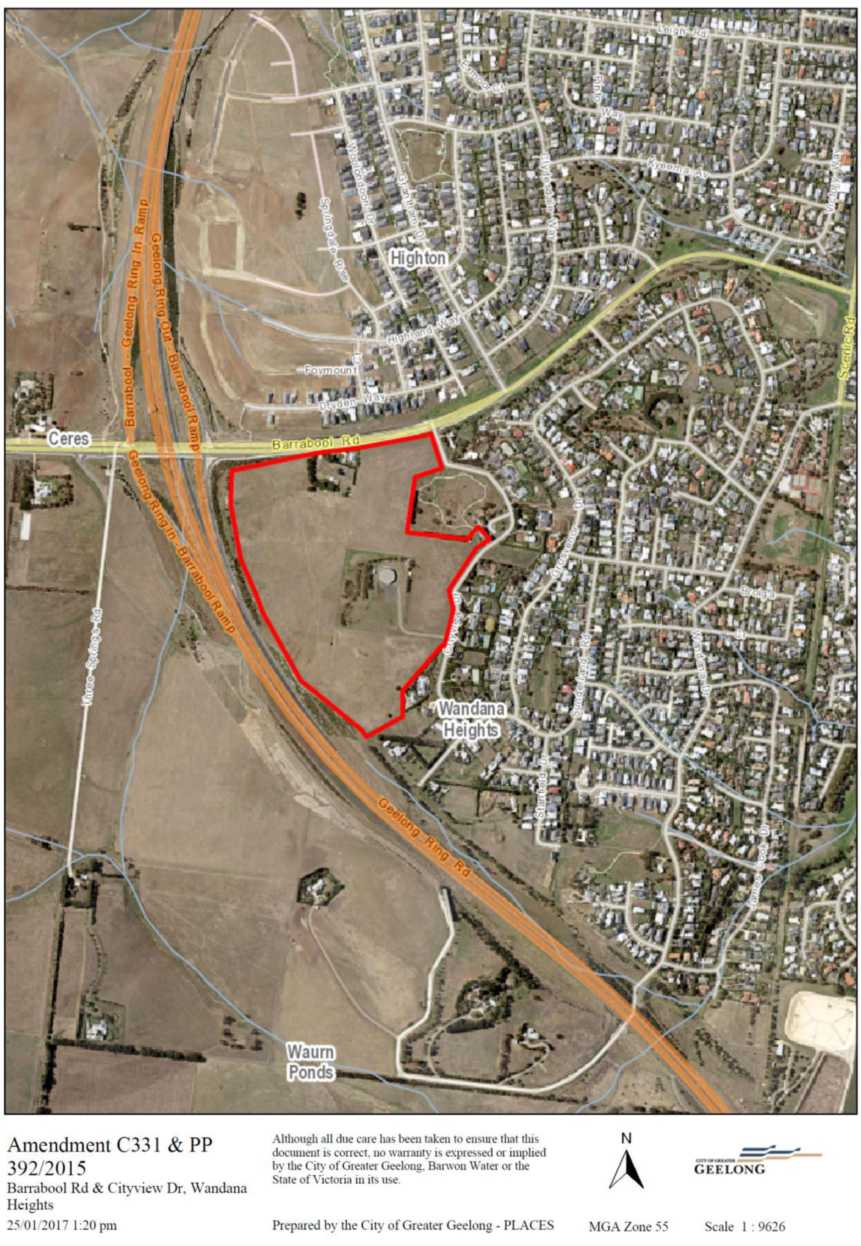
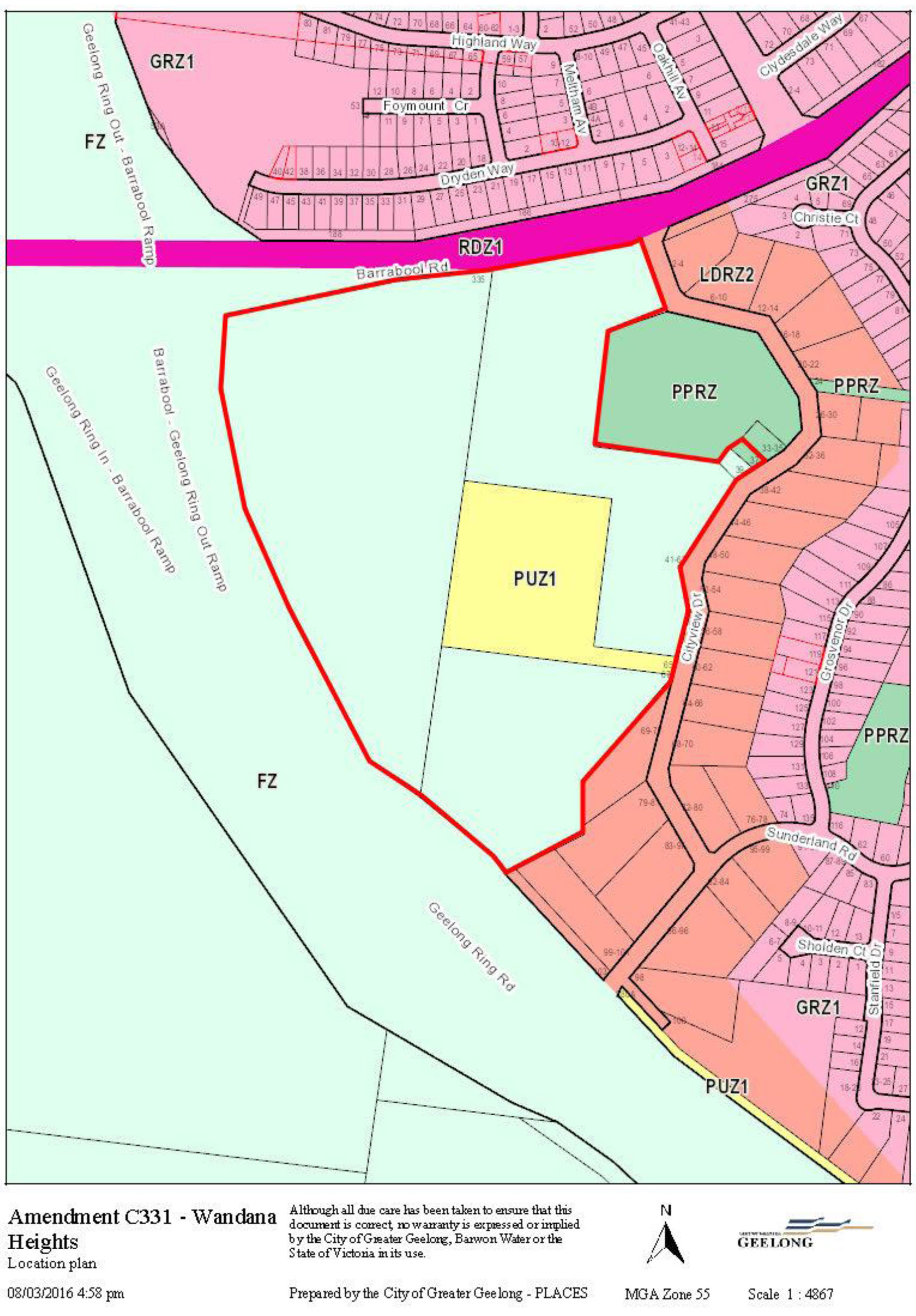
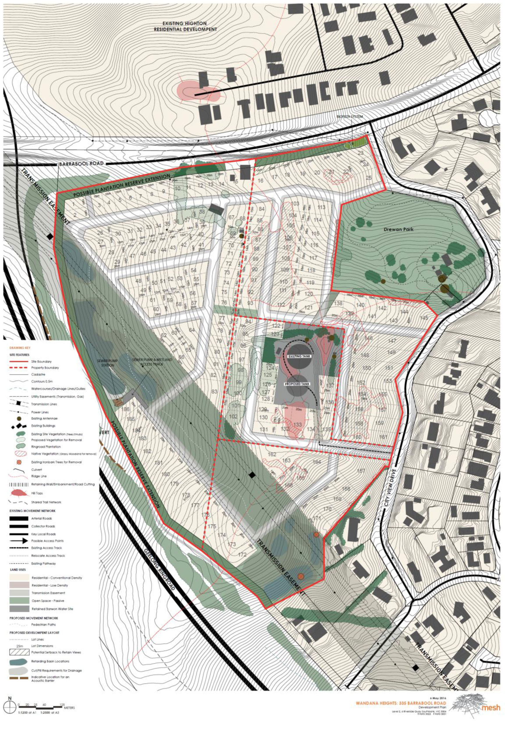
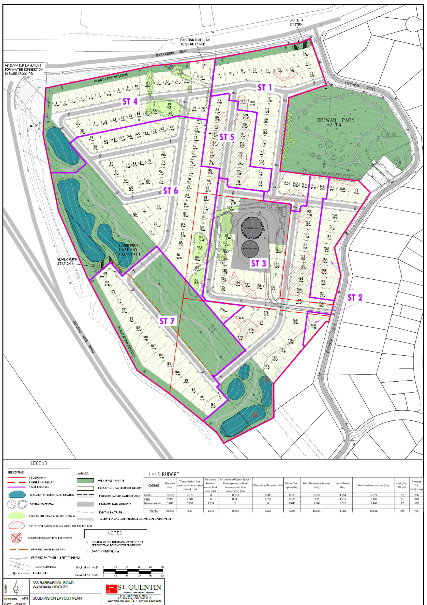
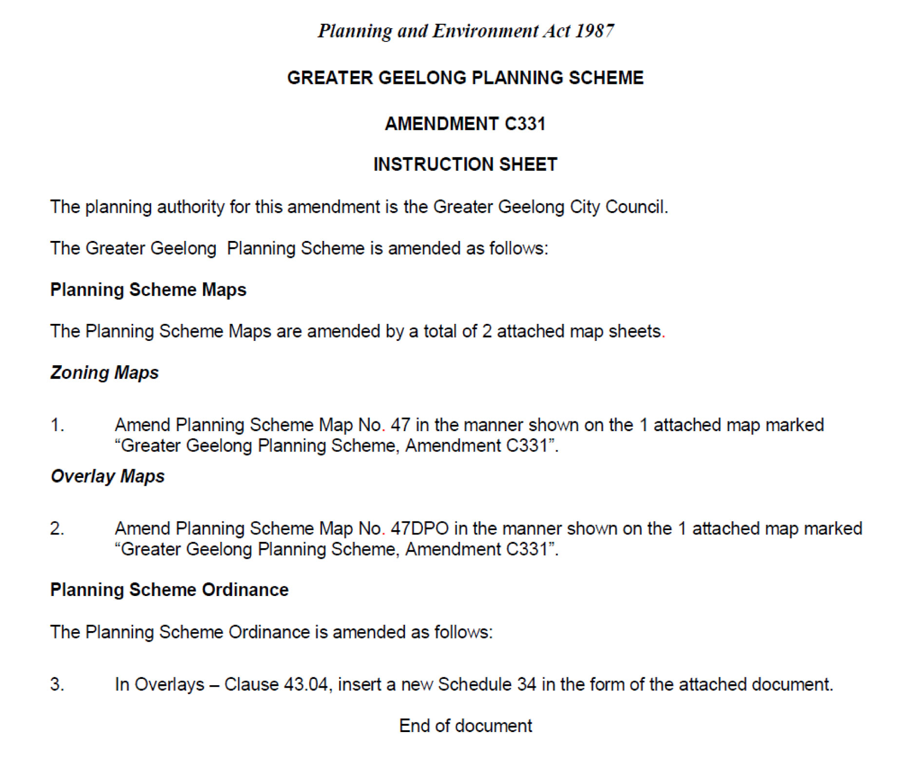
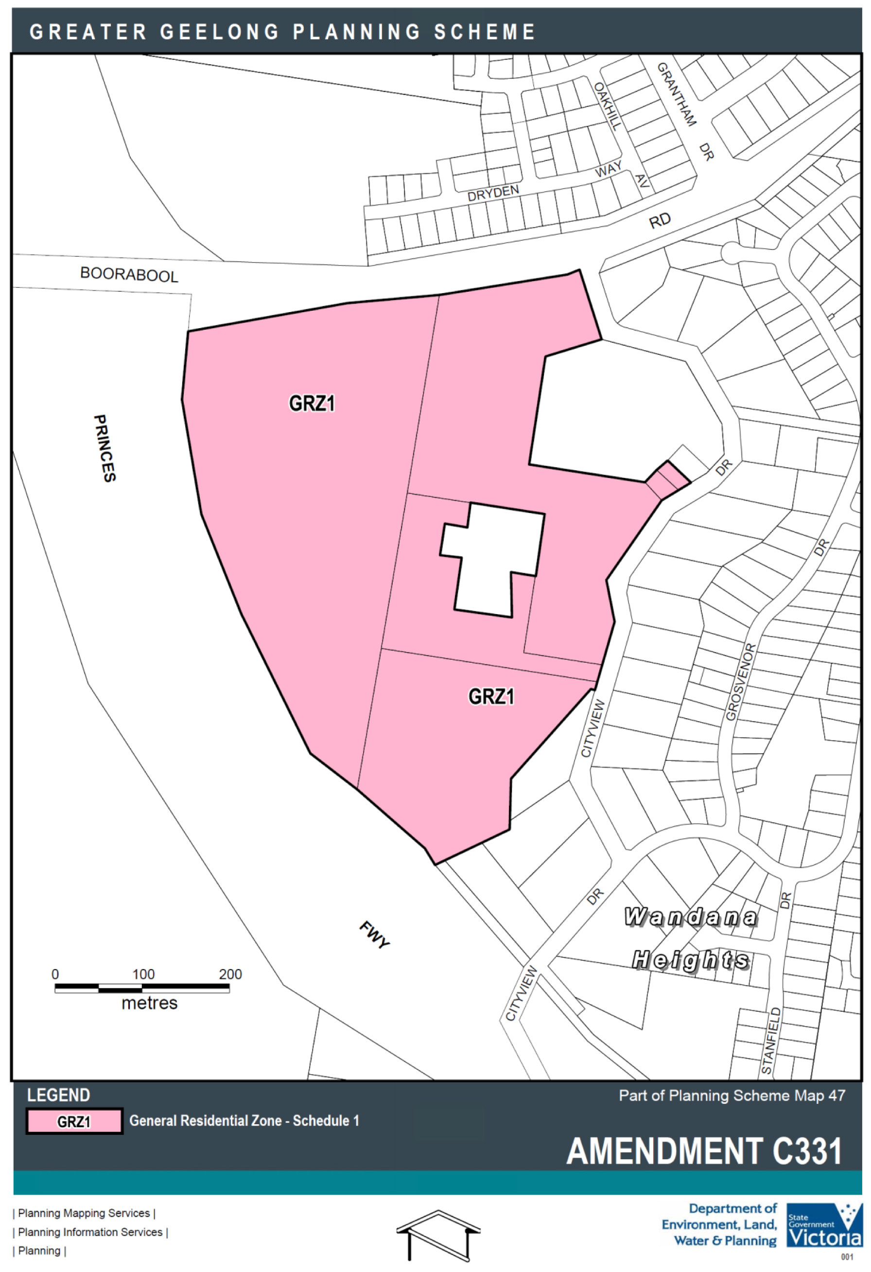
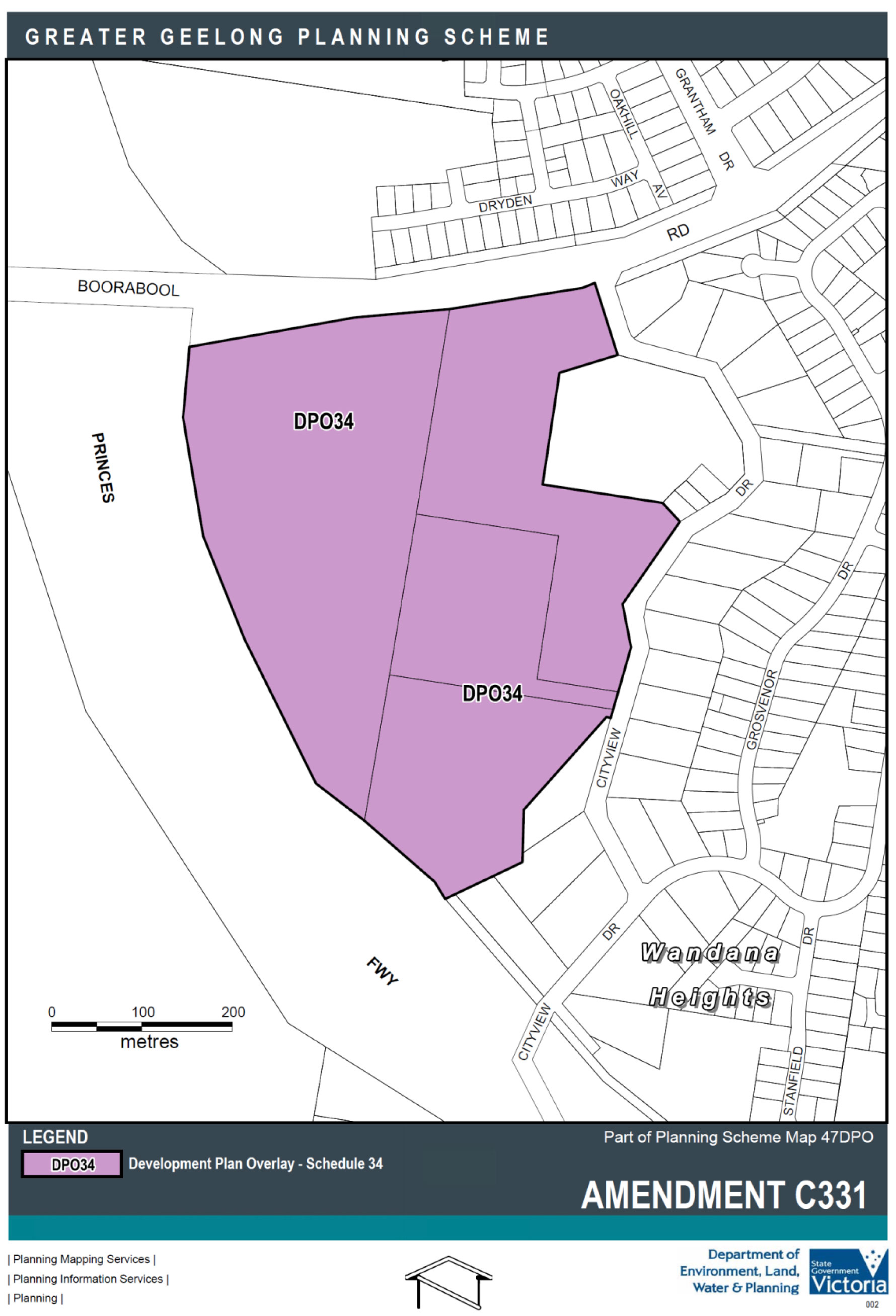
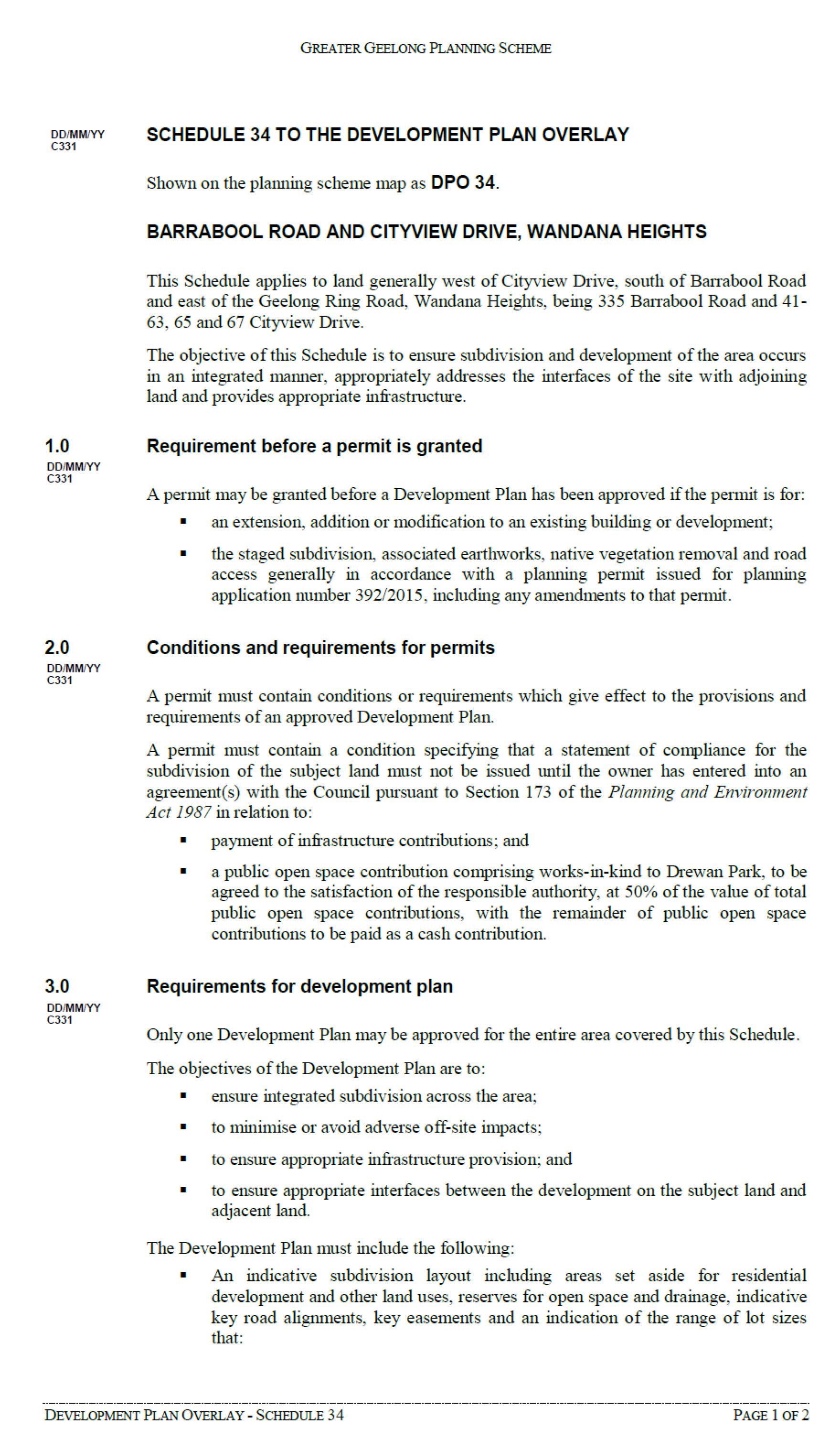
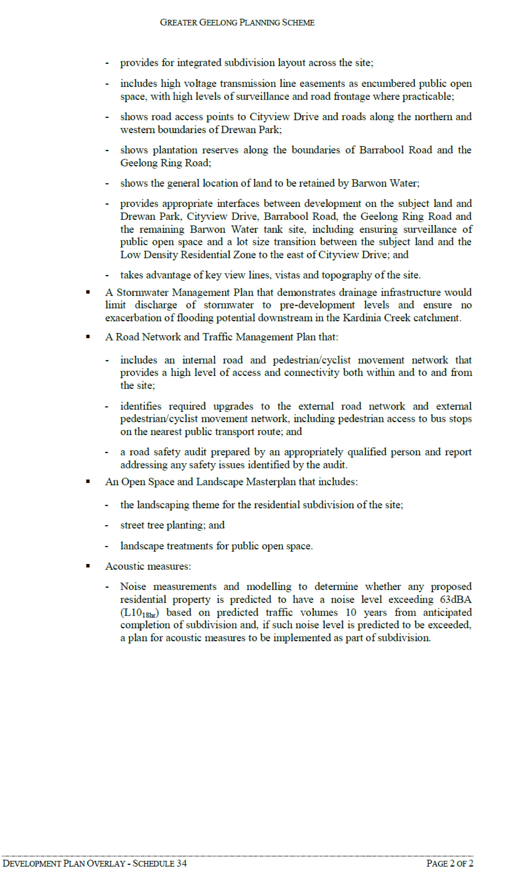
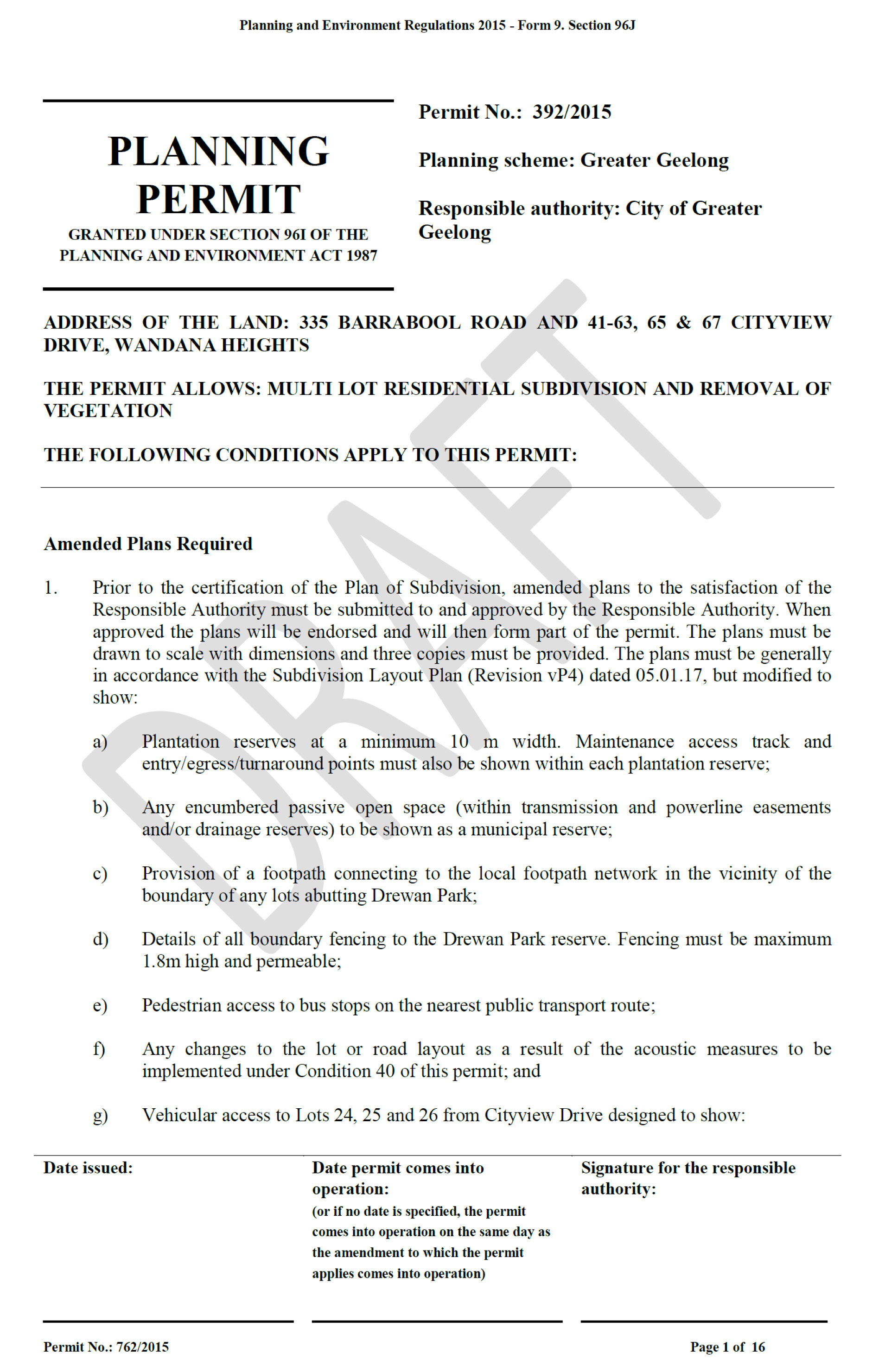
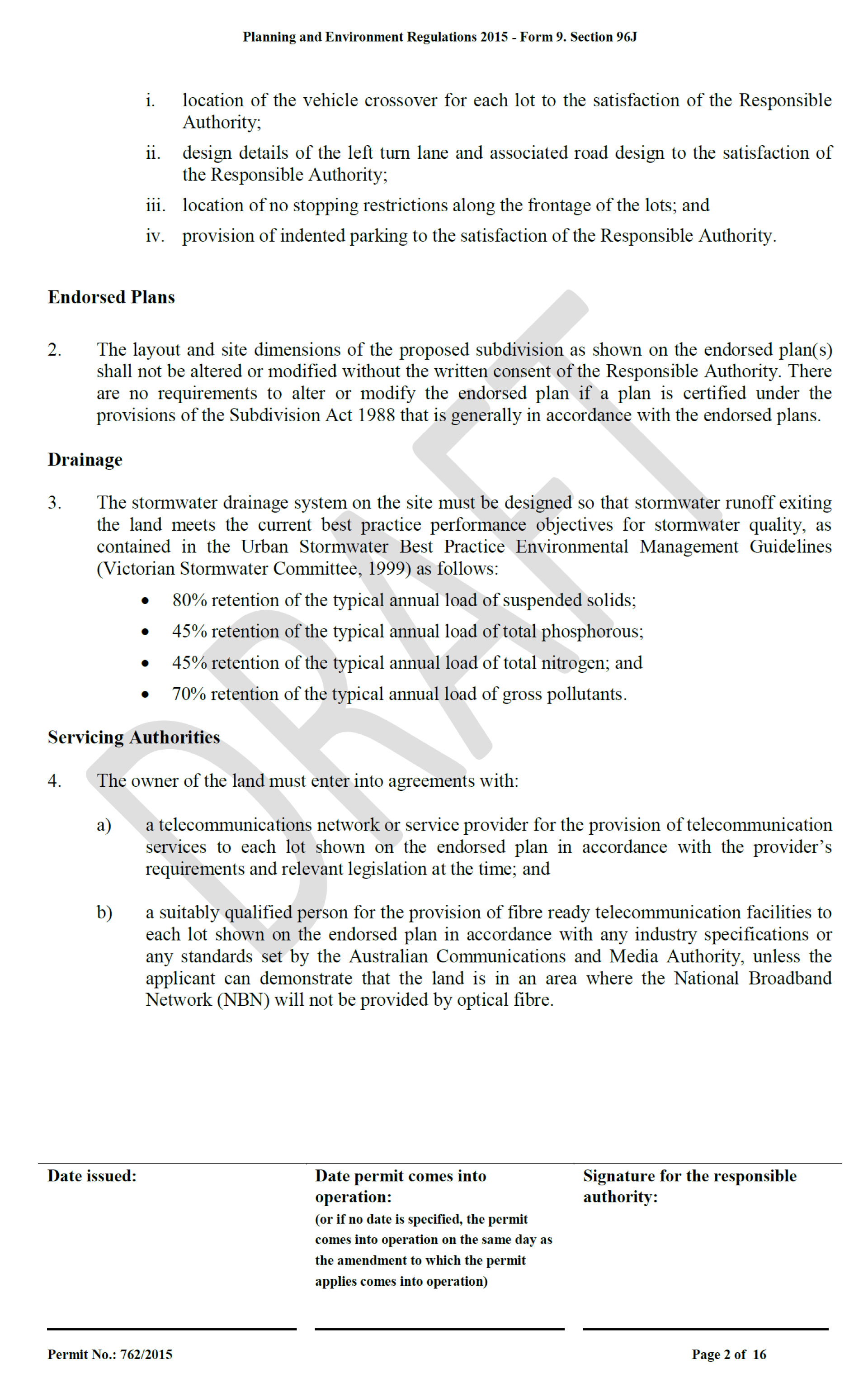
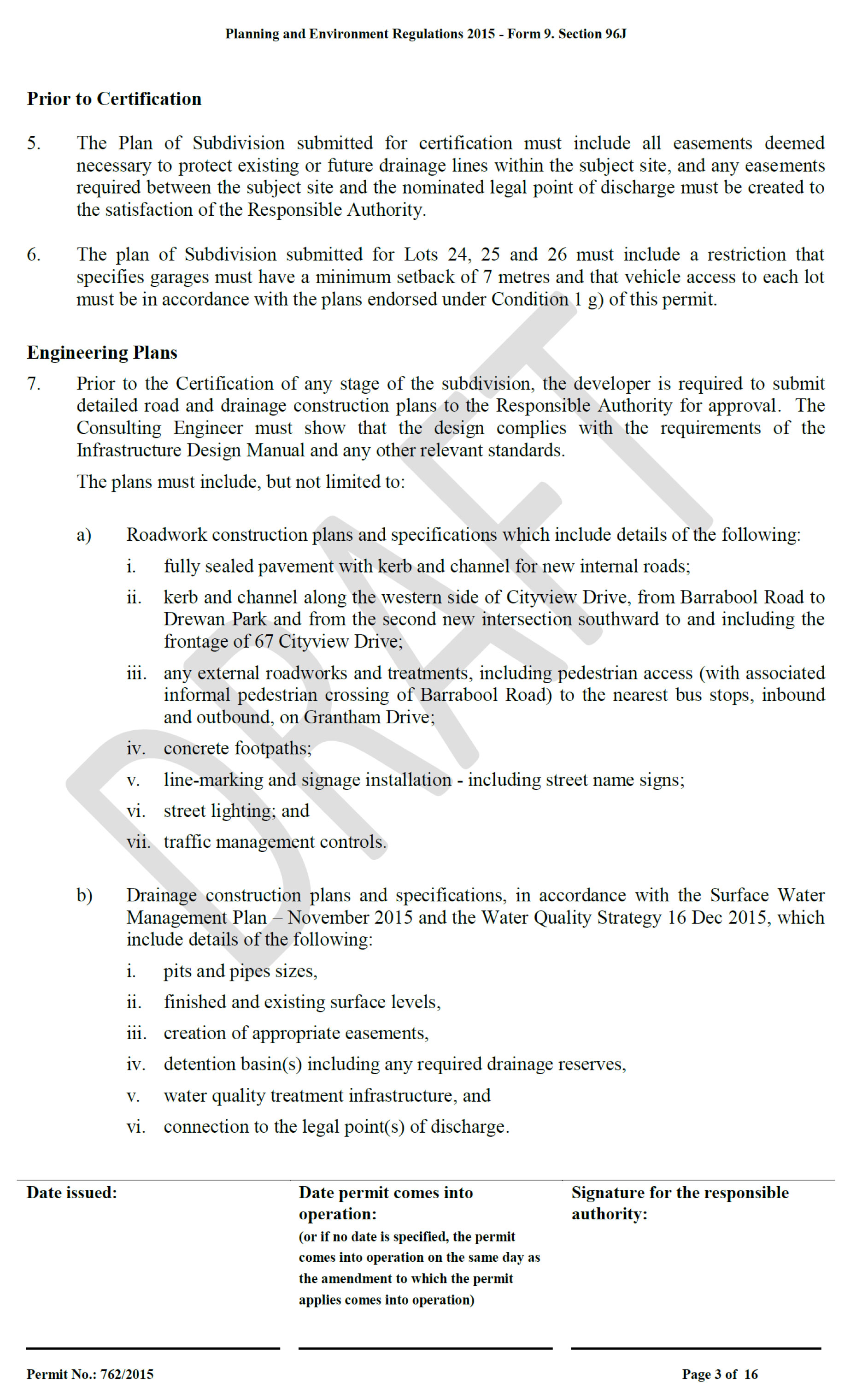
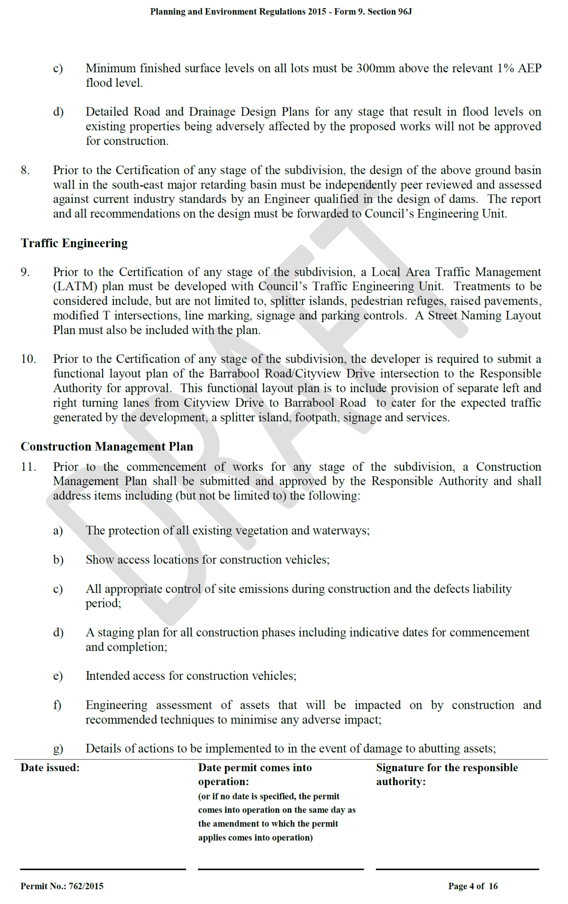
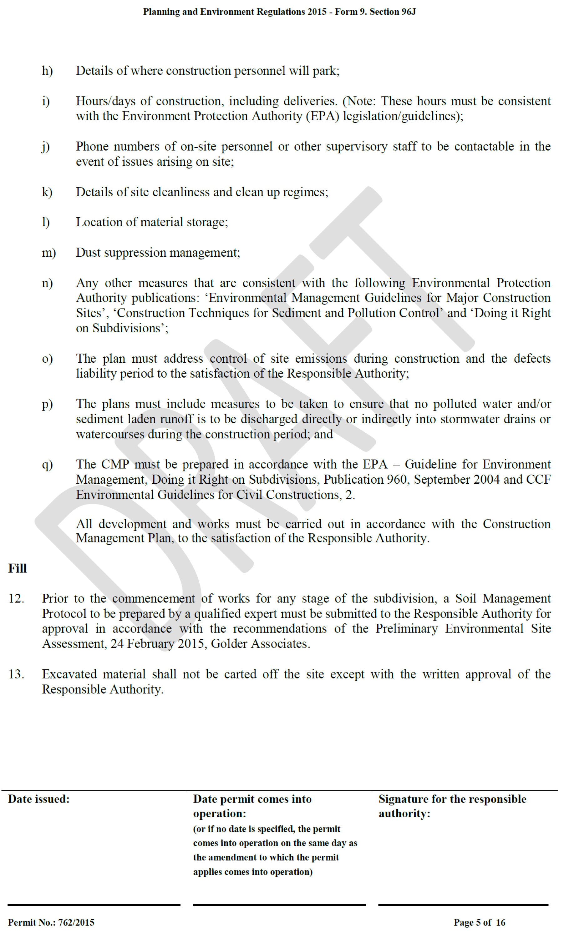
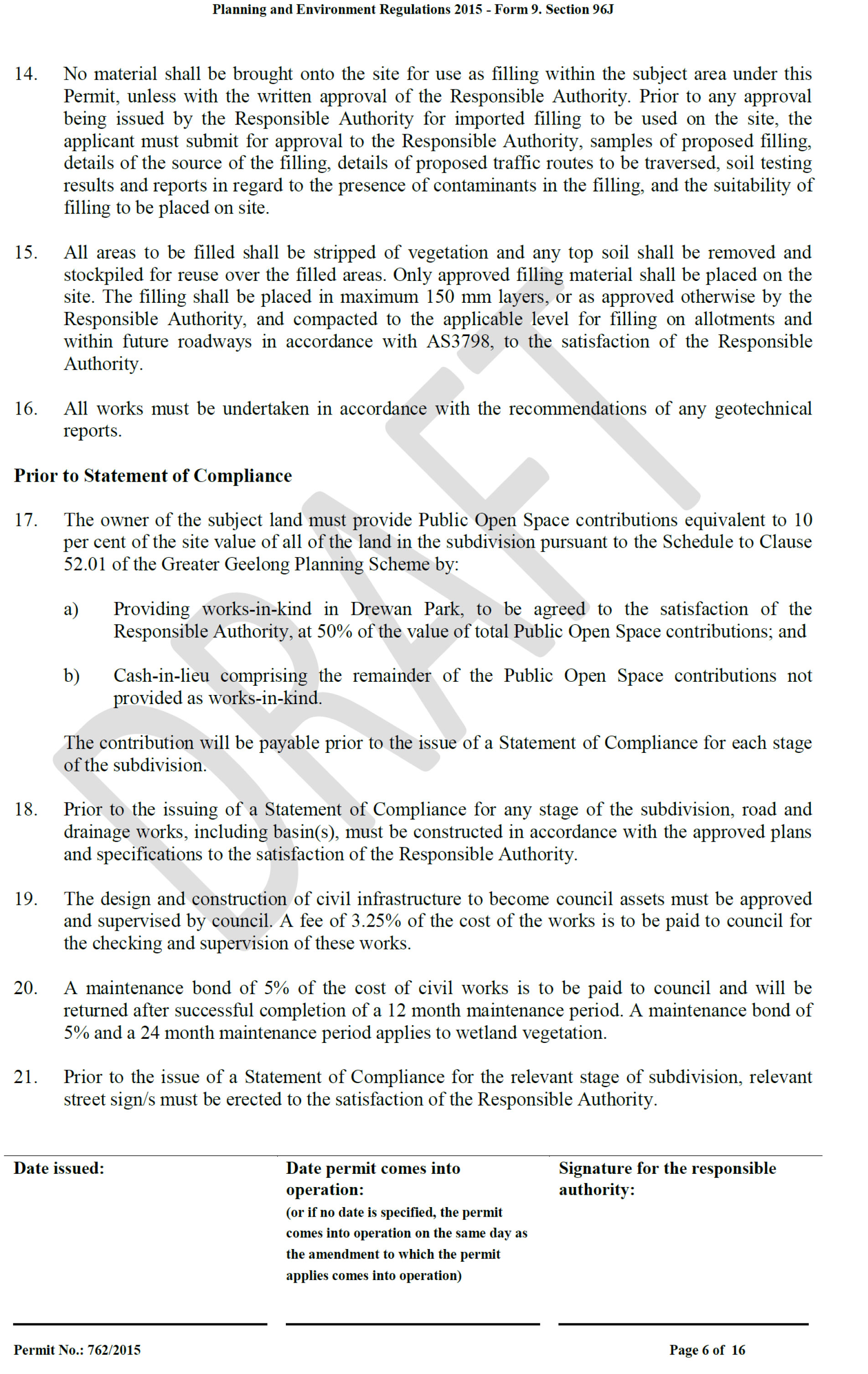
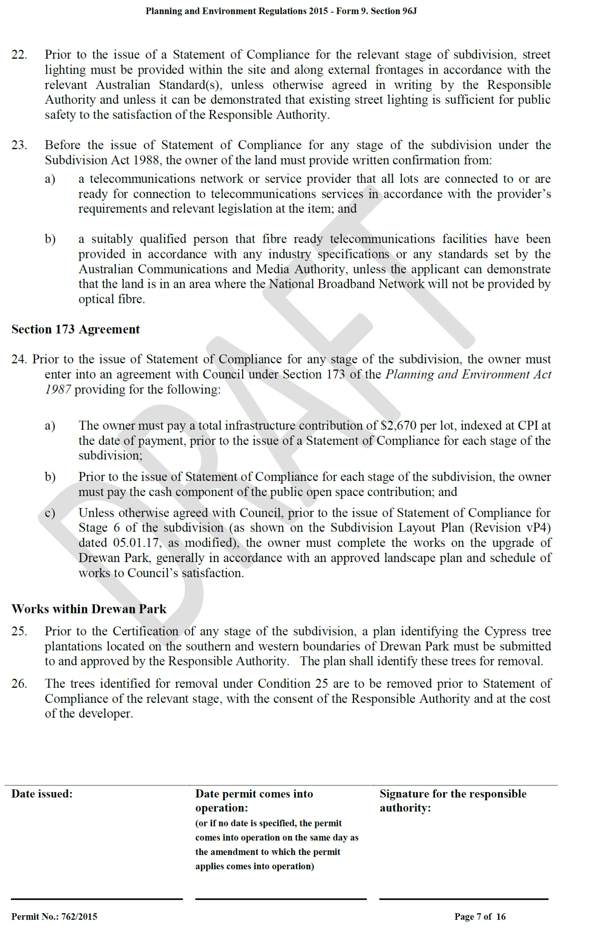
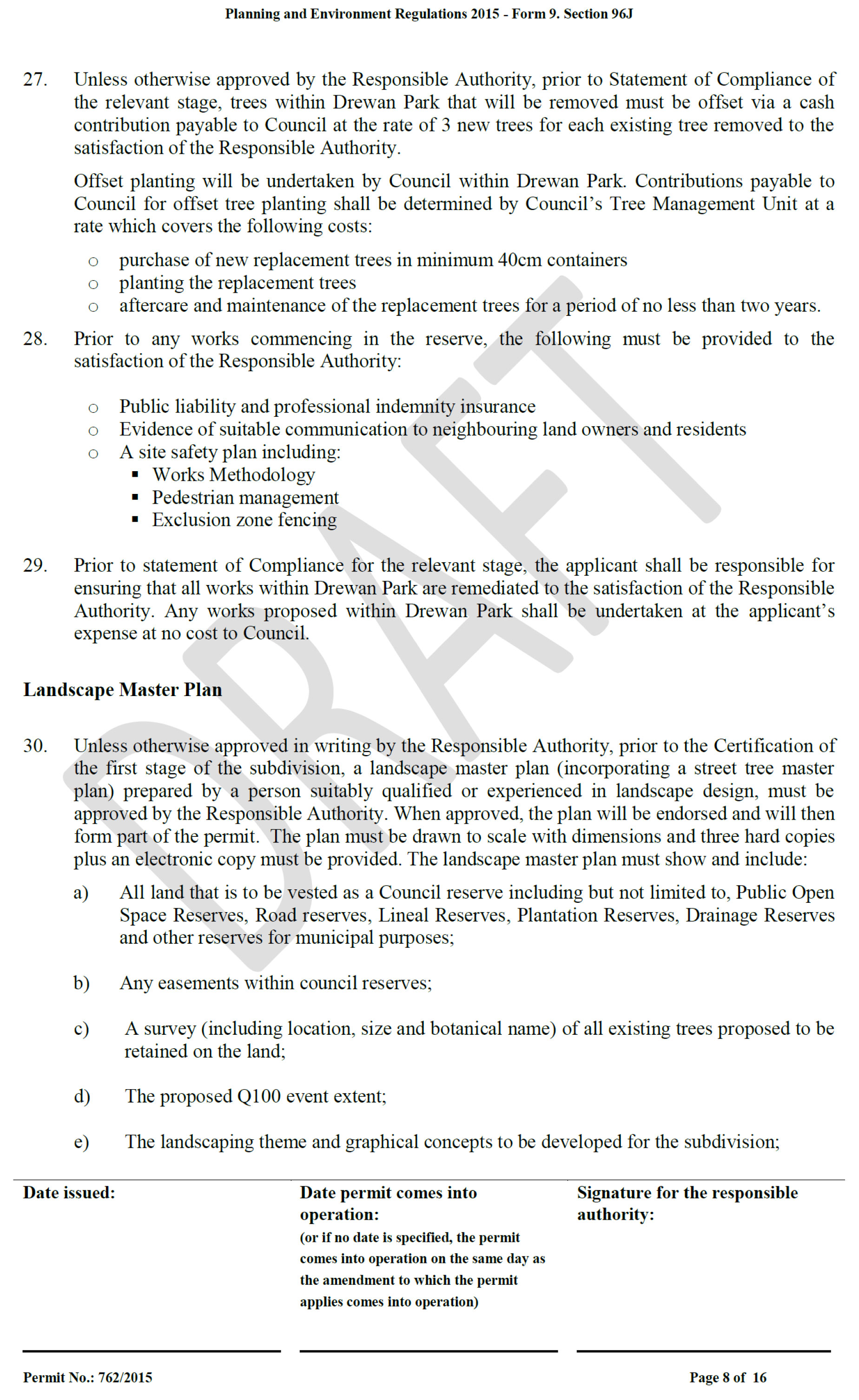
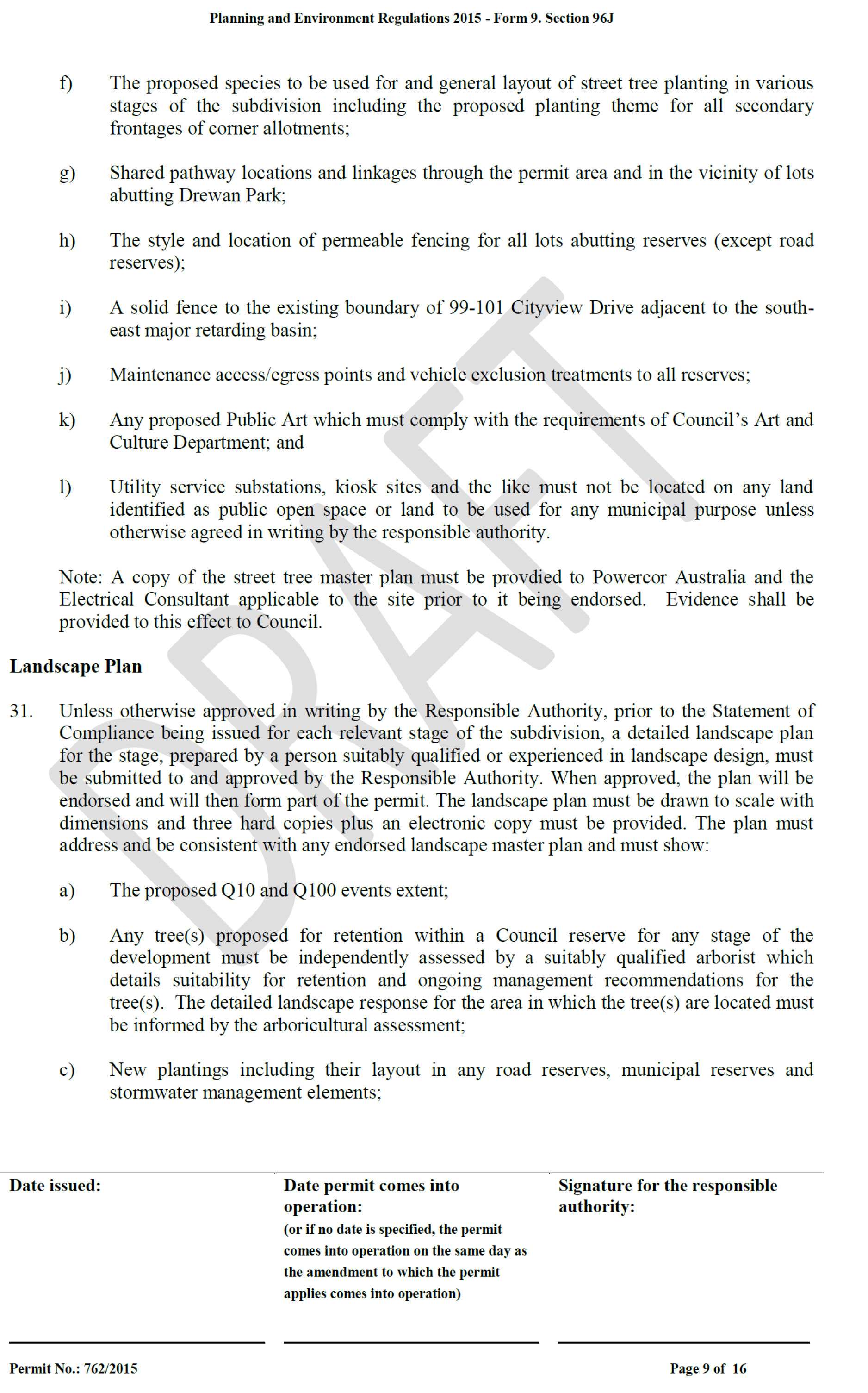
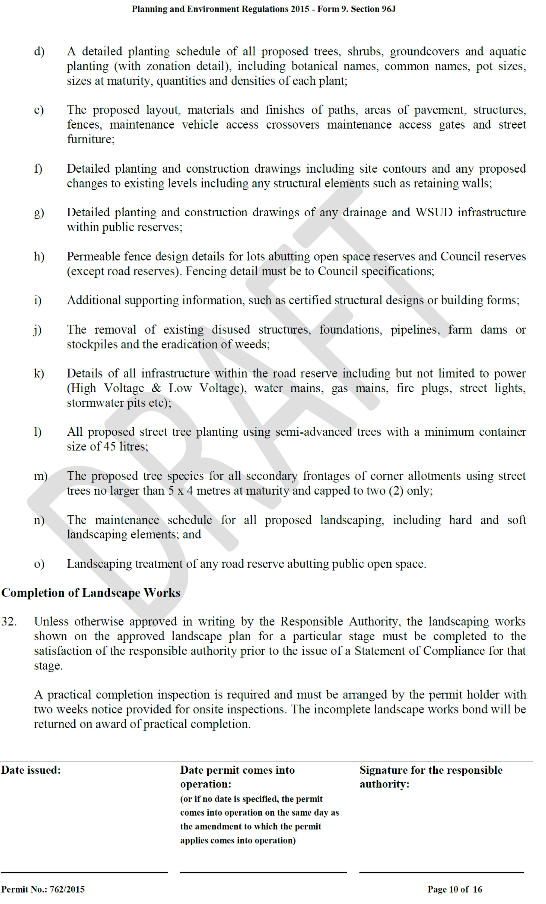
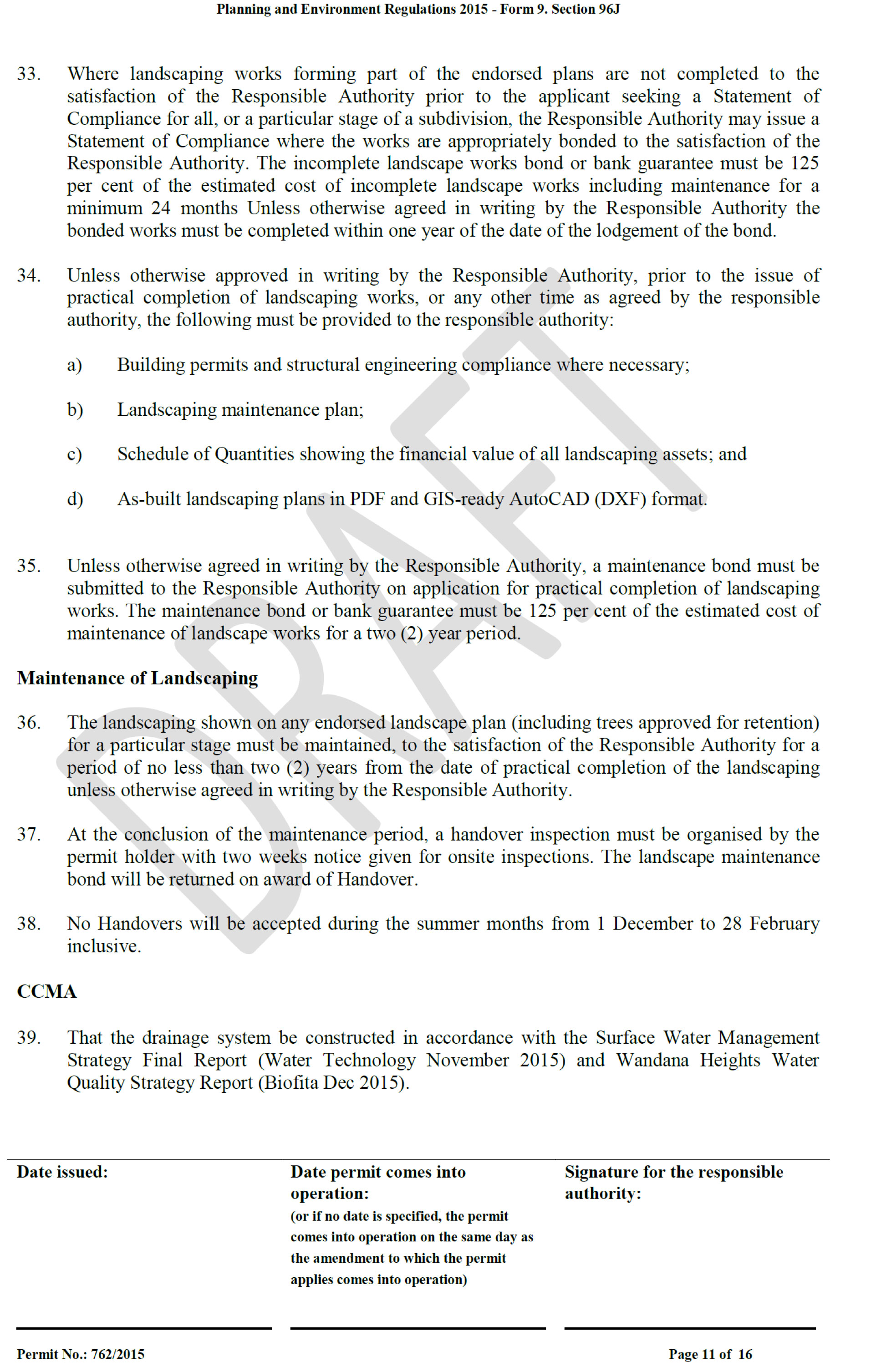
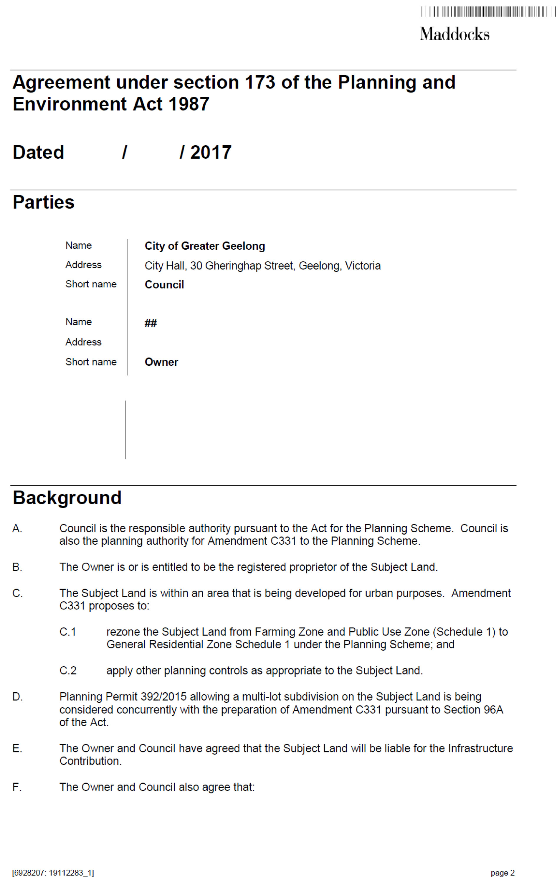
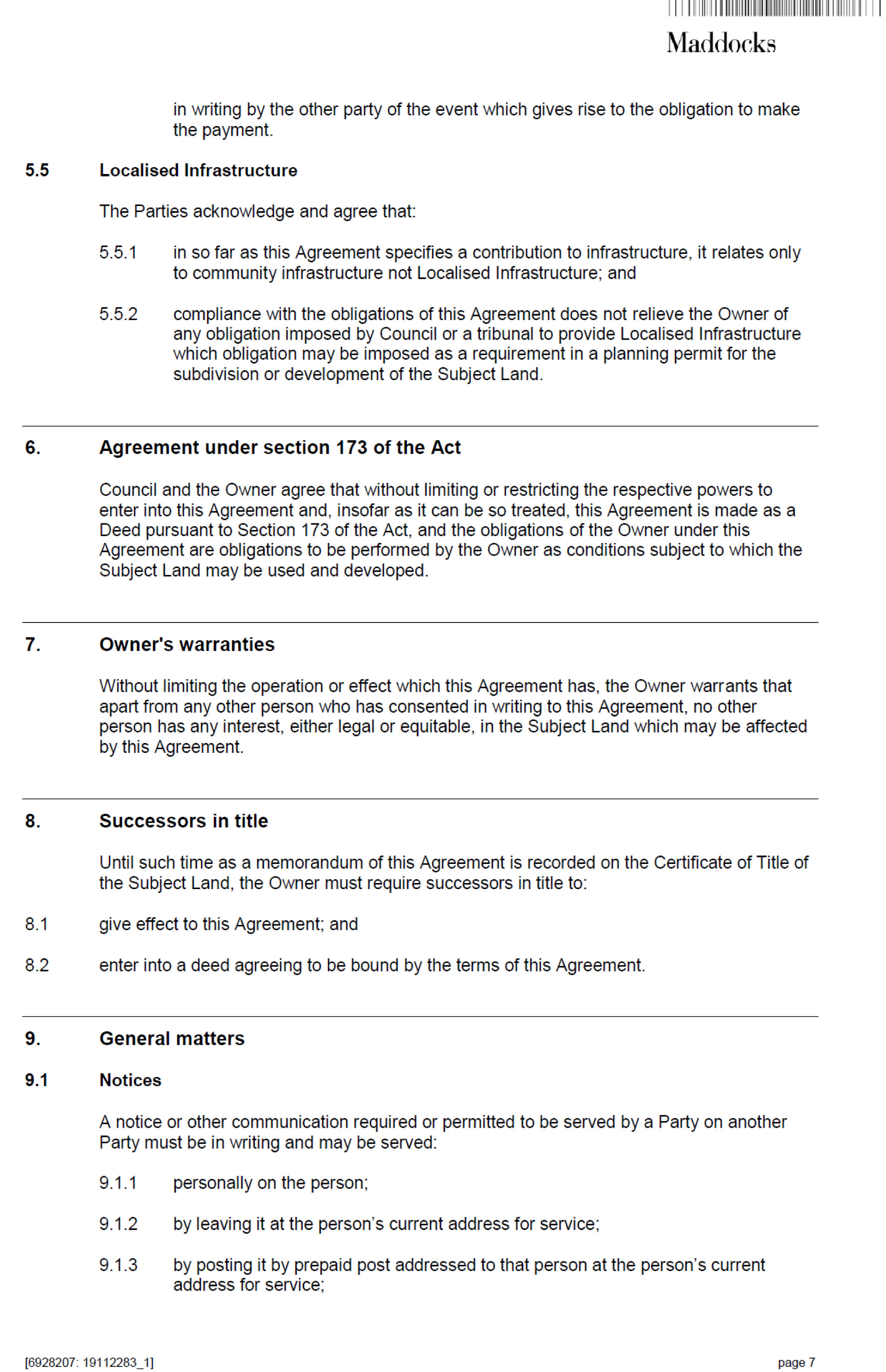
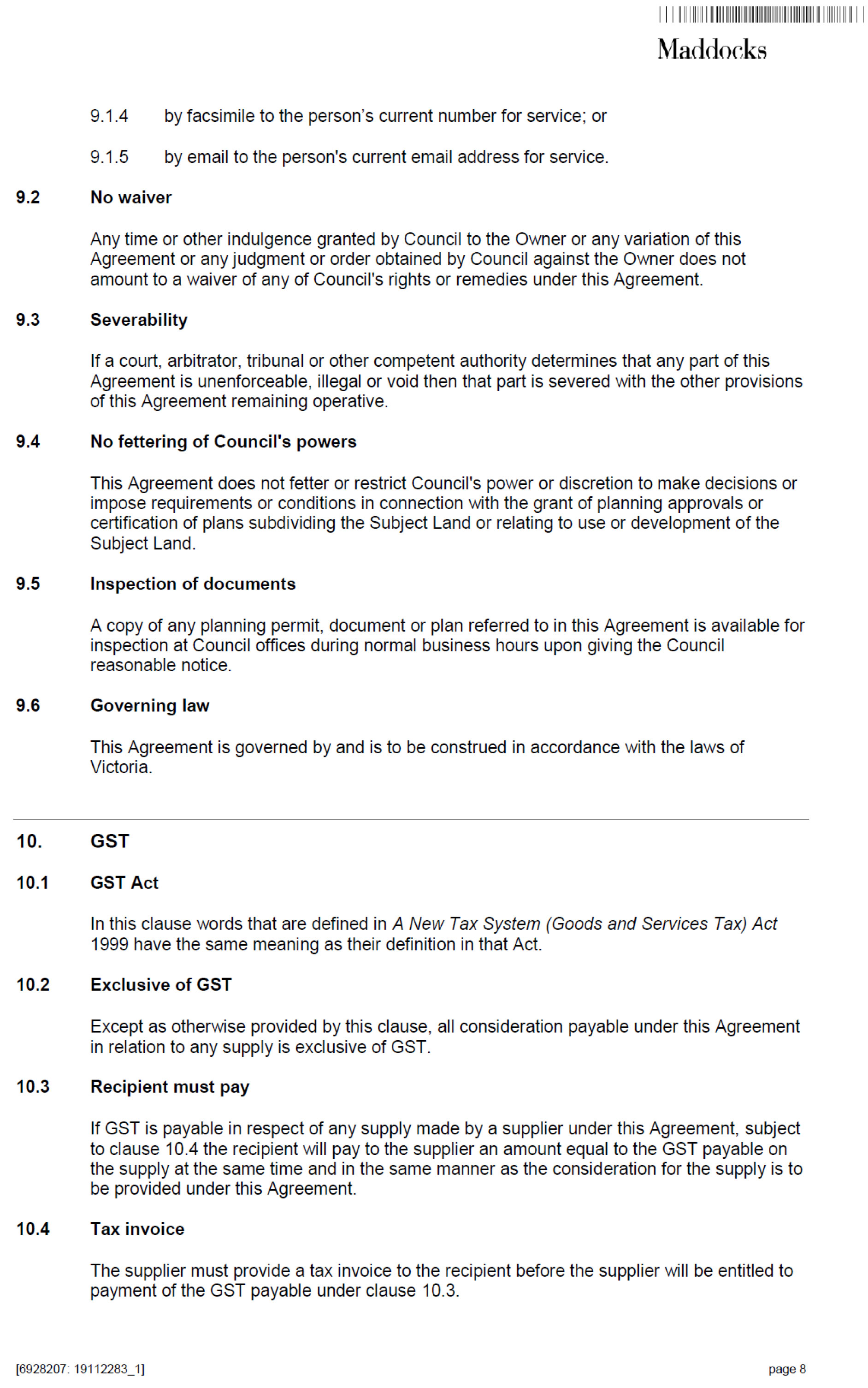
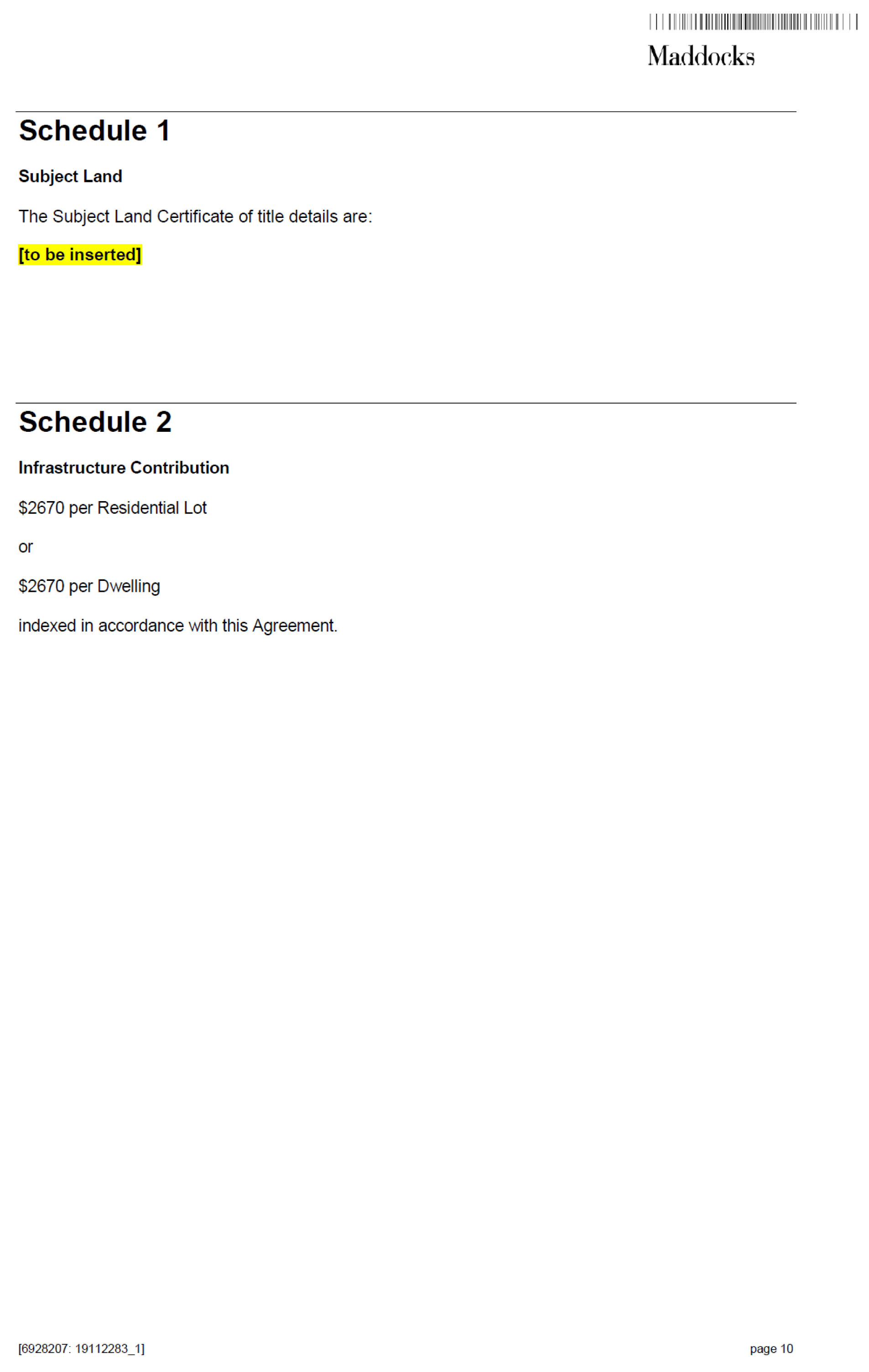

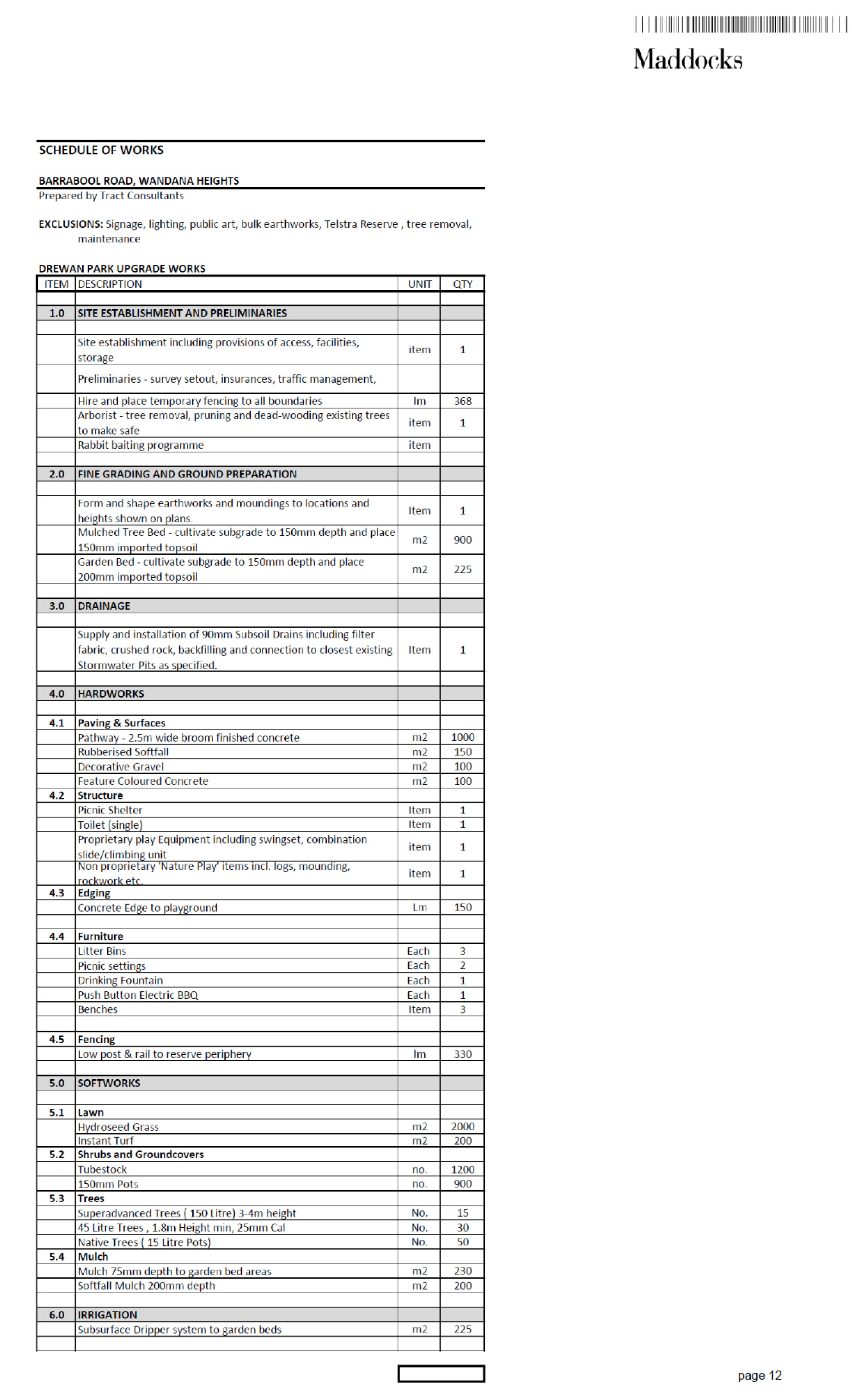

Source: |
Planning and Development – Strategic Implementation |
Director: |
Peter Bettess |
Index Reference: |
Application – C-361 |
To adopt Planning Scheme Amendment C361 and recommend approval of planning permit 1000/2016.
Amendment C361 proposes to rezone land at 1 Fyans Street and 4 Park Crescent South Geelong from General Residential Zone Schedule 1 to Residential Growth Zone Schedule 1. An accompanying permit 1000/2016 seeks approval for the existing “Shop” use and to extend the existing buildings at 1 Fyans Street together with a waiver of 6 car parking spaces. Exhibition of the combined Amendment/permit resulted in no submissions seeking any changes to the Amendment.
This Amendment is being sought to essentially enable an established business (Totally Workwear) to carry out relatively modest extensions to its premises at 1 Fyans Street South Geelong so the business can expand.
Despite a long history of commercial uses on this site, the proposed extensions to the existing Shop cannot be undertaken in accordance with the existing zone provisions, thus requiring the proposed rezoning.
The proposed building extensions are considered unlikely to have any adverse amenity impacts on the surrounding residential area with the business being expected to continue operating in the same manner as it has been doing for many years.
As no objecting submissions have been received as a result of the exhibition of the combined Amendment/permit, the Amendment can now be adopted and forwarded to the Minister for approval.
P Dorling moved, L Gardner seconded -
That Council:
adopts Amendment C361 in the form as outlined in Attachment 5 of this report;
submits the adopted Amendment together with the prescribed information to the Minister for Planning requesting approval; and
recommends to the Minister for Planning that Planning Permit 1000/2016 be approved in the form outlined in Attachment 6 of this report.
Carried.
This proposal resulted from an application made by Fadgyas Planning Associates on behalf of Totally Workwear for a combined Amendment/permit to rezone land at 1 Fyans Street and 4 Park Crescent South Geelong from General Residential Zone Schedule 1 (GRZ1) to Residential Growth Zone Schedule 1(RGZ1).
The accompanying permit application seeks approval for the existing “Shop” use and to extend the existing premises at 1 Fyans Street together with a waiver of 6 car parking spaces. The company has owned & operated the specialised workwear retail business from the site for some years and is now seeking to expand its operations.
The property at 1 Fyans Street has a very long history of commercial and retail uses.
The adjoining property at 4 Park Crescent is in the same ownership and occupied by a detached house used as a medical centre. It has a current permit for a pair of attached townhouses. Both properties have been included in the Amendment to ensure consistency of zoning and ownership.
Attachment 2 shows the existing zoning of the subject land and surrounding area. Attachment 3 shows the proposed building extensions subject of the permit application.
The subject land is situated at a high profile location at one of the city’s major intersections. Attachment 4 is an aerial photo of the subject land and surrounding area.
The rezoning will remove any lingering doubts about existing use rights of the existing business which is expected to continue to operate as it has done in the past. The modest building extensions will have no impact on the amenity of nearby residents. The proposed RGZ1 zoning is the same as already applied to properties opposite in Latrobe Terrace and enables the proposed permit to be issued for the existing use and building extensions.
Amendment C361 was exhibited in the normal manner between 23 March 2017 and 24 April 2017 and resulted in no submissions requesting any change to the amendment being received. In these circumstances the Amendment can now be adopted and together with the accompanying permit be forwarded to the Minister requesting approval.
Attachment 5 is the Amendment recommended for Adoption and Attachment 6 is the accompanying permit being recommended for approval.
The approval of the Amendment and accompanying permit will have no financial implications for Council.
Amendment C361 was exhibited in accordance with the provisions of the Planning and Environment Act to provide any affected person an opportunity to be heard before an Independent Panel appointed by the Minister for Planning.
The proposal is consistent with the overall thrust of State and Council planning policies responding to urban consolidation, sustainable development and community needs. It is consistent with the Local Policy at Clause 22.01 Discretionary Uses in Residential Areas which support uses providing for the needs of the local community without adversely impacting on the amenity of surrounding residential areas.
The Amendment and Permit are consistent with City Plan’s Growing our Economy priority by enabling additional development capitalising on existing infrastructure.
No Council officers involved in the preparation of this report have any direct or indirect interest, in accordance with Section 80C of the Local Government Act.
No risks have been identified in recommending approval of Amendment C361 and the accompanying Permit.
The Amendment and Permit have no environmental implications.
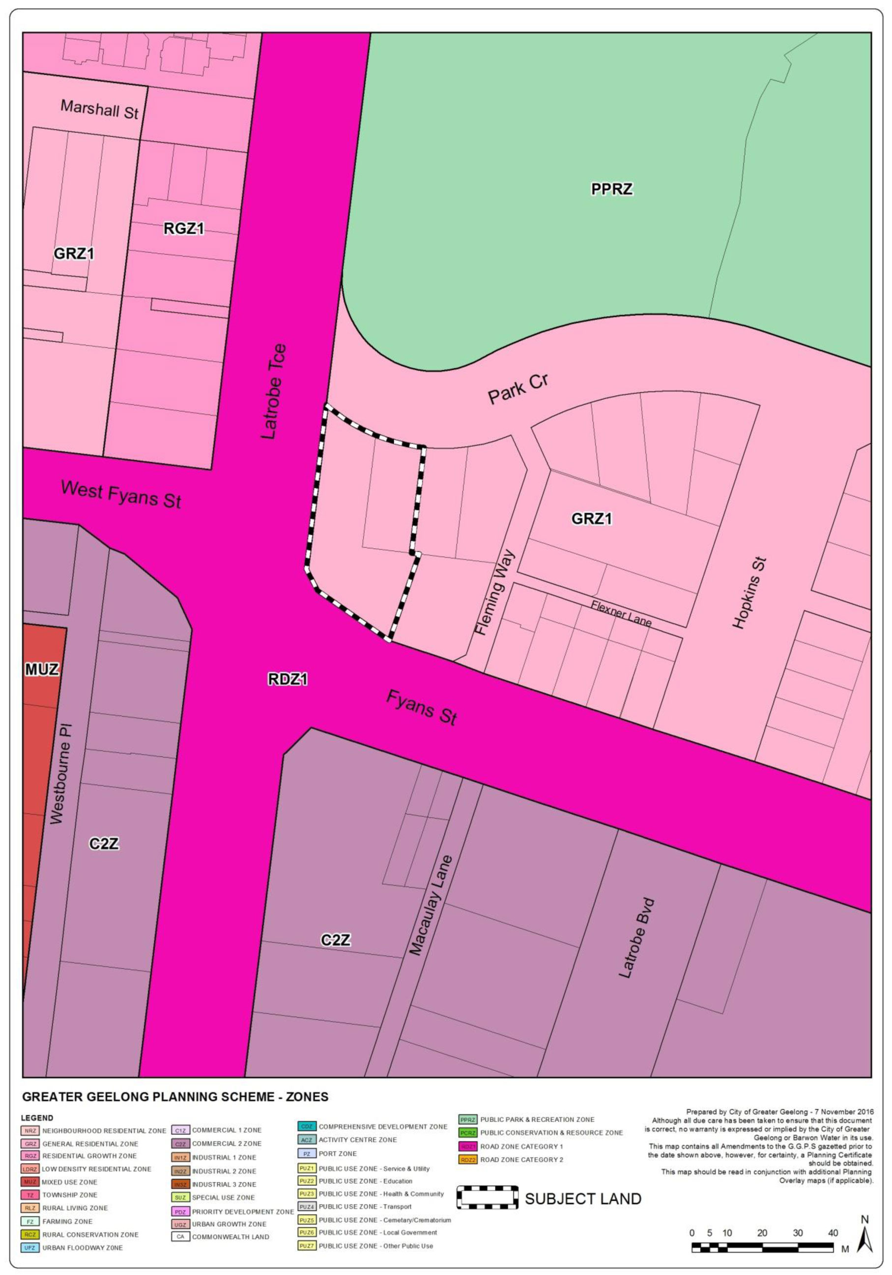
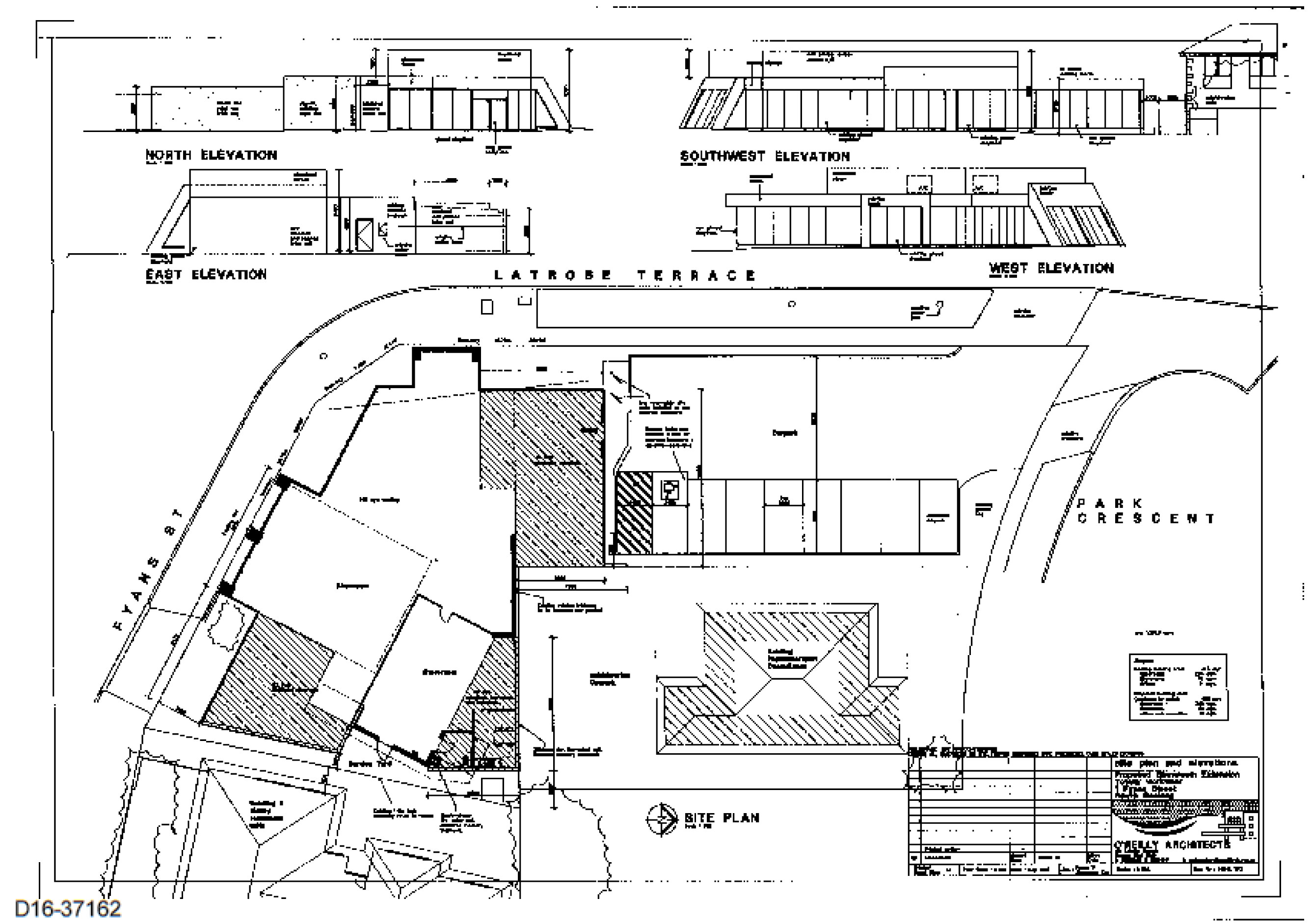
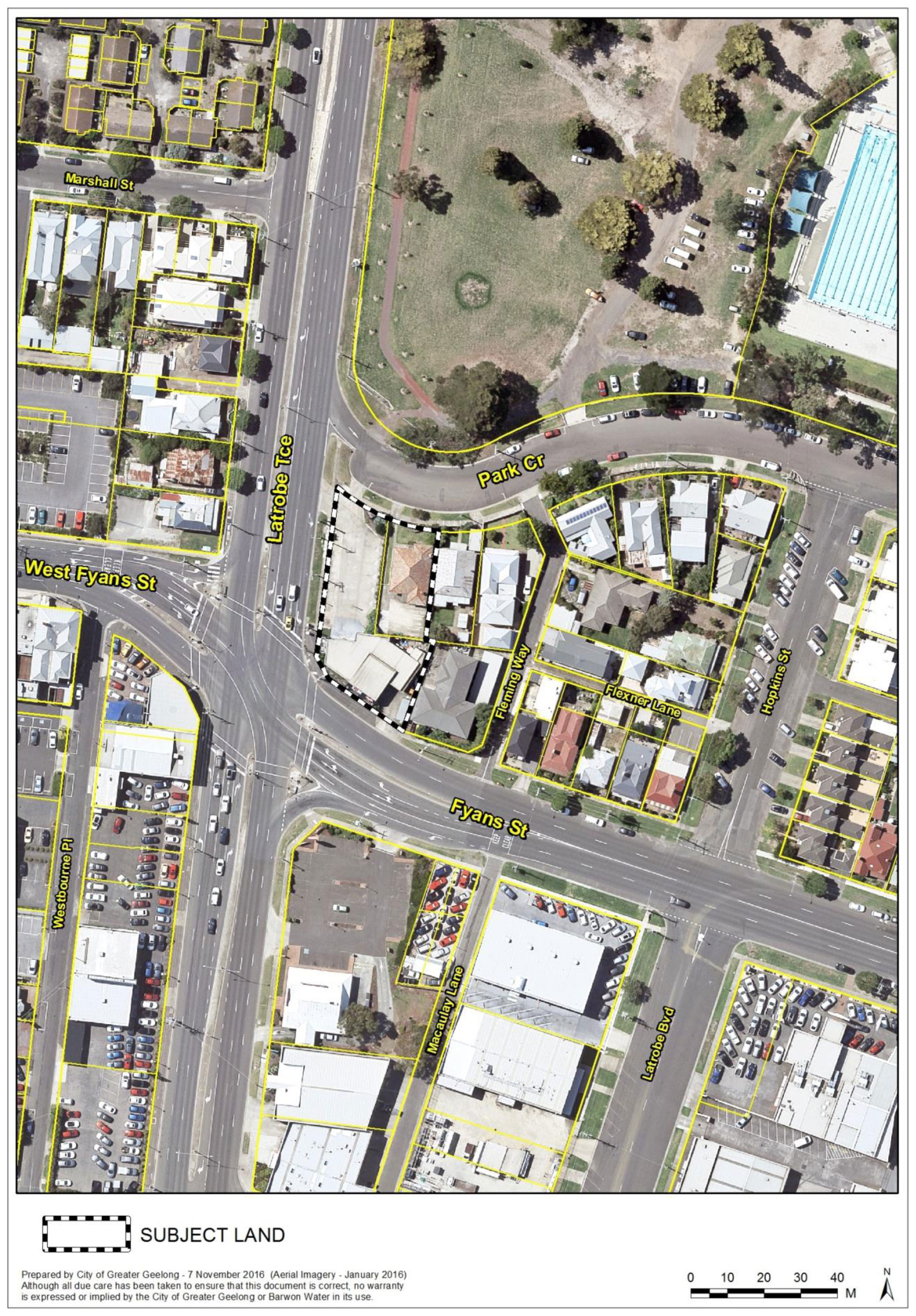
The planning authority for this amendment is Greater Geelong City Council.
The Greater Geelong Planning Scheme is amended as follows:
Planning Scheme Maps
The Planning Scheme Maps are amended by a total of 1 attached map.
Zoning Maps
Amend Planning Scheme Map No. 49 is amended as shown on the attached map.
Planning Scheme Ordinance
There are no changes to the Planning Scheme Ordinance
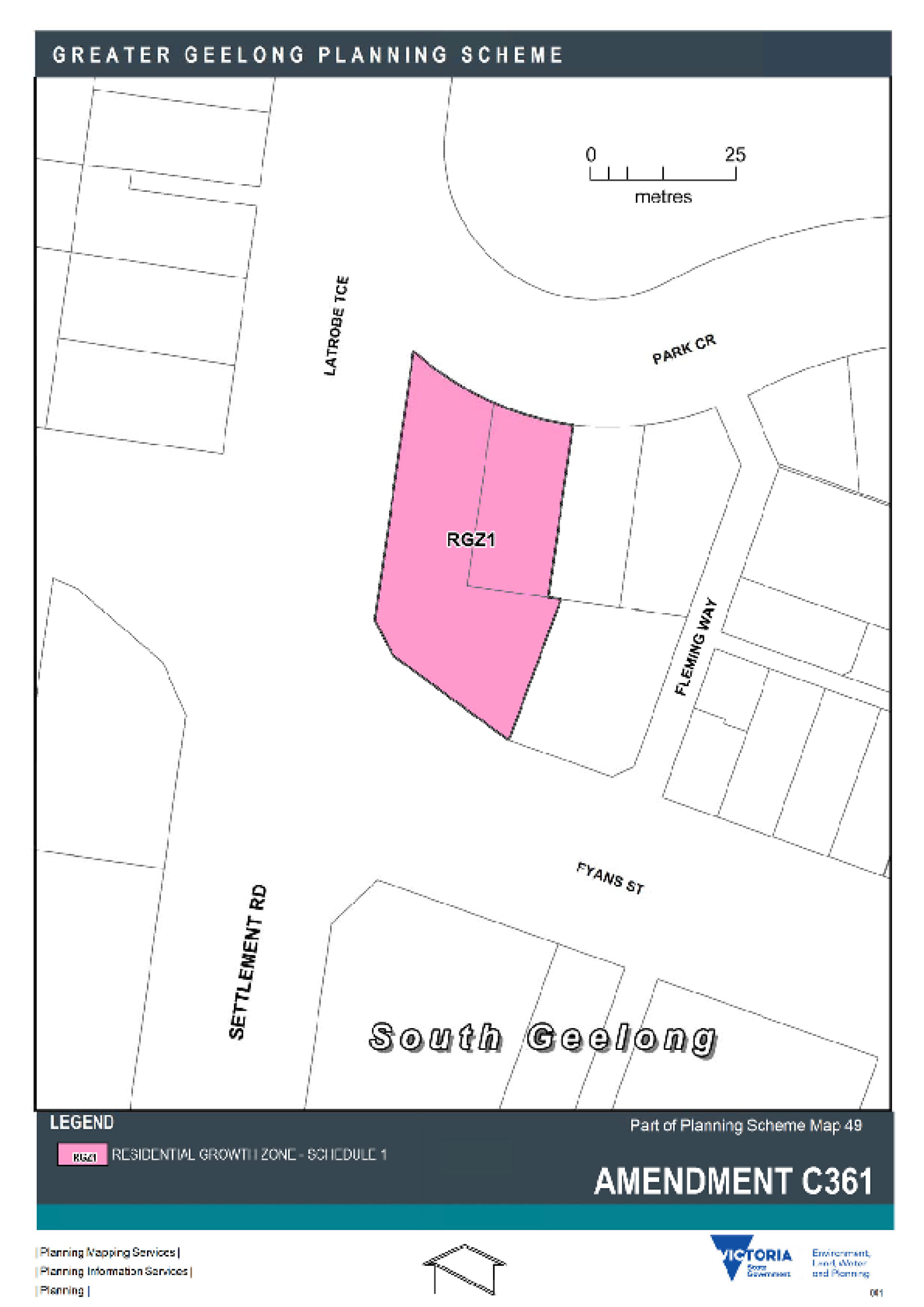
End of document
PLANNING PERMIT |
Permit No. |
PP-1000-2016 |
| Planning Scheme | Greater Geelong Planning Scheme | |
| Responsible Authority | Greater Geelong City Council | |
ADDRESS OF THE LAND |
1 FYANS STREET, SOUTH GEELONG |
|
THE PERMIT ALLOWS |
USE AND DEVELOPMENT OF A SHOP, AND REDUCTION IN CAR PARKING REQUIREMENT GENERALLY IN ACCORDANCE WITH THE ENDORSED PLANS |
|
THE FOLLOWING CONDITIONS APPLY TO THIS PERMIT: |
||
Amended Plans |
||
|
||
Endorsed Plans |
||
|
||
Landscaping |
||
When approved, the plan will be endorsed and form part of the permit, all to the satisfaction of the Responsible Authority. |
||
Prior to the Commencement of the Use |
||
all to the satisfaction of the Responsible Authority. |
||
Operating Times |
||
|
||
Maximum Staff Numbers |
||
|
||
General Amenity |
||
|
||
Car Parking |
||
|
||
Permit Expiry |
||
The Responsible Authority may extend the periods referred to if a request is made in writing before the permit expires; or |
||
Notes: |
||
|
||
Source: |
Planning and Development – Strategic Implementation |
Acting Director: |
Peter Bettess |
Index Reference: |
Application C342 |
To consider the Independent Panel report and adopt Planning Scheme Amendment C342.
Amendment C342 proposes to rezone land at 40-42 Newcombe Street Drysdale from Public Use Zone 1 (Service and Utility) to General Residential Zone Schedule 1. An accompanying permit seeks approval for a 10 lot residential subdivision of both 40-42 Newcombe Street and 41-47 Elgin Street Drysdale, both owned by Barwon Water. Exhibition of the Amendment from 17 November to 19 December 2016 resulted in the receipt of 11 submissions of which 5 objected or raised issues of concern. A Panel hearing was heard on 4 April 2017 and the Panel has supported the Amendment.
This Amendment is being sought to enable Barwon Water to sell land which is in excess of its operational requirements.
The subject land is centrally located in Drysdale and surrounded by conventional residential development.
he major issue raised in the objecting submissions is concern about additional traffic and dust because all roads accessing the site are unsealed.
The Panel recognises issues relating to dust and road condition but concurs that it would be an excessive imposition on a proposed 10 lot subdivision to require the owner to seal either or both Newcombe and Elgin Streets and that it “cannot impose the sealing of the roads on the Proponent beyond their immediate site’.
It is recommended the Amendment be adopted and forwarded to the Minister for approval.
P Dorling moved, L Gardner seconded -
That Council:
adopts Amendment C342 in the form as outlined in Attachment 6 of this report;
submits the adopted Amendment together with the prescribed information to the Minister for Planning requesting approval; and
recommends to the Minister for Planning that Planning Permit 1342/2015 be approved in the form outlined in Attachment 7 of this report.
Carried.
Amendment C342 is a combined Planning Scheme Amendment and Planning Permit resulting from an application made by St Quentin Consultants on behalf of Barwon Water, the owner of land at 40-42 Newcombe Street and 41-47 Elgin Street, Drysdale.
The Amendment proposes to rezone 3387 sq m of land at 40-42 Newcombe Street from (PUZ) Public Use Zone Schedule 1 to (GRZ1) General Residential Zone Schedule 1, retaining a 726 sq m portion in PUZ1 which is the site of an existing pump station.
The accompanying permit is seeking approval for a 10 lot residential subdivision of both 40-42 Newcombe Street and 41-47 Elgin Street, requiring the full construction of this part of Elgin Street.
Apart from the pump station, both properties are vacant and slope towards the significant stormwater drainage course running along the southern boundary of the subject land. The surrounding GRZ1 land is an established residential area developed in a generally similar manner to the subject proposal.
Attachment 2 shows the zoning of the subject land and surrounding area. Attachment 3 is an aerial photo of the area.
Attachment 4 shows the proposed 10 lot subdivision and Reserve intended to be retained by Barwon Water for its pump station.
Amendment C342 was exhibited in the normal manner between 17 November 2016 and 19 December 2016. It resulted in the receipt of 11 submissions of which six either supported the Amendment or offered no objection and five which either objected or raised an issue of concern.
The major issue of concern raised in the submissions is the impact of additional traffic and the dust it creates along the surrounding local roads, such that the sealing of these roads should be a condition of the approval of the permit. Other issues of concern include the loss of solar access to an adjoining property from subsequent development, loss of privacy and amenity from overlooking, suggested alternative uses of the land, stormwater management and whether additional noise insulation for the existing pump station is required.
Council (under delegation) considered a report on the submissions and resolved on 27 January 2017 to request the Minister for Planning to appoint an Independent Panel under Part 5 of the Planning and Environment Act to consider submissions and refer all submissions to the Panel.
Panel Hearing and Recommendations
A single person Panel was appointed and held a hearing in Geelong on 4 April 2017. The Council, the applicant’s consultant and one submitter appeared at the hearing.
The major issue raised at the hearing was the issue of traffic and dust on local roads. As Council was able to demonstrate, unsealed roads were not uncommon throughout most Bellarine Peninsula townships as a result of subdivisions created decades ago but which are progressively being constructed through Council’s Special Rates and Charges policy. The Panel agreed with Council’s presentation that it would be an unfair burden to place on the owner of the subject land to require the sealing of either Newcombe or Elgin Street as a condition of development of a relatively small 10 lot subdivision.
Issues relating to loss of solar access to an adjoining property & additional noise insulation for Barwon Water’s pump station had been resolved between the parties prior to the hearing. The Panel agreed with additional permit conditions to reflect these agreed arrangements.
The Panel did not support submissions regarding loss of amenity/privacy, suggested alternative uses for the land & stormwater related concerns.
Attachment 5 is a copy of the Executive Summary of the Panel report.
Council officer response
The Panel’s recommendations including the proposed additional permit conditions are consistent with Council’s presentation at the hearing and are therefore supported.
Attachment 6 is a copy of Amendment C342 recommended for adoption and Attachment 7 is a copy of the permit recommended for approval with the new conditions referred to above shown as track-changes.
It is not anticipated these proposals will result in any financial implications for Council. The construction of Elgin Street abutting the subject land will be paid for by the developer.
Amendment C342 was exhibited in accordance with the provisions of the Planning and Environment Act and provided any affected person an opportunity to make a submission and subsequently be heard before an Independent Panel appointed by the Minister for Planning.
The Amendment is consistent with the broad thrust of State and Council planning policies which support urban consolidation/infill housing in locations which have good access to existing community services and facilities.
The Amendment is consistent with Clauses 21.14-2 The Bellarine Peninsula and 21.14-10 (Drysdale Clifton Springs Structure Plan map) by providing additional land for urban development within the defined settlement boundary of the town.
The Amendment and Permit are consistent with City Plan’s Growing Our Economy priority as they provide for additional development to capitalise on existing services and infrastructure.
No Council officers have any direct or indirect interest, in accordance with Section 80C of the Local Government Act to which this Amendment and Permit relate.
No risks have been identified in processing Amendment C342 and the accompanying permit as being recommended by this report.
No significant environmental consequences have been identified with respect to the proposed Amendment and permit.
Conditions on the planning permit require weed removal, the retention of 2 river red gums on 41-47 Elgin Street and the design of the stormwater system to achieve best practice for stormwater quality.
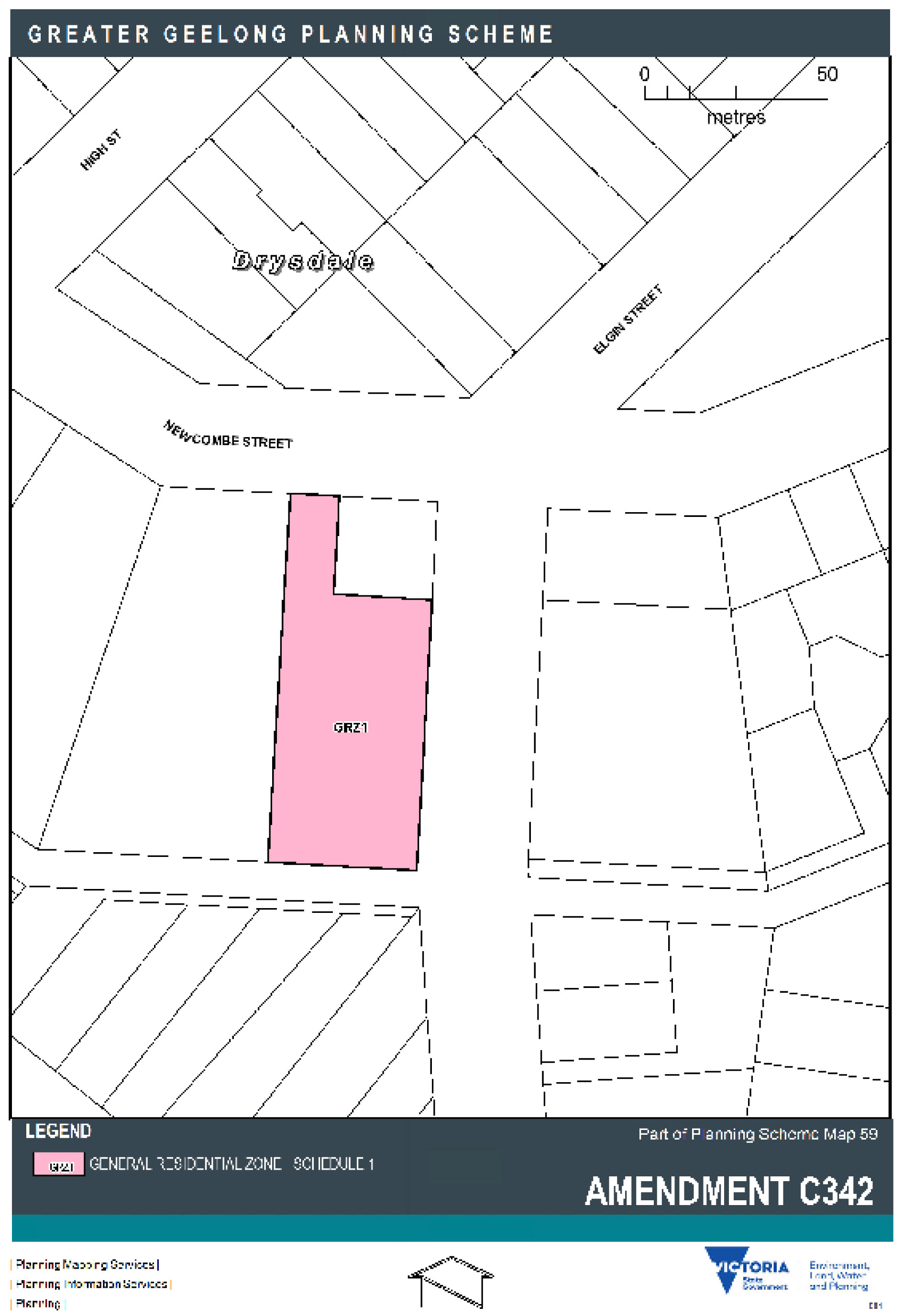
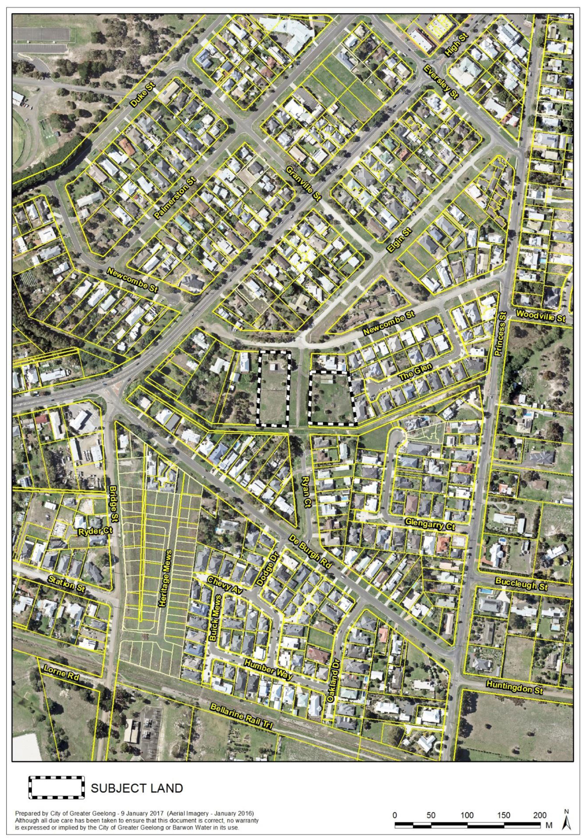
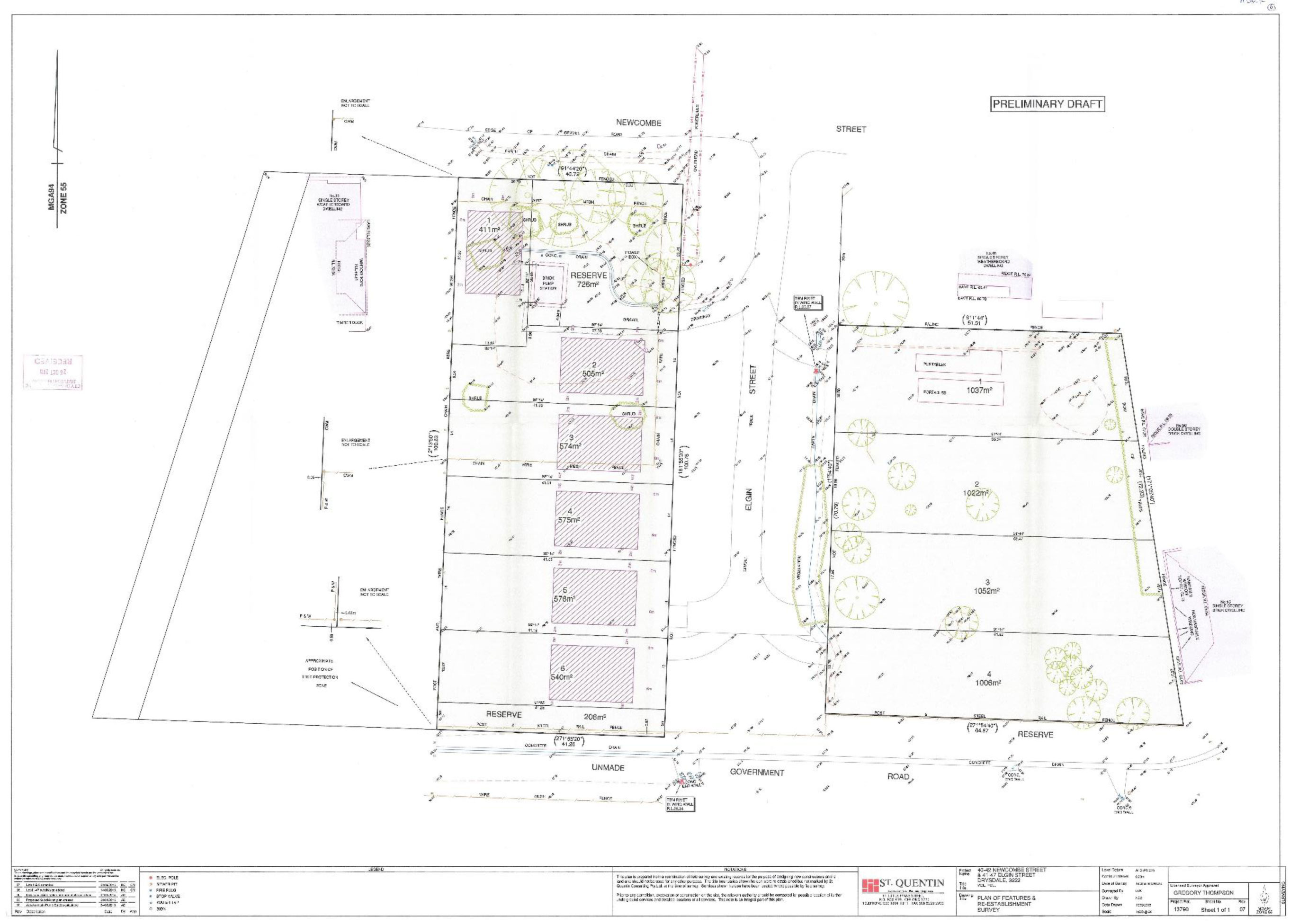
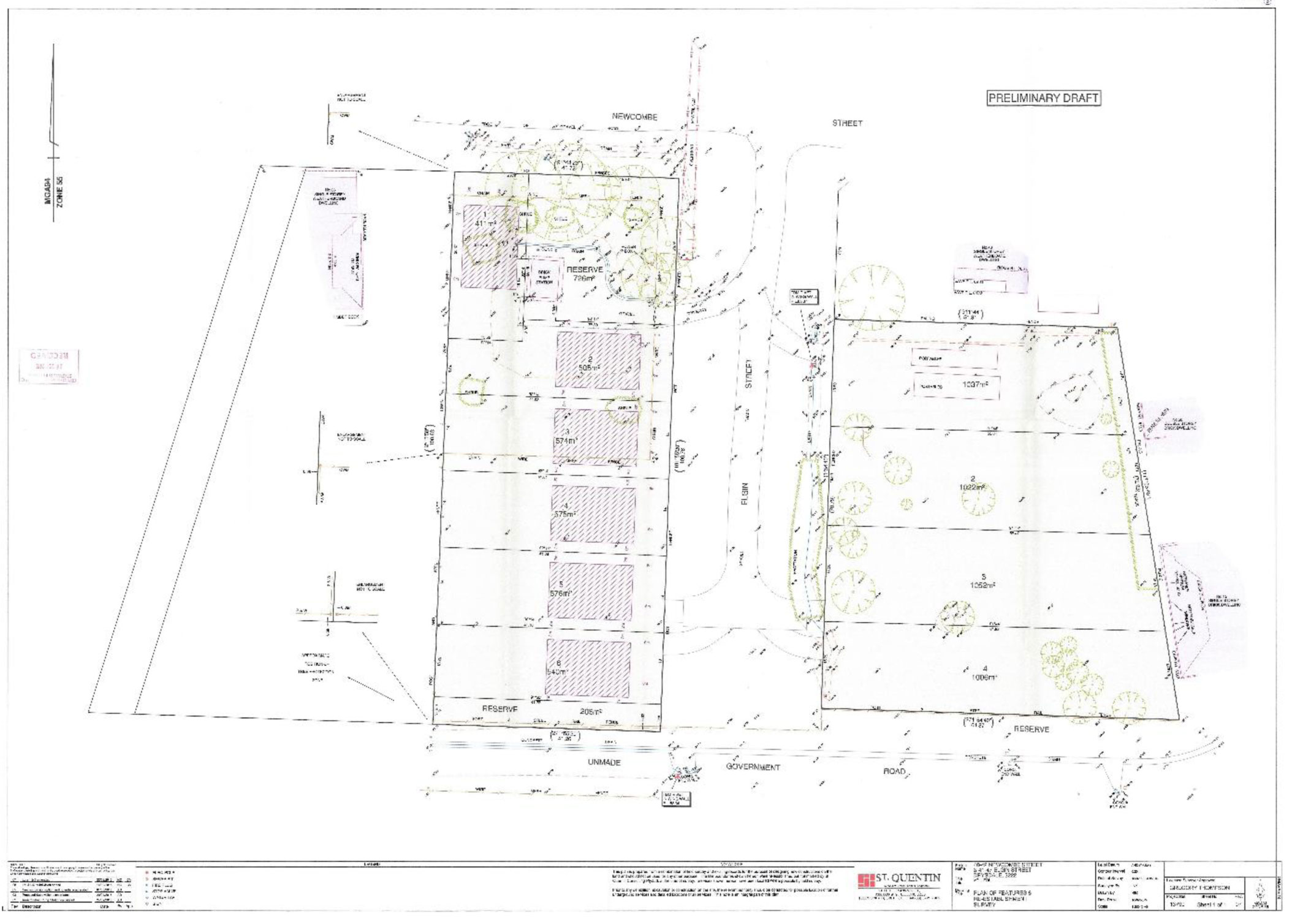
Greater Geelong Planning Scheme Amendment C342 | Panel Report | 4 May 2017
Greater Geelong Planning Scheme Amendment C342 (the Amendment) proposes to rezone the major portion of 40 – 42 Newcombe Street, Drysdale from Public Use Zone 1 (Service and Utility) (PUZ1) to the General Residential Zone Schedule 1 (GRZ1). The accompanying planning permit 1342/2015 proposes a 10 lot residential subdivision of both 40 – 42 Newcombe Street and 41 – 47 Elgin Street, which are owned by Barwon Water.
Drysdale is one of the three designated growth areas in Council’s planning scheme and has designated settlement boundaries. The subject land falls within this settlement boundary and the area surrounding the subject land is subdivided into conventional lots. The subdivision proposed is consistent with this pattern.
Key issues raised in submissions included:
unsealed roads and associated dust
loss of solar access to the immediate property to the east
stormwater
privacy
alternative uses.
A number of issues were resolved between the land owner (Barwon Water) and submitters through the negotiation of conditions on the draft planning permit, particularly relating to issues of solar access. These changes have been reflected in the Panel’s preferred Planning Permit at Appendix C of this report.
The Panel concludes:
The proposal provides an opportunity to more fully utilise the subject land and provide for a small scale urban consolidation project in the Drysdale township. The land is centrally located in the town and only some 600 metres walking distance from the majority of the town’s commercial and community facilities.
The Amendment is strategically justified and the application should be supported.
The accompanying planning permit should be supported subject to post-exhibition changes contained in Appendix C.
Based on the reasons set out in this report, the Panel recommends:
Adopt Amendment C342 to the Greater Geelong Planning Scheme as exhibited.
Issue Planning Permit 1342/2015, subject to the amended conditions provided in Appendix C.
The planning authority for this amendment is Greater Geelong City Council.
The Greater Geelong Planning Scheme is amended as follows:
Planning Scheme Maps
The Planning Scheme Maps are amended by a total of 1 attached map sheet
Zoning Maps
Amend Planning Scheme Map No 59 in the manner shown on the 1 attached map marked Greater Geelong Planning Scheme, Amendment C342.
End of document
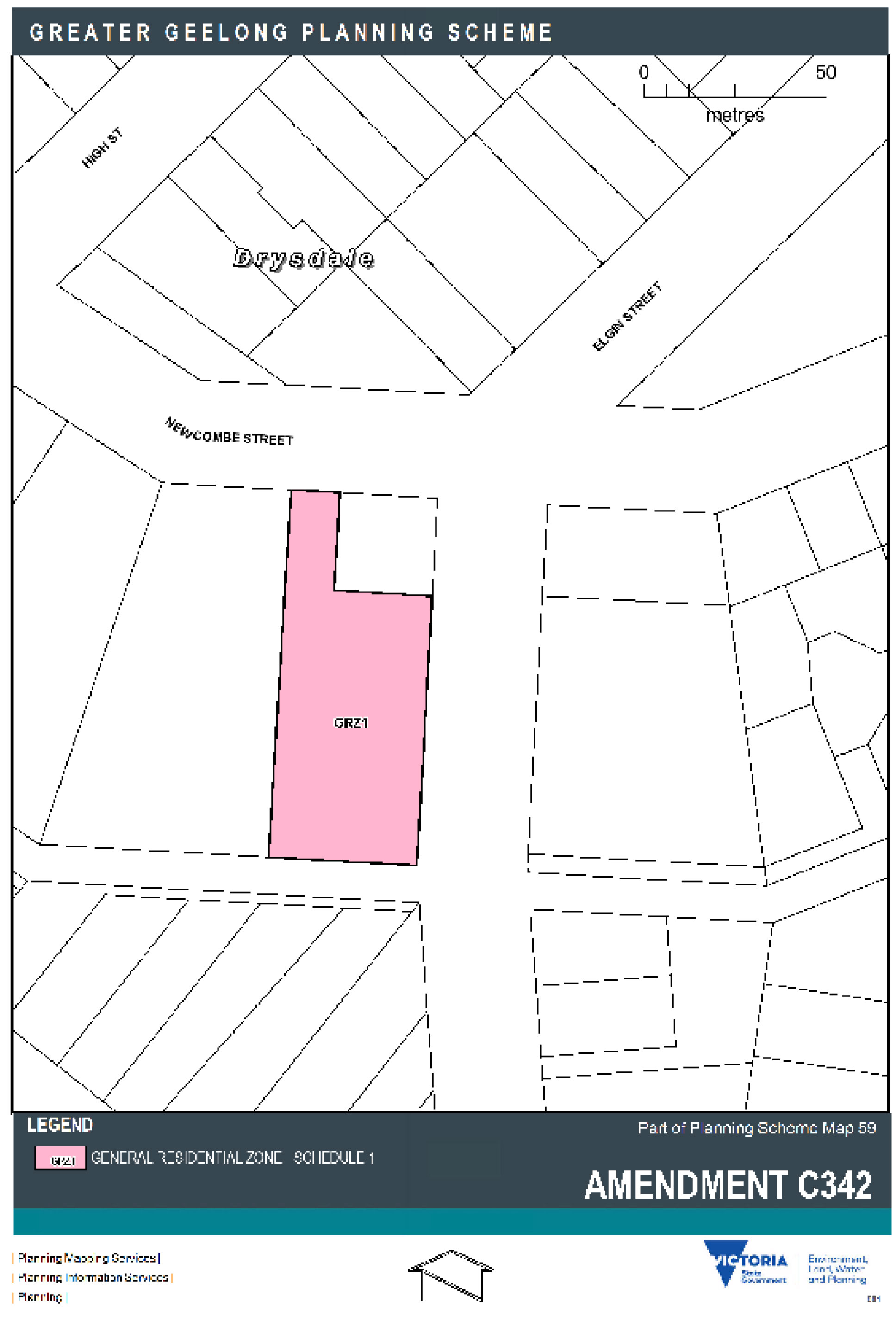
Greater Geelong Planning Scheme Amendment C342 | Panel Report | 4 May 2017
PLANNING PERMIT |
Permit No.: |
1342/2015 |
GRANTED UNDER section 96I OF THE PLANNING AND ENVIRONMENT ACT 1987 |
Planning scheme: |
Greater Geelong |
Responsible authority: |
City of Greater Geelong |
|
ADDRESS OF THE LAND: |
40-42 NEWCOMBE STREET and 41-47 ELGIN STREET, DRYSDALE |
|
THE PERMIT ALLOWS: |
TEN (10) LOT SUBDIVISION |
|
THE FOLLOWING CONDITIONS APPLY TO THIS PERMIT: |
||
Amended Plans Required
Note: The submitted plan must be accompanied by written approval from the CFA. |
||
Endorsed Plans
|
||
Plan for Certification
|
||
Construction Management Plan
|
||
Works Adjacent Waterway – Corangamite Catchment Management Conditions
|
||
Engineering Plans - Road Design and Drainage |
||
Construction Plans
|
||
Drainage and Road Construction Completion
|
||
Street Names – Place Signs
|
||
Street Lighting
|
||
Maintenance of Civil Works
|
||
Maintenance Bond
|
||
Disturbed Surfaces
|
||
Council Assets
|
||
Existing Fill
|
||
Streetscape and Landscaping Works |
||
Weed Removal
|
||
Vegetation Protection
|
||
Streetscape Plans - Landscaping
Notes
|
||
Completion of Streetscape Works
Notes
|
||
Maintenance of Streetscape Works
Notes
|
||
Pumphouse and Reserve to be Vested to Council - Landscaping Works
|
||
Council Reserves – Footpath / Loam / Landscape
|
||
Council Reserves – Vehicle Access Barriers
|
||
Fencing of Council Reserves
|
||
Pumphouse Noise Insulation
|
||
Public Open Space Contribution
|
||
PROVISION OF SERVICES |
||
Telecommunications
|
||
POWERCOR CONDITIONS
|
||
BARWON WATER CONDITIONS |
||
General
Water
Sewer
Note: The developer is to apply to Barwon Water for details relating to costs and conditions required for the provision of a water supply and sewerage service to the subdivision. |
||
CFA CONDITIONS |
||
Hydrants
|
||
Roads
|
||
SUBDIVISION EXPIRY
The Responsible Authority may extend the periods referred to if a request is made in writing before the permit expires or within six (6) months afterwards. Note:
[If the permit has been amended, include the following table indicating the date and nature of amendments included in the amended permit, and the name of the responsible authority that approved the amendment —]
|
||
Date of amendment |
Brief description of amendment |
Name of responsible authority that approved the amendment |
Source: |
Planning and Development – Strategic Implementation |
Chief Executive Officer: |
Kelvin Spiller |
Index Reference: |
Amendment C368 and Planning Permit 11/2017 |
To seek Ministerial Authorisation to exhibit a combined re-zoning and planning permit to re-zone land at 143 – 179 Flinders Avenue, Lara to the General Residential Zone and subdivide the land for conventional residential development.
The amendment has been made at the request of TGM Consulting on behalf of L. Bisinella Developments Pty Ltd.
In 2013 the then Minister for Planning prepared Amendment C293 to the Greater Geelong Planning Scheme, to re-zone to the General Residential Zone the land immediately to the west of the land which is the subject of the current application.
In its Report to the Minister the C293 Planning Panel indicated in relation to the 143 – 179 Flinders Avenue that:
“While the Council submitted that this land should be included for rezoning the Panel is not convinced that all parties who might be affected by such a proposal have had the opportunity to make a submission.” (P. 15)
Amendment C368 is supported by the Lara Structure Plan, which identifies this land as suitable for conventional residential development to take advantage of its proximity to established residential areas and easy access to a range of community facilities and services.
The appropriate extent of such rezoning, with respect to the provision of a 200 metre buffer to Serendip Sanctuary, was considered and determined as part of Ministerial Amendment C293.
The land proposed to be rezoned by Amendment C368 conforms to the setback distance from Serendip Sanctuary established by Amendment C293.
Council previously expressed its support for the rezoning of this land in its submission to the C293 Planning Panel.
P Dorling moved, L Gardner seconded -
That Council:
supports the preparation and exhibition of Amendment C368 to the Greater Geelong Planning Scheme to re-zone land at 143 - 179 Flinders Avenue Lara from Rural Living Zone to General Residential Zone 1;
revises the Map at Clause 21.13 - 4 to identify the land at 143 – 179 Flinders Avenue as suitable for conventional residential development;
considers the application for a planning permit for the multi-lot subdivision of the land to be re-zoned to the General Residential Zone concurrently with the preparation of the Amendment, in accordance with the provisions of Section 96A of the Planning; and
requests the Minister for Planning to authorise the preparation and exhibition of Amendment C368 and Planning Permit 11/2017.
Carried.
The subject land adjoins the eastern boundary of land in the General Residential Zone, via Ministerial Amendment C293 to the Greater Geelong Planning Scheme, in 2014.
The land is located on the western side of Flinders Avenue, approximately 250 metres south of its intersection with Caddys Road.
The request for Amendment C368 was lodged by TGM Consulting on behalf of L. Bisinella Developments Pty Ltd, who are also the applicants for planning permit 11/2017.
The combined application for the Amendment and Planning Permit is accompanied by the following reports:
Vegetation Assessment;
Approved Cultural Heritage Management Plan;
Flood Impact Assessment;
Infrastructure Servicing Report;
Clause 56 (Subdivision) Assessment; and
Traffic Report.
The re-zoning and planning permit will enable the land to be developed in an integrated manner with the adjoining residential land to the west, which will optimise the conventional residential development potential of this land, consistent with the objectives of the Lara Structure Plan.
It is further proposed to exhibit an amended map for inclusion in the Municipal Strategic Statement at Clause 23.13-4, to align the extent of the land identified as suitable for conventional residential development with the proposed re-zoning. This is consistent with the process adopted by the then Minister in relation to Amendment C293.
The extent of the area affected by the re-zoning is identified in Attachment 2.
The revised Map for inclusion in Clause 21.13-4 is provided as Attachment 3.
The proposed subdivision layout is shown on the plan in Attachment 4.
Council planners sought referral comments from internal Council departments and external referral agencies. Issues raised in comments have been resolved or are addressed by draft Planning Permit conditions.
All nearby property owners and other parties who lodged submissions to Amendment C293 will be notified at the time of the exhibition of this Amendment to enable them to make a submission and appear before an Independent Panel appointed by the Minister for Planning if they wish.
The Amendment is consistent with the Lara Structure Plan, 2011 which identifies this land as suitable for conventional residential development to take advantage of its proximity to established residential areas and easy access to a range of community facilities and services.
The proposal is consistent with the intent of the State Planning Policy Framework (SPPF) and supports its implementation by:
Limiting the impact of urban development on non-urban areas by allowing development within a designated township boundary (Clause 11.02-2, 11.07-1 and 11.07-2);
Encouraging subdivision of land which contributes to a compact urban structure with walkable distances between activities and with access to facilities to meet day to day needs (Clause 15.01-3);
Providing for a residential development that is cost-effective in infrastructure provision and use, energy efficient, incorporates water-sensitive design. (Clause 16.01-1);
Locates new housing in locations that offer good access to jobs, services and transport (Clause 16.01-2); and
Managing stormwater from the site through the incorporation of water-sensitive urban design techniques to reduce run-off and peak flows and integrate stormwater treatment into the landscape (Clause 19.03-3).
The amendment is also consistent with the following elements of the Local Planning Policy Framework:
21.06 Settlement and Housing
21.06-2 Urban growth – This policy seeks to retain development within defined urban growth areas and provide a mix of housing suited to the needs of a diverse range of household types.
21.06-3 Urban consolidation – This policy seeks to encourage urban consolidation and encourage a range of development densities.
21.06-4 Neighbourhood character – This policy seeks to ensure development appropriately responds to the existing character of the area.
21.08 Development and Community Infrastructure
21.081 Key issues and influences – This policy recognises the need to provide for the efficient use of services and conservation of water.
21.08-3 Development Contributions – This policy encourages development to proceed in a contiguous manner which maximises the use of development and community infrastructure.
21.08-5 Accessibility – The policy recognises the need to facilitate the development of access opportunities for all members of the community.
No Council officers involved in the preparation of this report have any direct or indirect interest, as defined in Section 80C of the Local Government Act, with respect to the matters to which this Amendment and Permit relate.
The Director, Planning & Development has declined to deal with this report due to civil proceedings issues by L Bisinella Developments Pty Ltd.
No adverse environmental consequences have been identified with respect to the proposed Amendment and Permit.
The documentation submitted in support of the planning permit application has informed the responses from both internal and external referral authorities, which are reflected in the conditions of the planning permit.
The internal referral response from Council’s Environment Unit includes the following comments:
“The northern boundary of the area to be rezoned GRZ1 coincides with a ‘200 metre line’ to the south of Serendip Sanctuary, which provides a buffer between the sanctuary and urban residential development.
there is no native vegetation present on the subject site, the site was seen to have been ploughed, planted out with exotic grass species and cut for hay at the time of the inspection. The several scattered trees remaining on the site are exotic Peppercorns Schinus spp.
Land to which the Planning Scheme Amendment and Planning Permit applies.
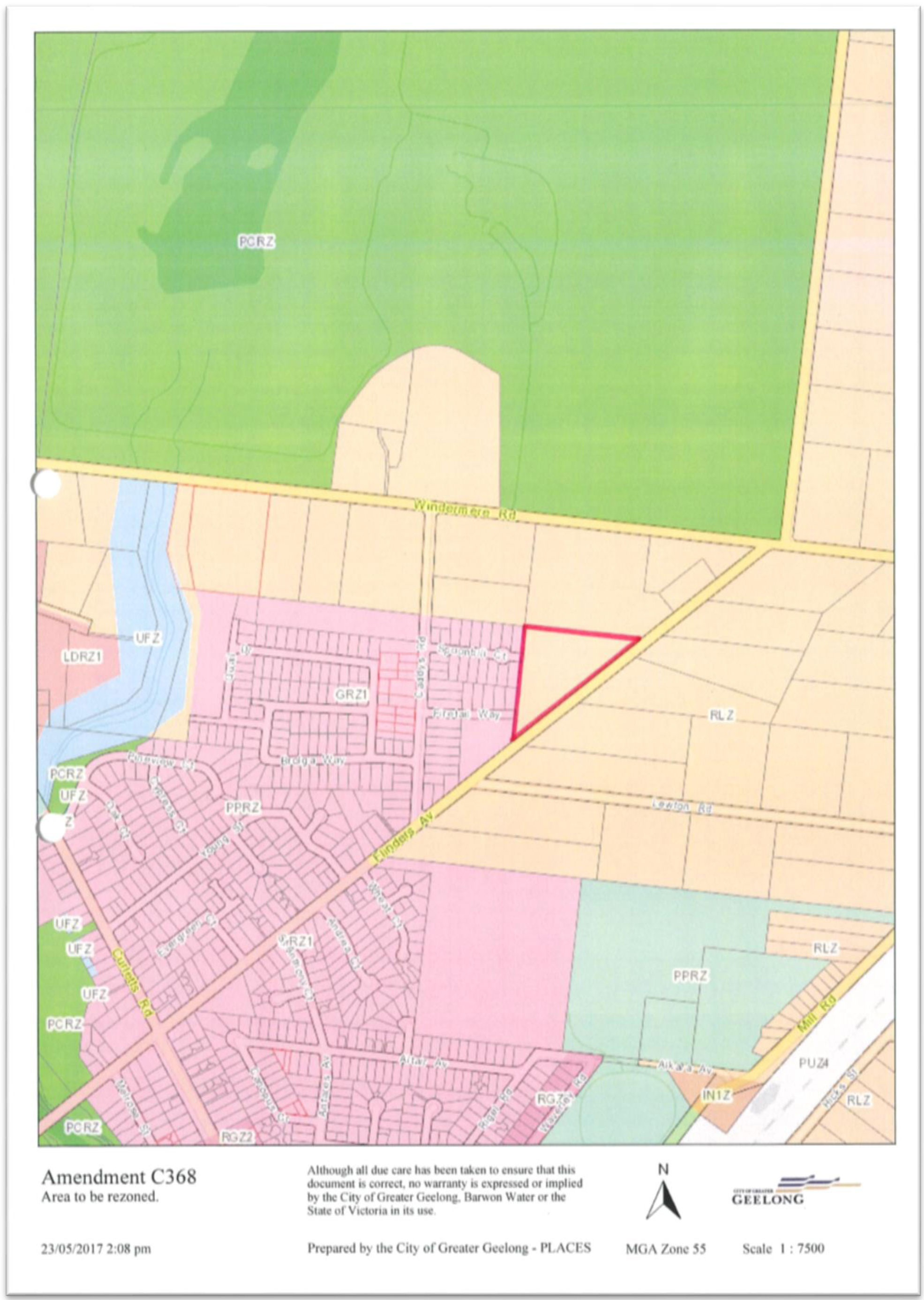
Revised Map: Clause 21.13-4
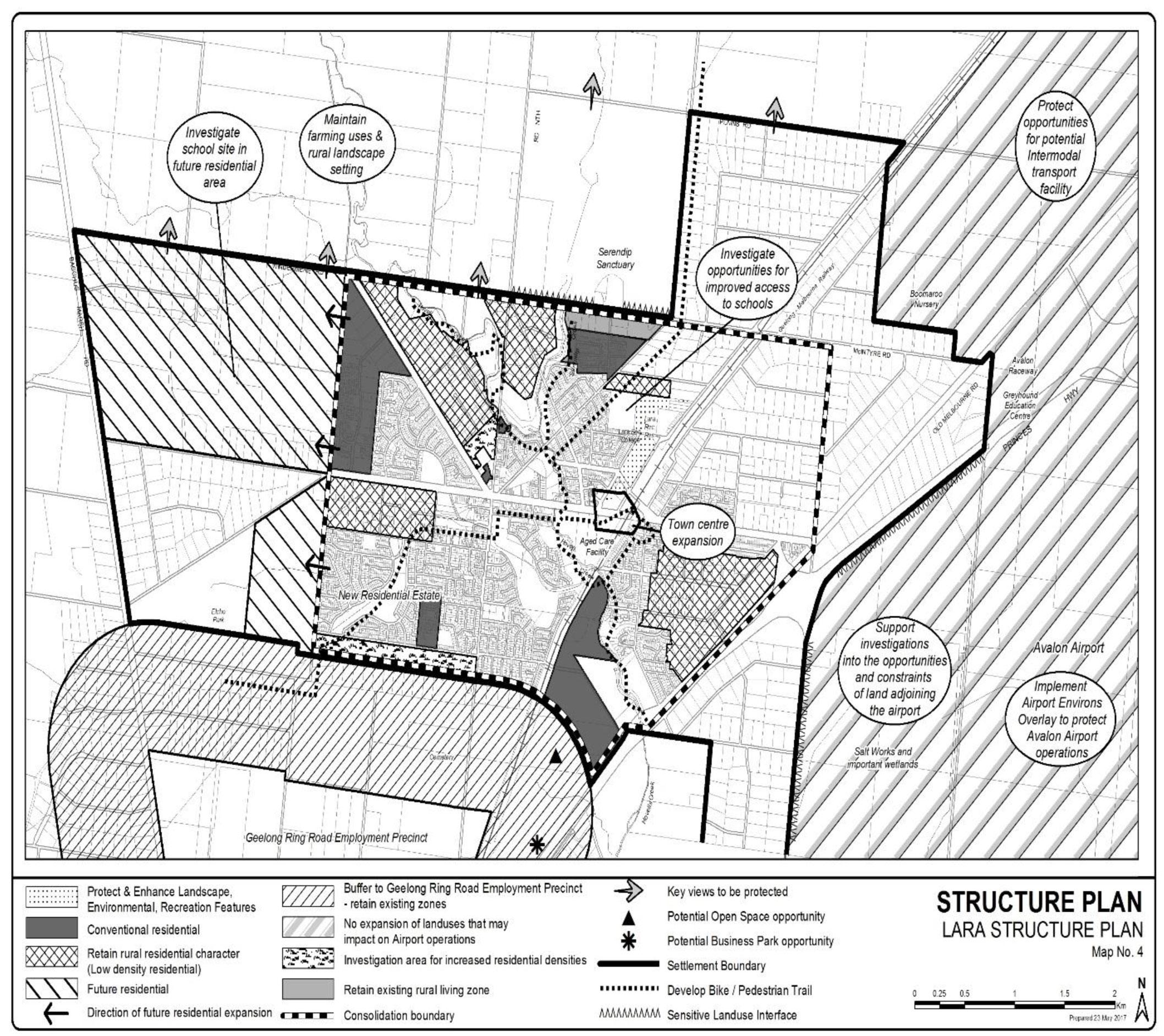
Plan of Proposed Subdivision
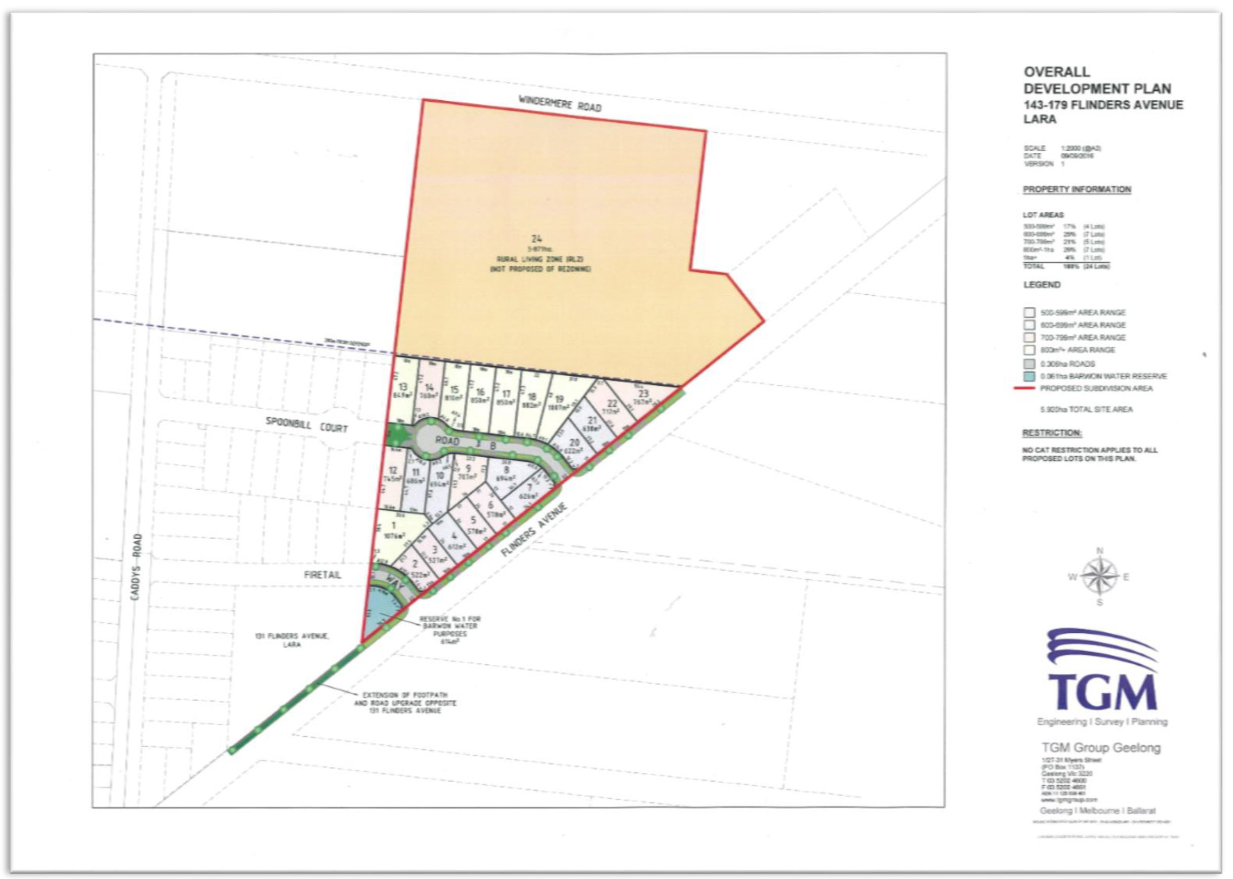
Source: |
Planning and Development |
Director: |
Peter Bettess |
Index Reference: |
Subject: Moolap Coastal Strategic Framework Plan |
The purpose of this report is to develop a response to the State Government’s release of the draft Moolap Coastal Strategic Framework Plan.
The draft Plan is seeking to establish a strategic framework for the future land use and development of the study area. The draft Plan has been prepared in the absence of detailed technical work and consequently its level of direction is reflected accordingly.
The draft Plan identifies four key precincts and associated primary land use directions within the study area.
Key primary land use directions of the draft Plan are: Point Henry precinct to be a high amenity tourist/residential lead area which provides a range of mixed uses; Industry precinct to be business as usual with potential expansion of existing business; South-East precinct to be a high quality sustainable residential development precinct with associated land uses; and Saltworks and Wetlands precinct for the Crown owned part to have an environmental focus with complementary tourism and for the privately owned areas to have an environmental focus/tourism investigation.
Elements of the draft Moolap Plan contradict current strategic planning policy contained in the Greater Geelong Planning Scheme and also potentially creating conflict and impact on existing land uses in the study area. This is particularly the case for the South-East precinct which supports extensive large scale residential growth, which has potential significant implications for the City and existing major industries in the study area.
Current policy respects and supports the need to protect existing industries and their contribution to the Geelong economy.
There are a number of positive outcomes identified in the draft Moolap Plan such as the urban renewal direction for the Point Henry precinct and potential positive environmental outcomes for the former Saltworks and Wetlands precinct.
All four precincts differ greatly in their current state but will be intrinsically linked in there future development. A balanced approach to future land use and development in the study area is required.
Ongoing strategic planning work being undertaken by the City and other key stakeholders will need to have regard to the primary land use directions contained in the draft Plan.
L Gardner moved, P Dorling seconded -
That Council officers provide a submission to the Department of Environment Land Water and Planning in response to the draft Moolap Coastal Strategic Framework Plan April 2017 based on this report.
Carried.
This report suggests a submission developed around the following key aspects:
Point Henry Precinct
General land use direction supported including application of UGZ.
Directions and strategies should allow for sea level rise; a resilient public coastal waterfront; protection of infrastructure; manage contamination; provide greater consideration of any environmental impacts associated with boating access; support design excellence and community infrastructure provision; and further analysis of the pier’s future usage.
Industry Precinct
Land use direction supported. Industrial zone retention supported.
Precinct specific DDO should be applied addressing Point Henry Road frontages.
Support for further infrastructure investment to support precinct including sewerage (strengthen Direction 18).
Strengthen direction 17 to provide greater direction relating to coastal foreshore links, access and extent.
South-East Precinct
Need to acknowledge settlement policy inconsistencies.
Stronger focus on achieving a residential outcome that delivers a significant community and environmental benefit including alignment with One Planet Living principles, significant coastal edge linkages and appropriate transition to the Bellarine.
Clearer plan for future industry/residential transition.
Retention of Farming Zone in interim supported.
Saltworks Precinct
Generally support objectives with further directions/strategy clarification of intended environmental and commercial outcomes.
Changes to Directions 19, 20, 22 & 22 recommended relating to coastal retreat, land use, open space and environment.
Retention of the Public Conservation and Resource Zone.
Application of Public Conservation and Resource Zone to Saltworks (Crown land) instead of Public Park and Retention Zone would reflect the preferred strategy.
Coastal Foreshore
Further clarification and strategic planning for coastal foreshore linkages from Eastern Gardens to Clifton Avenue.
Implementation
Clarification of implementation steps.
The key elements of this response are explored in the following draft Plan overview, policy context and discussion.
This report provides an overview of the draft Moolap Plan, primarily focusing on the four precincts and their associated primary land use directions, discussion about some of the potential land use planning, implementation or infrastructure challenges related to inform a submission.
Study Area
The Study Area is approximately 1,200 ha in size and lies within the northern part of the suburb of Moolap. It is located approximately 5 kilometres from Geelong CBD.
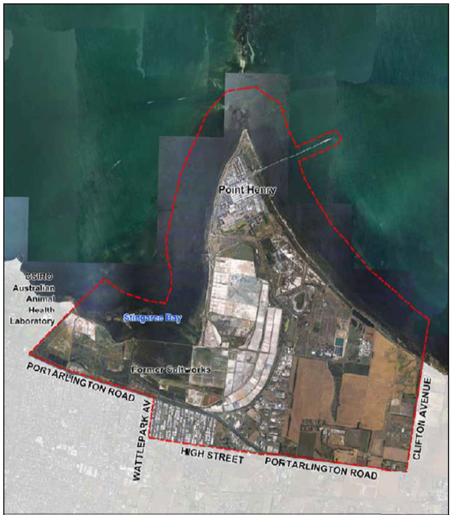
A key consideration in the strategic planning for this area is current landownership. The following map below shows the key stakeholders in the study area including Alcoa, State Government, Ridley (former Saltworks) and major industries including Winchester and Dow. Alcoa is also in the process of masterplanning its landholdings and has released a concept masterplan, Alcoa 575.
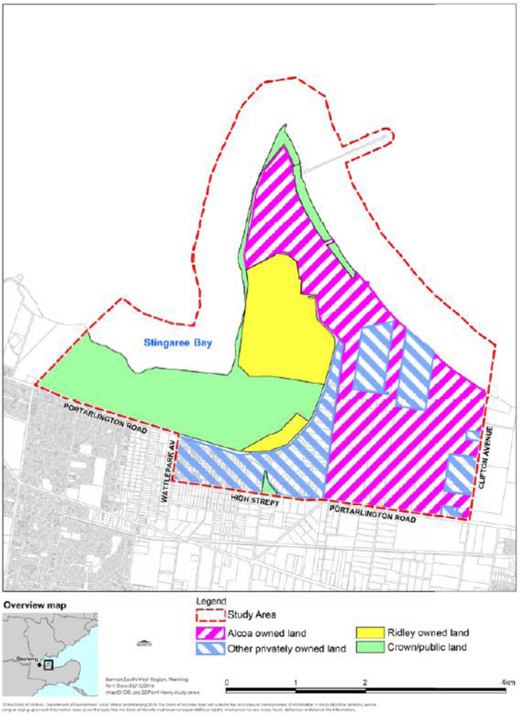
Existing Policy Context
There is an existing land use and environmental policy context which applies to the study area and broader region, which is relevant to providing a contextual background to the draft Plan. Key policies/strategies include:
Victorian Coastal Strategy 2014
G21 Regional Growth Plan 2013
Greater Geelong Planning Scheme - Municipal Strategic Statement and Local Planning Policy Framework. The key policy clauses include: 21.06 - Settlement and Housing, 21.00 - Economic Development and Employment, 21.05 - Natural Environment, 21.14 - Bellarine Peninsula and 22.06 Tourism development in rural areas.
Environment Management Strategy 2014-2017
Low Carbon Growth Plan for Geelong 2011
Climate Change Adaptation Strategy 2011
Geelong Port- City 2050
Some of the critical elements of these polices include the application of settlement boundaries and urban breaks, maintaining productive rural landscapes, retail centre hierarchy, industry buffers and protection of the environment including wetlands and responding to climate change.
The regional policy context set out in the G21 Regional Growth Plan (G21 RGP) is of particular relevance. The G21 RGP identifies a large part of the eastern extent of the study area as a key “settlement break”.
While non-compliance with the above policy/strategy platforms should not prejudice the consideration of strategic opportunities, it should flag matters for consideration to inform a balanced outcome.
Current strategic planning projects
Settlement Strategy
The City is in the process of preparing a settlement strategy for the municipality. The strategy will provide a framework to ensure the City can meet the housing needs of the municipality to 2036.
The estimated population in 2016 of 234,999 is expected to grow to 320,791 by 2036. This is an increase of 85,792 or 36.5% over 20 years (.id forecast CoGG 2015). It is estimated that at least an additional 35,000 houses will be required to cater for this growth. A combination of development in identified growth areas and existing urban areas will be required to meet this demand.
The strategy will provide clear direction on where growth and development should occur and set out the principles of sustainable urban development. This will ensure urban development occurs in a planned, logical, integrated, efficient and cost effective way. The Strategy will provide greater certainty to the City, the community and other stakeholders about meeting housing demand, providing housing development and infrastructure delivery, logical staging and sequencing and funding critical infrastructure.
The settlement strategy is on course for public consultation on discussion papers in June 2017. After this stage of public engagement, a draft settlement strategy will be prepared and it is anticipated to be in draft format in late 2017 or early 2018. The strategy will need to consider the ongoing preparation of the Moolap Coastal Strategic Framework Plan, particularly in terms of key precincts such as ‘Point Henry’ and ‘South-East’.
The draft Plan seeks to guide the future of the study area over the next 20-30 years. This in effect, will bring the land use plan up to 2050, a time frame well beyond that being considered in the settlement strategy. By 2050, the draft Plan envisages that the study area will have a distinctive high amenity residential development that is focused on the coast and provides diverse housing opportunities. The vision is absent of any detailed strategic analysis in regard to strategic planning for growth in the rest of the municipality, and this is where the settlement strategy will play a key role in the determining the need for additional land and possible timing for delivery.
Northern and Western Geelong Growth areas project
The Northern and Western Geelong Growth Areas project (NWGGA) is an ongoing growth area planning project which is furthering the work of the G21 RGP. The G21 RGP identified two ‘Further Investigation Areas’ in Lovely Banks and Batesford South (Northern and Western Geelong Growth areas). The project is planning for an estimated population in excess of 100,000 people.
The NWGGA project will deliver an Integrated Infrastructure Delivery Plan (IIDP) and a framework plan for each growth area. Both the IIDP and framework plans will be used to guide future development in these areas. Importantly, the IIDP looks at critical infrastructure necessary to support future communities in these areas and the necessary funding required.
The City will consider the findings and recommendations of the IIDP and framework plans to ensure that proper and orderly planning for these areas has been undertaken, also considering the impact of future growth in these areas on the City’s existing significant financial commitments to growing communities elsewhere in the municipality e.g. Armstrong Creek urban growth area.
The impact of continuous growth in the absence of orderly planning and financial feasibility potentially could diminish the City’s ability to sustainably provide for future population growth. Given the Moolap study area is not identified in the G21 RGP for future urban growth, this type of out of sequence land use framework plan and recommendations has the potential to have significant impact on the City’s orderly settlement planning.
Our Future
The Our Future long term community vision project has through community engagement, identified a strong preference for a clever and creative Geelong while retaining aspects of a sustainable future. Such directions are relevant to a response on the draft Plan.
Geelong Ring Road- Bellarine Link (VicRoads)
A strategic road infrastructure project is ongoing and is in the planning stages at present. The new Bellarine Link road will connect the Surf Coast Hwy to Portarlington Road. The study area stretches from the Surf Coast Highway at Baanip Boulevard to Moolap Station Road.
This project will be of significance to future development in the Moolap study area. It will provide an alternative high volume arterial route to the Geelong Ring Road removing a large part of through traffic into central Geelong.
The new road will value-add to land adjoining its alignment and will put pressure on existing land uses for future urban change. In tandem with the draft Moolap Plan, considerable pressure will be placed in this broader area for future development. Moreover, the new road alignment has the potential to create a new urban growth boundary for eastern Geelong.
This cumulative impact of key land use projects needs to be carefully considered by the City in its response to the future of this area.
Leopold Structure Plan review
Whilst not commenced, the review of the structure plan in 2017/2018 will provide landowners in the structure plan study area an opportunity to put forward their land for urban development, particularly in areas north of Portarlington Road adjoining Clifton Avenue. Given the proposed future primary land use identified in the draft Plan for land in the eastern extent of the study area, management of this impact and on the identified settlement break will inform desirable planning outcomes for this transition.
The existing precinct limitations (challenges of infrastructure provision including drainage) identified in the previous Eastern Boundary review also present challenges with any push to expand eastwards of Moolap (south of Portarlington Road) should residential actually progress towards Clifton Avenue.
Draft Moolap Plan
Precincts
Four precincts have been identified in the draft Plan: Point Henry, Industry, South-East, and Saltworks and Wetlands as shown below.
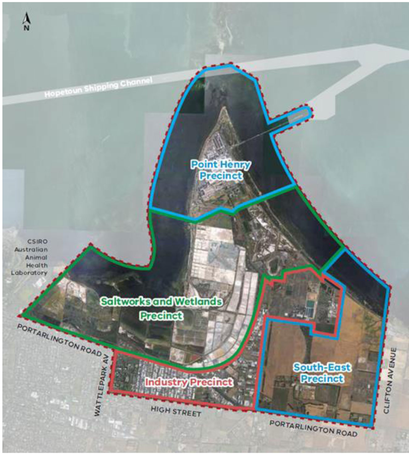
The identified precincts are largely based on their existing land uses and are generally logical in their extent. The precincts are provided with key directions and strategies.
Directions and strategies are also provided for the Coastal Foreshore which is not identified as a precinct in its own right but is a key land use issue over the lifetime of the draft Plan.
Land Use Direction plan
The draft Plan map shows the primary land use directions for each precinct. The land use directions have been derived through a detailed process of background analysis, feasibility analysis, land use scenario analysis, consideration of strategic implications and public engagement. A number of the land use directions are high level so as not to restrict any future land use that might be proposed by private landowners.
The draft land use direction summary plan below shows the following land use directions for the four identified precincts.
Precinct |
Primary land use direction |
Point Henry |
Tourism and Residential |
South-East |
Residential |
Industry |
Industry |
Saltworks and Wetlands |
Crown land: Environmental with complementary Tourism Private land: Environmental/Tourism investigation |
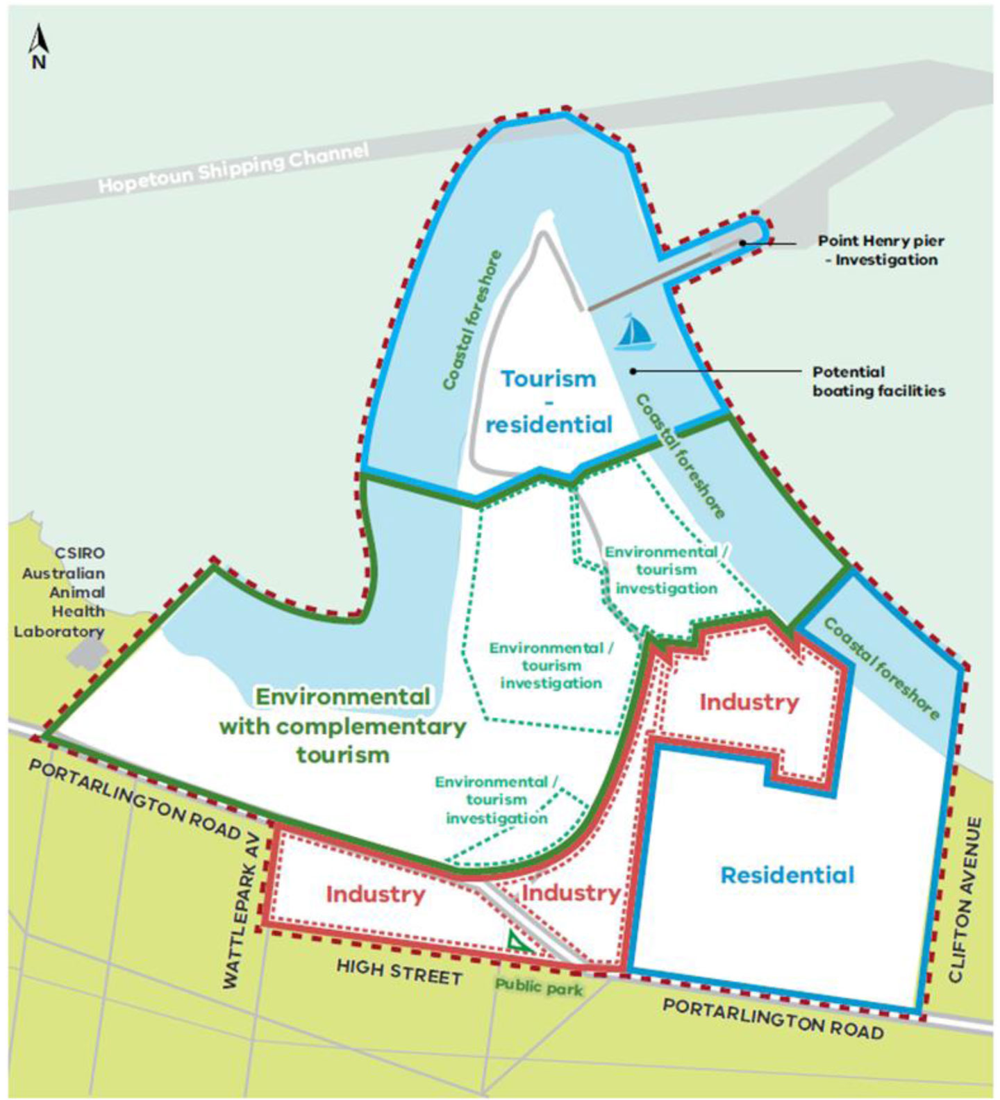
The following sections of this report summarise key elements of the draft Plan by precinct and identify discussion points and recommend submission responses informed by strategy and inputs from other Council departments.
Point Henry Precinct – discussion and response
The Point Henry precinct contains a plethora of land uses and development that provide an interesting context for future land use planning. Historical industrial manufacturing, landfill, coastal inundation amongst other elements make this precinct challenging to strategically plan for future land use.
Land Use:
The primary land use direction, tourism and residential, for the precinct is supported in principle. Tourism and residential land uses generally align in terms of reciprocal land use outcomes. Given the relative isolation of the precinct, accessed by Point Henry Road some five kilometres from Portarlington Road, future land uses in this precinct will need to have a key destination factor, specifically the tourism land uses. Tourism in this area will most likely be aligned with the coastal setting of the precinct to take advantage of the waterfront. This would of course depend on the ability to fully utilise the foreshore and future coastal processes.
To fully determine the tourism role of this precinct detailed analysis will be required to determine the type of uses that would be appropriate, particularly if the intent is to provide for a regional/strategic tourist offer. Arguably, the location of this precinct commands a strategic approach to tourism uses and a need to enable a different offer to that provided on the Bellarine and Surf Coast.
Challenges will exist in planning for a vibrant coastal waterfront precinct given potential sea level rises over the next 80 years. Providing a coastal waterfront will need to plan for sea level rise by 2100, which will lead to the current coastal foreshore being inundated in susceptible areas. Given this, the location of infrastructure including public open space within the current coastal foreshore will need to consider such environmental processes. Notwithstanding this, the potential to provide greater access to the foreshore is supported.
Given the historical land use of the precinct i.e. smelter, rolling mill, land-fill et al, there is a need to ensure that the remediation works undertaken by Alcoa are satisfactory. The EPA will regulate this process. There is a genuine challenge to remediate the land to a level where residential uses could be supported. In the absence of the precinct being cleaned up prior to the finalisation of the draft Plan, there is a level of assumption that residential land uses will be acceptable. An alternative to residential land use in this precinct has not been considered in the draft Plan.
The provision of boating and recreation facilities in this area will also need to have regard to future sea level rise but also, the impact of boating facilities on the existing sensitive coastal environment, including the challenging shallow depths of the bay, highly sensitive seagrass population and habitat for bird species.
Built form and urban design:
It is agreed that the precinct is not suited to the delivery of standard residential development. As the draft Plan identifies, there is a need to deliver an alternative housing stock that takes advantage of the existing site context but also aligns with the primary land use direction - tourism and residential.
Given land use constraints and the primary land use direction, the focus on medium to high density residential development is supported. The provision of medium to high density development would fit comfortably with the urban renewal context of the precinct and would provide an alternative offer to the housing market.
The requirement for design excellence given the prime location of the precinct is a must, including the adoption of environmental sustainable development. This precinct should be a leader in design and sustainability excellence and offers Geelong a genuine opportunity to capitalise on a significant urban renewal development.
Transport and Infrastructure:
It is noted that the precinct is well serviced by civil infrastructure. However, for the precinct to become a genuine tourist destination, comes the need to provide an appropriate movement and access strategy and importantly, a key part of this strategy will be provision of public transport services.
As mentioned previously, the relative isolation of the precinct from central Geelong will require an integrated land use and transport planning approach to ensure accessibility for future visitors and residents. An overall strategic approach to the Point Henry Road will be required to ensure that the precinct does not become an ‘island’, given the likely future sea level rise impact on the road itself. Coordination between a number of precincts, particularly the Pont Henry and the Saltworks and Wetlands precinct will be required to ensure the road remains a key access route in the absence of an alternative proposal.
The ultimate alignment of the future Geelong Ring Road Bellarine Link is likely to play a role in the strategic planning for this area. Ongoing project planning by VicRoads will ultimately determine the point where the new ring road extension meets Portarlington Road and may offer alternative access routes to the precinct.
Community facilities and open space:
From a first principle approach, the provision of unencumbered public open space should be a priority for this precinct.
The provision of community facilities must be commensurate with the future population of the area and be in recognition of the urban renewal and tourism focus that has been identified.
The strategy to facilitate continuous public access along the foreshore with links to public open space, key features, environmental assets and adjacent precincts is supported. The City supports the provision of improved public access to the foreshore. The creation of an extended public open space network must be free from genuine constraints including future sea level rise that is likely to lead to a permanent encumbrance (i.e. the public land provided along the coast should be wide enough to allow for anticipated sea level rise, any protective structures, vegetation recruitment, public involvement and foreshore enhancement).
Environment:
The ultimate aim for the environment of the Point Henry precinct is to ensure that the primary land uses proposed are deliverable in the context of the historical industrial uses of the land and extensive contamination. Ensuring that the existing wetlands continue to play a functional role will be of great assistance to any future development but also for providing passive open space.
Consideration of coastal retreat in this precinct will be key to ensuring that essential public infrastructure is provided in areas that will be useable in the future.
A suggested word change (shown in italics) to ‘Direction 5 – Environment’ is as follows: “Improve the environmental conditions of the precinct and coastal foreshore by cleaning up industrial land and management of wetland areas.”
Point Henry Pier:
The direction for the Point Henry pier is to ensure its future use complements the role and amenity of the tourism and residential direction of the precinct. This is a logical land use direction. However, the pier is owned by the Geelong Port and they do not own any land adjacent to the pier. Effectively this makes the pier a stranded asset putting pressure on the Geelong Port to utilise the pier in the absence of industrial activity run on the Alcoa site.
The future of the pier should be considered in terms of the overall strategic context of the precinct. Given its limitations and being a stranded asset, alternative land uses are somewhat limited and possibly create feasibility issues. It is recommended that the State Government work closely with Geelong Port through future strategic planning processes such as precinct structure plans to ensure the best land use outcome for the pier.
Dependencies:
Land use dependencies and environmental clean up issues will be critical for the success of this precinct.
The outcome of the EPA Clean-up notice and associated works must be closely monitored and reviewed to determine the potential future land uses in this precinct. It is foreseeable that sensitive uses such as residential may be restricted to certain parts of the precinct based on the extent of clean-up. This may create urban design challenges in the future in terms of achieving an exceptional urban design masterplan for the precinct.
Industry precinct – discussion and response
Land use:
The primary land use direction for the industry precinct is for it to continue to operate for industry purposes. This direction is fully supported as it retains existing jobs, provides future employment potential and is logical from a land use perspective.
Within the industry precinct itself there is a range of sub-precincts, largely defined by Portarlington Road. This is a key point in considering the industry precinct itself but also the broader land uses proposed in the study area.
The industry sub-precinct south of Portarlington Road is a long established industrial area, which has smaller lot sizes that accommodate a range of light industrial uses. There is no reticulated sewer in this industrial area and there are issues with stormwater flooding, which can exacerbate contamination of groundwater issues due to on-site effluent treatment systems.
On the north side of Portarlington Road, the industrial activities are more significant in operation, larger lot sizes, heavier industrial uses and larger industrial buffers. These industries have located here for a reason, being its historical separation from urban Geelong and uses that would inhibit their ongoing operation. Example industries north of Portarlington Road include concrete batching plants, Winchester Australia, Dow Chemicals.
The established nature of existing industries within this precinct need to be acknowledged and supported into the future. The local, municipal, regional and international services offer provided is important. The two large scale industrial operations north of Hays Road, (of Winchester and Dow Chemicals), provide an important contribution to the Geelong economy both employing around 70 staff and anticipating future site investment.
Built Form and Urban Design (not inclusive):
The draft Plan recommends that schedule 20 to the Design and Development Overlay (DDO) in the Greater Geelong Planning Scheme be revisited to improve the visual appearance of the industrial areas. Given the established nature of some of the major industries in this area, the DDO is only triggered when there is a new development proposed. Consequently, it is difficult to apply a strategic approach to built form and urban design when there are historical/ongoing local and significant industrial land uses in the area. A specific DDO is suggested to replace the existing DDO to be more effective.
The key access point to the Moolap study area will most likely be Point Henry Road. As it stands, Point Henry Road has a largely industrial setting to its eastern boundary and an environmental (saltworks) context to its west. Proposed Direction 15 Built Form and Urban Design states “Review the Design and Development Overlay and facilitate landscaping along Portarlington Road to improve this key route to Geelong and the Bellarine’. Direction 15 should also include wording about Point Henry Road given its primary role in providing direct access to the future Point Henry precinct. Including this wording would then reflect the associated strategy to achieve the direction.
Transport and Infrastructure:
Improvements to drainage and connection to reticulated sewerage would increase opportunities for infill development in these areas. This objective may require strategic infrastructure planning and implementation to take place, enabling change to be made or perhaps other types of enabling development such as that proposed in the South-East precinct, which could assist with alleviating broader drainage issues.
Community Facilities:
‘Direction 17 Community Facilities and Open Space’ states: “Continue to provide recreational opportunities at City of Greater Geelong owned parks.” This direction is very high level and lacks genuine direction. It is suggested that the Direction should read as follows: “Support the retention of existing City of Greater Geelong owned parks and their improvement commensurate with future demand.” The associated strategies for Direction 17 are also somewhat vague, in particular the strategy “Encourage continuous public foreshore access and links from open space to adjoining areas.” There are difficulties in providing public access to the foreshore north of the industrial estate not least the Portarlington Road (arterial road), the nature of the foreshore north of Portarlington Road and the susceptibility to coastal processes. Consequently, it is suggested that section ‘4.5.5 Community Facilities and Open Space’ be revisited in terms of its Direction and associated Strategies.
Environment:
‘Direction 18 Environment’ recommends improvement of the amenity and environment in the industrial areas by upgrading infrastructure. As a general principle, this is supported. However, a strategic approach to upgrading infrastructure in this area, particularly south of Portarlington Road is required. Multiple landownership and existing infrastructure conditions make any proposed infrastructure upgrade works a significant task. Funding such infrastructure works would be a massive impost on the City, service agency and landowners and simply may not be feasible not least from an economics perspective but an existing land use perspective. There would need to be a strategic demand to undertake this funding investment, and at this point in time it is difficult to see whether this would be a short, medium or long-term achievable objective. It is noted that the Direction 18 Environment and associated strategies are not carried through to the ‘potential implementation framework’ section of the draft Moolap Plan. Consequently, strategies as mentioned above lack the strategic support/direction through an implementable framework.
Precinct mapping:
The precinct mapping that defines that Industry precinct is incorrect. The western boundary of the precinct on the south side of Portarlington Rd includes land within the Low Density Residential Zone. The western boundary extends across to Coppards Road but it should in fact extend only as far as to Wattlepark Avenue.
South-East precinct – discussion and response
The South-East precinct is a sizeable area of land of approximately 300ha, which commands a strategic approach to land use planning.
The G21 RGP provides settlement and employment directions as outlined in the map below. The map below identifies four key settlement breaks, one of which is located between Moolap and Leopold. The settlement break shown here is known as the “Bellarine Peninsula” settlement break. Its role is ‘to ensure a strong farmed landscape character between Geelong and Bellarine towns, encourage rural production, maintain town identities and related tourism opportunities and minimise impacts on significant wetlands and coastal views’ (G21 Regional Growth Plan 2013; page 31).
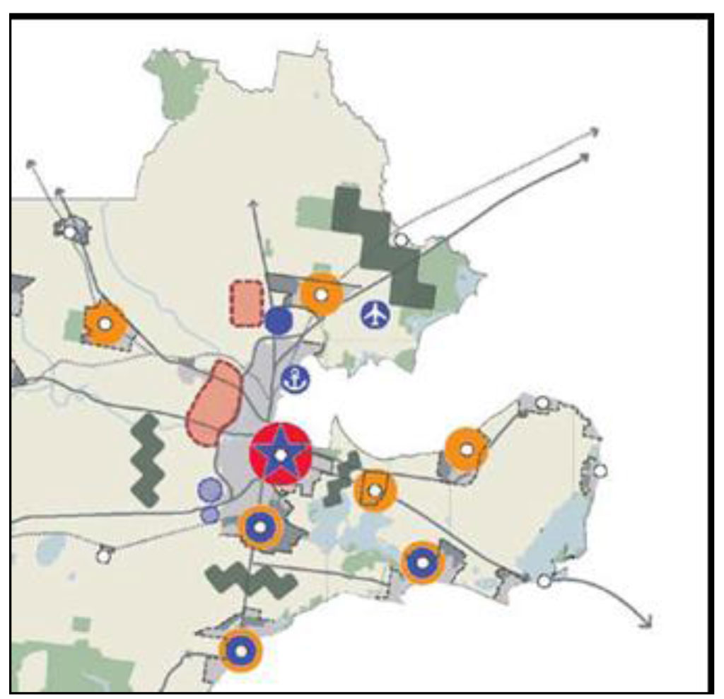
Leopold has historically been the gateway village to the Bellarine, which in effect gives further importance to the role of land within the study area, specifically the South-East precinct.
The closure of Alcoa was not foreseen within the context of the G21 RGP. Notwithstanding this, the role of land within the identified settlement break (largely under the ownership of Alcoa) would have remained important for the purposes of acknowledging the separation between urban Geelong and the Bellarine, a long standing policy position of the planning scheme and reinforced in the Bellarine localised planning statement.
The primary land use direction for the South-East precinct is residential, with residential land use up to Clifton Avenue. Historically, land east of Clifton Avenue has been under significant pressure for urban development. However, the Portarlignton Road has always provided a logical and robust settlement northern edge to the township. Land north of Portarlington is subject to a number of similar constraints found within the Moolap study area, such as future sea level rise, coastal environmental issues (seagrass meadows) and shallow bay depths. Leopold has also historically been seen as an ‘urban island’.
In 2014, the City commissioned a land capability study for land north of Portarlignton Road and west of Melaluka Road. The report identified that there were areas potentially suited to delivering urban development, that bay access in this area would be difficult to deliver for the abovementioned reasons in addition to a number of other matters such as public acquisition of foreshore land, ongoing management of foreshore access and boating facilities, that a strategic approach would be required to deal with infrastructure provision and extensive drainage constraints. The land capability report will be used to inform the future review of the Leopold Structure Plan in 2017/2018.
Given existing development pressure on land north of the Leopold township boundary, and the proposed future land use direction for the South-East precinct in the draft Plan, this combination of land use pressures, potentially will create a suite of issues for the City in the future, not least the issue of coalescence of settlements.
In the absence of any detailed technical analysis as to whether it would ever be capable of delivering residential development, the primary land use direction for the South-East precinct establishes a clear precedent in this area and will most likely exacerbate pressure on adjoining land particularly in terms of the future review of the Leopold Structure Plan.
The cumulative impact of the primary land use direction for the South-East precinct, the future Geelong Ring Road- Bellarine Link and the historical pressure of development of land north of Portarlngton Road at Leopold, will require considerable strategic analysis by the City in its future planning for these areas. Pressure is also likely to be seen for land south of Portarlington Road opposite the South-East precinct.
Land Use:
Discussion on the South-East precinct is largely informed by the existing and ongoing strategic planning policy context, existing growth areas, identified future growth areas and associated strategic planning work, and municipal housing land supply matters amongst others.
Other key matters that present potential policy/land use conflict are discussed in detail within the draft Plan, being the notable significant separation distances to existing industries within the study area. These industry buffers are primarily associated Winchester and Dow Chemicals both located off Hays Road. The separation distances to the industries are up to 2km. An industry buffer of this extent highlights the major industrial operations undertaken at these facilities and the need to ensure such operations are located in areas of low population density. These industries require isolated locations that allow them to operate in a manner that would not inhibit their operations nor impact the amenity of surrounding areas.
It is encouraging to note the draft Plan’s consideration of the major constraints that exist over this precinct and that in the absence of a review of such constraints and a focus on retaining and supporting established industrial operations, the future use of the precinct for residential development is a long term objective. However, the identification of the land for residential land use is somewhat lacking robust strategic justification that has been applied to other precincts in the study area.
Other constraints in the South-East precinct that will require consideration in any future masterplanning for the area are the historical landfill site owned by Alcoa and the replanted native vegetation wildlife corridor and Moolapio grasslands. The draft Plan acknowledges these matters and that detailed studies will be required to determine whether they would be suitable for development.
While there are notable policy misalignments with this area being residential which will require consideration to avoid policy inconsistencies there is some merit in residential use. This is on the basis that buffer, transition and built form responses can be addressed including proximity to central Geelong, access to Portarlington Road and the ability to provide an additional growth front and a unique and substantially different housing offer to Geelong area. Development in this area could also be an enabler to alleviating external issues and constraints relating to drainage and sewer. Planning gain through this type of infrastructure delivery to accommodate or assist with ongoing issues with stormwater and drainage should be a consideration given the strategic nature of the Moolap study area and intrinsic relationship between a number of precincts.
The draft Plan suggests that the coastal context of large scale residential development in this precinct may relieve some of the growth pressures from coastal towns of the Bellarine Peninsula. The South-East precinct is not considered a coastal location similar to that benefited by townships on the Bellarine. Access to the bay from this precinct would be limited and given the environmental and physical constraints found in the bay, access to the foreshore would be potentially limited to passive open space areas, shared paths et al. Furthermore, the adjoining areas of land east of Clifton Avenue and west of the South-East precinct are heavily constrained in terms of future sea level rise and existing industrial activities.
The draft Plan seeks to create a high amenity and sustainable residential precinct with convenient access to the coastal foreshore. This principle is supported. The objective for this precinct should be one of exemplar environmental sustainable development and seek to achieve some of the key principles outlined in the G21 Regional Growth Plan Implementation Plan about taking the ‘next steps’ for sustainable communities. This approach is being adopted for the Northern and Western Geelong Growth areas project. There is a potential for this area to demonstrate the One Planet Living principles.
The strategies associated with Direction 13 Land Use are relatively high level and typical of that which would be associated with large scale residential development. The strategy to enhance the coastal foreshore is acknowledged and consideration should be given to how the land is managed. The indication for potential boating facilities raises some concerns. Whilst in theory this strategy seeks to investigate opportunities, it is known that there are significant environmental issues and bathymetric issues in this part of Corio Bay.
The focus on residential development in this precinct is absent of any discussion about other alternative land uses that would be feasible as discussed in the Moolap Plan Discussion Paper. The drive for residential land use in this precinct has strong links with that identified in the Alcoa 575 masterplan, released for public comment in November 2016. The ability of this precinct to achieve its primary objective is highly questioned, which the draft Plan notes.
The draft Plan notes the level of housing land supply within the municipality. Approximately 25 years of residential land is zoned in the municipality. In addition to this, there is approximately 14 years of identified (unzoned) land for residential development (Note: The City’s Residential Land Supply Monitor is being updated to inform the preparation of the Settlement Strategy). On top of this, the City is currently planning for the Northern and Western Growth Areas.
Whilst land supply will not be the determining factor if this precinct is to be developed, it is an important consideration in terms of its timing. It is noted that the draft Plan is silent on any associated timing for this precinct.
Built Form and Urban Design:
The draft Plan advises that development in this precinct would need to provide sensitive interfaces with adjacent land. Key adjoining land uses include industry to the north and west and rural to the east. The delivery of sensitive interfaces is of course predicated on the need to resolve issues relating to separation distances. However, there are concerns that typical sensitive interface treatments as mentioned in the draft Plan (landscaping, service roads and off road/pedestrian cycle paths), are insufficient and do not recognise the significance of adjoining land uses. Significant public land should be provided along the coast line linking the Point Henry Precinct to Clifton Avenue. Consideration of appropriate infrastructure to Clifton Avenue and Portarlington Road should be considered in greater detail to achieve an appropriate transition to the adjoining rural areas and Leopold.
Transport and Infrastructure:
Future residential development in this precinct should adopt a strategic approach to the provision of movement and access. This means consideration of all transport users and an integration of land use and transport planning matters.
In terms of a holistic approach to water cycle management, working closely with key stakeholders such as Barwon Water and the City, the preparation of an integrated water cycle management plan is essential to ensure that all matters relating to water are integrated and provide a strategic approach to land use planning in the precinct.
Investigation of environmental sustainable development opportunities is another key way of ensuring transport and infrastructure are sustainably driven. Consideration of ESD opportunities could include water cycle management as mentioned above, zero carbon, zero waste, land use and biodiversity, sustainable transport etc. Future masterplanning for this area should adopt an approach to the delivery of a sustainable urban environment that considers short, medium and long term opportunities.
Dependencies:
The realisation of the primary direction for this precinct is predicated on a number of matters not least resolving the land use conflict between adjacent industry and potential residential land uses. The primary direction for this precinct is entirely focused on enabling residential land use. No other land use features in the primary direction. This is a major land use direction for this precinct in the absence of key matters being resolved. Should a resolution between land use conflicts be unachievable, the status quo will remain and perhaps this is a lost opportunity in terms of a key strategic land use direction for this precinct.
The draft Plan is quite clear about what needs to be undertaken to enable the use of the land- the key matter, as discussed earlier, is resolving the separation distances from existing industries.
The key industries to which the industrial buffers (separation distances) relate are Winchester and Dow Chemicals. It should be noted that other industries operate along Point Henry Road that are likely to have separation distances that would affect the South-East precinct. The nature of operation of these industries warrant separation distances and encroachment on their operation by sensitive land uses needs to be considered carefully not least for the impact on their operational and future operational aspirations but also the potential impact on the amenity of future residential who might live close to these operations.
The draft Plan notes that there is no obligation being proposed on industry to resolve the land use conflict, but rather it is the responsibility of proponents of residential development to avoid land use conflict. This statement is supported not least for the very reasons that these industries chose this location, but recognition that it is the onus of the adjoining landowner to resolve any land use conflict should they wish to develop their land for residential.
While the dependency for this precinct is no doubt largely based on the separation distances, other key dependencies include whether there is a need for residential land beyond that already zoned or identified and this closely relates to the adequacy of housing land supply and future population growth, the ability of the City to commit to delivering key infrastructure to new residential areas such as the South-East precinct mindful of ongoing financial commitments to current growth areas e.g. Armstrong Creek but also ongoing growth area projects such as the Northern and Western Geelong Growth areas project. Detailed land capability analysis is also required.
A stronger transition strategy for industry including a role for state government should be identified.
Saltworks and Wetlands Precinct – Discussion and Response
Land Use:
The saltworks and wetlands precinct are defined by two proposed primary land use directions. The crown land primary direction is Environmental with complementary tourism. The private land primary direction is Environmental/tourism investigation. The City acknowledges the draft Plan’s recognition of private and public land ownership, however, the primary direction for the area needs to be articulated in a clearer manner.
If coastal retreat is the preferred strategy for the precinct (all landownerships), this must be articulated at the start of the land use section (Section 4.7.2). Coastal retreat is a positive response to the existing and future conditions.
The primary land use directions are very high level and could be open to misinterpretation by the community. For the private landownership areas, the primary direction should read “Environmental and potential tourism investigation” if the preferred strategy is for coastal retreat. If the primary direction stays as it is currently presented “Environment/tourism investigation” this will lead to an ‘either/or’ situation which prejudices the preferred strategy.
A precautionary approach for this precinct is supported. Any land use proposal in this precinct should closely align with the Victorian Coastal Strategy 2014. The VCS is a key strategic policy document that provides a holistic framework for managing Victoria’s coastline. Deviation from the core policies provided by the VCS could create significant land use planning issues for coastal areas in the municipality, not least to the east of Clifton Avenue where significant urban expansive land use pressures exist.
If the preferred strategy is for coastal retreat and the preferred priority is for the coastal ecosystem to continue to provide a broad range of benefits, then there will be a need for protection of the wetlands in order for them to continue to act as a habitat for a range of significant species. The saltworks will be permanently inundated by 2100 consequently the current method of pumping water in the saltworks would need to continue or else the current habitat will be lost. There is a slight conflict between protecting coastal ecosystem and allowing coastal retreat.
It is suggested that ‘Direction 19 Land Use’ be reworded as follows (changes shown in italics): “Protect the coastal ecosystem whilst allowing it to provide a broad range of benefits that enable opportunities for small scale tourism and commercial facilities, where appropriate.” Wording around tourism and commercial facilities needs to be strongly set in the context of the saltworks environment. Further, given the level of reference to coastal retreat, Direction 19 should directly refer to coastal retreat, whilst allowing for opportunities for small scale tourism and commercial facilities, where appropriate and without prejudice to the precautionary approach.
It is further suggested that the wording to a specific strategy associated with Direction 19 be reworded as follows (change shown in italics) “Consider some water, heritage or nature based tourism and complementary facilities that are low impact and are linked to managing and improving the environmental and heritage assets.”
Built Form and Urban Design:
It is suggested that the wording of the first paragraph of section 4.7.3 be reworded as follows: “If it can be established that some tourism or commercial relates uses are acceptable within the Saltworks and Wetlands precinct, the built form should be designed to complement the environmental context, be low scale and protected from potential coastal hazards.”
For the strategies associated with Direction 20 Built Form and Urban Design, the third strategy, which discusses built form and urban design that can withstand a permanent or temporary hazard event. This strategy should be more transparent in what it means by temporary or permanent hazard. It needs to be clear in order to meet the overall Direction.
Transport and Infrastructure:
The City supports the direction to facilitate infrastructure programs within the saltworks and wetlands precinct that benefit both the precinct itself and areas outside. This is particularly so in relation to the industrial areas south of Portarlington Road which have outlets to the bay via the saltworks.
The importance of the Point Henry Road is again directly related to any future land uses contained in the saltworks and wetlands precinct. If coastal retreat is the preferred strategy, having regard to the importance of the Point Henry Road is key to ensuring it remains a useable vehicular corridor providing access to adjoining precincts such as the Point Henry precinct. Point Henry Road will be overwashed should there not be an appropriate response to sea level rise in the future.
Engineering Services flagged some concern with some directions relating to drainage that have significant cost implications to Council for future drainage management.
Community Facilities and Open Space:
The integration of the saltworks and wetlands precincts with adjoining precincts is supported. The provision of open space links e.g. continuous link along the foreshore should have regard to future sea level rise ensuring that any open space infrastructure is provided outside susceptible areas. This will require an integrated land use planning response across all four precincts to ensure that, where possible, a continuous link is provided for coastal access but mindful of future sea level rise and land use constraints.
It is suggested that the first strategy relating to ‘Direction 22 Community Facilities and Open Space’ should include reference to wetlands.
Environment:
It is suggested that the wording of ‘Direction 23 Environment’ be reworded as follows: “Protect the environment whilst supporting development, works, or uses which improve the environmental values of the former saltworks and wetlands.” The first priority should be to protect the environment and this aligns with the preferred strategy and preferred priority of the saltworks and wetlands precinct.
The first strategy of ‘Direction 23’, beginning with “Minimise impacts on the environmental…” reads as a direction rather than a strategy. It is suggested that the strategy be reworded to become actionable.
A major issue that is lacking discussion in this section relates to acid sulphate soils. This is a significant issue for this precinct as the saltworks and wetlands have acted as carbon repositories for decades and are considered a major threat to the environment if disturbed.
Coastal Foreshore – discussion and response
The draft Plan acknowledges the pressures on the coastal foreshore, namely future sea levels and the impacts of climate change including storm surge, coastal inundation and erosion, and that it is also at risk from development pressures that may expose acid sulphate soils and destroy seagrass meadows which could reduce marine life and have direct impacts on the biodiversity of the study area.
The City strongly considers these issues to be major constraints to future land use and development in affected areas. The 2014 Leopold land capability study is a useful reference in terms of considering such issues. Key recommendations from that study included coastal retreat from all areas likely to be affected by the 2100 sea level rise, provision of open space and associated infrastructure outside affected sea level rise areas, acknowledgement of the bathymetric issues of the bay e.g. shallow sea bed, extensive sea grass meadows, cost implications for the acquisition of private land to provide public access to the coast (land that would be inundated by 2100), and management of new boating facilities in these areas of high constraint.
The City acknowledges the desire to provide public access to the coastal foreshore and supports this policy position. However, as the draft plan suggests, there needs to be detailed strategic planning undertaken to ensure that the appropriate land use response to coastal processes is achieved. In the absence of this detailed work, the precautionary principle should prevail at this strategic framework planning level.
The Direction to facilitate the acquisition or contribution of coastal foreshore from private landowners to provide Crown coastal foreshore from the CSIRO to Clifton Avenue and improve connectivity, access and integration is encouraged. Again, with acquisition comes financial commitment and ongoing maintenance costs. Acquisition of land that is likely to be inundated is clearly an unfeasible proposal and should not be supported.
Potential Implementation Framework – discussion and response
The potential implementation framework is somewhat high-level in terms of actual timing. The draft Plan notes this but in the absence of timing, it is difficult to provide detailed commentary.
Planning Scheme Amendments:
The proposed implementation methodology of the Moolap Plan into the Greater Geelong Planning Scheme is clear. However, it is unclear as to what form of planning scheme amendment will be undertaken i.e. fast-tracked or extensive notice process, whether the Minister will run the amendment, full or partial implementation, staged zoning amendment etc.
Consideration of how the Moolap Plan itself will be implemented, as discussed above, should determine how the proposed rezonings are undertaken. Ideally, a Moolap policy via the MSS should be reviewed by an Advisory Committee or Planning Panel prior to implementation into the Planning Scheme. Potentially any major zone changes should follow policy implementation.
The plan below shows the proposed rezonings by the draft Moolap Plan:
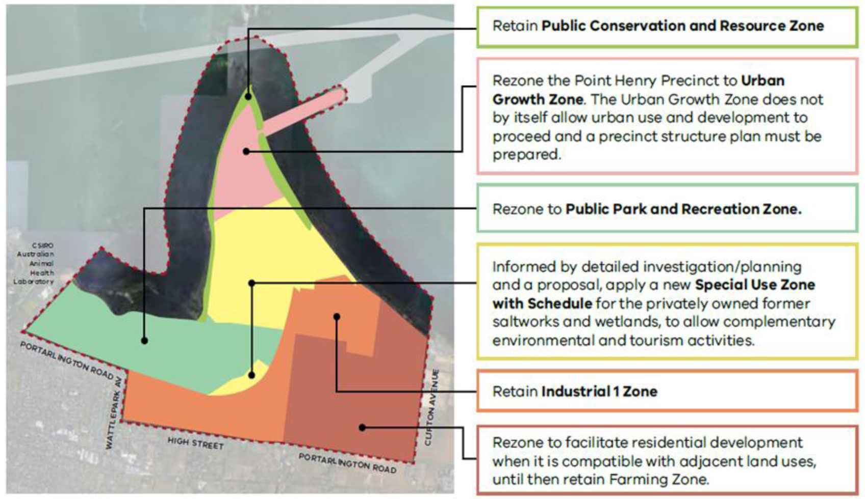
The retention of the Industrial 1 Zone in the Industry precinct is supported in principle.
The retention of Farming Zone in the South-East precinct is supported in principle.
The rezoning of the Crown Land from Special Use Zone to Public Park and Recreation Zone is questioned. Given the overall intent of this area, Public Conservation and Resource Zone is potentially a more suitable zoning option. The Public Park and Recreation Zone is recreation aligned and perhaps overrides the environmental significance of this area and the preferred strategy. Whilst not mentioned in the draft Plan, it is assumed the Crown land would continue to be under the ownership and management of the Crown.
The recommendation to apply a new Special Use Zone with schedule to the privately owned former Saltworks and Wetlands west of Point Henry Road to allow complementary environmental and tourism activities is supported in principle. It is suggested that the application of a new schedule to the Special Use Zone should be supported by a land use proposal in order to justify the planning scheme amendment or even a combined planning scheme amendment and permit application in order to give strength to any proposed land use/development.
The recommendation to rezone land east Point Henry Road from Industrial 1 Zone to Special Use Zone with a new schedule is supported in principle. The primary purpose of the schedule should be environment focused.
Ultimately, the approach to this area should be strategic in order to ensure consistency with adjoining land uses. The approach to rezoning land within the Saltworks and Wetlands precinct and the land proposed for rezoning to Urban Growth Zone must be strategic.
Whilst the rezoning of the respective parcels of land to various land use zones may take place in a piecemeal approach, any proposed amendment should be guided by the overall strategic intention for the broader study area and individual precincts in the Moolap Plan.
The proposal to apply the Urban Growth Zone to the Point Henry precinct is supported in principle. The Urban Growth Zone acts as a holding zone for future urban land use and development. The preparation of a precinct structure plan will add detail to the vision for the precinct set out in the draft Moolap Plan.
Schedule 20 to the Design and Development Overlay applies to a number of industrial precincts throughout the municipality. Any review of DDO20 would need to be undertaken cognisant of its broader application across the municipality. The City would need to consider the strategic benefit of undertaking a wholesale review of the DDO considering such matters as historical land use operations, the quality and applicability of the DDO design controls, the success of the DDO in guiding new development in industrial areas et al. Consequently, a review should form part of a broader review of the Greater Geelong Planning Scheme, for example in combination with Council’s Municipal Strategic Statement review. Alternatively, a precinct specific response is recommended to replace DDO20 in the study area.
Precinct Structure Plan- Point Henry:
The preparation of a precinct structure plan (PSP) for the Point Henry precinct is a logical next step after the application of the Urban Growth Zone. The PSP will provide a finer grain of precinct planning that will ensure a cohesive site response to existing site conditions and the identified primary land use direction of the area.
Section 8(d) refers to the PSP being a mechanism to investigate and implement, and include: determining the size and type of interface treatments between the South-East precinct and the rural land; and the South-East precinct and Portarlington Road. Investigation into such matters is considered beyond the scope of a PSP to be applied to the Point Henry precinct. This wording should be revised.
Residential- South-East precinct:
This section outlines how the land owner/developer should investigate actual separation distances required for existing industries adjacent to the South-East precinct including industries such as Winchester and Dow Chemicals operations.
The wording in this section should include the need to work closely with the EPA who provide key guidance on determining appropriate separation distances and associated criteria that should form part of any assessment for separation distances.
Reticulated Sewer Extension and Stormwater Drainage Improvements:
The wording associated with the investigation work is unclear. Given the South-East precinct’s primary land use direction is residential development, the onus should be on the land owner/developer to work with key service agencies to investigate the provision of reticulated sewer and improved stormwater drainage in the precinct. The City would of course be a key stakeholder in any discussions. The aim of the investigative work is to improve environmental management and infill opportunities in the South-East precinct- again the wording around this purpose is unclear.
Portarlington Gateway:
The desire to improve the visual amenity and streetscape along Portarlington Road and within the Industry precinct is acknowledged and supported. However, the implementation objective is very high level and lacks any clear direction for the two stakeholders, City of Greater Geelong and VicRoads, to work with. It is a strategic implementation objective that ultimately requires both the City and VicRoads to work collaboratively towards improving land within the VicRoads road reservation and working with private landowners to improve the visual amenity of their properties fronting Portarlington Road. The associated timeline, short term- within 10 years, is potentially slightly premature and is lacking awareness about funding requirements and challenges with multiple landownership etc.
The project has no immediate financial implications for Council. The final Framework Plan’s land use mix and infrastructure outcomes may have longer term financial implications i.e. new assets to manage, new infrastructure provision requirements, future planning scheme amendments including consequential changes to existing policy to address policy discrepancies.
DELWP has engaged in public consultation throughout the preparation of the draft Moolap Plan. Council officers have also been represented on the Project Steering Committee and Project Working Group throughout the plan preparation.
Discussion provided in this report have been based on consistency with key Council strategies and policies.
The project is consistent with:
Growing our Economy by responding to the challenges associated with the closure of Alcoa and supporting existing businesses and encouraging new and emerging growth sectors;
Community Wellbeing by providing opportunities to integrate the precinct with existing communities through linkages and providing access tore creation opportunities;
Sustainable Built and Natural Environment by providing opportunities to protect and enhance important habitat values.
Officers involved in preparing this report have no direct or indirect interest in the study area.
The draft Plan provides low to medium levels of risk over a short to medium term. Potential implementation tasks identified in the draft Plan may require Council to allocate resources to completing tasks. Other medium to long term works include impacts on assets impacted by sea level rise or the management and maintenance of new assets.
The draft Plan considers environmental impacts from future climatic processes but also, impacts likely to arise from future land use and development. The study area contains significant environmental qualities that will face challenges from both natural and man-made processes and actions. The draft Plan is largely cognisant of key environmental issues and this is reflected in some of the potential implementation tasks outlined in the draft report.
Source: |
City Services - Engineering Services |
Director: |
William Tieppo |
Index Reference: |
Flood and Drainage Management |
The purpose of this report is to revoke the designation of flood affected land within the stages of the development of Sanctuary, Armstrong Creek Stage 1.
The current designated flood mapping (refer to Attachment 2) was designated by Council, under the provisions of the Building Regulations 2006.
The subject of this report is the residential land at Sanctuary, 112-120 Burvilles Road, Armstrong Creek. Prior to subdivision the parent lot was used primarily as farmland.
The flood mapping is subject to a revision due to the subdivision and development at 112-120 Burvilles Road, Armstrong Creek. Prior to subdivision the parent lot was considered to be liable to flooding. This development site, which is also known as Sanctuary, Stage 1, achieves flood immunity for newly created lots for flood events up to and including the 100 year Average Recurrence Interval (ARI) event due to approved internal earthworks.
The earthworks undertaken have resulted in the floodwaters from the 100 year ARI event being contained within the boundaries of the road network. (Refer Attachment 3)
Council has a statutory obligation under the Building Regulations 2006 to designate land as liable to flooding where it reasonably knows it to be prone to flooding. Conversely, there is an obligation to remove the encumbrance of designation from land that is no longer considered to be flood-prone.
L Gardner moved, P Dorling seconded -
That Council revoke the Council designation of flood affected land Sanctuary, Stage 1 as liable to flooding pursuant to Regulation 802(2) of the Building Regulations 2006.
Carried.
The City has various statutory responsibilities for drainage management and flood management (prevention, response and recovery) as set out in the Local Government Act 1989, Local Government Regulations 1990, Planning and Environment Act 1987, Building Regulations 2006, Water Act 1989, Subdivision Act 1988 and Emergency Management Act 1986.
Council also has some risk exposure with any failure to disclose the flood-prone status of a property in a Land Information Certificate.
The designation of the flood data produced by the flood study is a key step toward minimising Council’s exposure to these risks.
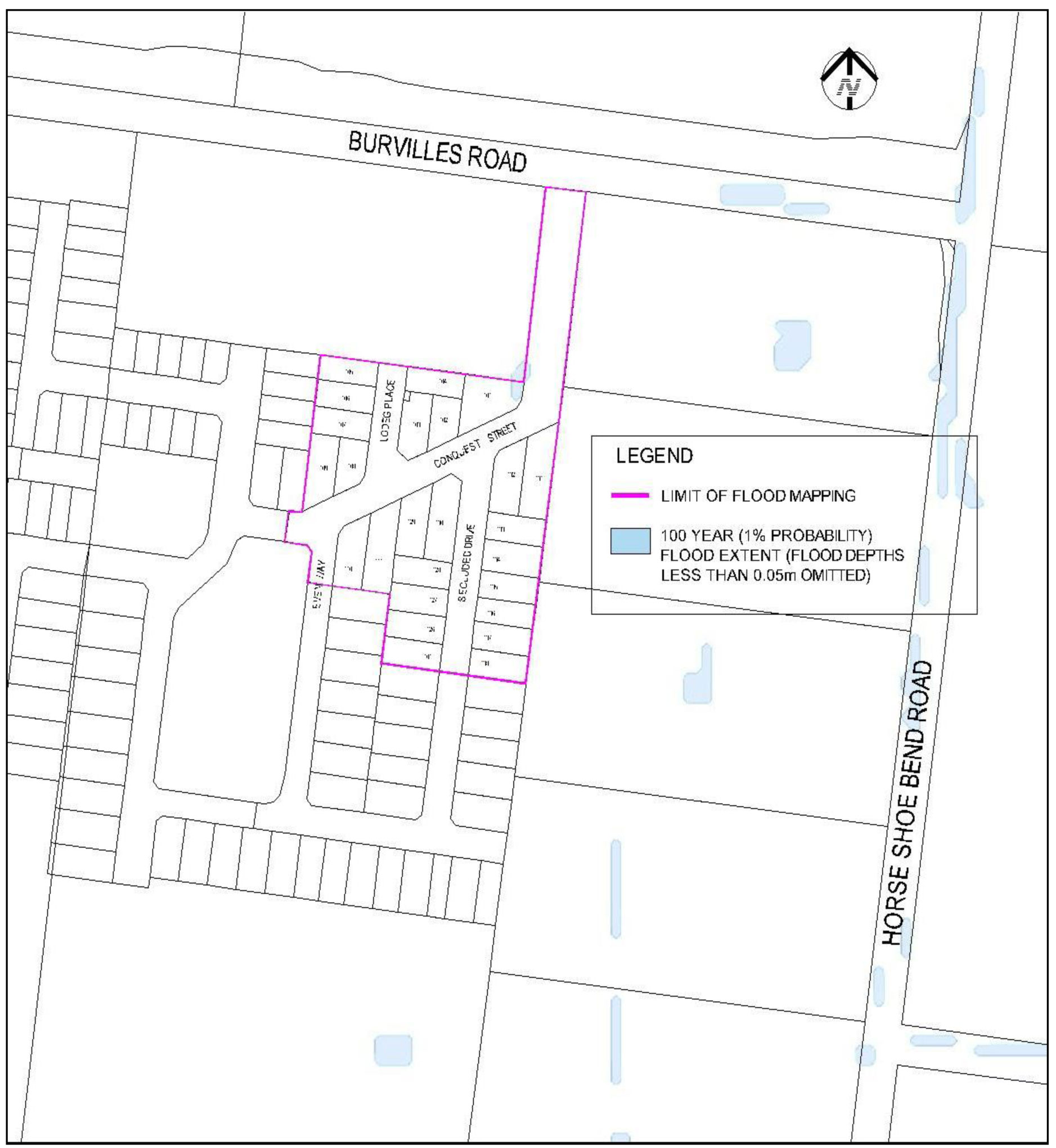
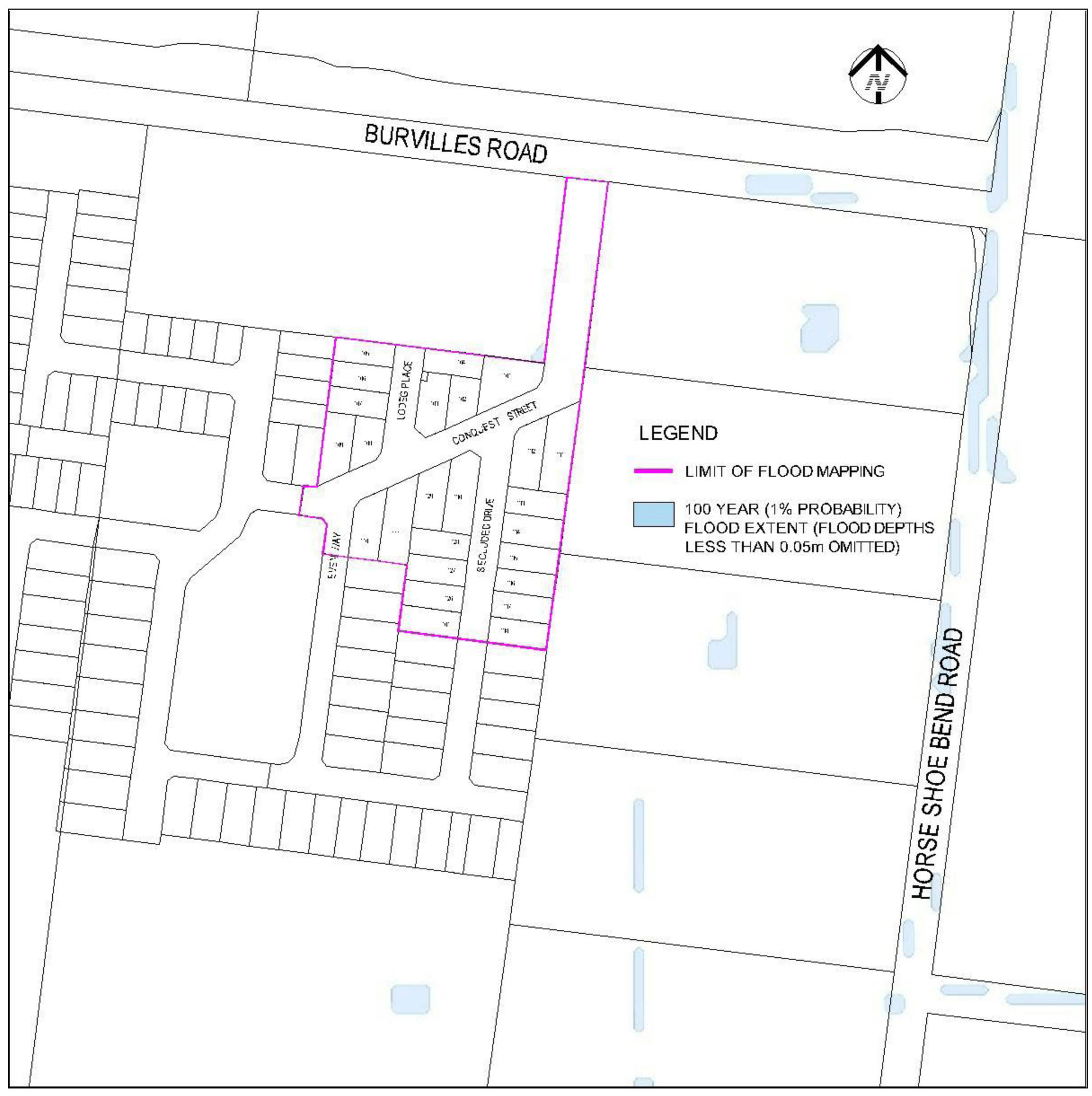
Source: |
City Services - Engineering |
Director: |
William Tieppo |
Index Reference: |
Roads – Road Management Plan |
To adopt the Road Management Plan (Version 6).
The City’s Road Management Plan (“the Plan”) (version 5) was reviewed and adopted in June 2013. The Road Management (General) Regulations 2016 requires that a review be undertaken no more than 4 years after the completion of the last review.
The review of the Road Management Plan has resulted in a number of changes in the maintenance standards for infrastructure where Council is the Co-ordinating Road Authority under the Act. The schedule of changes and amendments from Version 5 to Version 6 is attached to this report (Refer Attachment 2).
As required by the Road Management (General) Regulations 2016, the Plan was advertised in the City News section of the Geelong Advertiser on the 15th of April, 2017 and in the Victorian Government Gazette on the 20th of April, for a period of 28 days.
The plan was also advertised on the City’s webpage “Have your say…” section. Members of the general public were given the opportunity to download the updated document and the Schedule of Changes & Amendments and provide feedback. The page generated 270 page views and over 100 document downloads during this period. No comments that directly related to the updated Road Management Plan were received during this time.
L Gardner moved, P Dorling seconded -
That Council adopt the updated Road Management Plan Version 6 (Attachment 3).
Carried.
Since the commencement of the Road Management Act (2004), the City has prepared a Road Management Plan under Division 5 of the Act. The Road Management Plan establishes a system of management for the public road functions that are the responsibility of Council to meet the needs of the community.
The Road Management Plan establishes the levels of service for inspection, defect identification and response times related to road and road-related infrastructure for which Council is the co-ordinating road authority as per the Act. This Plan encompasses road user needs and expectations within an economic framework based on meeting "reasonable" maintenance operation targets and asset management programs relative to the road network function.
The City has reviewed the Road Management Plan four times over the past thirteen years with the last review occurring in June 2013 (Version 5). The current review of the document (version 6) has been prepared in accordance with the Road Management (General) Regulations 2016.
The updated Road Management Plan is the result of an 18 month internal review which involved reviewing the levels of service for the City’s footpaths in respect of the recognition of defects and the timeframes to remedy any identified defects. Additional changes to the document are documented in the Schedule of Changes & Amendments which is attached to this report.
The adoption of the Road Management Plan will have no direct financial implications for the 2017/18 financial year.
Members of the community and general public were given an opportunity as part of the Road Management Review to provide feedback on the updated version of the document.
A comprehensive internal review of the Plan was also undertaken. This involved the City’s Road Management Improvement Group and Infrastructure Asset Sub-group meetings with several internal stakeholders involved in providing feedback during the review process.
The City received feedback from the Municipal Association of Victoria (MAV) over the course of the review of the Plan to ensure compliance with the Road Management Act (2004).
This Road Management Plan has been prepared in accordance with the following Acts, Regulations and Codes of Practice:
Local Government Act 1989 (Vic);
Local Government (Best Value Principles) Act 1999 (Vic);
Road Management Act 2004 (Vic);
Road Management (General) Regulations 2016 (Vic);
Road Management (Works and Infrastructure) Regulations 2015 (Vic);
Road Safety Act 1986 (Vic); and
Ministerial Codes of Practice.
The Road Management Plan was prepared in 2004 as per sections 49 to 55 of the Road Management Act (2004). The Road Management (General) Regulations 2016 provides guidance on the review frequency of the Road Management Plan.
The Regulations state that a Road Authority must commence a review of its road management plan where the plan has been previously reviewed not more than 4 years after the completion of the last review. The City last reviewed the plan in June 2013.
There are no additional risks associated with adopting the Road Management Plan. The Road Management Plan addresses and documents “reasonable” maintenance standards in relation to the City’s roads, footpaths, kerb & channel and other road-related infrastructure in order to manage and mitigate the City’s risk in relation to these assets.
Version |
Date |
Changes/Amendments |
V 6.0 |
|
The sixth review of the plan resulted in the following changes: S1 – Removed street furniture, bus shelters, street lighting and parking meters as per S3 of the Road Management Act definition S1 – Updated asset total that Council manages S 1 – Removal of reference to Maintenance Management Plans S 1 – Removal of reference to the drought S 1 – Inclusion of reference to S85 of the Wrongs Act (1958) S 1 – Removal of paragraph reference to appropriate level of funding S 2.1 – Removal of reference to unmade roads S 2.3 – Expansion of pit lid defects to be identified by proactive inspections S 2.3.1 – Removal of storm water drain from cross section diagram S 2.7 – Removal of Public Amenity section S 3.4.4 – Amended Maintenance Responsiveness & Performance targets to reflect response timeframes relate to conducting an inspection only S 3.6.4 – Addition of Councils responsibility for the footpath portion of a driveway S 3.6.4 – Removal of reference to nature strips as these are defined as roadside for RMA purposes S 4.2 – Removed category 1 unformed paths S 4.3 – Table updated with recent data S 4.4.1 – Removal of Maintenance Management Plan paragraphs S 4.4.1 – Paragraph title “Temporary measures” renamed to “make safe” S 4.4.2 – Removal of reference to Management of Risks in relation to Asset Management Plans S 4.4.3 – Removal of Maintenance Management Plan paragraphs S 4.4.3 – Updated RFS inspections to reflect intervention levels in the plan S 4.4.3 – Removal of reference to SIR Inspections pursuant to S116 of the Act S 4.4.4 – Removal of reference to SIR Inspections pursuant to S116 of the Act S 4.4.5 – Removal of Civic Mutual Plus references S 4.4.5 – Public safety issue replaced with at intervention level S 4.4.5 – Removal of reference to tree inspections and paper based record system S 4.4.5 – Removal of reference to Maintenance Management Plans S 4.4.5 – Removal of Priority as a risk rating for defects S 4.5 – Removal of Consultation process section S 4.6.1 – Removal of reference to adequate provision for specific user groups relating to community levels of service S 4.6.1 – Replaced the word “safe” in “all road structures.to be maintained in a safe, workable condition” to “reasonable” S 4.6.4 – Response time for remedial work target updated to 100% S 5.4 – Removal of flowchart and reference paragraph S 5.9 – Asset Manager renamed to Asset Owner S 5.9.2 – Removal of reference to Maintenance Management Plan paragraphs Technical references – Removal of National Asset Management Manual & Civic Mutual Plus references Support Documents – Removal of Maintenance Management Plan documents Applicable Versions of Standards – Removal of Maintenance Management Plan document Attachment 2 – Changed 100 vpd to 1000 vpd for Link Roads Attachment 3 – Updated RFS inspections to reflect intervention levels Attachment 3 – Removal of SIR inspection reference Attachment 3 – Updated Programmed inspection defects to exceed the intervention levels Attachment 4 – Removal of category 1 unformed paths Attachment 4 – Updated signs to Regulatory, Warning and Hazard Attachment 4 – Changed condition inspections to N/A for unsealed roads Attachment 4 – Removal of line marking from inspection regime Attachment 4 – Addition of “or as soon as reasonably practicable thereafter” for all inspection timelines Attachment 4 – Removed Roadside furniture from inspection frequencies – non-road related infrastructure Attachment 5 – Updated RFS flowchart – Programmed inspections to reflect defects that exceed intervention Attachment 6 to 9 – Removal of obsolete work practice no’s Attachment 6 – Redefined intervention levels for damaged signs; Updated target rectification for Faded and Wrong Orientation signs Attachment 6 – Changed activity Routine Patrolling Patching to Road Repairs Attachment 6 – Removed Sealed Shoulder & Shoulder Grading activity Attachment 6 – Included pavement markings as an identified defect Attachment 6 – included vegetation and trees as an identified defect Attachment 6 – Updated pothole depth on Sealed roads to greater than 75mm from 35mm Attachment 6 – Updated defect rectification for Cat 2 regulatory, warning and hazard signs to 5 days instead of 20 days Attachment 6 – Distinction between sealed & brick path and concrete path defects for potholes and trip hazards Attachment 6 – Updated category 2 intervention level for trip hazards to 25mm; Removal of lip grinding as a defect/activity Attachment 6 – Change to Intervention level target response times for Category 2 to 5 footpaths |
Source: |
Capital Projects |
Director: |
William Tieppo |
Index Reference: |
Sustainable Buildings |
Provide an updated Sustainable Building Policy for adoption by ELT.
Council polices are reviewed and updated according to an adopted schedule. The Sustainable Building Policy is now due for review. Various departments have been consulted on the updates to the policy including Facility Maintenance and the Environment department.
The intention of the policy has not altered – that is to guide organisational practices to manage the social, environmental and financial aspects of Council Buildings in order to achieve sustainability standards.
Council owns and manages a large portfolio of existing buildings. In addition to those already owned, new buildings are consistently being constructed as part of the large capital works program.
It is imperative that new buildings and existing buildings that are being renovated achieve adopted sustainability standards.
The sustainable design features of a project will be considered as a holistic package which will aim to meet a 7 year simple payback period.
Large buildings will meet a 5 Star GreenStar Design and As Built rating or equivalent.
Small buildings will meet an ‘Excellent’ rating on the Built Environment Sustainability Scorecard for design, or equivalent
Flexibility is required in some instances where achievement of the sustainability standards may not be possible or practicable.
L Gardner moved, P Dorling seconded -
That Council adopt the updated Sustainability Building Policy CPL215.10.
Carried.
Source: |
Finance & Strategy - Financial Services |
Director: |
Joanne Moloney |
Index Reference: |
Financial Management Reporting |
To seek approval to rename the western made section of Currango Way, Ocean Grove to “Gypsy Court, Ocean Grove”.
Sub-divisional development has occurred which now truncates the western section of Currango Way, Ocean Grove in the area before it meets Valley Court, Ocean Grove. This truncation creates two Courts which will require naming to distinguish from Currango Way. The Courts will be named as Marlo Court and Gypsy Court, Ocean Grove. A Council reserve will be created in the middle of these Courts. The section of Currango Way to be renamed to Gypsy Court is a made roadway. Marlo Court will be constructed within the subdivision.
Council is responsible as a naming and numbering authority designated under the Local Government Act 1989 and is required to utilise the Naming Rules for Places in Victoria 2016 (“the Rules”).
Appropriate naming is essential to identify locations for managing emergencies and delivering goods and services.
The rules stipulate that a road name must not be applied in a disjointed or confusing way. Isolated road segments need to be uniquely named.
The developer was requested to submit a new name within his subdivision plan. The name “Gypsy” was supplied by the developer. This name met the required criteria under the Rules.
The road renaming from Currango Way to Gypsy Court will avoid confusion following the truncation, and ensure correct property location in an emergency situation.
Road renaming will result in 3 properties requiring re-addressing.
Letters have been sent to all affected and adjoining property owners (5) including survey for response.
Four of the five surveys were responded to, two in favour and two against.
Responses have been sent to all survey submissions advising that “Gypsy Court” has been selected for the Court name.
Advertisement placed in the Geelong Advertiser newspaper on 26 November 2016.
Proposal was placed on Council Website for 30 days as per statutory requirement.
P Dorling moved, L Gardner seconded -
That Council approve the renaming of the Western section of Currango Way to “Gypsy Court, Ocean Grove” (Attachment 2).
Carried.
It is proposed to rename the western section of Currango Way to “Gypsy Court, Ocean Grove and register the new road name with the Office of Geographic Place Names.
The area where the subdivision is occurring has now truncated Currango Way and formed two roadways (Courts). The truncation will also create a Council owned Reserve. As this roadway has now become disjointed Council is required, to rename the western section.
The section of Currango Way proposed to be renamed is the only section that is currently a made roadway. The roadway will be further constructed as part of the subdivision to intersect with the truncation.
The developer of the subdivision supplied the name Gypsy Court for this section of roadway as part of a further stage to the subdivision. A compliance check has been completed, as per the Rules, and the name meets these requirements.
The map included (Attachment 2) shows the subdivision highlighted in Pink. Gypsy Court and Marlo Court will become registered road names on title release of this subdivision. The legend within the map shows there is a portion of road to be renamed, indicated by the solid line. The hashed lines indicate the sections to be named within the subdivision.
The uniqueness and accuracy of a roadway’s name reduces the likelihood of delaying an emergency services vehicle due to inadequate or confusing location details, which might result in life threatening consequences.
The proposed renaming was advertised in the Geelong Advertiser on 26 November 2016.
Council communicated via letter and survey, with 3 affected property owners, and 2 adjoining property owners. The survey was issued in accordance with the Naming Rules for Places in Victoria 2016 and requested owners to advise if they agreed or disagreed to the renaming. Four of the five surveys were returned. Two surveys were in favour of the renaming, two surveys did not like the name and suggested new names. Names suggested were: Echidna, Wallaby, Orchid, Honeyeater, Wattle, Raffs, Shelduck, Woodduck and Bournda. These new names were checked and were found to be non-compliant as they either already existed or had similar named roadways within the area or are listed on the Reserve Road Register and are considered duplications.
All returned surveys have been considered as per “the Rules”, and replied to based on their submission.
The section of roadway which runs east from Conran Drive will remain as Currango Way, Ocean Grove (Attachment 2).
The approximate cost to Council is $360. This includes advertising, notification to adjoining and affected property owners, notification to authorities and street signage.
Correspondence has been sent to all adjoining and affected property owners advising them of the proposed renaming and inviting submissions by returning a survey.
Four surveys were returned to Council. Two surveys were in favour of the renaming and two surveys were against.
The proposal was advertised in the Geelong Advertiser newspaper on 26 November 2016. No submissions were received from the advertisement to the proposal.
The proposal was published on Council’s Geelong Australia website for 30 days as per the naming Rules for Places in Victoria 2016.
Subject to Council and the Registrar of Geographic Names approval, the relevant authorities and abutting owners will be notified of the official registration of this road renaming.
The Local Government Act 1989, the Geographic Place Names Act 1998 and the Naming Rules for Places in Victoria 2016 have been followed.
The proposal aligns to City Plan with the encouragement of Community Wellbeing.
There is no Council Officer direct or indirect interest involved in this report.
If an emergency situation occurred, Council’s proposal to rename this section of roadway could minimise the risk or failure to be able to access a situation in a timely manner.
There are no environmental issues arising from this report.
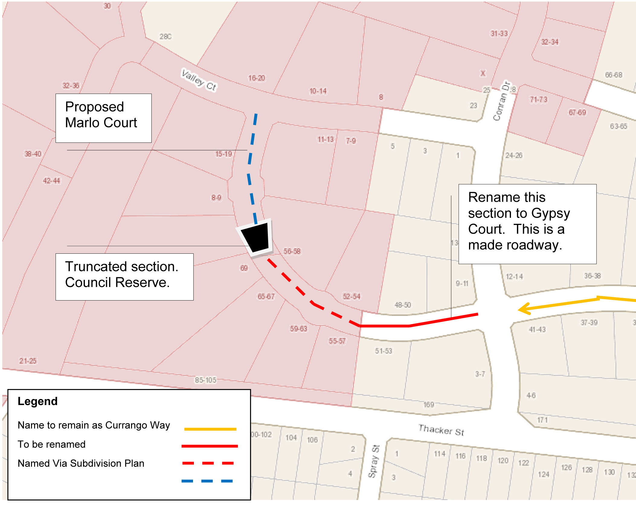
Source: |
City Services - Engineering Services |
Director: |
William Tieppo |
Index Reference: |
Subject: Special Rates and Charges, Colac Road, Highton |
The purpose of this report is to finalise the footpath scheme for Colac Road between the Geelong Ring Road and South Valley Road, Highton.
This project involved the construction of a shared footpath along the north side of Colac Road between the Ring Road and South Valley Road, Highton to provide pedestrian and cycle connections between Deakin University and Waurn Ponds Activity Centre. (See Plan – Attachment 3).
The Special Charge Scheme was declared by Council at its meeting of 22 April 2014.
The scheme affects twelve (12) properties and the cost estimate for the project was estimated at $363,760.
The works have now been completed and the scheme can be finalised by Council. The total cost of the project was $390,624.21. The cost increase of $26,864.21 was due to an additional retaining wall structure to support the footpath.
It is considered appropriate for Council to fund the increased cost in the project as supporting infrastructure is traditionally funded by Council.
P Dorling moved, L Gardner seconded -
That Council:
endorse the special charges on the project;
inform property owners as required by Section 166 of the Act as shown in Schedule A – Attachment 2; and
endorse the increased contribution from Council of $26,864.21.
Carried.
The financial details of the project are as follows:
Funding |
Estimate |
Actual |
Maximum scheme levy to Property Owners (income) |
$42,118.18 |
$42,118.18 |
Scheme levy to Council |
$50,541.82 |
$50,541.82 |
Direct Funding by Council to widen the path from 1.5 to 2.0 metres and provide support infrastructure |
$33,000.00 |
$59,864.21 |
Direct funding by VicRoads |
$238,100.00 |
$238,100.00 |
Total Project Cost |
$363,760.00 |
$390,624.21 |
The costs for the project were funded from C2303 SRC footpath construction in 2014. Property owners will be advised of the final charges.
Communication with property owners has taken place during the course of the project and Special Charge Scheme process. Works were constructed in conjunction with VicRoads funding associated with the extension of the Geelong Ring Road. Council will advise the property owners of the final costs.
The Special Charge Scheme has been administered in accordance with the Special Charge Scheme provisions of the Local Government Act 1989 as well as Council’s Special Rates and Charges policy and Community Engagement Guidelines.
COLUMN 1 |
COLUMN 2 |
COLUMN 3 |
COLUMN 4 |
COLUMN5 |
COLUMN6 |
Prop Key |
Address |
Legal Details |
Total Frontage |
Apportionable |
Pathway |
224141 |
140-150 Colac Road, Highton VIC 3216 |
Lot 2 TP 851204 |
110.90 |
110.90 |
$13,625.35 |
298209 |
152-156 Colac Road, Highton VIC 3216 |
Lot 1 PS 331074, Lot 1 TP 851204 |
50.41 |
10.00 |
$1,228.62 |
334219 |
160-172 Colac Road, Highton VIC 3216 |
1/2 Share of PC 370739 |
131.7 |
56.50 |
$6,941.68 |
343603 |
Suite No. 1/160-172 Colac Road, Highton VIC 3216 |
1/2 Share of PC 370739 |
131.7 |
56.50 |
$6,941.68 |
325304 |
Shop No. 1/132-138 Colac Road, Highton VIC 3216 |
1/5 Share of Lot 4 PS 404306 |
71.71 |
11.60 |
$1, 425.19 |
325305 |
Shop No. 2/132-138 Colac Road, Highton VIC 3216 |
1/5 Share of Lot 4 PS 404306 |
71.71 |
11.60 |
$1, 425.19 |
325306 |
Shop No. 3/132-138 Colac Road, Highton VIC 3216 |
1/5 Share of Lot 4 PS 404306 |
71.71 |
11.60 |
$1, 425.19 |
325312 |
Shop No. 5/132-138 Colac Road, Highton VIC 3216 |
1/5 Share of Lot 4 PS 404306 |
71.71 |
11.60 |
$1, 425.19 |
325313 |
Shop No. 4/132-138 Colac Road, Highton VIC 3216 |
1/5 Share of Lot 4 PS 404306 |
71.71 |
11.60 |
$1, 425.19 |
302381 |
126-130 Colac Road, Highton VIC 3216 |
Lot 3 PS 404306 |
50.91 |
50.91 |
$6,254.88 |
|
342.81 |
$42,118.18 |
|||
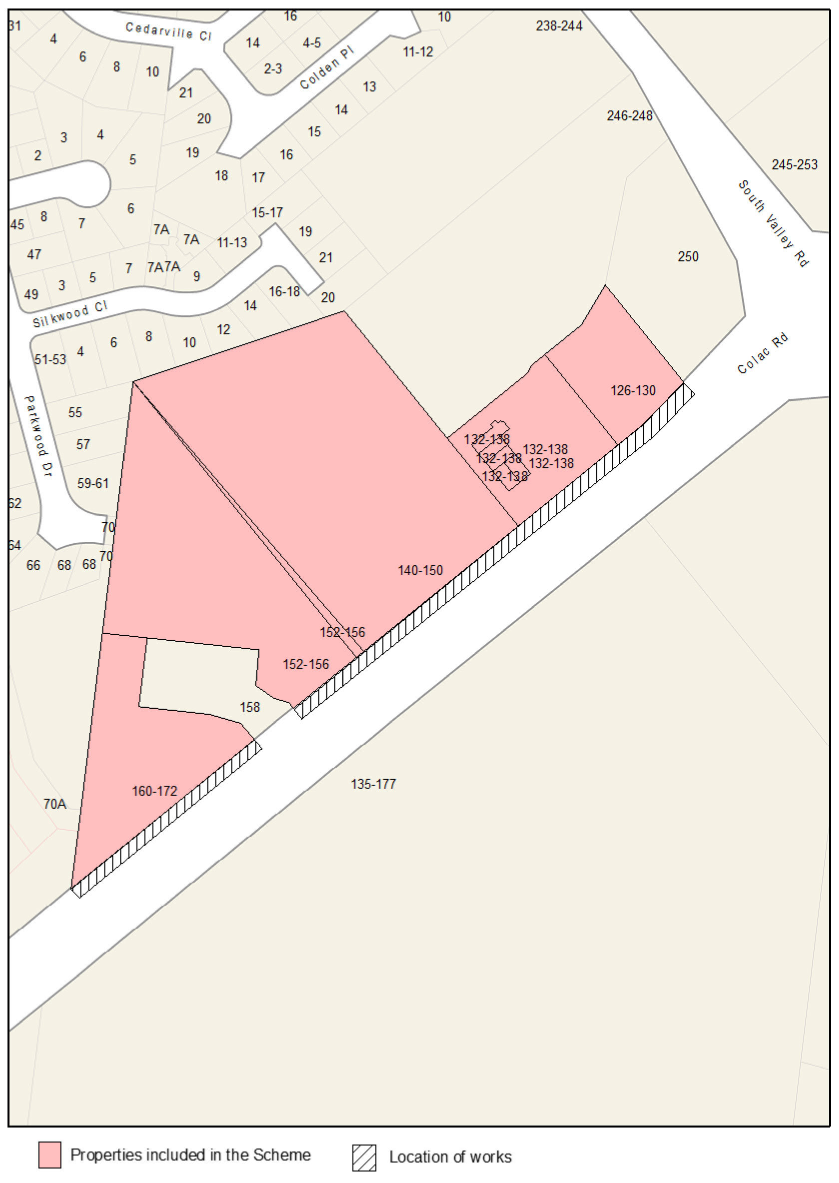
Stage |
Status |
Description |
Approval to prepare scheme |
✓ |
Decision made to prepare scheme following consideration of surveys of property owners and feedback from the community. Council may then place the project in the budget system or proceed immediately to prepare a scheme. Scheme preparation involves survey, design and preparation of an apportionment of costs. October 2014 |
Intention to Declare Scheme |
✓ |
Report to Council providing information on scheme including advice of impending advertising of scheme and declaration of charge. Seeks Council approval by resolution to proceed with process. 28 January 2014 |
Advertisement |
✓ |
The scheme is advertised in the local newspaper and all allotted property owners are notified by mail. This advertisement indicates Council’s intention and notification to ‘declare’ a scheme in a month’s time. 8 February 2014 |
Submissions |
✓ |
From the time of advertising property owners have 28 days (as set down by the Local Government Act) to lodge submissions, either in support or opposition to the scheme. Not applicable for this scheme |
Submissions Review Panel Hearing |
✓ |
A Submissions Review Panel is convened (quorum of three Councillors) and meets to consider submissions. Some submissions are written only, and other submitters may wish to be heard before the Panel. The Panel makes a recommendation to Council regarding the scheme. Panel hearing not required |
Declaration Report |
✓ |
Any time 28 days after advertising the scheme and after the Submissions Review Panel has met and considered submissions, Council considers a report and may proceed to “declare” the charges in accordance with its advertised intent. Subsequent to this the Finance Manager issues the levy notices and there is a formal charge placed on the property. This is the final step in the process for Council to make a decision on the scheme. 22 April 2014 |
Appeal |
✓ |
Property owners may lodge an application for review with the Victorian Civil and Administrative Tribunal (VCAT) within one month of issue of the levy notice. An appeal is listed, heard and determined by the Tribunal and this process generally takes three to four months. Decisions made by VCAT are binding on all parties. No appeal to VCAT |
Construction |
✓ |
Council may then proceed to construct the works. Invoices are issued seeking payment of the estimated cost within one month of commencement. 2016 |
Final Cost Report |
✓ |
At the completion of the works the scheme is “finalised” taking into account actual costs incurred and payments are adjusted accordingly. |
Source: |
City Services - Engineering |
Director: |
William Tieppo |
Index Reference: |
Special Rates and Charges, Albert Street Geelong West |
The purpose of this report is to finalise the Albert Street Laneways Special Charge Scheme, Geelong West.
This project involved the construction of the “Albert Street” laneways.
It consists of the main east-west laneway and 3 connecting north-south laneways (See Plan – Attachment 3).
The Special Charge Scheme was declared by Council at its meeting of 30 November 2012.
The scheme affects 31 properties and the cost estimate for the project was estimated at $128,470.
The works have now been completed and the scheme can be finalised by Council. The total cost of the project was $135,582. The cost increase of $7,112 was due to additional drainage works carried out to connect roof drains.
As drainage works for road schemes are traditionally funded by Council, it is recommended to accept the increase in cost as a Council contribution to the scheme.
A further revision to the scheme is the subdivision of the lots of 38 and 40 Elizabeth Street. These lots were subdivided into 38-40 Elizabeth Street and 97A Clarence Street. Since 38-40 Elizabeth Street no longer has access off the rear laneway, this property has been removed from the scheme. A revised plan is shown in Attachment 3. The revised apportionment is shown in Attachment 2. The result of this property removal is to increase Council’s contribution to the scheme by an additional $4,014.69.
P Dorling moved, L Gardner seconded -
That Council:
endorse the special charges on the project;
inform property owners as required by Section 166 of the Act as shown in Schedule A – Attachment 2; and
endorse the increased contribution from Council to $11,126.69.
Carried.
The financial details of the project are as follows:
|
Estimate |
Actual |
Scheme cost to property owners |
$128,470 |
$124,455.31 |
Scheme cost to Council |
$0 |
$0 |
Additional cost to Council for drainage - $7,112 $0 |
$0 |
$11,126.69 |
Additional cost to Council to refund the charge to the property owner at 38-40 Elizabeth Street - $4,014.69 |
||
TOTAL |
$128,470 |
$135,582 |
The scheme cost for the project has increased however property owner contributions remain unchanged. Property owners will be advised of the final charges.
Communication with property owners has taken place during the course of the project and Special Charge Scheme process. Council will advise the property owners of the final costs.
The Special Charge Scheme has been administered in accordance with the Special Charge Scheme provisions of the Local Government Act 1989 as well as Council’s Special Rates and Charges policy and Community Engagement Guidelines.
|
COL 1 |
COL 2 |
COL 3 |
COL 4 |
|
PROPERTY DESCRIPTION |
TOTAL COST |
PROPERTY |
PROPERTY DETAILS |
1 |
Lot 2 PS 722023 |
$4,014.69 |
207691 |
97 A Clarence Street, Geelong West VIC 3218 |
2 |
Lot 19 LP 3334 |
$4,014.69 |
207688 |
36 Elizabeth Street, Geelong West VIC 3218 |
3 |
Lot 18 LP 3334 |
$4,014.69 |
207686 |
34 Elizabeth Street, Geelong West VIC 3218 |
4 |
Lot 22 LP 3334 |
$4,014.69 |
207052 |
97 Clarence Street, Geelong West VIC 3218 |
5 |
lot 23 LP 3334 |
$4,014.69 |
207051 |
95 Clarence Street, Geelong West VIC 3218 |
6 |
Lot 24 LP 3334 |
$4,014.69 |
207050 |
93 Clarence Street, Geelong West VIC 3218 |
7 |
Lot 25 LP 3334 |
$4,014.69 |
207048 |
91 Clarence Street, Geelong West VIC 3218 |
8 |
Lot 26 LP 3334 |
$4,014.69 |
207047 |
89 Clarence Street, Geelong West VIC 3218 |
9 |
Lot 27 LP 3334 |
$4,014.69 |
207045 |
87 Clarence Street, Geelong West VIC 3218 |
10 |
Lot 28 LP 3334 |
$4,014.69 |
207043 |
85 Clarence Street, Geelong West VIC 3218 |
11 |
CP 157739 |
$4,014.69 |
207041 |
83 Clarence Street, Geelong West VIC 3218 |
12 |
Pt Lot 31, Pt Lot 30 LP 3334 |
$4,014.69 |
207039 |
81 Clarence Street, Geelong West VIC 3218 |
13 |
Lot 32 LP 3334 |
$4,014.69 |
207037 |
79 Clarence Street, Geelong West VIC 3218 |
14 |
Lot 33 LP 3334 |
$4,014.69 |
207035 |
77 Clarence Street, Geelong West VIC 3218 |
15 |
Pt Sec 8 CA 4 |
$4,014.69 |
207033 |
75 Clarence Street, Geelong West VIC 3218 |
16 |
Lot 1 PS 411163 |
$4,014.69 |
205932 |
76 Albert Street, Geelong West VIC 3218 |
17 |
Lot 2 LP 3334 |
$4,014.69 |
205934 |
78 Albert Street, Geelong West VIC 3218 |
18 |
Lot 3 LP 3334 |
$4,014.69 |
205936 |
80 Albert Street, Geelong West VIC 3218 |
19 |
Lot 4 LP 3334 |
$4,014.69 |
205938 |
82 Albert Street, Geelong West VIC 3218 |
20 |
Lot 5 LP 3334 |
$4,014.69 |
205938 |
82 Albert Street, Geelong West VIC 3218 |
21 |
Lot 6 LP 3334 |
$4,014.69 |
205940 |
84 Albert Street, Geelong West VIC 3218 |
22 |
Lot 7 LP 3334 |
$4,014.69 |
205941 |
84A Albert Street, Geelong West VIC 3218 |
23 |
Lot 8 LP 3334 |
$4,014.69 |
205943 |
86 Albert Street, Geelong West VIC 3218 |
24 |
Lot 9 LP 3334 |
$4,014.69 |
205945 |
88 Albert Street, Geelong West VIC 3218 |
25 |
Lot 10 LP 3334 |
$4,014.69 |
205947 |
90 Albert Street, Geelong West VIC 3218 |
26 |
Lot 11 LP 3334 |
$4,014.69 |
205949 |
92 Albert Street, Geelong West VIC 3218 |
27 |
Lot 12 LP 3334 |
$4,014.69 |
205951 |
94 Albert Street, Geelong West VIC 3218 |
28 |
Lot 13 LP 3334 |
$4,014.69 |
205953 |
96 Albert Street, Geelong West VIC 3218 |
29 |
Lot 17 LP 3334 |
$4,014.69 |
207684 |
32-32A Elizabeth Street, Geelong West VIC 3218 |
30 |
Lot 1 TP 255308, Lot 2 TP 255308 |
$4,014.69 |
207682 |
30 Elizabeth Street, Geelong West VIC 3218 |
31 |
Lot 14 LP 3334 |
$4,014.69 |
207680 |
28 Elizabeth Street, Geelong West VIC 3218 |
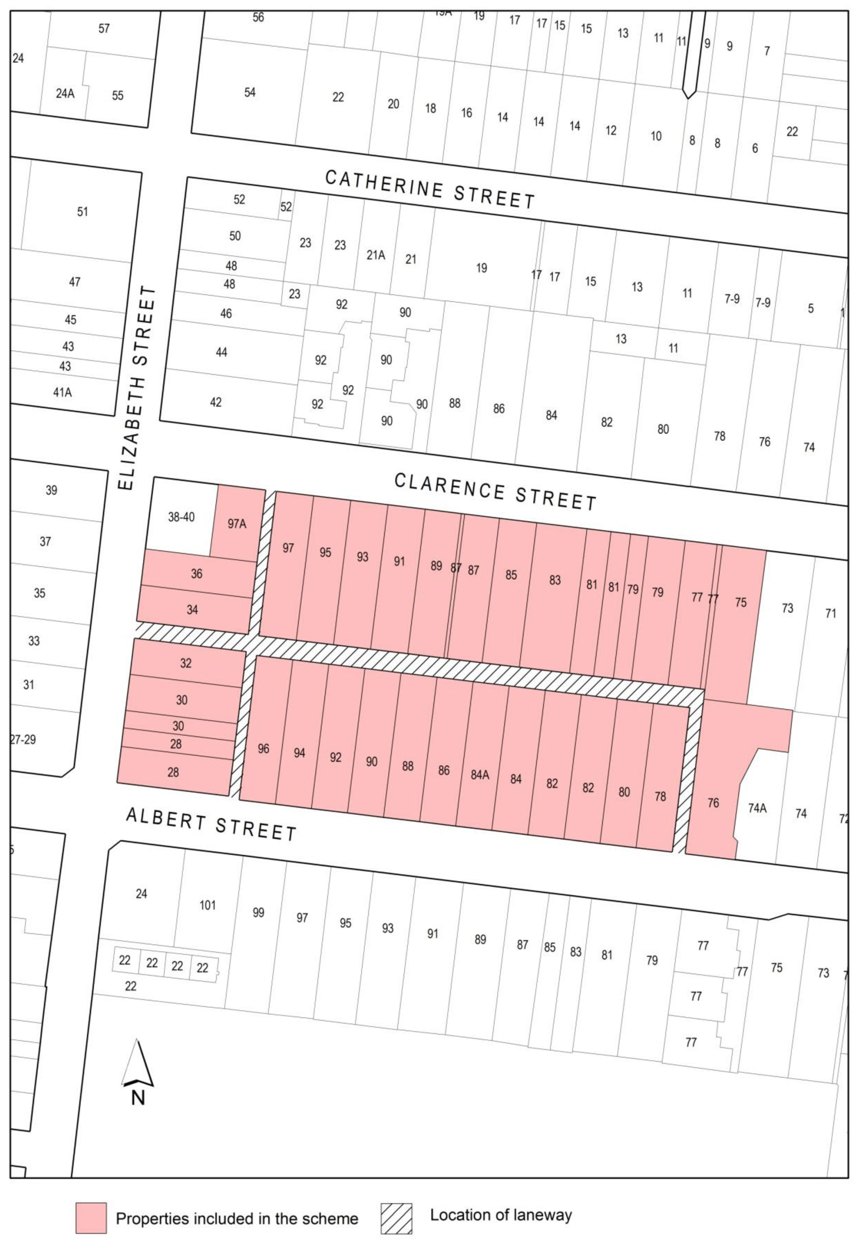
Stage |
Status |
Description |
Approval to prepare scheme |
✓ |
Decision made to prepare scheme following consideration of surveys of property owners and feed back from the community. Council may then place the project in the budget system or proceed immediately to prepare a scheme. Scheme preparation involves survey, design and preparation of an apportionment of costs. |
Intention to Declare Scheme |
✓ |
Report to Council providing information on scheme including advice of impending advertising of scheme and declaration of charge. Seeks Council approval by resolution to proceed with process. 26 June 2012 |
Advertisement |
✓ |
The scheme is advertised in the local newspaper and all allotted property owners are notified by mail. This advertisement indicates Council’s intention and notification to ‘declare’ a scheme in a month’s time. 7 July 2012 |
Submissions |
✓ |
From the time of advertising property owners have 28 days (as set down by the Local Government Act) to lodge submissions, either in support or opposition to the scheme. |
Submissions Review Panel Hearing |
✓ |
A Submissions Review Panel is convened (quorum of three Councillors) and meets to consider submissions. Some submissions are written only, and other submitters may wish to be heard before the Panel. The Panel makes a recommendation to Council regarding the scheme. 9 October 2012 |
Declaration Report |
✓ |
Any time 28 days after advertising the scheme and after the Submissions Review Panel has met and considered submissions, Council considers a report and may proceed to “declare” the charges in accordance with its advertised intent. Subsequent to this the Finance Manager issues the levy notices and there is a formal charge placed on the property. This is the final step in the process for Council to make a decision on the scheme. 30 November 2012 |
Appeal |
✓ |
Property owners may lodge an application for review with the Victorian Civil and Administrative Tribunal (VCAT) within one month of issue of the levy notice. An appeal is listed, heard and determined by the Tribunal and this process generally takes three to four months. Decisions made by VCAT are binding on all parties. One applicant withdrawn on 26 June 2013. |
Construction |
✓ |
Council may then proceed to construct the works. Invoices are issued seeking payment of the estimated cost within one month of commencement. 2015 |
Final Cost Report |
✓ |
At the completion of the works the scheme is “finalised” taking into account actual costs incurred and payments are adjusted accordingly. |
Source: |
City Services - Engineering |
Director: |
William Tieppo |
Index Reference: |
Special Rates and Charges, Clifton Springs, Drainage |
The purpose of this report is to finalise the Central Road drainage Special Charge Scheme, Clifton Springs.
This Special Charge Scheme project has been in progress since 2008.
The Special Charge Scheme was declared by Council at its meeting of 25 January 2011 (Refer Attachment 2).
Under the conditions of a 173 Agreement, the developer of a Retirement Village in Central Road, Clifton Springs constructed a main drainage outfall to Griggs Creek via the Clifton Spring Primary School at its cost.
As the main drainage project caters for development in the area, under the terms of the agreement a Special Charge Scheme was initiated to recover funds from all remaining benefiting property owners.
The scheme affects 38 properties and the cost estimate for the project was $1,492,827. This included the Retirement Village owner contribution of $348,919 and other benefiting land owners contribution of $1,143,908.
Due to the high charges imposed, a deferred payment option is available to property owners. Under this option, owners are not compelled to pay their charge until they either sell or develop their land.
There are 19 residential lots on the eastern fringe of the scheme boundary that are identified as beneficiaries. Due to these properties already being connected to drainage, their charges were funded by Council at a cost of $65,884.
Council was required to refund the proceeds of the scheme back to the land owner of the Retirement Village. A payment of $1,143,908 was made to the owner in June 2016 at the completion and acceptance by Council of the main drainage asset.
The scheme can now be finalised by Council.
P Dorling moved, L Gardner seconded -
That Council:
endorse the special charges on the project; and
inform property owners as required by Section 166 of the Act as shown in Schedule A – Attachment 3.
Carried.
The financial details of the project are as follows:
|
Estimate |
Actual |
Scheme cost to owner of retirement village (income) - $348,919 |
$1,426,943 |
$1,426,943 |
Scheme cost to remaining owners (income) - $1,078,024 |
$65,884 |
$65,884 |
Contribution by Council for 19 properties already subdivided (expenditure) |
||
TOTAL |
$1,492,827 |
$1,492,827 |
Communication with property owners has taken place during the course of the project and Special Charge Scheme process. In August 2016 a letter was sent to all affected property owners advising of the commencement of interest charge on the outstanding balance of funds from the date the scheme is finalised. A final notification letter will be sent out to all affected owners advising of payment options.
The Special Charge Scheme has been administered in accordance with the Special Charge Scheme provisions of the Local Government Act 1989 as well as Council’s Special Rates and Charges policy and Community Engagement Guidelines.
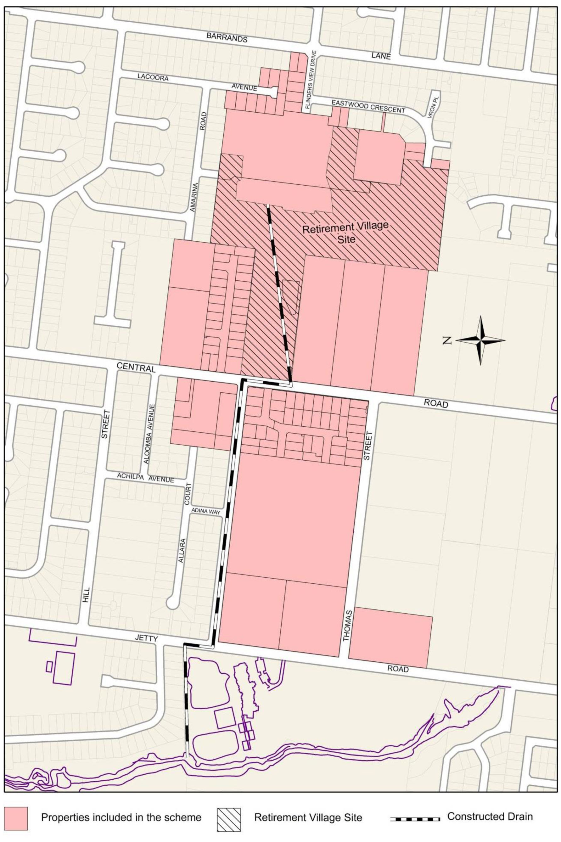
COL 1 |
COL 2 |
COL 3 |
COL 4 |
DESCRIPTION OF PROPERTY |
ACTUAL COST |
PROPERTY |
PROPERTY DETAILS |
Lot 1 LP 317 |
$28,126 |
253932 |
131 Jetty Road Drysdale |
Lot 1 TP 392182 |
$60,706 |
253931 |
115 Jetty Road Clifton Springs |
Lot 1 TP 239940 |
$60,706 |
253930 |
99 Jetty Road Clifton Springs |
Lot 1 TP 515351 |
$211,503 |
246244 |
19 Thomas Street Clifton Springs |
Lot 28 LP 317 |
$29,068 |
247230 |
86 Central Road Clifton Springs |
Block CAP 6 |
$87,664 |
264950 |
94 Central Road Clifton Springs |
Lot 38 LP 317 |
$9,433 |
247229 |
70 Central Road Clifton Springs |
Lot 2 PS 330309 |
$25,905 |
271600 |
74 Central Road Clifton Springs |
Lot 1 PS 422716 |
$19,404 |
261179 |
43 Allara Court Clifton Springs |
Lot 2 PS 422716 |
$3,361 |
271334 |
41 Ada Street Clifton Springs |
Lot 1 PS 405512 |
$46,661 |
302153 |
69 Central Road Clifton Springs |
Lot 22 LP 317 |
$73,352 |
247190 |
81 Central Road Clifton Springs |
Lot 21 LP 317 |
$92,031 |
247191 |
91 Central Road Clifton Springs |
Lot 20 LP 317 |
$73,352 |
247192 |
103 Central Road Drysdale |
Lot 19 LP 317 |
$73,352 |
247193 |
113 Central Road Drysdale |
Lot 18 LP 317 |
$77,935 |
247194 |
123 Central Road Drysdale |
Lot 2 PS 405512 |
$28,696 |
302154 |
35 Amarina Road Clifton Springs |
Lot B PS 505398 |
$35,162 |
317148 |
16 Eastwood Crescent Drysdale |
PS 430123, Lots 73 & B PS 505398 |
$133,636 |
301356 |
0 Flinders View Drive Drysdale |
Lot 2 PS 404049 |
$256,888 |
301357 |
0 Flinders View Drive Drysdale |
Lot 37 PS 323495 |
$2,539 |
271784 |
31 Lacoora Avenue Clifton Springs |
Lot 38 PS 323495 |
$2,632 |
271785 |
33 Lacoora Avenue Clifton Springs |
Lot 39 PS 323495 |
$2,820 |
271786 |
35 Lacoora Avenue Clifton Springs |
Lot 40 PS 323495 |
$2,708 |
271780 |
34 Lacoora Avenue Clifton Springs |
Lot 41 PS 323495 |
$2,495 |
271779 |
32 Lacoora Avenue Clifton Springs |
Lot 42 PS 323495 |
$2,416 |
271778 |
30 Lacoora Avenue Clifton Springs |
Lot 43 PS 323495 |
$2,697 |
271777 |
28 Lacoora Avenue Clifton Springs |
Lot 44 PS 323495 |
$2,697 |
271776 |
26 Lacoora Avenue Clifton Springs |
Lot 45 PS 323495 |
$2,798 |
271775 |
24 Lacoora Avenue Clifton Springs |
Road Reserve |
$3,884 |
|
|
Lot 33 PS 323495 |
$2,488 |
271790 |
10 Flinders View Drive Drysdale |
Lot 32 PS 323495 |
$2,488 |
271789 |
8 Flinders View Drive Drysdale |
Lot 31 PS 323495 |
$2,488 |
271788 |
6 Flinders View Drive Drysdale |
Lot 30 PS 323495 |
$2,488 |
271787 |
4 Flinders View Drive Drysdale |
Lot 8 LP 323495 |
$2,293 |
271765 |
60 Barrands Lane Drysdale |
Lot 9 LP 323495 |
$2,438 |
271767 |
62 Barrands Lane Drysdale |
Road Reserve |
$15,214 |
|
|
PART Lot 1 PS 430123 |
$865 |
271799 |
4 Eastwood Crescent Drysdale |
PART Lot 26 PS 323495 |
$793 |
271800 |
6 Eastwood Crescent Drysdale |
Lot 70 PS 505398 |
$2,658 |
317142 |
32 Eastwood Crescent Drysdale |
Lot 69 PS 505398 |
$2,524 |
317141 |
39 Eastwood Crescent Drysdale |
Road Reserve |
$1,460 |
|
|
Stage |
Status |
Description |
Approval to prepare scheme |
✓ |
Decision made to prepare scheme following consideration of surveys of property owners and feed back from the community. Council may then place the project in the budget system or proceed immediately to prepare a scheme. Scheme preparation involves survey, design and preparation of an apportionment of costs. 2009. |
Intention to Declare Scheme |
✓ |
Report to Council providing information on scheme including advice of impending advertising of scheme and declaration of charge. Seeks Council approval by resolution to proceed with process. 23 Feb 2010. |
Advertisement |
✓ |
The scheme is advertised in the local newspaper and all allotted property owners are notified by mail. This advertisement indicates Council’s intention and notification to ‘declare’ a scheme in a month’s time. 27 March 2010. |
Submissions |
✓ |
From the time of advertising property owners have 14 days (as set down by the Local Government Act) to lodge submissions, either in support or opposition to the scheme. 14 objections received. |
Submissions Review Panel Hearing |
✓ |
A Submissions Review Panel is convened (quorum of three Councillors) and meets to consider submissions. Some submissions are written only, and other submitters may wish to be heard before the Panel. The Panel makes a recommendation to Council regarding the scheme. 17 Aug 2010. |
Declaration Report |
✓ |
Any time 28 days after advertising the scheme and after the Submissions Review Panel has met and considered submissions, Council considers a report and may proceed to “declare” the charges in accordance with its advertised intent. Subsequent to this the Finance Manager issues the levy notices and there is a formal charge placed on the property. This is the final step in the process for Council to make a decision on the scheme. 25 January 2011. |
Appeal |
✓ |
Property owners may lodge an application for review with the Victorian Civil and Administrative Tribunal (VCAT) within one month of issue of the levy notice. An appeal is listed, heard and determined by the Tribunal and this process generally takes three to four months. Decisions made by VCAT are binding on all parties. 2 applicants – 6 February 2012. |
Construction |
✓ |
Once construction is completed a method of payment option form will be sent to the property owners and their invoices will be sent accordingly. Completed June 2016. |
Final Cost Report |
✓ |
At the completion of the works the scheme is “finalised” taking into account actual costs incurred and payments are adjusted accordingly. |
Source: |
City Services - Engineering |
Director: |
William Tieppo |
Index Reference: |
Barwarre Road, Marshall; Special Rates and Charges |
This report seeks a resolution by Council to consider an intention to declare a Special Charge Scheme to partially fund the construction of three road segments along Barwarre Road (east side) between Marshalltown Road and Reserve Road, Marshall. (See plan – Attachment 5).
Barwarre Road between Marshalltown Road and Reserve Road has been an ad-hoc development over the years. In the three underdeveloped sections the road edges remain unconstructed and between 129 and 137 Barwarre Road, a footpath section is also missing.
This proposal will see the construction of these missing segments including road widening, kerb and channel, underground drainage and footpath.
A Special Charge Scheme has been initiated and consists of three sub scheme components. Sub Scheme 1 is adjacent to three properties between 129 and 137 Barwarre Road. The works will include road widening, kerb and channel and a new footpath section.
Sub Scheme 2 is adjacent to two properties between 181 and 185 Barwarre Road. The works consist of road widening and kerb and channel.
Sub Scheme 3 is adjacent to one property at 193-197 Barwarre Road and also includes road widening and kerb and channel.
L Gardner moved, P Dorling seconded -
That Council:
Gives notice of its intention to declare a Special Charge Scheme in accordance with Section 163 (1A) of the Local Government Act 1989 (‘the Act’), as follows:
The Special Charge is declared for a period of five (5) years commencing upon commencement of the works.
The special charge be declared for the purposes of defraying expenses incurred by Council in relation to the construction of Barwarre Road, Marshall which:
will provide proper sealed road access, improved street drainage and enhancement to the general amenity for each of the properties included in the scheme;
Council considers is or will be a special benefit to those persons required to pay the special charge (and who are described in succeeding parts of this Resolution); and
arises out of Council’s function of planning for and providing infrastructure for property owners.
it be recorded that, for the purposes of Section 163 (2A) of the Act, the special charge proceeds will not exceed the amount calculated in accordance with the prescribed formula (R x C = S), the:
‘benefit ratio’ (R) being calculated at 0.26 for Sub Scheme 1, 0.28 for Sub Scheme 2 and 0.14 for Sub Scheme 3 represents the special benefits to all persons liable to pay the special charge; and
‘total cost’ (C) of performing the function described in Part b of this Resolution based on estimated cost be recorded as $191,783 for Sub Scheme 1, $80,401 for sub scheme 2 and $72,574 for sub scheme 3.
‘maximum levy’ (S) total amount of the special charge be levied and recorded as $49,021 for sub scheme1, $22,844 for sub scheme 2 and $10,332 for sub scheme 3.
the following be specified as the area for which the special rate is so declared:
the area within municipal district of Council highlighted in the plan attached to this Resolution (“the area”).
the following be specified as the land in relation to which the special charge so declared:
All land within the area shown on the plan.
the following be specified as the criteria which form the basis of the special charge so declared:
Ownership of any land described in Part 1(e) of this Resolution.
the following be specified as the manner in which the special charge so declared will be assessed and levied:
The costs to be apportioned based on access and amenity benefits.
The special charge will be levied by sending a notice to the person who is liable to pay, pursuant to section 163(4) of the Act.
having regard to the preceding parts of this Resolution but subject to Section 166 (1) of the Act, it be recorded that:
the owners of the land described in column 1 and 2 of Schedule C to the Resolution are estimated liable for the respective amounts set out in column 8 of Schedule C; and
such owners may, subject to any further resolution of Council pay the special charge in the following manner:
the charge will become due and payable within one month of the issue of the notice requesting payment pursuant to Section 167 (3) of the Act;
interest will not be charged for six months after the issue of the notice provided the person liable makes timely payment in accordance with any repayment arrangements that may be agreed on by Council; and
in accordance with Section 172 of the Act, the rate of interest which is payable on the special charge which has not been paid by the specified date is set at Council’s overdraft rate, reviewed every three months (provided that it shall not exceed the rate fixed by the Governor in Council by Order for the purposes of Section 172 (2A) in which case the rate of interest shall be the maximum rate fixed by the Governor in Council by Order for the purposes of this section).
Consider any submissions made under Section 223 of the Act and the proposed declaration via Council’s Submissions Review Panel, and then by Council at a subsequent meeting, at which time Council will consider whether to make a declaration in the form proposed.
Authorise Council’s Chief Executive Officer to give public notice of the proposed declaration in accordance with sections 163 (1A) and (1B) of the Act and send a copy of the public notice to each person who is liable to pay the special rate in accordance with Section 163 (1C) of the Act.
Carried.
The project has a one off capital cost and there will be minimal ongoing maintenance costs. The scheme is funded from the core road construction program C02301 and can proceed in the 2017/18 financial year if approved.
A breakdown of costs is as follows:
Estimated scheme cost to property owners |
$82,197 |
Estimated scheme cost to Council |
$262,561 |
Total Project Cost |
$344,758 |
The total estimated net cost to Council for this project is $262,561.
All affected property owners are aware of this road construction proposal. Mail outs and a community meeting was held in 2014 in regards to the proposed ‘up front’ agreement and an update letter was mailed in March 2017 advising of the change to a Special Charge Scheme.
Further information will be sent to all affected property owners should Council resolve to make its intention to declare the scheme.
The scheme has been prepared in accordance with the Special Rate and Charge provisions of the Local Government Act 1989 along with Council’s Special Rates and Charges Policy and community engagement guidelines.
This report aligns with the City Plan as follows:
Community Wellbeing:
Healthy Lifestyles – Facilitating and promoting physical activity.
Healthy Environments – Safe, hazard and nuisance free environments.
Sustainably Built and Natural Environment
Enhance and protect natural areas and ecosystem health.
Support our Community to live – Encourage increased use of alternatives to car transport.
Advocate for and promote sustainable design and development – Promoting sustainable design and retrofitting and acknowledging the communities desire to have their say.
No Council Officer involved with this process has any direct or indirect interest in the properties.
Provision of sealed roads will provide safer driving conditions for motorists with a defined and widened road profile. Walking conditions for pedestrians will also be enhanced by minimising the risk of personal injuries through conflict with vehicles. The improved drainage will reduce the hazards associated with water over roads and the affects of nuisance flooding to property.
There are no other identified risks for Council in making its intention to declare the scheme.
The road infrastructure proposal provides proper sealed access, improved drainage and improved safety for pedestrian and vehicular traffic. Dust is eliminated.
It is anticipated that minimal vegetation removal will be required to complete the project. The design has taken existing vegetation into consideration and does not affect any natural habitats.
The works for Barwarre Road, Marshall which consist of excavation, concrete footpath, kerb and channel, reinstatement of nature strip, miscellaneous construction works, legal advice and professional services associated with survey, engineering design, drafting, supervision and administration of the project all as included in the cost estimate shown below.
Estimated cost of road and footpath construction |
|||||
ITEM |
DESCRIPTION |
QUANTITY |
UNIT |
RATE |
AMOUNT |
1.01 |
Initial site establishment and set up, decamping and site cleanup and other fixed costs up to time of completion of works. |
1 |
ITEM |
$12,000.00 |
$12,000.00 |
1.02 |
Traffic management costs. |
5 |
ITEM |
$800.00 |
$4,000.00 |
1.03 |
Setting out of works. |
1 |
ITEM |
$500.00 |
$500.00 |
2.00 |
EARTHWORKS & DEMOLITION |
|
|
|
|
2.01 |
Excavation and disposal of all materials to limits of work as indicated on plan, including trimming for new road pavement, excavation of soft spots and removal of concrete. |
370 |
m3 |
$60.00 |
$22,202.40 |
2.02 |
Removal of existing rural crossings, endwalls and pipes if in good condition to be shipped to COGG Belmont depot. |
4 |
ITEM |
$250.00 |
$1,000.00 |
2.03 |
Break out top of pits fill with FCR and 100mm topsoil. |
2 |
No. |
$350.00 |
$700.00 |
2.04 |
Placement and consolidation of engineered fill with approved materials in preparation for new works. |
10 |
m3 |
$60.00 |
$600.00 |
2.05 |
Saw-cutting of asphalt paving. |
145 |
m |
$3.50 |
$507.50 |
3.00 |
PAVEMENT WORKS |
|
|
|
|
|
BIDIM A34 Geofabric laid on sub base |
293 |
m2 |
$20.00 |
$5,860.00 |
3.01 |
400mm compacted depth Class 3, 40mm crushed rock, supplied, spread and compacted. |
117 |
m3 |
$100.00 |
$11,720.00 |
3.02 |
150mm compacted depth Class 2, 20mm crushed rock, supplied, spread and compacted. |
44 |
m3 |
$120.00 |
$5,274.00 |
3.03 |
30mm compacted depth 10mm nominal size type N asphalt spread and compacted including emulsion prime & grit using a paver. |
638 |
m2 |
$35.00 |
$22,330.00 |
4.00 |
CONCRETE WORKS: |
|
|
|
|
4.01 |
B2 Barrier kerb and channel 450mm wide and associated laybacks for vehicle crossings, including fine crushed rock bedding. |
140 |
m |
$136.00 |
$19,040.00 |
4.02 |
Concrete pram crossing 1.5m wide, including fine crushed rock bedding. |
2 |
No. |
$250.00 |
$500.00 |
4.03 |
125mm concrete paving with SL72 mesh including crushed rock bedding and reinstate nature strip. |
245 |
m2 |
$125.00 |
$30,625.00 |
4.04 |
O2 porous pave, or equivalent, supplied and placed as per manufacturer's specification. |
77 |
m2 |
$280.00 |
$21,560.00 |
5.00 |
LANDSCAPING |
|
|
|
|
5.01 |
Top soiling and seeding nature strips, medians and outer separators. |
140 |
m2 |
$10.00 |
$1,400.00 |
SUB-TOTAL |
$159,819.00 |
||||
10% Contingency |
$15,981.89 |
||||
Design |
$7,991.00 |
||||
Project Administration |
$7,991.00 |
||||
CONSTRUCTION COST ESTIMATE |
$191,783 |
||||
Estimated cost of road widening and kerb and channel |
|||||
ITEM |
DESCRIPTION |
QUANTITY |
UNIT |
RATE |
AMOUNT |
1.00 |
Initial site establishment and set up, decamping and site cleanup and other fixed costs up to time of completion of works. 1 ITEM $6,000.00 $6,000.00 |
|
|
|
|
1.01 |
Traffic management costs. |
5 |
ITEM |
$800.00 |
$4,000.00 |
1.02 |
Setting out of works. |
1 |
ITEM |
$1,000.00 |
$1,000.00 |
2.00 |
EARTHWORKS & DEMOLITION |
|
|
|
|
2.01 |
Excavation and disposal of all materials to limits of work as indicated on plan, including existing rural vehicle crossings, trimming for new road pavement, excavation of soft spots and removal of concrete. |
173 |
m3 |
$60.00 |
$10,362.62 |
2.02 |
Removal of existing rural crossings, endwalls and pipes if in good condition to be shipped to COGG Belmont depot. |
2 |
ITEM |
$250.00 |
$500.00 |
2.03 |
Saw-cutting of asphalt paving. |
88 |
m |
$3.50 |
$308.00 |
3.00 |
PAVEMENT WORKS |
|
|
|
|
3.01 |
BIDIM A34 Geofabric laid on sub base |
287 |
m2 |
$20.00 |
$5,740.00 |
3.02 |
150mm compacted depth Class 2, 20mm crushed rock, supplied, spread and compacted. |
43 |
m3 |
$100.00 |
$4,305.00 |
3.03 |
400mm compacted depth Class 4, 40mm crushed rock, supplied, spread and compacted. |
115 |
m3 |
$100.00 |
$11,480.00 |
3.04 |
30mm compacted depth 10mm nominal size type N asphalt spread and compacted including emulsion prime & grit using a paver. |
287 |
m2 |
$35.00 |
$10,045.00 |
4.00 |
CONCRETE WORKS: |
|
|
|
|
4.01 |
B2 Barrier kerb and channel 450mm wide including fine crushed rock bedding. |
82 |
m |
$145.00 |
$11,948.00 |
5.00 |
LANDSCAPING |
|
|
|
|
5.01 |
Top soiling and seeding nature strips. |
164 |
m2 |
$8.00 |
$1,312.00 |
SUB-TOTAL |
$67,001 |
||||
10% Contingency |
$6,700.06 |
||||
Design |
$3,350 |
||||
Project Administration |
$3,350 |
||||
CONSTRUCTION COST ESTIMATE |
$80,401 |
||||
Estimated cost of road widening and kerb and channel |
|||||
ITEM |
DESCRIPTION |
QUANTITY |
UNIT |
RATE |
AMOUNT |
1.01 |
Initial site establishment and set up, decamping and site cleanup and other fixed costs up to time of completion of works. |
1 |
ITEM |
$5,500.00 |
$5,500.00 |
1.02 |
Traffic management costs. 5 ITEM $800.00 $4,000.00 |
|
|
|
|
1.03 |
Setting out of works. |
1 |
ITEM |
$500.00 |
$500.00 |
2.00 |
EARTHWORKS & DEMOLITION |
|
|
|
|
2.01 |
Excavation and disposal of all materials to limits of work as indicated on plan, including trimming for new road pavement, excavation of soft spots and removal of concrete. |
142 |
m3 |
$60.00 |
$8,526.00 |
2.02 |
Placement and consolidation of engineered fill with approved materials in preparation for new works. |
12 |
m3 |
$50.00 |
$600.00 |
2.03 |
Saw-cutting of concrete and/or asphalt paving. 78 m $30.00 $2,340.00 |
|
|
|
|
2.04 |
Removal of existing rural crossings, endwalls and pipes if in good condition to be shipped to COGG Belmont depot. |
3 |
No |
$250.00 |
$750.00 |
3.00 |
PAVEMENT WORKS |
|
|
|
|
3.01 |
400mm compacted depth Class 3, 40mm crushed rock, supplied, spread and compacted. |
98 |
m3 |
$90.00 |
$8,820.00 |
3.02 |
150mm compacted depth Class 2, 20mm crushed rock, supplied, spread and compacted. |
37 |
m3 |
$110.00 |
$4,042.50 |
3.04 |
30mm compacted depth 10mm nominal size type N asphalt spread and compacted including emulsion prime & grit. |
350 |
m2 |
$35.00 |
$12,250.00 |
4.00 |
DRAINAGE |
|
|
|
|
4.01 |
Connect existing household storm water to kerb and channel. Including excavation, supply and placement of kerb adapters. |
1 |
No. |
$250.00 |
$250.00 |
4.02 |
Convert existing SEP to 1900mm x 600mm double S.E. Pit up to 1.5m deep, with gatic type cover, supplied and placed including excavation, placement of approved fine crushed rock bedding and back-filling with approved material. |
1 |
No. |
$1,850.00 |
$1,850.00 |
5.00 |
CONCRETE WORKS & LANDSCAPING ` |
|
|
|
|
5.01 |
B2 Barrier kerb and channel 450mm wide, including fine crushed rock bedding. |
70 |
m |
$115.00 |
$8,050.00 |
5.02 |
Concrete |
2 |
m2 |
$300.00 |
$600.00 |
5.03 |
Top soiling and seeding nature strips, medians and outer separators. |
300 |
m2 |
$8.00 |
$2,400.00 |
SUB-TOTAL |
$60,479.00 |
||||
10% Contingency |
$6,047.85 |
||||
Design |
$3,024.00 |
||||
Project Administration |
$3,024.00 |
||||
CONSTRUCTION COST ESTIMATE |
$72,574.00 |
||||
|
Benefit Ratio Calculation – Sub Scheme 1 |
||||||
A |
Purpose |
|
|||||
|
To provide infill road widening and footpath for Barwarre Road, east side abutting 129-137 Barwarre Road, Marshall. |
|
|||||
B |
Coherence |
|
|||||
|
The works will provide proper continuity of Barwarre Road and will be a direct benefit for abutting properties and the wider community. |
|
|||||
C |
Total Cost C |
|
|||||
|
Total Estimated cost of works |
|
|||||
|
TOTAL COST |
$191,783.00 |
|||||
D |
Identify Special Beneficiaries |
|
|||||
|
3 properties are considered to receive access and amenity benefits. The community will also receive benefit by way of improved road drainage and safety. |
|
|||||
E |
Properties to include |
|
|||||
|
Total Special Benefits (in) is apportioned to 3 properties |
|
|||||
|
There are no Council owned properties in the scheme. Therefore: |
|
|||||
|
Total Special Benefits out of the scheme TSB (out) = |
0 |
|
|
|||
F |
Estimate of Total Special Benefits |
|
|||||
|
For this sub scheme it is considered that the benefit is for pedestrian and vehicular access and property amenity. It is estimated that 75% of benefit relates to access and 25% relates to amenity. From current traffic counts the estimated use of the road is 99.25% for the wider community and 0.75% for the affected property owners. There are no amenity benefits apportioned for the wider community. Amenity benefit is based on frontage with 100% of the new kerb and channel fronting benefiting properties. TSB (in) is therefore calculated as follows: |
|
|||||
|
TSB (in) = 75% X 0.75%(access) + 25% X 100% (amenity) = |
25.6% |
|
|
|||
G |
Estimate of Total Community Benefit -TCB |
|
|
|
|
|
|
|
It is considered that people in the community will receive an access benefit from the works as the roadway is used to access other areas and provides improved safety. TCB is calculated as follows: |
|
|||||
|
TCB = 75% X 99.25% (access) = |
74.4% |
|
|
|||
H |
Calculate "Benefit Ratio" - R |
|
|||||
|
Benefits Ratio = |
TSB (in) |
|
20.6 |
|
0.255606 |
|
|
|
TSB (in) |
= |
20.6 +0 |
|
|
|
|
|
+ TSB (out) + TCB |
|
+ |
79.4 |
|
|
I |
Maximum Total Levy (S) |
|
|||||
|
Maximum Total Levy S = R X C |
$49,020.96 |
|||||
|
Council Contribution to Special Charge Scheme |
$142,762.04 |
|||||
|
Benefit Ratio Calculation – Sub Scheme 2 |
|
|
|
|
|
|
A |
Purpose |
|
|
|
|
|
|
|
To provide infill road widening and kerb and channel for Barwarre Road, east side between 181 - 185 Barwarre Road, Marshall. |
|
|||||
B |
Coherence |
|
|
|
|
|
|
|
The works will provide proper continuity of Barwarre Road and will be a direct benefit for abutting properties and the wider community. |
|
|||||
C |
Total Cost C |
|
|
|
|
|
|
|
Total Estimated cost of works |
|
|
|
|
|
|
|
TOTAL COST |
$80,401.00 |
|||||
D |
Identify Special Beneficiaries |
|
|
|
|
|
|
|
2 properties are considered to receive access and amenity benefits. The community will also receive benefit by way of improved road drainage and safety |
|
|||||
E |
Properties to include |
|
|
|
|
|
|
|
Total Special Benefits (in) is apportioned to 2 properties |
|
|||||
|
There are no Council owned properties in the scheme. Therefore: |
TSB (out) |
= |
|
0 |
|
|
|
Total Special Benefits out of the scheme |
|
|
|
|
|
|
F |
Estimate of Total Special Benefits |
|
|
|
|
|
|
|
For this sub scheme it is considered that the benefit is for vehicular access and property amenity. It is estimated that 70% of benefit relates to access and 30% relates to amenity. From current traffic counts the estimated use of the road is 99.2% for the wider community and 0.8% for the affected property owners. There are no amenity benefits apportioned for the wider community. Amenity benefit is based on frontage with 90% of the new kerb and channel fronting benefiting properties. TSB (in) is therefore calculated as follows: |
|
|||||
|
TSB (in) = 70% X 0.8%(access) + 30% X 90% (amenity) = |
27.6% |
|
|
|||
G |
Estimate of Total Community Benefit -TCB |
|
|
|
|
|
|
|
It is considered that people in the community will receive an access benefit from the works as the roadway are used to access other areas and provides improved safety. TCB is calculated as follows: |
|
|||||
|
TCB = 70% X 99.2% (access) = |
69.4% |
|
|
|||
H |
Calculate "Benefit Ratio" - R |
|
|
|
|
|
|
|
Benefits Ratio = |
TSB (in) |
= |
20.2 |
|
0.284 |
|
|
|
TSB (in) |
|
20.2 +0 |
|
|
|
|
|
+ TSB (out) + TCB |
|
+ |
79.8 |
|
|
I |
Maximum Total Levy (S) |
|
|
|
|
|
|
|
Maximum Total Levy S = R X C |
|
|
|
|
|
$22,843.83 |
|
Council Contribution to Special Charge Scheme $57,557.17 |
|
|
|
|
|
|
Benefit Ratio Calculation – Sub Scheme 3 |
|||||||
A |
Purpose |
||||||
|
To provide infill road widening for Barwarre Road, east side abutting 193-197 Barwarre Road, Marshall. |
|
|||||
B |
Coherence |
|
|||||
The works will provide proper continuity of Barwarre Road and will be a direct benefit for abutting properties and the wider community. |
|||||||
C |
Total Cost C |
|
|||||
|
Total Estimated cost of works |
|
|||||
|
TOTAL COST |
$72,574.00 |
|||||
D |
Identify Special Beneficiaries |
||||||
|
1 property is considered to receive access and amenity benefits. The community will also receive benefit by way of improved road drainage and safety |
||||||
E |
Properties to include |
||||||
|
Total Special Benefits (in) is apportioned to 1 property |
||||||
|
There are no Council owned properties in the scheme. Therefore: |
||||||
|
Total Special Benefits out of the scheme |
TSB (out) |
= |
0 |
|||
F |
Estimate of Total Special Benefits |
||||||
|
For this sub scheme it is considered that the benefit is for vehicular access and property amenity. It is estimated that 80% of benefit relates to access and 20% relates to amenity. From current traffic counts the estimated use of the road is 99.70% for the wider community and 0.30% for the affected property owner. There are no amenity benefits apportioned for the wider community. Amenity benefit is based on frontage with 65% of the new kerb and channel fronting benefiting properties. TSB (in) is therefore calculated as follows: |
||||||
|
TSB (in) = 80% X 0.30%(access) + 20% X 65% (amenity) |
= |
13.2% |
|
|||
G |
Estimate of Total Community Benefit -TCB |
|
|
||||
|
It is considered that people in the community will receive an access benefit from the works as the roadway is used to access other areas and provides improved safety. TCB is calculated as follows: |
|
|
||||
|
TCB = 80% X 99.70% (access) |
= |
79.8% |
||||
H |
Calculate "Benefit Ratio" - R |
|
|||||
|
Benefits Ratio = |
TSB (in) |
= |
13.24 |
|
0.142 |
|
|
|
TSB (in) + TSB (out) + TCB |
|
13.24 |
|
|
|
|
|
|
|
+0 + |
|
79.8 |
|
| I | Maximum Total Levy (S) | ||||||
|
Maximum Total Levy S = R X C |
$10,332.04 |
|||||
|
Council Contribution to Special Charge Scheme |
$62,241.96 |
|||||
Barwarre Road Construction |
|||||||
Column 1 |
Column 2 |
Column 3 |
Column 4 |
Column5 |
Column 6 |
Column 7 |
Column8 |
Prop Key |
Address |
Apportionable Frontage (Road) |
Apportionable Frontage (Footpath) |
Access and Amenity Benefit (Road) |
Access benefit (f/path) |
Amenity benefit (f/path) |
Estimated total cost |
Sub Scheme 1 – Road widening and footpath |
|||||||
340265 |
129-131 Barwarre Road, MARSHALL VIC 3216 |
32.00 |
42.07 |
$9,768.84 |
$1,208.33 |
$1,038.15 |
$2,015.32 |
220760 |
135 Barwarre Road, MARSHALL VIC 3216 |
46.83 |
46.83 |
$14,296.09 |
$1,208.33 |
$1,155.61 |
$16,660.03 |
220759 |
137 Barwarre Road, MARSHALL VIC 3216 |
58.00 |
58.00 |
$17,706.03 |
$1,208.33 |
$1,431.25 |
$20,345.61 |
Sub Scheme 2 – Road widening |
|||||||
220754 |
181-183 Barwarre Road, MARSHALL VIC 3216 |
50.60 |
|
$13,286.18 |
- |
- |
$13,286.18 |
220756 |
185 Barwarre Road, MARSHALL VIC 3216 |
36.40 |
|
$9,557.65 |
- |
- |
$ 9,557.65 |
Sub Scheme 3 – Road widening |
|||||||
312728 |
193-197 Barwarre Road, MARSHALL VIC 3216 |
40.00 |
|
$10,332.04 |
- |
- |
$10,332.04 |
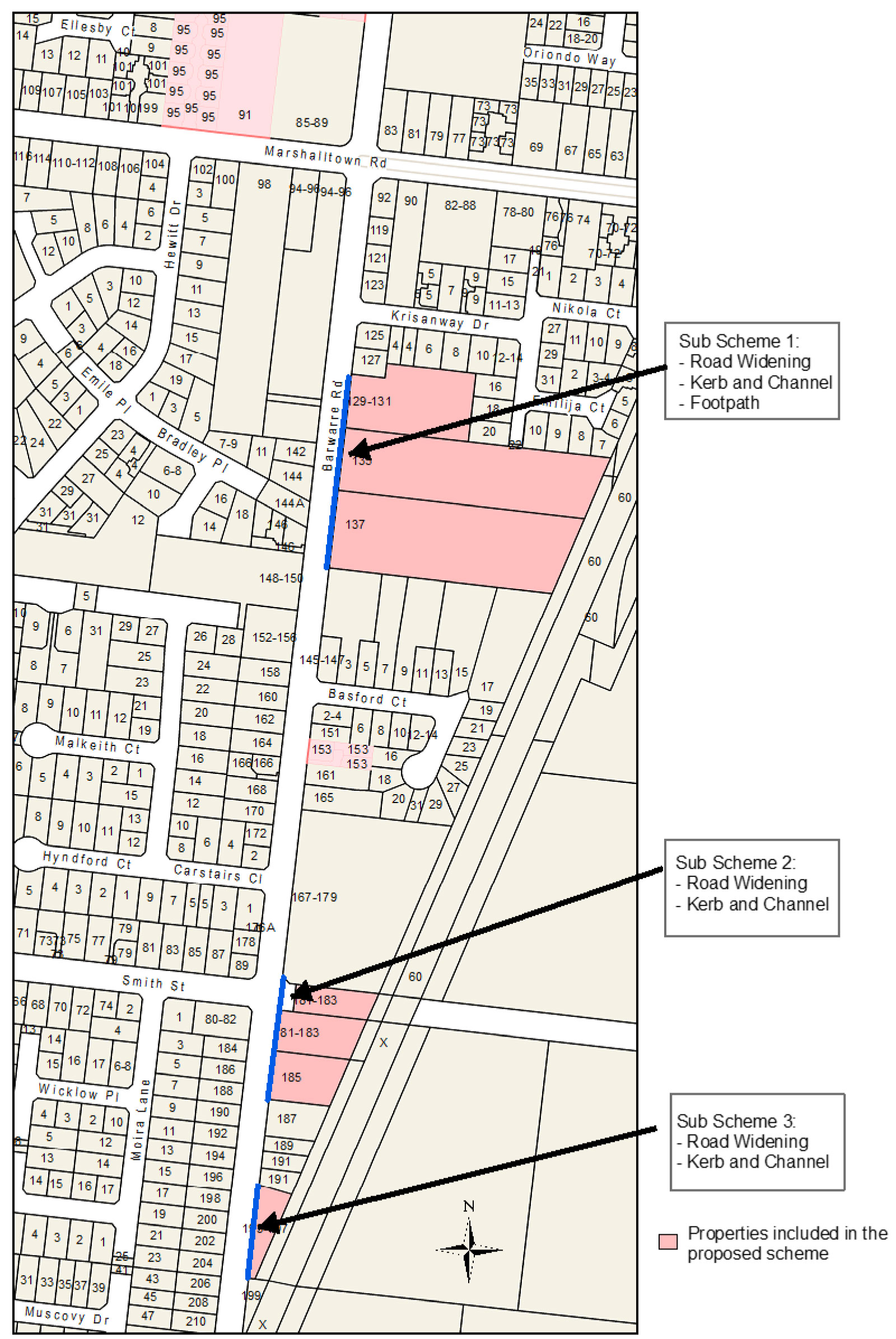
Stage |
Status |
Description |
Approval to prepare scheme |
✓ |
Decision made to prepare scheme following consideration of surveys of property owners and feed back from the community. Council may then place the project in the budget system or proceed immediately to prepare a scheme. Scheme preparation involves survey, design and preparation of an apportionment of costs. April 2015. |
Intention to Declare Scheme |
✓ |
Report to Council providing information on scheme including advice of impending advertising of scheme and declaration of charge. Seeks Council approval by resolution to proceed with process. |
Advertisement |
|
The scheme is advertised in the local newspaper and all allotted property owners are notified by mail. This advertisement indicates Council’s intention and notification to ‘declare’ a scheme in a month’s time. |
Submissions |
|
From the time of advertising property owners have 28 days (as set down by the Local Government Act) to lodge submissions, either in support or opposition to the scheme. |
Submissions Review Panel Hearing |
|
A Submissions Review Panel is convened (quorum of three Councillors) and meets to consider submissions. Some submissions are written only, and other submitters may wish to be heard before the Panel. The Panel makes a recommendation to Council regarding the scheme. |
Declaration Report |
|
Any time 28 days after advertising the scheme and after the Submissions Review Panel has met and considered submissions, Council considers a report and may proceed to “declare” the charges in accordance with its advertised intent. Subsequent to this the Finance Manager issues the levy notices and there is a formal charge placed on the property. This is the final step in the process for Council to make a decision on the scheme. |
Appeal |
|
Property owners may lodge an application for review with the Victorian Civil and Administrative Tribunal (VCAT) within one month of issue of the levy notice. An appeal is listed, heard and determined by the Tribunal and this process generally takes three to four months. Decisions made by VCAT are binding on all parties. |
Construction |
|
Council may then proceed to construct the works. Invoices are issued seeking payment of the estimated cost within one month of commencement. |
Final Cost Report |
|
At the completion of the works the scheme is “finalised” taking into account actual costs incurred and payments are adjusted accordingly. |
Source: |
City Services - Engineering |
Director: |
William Tieppo |
Index Reference: |
Thompson Road North Geelong, Special Rates and Charges |
This report seeks a resolution by Council to declare the revised charges for a Special Charge scheme to partially fund the construction of a footpath along Thompson road between Morgan Street and Cowies Creek, North Geelong (See plan – Attachment 5).
Council’s footpath network strategy identifies the footpath construction priorities of which Thompson Road, North Geelong is listed. It is considered that the proposed new footpaths will provide the missing pedestrian link between Morgan Street, Cowies Creek Reserve and the residential area of Norlane to the north. The new footpaths will also provide safe pedestrian access for patrons of the Child Care Centre in Kelly Court.
Council made its Intention to Declare the Scheme on 27 September 2016. In the subsequent submissions period, four objections were received. A formal submissions panel hearing was not convened as no property owner requested to be heard. The panel members met on 22 March 2017 to discuss the submissions and scheme review.
It is proposed to construct 478 lineal meters of 1.5 metre wide footpath to provide for pedestrian access along both sides of Thompson Road, North Geelong.
Thomson Road has in excess of 14,000 vehicles per day and is managed by VicRoads as an arterial road. The planned footpath will satisfy the design parameters of the Infrastructure Design Manual for footpath provision on both sides of an arterial road.
As a result of the submissions process a revision of the scheme was carried out by the submissions panel. Some properties have been removed from the scheme as a result of the revised scheme.
There is an amended twenty five (25) properties abutting the proposed footpath that will receive special benefit. There is one (1) Council owned property in the scheme.
The total estimated scheme cost is $198,394. Additional works to the value of $89,400 will be funded by Council to improve existing infrastructure and construct a retaining wall.
A Benefit Ratio of 0.32 has been calculated in accordance with Section 163 of the Local Government Act, which equates to a Council contribution to the scheme of $134,100 and property owner contribution of $64,295.
L Gardner moved, P Dorling seconded -
That Council:
Resolves to declare the revised Special Charge Scheme as follows:
The Special Charge is declared for a period of five (5) years commencing upon completion of the works.
The Special Charge be declared for the purpose of defraying any expenses incurred by Council in relation to the construction of the footpath on Thompson Road, North Geelong between Morgan Street and Cowies Creek. Council considers the project:
Will provide proper pedestrian access, improved pedestrian safety and enhancement to the general amenity for each of the properties included in the scheme;
Will provide a special benefit to those persons required to pay the special charge (and who are described in succeeding parts of this Resolution); and
Arises out of Council’s function of planning for and providing infrastructure for property owners.
The total cost of project, be recorded as $287,799 (Schedule A).
It be recorded that, for the purposes of Section 163 (2A) of the Act, the special charge proceeds will not exceed the amount calculated in accordance with the prescribed formula (R x C = S), the:
‘benefit ratio’ (R) being calculated at 0.32 represents the special benefits to all persons liable to pay the special charge (Schedule B);
‘total cost’ (C) of performing the function described in part 1 (b) of this resolution based on estimated cost be recorded as $198,395; and
‘Maximum levy’ (S) be recorded as $64,295.
the following be specified as the area for which the special rate is so declared:
The area within municipal district of Council highlighted in the plan attached to this Resolution (Appendix 4).
the following be specified as the land in relation to which the special charge so declared:
Land within the area shown on the plan.
the following be specified as the criteria which form the basis of the special charge so declared:
Ownership of any land described in Part 1(e) of this Resolution.
the following be specified as the manner in which the special charge so declared will be assessed and levied:
Each lot receives a primary access and amenity benefit;
The maximum levy is divided on a access and frontage share basis;
The special charge will be levied by sending a notice to the person who is liable to pay, pursuant to section 163(4) of the Act.
having regard to the preceding parts of this Resolution but subject to Section 166 (1) of the Act, it be recorded that;
the owners of the land described in column 2 and 3 of Schedule C to the resolution are estimated liable for the respective amounts set out in column 7 of Schedule C; and
such owners may, subject to any further resolution of Council pay the special charge in the following manner;
the charge will become due and payable within one month of the issue of the notice requesting payment pursuant to Section 167 (3) of the Act;
interest will not be charged for six months after the issue of the notice provided the person liable makes timely payment in accordance with any repayment arrangements that may be agreed on by Council; and
in accordance with Section 172 of the Act, the interest rate payable on the special charge which has not been paid by the specific date is set at Council’s overdraft rate, reviewed every three months (provided that it shall not exceed the rate fixed by the Governor in Council by Order for the purposes of Section 172 (2A) in which case the rate of interest shall be the maximum rate fixed by the Governor in Council by Order for the purposes of this section).
Authorise an increase of $17,442 of Council funds to reduce the maximum levy to property owner and retain the validity of the scheme.
Authorise Council’s Chief Executive Officer to levy the Special Charge in accordance with Section 163 (4) of the Act.
Carried.
After the submission period was completed, a full review of the scheme was carried out. On inspection of the footpath, it was found that some sections of the footpath had legitimately been constructed post intention to declare the scheme as part of property upgrade works. The affect of this is that two properties (398 and 400 Thompson Road) are no longer required to contribute towards the scheme and have subsequently been removed.
At 402 Thompson Road, this address has a single title but separable into three addresses; namely 402A, B and C. On inspection of this property it was discovered that the addresses at 402A and C have no access to Thompson Road as they have been fenced off and are accessed off the intersecting Rodney Road. For this reason, these two addresses have also been excluded from the scheme.
The other part of the review included the cost apportionment of properties where some discrepancies were found relating to the titles and ownership of the land. Where there are shared titles, charges have been reapportioned as a shared arrangement rather than allocate charges as though the property address had its own independent title. Nine (9) property charges have been reduced based on the shared title and ownership information.
The consequence of reduced charges to some properties and removal of others from the scheme means that there are less properties in the scheme and the balance of charges is absorbed by the remaining property owners. This equates to $17,442 additional funds to spread over the remaining property owners in the scheme.
Section 166 of the Local Government Act 1989 outlines the legislation behind the variation of a Special Rate or Special Charge. A 10% increase of a special charge would result in notification and recommencement of the scheme.
To overcome the requirement to recommence the scheme, it is recommended to increase Council contribution to the scheme by $17,442. This will have the affect of reducing the levy on the remaining property owners, retaining their original charges and keeping the scheme compliant.
The project is a one off capital cost and there will be minimal ongoing maintenance costs. If approved, the scheme could proceed next financial year under the core footpath program C02303. Financial details are as follows:
Revised scheme levy to Property Owners (income) |
$46,853 |
Additional levy funds by Council due to revision of scheme - $17,442 |
$240,946 |
Original Scheme levy to Council - $134,100 |
|
Direct Funding by Council to reinstate existing footpath and driveways, new kerb and channel for a kerb return modification at Rodney Road, asphalt pavement reinstatement and reinforced concrete retaining wall and footing - $89,404 |
|
Total Project Cost |
$287,799 |
From the table above, the revised net cost to Council for this project is estimated to be $240,946.
Consultation was carried out as follows:
March 2015 - Information pack to affected property owners that included an initiation letter, a plan showing the location of works, a Special Rates and Charge Scheme brochure, a detailed cost apportionment spreadsheet and informal survey form.
3 October 2016 – Letter to owners informing them of Council’s Intention to Declare the scheme and submissions period.
Responses to 4 property owners at the conclusion of the submissions period.
Further correspondence to the affected property owners will be sent should Council make its declaration of charge.
The scheme has been prepared in accordance with the Special Rate and Charge provisions of the Local Government Act 1989 along with the 2004 ministerial guidelines and Council’s Special Rates and Charges Policy.
This report aligns with the City Plan as follows:
Sustainably Built and Natural Environment
Support our Community to live sustainably – Encourage increased use of alternatives to car transport and seek efficient traffic movement throughout the municipality.
Advocate for and promote sustainable design and development – Promoting sustainable design and retrofitting.
Acknowledge the community’s desire to have their say and be involved in planning for the future of Greater Geelong.
No Council Officer involved with this process has any direct or indirect interest in the properties.
Provision of a sealed pathway will provide safer walking conditions for pedestrians by minimising the risk of personal injuries through conflict with vehicles and the elimination of uneven and slippery surfaces.
There are no identified risks for Council in making its declaration of the scheme.
The provision of a sealed pathway surface provides a permanent and safe means of access.
The project does not create waste with the exception of some excavated material.
The proposal does not affect any natural habitats. The proposal will require some nature strip trees and shrubs to be trimmed but removal of vegetation is not expected.
The works for the construction of footpaths in Thompson Road, North Geelong which consist of excavation, footpath, reinstatement of nature strip and driveways, miscellaneous construction works, legal advice and professional services associated with survey, engineering design, drafting, supervision and administration of the project all as included in the cost estimate shown below.
Estimated cost of footpath construction |
|||||
ITEM |
DESCRIPTION |
QUANTITY |
UNIT |
RATE |
AMOUNT |
1.00 |
GENERAL |
|
|
|
|
1.01 |
Initial site establishment and set up, decamping and site cleanup and other fixed costs up to time of completion of works. |
1 |
ITEM |
$17,711.00 |
$17,711.00 |
1.02 |
Traffic management costs. |
1 |
ITEM |
$6,000.00 |
$6,000.00 |
1.03 |
Setting out of works. |
1 |
ITEM |
$700.00 |
$700.00 |
1.04 |
Service/Cable locations |
1 |
ITEM |
$800.00 |
$800.00 |
1.05 |
Internal supervision fee (COGG construction) |
1 |
ITEM |
$8,359.00 |
$8,359.00 |
2.00 |
EARTHWORKS & DEMOLITION |
|
|
|
|
2.01 |
Excavation and disposal of all materials to limits of work as indicated on plan, including trimming for new road pavement, excavation of soft spots and removal of concrete. |
268 |
m3 |
$60.00 |
$16,080.00 |
2.02 |
Saw-cutting of Asphalt paving. |
64 |
m |
$10.00 |
$640.00 |
2.03 |
Saw-cut of concrete kerb and channel |
6 |
m |
$10.00 |
$60.00 |
3.00 |
PAVEMENT WORKS |
|
|
|
|
3.01 |
75mm compacted depth Class 3 40mm crushed rock, supplied, spread and compacted. |
34 |
m3 |
$100.00 |
$3,400.00 |
3.02 |
150mm compacted depth Class 2 20mm crushed rock, supplied, spread and compacted. |
27 |
m3 |
$120.00 |
$3,240.00 |
4.00 |
DRAINAGE |
|
|
|
|
|
PITS |
|
|
|
|
4.01 |
Modify existing Junction pit to match finished surface level and supply and fit Gatic type cover. |
3 |
No. |
$770.00 |
$2,310.00 |
5.00 |
CONCRETE WORKS KERBING: |
|
|
|
|
5.01 |
Concrete pram crossing 1.5m wide, including fine crushed rock bedding. |
2 |
No. |
$250.00 |
$500.00 |
|
CONCRETE WORK PAVING: |
|
|
|
|
5.02 |
125mm (25 Mpa) concrete paving with SL72 mesh including crushed rock bedding and reinstate nature strip. |
457 |
m2 |
$135.00 |
$61,695.00 |
5.03 |
175mm (32 Mpa) concrete paving with SL82 mesh including crushed rock bedding and reinstate nature strip. |
182 |
m2 |
$140.00 |
$25,480.00 |
6.00 |
LANDSCAPING |
|
|
|
|
6.01 |
Top soiling and seeding nature strips. |
638 |
m2 |
$8.00 |
$5,104.00 |
7.00 |
SIGNING, LINE-MARKING AND FENCING |
|
|
|
|
7.01 |
Relocation of permanent signs and posts as per plan. |
1 |
No. |
$250.00 |
$250.00 |
8.00 |
PROVISIONAL ITEMS |
|
|
|
|
8.01 |
Adjust level of existing telstra pit, electricity pit, sewer services lid and water services cover and replaced as needed. |
1 |
ITEM |
$13,000.00 |
$13,000.00 |
SUB-TOTAL |
$165,329 |
||||
10% Contingency |
$16,533 |
||||
Design |
$9,920 |
||||
Project administration |
$6,613 |
||||
CONSTRUCTION COST ESTIMATE |
$198,395 |
||||
COUNCIL FUNDED WORKS |
|||||
ITEM |
DESCRIPTION |
QUANTITY |
UNIT |
RATE |
AMOUNT |
1.00 |
GENERAL |
|
|
|
|
1.01 |
Initial site establishment and set up, decamping and site cleanup and other fixed costs up to time of completion of works. |
1 |
ITEM |
$7,985.00 |
$7,985.00 |
1.02 |
Traffic management costs. |
1 |
ITEM |
$2,000.00 |
$2,000.00 |
2.00 |
EARTHWORKS & DEMOLITION |
|
|
|
|
2.01 |
Excavation and disposal of all materials to limits of work as indicated on plan, including trimming for new road pavement, excavation of soft spots and removal of concrete. |
118 |
m3 |
$60.00 |
$7,080.00 |
2.02 |
Saw-cutting of Asphalt paving. |
124 |
m |
$10.00 |
$1,240.00 |
2.03 |
Saw-cut of concrete paving |
37 |
m |
$10.00 |
$370.00 |
2.04 |
Saw-cut of concrete kerb and channel |
27 |
m |
$10.00 |
$270.00 |
3.00 |
PAVEMENT WORKS |
|
|
|
|
3.01 |
150mm compacted depth Class 2 20mm crushed rock, supplied, spread and compacted. |
33 |
m3 |
$120.00 |
$3,960.00 |
3.02 |
150mm compacted depth Class 3 40mm crushed rock, supplied, spread and compacted. |
16 |
m3 |
$100.00 |
$1,600.00 |
3.03 |
30mm compacted depth 10mm nominal size type N Asphalt spread and compacted including emulsion prime & grit using a paver. |
140 |
m2 |
$35.00 |
$4,900.00 |
4.00 |
DRAINAGE PITS |
|
|
|
|
4.01 |
Modify existing Side Entry pit to Bike safe Grated Junction pit to match new finished surface level, supply and fit Grated cover. |
1 |
No. |
$800.00 |
$800.00 |
4.02 |
1set - of 2 pcs New Standard Weepa (weep holes) with 90mm Extension Dimension of weep holes 75W x 20H x 195D spaced @ 1.0m on center |
83 |
No. |
$6.00 |
$498.00 |
4.03 |
20mm aggregate backfill for drainage zone 250mm x 450mm (or 250mm) enveloped with geo-textile as per plan. |
7.3 |
m3 |
$110.00 |
$803.00 |
5.00 |
CONCRETE WORKS KERBING: |
|
|
|
|
5.01 |
Remove existing concrete kerb and construct modified SM2 Semi-mountable kerb and channel 600mm wide as per plan and reinstate nature strip. |
25 |
m |
$156.00 |
$3,900.00 |
5.02 |
Concrete pram crossing 1.5m wide, including fine crushed rock bedding. |
2 |
No. |
$250.00 |
$500.00 |
|
CONCRETE WORKS PAVING: |
|
|
|
|
5.03 |
175mm (32 Mpa) concrete paving with SL82 mesh including crushed rock bedding and reinstate nature strip. |
129 |
m2 |
$140.00 |
$18,060.00 |
5.04 |
Reinforced Concrete Retaining Wall and Footing with SL72 mesh including 75mm compacted depth Class 3 FCR bedding and reinstate nature strip as per plan. |
85 |
m |
$165.00 |
$14,025.00 |
6.00 |
SIGNING, LINE-MARKING AND FENCING |
|
|
|
|
6.01 |
Relocation of permanent signs and posts as per plan. |
1 |
No. |
$250.00 |
$250.00 |
7.00 |
PROVISIONAL ITEMS |
|
|
|
|
7.01 |
Adjust level of existing Telstra pit, electricity pit, sewer services lid and water services cover and replaced as needed. |
1 |
ITEM |
$2,000.00 |
$2,000.00 |
SUB-TOTAL |
$74,503 |
||||
10% Contingency |
$7,450 |
||||
Design |
$4,470 |
||||
Project administration |
$2,980 |
||||
CONSTRUCTION COST ESTIMATE |
$89,404 |
||||
A |
Purpose |
|
||||
|
To construct a footpath in Thompson Road, North Geelong to provide all weather pedestrian access for property owners and the wider community. The project also includes kerb return modification works to improve vehicular and pedestrian safety |
|
||||
B |
Coherence |
|
||||
|
The works will provide a physical pathway connection between Morgan Street and Recreation Reserve and will provide a special benefit to adjoining and remote properties. |
|
||||
C |
Total Estimated cost of works |
$287,799 |
||||
|
Direct funding by Council to reinstate existing footpath and driveways, new kerb and channel for kerb return modification at Rodney Road, asphalt pavement reinstatement and reinforced concrete retaining wall and footing. |
$89,404 |
||||
Total Cost of Footpath Construction |
$198,395 |
|||||
D |
Identify Special Beneficiaries |
|
||||
|
35 properties with frontages to the proposed footpath are considered to receive access and amenity benefits. |
|
||||
E |
Properties to include |
|
||||
|
The 35 abutting properties receive both access and amenity benefits. Therefore: Total Special Benefits (in) is apportioned to 35 properties Total Special Benefits out of the scheme is apportioned to one property. |
|
||||
F |
Estimate of Total Special Benefits |
|
||||
|
For this scheme, benefit will be apportioned on the basis of access and amenity by way of a Benefit Unit (BU). We shall assume that the makeup of the BU for each property comprises 1/2 BU of amenity and 1/2 BU for access benefits. The Council owned property shares the same access and amenity benefit as the private properties. A summary of the special benefits is shown in table form below: |
|
||||
|
|
35 Private Properties TSB (in) |
1 Council Property TSB |
TSB (in) |
35 BU |
|
|
Access |
17.5 BU |
0.5 BU |
|
|
|
|
Amenity |
17.5 BU |
0.5 BU |
|
|
|
|
Total Special Benefits |
35 BU |
1.0 BU |
TSB (out) |
1 BU |
|
G |
Estimate of Total Community Benefit -TCB |
|
|
|
|
|
|
It is considered that people in the community will receive a benefit from the works as the pathway is used to access other areas. Estimated pedestrian use of the footpath is 20% for the abutting property owners and 80% for the wider community. There are no amenity benefits considered for the wider community. If 20% of access benefit represents a total of 18 BU, 80% will represent 72BU. |
|
||||
|
|
|
|
TCB |
72 BU |
|
H |
Calculate "Benefit Ratio" - R |
|
||||
|
Benefits Ratio = |
TSB (in) |
= |
35 |
0.32 |
|
|
TSB (in) + TSB (out) + TCB |
|
35 + 1 + 72 |
|
|
|
I |
Maximum Total Levy (S) |
|
||||
|
Maximum Total Levy S = R X C |
$64,295 |
||||
|
Council Contribution to Special Charge Scheme |
$134,100 |
||||
COLUMN 1 |
COLUMN 2 |
COLUMN 3 |
COLUMN 4 |
COLUMN 5 |
COLUMN 6 |
COLUMN 7 |
Prop |
Address |
Legal Details |
Apportionable |
Access Benefit |
Amenity Benefit |
Footpath |
280171 |
380 Thompson Road, NORTH GEELONG |
Lot 4 RP 15195 |
9.21 |
$681.75 |
$564.48 |
$1,246.23 |
280172 |
382 Thompson Road, NORTH GEELONG |
Lot 3 RP 15195 |
9.21 |
$681.75 |
$564.48 |
$1,246.23 |
280173 |
384 Thompson Road, NORTH GEELONG |
Lot 2 RP 15195 |
7.39 |
$681.75 |
$421.48 |
$1,103.23 |
280174 |
384A Thompson Road, NORTH GEELONG |
Lot 1 RP 15195 |
9.21 |
$681.75 |
$564.48 |
$1,246.23 |
348297 |
386 Thompson Road, NORTH GEELONG |
Lot 14 LP 93927 |
15.24 |
$1,363.51 |
$879.47 |
$2,242.98 |
298770 |
388 Thompson Road, NORTH GEELONG |
1/2 Share of CP 155275 |
0.00 |
$681.75 |
$0.00 |
$681.75 |
280177 |
390 Thompson Road, NORTH GEELONG |
1/2 Share of CP 155275 |
0.00 |
$518.50 |
$0.00 |
$518.50 |
280178 |
394 Thompson Road, NORTH GEELONG |
Lot 1 LP 117090 |
1.73 |
$549.37 |
$106.03 |
$655.40 |
280179 |
396 Thompson Road, NORTH GEELONG |
Lot 2 LP 117090 |
8.28 |
$1,363.51 |
$328.71 |
$1,692.22 |
319642 |
402B Thompson Road, NORTH GEELONG |
Lot 26 LP 114984, 1/3 Share of Lot 18 LP 114984 |
9.06 |
$1,363.51 |
$555.27 |
$1,918.77 |
280183 |
404-406 Thompson Road, NORTH GEELONG |
Lot 6 LP 93927, Lot 5 LP 93927 |
1.05 |
$681.75 |
$64.35 |
$746.11 |
280184 |
408-410 Thompson Road, NORTH GEELONG |
Lot 4 LP 93927, Lot 3 LP 93927 |
16.60 |
$1,363.51 |
$987.09 |
$2,350.60 |
280185 |
412 Thompson Road, NORTH GEELONG |
Lot 2 LP 93927 |
0.64 |
$681.75 |
$39.22 |
$720.98 |
280186 |
414 Thompson Road, NORTH GEELONG |
Lot 3 PS 503554 |
3.42 |
$1,363.51 |
$181.53 |
$1,545.04 |
280187 |
416 Thompson Road, NORTH GEELONG |
1/2 Share of Lot 4 PS 503554 |
4.58 |
$681.75 |
$280.39 |
$962.14 |
280188 |
418 Thompson Road, NORTH GEELONG |
1/2 Share of Lot 4 PS 503554 |
4.58 |
$681.75 |
$280.39 |
$962.14 |
280189 |
420 Thompson Road, NORTH GEELONG |
Lot 2 PS 503554 |
16.27 |
$1,363.51 |
$960.97 |
$2,324.48 |
344759 |
371 Thompson Road, BELL PARK |
Pt Lot 1 TP 164072 Ppsd Lot 2 PS 641441 |
58.54 |
$681.75 |
$3,587.78 |
$4,269.54 |
280237 |
373-375 Thompson Road, BELL PARK |
Lot 1 LP 145062 |
15.03 |
$1,363.51 |
$862.85 |
$2,226.36 |
301812 |
377 Thompson Road, BELL PARK |
1/3 Share of Lot 2 LP 210814 |
8.38 |
$449.96 |
$513.71 |
$963.67 |
301813 |
1/379 Thompson Road, BELL PARK |
1/3 Share of Lot 2 LP 210814 |
8.38 |
$449.96 |
$513.71 |
$963.67 |
311847 |
2/379 Thompson Road, BELL PARK |
1/2 Share of Lot 2 LP 210814 |
8.38 |
$449.96 |
$513.71 |
$963.67 |
280239 |
1/381-383 Thompson Road, BELL PARK |
1/6 Share of Lot 2 PS 641531 |
5.00 |
$231.80 |
$306.44 |
$538.23 |
280240 |
2/381-383 Thompson Road, BELL PARK |
1/6 Share of Lot 2 PS 641531 |
5.00 |
$231.80 |
$306.44 |
$538.23 |
280241 |
3/381-383 Thompson Road, BELL PARK |
1/6 Share of Lot 2 PS 641531 |
5.00 |
$231.80 |
$306.44 |
$538.23 |
280242 |
4/381-383 Thompson Road, BELL PARK |
1/6 Share of Lot 2 PS 641531 |
5.00 |
$231.80 |
$306.44 |
$538.23 |
280243 |
5/381-383 Thompson Road, BELL PARK |
1/6 Share of Lot 2 PS 641531 |
5.00 |
$231.80 |
$306.44 |
$538.23 |
280244 |
6/381-383 Thompson Road, BELL PARK |
1/6 Share of Lot 2 PS 641531 |
5.00 |
$231.80 |
$306.44 |
$538.23 |
280245 |
385-387 Thompson Road, BELL PARK |
Lot 5 LP 208936 |
24.03 |
$1,363.51 |
$1,472.74 |
$2,836.25 |
278564 |
1 Kelly Court, BELL PARK |
Lot 6 LP 210814 |
45.77 |
$681.75 |
$2,805.14 |
$3,486.89 |
280247 |
407-411 Thompson Road, BELL PARK |
Lot 4 LP 208205 |
71.58 |
$1,363.51 |
$4,386.98 |
$5,750.48 |
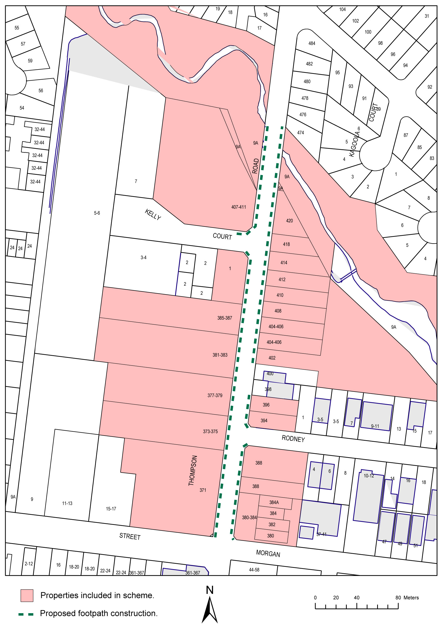
Stage |
Status |
Description |
Approval to prepare scheme |
✓ |
Decision made to prepare scheme following consideration of surveys of residents and feed back from the community via informal survey. Council may then place the project in the budget system or proceed immediately to prepare a scheme. Scheme preparation involves survey, design and preparation of an apportionment of costs. |
Intention to Declare Scheme |
✓ |
Report to Council providing information on scheme including advice of impending advertising of scheme and declaration of charge. Seeks Council approval by resolution to proceed with process. 27 September 2016 |
Advertisement |
✓ |
The scheme is advertised in the local newspaper and all allotted property owners are notified by mail. This advertisement indicates Council’s intention and notification to ‘declare’ a scheme in a month’s time. 8 October 2016 |
Submissions |
✓ |
From the time of advertising property owners have 28 days (as set down by the Local Government Act) to lodge submissions, either in support or opposition to the scheme. |
Submissions Review Panel Hearing |
✓ |
A Submissions Review Panel is convened (quorum of three Councillors) and meets to consider submissions. Some submissions are written only, and other submitters may wish to be heard before the Panel. The Panel makes a recommendation to Council regarding the scheme. 22 March 2017 |
Declaration Report |
✓ |
Any time 28 days after advertising the scheme and after the Submissions Review Panel has met and considered submissions, Council considers a report and may proceed to “declare” the charges in accordance with its advertised intent. Subsequent to this the Finance Manager issues the levy notices and there is a formal charge placed on the property. This is the final step in the process for Council to make a decision on the scheme. |
Appeal |
|
Property owners may lodge an application for review with the Victorian Civil and Administrative Tribunal (VCAT) within one month of issue of the levy notice. An appeal is listed, heard and determined by the Tribunal and this process generally takes three to four months. Decisions made by VCAT are binding on all parties. |
Construction |
|
Council may then proceed to construct the works. Invoices are issued seeking payment of the estimated cost within one month of commencement. |
Final Cost Report |
|
At the completion of the works the scheme is “finalised” taking into account actual costs incurred and payments are adjusted accordingly. |
Source: |
Planning and Development - Urban Growth Area Planning |
Director: |
Peter Bettess |
Index Reference: |
Armstrong Creek West Precinct |
L Gardner moved, P Dorling seconded -
That in accordance with Section 89 (2) (d) of the Local Government Act 1989, this contractual matter be considered at the conclusion of all other business at which time the meeting be closed to members of the public.
Carried.
Source: |
City Services - Environment and Waste Services |
Director: |
William Tieppo |
Index Reference: |
Waste Management |
L Gardner moved, P Dorling seconded -
That in accordance with Section 89 (2) (d) of the Local Government Act 1989, this contractual matter be considered at the conclusion of all other business at which time the meeting be closed to members of the public.
Carried.
Contents | Previous Page: Section A - Procedural Matters | Next Page: Section C - Assembly of Councillors
