
Council Minutes - Section B: Reports - 22 August 2017
Contents | Previous Page: Section A - Procedural Matters | Next Page: Section C - Assembly of Councillors
Contents | Previous Page: Section A - Procedural Matters | Next Page: Section C - Assembly of Councillors
Reports tabled at the Ordinary Meeting of Council on Tuesday date held at the Council Conference and Reception Centre in City Hall, 57 Little Malop Street, Geelong.
Annual Review of the Geelong Public Health and Wellbeing Plan 2013-2017
Portarlington Golf Club Application to Increase Number of Electronic Gaming Machines
Emergency Management – Municipal Emergency Management Plan 2017-2019
Peter Dorling (Administrator) declared an Indirect Interest in Agenda Item 1, Barwon Heads Structure Plan 2017, in that he had a past interest in previous Structure Plan for Barwon Heads and left the meeting room at 6:58pm prior to discussion of the item.
Source: |
Planning and Development - Planning Strategy |
Acting Director: |
Geoff Lawler |
Index Reference: |
Barwon Heads Structure Plan Review 2016 |
To set out the findings and recommendations of the update to the Barwon Heads Structure Plan 2010 and to request that Council adopt the Draft Barwon Heads Structure Plan 2017 (Draft SP) and to give them statutory effect through a planning scheme amendment.
The Barwon Heads Structure Plan was adopted by Council in 2007 and incorporated in the Planning Scheme in 2010. The update to the Structure Plan was initiated in April 2016. The comprehensive update has considered a range of factors around the changing needs of the town and recent changes to state and local policy. This includes changing demographics, development pressures across the township, housing diversity, residential character, climate change, flooding, the natural environment, transport and infrastructure.
Preparation of the Structure Plan has been accompanied by comprehensive community engagement. The Help Shape the Place community engagement in October and November 2017 had around 120 people attend workshops and drop in sessions, as well as 130 submissions being received. Engagement on the Draft Structure Plan in May and June 2017 resulted in 1,050 submissions.
Three requests have been received to rezone Farming Zone land outside of the settlement boundary. The Draft Structure Plan does not recommend the westward expansion of the Settlement Boundary.
The Structure Plan has been informed by a Residential and Landscape Character Assessment that recognises that Barwon Heads has a unique coastal design character. The following changes are recommended:
Rezone Residential Growth Zone to General Residential – Schedule 1.
The Increased Housing Diversity Area (IHDA) to be retained; although removed from land south of Bridge Road and Apply a new Design and Development Overlay – the Barwon Heads IHDA area be applied.
Rezone General Residential Area to Neighbourhood Residential Area and apply a new Design and Development Overlay – Barwon Heads Incremental Change Area be applied.
The Structure Plan recommends that land in the Warrenbeen Court Area be rezoned to Neighbourhood Residential Zone with a schedule that limits development to one dwelling per lot with a minimum site size of 4,000m2. Apply an Environmental Significance Overlay to the Warrenbeen Court Area and part of the Farming Zone north of Taits Road and seek interim planning controls from the Minister of Planning.
The Structure Plan recommends retaining the Comprehensive Development Zoning for 13th Beach Resort.
Other significant issues that are discussed in the Structure Plan include parking and transport, flooding, stormwater and climate change and the significance of the surrounding environment, landscape character and biodiversity.
The Draft Structure Plan recommends that there be no set review period for the Structure Plan.
K Alexander moved, L Gardner seconded -
That Council:
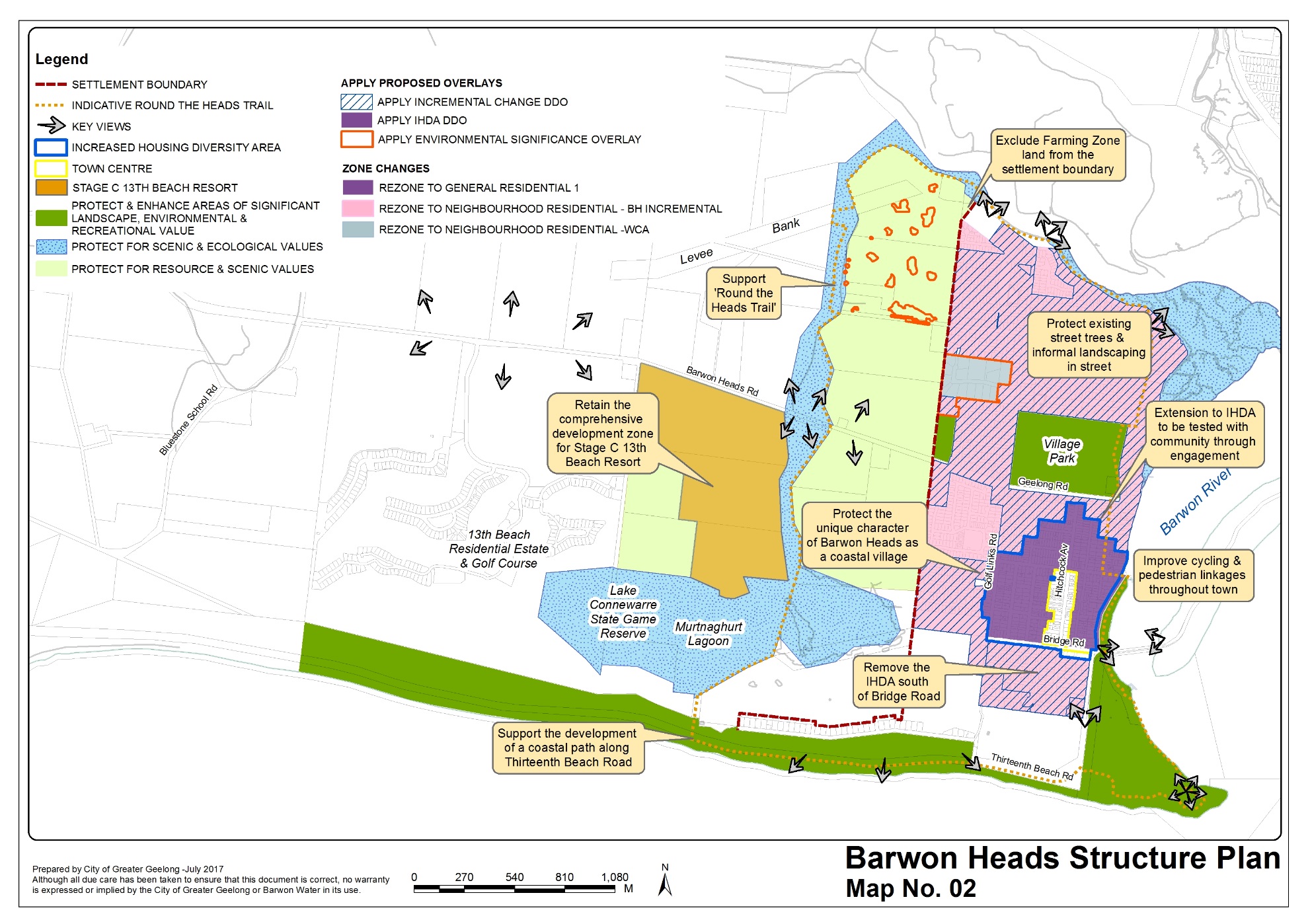
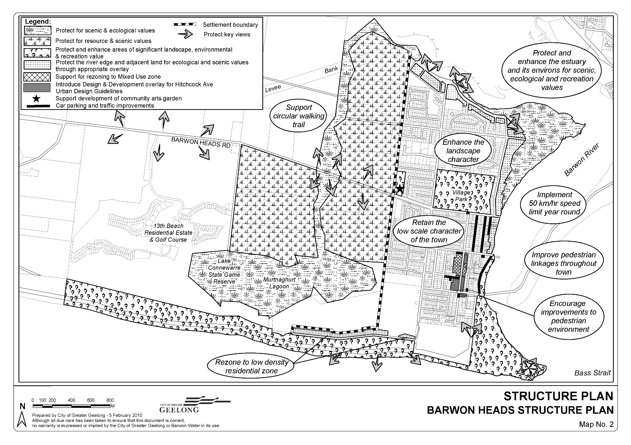
adopts the Draft Barwon Heads Structure Plan 2017, including the Structure Plan map as shown in Attachment 2;
resolves to prepare and exhibit a planning scheme amendment to include the necessary elements of the Structure Plan within the Greater Geelong Planning Scheme, subject to authorisation;
requests the Minister for Planning to exercise powers under Section 20(4) of the Planning and Environment Act 1987 by applying an interim Environmental Significance Overlay schedule while the formal Planning Scheme Amendment is prepared and considered.
Carried.
Peter Dorling re-entered the meeting room at 7:02pm.
Introduction
The update of the Barwon Heads Structure Plan (BHSPU) commenced in April 2016. The Draft Structure Plan 2016 (Draft SP) has been modelled on the City of Greater Geelong’s Structure Plan framework to ensure consistency with other Council produced structure plans. The plan includes discussion on policy context, urban growth (demographics and lot supply), settlement and housing (urban environment) infrastructure (services, access and movement and community infrastructure), natural environment (flooding, climate change and key environmental features), economic development and employment (retail analysis, industrial analysis and tourism), and rural areas.
Comprehensive community engagement has been a key aspect of the BHSPU process. This was in part a response to a residual general lack of trust of Council within the Barwon Heads community resulting from past structure plan consultation processes and that landowners requesting to develop outside of the settlement boundary indicating that there is a silent majority of people who support the extension to the boundary that do not make submissions. To maximise and encourage community participation throughout the BHSPU process Council commissioned the independent consultation company Campbell & Jones to prepare an engagement and communications plan and to subsequently assist with its implementation. The brief clearly sets out the need for Campbell & Jones to consider innovative techniques to ensure that views across the entire community could be achieved.
A submission received by Council on the Draft SP made by a proponent of a landowner who is seeking to develop outside of the settlement boundary has suggested that the consultation process was insufficient and Council should undertake a Citizens Jury process. Given the comprehensive consultation process that has been put in place as set out below this is not considered necessary. Council has dedicated substantial resources and funding to this process. In addition, the landowners themselves have not presented evidence in a submission to support their position of a silent majority and Council continues to receive a large number of submissions that support retention of the settlement boundary.
Internal and stakeholder referrals
Engagement commenced in March 2015 with referrals sent to internal Council departments and external stakeholders and service providers such as Barwon Water, VicRoads, the Department of Environment Land Water and Planning and Barwon Coast Committee of Management. This provided high level background to key infrastructure and land use/ development issues in the town that was incorporated into an Issues Paper and Issues Paper Summary.
Methods used to engage with the community
The community has been continually kept informed of the progress of the project through project bulletin updates. The updates have provided details of the project timing, invitations to get involved in project engagement and reporting on outcomes from the engagement. A number of mechanisms have been used to reach out across the community:
Consultation database: Those wishing to be involved in the BHSPU process were recorded on a database and have been sent project bulletins and invites to be involved in consultation via email and letters.
Talking Heads Magazine: Regular project updates and invitations for engagement have been included in this magazine, which is distributed to all Barwon Heads households on the first Saturday of every month.
Other Media: Adverts for key engagement dates were included in the City News adverts for the Geelong Advertiser and Geelong Independent as well as the Bellarine Times. During the two key engagement periods media releases were prepared and also included on the Council’s social media via Geelong Australia webpage.
Council’s website: A BHSPU information webpage has been available on Geelong Australia. Project updates and all engagement documents and background reports have been provided on the website.
Other representatives: Other groups within the town have their own distribution networks. This includes the Barwon Heads Association, Save Barwon Heads Association and the Barwon Heads Sustainability Group. Key documentation has been included on the webpages of these groups and distributed through their networks. Notices were also placed in key businesses within the town.
Direct contact to community networks: Emails and letters were sent directly to a range of over 50 groups with the community to recruit groups and their members for community engagement and community leadership. This included groups involved in recreation, community interest and residents groups, government agencies and political representatives, health and education, environment and sustainability groups, landowners and developers and traders.
Warrenbeen Court Area and land north of Taits Road – Direct Contact (see detailed discussion on Page 11).
Help Shape the Place engagement
This was the first major opportunity for the community to get involved. The 40 page Issues Paper noted above provided background information to the community. The engagement involved:
Help Shape the Place Workshop: The workshop was held on Wednesday 26 October and was open to anyone in the community. The workshop was facilitated by Campbell & Jones and over 60 attendees worked in groups to discuss planning issues and solutions facing Barwon Heads.
Help Shape the Place Drop in Sessions: Two drop-in sessions were held on Thursday 27 October 2016. The sessions built on the workshops and the community were able to ‘drop in’ and ask questions of Council officers. A further 60 people attended the sessions.
Submissions: Any member of the community was able to make written submission on the Structure Plan, either at the engagement sessions or by email, post or online. Council received over 130 written submissions.
In facilitating the Help Shape the Place engagement activities Campbell & Jones and Council were also supported by Hansen Partnerships who were preparing the Barwon Heads Residential and Landscape Character Assessment.
Draft Structure Plan Engagement
A Draft Structure Plan was released by Council on 23 May 2017. Members of the public were able to make a submission on the draft until 23 June via the online form, by email or post. A ‘drop in’ information session was held on Wednesday 7 June.
Almost 1,050 submissions were received. Most of these (970) were provided by the Save Barwon Heads Alliance who set up an online response portal that was independent of Council. Primarily the online response form focussed on a respondent to choose pre-written arguments in support of Council retaining the settlement boundary. The supporting arguments related to urban growth, amenity, retaining the seaside feel, tourism, environment, climate change and risk. Respondents were also able to provide other comments. It is noted that of the 970 responses received 66% reside in Barwon Heads and 78% in the Greater Geelong area.
Of the 67 submissions that were received by Council directly, 20% did not provide an address or were located outside of Greater Geelong. All methods of consultation had some multiple responses within a household.
Key Themes from Consultation and the review of the Structure Plan
The Draft SP largely retains the key principles and directions from the 2008 Structure Plan (refer Attachment 3). As a part of the BHSPU and engagement process, a number of key issues were identified and are set out below. The Draft SP and recommended planning controls as well as a summary of submissions received on the Draft SP have been made available on the Geelong Australia website by visiting the ‘Barwon Heads Structure Plan Update’ page.
Settlement Boundary
Submissions have been received from the landowners identified in Table 1. Council also received a further 14 submissions that object to the recommendation in the Draft SP to not allow the westward extension of the settlement boundary.
Table 1. Rezoning requests outside of the settlement boundary
Rezoning Request |
Suggested lots (If known) |
Residential Rezoning requests outside of the settlement boundary |
|
Land on the south side of Barwon Heads Road, west of existing Residential zone (1900-1920 Barwon Heads Road) |
250-300 |
All rural land west of the existing settlement boundary on the north side of Barwon Heads Road to the flood levee (representing owners of 135 Taits Road, 137 Taits Road and 1941-1949 Barwon Heads Road) |
Unknown |
2 X submissions for land on the north side of Taits Road, west of existing Residential zone (122-138 Taits Road) |
Unknown |
A summary of the reasons provided to support the change to the boundary include:
Do not support Council’s assessment of coastal settlement policy, including the State and Local Planning Policy Frameworks of the Greater Geelong Planning Scheme (GGPS), the Victorian Coastal Policy Statement and the Bellarine Peninsula Localised Planning Statement;
Do not agree on Council’s position that housing provision should be considered on a municipal basis and other strategies under Clause 11.02-1 of the Greater Geelong Planning Scheme that require planning for urban growth to consider opportunities to consolidate, redevelop and intensify existing urban areas. All towns should provide for some growth;
Council is too reliant on community opposition and should balance the present and future interests of all Victorians under objective 1(g) of the Planning and Environment Act 1987;
There is currently not enough affordable or diversity of housing in the township. Development will increase housing options and will provide an injection of improved design, jobs and investment;
C159 and the Panel set out that limited development is feasible if it provides a net environmental benefit for the Murtnaghurt Lagoon and channel;
Development can be designed to preserve the natural environment and the wetlands, including separation distances to environmental values – resulting in net environmental impacts;
Development can be designed to mitigate issues of development regarding concerns raised by Council for environmental impacts, flooding and climate change amenity impacts to the existing townships and the provision of infrastructure. These issues should not preclude development. The proponents for 1900 Barwon Heads Road have submitted specialist reports to support this position;
Development will enable the delivery of increased community infrastructure and landscaping, including sporting ovals and pedestrian connections, as well as retirement living to meet the needs of the ageing population identified in the Draft SP;
Inconsistency for sensitivities of wetlands when other development has been allowed in the eastern side of the township near the Barwon River;
Land is not viable for farming purposes;
There is a need for tourist accommodation in the town;
Issues around Council’s consultation process (discussed above).
Recommended Council position on the settlement boundary
It is recommended that the settlement boundary for Barwon Heads not be expanded. In the first instance it is considered that there is a lack of policy support ‘in principle’ to extend the settlement boundary. To support this position Council has received significant community opposition to development through two community engagement processes. Due to the lack of ‘in-principle’ support for development, Council has not undertaken a detailed feasibility assessment of individual sites. High level advice has been received from referral agencies on aspects such as drainage, environment and climate change and other servicing requirements. It is considered that urban development outside of the settlement boundary would irrevocably erode the “village” atmosphere of the town and undermine the vision of the town, which aspires to be a place, where human impact is managed to support the fragile natural surroundings. These issues are discussed further below.
No policy support. In accordance with PPN36 a settlement boundary can be reviewed and must have regard to changed circumstances and other relevant matters. It is considered that since the last Structure Plan review the arguments that Council made against the extension to the settlement boundary have not changed and in fact have been strengthened.
A key State strategy is the Victorian Coastal Strategy (VCS). The VCS notes that development should occur in areas identified for growth. Development will only be considered where located within existing, modified and resilient environments, where the demand for development is evident and any impacts can be managed sustainably. In the first instance significant environmental and cultural values should be protected.
Both the G21 Regional Growth Plan and Clause 21.06 of the GGPS do not identify Barwon Heads as a town for growth. Further the State and Local Planning Policy Frameworks at Clause 11.02-1 Supply of Urban Land seeks to plan for population growth over a 15 year period. Residential land supply is required to be considered on a municipal basis, rather than a town-by-town basis. An analysis of residential supply has shown that there is a significant supply of land that goes well beyond the 15 year period for the Greater Geelong Municipal area, as well as the Bellarine Peninsula Region.
In the context of the adequate supply of land at the municipal level this does not automatically result in no growth whatsoever for a town not identified for growth. On the contrary the G21 plan notes that modest growth can occur, but this must be considered in the context of other policies, such as 21.06 which primarily directs growth to the growth area locations and at the same time promotes urban consolidation in line with the Housing Diversity Strategy 2008. Ultimately modest growth does not necessarily mean outward expansion and Barwon Heads should be considered in terms of its locational context. PPN36 is also relevant in that Council must consider the principle of development constraints. For Barwon Heads there are substantial amounts of growth occurring in the nearby growth area locations of Armstrong Creek and to the north of Ocean Grove. Clearly Barwon Heads cannot be looked at in isolation and Ocean Grove, which is located only 5km from Barwon Heads, is directly linked as a housing market. A housing market can consider key functional linkages between places where people live and work and is not necessarily defined by one township only. This is relevant for Barwon Heads in that as a standalone suburb the town does not have the range of services available to make it self-sufficient.
It is also considered unlikely that extending the settlement boundary will have a marked impact on affordability. As noted above the market for properties is larger than just Barwon Heads. Plus it is debateable that for a small town, new land is going to be priced at a lower point than what is the current market price for Barwon Heads. Across Victoria land in new development areas is often released in a limited or phased manner to keep prices higher at market levels or above. The proponents for landowners have noted that the delivery of housing could be drip fed over a number of years, which would support this argument.
The town centre and the surrounding 400 metre walkable catchment is currently located within an Increased Housing Diversity Area (IHDA), which is supported by the Housing Diversity Strategy 2008 and is part of Council’s broader settlement strategy policy. There remains an expectation that there will be a level of development that is facilitated in Barwon Heads in the IHDA as well as through incremental change in surrounding residential areas.
The State Planning Policy Framework (SPPF) for the Bellarine Peninsula has been strengthened by the adoption of the Bellarine Peninsula Localised Planning Statement in 2014. This further enhances the importance of the ecology of the Bellarine Peninsula and the need to protect it from inappropriate urban encroachment.
Undesirable precedent. Any arguments put forward that support development of certain portions of land west of the settlement boundary would also not be supported by Council policy. This would create a precedent for land be developed west of the settlement boundary and would seriously affect the ability to hold this policy position.
Community support.
It is acknowledged that the Panel Report for C159 encouraged Council to reconsider its opposition to development of land at 1900 Barwon Heads Road where limited development can achieve a net environmental benefit. However the panel is clear that this is to be determined by the Council and the Barwon Heads Community. Further, the opposition by the community is not something that the Panel considered it was able to dismiss. The current Structure Plan update process has shown through two community engagement processes that the significant opposition by the community remains. The proposed development for 1900 Barwon Heads Road is also more substantial in terms of the number of houses and land area proposed for residential uses under the 2010 Structure Plan. It is therefore not considered that the scale of development proposed constitutes ‘limited’ development.
Detailed Land Development
As noted earlier there is no policy support for the development of land outside of the Settlement Boundary therefore a detailed assessment of land development feasibility has not been undertaken.
The proponents for 1900 Barwon Heads Road have submitted reports that were used during preparation of the 2010 Structure Plan that they consider support the development of land outside of the Settlement Boundary. This includes a Drainage and Services Report (2009), a Coastal Vulnerability, Flooding and Stormwater Assessment (2009) and updated biodiversity advice (June 2017). The reports provided are not detailed assessments and are high level at this stage. No similar information has been provided from the landowners north of Barwon Heads Road.
Referral advice from internal and external experts that has been provided to Council does not support the western expansion of development outside of the settlement boundary. Council’s Environmental Planning Unit and Engineering Services do not support the proposal to extend the settlement boundary and the Department of Environment Land Water and Planning (DELWP) have also raised concerns. Of the greatest concern is the impact to the internationally recognised Ramsar Wetlands at Murtnaghurt Lagoon and overflow channel that connects the lagoon to Lake Connewarre via the Barwon River. The ecological, biodiversity and ecological importance of the area are well established through numerous studies. The impacts are not restricted to the wetlands themselves, but also from off site impacts of development such as through the development process and subsequent stormwater drainage or indirect impacts of domestic animals and the like. A need to provide buffers to the wetlands is also identified.
Experience from other developments in the City highlights that Council needs to adopt the ‘precautionary principle’ as outlined in Clause 12 of the GGPS. DELWP have advised that experience from Armstrong Creek has identified that increasing freshwater inflows into a saline wetland system can lead to degradation of the wetland by changing the vegetation community and not allowing the system to dry out as it would occur in the natural system. Further, Council’s Engineering Services have noted that there are already stormwater drainage problems in Barwon Heads township and an extension to the settlement would likely exacerbate these impacts. Council also does not accept the use of pumped main drainage systems in this type of broad hectare location due to the ongoing maintenance costs resulting from the low lying nature of the land and salinity levels from ground water.
The proponent for 1900 Barwon Heads Road notes that the proposal will provide community benefits; including the potential for an aged care facility, open space reserve and community oval and a shared path network. The need for expanded community services and land would essentially be driven by the population growth that would result from an expanded settlement boundary, which Council policy does not support. Potential pedestrian connections would have a benefit for the community. Aged care facilities are not supported outside of the settlement boundary.
Residential Character
The recommendation to not extend the settlement boundary will have an influence on how development occurs within in the township and there has been significant residential infill in Barwon Heads over recent years. It is not possible or appropriate to stop all growth and Barwon Heads is required to provide a ‘modest’ level of growth in line with the G21 Regional Growth Plan. To inform future infill development in Barwon Heads a Residential and Landscape Character Assessment 2017 (Character Assessment) was undertaken by Hansen Consultants to inform the Structure Plan.
Feedback from the community during the Have Your Say engagement was that infill development has been detrimental to the village character of the town and there is concern over the use of the Residential Growth Zone near to the town centre. Most community members supported or understood the need for a diversity of dwellings within Barwon Heads, consistent with existing policies, but are concerned that the scale / form of development allowable under the current controls is out of character. The broad sentiment expressed was that some control was needed, but that this needed to be reasonable and not too onerous. Building height, site cover and building bulk, the need for vegetation/ landscaping and the retention of informal landscapes were seen as key opportunities for introducing planning controls. The extent of the residential growth zone was also an area of concern.
The final Character Assessment notes that Barwon Heads has a unique coastal character that is recognised by its setting and function as a coastal Victorian ‘village’. The Character Assessment confirms that there has been significant infill occurring in Barwon Heads over recent years, however, contrary to the perceived community impression, most dwellings (75%) that are being constructed are not increasing densities, but the replacement of a smaller single dwelling with a larger footprint dwelling. The residential and landscape character of Barwon Heads is mixed. Despite the mixed character noted above, Barwon Heads has seen incremental erosion of its ‘coastal character’ over the last few decades and this trend will continue without the application of controls to manage built form.
As a result of the Have Your Say engagement and the recommendations of the Character Assessment the following recommendations were released as the Draft SP and planning controls for consultation in May 2017:
Rezone Residential Growth Zone to General Residential – Schedule 1.
The Increased Housing Diversity Area (IHDA) to be retained; although removed from land south of Bridge Road and apply new Design and Development Overlay – the Barwon Heads IHDA area.
General Residential Area to be rezoned to Neighbourhood Residential Area and apply new Design and Development Overlay – Barwon Heads Incremental Change Area.
The design response to recognise the unique coastal design character of Barwon Heads and appropriate zone includes (refer to the map below and Attachment 2):
A planning permit needed for a single dwelling where certain provisions are not met and a permit needed for the construction of more than one dwelling on a lot;
Provide space around buildings and separation between buildings, landscaped front gardens and retention/planting of indigenous vegetation;
Appropriate consideration of building materials and high quality non- suburban design styles will be considered through Decision Guidelines when a permit is required;
Height of buildings will depend on design and being able to meet the preferred coastal design character outcomes;
The IHDA Design and Development Overlay encourages a need for smaller dwellings, provided it is the right type and design of dwelling and is in the right design context and scale;
Planning permit applications for single dwellings to be exempt from advertising and third party appeal rights;
The choice of residential zones recognises recent State changes to the residential zones; and
Management of the public realm should recognise existing street trees and the informal landscaping of streets.
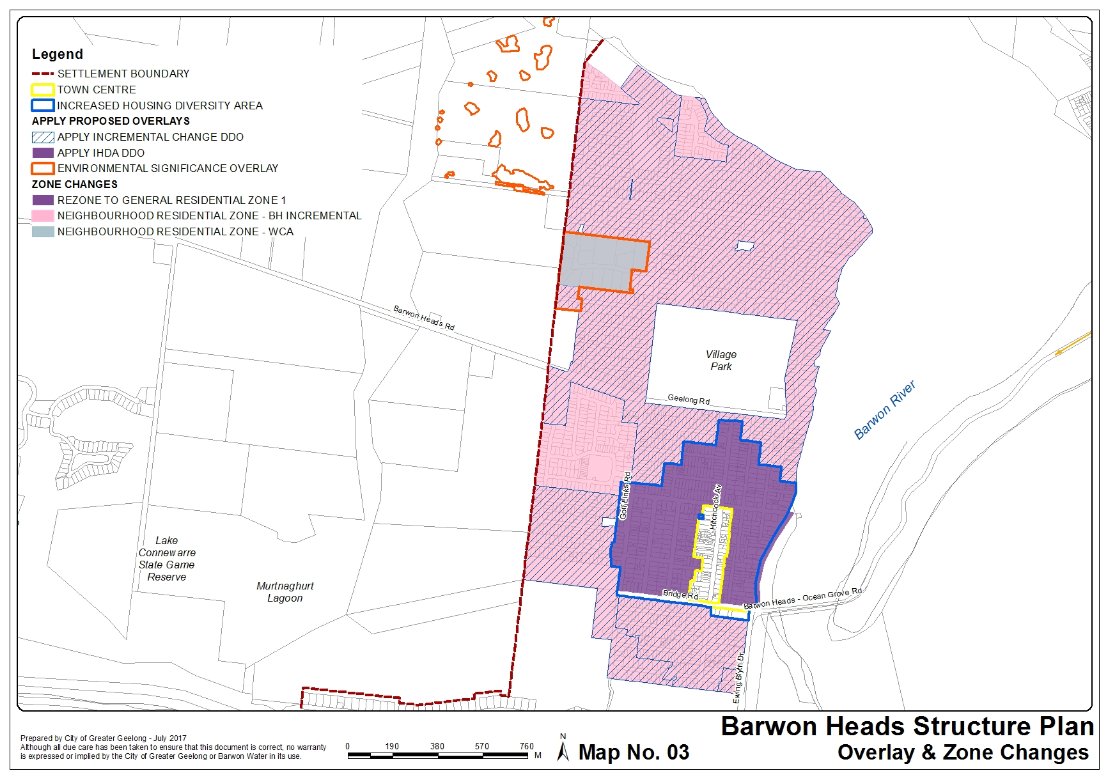
There was generally positive feedback received during the consultation on the Draft SP and the recommended planning controls and zone changes. Building height was again the predominant issue that was raised by the community and primarily to restrict height to no more than 2 storeys across the township, including the General Residential Zone. Since the building heights are set as mandatory controls by the State Government under changes made through VC109 there were requests that the entire Barwon Heads residential areas should be rezoned to Neighbourhood Residential Zone (which has a two storey mandatory height limit). The were also a number of submissions received that did not support Council’s recommendation to exempt advertising and third party appeal rights for permit applications for single dwellings.
The retention of the IHDA and zoning of residential land as the General Residential Zone recognises Council’s broad policy to promote density and change near town centres and the need to encourage increased diversity of housing of the right type, which would include one and two bed units along with older persons housing to recognise the ageing population of the community. It is recommended that the location of the IHDA south of Bridge Road be reduced to support the Hansen recommendations and recognise the unique character and topography of this area. Council has received support from several landowners in the this area and no objections. It is not, however, recommended that the IHDA be extended north to Geelong Road and west to Golf Links Road, which was an option for consideration through consultation on the Draft SP. The community has generally sought that Council reduce the size of the IHDA area and no submissions were received to support the extension.
The approach recommended is a balanced approach that allows for some growth to occur within the Barwon Heads township, while ensuring that this occurs in the right coastal design context for Barwon Heads and the controls are not overly prohibitive. This is supported by the Character Assessment and the height limits for the General Residential Zone are uniform across the State as a mandatory maximum of 11m (3 storeys). The requirement for a relax in the third party rights recognises this balanced approach by not being overly onerous for applicants or on Council resources. If the application involves a multi unit development or there is another overlay in place, for example a heritage application, then there will be opportunity for the community to be involved.
Submissions on the Draft SP have requested that Council implement interim height controls to remove the ability for developers to ‘hurry along’ a development ahead of Council’s recommended zone changes and implementation of planning controls. Interim Planning Controls can only be applied by the Minister of Planning at the request of Council. Interim controls are generally only applied when there is a clearly identified risk, such as the demolition of a heritage building or removal of significant vegetation. Council recommendations are seeking to apply zone changes to the residential zones. Height within the subsequent Neighbourhood Residential and General Residential Zones are determined by the mandatory height requirements of the zones. Therefore it is not considered appropriate for Council to request interim changes to the zones ahead of the proper planning scheme process for the zone changes, which will involve a formal exhibition stage and likely Planning Panels Victoria Hearing.
Parking and transport
The scale of traffic flows through the town and the amount of car parking supply is continuously raised as an issue requiring attention by residents and traders and is one of the major challenges for Barwon Heads. Primarily the feedback received through the community engagement relates to a lack of parking, congestion and slow traffic times through the town that are particularly bad during the holiday season, many weekends, public holidays and school holidays, a need to improve safety and the need for more pedestrian and cycling connections. There were similar comments raised during both consultation exercises. Other feedback received from residents indicated an acceptance of the parking situation and that there is a need for people to consider walking or cycling more often. Often there is an expectation for people being able to park directly outside a shop or service. This is not realistic year round, comparable to many areas across Geelong.
To address parking and traffic issues Council Commissioned GTA to undertake traffic and parking studies in 2003 and an update in 2010. Subsequently a series of actions have been implemented through these studies. Outside of the holiday peak times volumes on the arterial and collector roads are generally within the capacity of these roads. The main ‘arterial road’ through the township is Barwon Heads Road, Golf Links Road, Bridge Road and across the Barwon Heads Bridge that is managed by VicRoads. Council must work within the limitations which this road alignment, and its management, presents in relation to traffic movements and associated issues for the wider township. Council’s Engineering Team have advised that further speed reductions on certain roads in the town will inevitably transfer those problems to other roads. Further, a blanket reducing of speeds across Barwon Heads would likely have a detrimental impact on the overall traffic flows in the town, which could lead to considerable objections from the community (and there have been objections raised in regards to additional pedestrian crossings installed in 2016).
Parking provision is a complex issue, as the significant problems in the holiday peak of around two months skews the impacts and makes it difficult to plan for and to justify further provision of budgets for Council. Further, there are many different views across the community as to what solutions would be appropriate for Barwon Heads. Ultimately Council’s Engineering team do not at this stage recommend any significant changes to the parking regime and infrastructure that is available to Barwon Heads. This is continually monitored by the Engineering team who respond to customer requests or complaints where necessary. A number of options have been outlined in the Draft SP that may be considered for implementation in the future by Council if budgets are available and there is community support. This includes residents permit parking or paid metres in the town centre, park and ride or extension to the community bus, council purchase and development of off-street car parks (although this is likely to be cost prohibitive) or a Special Rates and Charges Scheme to fund car parking, parking infrastructure or pedestrian and cycling connections (part or completely funded by the local community).
Council has received submissions requesting that an additional traffic and parking assessment should be undertaken. This is not supported as considerable resources have been put into implementing improvements for the town and as noted earlier Council does undertake its own monitoring of parking and traffic and future options for improvements are outlined in the plan. It is also noted that the Structure Plan is a land use plan and not a traffic plan.
In promoting an improved pedestrian and cycling network the G21 Principal Bicycle Network, Greater Geelong Cycling Strategy and the Barwon Heads Walks Project are used to assist the prioritisation of paths infrastructure where appropriate and Council budgets are available. The informal streets provide an important character element for the town and should generally be protected as recommended by the Character Assessment. There will sometimes be a need to provide footpaths to improve pedestrian connections and active travel around the town; although these are prioritised in high movement areas and/or the most direct route or where identified in an relevant Council plan or strategy.
Flooding and Stormwater
Barwon Heads is susceptible to flooding due to the low lying nature of the town and since it originally made up part of the floodplain for the Barwon River. The majority of the town is well protected from Riverine Flooding by the levee bank to the east, however, the town experiences relatively serious and frequent drainage related or ‘stormwater’ flooding. To address the stormwater flooding Council has put in place a Special Building Overlay in areas designated flood prone land and has also installed a pumping station in Clifford Parade to cater for more frequent, lower intensity rain events; although this will not eliminate flooding.
The issue of stormwater has the potential to be exacerbated through the pressures from infill development in the town centre, particularly in the context of a Residential Growth Zone being in place within 400m of the Town Centre. It would be impossible to eliminate all flooding by increasing capacity of the underground drain network. Outcomes from this structure plan seek to address the extent of the impacts of stormwater flooding impacts by putting in place the following measures:
The recommended zone changes from Residential Growth Zone to General Residential – Schedule 1 in the IHDA area;
The Design and Development overlay that change the zone schedule to decrease site coverage to 40% in the proposed Neighbourhood Residential Zone;
New development will be required to include measures to restrict stormwater discharge to acceptable level, with major development being informed by a detailed stormwater management plan;
A future updated Flood Management Plan may recommend the need for planning controls to be put in place to address localised stormwater flooding.
Council’s Climate Adaptation Strategy 2011 has lead to the preparation of a 3rd Pass Local Coastal Hazard Assessment (LCHA). The mapping shows that there are some small areas on the coastal edge of the existing town that may be subject to climate change risk to 2070 and 2100 resulting from storm tide events on top of the sea level rise scenarios. The impact of coastal inundation by the year 2100 will require careful coastal planning in the future. Council is currently working with the Borough of Queenscliffe to determine appropriate planning mechanisms to include in the Planning Scheme resulting from the LCHA.
Environment
The natural environment of Barwon Heads plays an important role for the township and is highly valued by the community as evidenced through both engagement processes. It provides intrinsic habitat and biodiversity values that are environmentally significant; not just to the State, but also nationally and internationally. The Structure Plan continues to recognise this environmental context of Barwon Heads.
Submissions have been received requesting that Council implement additional environmental and conservation zone overlays in the private land adjoining the wetlands to protect the wetland ecosystems and the need for appropriate protective buffers. Council’s Environment Team have advised that the Council’s Biodiversity Strategy is out of date. A future review of the Strategy will consider whether biodiversity is adequately protected across Greater Geelong and whether additional planning controls are needed. Any recommendations of the study would need to be implemented through a planning scheme amendment process.
Warrenbeen Court Area and Taits Road west of Settlement Boundary
The Warrenbeen Court area includes Warrenbeen Court and a small part of Saratoga Avenue. It is a residential area that is located within a unique vegetation and landscape setting. Taits Road west of the settlement boundary is located within the Farming Zone. Council commissioned Ecology Heritage Partners to conduct a significant tree assessment within private land at Warrenbeen Court completed in October 2016 and for land in rural areas north of Taits Road completed in February 2017. Remnant indigenous vegetation in both areas are representative of the Ecological Vegetation Class: Coastal Alkaline Scrub (EVC 858). The area contains indigenous vegetation of State significance, listed as threatened under the Flora and Fauna Guarantee Act 1988 and Endangered within the Otway Plain bioregion.
The study area contains Coastal Moonah woodland community (Melaleuca lanceolata) (Coastal Moonah) ranging from poor to good condition. Condition is a representation of the overall vegetation community structure. The presence of poor condition, or relatively poor condition, Moonah woodland is an indication of poor management of the understorey. Further degradation of understorey vegetation throughout the study area remains a high risk and the study recommends that Council protect and improve the diversity of remnant vegetation through planning controls.
Within Warrenbeen Court there are covenant restrictions listed against the titles to benefit other landowners of the area. The covenants seek to protect vegetation on the land through the following restrictions on development:
The owners…shall not allow the erection of more than one dwelling on any single lot or further subdivision of any lot. [COVENANT X290849N of 01/02/2001 – expires on 31 December 2020]
The owners…shall not develop the land other than in accordance with an approved neighbourhood design plan pursuit to planning permit No.1057/97.[COVENANT PS412071E of 20/09/1999 – no expiry date. It may be removed (or replaced) only “by agreement of all interested parties”]
To recognise the existing protection in the area and the recommendations of the Ecology Heritage Studies two changes are recommended:
Rezone land at the Warrenbeen Court Area from General Residential Zone – Schedule 2 to Neighbourhood Residential Zone with a schedule requiring a minimum lot size of 4,000m2 and limiting development to one dwelling per lot.
For both the Warrenbeen Court Area and the Taits Road area apply an Environmental Significance Overlay (ESO). The ESO would protect the trees and their ecological values and habitats (community). The overlay would also require a permit for most building works.
Landowners in the area have been directly notified by letter as part of the Have Your Say and Draft SP engagements. During the Draft SP engagement a proposed ESO was available. Engagement on the Draft SP has resulted in four neighbour objections being received. In summary the objections include that there is an expectation of development when the covenant restrictions are removed; there are already exemptions for removal of trees through bushfire exemptions; a Vegetation Protection Overlay (VPO) would be more appropriate; and there are issues with the cost of maintenance in the rural areas.
A Supreme Court of Victoria decision (VSC 677) in November 2016 has highlighted that there is a need to prepare planning controls to protect vegetation in the area. The decision involves a dispute between two neighbours in Warrenbeen Court over construction of buildings outside of the building envelopes. The Supreme Court has ruled that there is no longer any legal protection of vegetation in the area excepting in cases where building is proposed outside of the permitted envelope. Whilst the Court recognises the purpose of the covenant as being protection of the vegetation, absent of a breach of the covenant there are no vegetation controls. The decision also confirms that there are two covenants in place and the covenant that restricts development within the building envelopes remains in perpetuity. Therefore the expectation that the land can be developed is incorrect. The whole uniqueness of the area is dependent on the retention of large allotments and retention of vegetation is the primary component of the character. The ability to subdivide or undertake further development would seriously risk this. Further the Neighbourhood Residential Zone has been recommended for the surrounding residential areas and the proposed Warrenbeen Court Area zone is consistent with this.
A VPO is not considered to provide adequate protection of the Coastal Moonah Woodland community. Under a VPO only specific trees are protected, but not necessarily the vegetation community, including the understorey; nor are the trees protected from building or construction works, which have the ability to negatively impact on the vegetation community. Maintenance issues associated with vegetation can potentially be addressed through a planning permit on an ongoing basis.
Clause 52.48 Bushfire Protection – Vegetation Clearance Exemptions
Clause 52.48 results in exempting the requirements of obtaining a planning permit resulting from a prohibition of the removal, destruction or lopping of vegetation. Council considered a Report and wrote to the Minister for Planning in early 2016 to request the Minister investigate the blanket application of this provision as it is seeing vegetation removed in urban areas with no identified fire threat.
The Minister advised in writing in June 2016 that DELWP (the department) is currently investigating a proposed update to the clause based on a more risk based approach and the matter will be considered ‘in due course’. No response has yet been received by the Minister. This is a similar approach to the Ocean Grove significant tree assessment and recommended planning controls.
Interim Controls – Warrenbeen Court
It is recommended Council apply for interim controls for the Environmental Significance Overlay while the amendment is being considered. Without interim controls there could be a loss of vegetation as there are currently no planning controls in place. This has become more pertinent as the Supreme Court decision noted above has confirmed that there is effectively no vegetation protection outside of the building platforms. Further, submissions that have been received have indicated a wish to develop the area. There have also been comments made from landowners that the land could be ‘moonscaped’.
Interim controls are routinely applied where heritage overlays are proposed and there have been instances where Councils have applied them to vegetation. This includes the recent application of interim planning controls in Ocean Grove resulting from the Ocean Grove Significant Tree Project.
Additional Vegetation Protection
In addition to the vegetation protection noted above, submissions have been received during the Draft SP engagement that consider that Council should be putting in place greater protections for vegetation on public and private land within Barwon Heads. It is noted that Council is currently undertaking additional tree assessments on public land and road reserves in Barwon Heads and across the Bellarine Peninsula. Once this work has been completed and there are available resources, a planning scheme amendment process to incorporate these into the GGPS with community engagement is likely to be instigated. Warrenbeen Court has for a number of years been identified as an EVC that needs to protect vegetation and the area is unique due to its large property sizes. The DDOs that are noted earlier have made recommendations that require additional indigenous canopy trees be retained and protected on site. It is not considered necessary that additional protections be required for private land within Barwon Heads.
13th Beach Resort
During the preparation of the 2010 Structure Plan Council sought to rezone Stage C of the land as Rural Conservation Land. The Panel’s report on the subsequent Planning Scheme Amendment C159 supported the retention of the Comprehensive Development Zone (CDZ) given its ability to provide the greatest level of control over future site outcomes and the potential to deliver net environmental benefits to Murtnaghurt Lagoon. The panel noted, however, that the zoning of the land would not necessarily be retained in perpetuity if not acted on in the short term could revisit the land zoning. The site is recommended to remain in the CDZ for the following reasons:
The redevelopment provides an opportunity to deliver net environmental benefits for the community;
Economic conditions that would have allowed for redevelopment in a short timeframe have changed;
This is a nationally recognised golf course that is identified in the Tourism Greater Geelong and the Bellarine Tourism Development Strategy as a key tourism facility for the City;
The Farming Zone has changed since 2010 and allows for a wider range of land uses;
A golf course of this nature can provide a high level of visual and landscape amenity;
There was limited support for the change by the community through engagement; and
A key requirement is that no residential development should occur on the site.
Other issues.
A submission was received regarding the development potential of farming zoned land to the north of Barwon Heads at 44 River Parade and 14 Eddystone Court. These areas are located within the settlement boundary, however, are included in the Farming Zone. Further investigations have indicated that this appears to be an anomaly. The two parcels of land were originally linked to the area of land associated by a historical Section 173 agreement. Each parcel is associated with a larger parcel of farming land to the west that is outside of the settlement boundary. The site is also a triangle of land wedged between the Moonah Park at the edge of the settlement boundary. 44 Eddystone Court is also identified as Flood Prone Land. Overall the land is likely to be constrained and it is recommended that the settlement boundary be changed to exclude the land from the settlement area.
A submission was received requesting the rezone the Jirrahlinga Koala and wildlife Sanctuary to Special Use Zone to uphold the environmental and land use values. The sanctuary is located within the Farming Zone and has existing use rights to operate. Further the land use is privately owned and the submission has not come from the landowners. A rezone is not considered necessary and the use is buffered from residential uses by virtue of being located in the Farming Zone.
The old kindergarten building in Clifford Avenue is owned by Council and is currently vacant. Council is yet to resolve a way forward for how the site can be used.
It is not necessary for this Structure Plan to designate future areas for educational purposes, nor consider availability of land for additional educational facilities. An additional Catholic primary school in Barwon Heads is also not required.
The draft Retail Strategy suggests that to support Barwon Heads there is a floorspace need of 7,200m2, which means there is currently an excess of land required at 9,800m2. Taking account of population projections to 2031 it is projected that there is adequate land in Barwon Heads to support the township with the 9,300m2 floorspace required (with no extension to the settlement boundary);
A submission was received requesting that Commercial 1 Zone land at 1-3 Clifford Parade and 8-10 Bridge Road be rezoned to Mixed Use Zone. A rezone is not supported. Projections in the draft Retail Strategy that note an excess of 500m2 of retail land is considered to be insignificant and this is not an absolute figure. Further, the two areas of land that have been requested for rezoning comprise of a total of 3,645m2;
The emerging Open Space Strategy does not identify a need for additional open space or land acquisitions to meet the needs of the community. There is a need to improve accessibility to recreation facilities and networks around the town;
Council continues to support the development of a Round the Heads Trail although the project timeline is currently unknown. Some sections of the trail are already in place. To proceed to detailed design would require permanent or part closure of a section of the Lake Connewarre State Game Reserve, potential acquisition or negotiation of private land and available budget. Submissions have been received that object to the trail due to potential implications on the surrounding wetlands and birdlife. Detailed design planning of the trail would need to consider environmental impacts and would involve community consultation;
Review period of the Structure Plan. Council received submissions that both supported and opposed the timeframe for review of the Structure Plan. Council’s approach it is that a full review of the Structure Plan would only occur if there is significant change to State or Local Policy. It is costly and time consuming for Council to be undertaking reviews of Structure Plans every five years for a plan with a 15 year planning horizon and clear policy direction. This is particularly relevant when the town is not identified as a growth area. Further, this does not provide any certainty to the community. Council is currently preparing a Settlement Strategy at the municipal level and in the future land supply may be considered at broader level rather than on a settlement by settlement basis.
There will be no significant financial implications on Council as part of the future planning scheme amendment process. All future statutory processes will be covered by respective departmental budgets.
In addition to the informal community consultation outlined in this report, the planning scheme amendment process will include a statutory consultation period (minimum 30 days). Where submissions cannot be resolved, an Independent Panel will be requested.
The Project has considered the relevant State and local planning considerations. To give proposed controls statutory weight, a planning scheme amendment will be initiated to implement them in the Greater Geelong Planning Scheme.
This report aligns with the directions of the Sustainable Built and Natural Environments theme in City Plan.
The report aligns with the Greater Geelong community vision to create a clever and creative city-region for a community that is connected, sustainable and resilient, prosperous and designed for people.
No Council officers involved in the development of the Barwon Heads Structure Plan 2017 and preparation of the report have a direct or indirect interest in the issue, in accordance with Section 80C of the Local Government Act, to which this report relates.
There is a risk in not updating the Structure Plan given there have been several changes to State and Local Policy since 2007. The recommendations will result in changes to Clause 21.14 Bellarine Peninsula where it relates to Barwon Heads.
Environmental implications have been considered as part of the Structure Plan update and Council’s Environment and Waste Team and the Department for Environmental Land Water and Planning have provided a referral response to the Structure Plan. Key environmental features within and around the town have been reviewed and considered in terms of future land use and development and associated impacts.
Source: |
Environment and Waste Services |
Acting Director: |
Peter Godfrey |
Index Reference: |
Breamlea Holiday Park |
To seek Council endorsement for the public exhibition of the Draft Breamlea Holiday Park Master Plan
Situated on Crown Land, The City of Greater Geelong (CoGG) acts as Committee of Management (CoM) for the Park and surrounding foreshore on behalf of the Department of Environment, Land Water and Planning (DELWP). Council’s Environment and Waste Services Department is responsible for management of the Park, with a contracted caretaker undertaking day to day park management.
Council has undertaken significant upgrades over the past seven years including the construction of three eco friendly villas, upgrades to the amenity blocks, BBQ areas and general store frontage, improved outdoor lighting, installation of an all abilities toilet, new fencing and improved tree management.
A survey was issued to site holders and local residents in March 2016 with feedback considered as part of the final Draft Master Plan.
The Park is operationally profitable.
The Master Plan seeks to align with the requirements of State Government policy and best practice guidelines for foreshore caravan parks. The aim of the Master Plan is to:
maintain a Park that is financially sustainable and attractive to potential users;
deliver a mix of accommodation by rationalising location and size of sites by;
consolidating six and twelve month permit sites and casual sites as well as providing open areas for group bookings in off-peak times;
designating an additional 25 sites as 12-month permit sites;
designating an area to be available for use by larger motor-homes;
designating an area most suitable for additional cabin accommodation;
continue to monitor and manage established trees and undertake a tree replacement program using appropriate indigenous species;
in consultation with the CFA, conduct staged fire safety fuel reduction along the Park boundary to maintain safe a clearance zone from caravan sites and reduce fire risk;
protect and minimise impact on Aboriginal cultural heritage values;
upgrade site power and water service arrangements to best practice;
The Master Plan has been prepared to improve the safety, management and facilities of the Breamlea Holiday Park for the next five years until 2022 with a key objective being to maintain financial viability while preserving the intrinsic values of the Park and associated foreshore areas.
That Council endorse for public exhibition, the draft Breamlea Holiday Park Master Plan (Attachment 2).
Carried.
Breamlea is part of the internationally renowned Great Ocean Road region. Whilst other towns attract large visitor numbers, Breamlea has retained its charm and low profile in part as it’s not directly linked to main coastal roads. Breamlea has just over 100 residential homes, with a population (permanent and non-permanent combined) of approximately 230. It is also home to the Bancoora Surf Life Saving Club. Breamlea Holiday Park offers a unique and relaxed holiday experience to holiday makers.
The combined holiday park, post office and general store are the only commercial facilities in Breamlea and are important to the function and social fabric of the town.
Breamlea is surrounded by significant environmental areas including the open coast, dunes, and wetlands which are inhabited by a diverse array of flora and fauna.
Breamlea is an area of high cultural heritage significance with more than 60 known Aboriginal archaeological sites within a 2km radius of the Holiday Park.
The cost to implement the full range of actions within the Master Plan over the next 5 years, regardless of whether they rank Mandatory, High, Medium or Low priority is $1.15 million.
Many of the actions will be delivered by Park surplus received from the operation of the Park. Note the current annual income for the park is approximately $430,000 and the surplus is around $60,000.
The following provides a summary of financial implications:
$30,000 to undertake a Cultural Heritage Management Plan (CHMP) is considered mandatory. This can be delivered from Park surplus.
$405,000 to replace old cabins is considered a priority in the medium term (3 to 5 years). A proportion can be paid for via Park surplus and through some budget submissions in future years.
$715,000 for a broad range of low priority, non-urgent actions that are considered discretionary but which in total deliver the level of amenity required.
Some elements of the Master Plan will be dependent on new business cases to be considered in future budgets.
Community and stakeholder consultation has been an important component of development of the Draft Master Plan.
Initial consultation involved a workshop held at the Park with representatives from Council, Park management, DELWP, CFA, the Wathaurung and Parcor Safety Training and Consulting.
Consultation was also sought from the community, regular and casual Park users, visitors and stakeholder authorities. It included a survey where comments and feedback were sought.
As the land owner DELWP were consulted again in May 2017 and have provided in principle support for the Draft Master Plan (see Attachment 3 – DELWP letter of support).
Notification of the endorsement of the Draft Master Plan will occur on Council’s website and via letters to site holders and residents and information displayed at Breamlea General Store.
The changes suggested as part of the Draft Master Plan are consistent with requirements of State Government policy and best practice guidelines for foreshore caravan parks.
As the land owner, it is a requirement that DELWP provide their support before any Draft Master Plan becomes a final.
No Council officer involved in the preparation of this report has a direct or indirect interest in the matter to which the report relates.
As part of the planning process for the Park, emergency management and OH&S procedures are being reviewed and updated.
The coastal vegetation adjoining the Park which is dominated by Coastal Tea Tree and Coast Wattle with a thick understorey of indigenous ground covers result in a high fuel load and presents a potential fire risk. The Emergency Management Plan requires an annual inspection by the CFA which includes an assessment of whether this risk is being appropriately managed.
By commissioning a CHMP, the Master Plan will minimise risks by providing additional detail around required actions relating to protecting Aboriginal cultural heritage sites.
Breamlea is surrounded by significant environmental areas including the open coast, dunes, and wetlands which are inhabited by a diverse array of flora and fauna. The operation of the Park in this sensitive setting is geared around minimising environmental impacts.
There is no remnant indigenous vegetation within the Park. The existing large Eucalypts include Southern Mahogany, Tuart and Sugar Gum are not indigenous to Breamlea but contribute to landscape character and amenity.
Ongoing monitoring and management of the trees will continue and a staged tree replacement program using indigenous local provenance Moonah and Coast Manna Gum will be implemented.
Rebecca Leonard (Executive Manager Legal Services and Governance) declared an Indirect Interest in Agenda Item 3, Amendment C332 & Permit 1303/2015 – Barwon Water Depot, Breakwater – Consideration of Panel Report and Adoption in that she is a Director of Barwon Water, but was not required to leave the room.
Source: |
Planning & Development - Strategic Implementation |
Acting Director: |
Geoff Lawler |
Index Reference: |
Financial Management Reporting |
To consider the Independent Panel Report and adopt Planning Scheme Amendment C332.
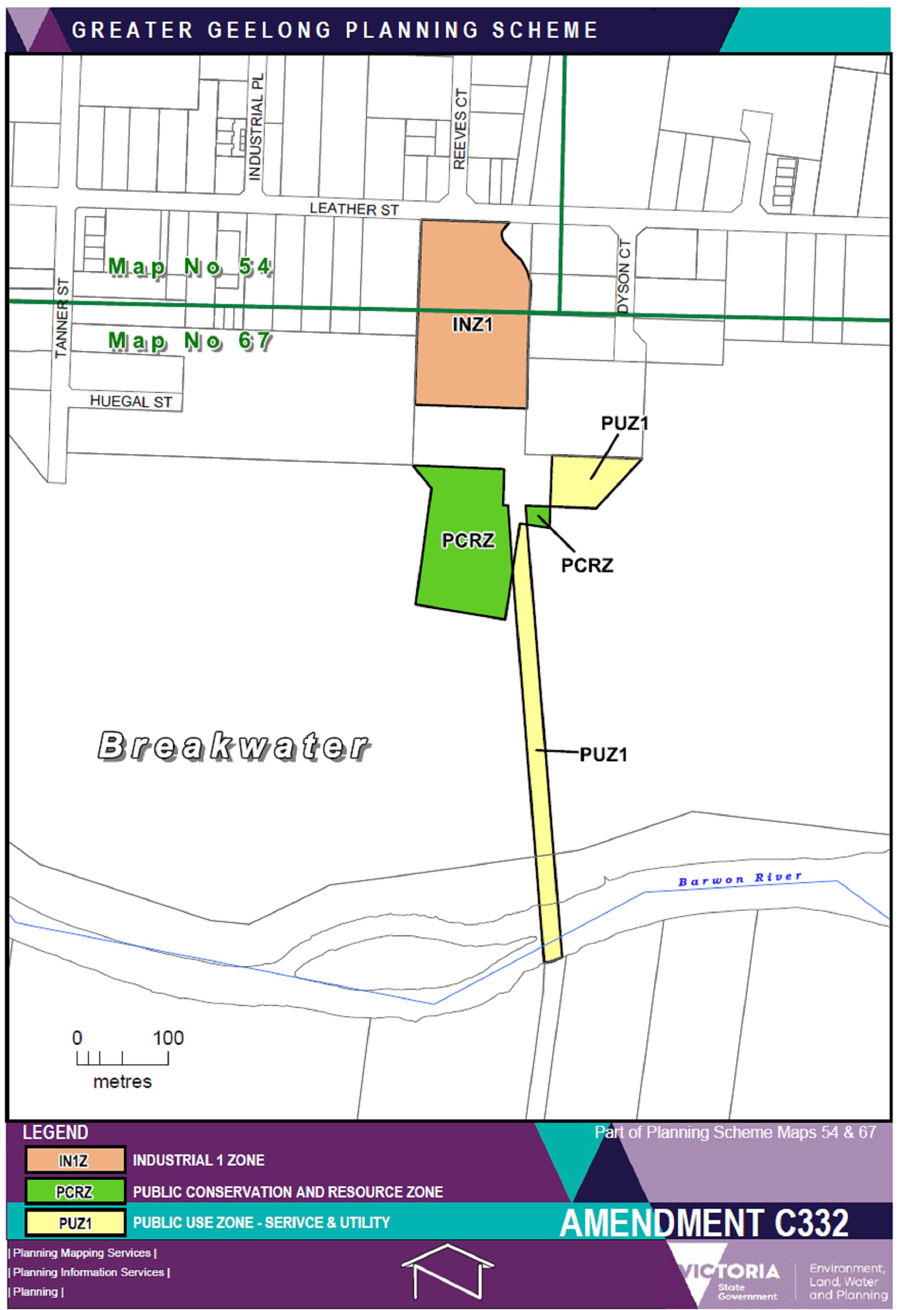
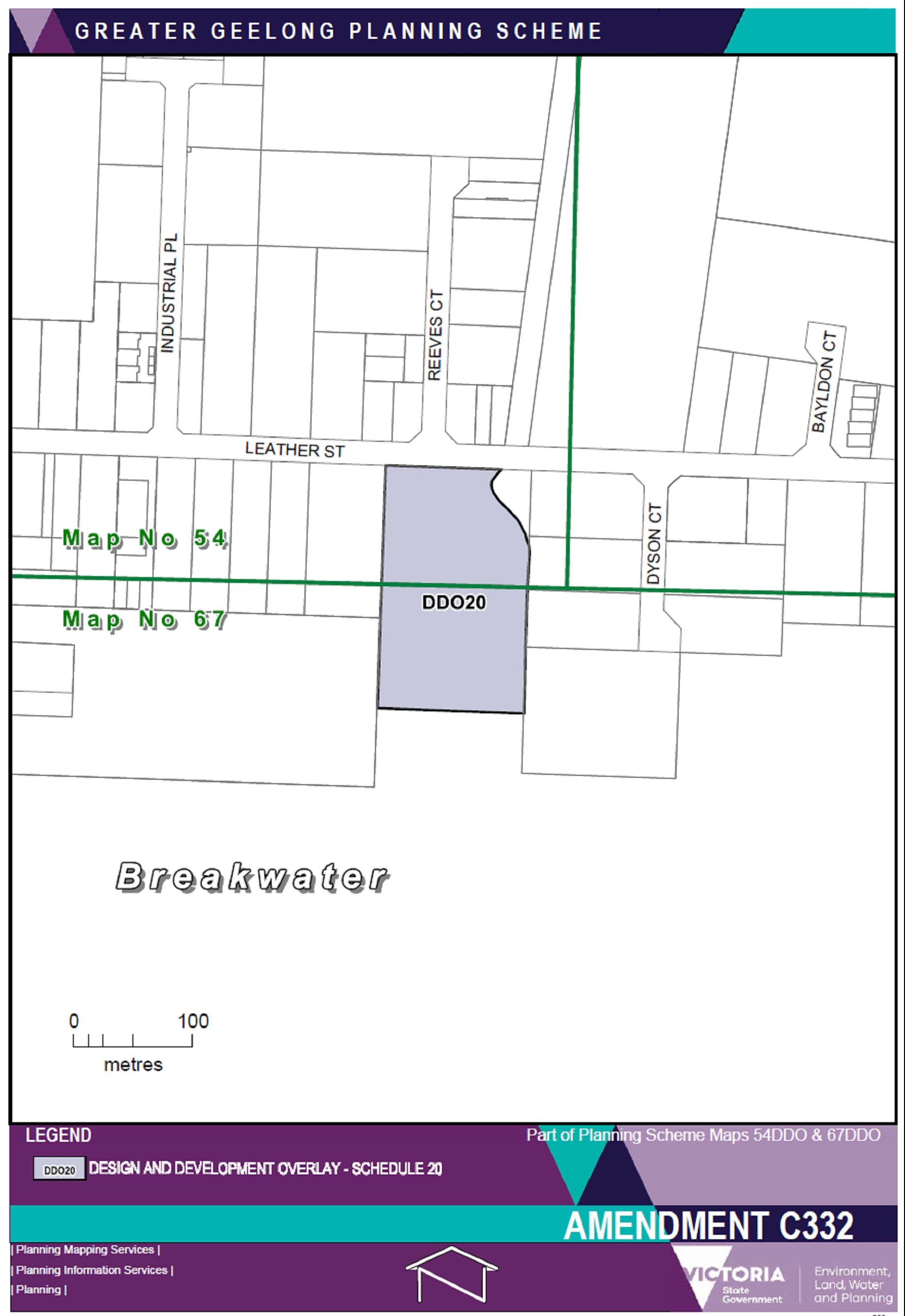
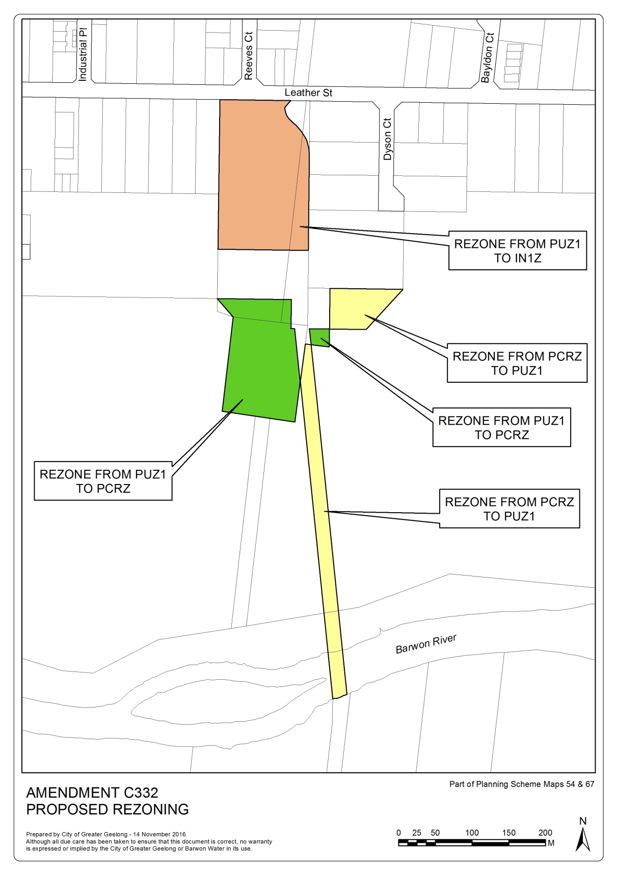
Amendment C332 proposes to rezone Barwon Water owned land south of Leather Street in Breakwater concurrent with a 10 lot industrial subdivision. The Amendment is supported by a Section 173 Agreement consistent with Ministerial Direction No. 1 Potentially Contaminated Land.
Exhibition of the Amendment from 23 March to 24 April 2017 resulted in the receipt of 5 submissions of which one objected. A Panel Hearing was heard on 23 June 2017 and the Panel has supported the Amendment.
Barwon Water proposes to reorganise its land for asset storage and infrastructure maintenance. Barwon Water is also progressing the Ovoid Sewer Aqueduct Park plan on 66 hectares of the Barwon River floodplain.
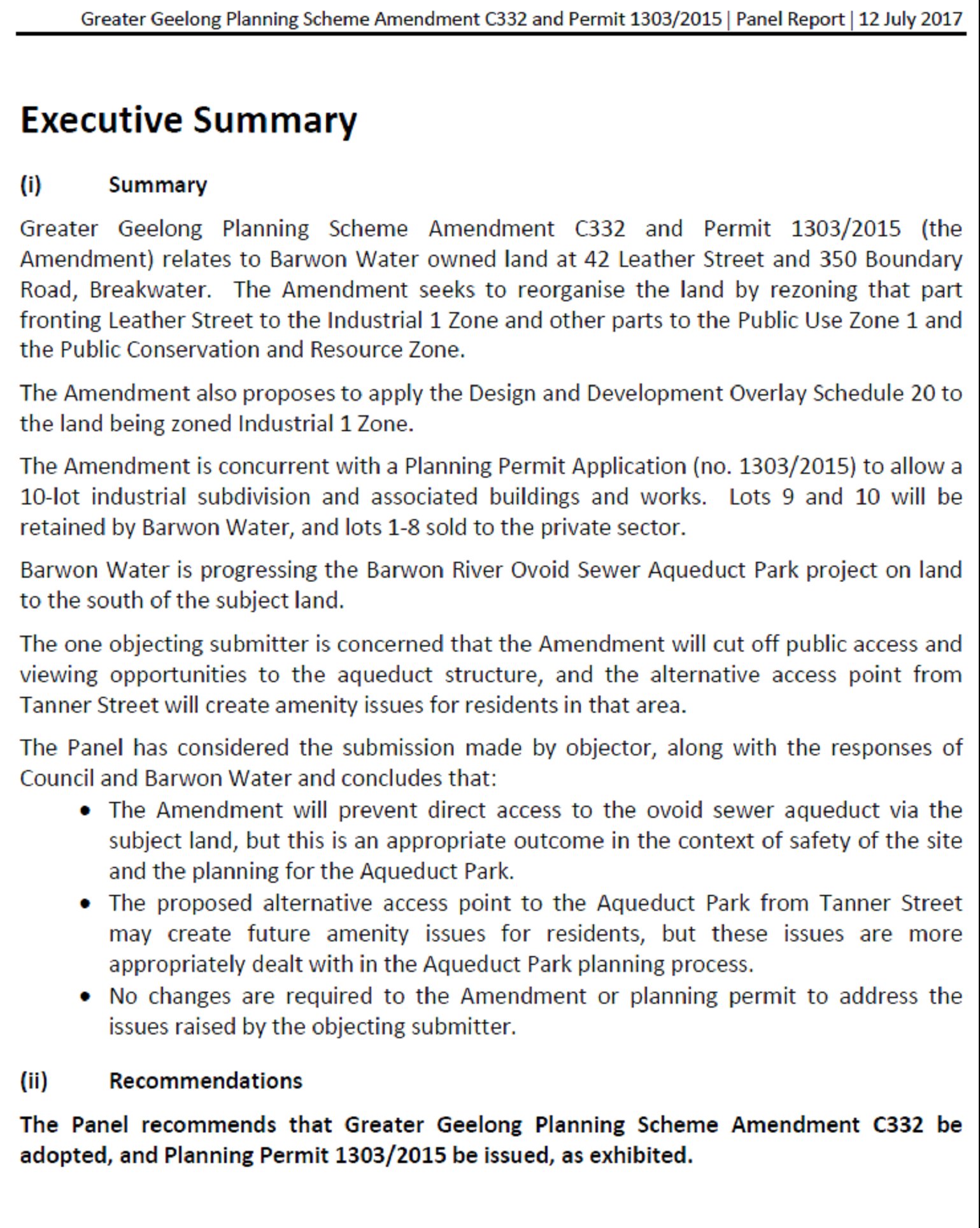
The objector is concerned that the rezoning will cut off public access and viewing opportunities to the aqueduct structure, and an alternative access point from Tanner Street will create amenity issues for residents in that area.
Under delegation on 23 May 2017, Council resolved to refer all the submissions to an Independent Panel. Council’s position was that there is no relationship between the Aqueduct Park plan and Amendment C332.
The Panel noted that the strategic merits of the Amendment are not contested.
The Panel concluded that no changes are required to the Amendment or planning permit to address the issues raised by the objecting submitter.
P Dorling moved, L Gardner seconded -
That Council resolves to:
adopt Amendment C332 in the form as outlined in Attachment 2 of this report;
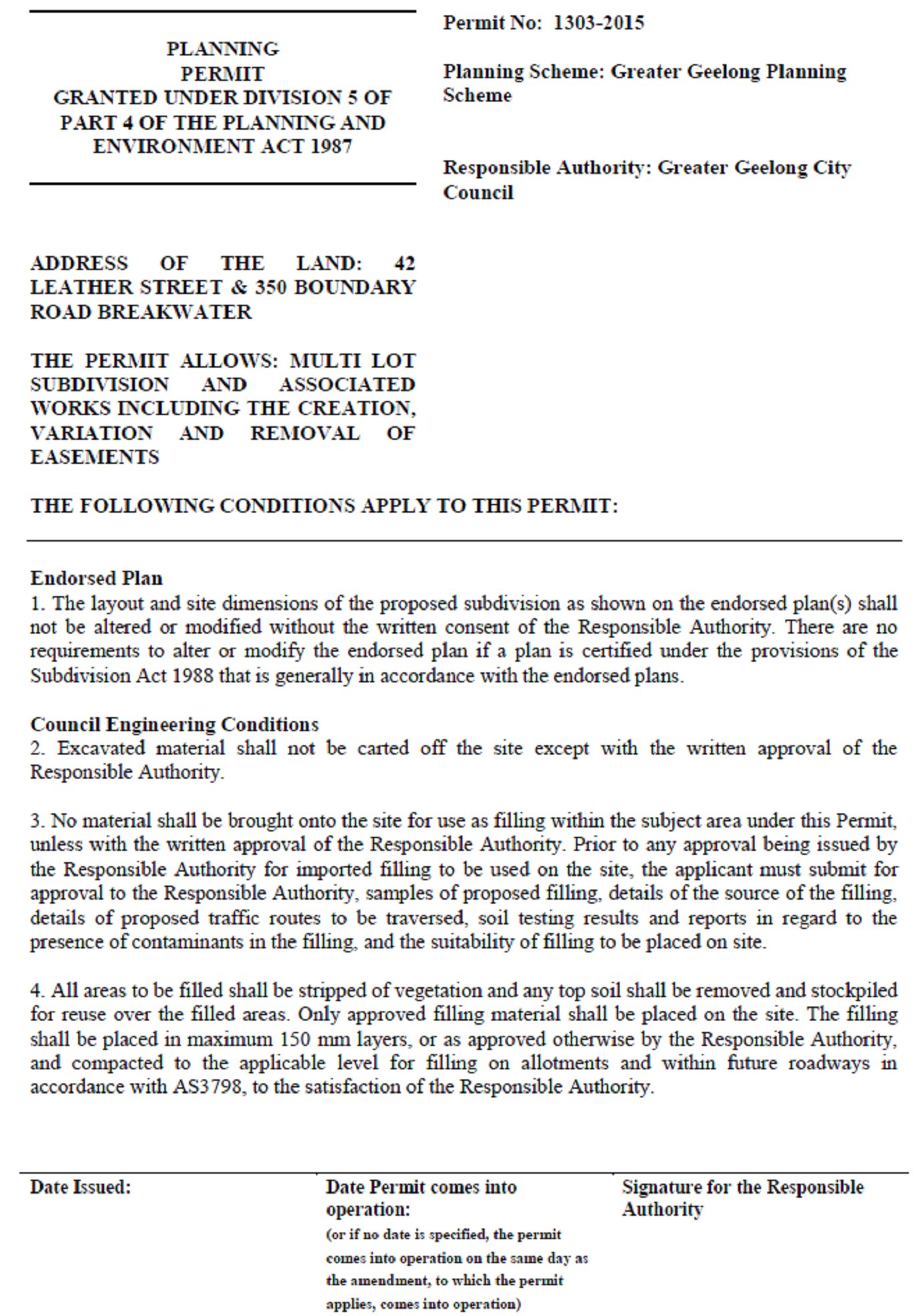
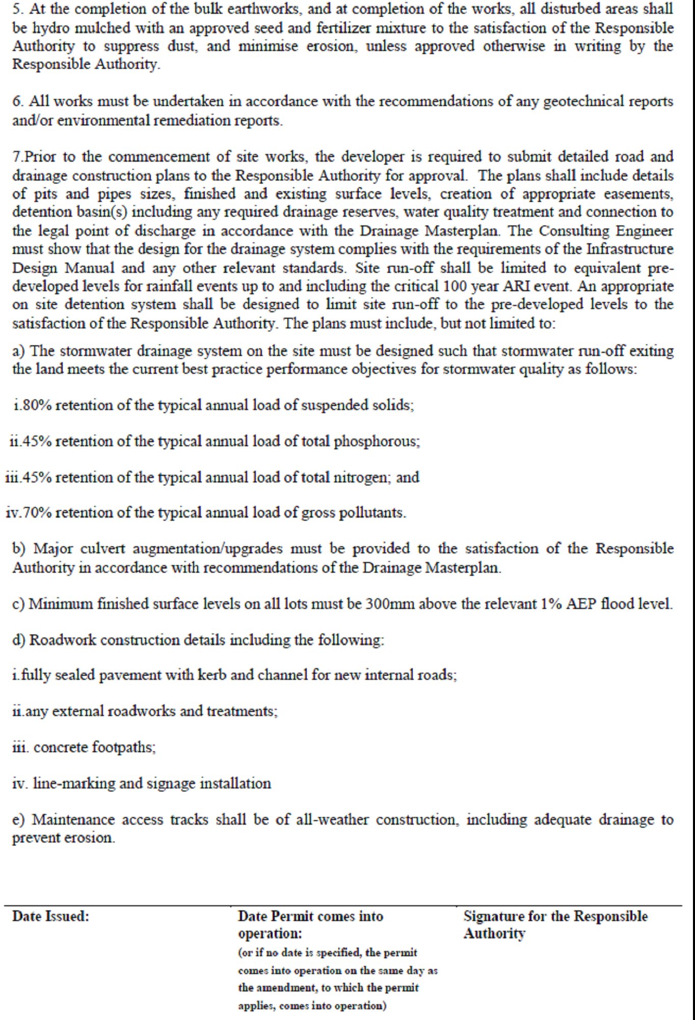
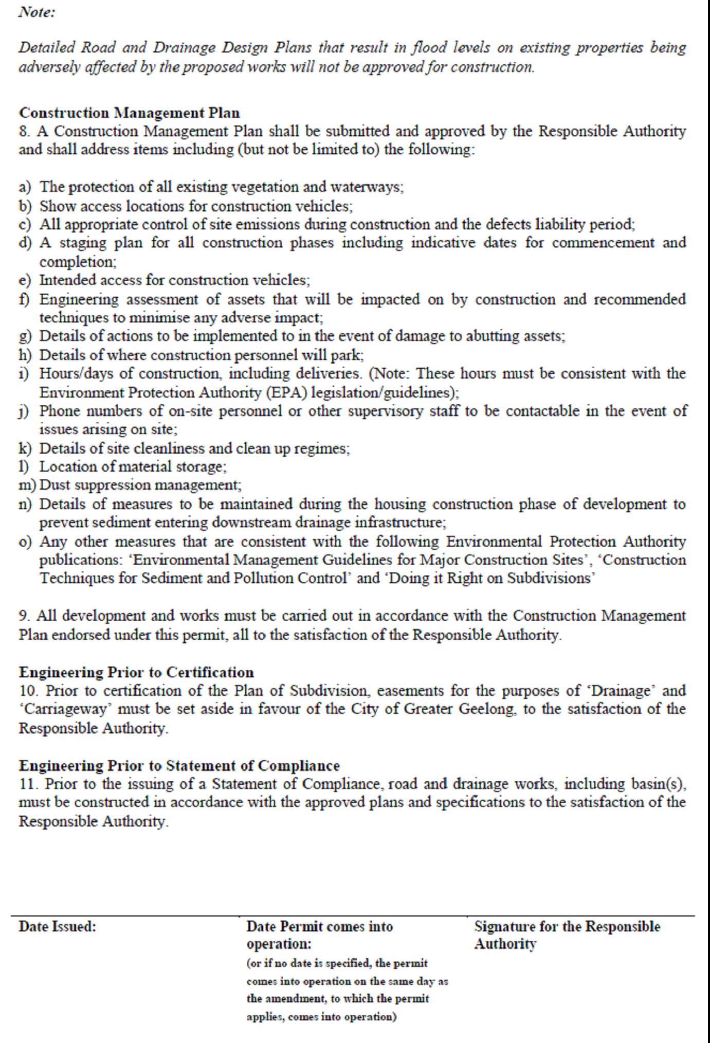
recommend to the Minister for Planning that Planning Permit 1303/2015 be granted pursuant to Section 96G of the Planning and Environment Act 1987 (the Planning Permit is in Attachment 3 of this report); and
submit the adopted Amendment together with the prescribed information to the Minister for Planning requesting approval;
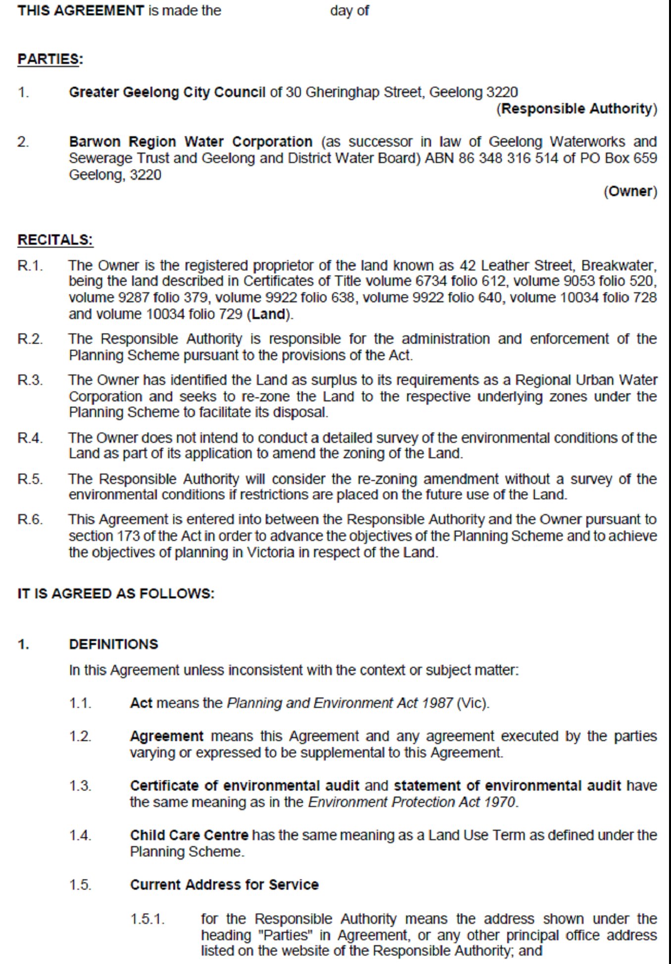
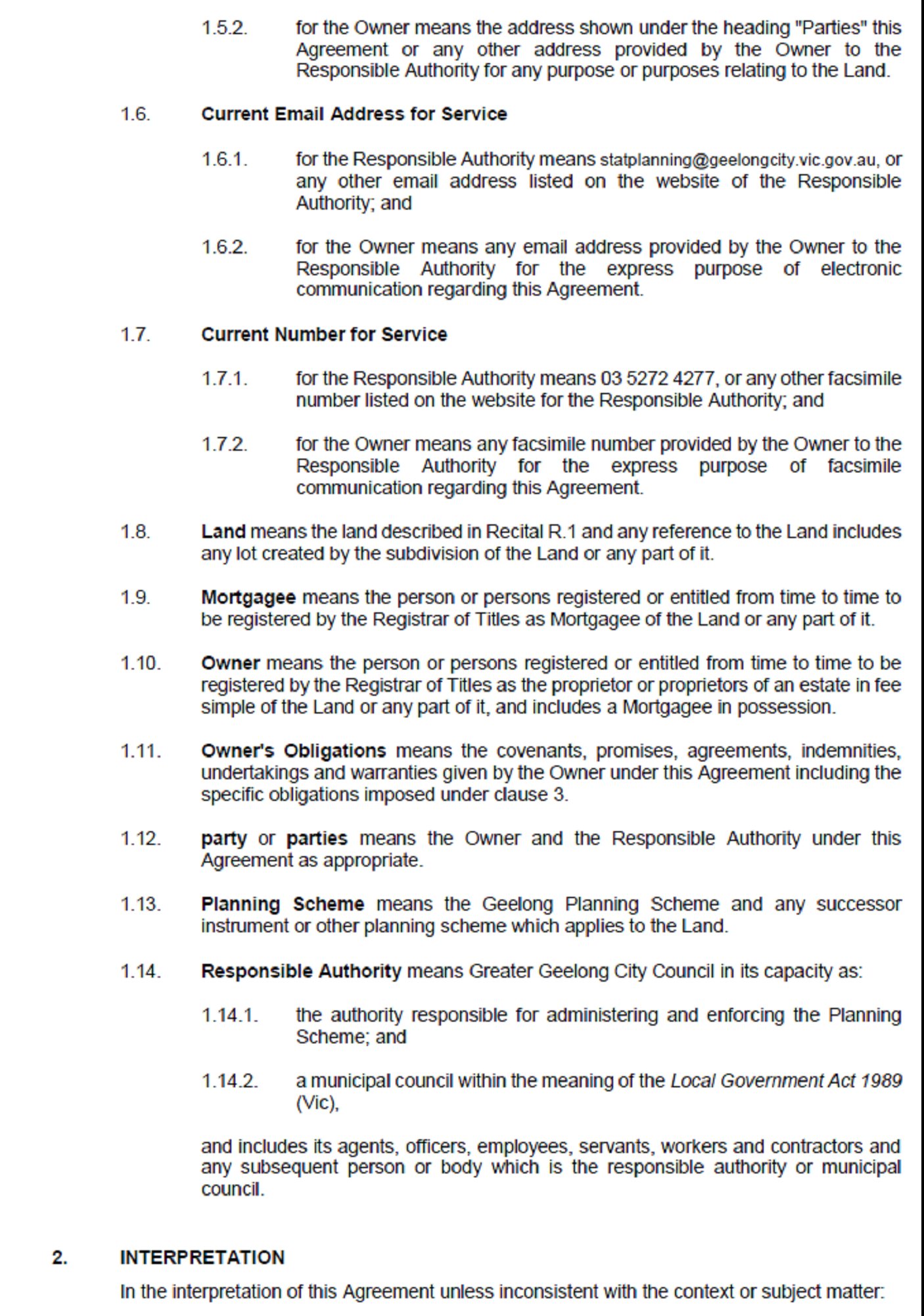
sign and seal the Section 173 Agreement accompanying this Amendment to satisfy Ministerial Direction No. 1 (Attachment 4 is a copy of the Agreement).
Carried.
In October 2015 TGM Group Pty Ltd on behalf of the Barwon Region Water Corporation submitted a combined Planning Scheme Amendment Application in accordance with Section 96A of the Planning and Environment Act 1987 for the rezoning and subdivision of land at 42 Leather Street and 350 Boundary Road, Breakwater.
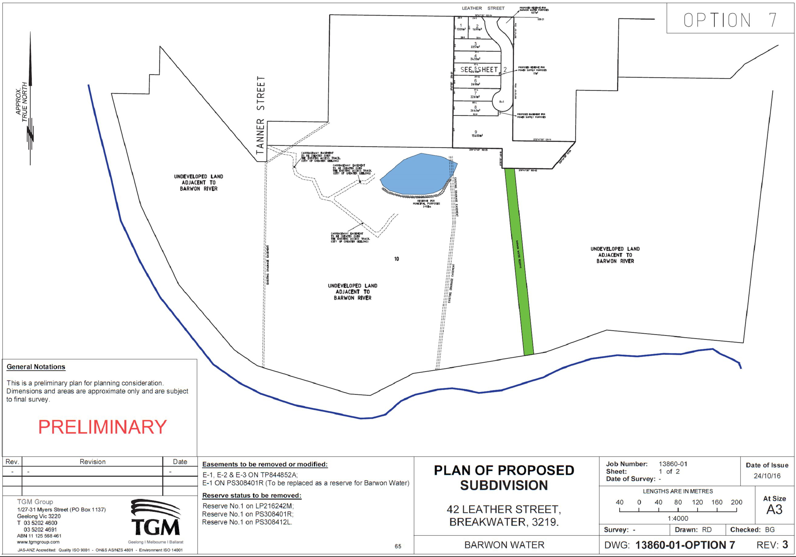
Barwon Water is seeking to reorganise and better utilise the land for asset storage and infrastructure maintenance. This includes subdivision and the creation of 10 new lots with access to Leather Street. Eight of the lots are proposed to be rezoned to the Industrial 1 Zone for sale to the private sector.
Attachment 5 shows the various rezoning components of the proposal and the subdivision plan is shown at Attachment 6.
Independent of the Amendment Barwon Water, in collaboration with the Barwon River Parklands Steering Committee, is progressing the Ovoid Sewer Aqueduct Park project.
On 2 February 2017 Council resolved under delegation to exhibit Amendment C332 to the Greater Geelong Planning Scheme. Public exhibition commenced on 23 March and closed on 24 April 2017. A total of 5 submissions were received including one objecting submission. None of the submissions refuted the strategic basis of the Amendment.
The objector was concerned that the rezoning and development of industrial land at 42 Leather Street would cut off public access and viewing opportunities to the heritage significant ovoid sewer aqueduct structure – shifting amenity impacts (notably noise and dust) to Tanner Street.
Council and Barwon Water officers met with the objector on 9 May 2017 in an attempt to resolve the objectors concerns, however the objector requested to proceed to a Panel Hearing.
Council (under delegation) then considered a report on the submissions and resolved on 23 May 2017 to request the Minister for Planning appoint an Independent Panel to consider the submissions.
Panel hearing and recommendations
A single person Panel conducted the Hearing on 23 June 2017. A Council officer, the applicant and the applicant’s consultant, and the objector attended the hearing. The hearing solely concentrated on the objecting submission.
The objector raised similar themes to its written submission, adding that the Amendment and permit present an opportunity to directly address the potential amenity concerns. The objector requested that Tanner Street be sealed to eliminate potential dust and amenity issues.
Council submitted to the Panel that the concerns of the objector are long-standing and genuine however unrelated to Amendment C332. TGM acting for Barwon Water said there is no logical connection between the Amendment and the ultimate longer term resolution of the establishment of the Aqueduct Park.
In its 12 July 2017 report, the Panel agreed with Council and Barwon Water that the Amendment is strategically justified.
Regarding the objecting submission, the Panel concluded:
The Amendment will prevent direct access to the ovoid sewer aqueduct via the subject land, but this is an appropriate outcome in the context of safety of the site and the planning for the Aqueduct Park.
The proposed alternative access point to the Aqueduct Park from Tanner Street may create future amenity issues for residents, but these issues are more appropriately dealt with in the Aqueduct Park planning process.
No changes are required to the Amendment or planning permit to address the issues raised by the objecting submitter.
A copy of the Panel Report’s Executive Summary is in Attachment 7.
Council officer response
The Panel Report conclusions and recommendation are supported.
Planning Permit 1303-2015
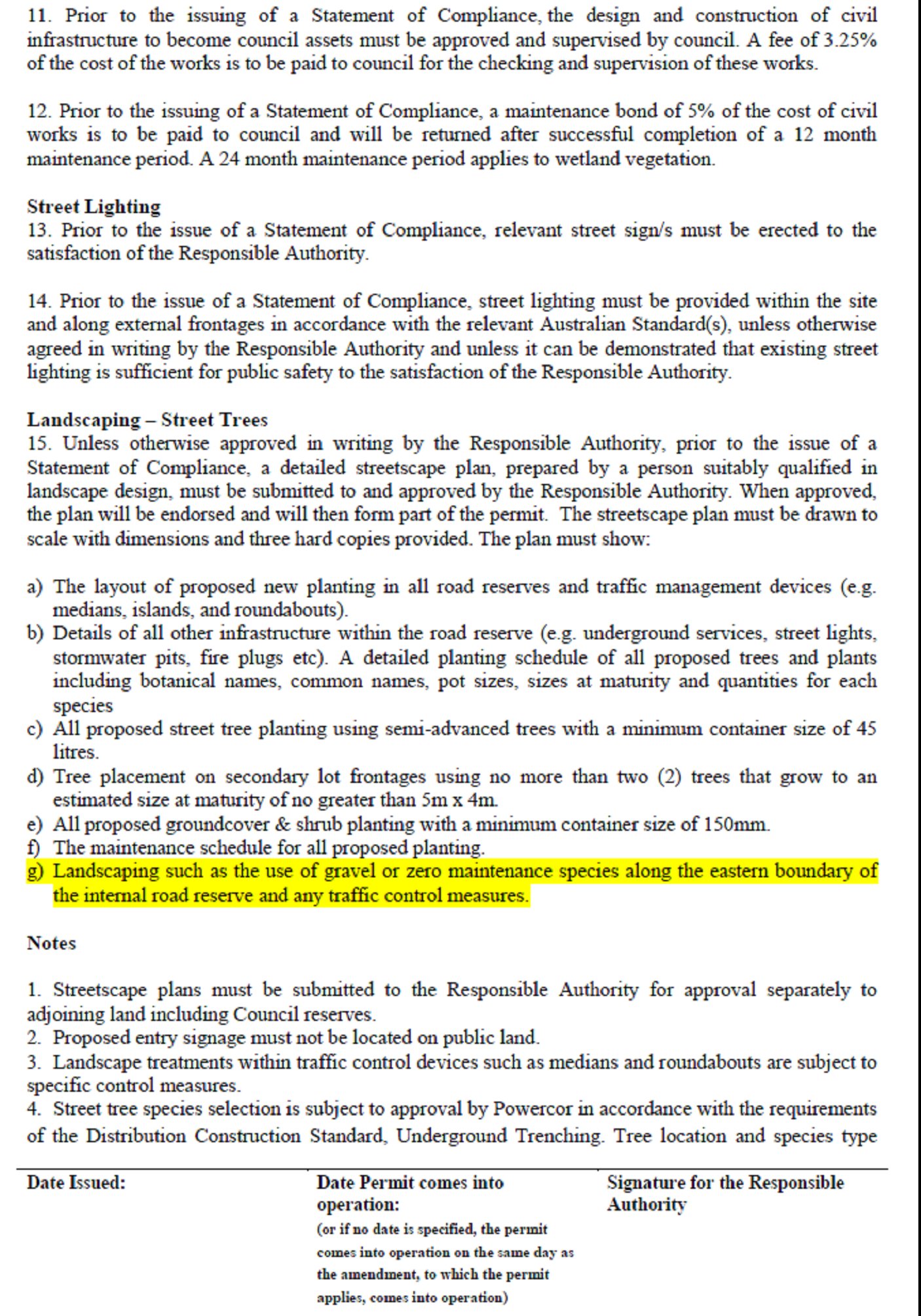
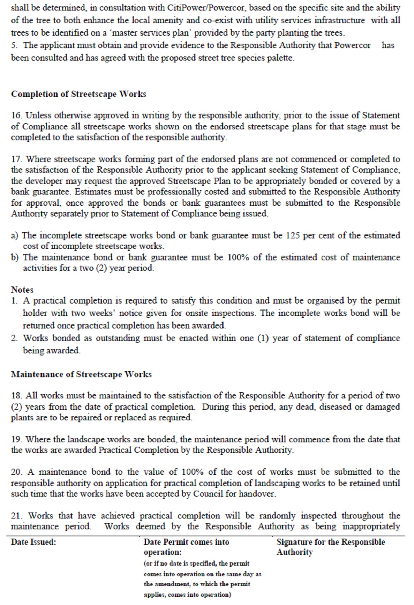
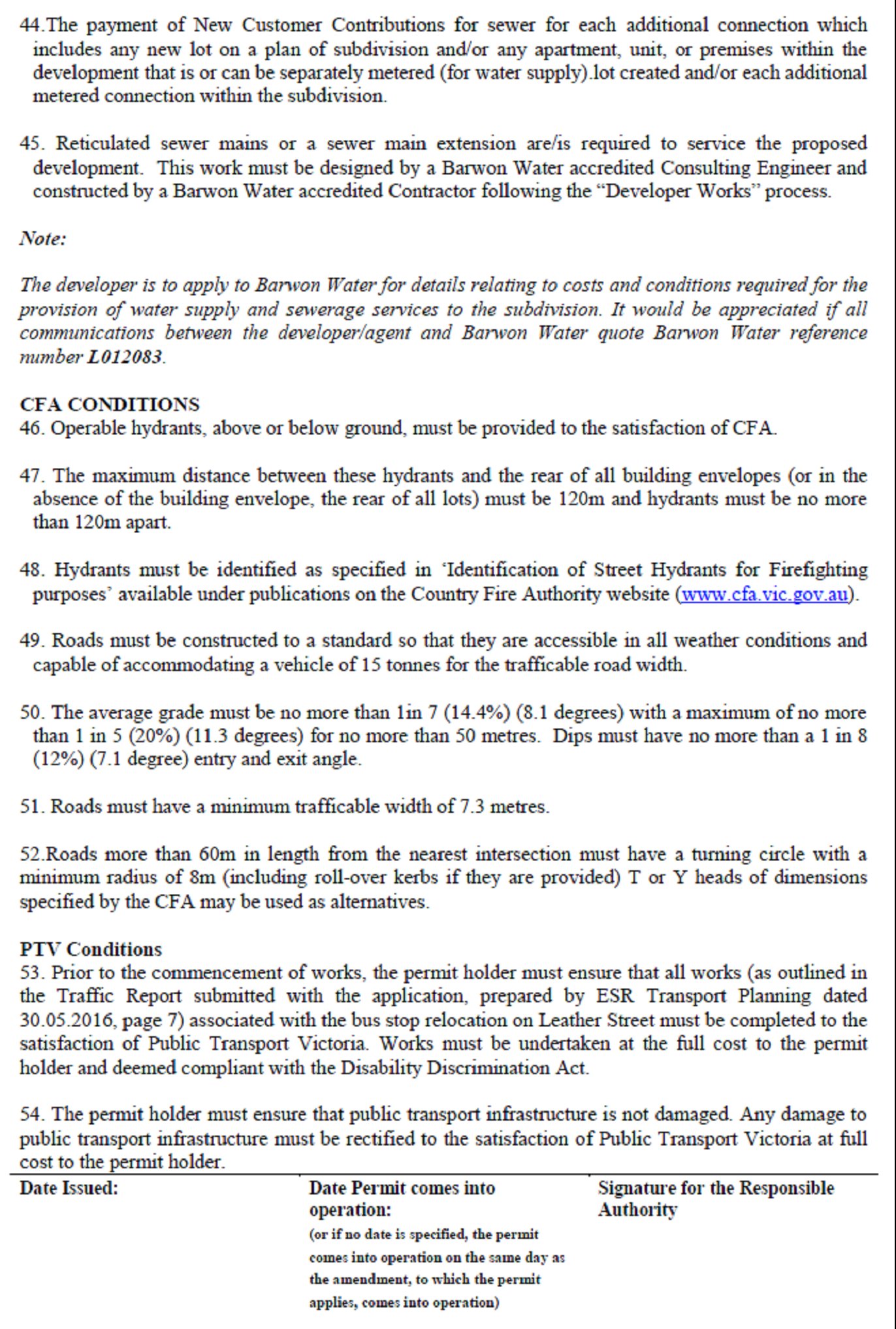
It is noted that a minor change to the exhibited permit in consultation with Barwon Water has been made to accommodate the submission of a landowner in Dyson Court, Breakwater. The change (new condition 15g) relates to the construction and maintenance of the eastern boundary internal road reserve created by the subdivision.
This matter was resolved between Council, Barwon Water and the Dyson Court submitter and was not considered by the Independent Panel.
There are no financial implications.
Council officers have written to the Amendment submitters to advise them of the release of the Panel Report. Submitters will be notified of the final decision of Council and the Minister for Planning.
The rezoning and permit are consistent with a range of State and Local policies as outlined in the Amendment C332 Explanatory Report.
The Amendment supports the ‘Growing our Economy’ strategic direction of City Plan by providing additional industrial land in a serviced estate.
The Amendment aligns with “A Clever and Creative Future” by contributing to a prosperous economy that supports jobs through providing industrial land for development.
No officers involved in this report have any direct or indirect interest In accordance with Section 80C of the Local Government Act.
There are no notable risks associated with implementing the recommendations contained in this report.
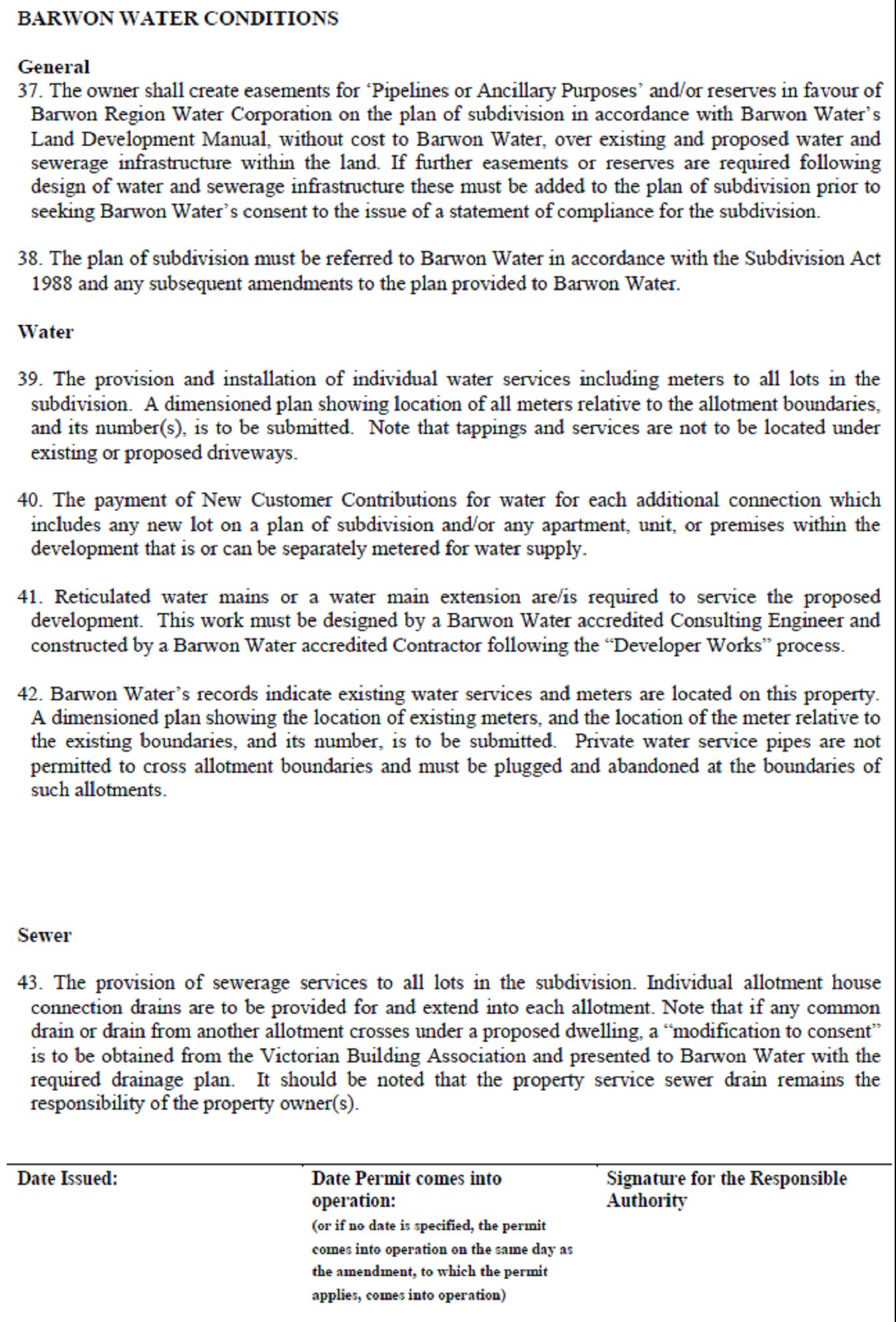
The environmental site investigation did not identify soil contamination or groundwater conditions that would prevent use of the site for commercial/industrial purposes. The assessment makes recommendations to prepare a Soil Management Plan which are conditioned on the permit.
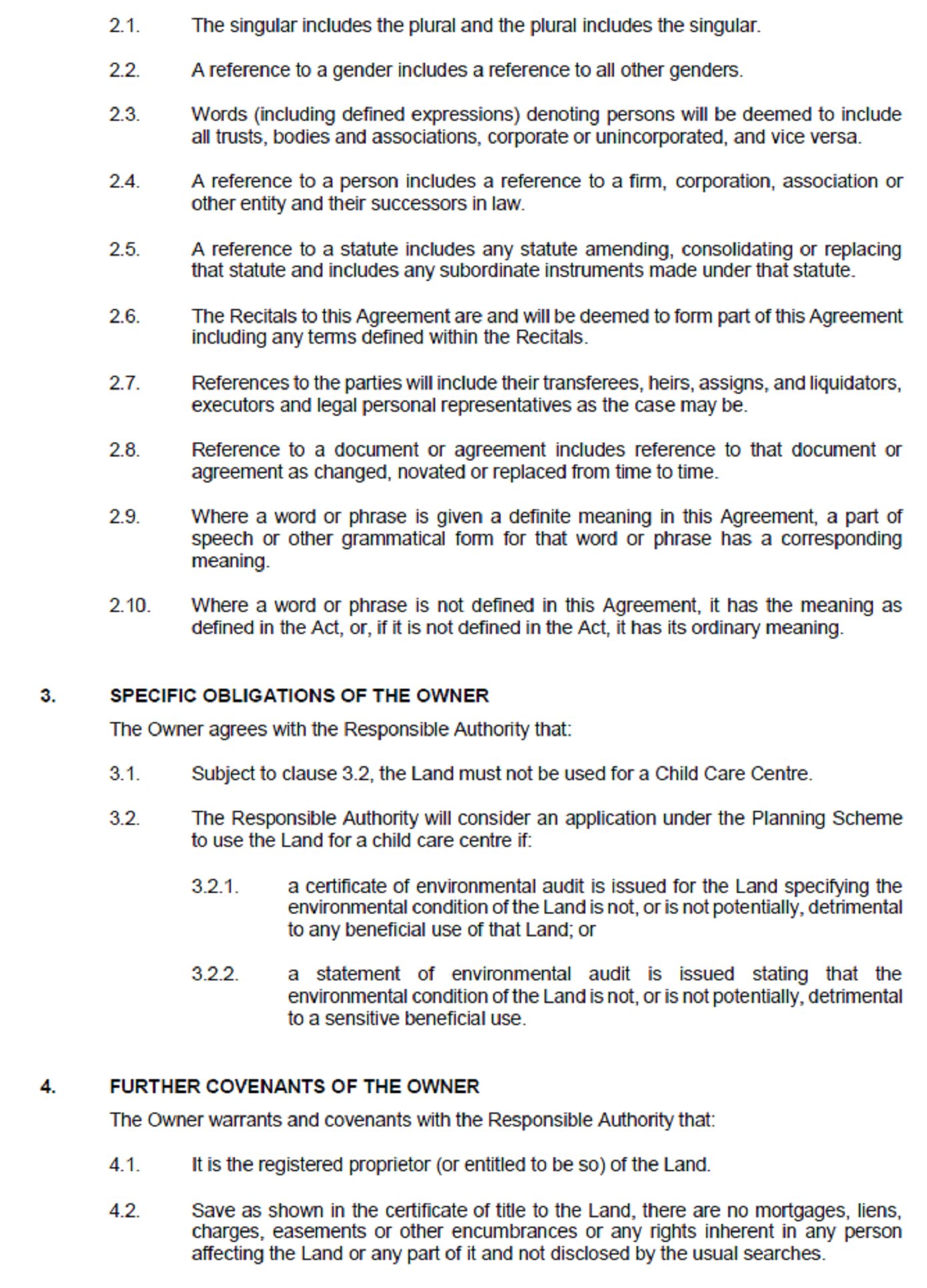
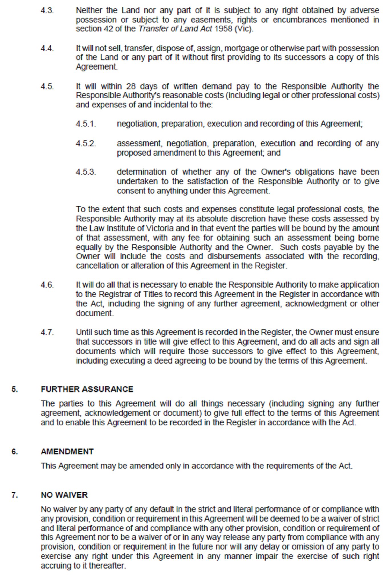
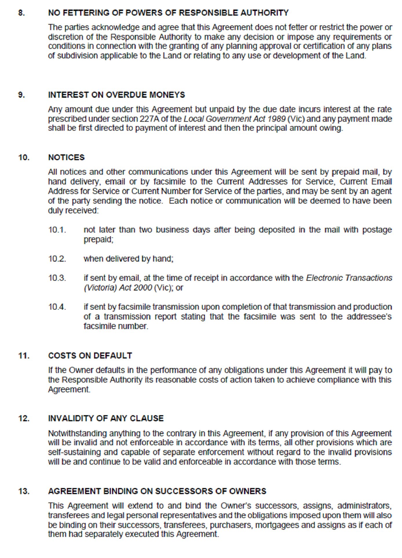
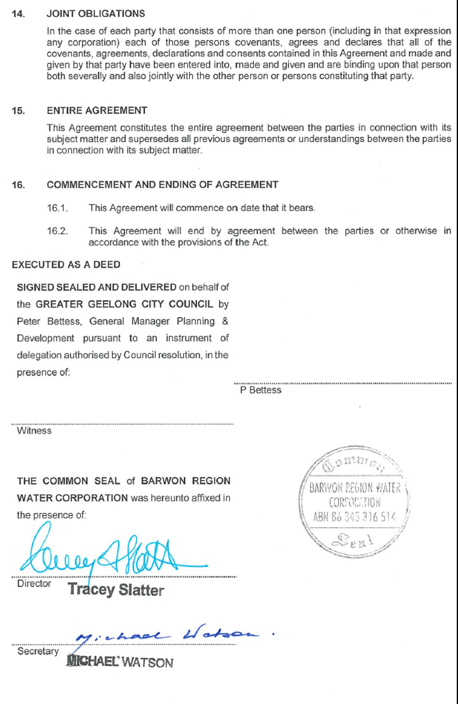
The Amendment is required to consider Ministerial Direction No. 1 Potentially Contaminated Land given the Industrial 1 Zone allows a sensitive use (i.e. Child care centre) to be established (whether or not subject to the grant of a permit). Council and Barwon Water have agreed to enter into a Section 173 Agreement stating the land must not be used as a Child care centre in the absence of a certificate of environmental audit or statement. The Agreement will be signed and registered on title as part of the amendment process, thereby satisfying Ministerial Direction No. 1.
No native vegetation will be removed as a consequence of this application.
A drainage basin is located within the floodplain which shall be the point of discharge for the industrial subdivision. This basin has naturally evolved into a wetland and is in reasonably good health. The TGM Site Stormwater Management Plan adequately addresses stormwater management.
The planning authority for this amendment is the Greater Geelong City Council.
The Greater Geelong Planning Scheme is amended as follows:
Planning Scheme Maps
The Planning Scheme Maps are amended by a total of 2 attached map sheet.
Zoning Maps
Amend Planning Scheme Map Nos. 54 and 67 in the manner shown on the 1 attached map marked “Greater Geelong Planning Scheme, Amendment C332”.
Overlay Maps
Amend Planning Scheme Map Nos. 54DDO and 67DDO in the manner shown on the 1 attached map marked “Greater Geelong Planning Scheme, Amendment C332”.
End of document
Source: |
Planning & Development |
Acting Director: |
Geoff Lawler |
Index Reference: |
Development Contribution Plans - Governance |
As part of Council’s Development Contribution Governance Framework an annual report is presented to Council and the Audit Advisory Committee reporting on the income, expenditure and general performance of Council’s seven (7) Development Contribution Plans over the past 12 months. Attachment 1 to this report outlines the key Audit results.
A robust governance framework has been set up for the management and administration of Development Contribution Plans (DCPs) with a particular emphasis on consistency, accountability, transparency and strategic focus.
Council’s DCPs currently value the required essential infrastructure projects which will service Council’s key growth areas at $485M. Over the next 15 - 20 years there is approximately $433M in projects to be delivered with an income of approximately $410M expected. This represents a current funding DCP project funding gap of approximately $22.6M.
The performance of Council DCPs during the 2016/17 financial year has seen $3.72M in income received (cash) and $10.57M in expenditure ($9.18M in seven works-in-kind projects and $1.39M in thirteen Council initiated projects).
A fall in the index figure of -2.88% for the ‘Victoria Roads and Bridge Construction Index’ and a 0.85% decline in the growth of the ‘Victoria Building Construction Index’ reduced the Development Infrastructure Levy rates and the capital cost of the majority of the DCP projects. The exception being the Jetty Road DCP which uses the CPI and Rawlisons indices.
Development within Council’s major growth area, Armstrong Creek, has continued to show very strong development activity with dwelling activity currently at 58% above original forecasts (2015/16 was 60%). This highlights the importance of continued investment in key DCP projects to meet the needs of this, and other, growing communities around the City of Greater Geelong.
L Gardner moved, P Dorling seconded -
That Council notes the 12 month annual report on Development Contribution Plans and the current funding gap of approximately $22.6M over the next 15-20 years (not including additional costs directly or indirectly linked to urban growth).
Carried.
Geelong is experiencing significant urban growth across the municipality and with this growth comes the need to efficiently deliver key infrastructure to service these new communities.
One of the key funding avenues to deliver this infrastructure is the use of development contributions, or more formally, the use of a Development Contribution Plan (DCP) or in the future an Infrastructure Contribution Plan (ICP).
A DCP is an incorporated document within the planning scheme that allows Council to levy a charge upon a specific area/precinct of development in order to facilitate the delivery of future projects specifically required to service this area/precinct (e.g. traffic lights, recreation reserves, community centres, etc.).
Over the past seven years the City of Greater Geelong has been implementing a detailed governance framework for the administration of DCPs (refer to table 8 Development Contributions Governance Framework in this report). The framework is aimed at ensuring all DCPs are managed and administered in a strategic, consistent, accountable and transparent manner.
A recognised component of the governance framework was the need to provide an annual report to Council detailing the performance of Council’s DCPs over the past financial year.
The report is aimed at summarising the following key features:
Income received
Works in Kind projects delivered by developers
Council expenditure on DCP projects
Land provided to Council (funded by a DCP)
Current funding gaps for DCPs
General growth area development activities
These themes are consistent with the recommendations made by the Standard Development Contribution Advisory Committee responsible for recommending reforms within the State Government’s new development contributions system. This new system was implemented in late 2016.
The above themes are also consistent with the template provided by State Government relating to the proposed annual reporting requirements set out under recent changes to the Planning and Environmental Act (Part 3B, Section 46QD).Refer to tables 1 to 4 of this report.
The indexation performance of Council’s DCP Levies shows this year an average annual decrease of between 0. 85% and 2.85% per annum for Council’s DCP Levies with Jetty Road being the exception with a 2.5% increase. A key factor in this variation is due to DCP levies being indexed via three separate indices for land, civil works and building projects. Land values had declining growth of only 2% across all seven DCPs this year compared to 10.2% last year.
DCP INCOME RECEIVED
Six of the Seven DCPs are generating income from either the Development Infrastructure Levy (DIL) or the Community Infrastructure Levy (CIL), or both.
The total cash income received across the DCPs was $3.4M ($2.4M for DIL and $1M for CIL). The whole of life DCP income balance is $3.86M with Council forward funding eight of the thirteen Projects currently underway. For current income by precinct refer to Table 6.
DCP WORKS IN KIND PROJECTS (EXCLUDING LAND)
Works in kind projects are those projects delivered by developers in exchange for a credit against their developments DCP liability.
A total of seven (7) works in kind projects were delivered either in full or in part during 2016-17; Ongoing native plantings and water quality improvement works along the Armstrong Creek environmental corridor, the Surf Coast Highway and Unity Drive intersection, additions to the shared path network and essential drainage and storm water treatment works. The credited value of these DCP projects was $9.18M.
DCP PROJECTS DELIVERED BY COUNCIL
Council has thirteen ongoing DCP projects in 2016/17; with rehabilitation works on Griggs Creek, design work for the Portarlington Road intersection north-south connector road into the Jetty Road growth area and design of major wetlands for the Horseshoe bend precinct. The credited value of these DCP projects was $1.39M.
A detailed breakdown is included in tables 2 and 4 ‘ Ministerial Reporting Requirements’.
DCP FUNDED LAND
During 2016/17 nine land projects were undertaken within Council’s DCP areas. Eight being delivered by Council and the other a developers works-in-kind contribution for a wetlands/retarding basin.
The Council projects included land purchases for the future transit corridor and drainage in the Town Centre Precinct and some legal and administration costs associated with land acquisition projects for the wetlands required for the Horseshoe Bend Precinct and intersections in Lara and Curlewis (Jetty Road).
DCP DELIVERY STATUS
The current delivery status of all seven of Council’s DCPs (whole of life) shows approximately $51.8M or 11% of projects have been completed. This is behind the initial forecast of $79M for 2016 by 34% due mainly to unavailability of land for projects, staged delivery of some infrastructure, accelerated housing growth and no developer activity in the North East Industrial Precinct.
DCP FUNDING GAPS
A critical component of managing Council’s DCPs is a clear understanding of the $22.6M funding gap associated with delivering Council’s legal obligations under the DCPs.
$15.5M of the gap comprises of Council’s known commitment to co-fund key projects including land acquisition and intersection construction costs for Burvilles Road, funding for shared use stadiums in new schools in Armstrong Creek and Lara, Griggs Creek rehabilitation works and contributions towards the future updated Drysdale library.
$6.4M of the gap consists of a partial funding commitment from the Department of Education for the shared use stadiums in schools.
The long term impact of the Community Infrastructure levy cap has been reduced to $1.6M. The previous $900, cap in place since 2003, was increased to $1150/dwelling by the State Government in October 2016 and adopted by the City of Greater Geelong on the 1st January 2017.
For a detailed breakdown of Council’s current liabilities and gap funding refer Table 5 - Development Contribution Plans - Whole of Life Remaining Liability, Income and Funding Gap. Table 9 shows the comparison of the development contributions status from July 2016 to July 2017.
The above funding gaps don’t include additional costs associated with:
$7.3M of funding allocated in the DCPs to the future Marshall and Western Employment Precincts which is at risk funding until contribution plans are in place;
Increases in scope for DCP projects (e.g.: increasing the size, standard, etc. for community centres, pavilions or recreation facilities and playing fields);
Financing costs associated with forward funding DCP projects in advance of DCP income being available;
Increased cost of land acquisition program due to legal/administration costs, increased compensation claims and land value escalation;
The cost of public open space land. Public open space contribution is a separate levy, but has a similar exposure to large land compensation; and
Unfunded projects not linked to DCPs but are essential to the long term infrastructure/service needs of the community (e.g.: Armstrong Creek’s regional library, aquatic centre, multi-purpose stadium and art and cultural facility). It is estimated that on their own these unfunded projects total close to $80M.
DCP GROWTH AREAS – DEVELOPMENT ACTIVITY
Another important aspect of DCP management is understanding the development activity that supports the generation of income for the DCPs and also triggers the need for DCP projects that service these new communities.
Table 7 – Armstrong Creek Annual Dwelling Activity by Suburb (compared to forecast) illustrates the development activity within the City’s major growth area, Armstrong Creek. The table highlights the need for strong financial planning and early infrastructure investment to ensure Council delivers DCP projects as required under the DCP (e.g. facilities like community and recreation facilities, purchasing land to facilitate other projects and in some case drainage projects required to unlock/service fragmented development fronts).
The table shows the Armstrong Creek growth area (suburbs of Armstrong Creek and Mt Duneed) is delivering dwellings at 58% above that forecast for the 2011/12 to 2016/17 period (i.e.: projected dwellings of 1,929 versus actual dwellings of 3,052). This is a total of 1123 additional dwellings delivered over the six year period.
The Jetty Road growth area has seen continued strong subdivision activity during 2016/17 with 177 lots produced, close to double the annual projection of the growth area approximately 100 lots per annum. The Lara West Growth Area has only recently commenced construction.
Development Contributions Plan General Progress Report
A Development Contributions Plan (DCP) is a mechanism used to fund infrastructure requirements in new developments and apply a levy to stakeholders for contributions as allowed for under the Planning and Environment Act (1987).
Development contributions represent a cash contribution or works in kind credit that is applied across all developable land to ensure that all developers are funding the required infrastructure to service these large development areas.
A DCP specifies the type of infrastructure to be provided, shows cost and apportionment and allows Council to collect development contribution levies.
There are two types of levies, Development Infrastructure Levy which collects funds for Intersections, drainage, community and recreation/sporting projects calculated on a per hectare basis and a Community Infrastructure levy which will fund Community Sports Pavilions (rate capped at $1,150 per dwelling).
The City of Greater Geelong currently has seven active Development Contribution Plans (DCPs). These seven DCPs total $485 million in total project value to the City over their expected 20 year life span.
DCP01 Armstrong Creek North East Industrial Precinct
On 3 June 2010 the North East Industrial Precinct Development Contributions Plan was incorporated into the Greater Geelong Planning Scheme. Development is yet to commence in this precinct.
DCP02 Jetty Road Urban Growth Area Stage 1
On 23 February 2012 the Jetty Road Urban Growth Development Contributions Plan was incorporated into the Greater Geelong Planning Scheme.
The Jetty Road stage 1 development is significantly advanced with Baywater, Bayview, Coriyule and Curlewis Parks (South) Estates underway and with Bellaview and Curlewis Parks (North) Estates complete. Council has collected Community Infrastructure Levies for 1,019 dwellings in total with 169 lots during 2016/17.
Council is undertaking detailed design of the Portarlington Road and Tivoli Drive Intersection which will be a crucial link for the residents to the Jetty Road Growth Area and Clifton Springs. Griggs Creek Rehabilitation and Revegetation. Works are well advanced with exotic tree removal and fencing complete along the majority of both sides of the Creek. The land acquisition process has commenced for land to accommodate the new north-south collector road.
DCP03 Armstrong Creek East Precinct
On 12 July 2012 the Armstrong Creek East Precinct Development Contributions Plan was incorporated into the Greater Geelong Planning Scheme.
The first large commercial centre in Armstrong Creek on Barwon Heads Road is currently under construction. Development is progressing on multiple fronts with Warralily and Promenade Estates near Barwon Heads Road and Coast Estate on the Surf Coast Hwy. Works in kind infrastructure contribution including award winning Armstrong Creek drainage and waterway improvement works, intersections along W Boulevard at Surf Coast Highway and Horseshoe Bend Road and works are beginning on the sports ground. Council have begun work on the community pavilion facilities located in the sports ground adjoining the commercial and education centres. Horizon Cove are nearing completion of their Estate and Armstrong Waters are also progressing development to the west of Barwon Heads Road.
Council has collected Community Infrastructure Levies for 2,141 dwellings in total, 383 lots during 2016/17.
DCP04 Armstrong Creek West Precinct
On 7 March 2013 the Armstrong Creek West Precinct Development Contributions Plan was incorporated into the Greater Geelong Planning Scheme.
Armstrong @ Mt Duneed has continued developing west of Surf Coast Highway contributing to the intersection at Surf Coast Highway and Unity Drive, a wetland retarding basin and shared path.
Council has collected Community Infrastructure Levies for 911 dwellings in total, 320 lots during 2016/17.
Horseshoe Bend Precinct DCP05
On 27 November 2014 the Horseshoe Bend Precinct Development Contributions Plan was incorporated into the Greater Geelong Planning Scheme.
Watermark and Charlemont Rise Estates have released their initial stages with works in kind contributions towards stormwater infrastructure and shared paths. Ashbury Estate are set to release their first stages later this year. Council has received Community Infrastructure Levies for 141 dwellings in total.
Armstrong Creek Town Centre Precinct DCP06
Armstrong Creek Town Centre Development Contributions Plan was approved by the Minister for Planning on 23 October 2014. The DCP includes eight intersections, shared paths, drainage works and contribution towards the construction of a Regional Library. Development is yet to commence in this precinct.
Lara West Urban Growth Area DCP07
On 17 July 2014 the Lara West Development Contributions Plan was incorporated into the Greater Geelong Planning Scheme. Manzeene Village has commenced development to the north of Patullous Rd. Council has received Community Infrastructure Levies for 28 lots during 2016/17 with 3.4ha developed. The land acquisition process has commenced to provide land for the upgrade of the intersection of Elcho, Patullos and O’Hallorans Roads.
One of the main features of the development contributions system is to ensure that new development funds essential infrastructure required to service these new communities.
The system is also setup to ensure these new development don’t create an unfair burden on the existing community. Therefore it is important to recognise the $22.6M funding gap in DCP projects and ensure these funds are included in Council long-term financial plan and various funding strategies are put in place to secure these funds when required with minimal impact to the existing community.
A summary of the report has been included in the draft City of Greater Geelong 2016-17 Annual Report.
The report has been prepared to reflect Council’s obligations under the Victorian Local Government Act (1989) and Planning and Environment Act (1987).
The report supports the Clever and Creative future of our City Plan, in particular our aspiration of ‘sustainable development that supports population growth and protects the natural environment’.
No officers involved in preparing this report have a conflict of interest in the matters contained in it.
As part of the DCP Governance Framework a detailed risk assessment has been undertaken to assist in the management of development contribution within Council. Key risks have been elevated to Council’s corporate risk register, while lower risks have been included as part of the DCP administration processes/procedures.
Some of these major corporate risks include failure to deliver infrastructure projects; over expenditure on DCP projects; and early claims for land purchase/compensation.
There are no significant environmental impacts as a result of the management and administration of Council DCP system.
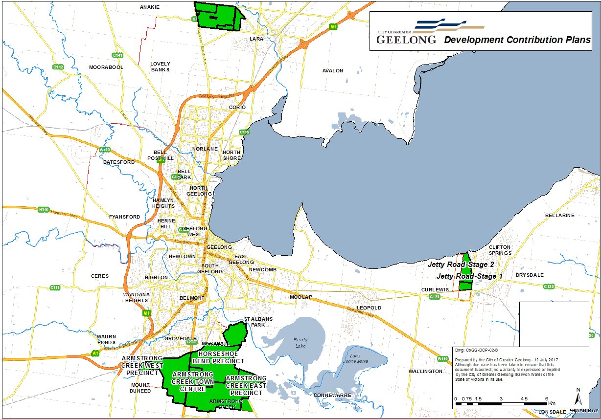
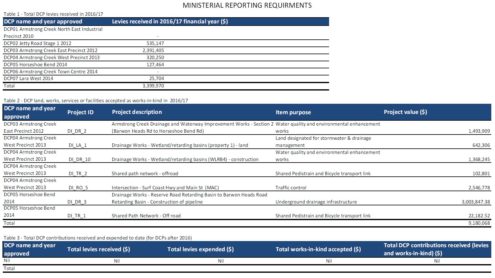
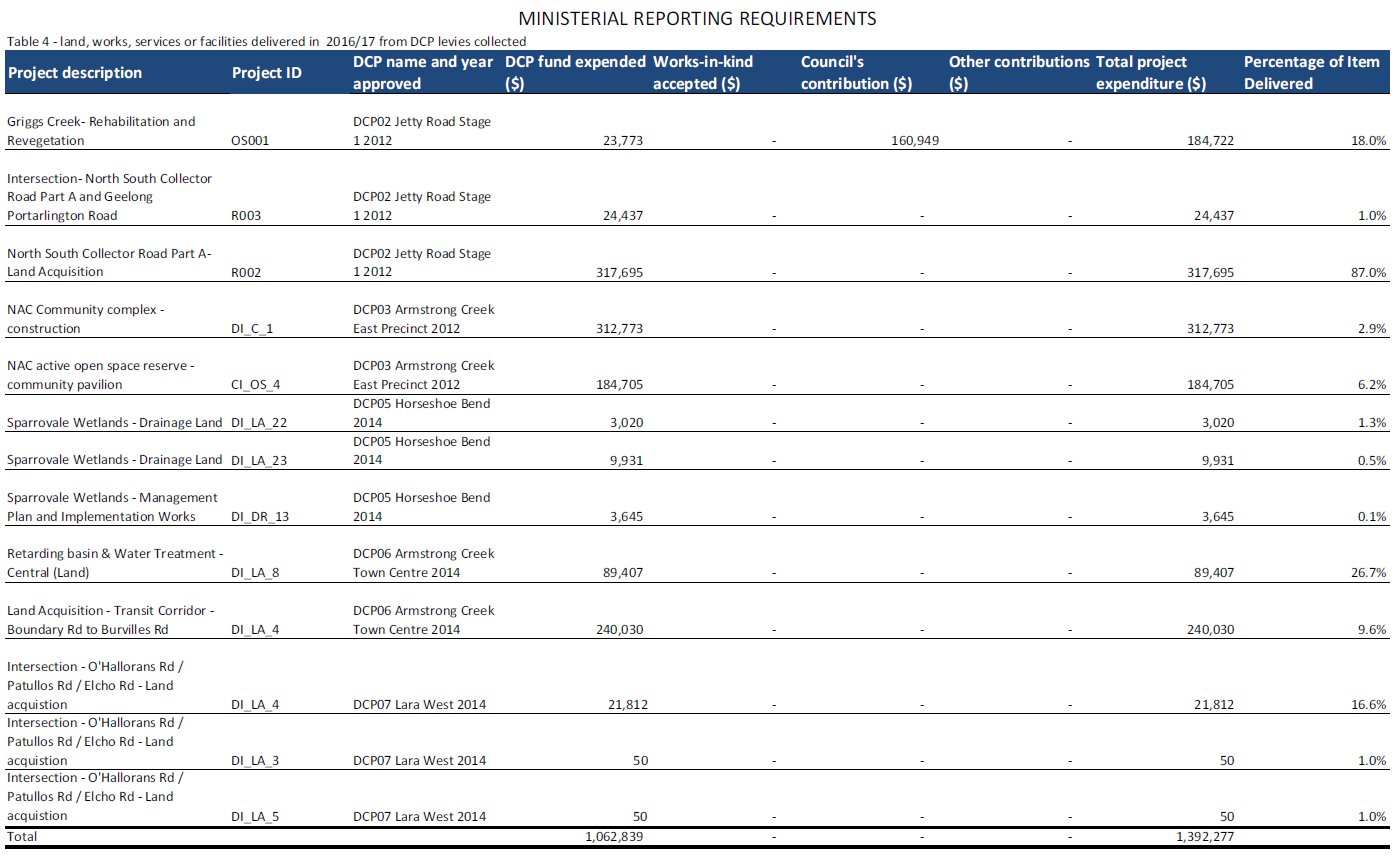
As at 30 June 2017
Development Contribution Plans |
Current Remaining Liability |
Remaining Income |
Funding Gap* |
% of Liability the Gap Represent |
DCP01 Armstrong Creek North East Industrail Precinct |
13,433,886 |
13,433,886 |
- |
0.0% |
DCP02 Jetty Road Stage 1 |
22,637,383 |
16,599,399 |
6,037,984 |
26.7% |
DCP03 Armstrong Creek East Precinct |
101,675,377 |
98,355,206 |
3,320,171 |
3.3% |
DCP04 Armstrong Creek West Precinct |
90,447,229 |
86,223,681 |
4,223,548 |
4.7% |
DCP05 Horseshoe Bend |
139,378,571 |
135,780,707 |
3,597,864 |
2.6% |
DCP06 Armstrong Creek Town Centre |
22,361,845 |
20,625,372 |
1,736,473 |
7.8% |
DCP07 Lara West |
43,574,018 |
39,821,317 |
3,752,701 |
8.6% |
TOTAL |
433,508,309 |
410,839,568 |
22,668,741 |
5.2% |
*Gap funding includes Community Infrastructure Levy shortfall (impacted by non-indexed $1,500/dwelling), CoGG contribution and DET contribution.
As at 30 June 2017
Development Contributions Plan |
Current Income $ |
Current Projects Complete $ |
% Total DCP Projects Completed |
DCP01 Armstrong Creek North East Industrial Precinct |
- |
- |
0% |
DCP02 Jetty Road Stage 1 |
431,419 |
6,475,098 |
22% |
DCP03 Armstrong Creek East Precinct |
2,611,290 |
24,563,425 |
19% |
DCP04 Armstrong Creek West Precinct |
1,124,128 |
17,456,515 |
16% |
DCP05 Horseshoe Bend |
-9,671 |
2,967,335 |
2% |
DCP06 Armstrong Creek Town Centre |
-246,031 |
331,472 |
1% |
DCP07 Lara West |
-24,254 |
23,823 |
0% |
TOTAL |
3,866,881 |
51,817,669 |
11% |
As at 30 June 2017
Suburb |
Projected or Actual Dwellings # |
Dwellings per Year |
||||||
11/12 |
12/13 |
13/14 |
14/15 |
15/16 |
16/17 |
TOTALS |
||
Armstrong Creek |
Projected |
40 |
180 |
345 |
346 |
350 |
360 |
1,621 |
|
Actual |
128 |
325 |
449 |
406 |
450 |
383 |
2,141 |
Mount Duneed |
Projected |
1 |
1 |
0 |
106 |
100 |
100 |
308 |
|
Actual |
0 |
0 |
71 |
224 |
296 |
320 |
911 |
TOTALS |
Projected |
41 |
181 |
345 |
452 |
450 |
460 |
1,929 |
|
Actual |
128 |
325 |
520 |
630 |
746 |
703 |
3,052 |
Difference |
|
87 |
144 |
175 |
178 |
296 |
243 |
1123 |
Cumulative Difference |
|
87 |
231 |
406 |
584 |
880 |
1123 |
- |
Percentage Increase |
|
212% |
80% |
51% |
39% |
66% |
53% |
58% |
# Based on City of Greater Geelong Population Forecast (forecast.id) and actual figures based on annual collection of community infrastructure levy ($1,500 / dwelling)
Note – Development has only recently commenced in the suburb of Charlemont, and yet to commence in Marshall.
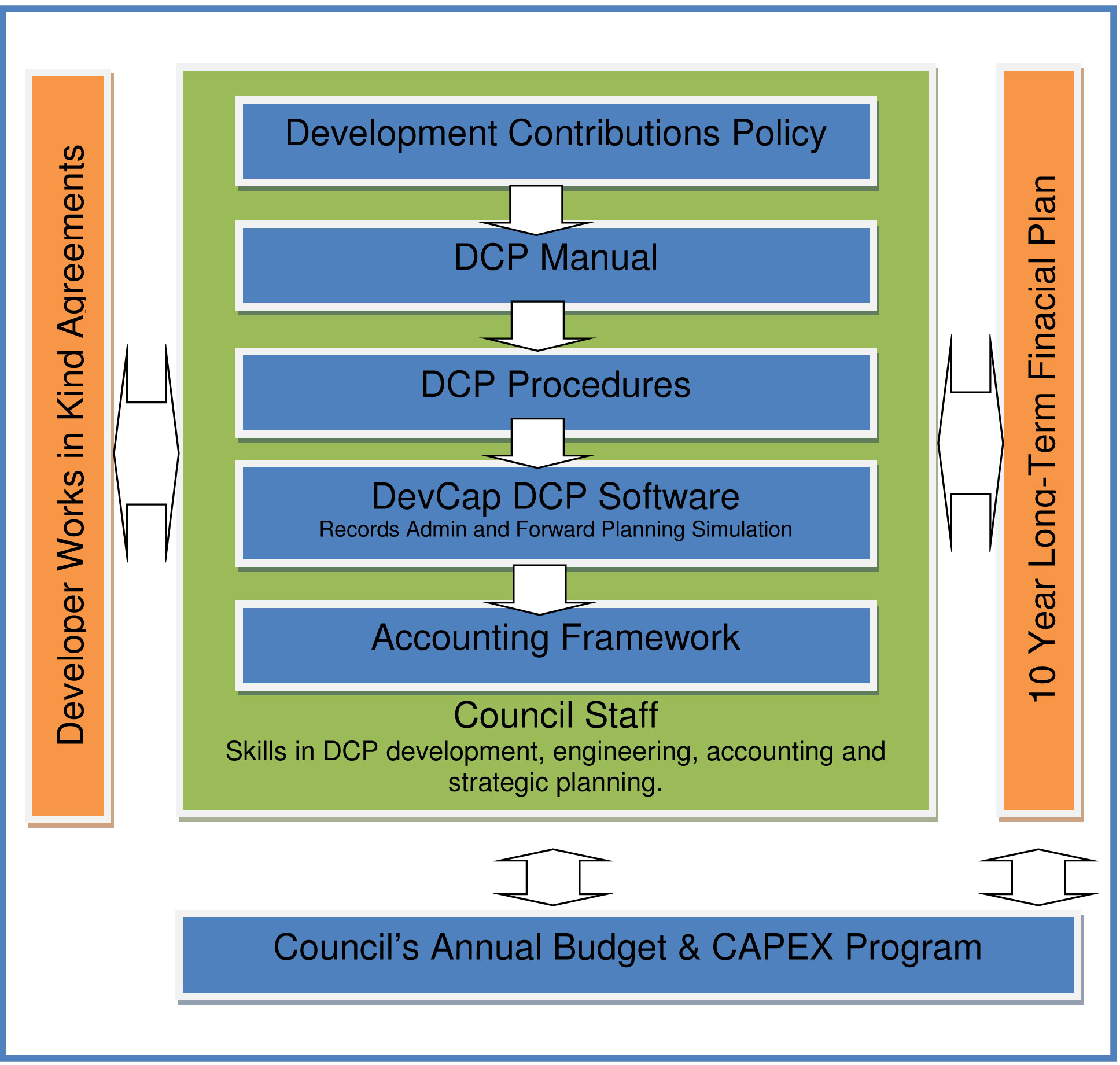
Source: |
Finance & Strategy – Property & Procurement |
Director: |
Joanne Moloney |
Index Reference: |
Land Sales |
The purpose of this report is to recommend that Council proceed to the sale of the Old Geelong Gaol (the Gaol) at 220 Myers Street, Geelong by Expressions of Interest (EOI) taking into consideration the submission received by the National Trust Australia (Victoria) (NTAV) in relation to the proposed sale and the site’s heritage value and prominence.
At the Council Meeting of 26 April 2017, Council resolved to give notice of intention to sell the Old Geelong Gaol. As required notice under s189 of the Local Government Act 1989 (the Act) was published in the Geelong Advertiser and the Geelong Independent on 5 and 6 May 2017.
It was proposed the sale be undertaken by the EOI process (Attachment 2) which would include upholding the heritage aspects in any development proposal, the participation by the developer in a master plan for the precinct and continued public access to the cell block.
Only one written submission was received under the s189 process. The submission from the NTAV progressed to a public hearing on 8 August 2017 of the Submissions Review Panel (the Panel) as per the requirements of the Act.
The Panel convened, on 8 August 2017 to hear the submission from the NTAV on the potential sale of the Old Geelong Goal as referred to in the Minutes of the meeting (Attachment 1).
NTAV’s submission noted that the opportunity exists to continue public access to the Gaol and stated an interest in partnering with the future owner of the Gaol to provide public programming and interpretation of its heritage significance. This was noted and discussed by the Panel along with the recommendation that there is potential opportunity for positive heritage and development outcomes that is comparable in other decommissioned Goals within Victoria.
It was further noted that the NTAV submission suggested that a feasibility study be undertaken which was rejected by the Panel. The Panel were of the opinion that, through the EOI process, potential purchasers would put forward use and/or development opportunities for the site. The Panel convened after considering the issues raised by NTAV and agreed to recommend to Council that the sale of the Old Geelong Goal should proceed by Expressions of Interest.
L Gardner moved, P Dorling seconded -
That Council endorses the sale of the Old Geelong Gaol by Expressions of Interest (Attachment 2).
Carried.
Submissions Review Panel
Hearing of Submissions – Proposed Sale of the Old Geelong Gaol
Tuesday 8 August 2017
5.30pm City Hall – Council Chamber
Attendees
Panel Members: Dr Kathy Alexander (Chair), Laurinda Gardner and Peter Dorling
Management: Joanne Moloney (Director Finance & Strategy) and Travis Kirwood (Manager Property & Procurement)
Apologies: Nil
NO |
ITEM |
1. |
Welcome: Kathy Alexander welcomed those attending. |
2. |
Conflicts of Interest: Nil |
3. |
Item: Background 26 April 2017 Council resolved to give notice of intention to sell the Old Geelong Gaol by Expressions of Interest (EOI). Notice under s189 of the Local Government Act 1989 was published on 5 and 6 May 2017 in both the Geelong Independent and the Geelong Advertiser. The submissions period closed 6 June 2017. One submission was received from the National Trust of Australia (Victoria) (NTAV). Following the Panel hearing, the Panel will meet to discuss the submission and provide a recommendation to be put to Council. |
4. |
Item: Hearing of Submission from NTAV. Presented by Ms Kristin Stegley OAM and Mr Simon Ambrose Summary of the submission:
|
7. |
Item: Hearing concluded at 6:03pm. |
8. |
Item: The Panel convened to consider the submission and resolved to recommend to Council that the sale of the Old Geelong Gaol proceed. |
9. |
Item: The meeting of the Panel concluded at 6:21pm. |
Prepare an Expression of Interest (EOI) document for the market based on the Council’s standard EOI format providing information about the property and the process.
Advertise and market through an appointed estate agent.
Information which will be sought in the EOI process is inclusive of:
price;
commitment to and details of a proposed maintenance program for the site;
details of how public access to the cell block will be provided;
a broad concept design (master plan) for use of the site;
the experience and capability of the purchaser in development of heritage sensitive sites; and
any specific contract conditions requested.
Council Requirements are inclusive of:
that the Cell block remains open to the public;
that full implementation of a maintenance program is implemented;.
that the purchaser must participate in the development of a master plan for the precinct; and
that the heritage of the site is a key consideration in any development proposals.
EOI’s responses will be assessed by a panel to be appointed.
The assessment panel will make a recommendation to Council of a preferred purchaser. The EOI assessment process may be a single or two stage process depending on the number of responses received and the level of information provided.
The evaluation criteria will be premised on:
the respondents response to Council requirements;
the experience and capability of the respondent in development of heritage sensitive sites;
the proposed concept plan for usage of the site; and
the proposed purchase price.
The EOI process outlined above is a guide to Council’s requirements and the conduct of the process. Council may vary the terms and conditions of the EOI depending upon responses.
The Minister for Planning, in June 2013, advised Council that the interest free Government loan of $360,000 taken out by the Council in 1996 for the purchase of the Gaol shall be repayable in full upon the sale of the asset.
However, the Minister also advised that upon repayment of the loan, consideration will be given to establishing a Geelong Heritage Restoration Fund for the conservation of heritage places in the City of Greater Geelong.
All persons, including tenants, have been provided the opportunity to make a submission following the giving of notice of intention to sell the property under s189 of the Local Government Act. Anyone who made a submission has had the opportunity to be heard.
In addition, in 2015 Council publically invited proposals for the future use of the Gaol which allowed for interested parties to have an opportunity to workshop proposals prior to a further report to Council.
As per s189 of the Local Government Act 1989 (the Act), Council has complied with its obligation to give notice of its intention to sell the Gaol. Council has also complied with its obligation under the Act to receive and hear submissions in relation to the proposed sale and provide a further report to Council prior to placing the property on the market.
The Council is also required to obtain a valuation within six months of the date of sale.
No officers or contractors involved in the preparation of this report have a direct or indirect interest in matters to which this report relates.
Ongoing ownership and arm’s length management of the property by the Council in the absence of a commitment to fund maintenance and improvements represents an unacceptable risk.
Should the Council continue to own the property, it will be accepting risk relating to the use of buildings for which they were not designed along with growing and unavoidable cost of maintenance and capital improvements.
The risks associated with the sale of the complex can be managed by obtaining appropriate advice and following normal management procedures.
While no environmental site assessment has been implemented, there are no known contamination issues on the site.
Source: |
Community Life - Social Planning and Investment |
Director: |
Linda Quinn |
Index Reference: |
Social Planning and Investment |
To adopt a revised set of Social Infrastructure Plan principles and endorse an approach for review of the existing Social Infrastructure Plan 2014 - 31.
Council adopted the Social Infrastructure Plan Executive Summary in October 2015 although the entire Social Infrastructure Plan 2014 - 31 was not adopted or endorsed.
In June 2017 Council resolved to release publicly the entire Social Infrastructure Plan 2014 - 31 and this occurred on 30 June 2017.
The existing Social Infrastructure Plan 2014 - 31 (SIP) has three key components:
Planning Policy Framework – that outlines the principles and policy parameters.
Social Infrastructure Requirements – that identifies the community need.
Social Infrastructure Projects – the social infrastructure planned to be delivered.
The SIP review will occur in two parts. The ‘social infrastructure planning framework’ (Part A) will be reviewed between September 2017 and March 2018, followed by a review of the ‘social infrastructure requirements and projects’ (Part B & C) post March 2018.
Key elements of the Part A review process are:
The community will be ‘involved’ in the engagement process consistent with the recently adopted City of Greater Geelong Community Engagement Framework.
The SIP review will be underpinned by five draft principles outlined in the attachment.
The first phase of consultation occurs September to October 2017. This will focus on further research, data gathering and analysis. This phase will also include a process of seeking preliminary feedback from the community about the current SIP.
The second phase of consultation is between November 2017 and March 2018. This involves the community through a range of online and face-to-face forums. It is designed to obtain greater community input into the planning policy framework.
A progress report will be provided to Council in March 2018. This will update Council on the research findings, community engagement outcomes, future policy and planning challenges, and any potential need for revision of the policy and planning framework. This progress report will inform the next stage of the SIP review.
K Alexander moved, L Gardner seconded -
That Council approve:
the Social Infrastructure Plan Principles (Attachment 1);
the scope of the Social Infrastructure Plan review (Attachment 1);
an allocation of $125,000 for the review of the Social Infrastructure Plan 2014-31 from the 2017-18 Budget and refer the outstanding amount of $125,000 for Part B&C of the process to the 2018-19 Budget process.
Carried.
Scope of the Social Infrastructure Plan (SIP) Review
The key objectives of the entire SIP review process is to:
Ensure there is a sound research and evidence basis for the review and the community is properly and fully informed.
Ensure that the community’s needs, opinions and aspirations are properly considered in the process, alongside the research and evidence.
To produce a Social Infrastructure Plan that is evidence based and broadly accepted by the community as a sound basis for future decision making.
The Social Infrastructure Plan review will be undertaken consistent with Council’s recently adopted Community Engagement Framework 2017 and the International Association of Public Participation (IAP2) best practice.
The research and data gathering methodology utilises Bradshaw’s ‘taxonomy of social need’ as a framework for assessing community needs. This approach identifies four approaches to identifying need, being:
Felt need (consultation): what can be inferred about community needs by what members of the community say or feel they need.
Expressed Need (audit): what can be inferred about community need based on observation of current characteristics and patterns of service use.
Normative need (demographics): what expert opinion, based on research, would identify as community needs (eg: social trends).
Comparative need (benchmarks): what can be derived about community needs from examining what has worked successfully in other communities.
The proposed community engagement process ensures the community will be ‘involved’ in the review process for the entirety of the review. A variety of structures, processes and techniques (both online and face to face) will be used including a number of community reference forums.
To ensure the community’s involvement is well supported, a rigorous methodology for evidence gathering and research will also be undertaken. This will include establishment of a Stakeholder Advisory Group, being an assembly of experts and service providers in the field of social and infrastructure planning to provide a well-informed evidence and research base for the review.
SIP Review approach
The review of the SIP will occur in two phases being a review of the ‘social infrastructure planning framework’ (Part A), followed by a subsequent review of the ‘social infrastructure requirements and projects’ (Part B&C).
Part A of the SIP review is to be undertaken between August 2017 and March 2018.
The aim of Part A is:
To review the research and data that currently informs the Social Infrastructure Plan 2014 - 2031.
To ‘involve’ the community in a review of the vision, principles, models, benchmarks and other policy parameters that underpin the Social Infrastructure Plan 2014 - 2031.
Provide a progress report to Council in March 2018 that identifies any potential revisions to the Social Infrastructure Planning Framework.
It is critical for Council to undertake this research and engagement to provide a fully informed platform upon which Council can make future decisions and prioritise the renewal and development of social Infrastructure.
Part B&C of the SIP review is to be undertaken between March and December 2018.
The aim of Part B&C of the review is:
To analyse the outcomes of the Part A process (ie: the research findings, community engagement outcomes and identified future policy and planning challenges) against the social infrastructure requirements and projects currently identified in the SIP 2014-31.
Provide a final draft Social Infrastructure Plan to Council by late 2018, that identifies any potential revisions to the social infrastructure requirements and future priorities for the City of Greater Geelong.
Principles for the SIP Review
The following principles will underpin the Social Infrastructure Plan review:
Equitable - the distribution of service and associated social infrastructure is consistent with the proposed Social Equity Framework.
Accessible – the services and associated social infrastructure are physically accessible and affordable for all people in the community.
Sustainable – the services and associated social infrastructure is financially, environmentally and socially sustainable over time.
Adaptable – the services are able to be responsive to changing needs and the associated social infrastructure has the potential to be reused, repurposed or recycled as needs change.
Integrated – the development of co-located services and infrastructure, combined with collaborative governance and management models that drive the implementation of the social infrastructure principles.
These principles may be further revised during the process to ensure they remain consistent with the Social Equity Framework.
The costs associated with the Social Infrastructure Plan total $250,000. The expenditure will occur over two financial years with $125,000 required in 2017-18 and another $125,000 required in 2018-19.
The community engagement is positioned at ‘involve’ in accordance with the International Association of Public Participation’s community engagement best practice guidance. This level of community participation recognises the complex nature of the social infrastructure plan review and a clear intention to ensure the community is appropriately engaged in the process.
The proposed community engagement process also seeks to involve a series of government and non-government key stakeholders at a State, Municipal and local level.
A key aspect of the review is the establishment of a Stakeholder Advisory Group that will provide some expert input into the review process.
This Social Infrastructure Plan 2014 - 31 is a key policy document of Council and was programmed for review in 2017.
It will be undertaken in the context of Council developing the Social Equity Framework that will guide Council‘s future approach to service and resource allocation.
In the Greater Geelong Clever and Creative Future, a key objective is for an inclusive, diverse, healthy and socially connected community. Success will be achieved through ensuring that public areas and local services are accessible to all levels of ability and that there is equity in the provision of community infrastructure.
The review of the Social Infrastructure Plan is identified as a key strategic document in achieving the aims of a Clever and Creative Future.
No officer involved in the recommendation of this report has any direct or indirect interest.
Source: |
Community Life – Healthy Communities |
Directorr: |
Linda Quinn |
Index Reference: |
Public Health Management – Planning and Strategy – Municipal Public Health Plan 2013-2017 (D17-137585) |
To report on the progress of the Geelong Public Health and Wellbeing Plan 2013-2017 and the proposed extension of the Plan to June 2018.
The purpose of the Geelong Public Health and Wellbeing Plan 2013-2017 is to demonstrate how the City of Greater Geelong will work to positively impact on the health of our local community over a four year period.
Conducting an annual review of a Municipal Public Health and Wellbeing Plan is a statutory requirement of councils under the Public Health and Wellbeing Act 2008.
Annual reviews of the Geelong Public Health and Wellbeing Plan 2013-2017 have been undertaken for each of the preceding three years.
Of the 73 actions in the plan:
20 discreet actions are complete (27%);
49 actions are embedded as business as usual and are on schedule (67%);
2 are reported as not started (3%);
2 are flagged as a minor issue (3%).
The Geelong Public Health and Wellbeing Plan 2013-2017 fulfils the requirements of the Public Health and Wellbeing Act 2008 that all Victorian councils prepare a Municipal Public Health and Wellbeing Plan within 12 months of council elections.
In the absence of Council elections in 2016, the Department of Health and Human Services (DHHS) advised Council in early 2017 that it will extend the current Geelong Public Health and Wellbeing Plan for an additional 12 month period.
The DHHS requires that Council incorporate actions that respond to the Victorian Government Royal Commission into Family Violence in the interim Public Health and Wellbeing Plans, by 22 October 2017.
L Gardner moved, P Dorling seconded
That Council:
note the progress that has occurred in the implementation of the Geelong Public Health and Wellbeing Plan 2013-2017;
endorse the existing Geelong Public Health and Wellbeing Plan 2013-2017 to remain in effect until June 2018; and
endorse the incorporation of measures to reduce family violence.
Carried.
Of the 73 actions listed in the plan, 20 have been completed and a further 49 have commenced and are reported as on schedule. Only two actions have not yet commenced and two have been reported as a minor issue.
The Geelong Public Health and Wellbeing Plan fulfils the requirements of the Public Health and Wellbeing Act 2008 that all Victorian councils prepare a Municipal Public Health and Wellbeing Plan within 12 months of council elections.
In the absence of Council elections in 2016, the DHHS advised Council in early 2017 that it will extend the current Geelong Public Health and Wellbeing Plan for an additional 12 month period.
From June 2018 the Geelong Public Health and Wellbeing Plan will be integrated in the Council plan for 2018 – 2021.
An application for exemption from preparing a stand-alone Municipal Public Health and Wellbeing Plan, in line with the requirements of s.27 of the Public Health and Wellbeing Act 2008, will be submitted to the Secretary, Department of Health and Human Services in May 2018, when the draft Council Plan is available.
In March 2017, the Victorian Government released a report of the Royal Commission into Family Violence.
This report included a recommendation that all councils report on action they propose to undertake to reduce family violence and respond to the needs of victims in their Municipal Public Health and Wellbeing Plans by October 2017.
In response to this recommendation we propose the follow key actions for 2017//2018:
Develop and endorse a Family Violence Action Plan to guide the work of our organisation over the next three years;
Develop a Gender Equity Framework to embed gender equity practices across the organisation; and
Align the work of Council with the Strategic Plan: Preventing and Addressing Violence Against Women and Children in the G21 region 2016-2020.
Clearly set out income or expenditure implications on the budget current and future. Highlight any additional staffing or maintenance estimates.
The Geelong Public Health and Wellbeing Plan 2013-2017 is available via the Geelong Australia Website and at Customer Service Centres in both designed and accessible formats.
A Geelong Preventative Health Survey of 1,500 residents is currently being undertaken with a final report available by the end of September 2017. This survey will provide valuable data on the health and wellbeing of our community and allow the monitoring of changes over time.
Additional stakeholder consultation will occur in the later part of 2017 and early 2018 to inform our directions for 2018-2021. This consultation will “involve” the community according to the IAP2 model of engagement.
The plan fulfils the requirements of the Public Health and Wellbeing Act 2008 that all Victorian councils prepare a Municipal Public Health and Wellbeing Plan within 12 months of council elections.
The Geelong Public Health and Wellbeing Plan is closely aligned to City Plan and the delivery of the Community Wellbeing strategic directions.
All actions in the Geelong Public Health and Wellbeing Plan seek to address the three strategic priorities for Community Wellbeing: Healthy Lifestyles, Healthy Environments and Connected, Creative and Strong Communities.
No officer involved in the preparation of this report has any direct or indirect interest relative to the advice provided in the report.
This report ensures compliance with the Public Health and Wellbeing Act 2008.
This report fulfils the recommendation of the Victorian Government Royal Commission into Family Violence that all councils report on the measures they propose to take to reduce family violence and respond to the needs of victims in preparing their Municipal Public Health and Wellbeing Plans, by 22 October 2017.
The Geelong Public Health and Wellbeing Plan 2013-2017 has been developed to meet the requirements of the Climate Change Act 2010, which is in accordance with the Public Health and Wellbeing Act 2008.
[Back to List]
Source: |
Community Life – Connected Communities |
Director: |
Linda Quinn |
Index Reference: |
Women in Community Life Advisory Committee |
To endorse new members for the Women in Community Life Advisory Committee.
In July 2013, Council established the Women in Community Life Advisory Committee, with the first meeting being held in November 2013.
The role of the Committee is to provide advice to Council on matters relating to women in community life. The mission statement of the Committee is to achieve equality, inclusion and respect for women in Greater Geelong.
The three key themes that frame the work and direction of the Committee as outlined in the Terms of Reference (ToR) include: Advocacy, Education and Training and Raising Awareness. Attachment 2; ToR currently under review.
The Women in Community Life Advisory Committee (WiCLAC) / (the Committee) is an important component of Council’s work in progressing gender equality.
Vacancies on the Committee have been created through resignation of some existing members.
Committee positions were advertised in City News, Women in Community Life Facebook page and local professional and members network between 24 March and 15 May 2017 with applications open to any interested community members.
After this, three current Committee members assessed the applications against the following key selection criteria; Commitment to furthering women’s participation, representation and leadership in community life, commitment to the Victorian Local Government Women’s Charter, demonstrated involvement in women’s and other networks, commitment and time to actively participate on the Committee and capacity to feedback, share and promote the work of the Committee to others
A recommendation to appoint five new Committee members was made by the assessment panel. Assessment summary is provided as attachment 3.
While there has been a reduction in Committee numbers over recent times, participation of existing members remains active with engagement in meetings and working together to develop and implement events and activities.
The ToR outline the Committee make up, which includes ten to twelve general members and three City of Greater Geelong officers (non-voting).
L Gardner moved, P Dorling seconded -
That Council endorses the appointment of Stevie van der Chys, Petra Goerschel, Simone Stevens, Erica Wastell and Leesa Hanlon to the Women in Community Life Advisory Committee for a two year term.
Carried.
The Committee mission statement of equality, inclusion and respect for women in Greater Geelong is supported by the Victorian Local Government Women’s Charter and further supports the work of Council.
It is the ethos of the Committee that all members are encouraged to actively participate in monthly meetings, sub-committee meetings and subsequent activities and events.
The Committee has representation across the municipality and includes a diversity of ages and personal and professional experience.
The Committee is currently chaired by a senior council officer and supported by an additional three Council officers.
No changes to current budget.
The Community Life Division is responsible for communication relating to this report.
This Committee is in line Council’s position as a signatory to the Victorian Local Government Women’s Charter. There are no statutory implications.
The Committee clearly aligns with and is supported by the Human Rights Charter (HRC). Principles of freedom, respect, equality and dignity are promoted by the HRC, and these are incorporated in the Victorian Local Government Women’s Charter, which is a guiding document to this Committee.
WiCLAC aligns with the Community Wellbeing and How we do Business objectives of City Plan.
The strategic direction and activities of the WiCLAC enhances the health and wellbeing of local communities, in particular, matters relating to women and their participation, representation and leadership in community and civic life.
No Council officer involved in the preparation of this report has a direct or indirect interest in the matter to which the report relates.
Source: |
Community Life – Healthy Communities |
Director: |
Linda Quinn |
Index Reference: |
Gambling |
To present a Social and Economic Impact Assessment (SEIA) regarding the proposed increase of ten electronic gaming machines (EGMs) at the Portarlington Golf Club by the City of Greater Geelong (the City) for submission to the Victorian Commission for Gambling and Liquor Regulation (VCGLR).
The Portarlington Golf Club Inc. (the applicant) has been operating an electronic gaming venue since 1994 and currently has 55 Electronic Gaming Machines (EGMs).
The City adopted its Electronic Gaming Policy in May 2017 which guides Council on how it will respond to applications to the VCGLR.
While the applicant proposes that there may be some benefits to the community as a result of the application (see Attachment 1), the City has carried out a SEIA and has reached the conclusion that there will be a net detriment to the community for the following reasons:
The layout of the building does not conform to best practice standards of a gaming venue;
The venue catchment will result in an EGM concentration above that for the City; and
There are pockets of high disadvantage located within the catchment and such communities are least able to deal with the negative effects of gambling.
L Gardner moved, P Dorling seconded -
That Council endorses the submission of a SEIA, which finds that a net detriment to the community will occur if the proposal to increase the number of electronic gaming machines at the Portarlington Golf Club is successful, to the VCGLR.
Carried.
The applicant argues that the increase in EGMs at the Portarlington Golf Club will not dramatically increase harm from gambling in the local community as the focus for obtaining the EGMs is to cater to an unmet demand on peak tourist times.
The applicant has also argued that the added income from the EGMs will enable it to redevelop and refurbish the venue at a cost of $1.5 million including:
A new soft lounge area (24 seats);
Upgraded bistro and capacity (100 additional seats);
Relocation of the existing administrative offices;
Provision of new furniture and equipment throughout;
Upgrading the existing bar front;
Upgrading the outdated electrical supply;
Improving fire services;
Upgrading the existing air conditioning, and
An overall improvement to the venue, its layout and internal fit-out.
Along with this there will be an increase in employment of EFT 2.3 employees in the gaming and bar areas and increase in the applicant’s community contributions by $10,000.
However, the following concerns arise from the application:
The layout of the building does not conform to best practice standards of a gaming venue. In particular, families seated at the bistro can see and hear the EGMs in operation. Council staff have commenced discussions with the applicant’s representative regarding this matter, however, this issue was not resolved at the time of writing this report.
While the venue is ideally located, in that it is outside of the town centre and away from day to day residential movements, there are pockets of high levels of disadvantage located within the catchment. Such communities are least financially able to deal with the negative effects of gambling.
If successful, the resulting EGM concentration will be 9 per 1,000 adults. This is above the city wide average of 6.94 and the Victorian figure of 5.65.
The applicant’s social and economic impact assessment of its proposal suggests that the increase in EGMs will not unduly harm the community. Internal surveys conducted by the applicant show that the current number of EGMs are under-utilised during non-tourist times when usage patterns are compared to peak tourist times. The report goes on to argue that the current number of EGMs cannot meet the tourist demands for EGMs and that Portarlington and the wider Bellarine Peninsula population swells during the tourist season.
It can also be argued that a revamped venue with added EGMs has the potential to increase the venue’s attractiveness and capacity during the peak tourist times, but also during the non-peak times when locals could reasonably be attracted to the venue. This has the potential to increase problem gambling in the community.
Further information is contained within the City's SEIA in response to the Portarlington Golf Club submission to the VCGLR (Refer Attachment 2).
This report does not have financial implications for the City’s budget.
Meetings have been held with the Portarlington Golf Club staff to express concerns regarding the physical layout of the venue. While a verbal commitment has been given to address the City’s concerns, nothing has been received in writing.
Residents have been given the opportunity to comment on the Social and Economic Impact of the proposed addition of 10 EGMs to the Portarlington Golf Club venue. This has been done via City’s Have Your Say web portal. There was also an opportunity to attend a public information session at the Portarlington Neighbourhood House. One person attended this session to have their questions answered both from a City of Greater Geelong officer and a representative of the Portarlington Golf Club.
With regard to ‘Have Your Say’, the webpage received one hundred and forty-three views. Further to this, six on-line responses were received and three were sent directly to a City officer. Of the responses received, two were in favour and seven were against the proposal. Those in favour highlighted the benefits to the community by having a refurbished facility and those against highlighted the harm to the community that gambling on EGMs can cause.
The Portarlington Golf Club is not required to apply for a planning permit, but is required to have approval from the VCGLR. The City has the opportunity to comment on this application to the VCGLR.
This report aligns with City Plan Health and Wellbeing priorities.
There is no officer conflict of interest regarding this report.
If the Portarlington Golf Club is successful there is a risk of increased problem gambling in the local community.
There are no environmental implications of this report.
Source: |
Office of the CEO - Corporate Communications & Marketing |
CEO: |
Kelvin Spiller |
Index Reference: |
Corporate Communications |
To present the revised Mayor and Councillors’ Media Engagement Policy (refer Attachment 2) for endorsement by Council, noting that this revision is consistent with the revised Code of Conduct – Councillors, and takes into account recent electoral changes in ward and council structures, as well as ongoing changes in the Media landscape – particularly social media.
Council adopted the Mayor and Councillors’ Media Engagement Policy in October 2015 to clarify the differing media engagement roles undertaken by the mayor and councillors, and to enhance the mayor’s role as the ‘principal spokesperson’ for council.
At the time, some councillors’ roles overlapped with the mayor’s role as the ‘principal spokesperson’ for the council.
The City has followed the policy up until the Victorian Government’s removal of the elected council in April 2016.
The mayor of the Council is the principal spokesperson for Council, representing its views, and those of the community; and responsible for carrying out the civic and ceremonial event duties of the Office (Local Govt Act 1989).
In addition to the Act, guidance is required on who fulfils these roles in the mayor’s absence, and for the roles of individual councillors in engaging with media.
Without such guidance, there is a risk for councillors and the organisation’s reputation.
The revised Mayor and Councillors’ Media Engagement Policy addresses these risks, and accommodates changes to make it consistent with the Code of Conduct – Councillors.
Other changes take into account the lack of councillor portfolio responsibilities; the municipality’s new four-ward structure; the recognition of the City’s Clever and Creative 30-year vision; and further clarification on the appropriate use of the City’s social media channels, in line with contemporary best-practice.
K Alexander moved, P Dorling seconded -
That Council adopt the Mayor and Councillors’ Media Engagement Policy 2017 (Attachment 2).
Carried.
This policy’s revision will provide support to a new mayor and councillors, in line with a recommendation from the Commission of Inquiry.
The revision also acknowledges the need to maintain adequate governance over City publication and communication with external audiences – including via social media – to help ensure consistent and appropriate communication and engagement.
Nil
Corporate Communications and Marketing Services has consulted with and monitored the activities of other ‘like councils’ as to how they manage media engagement. Notably, the City has based this policy on the City of Melbourne policy (revised July 2017).
The attached policy is in line with relevant Victorian Government Acts for the good governance of local councils generally, and the role of the mayor in particular.
The revised policy aligns with City Plan’s ‘How We Do Business’ by improving and facilitating appropriate engagement and communication between our councillors and the community they serve.
City staff have had no conflict of interest in the preparation or submission of this report.
The Mayor and Councillors’ Media Engagement Policy will help generate effective communication and engagement between the council and its community.
Nil.
Source: |
Finance & Strategy – Financial Services |
Director: |
Joanne Moloney |
Index Reference: |
Financial Reporting |
To approve a Fees and Charges Policy, incorporating a Fees and Charges Framework. This policy will ensure a clear, transparent and consistent approach to Council decision making in setting and/or reviewing Fees and Charges.
In April 2016 an independent Commission of Inquiry established by the Minister for Local Government reported on the City of Greater Geelong against a framework for good governance.
As a result of the Commission of Inquiry, Administrators were appointed to perform the powers, functions and duties of the Council. In order to inform the Administrators an independent review of the financial position and strategies of Council was completed by Ernst & Young, resulting in 18 recommendations.
One of the recommendations from Ernst & Young was for Council to develop a policy/procedure framework to ensure a consistent Council wide approach to fees and charges and service costing to be applied uniformly across the organisation.
This recommendation was also identified under Council’s Transformation Project (Management stream) to establish a Fees and Charges Policy and Framework by June 2017.
Financial resources are required to deliver the service objectives outlined in Our Future and City Plan.
Council decision making on the level of rate revenue compared to the revenue raised from specific users allocated to the service should be transparent and accountable.
Fees and Charges set during the budget process should be based on the same methodology across the organisation.
Growth and rate capping require long term planning in order for Council to fund services in a financially sustainable manner.
L Gardner moved, P Dorling seconded -
That Council adopt the Fees and Charges Policy (Attachment 2).
Carried.
Council, in response to the Ernst & Young Report, commissioned CT Management to develop an organisation wide process for the development of fees and charges which could be consistently applied, improve transparency and inform Council decision making.
The process is based on a framework specified in the Fees and Charges Policy (Attachment 2) underpinned by the following objectives:
To ensure resources are used efficiently and effectively to finance the service delivery objectives outlined in Our Future and City Plan.
To identify the level of rate contribution provided to individual services to ensure transparency and accountability in decision making.
To ensure Councils long term financial sustainability user pays principles will be considered as part of determining the most appropriate way to fund services.
The framework provides a standardised approach in determining a target rate contribution applicable to a service. The target rate contribution will allow service managers to develop individual fees and charges based on the required total revenue from fees and charges. The framework is based on a User Fee Decision matrix.
The User Fee Decision Matrix provides uniformity and improved transparency, in the decision making process, by demonstrating the level of rate contribution, cost recovery and fee setting criteria as shown in the table below:
Target Rate Contribution |
Cost Recovery |
Fees and Charge Setting Criteria |
Impediments/ Constraints |
100% Rate contribution |
No Cost recovery |
No Fee or Charge Levied |
N/A |
Partial Rate Contribution |
Partial Cost recovery |
Fee set by Council (Discretionary) |
Impediments may prevent targeted cost recovery (e.g. set by statute) |
0% Rate contribution |
Full Cost Recovery |
Options
|
Impediments may prevent full cost recovery (e.g. set by statute) |
0% Rate contribution |
Market Driven (must be Full Cost Recovery plus Margin) |
Fee set by Council (Discretionary) |
This service is a significant business activity and subject to National Competition Policy |
The decision making process is also assisted by additional evaluation of other criteria which are outlined in the Policy. A worked example has been provided by CT Management (Attachment 3) for Family Services, to demonstrate the standard approach to be implemented for Council services.
In developing the Annual Budget and setting fees and charges the process is as follows:
Action |
Responsibility |
User Fee Decision Matrix completed for defined services |
Council to review. |
Target level of rate contribution |
Council to review the level of rate contribution to service and determine the gross user fee income for the service. |
Set Fees and Charges |
Council to understand the required movement in Fees and Charges |
Monitoring and reporting |
Actual Variances to budgeted revenue reported to Council as part of the quarterly financial reporting process. |
The target level of rate contribution, known as the base level of rate contribution, for each service will be recognised as the levels approved within the 2016-17 Budget. Where there is a material difference between the required level of rate contribution and the base level of rate contribution Council will consider phasing increases in over a period of time. The phase-in period will be determined following consideration of the user’s capacity to pay, commercial implications and the funding pressures on Council.
Any increase in rate contribution due to change in service or service level will require approval as part of the annual ‘budget bid’ process.
The framework also, provides a consistent methodology which can be incorporated into Council’s long term planning in response to changes in the cost of service delivery.
This Policy will apply to all fees and charges listed in the annual budget as well as any new fee or charge which Council is eligible to charge under the Local Government Act which has not previously been included in the schedule of fees and charges.
The Fees and Charges Policy has been developed based on the findings of the Ernst and Young Report and the review completed by CT Management.
An information session was conducted at the commencement of the project to inform the Executive and Senior Leadership Team about the project. A session was also held at the conclusion of the project to provide an overview of the findings and to seek feedback.
Individual sessions were held with Leisure Services, Aged Services, Waste Services, Family Services and Sport and Recreation to test the framework prior to finalising the report.
The Policy complies with the Local Government Act 1989, specifically to sections 136 150 Financial Management. All legal and statutory obligations are referred to in the Policy.
This policy aligns to three of City Plan’s objectives - How We Do Business, Community Wellbeing and Growing the Economy, as it provides a framework which will enable Council to continue to provide services to the community in a financially sustainable manner.
There is no Council Officer direct or indirect interest involved in this report.
This policy exists to ensure Council’s legislative compliance in managing financial resources.
There are no environmental issues arising from this report.
Source: |
Finance & Strategy - Financial Services |
Director: |
Joanne Moloney |
Index Reference: |
Financial Management Reporting |
To seek approval to rename Lannaster Road, Charlemont to Precinct Road, Charlemont.
A subdivisional development occurred in Charlemont which has resulted in a roadway being named Lannaster Road. The Office of Geographical Names (OGN) made contact with the City to raise concerns for the assignment of the name Lannaster.
The OGN found the name Lannaster to be non-compliant as it believes the name contravenes Principle B – recognising the public interest of the Naming Rules. The OGN requested that Council engage with the developer to assign a new road name that is compliant to the Naming Rules.
The name “Precinct” was supplied by the developer, in response to a request by the City. This name meets the required criteria under the Rules, and is the proposed new road name for Lannaster Road.
Council is responsible as a naming and numbering authority designated under the Local Government Act 1989 and is required to utilise the Naming Rules for Places in Victoria 2016 (The Rules).
Appropriate naming is essential to identify locations for managing emergencies and delivering goods and services. The Rules stipulate that a road name must not cause offense to the general public and must not be detrimental to the preservation of longstanding community values.
This road renaming will result in 13 properties requiring re-addressing. Letters have been sent to all affected and adjoining property owners (17) including a survey for response.
Responses have been sent to all survey submissions advising that Precinct Road has been selected for the road name.
The proposed renaming was advertised in the Geelong Advertiser newspaper on 24 June 2017 along with being placed on our Council Website for 30 days as per statutory requirement.
P Dorling moved, L Gardner seconded -
That Council approve the renaming of Lannaster Road, Charlemont to Precinct Road, Charlemont.
Carried.
The west section of Lannaster Road proposed to be renamed is the only section where titles have been released. This section will require re-addressing. The east section of roadway can be renamed within the subdivision process.
The developer of the subdivision supplied the name Precinct Road due to it being the roadway leading to a proposed shopping precinct. A compliance check has been completed, as per the Rules, and the name meets these requirements. The OGN has agreed to the use of the name Precinct for the roadway.
The map included (Attachment 2) shows where Lannaster Road is located. The section outlined in grey shows where titles have already been released for Lannaster Road. This section of roadway requires re-addressing. The section outlined in pink shows where Precinct Road will become the registered road name following further title release in this subdivision.
All returned surveys have been considered as per the Rules and replied to based on their submission.
The approximate cost to Council is $680. This includes advertising, notification to adjoining and affected property owners, notification to authorities and street signage.
Correspondence has been sent to all adjoining and affected property owners advising them of the proposed renaming and inviting submissions by returning a survey.
Seven surveys were returned to Council. Four surveys were in favour of the renaming and three surveys were against the renaming.
The proposal was advertised in the Geelong Advertiser newspaper on 24 June 2017. No submissions were received from the advertisement to the proposal.
The proposal was published on Council’s Geelong Australia website for 30 days as per the Naming Rules for Places in Victoria 2016.
Subject to Council and the OGN approval, the relevant authorities and abutting owners will be notified of the official registration of this road name.
The Local Government Act 1989, the Geographic Place Names Act 1998 and the Naming Rules for Places in Victoria 2016 have been followed.
The proposal aligns to City Plan with the encouragement of Community Wellbeing.
There is no Council Officer direct or indirect interest involved in this report.
If an emergency situation occurred, Council’s proposal to rename this section of roadway could minimise the risk or failure to be able to access a situation in a timely manner.
There are no environmental issues arising from this report.
Source: |
City Services - Emergency Management and Fire Prevention |
Acting Director: |
Peter Godfrey |
Index Reference: |
Subject: Municipal Emergency Management Plan 2017-2019 |
This report recommends the adoption of the Municipal Emergency Management Plan 2017-2019.
The Municipal Emergency Management Plan (MEMPlan) undergoes an annual update, and every three years the MEMPlan undergoes a full review in preparation for an external audit. If necessary, the MEMPlan is amended following the audit and is then presented to the Municipal Emergency Management Planning Committee for endorsement and then to Council for adoption.
Part 4, s21(3) of the Emergency Management Act 1986 (the Act), requires a municipal council to appoint a Municipal Emergency Management Planning Committee (MEMPC) constituted by persons appointed by the municipal council being members and employees of the municipal council, response and recovery agencies and local community groups involved in emergency management issues;
Part 4, s21(4) of the Act states that the function of a MEMPC is to prepare a draft municipal emergency management plan for consideration by the municipal council;
Part 4, s21(5) of the Act requires that the MEMPC must give effect to any direction guidelines issued by the Co-ordinator in Chief, i.e. the Minister of Police and Emergency Services;
The City of Greater Geelong Municipal Emergency Management Plan (MEMPlan) complies with the abovementioned provisions of the Emergency Management Act 1986 and undergoes an annual update so as to ensure it reflects the agreed arrangements, new developments or directions issued by the Co-ordinator in Chief.
Every 3-years the MEMPlan undergoes full and extensive review prior to an external independent audit which is required under Part 4, s21A of the Act; and
The 2017-2019 MEMPlan is the revised and audited Plan which was endorsed by the Municipal Emergency Management Planning Committee at its November 2016 meeting. The Committee recommended that it go before the Council for adoption.
P Dorling moved, L Gardner seconded -
That Council endorse the Municipal Emergency Management Plan 2017-2019 (Attachment 5).
Carried.
The Municipal Emergency Management Plan (MEMPlan) underwent an external audit by a Panel that consisted of representatives from State Emergency Service (Chair), Department of Health and Human Services and Victoria Police.
This Audit Panel considers the MEMPlan along with audit specific supporting evidence that must be provided as well as interviewing council officers and a selection of members from the Municipal Emergency Management Planning Committee. The Audit Panel then produces a report, copies of which are sent to VicSES (Melb) and Council.
Following receipt of the audit report, the Victorian State Emergency Service’s Chief Officer, Operations, Mr Trevor White, wrote to council and advised that the MEMPlan ‘has been assessed as complying fully or more than adequately with the guidelines issued by the Minister.’ Out of the twenty-four audit questions, the MEMPlan received twenty-two best practice results.
The 2017-2019 MEMPlan is the revised and audited document which was endorsed by the Municipal Emergency Management Planning Committee at its November 2016 meeting. The Committee recommended that it go before the Council for adoption.
In order to maintain its currency, the 2017-2019 MEMPlan will continue to receive annual updates that are approved by the Municipal Emergency Management Planning Committee. These updates will occur in November 2017, 2018 and will be followed by the next scheduled external audit during late 2019.
The cost of maintaining the MEMPlan has been fully funded within the 2016-2017 recurrent budget. Copying the MEMPlan to USB sticks and the distribution of same has also been funded from the Emergency Management & Fire Prevention Unit’s approved recurrent budget.
Prior to the MEMPlan coming to the Council, a copy of the Plan was placed on the GeelongAustralia website. This copy of the MEMPlan had all names, contact numbers, email addresses removed for privacy reasons. Early June a notice was placed in the Geelong Advertiser requesting feedback from the community on the MEMPlan.
No comments were received.
In accordance with the Emergency Management Act 1986, Council has a statutory responsibility to resource, plan, respond and provide assistance to emergency situations. Council is also required to have a Municipal Emergency Management Plan and appoint officers to particular positions under this Act and the Country Fire Authority Act 1958. Council is, via the Municipal Emergency Management Planning Committee, required to review the MEMPlan annually and undertake an on-going risk assessment program via the Community Emergency Risk Assessment (CERA) program. Council is meeting these obligations.
The 2017 - 2019 MEMPlan complies with the Emergency Management Act 1986 along with recent amendments to the Emergency Management Manual Victoria.
Responding to emergency events ties into City Plan 2013-2017 Community Wellbeing strategic direction. These responses are provided as per the agreed arrangements outlined by the Municipal Emergency Management Plan (MEMPlan) which is also listed as a master plan to assist in delivering Community Wellbeing priorities
No council officers associated with writing this report have any direct or indirect interest, in accordance with Section 80 (C) of the Local Government Act 1989.
The annual update and 3-year review of the MEMPlan will ensure, as far as is practicable, that the MEMPlan will pass the next external audit process which is scheduled for 2019.
It is an important fact that many emergency events do have an impact on the environment. Well planned and coordinated response and recovery practices will only assist to minimise this impact. This is an important reason for why Council needs to pay close attention to its emergency management role and has a plan that guides these practices.
|
complies more than adequately |
complies |
falls short |
Question 1 (Legislative Requirement) |
☑ |
❑ |
❑ |
Question 2 (Legislative Requirement) |
☑ |
❑ |
❑ |
Question 3 (Legislative Requirement) |
☑ |
☑ |
❑ |
Question 4 (Legislative Requirement) |
☑ |
❑ |
❑ |
Question 5 |
☑ |
❑ |
❑ |
Question 6 (Legislative Requirement) |
☑ |
❑ |
❑ |
Question 7 (Legislative Requirement) |
☑ |
❑ |
❑ |
Question 8 |
☑ |
❑ |
❑ |
Question 9 |
☑ |
❑ |
❑ |
Question 10 |
☑ |
❑ |
❑ |
Question 11 |
☑ |
❑ |
❑ |
Question 12 |
☑ |
❑ |
❑ |
Question 13 |
☑ |
❑ |
❑ |
Question 14 |
☑ |
❑ |
❑ |
Question 15 |
☑ |
❑ |
❑ |
Question 16 |
☑ |
❑ |
❑ |
Question 17 (Legislative Requirement) |
☑ |
❑ |
❑ |
Question 18 |
☑ |
❑ |
❑ |
Question 19 (Legislative Requirement) |
❑ |
☑ |
❑ |
Question 20 |
☑ |
❑ |
❑ |
Question 21 |
☑ |
❑ |
❑ |
Question 22 |
❑ |
☑ |
❑ |
Question 23 |
☑ |
❑ |
❑ |
Question 24 |
☑ |
❑ |
❑ |
Totals |
22 |
2 |
|
Does the plan cover the geographical area of more than one municipal district?
YES / NO
If so has approval been received from the Coordinator in Chief appointed for one of the municipal councils to be appointed the principal municipal council in relation to emergency management?
YES / NO / NA
QUESTION 1 (LEGISLATIVE REQUIREMENT)
Describe and demonstrate how the MEMPlan reflects and incorporates the characteristics of the municipal district.
QUESTION 2 (LEGISLATIVE REQUIREMENT)
Describe how Council has prepared and maintained the MEMPlan in relation to the identification, use and coordination of municipal resources for emergency management activities.
QUESTION 3 (LEGISLATIVE REQUIREMENT)
Outline who has been appointed by the council, to coordinate, support and manage municipal emergency management activities.
QUESTION 4 (LEGISLATIVE REQUIREMENT)
Provide evidence that the Council has appointed a Municipal Emergency Management Planning Committee (MEMPC) and that the plan identifies appropriate representation of agencies/ groups
QUESTION 5
How often and under what circumstances does the Municipal Emergency Management Planning Committee (MEMPC) convene?
QUESTION 6 (LEGISLATIVE REQUIREMENT)
Explain the process by which the MEMPlan has been developed and maintained.
QUESTION 7 (LEGISLATIVE REQUIREMENT)
Explain how the MEMPlan has been reviewed by the MEMPC and the frequency.
QUESTION 8
Explain the process by which the contact directory is reviewed, updated and maintained.
QUESTION 9
Provide evidence that the MEMPlan has been presented to the Municipal Council for consideration.
QUESTION 10
Explain the process for the distribution of amendments to the MEMPlan, and to whom.
QUESTION 11
Describe and elaborate on the linkages between the MEMPlan and other municipal plans or strategies.
QUESTION 12
Outline the process by which the emergency risk management process is conducted and reviewed.
QUESTION 13
Explain what process has been undertaken to analyse and evaluate the identified risks.
QUESTION 14
Outline the process which was undertaken to develop an action plan for the treatment of risks.
QUESTION 15
Provide evidence that sub-plans are consistent with the risk profile of the municipal district.
QUESTION 16
Explain and demonstrate where the MEMPlan addresses the frequency of and details for exercises, which test elements of the MEMPlan.
QUESTION 17 (LEGISLATIVE REQUIREMENT)
Demonstrate that arrangements are in place for community awareness and information.
QUESTION 18
Demonstrate how the MEMPlan has considered and identified the response arrangements and whether these are consistent with State and Regional level plans.
QUESTION 19 (LEGISLATIVE REQUIREMENT)
Outline what procedures and arrangements are in place for the management of municipal response activities.
QUESTION 20
Demonstrate how the MEMPlan has considered and identified the emergency relief and recovery arrangements and whether these are consistent with Regional and State Emergency Relief and Recovery Plans?
QUESTION 21
Outline the procedures and policies in place for municipal emergency relief arrangements in relation to the coordination, management and provision of emergency relief activities.
QUESTION 22
Outline the procedures and policies in place for municipal recovery arrangements in relation to the coordination, management and service provision of emergency recovery activities.
QUESTION 23
Outline what procedures and arrangements are in place for municipal emergency relief and recovery arrangements in relation to the gathering and processing of information?
QUESTION 24
Outline what procedures and arrangements are in place for the establishment and functioning of Community Recovery Committee.
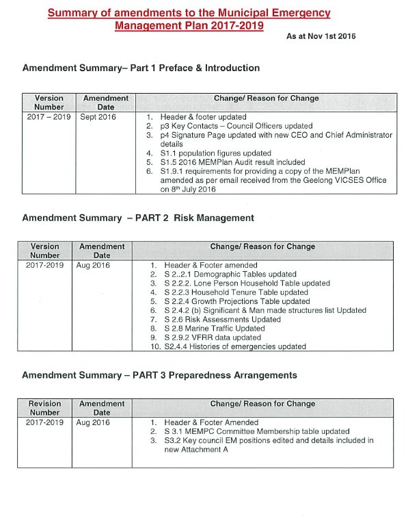
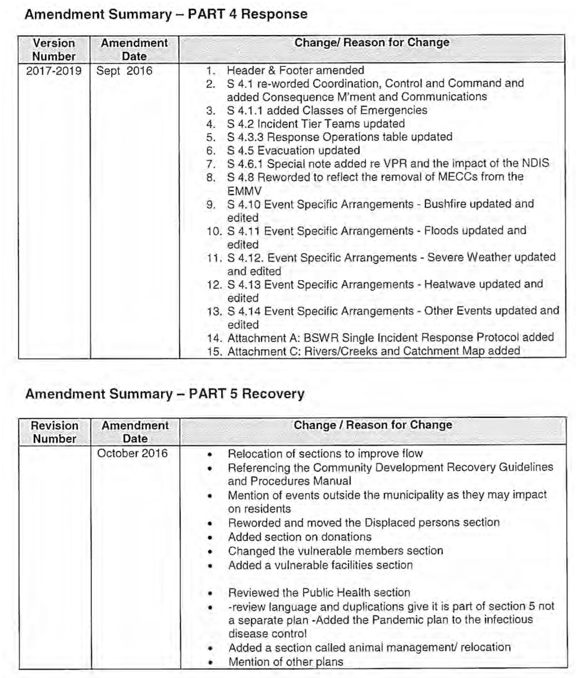
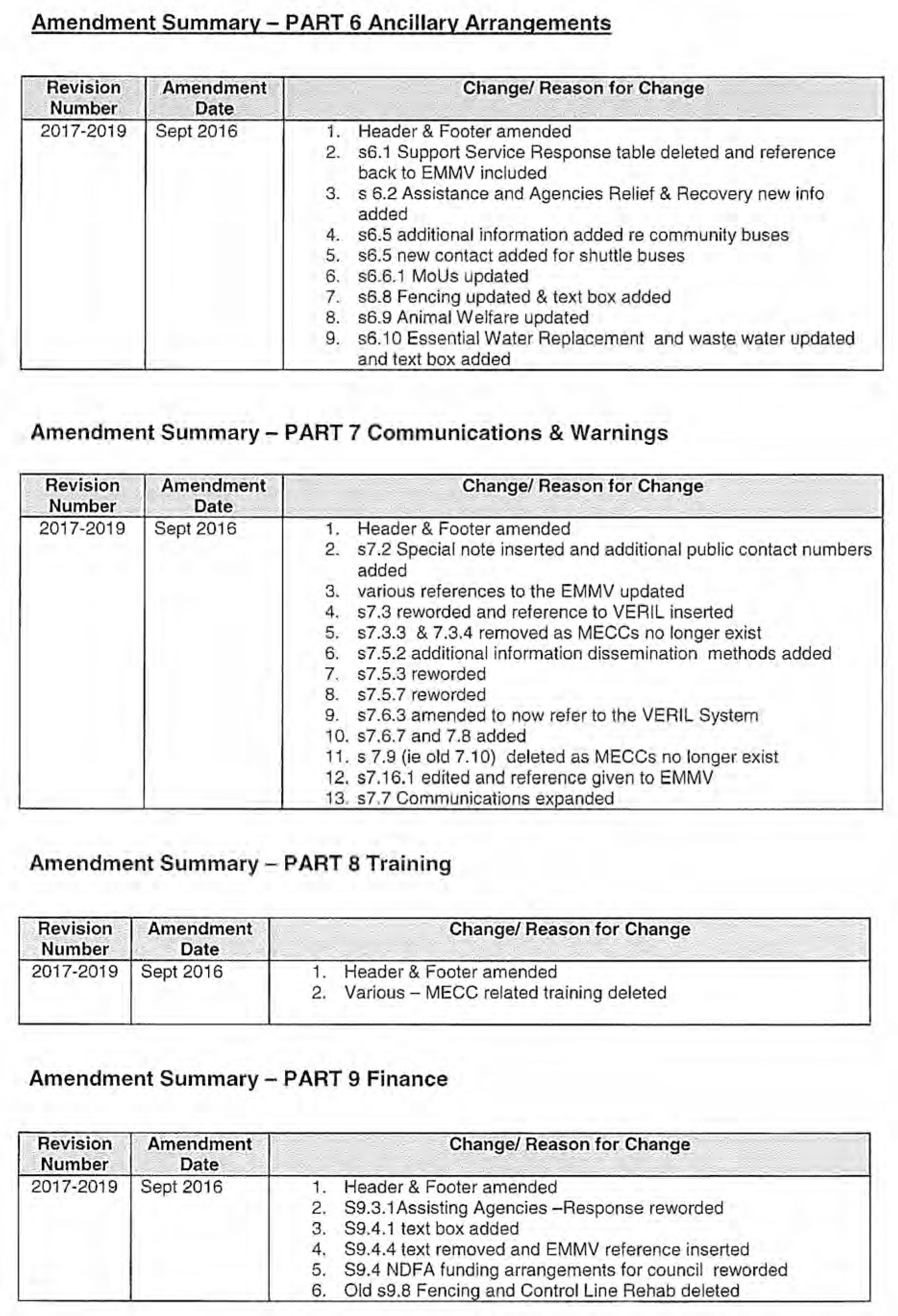
Source: |
Planning & Development - Urban Growth |
Acting Director: |
Geoff Lawler |
K Alexander moved, L Gardner seconded
That in accordance with Section 89 (2) (d) of the Local Government Act 1989, this contractual matter be considered at the conclusion of all other business at which time the meeting be closed to members of the public.
Carried.
Contents | Previous Page: Section A - Procedural Matters | Next Page: Section C - Assembly of Councillors
