
Council Minutes - Section B: Reports - 26 June 2018
Contents | Previous Page: Section A - Procedural Matters | Next Page: Section C - Assembly of Councillors
Contents | Previous Page: Section A - Procedural Matters | Next Page: Section C - Assembly of Councillors
Reports tabled at the Ordinary Meeting of Council on Tuesday date held at the Council Conference and Reception Centre in City Hall, 57 Little Malop Street, Geelong.
Corio (Purnell Road) Integrated Child and Family Centre – Submission Review Panel Hearing
Amendment C375 Barwon Heads Structure Plan – Consideration of Submissions
2017-2018 Borrowing Provision of $12.1M Finalisation (Confidential)
Audit and Risk Committee Summary Report (Confidential)
Contractual Matter (Confidential)
Source: |
Finance & Strategy – Financial Services |
Director: |
Peter Anderson |
Index Reference: |
SUB-16-2049 |
Portfolio: |
Finance |
To adopt the 2018-22 Council Plan and 2018-2019 Budget as proposed at Council meeting held on 1 May 2018, after consideration of submissions and any changes.
Under section 125 of the Local Government Act 1989 (Act), Council must prepare a Council Plan by 30 June 2018. The Council Plan identifies the objectives and priorities of Council. The Council Plan 2018-22 has been in development since the return of Council in November 2017. It is the culmination of extensive consultation with councillors, the City and the community.
In accordance with section 127 of the Act, Council is required to prepare a budget for each financial year and must ensure that it contains all required statements, reports and data as prescribed by the Act. Refer to Appendix 1 for an outline of these requirements.
The Proposed 2018-22 Council Plan & 2018-2019 Budget for the year commencing 1 July 2018 was considered by Council at its meeting on 1 May 2018 and public notice was given in accordance with Section 129 of the Act.
The Proposed 2018-22 Council Plan & 2018-2019 Budget has been prepared in accordance with the requirements of the Act and the Best Practice Guidelines that were developed by a Local Government industry taskforce.
The Proposed Council Plan (Appendix 1) includes:
Strategic priorities (11) each with deliverables and measures;
Overarching themes of sustainability, equity and community engagement; and
Support for the proposed 2018-2019 Budget, the Municipal Public Health and Wellbeing plan and the regions long term Vision Greater Geelong; A Clever and Creative Future.
The Proposed Budget (Appendix 1) includes:
The Budgeted Statements of Comprehensive Income, Cash Flows, Balance Sheet, Capital Works, Changes in Equity and Human Resources;
The Strategic Objectives to be undertaken during the financial year and Service Performance Outcome Indicators in relation to each Strategic Objective;
The relationship between the activities and initiatives in contributing to achieving the strategic objectives specified in the Council Plan; and
Details of the activities and initiatives to be funded in the budget.
As required under the Act a schedule declaring the differential rates and charges (Appendix 1) has been included.
The Rating Strategy for 2018-2019 (Appendix 2) contains the Council Policy, Procedure, rate assistance and information on the City’s approach to the raising of property rates updated to reflect the outcome of Council’s budget deliberations.
At the Council meeting held on 1 May 2018 a Submissions Panel was appointed to hear submissions made in relation to the Council Plan and Proposed Budget.
A Submissions Panel Hearing was held on Tuesday, 5 June 2018. The Panel comprised of Councillor B Harwood, Councillor A Aitken, Councillor S Asher, Councillor K Grzybek, Councillor E Kontelj, Councillor S Mansfield, Councillor J Mason, Councillor P Murnane, Councillor P Murrihy, Councillor R Nelson, Councillor T Sullivan (Refer Appendix 3).
A number of actions were initiated in response to these submissions and changes were made to the 2018-22 Council Plan.
The proposed 2018-2019 budget was changed to include latest advice from Victorian Grants Commission and project manager assessment of Capital project carryover.
Councillor Murnane moved, Councillor Mason seconded -
That:
The 2018-2019 Proposed Budget considered by Council on 1 May 2018, be varied to recognise early receipt of the Victorian Grants Commission general purpose grant funding (June 2018) which reduces 2018-2019 Grant funding by $10.3m, increases opening cash balance (July 2018), which is offset by a lower net result;
Having considered all submissions lodged, together with the report of the Submissions Panel (Appendix 3), the Proposed Budget considered by Council on 1 May 2018 be adopted by Council without change;
Having considered all submissions lodged, together with the report of the Submissions Panel (Appendix 3), the amended Proposed Council Plan considered by Council on 1 May 2018 be adopted by Council;
Public notice be given of the decision to adopt the 2018-22 Council Plan & 2018-2019 Budget and Rate Declaration in accordance with the Act;
Pursuant to Section 171 (4)(f) of the Act, Council resolves to treat any person who has successfully applied for and been granted a pensioner waiver of rates as having made a continuing application for such waiver, unless the person advises otherwise.
That:
Council adopts the Rating Strategy 2018-2019 (Appendix 2).
Council declares the following Rates & Charges:
Amount intended to be raised by General Rates, Municipal Charge, and Annual Service Charge for the period 1 July 2018 - 30 June 2019.
An amount of $224,941,888 be declared as the amount which Council intends to raise by General Rates, Municipal Charge and the Annual Service Charge, which amount is calculated as follows:
General Rates $177,708,537
Municipal Charge $12,362,428; and
Annual Service Charge $34,870,923.
General Rates
2.1 A general rate be declared for the period 1 July 2018 to 30 June 2019.
2.2 It be further declared that the general rate be raised by the application of differential rates.
2.3 A differential rate be respectively declared for rateable land having the respective characteristics specified below, which characteristics will form the criteria for each differential rate so declared.
2.3.1. Farm Land – means any land which:
is not less than 2 hectares in area; and
is used predominantly for the business of grazing (including agistment), dairying, pig-farming, poultry farming, fish farming, tree farming, bee-keeping, viticulture, horticulture, fruit growing or the growing of crops of any kind or for any combination of those activities; or
satisfies the criteria for municipal purpose benefit for large holdings to the extent that it is, for example, land that is predominantly used and maintained for heritage, cultural or environmental purposes, or land that is held as natural bushland under a trust for nature covenant, or land that is held under some other type of similar formal undertaking.
To avoid doubt, 'business' for the purposes of identifying Farm Land has the same meaning as that given to it by section 2(1) of the Valuation of Land Act 1960 for the same purpose, being a business that:
has a significant and substantial commercial purpose or character; and
seeks to make a profit on a continuous or repetitive basis form its activities on the land; and
is making a profit from its activities on the land, or that has a reasonable prospect of making a profit from its activities on the land if it continues to operate in the way that it is operating.
2.3.2 Residential Land - means any land:
that is used exclusively for residential purposes; or
on which a habitable building is erected, which building is unoccupied, and which is zoned residential under the Greater Geelong Planning Scheme.
2.3.3 Vacant Land - means any land:
that does not have the characteristics of Farm Land; and
on which no building is erected, save for any uninhabitable shed or shelter, the size of which does not exceed 5% of the total area of the land.
2.3.4 Petroleum Production Land – means any land that is:
used primarily for the production or conveyance of petroleum and/or petroleum by-products; and
is described as such in Schedule A.
2.3.5 Industrial Land – means any land that:
does not have the characteristics of
Vacant Land; or
Commercial Land; or
Petroleum Production Land; and
is used predominantly for industrial purposes, which includes manufacturing, repairing, servicing, processing and reprocessing or warehousing.
2.3.6 Commercial Land – means any land that:
does not have the characteristics of:
Farm Land; or
Industrial Land; or
Petroleum Production Land; and
is used predominantly for the sale of goods or services or other commercial purposes; or
on which a habitable building is erected, which building is unoccupied, and which is zoned other than residential under the Greater Geelong Planning Scheme.
2.3.7 Mixed Use Land – means any land that:
has the characteristics of Residential Land combined with the characteristics of Commercial Land or Industrial Land; and
is used partly for residential purposes and partly for commercial and/or industrial purposes.
2.3.8 The Point – Residential Land - means any land that:
is used exclusively for residential purposes; or
on which a habitable building is erected, which building is unoccupied, and which is zoned residential under the Greater Geelong Planning Scheme; and
is described as such in Schedule A.
2.3.9 The Point – Vacant Land - means any land:
that does not have the characteristics of Farm Land; and
on which no building is erected save for any small uninhabitable storage shed or shelter, the size of which does not exceed 5% of the total land area; and
is described as such in Schedule A.
2.3.10 The Point – Commercial Land - means any land that:
does not have the characteristics of:
Farm Land; or
Industrial Land; and
is used predominantly for the sale of goods or services, or other commercial purposes; or
on which a habitable building is erected, which building is unoccupied, and which is zoned other than residential under the Greater Geelong Planning Scheme; and
is described as such in Schedule A.
2.4 A rate pursuant to the Cultural and Recreational Lands Act 1963 be declared for rateable land having the respective characteristics specified below.
2.4.1 Cultural and Recreational Land -
Any land which -
has the characteristics of Recreational land as defined by the Cultural and Recreational Lands Act 1963; and
is described as such in Schedule A.
2.5 Each differential rate and Cultural and Recreation Lands Rate will be determined by multiplying the Capital Improved Value of each rateable land (categorised by the characteristics described in paragraph 2.3 and 2.4 by the relevant percentages indicated in the following table:
CATEGORY %
Farm Land .002390 (or .2390 percent of Capital Improved Value).
A rebate of 36.3% of the CIV by rate in dollar in accordance with Council policy for farm rating.
Residential Land .002390 (or .2390 percent of Capital Improved Value).
Vacant Land .003641 (or .3641 percent of Capital Improved Value).
The Point Residential Land .002390 (or .2390 percent of Capital Improved Value).
The Point Vacant Land .003641 (or .3641 percent of Capital Improved Value).
The Point Commercial Land .005473 (or .5473 percent of Capital Improved Value).
Petroleum Production Land .006871 (or .6871 percent of Capital Improved Value).
Industrial Land .006871 (or .6871 percent of Capital Improved Value).
Commercial Land .005473 (or .5473 percent of Capital Improved Value).
Mixed Use Land .003604 (or .3604 percent of Capital Improved Value).
Cultural and Recreational .001792 (or .1792 percent of Capital Improved Value).
2.6 It be recorded that Council considers that each differential rate will contribute to the equitable and efficient carrying out of Council functions; and that
2.6.1 the respective objectives of each differential rate be those specified in Schedule B;
2.6.2 the respective types or classes of land which are subject to each differential rate be those defined in Schedule B;
2.6.3 the respective uses and levels of each differential rate in relation to those respective types or classes of land be those described in Schedule B; and
2.6.4 the relevant
uses of; and
geographical locations of; and
planning scheme zonings of; and
types of buildings on the respective types or classes of land be those identified in Schedule B; and
2.2.7 It be confirmed that no amount is fixed as the minimum amount payable by way of general rate in respect of each rateable land within the municipal district.
Rebates
3.1 Farm Rebate
For 2018-2019 Council declare a rebate under section 169 of the Act of 36.3% for all land classified and rated as farm land. Properties defined as farms will be entitled to a rebate recognising that there is a benefit to the community in encouraging the retention of large lot primary producing holdings. An application can be made to Council to have land classified as Farm land.
3.2 Cultural and Recreational Rebate
For 2018-2019 Council declare a transitional rebate under section 169 of the Act for 50% of the difference between the Cultural and Recreational differential of the otherwise applicable differential. Properties that were eligible for the Cultural and Recreational differential in 2016-17 that are no longer eligible in 2017-2018 will be encouraged to apply for this rebate.
Waivers
4.1 Rates Assistance Waivers
Council declares a waiver of general rates under section 171 of the Act for the class of persons comprised of ratepayers in respect of assessments which are categorised as Residential Land or Farm Land where the valuation of the assessment has increased, between the 2016 valuation and the 2018 valuation, by 45% or more and that increase is purely attributable to market factors, not attributable, in whole or in part, to improvements made to the assessment by the owner (or occupier). The amount of the waiver is set at:
4.1.1 between 25% and 49.99% of the general rates payable for the 2018-2019 financial year, increasing pro rata according to the valuation increase, for valuation increases between 45% and 54.99%; and
4.1.2 50% of the general rates for the 2018-2019 financial year for valuation increases of 55% or more.
The waiver is designed to mitigate the rates shock of a valuation increase.
4.2 For 2018-2019 Council declares a Housing Support waiver of 100% of general rates and municipal charge under section 171 of the Act for the class of persons comprised of ratepayers in respect of assessments which contain the following types of housing:
4.2.1 transitional, emergency or crisis housing;
4.2.2 housing for Legatees or War Widows, provided by the Geelong Legacy Club or provided by RSL; and
4.2.3 supported housing for disabled people.
This waiver recognises that these properties provide for specific needs within the community. Application can be made to Council to have land classified as being eligible for the waiver.
4.3 New Corio Estate (Inappropriate Subdivision)
For 2018-2019 financial year, Council declares a waiver of 100% of general rates and municipal charge under section 171 of the Act for the class of persons comprised of ratepayers in respect of assessments which are in private ownership within the inappropriate subdivision known as New Corio Estate. This rates assistance waiver recognises the financial burden associated with ownership of this land. Land within the New Corio Estate is zoned as farming land and the area has been determined to be an inappropriate subdivision due to the difficulty of providing utilities and drainage and due to its distance from other residential areas. The Minister for Environment & Climate Change has approved a native vegetation plan for this land in support of natural temperate grassland of the Victorian Volcanic Plains. The waiver recognises the ongoing encumbrances on the land that prevent owners from making any demands on Council services now and into the future.
Municipal Charge
5.1 An annual municipal charge be declared for the period commencing 1 July 2018 to 30 June 2019.
5.2 The purpose of the municipal charge is to recover some of the administrative costs of the Council.
5.3 The charge be the sum of $102.00 for each rateable property in the municipality.
5.4 Applications for exemption for farm land in accordance with section 159 of the Act, is to be made within two months from the date of issue of annual rate notice.
Annual Service Charge
6.1 An Annual Service Charge be declared for the period commencing 1 July 2018 to 30 June 2019.
6.2 The Annual Service Charge be declared for the collection and disposal of refuse.
6.3 The Annual Service Charge be $316.90 for each rateable land and non-rateable land (or part) in respect of which the Annual Service Charge may be levied.
6.4 The criteria specified below, be the criteria, which form the basis of the Annual Service Charge, so declared:
Geographic existence within those areas of the municipal district in which Council provides a domestic refuse collection and disposal service. The charge will be raised irrespective of whether the service is used or not.
Annual Service Charge – Additional Bin Service
7.1 An Annual Service Charge – Additional Bin Service, be declared for the period commencing 1 July 2018 to 30 June 2019.
7.2 The Annual Service Charge – Additional Bin Service, be declared for the collection and disposal of refuse.
7.3 New Service Charge to apply if additional services are requested by the property owners who meet eligibility criteria.
7.4 The criteria specified below, be the criteria, which form the basis of the Annual Service Charge – Additional Bin Service, so declared:
The additional bin service charge will be available via application, compliant with the following criteria:
The property owner or their authorised agent signs the additional bin application form, provides appropriate supporting evidence and agrees to the applicable service charge;
In all cases of application for additional bins, Council reserves the right to inspect the applicant’s existing bins to confirm that they are overloaded. If this cannot be confirmed, the additional bins will not be provided;
The green waste additional bin will only become available when the Anakie Road Green Organics processing facility is fully operational.
Applications that meet the criteria will be billed via the Rate, Valuation & Charges notice.
If an application is received and approved in the first six months of the financial year, that is, from July to December, the full annual cost of the additional bin will be charged. If an application is received and approved in the second half of the financial year, that is January to June, half the annual cost will be charged.
The following costs will apply for the additional bin service:
Garbage bin 140L $141.90 (for 2018-2019)
Garbage bin 240L $101.70 (for 2018-2019)
Recycling bin $ 80.00 (for 2018-2019)
Central Activities Area Rate
Council has declared a special rate in respect of the central business district of Geelong applicable to non-residential, non-exempt properties and is in addition to other rates and charges. The special rate is the Central Activities Area (CAA) Rate calculated based on the Capital improved valuation and a rate in the dollar. The purpose of the special rate is to promote the CAA as a commercial shopping precinct using events, marketing and media.
A special rate has been declared for the period commencing on 1 July 2016 and concluding on 30 June 2021. The third year of the scheme (2018-2019) will raise $1,090,009 ($1,066,024 in 2017-2018). The rate in the dollar for 2018-2019 is set at $0.0006785 and $0.0002222 for Cultural & Recreation (Cultural and Recreation properties are charged a reduced CAA rate, in accordance with the ratio of the recreation rate to the commercial rate).
Incentives
No incentives be declared as the incentives to be given by Council for the payment of General Rates, Municipal Charge and the Annual Service Charge (described earlier in this document) before the dates fixed for their payment under section 167 of the Act.
Consequential
10.1 Notwithstanding anything said in any earlier Resolution of Council, the Geelong Advertiser be chosen, as the newspaper in which the public notice will appear.
10.2 The Responsible Officer of Council be authorised to levy and recover the General Rates, Municipal Charge and the Annual Service Charge described earlier in accordance with the Act.
Interest
Interest on unpaid rates and charges will be charged in accordance with section 172 of the Act. Interest will be charged at the penalty interest rate of 10% for 2018-2019. In proven cases of hardship where Council approves rates to be deferred, interest will be charged at 5.39% for 2018-2019.
SCHEDULE A
Petroleum Production Land
All that land generally bounded more or less by Princes Highway, Shell Parade, Corio Bay Foreshore, Wharf Road, Station Road and neighboring land.
The Point Residential Land
All the residential land formerly described in Certificate of Title Volume 09901 Folio 324 and also described as Lot B PS 635643, PS 640648Y, PS 722221H, PS 722220K, PS 743868K, PS 732908M, PS 638301D, PS 635642R, PS722215C, PS 722214E, PS 743877, PS 816893, PS 743876 and PS 743878.
The Point Vacant Land
All the vacant land formerly described in Certificate of Title Volume 09901 Folio 324 and also described as Lot B PS 635643, PS 640648Y, PS 722221H, PS 722220K, PS 743868K, PS 732908M, PS 638301D, PS 635642R, PS722215C, PS 722214E, PS 743877, PS 816893, PS 743876 and PS 743878.
The Point Commercial Land
All the commercial land formerly described in Certificate of Title Volume 09901 Folio 324 and also described as Lot B PS 635643, PS 640648Y, PS 722221H, PS 722220K, PS 743868K, PS 732908M, PS 638301D, PS 635642R, PS722215C, PS 722214E, PS 743877, PS 816893, PS 743876 and PS 743878.
Cultural and Recreational Land
Any land reserved under the Cultural and Recreational Lands Act 1963 including the following:
Ratepayer |
Property Address |
Bareena Bowling Club Incorporated |
89 Noble Street, NEWTOWN VIC 3220 |
Bell Park Sports Club |
10 Lynnburn Road, BATESFORD VIC 3213 |
Barwon Rowing Club Inc. |
2 Barwon Terrace, SOUTH GEELONG VIC 3220 |
Geelong College Rowing Club |
4 Barwon Terrace, SOUTH GEELONG VIC 3220 |
Geelong Church of England Grammar School |
6 Barwon Terrace, SOUTH GEELONG VIC 3220 |
Geelong Rowing Association |
8 Barwon Terrace, SOUTH GEELONG VIC 3220 |
Corio Bay Rowing Club |
10 Barwon Terrace, SOUTH GEELONG VIC 3220 |
Geelong Race Course Trustees |
99 Breakwater Road, BREAKWATER VIC 3219 |
Royal Geelong Agricultural & Pastoral Society Inc |
79 Breakwater Road, BREAKWATER VIC 3219 |
Royal Geelong Yacht Club |
25 Eastern Beach Road, GEELONG VIC 3220 |
Geelong Eastern Park Bowling Club Inc |
51-55 Garden Street, EAST GEELONG VIC 3219 |
Geelong Football Club Limited |
360 Moorabool Street, SOUTH GEELONG VIC 3220 |
East Geelong Golf Club |
401 Eastern Park Circuit, EAST GEELONG VIC 3219 |
East Geelong Recreation Reserve Committee |
137-139 McKillop Street, GEELONG VIC 3220 |
Western Beach Boat Club Inc |
74-90 Western Foreshore Road, GEELONG VIC 3220 |
Highton Bowling Club Inc |
204 Roslyn Road, HIGHTON VIC 3216 |
Barwon Heads Golf Club Incorporated |
1A Golf Links Road, BARWON HEADS VIC 3227 |
Belmont Bowling Club Incorporated |
16-36 Reynolds Road, BELMONT VIC 3216 |
Geelong Lawn Tennis Club Incorporated |
12-20 Sommers Street, BELMONT VIC 3216 |
Geelong Bowls Club Incorporated |
4-10 Sommers Street, BELMONT VIC 3216 |
Geelong Pistol Club Inc |
70-80 Williams Road, MOUNT DUNEED VIC 3217 |
Western District Car Club and |
55 Beach Road, AVALON VIC 3212 |
Geelong Motor Sports Complex Inc |
|
Beckley Park Committee of Management Inc |
40 Broderick Road, CORIO VIC 3214 |
Croatian Community Centre of Geelong (Inc) |
172 Cox Road, CORIO VIC 3214 |
Australian Croatian Sporting Centre and |
15 Gibbons Road, LARA VIC 3212 |
North Geelong Warriors Soccer Club Inc |
|
Geelong Trailable Yacht Club Inc |
105 Mackey Street, NORTH GEELONG VIC 3215 |
Clifton Springs Golf Club Inc |
62-88 Clear Water Drive, CLIFTON SPRINGS VIC 3222 |
Clifton Springs Bowling Club |
39 Springs Street, CLIFTON SPRINGS VIC 3222 |
Drysdale Bowling & Croquet Club Inc |
19-29 Collins Street, DRYSDALE VIC 3222 |
Lonsdale Golf Club |
PARENT - 28 Gill Road, POINT LONSDALE VIC 3225 |
Portarlington Sailing Club |
219 Point Richards Road, PORTARLINGTON VIC 3223 |
Portarlington Bowls Club Incorporated |
2A Harding Street, PORTARLINGTON VIC 3223 |
Indented Head Boat Club Inc |
326A The Esplanade, INDENTED HEAD VIC 3223 |
Indented Head Yacht Club |
326B The Esplanade, INDENTED HEAD VIC 3223 |
St Leonards Yacht Club & Motor Squadron |
1001 Lower Bluff Road, ST LEONARDS VIC 3223 |
Portarlington Golf Club |
92-160 Hood Road, PORTARLINGTON VIC 3223 |
Leopold Sportsmans Club Inc |
131-139 Kensington Road, LEOPOLD VIC 3224 |
Ocean Grove Bowling Club Incorporated |
16-24 The Terrace, OCEAN GROVE VIC 3226 |
St Leonards Bowling Club |
1274 Murradoc Road, ST LEONARDS VIC 3223 |
Ocean Grove Golf Club Incorporated |
9 Guthridge Street, OCEAN GROVE VIC 3226 |
Geelong Watersports Club Inc |
493-499 Wilsons Road, ST ALBANS PARK VIC 3219 |
Lagoon Boat Club Inc |
200 Foreshore Road, CORIO VIC 3214 |
Belrec Incorporated |
68 Calvert Street, HAMLYN HEIGHTS VIC 3215 |
North Shore Football & Netball Club Inc |
39 Rose Avenue, NORLANE VIC 3214 |
Lara Sporting Club Incorporated |
4 Mill Road, LARA VIC 3212 |
Corio Bay Sailing Club |
180 Foreshore Road, CORIO VIC 3214 |
Norlane Bowling Club Incorporated |
26-36 St Georges Road, CORIO VIC 3214 |
Lara Bowling Club Inc |
10 Alkara Avenue, LARA VIC 3212 |
Herne Hill Bowls Club Inc |
200 McCurdy Road, FYANSFORD VIC 3218 |
Seabrae Boat Owners Club Inc |
302 Clifton Avenue, LEOPOLD VIC 3224 |
Barwon Heads Bowling Club Inc |
18 Geelong Road East, BARWON HEADS VIC 3227 |
Lonsdale Golf Club |
69 Fellows Road, POINT LONSDALE VIC 3225 |
City of Geelong Bowls Club Inc |
7-9 Ballarat Road, NORTH GEELONG VIC 3215 |
Properties potentially eligible for the Cultural and Recreational rebate are:
Ratepayer |
Property Address |
Geelong & Dist Angling Club & Fish Protect Society |
9 Yuille Street, Geelong West VIC 3218 |
Geelong Table Tennis Association |
84-88 Church Street, North Geelong VIC 3215 |
Geelong Bridge Club |
148-152 Portarlington Road, NEWCOMB VIC 3219 |
Association of Ukrainians - Victoria |
16-21 Monastery Court, LOVELY BANKS VIC 3213 |
Austrian Club Geelong Incorporated |
258 Plantation Road, CORIO VIC 3214 |
Serbian Parish Youth Club |
256 Plantation Road, CORIO VIC 3214 |
St Leonards Golf Club Inc |
79-175 Harvey Road, St Leonards VIC 3223 |
Geelong Speedway Drivers Club Inc |
1/4 Wood Street, South Geelong VIC 3220 |
Wood Street Public Recreation Reserve COM Inc. |
2/4 Wood Street, South Geelong VIC 3220 |
Wood Street Public Recreation Reserve COM Inc. |
3/4 Wood Street, South Geelong VIC 3221 |
Geelong Transport Drivers Social Club Inc |
4/4 Wood Street, South Geelong VIC 3220 |
SCHEDULE B
Farm Land
Rating Objectives:
To ensure that all rateable land makes an equitable and efficient financial contribution to the cost of carrying out the functions of Council generally, including the:
construction and maintenance of public infrastructure;
development and provision of health and community services; and
provision of general support services.
To encourage and support the business of primary production and, where appropriate, expand the business of primary production.
These objectives will be met by setting the Farm Land differential at 100% of the Residential Land differential and by the provision of a farm rebate under section 169 of the Act.
Types and Classes
Rateable land having the relevant characteristics described previously in 2.3.1
Use and Level of Differential Rate
The differential rate will be used to fund some of those items of expenditure described
in the Budget adopted by Council.
The level of the differential rate less the applicable rebate is the level, which Council
considers it necessary to achieve the objectives specified above.
Geographic Location
Wherever located within the municipal district.
Use of Land
Any use permitted under the Greater Geelong Planning Scheme.
Planning Scheme Zoning
The zoning applicable to each rateable land within this category, as determined by
consulting maps referred to in the Greater Geelong Planning Scheme.
Types of Buildings
All buildings which are now constructed on the land or which are constructed prior to
30 June 2019.
Residential Land
Rating Objective:
To ensure that all rateable land makes an equitable and efficient financial contribution to the cost of carrying out the functions of Council generally, including the:
construction and maintenance of public infrastructure;
development and provision of health and community services; and
provision of general support services.
Types and Classes
Rateable land having the relevant characteristics described previously in 2.3.2
Use and Level of Differential Rate
The differential rate will be used to fund some of those items of expenditure described
in the Budget adopted by Council.
The level of the differential rate is the level which Council considers is necessary to
achieve the objectives specified above.
Geographic Location
Wherever located within the municipal district.
Use of Land
Any use permitted under the Greater Geelong Planning Scheme.
Planning Scheme Zoning
The zoning applicable to each rateable land within this category, as determined by
consulting maps referred to in the Greater Geelong Planning Scheme.
Types of Buildings
All buildings which are now constructed on the land or which are constructed prior to
30 June 2019.
Vacant Land
Rating Objectives:
To ensure that all rateable land makes an equitable and efficient financial contribution to the cost of carrying out the functions of Council generally, including the:
construction and maintenance of public infrastructure;
development and provision of health and community services; and
provision of general support services.
To encourage the prompt development of vacant land to attract new residents and businesses to the City of Greater Geelong.
To discourage untimely and unnecessary divisions of land.
These objectives will be met by setting the Vacant Land differential at 152% of the Residential Land differential.
Types and Classes
Rateable land having the relevant characteristics described previously in 2.3.3
Use and Level of Differential Rate
The differential rate will be used to fund some of those items of expenditure described
in the Budget adopted by Council.
Geographic Location
Wherever located within the municipal district.
Use of Land
Any use permitted under the Geelong Regional Planning Scheme.
Planning Scheme Zoning
The zoning applicable to each rateable land within this category, as determined by
consulting maps referred to in the Geelong Regional Planning Scheme.
Types of Buildings
No building must be located on the land or constructed prior to 30 June 2019 save
for any uninhabitable shed or shelter that does not exceed more than 5% of the total
area of the land.
Petroleum Production Land
Rating Objective:
To ensure that all rateable land makes an equitable and efficient financial contribution to the cost of carrying out the functions of Council generally, including the:
construction and maintenance of public infrastructure;
development and provision of health and community services; and
provision of general support services.
The Petroleum Production Land differential is set at the Industrial Land rate differential from 2017-2018.
Types and Classes
Rateable land having the relevant characteristics described previously 2.3.4.
Use and Level of Differential Rate
The differential rate will be used to fund some of those items of expenditure described
in the Budget adopted by Council.
Geographic Location
As described in Schedule A.
Use of Land
Any use permitted under the Greater Geelong Planning Scheme.
Planning Scheme Zoning
The zoning applicable to each rateable land within this category, as determined by
consulting maps referred to in the Greater Geelong Planning Scheme.
Types of Buildings
All buildings which are now constructed on the land or which are constructed prior to
30 June 2019.
Industrial Land
Rating Objective:
To ensure that all rateable land makes an equitable and efficient financial contribution to the cost of carrying out the functions of Council generally, including the:
construction and maintenance of public infrastructure;
development and provision of health and community services; and
provision of general support services.
Types and Classes
Rateable land having the relevant characteristics described previously in 2.3.5
Use and Level of Differential Rate
The differential rate will be used to fund some of those items of expenditure described
in the Budget adopted by Council.
Geographic Location
Wherever located within the municipal district.
Use of Land
Any use permitted under the Greater Geelong Planning Scheme.
Planning Scheme Zoning
The zoning applicable to each rateable land within this category, as determined by
consulting maps referred to in the Greater Geelong Planning Scheme.
Types of Buildings
All buildings which are now constructed on the land or which are constructed prior to
30 June 2019.
Commercial Land
Rating Objective:
To ensure that all rateable land makes an equitable and efficient financial contribution to the cost of carrying out the functions of Council generally, including the:
construction and maintenance of public infrastructure;
development and provision of health and community services; and
provision of general support services.
Types and Classes
Rateable land having the relevant characteristics described previously in 2.3.6
Use and Level of Differential Rate
The differential rate will be used to fund some of those items of expenditure described
in the Budget adopted by Council.
Geographic Location
Wherever located within the municipal district.
Use of Land
Any use permitted under the Greater Geelong Planning Scheme.
Planning Scheme Zoning
The zoning applicable to each rateable land within this category, as determined by
consulting maps referred to in the Greater Geelong Planning Scheme.
Types of Buildings
All buildings which are now constructed on the land or which are constructed prior to
30 June 2019.
Mixed Use Land
Rating Objective:
To ensure that all rateable land makes an equitable and efficient financial contribution to the cost of carrying out the functions of Council generally, including the:
construction and maintenance of public infrastructure;
development and provision of health and community services; and
provision of general support services.
Types and Classes
Rateable land having the relevant characteristics described previously in 2.3.7.
Use and Level of Differential Rate
The differential rate will be used to fund some of those items of expenditure described
in the Budget adopted by Council.
Geographic Location
Wherever located within the municipal district.
Use of Land
Any use permitted under the Greater Geelong Planning Scheme.
Planning Scheme Zoning
The zoning applicable to each rateable land within this category, as determined by
consulting maps referred to in the Greater Geelong Planning Scheme.
Types of Buildings
All buildings which are now constructed on the land or which are constructed prior to
30 June 2019.
The Point – Residential Land
Rating Objectives:
To ensure that all rateable land makes an equitable and efficient financial contribution to the cost of carrying out the functions of Council generally, including the:
construction and maintenance of public infrastructure;
development and provision of health and community services;
provision of general support services; and
management of environmentally sensitive land.
To ensure that, following the development of the Point Land, and transfer to Council of the management of environmentally sensitive land, including the provision of a range of services around an existing waterway, constructed lake and canal system, an equitable and efficient financial contribution to the cost of Council's management responsibilities will be made by the ratepayers in respect of that land.
Types and Classes
Rateable land having the relevant characteristics described previously in 2.3.8
Use and Level of Differential Rate
The differential rate will be used to fund some of those items of expenditure described
in the Budget adopted by Council.
Geographic Location
As described in Schedule A.
Use of Land
Any use permitted under the Greater Geelong Planning Scheme.
Planning Scheme Zoning
The zoning applicable to each rateable land within this category, as determined by
consulting maps referred to in the Greater Geelong Planning Scheme.
Types of Buildings
All buildings which are now constructed on the land or which are constructed prior to
30 June 2019.
The Point – Vacant Land
Rating Objectives:
To ensure that all rateable land makes an equitable and efficient financial contribution to the cost of carrying out the functions of Council, generally including the:
construction and maintenance of public infrastructure;
development and provision of health and community services;
provision of general support services; and
management of environmentally sensitive land.
To ensure that, following the development of the Point Land, and transfer to Council of the management of environmentally sensitive land, including the provision of a range of services around an existing waterway, constructed lake and canal system, an equitable and efficient financial contribution to the cost of Council's management responsibilities will be made by the ratepayers in respect of that land.
Types and Classes
Rateable land having the relevant characteristics described previously in 2.3.9
Use and Level of Differential Rate
The differential rate will be used to fund some of those items of expenditure described
in the Budget adopted by Council.
Geographic Location
As described in Schedule A.
Use of Land
Any use permitted under the Greater Geelong Planning Scheme.
Planning Scheme Zoning
The zoning applicable to each rateable land within this category, as determined by
consulting maps referred to in the Greater Geelong Planning Scheme.
Types of Buildings
All buildings which are now constructed on the land or which are constructed prior to
30 June 2019.
The Point – Commercial Land
Rating Objectives:
To ensure that all rateable land makes an equitable and efficient financial contribution to cost of carrying out the functions of Council, generally including the:
construction and maintenance of public infrastructure;
development and provision of health and community services;
provision of general support services; and
management of environmentally sensitive land.
To ensure that, following the development of the Point Land, and transfer to Council of the management of environmentally sensitive land, including the provision of a range of services around an existing waterway, constructed lake and canal system, to ensure that an equitable and efficient financial contribution to the cost of Council's management responsibilities will be made by the ratepayers in respect of that land.
Types and Classes
Rateable land having the relevant characteristics described previously in 2.3.10
Use and Level of Differential Rate
The differential rate will be used to fund some of those items of expenditure described
in the Budget adopted by Council.
Geographic Location
As described in Schedule A.
Use of Land
Any use permitted under the Greater Geelong Planning Scheme.
Planning Scheme Zoning
The zoning applicable to each rateable land within this category, as determined by
consulting maps referred to in the Greater Geelong Planning Scheme.
Types of Buildings
All buildings which are now constructed on the land or which are constructed prior to
30 June 2019.
Cultural and Recreational Land
Has the characteristics of Recreational land as defined by the Cultural and Recreational Lands Act 1963.
Types and Classes
Rateable land having the relevant characteristics described previously in 2.4.1
Use and Level of Differential Rate
The differential rate will be used to fund some of those items of expenditure described
in the Budget adopted by Council.
Geographic Location
As described in Schedule A.
Use of Land
Any use permitted under the Greater Geelong Planning Scheme.
Planning Scheme Zoning
The zoning applicable to each rateable land within this category, as determined by
consulting maps referred to in the Greater Geelong Planning Scheme.
Types of Buildings
All buildings which are now constructed on the land or which are constructed prior to
30 June 2019.
Carried.
Following consideration by Council of the Proposed Budget and Council Plan, an advertisement was placed in the Geelong Advertiser advising that both budget documents would be available for public scrutiny and inviting written submissions to be made.
The Submissions Review Panel met on Tuesday, 5 June 2018 at 6.15pm to consider written submissions about the Proposed Budget and Council Plan and hear any person who wished to address the Panel in support of their submission.
In respect to the Council Plan the Submissions Review Panel recommended (Appendix 3) that the proposed Council Plan be amended. The changes made to the Council Plan include the following;
The addition of a paragraph in the ‘About the Plan’ section which describes the services that Council provides to better explain the role of Council to the community.
The addition of a measure “Maintain visitation to our key cultural facilities (National Wool Museum, Potato Shed, Geelong Gallery, Courthouse Youth Arts and the Geelong Library and Heritage Centre)” to the Vibrant Arts and Culture council priority. This has been added to ensure the measures are more clearly expressed, measurable and aligned to one another (as per the recommendations from the 2012 VAGO report Performance Reporting by Local Government Victoria).
The addition of the key priority “Develop a housing policy to provide a range of social and affordable housing options” under the Improved Health and Safety of our Community council priority, in response to Di Roberts (submission topic 7).
The addition of several aims for 2018-2019 to the Effective Environmental Management council priority focusing on zero waste to landfill, protection and rehabilitation of our beaches, waterways and conservation reserves, and One Planet Living Principles. This is in response to Vicki Perrett (submission topic 18).
The recommendation from the Submissions Review Panel (Appendix 3) was not to propose any changes to the Proposed Budget adopted by Council on the 1 May, 2018. However the following changes have been made to the Budget and Rating strategy in response to recent announcements.
1. Grants Commission advice
The Victorian Grants Commission have provided preliminary advice that the City of Greater Geelong will receive 50% of the 2018-2019 general purpose grant allocation in June 2018. Therefore the Grants Commission funding recognition in the 2018-2019 budget will reduce by $10.3 million. The 2018-2019 budget has been changed to include a higher opening cash balance offset by lower net result. The recurrent operating surplus of $2.3 million in the proposed budget has been changed to an recurrent deficit of ($8.0 million). In addition the 2017-2018 Forecast recurrent result has been amended to forecast a deficit of ($6.7 million).
2. Capital Program
Project managers have provided an updated assessment of the 2017-2018 Capital works program. The timing of project delivery now requires an additional $2.5 million or $50.5 million of capital carryover from 2017-2018 to 2018-2019.
In addition a further $2.5 million is to carryover from 2018-2019 into 2019-2020. There is no change to the 2018-2019 Capital project expenditure of $128.2 million.
3. Fire Services Property Levy – 2018-2019 rates
Council collects the Fire Services Property Levy (FSPL) on behalf of the State Government via the Council rate notice. The FSPL rates were announced on 31 May 2018 with an increase of 1.9% for the fixed residential charge and a decrease of (52.5%) for the residential variable charge. The fixed charge for Primary Production, Commercial, Industrial, Public Benefit and Vacant has increased by 2.3%. The variable charges have decreased by (33.9%) for Primary Production, (30.8%) for Commercial, (34.1%) for Industrial, (54.0%) for Public Benefit and (52.9%) for Vacant.
The impact to the rate notice for the average residential ratepayer is as follows:
Fire Services Property Levy |
2017-2018 Rates on Average |
2018-2019 Budget Rates on Average |
|
Fixed |
107.00 |
109.00 |
1.9% |
Variable |
58.79 |
27.95 |
-52.5% |
|
165.79 |
136.95 |
-17.4% |
The Budget has been prepared in compliance with Rate Cap legislation and Ministerial announcement that the cap is 2.25% for 2018-2019. Changes in rates, fees and charges have been structured to meet the financial requirements as proposed for the 2018-2019 financial year.
Expenditure includes the continuation of Council services to the community.
The Budget includes a recurrent operating deficit of ($8.0 million) after adjusting for the early receipt of 50% of grants commission allocation.
The Capital program forecasts expenditure of $128.2 million in 2018-2019. This includes carryover project funding from 2017-2018 for incomplete projects of $50.5 million (previously $48 million), $104.2 million of new project funding with $26.5 forecast to carryover into 2019-2020 (previously $24 million).
New loans of $42.0 million are proposed for 2018-2019 including $27.1 million deferred loans from 2017-2018. The projected total amount of borrowings as at 30 June 2019 is $80.7 million.
Following adoption of the Proposed Budget and Council Plan on 1 May 2018 a process of community engagement has been undertaken with a total of 89 submissions received. These submissions were considered at a meeting on 5 June 2018.
A number of actions were initiated in response to these submissions which will be outlined in formal responses provided to each submitter (refer Appendix 3).
In accordance with requirements under the Act, once the Budget and Council Plan are adopted, a public notice will be placed in the newspaper on Wednesday, 27 June 2018, advising the adoption of the 2018-2019 Budget, Council Plan 2018-22, along with the Declaration of the Rates.
The proposed budget identifies the sources and allocation of resources to implement the many social initiatives that impact on the community.
The annual budget is prepared to comply with the requirements of the Local Government Act 1989 and the Local Government (Planning and Reporting) Regulations 2014. The process also recognises the need to align the annual budget to the direction and allocation of resources identified within the proposed Council Plan.
This report identifies the activities Council will undertake in 2018-22 which are aligned to achieving the priorities in Council Plan 2018-22.
No Council officers involved in the preparation of this report have a direct or indirect interest in any matter to which this report relates.
Under section 130 of the Act Council must adopt the Annual Budget by 30 June each year.
The budget has been developed in accordance with a timetable to ensure sufficient time to achieve 30 June adoption. This includes time for community consultation, meetings of the Executive and Council to prepare the 2018-22 Council Plan and 2018-2019 Budget. The timetable provides a framework to manage risk in order for Council to meet its statutory obligations and avoid adverse implications if the process is delayed.
The Budget identifies the sources and allocation of the resources to implement the many environmental initiatives that impact on the community as outlined with Council Plan 2018-22.
Source: |
City Services - Engineering |
Director: |
Guy Wilson-Browne |
Index Reference: |
Subject: Roads – Road Management Plan |
Portfolio: |
Social and Infrastructure Planning |
To adopt the revised Municipal Road Management Plan 2018-2021.
The purpose of a Municipal Road Management Plan is to establish a system for our road management functions, which is based on policy, operational objectives and available resources and to set a performance standard for our road management functions.
The City’s Municipal Road Management Plan (Plan) was previously reviewed and adopted as Version 6 in June 2017.
As required by the Road Management (General) Regulations 2016, the Plan is required to be reviewed by 30 June 2018 following the appointment of the new Council.
A comprehensive internal review of the Plan was undertaken including input from external consultants, and a number of amendments in the hazard identification and response for infrastructure are proposed.
A schedule of amendments proposed to Version 6 is attached to this report (Attachment 2).
Council must adopt the revised Municipal Road Management Plan 2018-2021 by 30 June 2018 in order to have a valid Plan and be compliant with the Road Management (General) Regulations 2016.
A number of changes have been proposed to inspection frequencies and response timeframes within the Plan. It is important to note that the purpose of the Plan is to identify and respond to hazards and safety risks and it does not limit our ability to undertake preventative maintenance on assets covered by the Plan. These changes have been made taking into account many factors including growth across the City, available resources, independent legal advice and benchmarking with other Council’s Road Management Plans.
Councillor Aitken moved, Councillor Kontelj seconded -
That Council adopt the revised Municipal Road Management Plan 2018-2021 Attachment 3.
Carried.
The adoption of the Municipal Road Management Plan will have no direct financial implications. However, in adopting the Plan there is regard for the cost of resources to implement the Plan and potential for financial claims if the Plan is not complied with.
As required by the Road Management (General) Regulations 2016, the Plan was advertised in the City News section of the Geelong Advertiser on 5 May 2018 and in the Victorian Government Gazette on 3 May 2018 for a period of 28 days.
The Plan was advertised on the City’s Twitter (19 May), LinkedIn (16 May) and Facebook (22 May) pages to assist in reaching a wider audience.
The Plan was also advertised on the City’s webpage “Have your say…” section. Members of the general public were given the opportunity to download the Plan and provide feedback. The page generated 899 page views and 62 document downloads during the 28 day advertising period.
Four submissions were received during the advertising period, however none of these directly related to the content of Plan.
The adoption of the Municipal Road Management Plan will have no direct social equity implications.
The Municipal Road Management Plan has been prepared in accordance with the following Acts, Regulations and Codes of Practice:
Local Government Act 1989 (Vic);
Local Government (Best Value Principles) Act 1999 (Vic);
Road Management Act 2004 (Vic);
Road Management (General) Regulations 2016 (Vic);
Road Management (Works and Infrastructure) Regulations 2015 (Vic);
Road Safety Act 1986 (Vic);
Wrongs Act 1958 (Vic); and
Ministerial Codes of Practice.
The Plan was initially prepared in 2004 as per sections 49 to 55 of the Road Management Act (2004). The Road Management (General) Regulations 2016 provides guidance on the review frequency of the Plan.
This report aligns directly to City Plan’s Strategic direction of “a Sustainable Built and Natural Environment”. The Municipal Road Management Plan is identified as a key strategy that will assist in delivering the priorities identified.
No officers involved in the preparation of this report have a direct or indirect interest in matters to which this report relates.
There are no additional risks associated with adopting the Municipal Road Management Plan. The Plan addresses and documents “reasonable” hazard response standards in relation to the City’s roads, footpaths, kerb & channel and other road-related infrastructure in order to manage and mitigate the City’s risk in relation to these assets.
There are no direct environmental implications by adopting the updated Road Management Plan.
Version |
Date |
Changes/Amendments |
V 7.0 |
|
The seventh review of the plan resulted in the following changes: General – Rewrite in Plain English to improve transparency of the Plan General – Reformatting to bring Plan in line with the City’s new Branding Guidelines General – Removed Executive Summary S1 – Added “The City” to Definitions S1 – Added “Other Roads” to Definitions S1 – Added “Road” to Definitions S1.1 – Added reference to Asset Management Framework S1.2 – Added reference to the Wrongs Act 1958 S1.3 – Removed reference to ad hoc reporting of drainage defects outside scope of the Plan S1.3 – Removed Table 1.1: Road Reserve Assets Covered by this Plan S1.4 – Removed Diagram 2.3.1 Typical Road Asset Cross Section S1.4 – Removed Table 1.2: Summary of Non-Council Assets on the Road Reserve S1.4 – Removed reference to Non-Council assets S1.5 – Rewrote S1.5: Suspending the Plan to clarify when the Plan may be suspended and who has responsibility to do so S1.6 – Added S1.6: Responsibility for the Plan S2.6.4 – Added reference to exclusion of obligation to maintain Non-Council assets, such as utilities and railway assets S3.2 – Removed reference to VicRoads in Asset Hierarchies S3.2 – Relocated Table 3.1: Footpath Hierarchy to Attachment 3 S3.3 – Updated road lengths tables with recent data S3.4.2 – Removed details on Asset Management Plans S3.4.4 – Removed Table 3.3: RFS Target Inspection Response times. Removed “Safety Issues” as an inspection type. S3.4.5 – Removed S3.4.5 Risk Assessment and Prioritisation of Remedial Works S3.5.1 – Removed S3.5.1 Community Levels of Service S3.5.2 – Removed S3.5.2 Technical Levels of Service – Asset Specifications S3.5.3 – Removed S3.5.3 Community Levels of Service – Maintenance and Operations S3.5.4 – Removed S3.5.4 Community Levels of Service – Performance Measures and Targets S3.6 – Removed S3.6 Impacts on Service Levels S3.7 – Removed S3.7 Internal Auditing of Processes S3.8 – Removed S3.8 Reviewing Maintenance Management Performance S4 – Removed S4: Road Management Framework S5 – Updated reference to the City’s Public Road Register S5.1 – Removed S5.1: Municipal Road Map S5.4 – Removed S5.4: Updating the Register S5.5 – Removed S5.5: Recognition of Found Assets Technical References – Updated to current technical references Supporting Documents – Removed reference to Supporting Documents Attachment 1 Urban Roads & Streets – Removed reference to Category 5 (VicRoads) Attachment 1 Rural Roads – Removed reference to Category 5 (VicRoads) Attachment 1 Rural Roads – Removed reference to Category 1 (Limited Access & Fire Tracks) Attachment 3 – Removed reference to Condition Inspections Attachment 4 – Removed reference to Work Unit Responsibility for Programmed Inspections Attachment 4 – Decreased inspection frequency of Cat 4 sealed roads from 2 to 4 months Attachment 4 – Decreased inspection frequency of Cat 3 sealed roads from 2 to 6 months Attachment 4 – Decreased inspection frequency of Cat 2 sealed roads from 6 to 12 months Attachment 4 – Decreased inspection frequency of Cat 1 sealed roads from 12 to 24 months Attachment 4 – Decreased inspection frequency of Cat 4 signs from 2 to 4 months Attachment 4 – Decreased inspection frequency of Cat 3 signs from 2 to 6 months Attachment 4 – Decreased inspection frequency of Cat 2 signs from 6 to 12 months Attachment 4 – Decreased inspection frequency of Cat 1 signs from 12 to 24 months Attachment 4 – Decreased inspection frequency of Cat 4 unsealed roads from 2 to 4 months Attachment 4 – Decreased inspection frequency of Cat 3 unsealed roads from 2 to 6 months Attachment 4 – Decreased inspection frequency of Cat 2 unsealed roads from 6 to 12 months Attachment 4 – Decreased inspection frequency of Cat 1 unsealed roads from 12 to 24 months Attachment 4 – Removed reference to Limited Access / Fire Tracks Attachment 4 – Removed reference to Level 2 Bridge inspections as this is a condition inspection and outside the scope of the Plan Attachment 4 – Decreased inspection frequency of Cat 5 footpaths from 3 to 4 months Attachment 4 – Decreased inspection frequency of Cat 4 footpaths from 3 to 6 months Attachment 4 – Decreased inspection frequency of Cat 3 footpaths from 6 to 12 months Attachment 4 – Decreased inspection frequency of Cat 2 footpaths from 12 to 24 months Attachment 4 – Decreased inspection frequency of Cat 4 kerb and channel from 2 to 6 months Attachment 4 – Decreased inspection frequency of Cat 3 kerb and channel from 2 to 12 months Attachment 4 – Decreased inspection frequency of Cat 2 kerb and channel from 6 to 24 months Attachment 4 – Decreased inspection frequency of Cat 1 kerb and channel from 12 to 36 months Attachment 5 – Removed Attachment 5 Chart of Data Flow RFS/Inspection Process Attachment 6 – Removed Cat 5 column for road assets Attachment 6 – Changed reference of ‘defects’ to ‘hazards’ Attachment 6 – Amend all response times to be in business days for consistency Attachment 6 – Decreased response time for Cat 4 sealed road potholes from 8 to 10 days Attachment 6 – Added intervention timeframe for Cat 1 sealed road potholes of 20 days Attachment 6 – Increased response time for Cat 4 sealed road edge drops from 15 to 10 days Attachment 6 – Increased response time for Cat 3 sealed road edge drops from 20 to 10 days Attachment 6 – Increased response time for Cat 2 sealed road edge drops from 25 to 20 days Attachment 6 – Added intervention timeframe for Cat 1 sealed road edge drops of 20 days Attachment 6 – Increased response time for Cat 4 sealed road deformations from 15 to 10 days Attachment 6 – Increased response time for Cat 3 sealed road deformations from 20 to 10 days Attachment 6 – Increased response time for Cat 2 sealed road deformations from 25 to 20 days Attachment 6 – Added intervention timeframe for Cat 1 sealed road deformations of 20 days Attachment 6 – Changed sealed road defect depth from 40mm to 75mm Attachment 6 – Decreased response time for Cat 4 sealed road debris hazards from 1 to 2 days Attachment 6 – Decreased response time for Cat 3 sealed road debris hazards from 1 to 2 days Attachment 6 – Decreased response time for Cat 2 sealed road debris hazards from 1 to 2 days Attachment 6 – Added intervention timeframe for Cat 1 sealed road debris hazards of 2 days Attachment 6 – Removed defect Debris on a Sealed Road Preventing Free Drainage Attachment 6 – Added hazard “Missing pit lids within the trafficable lane of a road” Attachment 6 – Added hazard “Broken pit lids within the trafficable lane of a road” Attachment 6 – Changed unsealed road defect depth from 50mm to 75mm Attachment 6 – Added unsealed road corrugations to be greater than 250m Attachment 6 – Increased response time for Cat 4 unsealed road defects from 50 to 30 days Attachment 6 – Increased response time for Cat 3 unsealed road defects from 100 to 60 days Attachment 6 – Increased response time for Cat 2 unsealed road defects from 150 to 120 days Attachment 6 – Increased response time for Cat 1 unsealed road defects from 260 to 240 days Attachment 6 – Decreased response time for Cat 4 sign defects from 5 to 10 days Attachment 6 – Decreased response time for Cat 3 sign defects from 5 to 10 days Attachment 6 – Decreased response time for Cat 2 sign defects from 5 to 20 days Attachment 6 – Decreased response time for Cat 4 guardrail defects from 10 to 20 days Attachment 6 – Decreased response time for Cat 3 guardrail defects from 10 to 20 days Attachment 6 – Decreased response time for Cat 2 guardrail defects from 10 to 90 days Attachment 6 – Decreased response time for Cat 4 pavement marking defects from 5 to 20 days Attachment 6 – Decreased response time for Cat 3 pavement marking defects from 5 to 20 days Attachment 6 – Decreased response time for Cat 2 pavement marking defects from 20 to 90 days Attachment 6 – Removed Cat 1 column for footpath assets Attachment 6 – Changed response time for Cat 5 footpath defects from 1 month to 20 days Attachment 6 – Changed response time for Cat 4 footpath defects from 3 months to 90 days Attachment 6 – Changed response time for Cat 3 footpath defects from 6 months to 120 days Attachment 6 – Changed response time for Cat 2 footpath defects from 12 months to 240 days Attachment 6 – Changed footpath trip hazard depth from 25mm to 30mm and added reference to cracking Attachment 6 – Added hazard type roadside vegetation overhanging footpaths Attachment 6 – Added hazard “Missing pit lids within the trafficable lane of a footpath” Attachment 6 – Added hazard “Broken pit lids within the trafficable lane of a footpath” Attachment 6 – Decreased response time for Cat 4 vegetation intruding into road envelope from 5 to 10 days Attachment 6 – Decreased response time for Cat 3 vegetation intruding into road envelope from 5 to 10 days Attachment 6 – Decreased response time for Cat 2 vegetation intruding into road envelope from 5 to 20 days Attachment 6 – Added hazard for Cat 1 vegetation intruding into road envelope Attachment 6 – Decreased response time for Cat 4 vegetation obstructing visibility from 5 to 20 days Attachment 6 – Decreased response time for Cat 3 vegetation obstructing visibility from 5 to 60 days Attachment 6 – Decreased response time for Cat 2 vegetation obstructing visibility from 5 to 120 days Attachment 6 – Added hazard for Cat 1 vegetation obstructing visibility Attachment 6 – Removed defect trees/limbs in danger of falling Attachment 6 – Removed defect trees/shrubs obstructing visibility as it is a duplicate Attachment 6 – Changed kerb and channel uplift defects from 20mm to 30mm Attachment 6 – Increased response time for Cat 4 kerb defects from 12 months to 120 days Attachment 6 – Changed response time for Cat 3 kerb defects from 12 months to 240 days Attachment 6 – Decreased response time for Cat 2 kerb defects from 12 months to 480 days Attachment 6 – Added hazard for Cat 1 kerbs Attachment 6 – Removed defect kerb with broken pieces greater than 200mm missing |
Source: |
Community Life |
Director: |
Linda Quinn |
Index Reference: |
Sports Leisure and Recreation - Reports |
Portfolio: |
Social and Infrastructure Planning |
To present the outcomes of the Submission Review Panel on the Corio (Purnell Road) Integrated Child and Family Centre for a decision of Council.
The proposed Corio (Purnell Road) Integrated Child and Family Centre (CICFC) is a new facility that will provide 91 child care places, 66 sessional kindergarten places, a two room Maternal and Child Health consulting suite and waiting room, multi-purpose room and Toy Library and specialised family support facilities/suite.
The site is on public open space located next to the Northern Bay College, Wexford Court Campus. The CCFC will be designed to enable future integration and shared entry with the school.
Council’s ‘Approval Procedure for Open Space Development Projects Policy’ provides an opportunity for the community to make submission in response to any significant development proposals on public open space.
The Corio Kindergarten is on the site for the proposed development. A submission (petition) from the Corio Kindergarten Committee of Management was received on 28 September 2017.
The key issues identified in the original submission of the Corio Kindergarten and further identified throughout the submission review process were: (1) traffic management and safety on surrounding roads (including inadequacy of car parking); (2) demolition of the current ‘stand-alone’ Corio Kindergarten; (3) cost of new kindergarten fees and charges for families using the new centre; and (4) loss of open space.
A Submission Review Panel hearing was held on 2 May 2018 to hear from the Corio Kindergarten Committee of Management (refer Attachment 3).
In response to the key issues raised during the submission review process, the following actions have been initiated or are proposed:
Corio City Learning and Care is demolished and the land repurposed for use as public open space, and negotiations be entered into with the Department of Education for public access to the Northern Bay College school oval. This proposal addresses the loss of public open space and has been agreed to by the Corio Kindergarten Committee of Management;
A marker or similar recognising the heritage of the Corio Kindergarten be incorporated into the design of the new CICFC;
Application and advocacy be made to VicRoads for the introduction of a 40Km/h zone in Purnell Road, Corio; and
Kindergarten fees will be developed in line with State Government kindergarten fees policy and will be presented to Council as part of the 2019/20 budget process.
Councillor Aitken moved, Councillor Grzybek seconded -
That Council:
Proceed with the process for development of the new Corio (Purnell Road) Integrated Child and Family Centre (CICFC), noting a tender report for construction of the facility is currently scheduled for presentation to Council in July 2018;
Authorise officers to undertake design work for a new sensory playspace on the site of the former Corio City Learning and Care and that the design be undertaken in consultation with the local community and be presented back to Council as part of the 2019/20 Budget process;
Authorise officers to enter into negotiations for a joint use agreement between the Department of Education and Training and the City of Greater Geelong for community use of the Northern Bay College school oval outside of school hours, to further increase the availability of open space in the area; and
Acknowledge the significant contribution of the current and former committees of management and staff at the Corio Kindergarten and (subject to the acceptance of the final tender by Council) request that officers work with the Corio Kindergarten Committee of Management to develop a recognition marker (or similar) at the site of the proposed new Corio Child and Family Centre.
Current approved budget.
The 2018/19 draft Council budget provides an amount of $13.3M toward the development of the new CICFC. The state government has recently announced a contribution of $1.6M toward the development of the new CICFC.
Construction tenders have been called for and are now closed. All tenders are currently being assessed and will be the subject of a tender report to Council for decision in July 2018.
The design for a new playspace at the former Corio City Learning and Care is estimated to cost $50,000. This funding is available in the 2018/19 budget through the CICFC development budget.
The operating costs and fees for the new CICFC will be presented to Council for consideration during the 2019/20 Council Budget process.
The development of the CICFC will reduce Council’s exposure to ongoing maintenance by consolidating six separately located and ageing facilities:
City Learning and Care – Corio
City Learning and Care – Norlane
Corio Kindergarten
Family Access Centre – Norlane
Corio West Maternal and Child Health Centre
Cheshire Recreation Reserve Pavilion
A summary that outlines the history of community engagement related to this project is provided in Attachment 4.
In September 2017, although technically not required, the City initiated the ‘Approval Procedure for Open Space Development Projects Policy’’ to provide an opportunity for the community to make submissions in regard to the proposed development of the CCFC on public open space.
All residents and owners within a 400m radius of the site received a letter providing an opportunity to make submission. One submission was received on 25 September 2017, at the beginning of the council caretaker period prior to the 30 October election of Council. During this period, under legislation, no consultation was allowed.
In accordance with Council policy a mediation / information sharing meeting was held with the Corio Kindergarten Committee on February 2018, following the 2017 Christmas school holidays to ensure parents and representatives of the Corio Kindergarten could attend.
As the matters raised were not all able to be successfully mediated, a Submission Review Panel was held on 2 May 2018, following the term 1 school holidays.
The Submission Review Panel meeting provided an opportunity for the submitter, being the Corio Kindergarten Committee of Management representatives and parents, to formally present their concerns and issues to Councillors.
The Corio-Norlane area has 1,482 children between 0 and 4 years of age, being the second largest population of children of this age cohort in the City of Greater Geelong. Population projections indicate that the current population of children aged 0-4 years is likely to remain relatively stable over the next 20 years.
The CICFC will be located in an acknowledged area of vulnerability among young children and families, with higher rates of disadvantage than the average rate for Greater Geelong. According to ABS data, the suburbs of Corio and Norlane are some of the most disadvantaged suburbs in the state and country.
Higher rates of developmental vulnerability amongst young children are also evident based on the most recent Australian Early Development Census (2015) in Corio, Norlane and North Shore compared with local, Victorian and Australian national averages.
Consequently the CICFC and the services it will provide, are likely to have a more significant impact and benefit for the local community.
A key issue raised during the submission panel review process was a concern about kindergarten fees.
This report provides an undertaking that the development of new fees and pricing of service will give consideration to the social equity principles of Council (adopted in September 2017) and be benchmarked against children’s services in similar areas prior to being presented to Council as part of the 2019/20 budget process.
The National Early Childhood Development Strategy provides a shared vision in a national framework to guide action by all governments in Australia to improve outcomes for children and their families. The Council of Australian Governments (COAG) endorsed the National Early Childhood Development Strategy – Investing in the Early Years on 2 July 2009.
The strategy focuses on six priority areas for reform with a focus on improving early childhood infrastructure that includes strengthening universal maternal, child and family health services; support for vulnerable children and improving early childhood infrastructure.
State government policy no longer supports the development of stand-alone childcare and kindergarten services. The focus and funding is for a more integrated service models to support children and families. One approach to achieving this policy outcome is support and funding for the development of integrated child and family centres.
The research indicates greater benefit to families and children in areas where an integrated child and family service hub operated when compared with children living in similar areas without a service hub. The children showed better social development, more positive social behaviour and greater independence/self-regulation.
The benefits for families include easier access to services, reduction in the number of agencies families have to access, more efficient service delivery and fewer families ‘falling through the cracks’. Integrated services tend to also result in greater parent satisfaction with services; improved wellbeing and quality of life; reduced impact of social isolation; and greater parental engagement with children and early childhood services.
The new Corio Family and Child Centre is aligned to the Council Plan objectives of enhancing our sustainable built environment and enhancing community well-being by delivering a range of services in an integrated model, tailored to the needs of children and families in the Corio / Norlane area.
Council’s Clever and Creative Strategy identifies as a priority the development of an inclusive, diverse, healthy and socially connected community. The success of this priority is measured by the ensuring public areas and local services are accessible to all levels of ability and equity in the provision of community infrastructure.
No officer involved in the preparation of this report has any known direct or indirect conflict of interest.
The most notable risk is the loss of community heritage for people directly associated with the Corio Kindergarten.
The heritage of the Corio Kindergarten is intended to be acknowledged through the establishment of a recognition marker (or similar) within the site of the new development.
A planning permit was sought with regard to native vegetation. No known endangered or other species of endangered fauna were identified and the planning permit has been issued.
Source: |
Community Life – Connected Communities |
Director: |
Linda Quinn |
Index Reference: |
Grants – Reports |
Portfolio: |
An Inclusive and Diverse Community |
To seek Council endorsement for the Community Investment Support Fund policy and assessment panel terms of reference, and to note that three independent members will be recruited to the assessment panel.
At its ordinary meeting on 23 May 2017, Council endorsed the community grants framework and funding model for the Community Investment Support Fund (CISF). Council endorsed an allocation of $5.6M in the 2017/2018 budget to support the delivery of the CISF. The CISF streamlines Council’s grants and provides clear guidelines for the community to access funding.
The CISF comprises five streams:
Grant programs (a number of smaller competitive grants)
Community Facility Infrastructure Fund (competitive grants)
Sponsorships and Donations
Strategic Partnerships
Geelong Major Events (supported by Section 86 Committee)
The CISF is being implemented in phases. It began in 2017/2018, with some components still to be implemented in full.
Subsequent to the introduction of the new CISF, at its ordinary meeting on 5 September 2017, Council endorsed the recruitment of an independent panel member to chair the grant assessment panel for the 2017/2018 CISF grant round. The use of independent panel members is considered best practice in grant assessment and is widely applied across the sector.
The independent panel member was selected based on knowledge of local government and experience in grants disbursement to community groups. Their primary role was to ensure guidelines, criteria, policy and procedures were applied. Officers provided support and advice on each grant application to the assessment panel and the panel made its recommendations to the Directors of Community Life and Investment & Attraction for final approval. Council noted the successful grant recipients.
Planning for the 2018/2019 CISF is progressing according to the program timeline and applications to the fund are scheduled to open early July 2018. Community information sessions about the grants are being held in June 2018.
It was originally proposed that multiple panels with a number of independent members be established for future rounds, rather than the single independent member previously used in the 2017/2018 rounds. However, given the success of the 2017/2018 assessment process it is recommended that one panel be maintained, but with the number of independent panel members increased from one to three. Terms of reference have been developed for the assessment panel and are included as part of the revised policy (Attachment 2).
Establishing multiple panels to assess each grant stream would be resource intensive and poses a risk to the timely distribution of grant funds to the community. One assessment panel, including three independent members is consistent with the intent of the original proposal as it will provide the increased accountability, consistency and transparency required. It will also better enable funds to be provided for community events and activities in a timely way.
Aligned with the proposal in the September 2017 Council report, the independent panel members are to be recruited through an expression of interest (EoI) process. The EoI will be advertised locally, and a selection made based on applicants’ knowledge of community activities, interest and according to the terms of reference.
To further support the phased implementation and to take account of the changes made as part of the CISF, the Council Policy has been reviewed.
Panel recommendations for funding through the CISF are to be made to Council for endorsement. Following Council approval, applicants will be notified about the outcome of their grant application.
Councillor Mansfield moved, Councillor Grzybek seconded -
That Council:
Endorses the Council Policy Community Investment Support Fund including the:
Application Framework;
Assessment Framework;
Guidelines for each competitive grant stream; and
Assessment Panel Terms of Reference.
Notes that three independent panel members will be appointed to assess applications to the Community Investment Support Fund according to the Terms of Reference.
Carried.
A review of the grant-making activities of Council was commissioned in December 2016. The resulting endorsed framework addresses requirements to improve Council’s governance and accountability, reinforcing probity, fairness and transparency.
The aim of the CISF is to: streamline internal processes by bringing together a number of grants variously administered across the organisation; comply with the Local Government Act 1989 and Council Policy; and provide clear guidelines to support community groups through a single grant application process.
Funding for the CISF is allocated annually as part of the budget process. The allocation proposed for 2018/19 CISF in the draft budget is $6,382,563.
Consultation sessions will be held to provide information to the community about the CISF and the process for applying for grants. Staff will be available during the application process to provide advice and information to groups submitting a grant application. All applicants to the CISF are notified of the outcome of their grant application following the assessment process and the list of allocations will be reported on the Geelong Australia website.
The CISF framework ensures equitable access to funding is available to eligible groups within our community. The program encourages applications for projects and initiatives that promote participation and inclusion across the community. The provision of grants through the CISF promotes inclusion and participation.
The CISF framework and related guidelines provide the parameters for managing and delivering the CISF to the community. The framework and guiding documents have been developed to reflect good practice as outlined by the Australian Institute of Grants Management.
The provision of grants through the CISF supports and encourages connection and engagement of a range of community groups and members. This aligns with the City Plan priority area of community wellbeing and Geelong’s vision, A Clever and Creative Future
No officer has any known indirect or direct conflict of interest in the preparation of this report.
Grants are governed in accordance with Council’s monitoring, reporting and accountability framework. The engagement of independent assessment panel members includes processes to ensure probity and conflict of interest issues are addressed.
A delay in establishing the panel arrangements could compromise the timeline in which the grant rounds are opened, closed, assessed and distributed and therefore not meet community expectations.
There are no environmental implications associated with this report.
Source: |
Community Life - Social Planning & Investment |
Director: |
Linda Quinn |
Index Reference: |
Sports Leisure and Recreation - Reports |
Portfolio: |
Social and Infrastructure Planning |
To seek Council approval to submit two applications for funding to the state government 2019-2020 Community Sport Infrastructure Fund.
In late April 2018, the state government opened applications to two Funds:
The Community Sport Infrastructure Fund (CSIF); and
The Female Friendly Facilities Fund (FFFF).
These Funds provide for Councils, community groups and sporting clubs to seek a contribution from the state to supplement their respective financial contributions to develop infrastructure that provides for greater community participation in sport.
The CSIF makes funding available for projects in the 2019/20 financial year. The maximum grant available from the CSIF Minor Facilities Category is $250,000. Council can submit up to two applications to the CSIF.
The FFFF makes funding available for projects in the 2018/19 financial year. The maximum total grant amount available from the FFFF is $500,000. Council can submit up to two applications to the FFFF.
The current process for Fund applications sees local clubs encouraged by Sport and Recreation Victoria (SRV) to submit expressions of interest (EOIs) to Council for consideration and potential submission to SRV. Council must make a co-contribution to the project funding, together with the sporting club or community group.
Council is in the process of reviewing the municipal Social Infrastructure Plan. The plan will identify future social infrastructure priorities for the municipality and will be used to guide Council’s decisions to seek or apply for state and federal government funding for community infrastructure projects in the future.
Two EOIs were received for the 2018/2019 FFFF. The two EOIs do not align with Council’s priority projects to which funding has been allocated in the draft budget. Due to the timing of the applications for the FFFF, and because Council’s draft budget makes no provision for the funding of the two EOIs received, it is recommended that these EOIs do not proceed to application.
Ten EOIs were received for the 2019/2020 CSIF. Eight of these EOIs are for floodlighting projects that are important, but are not afforded the same level of priority for investment by Council as other infrastructure projects under Council’s Fair Play Strategy.
The projects received through the EOI process which are recommended for funding by Council in its 2019/20 budget and for application for state funding to the CSIF are:
W.G. Little Reserve Portarlington Sub-Regional Playground. This is a highly utilised playground in a prominent public location and is in very poor condition. Through a review of playgrounds across the municipality, this playground was identified to be at end of life and is in urgent need of redevelopment. This playground is on Crown land managed by the Bellarine Bayside Foreshore Committee. It is acknowledged that this asset is on Crown land not managed by Council. Council generally does not fund community infrastructure projects outside of the Council’s Community Investment and Support Fund (CISF) for infrastructure on Crown land not managed by Council. This particular project would be eligible for a Council funding contribution through the Council’s Infrastructure stream of the CISF, and an application through the state CSIF provides an opportunity to secure additional state funding for this project.
The proposed funding for this project is:
Funding Source |
Confirmed |
Amount |
2019-2020 Community Sport Infrastructure Fund |
N |
$100,000 |
Council contribution 2019-2020 |
N |
$100,000 |
Bellarine Bayside Foreshore Committee (cash) |
Y |
$200,000 |
Total income/total project cost |
|
$400,000 |
Barwon Soccer Club Stage 2 Change Facility Development. This Club has expanded rapidly, and is the biggest soccer club in Geelong with 480 players, including 100 female players. The current facility does not meet the standards of Football Federation Victoria, which require two sets of change facilities to support the current levels of participation, including the development of gender neutral amenities. The club has undertaken the necessary planning requirements and are ready to proceed to construction.
The proposed funding for this project is:
Funding Source |
Confirmed |
Amount |
2019-2020 Community Sport Infrastructure Fund |
N |
$150,000 |
Council contribution 2019-2- |
N |
$325,000 |
Barwon Soccer Club (cash) |
Y |
$24,000 |
Total income/total project cost |
|
$499,000 |
Councillor Aitken moved, Councillor Nelson seconded -
That Council:
Approves a submission to Sport & Recreation Victoria’s 2019-2020 Community Sport Infrastructure Fund for the W.G. Little Reserve Portarlington sub-regional playground redevelopment and make a provisional budget allocation of $100,000 in the 2019-2020 budget;
Approves a submission to Sport & Recreation Victoria’s 2019-2020 Community Sport Infrastructure Fund for Barwon Soccer Club stage 2 change facility development and make a provisional budget allocation of $325,000 in the 2019-2020 budget;
Notes that should either of these applications be unsuccessful, Council’s contribution will not be required.
Carried.
Details of the projects recommended for submission to the 2019-2020 Community Sport Infrastructure Fund are:
W.G. Little Reserve Portarlington Sub-Regional Playground Redevelopment
At over 25 years old, the current playground is at end-of-life and in urgent need of renewal. The playground is of sub-regional importance and is widely used by the broader community, as well as visitors to this popular holiday destination.
It is acknowledged that Council does not currently have a clear policy position on the approach to investment in assets and facilities on Crown land not managed by Council. However, this proposal presents an opportunity for Council to partner with state government and the land manager, Bellarine Bayside Foreshore Committee of Management, to deliver contemporary playground infrastructure for Portarlington and the broader Bellarine community. The upgrade of the playground will provide an accessible, modern play facility that incorporates both natural and traditional equipment to enhance children’s play experience. Bellarine Bayside are contributing $200,000 towards this project.
Barwon Soccer Club Stage 2 Change Facility Development
In 2012, Stage 1 of the Barwon Soccer Club change and social room development was completed. This provided one set of change rooms and amenities for the club to utilise. Since then, the Club has expanded rapidly, and is now the biggest soccer club in Geelong with 480 registered players, 100 of those are female. The current facility does not meet the requirements of Football Federation Victoria, who require that two sets of change facilities must be available. The delivery of this project will further support future and existing participation by providing appropriate gender neutral amenities.
Information on the 2019-2020 Community Sport Infrastructure Fund can be found at: www.sport.vic.gov.au/grants-and-funding/our-grants/community-sports-infrastructure-fund
Should the projects recommended for submission to SRV be successful, Council will be expected to make a commitment to the projects in 2019-2020. The minimum funding ratio for this program in $1.5 State : $1 Local.
Following the state government opening of the funding rounds in May 2018 Council advertised and opened an EOI which called for submissions from all sporting clubs in the municipality.
EOIs were assessed against the funding guidelines along with Council’s budget drivers and the Our Future community indicators. Alignment to supporting strategies and project readiness were also considered. Discussions were held with local SRV representatives to ensure they had a level of comfort with the proposals. The assessment of EOIs can be found at Attachment 2.
The proposed projects will support participation through traditional sport and play across the municipality. All of the identified projects respond to a clear need and address a gap in facility provision. The Barwon Soccer Club project will provide greater opportunities for their 100+ female playing base and the W.G. Little Reserve Sub-Regional Playground will provide greater opportunities for children to engage and develop skills through play.
There are no legislative or legal ramifications associated with the adoption of this report.
The recommended project aligns to the City Plan’s priority of Community Wellbeing along with the City’s Clever and Creative vision through the Inclusive, Diverse, Healthy and Socially Connected Communities. This project will encourage healthy lifestyles and connected communities through active recreation and participation in.
No officer has any known direct or indirect conflict of interest in the preparation of this report.
There are no immediate risks associated with this report. The projects will include relevant risk management and Occupational Health & Safety assessments.
There are no foreseeable environmental implications associated with this report. Environmentally sustainable design initiatives will be incorporated into the design where practicable.
Source: |
Planning and Development - Strategic Implementation |
Acting Director: |
Joanne Van Slageren |
Index Reference: |
Application: Amendment C375 |
Portfolio: |
Sustainable Development |
To consider submissions to Planning Scheme Amendment C375 and recommend all the submissions be referred to an Independent Planning Panel.
In 2016/17 Council officers extensively engaged with the Barwon Heads community and stakeholders to prepare an update of the 2010 Barwon Heads Structure Plan. This culminated in Council resolving to adopt the Barwon Heads Structure Plan (BHSP) at its meeting of 22 August 2017. It was also resolved to exhibit a planning scheme amendment to implement the necessary elements of the Structure Plan into the Greater Geelong Planning Scheme.
Exhibition of Amendment C375 commenced on 1 February and closed on 16 March 2018. Notice of the amendment appeared in local newspapers, the Geelong Australia website and letters were sent to over 3,900 landowners and occupiers.
940 submissions were received. The overwhelming majority of submissions support the BHSPs retention of the current urban settlement boundary location.
Objecting submissions question the existence of the Increased Housing Diversity Area (IHDA) policy in a town such as Barwon Heads. Traffic, character and Warrenbeen Court are some of the other issues raised by residents (152 in total).
In accordance with the Planning and Environment Act Council must now either: change the Amendment in the manner requested by the submitters; refer the submissions to an Independent Panel; or abandon the Amendment.
Council officers have considered the submissions and recommend some drafting changes to the planning controls. Shifting the settlement boundary is not supported nor is removing the IHDA, except from properties west of Golf Links Road. The new zones and overlays are proposed to remain as exhibited.
It is recommended that all submissions be referred to an Independent Panel appointed by the Minister for Planning.
Councillor Mason moved, Councillor Kontelj seconded -
That Council having considered all submissions to Amendment C375 to the Greater Geelong Planning Scheme resolves to:
Request the Minister for Planning to appoint an Independent Panel under Part 8 of the Planning and Environment Act, 1987;
Refer all submissions to the Panel; and
Submit to the Panel its response to the submissions generally as outlined in this report; and
That officers commit to and support at the Panel an updated traffic and parking study being undertaken that includes measurements conducted during both peak summer season and the non-winter period. Such study should be conducted to reflect the changing traffic conditions in Barwon Heads as a result of regional growth in surrounding areas, as well as the car dependency of residents and visitors through limited alternative transport options.
Carried.
Preparation of the Barwon Heads Structure Plan 2017
Review of the 2010 Barwon Heads Structure Plan by Council’s Planning Strategy Unit commenced in April 2016. The update considered a range of factors around the changing needs of the town and recent changes to state and local policy. This included changing demographics, development pressures across the township, housing diversity, residential character, climate change, flooding, the natural environment, transport and infrastructure.
Preparation of the Structure Plan was accompanied by comprehensive community engagement. The Help Shape the Place sessions in October and November 2017 had 120 people attend workshops and drop in sessions, as well as 130 submissions being received. Engagement on the Draft Structure Plan in May and June 2017 resulted in 1,050 submissions.
The Structure Plan was informed by specialist residential character and native vegetation assessments that recognised the town’s unique coastal design character and pockets of significant vegetation.
Carried at the 22 August 2017 Ordinary Meeting was that Council:
adopts the Draft Barwon Heads Structure Plan 2017, including the Structure Plan map as shown in Attachment 2;
resolves to prepare and exhibit a planning scheme amendment to include the necessary elements of the Structure Plan within the Greater Geelong Planning Scheme, subject to authorisation;
requests the Minister for Planning to exercise powers under Section 20(4) of the Planning and Environment Act 1987 by applying an interim Environmental Significance Overlay schedule while the formal Planning Scheme Amendment is prepared and considered.
The full Council Report can be found at: www.geelongaustralia.com.au/meetings/documents/item/8d4eeef6124ede8.aspx
Part 3 of the resolution was completed on 14 December 2017 when Planning Scheme Amendment C374 applied an Environmental Significance Overlay Schedule 6 (ESO6) to properties in the Warrenbeen Court area. The ESO6 was applied on an interim basis while permanent controls are pursued as part of Amendment C375.
A copy of the adopted Barwon Heads Structure Plan, August 2017, can be found at: www.geelongaustralia.com.au/strategicplanning/documents/item/8cbc13e6e1024a9.aspx
Amendment C375 to the Greater Geelong Planning Scheme
Amendment C375 was exhibited between 1 February 2018 and 13 March 2018. Submissions were accepted up to Friday 16 March 2018, as well as two late submissions received on 27 April.
The Amendment proposes the following changes to the Planning Scheme:
Amend Clause 21.14 Bellarine Peninsula to add the key strategies of the Barwon Heads Structure Plan 2017 including an updated Barwon Heads Structure Plan Map.
Rezone all the land in the Residential Growth Zone Schedule 3 (except land south of Bridge Road) to the General Residential Zone Schedule 1.
Rezone all the land in the General Residential Zone Schedule 2 (except Warrenbeen Court properties) and the land in the Residential Growth Zone Schedule 3 south of Bridge Road, to the Neighbourhood Residential Zone Schedule 6.
Rezone all the properties in Warrenbeen Court from the General Residential Zone Schedule 2 to the Neighbourhood Residential Zone Schedule 7.
Insert a new Schedule 6 Barwon Heads Incremental Change Area to Clause 32.09 Neighbourhood Residential Zone.
Insert a new Schedule 7 Warrenbeen Court Residential Area, Barwon Heads to Clause 32.09 Neighbourhood Residential Zone.
Insert a new Schedule 41 to Clause 43.02 Design and Development Overlay that will apply to the majority of the land being rezoned to the Neighbourhood Residential Zone Schedule 6.
Insert a new Schedule 42 to Clause 43.02 Design and Development Overlay that will apply to all the land being rezoned to the General Residential Zone Schedule 1.
Replace Schedule 6 to Clause 42.01 Environmental Significance Overlay that applies to all the properties in Warrenbeen Court, nine Saratoga Avenue properties, part of Taits Road and fragments of farming zoned land north of Taits Road, with a new Schedule 6 on a permanent basis. The Environmental Significance Overlay was applied in the interim by Amendment C374.
Amend Schedule 9 to Clause 42.03 Significant Landscape Overlay (Barwon River Environs) to ensure consistency with the proposed new Design and Development Overlays.
Amend Schedule 25 to Clause 43.02 Design and Development Overlay (Barwon Heads Town Centre) to provide building form consistency within the Barwon Heads Increased Housing Diversity Area.
Amend Clause 22.36 Heritage Overlay 1649: Flinders Heritage Area to ensure consistency with the proposed new Design and Development Overlays.
Replace the Barwon Heads Increased Housing Diversity Area map in Clause 22.63 with a new map to reflect the removal of residential land south of Bridge Road from the increased housing diversity area.
Letters were sent to 3,925 property owners and occupiers in the Barwon Heads area. Notices were placed in the Geelong Independent, The Bellarine Times, Talking Heads Magazine and the Government Gazette. The documentation was available on the Geelong Australia website and at the Barwon Heads and Ocean Grove libraries. Those who were involved in the Structure Plan consultation process and requested to be informed about the Amendment, were also notified.
To better explain the proposed residential zone and overlay changes, an information brochure was included with the exhibition documents (see Attachment 2).
Exhibition of Amendment C375 resulted in a total of 940 submissions. Of these, 772 were pro forma submissions, individually lodged via an on-line google App supporting retention of the current settlement boundary location. The App also provided an opportunity for further comment in addition to the pro forma submission.
The breakdown of all submissions shows there were:
168 standard submissions (letter, email, Council online portal); 136 objecting on a range of issues and 32 supporting;
599 google App submissions supporting the BHSP position to retain the current settlement boundary location;
173 google App ‘further’ submissions; 157 supporting the BHSP position to retain the current settlement boundary location with personal comments and 16 objecting (i.e. support the settlement boundary issue but object on other grounds);
Overall, 940 submissions lodged; 788 supporting and 152 objecting.
It was common for standard submissions to support many of the BHSP directions (e.g. retain the existing settlement boundary or introduce the NRZ) but object to other aspects of the plan. Such submissions are treated as objections. Many submissions refer to an area (e.g. ‘Area 1’ or ‘Area 4’) which are derived from the Proposed Residential Zone & Overlay Changes in Barwon Heads brochure.
Council officers decided to engage Glossop Town Planning (GTP) to review the exhibited Amendment documentation and submissions and provide an opinion of the planning merits of Amendment C375. GTPs preliminary opinion is that the Amendment is strategically justified, however notes aspects for clarification. GTP have been retained by Council to appear as an expert witness at the pre-set Panel Hearing.
A summary of all submissions will be made available on Council’s Amendments webpage prior to the Council meeting. The webpage can be viewed via this link: www.geelongaustralia.com.au/amendments/item/8d56887c2c4a98e.aspx
Key issues/themes in the submissions have been identified as follows:
Settlement Boundary
Increased Housing Diversity Area
Warrenbeen Court
Residential land south of Bridge Road
The Neighbourhood Residential Zone
Movement and parking
Vegetation protection
Drafting (of the proposed planning controls)
Village character
Discussion of the above issues and Council officer’s response is set out in the following section of this report.
Settlement Boundary
The main issue raised in submissions concerns the Barwon Heads settlement boundary, which, in effect, is the extent of the western urban edge of the town. Amendment C375 updates Clause 21.14 and includes a new map that defines the settlement boundary location. The boundary location is proposed to remain the same as currently defined in the Greater Geelong Planning Scheme.
The settlement boundary is shown as a thick red-dashed line on the BHSP map:
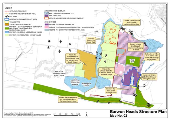
Council received 928 submissions in support of this position. This included 772 online google App pro-forma individually lodged submissions. The App was created by the Save Barwon Heads Alliance (SBHA). Supporting submissions were received from local residents and organisations/agencies such as the Barwon Heads Association (#13), Corangamite Catchment Management Authority (#31), Geelong Environment Council (#65), Geelong Field Naturalist Club (#66), SBHA (#128) and the Department of Environment, Land, Water and Planning (DELWP #167).
Reasons given in support are varied but essentially highlight the following:
Barwon Heads is not a designated growth township.
Avoids unacceptable pressure on finite infrastructure and township amenity, which would destroy its coastal character and charm.
Recognition of the sensitive coastal values inherent in the physical and ecological surrounds of the township and the threat that urban development represents to these values.
Alignment with international, national, state and local policy that supports limits to growth in sensitive coastal areas where knowledge is uncertain.
Retains non-urban breaks between settlements.
Twelve submissions were received in opposition, including submissions from consultants on behalf of landowners outside the settlement boundary seeking the boundary be shifted west to include additional land.
Submission #50 was prepared by Dominion Property Group on behalf of Barwon Heads Lifestyle Pty Ltd, owners of 1900 Barwon Heads Road. This 49.6 hectare site is located on the south side of Barwon Heads Road as shown on the map in Attachment 3 (under submission #50). The submission refers to site location and characteristics; being primarily zoned Farming Zone, with a southern segment zoned Rural Conservation Zone 10 which is also applied with the Environmental Significance Overlay Schedule 2 (High Value Wetlands and Associated Habitat Protection). The Land Subject to Inundation Overlay applies to a western portion of the site.
Submission #50 refers to the site’s planning history notably the Amendment C159 Panel Report recommendation (p.45):
“Council should consider the potential for limited residential development of 1900 – 1920 Barwon Heads Road as a means of achieving a net improvement to the environmental values of the Murtnaghurt Lagoon and channel. This assessment should also address the issues raised in this report”.
According to the submission this recommendation ‘provides a significant strategic position to facilitate a revision of the settlement boundary’. Other commentary on the BHSP argues that the site’s inclusion in the settlement boundary:
Is modest, logical and would have no discernible difference to the residential land supply of the municipality or Barwon Heads.
Includes a commitment to incorporating a retirement and aged care complex as part of the development ($110m investment and approximately 140 permanent jobs).
Can contribute to the establishment of the Round the Heads Trail;
Allows efficient connection to reticulated water and sewer as well as incorporating best practice urban stormwater techniques which would pose no threat to nearby wetlands and coastal environs;
Eases housing price pressures in Barwon Heads and provides market choice;
Would consider landscape and biodiversity issues in any rezoning request; and
Is not used for agriculture (and a change of use would have negligible impact on the sector).
Submission #50 requests changes to Clause 21.14 to include the developable part of the site within the settlement boundary and designating the Neighbourhood Residential Zone Schedule 6 and DDO41. The submission further requests the developable part be applied with the DDO41 and “otherwise facilitate the use and development of the developable part of the land at 1900 Barwon Heads Road for residential purposes”.
Submission #137 was prepared by St Quentin Consulting on behalf of a consortium of landowners at 135 Taits Road, 137 Taits Road and 1941-1949 Barwon Heads Road. This 39 hectare Farming Zone site is located on the north side of Barwon Heads Road as shown on the map in Attachment 3 (under submission #137).
The submission identifies the shortcomings of the BHSP under the categories of:
Growth: the BHSP implies that Council has no obligation to plan for future growth and is therefore inconsistent with Clause 11.05-1 which seeks to provide for a broad range of housing types and redevelopment opportunities. The Amendment restricts development within the town by replacing the GRZ with the more restrictive NRZ; and replacing the RGZ with the more restrictive GRZ. A western expansion of the settlement boundary could assist in addressing the limited housing supply and may also provide land supply for other basic services needed by the community.
Wetlands: the BHSP relies on assumptions regarding the ‘substantial threat’ to these wetlands posed by development west of the settlement boundary without any supporting evidence. The BHSP has not undertaken a detailed feasibility assessment of individual sites. The BHSP should remove all arguments for not extending the boundary due to potential impacts on sensitive environments because this is simply unsubstantiated.
Development alternatives: the BHSP assumes that it is not possible to design an innovative development that is hidden from view, protects the environment and does not erode village atmosphere. An expansion to the western boundary could involve well-planned development with large separation distances to environmental values, plenty of parkland and vegetation, integrated water management, highly sustainable development outcomes and great linkages to the existing town.
Submission #137 concludes by saying a western expansion of the settlement boundary could achieve a net community benefit.
The other objections were #38, 39, 40, 51, 58, 59, 118, 126, 147 & 161. Grounds include: that Barwon Heads has a significant shortage of land for new housing; land is available on the western boundary; land is required for aged care, affordable housing, tourist accommodation, walking trails, etc; and supposed threats to wetlands can be easily managed.
Submission #39 warns that if the rural land west of the settlement boundary falls into the hands of multi-national companies subdivisions will be approved, lot yields maximised and there will be no generous offers of free land for the community. Submission #161 asks why is the Special Building Overlay in the centre of Barwon Heads being supported for medium density while the area outside the boundary is ignored (and does not have potential flood problems)?
One submission (#94), supports retention of the current boundary but considers very low density development north of Taits Road combined with compulsory revegetation would improve the Moonah Woodland area.
Officer Response
Submissions seeking a westward shift of the settlement boundary are not supported.
The supporting submissions are noted and reinforce the reasons outlined in the BHSP. Clearly, there is overwhelming and passionate support to retain the current settlement boundary location from the local community.
The DELWP submission #167 notes that the Amendment is consistent with matters it raised in earlier feedback on the structure plan. This feedback was sought during the BHSP preparation phase and incorporated the views of Parks Victoria, manager of the Lake Connewarre State Game Reserve. The comments address issues relating to policy, servicing, ecology and Ramsar obligations, and potential conflicting uses. The DELWP letter is shown in Attachment 3.
The objecting Submission #50 from Dominion Property fails to outline any planning policies to support shifting the settlement boundary, instead relying on a panel report recommendation. The C375 Explanatory Report provides a strategic assessment of the Amendment including how retaining the existing settlement boundary is consistent with the State and Local Planning Policy Framework.
Providing a commitment to deliver aged care and retirement living is noted however substantial amounts of recently rezoned residential land is available in nearby Ocean Grove and Armstrong Creek. 1900 Barwon Heads Road is located in the Farming Zone and sits outside the township settlement boundary. Clause 21.06 requires retirement accommodation to be located within urban areas, preferably within close proximity to activity centres and public transport services.
No substantive detail is provided about this commitment, nor its relationship with more conventional residential subdivision which is also presumably proposed. Regardless, the uses are urban in nature and Barwon Heads is not a designated growth location with limited local service provision.
In the Section 4 Request, Submission #50 uses the term ‘developable part of the land’. However the submission has not included any technical assessments to determine and support the limits of development. It is assumed that the submission is really seeking all of the land to be included in the settlement boundary and detailed assessments undertaken at a later time. This is assumed because a Development Plan Overlay requirement is proposed to address landscape, biodiversity, cultural heritage and stormwater constraints (on page 5).
In some locations this approach may be acceptable but certainly not in this sensitive environmental location. The BHSP sets out the reasons for not supporting urban development outside the settlement boundary, including that Clause 12 of the State Planning Policy Framework requires Council to adopt the ‘precautionary principle’. Submission #50 has not included any peer and Council engineer reviewed evidence to demonstrate net environmental benefits to the area.
Submission #137 from St Quentin agrees that the wetlands around Barwon Heads are of significance but says the BHSP relies on a series of assumptions regarding the threat posed by development. The submission says Council has not undertaken a detailed feasibility assessment of individual sites to support its position. This argument is rejected. The BHSP makes it clear that due to a lack of ‘in-principle’ support for development, Council has not undertaken any such assessments but has received high level expert advice. This position is appropriate given the policy context and purpose of the structure plan.
Other arguments raised by Submission #137 are also rejected. The Amendment is consistent with Clause 11.05-1 as it supports managed growth and redevelopment and continues to designate an area for increased housing diversity. Council welcomes innovative, sustainable development and the owners are free to pursue opportunities in the Farming Zone.
Submissions #50 and #137 highlight the contribution their land could make to the establishment of the planned ‘round the heads trail’. Private land could indeed improve the ability to realise the trail by avoiding construction within some of the Murtnaghurt tidal palaeochannel. However this alone is not a sufficient reason to support the rezoning of over 88 hectares of sensitive coastal land.
All the objecting submissions refer, in one way or another, to the critical shortage of residential land supply in Barwon Heads. They also refer to the community benefits that would accrue from providing more residential land. The BHSP notes there is a limited supply of housing (Section 7.0), though when measured against Clause 11.02-1 Supply of urban land, substantial land is available in nearby Ocean Grove and Armstrong Creek. Also, in the context of Barwon Heads, it is unlikely that providing additional land will have a marked impact on affordability. No submission has produced any evidence that shifting the settlement boundary will increase housing affordability. The BHSP does not identify future areas for new community or educational uses.
The objecting Submission #161 appears to have an interest in 1900 Barwon Heads Road. The submission raises the issue of BHSP support for medium density housing in areas prone to flooding. This issue is addressed below under ‘2. Increased Housing Diversity Area’. Statements that the area outside the boundary has been ignored for development and (unlike within the town) does not have potential flood problems is incorrect. 1900 Barwon Heads Road is partly applied with a Land Subject to Inundation Overlay under the Planning Scheme and partly designated Flood Prone under the Building Regulations.
The BHSP (p. 128) notes that Council’s Engineering Services does not support the expansion of the settlement boundary for residential development and further states:
“The location of the town boundary has always left a buffer of rural zoned land between the levee and more intensive development. Any alteration of the township boundary to the west would need to be informed by a detailed risk assessment, including structural assessment of the levee and imposition of appropriate buffers in accordance with the Victorian Floodplain Management Strategy 2016.” (p. 99)
It is further noted that both the CCMA and DELWP support retaining the existing settlement boundary location.
Concerns that the land will fall into the hands of multi-national companies (Submission #39) is not relevant to Amendment C375. In responding to Submission #94, the rezoning of land for low density or rural living is generally not supported by Council. Clause 21.06-2 Urban Growth limits rural living development to existing zoned land in existing nodes such as nearby Wallington.
Increased Housing Diversity Area
Amendment C375 proposes to rezone the Increased Housing Diversity Area (IHDA) from the current Residential Growth Zone Schedule 3 (with a maximum building height of 10.5m) to the General Residential Zone Schedule 1 (with a maximum building height of 11m and no more than 3 storeys at any point). The Amendment will also apply a Design and Development Overlay Schedule 42 (DDO42) Barwon Heads Increased Housing Diversity Area to the IHDA.
It is noted that the IHDA south of Bridge Road is proposed to be removed – refer to the section below under the heading ‘Residential land south of Bridge Road’.
The exhibited IHDA is mapped as follows:
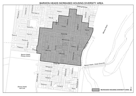
Council received 78 submissions that object to the existence of the IHDA policy. Objections seek to either remove the IHDA completely or reduce its extent. Submissions generally call for this area be rezoned to the NRZ.
Submission #10 was a petition with 24 signatures from residents seeking removal of the IHDA from the western side of Golf Links Road. Hence the submission requests this area be rezoned to the Neighbourhood Residential Zone. Reasons for the change include: negative impact on the neighbourhood; conflict with the nearby school traffic, parking and pedestrian activity; 11m is too high in the context of mainly single storey dwellings in this part of Barwon Heads; and the Neighbourhood Residential Zone still encourages development of a significant height.
Submission #57 typifies submissions saying: “I do not support an IHDA classification for Barwon Heads. The principles behind the IHDA are not compatible with a non-growth zone small coastal village. It is out of scale with the size of the town”. Submission #123 says the IHDA is not applicable as Barwon Heads is a coastal village and does not have transport hubs such as railway stations.
Submission #82 challenges the IHDA saying: “The Housing Diversity Strategy, in Map area 4, was applied by Council in 2008 and was not based on a detailed review of the existing character of individual settlements like Barwon Heads. The outcome is that a large part of Barwon Heads was identified as an ‘Increased Housing Diversity Area’. Apparently only for the reason it was within the 400m of a shopping area.”
Common to many of the objections is that the 11 metre building height limit (and 3 storeys) is too high and should be reduced to 9m. It is fair to say there is confusion as to why the height limit is being increased to 11m yet the zone is changing from Residential Growth to General Residential.
Some submissions highlight the conflict with the existing Flinders Heritage Area (see submission #81 and #136 for instance) and encouraging development in an area prone to flooding. There is also concern that the proposed DDO42 will do little to protect the unique coastal character of Barwon Heads.
The Barwon Heads Association Submission #13 seeks a reduction of the IHDA to 100m from the current commercial zone and limit to Ozone Road. Submission #77 advocates two IHDA areas: Hitchcock-Ozone-Grove-Bridge Roads and Hitchcock-Colite-Margate-Geelong Roads. Submission #84 suggests an area bound by Ozone Road, Grove Road, Bridge Road and Grandview Parade.
Seven submissions support the IHDA and associated zone and overlay controls.
Officer Response
Submissions calling for the complete removal of the Barwon Heads IHDA are not supported. The IHDA policy is embedded in the Municipal Strategic Statement at Clauses 21.06, 21.14 and 22.63. The policy is not ‘new’ and has formed part of Council’s housing strategy for 10 years. It also recognises the strategic policy in the G21 Regional Growth Plan for Barwon Heads to receive a ‘moderate’ degree of new residential development while respecting existing character.
There is continued need to encourage and support increased housing diversity close to the town centre. The existing Residential Growth Zone Schedule 3 Coastal Increased Housing Diversity Areas applies to all the Bellarine towns and sets a 10.5 metre building height limit. However, as a consequence of the State Government reformed residential zones (VC110) policy, RGZ schedules must be at least 13.5 metres. Heights of 13.5 metres and above (effectively 4 storeys) are not consistent with the preferred character of Barwon Heads.
The BHSP has recommended that the IHDA be rezoned to the General Residential Zone and applied with a new DDO42. The purpose of the proposed GRZ remains consistent with the intent of the IHDA. The GRZ sets a maximum building height requirement of 11 metres and 3 storeys (which schedules cannot lower) and is similar to the existing 10.5 metres. Therefore, while the height limit has increased by half-a-metre, the addition of the DDO42 provides design requirements to ensure that dwellings are designed, sited and landscaped in a manner to reduce the dominance that a two or three storey building would have on the streetscape.
Overall, the purpose of the GRZ is to encourage housing diversity and growth that respects neighbourhood character, while the purpose of the NRZ is primarily to preserve identified character. Given the IHDA is to remain, rezoning this area to the NRZ is not appropriate and not supported.
Concerns about the blanket 400m walkable catchment methodology applied under the 2008 Housing Diversity Strategy are not without merit. This methodology was applied uniformly to all the coastal towns, including the larger nearby Ocean Grove (noting that Ocean Grove has two separate IHDAs) which is a designated growth location.
However the 2008 Housing Diversity Strategy recognised that further work would be required stating on page 53:
“Subject to…specific studies undertaken by Council, consider [of] the use of Significant Landscape, Design and Development or similar Overlays to protect areas of specific urban design…notably specific areas of…Barwon Heads (RCS Precinct 2, 4, 5 and 6).”
This work occurred in the preparation of the 2017 BHSP where Council engaged Hansen Partnership and the Barwon Heads Residential & Landscape Character Assessment March 2017 was completed. The purpose of the Character Assessment was to determine if there is a need for new planning controls for residential development in Barwon Heads, in order to protect or enhance the existing character of the town in the face of new development.
The Assessment formed the view that (p. 38): “Increased diversity of housing stock is still encouraged but at a lower intensity commensurate with the scale of the township, associated availability of services and facilities, as well as the preferred character.”
The Character Assessment, which included field work and community engagement, has informed the BHSP settlement and housing discussion and directions. The City will undertake similar assessments for the other Bellarine townships to guide housing change as time and budget allows.
Other main issues raised in submissions are addressed as follows:
Reducing the extent of the IHDA (other than west of Golf Links Road) is not supported. As discussed above the strategic policy basis for the designated area is sound. Further review by the Barwon Heads Residential & Landscape Character Assessment recommended removing only two discrete parts.
Removal of the IHDA from the western side of Golf Links Road is supported. This area is recommended for removal in the Barwon Heads Residential & Landscape Character Assessment (p. 41). This will require changes to planning scheme maps 81 and 88 to remove the GRZ1 and replace with NRZ6; and remove DDO42 and replace with DDO41.
It is acknowledged that there is some conflict between the Flinders Heritage Area (HO1649) and the IHDA. This conflict exists now. The HO supporting policy Clause 22.36 promotes detached, single and double storey dwellings (amongst other design characteristics) which differs from the proposed GRZ maximum height of 11m and the IHDA policy. Local Policy Clause 22.63 Increased Housing Diversity Areas requires developments to respond positively to heritage matters. Permit applications in the HO will continue to be assessed on their planning merits.
It is noted that just because the GRZ allows dwelling heights up to 11m does not automatically mean landowners/developers will seek higher dwellings. The Hansen assessment found no 3 storey buildings when it undertook its analysis in 2016. Since the assessment, two 3 storey buildings have been constructed, neither in a HO.
It is acknowledged that parts of the IHDA are applied with a Special Building Overlay (SBO) and therefore prone to flooding. The BHSP responds to this constraint by proposing the GRZ and DDO42 to ensure redevelopment provides reduced building site coverage, and increased areas for soft landscaping, front setbacks and side setbacks. Applying these design requirements will reduce stormwater flow restrictions and increase infiltration.
The introduction of the NRZ, DDO41 and removal of the IHDA from land south of Bridge Road and west of Golf Links Road are further measures to lessen the extent of stormwater flooding impacts in Barwon Heads.
The interrelated hazard of climate change/sea level rise was raised in seven submissions. Climate change is discussed in the BHSP on pages 101-102 and includes a map showing the flood risk (1% Annual Exceedance Probability) and the climate change risk to 2070 and 2100 (for events that occur under a 1% AEP storm surge event on top of sea level rise scenarios). The mapping shows potential inundation to fragments of the IHDA under 0.8m sea level rise (by 2100).
The recently completed Bellarine Peninsula – Corio Bay Local Coastal Hazard Assessment Greater Geelong and Queenscliffe Planning Schemes Implementation (Our Coast, Final Report, Dec 2017) recommends that mapped inundation affecting urban areas be applied with a Land Subject to Inundation Overlay supported by local policy. Given that hazard assessments apply to Breamlea, Ocean Grove, Point Lonsdale, Queenscliff, St Leonards, Indented Head, Portarlington and Corio Bay, as well as Barwon Heads, Council officers are currently resolving a preferred approach to implement this information uniformly into the Planning Scheme.
Warrenbeen Court
The Amendment proposes to zone land in Warrenbeen Court to NRZ 7, with a minimum lot size of 4000 m2 that may be created in subdivision of an existing lot, and to permanently apply Schedule 6 to the Environmental Significance Overlay (ESO 6). ESO 6 currently applies on an interim basis until 30 June 2019.
11 submissions supported the Amendment’s proposals for Warrenbeen Court; eight objected and one requested changes. The eight objecting submissions were made by Warrenbeen Court landowners – owners of eight of 14 affected properties. Another submission from a Warrenbeen Court landowner did not object to the Amendment but requested changes to the wording of ESO 6. One supporting submission was from the Barwon Heads Association; the other 10 from individuals.
Issues raised by the objecting submissions included:
Subdivision restriction
Seven of the eight objecting submissions specifically opposed the proposed subdivision restriction (4000 m2 minimum lot size for any subdivision) and/or indicated the submitters had intended to subdivide their properties after the expiry of a restrictive covenant at the end of 2020. Three submissions indicated that subdivision of Warrenbeen Court lots could still maintain the existing street character and style. Two submissions contended that subdivision of lots into two (allowing one new dwelling) could retain significant Moonah or would not have significant environmental impact.
Retrospective and detriment to owners
Five submissions indicated that the Amendment is a retrospective action that discriminates against owners. One argued that Warrenbeen Court has long been zoned and developed for residential use, which should be the primary policy consideration. Another stated that the effected properties are private residences, not State Parks. Two submissions queried why properties were given two street numbers if Council’s original intention was not to allow subdivision. Another contended that the original Council subdivision approval being time limited indicates further subdivision after 2020 was originally intended.
Environmental Significance Overlay Schedule 6
Submissions objecting to ESO 6 argued it is: an unnecessary burden and restriction; too onerous; inappropriate in a residential area; restrictive and unreasonable in not allowing works such as carport, driveways, gardens or chook pens; best applied to land yet to be developed; and offensive to submitters who have developed sympathetically and cared for the Moonah environment.
Submissions argued that a Vegetation Protection Overlay (VPO) should be used instead of an ESO; one submission argued the purposes of a VPO are more closely aligned with the findings and recommendations of the tree assessment. One submission stated ESO 6 results in significant fire danger, arguing it would create dense, fire-fuelling vegetation in the form of trees and widespread undergrowth.
Vegetation
Several submissions raised issues specific to the vegetation the Amendment seeks to protect. Two submissions argued there are Moonah trees in several other locations in Barwon Heads; one argued that Warrenbeen Court has been unfairly singled out. One submission argued that the Warrenbeen Court Moonah is not the healthiest condition; another stated that much of the subdivision area is degraded and is no longer Moonah woodland. Another submitter indicated that they have planted many Moonah and Bellarine Yellow-gums in the area and managed trees on their property, but this appears to stand for nothing. A submission argued it is not feasible or viable to expect landowners in an established residential area to begin land management.
Other matters
Two submissions indicated a lack of consultation on the proposals. Frustration was expressed that alternatives suggested in submissions to the Structure Plan were not reflected in the adopted Structure Plan. One submission stated Council has not mentioned that restrictive covenants that expire at the end of 2020. Two submissions argued that Council should maintain the ability for infill development because extension of the town’s Settlement Boundary is not proposed. One submission contended Council is trying to placate residents elsewhere in Barwon Heads to the detriment of Warrenbeen Court landowners.
Officer Response
Clause 21.14-3 of the Scheme includes a further work action to undertake a landscape assessment study for Warrenbeen Court with the intention to apply an overlay to protect the existing character and vegetation. This action has been in the Scheme since 2010 and was proposed in the 2007 Barwon Heads Structure Plan.
Council commissioned Ecology & Heritage Partners to conduct a significant tree assessment within private land in Warrenbeen Court (it also assessed some adjacent land in Saratoga Court). The assessment, completed in October 2016, found remnant indigenous vegetation representative of the Ecological Vegetation Class: Coastal Alkaline Scrub (EVC 858). This EVC corresponds with the Coastal Moonah woodland community, listed as threatened under the Flora and Fauna Guarantee Act 1988. The report identified Coastal Moonah woodland on all privately owned lots proposed to be zoned NRZ 7 by this Amendment. The vegetation in that area ranged from good condition to poor to moderate condition. The report concluded that all areas supporting remnant vegetation in the study area should be retained and maintained and recommended planning controls to protect the vegetation.
The Amendment is justified to protect the very low density residential character and the Coastal Moonah woodland community vegetation identified by Ecology & Heritage Partners in Warrenbeen Court. The location of vegetation is such that further subdivision of the area and subsequent development of new dwellings would require substantial vegetation removal. The minimum lot size has been set at 4000 m2 in order to prevent subdivision of lots containing the vegetation the Amendment seeks to protect.
An aerial map of Warrenbeen Court is shown below:
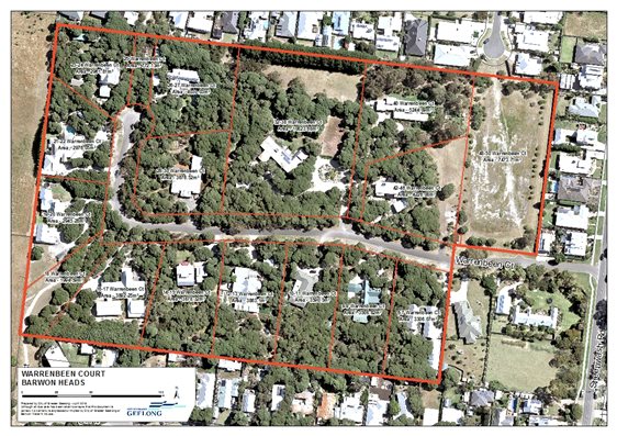
ESO 6 requires a permit to remove, destroy or lop vegetation indigenous to Victoria in most circumstances, as well as a permit for buildings and works affecting or within 2 metres of the outer edge of three canopy of vegetation identified in the Ecology & Heritage Partners report. Prior to the interim ESO 6, a permit was only required to remove vegetation on lots above 4000 m2; the majority of lots in Warrenbeen Court are below 4000 m2.
An ESO is preferred to a VPO. While a VPO would protect specific trees, the ESO protects the entire vegetation community, including the understorey. The ESO protects the vegetation community from building or construction works by requiring a permit for these and through decision guidelines specifying the need to avoid removal, lopping, destruction or disturbance of the Coastal Moonah Woodland community.
An ESO has been applied to protect environmental values in vegetated existing residential areas elsewhere in the City of Greater Geelong (e.g. Breamlea) and other Victorian local governments. While Warrenbeen Court vegetation was assessed, an approximately 1000 ha study area to the west of the Barwon Heads township was also assessed by Ecology & Heritage. ESO 6 is also being applied to portions of several Taits Road properties as well as some Saratoga Court properties.
Council acknowledges that landowners have managed the Coastal Moonah woodland, with the Ecology & Heritage assessment identifying vegetation on many lots as being in good or moderate condition. However, the Amendment’s proposals are warranted to ensure ongoing protection of the Coastal Moonah Woodland community.
With respect to bushfire hazard, Clauses 41.01-3 and 52.48 provide exemptions from the requirement for a permit to remove, destroy or lop vegetation in certain circumstances for bushfire protection. It is understood that the operation of Clause 52.48 is under review by the State Government.
There are restrictions created on the Plan of Subdivision for Lots 1 to 14 Warrenbeen Court, stipulating:
The owners ... shall not allow the erection of more than one dwelling on any single lot or further subdivision of any lot.
The owners ... shall not develop the land other than in accordance with an approved Neighbourhood Design Plan pursuant to Planning Permit No. 1057/97.
The second dot point means that no building can be located outside the building envelopes shown on that Neighbourhood Design Plan.
A separate private covenant on all but one lot, among various other matters relating to land use, stipulates an owner shall not build more than one dwelling on a lot or cause or permit the lot to be subdivided. This covenant expires on 31 December 2020.
While the second covenant expires at the end of 2020, the restrictions on the Plan of Subdivision will remain. The implications of these restrictions is that, regardless of Scheme controls, subdivision would not be possible without removing or varying these restrictions. The process for such removal or variation is set out in the Transfer of Land Act 1958 and the Planning and Environment Act 1987. Removing or varying the restrictions in order to allow subdivision would be highly unlikely without the consent of all landowners who are beneficiaries to the covenant, given Section 60(2) of the Planning and Environment Act 1987 and the impacts of substantial vegetation removal that subdivision and development of new lots would entail.
The restrictive covenants are separate from the Scheme and are not the reason or justification for the Amendment. However, the ongoing restrictions on the Plan of Subdivision provide context for judging the fairness of the Amendment’s controls on subdivision and development.
Range street numbering merely reflects the lengths of a property’s street frontage and is completely independent of whether there is current or anticipated subdivision potential.
Submissions on the Barwon Head Structure Plan regarding Warrenbeen Court were considered and are referred to in the adopted 2017 Structure Plan.
A few of the requested changes to ESO 6 (Submission #99) supporting the Amendment are supported as they provide clarity around Permit requirements. However, most of the requested changes are not supported as they are superfluous, inconsistent with the ESO parent clause 42.01-2 or contrary to the Ministerial Direction on the Form and Content of Planning Schemes.
Residential land south of Bridge Road
21 submissions specifically addressed Area 5, south of Bridge Road. The Amendment proposes to rezone ‘Area 5’ from Residential Growth Zone Schedule 3 (RGZ 3) to Neighbourhood Residential Zone Schedule 6 (NRZ 6), and to apply a new Design and Development Overlay Schedule 41 (DDO 41). Of the 21 submissions, eight supported and 13 opposed the Amendment’s proposals for the area. Of the eight supporting submissions, three were from affected owners. Of the 13 objecting submissions, 12 were from or on behalf of affected owners.
Objecting submissions raised a wide range of issues. Comments on the Amendment’s proposals in general included:
The Amendment affects Area 5 much more than other parts of Barwon Heads.
The Amendment significantly restricts opportunity to meet increased housing demand.
Higher density must be allowed if town’s settlement boundary is not expanded.
The proposals contradict the Housing Diversity Strategy and the 2017 Barwon Heads Structure Plan, which identify an ageing population and the need for greater housing diversity and indicate urban consolidation and infill is the most appropriate way to accommodate projected population growth.
Area 5 has no unifying neighbourhood character or unique landscape character.
It is arguably too late to preserve the character of the area, as many existing dwellings in the area are not consistent with the Amendment’s requirements/guidelines.
Height limit and site coverage are impractical for building a house.
Adverse impacts on land values.
Comments specifically on the proposed rezoning from RGZ to NRZ included:
Stifles development opportunities and inadequately supports projected population growth.
Good design outcomes can be achieved by retaining the RGZ and relying on tools such as Clause 55 and a DDO.
Despite the height limit change from 10.5 metres to 9.0 metres, allowing three storey buildings will dramatically change appearance of area.
Some land south of Bridge Road should be included in GRZ, near the supermarket (approximately 400 metre area between Hitchcock Avenue and Ewing Blyth Drive).
A wide range of comments were made regarding proposed DDO 41. Most objecting submissions commented on the proposed 40% site coverage, arguing that it:
is overly restrictive and disadvantages affected owners. One submitter indicated it would prevent them extending their home. Another indicated it would cause them to build higher than they would prefer. It was argued that the site coverage reduction is unfair on owners yet to build or redevelop;
is too restrictive on smaller lots (a 300 m2 lot and a 540 m2 lot were cited in separate submissions); one submission argued the Amendment should acknowledge that a permit for site coverage above 40% is supported on smaller lots created at an earlier time;
is unrealistic given most properties in the area already exceed this;
being reduced from 70% to 40% is a substantial rather than incremental change. A submission contended this was insufficiently highlighted during exhibition and many landowners were unaware of this change;
will result in more two or three storey dwellings, with overshadowing and adverse impact on character and streetscape, particularly on smaller lots;
makes little sense given trend towards larger dwellings; and
should be changed: one submission suggested 50 to 55%, two indicated 60%, and another indicated it should be removed or replaced with a more incremental change that also considers different limits for different lot sizes.
Submissions made comment on other specific aspects of DDO 41 include:
A design objective in Point 1 is “to protect the unique low scale coastal design character of Barwon Heads”, but this character was lost many years ago.
Several submissions objected to this point in 2.0 (Buildings and works): “Buildings are designed with lightweight, natural and timber materials and unobtrusive building colours”. Comments included the requirement is too restrictive; few existing structures use these materials; these materials require frequent upkeep in a seaside environment; and colour control could result in a bland built environment.
The requirement in 2.0 (Buildings and works) for a landscaping plan to be prepared for the site by a qualified landscape architect was questioned, contending that requiring a landscape architect is excessive and a cost burden.
Setbacks (Table 1) should be based on lot orientation.
The required min 2 m setback to at least one boundary (Table 1) will severely limit development; many properties currently do not comply with this setback.
Not clear that requiring garages to be set behind building frontages (Table 1) results in a more appealing outcome.
A 1 m high fence (Table 1) provides insufficient security.
Reducing the dominant scale of the upper level can be achieved in a number of ways, not necessarily recessing or articulating (5.0, Decision guidelines).
Officer Response
The proposed rezoning of Area 5 from RGZ 3 to NRZ 6 and the application of DDO 41 reflect recommendations of the Residential and Landscape Character Assessment 2017 (Character Assessment) undertaken by Hansen Consultants to inform future infill development in Barwon Heads. This assessment informed the 2017 Structure Plan.
The RGZ zoning of Area 5 has resulted from the City’s Housing Diversity Strategy. The Character Assessment noted that the Housing Diversity Strategy was undertaken at a municipal level and consequently was not based on a detailed review of the existing character of individual settlements. The Character Assessment also noted that the RGZ, which encourages higher density residential development, without regard to the existing character of the area, may be inappropriate for this area.
The Character Assessment identified the area south of Bridge Road as having a particularly strong character through the unformed nature of roadside and vegetation, which would be significantly compromised by more intensive development. It noted that the area is influenced by both the public and private realms, with the topography and road treatments particularly influential and vegetation across both the public and the private realms also notable. The Character Assessment recommended that the area be deleted from the Increased Housing Diversity Area (IHDA).
The particular character of the area south of Bridge Road has also been previously recognised. Clause 21.14 of the Scheme includes a further work item to undertake a landscape assessment study of the Ewing Blyth/Golf Links/Bridge Road area with the intention to apply an overlay to protect the existing character and vegetation. The area was also identified as having a distinct character by the 2001 Geelong Neighbourhood Character Study.
Consistent with other non-IHDA residential areas in Barwon Heads, the Amendment proposes the NRZ for Area 5. Given the findings and recommendations of the Character Assessment, reflected in the 2017 Structure Plan, this zoning is considered well justified. The IHDA, with its greater opportunities for infill development, will remain to the north of Bridge Road and east of Golf Links Road.
Only a small proportion of properties in Area 5 currently exceed 40% site coverage. There are very few vacant lots smaller than 500 metres2 in Area 5. For the few smaller lots in the area, a permit application proposing greater than 40% site coverage could be considered, although a very strong case would be required given 40% maximum site coverage is both a permit trigger and a design requirement on Table 1. In addition to protecting the character of the area, the proposed 40% maximum site coverage will also help to lessen stormwater drainage problems in Barwon Heads by retaining more permeable area as development proceeds.
The proposed reduction in maximum site coverage in Area 5 from 70% to 40% was clearly stated in information mailed to all landowners.
It is acknowledged that the NRZ and DDO 41 may result in more multi-storey dwellings; this is not considered an undesirable outcome. The Character Assessment has already identified the area south of Bridge Road as having a higher presence of two storey buildings than most of the town. The reduced site coverage will provide greater opportunities to retain existing and plant new trees, so that multi storey dwellings will sit in a more vegetated landscape. Under the NRZ, a 9 metre maximum height will apply.
The various comments in submissions on specific aspects of proposed DDO 41 have been considered and some changes to DDO 41 are recommended in response to these. Recommended changes to Point 2.0 include removing the requirement for a landscape plan to be prepared by a qualified landscape architect and removing reference to unobtrusive building colours. However, the majority of the content of proposed DDO 41 is considered appropriate and well justified, being based on recommendations of the Character Assessment.
Neighbourhood Residential Zone
The majority of the township is proposed to be rezoned from General Residential Zone Schedule 2 (GRZ2) to Neighbourhood Residential Zone Schedule 6 (NRZ6) accompanied by a Design and Development Overlay Schedule 41 (DDO41) Barwon Heads Incremental Change Residential Area.
The Barwon Heads Association Submission #13 and other submitters support the NRZ6 however believe a minimum lot size of no less than 400 square metres should be applied. There is widespread support for the 9m building height limit and reduced building site coverage of 40%. Submission #84 suggests the DDO41 should be applied to ‘Area 2’.
Submission #6 is strongly opposed to the 9m height limit and seeks 11 metres. Submission #94 also favours 11m in ‘Area 1’. On the other hand, Submission #87 says the height limit should be reduced to 7.5m.
Submission #111 by Novo Planning on behalf of a Barwon Heads landowner says the rezoning from GRZ1 to NRZ6 blanket application should be modified to apply to targeted areas in the township (Precincts 8 and 10 in the Barwon Heads Residential & Landscape Character Assessment March 2017 should be excluded from NRZ6 and DDO41). The submission states:
Newer development areas should remain in the General Residential Zone Schedule 2 to allow for varied development outcomes.
The DDO41 should be applied to areas that have high visual amenity such as main roads and more established areas, not nearly all of Barwon Heads residential areas. The 40% maximum site coverage and 30% soft landscaping requirements are not supported.
The default site coverage of 60% should remain, particularly given the inconsistency in the Barwon Heads Residential & Landscape Character Assessment.
The combination of the garden area, landscaping and site coverage requirements are onerous and limit infill development and good design outcomes.
Officer Response
The request to introduce a minimum lot size of no less than 400 square metres is not supported. Such a control would place serious restrictions on lots of less than 800 square metres and cause material detriment to landowners. Changing the exhibited NRZ6 to include a minimum subdivision area would be a transformation of the Amendment and, in accordance with the rules of natural justice, require reengagement and notification.
The Barwon Heads Residential & Landscape Character Assessment has recommended zone and overlay controls to better protect and enhance the town’s character as infill redevelopment occurs. The assessment identified the special vegetation character of Warrenbeen Court properties that warrant a minimum subdivision control. However the assessment recommended the broader township be applied with design and development overlays – which are performance based tools. No submission has provided expert landscape character evidence to support the introduction of a 400 sqm minimum lot size.
Applying the DDO41 to ‘Area 2’ is not supported as these are new residential subdivisions with notable character differences. The built form is unlikely to change and applying the DDO41 would have little to no benefit.
Submissions that oppose the height limit of 9 metres – and seek either higher or lower limits, are not supported. The NRZ is a Victorian Planning Provision that cannot be altered by Council. The NRZ at Clause 32.09-9 sets the building height at 9m and no more than 2 storeys at any point.
Submission #111 fails to identify the address of properties owned – which may give a clearer indication of why Precincts 8 and 10 are specifically requested to be excluded from the proposed NRZ and DDO41. The arguments raised in the submission are rejected.
The BHSP directs that the General Residential Zone only be applied to the IHDA. The IHDA is where infill development and diversity is encouraged. Precincts 8 and 10 in the Character Assessment are areas where most of the housing stock dates back to the 1980s or earlier. Application of the NRZ6 and DDO 41 to these areas is well justified and consistent with nearly all of Barwon Heads’ residential areas outside of the IHDA.
DDO 41 proposes maximum 40% site coverage, as a permit trigger and development requirement. This reflects the existing character of the town, with the great majority of properties having less than 40% site coverage. The Character Assessment notes that this lower site coverage will also reinforce the unique context of Barwon Heads and its associated ‘coastal’ character. In addition to protecting the character of the area, the proposed 40% site coverage will also help to lessen stormwater drainage problems in Barwon Heads by retaining more permeable area as development proceeds. The 40% site coverage is appropriate for all of the proposed DDO 41 area.
The garden area requirement is separate from, though complementary to, the site coverage and landscaping requirements in DDO 41, although it achieves similar outcomes. All of these requirements would apply, noting that the garden area requirement is mandatory whereas the other requirements may be varied.
Movement and parking
51 submissions specifically raised traffic and/or parking issues. Car parking was a clear matter of concern to submitters, with 47 submissions specifically referring to parking issues. Submissions outlined existing traffic and/or parking problems in Barwon Heads. Many indicated that these problems are worst in summer, peak holiday periods and weekends, but are extending throughout the year. Concern was expressed that problems would worsen with population growth in surrounding areas, increasing visitor numbers and new development in Barwon Heads.
Previous parking and traffic studies were criticised for being out of date and taking place outside the summer peak holiday season. Many submissions called for a new traffic and parking study and for traffic and parking improvements to be identified, rather than just ongoing monitoring.
Specific traffic issues raised included:
congestion on the bridge between Barwon Heads and Ocean Grove;
safety risks from arterial road traffic, including trucks, to pedestrians and cyclists, particularly Barwon Heads Primary School students;
impact of Bridge Road pedestrian crossings on traffic flow;
traffic congestion and management on Hitchcock Avenue and Ozone Road;
emergency vehicle access;
speed limits (two submissions suggested a 40 km/h limit, one for the whole town, one for all of Hitchcock Avenue).
Several submissions addressed pedestrian and cyclist networks and safety. Reduced safety for pedestrians and cyclists due to increased traffic volumes and congestion was cited. Submissions called for an expanded network of pedestrian and cycle paths. Two submissions recommended enhancing or preserving laneway links. Two submissions specifically indicated that improved roads, footpaths and cycle paths should not be funded through Special Rates and Charges, but through current rates/consolidated revenue.
A submission from the Department of Economic Development, Jobs, Transport and Resources (DEDJTR) indicated that Transport for Victoria and VicRoads are aware of community concerns regarding traffic congestion and that VicRoads is monitoring the issue, but has not developed any proposals at this stage. The DEDJTR submission indicated that the Structure Plan should identify shared path connections to the broader path network including the Thirteenth Beach coastal path extension to the path between Blackgate Road and Breamlea Road.
Many submissions referred to limited availability of car parking in Barwon Heads, particularly in and around the town centre. Concern was expressed at the impact of on-street parking in streets surrounding the town centre. 25 submissions raised the need for each development to provide adequate car parking. Most of these specifically expressed concern with the waiving of parking requirements for individual developments, with the impact of waived parking requirements on parking availability in and around the town centre cited in several submissions. Concern was also raised with the standard parking requirements for dwellings. Nine submissions expressed concerns with underground parking, including impact of the water table, flooding of car parks and neighbouring properties and impact on building foundations.
Among a wide range of specific solutions recommended in submissions to address parking issues were:
developing off-street car parking on Council or private property in or near the town centre;
improved enforcement of existing parking restrictions;
increasing timed parking bays on Flinders Parade;
analysing cumulative parking impacts of new development in Hitchcock Avenue;
requiring parking assessments to be carried out over summer and weekends; and
phasing out residential use in the town centre so that land is only used for commercial use or parking.
Officer Response
Community concerns with traffic volumes and flows and car parking supply in Barwon Heads are acknowledged and addressed in the 2017 Structure Plan.
An arterial road passes through Barwon Heads (Barwon Heads Road, Golf Links Road, Bridge Road and the Barwon Heads Bridge) and is managed by VicRoads. Council has to work within the limitations this arterial road alignment presents with respect to traffic movements in Barwon Heads. The Structure Plan recognises slower traffic flows and parking availability problems in peak holiday periods.
Council has previously commissioned traffic and parking studies for Barwon Heads, undertaken in 2003 and 2010. Council has implemented a wide range of traffic and parking improvements since the 2010 Barwon Heads Traffic and Parking study and continues to undertake monitoring of traffic and parking. Council’s Engineering Services does not support requests for a new traffic and parking study for Barwon Heads.
Council’s Engineering Services advises that further speed reductions on certain roads in the town would inevitably transfer problems to other roads, and that a blanket speed limit reduction across Barwon Heads would likely have a detrimental impact on the overall traffic flows in the town.
With respect to pedestrian and cycling infrastructure, the Structure Plan notes proposed improvements and states that Council will continue to undertake improvements to the road and pedestrian network and facilities when funding is available and in line with Council strategies and priorities.
DEDJTR’s submission that the Structure Plan should identify shared path connections to the broader path network including the Thirteenth Beach coastal path extension to the path between Blackgate Road and Breamlea Road is supported. The Structure Plan Map proposed to be included in Clause 21.14 already contains the notation “Support the development of a coastal path along Thirteenth Beach Road” and no change to the Amendment is required. However, the text of the Structure Plan can be revised to refer to that path connecting to the off-road path between Blackgate Road and Breamlea Road.
With respect to parking, the Structure Plan (Part C, point 6.4.4) identifies options that may be considered by Council in future, subject to funding and community support. A Special Rates and Charges Scheme is included as an option for funding car parking or footpaths, however the Structure Plan notes that community consultation would be required due to the financial implications this would have on affected ratepayers.
The Scheme provisions setting car parking requirements for various uses and addressing reductions to car parking requirements are Victoria Planning Provisions, applying throughout Greater Geelong and elsewhere in the State. Council has permitted reduced parking provision for a small number of mixed use (commercial and residential) developments in the town centre in recent years. These have been considered in accordance with Scheme provisions, a parking demand assessment and the advice of Council’s Traffic Unit.
Basement car parking is able to be approved subject to Engineering assessment and support and appropriate conditions. Where a Special Building Overlay applies, flooding risk must be considered when assessing proposed developments. The BHSP is a land use plan rather than a detailed traffic and parking plan. The issue has been adequately addressed in the Structure Plan and potential improvements can continue to be considered by Council on an ongoing basis.
Vegetation protection
24 submissions highlight the important contribution that vegetation provides within the Barwon Heads township. There is a concern that the Amendment fails to adequately protect the town’s vegetation, notably when redevelopment occurs. Submissions request controls be applied to private land similar to that proposed for Warrenbeen Court and in Ocean Grove.
The BHA request that Council urgently undertake further assessment of significant trees on private land (as well as public land) to support planning or other legal controls on the removal of vegetation to preserve landscape character.
Officer Response
Introducing vegetation protection controls in residential areas is problematic, especially where blanket controls are applied. As was the case with Warrenbeen Court and the Ocean Grove Significant Tree Project, previous studies and structure plans had identified the need for technical assessments to determine the merits of new vegetation controls in specific areas.
Planning Practice Note 07 Vegetation Protection in Urban Areas provides guidance on how to assess the significance of vegetation and how to protect significant vegetation. The Note states if the planning scheme is to be used to protect vegetation, a vegetation survey or study must be undertaken.
It would be a flawed approach for a Council to propose onerous vegetation controls on private land without supporting evidence. Statements such as that from Submission #122: “Significant vegetation and trees should be protected with tighter controls and a permit needed to remove any of the above”, while well meaning, would need to be supported by such evidence. The 2017 BHSP does not include any studies of private land vegetation nor recommend additional controls to the ESO6.
However this does not mean that the BHSP is silent or dismissive of the important value that vegetation – both indigenous to the area and non-indigenous – makes to Barwon Heads.
Amendment C375 proposes Design and Development Overlays to virtually the entire township. These overlays will, where a permit is triggered, require those seeking to redevelop to place greater emphasis on clever siting and design that gives proper consideration to protecting existing vegetation and incorporating new vegetation.
This is considered to be a practical and immediate approach to address the incremental loss of vegetation on private land.
The Amendment also includes the following proposed “Further work” to Clause 21.14:
Undertake a study to identify significant vegetation and biodiversity values of public areas and roadsides within Barwon Heads.
No further work or studies have been identified for private land in Barwon Heads. If the Barwon Heads Association is aware of particular vegetation areas of significance it had ample opportunity to highlight such areas during the BHSP consultation phase.
Drafting
This section addresses submissions that request general and specific drafting changes to the exhibited Amendment documents that have not been mentioned in previous sections of the report.
Common to many submissions is that the DDO41 and DDO42 single dwelling exemption from notice and review provision should be removed. Submission #13 states:
“I do not support the total exemption of planning permit applications for single dwellings from advertising and third party appeal rights. It is critical that residents be made aware of the proposed planning permits for all dwellings, be they single or multi-dwelling developments, so they can use their third party appeal rights when appropriate. By removing this right of appeal the community cannot express its views on inappropriate constructions. We need to retain this right to appeal against inappropriate constructions. Council must not remove this right.”
Submission #41 supports exemption provisions.
Further in relation to the DDOs, Submission #24 (and others) state:
“If DDO’s are to be of any use and to have any impact there need to be rigorous mechanisms for ensuring that design character requirements are clearly identified and incorporated into the design process of the development. A mechanism then needs to exist which sees that they are strictly adhered to and permits are not issued unless all requirements have been met. Requirements need to be much tighter. If the CoGG is serious about retaining the ‘coastal character’ of Barwon Heads this needs to be addressed urgently.”
And from Submission #81:
“The Design and Development Overlay 42 that is also proposed for Area 4 is manifestly inadequate. Although the reduction in coverage from 70% to 60 % is welcomed, the Decision Guidelines do not guarantee that dwellings will not dominate the streetscape or have a dominant built form or sufficient front setbacks or significant landscaping. The problem with these type of design overlays is that some or all of the key points can be waivered by well-meaning strategic planners. Or the” Buildings and works” requirements are open to a wide variety of interpretation by town planners and builders and developers.”
Requests for specific drafting changes are addressed in the ‘Officer Response’ section.
Officer Response
Having considered the submissions Attachment 4 highlights (in yellow) changes which will replace the exhibited Amendment clauses as Council’s position at the Panel Hearing. It is noted that some of the Attachment 4 drafting changes have been instigated by Council officers to improve clarity and purpose.
Removing the DDO41 & 42 notice and review exemption is not supported. The exemption only applies to single dwellings that do not meet measurable permit triggers in Table 1. Where a permit is required Council statutory planning staff are suitably equipped to assess the application. This is considered reasonable and appropriately limits applicant and Council time and cost. It is important for the community to understand that non-compliance with ResCode provisions (such as overlooking or overshadowing) are not assessed under the DDOs.
Submissions calling for the DDO requirements to be ‘tighter’ and ‘strictly adhered to’ need to appreciate the subjective nature of the requirements. Unlike the design requirements in Table 1 (of both DDO41 & 42), which are measurable, the buildings and works requirements pose a more sophisticated assessment of how individual design elements work together. The DDOs are drafted so that the permit triggers (i.e. Table 1) serve as the benchmark for all development, and variations will need to demonstrate how a specific design response to site context achieves the character objectives.
This approach is consistent with PPN59 The role of mandatory provisions in planning schemes. It notes the Victorian Planning Provision process is primarily based on the principle that there should be discretion for most developments, and that applications are to be tested against objectives and performance outcomes, rather than merely prescriptive mandatory requirements. Blanket mandatory controls are not appropriate for Barwon Heads.
Suggested specific drafting changes are responded as follows:
# |
Submission |
Response |
13 |
Clause 21.14 under ‘Barwon Heads’ add: “and increased height and density is contained in the immediate Hitchcock Ave precinct”. |
Not necessary and not agreed. |
13 |
DDO42 to include a height limit of 9m. |
Contrary to the GRZ 11m height limit and not agreed. |
13 |
DDO42 to specify site coverage of 60%. |
Agreed. |
13 |
DDO41: include more specific coastal design benchmarks which encourage stronger architectural design elements such as materials, form and colours. |
Not agreed. The design requirements stem from the Character Assessment. |
13 |
Clause 21.14 under ‘Barwon Heads’ remove reference to ‘support lifetime home living for older people’. |
Agreed. To be removed. |
13 |
DDO25 should not be amended unless further impacts on coastal character and township amenity is considered. |
Not agreed. The DDO25 is a consequential change to make the height consistent with the surrounding GRZ. |
84 |
Unclear why the statement “Consider the impacts of climate change on the future development of Barwon Heads in accordance with the Climate Change Adaptation Strategy to be developed by Council during 2010-2011,” is to be removed. |
The Strategy has been completed. Refer to the report discussion section 2. IHDA |
84 |
DDO42 to include the statement: “The development will deliver a variety of housing types, with a preference for smaller one and two bedroom housing types”. |
Agreed. |
84 |
DDO42 reference to Decision guidelines should strengthen wording ‘consider’ to ‘encourage’. |
Not agreed as would be contrary to MD Form & Content of Planning Schemes. |
84 |
DDO42 terminology “The upper levels of a building are recessed and articulated to reduce the dominant scale of the upper level “ should include ‘to all sides’. |
Agreed. |
84 |
SLO9 decision guidelines be amended to strongly discourage heights above 7.5m. |
Not agreed. The SLO9 was not reviewed other than consequential changes resulting from the Amendment. |
84 |
DDOs to mandate use of architects for built form. |
Not agreed. |
84 |
An overlay applicable such as the Barwon River Environs should be implemented, nominally 7.5m, to reduce height of building above the vegetation especially leading to the coastal dunes adjacent to the Golf Course. |
Not recommended in the Character Assessment and not agreed. |
Village character
Common to all the above themes is the overarching concept of ‘coastal character’ or ‘village character’. Many objecting submissions make mention of this concept, often critical or dismissive of the BHSPs ability to protect the established character of the town.
As stated in Submission #32: “The proposed changes will affect the residential amenity and liveability of Barwon Heads and the general style of this area and is contrary to the unique feeling the township of Barwon Heads has to offer.”
Some of the submissions that advocate expanding the settlement boundary say inappropriate development in recent years has permanently damaged the character and appeal of Barwon Heads. Others also say the expansion would reduce intensive development and village atmosphere issues.
Twelve submissions support the BHSPs approach and recommended planning controls to safeguard character.
Officer Response
Assumptions that infill development intrinsically implies detriment to village character is somewhat misguided. It is not possible or appropriate to stop growth and Barwon Heads will continue to change and renew. This is particularly so as the Barwon Heads housing market becomes ever more sophisticated.
Preparation of the BHSP involved comprehensive community engagement and the expertise of landscape consultants; to not only arrive at an understanding of what is the character of Barwon Heads, but how to best manage development and change to protect that character.
The resulting Barwon Heads Residential & Landscape Character Assessment has informed the BHSP. The Assessment says that fundamental to the concept of character is the distinction between ‘existing’ character and ‘preferred’ character. After analysing a range of development trends and design elements, the Assessment concluded that the residential and landscape character of Barwon Heads is very mixed.
The Assessment also sought the community’s views on the town’s special and valued characteristics.
The Assessment then lays out the approach to manage change supported by the evidence acquired in preparing the report. By identifying the important key elements of Barwon Head’s character, the Assessment was able to make informed recommendations including the most appropriate planning controls.
While the Character Assessment was concentrated on the land within the town, it is the coastal setting in which the town lies that most significantly defines Barwon Heads. This fact is evidenced in numerous policy and strategic documents, such as:
‘Protect the unique character of Barwon heads as a coastal village located within a sensitive environment and significant landscape setting’ [Clause 21.14 Greater Geelong Planning Scheme].
‘A place that is defined by the natural landscape features that surround it – the Bellarine Peninsula’s ‘island’ community’ [Barwon Heads Urban Design Framework 2013].
The township characteristics identified in the Barwon Heads Residential & Landscape Character Assessment March 2017 (p. 20).
Submissions that support the BHSPs efforts to protect the unique coastal or ‘village’ character of Barwon Heads are appreciated. Those that say the structure plan is a weak document and will do little to addresses character concerns are rejected – as are arguments that request expanding the township to the west.
The new zone and overlay controls, together with retaining the settlement boundary location, ensures Amendment C375 strategically responds to the challenges of accommodating a ‘modest’ level of growth while protecting the ‘village’ character of Barwon Heads.
The planning scheme amendment process has no significant financial implications for Council.
The Amendment was exhibited in accordance with the provisions of the Planning and Environment Act 1987.
In accordance with Clause 4(2) of Ministerial Direction No. 15 the following panel hearing dates have been set for this Amendment:
Directions Hearing: in the week commencing 23 July 2017.
Panel Hearing: in the week commencing 20 August 2018.
Planning Panels Victoria will notify all submitters of the Panel dates and invite requests to be heard at the hearing.
On 8.5.2018 Council officers met with several objecting Warrenbeen Court landowners; where the landowners reiterated their strong objections to the Amendment’s proposals.
The Amendment does not raise any social equity issues.
The 2017 BHSP has been prepared having regard to existing relevant State, regional and local planning policies as described in the BHSP policy context section (pp. 43-66) and the Explanatory Report accompanying the exhibited amendment.
The 2017 BHSP aligns with the Sustainable, Built and Natural Environment and Growing our Economy strategic directions in City Plan.
No Council officer involved in the preparation of this report has any direct or indirect interest, in accordance with Section 80(c) of the Local Government Act.
Deferral or delay of proceeding to the pre-set panel hearing will require rescheduling of the hearing with Planning Panels Victoria. Given the relatively high level of building activity in Barwon Heads and the Amendment C375 proposed new zone and overlay controls, any delay will cause inconvenience and confusion for landowners, the local community and the development industry.
Submission #29 stated that if the Amendment’s proposals for Warrenbeen Court proceed without compromise, the submitter will initiate legal proceedings against the City of Greater Geelong for substantial financial compensation for losses and backdated land rates adjustments back to the estate’s inception.
Maintaining the existing Barwon Heads settlement boundary location recognises the sensitive ecological and landscape values located west of the urban area. This includes the internationally recognised Ramsar wetland area of the Murtnaghurt Lagoon. The BHSP supports public land managers and community groups in the on-going management of Murtnaghurt Lagoon, the Bluff, the coastal and river environs and the estuary.
Barwon Heads is susceptible to flooding and a Special Building Overlay applies to areas in the town designated flood prone. Future growth in Barwon Heads will be from infill development, which has the potential to exacerbate stormwater runoff. Increasing the capacity of the underground drain network is not feasible and the Amendment responds to stormwater hazard by proposing zone changes and new development controls to reduce maximum building site coverage and create more permeable land.
The low lying nature of Barwon Heads in a coastal area also makes the Township susceptible to climate change. The 2017 Barwon Heads Structure Plan refers to Council’s Climate Change Adaption Strategy 2011 and the recent preparation of a 3rd Pass Local Coastal Hazard Assessment. The impacts of coastal inundation by the year 2100 will require careful coastal planning in the future.
Mapped Coastal Moonah Woodland communities in the Warrenbeen Court area and adjacent farming zoned land are recommended for protection by applying an Environmental Significance Overlay and minimum lot sizes. There are also BHSP directions to encourage revegetation and enhance existing street trees and informal landscaping in the street network.
![[Information sheet]](180626minutes-20.jpg)
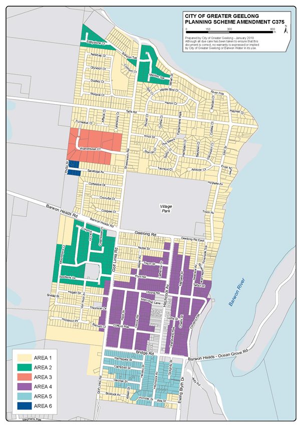
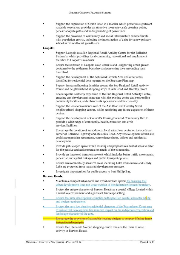
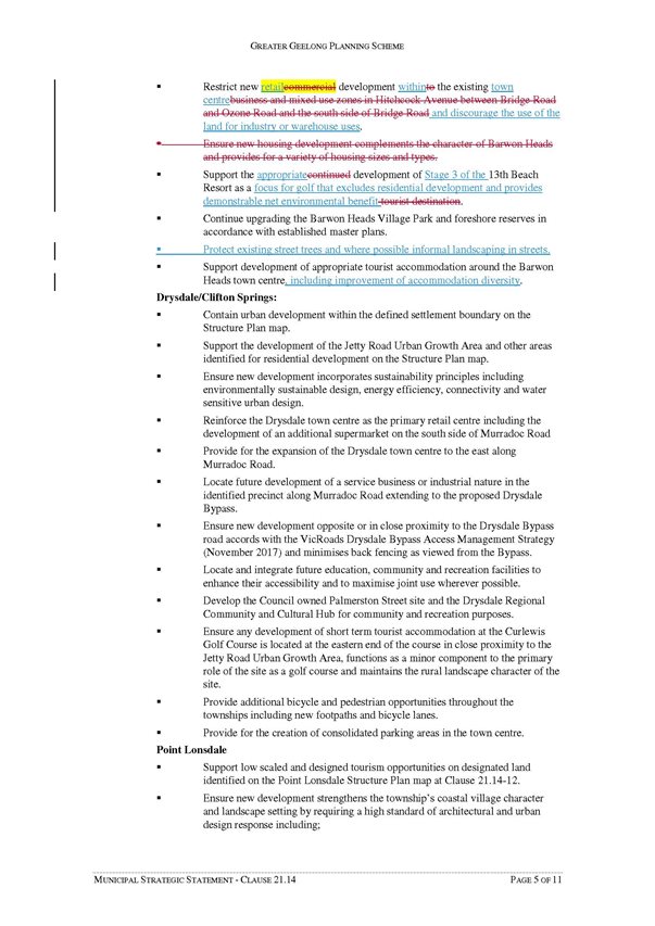
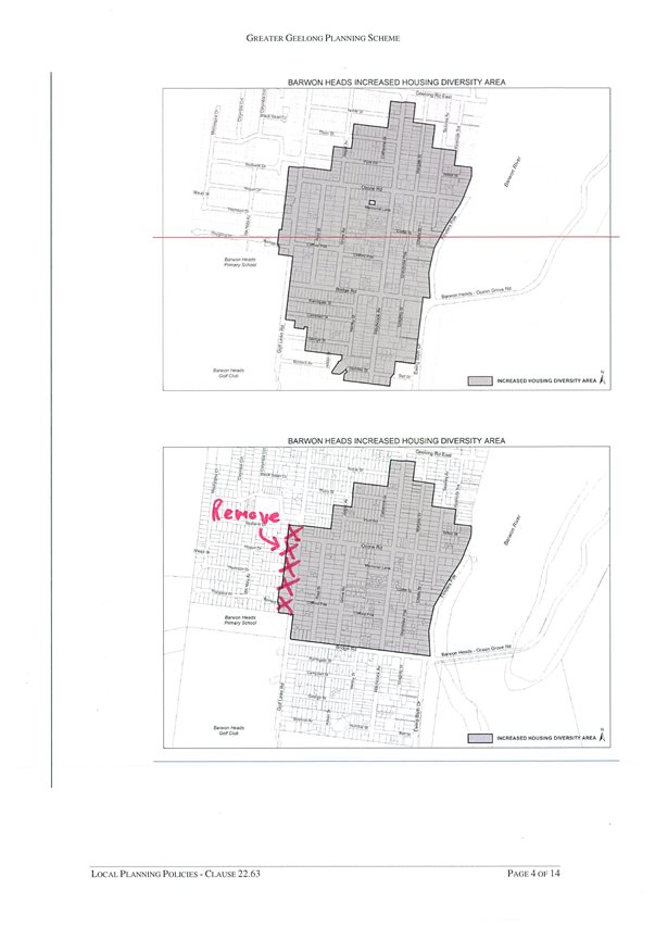
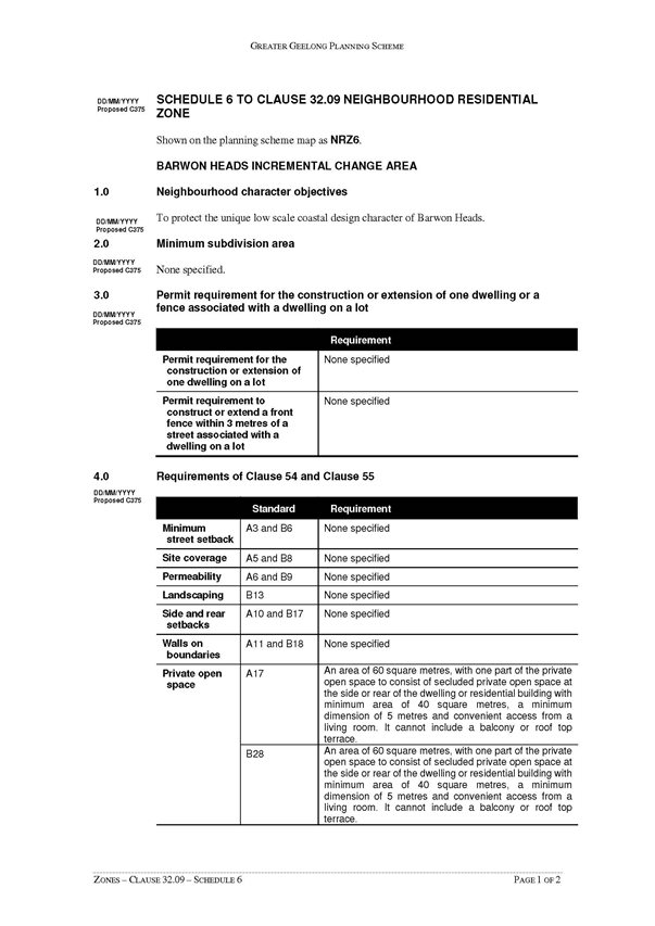
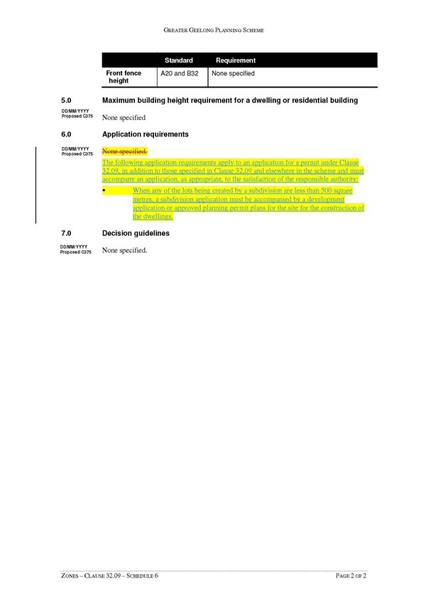
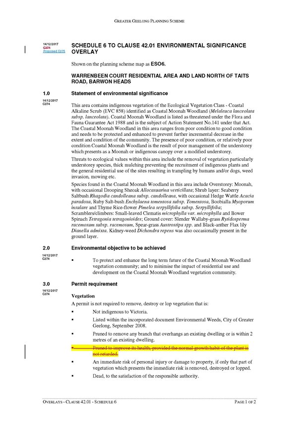
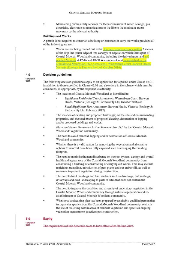
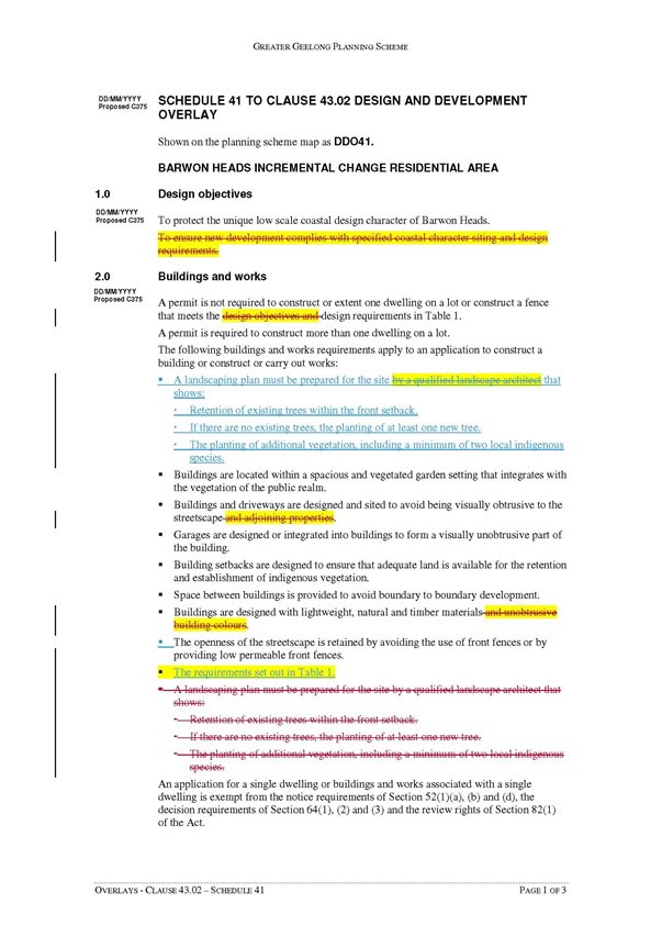
Source: |
Strategy & Finance - Property & Procurement |
Director: |
Peter Anderson |
Index Reference: |
Procurement policies and procedures |
Portfolio: |
Leadership and Governance |
To provide an update to the Procurement Policy following the period of Administration.
The Local Government Act 1989 (Vic) (Act) was amended in 2008 requiring the Council to develop, approve and regularly review its procurement policy.
The review of the policy is in line with our obligations under the Local Government Act, 1989 (Vic) – the “Act”.
The Procurement Policy provides a framework for the purchase of goods, works, and services that emphasises value-for-money while conducting business in a fair and equitable manner. The purpose of the policy is to:
Provide guidance, consistency, and controls over procurement activities;
Demonstrate accountability to rate payers;
Provide guidance on ethical behaviour in public sector purchasing;
Demonstrate best practice elements in purchasing; and
Increase probity of obtaining the right outcome when purchasing goods, works, and services.
Current amendments proposed include removal of reference to the Administrators; and clarifying code of conduct behaviours in procurement, updating sustainable procurement and local content requirements, inclusion of Clever and Creative (innovation), inclusion of Aboriginal and Torres Straight Islanders employment opportunities and clarification on when to appoint a probity auditor (outlined in Attachment 1).
Improvements have been made to the variation approval method by introduction of percentage or maximum approval amounts (outlined in Attachment 1).
This is a staged revision of Council’s procurement practices with the next revision to focus in further on improved economic consideration for the region, further collaborative approaches to procurement, closer links to our financial systems, improved and greater transparency in tender evaluations as well as better governance of low value procurements.
Councillor Murnane moved, Councillor Nelson seconded -
That Council adopts the updated Procurement Policy (Attachment 2).
Carried.
The changes that have been made to the existing policy include:
Adjustment to the Economic Contribution has been made to continue the City’s ongoing support of local content, use of local materials, local suppliers and local employment opportunities. Procurement will assist in the allocation of this criteria.
Maintaining Council’s support of GROW and G21 by including mandatory criteria strengthening the City’s encouragement of suppliers to provide opportunities to a range of different community groups within the region.
Inclusion of Aboriginal and Torres Strait Islanders into mandatory criteria strengthens the City’s encouragement of suppliers to provide opportunities to a range of different community groups within the region.
Inclusion of Clever and Creative (innovation) as a criteria is designed to align with the city’s vision.
Inclusion of mandatory criteria for Recycled Content and Environmental Considerations is a new addition, aimed at trying to get suppliers and purchases to consider the impacts on the environment and ways to reduce our environmental footprint through the City’s purchases and ongoing activities
Given 30% of the overall qualitative assessment criteria has been pre-set, with the intent to generate the best outcome for the City, the additional 70% will target the suppliers other key attributes, including methodology, capability, past performance and subject matter expertise to name a few.
The previous model allowed for up to 60% of the assessment criteria to incorporate all of the above criteria with the remainder focusing on pricing. This new model allows 100% for the assessment of qualitative criteria with value for money being a secondary calculation separate to the qualitative response. This provides the City with a quantitate/qualitative scoring model.
Changes to the variation threshold adjustments for awarded contracts. This tightens up the restriction on approval of low value procurements project creeping to major variations. This is a standard inclusion in most procurement policies.
The involvement of probity advisors on high risk and high value procurements.
The summary of the qualitative pre-set weightings to be applied is:
Local Content (Economic and Social Considerations) 10%
GROW and G21 initiatives 5%
Aboriginal and Torres Strait Islanders inclusion 5%
Recycled Content and Environmental Consideration 5%
Clever and Creative (Innovation) 5%
The City expends in the order of $200 million annually on procuring goods, works and services.
The City is committed to buying from local businesses on a value-for-money basis and supports the engagement of local suppliers, sub-contractors, and apprentices.
Application of this policy supports the City’s objective of value-for-money procurement outcomes.
There are no community engagement implications associated with updates to this policy, however, once approved the updated policy will be published and communicated via the website.
The policy articulates the City’s ongoing commitment to the principles of social equity in procurement and strengthened through our partnership with G21’s Region Opportunities for Work Compact (GROW).
Review of the policy is an accordance with the Act.
The policy has been reviewed and updated to align with our 30-year vision, Greater Geelong Clever and Creative and the community aspirations.
No officer involved in the preparation of this report have a direct or indirect interest in matters to which this report relates.
The policy accords with the Enterprise Risk Management Framework and applies risk management strategies at all stages of the procurement process.
The policy states that sustained value must be demonstrated in the City’s procurement, including the built and natural environment.
Source: |
Finance & Strategy - Financial Services |
Director: |
Peter Anderson |
Index Reference: |
SUB-16-2053 |
Portfolio: |
Finance |
Councillor Nelson moved, Councillor Grzybek seconded -
That in accordance with Section 89 (2) (d) of the Local Government Act 1989, this contractual matter be considered at the conclusion of all other business at which time the meeting be closed to members of the public.
Carried.
Source: |
Governance and Legal Services |
Executive Manager: |
Rebecca Leonard |
Index Reference: |
Audit - CG - Internal |
Portfolio: |
Leadership and Governance |
Councillor Nelson moved, Councillor Kontelj seconded -
That in accordance with Section 89 (2) (h) of the Local Government Act 1989, this matter which the Council considers would prejudice the Council or any person, be considered at the conclusion of all other business at which time the meeting be closed to members of the public.
Carried.
Source: |
Governance and Legal Services |
Executive Manager: |
Rebecca Leonard |
Councillor Nelson moved, Councillor Mason seconded -
That in accordance with Section 89 (2) (d) of the Local Government Act 1989, this contractual matter be considered at the conclusion of all other business at which time the meeting be closed to members of the public.
Carried.
Contents | Previous Page: Section A - Procedural Matters | Next Page: Section C - Assembly of Councillors
