
Council Minutes - Section B: Reports - 9 July 2019
Contents | Previous Page: Section A - Procedural Matters | Next Page: Section C – Urgent Business
Contents | Previous Page: Section A - Procedural Matters | Next Page: Section C – Urgent Business
Reports tabled at the Community Focus Council Meeting of Council on Tuesday 9 July 2019, held at the Indented Head Community Hall, opposite 326 The Esplanade, Indented Head.
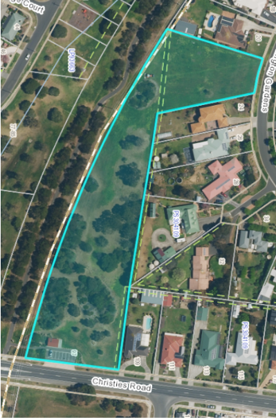
Naming 97 Christies Road, Leopold to Fred Cook Reserve, Leopold
Ba-Gurrk : A Gender Equity Framework for the Greater Geelong Region - Implementation Plan
G21 and Cricket Victoria Barwon Regional Cricket Strategy – Final Report
Amendment C367 – Mollers Lane, Leopold – Consideration of Panel Report and Adoption
Revised Terms of Reference for Planning Committee and Abolition of the Development Hearings Panel
Source: |
Community Life – Connected Communities |
Director: |
Robyn Stevens |
Portfolio: |
An Inclusive and Diverse Community |
To seek Council approval to name the reserve at 97 Christies Road Leopold, Fred Cook Reserve.
The City received a submission from the Friends of the Bellarine Rail Trail proposing the reserve at 97 Christies Road, Leopold be officially named Fred Cook Reserve to honour one of their longest serving and most active members, Mr Fred Cook.
Mr Cook joined the Friends of the Bellarine Rail Trail at the group’s establishment in 2002 and was a respected, committed and tireless working member until his death in 2017.
Mr Cook was instrumental in the revegetation, and improvement of community facilities, along the Bellarine Rail Trail Reserve. Mr Cook’s work lead to the establishment of over 80,000 plants, the installation of numerous community facilities, and the coordination of over 20,000 hours of volunteer work by members of the Friends of Bellarine Rail Trail.
The City believes that Mr Cook has made a significant contribution to improving our region’s natural environment and improving the Bellarine Rail Trail for the ongoing benefit of our community.
Naming the unnamed reserve in honour of Fred Cook is appropriate due to the significant contribution made by Mr Cook.
The proposal was advertised in the City News section of the Geelong Advertiser, the Bellarine Times and Armstrong Creek Times from 11 February 2019 to 10 March 2019.
25 online submissions were received, all in support of the official naming. No objections were received.
The suggested naming of the reserve meets the requirements of the Geographical Place Names Act 1998 guidelines.
Councillor Mason moved, Councillor Mansfield seconded -
That Council approve the official naming of the reserve at 97 Christies Road, Leopold as the Fred Cook Reserve.
Carried.
Council is responsible for signage of the reserve. The cost for updating signage is approximately $2,000 and can be accounted for within the existing budget for open space reserve upgrades.
The proposed naming of the reserve was advertised in the City News, Bellarine Times and Armstrong Creek Times for a four week period, 11 February to 10 March 2019.
25 online submissions were received, all in support of the official naming. No objections were received.
Subject to Council and Geographical Registrar approval, the relevant authorities and abutting owners and surrounding residents will be notified of the naming.
Considering social equity principles, the City supports the Friends of the Bellarine Rail Trail proposal to name the reserve, Fred Cook Reserve.
All Geographical Place Names Act 1998 guidelines and Council policies have been followed and met in relation to the naming proposal.
The proposal aligns to Council Plan’s strategic priority of ‘organisational leadership, strategy and governance’ under the key priority of ‘proactively manage our assets, including land holdings’.
No City officers or contractors who have provided advice in relation to this report have declared a conflict of interest regarding the matter under consideration.
The naming of the reserve considers the risk of emergency services not being able to locate the area. The risk is minimal, as the name isn’t duplicated elsewhere in the municipality and the naming complies with the Geographical Place Names Act 1998. The Emergency Services Telecommunications Authority (ESTA) responsible for responding to 000 calls, will be notified of the name change if approved.
There are no environmental issues arising from this report.
Source: |
Community Life – Social Planning & Investment |
Director: |
Robyn Stevens |
Portfolio: |
Social and Infrastructure Planning |
To seek Council endorsement to release the draft Drysdale Sporting Precinct Master Plan 2019 for an 8 week community consultation period.
The Drysdale Sporting Precinct is land owned by Council, located on the corner of Grubb Road and Belchers Road, Drysdale. It is home to several regular user groups including Drysdale Soccer Club, Drysdale Football Club and Drysdale Cricket Club, whilst also servicing the adjoining schools: St Thomas Primary School, St Ignatius College and Bellarine Secondary College.
Council adopted an original master plan for Drysdale Sporting Precinct in 2011.
In February 2018, Council delivered stage one of the master plan, being a multi-purpose field (oval and two soccer pitches), one stand-alone oval with adjoining practice wickets, and a multi-purpose sporting pavilion with floodlights for both fields.
In September 2018, the Victorian Government committed $50,000 to undertake a review and revision of the master plan, along with $5 million to deliver necessary sporting infrastructure arising from the revised master plan. The federal government also made an election commitment of $3.5 million towards future works at the reserve.
The draft revised Drysdale Sporting Precinct Master Plan (Attachment 2) has been developed through stakeholder consultation, research and analysis.
A revised master plan was required to account for the new Drysdale Bypass alignment, new and emerging trends in local sport and changes to land uses in the precinct. The key differences between the original master plan from 2011 and the revised draft proposed in this report, include removing the Council operations depot, a large open space area capable of being developed to accommodate a range of different active and passive recreational activities (including grass track athletics), and the inclusion of a walking / running circuit. The number of rectangular fields for sports such as soccer, touch rugby etc. have been reduced to be better align to current and future demand.
It is proposed to release the draft master plan for broader community consultation to test the proposals in the master plan, prior to a final master plan being prepared for Council endorsement.
Preliminary cost estimates to deliver the entirety of the proposed draft master plan are in the vicinity of $11-12 million. The master plan has been prepared so that a staged approach to develop can be achieved.
Councillor Mason moved, Councillor Sullivan seconded -
That Council release the draft Drysdale Sporting Precinct Master Plan (Attachment 2) for the purposes of broader community consultation for a period of 8 weeks.
Carried.
The Victorian Government has committed $5 million for implementation of work arising out of the Drysdale Sporting Precinct master plan. The City has apportioned $150,000 of this funding in the 2019-20 budget for the delivery of detailed design of these components to gain a more robust understanding of cost and timelines for delivery.
The federal government also made an election commitment during the 2019 election of $3.5 million towards future works at the reserve. The details and timing of the release of these funds are yet to be determined.
There are no immediate financial implications to Council. This draft of the master plan has been prepared to enable the delivery to be staged. The initial (priority) stage being deliverable within the $8.5 million of funding committed by the state and federal governments.
Subject to future decisions of Council, further investigations and detailed design will be required to gain a more robust understanding of cost and timelines for the delivery of future stages.
The original 2011 Drysdale Sporting Precinct Master Plan was developed following a series of stakeholder engagement activities, staff workshops and broader community consultation.
To guide the development of the revised 2019 Drysdale Sporting Precinct Master Plan a Project Control Group, Project Steering Group and Project Reference Group were established.
The Project Control Group consists of representatives from Sport and Recreation Victoria (representing the State Government of Victoria) and the City of Greater Geelong. The Project Reference and Steering Groups consist of a range of local key stakeholders including but not limited to Drysdale Soccer Club, Drysdale Football Club, Drysdale Cricket Club, St Thomas Primary School, St Ignatius College, Bellarine Secondary College, Landcare Bellarine, Peninsula Little Athletics and Drysdale Netball Club.
The draft Drysdale Sporting Precinct Master Plan as presented in this report, has been developed in response to stakeholder feedback from the Project Reference Group.
Subject to the resolution of Council, it is proposed that the draft Drysdale Sporting Precinct Master Plan 2019 be made available for an 8-week period of community engagement. This will involve providing an opportunity for local residents and stakeholders to have their say. This will include:
Connecting with the residents within 400m of the reserve via a letter drop and the broader Geelong community by requesting that they now provide feedback on the draft master plan via the City’s Have Your Say online platform;
Requesting that tenanting clubs distribute the draft master plan throughout their respective membership bases for any further feedback;
Advertising the engagement on Council’s Facebook page;
Advertising and publishing of the draft plan on geelongaustralia.com.au (hard copies available on request); and
Advertising signage displayed on site to engage non-affiliated and casual users of the reserve.
The Issues & Opportunities Paper for the Drysdale Sporting Precinct Master Plan 2019 (Attachment 3) has identified a range of matters that were raised and considered as part of developing the draft master plan, including the need to ensure social equity was considered as a guiding principle for development. Examples of adopting these principles include improvements to accessibility through enhanced pedestrian connections and improvements in accessibility related to the provision of parking in the precinct, along with gender equity outcomes via the provision of gender neutral facilities.
The Drysdale Sporting Precinct is home to a strong female participant base with a high level of female participation within the numerous sport and recreation clubs based at the reserve. Additional infrastructure proposed in the revised master plan will support the increase in female participation and create greater opportunities for future growth.
There are no known policy, legal or statutory implications associated with this report or the public consultation of the draft Drysdale Sporting Precinct Master Plan 2019.
The draft Drysdale Sporting Precinct Master Plan aligns with the following priorities in the Council Plan:
Informed social infrastructure and planning – the draft master plan is based on extensive consultation and will provide more quality active and passive recreational spaces for the Drysdale community.
A more inclusive and diverse community through the provision of infrastructure that supports social connections within our community. This extends to the provision of accessible and welcoming facilities for people of all genders and abilities.
Improved health and safety for our community by enhancing the safety and user satisfaction of social infrastructure, which in turn provide greater participation opportunities and health benefits.
No City officers or contractors who have provided advice in relation to this report have declared a conflict of interest regarding the matter under consideration.
Preliminary cost estimates associated with the draft master plan are provided at a point in time and are to be used as a guide only. These estimates are subject to change based on further detailed design and cost escalation.
The City can progress the master planning process but there is a risk that there will not be adequate funding to implement the plan.
The draft master plan is consistent with Council policy and approach to sporting reserve and facility development.
Releasing the draft master plan for public consultation provides the broader community with an opportunity to provide valuable feedback and input that will be considered prior to any final endorsement of the master plan by Council.
Ecological assessments have been undertaken which identified no significant fauna or flora at this site, which has a history of farming and grazing.
The draft Drysdale Sporting Precinct Master Plan proposes to improve the quality of open space, while also identifying opportunities for increased tree planting.
Environmentally sustainable design opportunities will be further explored in the detailed design phase for any new and upgraded facilities and lighting.
Source: |
Planning, Design & Development – Planning Strategy & Urban Growth |
Director: |
Gareth Smith |
Portfolio: |
Sustainable Development |
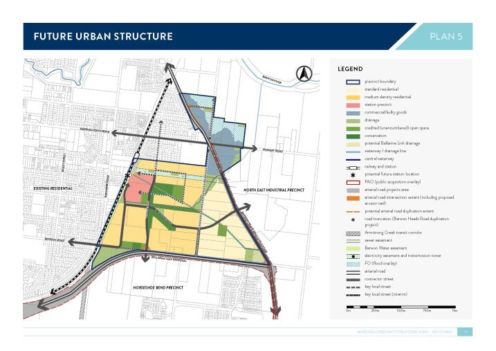
To seek Council endorsement to release the draft Marshall Precinct Structure Plan (Attachment 3) for community consultation for a minimum of 4 weeks.
The Armstrong Creek Urban Growth Plan (2008) guides the development of the Armstrong Creek Growth Area which is anticipated to provide housing for 54,000 people and 22,000 households. The majority of this growth area has since been planned, formalised and development has substantially commenced.
Marshall is the northern-most residential precinct structure plan (PSP) and the final residential PSP to be developed for the Armstrong Creek Growth Area.
In late 2017 the City committed to lead the preparation of the Marshall PSP due to there being multiple smaller land owners in the precinct. Other precincts were developer lead PSPs.
The Marshall PSP applies to approximately 123 hectares of land generally bounded by Barwon Heads Road to the east, Reserve Road to the south, the Geelong to Waurn Ponds passenger rail line to the west and the edge of the current residential development to the south of Marshalltown Road. There is also a small area to the east of Barwon Heads Road, close to the intersection of Marshalltown Road and Tannery Road.
The draft Marshall PSP will generate an estimated 1,978 dwellings to accommodate approximately 4,300 new local residents.
An extensive schedule of stakeholder engagement has informed the preparation of the Marshall PSP. This has included a community consultation session in June 2018 that was attended by 90 community members, government and development industry stakeholders. The community were provided site plans, to have their say on the opportunities and constraints in the precinct via the consultation meeting and the City’s website.
Technical reports to inform land use decisions related to stormwater management, transport, native vegetation and utility services have been prepared to inform the draft PSP.
After considering technical report recommendations, issues raised by the community and liaising with a broad range of key stakeholders, the draft PSP has been prepared for further consultation. The primary plan is the Future Urban Structure (Attachment 2).
Community and stakeholder input are now sought on the draft Marshall PSP. The Marshall Development Contributions Plan (DCP) and the Marshall Native Vegetation Precinct Plan will be prepared concurrently with the final PSP following this stage of consultation.
Councillor Mason moved, Councillor Asher seconded -
That Council approve the release of the draft Marshall Precinct Structure Plan (Attachment 3 of this report) for the purpose of broader community consultation.
Carried.
The Marshall DCP will include a fee, to be paid by the developer(s) to recover the cost of preparation of the Marshall PSP.
The Marshall DCP will generate most of the funding for subsequent development of transport and drainage infrastructure and community facilities. In order to minimise costs to Council and the community, open space and storm water assets will be delivered in a staged manner and as shared facilities, where practicable. Access to existing facilities in established areas will be maximised, and land will be purchased early where possible to minimise costs.
An extensive schedule of stakeholder engagement has informed the preparation of the Marshall PSP. A community consultation workshop occurred in June 2018 at the Grovedale Hall, which provided site plans, an opportunity to learn about the land use constraints and opportunities in the precinct, and to provide feedback.
Key issues raised during community engagement include:
Preserving the natural environment including Smith Street as a conservation reserve;
Integrating and improving access between surrounding major road and rail upgrade projects and the precinct;
Maximising access to Marshall Train Station;
Improving bicycle and pedestrian routes;
Interpreting existing land use constraints including easements and planning scheme overlays with a view to maximising development potential;
Resolving surface flooding and legacy drainage issues resulting from development to the immediate south of the precinct; and
Improving access to shopping, sports grounds, community facilities and schools.
A wide range of industry and government stakeholders have participated in technical reference groups for the major transport projects in the precinct, ensuring that all projects are prepared and delivered in a cohesive and integrated manner. Stakeholders include Transport for Victoria, VicRoads, Major Roads Projects Victoria, Barwon Water, Department of Environment, Land, Water and Planning and various internal departments from the City.
Stakeholder engagement has led to integrating land use, design and access requirements with the proposed Bellarine Link Road, Barwon Heads Road duplication and Geelong to Waurn Ponds commuter rail duplication and new train station(s) proposals. Ongoing collaboration with stakeholders will continue throughout the precinct development of the final PSP and through the precinct development process.
Further community engagement is scheduled to occur once the draft PSP is released providing an opportunity for the community and key stakeholders to make submissions on the draft PSP that will be considered in the preparation of the final PSP. This includes direct notification to all land owners in the precinct and a drop-in session with City officers on 22 July 2019. The draft PSP will be exhibited for a minimum of 4 weeks.
Subject to Council endorsing a future final Marshall PSP and an amendment process, a planning scheme amendment to implement the PSP will be ran to the required statutory exhibition period. Where any submissions cannot be resolved, an independent planning panel may be requested.
The project contributes to meeting to the City’s growing need for affordable housing in a connected and integrated community and delivering a vibrant, walkable neighbourhood with great amenity, environmental sustainability, abundant open space, and connections to the surrounding urban environment that provide the daily needs and jobs for local residents.
The PSP also provides medium and high density development as an alternative to standard residential greenfield development that maximises the location of Marshall Train Station as well as a high amenity interface through high quality urban design.
The Armstrong Creek Urban Growth Plan was adopted in 2008 and guides the future development of the Armstrong Creek Growth Area, including Marshall as the northern-most residential PSP in the area. The PSP guides land use and development where a planning permit is required under the Urban Growth Zone or any other provision of the Scheme that references the PSP.
The preparation of the draft PSP has considered state and local planning policy and existing planning overlays and refined by the further technical reports. Once the PSP is finalised and incorporated into the planning scheme applications can be made for subdivision and the urban development of the land can be delivered.
The draft PSP aligns with the ‘planned sustainable development’ strategic priority of the Council Plan. It will assist in delivering the following key priorities under that strategic priority: ensuring housing supply, diversity and affordability can meet the needs of our growing community; continuing to develop urban growth areas across the region; improving the environmental performance of new developments; improving transport connection and accessibility, managing the impact of development on the unique character of the precinct; and delivering biodiversity conservation.
The PSP also aligns with several other strategic priorities of the Council Plan: improved health and safety of our community; informed social infrastructure and planning; effective environmental management; integrated transport connections and a thriving and sustainable economy.
No City officers involved in the development of the PSP and preparation of the report have declared a direct or indirect interest in the issue to which this report relates.
The City commenced the preparation of Marshall PSP in late 2017 in response to community expectations, coordinate development of the fragmented precinct and uncertainty from the major transport projects.
The technical studies inform how urban development should occur to manage environmental and financial risks to the City. In some cases, detailed technical studies have identified recommendations that differ from the directions in the Armstrong Creek Urban Growth Plan, including potential biodiversity conservation, size and function of drainage infrastructure and road improvements that will inform public acquisition of land, where required. In all cases, these recommendations have been considered by the key and relevant internal and external stakeholders to prepare a draft PSP that provides logical, up to date and best practise outcomes.
The planning for infrastructure and sequencing of development is critical to managing the costs of urban development. The PSP has been carefully considered to ensure that the scale of infrastructure is commensurate with community needs, cost and burden on the City is minimised. Local infrastructure and the preparation of the PSP are to be funded through a Marshall DCP. It also provides flexibility by facilitating development alternatives that are clever, creative and meet the requirements and guidelines in the PSP, assisting in the timely and cost-effective development of the precinct.
Environmental implications have been considered as part of the preparation of the draft Marshall PSP. Technical studies on native flora and fauna, Aboriginal and post-contact heritage, geotechnical, hydrogeological and environmental constraints, stormwater drainage, and native vegetation assessment, as well as considering environmental implications in access management, traffic impact and utility service reports. The PSP includes requirements and guidelines relating to water sensitive urban design, sustainability management plans, conservation plans and integrated water management.
The PSP identifies actions to protect biodiversity through a native vegetation precinct plan, establish conservation reserves, sustainability management plans, water sensitive urban design guidelines, tree planting and minimum canopy requirements.
The PSP proposes an integrated water management outcome that requires treatment and management of precinct drainage, downstream drainage asset delivery, integration with open space, easements and shared user paths, protection of areas of biodiversity value and provision of potable, sewer and alternative water solutions to a best practice standard.
Source: |
Customer & Corporate Services – Property, Procurement & Assets |
Director: |
Michael Dugina |
Portfolio: |
Finance |
To consider the future ownership or potential use options of the former Geelong Post Office, 83 Ryrie Street Geelong.
At its meeting of 22 May 2018, Council resolved to give notice of intention to sell the former Geelong Post Office at 83 Ryrie Street, Geelong and to refer its Conservation Management Plan (CMP) to Heritage Victoria and the National Trust for comment.
On 25 September 2018 Council then resolved to commission another CMP and that the proposed sale of the property be considered by the Council when the new CMP became available.
At the Council meeting of 9 April 2019, the Council received a new CMP and resolved for officers to seek feedback on use and ownership of the building. A copy of the prior Council resolutions are provided in Attachment 2.
The City invited community submissions seeking feedback about options for the use and ownership of the former Geelong Post Office (criteria as per Attachment 3). 17 submissions were received in response through the City’s Have Your Say website. A summary of submissions contained in Attachment 3.
Whilst all submissions identified linkages to the Clever and Creative vision, the proposed solutions for how the restoration obligations identified in the CMP could be achieved, the refurbishment for proposed use or financially sustainability of its ongoing requirements identified that significant capital contribution and ongoing operational subsidisation would be required by the City.
Philanthropic funding sources were identified that could provide a contribution to the restoration and the ongoing maintenance of the former Geelong Post Office, however, there is no certainty of achieving funding. A defined use and a supporting business plan would need to be developed prior to seeking any funding source.
Whilst the submissions identify possible uses, there remains significant debate around what role Council should play in supporting additional (new) discretionary services such as museums, exhibition spaces and spaces for collections. This is all the more relevant in an environment where Council is seeking to define priorities within limited funding sources (e.g. rate capping), whilst also considering future use of City Hall. In addition, Council has committed to generating significant funding from the sale of surplus properties for the Civic Accommodation project. In light of these important Council positions, management is of the opinion that the sale of the Post Office should proceed on the condition that:
the CMP is adhered to; and
uses and development of the building are complimentary to the overall precinct (including possible accommodation and tourism).
Councillor Mason moved, Councillor Aitken seconded –
That consideration of the report be deferred until the Ordinary Council Meeting on 30 July 2019.
Carried.
Source: |
Community Life – Healthy Communities |
Director: |
Robyn Stevens |
Portfolio: |
An Inclusive and Diverse Community |
To inform Council about the Ba-gurrk Gender Equity Framework – Foundational Implementation Plan 2019-2022.
Gender equity entails the provision of fairness and justice in the distribution of benefits and responsibilities on the basis of gender. The concept recognises that people may have different needs and power related to their gender and that these differences should be identified and addressed in a manner that rectifies gender related imbalances.
In February 2019, Council endorsed the Ba-gurrk Gender Equity Framework, whichidentified relevant current research, policy and community expectations to achieve gender equality. That report detailed that an action plan would be completed, using the framework as context. The action plan was to incorporate the requirement for all policies, plans, services and programs with an organisational-wide and community-wide impact, to commit to gender equity principles to achieve a fair and inclusive community.
An implementation plan (Attachment 2) has been developed to articulate what will be done over the next three years to contribute towards achieving gender equality at the City and in the broader community.
The implementation plan has been developed in consultation with internal staff, who are also responsible for delivering the actions. Community engagement actions are included in the plan to ensure ongoing consultation and collaboration with internal and external stakeholders.
Annual implementation plans will be developed on a rolling basis to ensure continuity and delivery against the Ba-gurrk Gender Equity Framework in future years.
An internal working group will be established to implement the action plan and monitor its progress. This working group will be co-led between the Community Life and People and Culture directorates.
Councillor Mansfield moved, Councillor Grzybek seconded -
That Council note the Ba-gurrk Gender Equity Framework – Foundational Implementation Plan 2019-2022.
Carried.
Resourcing to deliver the implementation plan is accounted for in the Healthy Communities allocation in the 2019-2020 budget. Grant applications will be submitted when funding opportunities arise.
The Ba-gurrk Gender Equity Framework was based on consultation with community members, government and non-government organisations, as well as City staff. The draft framework was endorsed by Council at the 10 July 2018 meeting and then released for final public comment between 12 July 2018 and 13 August 2018. The framework was updated based on the feedback received and also considered the Best Practice Guide for Gender Equality in Local Government and the proposed priorities of the Gender Equality Bill, which is provisionally scheduled to be presented to the Victorian Parliament in 2019.
The implementation plan has been consulted with internal staff, who are also responsible for delivering on the outcomes. It also includes community engagement actions as part of the plan to ensure consultation with internal and external stakeholders.
The framework will contribute to address Council’s adopted Social Equity principles. The focus on addressing inequality, inequity and social exclusion for women is key to achieving social equity in Geelong.
Gender inequality is recognised as a key factor in contributing to family violence. Addressing family violence is a requirement of the Municipal Public Health and Wellbeing Plan 2018-21. Additionally, the Victorian Government Gender Equality Strategy 2016 identifies a strategic outcome of 50:50 by 2025 for women in elected positions. Actions directly aimed at achieving gender equity are within the remit of the Human Rights Charter. In 2019, it is anticipated the Victorian Government will present the Gender Equality Bill to Parliament. The Bill proposes new obligations on the Victorian public sector, including local government, to plan and report on gender equality.
The achievement of gender equality within the City will positively contribute to and underpin all ten of the council plan strategic priorities. In particular, improved health and safety of our community; informed social infrastructure and planning; a more inclusive and diverse community; vibrant arts and culture; a thriving and sustainable economy; and organisational leadership, strategy and governance.
A City focussed on gender equity positively supports and complements all aspects of the Clever and Creative Future vision, in particular the achievement of an inclusive, diverse, healthy and socially-connected community; a community where people feel safe; and a prosperous economy that supports jobs and education opportunities.
No City officers or contractors who have provided advice in relation to this report have declared a conflict of interest regarding the matter under consideration.
The expected Victorian Gender Equality Bill may be enacted as early as November 2019. Having an operational plan that addresses this issue will prepare the City for any changes.
There are no environmental implications arising from the subject of this report.
Source: |
Community Life – Social Planning & Investment |
Director: |
Robyn Stevens |
Portfolio: |
Social and Infrastructure Planning |
To seek Council endorsement of the final G21 and Cricket Victoria Barwon Regional Cricket Strategy, following the public exhibition of the draft strategy.
The G21 and Cricket Victoria Barwon Regional Cricket Strategy (Attachment 2) aims to guide the future planning and development of cricket across the Barwon region to 2028. The strategy provides a framework to support the future management, development and infrastructure needs of the sport. The strategy is a collaborative planning project between the G21 Region Alliance, G21 local government authorities (LGAs), Cricket Victoria, Victorian Government and the local cricket community.
The strategy investigates issues and opportunities facing cricket, which have been identified through extensive consultation with Barwon cricket and relevant stakeholders.
The strategy has identified five key strategic priorities which aim to improve and develop the sport. These are:
Priority 1 – Governance and cricket activity management;
Priority 2 – Participation growth;
Priority 3 – Facility provision, capacity and renewal;
Priority 4 – Regional cricket and community centre; and
Priority 5 – Resourcing and partnerships.
There are no immediate investment or resource implications for the City identified in the strategy.
The strategy identifies that improving the structure and governance of cricket in the region is the priority.
The public consultation period from 25 October 2018 to 7 December 2018 received 12 formal responses. The consultation summary can be found in Attachment 3.
The strategy has been endorsed by the G21 Sport & Recreation Pillar and will follow to the G21 Board once adoption from each LGA has been achieved.
Councillor Murrihy moved, Councillor Aitken seconded -
That Council endorse the final G21 and Cricket Victoria Barwon Regional Cricket Strategy (Attachment 2).
There is no budget allocated for implementation of the strategy. Funding for any action noted in the strategy into the future will be sought through a range of funding opportunities and partnerships. Any request for council funding will be the subject of a separate report.
The G21 and Cricket Victoria Barwon Regional Cricket Strategy provides the strategic framework to support and improve the sport of cricket over the next 10 years. The strategy has been driven through extensive engagement with the cricket community including local clubs, schools, stakeholder workshops as well as Project Control and Project Steering Groups. The consultation period identified a vision for the strategy being ‘More cricket, played by more participants, across a diverse range of programs and locations’. To achieve this vision, the strategy has identified five key strategy priorities. These are:
Priority 1 – Governance and Cricket Activity Management.
The structure of cricket in the Barwon region currently sees a mixed approach to the delivery of services, competitions, programs and activities with a number of clubs, associations, committees and player development programs operating independently. Therefore, the most immediate priority and challenge facing cricket across the region is the current governance and management structure. This is impacting on the viability of all other elements of the game and must be addressed in order for the sport to prosper. The most critical action under this priority is to ‘Develop an aligned and collaborative structure to manage cricket’ and for Cricket Victoria to lead a stakeholder working party in partnership with the local cricketing community. It is noted that all other strategic priorities cannot be progressed until this is addressed. A future amended governance model will require coordinated and supported administration and sustainable management.
Priority 2 – Participation Growth.
This priority aims to grow cricket, its range of activities, club capacity and profile across the region. It is identified within the draft strategy that cricket in G21 has experienced a decline in participation in recent seasons which is in contrast to the rest of Victoria. In addition, despite considerable improvement in the past two years, female participation rates are very low and clubs and associations require continued support from Cricket Victoria to provide diversification and flexible formats to help address this.
Within this priority is a need for Cricket Victoria to lead a strategic review of current structures and game formats and to work with clubs to introduce flexible and diversified programs. This includes engaging and promoting junior, youth and female programs and growing inclusive cricket for multi-cultural and indigenous communities. Along with this wider suite of cricket opportunities, there must be adequate resources to support implementation and ongoing operation.
Priority 3 – Facility Provision, Capacity and Renewal.
The Barwon region’s unique ‘metro meets country’ hybrid profile means that there is no one size fits all approach when looking at future cricket facility provision. Of the 155 playing fields in G21, 70% are located within the City, 12% in Colac Otway Shire, 11% Surf Coast Shire, 6% Golden Plains Shire and 1% in the Borough of Queenscliffe.
The provision of playing facilities in G21 align with recommendations for both country and metropolitan areas however the unique geographical spread of the region sees varying levels of demand for infrastructure. Due to this, the strategy notes that the prioritisation of new venues and facilities should be by capacity, equity and within areas of population growth (e.g. Armstrong Creek). In order to attract investment for the development of cricket facilities, the first critical action under this priority is for Cricket Victoria, LGAs and Sport & Recreation Victoria (SRV) to assist clubs in developing facility renewal plans that highlight projects that promote diversity and inclusion.
In addition, the strategy also notes that the development of additional turf pitch playing fields within the City is not supported in the short to medium term given the existing high level of turf pitch provision. While this provision is commensurate with higher population and participation numbers, it may also be restricting the capacity of existing sites and constraining the flexibility and opportunity for expansion of the game. While ensuring a suitable balance of turf and synthetic wickets will be a key focus for the Barwon region in the future, there is to be no net gain of turf pitches during the life of the strategy or until ‘Priority 1 – Governance and Cricket Activity Management: Develop an aligned and collaborative structure to manage cricket’ is resolved. This extends to turf practice nets also.
Priority 4 – Regional Cricket and Community Centre.
Cricket Victoria has identified a need to deliver and activate regional level Cricket and Community Centres across a number of regions including G21 to achieve and address the following key roles and functions:
Participation development – for year-round competition activities, program delivery and school participant development including a venue suitable for finals and events;
Education – provide adequate support, education and training for players, coaches, umpires and off-field support services including volunteers;
High performance – provision of indoor, outdoor, health and fitness infrastructure particularly within an area where access to such facilities may be limited; and
Shared regional services – to provide a more centralised and streamlined approach to future cricket activities including competition, marketing and promotion.
The delivery of a regional centre includes the opportunity to leverage off existing facilities using a multi-use approach.
The critical action under this priority is for a working group to further investigate this proposal and to consider potential locations. It is noted that any investment for a regional cricket and community centre will require a collaborative approach from G21 along with Cricket Victoria, Cricket Australia, state and federal government and potentially commercial partners.
Priority 5 – Resourcing and Partnerships.
It is identified within the strategy that no single organisation can deliver all activities and priorities alone, and that collaboration is required to create cohesive and efficient sports administration, programs, partnerships and infrastructure for the Barwon cricket region.
The critical action under this priority will be for LGAs and Cricket Victoria to actively advocate to the state government and Cricket Australia for the continuation of SRV’s Community Sports Infrastructure Fund ‘Cricket Facilities’ category along with Cricket Australia’s National Facilities Funding Scheme. In addition, project partners will be encouraged to work together to provide structured communication and promotion of the strategy and its progression.
The public exhibition of the draft strategy was from 25 October 2018 to 7 December 2018 and received 12 formal responses as well as additional feedback from all LGAs (consultation log can be found in Attachment 3). Themes from the feedback were consistent with the key strategic priorities identified in the strategy, including increasing participation and diversification of game formats, addressing governance and management issues as well as facility development opportunities.
The strategy was endorsed by the G21 Sport & Recreation Pillar at their meeting on 3 June 2019. Following endorsement by each LGA, the strategy will proceed to the G21 Board for consideration.
The strategy recognises the need to improve diversity and inclusion in cricket across the Barwon region. There is a strong focus on delivering programs which promote and support female participation, all-abilities as well as indigenous and multicultural communities. It is noted in the strategy that female participation in the region is well below the state’s average, and a key action under Priority 2 – ‘Participation Growth: Grow cricket, its range of activities and profile across the Barwon region’ is to support local clubs and associations in engaging and growing their female participant base. In addition to strengthening the female cricket pathway, it will be important to diversify and offer more flexible, non-structured formats to engage more people outside of their current traditional player profile. These opportunities will target participants with time or financial constraints who may not be inclined to participate on a more structured basis. The strategy also highlights improving female friendly facilities by working with clubs on developing improvement plans that prioritise inclusive outcomes.
There are no policy, legal or statutory implications arising from this report.
This report and strategy aligns to Council’s priorities of ‘Improved Health and Safety of Our Community’ and ‘Informed Social Infrastructure and Planning’ in the 2018-2022 Council Plan. By consulting with the community and developing a prioritised action plan with key stakeholders, the strategy will provide greater participation opportunities and health outcomes through cricket. Furthermore, this plan will support and provide strategic justification for the future management and infrastructure requirements for the sport within the G21 region.
No City officers involved in the preparation of this report or strategy are known to have a direct or indirect interest in matters to which this report relates.
If not endorsed, there is some risk in not having a regional strategy for cricket to guide decision-making, and which would be inconsistent with other major sports such as AFL and hockey.
There are no environmental implications associated with this report.
Source: |
Planning and Development – Strategic Implementation |
Director: |
Gareth Smith |
Portfolio: |
Sustainable Development |
To consider the Panel Report about Amendment C367 and Planning Permit 1463/2016 and adopt Amendment C367.
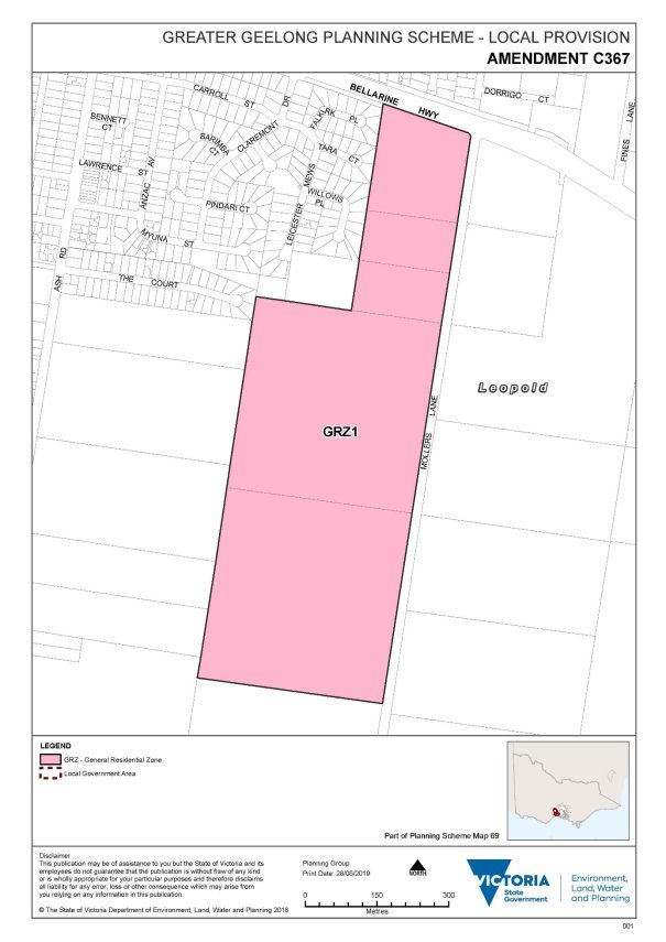
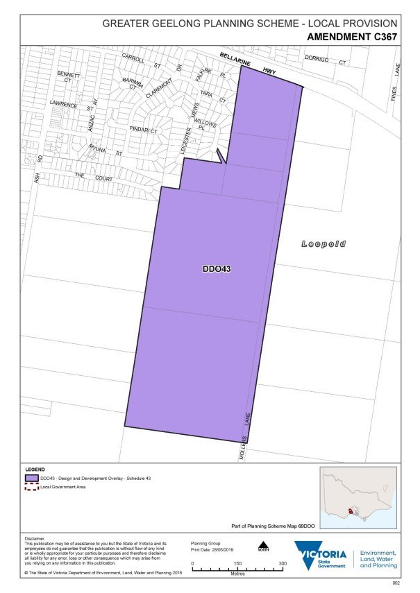
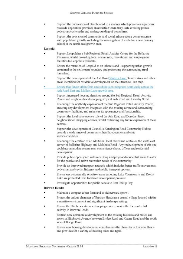
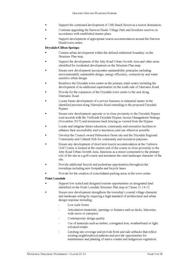
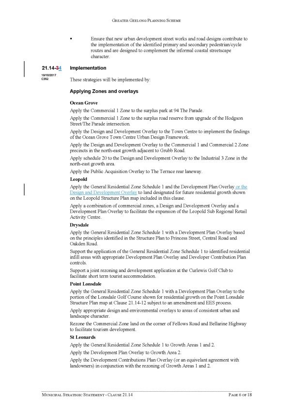
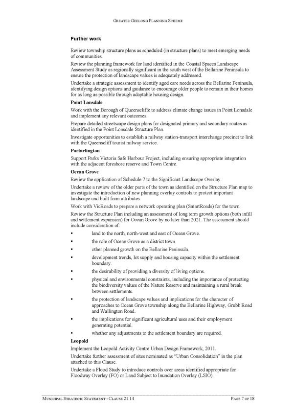
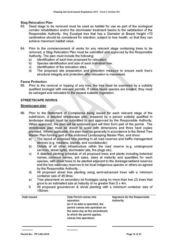
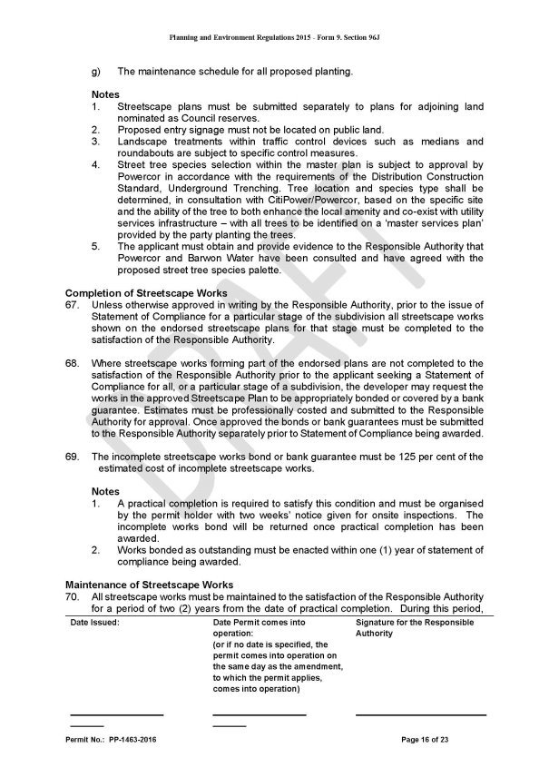
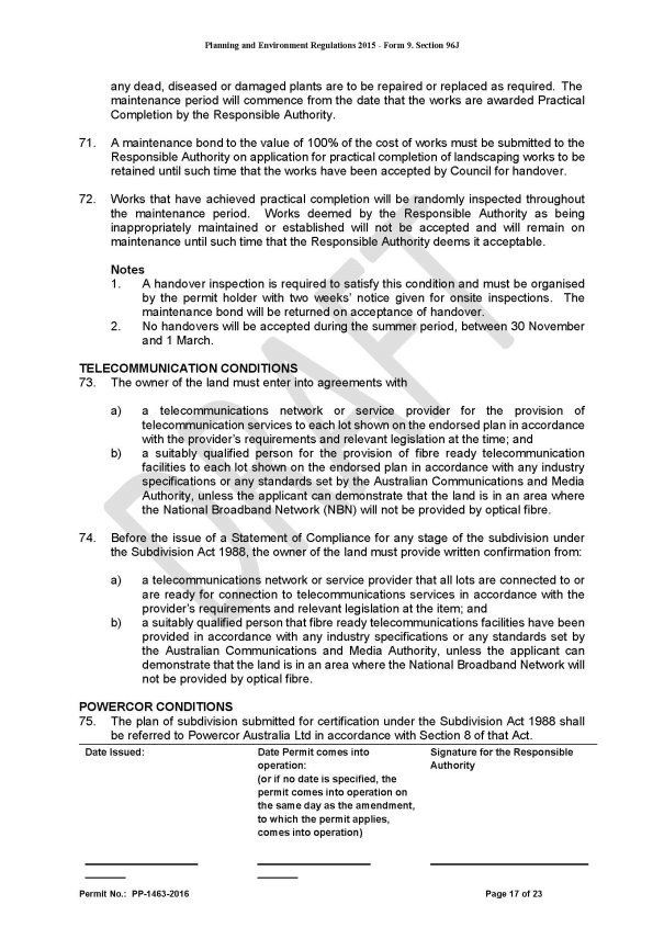
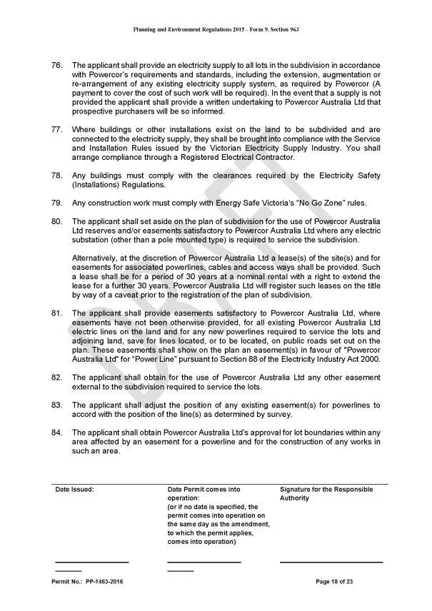
The Amendment primarily rezones land at 2-120 Mollers Lane Leopold from Farming Zone to General Residential Zone Schedule 1 and applies a Design and Development Overlay Schedule 43 to this land and the adjoining property at 10 Willows Place. The Planning Permit 1463/2016 allows the staged subdivision of the rezoned land.
This Amendment and permit implements the recommendations of the Leopold Structure Plan for future urban growth in the southeastern area of Leopold between Ash Road and Mollers Lane. Attachment 2 provides a background summary of the Amendment process, including consideration of the Panel Report.
Exhibition of the Amendment and draft planning permit in May and June 2018 resulted in sixteen written submissions addressing issues including storm water, impacts on Lake Connewarre, public open space provision and the extent of residential development.
The submissions were considered under delegation in October 2018 when it was resolved to refer all submissions to an independent Panel appointed by the Minister for Planning.
Following a hearing in December 2018, the Panel’s report was received on 22 January 2019. Under Section 27 of the Planning and Environment Act 1987, the Planning Authority must consider the Panel’s report before deciding whether or not to adopt the Amendment.
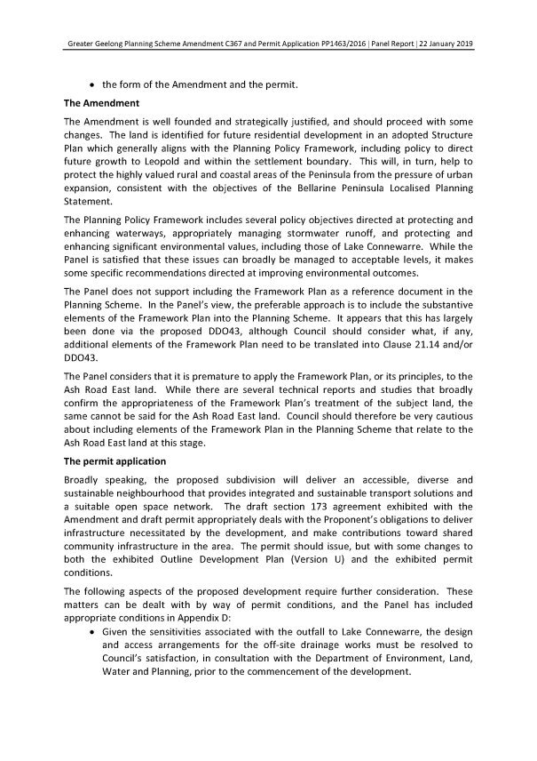
The Panel found the Amendment to be strategically supported by policy and recommends that both the Amendment and planning permit be adopted with changes.
The Panel has supported residential development of land south of the southern waterway, as there is no physical or landscape impediment to its residential development. They have also supported the retention of a one-hectare park adjacent to the northern detention basin, which the City considers to be a significant recommendation.
A revised subdivision plan reflecting the Panel recommendations is included at Attachment 8 and will become the endorsed plan at the time the permit is issued.
Whilst the Panel’s recommendations are generally supported, this report at Attachment 6 provides the City’s response.
It is recommended that Amendment C367 and PP1463/2016 be adopted with changes and sent to the Minister for Planning requesting approval.
Councillor Mason moved, Councillor Asher seconded -
That Council:
Adopt Amendment C367 in the form outlined in Attachment 3 of this report;
Submit the adopted Amendment C367 and prescribed information to the Minister for Planning requesting approval;
Recommend to the Minister for Planning that before a permit is issued, further notice should be given of the outline development plan (version Y2) under section 96H(2) of the Act;
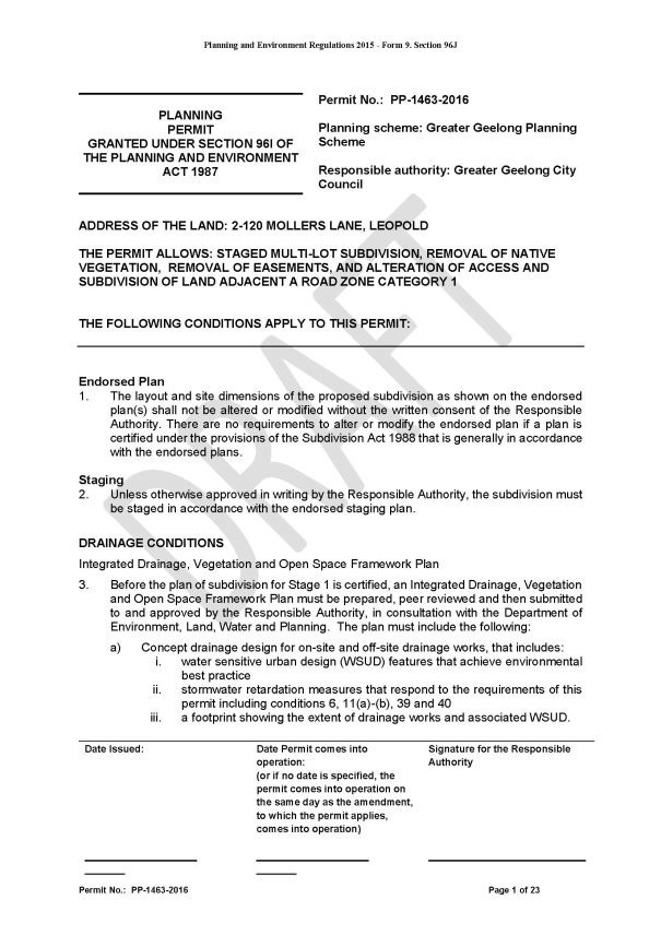
Recommend to the Minister for Planning that Planning Permit 1463/2016 be approved in the form outlined in Attachment 4 of this report;
Authorise the signing and sealing of the Section 173 Agreements accompanying this Amendment C367 to formalise development contributions arrangements (the draft Agreement is in Attachment 7 to this report); and
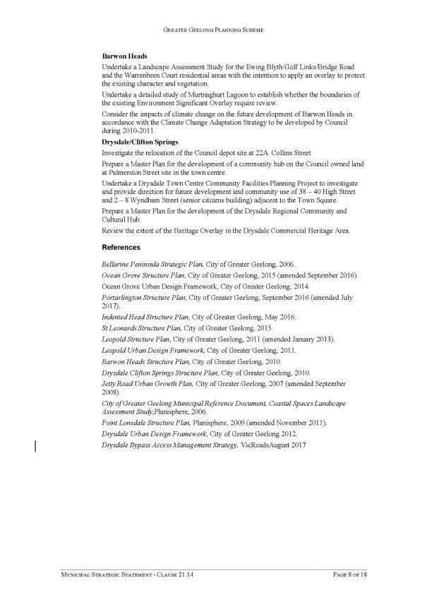
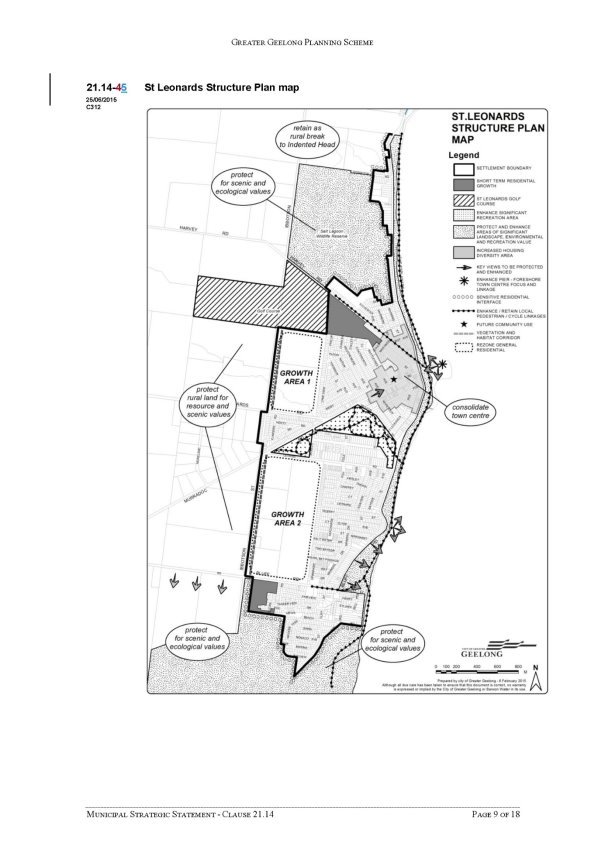
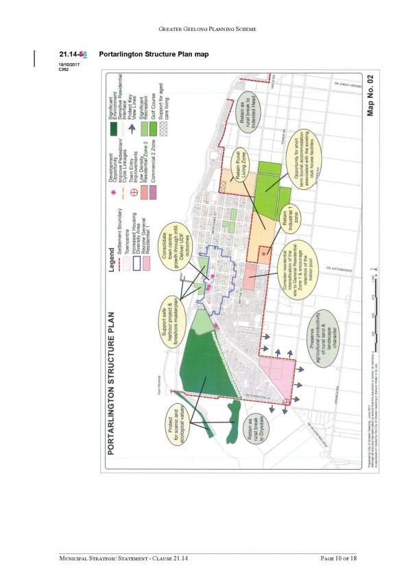
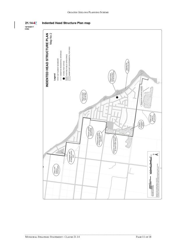
Resolve the inconsistencies between the revised settlement boundary shown in the map to Clause 21.14 and the Leopold Structure Plan in the next 5 yearly review of the Leopold Structure Plan.
Carried.
The Amendment and permit are accompanied by an Agreement under Section 173 of the Planning and Environment Act 1987. A Section 173 Agreement is a voluntary agreement between Council and a landowner. They can include requirements relating to the use and development of land and they run with the title of the land. In this case the Agreements require landowners/developers to pay Council development contributions of $40,000 per developable hectare when the land is subdivided. Council will be obliged to spend this funding on community facilities within the Leopold area. The Agreements also require the landowner to deliver infrastructure when the land is developed. This includes road widening along Mollers Lane, a signalised intersection at the Bellarine Highway, parkland and drainage works.
Amendment C367 and draft Planning Permit 1463/2016 were exhibited in accordance with the requirements of the Planning and Environment Act 1987.
All submitters had an opportunity to be heard before an Independent Panel appointed by the Minister for Planning. The Panel considered all submissions referred to it, not just the submissions presented at the hearing.
The Independent Panel report has been publicly released and all submitters notified of its availability.
The Amendment will provide social benefits through the establishment of a new residential development supported by open space conveniently located proximate to sporting, community and educational facilities. Development contributions will be allocated to community infrastructure projects within Leopold.
The Amendment is consistent with the Greater Geelong Planning Scheme Planning Policy Framework, in particular Cause 21.14, which supports the residential growth of this area.
The Amendment aligns with the Sustainable, Built and Natural Environment and Growing our Economy strategic priorities as it facilitates development in accordance with an adopted township structure plan.
No City officer involved in the preparation of this report has any direct or indirect interest.
Delay in adopting Amendment C367 will impact the timeline for the subdivision development and bringing this next Leopold growth area onto the market.
Reinstatement of the two waterways will provide habitat and native vegetation for the area. Offsets will be required for loss of native vegetation. Some vegetation is being retained as part of the open space provision.
The planning permit includes conditions to conserve and manage the local environment, including downstream in Lake Connewarre.
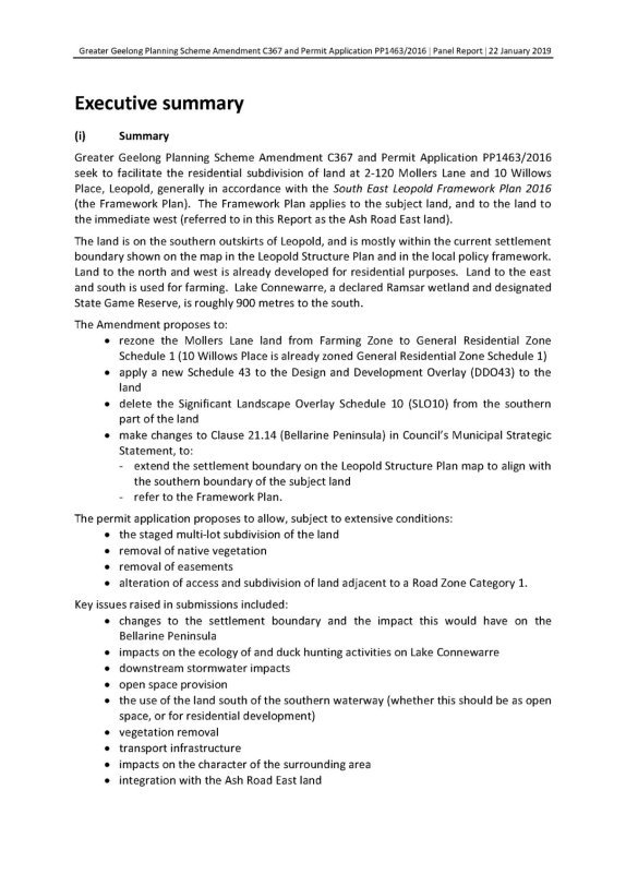
Amendment C367 and permit application 1463/2016 seek to facilitate the residential subdivision of land at 2-120 Mollers Lane and 10 Willows Place, Leopold, generally in accordance with the Leopold Structure Plan and the South East Leopold Framework Plan 2016 (the Framework Plan).
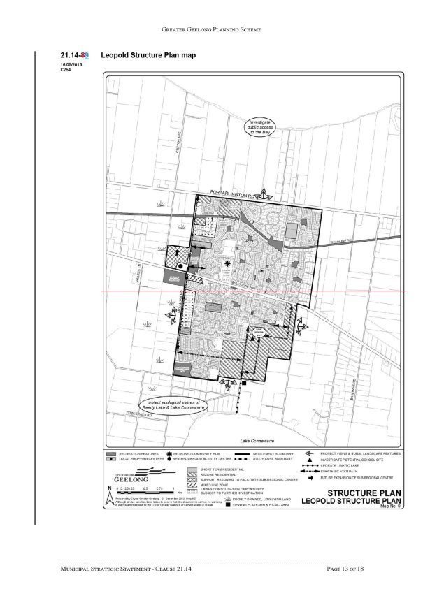
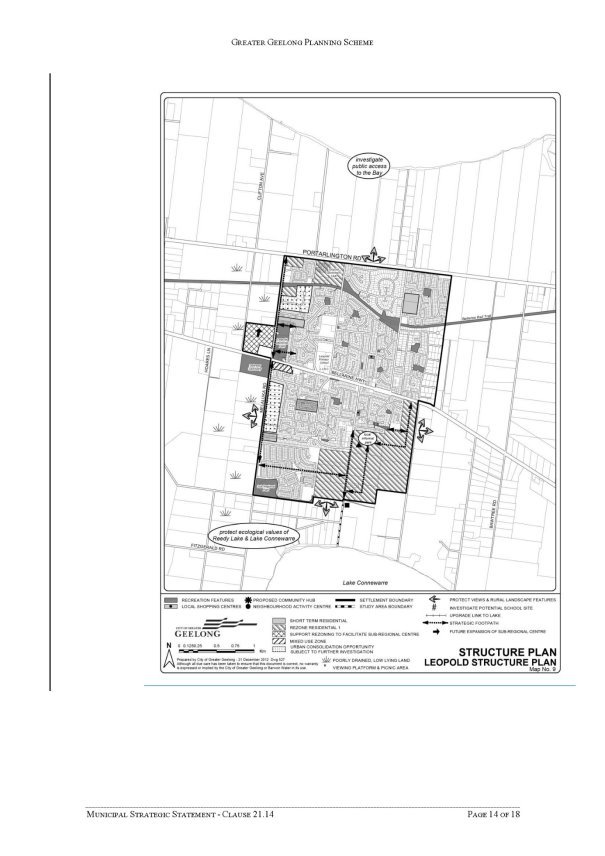
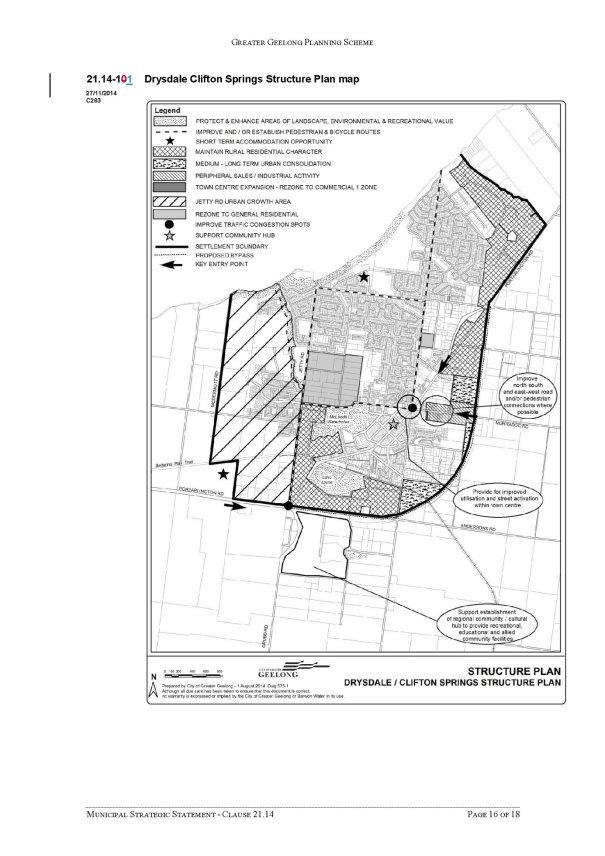
The land is on the southern outskirts of Leopold, and is mostly within the current settlement boundary shown on the map in the Leopold Structure Plan and in the clause 21.14 of the local policy framework in the Planning Scheme.
Land to the north and north west is already developed for residential purposes. Land to the east and south is used for farming purposes. Lake Connewarre, a declared Ramsar wetland and designated State Game Reserve, is roughly 900 metres to the south.
The Amendment as exhibited sought to:
Rezone the Mollers Lane land from Farming Zone to the General Residential Zone Schedule 1 (10 Willows Place is already zoned General Residential Zone Schedule 1)
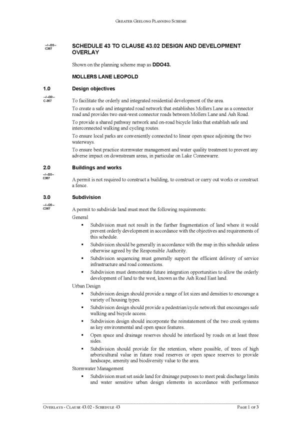
Apply a new schedule to the Design and Development Overlay Schedule (DDO43) to the land
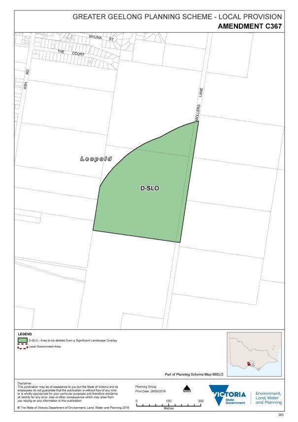
Delete the Significant Landscape Overlay Schedule 10 (SLO10) from the southern part of the land
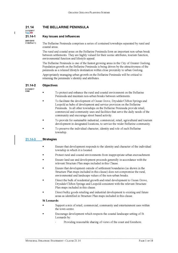
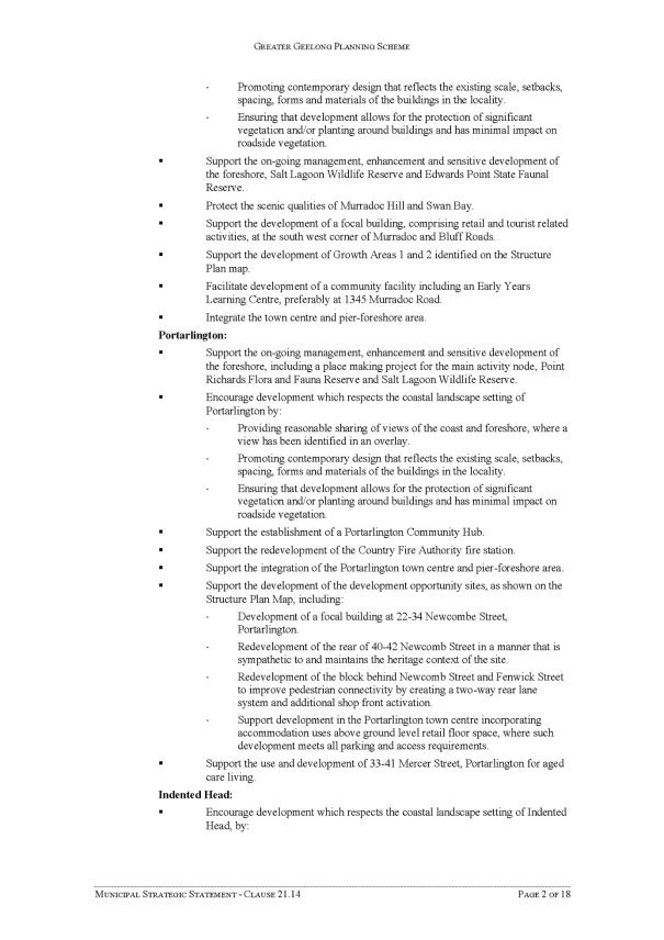
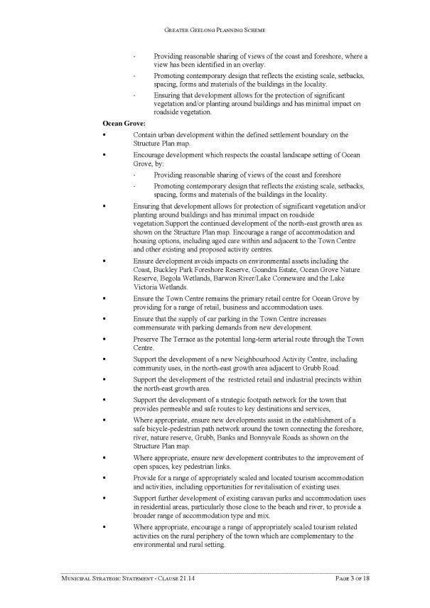
Make changes to Clause 21.14 (Bellarine Peninsula) in Council’s Municipal Strategic Statement, to:
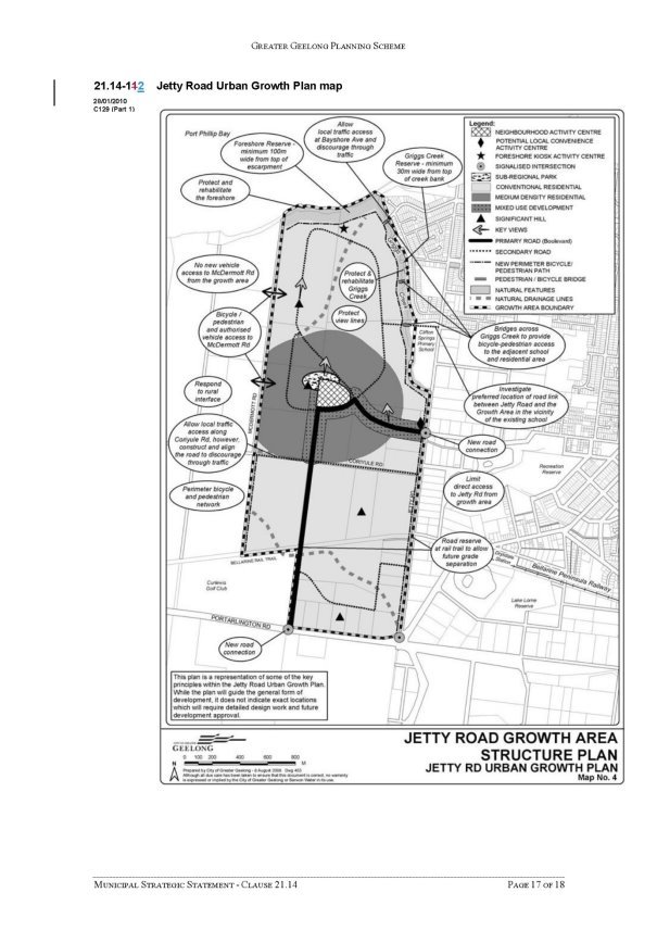
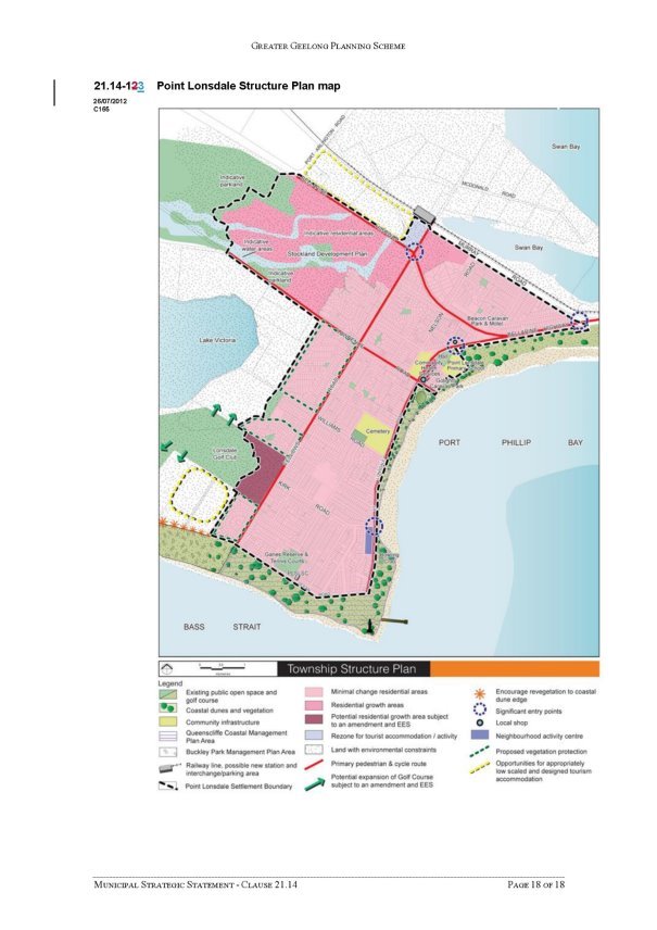
Extend the settlement boundary on the Leopold Structure Plan map to align with the southern boundary of the subject land
Refer to the Framework Plan.
The planning permit application proposes to allow, subject to conditions:
The staged multi-lot subdivision of the land
Removal of native vegetation
Removal of easements
Alteration of access and subdivision of land adjacent to a Road Zone Category 1.
A draft Section 173 Agreement relating to development contributions for community infrastructure was exhibited with the Amendment. Landowners were to agree to a contribution of $40,000 per net developable hectare to be used by Council for the purpose of providing community facilities within Leopold. Landowners were further to agree that they were responsible for the delivery of the open space, drainage, roads and intersection upgrade as part of the subdivision.
Owners of the five properties subject to the Agreement (only the properties fronting Mollers Lane subject to the rezoning) have signed the Section 173 Agreement (a model Agreement, with individual landowner details removed, is at Attachment 7).
The South East Leopold Framework Plan was prepared in 2016 and applies to the subject land and the Ash Road east land. Council engaged Tract consultants to prepare the Framework Plan as a tool to guide future development and ensure a coordinated subdivision approach across the Leopold growth area. Tract engaged with affected landowners and authorities such as Barwon Water and the CCMA. The Framework Plan has not been formally adopted nor subject to broader public consultation.
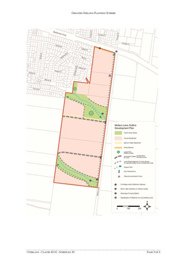
The Framework Plan establishes the need for open space along the two (2) waterways bisecting the growth area, the provision of two (2) east-west connector roads between Ash Road and Mollers Lane (including one connecting to the intersection of Ash Road and Walkers Road/Estuary Boulevard), the provision of larger parcels of public open space and the location of sewerage pumping stations.
Amendment C367 was exhibited between 17 May and 18 June 2018. Late submissions were accepted. As a result, sixteen (16) submissions were received of which fourteen (14) opposed/sought changes to the Amendment.
The major issues raised in the submissions were:
Changes to the settlement boundary and the impact this would have on the Bellarine Peninsula
Impacts on Lake Connewarre
Downstream storm water impacts
Open space provision
Use of the land south of the southern waterway (whether this should be as open space, or for residential development)
Integration with the Ash Road (east) land
The Council delegate report dated 18 October 2018 and a supplementary Council delegate report dated 21 November 2018 (considering a very late submission) summarised all of the submissions and provided a detailed City response to all of the issues raised.
All submissions were considered pursuant to Sections 22 (1) & (2) of the Planning and Environment Act 1987 and referred to an Independent Panel appointed by the Minister for Planning.
The appointed two person Panel held a directions hearing on 5 November 2018 and a three day Panel Hearing in Geelong between 3 December 2018 and 5 December 2018. Council was represented at the hearing by City officers.
The Panel has now presented its report to Council and recommended that Amendment C367 be adopted as exhibited subject to some changes, and that planning permit application 1463/2016 be amended. Attachment 5 is the Executive Summary of the Panel Report and contains the consolidated panel recommendations. Attachment 6 is the consolidated Panel recommendations and City responses.
A complete copy of the Panel’s report is available on the Geelong Australia website.
The Panel Report provided discussion and a series of findings and recommendations about all the issues associated with the Amendment, planning permit and S173 Agreement. A summary and response to the key matters is provided below.
Issue - Strategic justification for the proposal
The Panel was not persuaded by any party that there is any reason to question the overall policy support for the proposal as the land is identified for growth in an adopted structure plan. The Panel also noted that the proposal will deliver additional land supply consistent with policy objectives and that the slightly lower density is appropriate given the location on the outskirts of Leopold.
The Panel accepted evidence that the proposed subdivision represents an accessible, diverse and sustainable neighbourhood that provides integrated and connected transport solutions consistent with policy.
The Panel noted that the Planning Policy Framework includes policy objectives aimed at protecting and enhancing waterways, managing storm water runoff, and protecting and enhancing environmental values including those of Lake Connewarre. While the Panel was satisfied these could be managed to acceptable levels, it considered there was scope for improving environmental outcomes and made specific recommendations for additions to the planning permit.
Panel Conclusion: The Panel concluded that the Amendment is well founded and strategically justified as it is identified for future residential development in an adopted Structure Plan which aligns with the Planning Policy Framework.
City Response: The City concurs with the view of the Panel on the suitability and policy support for re-zoning to GRZ1.
Issue – Strategic justification for changing the settlement boundary
The issue considered was whether the change to the settlement boundary to align with the title boundary of 92-120 Mollers Lane was strategically justified, noting that policy supports containing townships on the Bellarine Peninsula within settlement boundaries and the Leopold Structure Plan discourages residential development outside of the settlement boundary.
Panel Conclusion: The Panel accepted Council’s submission that it was logical to align the settlement boundary with title boundaries and the advice of Barwon Water that extending the boundary would allow for a reduced number of pump stations required to service the new development. It also accepted the expert evidence that not moving the boundary would result in the creation of an isolated parcel of low value farming land.
City Response: The City concurs with the Panel’s conclusion on moving the settlement boundary. This would be considered a logical inclusion in terms of the Settlement Strategy.
Issue – Storm water management and downstream impacts
The Panel considered whether the impacts of storm water runoff on downstream private properties and Lake Connewarre were acceptable.
It was noted that the proposed drainage system for on-site drainage infrastructure is well defined and will retard the water flow to pre-development levels. All storm water runoff from the site will make its way downstream through a natural watercourse that flows to Lake Connewarre through a private dam located to the east of the subject land. The Panel notes that this footprint is less defined and that the proponent doesn’t have any interest in the privately owned land where off-site drainage works are proposed, nor are there any easements in favour of a drainage authority.
Panel Conclusion: The Panel concluded that off-site drainage works will be required to acceptably manage the impacts of the proposed development and that it is likely these will be required on privately owned land. Given the sensitivities associated with the outfall to Lake Connewarre, the Panel found that it is necessary for the planning permit to include a condition requiring the extent of off-site works and easement arrangements to be resolved before the development proceeds.
City Response: The City concurs with the view of the Panel about management of the off-site drainage works and have incorporated the proposed conditions into the planning permit to ensure this is resolved before development proceeds. The City has been working with the proponent to examine alternatives that would support discharge into a pipe in the Mollers Lane road reserve to avoid the need to cross privately owned land downstream. This investigation is ongoing but does not impact on the adoption of the Amendment and planning permit.
Issue – Encumbered versus unencumbered open space
The Panel considered the disagreement between Council and the proponent on what should be considered encumbered and unencumbered land as it is relevant to how much unencumbered land should be provided as open space and how the south-west wedge land should be considered.
Panel Conclusion: The Panel agreed with Council and the proponent that the land within the 1 in 100 year flood zone and the retarding basins should be considered encumbered. The Panel was not persuaded that the linear open space corridors should be regarded as encumbered (other than the land within the 1:100 year flood extent). The Panel concluded that the south-west wedge land should not be treated as encumbered as the level of slope was no greater than other developable parts of the subject land.
City Response: The City accepts the determination of the Panel on what should be regarded as encumbered open space and what is unencumbered.
Issue – The amount of open space
The Panel has considered how much open space should be provided in the subdivision. The City supported the amount of open space shown in the exhibited outline development plan, but submitted that the amount provided in the amended plan was insufficient to provide for the needs of the future community, especially children. In contrast, the proponent argued that provision at 10% was all that should be required in the area.
Panel Conclusion: The Panel agreed with Council’s argument that the rate of open space provision in Clause 53.01 of the Scheme (stated as 10%) is not applicable to a combined Amendment and permit. For such a case, the Panel agreed that the open space requirement should be considered in terms of the strategic planning framework for the area and local needs. Having heard the Council submission that public open space contributions in growth areas normally range from 20-35 percent (encumbered and unencumbered) the Panel found that there was not a need for a total open space contribution of up to 23 percent in this area. The Panel was not persuaded that a contribution of more than 10-12 percent of unencumbered land was justified or would necessarily deliver a net community benefit. The Panel also sought to ensure a balance was struck with other policy considerations such as the efficient use of residential land and maximising growth opportunities within settlement boundaries.
City Response: The City accepts this conclusion of the Panel. The final form of the subdivision provides about 12.99% of public open space as a result of reinstating the 1-hectare park. This is accepted by the proponent and has been included in the revised subdivision plan shown in Attachment 8.
Issue – The one hectare local park
The proponent circulated a revised development plan prior to the Panel Hearing which had deleted the 1 hectare park (and the encumbered public open space in the wedge to the south of the southern waterway). This was relied upon by the proponent and their expert witnesses during the Hearing as their preferred subdivision form for the area. The proponent argued the local park was not needed as the linear open spaces would satisfy the open space needs for the subdivision.
Council submitted that the 1-hectare local park adjacent to the northern retarding basin and northern waterway should be retained as identified in the Structure Plan and Framework Plan and as required by the objectives of clause 56.05-2 of the Scheme. If this was not provided, it would reduce the overall recreation opportunities for new residents.
Panel Conclusion: The Panel agrees with Council that the one-hectare local park should be provided as it maximises open space opportunities adjacent to the drainage corridor and offers a more varied and diverse open space network consistent with the Planning Policy Framework. Additionally, the park will ensure that open space is provided within 400 metres safe walking distance of most of the proposed lots. In support of this conclusion, the panel recommended the inclusion of a condition in the planning permit requiring the local park to be retained.
City Response: The City considers this is a significant recommendation of the Panel. This is an important piece of open space for the new residential area and one that was hard fought for by the City at the Panel Hearing. The City is supportive of this critical recommendation of the Panel. The future residents of the area will derive the recreational benefit of this land for years to come.
Issue – Residential development of the south-west wedge
As exhibited, the south-west wedge of land, which is located to the south of the southern waterway, is shown to be retained as encumbered open space. Council has not supported the residential development of this wedge of land as it does not accord with Framework Plan, and it would provide a buffer to the rural land to the south, between the subject land and Lake Connewarre.
The proponent submitted that there was no planning basis for requiring this land to be provided as open space, rather that the use of the land should be maximised for residential development. Expert evidence to the Panel submitted that the south-west wedge land is not well located as open space, there was no justification for its use as a buffer, and that street tree planting along the boundary would be sufficient to physically distinguish the two land uses.
Panel Conclusion: The Panel accepted that the south-west wedge land was not subject to physical constraints such as slope and negative landscape impact that would prevent its development for residential purposes. The Panel also rejected that it was required as buffer or necessary to provide an appropriate quantum of open space.
The Panel was cognisant of not wasting opportunities to efficiently use urban land and to maximise development within settlement boundaries. Concluding that the south-west wedge land is not required as open space the Panel recommended that is should be made available for conventional residential development and permit conditions be amended to allow for this outcome.
City Response: The Panel has heard all of the arguments and submissions about the proposal and has made a reasoned explanation of the issue. The Panel has balanced the various policy objectives of the Scheme and in the absence of any clear physical impediment to development, concluded that maximising development opportunity within the settlement boundary was meritorious. Whilst the Panel recommendation differs to the planning position and advice consistently given to the proponent since the preparation of the Framework Plan, the City accepts the Panel’s recommendation.
Issue – Form and content of the Amendment
The Panel has considered whether the design and development overlay is the appropriate planning tool and whether the Framework Plan should be referenced in the policy framework. The status of the Framework Plan was questioned with concerns about whether it met the requirements of the Planning Practice Note 13: Incorporated and Reference Documents. Inclusion of elements of the Framework Plan that affect Ash Road East were also questioned because the necessary technical reports for that land have not been prepared in relation to that site.
Panel Conclusion: The Panel agreed that the DDO was an appropriate tool as it meets the requirements of the Planning Practice Note and there is an accompanying planning permit. The DDO will provide control over the land in the event that the planning permit is not acted upon.
The Panel commented that use of the DDO in Mollers Lane does not pre-determine the application of a DDO to the Ash Road East land, concluding that the same or another tool will be considered as part of an Amendment application for that development front.
The Panel concluded that as the Framework Plan is intended to guide the exercise of discretion, it should not be included as a reference document in clause 21.14. Instead, only the substantive elements of it should be included and any map and elements relating to the Ash Road East land should be removed from the DDO43.
City Response: The Panel conclusions on using a DDO support the City’s position in choosing this tool. The City supports the Panel recommended changes to the DDO and Clause 21.14 and these are included in the Amendment for adoption in Attachment 3. The Framework Plan has effectively done its job in directing the subdivision layout of the growth area to ensure an integration of the land along the two waterways and ensuring delivery of an east-west road connection between Mollers Lane and Ash Road that meets at Walkers Road.
The City has been open to a different approach to the Ash Road East land, noting that a combined Amendment and permit application have now been lodged for this site, including all the technical reports and studies that are required to properly assess future development of this area. This will be presented to Council at a future meeting for consideration.
Issue – The Amended ODP and further notice
The amended outline development plan (ODP) submitted to the Panel by the proponent included significant changes to the exhibited version. It was produced just before the Panel Hearing and had not been subject to full consideration by the City, public notification or consultation with relevant agencies/referral authorities. The most significant variations are the deletion of the 1-hectare park and the substitution of residential subdivision for the encumbered open space south of the southern waterway.
Panel Conclusion: Section 96H(2) allows the Minister to direct the planning authority to give more notice of the permit application if he thinks that the notice already given was inadequate (even if the planning authority complied with the notice requirements of the Act). The Minister may allow any person affected by the changes to make a submission the Minister and these may then be referred to a panel, which may require a further hearing.
While generally supporting the revised ODP, subject to the reinstatement of the 1 hectare park, the Panel considered that Section 96H(2) of the Act should be used to direct further notification of the permit application. It is not available for the Panel to direct the Minister to use these powers, but is a matter that Council should bring to the Minister’s attention when submitting the combined Amendment and permit for approval.
City Response: The change to the ODP to allow residential development in the south-west wedge may impact on surrounding landowners and servicing authorities. It is noted that no adjoining landowners in the immediate vicinity of the proposed change made a submission and it is unknown whether the changes proposed to the ODP would affect their view of the Amendment and permit. The City supports this recommendation to ensure that any person that may be potentially affected by the changes are able to make formal submissions and have those considered by a Panel.
The planning authority for this amendment is Greater Geelong City Council.
The Greater Geelong Planning Scheme is amended as follows:
Planning Scheme Maps
The Planning Scheme Maps are amended by a total of three attached map sheets.
Zoning Maps
Amend Planning Scheme Map No. 69 in the manner shown on the one attached map marked “Greater Geelong Planning Scheme, Amendment C367”.
Overlay Maps
Amend Planning Scheme Map No. 69DDO in the manner shown on the one attached map marked “Greater Geelong Planning Scheme, Amendment C367”.
Amend Planning Scheme Map No. 69SLO in the manner shown on the one attached map marked “Greater Geelong Planning Scheme, Amendment C367”.
Planning Scheme Ordinance
The Planning Scheme Ordinance is amended as follows:
In Local Planning Policy Framework – replace Clause 21.14 with a new Clause 21.14 in the form of the attached document.
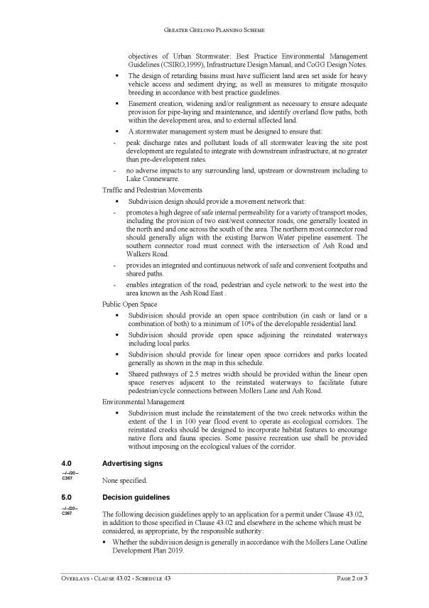
In Overlays – Clause 43.02, insert a new Schedule 43 in the form of the attached document.
End of document
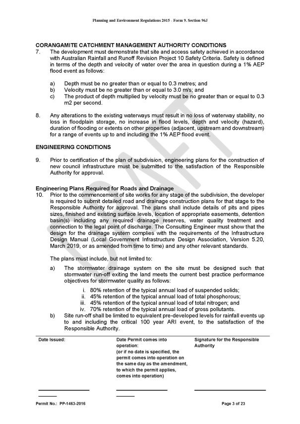
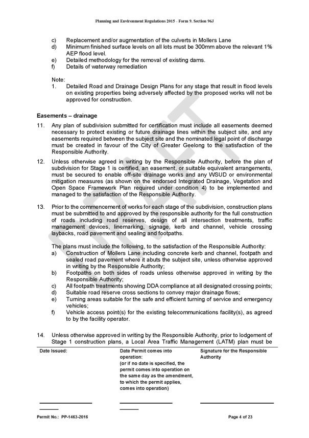
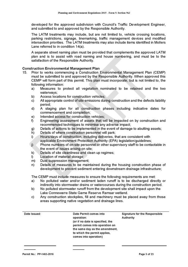
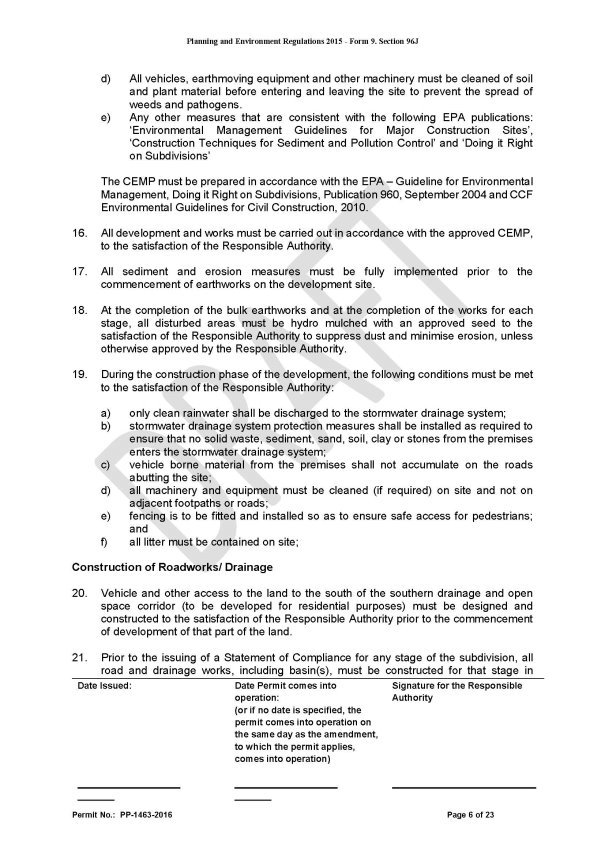
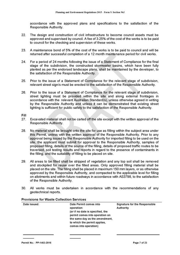
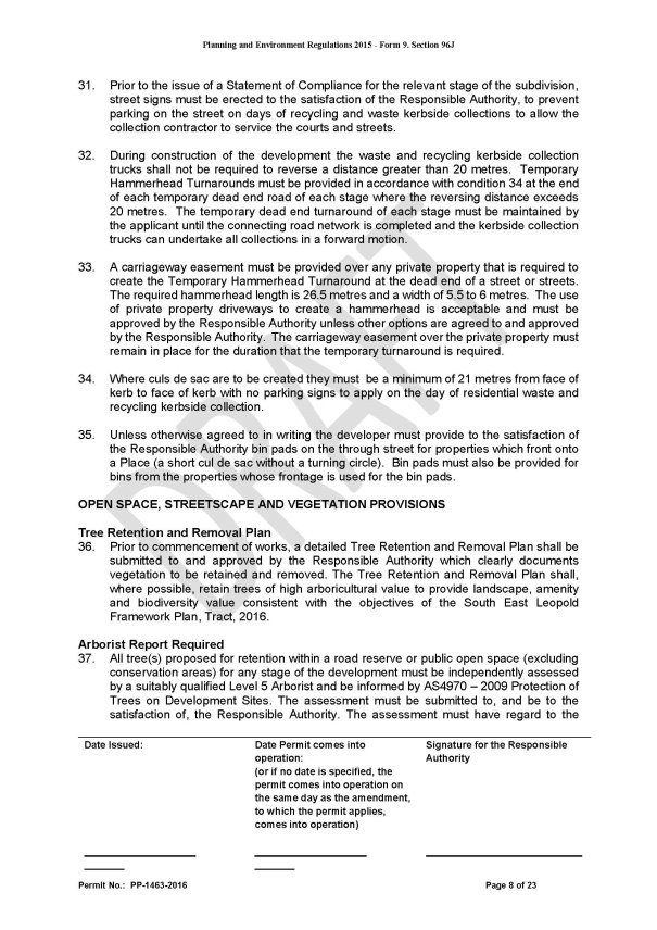
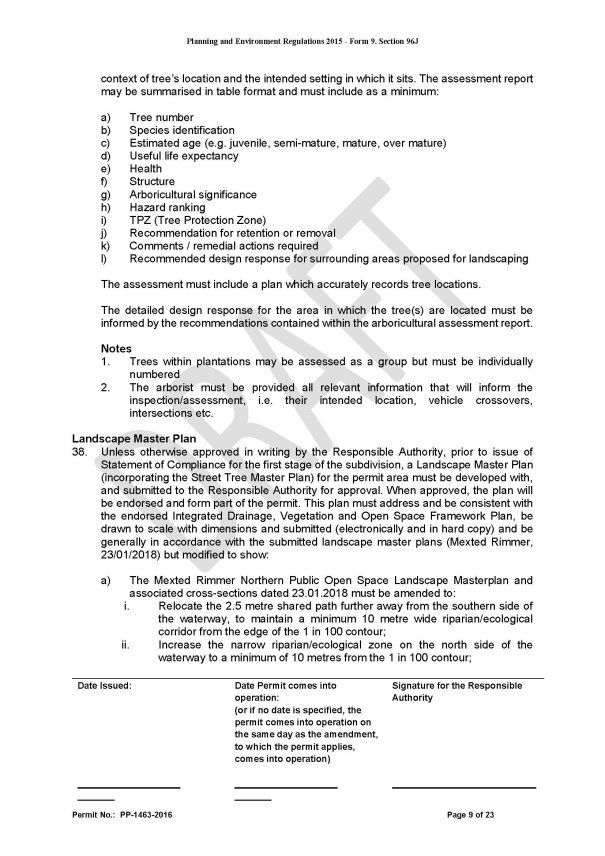
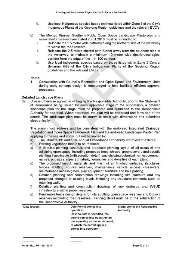
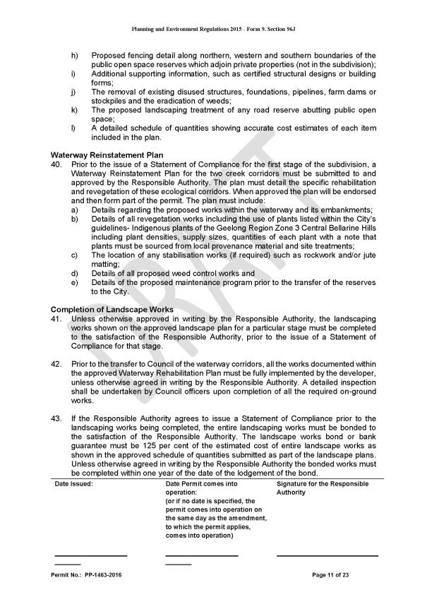
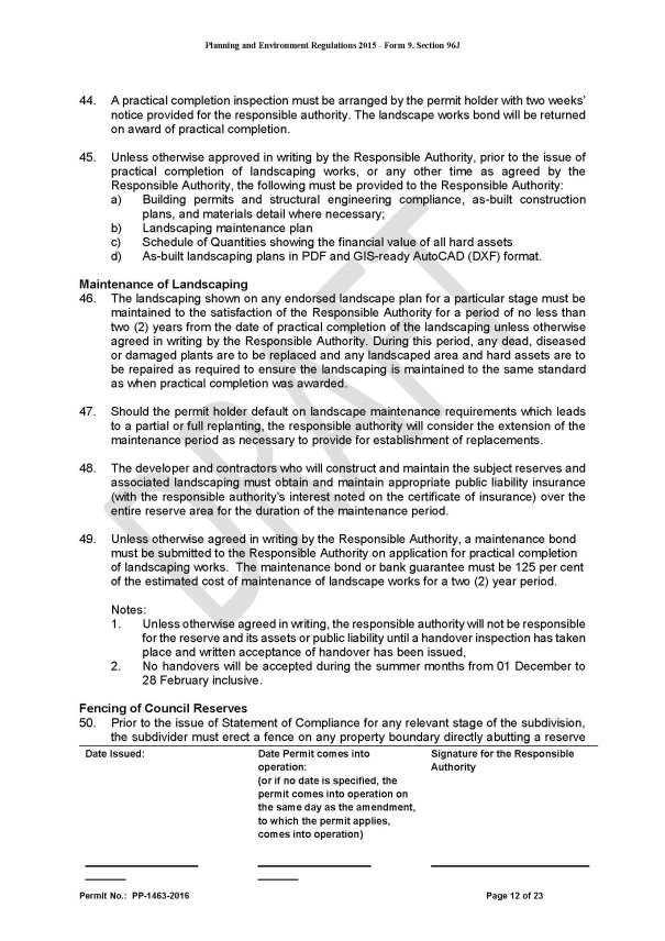
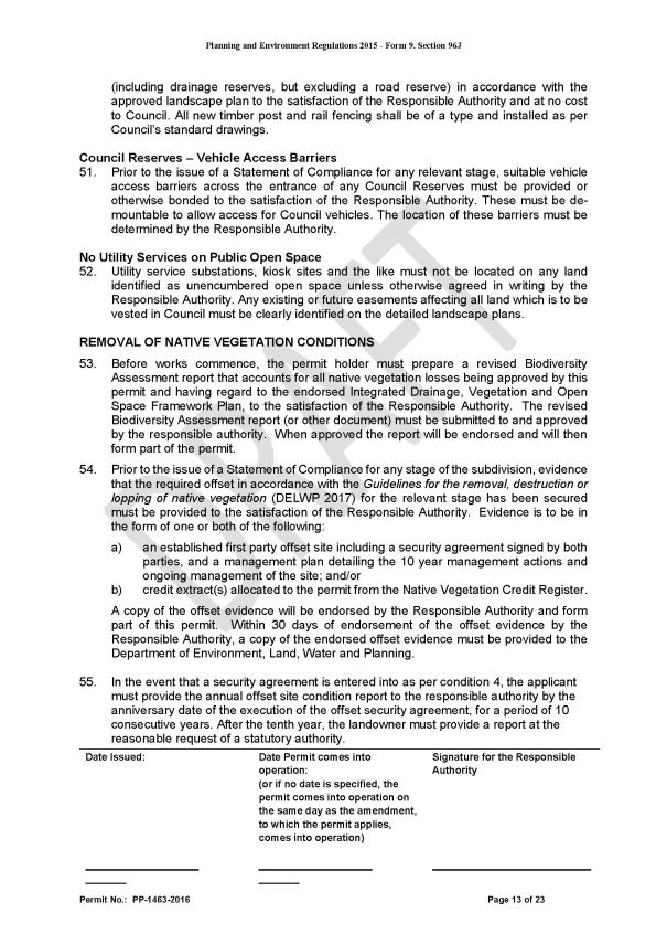
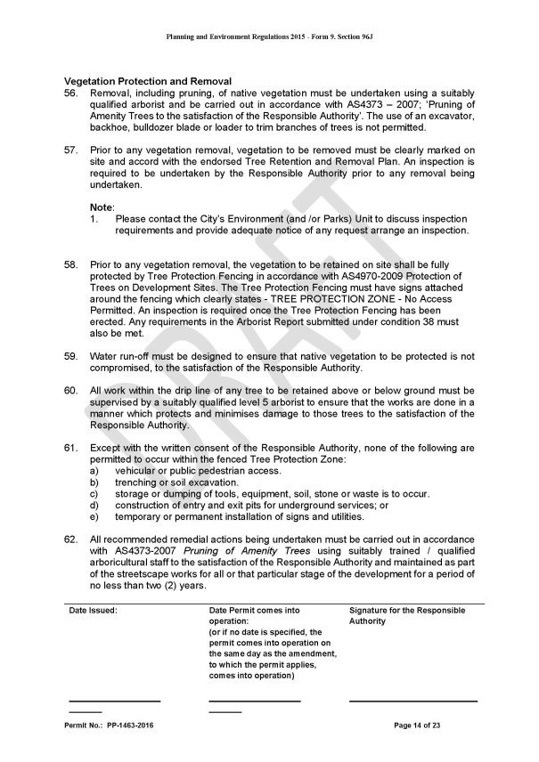
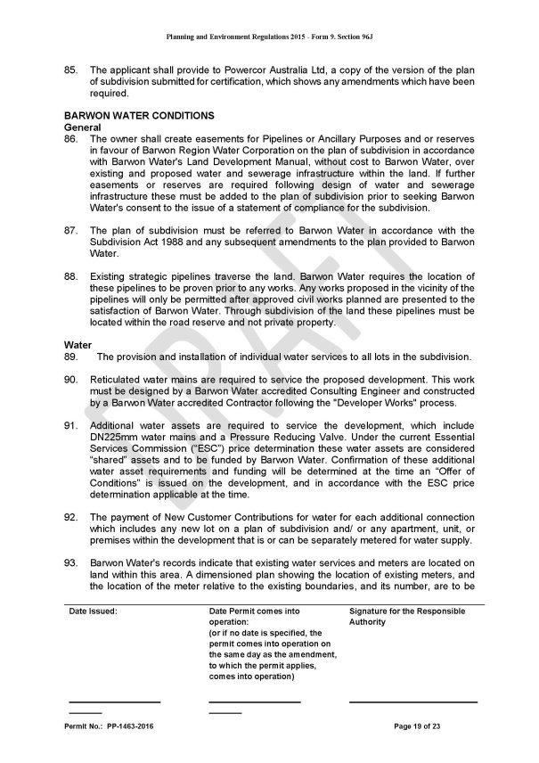
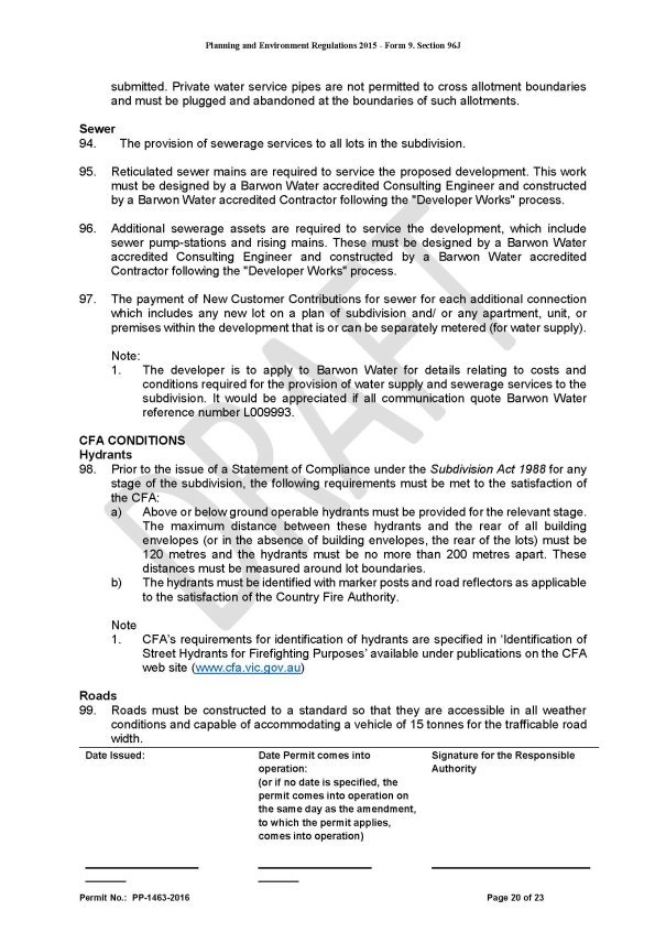
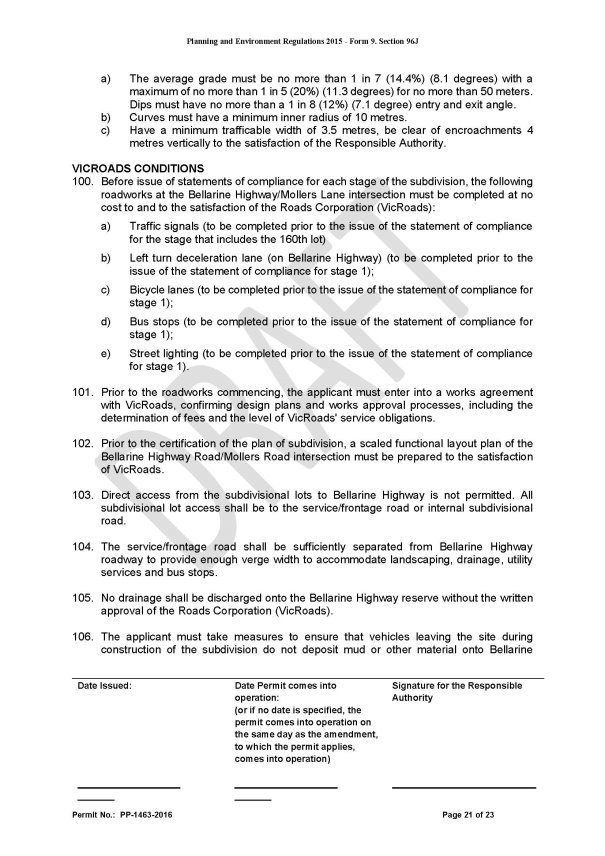
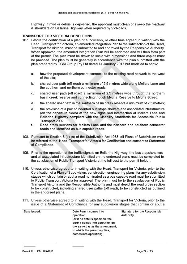
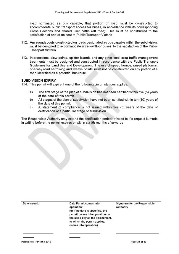
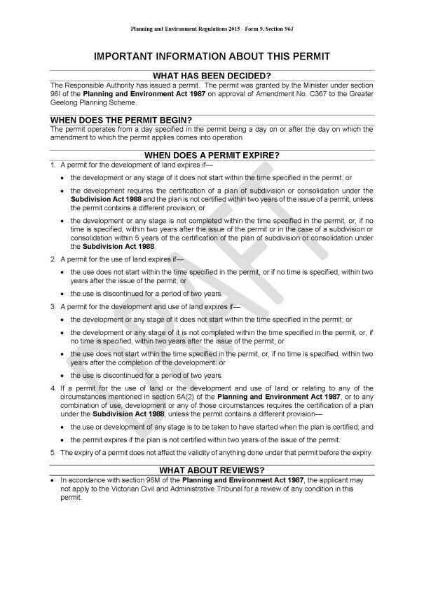
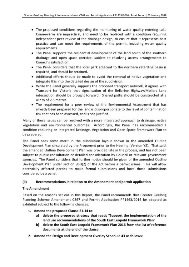
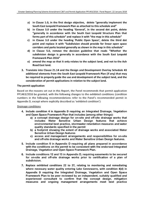
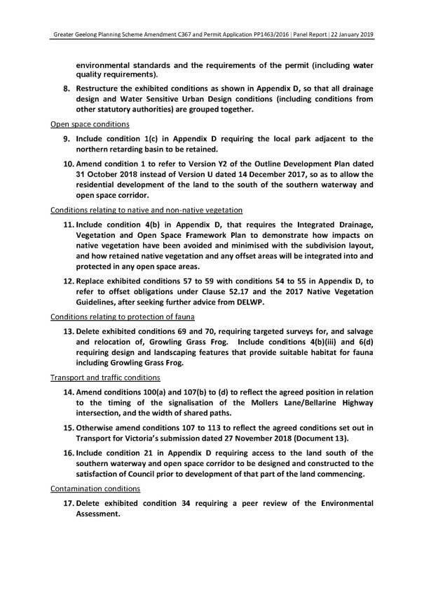
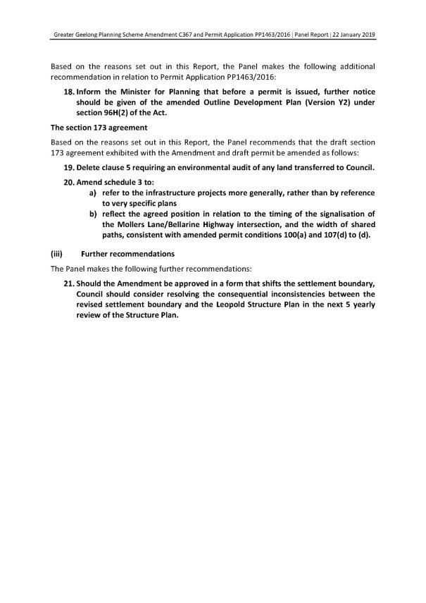
No. |
Panel Recommendations Greater Geelong Planning Scheme Amendment C367 |
City Response |
Adopted Council Position |
The Amendment Based on the reasons set out in this Report, the Panel recommends that Greater Geelong Planning Scheme Amendment C367 and Permit Application PP1463/2016 be adopted as exhibited subject to the following changes: |
|||
1 |
Amend the proposed Clause 21.14 to:
|
Supported. The Framework Plan has done its job in directing the subdivision layout of the growth area, with the concurrent planning permit with this Amendment and the recent application for the Ash Road East side generally consistent. |
Refer to Attachment 3 (Clause 21.14 for adoption). |
2 |
Amend the Design and Development Overlay Schedule 43 as follows:
|
Supported Some minor modifications to the Panel’s recommended wording is required to ensure grammatically correct sentences in the DDO43. The Panel has not made a specific recommendation to delete the fifth dot point in Clause 3.0 under the heading ‘Public Open Space’, which states “Along the Mollers Lane frontage of the growth area, encumbered open space must be provided as a buffer between the southern creek and the southern settlement boundary”. This contrasts with the Panel’s recommendation to allow residential development of the south-west wedge. In accepting that recommendation, the City considers that this dot point of the DDO43 needs to be removed. An updated map has been prepared to show only the Mollers Lane area. |
Refer to Attachment 3 (Clause 43.02- for adoption). |
3 |
Translate into Clause 21.14 and the Design and Development Overlay Schedule 43 additional elements from the South East Leopold Framework Plan (if any) that may be required to properly guide the use and development of the subject land, and the consideration of permit applications in relation to the subject land. |
Supported As the exhibited DDO43 was reasonably comprehensive, there is little change required to import additional elements from the Framework Plan. |
Refer to Attachment 3 (Clause 21.14 for adoption). |
|
The permit application Based on the reasons set out in this Report, the Panel recommends that permit application PP1463/2016 be granted, with the following changes to the exhibited conditions (condition numbers in the following recommendations refer to the Panel’s recommended permit in Appendix D, except where explicitly described as ‘exhibited condition’): |
||
|
Drainage conditions |
||
4 |
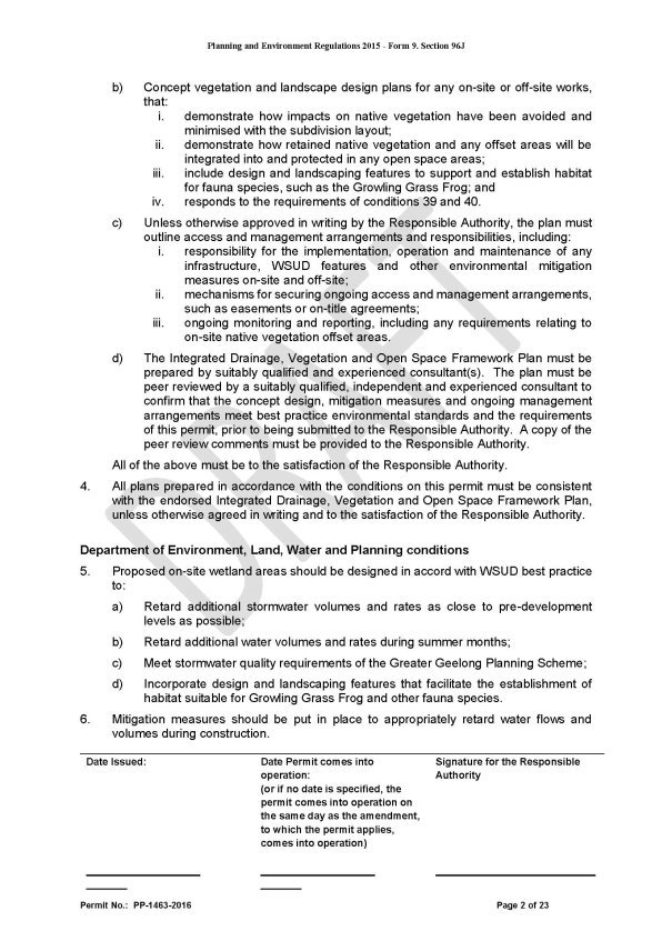
Include condition 4 in Appendix D requiring an Integrated Drainage, Vegetation and Open Space Framework Plan that includes (among other things):
|
Supported. (note that the renumbering of permit conditions changes the numbering referred to by the Panel.) |
Refer to Attachment 4 (condition 3 of the Planning Permit 1463/2016 for adoption) |
5 |
Include condition 5 in Appendix D requiring all plans prepared in accordance with the conditions on the permit to be consistent with the endorsed Integrated Drainage, Vegetation and Open Space Framework Plan. |
Supported. (note that the renumbering of permit conditions changes the numbering referred to by the Panel.) |
Refer to Attachment 4 (condition 4 of the Planning Permit 1463/2016 for adoption) |
6 |
Include conditions 12 and 13 in Appendix D, requiring easements to be secured for on-site and off-site drainage works prior to certification of a plan of subdivision. |
With post-panel discussion between the proponent and the City about possible alternatives to easements on downstream private land, the permit condition now also includes capacity for such an alternative outcome subject to Council approval. (note that the renumbering of permit conditions changes the numbering referred to by the Panel.) |
Refer to Attachment 4 (conditions 11 and 12 of the Planning Permit1463/2016 for adoption) |
7 |
Replace exhibited conditions 22 to 27, relating to monitoring and remediating where necessary water quality entering Lake Connewarre, with condition 4(d) in Appendix D requiring the Integrated Drainage, Vegetation and Open Space Framework Plan to be peer reviewed by an independent, suitably qualified and experienced consultant to confirm that the concept design, mitigation measures and ongoing management arrangements meet best practice environmental standards and the requirements of the permit (including water quality requirements). |
Supported. This is consistent with the expert evidence at the Panel Hearing and will provide Council with additional information about downstream water quality. (note that the renumbering of permit conditions changes the numbering referred to by the Panel.) |
Refer to Attachment 4 (condition 3d of the Planning Permit 1463/2016 for adoption) |
8 |
Restructure the exhibited conditions as shown in Appendix D, so that all drainage design and Water Sensitive Urban Design conditions (including conditions from other statutory authorities) are grouped together. |
Supported. This is a minor formatting / drafting matter. (note that the renumbering of permit conditions changes the numbering referred to by the Panel.) |
Refer to Attachment 4 (conditions 34 through to 8 of the Planning Permit 1463/2016 for adoption) |
|
Open space conditions |
||
9 |
Include condition 1(c) in Appendix D requiring the local park adjacent to the northern retarding basin to be retained. |
Supported. This is an important piece of open space for the new residential area and one that was hard fought by the City at the Panel Hearing. The City supports the retention of the local park generally in the same configuration as shown on the Version U plan. This includes that provision of the local park at a 1 hectare size. The City notes that the provision of this 1ha park does result in an open space provision of about 12.99% which is more than the 10-12% public open space preferred by the Panel. The City considers this is reasonable as it reflects the Panel’s recommendation and provides a useable local park for the area. With continued discussions between the City and the proponent post the Panel report, a revised plan incorporating the Panel’s recommendations has been prepared. This is accepted by the City and will become the endorsed plan when the permit is issued. As a result, condition 1 in the Panel’s preferred permit, is to be deleted as the requirements of this condition have either been included in the revised plan to be endorsed or incorporated into other conditions within the permit, such as the access arrangements for the telco tower site, which have been added into condition 14. |
Attachment 8 – revised plan to be endorsed at time of permit issue. |
10 |
Amend condition 1 to refer to Version Y2 of the Outline Development Plan dated 31 October 2018 instead of Version U dated 14 December 2017, so as to allow the residential development of the land to the south of the southern waterway and open space corridor. |
Supported. The Independent Panel has heard all the arguments and made a reasoned explanation of the issue and recommendation. There are no landscape or physical impediments to this land being made available for residential development. With continued discussions between the City and the proponent post the Panel report, a revised plan incorporating the Panel’s recommendations has been prepared. This is accepted by the City and will become the endorsed plan when the permit is issued. As a result, condition 1 in the Panel’s preferred permit, is to be deleted as the requirements of this condition have either been included in the revised plan to be endorsed or incorporated into other conditions within the permit, such as the access arrangements for the telco tower site, which have been added into condition 14. |
Attachment 8 – revised plan to be endorsed at time of permit issue. |
|
Conditions relating to native and non-native vegetation |
||
11 |
Include condition 4(b) in Appendix D, that requires the Integrated Drainage, Vegetation and Open Space Framework Plan to demonstrate how impacts on native vegetation have been avoided and minimised with the subdivision layout, and how retained native vegetation and any offset areas will be integrated into and protected in any open space areas. |
Supported. (note that the renumbering of permit conditions changes the numbering referred to by the Panel.) |
Refer to Attachment 4 (condition 3 (b) of the planning permit 1463/2016 for adoption). |
12 |
Replace exhibited conditions 57 to 59 with conditions 54 to 55 in Appendix D, to refer to offset obligations under Clause 52.17 and the 2017 Native Vegetation Guidelines, after seeking further advice from DELWP. |
Supported. DELWP has provided updated permit conditions and these are supported by the City. (note that the renumbering of permit conditions changes the numbering referred to by the Panel.) |
Refer to Attachment 4 (conditions 53 and 54 of the planning permit 1463/2016 for adoption). |
|
Conditions relating to protection of fauna |
||
13 |
Delete exhibited conditions 69 and 70, requiring targeted surveys for, and salvage and relocation of, Growling Grass Frog. Include conditions 4(b)(iii) and 6(d) requiring design and landscaping features that provide suitable habitat for fauna including Growling Grass Frog. |
Supported. (note that the renumbering of permit conditions changes the numbering referred to by the Panel.) |
Refer to Attachment 4 (conditions 3 and 5 of the Planning Permit 1463/2016 for adoption) |
|
Transport and traffic conditions |
||
14 |
Amend conditions 100(a) and 107(b) to (d) to reflect the agreed position in relation to the timing of the signalisation of the Mollers Lane/Bellarine Highway intersection, and the width of shared paths. |
Supported. The timing as required by VicRoads for the installation of signals at the Bellarine Highway and Mollers Lane intersection is tied to the development of the 160th lot in the subdivision. This is also captured in the S173 Agreement. |
Refer to Attachment 4 (conditions 100a and 107b-d of the Planning Permit 1463/2016 for adoption) |
15 |
Otherwise amend conditions 107 to 113 to reflect the agreed conditions set out in Transport for Victoria’s submission dated 27 November 2018 (Document 13). |
Supported. |
Refer to Attachment 4 (conditions 107-113 of the Planning Permit 1463/2016 for adoption) |
16 |
Include condition 21 in Appendix D requiring access to the land south of the southern waterway and open space corridor to be designed and constructed to the satisfaction of Council prior to development of that part of the land commencing. |
Supported. It is a concern that access to this land is across a corridor of open space. The City supports being involved in the design and construction of this access to ensure that the open space and drainage functions and attributes of the corridor are not compromised. (note that the renumbering of permit conditions changes the numbering referred to by the Panel.) |
Refer to Attachment 4 (condition 20 of the Planning Permit 1463/2016 for adoption) |
|
Contamination conditions |
||
17 |
Delete exhibited condition 34 requiring a peer review of the Environmental Assessment. |
Supported. |
Refer to Attachment 4 (Planning Permit for adoption) – no condition included. |
18 |
Based on the reasons set out in this Report, the Panel makes the following additional recommendation in relation to Permit Application PP1463/2016: Inform the Minister for Planning that before a permit is issued, further notice should be given of the amended Outline Development Plan (Version Y2) under section 96H(2) of the Act. |
Supported. Allowing development south of the southern waterway has arisen from the proponent post-exhibition in the lead up to the Panel Hearing. Landowners and residents in the vicinity have not had the opportunity to view these plans or have their say on them. It is important for the integrity of the process for this to be undertaken prior to any approval of the Amendment and planning permit. |
Refer to the report recommendation for this resolution. |
|
The section 173 agreement Based on the reasons set out in this Report, the Panel recommends that the draft section 173 agreement exhibited with the Amendment and draft permit be amended as follows: |
||
19 |
Delete clause 5 requiring an environmental audit of any land transferred to Council. |
Supported The environmental assessment report submitted with the application address the condition of the land and finds that there is no contamination above WHO standards. |
Refer to Attachment 7 (S173 Agreement) |
20 |
Amend schedule 3 to:
|
Supported. These Panel recommendations reflect the position that the City presented to the Panel during the Hearing, and the negotiations held with Transport for Victoria. |
Refer to Attachment 7 (S173 Agreement) |
|
Further recommendations The Panel makes the following further recommendations: |
||
21 |
Should the Amendment be approved in a form that shifts the settlement boundary, Council should consider resolving the consequential inconsistencies between the revised settlement boundary and the Leopold Structure Plan in the next 5 yearly review of the Structure Plan. |
Supported. |
Included in the report recommendation |
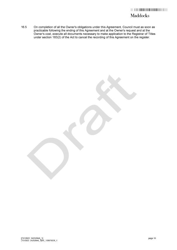
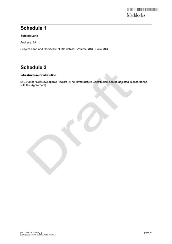
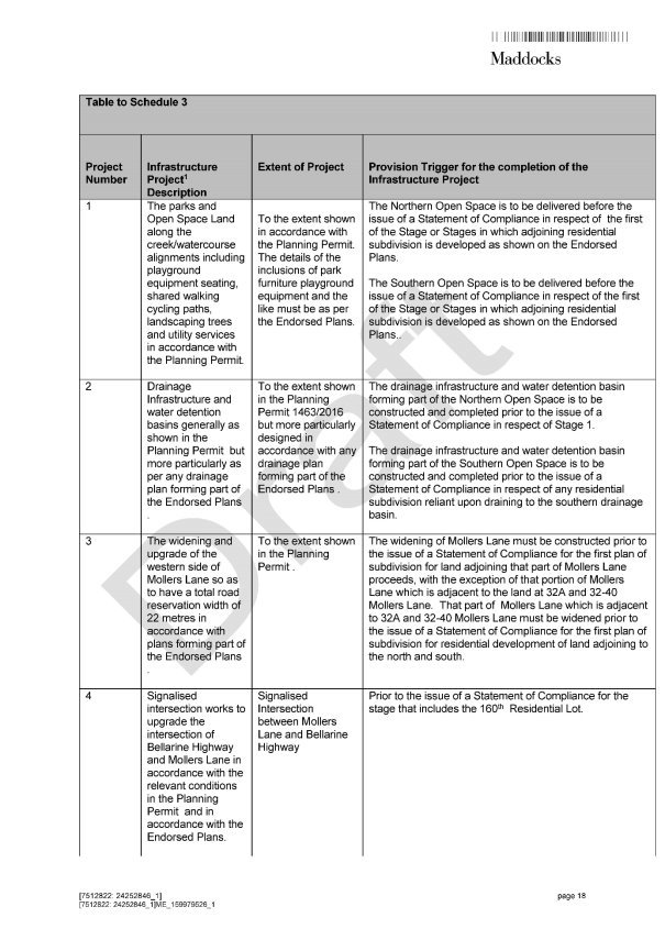

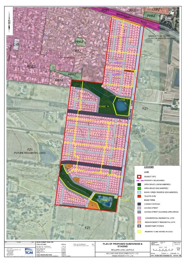
Source: |
Planning, Design & Development – City Development |
Director: |
Gareth Smith |
Portfolio: |
Sustainable Development |
To seek endorsement of revised terms of reference for the Planning Committee and to abolish the Development Hearings Panel (DHP) and revoke its instrument of delegation and terms of reference.
The Planning Committee is a committee established under section 86 of the Local Government Act (Vic) 1989 (Act). Its membership entirely consists of Councillors. It considers and determines planning permit applications which have been called in by a Councillor. Since May 2018, 16 applications have been called in and 13 meetings have been held on an as required basis.
The DHP is also a committee established under section 86 of the Act and its membership consists of four senior Council officers and can include a Councillor (if the nominated Councillor wishes to attend). The DHP considers and determines planning permit applications which are referred by either a Councillor or planning officers, have 6 or more objections lodged or are recommended for refusal.
Planning Committee and DHP meetings provide a forum for objectors and applicants to put their views for or against an application to the Council decision makers. Both the Planning Committee and DHP make decisions on the evening of the hearing using delegated authority as expressed by Council in the respective instruments of delegation.
The terms of reference for both the Planning Committee and DHP were last updated by Council resolution of 12 May 2015. Changes are required to the terms of reference, at a minimum to reflect new position titles and to clarify call in criteria and procedures.
The recommendation is informed by benchmarking undertaken with a number of similar large and regional councils regarding their planning permit decision-making process (Attachment 2).
It is recommended to make changes to the Planning Committee terms of reference (Attachment 3) to include:
The trigger for councillors to “call in” planning permit applications with 6 or more objections or applications for refusal.
The process for an application to be called in to Planning Committee to require a minimum of two ward Councillors and one other Councillor agreeing to a “call in”. The additional councillor is recommended to be the Planning Committee Chairperson or the Mayor where the Planning Committee Chairperson is also a relevant ward Councillor.
It is also recommended that the DHP be abolished and relevant officers provided with full delegation to enable streamlining of considering planning applications.
Councillor Asher moved, Councillor Mason seconded -
That Council:
Endorse the revised terms of reference for the Planning Committee (Attachment 3);
Abolish the Development Hearings Panel special committee and:
Revoke the Greater Geelong City Council Instrument of Delegation Development Hearings Panel authorised by a resolution of Council made on 23 October 2018; and
Revoke the Development Hearings Panel Terms of Reference adopted by a 12 May 2015 Council resolution.
Through the exercise of the powers conferred by section 98(1) of the Local Government Act 1989 (the Act) and the other legislation referred to in the attached updated instrument of delegation (Attachment 4), extend officer delegations to deal with all planning applications by resolving that:
There be delegation to the members of Council staff holding, acting in or performing the duties of the officers or positions referred to in the attached Instrument of Delegation to members of Council staff, the powers, duties and functions set out in that instrument, subject to the conditions and limitations specified in that Instrument (Attachment 4):
The instrument comes into force immediately the common seal of Council is affixed to the instrument;
The affixing of the common seal of Council be undertaken no earlier than 19 August 2019;
On the coming into force of the instrument all previous delegations to members of Council staff (other than the Chief Executive Officer) are revoked; and
The duties and functions set out in the instrument must be performed, and the powers set out in the instruments must be executed, in accordance with any guidelines or policies of Council that it may from time to time adopt.
Authorise the changes in paragraph 9.2 above to be made on 19 August 2019.
Note an appropriate internal protocol will be established to provide effective oversight of application refusals.
Review in 12 months’ time through Councillor and community feedback if the Revised Terms of Reference for Planning Committee and Abolition of the Development Hearings Panel have met favourable Councillor and community expectations.
Carried.
There are no financial implications associated with changing the terms of reference. Planning Committee meetings are held in the City’s offices and apart from newspaper advertising the main cost is Council officer and Councillor time. The removal of DHP will provide staff resource efficiencies in the order of at least 0.5 equivalent full time staff (EFT) which would be used for processing of planning permits.
Permit applicants and objectors often include consulting support to attend DHP. Ceasing DHP can provide financial savings to many applicants and objectors.
The Planning Committee is considered to be a positive means to engage the community in the planning process for significant applications. The planning officer provides a summary of their report and answers questions on the night. Objectors can express their concerns about the planning permit application being heard to councillors prior to a decision being made. Applicants can also articulate the benefits of their proposals and answer any questions.
Improving the efficiency of permit decision making is consistently raised by applicants. The proposed ceasing of the DHP and amendments to the Planning Committee Terms of Reference reduces the time it will take to consider applications and improves certainty of the process for applicants and objectors because there is one less forum where a permit may be decided.
DHP and Planning Committee meetings are public meetings accessible to all members of the community who have an interest in the planning permit application that is being heard.
Retaining the Planning Committee and allowing all councillors the option to call in applications with 6 or more objections or for refusal, will provide a public forum for applicants and objectors to be equally heard.
The draft recommendation abolishes the DHP special committee, revokes the Greater Geelong City Council Instrument of Delegation Development Hearings Panel authorised by a resolution of Council passed on 23 October 2018 and revokes the Development Hearings Panel Terms of Reference adopted by a 12 May 2015 Council resolution.
The abolition of the DHP requires amendments to the Greater Geelong City Council Instrument of Delegation to Members of Council Staff authorised by a 23 October 2018 resolution of Council. This is needed to provide for officer determination of planning permits and to remove references to the DHP.
The two committees align with Council Plan 2018-22 priorities relating to organisational leadership, strategy and governance.
No officer involved in the preparation of this report has a direct or indirect interest.
The changes seek to clarify the terms of reference and will minimise any risk of misinterpretation particularly in relation to Councillor “call ins” and the role of the Planning Committee.
The abolition of the DHP reduces the risk that planning permit decisions take longer than the required time frames.
An internal protocol will be established to monitor application refusals. This may include the Manager City Development to authorise all refusals.
There are no relevant environmental implications.
Development Hearings Panel
DHP meetings are held the first and third Thursday evening each month and over the last 12 months on average 2 applications are determined at each meeting.
The DHP process adds an average of 4 weeks to the decision making process for planning applications. This is due to the need for reports to be written and checked and for parties to be given timely notification of the panel date. The DHP process also involves increased staff resources due to hearing times, report writing and reviewing.
Benchmarking against a number of similar large and regional councils shows that the City is the only council using an officer panel, the DHP, to decide planning applications. The majority of councils provide officers with full delegation to make decisions on planning applications or have a threshold number of objections for applications to be considered by Council at a committee meeting or ordinary council meeting.
Abolishing the DHP and providing full delegation to planning staff to determine applications will improve timeframes of planning applications, which was an issue raised at recent developer forums.. It is estimated conservatively 0.5 EFT will be saved with the removal of the DHP which would assist with the City’s objective to improve the timeliness and effectiveness of considering planning applications.
It is recommended that the DHP and delegation changes come into effect after the scheduled DHP meetings in August to enable necessary transition.
Planning Committee
The Planning Committee has considered 15 planning permit applications in the 12 months from July 2018 to June 2019. All of the applications considered by the Planning Committee during this period had more than 6 objections or were recommended for refusal. This equates to 1% of the total applications determined by the City.
The benchmarking against a number of other councils for the same 12 month period shows that all Councils benchmarked have 1% to 2 % of their total applications considered by a Council, at a committee meeting or ordinary council meeting. In terms of numbers of applications this ranged from 6 to 20 applications.
It is recommended to make changes to the Planning Committee terms of reference (Attachment 3) to include:
The trigger for councillors to “call in” planning permit applications with 6 or more objections or applications for refusal.
The process for an application to be called in to Planning Committee would require a minimum of two ward councillors and the Planning Committee Chairperson agreeing to a “call in” or the Mayor where the Planning Committee Chairperson is a relevant ward Councillor.
Having multiple ward Councillors involved in a “call in” aims to encourage councillors within the ward to work together and be across significant planning matters for their ward.
Planning Committee |
Document No: |
CTR45.2 |
Approval Date: |
July 2019 |
|
Approved By: |
Council |
|
Review Date: |
November 2020 |
|
Responsible Officer:Director Planning, Design and Development |
Version No: |
06 |
Authorising Officer: |
Council |
|
The Planning Committee (Committee) has been formed to consider and decide planning permit applications which have been called in by a Councillor.
The Committee has delegated authority as expressed by Council in the sealed Instrument of Delegation.
The Committee will operate within the context of Planning and Environment Act 1987 and the Subdivisions Act 1998 together with any other Act or Regulation where Council may exercise the powers of a Responsible Authority.
To consider and decide planning permit applications which have been called in by a Councillor under the Committee terms of reference.
Call-in is the process of initiating a Council intervention in the consideration of a planning permit application through referral of the planning permit application to the Planning Committee.
Responsible Authority has the same meaning as defined in the Planning and Environment Act 1987.
Planning Committee means the forum comprised of Councillors appointed by Council with delegated power to determine development applications.
Applications of Interest is a data base distributed by the Manager City Development on a fortnightly basis that provides all Councillors with a list of planning applications of interest, which could include those that:
raise an issue of significant public interest, opportunity, concern or controversy, or are likely to do so. Such issues would normally involve an assessed high or extreme risk rating and are likely to impact on people and the places they live, work and play or
have given rise to substantial public objection or appear likely to do so, or
involve an issue of policy which affects the community in some way where there is no existing Council policy to guide the delegate, or
would lead to a delegate decision inconsistent with, or appearing to be inconsistent with, a previous decision or previous decisions made by or on behalf of Council regarding the matter or similar matters, or
the delegate otherwise considers would be more appropriately decided by Council resolution.
This Committee:
Commences immediately the common seal of Council is affixed to the committee’s instrument of delegation; and
Ends on the day of a Council resolution to abolish the Committee.
4.2.1 Membership & Eligibility
The Committee shall consist of all Councillors.
4.2.2. Chairperson
4.2.2.1. The Chairperson is appointed by the Mayor, pursuant to section 11E(1)(b) of the City of Greater Geelong Act 1993.
4.2.2.2. If the Mayor elects not to exercise this discretionary power, the role will be performed by the Councillor responsible for the Planning Portfolio (or other named portfolio related to Council’s role as a Responsible Authority).
4.2.2.3. In the absence of the Chairperson, the meeting shall elect a temporary Chairperson.
4.2.3. Quorum
A quorum for a meeting shall be one more than half of the membership of the Committee.
4.3.1. The Committee operates under delegated authority as expressed by Council in the committee’s sealed instrument of delegation.
4.3.2. The Committee will operate within the context of Planning and Environment Act 1987, the Subdivisions Act 1988, together with any other Act or Regulation under which Council may exercise the powers of a Responsible Authority.
4.4.1. Committee meetings shall be scheduled once a month and notice of meeting dates published in accordance with section 89(5) of the Local Government Act 1989.
4.4.2. Meetings are open to the public and other than in circumstances where the committee resolves to close the meeting in accordance with Section 89 of the Local Government Act 1989, decisions shall be made in the public forum.
4.4.3. The committee operates under the Council’s Meeting Procedures Local Law (or any subsequent replacement Local Law), with such modifications and adaptations as the committee deems necessary for the orderly conduct of meetings.
4.4.4. Notice of meetings together with a meeting agenda shall be delivered to members in accordance with the Meeting Procedures Local Law 2017.
4.4.5. The Chairperson of the Committee shall have a casting vote.
4.4.6. The process for submitters to be heard by the Committee shall be:
the officer to present the report;
the objectors to present submissions. A three minute time limit applies to each person addressing the meeting;
the applicant to present a submission. A ten minute time limit applies to the applicant addressing the meeting; and
at the discretion of the Chairperson, the applicant may be permitted to make points of clarification. A three minute time limit applies.
4.5.1. The Co-ordinator Mayor & Councillor Support is responsible for convening meetings in consultation with the Manager City Development.
4.5.2. The Manager City Development is responsible for preparing and delivering the meeting agenda, ensuring planning officer attendance and providing advice at meetings, recording of minutes and implementation of decisions of the Committee.
4.6.1. Notice of meetings together with a meeting agenda shall be delivered to members in accordance with the Meeting Procedures Local Law 2017.
4.6.2. On a fortnightly basis the Manager City Development will furnish all Councillors with a list of planning applications of interest.
4.6.3. On an as required basis the Manager City Development will furnish all Councillors with a list of officers intention to make a decision on planning applications with 6 or more objections or applications for refusal.
A Councillor may only request to call in planning permit applications which have 6 or more objections lodged or applications for refusal.
The process for a Councillor to call-in a matter to be heard by the Committee is as follows: (see flow chart in Attachment 1):
4.9.1.1 Councillors requesting call in notify of intention to call in an application. This information will be recorded in the register for call ins.
4.9.1.2 A minimum of two ward Councillors and the Committee Chairperson are all required to agree to a call in, or the Mayor where the Committee Chairperson is one of the two ward Councillors requesting a call in.
4.9.1.3 Committee chairperson advises Manager City Development.
4.9.1.4 Officers will contact applicants and objectors to notify them of the meeting and details.
Quality Records shall be retained for at least the period shown below.
Record |
Retention/Disposal Responsibility |
Retention Period |
Location |
Minutes |
Manager, City Development |
Permanent |
Initially within City Development, for archive purposes Heritage Centre. |
“Call in” process
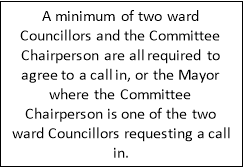
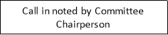
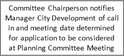
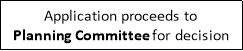
Contents | Previous Page: Section A - Procedural Matters | Next Page: Section C – Urgent Business
