
Council Minutes - Section B: Reports - 23 February 2021
Contents | Previous Page: Section A - Procedural Matters | Next Page: Section C - Notice of Motion
Contents | Previous Page: Section A - Procedural Matters | Next Page: Section C - Notice of Motion
Reports tabled at the Ordinary Meeting of Council on Tuesday date held at the Council Conference and Reception Centre in City Hall, 57 Little Malop Street, Geelong.
Northern Aquatic and Community Hub – Federal Funding Opportunities
Terms of Reference – Central Geelong Business Reference Group
Central Geelong Marketing – Intention to Declare Special Rate
Proposed Partial Road Discontinuance and Sale Abutting 248 Kilgour Street
Station Street, Drysdale – Street and Footpath Construction SRC239 – Finalisation of Scheme
Montpellier Drive, Highton – Street Construction SRC345 – Finalisation of Scheme
Barwarre Road, Marshall – Street Construction SRC351 – Finalisation of Scheme
Revocation of Flood-Prone Area Designation of New Lots at Armstrong Mt Duneed – Stages 47A and 65A
Source: |
Governance, Strategy & Performance – Government Relations & Advocacy |
Director: |
Rebecca Leonard |
To seek Council approval to apply for two federal funding opportunities for Northern Aquatic & Community Hub.
The Northern Aquatic & Community Hub is a $61.6 million transformative community infrastructure project that will provide health, fitness, community and civic facilities for Geelong’s northern suburbs as well as serve a rapidly growing population.
Council has committed $20.6 million to this priority project and is seeking the remaining $41 million required through state and federal government funding.
Two federal funding opportunities have become available, where the Northern Aquatic & Community Hub is both an eligible project and is the preferred project for submission; the Building Better Regions Fund (Round 5) and the Local Roads & Community Infrastructure Fund (Phase 2).
The Northern Aquatic & Community Hub meets the eligibility to apply for $20,000 to $10 million under the Infrastructure Project Stream of the Building Better Regions Fund (Round 5), with applications closing on 5 March 2021.
The federal government has allocated the City of Greater Geelong $8,262,225 under the Local Roads & Community Infrastructure Fund (Phase 2). The City must nominate project/s that meet the fund guidelines for approval via a Work Schedule up to the allocated amount.
The Northern Aquatic & Community Hub meets the eligibility criteria for the Local Roads & Community Infrastructure Fund (Phase 2) other than the completion date of June 2022. This deadline could not be met due to still seeking additional funding to deliver the project and the length of time to complete this substantial project once funding is secured. The guidelines, however, provide for an extension of time under exceptional circumstances.
The City believes Northern Aquatic & Community Hub would meet the definition of exceptional circumstances due to the significant benefit of the project to the Geelong community in immediate economic stimulus and jobs during construction as well as long term health benefits and the provision of community infrastructure for a growing population.
A two-year extension would allow the City reasonable time to secure additional funding and deliver the project.
Whilst there are many other worthy projects in the region that qualify to apply for this funding, the City recommends that this is the priority project for these funds for the Council.
Councillor Aitken moved, Councillor Grzybek seconded -
That Council:
Approve an application to the Building Better Regions Fund (Round 5) for $10 million for the Northern Aquatic and Community Hub; and
Approve the submission of a Work Schedule for approval to the federal Department of Infrastructure, Transport, Regional Development and Communications allocating $8,262,225 in Local Roads & Community Infrastructure (Phase 2) funding to Northern Aquatic & Community Hub and requesting a two-year extension of the funding agreement under exceptional circumstances.
Carried.
Construction of Northern Aquatic & Community Hub is currently costed at $61.6 million. Council has committed $20.6 million in its forward budget to the project and is seeking state and federal government funding for the remaining $41 million.
dditionally, the City has invested $2.2 million in planning and design so that the project is shovel ready and ready to begin construction tender once it is fully funded.
A business case was prepared by Deloitte in 2017, including detailed costings which have recently been re-confirmed.
The business case estimates that construction will inject $67 million into the local economy and support 111 jobs.
Preventative health savings are estimated at $111 million in the first decade.
The guidelines list that the objective of the Local Roads & Community Infrastructure Program is to stimulate additional infrastructure construction activity in local communities across Australia to assist communities to manage the economic impacts of COVID-19.
A two-year extension would need to be sought and approved by the federal government, to June 2024, under exceptional circumstances for the Local Roads & Community Infrastructure Fund (Phase 2). This allows some additional time to seek the remaining funding and deliver a project of this significance.
Northern Aquatic & Community Hub was not eligible under Local Roads and Community Infrastructure (Phase 1) funding as projects had to be completed by 31 December 2021, with no provision for an extension under exceptional circumstances.
The City has twice applied to the Building Better Regions Fund for $10 million for the Northern Aquatic & Community Hub (then referred to as Northern ARC), when the project has been eligible under the fund guidelines.
The Northern Aquatic & Community Hub project has included extensive community engagement over a number of years during its planning and design.
The project is supported as a priority project for Geelong by a number of key stakeholders including the Barwon Regional Partnership, G21, Committee for Geelong and the Geelong COVID Recovery Collective.
Northern Aquatic & Community Hub addresses social equity through the provision of equitable community infrastructure.
A key requirement of the facility is to provide access to the diverse community residing in Geelong’s northern suburbs.
Norlane and Corio are ranked among the most vulnerable postcodes in Australia.
A recent survey (City of Greater Geelong 2019, Geelong Preventative Health Survey 2017) found that 22.6 per cent of respondents from Corio are classified as sedentary and 21.2 per cent rated their health as fair or poor. Over 21 per cent considered themselves to have high or very high distress rates. All these rates were double the average in the municipality. Over 54 per cent of respondents also identified themselves as obese or overweight.
Norlane and Corio have lower median household income, higher unemployment and a higher proportion of older people requiring assistance, compared to both Geelong and Victoria.
In August 2020, Corio/Norlane was listed as the second highest location in the state for JobSeeker recipients, numbering 3,071. This statistic, combined with the underlying issues listed above, clearly demonstrate residents in these areas are likely to be particularly hard hit by economic hardship as a result of the recession caused by the COVID-19 pandemic, including the attendant consequences for physical and mental health.
All these factors signal a greater need for wrap-around services and accessible public health facilities, particularly preventative health. Northern ARC has a focus on diversity, accessibility and inclusion, leading to better health outcomes and increased community resilience.
Geelong’s significant current population growth, and projected future growth for the northern and western growth areas, requires careful planning and delivery of community infrastructure to maintain social equity. Northern Aquatic & Community Hub helps deliver current and future health needs for a large catchment area of the northern suburbs and well beyond.
If successful in the Building Better Regions Fund application, the City will enter into a funding agreement with the federal government.
If Northern Aquatic & Community Hub is approved by the Department of Infrastructure, Transport, Regional Development and Communications for Local Roads & Community Infrastructure funding, the City will enter into a funding agreement with the federal government.
The recommendations in this report align with the strategic priorities detailed in the Council Plan 2018-2022 of:
Improved health and safety of our community;
Informed social infrastructure and planning;
A more inclusive and diverse community; and
A thriving and sustainable economy.
There is no known conflict of interest arising from any officer involved in the preparation of this report.
The risk of not being able to deliver the project within the deadlines for the Local Roads & Community Infrastructure Fund (Phase 2) has been acknowledged and mitigated by proposing a request for an extension of time under the provision of ‘exceptional circumstances’ in the guidelines.
There are no environmental implications related to this report.
The Northern Aquatic & Community Hub is aiming for a 5-star Greenstar certification in accordance with Council’s Sustainable Building Policy.
Source: |
Planning, Design & Development – Health & Local Laws |
Acting Director: |
Gareth Smith |
To recommend changes to the Dog Controls in Public Places Policy and dog control orders at the Barwon Heads Village Park (BHVP) in response to community engagement on the appropriateness of current dog control measures.
In 2018, the City of Greater Geelong consulted with the Greater Geelong community for a review of the Dog Controls in Public Places Policy (the Policy). Feedback informed a policy position that increased the number of reserves that provide dogs off leash areas by 150%. The Policy changes also included that dogs should be on a leash in all municipal equestrian/pony club areas as a safety measure. This Policy was endorsed by Council at its 11 December 2018 meeting.
An audit of reserve signage was undertaken in 2019 to identify improvements in signage across the municipality, including those relating to dog orders. Funding was included in the 2020-21 budget to implement the audit findings which has seen signage upgrades progressively implemented in 2020.
The signage at ‘Pony Paddocks’ at Barwon Heads Village Park (BHVP), was replaced around September 2020 and caused an immediate community response as they were not aware of the 2018 Policy changes.
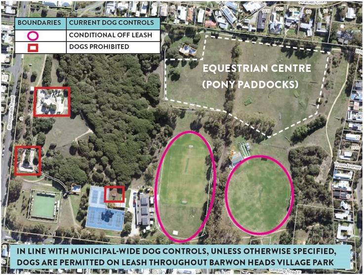
The current Policy regarding dog controls only permit dogs to be off leash on the two playing ovals at BHVP outside times when they are being used for organised sport and training.
The City has a licence agreement with the Barwon Heads and District Pony Club. Historically the Pony Club have used the pavilion and grounds within the BHVP once a month. Attachment 2 includes a plan of the BHVP, including the equestrian centre.
In response to local feedback and concurrent with the BHVP Masterplan process, the City investigated whether the application of the Policy should be modified, allowing for dogs to be walked off-leash within part of, or all of the reserve under certain circumstances.
A community survey on the matter was opened in January 2021, which received 304 responses. 82% of respondents support a change to the Policy to increase off-leash spaces in the BHVP, with the equestrian centre being the most supported space for dogs off-leash. Attachment 3 provides a summary of the community engagement. A petition, through change-org, to allow dogs off-leash within the equestrian grounds had 485 signatures by 31 January 2021.
Given the community feedback was overwhelmingly in support of permitting dogs off-leash in the equestrian centre of BHVP, it is recommended that the Policy and dog control orders be amended to enable dogs off-leash when the equestrian area is not in use.
Councillor Asher moved, Councillor Sullivan seconded -
That Council:
Note the findings from the community engagement on dog control orders in the Barwon Heads Village Park;
Authorise the necessary amendment of the Dog Controls in Public Places Policy as shown in Attachment 4;
Authorise the making of the Order under Section 26 (2) of the Domestils Act 1994 to allow for dogs off-leash and supervised in the equestrian centre at the Barwon Heads Village Park when there are no horses present; and
Delegate the Manager of Health and Local Laws the authority to carry out the required statutory advertising in the making of the Order by Council.
Carried.
There are no financial implications associated with respect to amending the Policy and authorisation of the making of this Order by Council. There is small cost to update signage which can funded from the 2020-21 budget allocation.
Community engagement on dog controls at BHVP occurred between 6 January 2021 to 31 January 2021. A summary of the community engagement is provided in Attachment 3.
The survey was available online through the City’s Have Your Say page and officers attended the BHVP on Friday, 8 January and Monday, 11 January to seek direct community input.
304 survey responses were received by the City.
A change-org petition to allow dogs off-leash within the equestrian area had 485 signatures at the end of the community engagement period on 31 January 2021.
Prior to the community engagement taking place the Barwon Heads and District Pony Club indicated that they would support dogs off-lease when there are no horses present.
The community feedback in the survey regarding dog controls will also be considered as part of consulting the community regarding the draft BHVP Master Plan process planned to commence in April 2020.
The proposed changes to the Policy and orders aim to achieve a balanced approach, for the benefit of all members of the community.
The Dog Controls in Public Places Policy provides guidance to the community with respect to understanding dog control rules within the municipality and conditions that apply in open public spaces to ensure community safety, environment protection and fair and equitable access to such spaces.
The Policy notes that Council will review the effectiveness of ‘Off Leash – Supervised Areas’ on an ongoing basis and will consider any request for new ‘Off Leash – Supervised Areas’ to be established based on the following criteria, which will ensure safety, and equitable access to such spaces. These include:
Linear open public spaces (that is: green corridors, easements) may be considered if there is sufficient width to ensure safe use and passage;
Public open spaces that do not contain a playground or where the playground is fully enclosed/fenced. Open public spaces with centrally located playgrounds are not suitable as an ‘Off Leash - Supervised Area’;
Public open spaces that are located at a safe distance from busy roads;
Any other public open space not mentioned above that is not adjoining/adjacent to a water body and where no wildlife is present;
Places where there is no detriment to public safety or the environment through the use of such open public spaces; and
Suitable open spaces will be reviewed annually to monitor performance and identify any additional reserves that may be suitable as “Off Leash - Supervised Areas’.
The BHVP equestrian centre/pony paddocks meet the above criteria for consideration as a new Off Leash – Supervised Area.
The Dog Controls in Public Places Policy has been amended to support BHVP equestrian centre/pony paddocks as an Off Leash – Supervised Area when horses are not present. A copy of the proposed amendments to the Policy are included as Attachment 4.
In order for dog control orders to have legal effect, Council, after agreeing to adopt the proposed orders, is required under Section 26 (2) of the Domestic Animals Act 1994 to formally authorise the ‘making’ of such Orders. The resolution of this report facilitates this need to create new orders and provides the appropriate delegations to progress in a timely manner.
Improved Health and Safety of our Community:
Providing safer public places;
Encouraging responsible pet ownership; and
Promoting active living.
Informed Social Infrastructure and Planning:
Provide more quality spaces that support active lifestyles.
There is no conflict of interest with respect to any officer in the preparation of this report.
Signage will be placed in the BHVP to ensure that users of the park are aware that dogs are required to be on-leash when the equestrian grounds are in use.
There are no environmental implications associated with the recommendations contained in this report.
DOG CONTROLS IN PUBLIC PLACES |
Document No: |
CPL50.3 |
Approval Date: |
11/12/2018 |
|
Approved By: |
Council |
|
Review Date: |
|
|
Responsible Officer: Director Planning, Design and Development |
Version No |
03 |
Authorising Officer: |
Chief Executive Officer |
|
The purpose of this policy is to recognise that dog controls in public places are necessary, and implemented with a balanced approach, for the benefit of all members of the community.
The policy will guide the community with respect to understanding dog control rules within the municipality and conditions that apply in public open spaces to ensure community safety, environment protection and fair and equitable access to such spaces.
The policy applies to all Council managed lands subject to a Council Resolution and Order under Section 26 (2) of the Domestic Animals Act 1994.
Domestic Animals Act 1994
Domestic Animal Management Plan 2018 - 2021
Road has the same meaning as ascribed to it by Section 3 of the Local Government Act
The following principles will be used for the implementation of this policy:
Locations
Dogs are allowed off leash and supervised in specific designated public open space areas and/or any area as indicated by the relevant signage. This includes, amongst other designated public open spaces:
Those paths and adjoining land located on the Fyansford Common and the shared path on the northern side of the Barwon River upstream from the Queens Park Bridge to Fyansford Common including Zillah Crawcour Park);
Sporting grounds/ovals (playing area) outside times when being used for organised sports, including training (as defined by a formal booking with Council); except those playing surfaces/spaces with artificial surfaces and dogs must be kept a minimum of 10 metres away from turf wickets;
Sporting complexes/reserves – outside times when being used for organised sports, including training (as defined by a formal booking with Council). The exception to this is any equestrian centre which is an on-leash area at all times, unless otherwise allowed through a site specific Dog Control Order authorised by the Council;
A range of Reserves and broad Open Space Parks as listed in the attachment to this Policy and as represented by Table 1; and
Council approved Dog Parks.
Council will review the effectiveness of these ‘Off Leash – Supervised Areas’ on an ongoing basis and will also consider any request for new ‘Off Leash – Supervised Areas’ to be established based on the following criteria, which will ensure safety, and equitable access to such spaces. These include:
Linear open public spaces (that is: green corridors, easements) may be considered if there is sufficient width to ensure safe use and passage;
Public open spaces that do not contain a playground or where the playground is fully enclosed/fenced. Open public spaces with centrally located playgrounds are not suitable as an ‘Off Leash - Supervised Area’;
Public open spaces that are located at a safe distance from busy roads;
Any other public open space not mentioned above that is not adjoining/adjacent to a water body and where no wildlife is present;
Places where there is no detriment to public safety or the environment through the use of such open public spaces; and
Suitable open spaces will be reviewed annually to monitor performance and identify any additional reserves that may be suitable as “Off Leash - Supervised Areas’.
Conditions Applicable to ‘Off Leash - Supervised Areas’
The following conditions must be followed when using the ‘Off Leash - Supervised Areas’:
Dog owners must have a leash in their possession at all times so as to secure their dog when required and to place their dog back on the leash when leaving an off-leash area; and
Dogs that are over excitable and providing unwanted attention towards people, wildlife, cyclists or other dogs, should be kept on leash in such circumstances. Those dogs that are aggressive and/or behave in an anti-social manner towards other people, wildlife, cyclists or other dogs should be muzzled and on leash when in public.
When encountering other people or animals using this area, the dog must be supervised and under effective control, which includes:
The handler must be able to demonstrate audible control of the dog;
Dogs must remain in visual and audible range of their handler to allow it to be effectively recalled at any time;
The dog owner applying necessary recall and restraint to their dog when the dog interacts with other dogs or persons within an off-leash area, unless permitted otherwise by the owner of the other dog(s) or persons to enable the safe socialisation of dogs;
Dogs must not enter water habitats that contain wildlife, beach nesting birds or chase wildlife in these areas;
Dogs attracted to the motion of wheels must be controlled at all times;
Dogs declared menacing/dangerous/restricted breed are not permitted to be walked off-lead in ‘Off Leash – Supervised Areas’; and
The handler must at all times have a means to pick up and appropriately dispose of dog droppings in a waste bin.
Signage
Signs will clearly indicate those parks, reserves or public open spaces where dogs are permitted to be off a leash and supervised.
Within the City of Greater Geelong, unless otherwise designated by signage as an ‘off leash’ area (Table 1), all public open space Areas, parks, reserves and other Council lands shall be designated as ‘On Leash - Controlled Areas’.
More specifically this includes:
All roads and footpaths/nature strips/shared paths;
Beaches, reserves and parks;
Shopping centres;
High use areas pedestrian and/or cycling areas (for example the Waterfront Precinct in Geelong);
Sporting complexes and reserves (not including playing area) during times of organised sports (as defined by a formal booking with Council which includes times booked for sports practice/training). The exception to this is any equestrian centre which is an on-leash area at all times, unless otherwise allowed through a site specific Dog Control Order authorised by the Council;
All areas in the Kardinia Park Reserve Precinct (except for the Kardinia Park West ground playing surface and Geelong Cricket Ground) at all times;
At Council sanctioned/approved events, markets etc.;
Shared use paths or walking paths and including areas either side of the abutting edge of the path; (except those in designated ‘Off Leash – Supervised Areas’);
Dogs are prohibited within ten (10) metres of a children’s playground but can be safely tethered no less than ten (10) metres from any play equipment; beyond ten (10) metres, the dog rules (as per the signage) for that location would apply;
Dogs being within and/or tethered within ten (10) meters of picnic and barbecue areas (as defined by Council provided barbecues and/or tables and associated seating);
In areas designated as environmentally significant ;
Jetties, piers and boat ramps;
Water bodies such as creeks, rivers, lakes and beaches unless signposted as a dedicated swimming area for dogs;
Beach foreshore and coastline areas (except those designated otherwise): and
Other Council lands.
Conditions applying to all ‘On Leash Controlled Areas’ and ‘Off Leash Supervised Areas’
The handler must at all times have a means to pick up and appropriately dispose of dog droppings in a waste bin;
Dogs when tethered in a public place must be safely secured within the line of sight and able to be adequately and promptly supervised; and
All leads including retractable leads must be restricted to approximately 2 metres in length in ‘On Leash – Controlled Areas’ when encountering other people, wildlife, cyclists or dogs.
Dog Control Categories (applicable to coastline areas and other public open spaces as designated) apply to reflect the needs of all public open space users and ensure community safety and environmental protection.
Category 1 (Green) – Off leash ‘Supervised’ Area
Areas where dogs are permitted off leash and supervised all year round.
Category 2 (Yellow) – Conditional Off Leash ‘Supervised’ Area
Allow dogs off leash and supervised during specified times all year round; in the mornings prior to 10.00 a.m. and in the evenings after 5.00 p.m. Dogs would be required to be on leash at all other times.
Category 4 (Brown) – On Leash ‘Controlled’ Area (Environmentally Sensitive Areas) and/or high use pedestrian/tourist precincts
Areas where dogs are required to be on leash all year round due to:
environmental sensitivity;
where there is an Order by Council;
the land management authority (not being Council) has regulated dog access under their own rules or legislation; and
high use pedestrian/tourist precincts.
Category 5 (Purple) – Conditional on Leash ‘Controlled’ Area (Hooded Plover and Wildlife Zones)
Allow dogs on leash during specified periods as designated by signage including periods during the hooded plover nesting season and/or other periods dedicated to protecting other wildlife (that is: seals, penguins). Dogs are permitted to be off leash and supervised at other times/periods.
Category 6 (Red) - Exclusion Area All Year Round
Areas that will have dogs prohibited where:
there is extremely high environmental sensitivity;
there is an Order by Council;
the land management authority (not being Council) has prohibited dogs under their own rules or legislation (effected by a dog control order);
there are artificial sporting playing surfaces;
organised sport is being played on a sporting reserve/oval (playing area only);
they are Council buildings (Guide/Assistance Dogs exempted); and
the facilities are of Regional importance; these include the John Landy Athletics Track/Field, Goldsworthy Athletics Track/Field, Geelong Baseball Centre (Pioneer Park).
Table 1 - Designated ‘Off Leash - Supervised Areas’
Park/Reserve |
Location |
|---|---|
North Zone |
|
All Sporting Grounds/Ovals (playing surfaces) when no organised sport is being played |
21 (as at September 2018) |
All Sporting Reserves (non- playing surfaces) when no organised sport is being played |
14 (as at September 2018) |
Elcho Park (all areas other than the Equestrian Centre) |
125 Elcho Road, Lara |
Abe Wood Reserve |
300 Evans Road, Lovely Banks |
Sutcliffe Reserve |
240-268 Plantation Road, Corio |
Stead Park |
190-216 Princes Highway, Corio |
Myers Reserve |
5-35 Bluestone Bridge Road, Bell Post Hill |
Seagull Paddock |
380-400 Melbourne Road, North Geelong |
Fyansford Common |
Deviation Road, Fyansford |
Goldsworthy Open Space Reserve |
49 Goldsworthy Road, Corio |
Rennie Street, Hovells Creek Reserve |
106 Rennie Street, Lara |
Rippleside Park (conditional off leash – before 10:00am. and after 5:00 pm) |
42 Bell Street, Rippleside |
Haines Reserve |
1A Wilks Street, Hamlyn Heights |
Kevin Kirby Reserve |
39-49 Heytesbury Street, Herne Hill |
Chirnside Park |
39-65 Patullos Road, Lara |
Weddell Street Reserve |
56-98 Weddell Road, North Geelong |
Hovells Creek Reserve, Limeburners Point Open Space areas |
150 Foreshore Road, Corio |
Sparrow Park |
158-178 Hope Street, Geelong West |
South Zone |
|
All Sporting Grounds/Ovals (playing surfaces) when no organised sport is being played |
25 (as at September 2018) |
All Sporting Reserves (non- playing surfaces) when no organised sport is being played |
16 (as at September 2018) |
Rotary Centennial Park |
188A West Fyans Street, Newtown |
Frank Mann Reserve |
5 Heal Street, Ceres |
Grinter Reserve (all areas other than the Equestrian Centre) |
125-177 Coppards Road, Moolap |
Brearley Reserve |
Grove Road, Marshall |
Breakwater Road Reserve |
Breakwater Road, Belmont |
Gun Dog Lane |
26-76 Gun Dog Lane, Marshall |
Aldershot Reserve |
41-55 Aldershot Reserve, St Albans Park |
Barwon Valley Park |
42-120 Barrabool Road, Belmont |
Pepperdine Park |
84-102 Thornhill Road, Highton |
Montpellier Park |
8-10 Westbury Terrace, Highton |
Woolscour Lane |
5-23 Woolscour Road, Marshall |
Eastern Park – open space areas |
Eastern Park Circuit, East Geelong |
John Croft Reserve |
35-53 Heyers Road, Grovedale |
Transmission Line Reserve |
14A Greenville Drive, Grovedale |
Transmission Line Reserve |
37 Burdoo Drive, Grovedale |
East Zone |
|
All Sporting Grounds/Ovals (playing surfaces) when no organised sport is being played |
14 (as at September 2018) |
All Sporting Reserves (non- playing surfaces) when no organised sport is being played |
13 (as at September 2018) |
Portarlington Recreation Reserve |
4-22 Sproat Street, Portarlington |
Drysdale Recreation Reserve |
30 Duke Street, Drysdale |
Charles McCarthy Memorial Reserve |
Leviens Road, St Leonards |
Kingston Park Recreation Reserve |
8-52 Adco Grove, Ocean Grove |
Green Acre Drive Reserve |
14-24 Green Acre Drive, Leopold |
Lake Avenue Reserve |
36-66 Blue Waters Drive, Ocean Grove |
Collendina Reserve |
93A Sunset Strip, Ocean Grove |
Beacon Point Reserve |
Beacon Point Road, Clifton Springs |
Dog Controls in Coastal and Other Open Space Areas
The following maps (19 in total) show various coastal beaches and any adjoining reserves and open space areas within the City of Greater Geelong. The maps commence at the south western boundary of the municipality and work around the coastline to the north eastern boundary near Little River.
Map Number |
Description |
|---|---|
Map 1 |
Overview of Municipality Coastline. |
Map 2 |
Designated ‘Off Leash - Supervised’ Areas within Sporting Complexes and Reserves. |
Map 3 |
Redgum Island, Fyansford Common – Barwon River. |
Map 4 |
Breamlea Beach and Bancoora Beach. |
Map 5 |
Ocean Grove, Collendina and Point Lonsdale Beaches. |
Map 6 |
Deleted |
Map 7 |
deleted |
Map 8 |
deleted |
Map 9 |
Ramblers Road; The Dell; Jetty Road and west of Jetty Road Beaches Clifton Springs. |
Map 10 |
Point Henry (east and west side). |
Map 11 |
Waterfront Precinct, Geelong. |
Map 12 |
Western Beach; Rippleside Beach and St. Helens Beach. |
Map 13 |
Moorpanyal Beach, North Shore; Shell Foreshore (beach area); Grammar School Beach; Limeburner’s Lagoon and Avalon Beach. |
Map 14 |
Batesford Reserve, Batesford. |
Map 15 |
Land along Barwon River from Queens Park Bridge to Breakwater. This land is managed by Corangamite Catchment Management Authority (with a small portion managed by Barwon Water near the McIntyre Footbridge). Existing dog controls have been implemented by these land managers and Council does not have the authority to amend these controls. |
Colour coding of the maps demonstrates dog controls at a glance. The category of controls in turn relate back to Council’s Policy on Dogs in Public Places.
The areas depicted on the Maps are those where Council has made a decision in relation to dog controls on coastal reserves. Map 2 is a quick reference to the other open space off leash areas applicable at the time of the policy update.
Quality Records shall be retained for at least the period shown below.
Record |
Retention/Disposal Responsibility |
Retention Period |
Location |
|---|---|---|---|
Domestic Animals Act 1994 |
Victorian Government |
N/A |
N/A |
Domestic Animal Management Plan 2018-2021 |
Council Record Management System |
4 years |
Electronic Data System |
Source: |
Governance, Strategy & Performance – Corporate Affairs |
Director: |
Rebecca Leonard |
For Council to adopt the Community Engagement Policy, taking into account feedback received by the community.
A draft Community Engagement Policy (the Policy) was developed to reflect Council’s ongoing commitment to meaningful community engagement, to replace the City’s existing Community Engagement Policy and to meet community engagement requirements of the Local Government Act (Vic) 2020 (the Act).
On 15 December 2020, Council endorsed the draft Community Engagement Policy for community consultation.
Under the Act, Councils must adopt a Community Engagement Policy by 1 March 2021.
A program of deliberative engagement was undertaken to receive community feedback on the draft Policy.
The community engagement included:
The City’s Have Your Say page detailed the Policy project and diverse methods for providing feedback which included:
An online feedback survey, quick poll and written submissions form; and
Three online facilitated workshops.
The feedback received during this engagement process was representative of a wide variety of views and diversity of individuals, community groups and partner organisations.
The community feedback received through the engagement process is summarised in the Engagement Summary Report Attachment 2. In response to the feedback received, the following amendments to the Policy are recommended:
Throughout the document, edits and wording change are proposed to improve the simplicity and readability of the document, using concise, plain English;
Throughout the policy tables and images have been converted to text and hyperlinks added for external references to ensure the final document is accessible and suitable for screen-readers;
Page 2, the addition of Acknowledgement of Country and overarching statement promoting genuine reconciliation with Aboriginal and Torres Strait Islander People;
Page 3, re-wording of the Purpose, definition of Community Engagement and Why it is Important, to better represent the collaborative partnership between Council and community and the value of harnessing community knowledge and expertise;
Page 4, removal of third item from Out of Scope to better meet the requirements of the Act. (Noting how Council will proceed with submissions and panel hearing engagements is now included on Page 7, see below);
Page 5, the inclusion of definitions for Engagement and Stakeholders;
Page 6, some re-wording to better acknowledge the barriers to engagement participation and Council’s responsibility to breaking down these barriers;
Page 6, inclusion of distinction between pre-planning for emergencies, when engagements can take place, and a live emergency when Council may not engage;
Page 7, inclusion of Council’s approach to submission and panel hearing engagements previously conducted under section 223 of the Act 1989;
Page 7 & 8 removal of sections of text under ‘How we will engage’ to reduce repetition and simplify the information to more clearly outline how forms of engagement will be identified and used;
Page 9 removal of table with engagement tools, and inclusion of example tools being included under the Participatory and Deliberative sections instead;
Page 9, inclusion of how Council may report back to community during engagement processes, not only after engagements have closed;
Page 10, increased accountability regarding the use of this Policy within Council; and
Page 10, improved identification of monitoring processes.
This Policy provides guidance about why we engage, when we will engage, who we will engage with, and how we will engage and includes the amendments proposed in the summary report in track changes (Attachment 3) and in a finalised version (Attachment 4).
Councillor Mason moved, Councillor Aitken seconded -
That Council:
Note the summary report, its recommendations and proposed amendments to the draft Community Engagement Policy;
Adopt the engagement summary report recommendations; and
Endorse and adopt the final Community Engagement Policy.
Carried.
To ensure the City delivers on community expectations for meaningful and quality engagement, officers are reviewing engagement resources in line with the annual budget process.
An engagement plan was delivered to ensure that the Policy was developed in consultation with the community.
The engagement plan included three stages of engagement in Policy development:
Stage one – Engagement Practice Review (internal employee and external community surveys undertaken to gather sentiment on current engagement practice and recommendations for future practice);
Stage two – Policy development consultation (internal stakeholder and Council liaison to inform the draft Policy and provide feedback and recommendations for the further development of the draft Policy); and
Stage three – draft Policy consultation. Endorsed by Council, the draft Policy was published, and a number of deliberative engagement activities were delivered to provide accessible and inclusive engagement opportunities.
The Policy recognises the importance of equity, access and inclusion as a key priority to best practice engagement.
Social equity, diverse and inclusive participation, has been considered during workshops and interviews and considered in the development of the Policy.
Community engagement is an essential part of good governance. It supports the community to consider, respond to and participate in decision making.
The Policy:
Ensures people who live, work and do business across our region have the opportunity to engage with Council and the City about upcoming decisions;
Promotes effective, authentic and accessible community engagement as a mechanism to driving greater trust, stronger relationships and better outcomes for Council and the communities it represents;
Establishes transparent processes to show how community input is used to inform and influence decision-making; and
Guides Council to meet its legislated engagement obligations with the community, giving effect to the engagement principles under the Act.
The development of Council’s Community Engagement Policy adheres to the legislated requirements set out in the Act.
The Policy must give effect to the legislated requirements set out in the Act.
Council adheres to the legislative requirements set out in the Act in implementation of the Policy.
The Act requirements have been considered and outlined in the development of this policy, the advice and guidance of the City Legal department has been sought and incorporated in the policy.
Community engagement relates to the majority of areas of Council Plan. Community engagement is central to the development, implementation and evaluation of impact and effectiveness of the Council Plan.
Council Officers have no general or material conflict of interest in preparing this report.
Community engagement is directly linked and impacts the City’s reputation and trust with the people who live, work and invest in Greater Geelong.
No environmental implications will result from the recommendation of this report.
Source: |
Community Life – Social Planning & Investment |
Director: |
Robyn Stevens |
To seek approval from Council to undertake an expression of interest (EOI) process for the sustainable development and use of Osborne House.
At the Council meeting on 8 September 2020 Council resolved (in part) to receive a further report in January 2021, outlining the terms of an EOI process, for the purpose of seeking interest from potential investors and government in the future redevelopment of Osborne House. This report was to also include an outline of options for the maritime and naval collection housed in the Osborne House Stables.
An EOI document (Attachment 2) has been developed to seek the engagement of potential investors, in partnering with Council on the redevelopment of Osborne House. The significant elements of the proposed EOI document and process include:
A requirement for all expressions of interest to address the sustainable development parameters and principles previously adopted by Council;
The EOI process will be a competitive process designed to occur in two stages. The aim of this being to provide confidence that only parties who can demonstrate a capacity and capability for the contemporary redevelopment and repurposing of historical buildings will be seriously considered; and
A series of panels with persons representing areas of expertise and general community are involved in the decision-making process. This is achieved through the establishment of three assessment panels on the topics of ‘Finance & Capability’, ‘Activation & Use’ and ‘Planning, Design & Heritage’.
The options paper (Attachment 3) for the future of the maritime and naval collection, broadly indicates a range of opportunities to house these collections in the future. The role of Osborne House will be the subject of further deliberation and should be consistent with the direction of Council’s Cultural Heritage Strategy, which is currently being developed.
Councillor Aitken moved, Councillor Grzybek seconded -
That Council:
Endorse the implementation of an Expression of Interest process for Osborne House as outlined in the corresponding report to Council;
Note the options paper for the future of maritime and naval collections, and that the housing of the collections at Osborne House will also be considered as part of the proposed redevelopment and the Expression of Interest process;
Authorise the amendment of the draft Expression of Interest document (Attachment 2) prior to its endorsement by the Project Control Group to accurately reflect the area defined as ‘Osborne House’ is consistent with the definition adopted by Council in February 2020, that is, any reference to ‘Osborne House’ incorporates the house, stables, Council depot (being the former Russell Polo Field) and adjacent landscape; and
Note that an option for sale of the land and buildings is not being considered as part of the Expression of Interest process.
Carried.
The high-level financial analysis of the sustainable development options considered by this report, indicate potential total costs for redevelopment of Osborne House ranging from approximately $21 million to $48 million depending on the type of future uses and development proposed, with all options potentially attracting various levels of government and private partnership investment.
The type of development and level of government and private investment will have a significant impact on the Council’s financial capacity to renew and redevelop Osborne House.
A budget of $2 million has been made available in the 2020-21 financial year for restoration and maintenance works. These priority works are underway, consistent with the findings of the Lovell Chen Conservation Management Plan 2009.
A key principle adopted by Council in August 2020 was an acknowledgement that to restore the heritage asset, reopen for public uses and leverage other potential funding, Council will contribute up to $10 million over three to four years (including the $2 million contribution as per clause 3 above).
The development of the EOI documentation and process has been done in consultation with the Osborne House Project Control Group. The members of that group include City of Greater Geelong and representatives from Heritage Victoria (HV), National Trust of Australia (Victoria) (NTAV) and an executive member of the Osborne Park Association (OPA).
During the course of 2020 a series of regular meetings have been held with the broader executive members of the OPA and this consultation has also indirectly informed the development of the proposed process.
The EOI process proposes that a series of advisory panels be formed to consider in detail any expressions of interest received from this process. These advisory panels are ‘Finance & Capability’; ‘Activation & Use’; and ‘Planning, Design & Heritage’. The membership of these groups is proposed to have a mix of independent technical/subject matter experts and one community representative on each advisory panel, with each panel being chaired by an officer from the City of Greater Geelong.
The EOI process is to be conducted in two stages and is outlined as follows:
Stage 1 open EOI - March 2021;
Stage 1 close EOI - April 2021;
PCG assessment of EOIs - May 2021;
Stage 2 request for proposal released - June 2021;
Request for proposal closed - September 2021; and
Advisory panel meetings and assessment - October-November 2021.
The EOI process will be guided by the principles adopted in Council’s previous report on this matter in February 2020. These principles are as follows:
Culturally:
Interpret, protect and celebrate the values of the land known as Osborne Park;
Any future development of Osborne House should involve the interpretation, protection and celebration of the First Nations’ heritage along with the significant post-settlement heritage buildings and landscape;
Any future development should consider the total restoration of the significant heritage buildings of Osborne House, as identified in the Lovell Chen Conservation Management Plan 2009, including giving consideration to its naval heritage;
That a heritage interpretation plan shall accompany any proposal for the future development and use of Osborne House; and
The Muirhead and Russell buildings to be made available for general public use and ensure contemporary heritage interpretation of the spaces/buildings.
Socially:
The future management and development of Osborne House should consider a mix of community, public and commercial uses, while also providing for public access and community use;
Future management and development of Osborne House should ensure the ongoing public recreational use of the adjoining Osborne Park sports fields;
Uses that are complementary to and consistent with the concept of a community and cultural heritage precinct, with a proportion (percentage) of appropriately designed space made available for community use (for example: accommodation of groups, meeting rooms, function area, etc.);
Opportunities to co-locate people and small scale organisations who can benefit from the sharing of facilities and ideas in the areas of innovation and cultural activities/business; and
A community governance structure in place to oversee the future use of Osborne House.
Financially:
Any future proposal will consider ideas from private partners for developments to occur in zone 1 and/or zone 3 of the Osborne House site under a long-term lease arrangement, noting that any future development must comply with principles of the Conservation Management Plan (2009) by Lovell Chen;
Osborne House shall be retained in public ownership;
Tenancy arrangements can be considered over all or part of Osborne House, to generate income to cover ongoing maintenance and ensure the viability and financial sustainability of Osborne House, however these arrangements must ensure an appropriate level of public access and use;
All and any areas identified for sole use by community groups and general public, to be under direct control of the City, in perpetuity;
To make safe and secure, restore the heritage asset, reopen for public uses and leverage other potential funding, Council will contribute up to $10 million over three to four years (including the $2 million contribution made during 2019/20 and 2020/21);
Future funding will be accumulated and held in an Osborne House (Heritage Restoration) Provision; and
That any future development of Osborne House should also give regard to broader government objectives (that is: employment creation and increased local civic and economic development).
Environmentally:
Osborne House be developed and maintained consistent with Council’s Sustainability and Asset Management Policy(s) for public buildings; and
That the surrounding landscape of Osborne House be developed and maintained consistent with Council’s policies and incorporating the heritage principles identified in the Lovell Chen Conservation Management Plan 2009.
The EOI process is a non-binding arrangement. Council can at its discretion, seek to adopt or consider any or all expressions of interest as part of this process. The future development of Osborne House and the EOI process will need to be cognisant of the following policy and legal constraints:
Osborne House is entered on the Victorian Heritage Register (H1101) and future options for development will need to consider the permit approval requirements of Heritage Victoria under the Heritage Act 2017. These requirements will take precedence over any heritage requirements arising from the City of Greater Geelong planning scheme;
The Council Depot (former Russell Polo Field) and parts of the foreshore, along with Osborne House, are separately entered in the Victorian Heritage Inventory for its archaeological potential, and future options for development will also need to consider the permit approval requirements of Heritage Victoria;
Osborne House, adjoining parts of the Foreshore Reserve and Swinburne Street Road Reserve contain Aboriginal artefact sites and are within an area of Aboriginal cultural sensitivity. Future options for development will need to consider First Nation values while a Cultural Heritage Management Plan will be required prior to any development works; and
The land Osborne House is on is currently zoned PUZ6 for Local Government Use under the planning scheme. Future management and development options should not be limited by this consideration, but a future amendment to the scheme will be submitted to Council once the future use requirements have been determined.
The potential redevelopment of Osborne House as an enduring, creative, productive and protected heritage and community asset is consistent with:
Council’s Vision for a Clever and Creative City, which states specifically that success (in part) “will be achieved by attracting creatively oriented and artistic industries to the region through the creative re-use of heritage assets”; and
The UNESCO City of Design key objective being to “work towards placing creativity and cultural industries at the heart of their development plans”.
The Council Plan 2018-22 and several Council key priorities including:
A Vibrant Arts and Culture, incorporating arts and cultural initiatives into infrastructure development, to enhance our sense of place and specifically commencing the remediation of Osborne House; and
Informed Social Infrastructure and Planning, specifically Council’s priority to deliver accessible and attractive community infrastructure, based on community need.
No Council officers or contractors who have provided advice in relation to this report have declared a conflict of interest regarding the matter under consideration.
There is a financial, reputational and asset risk related to Osborne House. If an agreed plan for the use and development of the building is not actioned, the building will continue to fall into disrepair and the heritage values of the building could be lost. To offset this risk Osborne House requires investment and activation to ensure an enduring, creative and productive future which celebrates and protects the significant heritage status of the building.
The current pandemic presents both a financial and delivery risk. This current environment may have a negative impact on the number of private partners indicating an interest in the development of Osborne House. The proposal to release the EOI for early 2021 is designed to mitigate the impact the current pandemic may have on investor interest.
The Council principle that requires the land and buildings of Osborne House to remain in public ownership may present a risk to potential investment by private partners. Council may need to consider other mechanisms that will provide certainty of tenure and development rights over the land and buildings to attract any potential private partnership.
The current land is zoned public use. This zoning may not be compatible with future interest that arise through the next stages of the process. Dependant on the nature of any interest that does emerge, Council may need to consider facilitating a future rezoning of the current land use and any rezoning will be contingent on adoption by the Minister for Planning.
The future development of Osborne House will give consideration to Council’s Sustainability Framework.
Any redevelopment of Osborne House will require a Cultural Heritage Management Plan to ensure the indigenous cultural heritage of the landscape is understood and protected.
Source: |
Governance, Strategy & Performance - Governance |
Director: |
Rebecca Leonard |
For Council to adopt the updated Councillor Code of Conduct (the Code).
Section 139 of the Local Government Act 2020 (the Act) requires Council to review and adopt the Code within 6 months of a General Election, 24 February 2021.
The Code includes the standards of conduct expected to be observed by Councillors in the performance of their duties.
The Local Government (Governance and Integrity) Regulations 2020 (the Regulations) prescribe the standards of conduct that must be included in the Code.
The previous Councillor Code of Conduct was adopted 27 February 2018.
The Code has been reviewed and updated to reflect the new requirements under the Act and Regulations, including best practice examples sourced by Local Government Victoria. There are minimal changes to the foundations established in the previous 2018 Code.
The Regulations prescribe the 5 standards of conduct that replace primary principles of conduct that were previously prescribed in section 76B and of the Local Government Act 1989. These new standards are:
Treatment of others;
Performing the role of Councillor;
Compliance with good governance measures;
Councillor must not discredit or mislead Council or public; and
Standards do not limit robust political debate.
The Code has been updated to reflect new provisions in the Act, including:
Roles and functions of the Mayor, Deputy Mayor and the Chief Executive Officer; and
Dispute resolution process when dealing with allegations of Councillor Misconduct.
Councillor Asher moved, Councillor Sullivan seconded -
That Council adopt the Councillor Code of Conduct 2021 (Attachment 2).
Carried.
There are no financial implications associated with this report.
Consultation with Councillors and relevant City officers has been undertaken.
The Code will be publicly available on Council’s website.
There are no social equity considerations associated with this report.
The Code ensures compliance in accordance with the Act and Regulations, specifically section 139 of the Act requiring adoption by 24 February 2021.
This report aligns to the Council Plan’s strategic priority ‘Organisational leadership, strategy and governance’.
No officer involved in the preparation of this report has declared a general or material interest in the matter.
The Code, upon adoption, will ensure statutory compliance and mitigate reputational, governance and financial risks associated with Councillor misconduct.
The Code also mitigates the risks associated with conflicts of interest attached to the roles of the Mayor, Councillors, the CEO and arbiters in the conduct management process.
There are no environmental implications associated with this report.
Source: |
City Services – Engineering Services |
Director: |
Guy Wilson-Browne |
To update Council on sustainable transport planning, collaboration and projects.
At the 30 June 2020 meeting, Council requested a report (Attachment 2) to outline planning for sustainable transport, collaboration with stakeholders and active transport projects (completed, current and proposed). The resolution is at Attachment 3.
Geelong’s population is forecast to grow significantly which places an increased importance on sustainable transport to enable connectivity and movement for our community and the economy.
The community’s vision is outlined in Clever and Creative Future, setting an aspiration for 50% of all journeys to work to be made by public transport, walking or cycling.
Sustainable transport is embedded within several Council-adopted strategies, generally related to infrastructure, parking, freight and growth.
The City’s Comprehensive Integrated Transport Plan was developed in 2015. The plan is outdated and no longer serves the needs of the community or responds to the future growth predicted for Geelong.
A new Integrated Transport Plan (ITP) is proposed, to establish a framework approach to transport planning that responds to evolving transport and connection issues with a 30 year vision to align decision makers from multiple implementation agencies and assist collaboration. The ITP will identify future network enhancements, for all users, inform infrastructure investment and will be a key advocacy document for Council.
Collaboration with stakeholders such as Department of Transport and G21 is essential. The ITP will be a key input to the G21 Regional Transport Strategy. It’s critical Geelong’s ITP precedes the G21 Regional Transport Strategy, to ensure Geelong’s future transport vision and actions is accurately represented in broader regional planning.
The City currently has limited resourcing (2 EFT) to enable the numerous transport planning activities underway in the region. Transport is important for our community and has significant implications for liveability. Growth presents an ongoing challenge.
Councillor Harwood moved, Councillor Mansfield seconded -
That Council:
Note the Sustainable Transport Approach in Attachment 2; and
Note the development of the Geelong Integrated Transport Plan as a priority project to be considered in the 2021-22 budget.
Carried.
The ITP project is in preliminary planning stages and is not confirmed in future budgets.
A business case is being developed for Council to consider as part of the 2021/22 budget process to enable development of the ITP.
Current resourcing is limited to 2 EFT for all transport planning initiatives. This includes the development and delivery of projects such as Shared Trails Masterplan, Geelong Growth Area Transport Infrastructure Study, Northern and Western Geelong Growth Area planning, Barwon Heads Transport and Parking Study, Building Better Bike Connections, among other ‘business as usual’ transport planning, customer service, active transport management and public transport advocacy functions.
Additional resourcing will be required to effectively develop, plan and deliver on future strategic transport planning needs, such as the ITP.
The infrastructure projects listed in this report require additional funds to be realised and funding applications will be submitted as part of annual budget considerations.
No community consultation has been undertaken in the preparation of this report however numerous stakeholders and community groups are identified for engagement to inform the development of the ITP.
The ITP aims to set a 30-year vision and its development is expected to take up to two years. This timeframe allows for advocacy and community engagement across a broad range of transport users and stakeholders.
Various community engagements were undertaken in developing existing strategies and plans (that is: Shared Trails Masterplan, Clever and Creative Future).
Providing accessibility to all is an important factor in a sustainable transport network.
Access for all considers the social, physical, economic and safety barriers that form some of the constraints which influence accessibility for communities.
Council is the road management authority for local roads.
Public transport and arterial roads are the responsibility and management of the Department of Transport. The Sustainable Transport Approach considers supporting broader regional movements, goods and logistics and public transport (buses and trains).
Sustainable transport is directly linked to the actions and priorities set in the City’s Council Plan 2018-22. Further information is provided in Attachment 2.
No officer involved in the preparation of this report has declared a general or material interest in the matter.
There is a risk to the liveability and amenity of Geelong if sustainable, active and integrated transport solutions are not planned and delivered to accommodate the current and growing movement needs of our community.
Council’s adopted Sustainability Framework acknowledges sustainable transport as a related material topic the contributes to many actions set out in the framework’s Action Plan.
The City Of Greater Geelong
Current and Future Transport Planning
Collaboration with State Government and Key Stakeholders
Active Transport Infrastructure Projects - Underway
SUSTAINABLE Transport Projects – In Planningn
Sustainable transport is embedded in many of the City’s adopted strategies and plans. Clever and Creative Future articulates community aspirations to align with the vision that by 2047 Greater Geelong will be internationally recognised as a clever and creative city-region that is forward looking, enterprising and adaptive, and cares for its people and environment. Council Plan is the four-year implementation plan to achieve Geelong’s aspirations. The Comprehensive Integrated Transport Plan, developed in 2015, provides a cohesive transport and land use framework for the City, however, is now outdated and no longer serves the needs of the community or responds to the recent projections of growth across the municipality - and requires updating.
The below diagram shows how the Integrated Transport Plan, and other Council plans and strategies are imbedded into the overall City planning framework.
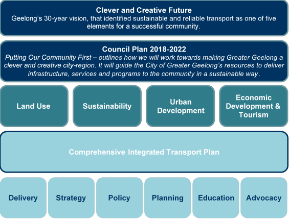
Developed in 2018, the Clever and Creative Future is a 30-year vision developed from contributions from over 16,000 community members. community aspirations were formed, one which specifically related to transport: A fast, reliable and connected transport network. With a specific measure of success centred on 50 per cent of journeys to work are made by public transport, walking or cycling. This, amongst others centred on sustainability, health and wellbeing and inclusive and connected communities, set a clear mandate that supporting sustainable transport is a key priority of Council. This document provides the vision and foundation to inform key Council strategies and Council Plan.
Council Plan 2018-22 – Putting Our Community First outlines how we will work towards making Greater Geelong a clever and creative city-region. It guides the City’s resources to deliver infrastructure, services and programs to the community in a sustainable way.
Eleven strategic priorities form the focus of the four-year plan. Many of the focus areas rely on sustainable and active transport in order to achieve their specific outcome. Such priorities are centred on; planned sustainable development; integrated transport connections; a thriving and sustainable economy; growing our tourism and events; a more inclusive and diverse community; informed social infrastructure planning; and, improved health and safety of our community. Council Plan 2018-22 aligns with the Clever and Creative Future and further provides guidance on Council’s key strategies and plans.
Council Plan is currently being reviewed by the newly elected Council for the next four-year Plan.
There are several guiding strategies and plans that inform how sustainable transport contributes to the prosperity of the Geelong community. These documents provide guidance on a holistic view of the various touch points transport has across the City and community, and the challenges we face now and into the future. These documents can generally be categorised into Land Use, Sustainability, Urban Development and Economic Development & Tourism. These various strategies and plans will also inform an updated Integrated Transport Plan on how the transport system needs to respond, provide and support the community now and into the future. Such documents include, but are not limited to:
Land Use – Settlement Strategy, G21 Regional Growth Plan, Northern and Western Geelong Framework Plan, Social Infrastructure Plan;
Sustainability – Sustainability Framework, Zero Carbon Emissions Strategy, Community Zero Carbon Action Plan;
Urban Development – Revitalising Central Geelong Action Plan, Armstrong Creek Precinct Structure Plans; and
Economic Development & Tourism –Tourism Greater Geelong and The Bellarine – Tourism Development Plan.
The Comprehensive Integrated Transport Plan (CITP) was developed in 2015 and provided a framework for the City’s transport and land use planning. The plan outlined short (<1 year), medium (1–5 years) and long term (5–10 years) strategic actions for planning, developing and managing an integrated transport system that covers the entire City of Greater Geelong region. However, the plan is outdated and no longer serves the needs of the community and the future growth predicted for Geelong. Since 2015, changes to Geelong’s growth fronts and associated challenges are now more defined and a new Integrated Transport Plan (ITP) needs to be developed in order to respond to the transport challenges facing Geelong’s future.
It is intended an updated ITP will provide an overarching long-term vision, guided by the City’s existing strategies and plans, of how Geelong’s transport network will integrate to support the Geelong community. Embedded within will be short-term actions to support step change to align and achieve this long-term vision.
Pre-planning has commenced on Geelong’s ITP, however its development and continued progression is subject to funding and additional resourcing. Further detail on the proposed ITP is provided below.
Following completion of the ITP, Council will be able to make more informed decisions and take action to support the community’s needs and ensure sustainability across the transport system. These actions may encompass the delivery of infrastructure, development of strategy and policy, further network planning, community education and advocating for improvements to public transport and the arterial road network.
The Geelong Growth Area Infrastructure Strategy (GGATIS) is a partnership project with the Department of Transport and Victorian Planning Authority. The strategy will develop a long-term transport infrastructure plan for the municipality that will set the overarching framework for investment in state significant road and rail infrastructure projects to support greenfield development. The project will provide an in-depth understanding to the challenges facing the Greater Geelong transport network and how changing our approach to future large-scale projects can influence congestion, travel time and delay for users.
The outcomes and modelling undertaken as part of the GGATIS project are crucial inputs to developing the revised Integrated Transport Plan.
Strong and collaborative relationships with transport agencies and stakeholders are key to achieving a sustainable transport network.
The Transport Integration Act sets out the legislative framework for the various transport and land use authorities to work together to achieve a fairer, safer and more environmentally sustainable transport system.
The City and the Department of Transport (DoT) have different roles and responsibilities under the Road Management Act 2004. Generally:
The City is the road management authority for local roads. This is largely confined to local streets, footpaths and shared paths; and
DoT is the responsible authority for public transport and arterial roads. This also considers broader regional movements, goods and logistics and public transport services (buses and trains).
The City can advocate for change and alteration to roads and services that are under the authority of DoT, however, ultimately cannot deliver or implement these changes.
The City works closely with DoT who generally lead major transport planning and delivery projects. Typically, these projects occur over long periods due to their large scale and the nature of securing funding for delivery. The City is currently working with DoT on several active State Government projects, including:
Rail duplication (Geelong to Waurn Ponds);
Rail station upgrades (South Geelong, Marshall and Waurn Ponds);
Armstrong Creek Transit Corridor;
Barwon Heads Road duplication; and
Bellarine Link.
In July 2020, Council wrote to DoT acknowledging and welcoming their support for the development of a new Geelong ITP.
The City is working in partnership with DoT and the Victorian Planning Authority on the Geelong Growth Areas Transport Infrastructure Strategy (GGATIS). Further information on this strategy is provided above, under Current and Future Transport Planning.
The City is working with DELWP on the Central Geelong Planning Framework. The City has been involved in the review of transport and movement that is being incorporated in this framework. The draft planning framework is expected to be released for public exhibition in March 2021 before commencing amendment to the planning scheme.
The City and DoT are both active members of G21 and specifically the G21 Transport Pillar. This committee includes membership from other G21 Councils (Surf Coast Shire, Golden Plains Shire, Colac Otway Shire and the Borough of Queenscliffe) as well as other industry stakeholders, associations and agencies.
Through G21, Council has endorsed the G21 Region Road Transport Plan 2017-20 and the G21 Region Public Transport Strategy 2014, amongst others, which incorporate and combine local and state transport plans and initiatives.
The G21 Transport Pillar is in the process of scoping a G21 Regional Transport Strategy. The new Geelong Integrated Transport Plan will be critical to informing and contributing to the broader G21 Regional Transport Strategy.
The City is an active member of the Committee for Geelong, as are DoT, which provides opportunity to unify advocacy across the variety of membership base and community.
City of Greater Geelong officers are represented on community groups and associations, which often include State Government representation. Attendance is often on an as-needed basis and involves groups such as the Ocean Grove Community Association, Barwon Heads Traffic and Parking Sub-committee, Geelong Cycling Advisory Committee etc.
These types of forums are important opportunities for the City to hear community concerns, discuss initiatives and undertake engagement for transport planning and management.
Active transport is a vital part of ensuring sustainable transport is accessible to the community. Safety, connectedness and directness are key elements when developing and planning for active transport routes. The City has a number of current initiatives to deliver and support active transport.
The Western Link of the Better Bike Connections project was delivered in early 2020, linking Central Geelong to Geelong West and Hamlyn Heights.
The Southern Link of the Better Bike Connections Project extends from Central Geelong, through Belmont, to Waurn Ponds and is split into two stages:
Stage One from Central Geelong to Barwon River – procurement is underway with construction planned to start early 2021; and
Stage Two from the Barwon River to Waurn Ponds (including High Street, Belmont) - requires confirmation of detailed design, following Council’s adoption of the concept in 2019. Procurement of detailed design is anticipated in early 2021.
The Shared Trails Masterplan was adopted by Council in March 2020. The plan identified 17 network gaps, 10 trail gaps and various trail deficiencies in the existing trail network. It is anticipated that investigation, design, and delivery of all 19 network connections could take up to 10 years to complete given the complexity of some segments.
Four paths from the Shared Trails Masterplan are planned for construction this financial year, which include:
13th Beach Road shared path – between 13th Beach Surf Lifesaving Club and existing shared path (Trail Gap #10);
Bay Trail at Rippleside – St. Helens Boat Ramp (Trail Gap #6);
Bay Trail at Rippleside – link between existing Corio-Waurn Ponds Road shared path (to North Geelong Station) and Corio Quay Road and Bay Trail (Trail Gap #6); and
Bay Trail to North Shore Station – connection along Corio Quay Rd, Esplanade, Albery Road, Station Street (Trail Gap #2).
Note: these projects may be subject to change or alteration as further detailed investigation, service proofing and designs are undertaken.
The Local Roads and Community Infrastructure Program is a Federal Government initiative to stimulate the local economy and deliver benefits to the community including improved road safety. The City was successful in securing grant funding, of which $500,000 will deliver a 1.4km shared path along Scenic Road, Highton between Barrabool Road and Orana Road (Montpellier Water Service Basins) to connect new residential development areas and improve safety for pedestrians and cyclists. Work is scheduled to start in February and complete by June 2021.
As part of the State Government commitment to upgrading Barwon Heads Road, DoT is currently finalising plans for the duplication of Barwon Heads Road between Settlement Road and Reserve Road. As a key stakeholder, the City has been working closely with DoT and advocating to ensure the inclusion of active transport infrastructure that meets the needs of the community. The duplication works will include on-road cycling facilities, as well as a separated shared path along the length of the project.
Project development and feasibility has commenced on several larger scale network gaps across the Bellarine (aimed at linking the townships of Ocean Grove, Drysdale, Portarlington, St Leonards and Point Lonsdale) and in the north at Lara.
Further project investigations are required to inform if viable routes are available and costs for the delivery of major network gaps. Some of these investigations are underway however outcomes and results from these assessments are not complete. These projects include:
Drysdale to Ocean Grove (Network Gap #15)
Drysdale to Portarlington (Network Gap #14)
Drysdale to St Leonards (Network Gap #13)
Ocean Grove to Point Lonsdale (Network Gap #16)
Lara to You Yangs (Network Gap #3)
Network gaps often involve complex challenges due to available land, environmental and native vegetation, road safety and the location of existing services. Detailed investigation is required to determine available route options. Should a network gap contain a viable route, additional cost estimates will then be provided to Council for land acquisition (if required), vegetation offsets, and construction etc. The requirements to deliver each project will vary based on the topography and land availability of the link.
Further investigation and project development will also commence on the connection from Lara to the You Yangs and Little River (Network Gap #3). Preliminary route analysis and discussion with Serendip Sanctuary have commenced and further work will be undertaken this financial year to resolve the route alignment.
Two of the ten priority trail gaps identified in the Shared Trails Masterplan will be delivered with existing 2020-21 budget. Additional investigation on the remaining trail gaps will continue to develop and identify link connections to expand the shared trails network.
Further updates will be provided via briefing to Council.
A new ITP will solidify Greater Geelong’s future transport vision and establish short-term actions for implementation. These short-term actions will be frequently reviewed within the planning framework to ensure responsiveness to changes in the community.
The plan will be an integration of the City’s existing strategies and plans to form and articulate Greater Geelong’s long-term future movement and access vision. The plan will also articulate the implications existing challenges and future growth will have on the way our community moves. An action plan will be the final component of the project that will inform Council’s role in implementing changes to the local road and path network and/or advocating for changes to transport matters that are not the responsibility of Council (that is: public transport, arterial road network). The GGATIS will be a key input to the ITP.
The ITP will be a Council developed and owned document. Various stakeholders will be engaged with, and have input; however, the plan will specifically focus on matters that Council can deliver, influence or advocate for. This will allow Council to advocate from the community’s point of view which may differ from the position of other authorities or agencies, such as public transport (ie rail and bus services).
DoT has agreed to be a key stakeholder to contribute to the ITP.
The proposed process for developing the ITP is a framework approach that seeks to respond to a future transport vision, while providing tangible short-term actions that can respond to evolving transport issues.
The development of the ITP is currently unfunded and the delivery method is being considered by officers. A business case is being developed for consideration as part of the Council 2021/22 budget process.
There are several active projects occurring across the City that incorporate sustainable transport within their actions, design or outcomes. Such projects include, but are not limited to:
Central Geelong Car Parking Strategy
Sustainability Framework
Malop Street Green Spine
South Geelong Urban Design Framework
Pakington Street Urban Design Framework
Northern and Western Geelong Growth Area Precinct Structure Plans
Central Geelong Planning Framework
The Council resolution from the 30 June 2020 Council meeting requesting a report on active and planned sustainable transport:
‘That Council request the Chief Executive Officer to provide a report back to Council by December 2020 that:
Outlines how Council will continue planning for transport to become increasingly sustainable as growth across the region continues, including how existing plans align with strategic transport planning underway by the City and other agencies;
Describes how we are collaborating with key stakeholders and State Government agencies to coordinate the municipality's transport planning;
Provides an update on completed, current and proposed active transport infrastructure projects; and
Identifies short and long-term sustainable transport projects that are ready for funding, particularly those that support active travel and other means to reduce dependence on vehicle travel for commuting, shopping and recreation’.
Source: |
Customer & Corporate Services – Financial Services |
Director: |
Michael Dugina |
To present to Council the financial performance information to 31 December 2020.
On 30 June 2020 the 2020-21 budget was adopted with a recurrent operating deficit of ($24.6m) and a non-recurrent surplus of $110.2m, resulting in a net surplus of $85.6m.
The financial statements and commentary are for the period July 2020 to December 2020.
The recurrent operating result for the six-month period is a deficit of ($7.6m), which compares to the budgeted deficit of ($15.8m). This represents a better than anticipated outcome by $8.2m. A summary of the year to date variances are provided in Attachment 2 of this report.
The non-recurrent result (for example: gifted assets from development, capital income, sale of properties, developer cash contributions to infrastructure etc.) for the six months was a surplus of $69.2m, which compares to the budgeted surplus of $53.4m. This represents a better than anticipated outcome by $15.8m. A summary of the non-recurrent variances is provided in Attachment 2 of this report.
The total surplus of $61.6m is $24.0m favourable to the year to date budget.
Through the Working for Victoria fund, the City is set to receive around $8m this financial year to employ just under 200 FTE to help stimulate employment throughout the region. To the end of December, $5.6m of income has been recognised, of which $3.5m has been used to fund these FTE.
The City has also been sourcing Government grants to support recovery from COVID-19 pandemic. To date we have received funding of $500k to support outdoor dining initiatives and further $2.1m boost for local roads and infrastructure to fund shovel ready projects.
Capital expenditure year to date is $56.5m against a year to date budget of $60.2m. Spend on capital projects is continually being reviewed throughout the year. A summary of capital expenditure variances is provided in Attachment 2 of this report.
The cash and investment balance of $118.0m is $35.6m higher than budgeted mainly due to higher rates receipts, developer cash contributions, grants income, loan borrowings and capital income, offset by lower land sales and fees and charges.
During September a $45m loan was taken out in order to fund the Civic Precinct and LED Streetlighting capital projects. The budget allows for total loan borrowings of $66.9m for the financial year if required.
The full year forecast in our September 2020 Quarterly Financial Management Report indicated a ($33.4m) recurrent deficit, which was ($8.8m) unfavourable to the budget. This variance was largely driven by additional COVID-19 support packages adopted by Council and revenue losses in leisure facilitates due to continued forced closures, unbudgeted building demolition costs, partly offset by FTE vacancies and favourable waste/landfill income.
Since September, a stronger outlook in leisure centres and waste service costs, lower utility expenses, and savings from continued office closures indicates a full year recurrent forecasted deficit of ($30.4m), or ($5.8m) unfavourable to budget. The forecast will be further refined in Q3, which will be outlined in the March 2021 Quarterly Financial Management Report.
Councillor Aitken moved, Councillor Asher seconded -
That Council endorse the Financial Management Report to 31 December 2020.
Carried.
Any financial implications are addressed within the body of the report.
It has been determined by the Chief Executive Officer that a revised budget is not required for the 2020-21 financial period.
Project managers have been consulted and provided the latest project updates which have been factored into this report.
There are no social equity implications arising from the subject of this report.
The report is provided in accordance with requirements under the Local Government Act 2020.
The report is aligned to the Council Plan Strategic Objective ‘Innovative Finances and Technology’.
No City Officers or contractors who have provided advice in relation to this report have declared a conflict of interest regarding the matter under consideration.
There are no high or extreme risks arising from the subject of this report.
There are no environmental implications arising from the subject of this report.
December 2020
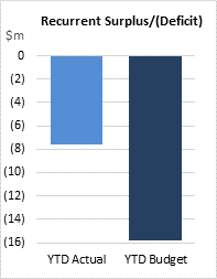
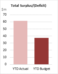
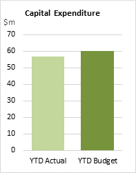
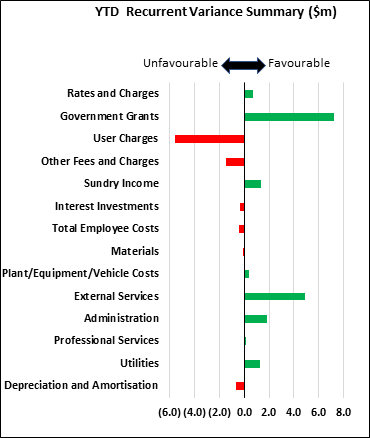
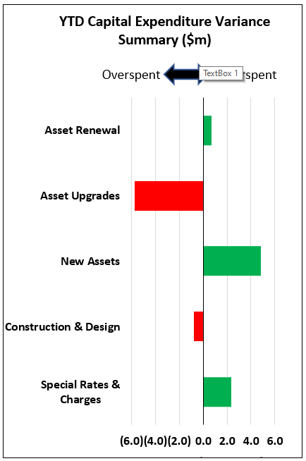
The December 2020 data is provided in the following table to report year to date performance versus the budget. The full year high level forecast is expecting a recurrent ($5.8m) unfavourable and non-recurrent $19.1m favourable result.
Overall Summary |
||||||
|---|---|---|---|---|---|---|
|
YTD Actual |
YTD Budget |
YTD Var |
FY Budget |
FY Forecast |
FY Var |
Recurrent Surplus/(Deficit) |
(7.6) |
(15.8) |
8.2 |
(24.6) |
(30.4) |
(5.8) |
Non-Recurrent Surplus/(Deficit) |
69.2 |
53.4 |
15.8 |
110.2 |
130.5 |
20.3 |
Net Surplus/(Deficit) |
61.6 |
37.5 |
24.0 |
85.6 |
100.1 |
14.5 |
Capital Expenditure |
56.5 |
60.2 |
3.7 |
160.4 |
160.4 |
0.0 |
Closing Net Cash |
118.0 |
82.4 |
35.6 |
106.6 |
85.7 |
(20.9) |
Recurrent Summary |
||||||
|---|---|---|---|---|---|---|
|
YTD Actual |
YTD Budget |
YTD Var |
FY Budget |
FY Forecast |
FY Var |
Recurrent Income |
184.5 |
182.6 |
1.9 |
372.4 |
370.4 |
(2.0) |
Recurrent Expenditure |
192.1 |
198.4 |
6.3 |
397.0 |
400.8 |
(3.8) |
Recurrent Surplus/(Deficit) |
(7.6) |
(15.8) |
8.2 |
(24.6) |
(30.4) |
(5.8) |
YTD Variance - $8.2m Favourable |
||||||
The following major variances contributed to this recurrent result:
Income:
Rates & Charges $695k favourable – Mostly driven by higher supplementary rates (an increase of 2,428 rateable properties compared to budget), however this is subject to be offset by objections as the year progresses.
Government Grants $7,233k favourable – Timing of Working for Victoria Fund receipts $5,600k (offset by $3,463k expenditure), favourable Home Care Packages due to high demand and additional grants in Family Services due to additional state funding and transition payment to support the under-utilisation and freeze on fee increases. This is partly offset by Food Act reimbursement for closures.
User Charges ($5,595k) unfavourable – Lower Activity/Program fees ($4,023k – Leisure & Family Services), car parking fees ($928k) due to free parking initiatives, commercial rent relief ($367k).
Other Fees and Charges ($1,453k) unfavourable – Food Act Licences waived due to COVID ($1,372k) and lower parking fines ($989k), offset by higher planning approvals/submissions $838k.
Expenditure:
Employee costs ($409k) net unfavourable – Working for Victoria spend and other redeployment related costs, offset by savings due to vacancies/staff turnover and changed EBA uplift assumptions (budget assumed 2.3%).
External Services $4,869k favourable – Timing of contractors $2,986k, Waste Disposal/Recycling savings to due redirecting waste from Wyndham – lower gates fees and transport costs and unbudgeted internal income), Building Maintenance $522k and Events/Functions $513k, offset by unbudgeted building demolition works ($1,048k) and timing of grants/contributions payments ($485k).
Administration $1,808k favourable – Lower training/development costs $744k,printing/stationery/photocopying costs $431k, debt collection costs $174k (no expenses incurred YTD) and computer software $156k.
Utilities $1,275k favourable – lower costs for Water $886k (mostly due to wet weather) and Electricity/Gas $352k (due to office and facility closures).
Non-Recurrent Summary |
||||||
|---|---|---|---|---|---|---|
|
YTD Actual |
YTD Budget |
YTD Var |
FY Budget |
FY Forecast |
FY Var |
Non-Recurrent Surplus/(Deficit) |
69.2 |
53.4 |
15.8 |
110.2 |
130.5 |
20.3 |
YTD Variance – $15.8 million favourable |
||||||
This non-recurrent result was driven by favourable developer contributions $14.2m, capital income $7.5m and the favourable operating position $8.2m, offset by lower than expected subdivision gifted assets ($2.6m) and gain on property sales ($4.7m).
Capital Expenditure Summary |
||||
|---|---|---|---|---|
|
YTD Actual |
YTD Budget |
YTD Var |
FY Budget |
Capital Expenditure |
56.5 |
60.2 |
3.7 |
160.4 |
YTD Variance – $3.7m underspent |
||||
The capital program is currently $3.7m underspent, mostly due to the timing of project spend. Large project variances to budget are as follows.
Project |
YTD Var |
|---|---|
C20420 - Civic Accommodation Project |
6.27 |
C17301 - Elcho Channel SRC Scheme |
1.48 |
C20312 - Safe Travel in Local Streets |
1.35 |
C11206 - New Corio/New Station Estates Purchase Scheme |
0.87 |
C19204 - ICT Strategy Projects |
0.74 |
C19201 - Waterworld Canopy Replacement |
0.50 |
C68902 - DCP - JR Tivoli Drive Curlewis _ R001, R003 and P003 |
(1.14) |
C20402 - Herne Hill Reserve |
(1.42) |
C19413 - Polworth Pavilion and West Oval - Pavilion Construction |
(4.31) |
The graph below summarises total capital gross expenditure to date.
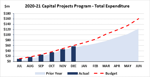
The City has two environmental upgrade agreements in place.
An environmental upgrade agreement was entered into in June 2017 for Lot 2 on Plan Subdivision 041455, Volume 08704 Folio 526.
The total charge for this agreement is $115k and all payments that have fallen due have been remitted.
The total value of payments that are yet to fall due is $75k.
An environment upgrade agreement was signed in April 2020, with payments deferred until 30 September 2020 due to COVID-19 for Lot 3 on Plan Subdivision 74780, Volume 08651 Folio 328.
The total charge for this agreement is $122k. The first payment due to be remitted 30 September 2020, is still outstanding and is under discussion.
OPERATING STATEMENT |
|||||||||
|---|---|---|---|---|---|---|---|---|---|
Figures in $000s |
Current Month |
Year to Date |
Full Year |
||||||
ACT |
BUD |
D BUD |
ACT |
BUD |
D BUD |
F/CAST |
BUD |
D BUD |
|
Rates and Charges |
21,072 |
20,959 |
113 |
128,842 |
128,147 |
695 |
254,884 |
254,042 |
842 |
Government Grants |
3,728 |
2,732 |
996 |
30,560 |
23,328 |
7,232 |
57,261 |
45,907 |
11,354 |
User Charges |
2,827 |
4,462 |
(1,635) |
15,523 |
21,118 |
(5,595) |
39,169 |
50,943 |
(11,774) |
Other Fees and Charges |
816 |
1,233 |
(417) |
6,004 |
7,458 |
(1,454) |
14,460 |
15,877 |
(1,417) |
Sundry Income |
544 |
196 |
348 |
3,208 |
1,833 |
1,375 |
3,977 |
4,236 |
(259) |
Interest Investments |
39 |
95 |
(56) |
350 |
670 |
(320) |
640 |
1,400 |
(760) |
Total Recurrent Income |
29,026 |
29,676 |
(650) |
184,488 |
182,553 |
1,935 |
370,391 |
372,405 |
(2,013) |
Salaries |
16,254 |
15,290 |
(964) |
84,614 |
84,153 |
(461) |
172,691 |
169,903 |
(2,788) |
Workcover |
260 |
240 |
(20) |
1,327 |
1,379 |
52 |
2,695 |
2,724 |
29 |
General Works - Materials |
550 |
720 |
170 |
3,725 |
3,663 |
(62) |
7,985 |
7,734 |
(251) |
General Works - Plant/Equipment/Vehicles |
867 |
763 |
(104) |
3,879 |
4,287 |
408 |
8,272 |
8,609 |
337 |
General Works - External Services |
9,720 |
9,313 |
(407) |
47,419 |
52,288 |
4,869 |
101,878 |
103,050 |
1,172 |
Administration |
1,093 |
1,054 |
(39) |
5,101 |
6,909 |
1,808 |
12,184 |
14,582 |
2,398 |
Professional Services |
909 |
868 |
(41) |
4,567 |
4,706 |
139 |
13,884 |
8,278 |
(5,606) |
Utilities |
682 |
1,102 |
420 |
4,571 |
5,847 |
1,276 |
10,107 |
12,232 |
2,125 |
Efficiency Dividend |
- |
(200) |
(200) |
- |
(1,200) |
(1,200) |
(2,400) |
(2,400) |
- |
Depreciation |
6,241 |
6,037 |
(204) |
37,002 |
36,332 |
(670) |
73,446 |
72,263 |
(1,183) |
(Gain)/Loss on Sale of Plant & Equipment |
- |
5 |
5 |
(111) |
30 |
141 |
45 |
59 |
14 |
Total Recurrent Expenditure |
36,577 |
35,194 |
(1,383) |
192,095 |
198,392 |
6,297 |
400,787 |
397,034 |
(3,753) |
Recurrent Surplus/(Deficit) |
(7,550) |
(5,518) |
(2,032) |
(7,607) |
(15,838) |
8,231 |
(30,396) |
(24,629) |
(5,767) |
Subdivision Gifted Assets |
10,472 |
6,250 |
4,222 |
34,865 |
37,500 |
(2,635) |
80,000 |
75,000 |
5,000 |
Capital Grants and Income |
3,037 |
70 |
2,967 |
14,629 |
7,099 |
7,530 |
23,505 |
16,801 |
6,704 |
Developer Contributions |
2,615 |
2,126 |
489 |
20,991 |
6,802 |
14,189 |
30,981 |
14,510 |
16,471 |
Gain/(Loss) on Sale of Property |
1 |
791 |
(790) |
1 |
4,747 |
(4,746) |
5,437 |
9,495 |
(4,058) |
Total Non-Recurrent Income |
16,125 |
9,238 |
6,887 |
70,486 |
56,148 |
14,339 |
139,923 |
115,805 |
24,117 |
Loss on Disposal of Infrastructure |
24 |
464 |
440 |
338 |
2,785 |
2,447 |
5,570 |
5,570 |
0 |
Prior Year Adjustments |
- |
- |
- |
985 |
- |
(985) |
3,830 |
- |
(3,830) |
Total Non-Recurrent Expenditure |
24 |
464 |
440 |
1,324 |
2,785 |
1,461 |
9,400 |
5,570 |
(3,830) |
Non-Recurrent Surplus/(Deficit) |
16,101 |
8,774 |
7,327 |
69,163 |
53,363 |
15,800 |
130,523 |
110,235 |
20,287 |
TOTAL SURPLUS/(DEFICIT) |
8,551 |
3,256 |
5,295 |
61,556 |
37,525 |
24,031 |
100,127 |
85,606 |
14,521 |
STATEMENT OF FINANCIAL POSITION |
|||
|---|---|---|---|
Figures in $000s |
YTD ACTUAL |
PRIOR MONTH |
Comments on major monthly movements |
CURRENT ASSETS |
|
|
|
Cash and Cash Equivalents |
118,048 |
127,246 |
|
Trade and Other Receivables |
183,810 |
204,020 |
Reduction mostly due to continued rate payments. |
Prepayments |
4,819 |
6,089 |
|
Inventories |
1,317 |
1,391 |
|
TOTAL CURRENT ASSETS |
307,994 |
338,746 |
|
CURRENT LIABILITIES |
|
|
|
Trade and Other Payables |
47,268 |
52,271 |
|
Unearned Income |
137,475 |
156,534 |
Reducing as revenue is recognised on the Operating Statement. |
Loans |
11,829 |
11,791 |
|
Refundable Deposits |
10,079 |
10,664 |
|
Employee Benefits |
40,982 |
39,147 |
|
Landfill Provision |
124 |
124 |
|
TOTAL CURRENT LIABILITIES |
247,756 |
270,531 |
|
NET CURRENT ASSETS |
60,238 |
68,215 |
|
NON-CURRENT ASSETS |
|
|
|
Land and Buildings |
1,224,246 |
1,224,178 |
|
Plant and Equipment |
31,691 |
32,013 |
|
Infrastructure |
1,505,904 |
1,499,662 |
|
Intangible Assets |
2,644 |
2,676 |
|
Work In Progress |
104,482 |
94,792 |
Capital projects not yet finalised. |
Right Of Use Assets |
4,725 |
4,991 |
|
Investments |
11,835 |
11,835 |
|
Receivables |
9,429 |
9,429 |
|
TOTAL NON-CURRENT ASSETS |
2,894,956 |
2,879,575 |
|
|
|
|
|
NON-CURRENT LIABILITIES |
|
|
|
Developer Contributions Liability |
68 |
26 |
|
Loans |
113,889 |
115,038 |
$45m loan drawdown in Sep, less loan principal repayments. |
Employee Benefits |
1,913 |
1,953 |
|
Landfill Provision |
16,559 |
16,559 |
|
TOTAL NON-CURRENT LIABILITIES |
132,430 |
133,577 |
|
NET ASSETS |
2,822,764 |
2,814,213 |
|
Represented by: |
|
|
|
RATEPAYER EQUITY |
|
|
|
Surplus Year to Date |
61,556 |
53,005 |
|
Accumulated Surplus |
1,541,041 |
1,541,041 |
|
Asset Revaluation Reserve |
1,187,580 |
1,187,580 |
|
Reserves |
32,588 |
32,588 |
|
TOTAL RATEPAYER EQUITY |
2,822,764 |
2,814,213 |
|
STATEMENT OF CASH FLOWS |
||||
|---|---|---|---|---|
Figures in $000s |
ACTUAL |
BUDGET |
D BUDGET |
|
Cash Flows from Operating Activities |
|
|
|
|
Payments |
|
|
|
|
|
Employee Costs |
(80,664) |
(87,391) |
6,727 |
|
General Works / Utilities / Disbursements |
(78,189) |
(70,008) |
(8,181) |
|
Administration / Professional Services |
(9,036) |
(10,529) |
1,493 |
|
Interest Expense |
(1,409) |
(1,388) |
(21) |
|
|
(169,298) |
(169,316) |
18 |
Receipts |
|
|
|
|
|
General Rates |
101,526 |
85,832 |
15,694 |
|
Fire Services Levy |
429 |
0 |
429 |
|
Fees and Charges |
20,737 |
31,802 |
(11,065) |
|
Investment Income |
350 |
670 |
(320) |
|
GST Recoveries on Operating Transactions |
10,637 |
5,124 |
5,513 |
|
Government Grants |
31,110 |
23,328 |
7,782 |
|
164,789 |
146,757 |
18,032 |
|
Net Cash Inflow/(Outflow) from Operating Activities before Capital Income |
(4,509) |
(22,560) |
18,051 |
|
Cash Flows from Investing Activities |
|
|
|
|
Payments for Land & Buildings, Plant & Equipment and Infrastructure Assets |
(56,548) |
(60,232) |
3,684 |
|
Capital Income |
14,629 |
7,099 |
7,530 |
|
Proceeds from Sale of Land & Buildings |
1 |
12,125 |
(12,124) |
|
Proceeds from Sale of Plant & Equipment |
256 |
653 |
(397) |
|
Developer Cash Contribution |
21,033 |
6,802 |
14,231 |
|
Net Cash Outflow from Investing Activities |
(20,629) |
(33,554) |
12,925 |
|
Cash Flows from Financing Activities |
|
|
|
|
Repayment of Borrowings |
(5,183) |
(4,755) |
(428) |
|
Proceeds from New Loans |
45,000 |
39,936 |
5,064 |
|
Net Cash Outflow from Financial Activities |
39,817 |
35,181 |
4,636 |
|
Net Increase (Decrease) in Cash Held |
14,679 |
(20,933) |
35,612 |
|
Cash at the Beginning of the Financial Year |
103,369 |
103,369 |
|
|
Cash at the End of Current Period |
118,048 |
82,436 |
35,612 |
|
|
YTD Actual |
YTD Budget |
YTD Var |
FY Budget |
|---|---|---|---|---|
Closing Net Cash - Positive/(Negative) |
118.0 |
82.4 |
35.6 |
106.6 |
YTD Variance – $35.6m favourable |
||||
As at the end of December the cash and investments balance was $118.0m or $35.6m favourable to budget, mostly due to higher rates receipts, developer cash contributions, grants income, loan borrowings and capital income, offset by lower land sales and fees & charges. Cashflow continues to be closely monitored, especially given the pressures resulting from COVID-19.
Council has future commitments for $52.6m, as detailed below:
Long service leave |
$23.9m |
Statutory reserves |
$ 7.9m |
Refundable deposits |
$10.1m |
Income in advance |
$10.7m |
Asset development |
$ 0.1m |
Total |
$52.6m |
The landfill provision balance is currently $16.6m.
Working capital funds are invested in short term deposits and investment returns are as follows:
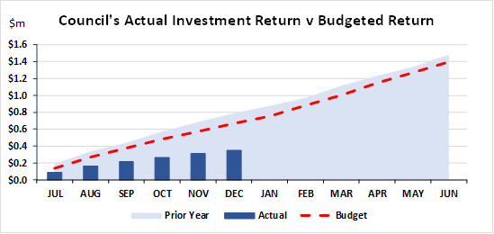
Investment returns are currently ($320k) below budget and ($439k) lower compared to the same time last year. This is driven by declining interest rates and lower amounts invested, due to a focus on maintaining a healthy cash balance due to the uncertainty caused by COVID-19.
Financial Performance Indicators
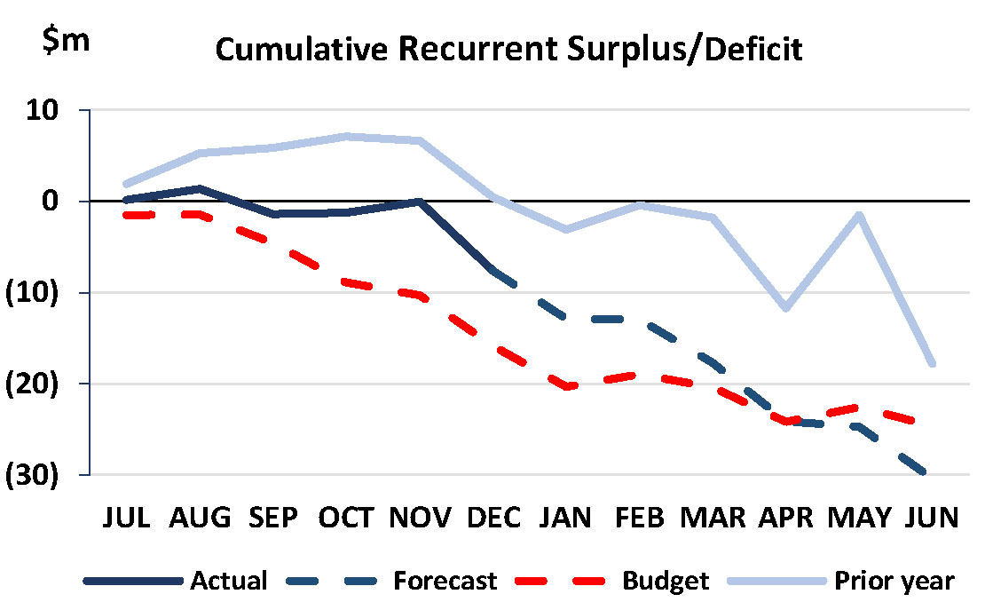 |
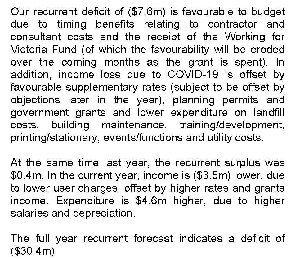 |
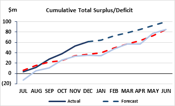 |
 |
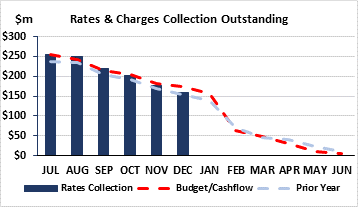 |
 |
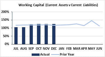 |
 |
Source: |
Economy, Investment & Attraction – Central Geelong & Waterfront |
Acting Director: |
Tim Ellis |
For Council to endorse the Terms of Reference for a Central Geelong Business Reference Group.
A Geelong Central Business District (CBD) Engagement Taskforce was established in 2020, comprising of 31 business and property owners in Central Geelong to provide feedback and suggestions on public transport servicing the CBD, on and off-street parking in the CBD, Central Geelong Marketing Committee and levy and commercial rates through a series of online workshops.
The Geelong CBD Engagement Taskforce – Findings Report (2020) was presented to Council on 21 September 2020. The report was referred to the incoming Council.
Following a number of workshops in 2020, a post-workshop survey of the participants showed an interest in continuing to provide their perspective on the key topic areas.
It was resolved at the 15 December 2020 Ordinary Council Meeting that Council:
thank and note the advice, feedback and suggestions from the Task Force contained in the Geelong CBD Engagement Task Force - Findings Report, which identified the four topics of:
public transport servicing;
on and off-street parking;
Central Geelong Marketing Committee and Levy; and
commercial rates;
request the Chief Executive Officer by 23 February 2021 draft Terms of Reference for Council’s consideration to establish an ongoing engagement process to be conducted three times per year with members of the original Geelong CBD Task Force regarding the four topics above in order to provide Council with feedback regarding Geelong’s CBD precinct; and
officers, when presenting future reports to Council on the four topics above, consider and reference the advice and feedback from the Geelong CBD Taskforce report in their recommended initiatives to Council.
The Terms of Reference (Attachment 2) recommend a change of name from ‘Geelong CBD Engagement Taskforce’ to ‘Central Geelong Business Reference Group’ to reflect the ongoing nature of the engagement with the members of the group.
An annual funding allocation of $30,000 is required to retain an external facilitator to prepare, facilitate and provide the reports and documents associated with the group independent of Council Officers.
Councillor Sullivan moved, Councillor Aitken seconded -
That Council:
Endorse the Terms of Reference for a Central Geelong Business Reference Group (Attachment 2);
Include in the 2021/22 budget an allocation of $30,000 to support the Central Geelong Business Reference Group;
Authorise the Chief Executive Officer or delegate to invite business members of the Geelong CBD Engagement Taskforce to be members of the Central Geelong Business Reference Group; and
That Council officers update in the Central Geelong Business Reference Group (the Group) Terms of Reference the:
Objectives to include the option for the Group to provide advice and feedback on other strategic items to be first submitted in writing to the Chief Executive Officer for inclusion at their discretion; and
Membership to include:
A maximum number for the Group be set at 45;
Membership be reviewed on an annual basis;
Business and/or property owners from the Central Geelong Action Plan area (refer Attachment 2) may express in writing to the Chief Executive Officer or delegate an interest in being a member of the Group;
Once the maximum number for the Group has been reached, applicants may submit an Expression of Interest to be considered by the Chief Executive Officer or delegate as part of the annual review process; and
Members of Central Geelong Marketing Committee be excluded from being members of the Group.
Carried.
The cost for retaining an external facilitator will be up to $30,000 per year to prepare, facilitate and provide the reports and documents associated with the group independent of Council Officers.
The appointment of members to the Reference Group will include:
The participants of the Geelong CBD Engagement Taskforce will be invited to be members of the Central Geelong Business Reference Group; and
Members of the Central Geelong Business Reference Group must be current business and/or property owners in the Central Geelong Action Plan area.
The timing for engagement with the Reference Group will be determined at the discretion of the Director Economy, Investment and Attraction taking into consideration emerging business-related issues relevant to the four identified topics commencing from 1 July 2021.
The Central Geelong Business Reference Group will contribute via the deliberative engagement model, as described in the draft Community Engagement Policy.
The impact of COVID-19 may have greater impacts in health and/or financial terms across the local community. As Geelong navigates through the pandemic and plans its move towards recovery, it is important to support a healthy, active and thriving CBD.
Social equity considerations will be assessed as part of the ongoing engagement with the Central Geelong Business Reference Group.
Feedback and suggestions from the Geelong CBD Engagement Task Force – Findings Report (2020) can be considered and implemented by the City. Other suggestions will require the City to take on an advocacy role, as the responsibility sits with other levels of government. This approach will apply to the outputs of the group throughout the proposed one-year term.
The Terms of Reference provide clear governance for the group.
The advice, feedback and suggestions outlined in the Geelong CBD Engagement Task Force – Findings Report, align directly to the strategic priorities outlined in the Council Plan 2018-22 with regard to ‘A Thriving and Sustainable Economy’, ‘Informed Social Infrastructure and Planning’, ‘Growing our Tourism and Events’, and ‘Integrated Transport Connections’.
No City officer involved in the preparation of this report has declared a general or material interest in this matter.
COVID-19 still presents many risks to the community and businesses. As the City navigates through the current challenges and toward a recovery post COVID-19, it is extremely important we transition out of the Pandemic environment with a healthy and active Central Geelong Business District (CBD).
Further risk assessments would be conducted should Council request for specific initiatives to be explored and evaluated through the Central Geelong Business Reference Group.
The advice, feedback and suggestions relating to the priority topic areas of public transport servicing the CBD and on and off-street parking in the CBD would require further assessment in relation to environmental implications, should Council request for specific initiatives to be explored and evaluated further.
Source: |
Economy, Investment & Attraction – Central Geelong & Waterfront |
Acting Director: |
Tim Ellis |
To commence the statutory process to renew the Central Geelong Special Rate and Charge Scheme, for the 1 July 2021 to 30 June 2026 period, for the purpose of marketing, promotion and business development of the Central Geelong CBD.
Central Geelong Marketing (CGM) has provided a placemaking function in Central Geelong through marketing, activation, business development and events throughout Central Geelong since 2001 via the Central Geelong Special Rate. The Committee, made up of 14 business and stakeholder representatives, fully supports the continuation of the program.
The award-winning activities of CGM have consistently demonstrated considerable economic, social and strategic benefit for the Central Geelong business community and the wider municipality who work, study, shop, dine, visit professional services and spend leisure time in Central Geelong. The CGM program has provided an average return on investment of $15.90 for every $1 invested within the current special rate period.
The Geelong CBD Engagement Task Force Findings Report tabled at the Ordinary Council Meeting on 21 September 2020 indicated general support for the services delivered by the but felt the program also provided broad benefits to the entire Greater Geelong municipality and that the costs related to the delivery of the program should not be borne by the Central Geelong businesses and property.
Supporting a vibrant, ever growing CBD and assisting business recovery for those sectors hit hardest by COVID-19 is critical to region’s ongoing success. There were approximately 54% of Central Geelong businesses closed during April 2020 with only 13% indicating they were trading as normal. Approximately 92% of the businesses in Central Geelong were impacted by the pandemic.
Without a Council resolution to consider a further five-year Special Rate program or alternate recurrent funding models, the current five-year Special Rate program ends 30 June 2021 and all activities delivered by Central Geelong Marketing will cease immediately.
For the CGM program to continue in its current form, the process requires Council to decide to proceed with an Intention to Declare a Special Rate, followed by a consultation process with commercial and business property owners including a hearing of submissions. Council would receive a further report for decision to declare the Special Rate based on the engagement phase including the result of the Council Hearing Panel process and any amendments made by that Panel.
The special rate is declared for the purpose of fully funding CGM to develop programs to bring boosted visitation and increased economic benefit through the promotion of businesses and activity delivery within the Central Geelong precinct on the basis that the outputs of the CGM will be a special benefit to those persons required to pay the special rate in the area as shown in Attachment 2.
Councillor Murrihy moved, Councillor Sullivan seconded -
That Council:
in accordance with the provisions of section 163 of the Local Government Act 1989 (the Act), resolve to give notice of its intention to declare the Central Geelong Marketing Special Rate as follows:
A special rate be declared for the period commencing on 1 July 2021 and concluding on 30 June 2026. The special rate be declared for the purpose of financing the operation and administration of the Central Geelong Marketing office, marketing, promotion and advertising initiatives, the provision of business information, business training and networking, the provision of events and activities and the associated encouragement and development of commerce and trade within the Geelong Central Business Precinct.
It be recorded that, for purposes of Section 163(2A) of the Act, the special rate proceeds will not exceed the amount calculated in accordance with the prescribed formula (R x C = S), the:
‘benefit ratio’ (R) being calculated at 100%, and representing the special benefits to all persons liable to pay the special rate; and
‘total cost’ (C) of performing the function described in part 9.1.3 of this resolution be recorded as per part 9.1.4 of this resolution; and
‘maximum levy’ (S) be recorded as per part 9.1.4 of this resolution.
The following be specified as the area for which the special rate is so declared:
The area within the municipal district of Council highlighted in the plan (Attachment 2) attached to this Resolution (“the area”).
‘maximum levy’ (S) be recorded as per part 9.1.4 of this resolution.
The following be specified as the land in relation to which the special rate so declared:
All land within the area other than land used exclusively for residential purposes.
‘maximum levy’ (S) be recorded as per part 9.1.4 of this resolution.
The following be specified as the criteria which form the basis of the special rate so declared:
Ownership of any land described in part 9.1.6 of this Resolution.
‘maximum levy’ (S) be recorded as per part 9.1.4 of this resolution.
The following be specified as the manner in which the special rate so declared will be assessed and levied:
An amount calculated by applying 0.00059986 cents in the dollar of the Capital Improved Value to each parcel of rateable land together with such further amount as represents any increase in the Consumer Price Index (Capital Cities Weighted Average – All Groups) during the immediately preceding 12 month period, in respect of each 12 month period from 1 July 2022 onwards.
For the purposes of part 9.1.6.3 of the Resolution, the Capital Improved Value of each parcel of land is the Capital Improved Value of that parcel of land at the time of levying the special rate (so that the Capital Improved Value may alter during the period in which the special rate is in force, reflecting any revaluations and supplementary valuations which take place).
Having regard to the preceding parts of this Resolution but subject to section 166(1) of the Act, it be recorded that, subject to any further Resolution of Council, the special rate will be due and payable on the date(s) fixed under section 167 of the Act as the date or dates on or by which Council's general rates are due.
Consider any submissions made under section 223 of the Act and the proposed declaration via a Submissions Review Panel, and then at a subsequent Council meeting, at which time Council will consider whether to make a declaration in the form proposed.
Authorise the Chief Executive Officer to give public notice of the proposed declaration in accordance with sections 163(1A) and (1B) of the Act and send a copy of the public notice to each person who is liable to pay the special rate in accordance with section 163(1C) of the Act.
Refer the intention to declare the Central Geelong Marketing Special Rate to the Central Geelong Business Reference Group for consideration and feedback, and report any recommendations the Reference Group may make to Council as part of the final report to accept or reject this special rate.
Carried.
The total amount of the proposed special rate for 2021/2022 is $1,139,605 (same as the 2020/2021 amount) with expenditure to be approved by the Committee annually. The annual budget is generally fully expended each year.
The CGM Special Rate was applicable to 1,477 businesses across Central Geelong as an additional charge on their rates notice for 2020/2021. The income is $1,139,605 from the Special Rate as well as other minor income from other sources. The rate is set on the capital improved value of the property. The average property/ business would pay per week for the 2021/2022 period.
The CGM program has provided an average return on investment of $15.90 for every $1 invested within the current special rate period and is highly regarded for its financial management. Refer Attachment 4 for an evaluation report prepared by an independent subject matter expert consultant providing an assessment of the effectiveness of the Central Geelong Special Rate and comparison with other regional centres.
The decision to renew the special rate is made every five years – 2021 will be the fifth time the program has been put to Council over 20 years. Following the Intention to Declare a Special Rate all businesses in the CBD (1,477) are provided the opportunity to make a submission regarding the proposed special rate, which are heard by a Council panel.
The Central Geelong Marketing Committee – representing business and stakeholder organisations in Central Geelong - resolved in May 2020 to request the continuation of the Central Geelong Marketing program.
During the consultation period prior to the renewal of the current Special Rate (2016 – 2021), a stakeholder survey showed majority of respondents supported the continuation of the program. The Submissions Hearing Panel for the current special rate received a total of 51 submissions from the 1,496 properties which 29 were in favour; 3 supported the scheme with suggestions for alternate funding sources; 16 were objections and 2 were outside the scope of the Special Rate scheme. The January 2020 CGM Stakeholder Survey results indicated a high level of support for the consolidated marketing body. The feedback from the Geelong CBD Engagement Task Force Report indicated the services provided by CGM are generally valued but property and business owners suggest council fund the program.
Stakeholder Survey Statistics |
|
|---|---|
90% |
of businesses surveyed indicated they were aware of CGM’s programs; |
81% |
thought CGM had provided a central focus for businesses and the promotion of Central Geelong |
93% |
agreed there is a benefit in having a collective approach to marketing Central Geelong. |
44% |
thought Special Rate paid for the activities of Central Geelong Marketing represents good value, |
50% |
were unsure if the special rate represents good value |
4% |
did not think the amount paid by the Special Rate provided good value |
The consultation process is through a Public Notice in the print media (Friday 5 February and Saturday 6 February) in City News. The Public Notice period is 28 days.
A Submissions Review Panel would be established to receive and hear from submitters. The hearings shall take place on one day with a date of Friday 19 March proposed to meet the timeframes for a final report to Council on 27 April.
The Effectiveness of Central Geelong Marketing Program report (McNabb, 2020) (Attachment 4) is an independent assessment of the current program and includes opportunities for CGM in the future.
The special rate scheme has been prepared in accordance with the special rate and special charges provision of the Local Government Act 1989, and Regulation 10 of the Local Government (General) Regulations 2015.
Links to our Clever & Creative Vision:
Support and promote across the region, local businesses, markets and products;
People feel safe wherever they are; and
An inclusive, diverse, healthy and socially connected community.
2018-2022 Council Plan
A thriving and sustainable economy:
Support and promote across the region, local businesses, markets and products.
The CGM placemaking approach supports the Municipal Public Health and Wellbeing Plan (2018-2021) including encouraging organisations (such as trader groups) and individuals to work collectively to improve local decision making and accountability for health in Neighbourhoods and, the place-based approaches of potential placemaking initiatives to create spaces with good surveillance, safe pedestrian access, walking paths, trees for shade and accessible public amenities around activity centres. (See Attachment 5 – Placemaking for Greater Geelong Discussion Paper – December 2020)
CGM staff are funded via the special rate however there are no other officers involved in preparing this report who have declared a general or material interest.
Disbanding of the CGM function will result in a loss of 4 FTE staff and the delivery of the successful programs and return of investment that the businesses and community have experienced for almost 20 years will cease.
There is a risk of reputational damage through the local media caused by job losses and the City withdrawing the CGM funding through the special levy.
There will be no coordinated marketing and place activities in Central Geelong and there could be future demands on the City for additional funds for place activation and marketing in Central Geelong should the activities of CGM cease. Refer Attachment 3 for the list of activities undertaken by the Committee.
There are no environmental implications associated with this report.
Source: |
Customer & Corporate Services – Property, Procurement and Assets |
Director: |
Michael Dugina |
To recommend the Council resolve to discontinue and sell part of an unnamed laneway abutting the property at 248 Kilgour Street, East Geelong.
The City was approached by the abutting property owner at 248 Kilgour Street, to purchase approximately 20m2 of the laneway. See Attachment 2 for location.
The laneway is unmade and properties abutting this laneway utilise Normanby Street and St Albans Road for property access.
At the Council meeting held on 1 December 2020, Council resolved to begin the road discontinuance and sale process by giving notice under section 223 Local Government Act 1989 (LGA89) to invite submissions.
The process of a road discontinuance is commenced by giving public notice under section 223 of LGA89, that the City intends to discontinue and sell the section of road reserve and invites submissions under section 207A of LGA89 on the proposed discontinuance.
A public notice was published and the period for submissions closed on 16 January 2021.
No submissions were received.
If the proposed discontinuance is completed part of the laneway will be sold to the abutting neighbour.
Councillor Murrihy moved, Councillor Mansfield seconded -
That Council:
Resolve to discontinue part of the unnamed laneway (approximately 20m2) abutting the property at 248 Kilgour Street, East Geelong;
Authorise the sale of the discontinued portion of the unnamed laneway to the abutting owner of 248 Kilgour Street, East Geelong;
Authorise the Chief Executive Officer to publish a notice in the Victorian Government Gazette detailing the road discontinuance; and
Authorise the signing of all documents to complete the sale of the land.
Carried.
The purchaser will bear any costs incurred for the discontinuance and sales process.
A public submissions process under s223 of LGA89 was required for the proposed discontinuance and sale outlined in this report. This provided an opportunity for the community provide its feedback to the Council on the proposed discontinuance.
The submissions process expired on 16 January 2020. No submissions were received.
There are no adverse social equity impacts created as a result of this road discontinuance.
Council has the power to discontinue a road under Clause 3(a) of Schedule 10 of the LGA89 notice published in the Government Gazette.
Council has the power to sell the resulting land from a road discontinuance under Clause 3(b) of Schedule 10 of the LGA89.
The proposal aligns with the objective of organisational leadership, strategy and governance where one of the key priorities is proactively managing our assets, including land holdings.
There is no identified conflict of interest for any officer involved in the preparation of the road discontinuance, submissions and sales process.
Internal consultations with key stakeholders including Engineering, Social Planning and Infrastructure Planning have been undertaken as part of the risk assessment process. External stakeholders including Barwon Water, Telstra and Powercor have also been consulted.
Internal and external stakeholders support the discontinuance and sale of this portion of laneway.
There are no other notable risks associated with the implementation of the recommendations.
There are no environment implications to this proposal.
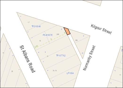
Source: |
City Services – Engineering Services |
Director: |
Guy Wilson-Browne |
To finalise the Special Charge Scheme for road construction works in Station Street, Bridge Street and Crimea Street, Drysdale.
This project involved road construction in Station Street, Bridge Street and Crimea Street, Drysdale (see plan – Attachment 3) to address complaints over a considerable period about the condition of these unsealed roads. The majority of property owners supported the simple rural road construction option to provide safer access for road users.
The works were facilitated via a Special Charge Scheme which was declared by Council at its meeting of 28 February 2017. Prior to the declaration, administrators were appointed to act as the Greater Geelong City Council when the scheme Submissions Review Panel Hearing was conducted, and the scheme was declared.
There are 47 residential properties abutting the works that were determined to receive special benefit;
There are no City owned properties in the scheme; and
The total estimated scheme cost was $313,186 (made up of $250,549 from property owners and $62,637 funded by the City).
The works have been completed (Attachment 5) consisting of Special Charge Scheme works totalling $468,405 plus $253,060 funded by the City for additional related works, resulting in a total project cost of $721,465.
In consultation with the property owners, the scheme scope was intentionally restricted, which reallocated a range of risks and scope requirements to the City to deliver the whole project and enabled the scheme to proceed.
Additional works delivered by the City separate to the scheme related to VicRoads upgrade works, underground drainage, backfill, road closure infrastructure, fencing, second road seal, removal of asbestos pipes and asphalt cost.
The Special Charge Scheme can be finalised based on the recommended cost as shown in Schedule A – Attachment 2.
Total property owner charges are proposed to be a total of $22,549 more than the declared charge representing a 9% increase guided by the Local Government Act Section 166 without the need to formally vary the scheme.
Councillor Mason moved, Councillor Sullivan seconded -
That Council:
Endorse the Special Charge Scheme final costs and amendments to the special charges on properties as shown in Schedule A – Attachment 2; and
Instruct the Chief Executive Officer to adjust the special charge and notify the property owners as required by Section 166 of the Local Government Act 1989 as shown in Schedule A – Attachment 2.
Carried.
The project has been funded under the core Street Construction program (C02301).
The final design and construction costs are summarised below:
|
Estimate |
Actual |
% Change |
|---|---|---|---|
Revised Scheme cost to property owners |
$250,549 |
$273,098 |
9% increase |
Scheme cost to Council |
$62,637 |
$195,306 |
312% increase |
Scheme Total |
$313,186 |
$468,404 |
50% increase |
Direct Funding by Council to construct VicRoads upgrade, underground drainage, engineered fill, bollards for closure, fencing for path, 2nd seal of double Primerseal, removal of AC pipes, asphalt |
Not determined and / or excluded at scheme declaration |
$253,060 |
N/A |
Works Total |
$313,186 |
$721,465 |
|
There were several additional actual costs for the project and listed in Attachment 6.
Amending the scheme to include the full cost increase (50%) would require a formal variation to the scheme, whereas an increase less than 10% without a formal scheme variation is permitted under the Local Government Act 166(3), which stipulates that:
“A Council must ensure that those persons who are liable to pay a special rate or special charge which is varied are notified if it is varied. If a variation of a special rate or special charge will result in—
(a) persons being required to pay a special rate or special charge who were not previously required to do so; or
(b) an increase equal to or greater than 10% in the amount of the special rate or special charge payable by a person”.
The actual cost increase in the scheme cost is $155,219, whereas the revised scheme cost to the property owners reflects a 9% increase ($22,549) with all other costs being funded by the City.
The recommended final special charges consistent with a 9% increase to property owners have been prepared as shown in Attachment 2.
Property owners can nominate a payment plan and may access our hardship policy if applicable. Further details on the payment plan and how to access the hardship policy are outlined in the levy notice sent to all affected property owners.
Initial property owner feedback to the scheme indicated that most property owners preferred the simple road construction option which included sealing 685 metres of unsealed portions of road including Station, Crimea and Bridge Street.
Concerns raised were considered as part of the declaration report and Council determined to proceed with the scheme as the recovery of cost was less than one third of the total cost.
On 24 May 2016, Administrators were appointed to act as Council until 28 October 2017. New Council was sworn in on 14 November 2017. During this period the following engagement was undertaken also outlined in Attachment 4.
26 July 2016 – Intention to declare a scheme was endorsed.
8 November 2016 – A panel hearing was conducted following 6 objection submissions
29 November 2016 – A letter was sent to property owners advising of Council’s decision and reason to declare the scheme.
28 February 2017 – The scheme was declared on 28 February 2017.
2 March 2017 – A levy notice was issued to property owners.
26 October 2017 – Nine property owners jointly appealed to VCAT for a review of the scheme. A VCAT hearing commenced with an Order issued on 9 November 2017 as follows:
“This application for review is dismissed and the special charge is confirmed pursuant to section 185(3)(c) of the Local Government Act 1989.”
The provision of properly sealed and drained roads and footpaths provides improved amenity, connectivity and safety for pedestrians.
The scheme has been prepared in accordance with the Special Rate and Charge provisions of the Local Government Act 1989 and guided by the 2004 ministerial guidelines and Council’s Special Rates and Charges Policy. The process chart for Special Rate Schemes is shown in Attachment 4.
In accordance with Council’s Special Rates and Charges Policy, once the project has reached final completion and all costs have been aggregated, a finalisation report will be presented to Council. Any cost adjustments will be in accordance with requirements of the Act.
This report aligns with the Council Plan as follows:
Integrated Transport Connections and key priority to improve our road management and engagement program;
Implement a Council program of infrastructure upgrades including streets, roads and drains.
Other connections to the Council Plan include:
An investment into sustainable infrastructure, reducing operation and maintenance liability; and
Encourages use of active transport, such as walking due to the footpath construction creating a safer public space.
No Council Officer involved with this process has any general or material interest in the project or properties included in the Special Charge Scheme.
Provision of a sealed pathway provides safer walking conditions for pedestrians by minimising the risk of personal injuries through conflict with vehicles and the elimination of uneven and slippery surfaces. Provision of a footpath constructed to standards and suitably drained will provide safer passage for pedestrians.
Improved, sealed roads and proper drainage lowers the City’s ongoing maintenance requirements and deliver a higher level of service
Inclusion of the construction of VicRoads upgrade, underground drainage, engineered fill, bollards for closure, fencing for path, second seal of double Primerseal, removal of AC pipes and asphalt provides enhancement of all road user safety.
The new footpath and sealed road provides proper sealed access and improved amenity as dust and mud concerns are mitigated.
No significant vegetation removal was required to complete the project.
Property Key |
ADDRESS |
ESTIMATED COST |
REVISED COST |
|---|---|---|---|
253109 |
97-99 High Street, DRYSDALE |
$6,874.88 |
$7,493.62 |
253118 |
119 High Street, DRYSDALE |
$5,570.89 |
$6,072.27 |
325926 |
121 High Street, DRYSDALE |
$4,978.22 |
$5,426.26 |
253120 |
123 High Street, DRYSDALE |
$6,299.19 |
$6,866.12 |
253121 |
125 High Street, DRYSDALE |
$7,617.76 |
$8,303.36 |
253122 |
127 High Street, DRYSDALE |
$6,449.37 |
$7,029.81 |
349400 |
1 Madison Court, DRYSDALE |
$1,659.26 |
$1,808.59 |
349401 |
2 Madison Court, DRYSDALE |
$1,659.26 |
$1,808.59 |
349402 |
3 Madison Court, DRYSDALE |
$1,659.26 |
$1,808.59 |
349404 |
1 Ryder Court, DRYSDALE |
$1,659.26 |
$1,808.59 |
349405 |
2 Ryder Court, DRYSDALE |
$1,659.26 |
$1,808.59 |
349406 |
3 Ryder Court, DRYSDALE |
$1,659.26 |
$1,808.59 |
349407 |
4 Ryder Court, DRYSDALE |
$1,659.26 |
$1,808.59 |
349408 |
5 Ryder Court, DRYSDALE |
$1,659.26 |
$1,808.59 |
349409 |
6 Ryder Court, DRYSDALE |
$1,659.26 |
$1,808.59 |
351075 |
18 Bridge Street, DRYSDALE |
$1,659.26 |
$1,808.59 |
351075 |
24 Bridge Street, DRYSDALE |
$10,284.78 |
$11,210.41 |
352569 |
30 Bridge Street, DRYSDALE |
$1,659.26 |
$1,808.59 |
355435 |
32A Bridge Street, DRYSDALE |
$1,659.26 |
$1,808.59 |
355435 |
32B Bridge Street, DRYSDALE |
$1,659.26 |
$1,808.59 |
325927 |
9 Station Street, DRYSDALE |
$8,352.68 |
$9,104.42 |
260514 |
2-10 Station Street, DRYSDALE |
$19,439.18 |
$21,188.71 |
260507 |
11 Station Street, DRYSDALE |
$8,502.03 |
$9,267.21 |
260515 |
12 Station Street, DRYSDALE |
$6,752.46 |
$7,360.18 |
260508 |
13 Station Street, DRYSDALE |
$6,895.89 |
$7,516.52 |
264862 |
14 Station Street, DRYSDALE |
$6,752.46 |
$7,360.18 |
260509 |
15-19 Station Street, DRYSDALE |
$13,790.60 |
$15,031.75 |
260516 |
16 Station Street, DRYSDALE |
$6,895.89 |
$7,516.52 |
364999 |
1/18 Station Street, DRYSDALE |
$6,895.89 |
$7,516.52 |
364998 |
2/18 Station Street, DRYSDALE |
$0.00 |
$0.00 |
260518 |
20 Station Street, DRYSDALE |
$6,895.89 |
$7,516.52 |
260510 |
21-23 Station Street, DRYSDALE |
$8,087.16 |
$8,815.00 |
260519 |
22 Station Street, DRYSDALE |
$6,895.89 |
$7,516.52 |
260520 |
24 Station Street, DRYSDALE |
$6,895.89 |
$7,516.52 |
260511 |
25-27 Station Street, DRYSDALE |
$8,087.59 |
$8,815.47 |
260521 |
26 Station Street, DRYSDALE |
$6,895.89 |
$7,516.52 |
298815 |
28 Station Street, DRYSDALE |
$7,482.63 |
$8,156.07 |
343495 |
29 Station Street, DRYSDALE |
$3,809.26 |
$4,152.09 |
298816 |
30 Station Street, DRYSDALE |
$7,482.63 |
$8,156.07 |
343496 |
31 Station Street, DRYSDALE |
$3,792.66 |
$4,134.00 |
352567 |
32 Station Street, DRYSDALE |
$1,659.26 |
$1,808.59 |
343495 |
33 Station Street, DRYSDALE |
$5,215.07 |
$5,684.43 |
352568 |
34 Station Street, DRYSDALE |
$1,659.26 |
$1,808.59 |
343494 |
35 Station Street, DRYSDALE |
$5,215.07 |
$5,684.43 |
351072 |
37 Station Street, DRYSDALE |
$5,689.21 |
$6,201.24 |
351073 |
39 Station Street, DRYSDALE |
$5,410.66 |
$5,897.62 |
351074 |
41 Station Street, DRYSDALE |
$5,452.14 |
$5,942.83 |
|
TOTAL |
$250,548.71 |
$273,098.09 |
Note: Officially declared amounts and proposed charges are shown in Attachment 2 – Schedule A, whereas values shown in the report have been rounded.
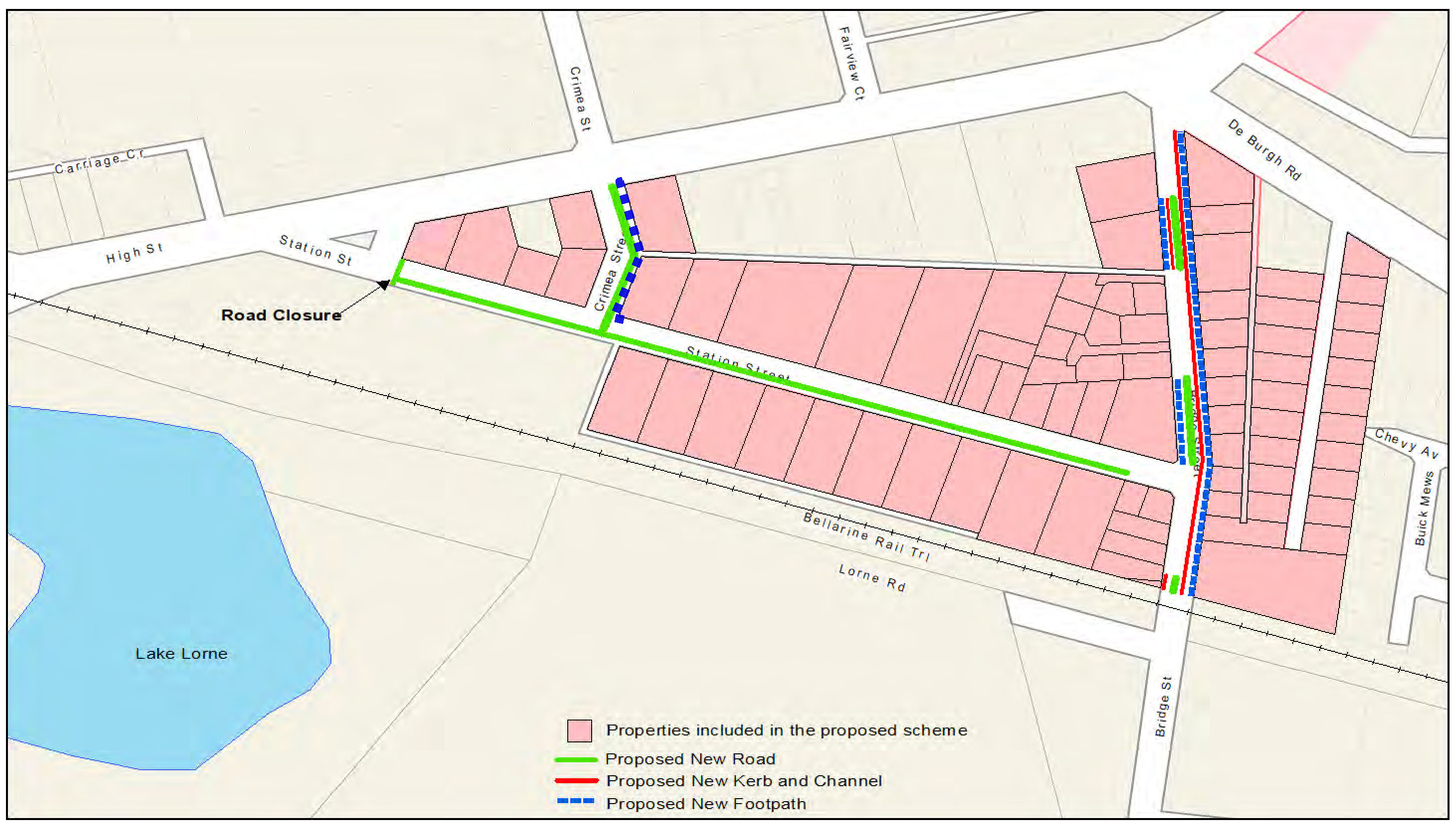
Station Street, Crimea Street and Bridge Street, Drysdale
Stage |
Status |
Description |
Date |
|---|---|---|---|
Approval to prepare scheme |
✓ |
Decision made to prepare scheme following consideration of surveys of property owners and feedback from the community. Council may then place the project in the budget system or proceed immediately to prepare a scheme. Scheme preparation involves survey, design and preparation of an apportionment of costs. |
January 2015 |
Intention to Declare Scheme |
✓ |
Report to Council providing information on scheme including advice of impending advertising of scheme and declaration of charge. Seeks Council approval by resolution to proceed with process. |
26 July 2016 |
Advertisement |
✓ |
The scheme is advertised in the local newspaper and all allotted property owners are notified by mail. This advertisement indicates Council’s intention and notification to ‘declare’ a scheme in a month’s time. |
6 August 2016 |
Submissions |
✓ |
From the time of advertising property owners have 28 days (as set down by the Local Government Act) to lodge submissions, either in support or opposition to the scheme. |
5 September 2016 |
Submissions Review Panel Hearing |
✓ |
A Submissions Review Panel is convened and meets to consider submissions. Some submissions are written only, and other submitters may wish to be heard before the Panel. The Panel makes a recommendation to Council regarding the scheme. |
8 November 2016 |
Declaration Report |
✓ |
Any time 28 days after advertising the scheme and after the Submissions Review Panel has met and considered submissions, Council considers a report and may proceed to “declare” the charges in accordance with its advertised intent. Subsequent to this the Finance Manager issues the levy notices and there is a formal charge placed on the property. This is the final step in the process for Council to make a decision on the scheme. |
28 February 2017 |
Appeal |
✓ |
Property owners may lodge an application for review with the Victorian Civil and Administrative Tribunal (VCAT) within one month of issue of the levy notice. An appeal is listed, heard and determined by the Tribunal and this process generally takes three to four months. Decisions made by VCAT are binding on all parties. |
9 November 2017 |
Construction |
✓ |
Council may then proceed to construct the works. Invoices are issued seeking payment of the estimated cost within one month of commencement. |
Commenced 12 June 2018. Completed 13 September 2018. |
Final Cost Report |
✓ |
At the completion of the works the scheme is “finalised” considering actual costs incurred and payments are adjusted accordingly. |
For endorsement |
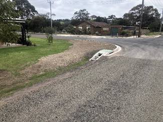
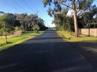
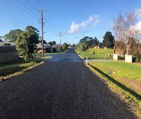
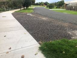
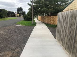
Design Changes: |
Additional Costs |
Responsibility |
|---|---|---|
Existing pavement was not able to be used due to limited depth and poor quality. Additional costs to excavate 150mm depth over entire site and provide backfill of class 3 Fine Crushed Rock (FCR). |
$55,364.00 |
Council |
VicRoads required upgrade of pavement at intersection of Crimea St with High St. This included 100mm extra pavement and 40mm asphalt surface. (asphalt cost included in item 4 below). |
$1,876.24 |
Council |
Total A |
$57,240.24 |
|
Excluded from scheme: |
Additional Costs |
Responsibility |
Excavation costs for table drain formation |
$35,932.90 |
Council |
Drainage works other than pipe crossings for driveways |
$10,866.00 |
Council |
Nature strip topsoiling and seeding |
$48,535.00 |
Council |
Placement of engineering fill |
$10,251.00 |
Council |
Bollards |
$4,820.00 |
Council |
Fencing |
$5,059.80 |
Council |
Double instead of single Primerseal-minimal cost. Tender amount was $3988 more but deduction due to asphalt work of $7502. |
-$3,514.14 |
Council |
Total B |
$111,950.56 |
|
Variations identified during works: |
Additional Costs |
Responsibility |
Remove & dispose of Asbestos Cement pipes |
$3,277.00 |
Council |
Asphalting Station/Crimea intersection rather than seal |
$25,265.00 |
Council |
Additional drainage at Station/Crimea |
$13,318.00 |
Council |
Additional concrete laybacks and crossovers |
$5,570.00 |
Council |
Additional gravel driveways |
$3,253.00 |
Council |
Extension of house drains to new table drain |
$7,840.00 |
Scheme |
Alteration to water and gas services |
$12,250.00 |
Council |
Inadequate allowance for traffic control |
$42,516.75 |
Scheme |
Inadequate allowance for Rural type vehicle crossing |
$81,065.00 |
Scheme |
Inadequate allowance for Set Out |
$11,432.87 |
Scheme |
Balance of remaining contract prices compared to scheme estimate |
$187.03 |
Scheme |
Additional Design Costs |
$20,936.55 |
Council |
Total C |
$226,911.20 |
|
Total of all additional works (A+B+C): |
$408,279.00 |
|
Source: |
City Services – Engineering Services |
Director: |
Guy Wilson-Browne |
To finalise the Special Charge Scheme for footpath construction in Montpellier Drive and Reigate Road, Highton.
This project involved footpath construction in Montpellier Drive and Reigate Road, Highton to link with footpaths in Lansbury Crescent to the north, Cheam Walk and Lambhill Crescent to the west and Mount Pleasant Road to the south, for an improved pedestrian network around Montpellier Primary School (plan – Attachment 3).
Development of a Special Charge Scheme was considered as early as 2005.
The affected property owners were advised of the current scheme proposal in June 2015. From surveys provided to property owners, out of the 20 properties affected by the scheme 12 property owners responded.
The results included two yes votes for the proposed footpath and 10 no votes.
Council resolved its Intention to Declare the Scheme on 27 January 2016, with four submissions received. At a Submissions Panel Hearing of 7 September 2016, the advice from the panel was to proceed to declaration. The Special Charge Scheme was declared by Council at its meeting of 13 December 2016.
The works have been completed (refer to Attachment 5) with the total of Special Charge Scheme works being $130,824 made up of:
$41,863.68 from property owner scheme contributions; and
$88,960.32 scheme funded by Council.
Additional related works of $82,871 were funded by Council.
Construction of the 1.5-metre-wide footpath (440 metres) improves pedestrian safety and connectivity near Montpellier Primary School.
There are no Council owned properties in the scheme.
The Special Charge Scheme can now be finalised based on the recommended cost as shown in Schedule A – Attachment 2.
Councillor Nelson moved, Councillor Harwood seconded -
That Council:
Endorse the Special Charge Scheme final costs and amendments to the special charges on properties as shown in Schedule A – Attachment 2; and
Instruct the Chief Executive Officer to adjust the special charge and notify the property owners as required by Section 166 of the Local Government Act 1989 as shown in Schedule A – Attachment 2.
Carried.
The project is a one-off capital cost and there will be ongoing maintenance costs.
The project has been funded under the Footpath Construction program (C02303).
The final design and construction costs are summarised below:
|
Estimate |
Actual |
Change |
% Change |
Scheme cost to property owners |
$41,864 |
$41,864 |
$0 |
0% |
Scheme cost to Council |
$88,960 |
$88,960 |
$0 |
0% |
Total Scheme |
$130,824 |
$130,824 |
$0 |
0% |
The recommended final special charges have been prepared as shown in Attachment 2
Property owners can nominate a payment plan and may access our hardship policy if applicable. Further details on the payment plan and how to access the hardship policy were outlined in the levy notice sent to all affected property owners.
Community consultation for the current footpath construction Special Charge Scheme has been carried out as follows:
30 June 2015 – Initiation letter including a concept plan, cost estimate, apportionment of charges, Special Rates and Charges brochure and survey to property owners;
29 January 2016 – Letter to owners advising of Council’s Intention to declare the scheme and invitation to make a submission;
17 May 2016 – Update letter to owners advising of the upcoming panel hearing and process;
7 September 2016 – Panel Hearing. Three property owners presented to the panel in support of their submissions;
5 October 2016 – Letter to owners advising of the results of the panel hearing and decision to proceed to declaration. Some phone calls were received in response to the correspondence;
The Special Charge Scheme was declared by Council at its meeting of 13 December 2016; and
A levy notice was issued to property owners on 15 December 2016.
The provision of properly sealed and drained roads and footpaths provides improved amenity, connectivity and safety for pedestrians.
The scheme has been prepared in accordance with the Special Rate and Charge provisions of the Local Government Act 1989 with the 2004 ministerial guidelines and Council’s Special Rates and Charges Policy. The process chart for Special Rate Schemes is shown in Attachment 4.
This report aligns with the Council Plan as follows:
Integrated Transport Connections and key priority to improve our road management and engagement program; and
Implement a Council program of infrastructure upgrades including streets, roads and drains.
Other connections to the Council Plan include:
An investment into sustainable infrastructure, reducing operation and maintenance liability; and
Encourages use of active transport, such as walking due to the footpath
In preparing this report, no Council officer has any general or material interest in the properties affected by the scheme.
Provision of a sealed footpath will provide safer walking conditions for pedestrians by minimising the risk of personal injuries through conflict with vehicles and the elimination of uneven and slippery surfaces.
During construction, the manufacture and procurement of materials, energy is used resulting in some greenhouse gas emissions. This stopped when construction was completed.
The project did not create waste with the exception of some excavated material.
The proposal did not affect any natural habitats.
The proposal required some nature strip and property trees and shrubs to be trimmed. Two small nature strip trees were removed. A specialised porous pavement was used around the root zones of some of the more established trees within the nature strip. This will protect and preserve the tree roots.
Property Key |
ADDRESS |
ESTIMATED COST |
ACTUAL COST |
|---|---|---|---|
233261 |
2 Montpellier Drive, HIGHTON VIC 3216 |
$2,049.60 |
$2,049.60 |
233263 |
4 Montpellier Drive, HIGHTON VIC 3216 |
$1,927.22 |
$1,927.22 |
233265 |
6 Montpellier Drive, HIGHTON VIC 3216 |
$1,989.99 |
$1,989.99 |
233267 |
8 Montpellier Drive, HIGHTON VIC 3216 |
$2,187.13 |
$2,187.13 |
233269 |
10 Montpellier Drive, HIGHTON VIC 3216 |
$1,691.58 |
$1,691.58 |
233271 |
12 Montpellier Drive, HIGHTON VIC 3216 |
$1,641.24 |
$1,641.24 |
233273 |
14 Montpellier Drive, HIGHTON VIC 3216 |
$2,320.24 |
$2,320.24 |
233275 |
16 Montpellier Drive, HIGHTON VIC 3216 |
$2,033.27 |
$2,033.27 |
233277 |
18 Montpellier Drive, HIGHTON VIC 3216 |
$2,368.92 |
$2,368.92 |
233278 |
20 Montpellier Drive, HIGHTON VIC 3216 |
$1,532.15 |
$1,532.15 |
233280 |
22 Montpellier Drive, HIGHTON VIC 3216 |
$1,761.51 |
$1,761.51 |
233282 |
24 Montpellier Drive, HIGHTON VIC 3216 |
$2,346.89 |
$2,346.89 |
233283 |
25 Montpellier Drive, HIGHTON VIC 3216 |
$2,505.71 |
$2,505.71 |
233284 |
26 Montpellier Drive, HIGHTON VIC 3216 |
$2,147.13 |
$2,147.13 |
233285 |
27 Montpellier Drive, HIGHTON VIC 3216 |
$2,254.72 |
$2,254.72 |
338914 |
28 Montpellier Drive, HIGHTON VIC 3216 |
$1,808.62 |
$1,808.62 |
233287 |
29 Montpellier Drive, HIGHTON VIC 3216 |
$1,492.24 |
$1,492.24 |
233881 |
262 Mt Pleasant Road, HIGHTON VIC 3216 |
$2,594.43 |
$2,594.43 |
236566 |
44 Reigate Road, HIGHTON VIC 3216 |
$2,664.09 |
$2,664.09 |
236568 |
46 Reigate Road, HIGHTON VIC 3216 |
$2,546.99 |
$2,546.99 |
|
Totals |
$41,863.67 |
$41,863.67 |
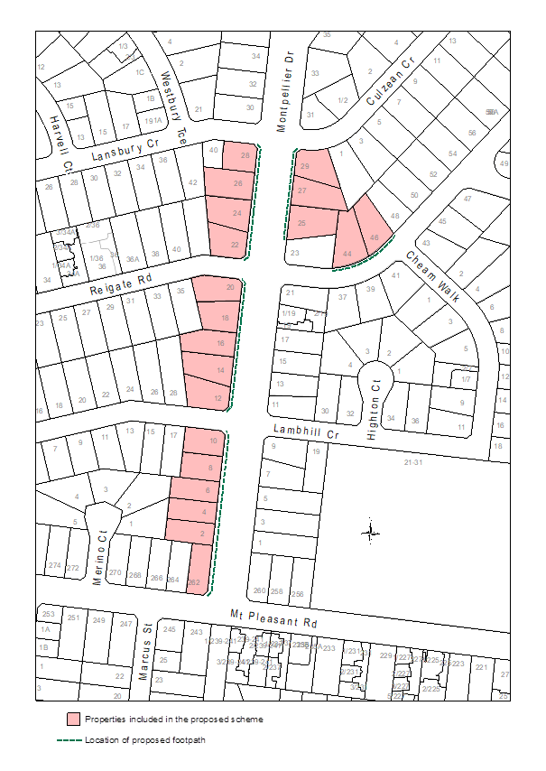
Stage |
Status |
Description |
Date |
|---|---|---|---|
Approval to prepare scheme |
✓ |
Decision made to prepare scheme following consideration of surveys of residents and feedback from the community via informal survey. Council may then place the project in the budget system or proceed immediately to prepare a scheme. Scheme preparation involves survey, design and preparation of an apportionment of costs. |
June 2015 |
Intention to Declare Scheme |
✓ |
Report to Council providing information on scheme including advice of impending advertising of scheme and declaration of charge. Seeks Council approval by resolution to proceed with process. |
27 January 2016 |
Advertisement |
✓ |
The scheme is advertised in the local newspaper and all allotted property owners are notified by mail. This advertisement indicates Council’s intention and notification to ‘declare’ a scheme in a month’s time. |
6 February 2016 |
Submissions |
✓ |
From the time of advertising property owners have 28 days (as set down by the Local Government Act) to lodge submissions, either in support or opposition to the scheme. |
Closed 7 March 2016 |
Submissions Review Panel Hearing |
✓ |
A Submissions Review Panel is convened (quorum of three Councillors) and meets to consider submissions. Some submissions are written only, and other submitters may wish to be heard before the Panel. The Panel makes a recommendation to Council regarding the scheme. |
7 September 2016 |
Declaration Report |
✓ |
Any time 28 days after advertising the scheme and after the Submissions Review Panel has met and considered submissions, Council considers a report and may proceed to “declare” the charges in accordance with its advertised intent. Subsequent to this the Finance Manager issues the levy notices and there is a formal charge placed on the property. This is the final step in the process for Council to make a decision on the scheme. |
Declared 13 December 2016 Levy notice sent 15 December 2016. |
Appeal |
N/A |
Property owners may lodge an application for review with the Victorian Civil and Administrative Tribunal (VCAT) within one month of issue of the levy notice. An appeal is listed, heard and determined by the Tribunal and this process generally takes three to four months. Decisions made by VCAT are binding on all parties. |
Closed 15 January 2017 |
Construction |
✓ |
Council may then proceed to construct the works. Invoices are issued seeking payment of the estimated cost within one month of commencement. |
Construction was completed in February 2018 |
Final Cost Report |
✓ |
At the completion of the works the scheme is “finalised” taking into account actual costs incurred and payments are adjusted accordingly. |
|
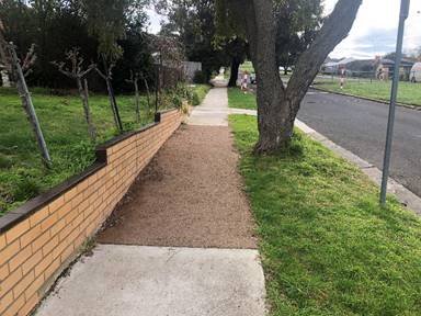
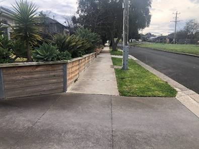
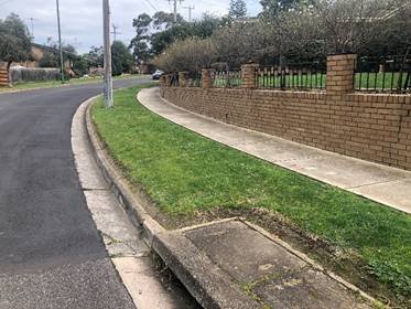
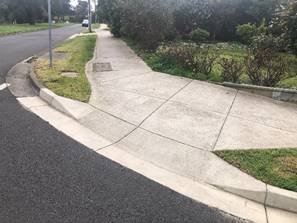
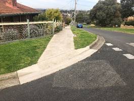
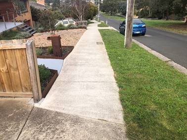
Source: |
City Services – Engineering Services |
Director: |
Guy Wilson-Browne |
To finalise the Special Charge Scheme for the construction of three road segments along Barwarre Road (east side) between Marshalltown Road and Reserve Road, Marshall.
This project involved the road construction in Barwarre Road, Marshall (see plan – Attachment 3) of three under-developed sections and included road widening, kerb and channel, underground drainage and footpath works.
Barwarre Road between Marshalltown Road and Reserve Road has experienced ad-hoc development over time. In the three under-developed sections, the road edges remained unconstructed with no footpath between 129 - 137 Barwarre Road.
The works were facilitated via a Special Charge Scheme which was declared by Council at its meeting on 20 September 2017:
There are six residential properties abutting the proposed works that were determined to receive special benefit.
There are no City owned properties in the scheme.
The total estimated scheme cost was $344,758 made up of $82,197 from property owners and $262,561 funded by the City.
No submissions were received during the scheme submissions period.
Completed construction (Attachment 5) represents a total of Special Charge Scheme works of $563,089 made up of $89,595 from property owner contributions and $473,494 funded by the City. The cost increases are outlined in Attachment 6.
While the total scheme cost has increased by around 63%, the total property owner charges are proposed to be capped at $89,595 representing a 9% increase from the declared charge of $82,197 permitted under the Local Government Act (Sec 166) without the need to formally vary the scheme.
Construction consisted of three) sub-projects components
Sub-project 1 is adjacent to three properties between 129 and 137 Barwarre Road. The works included road widening, kerb and channel and a new footpath section.
Sub-project 2 is adjacent to two properties between 181 and 185 Barwarre Road. The works consisted of road widening and kerb and channel.
Sub-project 3 is adjacent to one property at 193-197 Barwarre Road and also included road widening and kerb and channel.
The Special Charge Scheme can now be finalised based on the recommended cost as shown in Schedule A – Attachment 2.
Councillor Harwood moved, Councillor Moloney seconded -
That Council:
Endorse the Special Charge Scheme final costs and amendments to the special charges on properties as shown in Schedule A – Attachment 2; and
Instruct the Chief Executive Officer to adjust the special charge and notify the property owners as required by Section 166 of the Local Government Act 1989 as shown in Schedule A – Attachment 2.
Carried.
The project is a one-off capital cost and there will be ongoing maintenance costs.
The project has been funded under the Road Construction Program (C02301).
The final design and construction costs are summarised below:
|
Estimate |
Actual |
Change |
% Change |
|---|---|---|---|---|
Estimated scheme cost to property owners Sub-project 1 - $49,021 Sub-project 2 - $22,844 Sub-project 3 - $10,332 |
$82,197 |
$89,595 |
$7,398 |
9% increase |
Estimated scheme cost to Council Sub-project 1 – $142,762 Sub-project 2 – $57,557 Sub-project 3 - $62,242 |
$262,561 |
$473,494 |
$210,933 |
80% increase |
Scheme Total |
$344,758 |
$563,089 |
$218,331 |
63% Increase |
The cost increases were due to actual costs being higher than estimated for the Pebble Lite paving and road pavement items. A detailed breakdown of these costs is included in Attachment 6.
Amending the scheme to include the full cost increase (63%) to the property owners would require a formal scheme variation, whereas an increase less than 10% without a formal scheme variation is permitted under the Local Government Act sec 166(3), which stipulates that:
"A Council must ensure that those persons who are liable to pay a special rate or special charge which is varied are notified if it is varied. If a variation of a special rate or special charge will result in—
persons being required to pay a special rate or special charge who were not previously required to do so; or
an increase equal to or greater than 10% in the amount of the special rate or special charge payable by a person”
The actual increase in the scheme cost is $218,331 and the revised Scheme cost to the property owners is shown in the table above and reflects a 9% increase in the liability of the property owners under the Act.
The recommended final special charges consistent with the 9% increase to property owners have been prepared as shown in Attachment 2.
Property owners can nominate a payment plan and may access the City’s hardship policy if applicable. Further details on the payment plan and how to access the hardship policy were outlined in the Levy notice sent to all affected property owners.
Consultation with the affected property owners has taken place as follows:
2013/14 – Mail out and community meeting held at the Grovedale Community Centre regarding the proposed ‘up front’ agreement. Majority agreement was assessed at this time.
March 2017 – an update letter was mailed advising of the change to a Special Charge Scheme. This letter included advice on the revised scheme charges.
27 June 2017 – Council gave notice of its Intention to Declare a Scheme.
3 July 2017 – Letter advising of Council’s Intention to Declare a Scheme and invitations to make a submission.
8 July 2017 – Public notice in the local newspaper.
11 July 2017 – A copy of the public notice was mailed out to property owners.
20 September 2017 – Scheme was Declared by Council.
25 September 2017 - a levy notice was issued to property owners
The provision of road segments is aligned to Council’s City Plan as described above and provides improved connectivity and safety for pedestrians.
The scheme has been prepared in accordance with the Special Rate and Charge provisions of the Local Government Act 1989 along with the 2004 ministerial guidelines and Council’s Special Rates and Charges Policy. The process chart for Special Rate Schemes is shown in Attachment 4.
This report aligns with the Council Plan objective of Integrated Transport Connections and key priorities to improve our road management and engagement program through implementing a program of infrastructure upgrades including streets, roads and drains.
Other connections to the Council Plan include:
Investment into sustainable infrastructure, reducing operation and maintenance liability.
Encourages use of active transport, such as walking due to the footpath construction creating a safer public space.
No Council Officer involved with this process has any general or material interest in the properties.
Provision of sealed roads will provide safer driving conditions for motorists and cyclists with a defined and widened road profile.
Walking conditions for pedestrians will also be enhanced by minimising the risk of personal injuries through conflict with vehicles.
The improved drainage will reduce the hazards associated with water over roads and the effects of nuisance flooding to property.
Minimal vegetation removal was required to complete the project. The design took existing vegetation into consideration.
During construction and the manufacture and procurement of materials, there was expenditure of energy sources and greenhouse gas emissions. This ceased when construction was completed.
The project did not create waste except for some excess spoil. The construction did not affect any natural habitats.
Storm water runoff will be less contaminated with silt prior to discharge as the bulk of the storm water will be cleaner coming off a sealed environment.
Property Key |
ADDRESS |
ESTIMATED COST |
ACTUAL COST |
|---|---|---|---|
340265 |
129-131 Barwarre Road, MARSHALL VIC 3216 |
$12,015.32 |
$13,096.70 |
220760 |
135 Barwarre Road, MARSHALL VIC 3216 |
$16,660.03 |
$18,159.43 |
220759 |
137 Barwarre Road, MARSHALL VIC 3216 |
$20,345.61 |
$22,176.71 |
220754 |
181-183 Barwarre Road, MARSHALL VIC 3216 |
$13,286.18 |
$14,481.94 |
220756 |
185 Barwarre Road, MARSHALL VIC 3216 |
$9,557.65 |
$10,417.84 |
312728 |
193-197 Barwarre Road, MARSHALL VIC 3216 |
$10,332.04 |
$11,261.92 |
TOTALS |
$82,196.83 |
$89,594.54 |
|
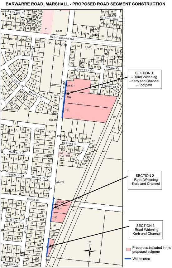
BARWARRE ROAD, GROVEDALE
Stage |
Status |
Description |
Date |
|---|---|---|---|
Approval to prepare scheme |
✓ |
Decision made to prepare scheme following consideration of surveys of residents and feedback from the community via informal survey. Council may then place the project in the budget system or proceed immediately to prepare a scheme. Scheme preparation involves survey, design and preparation of an apportionment of costs. |
April 2015 |
Intention to Declare Scheme |
✓ |
Report to Council providing information on scheme including advice of impending advertising of scheme and declaration of charge. Seeks Council approval by resolution to proceed with process. |
27 June 2017 |
Advertisement |
✓ |
The scheme is advertised in the local newspaper and all allotted property owners are notified by mail. This advertisement indicates Council’s intention and notification to ‘declare’ a scheme in a month’s time. |
8 July 2017 |
Submissions |
✓ |
From the time of advertising property owners have 28 days (as set down by the Local Government Act) to lodge submissions, either in support or opposition to the scheme. |
No submissions |
Submissions Review Panel Hearing |
✓ |
A Submissions Review Panel is convened (quorum of three Councillors) and meets to consider submissions. Some submissions are written only, and other submitters may wish to be heard before the Panel. The Panel makes a recommendation to Council regarding the scheme. |
Not required |
Declaration Report |
✓ |
Any time 28 days after advertising the scheme and after the Submissions Review Panel has met and considered submissions, Council considers a report and may proceed to “declare” the charges in accordance with its advertised intent. Subsequent to this the Finance Manager issues the levy notices and there is a formal charge placed on the property. This is the final step in the process for Council to make a decision on the scheme. |
Declared 20 September 2017 Levy notice sent 25 September 2017 |
Appeal |
N/A |
Property owners may lodge an application for review with the Victorian Civil and Administrative Tribunal (VCAT) within one month of issue of the levy notice. An appeal is listed, heard and determined by the Tribunal and this process generally takes three to four months. Decisions made by VCAT are binding on all parties. |
Closed 25 October 2017 |
Construction |
✓ |
Council may then proceed to construct the works. Invoices are issued seeking payment of the estimated cost within one month of commencement. |
Commenced 7 November 2018 Completed 2 April 2019 |
Final Cost Report |
✓ |
At the completion of the works the scheme is “finalised” taking into account actual costs incurred and payments are adjusted accordingly. |
|
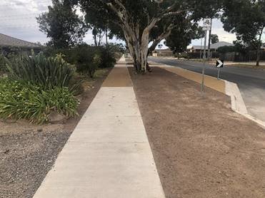
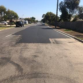
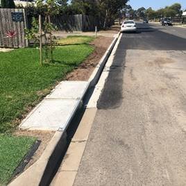
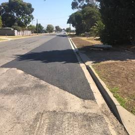
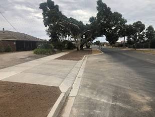
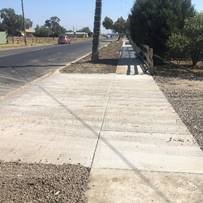
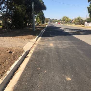
Reasons for Additional Costs |
Scheme |
Actual |
Change |
Responsible |
|---|---|---|---|---|
129-137 BARWARRE ROAD |
||||
Traffic Management under-estimated |
$4,400 |
$24,582 |
-$20,182 |
Scheme |
Pebble Lite paving more expensive than estimate |
$23,716 |
$109,040 |
-$85,324 |
Scheme |
Repair to existing road - CoGG responsibility |
$0 |
$9,340 |
-$9,340 |
Scheme |
Sewer manhole adjustments for footpath |
$0 |
$9,411 |
-$9,411 |
Scheme |
Linemarking |
$0 |
$2,286 |
-$2,286 |
Scheme |
Extra cost for making driveway stronger at #131-133 |
$0 |
$2,679 |
-$2,679 |
Scheme |
Remaining costs |
$147,685 |
$157,691 |
-$10,006 |
Scheme |
Design |
$7,991 |
$7,902 |
$89 |
Scheme |
Project Admin |
$7,991 |
$0 |
$7,991 |
Scheme |
TOTAL A |
$191,783 |
$322,931 |
-$131,148 |
|
181-185 BARWARRE ROAD |
||||
Traffic Management under-estimated |
$4,400 |
$13,360 |
-$8,960 |
Scheme |
Linemarking |
$0 |
$1,345 |
-$1,345 |
Scheme |
Tree Replacement |
$0 |
$1,760 |
-$1,760 |
Scheme |
Road Pavement |
$34,727 |
$56,862 |
-$22,135 |
Scheme |
Crushed Rock driveways |
$0 |
$6,235 |
-$6,235 |
Scheme |
Pit works |
$0 |
$1,522 |
-$1,522 |
Scheme |
Sub-soil drainage |
$0 |
$4,964 |
-$4,964 |
Scheme |
Remaining Works |
$34,574 |
$32,986 |
$1,588 |
Scheme |
Design |
$3,350 |
$2,742 |
$608 |
Scheme |
Project Admin |
$3,350 |
$0 |
$3,350 |
Scheme |
TOTAL B |
$80,401 |
$121,776 |
-$41,375 |
|
193-197 BARWARRE ROAD |
||||
Traffic Management under-estimated |
$4,400 |
$13,360 |
-$8,960 |
Scheme |
Linemarking |
$0 |
$1,144 |
-$1,144 |
Scheme |
Road Pavement |
$27,624 |
$47,736 |
-$20,112 |
Scheme |
Crushed Rock driveways |
$0 |
$4,097 |
-$4,097 |
Scheme |
Drainage incl sub-soil drainage |
$2,310 |
$10,173 |
-$7,863 |
Scheme |
Remaining Works |
$32,192 |
$40,023 |
-$7,831 |
Scheme |
Design |
$3,024 |
$1,849 |
$1,175 |
Scheme |
Project Admin |
$3,024 |
$0 |
$3,024 |
Scheme |
TOTAL C |
$72,574 |
$118,382 |
-$45,808 |
|
TOTAL of all works (A+B+C) |
$344,758 |
$563,089 |
-$218,331 |
|
Source: |
City Services – Engineering Services |
Director: |
Guy Wilson-Browne |
To revoke Council’s designation of 12 December 2006 of flood affected land at Armstrong Mt Duneed, Stage 47A and Stage 65A as liable to flooding pursuant to regulation 153 of the Building Regulations 2018.
Council has a statutory obligation under the Building Regulations 2018 to designate land as liable to flooding where it reasonably knows it to be prone to flooding. Conversely, there is an obligation to remove the encumbrance of designation from land that is no longer considered to be flood-prone.
The current designated flood mapping (Attachment 2) was designated by Council at its meeting of 12 December 2006.
This revocation will result in another two stages of new lots in Armstrong Mt Duneed Estate, one fronting 80 Penedrel Drive and the other fronting 110A Boundary Road, Mount Duneed being free of their flood prone status, paving the way for homes to be built on this land.
The flood mapping is subject to a revision due to the subdivision and development at 80 Penedrel Drive, Mount Duneed and 110A Boundary Road, Mount Duneed. Prior to subdivision the parent lots were considered liable to flooding. These development sites, which are also known as Armstrong Mt Duneed, Stage 47A & Stage 65A achieves flood immunity for newly created lots for flood events up to and including the 100 year Average Recurrence Interval (ARI) event due to the completion of approved internal works.
The recommendation by Council engineers that the flood prone status can be removed includes assessment of internal drainage, road construction and earthworks to contain potential floodwaters from the 100 year ARI event within road and drainage reserves (Attachment 3).
It should be noted that designation is separate to the creation of flood overlays within the Planning Scheme, which generally follows designation. In the case of this development, the planning scheme amendment to create post-development flood zones or overlays is proposed after the design of the proposed precincts.
Councillor Moloney moved, Councillor Nelson seconded -
That Council revoke the Council designation of 12 December 2006 of flood affected land at Armstrong Mt Duneed, Stage 47A & Stage 65A as liable to flooding pursuant to regulation 153 of the Building Regulations 2018.
Carried.
There are no financial implications arising from the subject of this report.
A revocation of designation does not warrant public consultation as it constitutes the removal of an encumbrance on land.
Relevant City databases and flood maps will be revised and updates sent to the Corangamite Catchment Management Authority and Building Control Commission.
Council have a responsibility to the community to provide the best possible information on areas that are flood prone. The removal of flood prone designation allows owners to build on their land without a special permit from the City, and without raising the floor level of their home. It also reduces the cost of property insurance.
The City has various statutory responsibilities for drainage management and flood management (prevention, response and recovery) as set out in the Local Government Act 1989, Local Government Regulations 1990, Planning and Environment Act 1987, Building Regulations 2018, Water Act 1989, Subdivision Act 1988 and Emergency Management Act 1986.
The works have resulted in the lots being protected from flooding during a major storm event that has a one per cent probability of occurring in any one year, and occurs on average once in 100 years. This is the required standard for new subdivisions.
The recommendations of this report are consistent with the Council Plan, in relation to planned sustainable development.
No City officers or contractors who have provided advice in relation to this report have declared a conflict of interest regarding the matter under consideration.
Council has some risk exposure with any failure to disclose the flood-prone status of a property in a Land Information Certificate.
The revocation of the designation is the final step in minimising Council’s risk.
The revocation of flood-prone areas designation and designation of revised flood data through the design of this stage is considered unlikely to result in any known adverse environmental impacts.
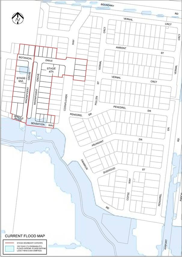
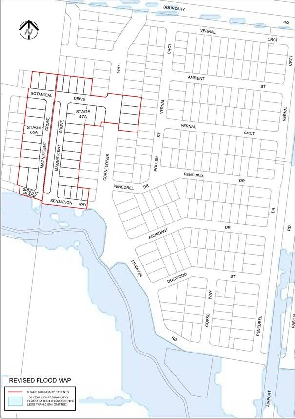
Contents | Previous Page: Section A - Procedural Matters | Next Page: Section C - Notice of Motion
