
Council Minutes - Section B: Reports - 27 April 2021
Contents | Previous Page: Section A - Procedural Matters | Next Page: Section C - Record of informal meetings of councillors
Contents | Previous Page: Section A - Procedural Matters | Next Page: Section C - Record of informal meetings of councillors
Reports tabled at the Ordinary Meeting of Council on Tuesday date held at the Highton Bowls Club, corner Roslyn and North Valley Roads, Highton.
Endorse for Exhibition Draft Our Community Plan 2021-2025 and Proposed 2021-2022 Budget
Social Housing Plan - Governance Model of an Affordable Housing Trust
Consideration Submissions and Adoption of Amendment C409GCEE - Planning Scheme Anomalies
Tender T2100013 - Building Better Bike Connections Project - Southern Corridor - Stage 1
Proposed Lease of 2-240 Pioneer Road, Grovedale (Leisurelink Kiosk)
Powercor Lease - Substation Site - 137-149 Mercer Street, Geelong
Proposed Sale or Lease 151 Mercer Street, Geelong - Civic Precinct
Proposed Road Discontinuance and Sale - Laneway Abutting 4 Cleveland Court, Corio
Anchoridge Estate, Stages 8A and 0 - Revocation nof Flood Prone Area Designation of New Lots
Warralilly Grange Stage 21 - Revoction of Flood prone Area Designation of New Lots
Geelong Arena Confidential
Audit and Risk Committee Summary Report Confidential
Audit and Risk Committee Activity Report - 1 September 2020 to 3 March 2021 Confidential
Local Government Renewable Energy Power Purchase Agreement Confidential
CouncillorKontelj declared a Conflict of Interest in Agenda Item 1, Council Submission to the Surf Coast Distinctive Area and Landscape – Phase 3 Public Consultation, in that an interested party is a customer of the business of which he is a Director. Councillor Kontelj left the meeting room prior to discussion at 6:47pm.
Source: |
Customer & Corporate Services – Financial Services |
Director: |
Michael Dugina |
To endorse the Draft Our Community Plan 2021-2025 (Plan) and Proposed 2021-2022 Budget and release both documents for a 28-day public submission period.
Under section 90 of the Local Government Act 2020 (Act), Council must prepare and adopt a Council Plan by 31 October 2021. The Council Plan identifies the objectives and priorities of Council during its four-year term. The Plan has been in development since the return of Council in November 2020. It is the culmination of extensive consultation with Councillors, the City and the community.
The Plan includes the following:
The four strategic directions of the Council;
Four-year priorities for achieving the strategic directions;
Strategies for achieving the priorities for a period of at least the next 4 financial years;
Indicators for monitoring the achievements of the priorities; and
Any other matters prescribed by the regulations.
The Draft Our Community Plan combines the Council Plan and the Municipal Public Health & Wellbeing Plan for the next four years.
Section 27 of the Public Health and Wellbeing Act 2008 provides Council with the option to seek an exemption from producing a municipal public health and wellbeing plan by including public health and wellbeing matters in the Draft Our Community Plan 2021-2025.
An integrated plan is important to Council as the health and wellbeing of our community is central to everything we do – whether it’s supporting economic growth in our region, creating new opportunities for social connection or putting in place safeguards to encourage sustainable development.
In accordance with section 94 of the Act, Council is required to prepare a budget for each financial year and must ensure that it contains all required statements, reports and data as prescribed by the Act. These requirements are provided in Attachment 4.
The Draft Our Community Plan 2021-2025:
Is the key strategic document for Councillors and the City;
Contains four strategic directions, each with four-year priorities and indicators. Note that it does not capture normal service delivery functions;
Incorporates the key health and wellbeing priorities of Councillors, the City and the community;
Has overarching themes of sustainability, equity and community engagement; and
Is supported by the region’s long-term vision Greater Geelong: A Clever and Creative Future.
As part of the process to integrate the Council Plan with the Municipal Public Health & Wellbeing Plan, councils considering integration must apply to the Secretary for an 'exemption from producing a stand-alone Municipal Public Health & Wellbeing Plan’, by submitting a draft of the integrated Council Plan which addresses the required aspects of the Public Health and Wellbeing Act 2008.
The Draft Our Community Plan 2021-2025 was formally submitted for exemption to the Department of Families, Fairness and Housing on 9 April 2021.
The elements of the proposed 2021-2022 Budget are contained in Attachment 4. Key outcomes are:
An overall comprehensive result of $124.3 million surplus driven on the back of large developer contributions and gifted assets;
The underlying operating result is a deficit of $7.9 million. The City continues to recover from the COVID-19 pandemic with several services yet to reach normal revenue or utilisation levels. Despite this the City has planned to maintain services levels;
The City is expecting, post 2021-2022, that operating results will return to surplus as projections assume a return to non-COVID service levels;
In the 2021-2022 financial year the City will deliver over $196 million of capital works. Over the next four financial years the City will continue to deliver a significant capital works program budgeted at $687 million; and
There is an increased focus on asset renewal with additional funding invested over the four-year budget. Funding will be expensed in areas with the greatest need, based on recent asset condition assessments.
A full list of Fees and Charges is provided within the Proposed 2021-2022 Budget Report (Attachment 4).
Councillor Grzybek moved, Councillor Sullivan seconded -
That Council:
Note that pursuant to Section 90 of the Local Government Act 2020 Council:
Must prepare and adopt a Council Plan (known as Our Community Plan – Attachment 3) for a period of at least the next 4 financial years after a general election in accordance with its deliberative engagement practices; and
Note the four strategic directions of the Council.
Endorse for exhibition the draft Our Community Plan 2021-2025 by publishing a notice in the Geelong Advertiser on Wednesday 28 April 2021, make copies available on the City of Greater Geelong website or on request and invite submissions from the public via the Have Your Say engagement page on Council’s website or in written format only, with the submission period closing at 5pm on Tuesday 25 May 2021;
Appoint a Submissions Review Panel (Panel) to:
City of Greater Geelong Have Your Say engagement page and hear any person who wishes to address the panel in support of a submission on the proposed Our Community Plan 2021-2025 at a meeting on or after Wednesday 2 June 2021; and
Provide a report to Council on its proceedings, including a summary of hearings including any recommendations.
Note that, after considering the report of the Submissions Review Panel, Council will consider adopting Our Community Plan 2021-2025 at a Council meeting in June 2021.
Carried.
Councillor Aitken moved, Councillor Sullivan seconded -
That Council:
Note that pursuant to Section 94 of the Local Government Act 2020 Council:
Must prepare and adopt a budget for each financial year and the subsequent 3 financial years by 30 June each year;
Receive and consider the Proposed 2021-2022 Budget (Attachment 4), which includes the annual budget and 3-year projections, Financial Statements and Statement of Human Resources;
Receive and consider the Rates, Waste Collection & Recycling Charge and other income (required to meet the appropriate financial requirements as proposed in the 2021-2022 Budget);
Receive and consider the proposed declaration of Rates and Charges (Attachment 5), for the purpose of:
public scrutiny and comment;
inclusion with the Rating Strategy 2021-2022 of rate waivers under section 171 of the Local Government Act 1989 as detailed therein; and
inclusion within the Rating Strategy 2021-2022 of rates rebates, under section 169 of the Local Government Act 1989 as detailed therein.
Receive and consider the full list of Fees and Charges provided with the Proposed Budget 2021-2022.
Endorse for exhibition the Proposed 2021-2022 Budget by publishing a notice in the Geelong Advertiser on Wednesday 28 April 2021, make copies available on the City of Greater Geelong website or on request and invite submissions from the public via the Have Your Say engagement page on Council’s website or in written format only, with the submission period closing at 5pm on Tuesday 25 May 2021;
Appoint a Submissions Review Panel (Panel) to:
Consider any written submissions or submissions received on The City of Greater Geelong Have Your Say engagement page and hear any person who wishes to address the panel in support of a submission on the proposed 2021-2022 Budget and Differential Rating, at a meeting on or after Wednesday 2 June 2021; and
Provide a report to Council on its proceedings, including a summary of hearings including any recommendations.
Note that, after considering the report of the Submissions Review Panel, Council will consider adopting the 2021-2022 Budget and declare the rates at a Council meeting in June 2021.
Carried.
The budget has been prepared in accordance with the direction provided by Council at a rate increase of 1.5% which is in line with the rate cap of 1.5%. Changes in rates, fees and charges have been structured to meet the financial requirements as proposed for the 2021-2022 year.
Expenditure includes the continuation of council services to the community.
The 2021-2022 budget achieves a comprehensive income result of $124.3 million including underlying deficit of ($7.9) million, recognition of infrastructure $80.0 million and capital grant income of $10.5 million.
The Draft Plan has been developed in accordance with Council’s deliberative engagement practices.
A public notice will be published in the Geelong Advertiser on Wednesday 28 April 2021, advising the proposed Our Community Plan 2021-2025 and 2021-2022 Budget will be available for public inspection and inviting submissions to be made in writing or on the Have Your Say engagement page on Council’s website.
Following the closing date for receipt of submissions on Tuesday 25 May 2021 at 5:00pm, it is proposed to convene a Submissions Panel hearing on Wednesday 2 June 2021 to review any submissions that have been received. A report will then be presented to Council with any recommended amendments to the proposed Our Community Plan 2021-2025 and 2021-2022 Budget.
Public notice of the adopted Our Community Plan 2021-2025, 2021-2022 Budget and declaration of rates and charges will be advertised following the Council meeting on 22 June 2021.
The proposed budget identifies the sources and allocation of resources to assist in the implementation of many social initiatives support the community.
The Draft Our Community Plan (incorporating the Municipal Public Health and Wellbeing Plan) and Proposed Budget have been developed with consideration of the adopted social equity principles. Actions and activities are informed by up to date demographics and data on priority groups for attention with a focus on addressing needs within these groups. Partnerships with key agencies and services have informed the planning and will continue to be fostered throughout the implementation period.
The annual budget is prepared to comply with the requirements of the Act and the Local Government (Planning and Reporting) Regulations 2020. The process also recognises the need to align the annual budget to the direction and allocation of resources identified in Our Community Plan 2021-2025.
The Draft Our Community Plan, which incorporates the Municipal Public Health and Wellbeing Plan is prepared in accordance with requirements under the Local Government Act 2020 and the Public Health and Wellbeing Act 2008.
Priority areas in the Victorian Public Health Plan 2019-2023 have been included within the Draft Our Community Plan and an exemption from the Department of Health and the Department of Families, Fairness and Housing has been sought to enable integration of these strategic documents.
This report identifies the activities council will undertake in 2021-2022 which are aligned to achieving the priorities in Our Community Plan 2021-2025.
An annual action plan will be developed outlining the key actions undertaken each year to deliver on the strategic four-year priorities, set out in the Our Community Plan 2021-2025. The progress of these actions will be reported on publicly each quarter.
No council officers involved in the preparation of this report have a general or material conflict of interest in any matter to which this report relates.
In accordance with the Local Government Act 2020 Council must adopt an annual budget each year.
The budget has been developed in accordance with a timetable to ensure sufficient time to achieve the adoption timeframe and to include community consultation, meetings of the executive and preparation of the proposed Our Community Plan 2021-2025 and 2021-2022 Budget. The timetable provides a framework to manage risk for Council to meet its statutory obligations and avoid adverse implications if the process is delayed.
The proposed budget identifies the sources and allocation of the resources to implement the many environmental initiatives that impact on the community as outlined in the Draft Our Community Plan 2021-2025.
The Draft Our Community Plan 2021-2025 and Proposed 2021-2022 Budget for the financial year commencing 1 July 2021 has been completed.
The Draft Our Community Plan 2021-2025 (Attachment 3) and Proposed 2021-2022 Budget (Attachment 4) have been prepared based on the best practice guidelines as developed by a local government industry taskforce and issued to all municipalities across Victoria. The proposed budget document has been developed under the following sections:
1. Link to Community Plan
2. Services and Service Performance indicators.
3. Financial Statements.
4. Notes to the Financial Statements.
5. Financial Performance indicators.
6. Appendices.
In accordance with the Act, the proposed 2021-2022 Budget also includes clear linkages to the Draft Our Community Plan 2021-2025 and its supporting key strategies and actions.
Specific inclusions in the proposed Budget are a summary by Community Plan Strategic Directions:
The activities and initiatives to be funded in the budget;
How the activities and initiatives will contribute to achieving the strategic priorities; and,
The measure of success in relation to each strategic priority.
In addition, a component of the proposed budget is the setting of rates and charges. The Minister for Local Government announced on 21 December 2020 that the 2021-2022 rate cap would be 1.5% for all Victorian councils. The Declaration of Rates and Charges for 2021-2022 is attached (Attachment 5).
The formal Revenue and Rating Plan document will be updated to reflect Council’s statements of policy, procedure, general information and historical trends.
Council has not declared any new special rate and charge schemes for 2021-2022. The Central Activities Area (CAA) rate is currently under review.
Revenue and Rating Plan
The Revenue and Rating Plan document will be updated to reflect the outcome of Council’s budget deliberations.
Rates and charges are the major source of council revenue accounting for 65% of the annual underlying recurrent income. An increase in rate income is required to meet the objectives of council aspirations and community expectations for an array of services and new infrastructure.
The Minister for Local Government announced on 21 December 2020 that the 2021-2022 rate cap would be 1.5% for all Victorian councils.
Not all council charges are included in the rate cap calculation.
Rates and any Municipal charge are included in the rate cap calculation.
The Waste charge and the Fire Services Property Levy are not included in the rate cap calculation.
The base average rate is calculated as $1,608.11 and the 2021-2022 Budget proposes this will increase by 1.5% to $1,632.19.
The rate cap calculation for 2021-2022 is:
Proposed Average Rate Increase all Rateable Property |
2020-21 |
2021-2022 |
|---|---|---|
Rates (adjusted for Supplementary Rates 2020-21) |
1,619.39 |
1,632.19 |
Number of Rateable Properties |
128,952 |
133,295 |
Base Average Rate (BAR) |
1,589.27 |
1,608.11 |
The rates and charges for individual properties may have increased or decreased by a different percentage amount to the rate cap for the following reasons:
The valuation of a property relative to the valuation of another property in the municipal district;
The application of a differential rate based on land use; and
The inclusion of other charges not included in the rate cap.
Current Year Rate Increases
The 2021 revaluation has not had uniform valuation movements amongst the rating differentials. Residential properties have increased by an average of 5.9% compared to a decrease of (2.7%) for commercial properties. Other differentials have moved by 5.5% for farm properties, 1.4% for industrial properties and 8.3% for vacant land.
After adjusting the rate in the dollar for the impact of the 2021 revaluation, the average payable for a residential property has increased by more than the rate cap of 1.5% at a 1.7% increase. The average payable for a farm property has increased at the same rate as residential properties. Other average payable movements are as follows, industrial has increased by 1.5%, vacant land has increased by 1.9%, cultural and recreational has increased by 1.1% and petroleum has increased by 0.1%. Commercial has been maintained at the same income as 2020-21with no average increase.
The Waste Collection Service charge is calculated based on a fee for service, including direct, indirect and overhead costs. For 2021-2022, the charge includes a standard hard waste service. The charge is also impacted by the cost of recycling processing and the EPA levy of $56.88 per tenement. The charge for 2021-2022 will increase from $360.95 to $395.45 or 9.6%.
A new charge for 2021-2022 will be introduced for identified multi unit assessments via the planning application process, that are unable to utilise the standard waste collection service. The charge will be $151.55 per assessment.
A section 162 Service Charge known as Additional Bins Service was introduced in 2016-17. Households may apply for an additional garbage bin, upsized garbage bin, recycling bin or a green waste bin. The charges for 2021-2022 are $162.60 for a 140L garbage bin, $117.55 to upgrade to a 240L garbage bin, $89.60 for a recycling bin and $84.90 for a 240L green waste bin.
The Farm rebate has been set at 18.7% to maintain an average rate increase consistent with residential rates and represents a cost to Council of $562k. The farm rate in the dollar has been set at the lowest rate possible within the four times rule.
The Housing Support Waiver for eligible Charitable Housing will be maintained for 2021-2022 and is available upon application.
The Rates Assistance Waiver is retained for 2021-2022 with the valuation threshold at 50% where the 2021 revaluation may cause financial hardship.
A rates waiver introduced for the New Corio Estate from 2013-2014 recognising this inappropriate subdivision and Planning Scheme Amendment C243 will be maintained.
The COVID-19 Hardship policy was introduced by Council on 14 April 2020, supporting vulnerable rate payers experiencing hardship, including the ability to waive and defer rates and interest on rates.
The pensioner concession will increase from $241.00 in accordance with movement in CPI for Melbourne as advised by the Australian Bureau of Statistics to an estimated $244.60 (to be confirmed in May 2021).
The gap between the Commercial and Industrial differential has been reduced from 9.3% in 2020-21 to 6.4% in 2021-2022 in line with Council policy. The intention is for these two rates being set at the same rate in future years.
The Petroleum differential has been aligned to the Industrial rate in the dollar, as per Council’s adopted Statement of Principle.
Residential Rates and Charges
The average Capital Improved Value of residential properties within the municipality has increased from $550,777 to $583,159.
The total increase in rates and charges for the average residential property with a capital improved value of $583,159 is $57.33 or 3.4%. This increase is made up of $22.83 for General Rates, and $34.50 for the Waste Collection Service.
Residential Properties |
2020-2021 |
2021-2022 |
Percentage |
|---|---|---|---|
General Rates CIV x Rate in $ |
1,311.92 |
1,334.75 |
1.7 |
Total Rates |
1,311.92 |
1,334.75 |
1.7 |
Waste Collection Service |
360.95 |
395.45 |
9.6 |
Total Rates & Charges |
1,672.87 |
1,730.20 |
3.4 |
Rate Waiver
Council declares a waiver under section 171 of the Act for residential land and farm land properties where the valuation of the assessment has increased between the 2020 valuation and the 2021 valuation by 50% or more and that increase is purely attributable to market factors, not attributable, in whole or in part, to improvements made to the assessment by the owner (or occupier). The amount of the waiver be set at:
between 25% and 49.99% of the general rates payable for the 2021-2022 financial year, increasing pro rata according to the valuation increase, for valuation increases between 50% and 59.99%; and
50% of the general rate payable for the 2021-2022 financial year for valuation increases of 60% or more.
The waiver is designed to mitigate the impact of significant valuation increases for ratepayers who can demonstrate low income status (maximum income of $55,626 and owned the property for both valuation periods).
In accordance with the COVID-19 Hardship policy any waiver of rates will only apply in exceptional circumstances. Waivers can only be approved by the Chief Executive Officer and are limited to a total value of $1,000.
Council declare a Housing Support waiver under section 171 of the Act of 100% of general rates for the following types of housing; transitional, emergency, crisis housing, housing for legatees or war widows provided by the Geelong Legacy Club or provided by RSL, and supported housing for people with a disability.
This waiver recognises that these properties provide specific needs within the community. Application can be made to Council to have land classified as being eligible for the waiver.
The New Corio Estate is an old and inappropriate subdivision within an established farming zone in Corio. Since the land is zoned as farming land it cannot be developed for residential use with no services available for the area.
There is no prospect of these services becoming available in the future. In addition, environment reports in recent years have shown that the land contains significant native vegetation which Council is obligated to protect for future generations. Council adopted Planning Scheme amendment C243 which formally protects the native vegetation and provides some certainty over the future of the land. This amendment was approved by the Minister of Environment & Climate Control on 30 April 2013.
From 2013-2014 Council declared a waiver under section 171 of the Act of 100% of general rates for privately owned properties in the New Corio Estate. This rates assistance waiver recognises the financial burden associated with ownership of the land and the encumbrances that prevents property owners from making any demands on Council services now and into the future.
Rate Structure
Council has 11 rating or tariff groups with the application of differential rates to each of these groups in accordance with section 161 of the Act. The finalised Ministerial Guidelines for Differential Rating were gazetted on 26 April 2013 and came into effect from 1 July 2013. The intention of the guidelines is to provide clarity, consistency and transparency. Council is required to consider the objectives, the suitable uses and the types of classes of land when introducing a differential rate. The guidelines establish three groups of types and classes of land categories for differential rates – those which are considered ‘appropriate’, those which must be ‘carefully considered’ by a council and those which would ‘not be appropriate’.
2021-2022 Proposed Budget forms part of this report. It is provided as a separate document.
In accordance with section 94(2) of the Local Government Act 2020 (Act), Council is required to prepare a budget for each financial year and must ensure that it contains:
The budgeted statements in the form and containing the information required by the regulations;
A description of the services and initiatives to be funded in the budget;
A statement as to how the activities and initiatives described under paragraph (b) will contribute to achieving the strategic objectives specified in Our Community Plan;
Separately identified strategic objectives to be undertaken during the financial year and service performance outcome indicators in relation to each strategic objective; and
Any other details required by the regulations.
In addition, Council must ensure the budget considers the following:
If the Council intends to declare a differential rate under section 161 of The Local Government Act 1989, the details listed in section 161(2), and;
If the Council intends to declare a differential rate under section 161A of The Local Government Act 1989, the details listed in section 161(2).
Amount intended to be raised by General Rates and Annual Service Charge for the period 1 July 2021 - 30 June 2022. An amount of $264,764,107 be declared as the amount which Council intends to raise by General Rates and the Annual Service Charge, which amount is calculated as follows:
General Rates |
$217,808,518 |
Annual Service Charge |
46,955,589 |
General Rates
2.1 A general rate be declared for the period 1 July 2021 to 30 June 2022.
2.2 It be further declared that the general rate be raised by the application of differential rates.
2.3 A differential rate be respectively declared for rateable land having the respective characteristics specified below, which characteristics will form the criteria for each differential rate so declared.
Farm Land – means any land which:
is not less than 2 hectares in area; and
is used predominantly for the business of grazing (including agistment), dairying, pig-farming, poultry farming, fish farming, tree farming, bee-keeping, viticulture, horticulture, fruit growing or the growing of crops of any kind or for any combination of those activities; or
satisfies the criteria for municipal purpose benefit for large holdings to the extent that it is, for example, land that is predominantly used and maintained for heritage, cultural or environmental purposes, or land that is held as natural bushland under a trust for nature covenant, or land that is held under some other type of similar formal undertaking.
To avoid doubt, 'business' for the purposes of identifying Farm Land has the same meaning as that given to it by section 2(1) of the Valuation of Land Act 1960 for the same purpose, being a business that:
has a significant and substantial commercial purpose or character;
seeks to make a profit on a continuous or repetitive basis form its activities on the land; and
is making a profit from its activities on the land, or that has a reasonable prospect of making a profit from its activities on the land if it continues to operate in the way that it is operating.
Residential Land - means any land:
that is used exclusively for residential purposes; or
on which a habitable building is erected, which building is unoccupied, and which is zoned residential under the Greater Geelong Planning Scheme.
Vacant Land - means any land:
that does not have the characteristics of Farm Land; and
on which no building is erected, save for any uninhabitable shed or shelter, the size of which does not exceed 5% of the total area of the land.
Petroleum Production Land – means any land that is:
used primarily for the production or conveyance of petroleum and/or petroleum by-products; and
is described as such in Schedule A.
Industrial Land – means any land that:
does not have the characteristics of
Vacant Land; or
Commercial Land; or
Petroleum Production Land; and
is used predominantly for industrial purposes, which includes manufacturing, repairing, servicing, processing and reprocessing or warehousing.
Commercial Land – means any land that:
does not have the characteristics of:
Farm Land; or
Industrial Land; or
Petroleum Production Land; and
is used predominantly for the sale of goods or services or other commercial purposes; or
on which a habitable building is erected, which building is unoccupied, and which is zoned other than residential under the Greater Geelong Planning Scheme.
Mixed Use Land – means any land that:
has the characteristics of Residential Land combined with the characteristics of Commercial Land or Industrial Land; and
is used partly for residential purposes and partly for commercial and/or industrial purposes.
The Point – Residential Land - means any land that:
is used exclusively for residential purposes; or
on which a habitable building is erected, which building is unoccupied, and which is zoned residential under the Greater Geelong Planning Scheme; and
is described as such in Schedule A.
The Point – Vacant Land - means any land:
that does not have the characteristics of Farm Land; and
on which no building is erected save for any small uninhabitable storage shed or shelter, the size of which does not exceed 5% of the total land area; and
is described as such in Schedule A.
The Point – Commercial Land - means any land that:
does not have the characteristics of:
Farm Land; or
Industrial Land; or
Petroleum Production Land; and
is used predominantly for the sale of goods or services, or other commercial purposes; or
on which a habitable building is erected, which building is unoccupied, and which is zoned other than residential under the Greater Geelong Planning Scheme; and
is described as such in Schedule A.
2.4 A rate pursuant to the Cultural and Recreational Lands Act 1963 be declared for rateable land having the respective characteristics specified below:
Cultural and Recreational Land - Any land which -
has the characteristics of Recreational land as defined by the Cultural and Recreational Lands Act 1963; and
is described as such in Schedule A.
2.5 Each differential rate and Cultural and Recreation Lands Rate will be determined by multiplying the Capital Improved Value of each rateable land (categorised by the characteristics described in paragraph 2.3 and 2.4 by the relevant percentages indicated in the following:
CATEGORY %
Farm Land .00145519 (or .145519 percent of Capital Improved Value).
A rebate of 18.7% of the CIV by rate in dollar in accordance with Council policy for farm rating.
Residential Land .00228882 (or .228882 percent of Capital Improved Value).
Vacant Land .00321713 (or .321713 percent of Capital Improved Value).
The Point Residential Land .00228882 (or .228882 percent of Capital Improved Value).
The Point Vacant Land .00321713 (or .321713 percent of Capital Improved Value).
The Point Commercial Land .00547032 (or .547032 percent of Capital Improved Value).
Petroleum Production Land .00582076 (or .582076 percent of Capital Improved Value).
Industrial Land .00582076 (or .582076 percent of Capital Improved Value).
Commercial Land .00547032 (or .547032 percent of Capital Improved Value).
Mixed Use Land .00331464 (or .331464 percent of Capital Improved Value).
Cultural and Recreational .00171661 (or .00171661 percent of Capital Improved Value).
2.6 It be recorded that Council considers that each differential rate will contribute to the equitable and efficient carrying out of Council functions; and that;
the respective objectives of each differential rate be those specified in Schedule B;
the respective types or classes of land which are subject to each differential rate be those defined in Schedule B;
the respective uses and levels of each differential rate in relation to those respective types or classes of land be those described in Schedule B; and
the relevant:
uses of; and
geographical locations of; and
planning scheme zonings of; and
types of buildings on the respective types or classes of land be those identified in Schedule B; and
2.7 It be confirmed that no amount is fixed as the minimum amount payable by way of general rate in respect of each rateable land within the municipal district.
Rebates
3.1 Farm Rebate
For 2021-2022 Council declare a rebate under section 169 of the Act of 18.7% for all land classified and rated as Farm Land. Properties defined as farms will be entitled to a rebate recognising that there is a benefit to the community in encouraging the retention of large lot primary producing holdings. An application can be made to Council to have land classified as Farm land.
Waivers
4.1 Rates Assistance Waiver
Council declares a waiver of general rates under section 171 of the Act for the class of persons comprised of ratepayers in respect of assessments which are categorised as Residential Land or Farm Land where the valuation of the assessment has increased, between the 2020 valuation and the 2021 valuation, by 50% or more and that increase is purely attributable to market factors, not attributable, in whole or in part, to improvements made to the assessment by the owner (or occupier). The amount of the waiver is set at:
between 25% and 49.99% of the general rates payable for the 2021-2022 financial year, increasing pro rata according to the valuation increase, for valuation increases between 50% and 59.99%; and
50% of the general rates for the 2021-2022 financial year for valuation increases of 60% or more.
The waiver is designed to mitigate the rates shock of a valuation increase.
4.2 For 2021-2022 Council declares a Housing Support waiver of 100% of general rates under section 171 of the Act for the class of persons comprised of ratepayers in respect of assessments which contain the following types of housing:
transitional, emergency or crisis housing;
housing for Legatees or War Widows, provided by the Geelong Legacy Club or provided by RSL; and
supported housing for disabled people.
This waiver recognises that these properties provide for specific needs within the community. Application can be made to Council to have land classified as being eligible for the waiver
4.3 New Corio Estate (Inappropriate Subdivision)
For 2019-20 financial year, Council declares a waiver of 100% of general rates under section 171 of the Act for the class of persons comprised of ratepayers in respect of assessments which are in private ownership within the inappropriate subdivision known as New Corio Estate. This rates assistance waiver recognises the financial burden associated with ownership of this land. Land within the New Corio Estate is zoned as farming land and the area has been determined to be an inappropriate subdivision due to the difficulty of providing utilities and drainage and due to its distance from other residential areas. The Minister for Environment & Climate Change has approved a native vegetation plan for this land in support of natural temperate grassland of the Victorian Volcanic Plains. The waiver recognises the ongoing encumbrances on the land that prevent owners from making any demands on Council services now and into the future.
4.4 Hardship Policy
Council acknowledges and inequity for ratepayers is created where rates are waived which would otherwise be charged against the property assets and recognised the deferral of rates and charges as a more equitable outcome for the entire community.
However, Council will consider waiving or reducing rates for certain ratepayers where exceptional circumstances are experienced, and where severe impact can be demonstrated.
Consideration of a waiver can only occur if all financial information has been disclosed to Council with supporting documentation as may be requested. Penalties apply for providing false and misleading information for an application for waiver.
Exceptional circumstances will be determined at the sole discretion of the Chief Executive Officer. Waivers can only be approved by the Chief Executive Officer and are limited to a total value of $1,000.
Municipal Charge
5.1 No municipal charge be declared for the period commencing 1 July 2021 to 30 June 2022.
Annual Service Charge
6.1 An Annual Service Charge be declared for the period commencing 1 July 2021 to 30 June 2022.
6.2 The Annual Service Charge to be declared for the collection and disposal of refuse.
6.3 The Annual Service Charge to be $395.45 for each rateable land and non-rateable land (or part) in respect of which the Annual Service Charge may be levied. For 2021-2022 a new charge will be introduced for identified multi unit assessments via the planning application process, at $151.55.
6.4 The criteria specified below, be the criteria, which form the basis of the Annual Service Charge, so declared:
Geographic existence within those areas of the municipal district in which Council provides a domestic refuse collection and disposal service. The charge will be raised irrespective of whether the service is used or not unless it has been identified as a multi unit assessment via the planning process where the traditional waste collection service cannot be used.
Annual Service Charge – Additional Bin Service
7.1 An Annual Service Charge – Additional Bin Service, be declared for the period commencing 1 July 2021 to 30 June 2022.
7.2 The Annual Service Charge – Additional Bin Service, be declared for the collection and disposal of refuse.
7.3 New Service Charge to apply if additional services are requested by the property owners who meet eligibility criteria.
7.4 The criteria specified below, be the criteria, which form the basis of the Annual Service Charge – Additional Bin Service, so declared:
The additional bin service charge will be available via application, compliant with the following criteria:
The property owner or their authorised agent signs the additional bin application form, provides appropriate supporting evidence and agrees to the applicable service charge;
In all cases of application for additional bins, Council reserves the right to inspect the applicant’s existing bins to confirm that they are overloaded. If this cannot be confirmed, the additional bins will not be provided;
7.5 Applications that meet the criteria will be billed via the Rate, Valuation & Charges notice.
If an application is received and approved in the first six months of the financial year, that is, from July to December, the full annual cost of the additional bin will be charged. If an application is received and approved in the second half of the financial year, that is January to June, half the annual cost will be charged.
The following costs will apply for the additional bin service for 2021-2022:
Garbage bin 140L $162.60
Garbage bin 240L $117.55
Recycling bin 240L $89.60
Green waste 240L $84.90
Central Activities Area Rule
Council is currently reviewing a special rate in respect of the central business district of Geelong applicable to non-residential, non-exempt properties and is in addition to other rates and charges. The special rate is the Central Activities Area (CAA) Rate calculated based on the Capital improved valuation and a rate in the dollar. The purpose of the special rate is to promote the CAA as a commercial shopping precinct using events, marketing and media.
Incentives
No incentives be declared as the incentives to be given by Council for the payment of General Rates and the Annual Service Charge (described earlier in this document) before the dates fixed for their payment under section 167 of the Act.
Consequential
10.1 Notwithstanding anything said in any earlier Resolution of Council, the Geelong Advertiser be chosen, as the newspaper in which the public notice will appear.
10.2 The Responsible Officer of Council be authorised to levy and recover the General Rates and the Annual Service Charge described earlier in accordance with the Act.
Interest
Interest on unpaid rates and charges will be charged in accordance with section 172 of the Act. Interest will be charged at the penalty interest rate of 10% for 2021-2022. In proven cases of hardship where Council approves rates to be deferred, interest will be charged at 3.56% for 2021-2022.
Petroleum Production Land
All that land generally bounded more or less by Princes Highway, Shell Parade, Corio Bay Foreshore, Wharf Road, Station Road and neighboring land.
The Point Residential Land
All the residential land formerly described in Certificate of Title Volume 09901 Folio 324 and also described as Lot B PS 635643, PS 640648Y, PS 722221H, PS 722220K, PS 743868K, PS 732908M, PS 638301D, PS 635642R, PS722215C, PS 722214E, PS 743877, PS 816893, PS 743876 and PS 743878, PS 822924, PS 822922, PS 822918, PS 816907, PS 822928, PS 832773, PS 822948 PS 743870 and PS 843583.
The Point Vacant Land
All the vacant land formerly described in Certificate of Title Volume 09901 Folio 324 and also described as Lot B PS 635643, PS 640648Y, PS 722221H, PS 722220K, PS 743868K, PS 732908M, PS 638301D, PS 635642R, PS722215C, PS 722214E, PS 743877, PS 816893, PS 743876 and PS 743878, PS 822924, PS 822922, PS 822918, PS 816907 PS 822928, PS 832773, PS 822948 PS 743870 and PS 843583.
The Point Commercial Land
All the commercial land formerly described in Certificate of Title Volume 09901 Folio 324 and also described as Lot B PS 635643, PS 640648Y, PS 722221H, PS 722220K, PS 743868K, PS 732908M, PS 638301D, PS 635642R, PS722215C, PS 722214E, PS 743877, PS 816893, PS 743876 and PS 743878, PS 822924, PS 822922, PS 822918, PS 816907 PS 822928, PS 832773, PS 822948 PS 743870 and PS 843583.
Cultural and Recreational Land
Any land reserved under the Cultural and Recreational Lands Act 1963 including the following:
Ratepayer |
Property Address |
|---|---|
Bareena Bowling Club Incorporated |
89 Noble Street, NEWTOWN VIC 3220 |
Bell Park Sports Club |
10 Lynnburn Road, BATESFORD VIC 3213 |
Barwon Rowing Club Inc. |
2 Barwon Terrace, SOUTH GEELONG VIC 3220 |
Geelong College Rowing Club |
4 Barwon Terrace, SOUTH GEELONG VIC 3220 |
Geelong Church of England Grammar School |
6 Barwon Terrace, SOUTH GEELONG VIC 3220 |
Geelong Rowing Association |
8 Barwon Terrace, SOUTH GEELONG VIC 3220 |
Corio Bay Rowing Club |
10 Barwon Terrace, SOUTH GEELONG VIC 3220 |
Geelong Race Course Trustees |
99 Breakwater Road, BREAKWATER VIC 3219 |
Royal Geelong Agricultural & Pastoral Society Inc |
79 Breakwater Road, BREAKWATER VIC 3219 |
Royal Geelong Yacht Club |
25 Eastern Beach Road, GEELONG VIC 3220 |
Geelong Eastern Park Bowling Club Inc |
51-55 Garden Street, EAST GEELONG VIC 3219 |
Geelong Football Club Limited |
360 Moorabool Street, SOUTH GEELONG VIC 3220 |
East Geelong Golf Club |
401 Eastern Park Circuit, EAST GEELONG VIC 3219 |
East Geelong Recreation Reserve Committee |
137-139 McKillop Street, GEELONG VIC 3220 |
Western Beach Boat Club Inc |
74-90 Western Foreshore Road, GEELONG VIC 3220 |
Highton Bowling Club Inc |
204 Roslyn Road, HIGHTON VIC 3216 |
Barwon Heads Golf Club Incorporated |
1A Golf Links Road, BARWON HEADS VIC 3227 |
Belmont Bowling Club Incorporated |
16-36 Reynolds Road, BELMONT VIC 3216 |
Geelong Lawn Tennis Club Incorporated |
12-20 Sommers Street, BELMONT VIC 3216 |
Geelong Bowls Club Incorporated |
4-10 Sommers Street, BELMONT VIC 3216 |
Geelong Pistol Club Inc |
70-80 Williams Road, MOUNT DUNEED VIC 3217 |
Western District Car Club and |
55 Beach Road, AVALON VIC 3212 |
Geelong Motor Sports Complex Inc |
|
Beckley Park Committee of Management Inc |
40 Broderick Road, CORIO VIC 3214 |
Croatian Community Centre of Geelong (Inc) |
172 Cox Road, CORIO VIC 3214 |
Australian Croatian Sporting Centre and |
15 Gibbons Road, LARA VIC 3212 |
North Geelong Warriors Soccer Club Inc |
|
Geelong Trailable Yacht Club Inc |
105 Mackey Street, NORTH GEELONG VIC 3215 |
Clifton Springs Golf Club Inc |
62-88 Clear Water Drive, CLIFTON SPRINGS VIC 3222 |
Clifton Springs Bowling Club |
39 Springs Street, CLIFTON SPRINGS VIC 3222 |
Drysdale Bowling & Croquet Club Inc |
19-29 Collins Street, DRYSDALE VIC 3222 |
Lonsdale Golf Club |
PARENT - 28 Gill Road, POINT LONSDALE VIC 3225 |
Portarlington Sailing Club |
219 Point Richards Road, PORTARLINGTON VIC 3223 |
Portarlington Bowls Club Incorporated |
2A Harding Street, PORTARLINGTON VIC 3223 |
Indented Head Boat Club Inc |
326A The Esplanade, INDENTED HEAD VIC 3223 |
Indented Head Yacht Club |
326B The Esplanade, INDENTED HEAD VIC 3223 |
St Leonards Yacht Club & Motor Squadron |
1001 Lower Bluff Road, ST LEONARDS VIC 3223 |
Portarlington Golf Club |
92-160 Hood Road, PORTARLINGTON VIC 3223 |
Leopold Sportsmans Club Inc |
131-139 Kensington Road, LEOPOLD VIC 3224 |
Ocean Grove Bowling Club Incorporated |
16-24 The Terrace, OCEAN GROVE VIC 3226 |
St Leonards Bowling Club |
1274 Murradoc Road, ST LEONARDS VIC 3223 |
Ocean Grove Golf Club Incorporated |
9 Guthridge Street, OCEAN GROVE VIC 3226 |
Geelong Watersports Club Inc |
493-499 Wilsons Road, ST ALBANS PARK VIC 3219 |
Lagoon Boat Club Inc |
200 Foreshore Road, CORIO VIC 3214 |
Belrec Incorporated |
68 Calvert Street, HAMLYN HEIGHTS VIC 3215 |
North Shore Football & Netball Club Inc |
39 Rose Avenue, NORLANE VIC 3214 |
Lara Sporting Club Incorporated |
4 Mill Road, LARA VIC 3212 |
Corio Bay Sailing Club |
180 Foreshore Road, CORIO VIC 3214 |
Norlane Bowling Club Incorporated |
26-36 St Georges Road, CORIO VIC 3214 |
Lara Bowling Club Inc |
10 Alkara Avenue, LARA VIC 3212 |
Herne Hill Bowls Club Inc |
200 McCurdy Road, FYANSFORD VIC 3218 |
Seabrae Boat Owners Club Inc |
302 Clifton Avenue, LEOPOLD VIC 3224 |
Barwon Heads Bowling Club Inc |
18 Geelong Road East, BARWON HEADS VIC 3227 |
Lonsdale Golf Club |
69 Fellows Road, POINT LONSDALE VIC 3225 |
City of Geelong Bowls Club Inc |
7-9 Ballarat Road, NORTH GEELONG VIC 3215 |
Farm Land
12.1 Rating Objectives:
To ensure that all rateable land makes an equitable and efficient financial contribution to the cost of carrying out the functions of Council generally, including the:
construction and maintenance of public infrastructure;
development and provision of health and community services; and
provision of general support services.
To encourage and support the business of primary production and, where appropriate, expand the business of primary production.
These objectives will be met by setting the Farm Land differential at 63.6% of the Residential Land differential and by the provision of a farm rebate under section 169 of the Act.
Types and Classes
Rateable land having the relevant characteristics described previously at point 2.3.1 Attachment 5
Use and Level of Differential Rate
The differential rate will be used to fund some of those items of expenditure described in the Budget adopted by Council. The level of the differential rate less the applicable rebate is the level, which Council considers it necessary to achieve the objectives specified above.
Geographic Location
Wherever located within the municipal district.
Use of Land
Any use permitted under the Greater Geelong Planning Scheme.
Planning Scheme Zoning
The zoning applicable to each rateable land within this category, as determined by consulting maps referred to in the Greater Geelong Planning Scheme.
Types of Buildings
All buildings which are now constructed on the land or which are constructed prior to 30 June 2022.
Residential Land
To ensure that all rateable land makes an equitable and efficient financial contribution to the cost of carrying out the functions of Council generally, including the:
construction and maintenance of public infrastructure;
development and provision of health and community services; and
provision of general support services.
Types and Classes
Rateable land having the relevant characteristics described previously at point 2.3.2 Attachment 5
Use and Level of Differential Rate
The differential rate will be used to fund some of those items of expenditure described in the Budget adopted by Council. The level of the differential rate is the level which Council considers is necessary to achieve the objectives specified above.
Geographic Location
Wherever located within the municipal district.
Use of Land
Any use permitted under the Greater Geelong Planning Scheme.
Planning Scheme Zoning
The zoning applicable to each rateable land within this category, as determined by consulting maps referred to in the Greater Geelong Planning Scheme.
Types of Buildings
All buildings which are now constructed on the land or which are constructed prior to 30 June 2022.
Vacant Land
14.1 Rating Objectives:
To ensure that all rateable land makes an equitable and efficient financial contribution to the cost of carrying out the functions of Council generally, including the:
construction and maintenance of public infrastructure;
development and provision of health and community services; and
provision of general support services.
To encourage the prompt development of vacant land to attract new residents and businesses to the City of Greater Geelong.
To discourage untimely and unnecessary divisions of land.
These objectives will be met by setting the Vacant Land differential at 140.6% of the Residential Land differential.
Types and Classes
Rateable land having the relevant characteristics described at point 2.3.3 Attachment 5.
Use and Level of Differential Rate
The differential rate will be used to fund some of those items of expenditure described in the Budget adopted by Council.
Geographic Location
Wherever located within the municipal district.
Use of Land
Any use permitted under the Geelong Regional Planning Scheme.
Planning Scheme Zoning
The zoning applicable to each rateable land within this category, as determined by consulting maps referred to in the Geelong Regional Planning Scheme.
Types of Buildings
No building must be located on the land or constructed prior to 30 June 2022 save for any uninhabitable shed or shelter that does not exceed more than 5% of the total area of the land.
Petroleum Production Land
15.1 Rating Objective:
To ensure that all rateable land makes an equitable and efficient financial contribution to the cost of carrying out the functions of Council generally, including the:
construction and maintenance of public infrastructure;
development and provision of health and community services; and
provision of general support services.
The Petroleum Production Land differential is set at the Industrial Land rate differential for 2021-2022.
Types and Classes
Rateable land having the relevant characteristics described at point 2.3.4 Attachment 5.
Use and Level of Differential Rate
The differential rate will be used to fund some of those items of expenditure described in the Budget adopted by Council.
Geographic Location
As described in Schedule A.
Use of Land
Any use permitted under the Greater Geelong Planning Scheme.
Planning Scheme Zoning
The zoning applicable to each rateable land within this category, as determined by consulting maps referred to in the Greater Geelong Planning Scheme.
Types of Buildings
All buildings which are now constructed on the land or which are constructed prior to 30 June 2022.
Industrial Land
16.1 Rating Objective:
To ensure that all rateable land makes an equitable and efficient financial contribution to the cost of carrying out the functions of Council generally, including the:
construction and maintenance of public infrastructure;
development and provision of health and community services; and
provision of general support services.
Types and Classes
Rateable land having the relevant characteristics described previously at point 2.3.5 Attachment 5.
Use and Level of Differential Rate
The differential rate will be used to fund some of those items of expenditure described in the Budget adopted by Council.
Geographic Location
Wherever located within the municipal district.
Use of Land
Any use permitted under the Greater Geelong Planning Scheme.
Planning Scheme Zoning
The zoning applicable to each rateable land within this category, as determined by consulting maps referred to in the Greater Geelong Planning Scheme.
Types of Buildings
All buildings which are now constructed on the land or which are constructed prior to 30 June 2022.
Commercial Land
17.1 Rating Objective:
To ensure that all rateable land makes an equitable and efficient financial contribution to the cost of carrying out the functions of Council generally, including the:
construction and maintenance of public infrastructure;
development and provision of health and community services; and
provision of general support services.
Types and Classes
Rateable land having the relevant characteristics described previously at point 2.3.6 Attachment 5.
Use and Level of Differential Rate
The differential rate will be used to fund some of those items of expenditure described in the Budget adopted by Council.
Geographic Location
Wherever located within the municipal district.
Use of Land
Any use permitted under the Greater Geelong Planning Scheme.
Planning Scheme Zoning
The zoning applicable to each rateable land within this category, as determined by consulting maps referred to in the Greater Geelong Planning Scheme.
Types of Buildings
All buildings which are now constructed on the land or which are constructed prior to 30 June 2022.
Mixed Use Land
18.1 Rating Objective:
To ensure that all rateable land makes an equitable and efficient financial contribution to the cost of carrying out the functions of Council generally, including the:
construction and maintenance of public infrastructure;
development and provision of health and community services; and
provision of general support services.
Types and Classes
Rateable land having the relevant characteristics described previously at point 2.3.7 Attachment 5.
Use and Level of Differential Rate
The differential rate will be used to fund some of those items of expenditure described in the Budget adopted by Council.
Geographic Location
Wherever located within the municipal district.
Use of Land
Any use permitted under the Greater Geelong Planning Scheme.
Planning Scheme Zoning
The zoning applicable to each rateable land within this category, as determined by consulting maps referred to in the Greater Geelong Planning Scheme.
Types of Buildings
All buildings which are now constructed on the land or which are constructed prior to 30 June 2022.
The Point – Residential Land
19.1 Rating Objectives:
To ensure that all rateable land makes an equitable and efficient financial contribution to the cost of carrying out the functions of Council generally, including the:
construction and maintenance of public infrastructure;
development and provision of health and community services;
provision of general support services; and
management of environmentally sensitive land.
To ensure that, following the development of the Point Land, and transfer to Council of the management of environmentally sensitive land, including the provision of a range of services around an existing waterway, constructed lake and canal system, an equitable and efficient financial contribution to the cost of Council's management responsibilities will be made by the ratepayers in respect of that land.
Types and Classes
Rateable land having the relevant characteristics described previously at point 2.3.8 Attachment 5.
Use and Level of Differential Rate
The differential rate will be used to fund some of those items of expenditure described in the Budget adopted by Council.
Geographic Location
As described in Schedule A.
Use of Land
Any use permitted under the Greater Geelong Planning Scheme.
Planning Scheme Zoning
The zoning applicable to each rateable land within this category, as determined by consulting maps referred to in the Greater Geelong Planning Scheme.
Types of Buildings
All buildings which are now constructed on the land or which are constructed prior to 30 June 2022.
The Point – Vacant Land
20.1 Rating Objectives:
To ensure that all rateable land makes an equitable and efficient financial contribution to the cost of carrying out the functions of Council, generally including the:
construction and maintenance of public infrastructure;
development and provision of health and community services;
provision of general support services; and
management of environmentally sensitive land.
To ensure that, following the development of the Point Land, and transfer to Council of the management of environmentally sensitive land, including the provision of a range of services around an existing waterway, constructed lake and canal system, an equitable and efficient financial contribution to the cost of Council's management responsibilities will be made by the ratepayers in respect of that land.
Types and Classes
Rateable land having the relevant characteristics described previously at point 2.3.9 Attachment 5.
Use and Level of Differential Rate
The differential rate will be used to fund some of those items of expenditure described in the Budget adopted by Council.
Geographic Location
As described in Schedule A.
Use of Land
Any use permitted under the Greater Geelong Planning Scheme.
Planning Scheme Zoning
The zoning applicable to each rateable land within this category, as determined by consulting maps referred to in the Greater Geelong Planning Scheme.
Types of Buildings
All buildings which are now constructed on the land or which are constructed prior to 30 June 2022.
The Point – Commercial Land
21.1 Rating Objectives:
To ensure that all rateable land makes an equitable and efficient financial contribution to cost of carrying out the functions of Council, generally including the:
construction and maintenance of public infrastructure;
development and provision of health and community services;
provision of general support services; and
management of environmentally sensitive land.
To ensure that, following the development of the Point Land, and transfer to Council of the management of environmentally sensitive land, including the provision of a range of services around an existing waterway, constructed lake and canal system, to ensure that an equitable and efficient financial contribution to the cost of Council's management responsibilities will be made by the ratepayers in respect of that land.
Types and Classes
Rateable land having the relevant characteristics described previously at point 2.3.10 Attachment 5.
Use and Level of Differential Rate
The differential rate will be used to fund some of those items of expenditure described in the Budget adopted by Council.
Geographic Location
As described in Schedule A.
Use of Land
Any use permitted under the Greater Geelong Planning Scheme.
Planning Scheme Zoning
The zoning applicable to each rateable land within this category, as determined by consulting maps referred to in the Greater Geelong Planning Scheme.
Types of Buildings
All buildings which are now constructed on the land or which are constructed prior to 30 June 2022.
Cultural and Recreational Land
22.1 Has the characteristics of Recreational land as defined by the Cultural and Recreational Lands Act 1963.
Types and Classes
Rateable land having the relevant characteristics described previously at point 2.4.1 Attachment 5.
Use and Level of Differential Rate
The differential rate will be used to fund some of those items of expenditure described in the Budget adopted by Council.
Geographic Location
As described in Schedule A.
Use of Land
Any use permitted under the Greater Geelong Planning Scheme.
Planning Scheme Zoning
The zoning applicable to each rateable land within this category, as determined by consulting maps referred to in the Greater Geelong Planning Scheme.
Types of Buildings
All buildings which are now constructed on the land or which are constructed prior to 30 June 2022.
Source: |
Community Life – Social Planning and Investment |
Director: |
Robyn Stevens |
To seek Council’s approval for the release of the Barwon Heads Village Park Draft Master Plan (Attachment 2) for community engagement for a period of six weeks.
The City commissioned a new master plan for Barwon Heads Village Park to update the 2012 master plan to provide strategic guidance for its future development.
A Project Reference Group (PRG) consisting of key stakeholders at the reserve and representatives from the community was established and has provided expertise and input into the future needs of the reserve.
Over the last 12 months, consultants have completed the first three stages including a background analysis, the development of an issues and opportunities report and now the development of the draft plan which is ready for the next stage of community engagement.
The City is working with the PRG to establish a balanced approach to the development of the reserve for open space, sporting, recreation, community use and environmental outcomes.
A key focus of the master plan has been to establish a vision and goals for the park to capture and protect the character of the park, minimising increases in the building footprint.
Some of the key social infrastructure initiatives include the development of a new bowls pavilion, a new site for Scouts and redevelopment of the tennis pavilion and shared cricket, soccer and football pavilion with restoration or re-use of the previous building footprints.
A range of other facility and environmental improvements have been identified to enhance the park for the community, including a new area for sustainable bike play and greater protection of the Moonah woodlands and cultural heritage sites.
The release of the draft plan for six weeks of community engagement in May and early June 2021 will be an opportunity for the broader community to provide input to the draft plan.
Councillor Mason moved, Councillor Sullivan seconded -
That Council approve the release of the Barwon Heads Village Park Draft Master Plan for the purpose of broader community engagement for a period of six weeks.
Carried.
A preliminary cost estimate will be developed for all projects listed in the final plan.
The final plan will also consider project priorities and future staging of works.
The Barwon Heads Bowls Club has allocated $500,000 towards the bowls pavilion project and have already completed concept designs. Significant further funding will be required to complete detailed design and construction for this project which is being sought through the Council budget and Sport and Recreation Victoria (SRV) grants program.
The master plan will inform the City’s long-term investment priorities and guide the future funding at the village park.
The project is governed by a Project Control Group (PRG) and Project Working Group (PWG) including key internal departments.
A Project Reference Group exists, made up of all current tenants of the reserve and community organisations. The PRG consists of members from the Barwon Heads Association, Barwon Heads Football and Netball Club, Barwon Heads Cricket Club, Barwon Heads Soccer Club, Barwon Heads Bowls Club, Barwon Heads Tennis Club, Barwon Heads Scout Group, Barwon Heads & District Pony Club, Barwon Grove Golf Club, Ocean Grove / Barwon Heads Little Athletics Club, Barwon Heads Fire Brigade and 13th Beach Boardriders.
The draft master plan as presented in this report has been developed in response to stakeholder feedback from the PRG.
It is proposed that the Barwon Heads Village Park Draft Master Plan 2021 be made available for a six-week period through May and early June to seek further broader community feedback.
This will involve providing an opportunity for residents and stakeholders to ‘Have their say’ through a variety of engagement tools in line with the community engagement plan.
The Barwon Heads community is a relatively small community of approximately 4,000 residents with the highest SEIFA index indicating the lowest level of disadvantage. The established town boundary limits future growth although the popular tourist destination receives significant seasonal fluctuations during the holiday season.
A range of social equity matters were identified and considered as part of developing the draft master plan, including the demographics of the population using the reserve, club membership and the role of the reserve in providing community services and broader community use.
Initiatives in the draft master plan are aimed at providing opportunities for people of all ages and backgrounds to participate in formal sport, community programs and informal recreation. The plan aims to create an inclusive and accessible park for all and reduce barriers to participation and active living.
The reserve is an area of cultural heritage sensitivity and projects that require soil disturbance may be required to undertake a cultural heritage management plan before they can proceed.
The draft master plan complies with all relevant legislation and council policy and there are no other known legal, statutory or policy implications associated with the draft recommendations.
The draft master plan aligns with the following priorities in the Council Plan 2018-2022:
Informed social infrastructure and planning – the draft master plan will deliver more accessible and attractive social infrastructure and quality active and passive recreational spaces for the Barwon Heads community;
A more inclusive and diverse community - the provision of social infrastructure supports greater social connections within our community. This extends to the provision of accessible and welcoming facilities for people of all genders and abilities;
Improved health and safety of our community - enhancing the safety and user satisfaction of social infrastructure provides greater participation opportunities and health benefits; and
Planned sustainable development and effective environmental management – the park contains significant biodiversity areas that will be enhanced through effective pest plant programs and expanded revegetation areas.
No Council officers or contractors who have provided advice in relation to this report have declared a conflict of interest regarding the matter under consideration.
The release of the draft master plan for community engagement is in line with council policy and will ensure the whole community has an opportunity to respond to the plan reducing risks of the community not supporting the plan and any initiatives contained within it.
Additional planting and protection of Moonah Woodland as identified in the draft master plan and as considered under the Flora and Fauna Guarantee Act 1988 will improve the amenity and environmental values of the reserve.
Additional fencing and revegetation of the dune woodlands will provide greater protection to registered cultural heritage sites.
Source: |
Community Life – Social Planning & Investment |
Director: |
Robyn Stevens |
To endorse the scope and concept design for the proposed North Bellarine outdoor pool.
In August 2020 Council resolved to endorse the Drysdale Sport and Leisure Precinct as the preferred location for development of a new 50-metre outdoor pool, in part due to this location having the potential to provide for an enhanced aquatic indoor facility in the future to address the emerging needs of the north Bellarine community (refer Attachment 2).
The design process has commenced and the concept designs for the pool developed for consideration by Council prior to entering into a funding agreement with the Federal Government Department of Health for the delivery of a 50-metre outdoor pool and associated infrastructure.
The concept proposed for the new North Bellarine pool is provided in Attachment 3.
The key project deliverables include a 50 metre (eight lane) outdoor pool being compliant with FINA (International Swimming Federation) and Swimming Australia standards, at a depth range of 1.1 metres to 1.8 metres. The proposal also provides for the necessary associated infrastructure that includes change facilities, landscaped surrounds and adjacent car parking. The pool will be heated to enable its use all year round.
The pool has been designed to maximise the range of uses for people of all abilities and will be able to host lap swimming, water exercise activities for all ages, learn to swim activities, and some events and carnivals, particularly for schools and local swimming clubs.
The benefits of physical activity, including swimming/aquatic activity, in improving both mental and physical health outcomes are well documented. Provision of recreation facilities, such as this one, are important in ensuring the community on the Bellarine have access to a range of opportunities that enable participation in recreational activities.
The design of the 50-metre outdoor pool has taken into consideration the potential future development of the site into a more enhanced aquatic facility.
The estimated cost for construction is $15.5 million, noting this will be further refined during the next detailed design phases of the project. The estimated operating cost of operating the pool all year round being $740,000 per annum.
The delivery of a 50-metre outdoor pool is in accordance with the $10 million funding agreement provided by the Federal Government.
The delivery of a 50-metre outdoor pool begins to address an inequity in access (travel distance) to aquatic facilities for people and schools in the northern Bellarine area. The towns of St Leonards, Indented Head, Portarlington, Ocean Grove, Drysdale and Clifton Springs all being further than a 20 kilometre / minute drive from a 50-metre outdoor pool, with some towns up to a 35-minute drive. The new pool will also service a significant school population on the north Bellarine, including the over 3,500 students within 200 metres of the site, with the new pool allowing for school events and swimming carnivals of over 500 participants and spectators.
Councillor Sullivan moved, Councillor Mason seconded -
That Council:
Endorse the concept plans for development of the North Bellarine 50 metre outdoor pool which is in accordance with the funding agreement provided by the Federal Government; and
Identify potential avenues of funding to advocate for a future stage two of the development which would complement the 50 metre outdoor pool and deliver an indoor aquatic facility that includes provision for a warm water pool, aqua play, hydrotherapy and other associated facilities to service the needs of the North Bellarine community.
Carried.
At the concept stage of development, the estimated cost for construction of the 50-metre outdoor pool is $15.5 million, noting a contribution of $10 million from the Federal Government. It should be emphasised that these are estimates only, as the actual cost of construction cannot be known until tenders are received and a contract is let.
It should be noted that work to Peninsula Drive is also required to service not only the pool, but the entire precinct to improve and make safer the access to schools, Potato Shed and expanding sporting uses in the future. The total cost of the entire Peninsula Drive upgrade is estimated at $9 million, with the immediate works required prior to the opening of the pool estimated at $1 million. It is the officer’s view that the cost of the immediate works is not solely attributable to the pool. That the immediate roadworks (estimate $1 million) need to be considered as a mandatory item in the 2022-23 budget development process.
The estimated cost for operating the 50-metre outdoor pool as an all-year-round facility or as a seasonal facility is estimated at $740,000 per annum and $240,000 per annum respectively.
In March 2020 a scoping study was prepared for Council that identified that access to aquatic facilities needed to be addressed in the north Bellarine area.
In July 2020 the City adopted the Social Infrastructure Plan (SIP) that sets out the principles that will guide Council’s priorities for investment in social and community infrastructure. There was extensive community consultation during the development of the SIP with over 2,000 people responding. The SIP identified the delivery of an aquatic facility as a priority action.
In August 2020 an options paper was presented to Council following consultation with the community for locating a 50-metre outdoor pool. The preferred site identified was the future Drysdale Sport and Leisure Precinct.
Since August 2020 a concept plan for the 50-metre outdoor pool has occurred and the consultation undertaken with the North Bellarine Aquatic Group at a meeting on 25 March 2021.
The Federal Government (via the Department of Health) has agreed to the terms of the draft of the funding agreement, that is consistent with delivery of the 50-metre outdoor pool and associated facilities as outlined in this report.
The concept plans for the pool (subject to the resolution of Council), will then be made available for information via the City of Greater Geelong website.
The northern Bellarine area includes some towns and locations in the lower quartile of disadvantage as measured by the SEIFA index.
The scoping study (August 2020) indicated that there was inequity in access (travel distance) to aquatic facilities for people in the Northern Bellarine area, with the towns of St Leonards, Indented Head, Portarlington, Ocean Grove, Drysdale and Clifton Springs all being further than a 20 kilometres / minute drive, and up to 35 minutes, from a 50-metre outdoor pool.
There are two enclosed warm water pools at Splashdown and Bellarine Aquatic and Sports Centre which currently serve the North Bellarine community. The previous scoping study also noted that access to aquatic facilities is likely to be exacerbated with the population of the northern Bellarine projected to reach over 40,000 people by 2041. Therefore, allowance has been made for the potential future expansion of an indoor aquatic facility in the future should further funding be made available.
The draft Funding Agreement with the Federal Government is for a 50-metre outdoor pool and associated facilities. The obligation of Council once the agreement is signed, is to deliver on this agreement, that does not allow for an indoor aquatic centre either in scope or in terms of the amount of funding available.
The concept proposal for a 50-metre outdoor pool in the northern Bellarine is consistent with many of the principles in the Social Infrastructure Policy that aims to consider and address equity and accessibility to social infrastructure across the municipality.
Council’s Municipal Public Health and Wellbeing Plan 2018-2021 identifies that over half of the City’s residents do not meet physical activity guidelines and the rates of anxiety and depression are higher than the level for Victoria. The benefits of physical activity, including swimming/aquatic activity in improving both mental and physical health outcomes are well documented. Provision of recreation facilities such as this one, are important in ensuring community members have access to a range of opportunities that enable participation in community life.
The scoping study (August 2020) and this concept plan for the proposed 50-metre outdoor pool are consistent with Council Plan objectives for informed social infrastructure planning and improved health and safety of our community.
There are no known conflicts, general or material, for any person involved in the preparation of this report.
Cultural Heritage – the establishment of a cultural heritage management plan has commenced. Based on the recent experience with the development of the Drysdale Bypass, there is a possibility for discovery of culturally sensitive artefacts at the site, which if identified will materially delay the delivery of the project. The City’s experience with other projects indicates that there is currently some delay in processing of sites found to have culturally sensitive artefacts. Any such delays could affect timelines for delivery.
Cost – the cost estimate provided is based on concept plans and there remains unknown in the project delivery. These costs will be managed as per normal project management processes.
Patronage – in the immediate term, as a stand-alone 50m pool the number of people patronising the venue is anticipated to be less than other aquatic facilities. However, the location of the facility neighbouring three school sites, and within closer proximity for schools on the Bellarine, with a combined student population of approximately 3,500 pupils within 200 metres, will provide the opportunity for usage during school hours for swimming programs, learn to swim and carnival events, therefore potentially mitigating this risk.
There are opportunities to improve the natural environment through appropriate landscaping and planting within the precinct. This will be considered further as part of the detailed design and construction.
In order to minimise the environmental footprint of heating, and within the budget available, options for alternative energy sources will be considered in the detailed design phase.
Source: |
Community Life – Social Planning and Investment |
Director: |
Robyn Stevens |
To seek Council’s endorsement of the final concept for the Rippleside Inclusive Playspace.
At the Council meeting on 26 March 2019, Council resolved to authorise the Chief Executive Officer to enter into a Memorandum of Understanding with Touched by Olivia and Variety to partner in the delivery of an inclusive playspace at Rippleside Park.
At the Community Focus Council Meeting on 14 July 2020, Council resolved to approve release of the draft concept designs for the Rippleside Inclusive Playspace for community engagement.
Rippleside Park is an eight-hectare regional park. The proposed area required to accommodate the new regional Rippleside Inclusive Playspace is 3,184 square metres. This is approximately three times the area of the current playground and approximately 5 per cent of the total parkland.
Community engagement was undertaken in July and August 2020 (Attachment 2).
The proposed Rippleside Inclusive Playspace is made up of two key components being a formal ‘soft-fall’ playground and a surrounding ‘fenced grass’ area, which includes access paths, lawn and shaded picnic areas (Attachment 3).
The majority of community feedback was positive and in support of the proposed Rippleside Inclusive Playspace. The Friends of Rippleside Park and Environs (FORPE) is a local community group who support the proposed development of a new inclusive playspace, however, do not support the increase of fenced area. Officers’ assessment of the impacts in reducing the playscape size has been undertaken (Attachment 4 & 5).
A material reduction in the size of the proposed ‘soft-fall’ playground would result in less diversity and number of play elements being provided, as it is not possible to reduce the space between the play elements required to meet accessibility requirements.
A material reduction in the size of the proposed ‘fenced grass’ area would have a detrimental impact on accessibility. The proposed path network is designed to ensure safe access within the playspace to the toilets and car park for people with disabilities. The appropriate gradient (fall) across the path network cannot be adequately achieved if the ‘fenced grassed’ area is materially reduced in size.
In response to concerns about adequate park facilities outside of the ‘fenced grass’ area, additional tree planting and park furniture immediately adjacent to and outside the fenced grass area will also be provided.
It is not proposed to reduce the area of the proposed Rippleside Inclusive Playspace, as any material reduction in area would result in Council not being able to deliver a regional playspace that achieves best practice accessibility for people of all abilities.
Councillor Aitken moved, Councillor Mansfield seconded -
That Council:That Council:
Endorse the proposed final concept plans for the new Rippleside Inclusive Playspace; and
Note that a further process of detailed design including engagement with key stakeholders and the broader community will commence in May 2021.
Carried.
The total project cost is estimated at $2.5 million. This overall figure includes demolition of the existing playspace as well as upgrades to supporting infrastructure that will be required to service the new inclusive playspace, such as toilet facilities, improving accessibility of path connections and re-configuring car parking spaces.
In the 2020-21 $400,000 has been allocated with a further $1.1 million projected for the 2021-2022 year.
The State Government is supporting the project through the Sport and Recreation Community Infrastructure Program with a grant of $800,000.
The balance of funding will be sought via a community funding campaign to seek direct financial contributions and in-kind support from other community partners. Project partner Variety will be leading this fundraising campaign.
The playspace design allows for a staged approach to construction, in order to progress the project whilst remaining responsive to funding availability.
An increase of operational and maintenance costs at this site will need to be factored into future annual operational budgets.
The purpose of the most recent community engagement was 1) to raise awareness of the project; 2) share the draft concept designs with the community; and 3) to seek community feedback.
The draft playspace concept designs were based on accessibility and inclusive design principles and were informed by the engagement findings from the first round of community and stakeholder consultation.
Due to COVID-19 face-to-face engagement was not possible for this stage of engagement. Draft concept plans were available for the community to view and leave their comments between 20 July to 30 August 2020 via the City’s community engagement ‘Have Your Say’ platform welcoming open-ended feedback.
The engagement was promoted through social media, on-site signs, printed media and the City’s webpage. The ‘Have Your Say’ webpage received 1,816 views and 46 comments were submitted. 1,762 engagements were received through social media with a total reach of 27,980 people.
The majority of feedback was positive and supported the project and many suggestions around design and play elements were received to be included in the final concept plan. Comments around retaining the existing equipment were made and returning the named fence pickets (from the existing playground) back to those who sponsored them was also mentioned.
Feedback was also received from key stakeholder groups including Barwon Child Youth and Family (BCYF), the City’s Access and Inclusion Advisory Committee, Hamlyn Views School (specialist school) with strong support. These groups stressed their support for fencing and the total play experience proposed in the concept. They also expressed their support for accessible paths, swinging equipment and provision for people with sensory processing conditions requiring quiet places to self-regulate.
The plans were also presented to Access Consultants, Morris Goding, whom were very supportive of the access and inclusion features in the concept plan which is facilitated by the expanded footprint.
FORPE expressed concerns about the size of the proposed playspace and potential further loss of open space for additional car parking requirements.
In February 2021 Council officers met on site with FORPE members to understand and address their concerns. The need for the expanded footprint to meet universal design principles was explained to the members present on site. They were also advised that no expansion of the existing car park is included within the scope of works.
In seeking to resolve the concerns of the FORPE a number of options to reduce the footprint of the proposed area were investigated. This analysis concluded that the fenced area could not be reduced without significant detriment to the accessible or inclusive design principles the project is intended to deliver. The landscape architects were also requested to respond to FORPE’s concerns and offer professional insights into the proposed designs.
To address FORPE’s concerns that the expanded fence line occupies open space that is currently valued by park users who do not wish to enter the fenced space, it is proposed to include additional tree planting and park furniture outside of the new fence line to continue to meet the needs of these park users.
The fenced area of the proposed playspace is 3,869 metres square. This is an increase to the existing 1,145 metres square. The proposed space will also incorporate existing and new lawn areas, landscaping, accessible paths and supporting infrastructure such as picnic and barbeque facilities.
The area taken up by new play equipment (sand/mulch/rubber surfaces) within the proposed fence line is 1,686 metres square, which is a modest increase to the existing playground which is 1,145 metres square.
Refinement of the draft concept plan is contingent on the designers having an approved footprint to work within. A final detailed plan incorporating design suggestions and feedback received through the community engagement process is yet to be prepared and is awaiting resolution of the fenced area footprint.
Play is for everyone, young and old, families and carers, and people of all abilities. The importance of play is recognised by the United Nations Convention on the Rights of the Child. The United Nations recognises play as a right for all children. Play is essential to children’s development.
The City’s Geelong Play Strategy 2012-2021 also recognises the important role of play in the development of children and their families, and in the development of prosperous and cohesive communities. The strategy recognises that play enables children to learn new skills, make friends and build self-confidence. Play is important to the health and wellbeing of people of all ages and cultural backgrounds.
Geelong currently has limited play opportunities for people with disabilities. With over 14,000 people with a disability in the region, an ageing population increasingly involved in the everyday care of their grandchildren, and a multicultural society, playspaces should provide an inclusive experience for all. The City owns and manages over 300 playgrounds and not one is fully accessible. Many families need to leave the municipality to access inclusive playspaces elsewhere.
The Access and Inclusion Action Plan 2018-2022 is the City’s commitment to upholding the rights of equal and dignified access for all persons in accordance with the Disability Discrimination Act 1992. The development of an inclusive playground addresses the first three goals in the Access and Inclusion Action Plan 2018-2022:
Ensure facilities, buildings, environments and experiences are accessible to everyone;
Provide more accessible public urban space; and
Increase the number of community facilities with accessible toilets and adult change facilities.
The importance of play is recognised by the United Nations Convention on the Rights of the Child. The United Nations recognises play as a right for all children.
The Inclusive Playspace supports our Access and Inclusion Plan (Disability Action Plan) that, as specified under Section 3 of the Disability Act 2006, is prepared for the purpose of:
Reducing barriers to persons with a disability accessing goods, services and facilities;
Reducing barriers to persons with a disability obtaining and maintaining employment;
Promoting inclusion and participation in the community of persons with a disability; and
Achieving tangible changes in attitudes and practices which discriminate against persons with a disability.
The goals established in our Municipal Public Health and Wellbeing Plan 2018–2021 are also supported, including improving access to safe and healthy local environments and increasing participation in physical activity.
The redevelopment of Rippleside Park is identified as one of the key projects for planning area 11 within the Social Infrastructure Plan adopted by Council in 2020.
The development of an inclusive playspace is consistent with the following strategic priorities of the Council Plan:
Improved health and safety for our community – by improving the safety and user satisfaction of community infrastructure, creating more health and fitness options and promoting active living;
Informed social infrastructure and planning – by providing more quality spaces that support active lifestyles, delivering accessible and attractive community infrastructure based on community need and implementing an action identified in the Social Infrastructure Plan;
A more inclusive and diverse community – by supporting activities that improve social connections in our community, improving access to facilities and programs for people of all abilities; and
A destination that attracts local and international visitors – by developing amenity of a very high standard with Universal Design Principles to meet the needs of the widest possible range and number of people.
No officer involved in the preparation of this report or the concept designs has any conflict to declare either general or material.
The primary risk associated with this project is the reputational risk to the City of not completing the works after receiving very strong community support during the engagement process.
The State Government has also pledged its support with a major Sport and Recreation Victoria Grant of $800,000 to provide an inclusive playspace of the highest standard. The Funding Agreement with the State Government expressly identifies that the purpose of the funding is “To construct a high quality and fully accessible regional playspace at Rippleside Park in Geelong that is underpinned by the principles of Universal Design and features the following elements: different zones for activity, social and imaginative, sensory and nature play, as well as quiet spaces and areas for more adventurous activities for all.” This scope cannot be delivered within the existing playground fence line.
Whilst there has been strong community support for an inclusive playspace at Rippleside, a few community members overlooking the site will not be supportive of all aspects of the proposed playspace especially increasing the size of the current fenced area footprint.
A reduction to the size of the proposed inclusive playspace will result in a reduction of the project scope. A reduction in available space will mean play elements for certain groups of the community will need to be removed from the plans resulting in a reduction in the playspace’s overall accessibility to the broadest range of people and a risk to not achieving the original aspirations for the project.
Increased tree and garden bed planting within Rippleside Park will improve canopy coverage and biodiversity within the area. The large size of this reserve makes it an ideal location to increase vegetation coverage while still maintaining large open areas for recreation use by the community.
Source: |
Community Life – Healthy Communities |
Director: |
Robyn Stevens |
To endorse a preferred model for the establishment of a Geelong Affordable Housing Trust that will help facilitate an increased supply of social and affordable housing in the City as per the adopted Social Housing Plan 2020-2041.
Council adopted the Social Housing Plan 2020-2041 in February 2020 and as part of the resolution Council requested that officers investigate the creation of an Affordable Housing Trust within 18 months of the adopted report.
The Discussion paper identifies three options for consideration (Attachment 2). These are:
Option 1 – Establish a Geelong Affordable Housing Trust and a new Geelong based housing company that is a Registered Housing Association (RHA);
Option 2 – Establish a Geelong Affordable Housing Trust and appoint an existing Registered Housing Association (RHA) as trustee; and
Option 3 – Case by case procurement of social housing providers.
Each option provided has a range of advantages and disadvantages, provides a high-level risk analysis and some detail around the financial implications.
Since the adoption of the Social Housing Plan 2020-2041, a range of activities have commenced based on the recommendations adopted. The 100 dwellings feasibility study is underway which has been jointly funded by Council and the Department of Health and Human Services (DHHS) now known as Homes Victoria. A report about this initiative will be presented to Council.
An Affordable Social Housing Advisory Committee has been established and its first meeting was held in late January 2021.
The Victorian Government’s Big Housing Build initiative announced late November 2020 will positively impact on the provision of social and affordable housing in Geelong. Two significant components for the City to highlight include the provision of a maximum guarantee investment of $180 million over the next four years for Geelong, and the development of a ‘social and affordable housing compact’ with the City. It is expected that more details about these two initiatives will be known early in 2021 (Attachment 3).
Councillor Mansfield moved, Councillor Aitken seconded -
That Council:
Endorse Option 2 as a preferred option for a governance model for a Geelong Affordable Housing Trust as per adopted Social Housing Plan 2020-2041, this being:
Option 2 – Establish a Geelong Affordable Housing Trust and appoint an existing Registered Housing Association (RHA) as trustee.
Note that a further report will be provided to Council to appoint a Registered Housing Association as trustee following an Expression of Interest and due diligence process.
Carried.
The three options listed provide some financial details however, caution should be applied as these are cost estimates at this stage. In terms of the State Government Big Housing Build, the Geelong region will receive a maximum guarantee investment of $180 million over four years, however, the details of this agreement via a “compact” is not yet known and further details will be provided during 2021.
Throughout the development of the Social Housing Plan 2020-2041, significant community and stakeholder engagement was undertaken. Targeted engagement on the Geelong Affordable Housing Trust has occurred through the Social and Affordable Housing Advisory Committee at its meeting held on the 9 March 2021 regarding the discussion paper and associated options (Attachment 4).
Safe, secure and affordable housing is a necessity to personal wellbeing and community safety. Housing also plays a role in facilitating access to services such as health, education and employment providing the foundation for participation in local, neighbourhood and community life.
The Social Housing Plan is evidence based, using the most up to date demographic forecast from .id forecasting data. It includes attention to community groups such as the Aboriginal and Torres Strait Islander communities. Service infrastructure design, location, communication and support arrangements will address the needs and obstacles faced by priority areas and groups.
The right to housing is to have somewhere to live. Relevant policy and statutory implications are:
Victorian Housing Act 1983 and subsequent the Victorian Big Housing Build Policy 2020;
Planning and Environment Act 1987;
National Housing and Homelessness Agreement (NHHA);
Victorian Charter of Human Rights and Responsibilities 2006; and
Victorian Local Government Act 2020.
Under priority 2 Informed Social Infrastructure and Planning, the Council Plan 2018-2022 states that Council will advocate and plan for a range of social and affordable housing options.
Under priority 4 Planned Sustainable Development, the Council Plan 2018-2022 states that Council will make sure housing supply, diversity and affordability can meet the needs of our growing community.
No Council officers or contractors who have provided advice in relation to this report have declared a conflict of interest regarding the matter under consideration.
A key risk with Option 2 is that a Trustee does not provide enough “attention” to the Greater Geelong community as its role as Trustee. This risk may be mitigated through the active participation by the City in the Trust and the ongoing investment by the City in the way of developer contributions, land and cash contributions. Any further detailed risk analysis would be determined following resolve of a preferred option.
There are no immediate environmental implications associated with this report.
Source: |
Customer & Corporate Services – Financial Services |
Director: |
Michael Dugina |
For Council to adopt the Fees and Charges Policy.
The Fees and Charges Policy (the Policy) requires review each year as part of the annual budget development process and the setting of fees and charges for the City’s services.
The policy was reviewed and Version 01 (Attachment 2) was presented to the Policy Review Committee (PRC) at a meeting on 14 February 2020. The PRC endorsed the policy and recommended it be presented to the Executive Leadership Team (ELT) for approval.
At a meeting of ELT on 20 July 2020 the policy was considered. The action arising was the policy required consultation on uniform pricing and be finalised at a local level.
The City will endeavour to achieve uniform pricing in its fees and charges in the longer term.
Key changes to the policy include:
Policy updated in the new corporate template;
The responsible officer authority changed from the Manager Financial Services to the Chief Financial Officer;
Obsolete definitions removed from the document; and
Minor editorial and grammatical changes.
Councillor Aitken moved, Councillor Sullivan seconded -
That Council adopt the Fees and Charges Policy.
Carried.
The review and setting of fees and charges considers Council’s revenue raising strategy to ensure the City’s long-term financial sustainability and ability to continue delivery of services to the community. The fees and charges for 2021-2022 will be considered and adopted as part of the Budget and will be included in Council’s long-term financial plan.
The setting of fees and charges is completed as part of the annual budget development. Business Support Accountants are engaged when identifying and confirming the level of rate contribution for the City’s services.
Updating the City’s policies will ensure social equity considerations within those documents that are reviewed and improved.
The proposed policy will support the organisation to comply with statutory requirements and improve the quality of governance arrangements across the City.
The proposal supports the strategic priority Innovative Finances and Technology. Annually the fees and charges for the City’s services are examined and levied to support the funding of future initiatives
No Council officer had a general or material conflict of interest relating to the matters contained in this report.
There are no risk implications arising from the subject of this report.
There are no environmental implications arising from the subject of this report.
Source: |
Community Life |
Director: |
Robyn Stevens |
To consider the priority projects and funding contribution required to support the City’s application to Sport and Recreation Victoria Local Sports Infrastructure Fund Program.
In February 2021, the State Government announced the release of its annual Local Sports Infrastructure Fund Program.
The criteria in assessing priorities for application to the funding program include: alignment to Council’s strategic direction (Council Plan, Social Infrastructure Plan, relevant G21 Sports Strategies); asset condition and compliance; overall community benefit and project readiness (projects must be ready to commence construction within six months of executing a funding agreement).
The program includes five streams for application: Better Indoor Stadiums; Female Friendly Facilities; Community Sports Lighting; Facilities for active Seniors; Scoreboards and Fixed equipment.
All applications to the funding program require a $1: $1.5 contribution between Council and State Government, respectively.
All applications to be lodged by 22 March 2021, any financial contribution of Council needs to be confirmed by Council. The funding for the program would form part of the 2021-2022 budget.
An assessment of known projects has been undertaken against the Sport and Recreation Victoria (SRV) funding criteria. Only two program streams were deemed to have suitable projects to put forward for the application.
The priority projects proposed for funding under the Local Sports Infrastructure Fund Program are:
Female Friendly Facilities Stream – Shell Reserve, Corio – Re-development of the current pavilion to include female friendly, compliant, fit for purpose facilities. Total project cost $3.6 million.
Facilities for Active Seniors Stream – Barwon Heads Bowling Club – Development of new clubrooms and amenities to provide a consolidated, fit for purpose, accessible and compliant facility to support participation opportunities for the active seniors cohort and broader Barwon Heads community. Total project cost is $1.2 million, noting this project has existing Federal Government funding of $500,000.
The above projects have been submitted for consideration in the 2021-2022 Council budget process.
Councillor Nelson moved, Councillor Sullivan seconded -
That Council:
Endorse the submission for two applications to the Sport and Recreation Victoria (SRV) Local Sports Infrastructure Fund Program for Shell Reserve Corio, and Barwon Heads Bowling Club; and
Approve a pre-commitment of $3.6 million in the 2021-2022 budget for the funding required toward these projects.
Carried.
The City will be required to pre-commit funding within the 2021-2022 budget to meet the SRV criteria for making application.
The maximum funding allocated to any individual project by the State is as outlined below:
Female Friendly Facilities Stream - $500,000; and
Active Seniors Stream - $200,000.
Should a project be successful in securing State funding, the City will be required to contribute the remaining budget needed to complete the project.
High level preliminary costings have been obtained for each project and are outlined below:
Shell Reserve, Corio (Pavilion Re-development) $3.6 million; and
Barwon Heads Bowling Club (Clubroom Development) $1.2 million.
Preliminary costings for projects may change throughout detailed design and construction.
Officers have consulted with, and obtained letters of support from the following stakeholders:
AFL Barwon;
Bowls Victoria;
Corio Football Netball Club;
Corio Cricket Club; and
Barwon Heads Bowling Club.
If successful, the delivery of these projects will provide a high level of community benefit and increased participation opportunities for the broader community.
The Shell Reserve project is specifically aimed at increasing female participation in sport and breaking down barriers resulting from out-of-date and non-compliant facilities.
The Shell Reserve project is also in a more disadvantaged area where sport is a major contributor to building social connections and community cohesion.
The Barwon Heads project is targeted at ensuring older members of the community remain active through bowls which is often attributed to the retention of older age groups in sport and recreation.
There are no known legal or statutory impediments to the arrangement proposed in this report.
This proposal aligns with the strategic objectives of the Council Plan, specifically in response to ‘Improved Social Infrastructure and Planning’, which aims to provide new sports and leisure facilities and upgrade existing ones and engage with sporting clubs and community groups to improve access to community and sporting facilities.
There are no staff involved in the preparation of this report who have an undisclosed conflict, general or material.
The risk to Council may be that the existing preliminary costs obtained for each project may change/increase as detailed design and construction is completed. If this was to occur the City would be required to increase its contribution to deliver the project.
There are no known environmental implications.
Source: |
City Planning & Economy - Tourism |
Director: |
Gareth Smith |
To note the updated tourism industry led four-year 2021/22-2024/25 Corporate Plan (Attachment 2) of Tourism Greater Geelong and The Bellarine (TGGB) and renewed priorities as set by the Board of the association on behalf of the tourism industry.
To seek Council’s endorsement to enter a four-year Memorandum of Understanding (Attachment 3), to continue the partnership with TGGB Incorporated and neighbouring councils (Borough of Queenscliffe and Golden Plains Shire).
Founded in 2014, Tourism Greater Geelong and The Bellarine (TGGB) Incorporated represents one of the most visited regions outside of Melbourne which includes the Moorabool Valley, Bellarine Peninsula and Geelong. TGGB is the official Regional Tourism Board as outlined by Visit Victoria.
The partnership obligations of all parties (City of Greater Geelong, TGGB and the neighbouring councils of the Borough of Queenscliffe and Golden Plains Shire) is detailed in the Memorandum of Understanding document (Attachment 3).
The Memorandum of Understanding (MOU) between the three municipal partners (City of Greater Geelong, Borough of Queenscliffe and Golden Plains Shire) aligns to the delivery of the 2021/22-2024/25 Corporate Plan of TGGB recently endorsed by the Board of TGGB.
An annual action plan is developed by TGGB to deliver on the strategic priorities as outlined in the Corporate Plan. A key deliverable in the first year of the Corporate Plan is the development of a 10-year Destination Masterplan for the region focused on sustainable destination development to support a resilient visitor economy. This will include deliberative engagement and will guide an update to Council’s Tourism Policy.
By entering a four-year MOU with Tourism Greater Geelong and The Bellarine, Council will continue to provide financial and staffing resources to support the administration of TGGB; seek and support conferences and meetings within the municipality via Business Events Geelong; coordinate the operations of the local and regional Visitor Information Centres located within the municipality and enhance the experiences of international students studying in Geelong via Study Geelong.
Councillor Sullivan moved, Councillor Murrihy seconded -
That Council:
Endorse the continuation of the partnership with the tourism industry by entering into a four-year 2021/22 – 2024/25 Memorandum of Understanding with the Tourism Greater Geelong and The Bellarine Incorporated; and
Note the corresponding tourism industry led 2021/22-2024/25 Tourism Greater Geelong and The Bellarine Corporate Plan.
Carried.
The City will be responsible for the provision of dedicated staff to further develop and coordinate tourism in the region whilst recognising that Tourism Greater Geelong and The Bellarine will be the primary body developing the industry and promoting the region.
Tourism Greater Geelong and The Bellarine will dedicate financial resources to the implementation of the regional marketing and development initiatives as detailed in the Corporate Plan via industry, membership and State Government contributions.
The City, having regard to its overall budgetary constraints shall continue to provide resources to Tourism Greater Geelong and The Bellarine:
to staff, accommodate and allow effective administration of Tourism Greater Geelong and The Bellarine;
to seek, and support conferences and meetings, within the municipality operating as a unit of Tourism Greater Geelong and The Bellarine called Business Events Geelong;
to coordinate the staffing (volunteers and council staff) and operations of the local and regional Visitor Information Centres located within the municipality; and
to enhance the experiences of international students studying in Geelong operating as a unit of Tourism Greater Geelong and The Bellarine called Study Geelong.
Under the renewed four-year Memorandum of Understanding (MOU) there is no change to Council’s current recurrent contribution levels allocated to tourism. The current recurrent allocations are outlined below.
Council’s current breakdown to tourism is $2,157,030. The following is a breakdown of the 2021/22 recurrent budget:
Tourism Administration $1,313,421;
Visitor Information Centre $366,159; and
Business Events Geelong $477,450.
In addition to Council’s recurrent contribution to tourism, in 2020/21 Council provided $633,000 in tourism related COVID recovery initiatives (including Study Geelong). This investment supported an overall tourism industry projects budget of $1,632,537 for 2020/21 which includes government grants, tourism industry contributions and a Regional Tourism Board funding allocation from State Government to deliver the Annual Action Plan via TGGB Incorporated.
The TGGB Corporate Plan addresses and supports the community-led aspirations of the ‘A Clever and Creative Future’ vision. The TGGB Corporate Plan is developed as a guiding document by the Board of TGGB to align to the deliverables of the four-year MOU.
A key deliverable in the first year of the TGGB Corporate Plan is the development of a 10-year Destination Masterplan for the region focused on sustainable destination development to support a resilient visitor economy. This will include deliberative engagement and align to the principles of Council’s Community Engagement Policy.
By entering the four-year MOU with TGGB, Council will support the delivery of the TGGB Corporate Plan which recognises the value and importance of the visitor economy to the local community in providing diverse employment opportunities and greater quality of life.
The continuation of the partnership with the tourism industry through the four-year MOU with TGGB outlines the partnership obligations with all parties (City of Greater Geelong, TGGB and the neighbouring councils of the Borough of Queenscliffe and Golden Plains Shire).
The MOU has been independently peer reviewed by a legal firm representing TGGB Incorporated.
Council’s Tourism Policy will be updated in accordance with the development of a new 10-year Destination Masterplan for the region, to be delivered in the first year of the 2021/22-2024/25 TGGB Corporate Plan. The Destination Masterplan will include deliberative engagement with the region to guide sustainable destination development and support a resilient visitor economy.
TGGB will support councils to attract tourism related investment and tourism infrastructure to the region and where appropriate will work closely with councils’ Economic Development Unit and relevant Council officers.
By entering the four-year MOU with TGGB, there is a direct alignment with priority 9 of the Council Plan 2018-22, ‘Growing our Tourism and Events’.
No Council officers or contractors who have provided advice in relation to this report have declared a general or material interest in the matter.
Tourism Greater Geelong and The Bellarine plays a pivotal role in advocating on tourism related issues in a variety of settings and at different levels of government. The organisation provides leadership to the regions tourism industry in dealing with both demand and supply issues, as well as opportunities to collaborate on a range of campaigns and initiatives. This leadership role will continue under Tourism Greater Geelong and The Bellarine Inc and will be a critical element to the region’s visitor economy recovery and ongoing resilience as a growth industry for the region.
Without an organised and united approach, the industry would most likely suffer or remain stagnant. The existing structure allows for long term planning to be adopted in cooperation with neighbouring Regional Tourism Boards and Visit Victoria.
Sustainable destination development has been identified as one of the four strategic pillars of 2021-2025 TGGB Corporate Plan.
A key deliverable in the first year of the Corporate Plan is a 10-year Destination Masterplan which will consider sustainability measures including environmental implications.
Source: |
Planning, Design & Development – City Development |
Director: |
Gareth Smith |
To consider the submissions and adopt Amendment C409ggee to the Greater Geelong Planning Scheme.
Since the new format Greater Geelong Planning Scheme came into operation on 27 July 2000 there have been regular amendments and changes. Over time this can give rise to several minor anomalies that were inadvertently included and which need to be rectified. These are identified through the everyday use and implementation of the Scheme and over the past couple of years several minor anomalies have been identified for correction.
It is incumbent on Council to ensure the Planning Scheme is relevant, up to date, of a high quality and standard, and meets the State Government’s requirements.
There are several map and ordinance anomalies spread across the municipality. Correction of these anomalies does not change the intent of the Planning Scheme and is consistent with State and Local planning policy.
As the Minister for Planning did not grant exemption from the notification requirements of the Planning and Environment Act 1987, the City notified affected landowners and occupiers and other required parties and placed notice in the local newspapers.
In response to exhibition three (3) submissions were received of which two (2) supported the amendment and one (1) raised objection.
The City made considerable effort to contact the objecting submitter through several means but has been unsuccessful.
The City sought legal advice on the legitimacy of the submission and how to proceed in the context of the options available in the Act. The advice concluded that where the details of the person cannot be verified, the planning authority is not required to treat the submission as a valid submission or refer it to a panel.
The legal advice recommended that the City notify the submitter in accordance with the Act, that it intends to adopt the amendment without referring the submission to a panel. This notification was sent on 4 January 2021.
Councillor Grzybek moved, Councillor Harwood seconded -
That Council:
Adopts Amendment C409ggee to the Greater Geelong Planning Scheme as contained in Appendix 1 of this report; and
Submits the adopted Amendment together with the prescribed information to the Minister for Planning requesting approval.
Carried.
There are no financial implications for Council as a result of this Amendment.
The Amendment was advertised in accordance with the requirements of the Planning and Environment Act 1987 with landowners and occupiers, prescribed Ministers and other relevant agencies directly notified and the broader community notified through notices in local newspapers and on the City’s website.
Three submissions were received in response to the exhibition, of which one was objecting.
There are no social equity implications as a result of this Amendment.
The proposed amendment is consistent with the Planning Policy Framework of the Greater Geelong Planning Scheme.
The proposal is consistent with the format for planning schemes and with the Ministerial Direction on the Form and Content of Planning Schemes.
Legal advice obtained about the status of the objecting submission advises that the submission does not need to be considered as there can be no engagement with the submitter as they have not provided contact details that can be verified. Further, the advice is that the planning authority is not required to treat the submission as valid or refer it to a panel.
To support any possible action by the submitter to VCAT for a defect in procedure, the City has provided notice to the submitter of this intention to adopt the amendment without referral to a Panel at least thirty (30) days prior to adopting C409ggee.
Amendment C409ggee proposes to correct errors with the Planning Scheme which supports both the Growing our Economy & Sustainable Built and Natural Environment strategic directions of City Plan.
No Council officers involved in the preparation of this report have declared an interest in the matter to which this report relates.
There are no notable risks associated with implementing the recommendation contained in this report.
There are no environmental implications as a result of this Amendment.
The Amendment as exhibited proposes to:
Rezone part of the land at 2 Newfields Drive, 6-10 & 12-14 Stonebridge Road, 19-27 Tranquil Terrace, 11-17 Woodville Street Drysdale from GRZ2 to GRZ1.
Rezone part of 1-3 Serene Terrace, Drysdale from GRZ1 to GRZ2.
Rezone part of the land at 21-25 & 22-34 Enterprise Drive and 87-91 Prosperity Drive, Corio from IN2Z to IN1Z.
Rezone part of the land at 155-175 O’Briens Road and 70-80 Prosperity Drive, Corio from IN1Z to IN2Z.
Rezone the land at 6a Bennett Street, Highton from GRZ2 to PPRZ.
Rezone the land at 10 Bennett Street, Highton from PPRZ to GRZ2.
Rezone the land at 660 Bateman Road, Indented Head from GRZ2 to PCRZ.
Rezone the land at 10 Murphys Road, Balliang from FZ to PCRZ.
Rezone part of the land at 17 Evans Street, Belmont from RGZ2 to GRZ1.
Delete HO343 from part of the land at 50-54 Barwon Heads Road, Belmont.
Delete HO1620 from the land at 31A, 33 & 35 Serene Terrace, Drysdale.
Delete HO1637 from the land at 171-173 Moorabool Street, Geelong.
Delete HO1176 from the land at 106 Tanner Street, Breakwater.
Apply HO1785 to part of the land at 17 Evans Street, Belmont.
Delete DDO26 from the land at 37-65 Walchs Road, North Shore.
Amend the Schedule to Clause 43.01 to delete external paint controls for HO155 affecting the property at 191-195 Ryrie Street, Geelong.
Amend the Schedule to Clause 43.01 to change the street address description for entry HO1926.
Amend the Schedule to Clause 43.01 to change the street address description for entry HO204.
Amend the Schedule to Clause 43.01 to change the HO number for the Western Beach Road Heritage Area from HO2048 to HO2018.
Amend Schedule 1 to Clause 37.08 to replace the land use term ‘tavern’ with the term ‘bar’.
Amend Schedule 13 to Clause 37.01 to replace the land use term ‘tavern’ with the term ‘bar’.
Amend Schedule 5 to Clause 37.07 to replace the land use term ‘tavern’ with the term ‘bar’.
Amend the Schedule to Clause 59.15 to replace the land use term ‘tavern’ with the term ‘bar’.
The following explains the need for each change to the Planning Scheme:
Incorrect mapping of the extent of heritage overlay HO1637 (Geelong Commercial Heritage Area). The extent of the mapping has included the land at 171-173 Moorabool Street, Geelong which is part of the Belcher Arcade. The overlay has been applied in a blanket manner over land approximately 30 metres south of Ryrie Street, primarily between Moorabool Street and Market Street but with some minor exceptions. In this location, the overlay is primarily directed to sites along Ryrie Street, although it does not follow the title boundaries of these sites. As a result, 171-173 Moorabool Street which is oriented to Moorabool Street, has been included in this HO1637, even though there is no heritage significance and that the building was constructed concurrent with the balance of the Belcher Arcade (171-179 Moorabool Street) which is not included in this overlay. The site is also visually indistinguishable at street level from the balance of the Belcher Arcade, further highlighting the anomaly.
Incorrect mapping of the extent of the heritage overlay HO343 applicable to the RSL monument located at 50-54 Barwon Heads Road Belmont – RSL site. The extent of the heritage overlay should apply to the extent of all the land within 5 metres of the monument, as identified in the schedule to the heritage overlay at clause 43.01 in the Planning Scheme Ordinance.
Inadvertent ongoing application of the heritage overlay HO1176 to the land at 106 Tanner Street, Breakwater. HO1176 originally applied to the land at 106-110 Tanner Street but this land has since been subdivided. The dwelling of significance is now on land at 108-110 Tanner Street and the land at 106 Tanner Street is vacant and included in the Industrial 2 Zone.
Inadvertent ongoing application of the HO1620 to the land at 31A, 33 and 35 Serene Terrace, Drysdale following the subdivision of this land as part of the Drysdale Central Walk development that subdivided the land at the back of 23 and 25 Princess Street Drysdale. These later properties were included in the Drysdale Heritage Area primarily for their frontage to Princess Street. The subdivision of the rear portions of these properties has separated this land from any heritage contribution or value for the Drysdale Heritage Area.
Land at 17 Evans Street, Belmont is incorrectly included in 2 zones with the majority being GRZ1 and a smaller portion partly GRZ2. This is the result of a boundary realignment made in 2019. This needs to be corrected to wholly include the land within the GRZ1.
The site at 17 Evans Street, Belmont is also included in the heritage overlay HO1785, which also as a result of the boundary realignment does not cover the whole of the property. This requires correction to extend the heritage overlay southward to the southern property boundary.
Inadvertent ongoing application of the Farming Zone to a small triangular shaped Nature Reserve at 10 Murphys Road, Balliang. This is Council owned land that is managed by the City and the local community as a nature reserve and contains one of the oldest redgums known in Geelong. The reserve should be included in the PCRZ.
Land at 21-25 Enterprise Drive, 22-34 Enterprise Drive, 87-91 Prosperity Drive, 155-175 O’Briens Road, and 70-80 Prosperity Drive, Corio is incorrectly included in two zones – the Industrial 1 and Industrial 2 Zones. This is required to be corrected, with the land at 70-80 Prosperity Drive and 155-175 O’Briens Road to be wholly included in the IN2Z and the other properties corrected to be wholly included in the IN1Z.
Inadvertent ongoing application of the GRZ2 to the Council owned Indented Head Woodland Reserve at 660 Batman Road, Indented Head. This land should be included in the PCRZ. It was part of a land exchange in the development of the Seabreeze residential estate to protect the high ecological values of the land.
Land at 2 Newfields Drive, Drysdale and 6-10 and 12-14 Stonebridge Road, Drysdale is incorrectly included in two zones. As a result of final subdivision design, these properties are mostly within the GRZ1 but retain small portions along their frontages in the RGZ2. Similarly, the land at 1-3 Serene Terrace, Drysdale is incorrectly included in two zones with a small portion of the south west corner included in GRZ1 and the balance in GRZ2. Whilst tidying up these sites it is also prudent to correct the zoning of the nearby Council owned land at 11-17 Woodville Street and 19-27 Tranquil Terrace, Drysdale which is also split into the GRZ1 and GRZ2.
Incorrect application of the PPRZ to privately owned land and residence at 10 Bennett Street, Highton and the GRZ2 to a Council owned public park at 6a Bennett Street, Highton. This is considered an historical mapping error at the time of the preparation of the new format planning scheme which was approved in 2000.
Incorrect application of the Design and Development Overlay Schedule 20 (DDO20) to the land at 37-65 Walchs Road, North Shore. The DDO20 only applies to land included in the INZ1, 2 & 3. The land at 37-65 Walchs Road is included in the Port Zone (PZ).
Incorrect address description in the schedule to Cause 43.01 (the Heritage Overlay) for HO204. The planning scheme maps correctly map HO204 to the land at 217 Mt Pleasant Road, Highton, but the schedule lists the street address as 235 Mt Pleasant Road, Highton.
Redundant exterior paint controls applicable to the heritage overlay HO155 at 191-195 Ryrie Street, Geelong - the former Geelong Advertiser. The basis for the heritage overlay on the site is the plaque which is located inside the building. As it is the plaque which is of heritage significance and this is inside the building, there is no need for external paint controls to apply.
Incorrect description of the extent of the Heritage Overlay HO1926 in the Schedule to the Clause 43.01. HO1926 extends from 354-388 Shannon Avenue, Geelong West but the address description in the Schedule is 354-358 Shannon Avenue, Geelong West. The HO is intended to extend to all the properties as shown on the planning scheme map and as outlined in the Newtown West Heritage Study.
Incorrect HO number in the Schedule to Clause 43.01 for the Western Beach Heritage Area. The HO number included in the Schedule at approval of previous Amendment C359ggee was mistakenly recorded as HO2048 but should have been recorded as HO2018.
Inadvertent ongoing inclusion of the land use term ‘tavern’ instead of ‘bar’ within three zones. The term ‘tavern’ was changed to the term ‘bar’ as part of Amendment VC159 and is now redundant. The land use tables within the ACZ1, SUZ13 and UGZ5 require updating to use the correct land use term ‘bar’ in place of ‘tavern’. Land affected by the schedule to clause 59.15 Local VicSmart Applications is also similarly affected and requires updating to correct the land use term ‘tavern’ to ‘bar’.
At the request of DELWP, Schedule 1 to the Activity Centre Zone, Schedule 13 to the Special Use Zone and Schedule 5 to the Urban Growth Zone are also updated to meet the form requirements of the Ministerial Direction on the Form and Content of Planning Schemes.
Amendment C409ggee was exhibited between 13 May and 14 June 2020. As a result of exhibition, three (3) submissions were received of which two supported the amendment (from a private consultant on behalf of an affected landowner and a public authority) and one submission from an individual raising objection to some of the proposed heritage corrections.
Submission 1: Raises the following objections and concerns:
Submission Point 1 - Objects to the removal of heritage overlay at Drysdale (HO1620), as I object to Council removing any further heritage overlay, in their efforts to create room for suburban new development expansions;
City response: Deletion of HO1620 from 3 small lots at 31A, 33 & 35 Serene Terrace, Drysdale affects properties that have been subdivided from the rear of properties at 23 and 25 Princess Street Drysdale. These large (original) properties were included in the Drysdale Heritage Area primarily for their frontage to Princess Street. The subdivision of the rear portions of these properties has separated this land from any heritage contribution value for the Drysdale Heritage Area. The 2 properties at 33 and 35 Serene Terrace are in fact developed with new housing and face inward to the Central Walk residential estate. The land at 31A Serene Terrace is a small, vacant triangular piece of land (only 90 square metres) that also faces inward to the Central Walk estate. The very minor change proposed by this amendment reflects the current on ground circumstances and physical separation of the land from the Heritage Area. The Drysdale Heritage Area is an extensive one and it remains intact with its focus on the central and commercial precinct of Drysdale. This amendment does not create any new room for suburban development and expansions;
Submission Point 2 - Seeks clarification that the deletion of HO343 is the site of the Belmont/Geelong RSL?;
City response: The deletion of part of HO343 is constricting the extent of the heritage overlay affecting the RSL monument sited out the front of the RSL property at 50-54 Barwon Heads Road, Belmont. The extent of the heritage overlay for this monument should only apply to the extent of all the land within 5 metres of the monument and not across the whole of the property; and
Submission Point 3 - Seeks clarification that the deletion of H01637 is the Belcher Arcade? If this is removed, the submission queries what is being planned to account for any asbestos, lead, or other outdated and dangerous materials? Is a new commercial building already under consideration? If so, will there be height restrictions or will Geelong simply become another extension of Melbourne in its design and density? Is a residential building unit already being considered for the site? If so, what is the Council doing to ensure a range of affordable accommodations are available to the public?
City response: The deletion of part of HO1637 affects a small part of the land at 171 Moorabool Street, Geelong. The site is located to the immediate south of the Telstra Building on the south-east corner of Moorabool Street and Ryrie Street. The site is a small rectangular allotment, occupied by a two-storey building oriented to Moorabool Street. It receives vehicular access off Ryan Place North to the east and has been designed as a part of the Belcher Arcade building to the south (171-179 Moorabool Street). From Moorabool Street the building has a uniform appearance in keeping with the design of Belcher Arcade, although as visible from aerials and Ryan Place North at the rear, the site has a substantially smaller floor area.
The site is currently included in HO1637 which is applied to the Geelong Commercial Heritage Area. Specifically, this overlay references three separate areas focussing on Malop Street, Ryrie Street, Moorabool Street, Yarra Street, Corio Street, Lt Malop Street and Gheringhap Street, Geelong. This overlay has been applied in a blanket fashion over land approximately 30 metres south of Ryrie Street, primarily between Moorabool Street and Market Street with some minor exceptions. As visible in this location, the overlay is primarily directed to sites along Ryrie Street, although it does not follow the title boundaries of these sites. As a result of the above, the site which is oriented to Moorabool Street has been included in this overlay even though there is no apparent heritage significance and that the building was constructed concurrent with the balance of the Belcher Arcade (171-179 Moorabool Street) which is not included in this overlay. The site is also visually indistinguishable at street level from the balance of the Belcher Arcade, further highlighting the anomaly.
Correction of the extent of the Geelong Commercial Heritage Area does not affect the removal of asbestos, lead of other dangerous materials from the site. Planning permit PP-883-2019 has been issued for the partial demolition and buildings and works associated with a redevelopment of the Belcher Arcade site for a 4-storey retail and office development. This permit includes a condition requiring a detailed demolition method statement prepared by a qualified structural engineer and describing the demolition and construction methods to be used. The development does not include any residential accommodation. The height of the development is within the parameters of the planning scheme.
Submission Point 4 - objects to deleting heritage overlay from H01176 from 106 Tanner Street which looks to run into the property of 110 Tanner Street. As this is an historic appearing house; the council should be ashamed of themselves. There is also a beautiful heritage site at 118 Tanner St. The submitter seeks Council to preserve these houses and consider handing them over to the National Trust to preserve or consider exploring selling them by private approval to genuine local heritage preservation group members.
City response: Deletion of the heritage overlay (d-HO1176) from 106 Tanner Street, Breakwater is correct. This is a vacant property that has no heritage significance. The adjoining property to the south at 108-110 Tanner Street is of heritage significance and is correctly included in the heritage overlay. The property at 116-118 Tanner Street, Breakwater is included in the heritage overlay HO52. I understand that both these later two properties are privately owned and not available for Council to provide to the National Trust.
Submission Point 5 - Requests Councillors to visit these sites before removing heritage overlays as Geelong will soon have no heritage left, and visits to Ballarat or Bendigo will be required to appreciate any past architectural value.
City response: The City has adopted strong heritage policies with thousands of individual properties and many precincts protected by inclusion in the Heritage Overlay.
Section 23 of the Planning and Environment Act 1987 outlines three (3) options for dealing with submissions requesting a change to an amendment: change the amendment as requested, refer the submissions to an independent panel for review or abandon the amendment.
The City attempted to engage with the only objecting submitter to see if there was any more detail that could be provided that would satisfy their objection and queries and resolve their submission. The email bounced back due to an unknown email address, the paper correspondence was received back by the City marked ‘returned to sender’, the street/postal address does not exist, a phone number wasn’t included in the submission and other avenues to track down the submitter were exhausted without success.
As changes to the amendment are not supported by the City, the available option to deal with the objecting submission would be to refer it to an independent panel for review. This is an unusual situation as often there are other objecting submissions so referral to a Panel is undertaken. However, in this case the referral to a panel would be a costly process for a submitter that cannot be contacted. As the City is also receiving more online submissions for amendments from non-contactable email addresses it was considered valuable to gain legal advice that would be of benefit for not just this situation but more broadly for other amendments.
P E Law was asked to provide advice on the following two points:
Is the City required to consider an anonymous submission from a person, if the identity and address of the submitter cannot be verified?
If the City adopted the Amendment without referring the submission to a panel, could this be considered a defect in procedure?
In December 2020 P E Law provided a legal opinion. The advice is that where the identity and contact details of the person cannot be verified, the planning authority is not required to treat the submission as a valid submission or refer it to a panel. The identity and contact details for a submitter must be ascertainable for the submission to be regarded as valid. It is simply not possible to accord a person procedural fairness if there is no way of contacting the person, because they have provided false contacts details.
The advice further provides that if the City decides not to refer the submission to a panel, it should notify the submitter in accordance with section 145(1) and (2) of the Planning and Environment Act 1987, that it intends to adopt the amendment without referring to the submission to a panel, and wait at least 30 days before adopting the amendment. The city should then provide further notice that the amendment has been adopted.
The City provided notice on 4 January 2021 to the submitter that it intends to adopt Amendment C409ggee at the 23 February 2021 meeting. On 20 January 2021, the City received the mail marked return to sender.
Submission 2: Tract Consultants on behalf of 171 Moorabool Street Pty Ltd supports the amendment, particularly the removal of the HO1637 from the land at 1717-173 Moorabool Street, Geelong. The site has no apparent heritage significance and does not appear to contribute to the significance of any other adjoining sites or the wider area.
The built form within the site was constructed concurrent with the balance of the Belcher Arcade yet the balance is not being listed as having heritage significance and is not affected by the Heritage Overlay. The site is visually indistinguishable at street level from the balance of the Belcher Arcade, further highlighting the perceived anomaly.
The application of the overlay in this location seems primarily directed at sites oriented to Ryrie Street, or sites on the west side of Moorabool Street. The site is on the east side of Moorabool Street and has no frontage or relevance to Ryrie Street, further highlighting the anomaly.
Buildings to the south have been excluded from the application of this same overlay.
The site is a small allotment within the context of the area and is not consistent in size or shape with other heritage sites in the area.
Submission 3: DELWP supports the amendment, particularly the rezoning of land at 660 Batman Road, Indented Head from General Residential Zone 2 to the Public Conservation and Resource Zone.
DELWP notes that there is remnant vegetation belonging to the endangered grassy woodland ecological vegetation class at the subject land, and that the proposed rezoning will support the ongoing protection of the significant and declining community.
DELWP also notes that the proposed rezoning supports the outcomes of the Indented Head Structure Plan adopted by Council in May 2016.
Since exhibition, the Minister for Planning prepared Amendment C396ggee in December 2020 to remove inconsistencies and technical errors in local schedules to ensure compliance with the Victoria Planning Provisions and the Ministerial Direction on Form and Content of Planning Schemes. The changes to the format of the Schedules outlined in paragraph 3 of Attachment 2 have been made redundant by this recent amendment and are removed from the adoption of C409ggee. The change to the land use term ‘tavern’ in favour of the term ‘bar’ in the Schedules to the Urban Growth Zone, Special Use Zone and clause 59.15 are still required though and are included in this amendment for adoption.
The planning authority for this amendment is Greater Geelong City Council.
The Greater Geelong Planning Scheme is amended as follows:
Planning Scheme Maps
The Planning Scheme Maps are amended by a total of 12 attached map sheet.
Zoning Maps
Amend Planning Scheme Map Nos 59, 26, 52, 44, 2 and 53 ZN in the manner shown on the 6 attached maps marked “Greater Geelong Planning Scheme Planning Scheme, Amendment C409ggee”.
Overlay Maps
Amend Planning Scheme Map Nos. 50, 53, 54, 59 and 67 HO in the manner shown on the 5 attached maps marked “Greater Geelong Planning Scheme Planning Scheme, Amendment C409ggee”.
Amend Planning Scheme Map No. 26DDO in the manner shown on the 1 attached map marked “Greater Geelong Planning Scheme Planning Scheme, Amendment C409ggee”.
Planning Scheme Ordinance
The Planning Scheme Ordinance is amended as follows:
In Zones – Clause 37.01, replace Schedule 13 with a new Schedule 13 in the form of the attached document.
In Zones – Clause 37.07, replace Schedule 5 with a new Schedule 5 in the form of the attached document.
In Overlays – Clause 43.01, replace Schedule with a new Schedule in the form of the attached document.
In Particular Provisions – Clause 59.15, replace Schedule with new Schedule in the form of the attached document.
End of document
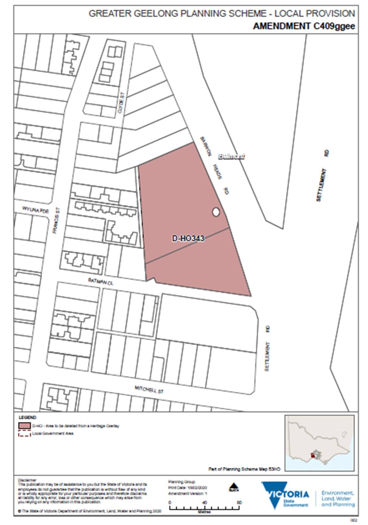
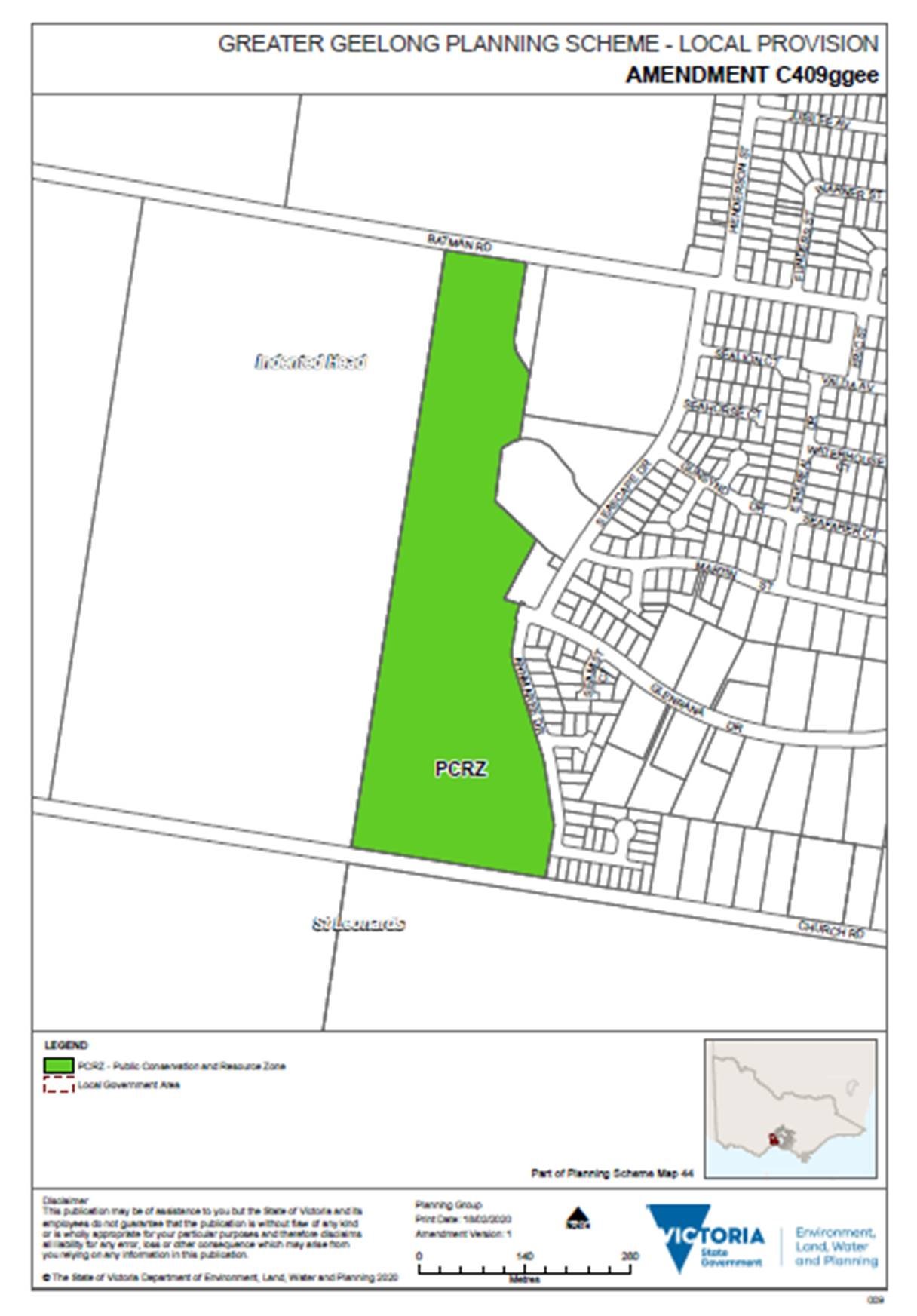
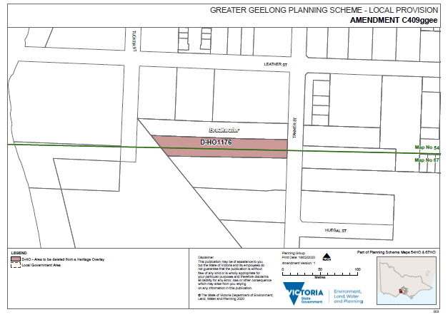
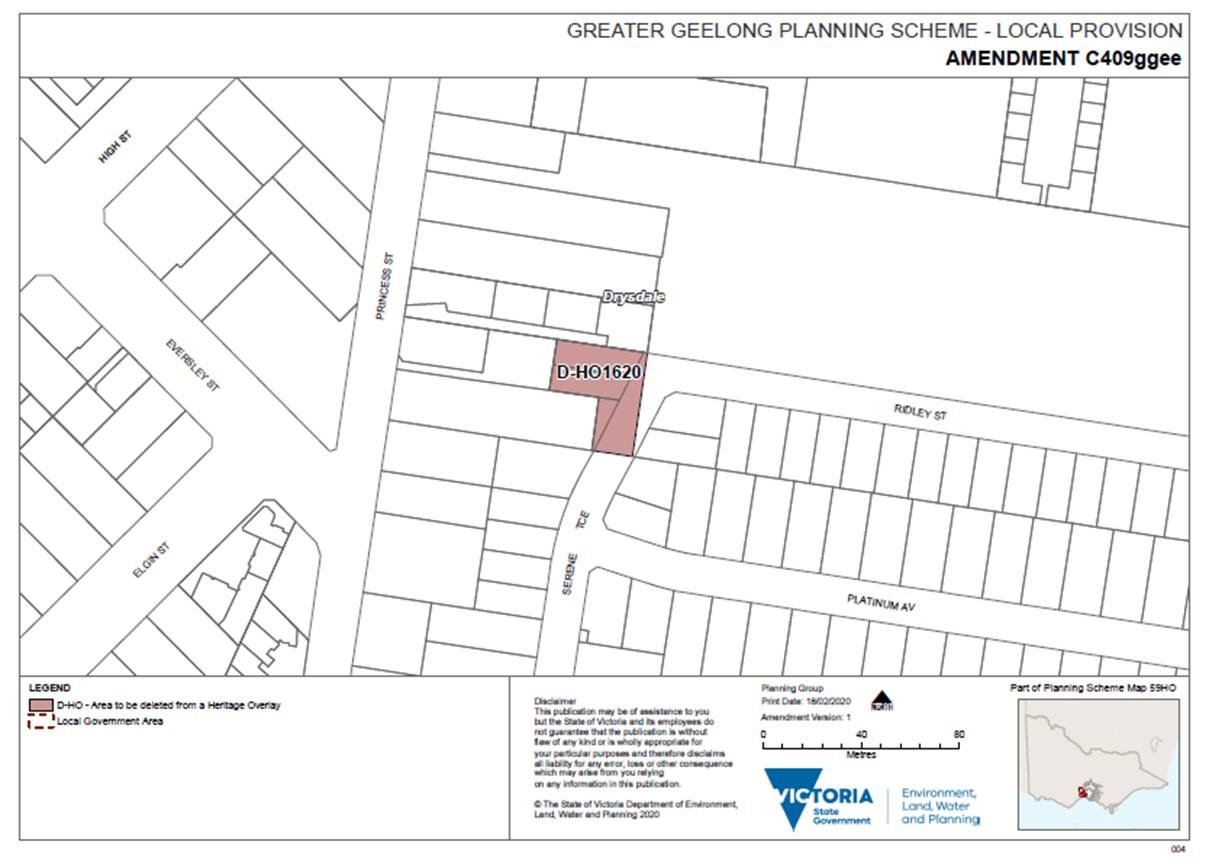
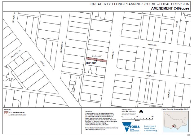
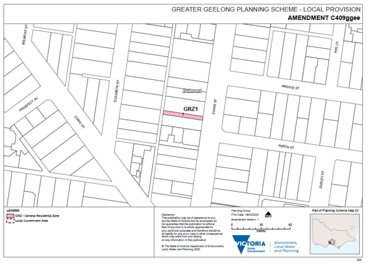
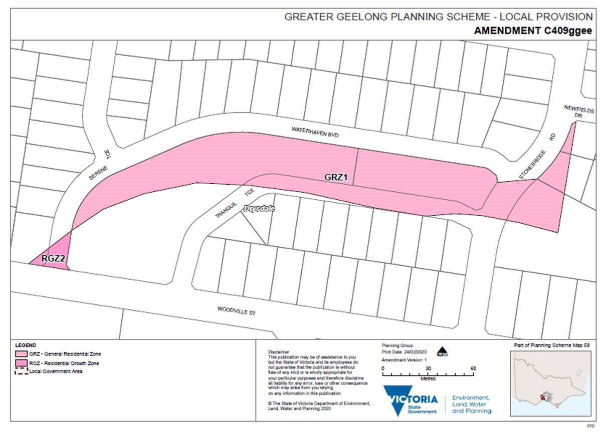
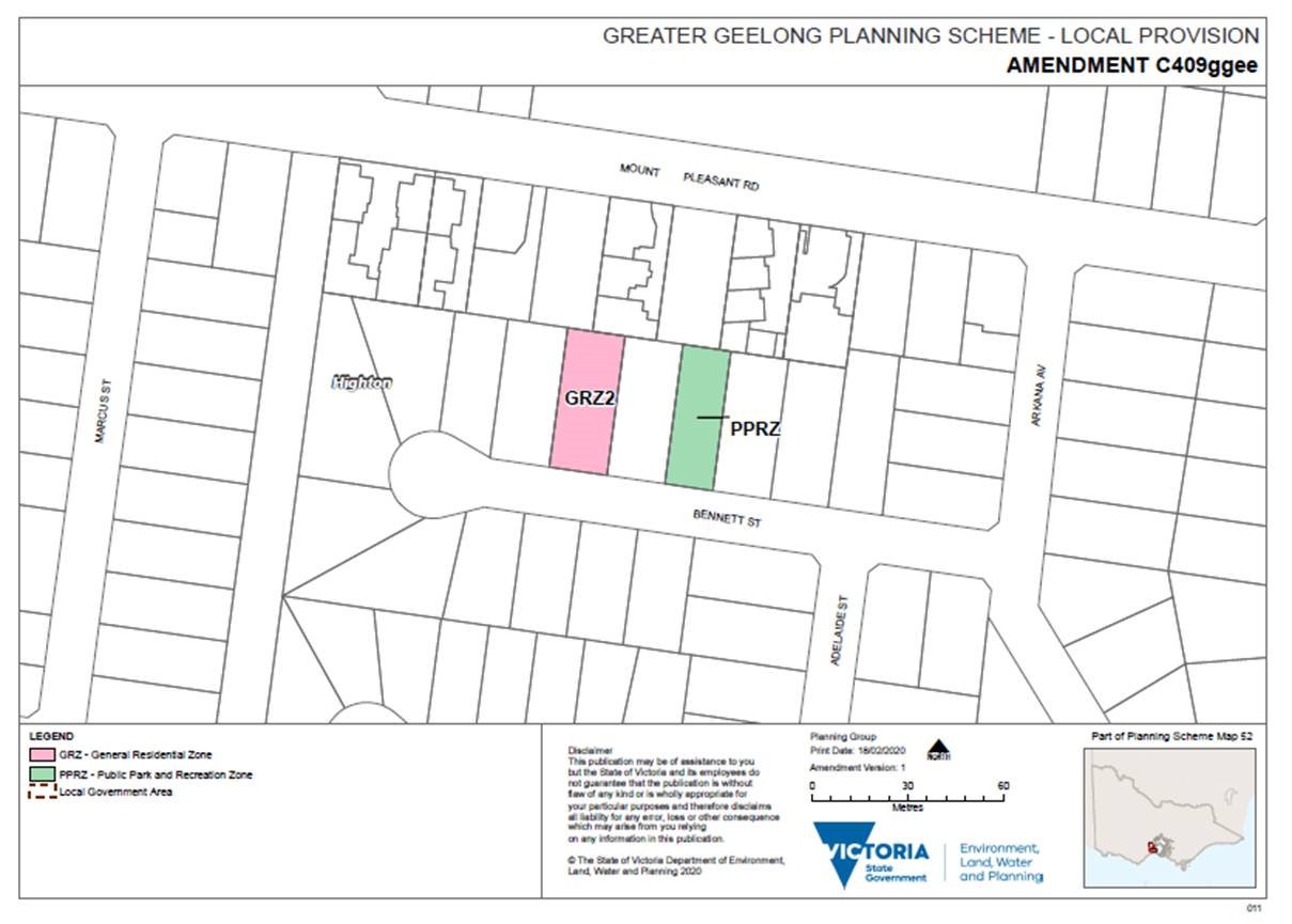
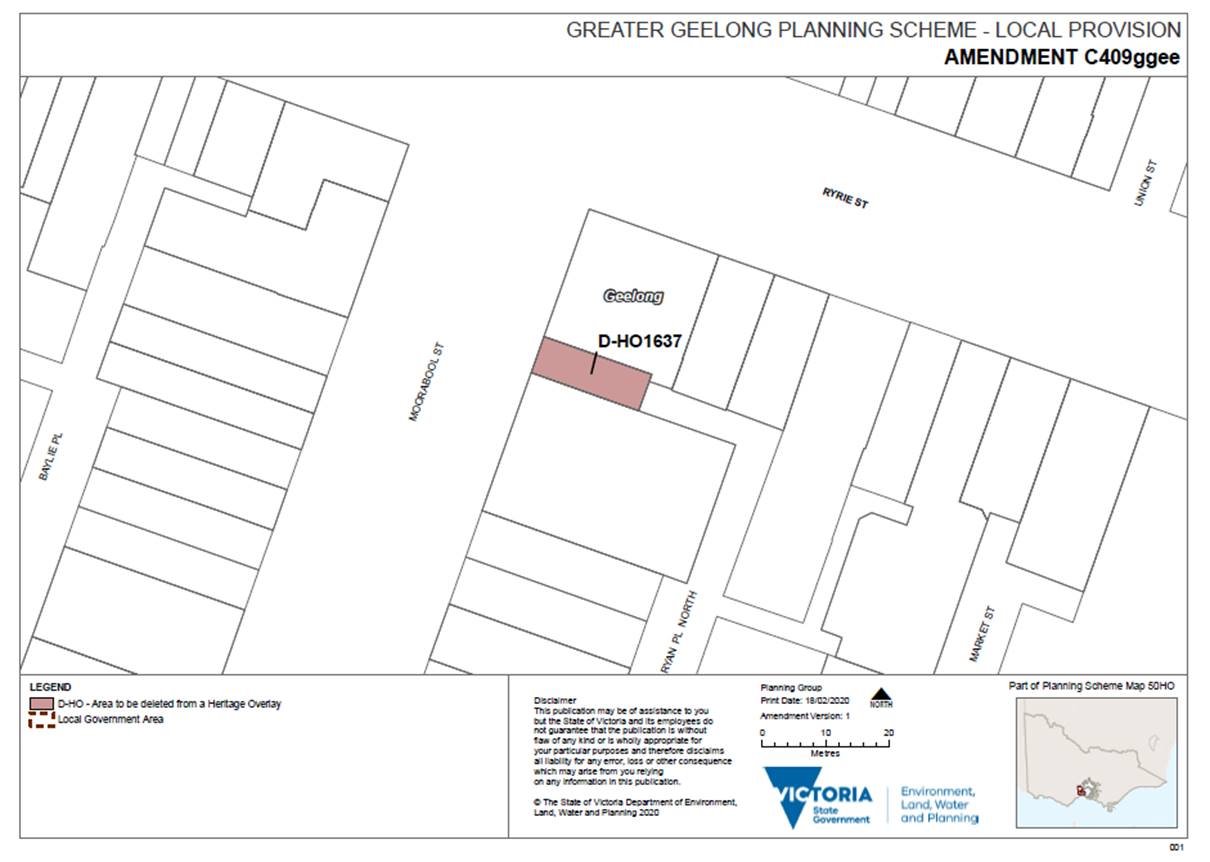
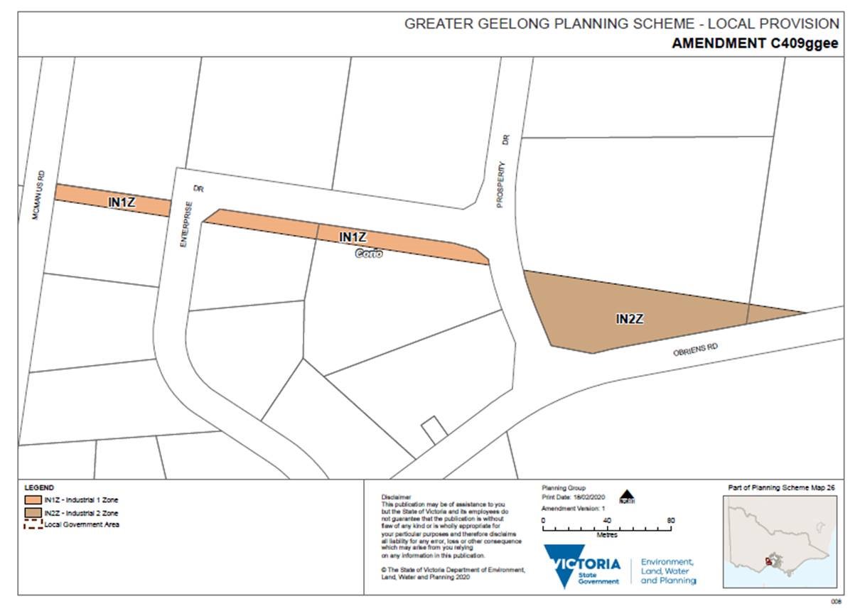
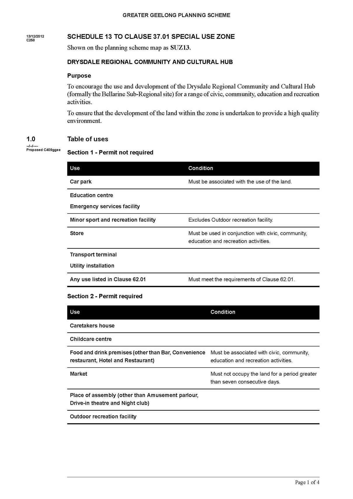
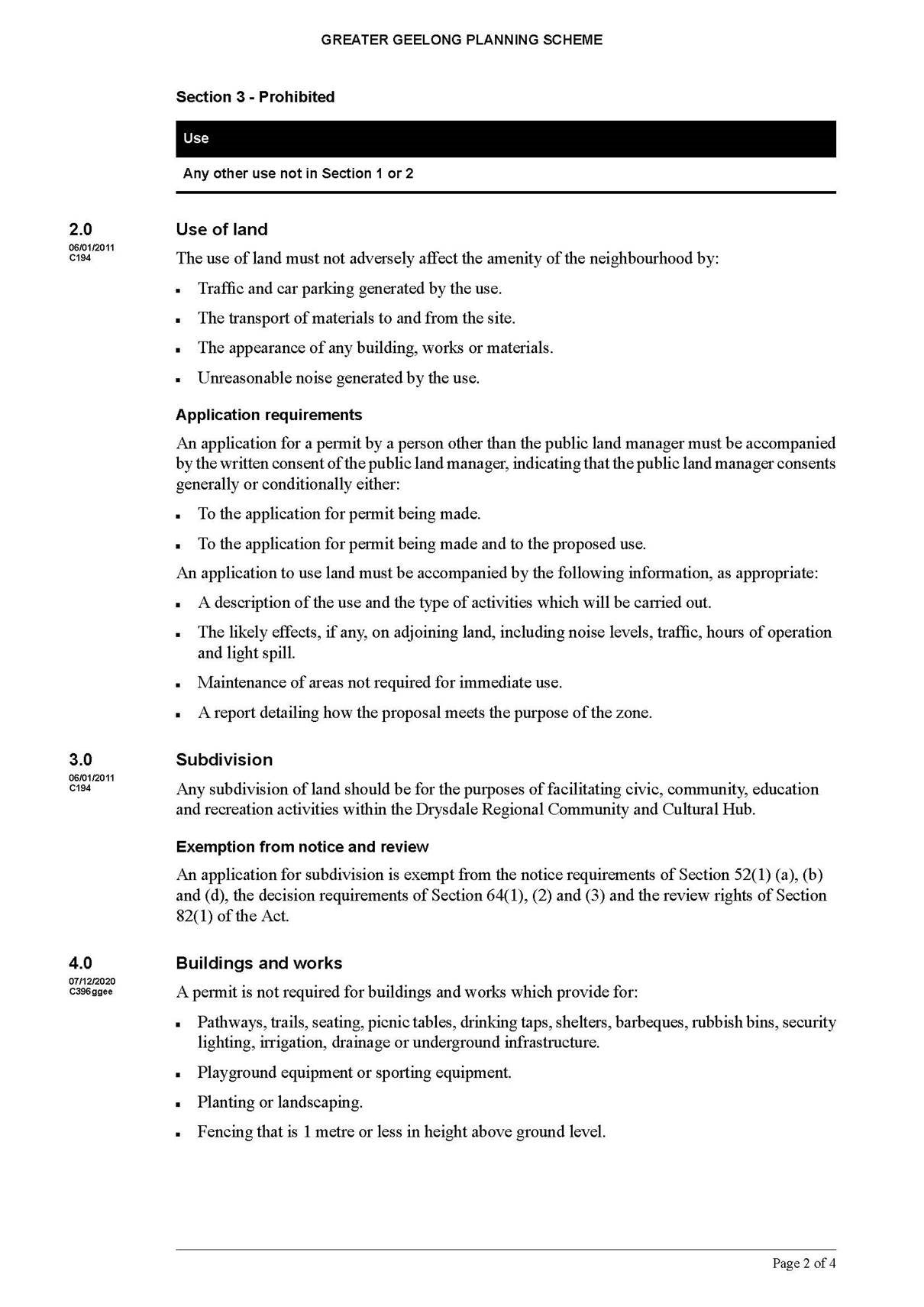
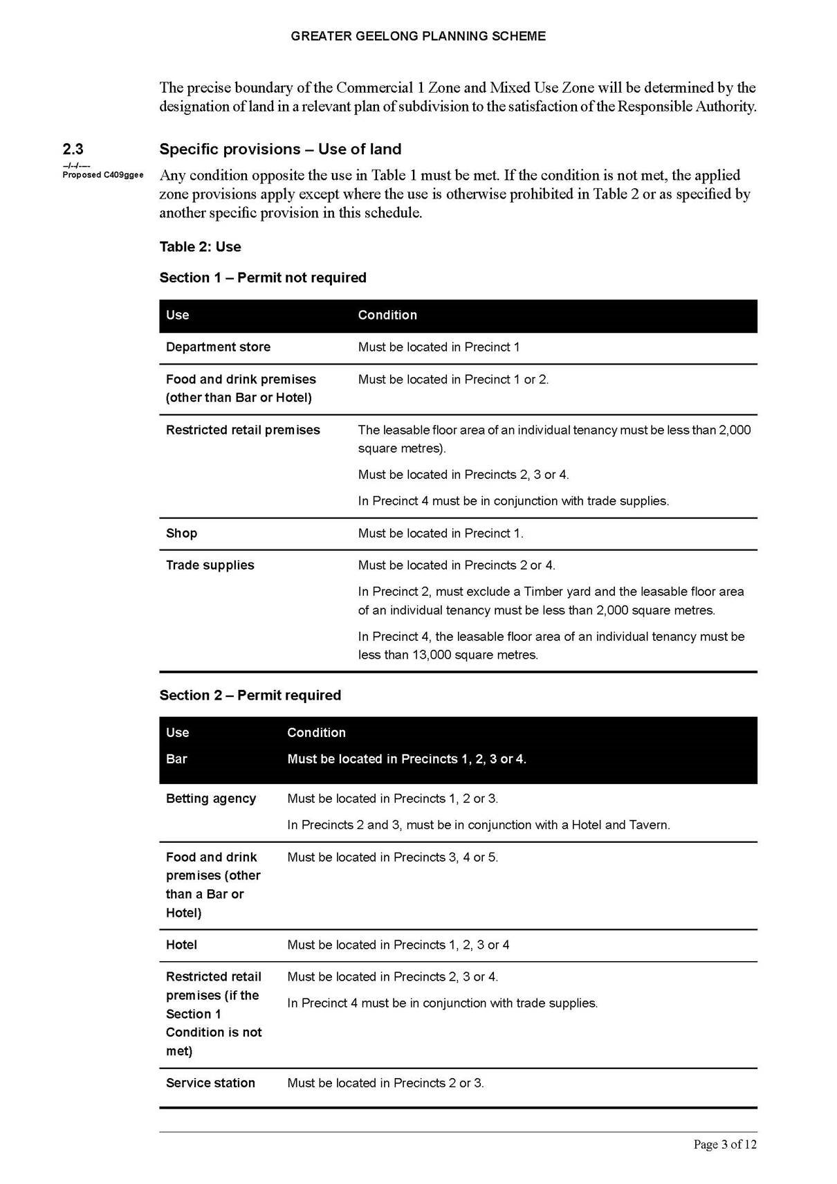
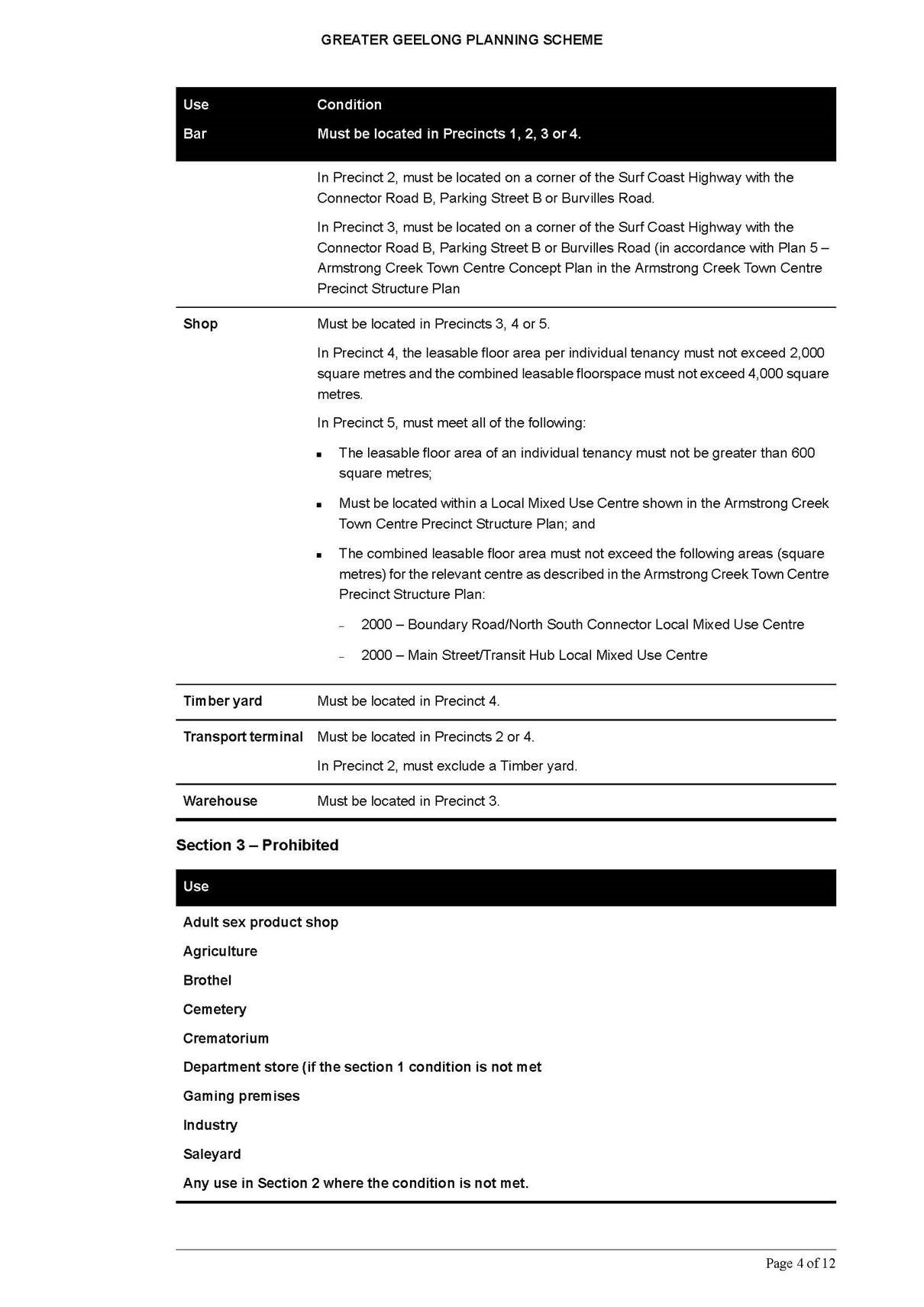
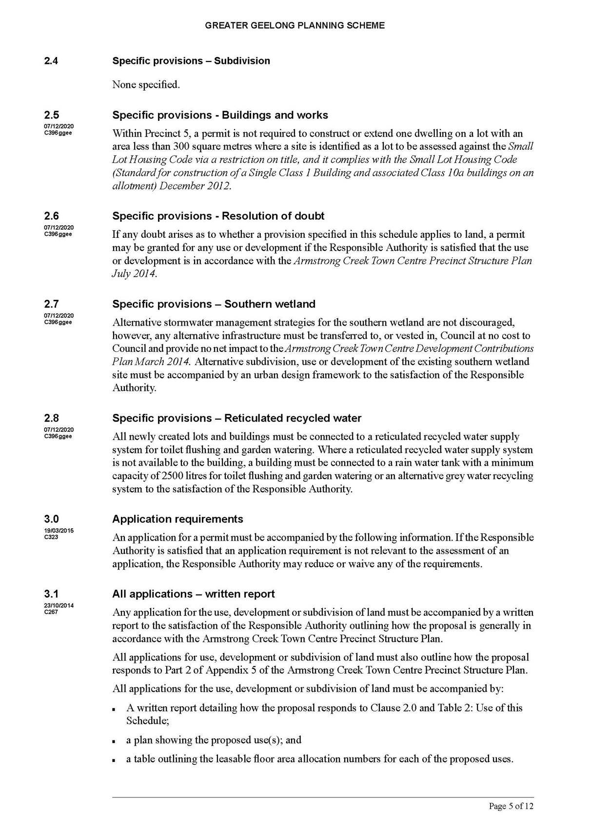
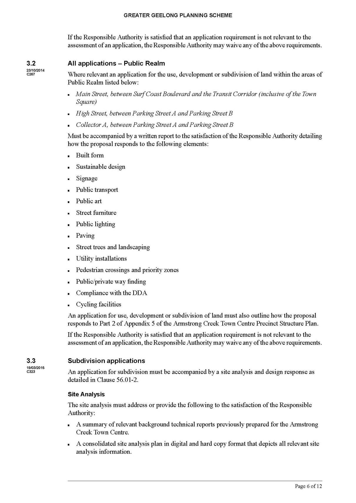
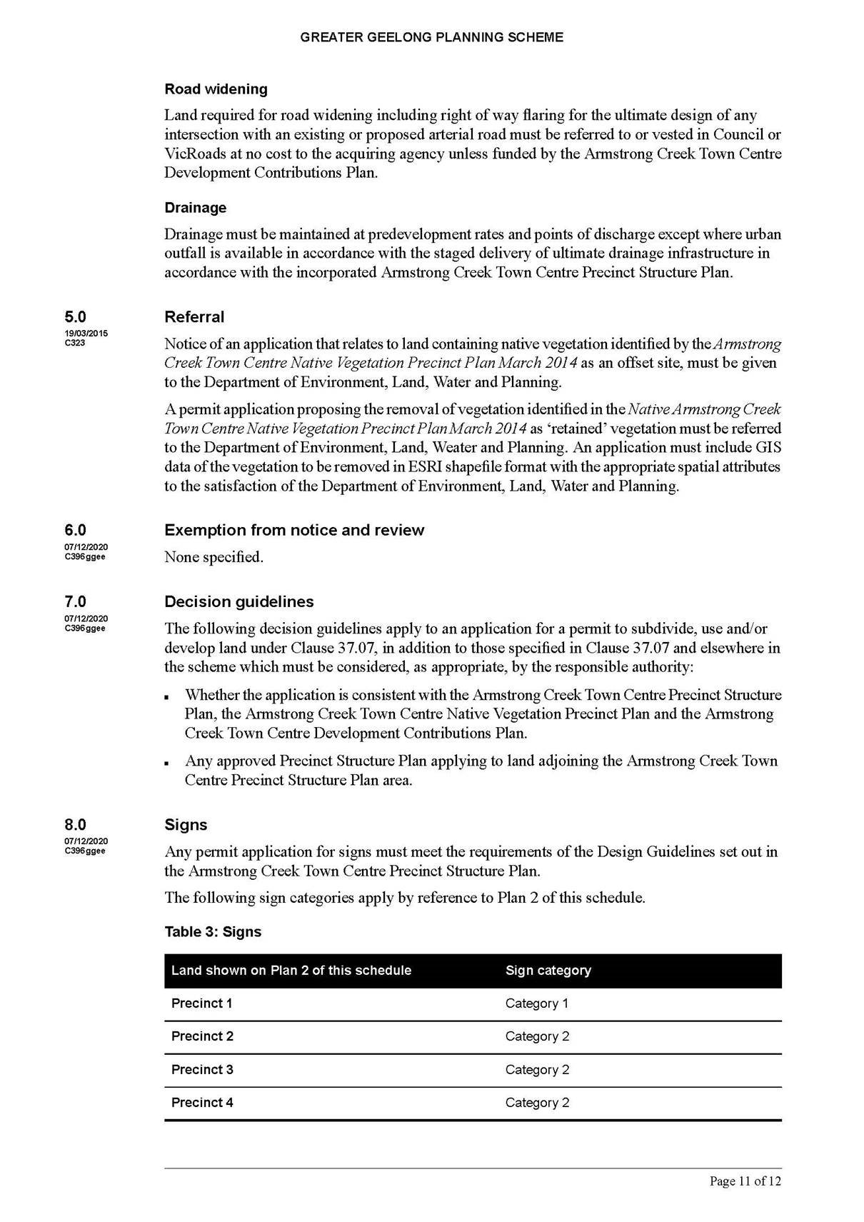
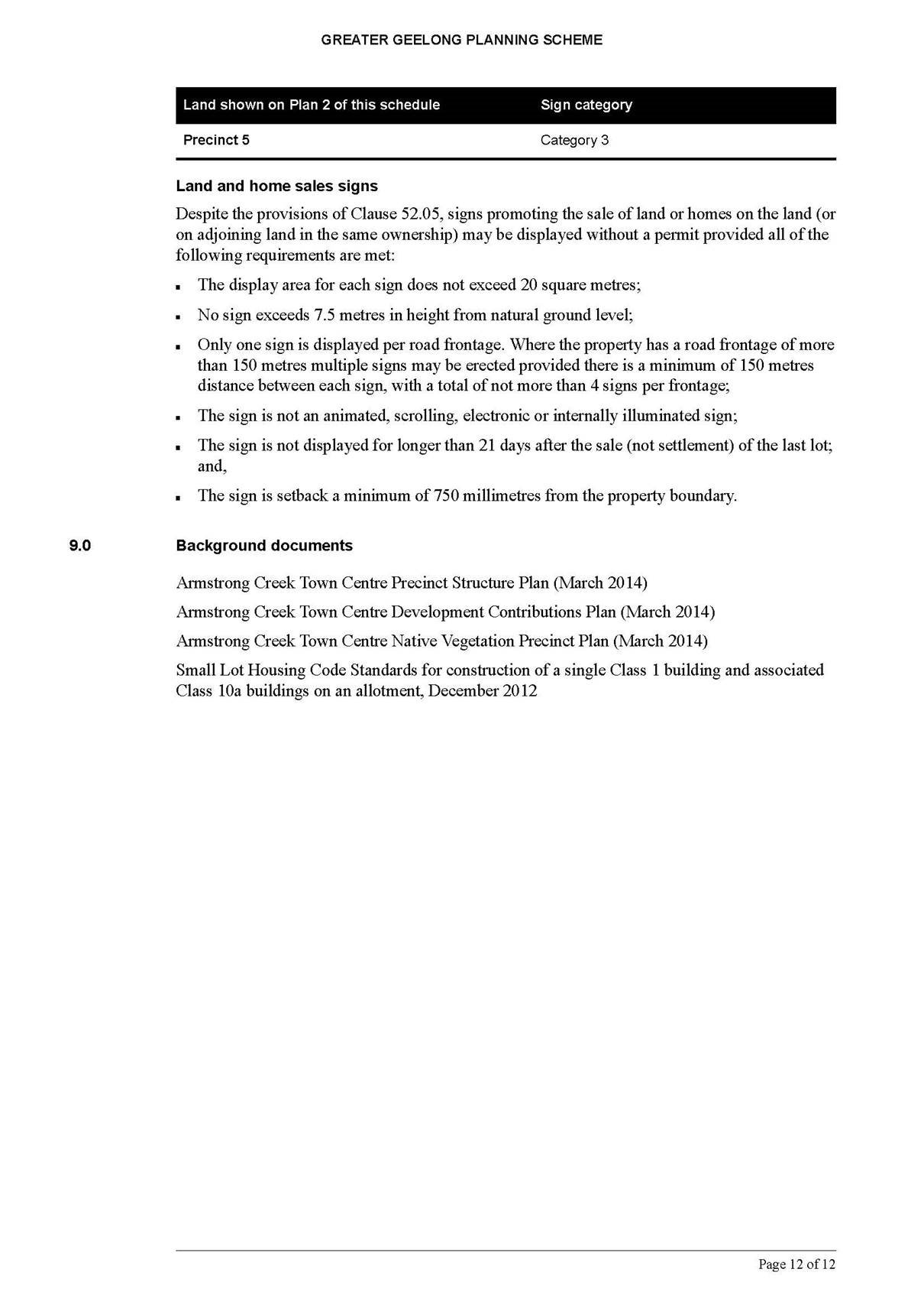
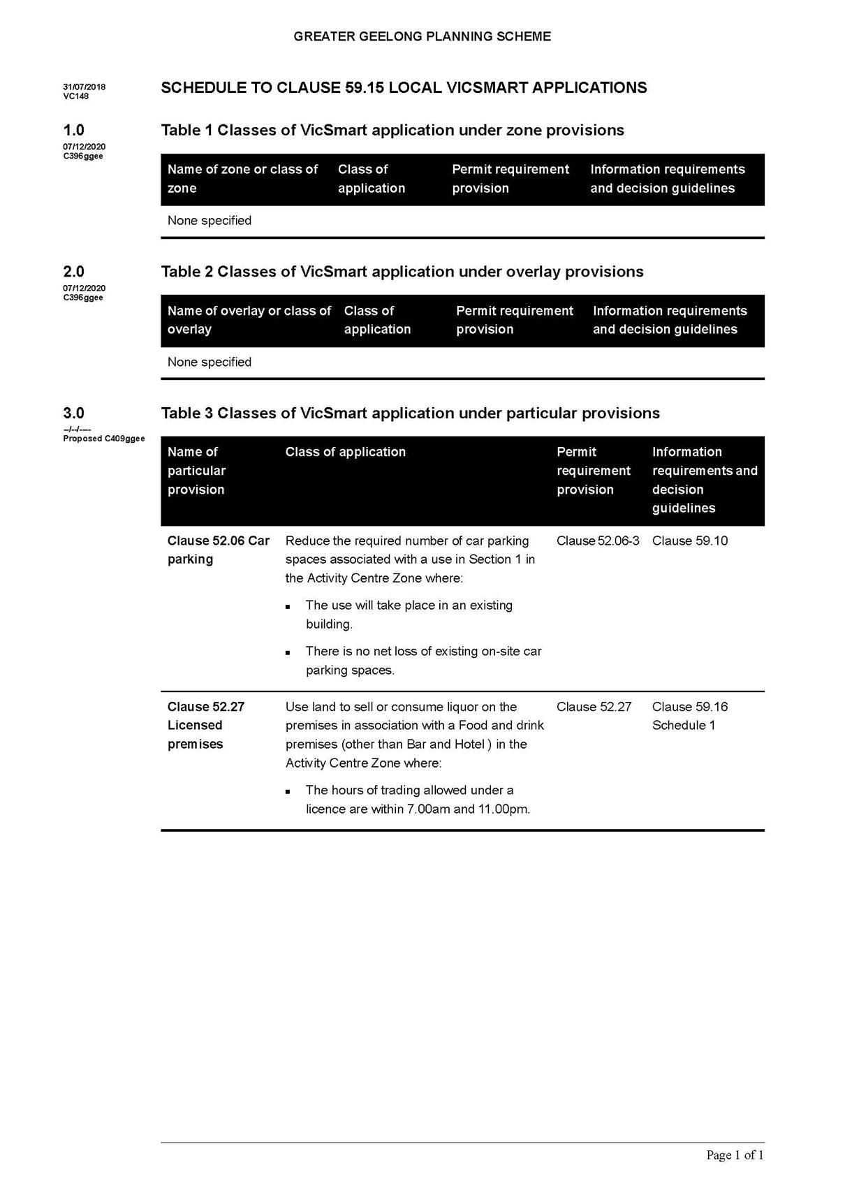
Note – As there are 166 pages in the schedule to Clause 43.01 (Heritage Overlay) only the four pages with changes are included in this attachment
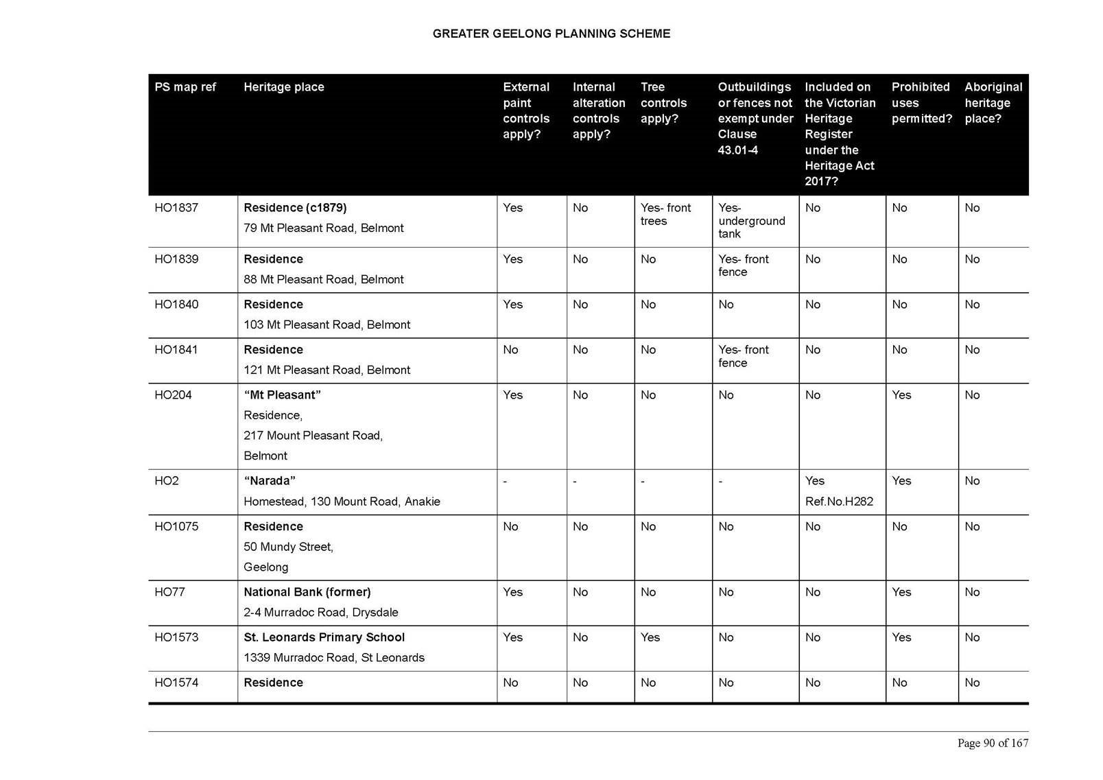
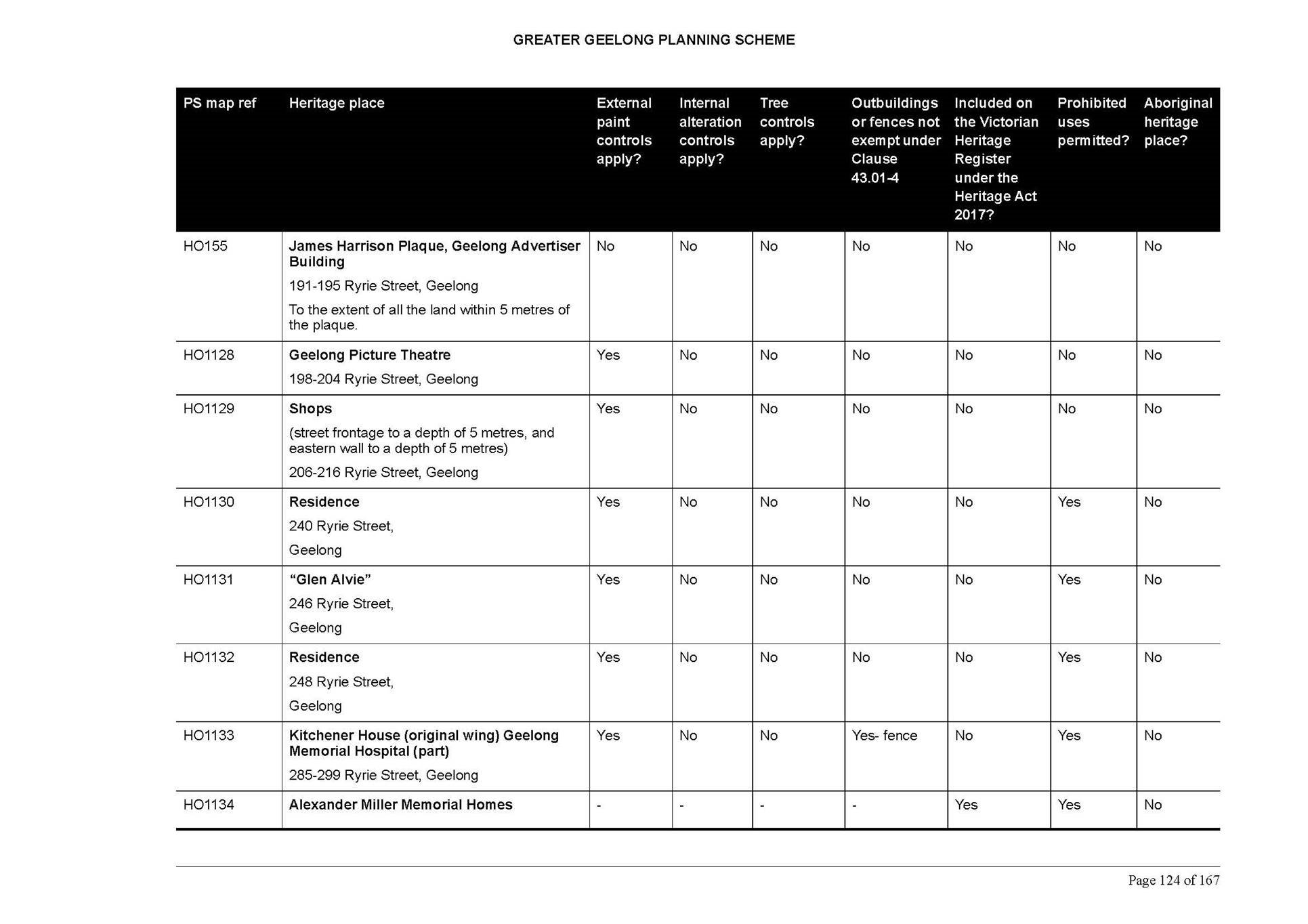
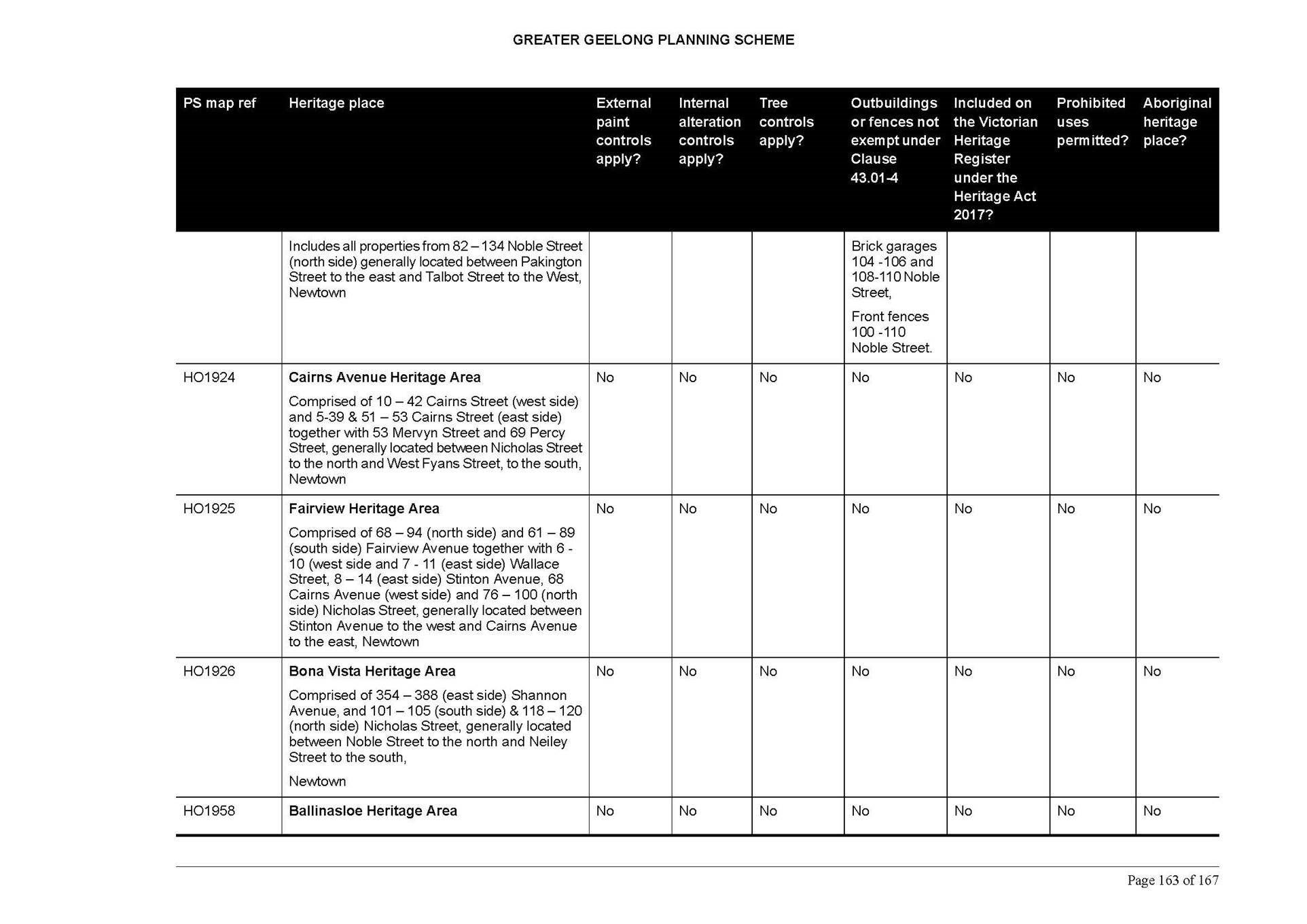
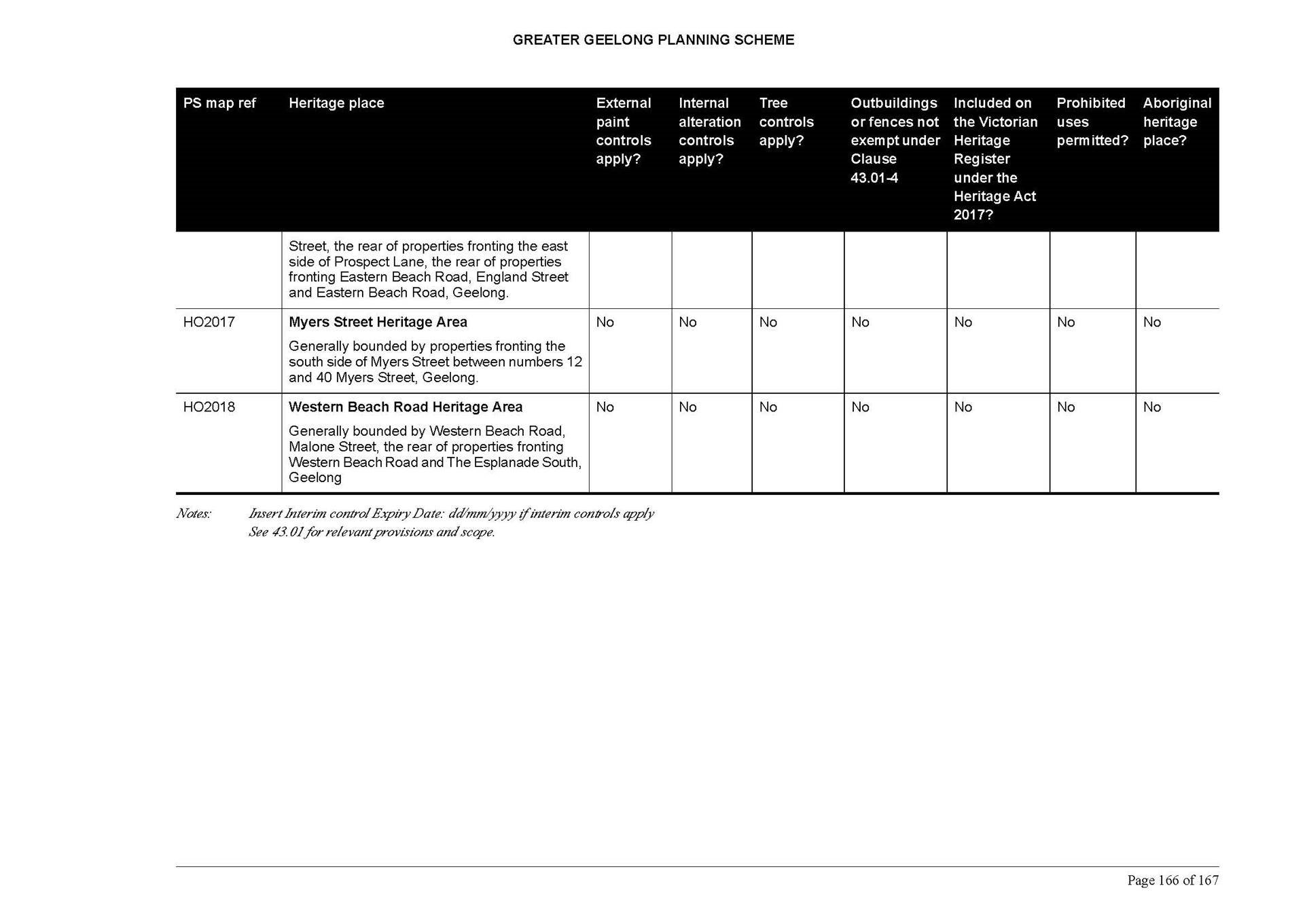
Councillor Grzybek declared a Conflict of Interest in Agenda Item 10 Tender T2100013 Building Better Bike Connections Project – Southern Corridor – Stage 1, in that Councillor Grzybek is an employee of the TAC who are funders of the bike path, and left the meeting room prior to discussion at 9:02pm.
Source: |
Customer & Corporate Services – Property, Procurement & Assets |
Director: |
Michael Dugina |
To award Contract C2100013: Building Better Bike Connections Project – Southern Corridor Stage 1 to Enoch Civil Pty Ltd (ABN 68 111 113 770).
The City of Greater Geelong received funding from the State Government to invest in new dedicated paths and routes across Geelong, filling the ‘missing links’ in existing bicycle networks. The works will improve access to train stations, the CBD and keep cyclists separated from traffic.
The Southern Corridor Stage One is a critical link in Geelong’s cycling network, connecting 25 per cent of Geelong’s population located south of the Barwon River to Geelong’s key employment precinct and transport hubs.
Design of the Southern Corridor Stage One was endorsed by Council in April 2019.
Procurement Services managed an open tender process seeking to appoint a suitably qualified and experienced contractor to undergo the construction works of the Building Better Bike Connections – Southern Corridor Stage 1 project.
The submissions were evaluated in accordance with the processes detailed in the City’s ‘Procurement and Contracts Manual’.
Based on the tenderer’s experience, expertise and value for money, the Tender Evaluation Panel (TEP) recommend that Enoch Civil Pty Ltd (ABN 68 111 113 770) be awarded the contract for the provision of the above project.
Subject to awarding the contract, the project will commence on 4 May 2021, with site works commencing 2 August 2021.
The lump sum for the delivery of the project is $1,969,434.94 (excl. GST).
Councillor Kontelj moved, Councillor Sullivan seconded -
That consideration of the report be deferred.
Carried.
Councillor Grzybek re-entered the meeting room at 9:03pm.
Source: |
Customer & Corporate Services – Property Procurement & Assets |
Director: |
Michael Dugina |
To request Council approval to give public notice of the City’s intention to enter into a lease for the café space at 2/240 Pioneer Road, Grovedale 3216 (Premises).
The Premises comprises a lettable area of approximately 80m2 which does not include the adjoining common dining area which is available for all patrons.
The previous tenant surrendered its lease in January 2021 and removed its fitout and returned the Premises to a vacant shell.
A market valuation to determine the value of the Premises is required and consideration of commercial terms relevant to a proposed lease.
The City proposes to invite submissions to lease the Premises.
The Premises is proposed to be offered as a vacant shell, which would enable a tenant to undertake a fitout.
It is anticipated a long-term lease will be sought, to offset the capital contribution required by the tenant and for security of tenure.
In accordance with the Local Government Act 1989 the City is required to give public notice of its intention to offer a lease for the Premises.
Councillor Nelson moved, Councillor Moloney seconded -
That Council:
Give notice in accordance with section 223 of the Local Government Act 1989 and the City’s Community Engagement Policy of its intention to lease the land at 2/240 Pioneer Road, Grovedale, contained in Certificates of Title Volume 11978 Folio 496, Volume 9499 Folio 304, Volume 9034 Folio 242, Volume 11978 Folio 513;
Appoint a Submissions Review Panel to hear any submission if any person wishes to appear in person or be represented by a person specified in support of a submission; and
Note that a further report will be presented to Council to consider the outcomes of the Submissions Review Panel and/or the proposed lease of the land.
Carried.
There are no financial implications of completing the submissions process for the lease of the land.
If the Council resolves to lease the land, the financial implications of any proposals for the lease of the land will be considered as part of their assessment.
A public submissions process in accordance with s223 of Local Government Act 1989 and the Community Engagement Policy is required to consider the proposed lease of the land. This provides an opportunity for the community to provide its feedback to Council on the proposal, to assist in further consideration.
Any person will have an opportunity to make a written submission on the proposed lease. A submitter is entitled to request in the submission, that the person wishes to appear or be represented by a person specified in the submission, at a meeting to be heard in support of their submission.
There are no known social equity issues by the recommendation to give public notice and invite submissions for the proposed lease of the land.
The City shall comply with its obligations under the Local Government Act 2020.
A proposed lease shall consider and align with the City’s Healthy Food Policy.
Council must comply with sections 189, 190 and 223, Local Government Act 1989 by giving notice of the proposed lease of the land to inform decision making on whether to resolve to lease the land.
A person may make a submission under Section 223 of Local Government Act 1989 on the proposal and, also, request to be heard by a Submissions Review Panel in respect to their submission.
As at 1 July 2021, the Local Government Act 2020 will impact the sections governing the proposed lease of land. To comply with this in the transitional period, the City will undertake engagement in accordance with its Community Engagement Policy.
The proposal aligns with the objective of organisational leadership, strategy and governance where one of the key priorities is proactively managing assets, including land holdings.
There is no identified conflict of interest, general or material for any officer involved in the preparation of the lease of land or the submissions process.
There are no identified risks associated with the implementation of the recommendation to give public notice to lease the land.
There are no environmental implications to this proposal.
Source: |
Customer & Corporate Services – Property, Procurement and Assets |
Director: |
Michael Dugina |
To seek approval to enter into a 30-year lease with Powercor Australia Limited (Powercor) for the site of a power substation at 137-149 Mercer Street, Geelong 3220 (Leased Area).
An indoor Powercor substation is required to be installed in the Leased Area on the ground floor of the new Civic Accommodation building currently under construction at 137-149 Mercer Street, Geelong (Premises). Attachment 2 is the locality plan.
Powercor’s substation is necessary to provide adequate electricity supply to the Premises at 137-149 Mercer Street, Geelong 3220.
Powercor seeks to enter into a lease with the Greater Geelong City Council (the City) for the Leased Area within the Premises, for a term of 30 years.
The City issued a public notice of its intent to grant the lease and invited submissions in accordance with sections 190 and 223 of the Local Government Act 1989.
No submissions were received.
Councillor Harwood moved, Councillor Murrihy seconded -
That Council authorise the City to enter into a lease with Powercor Australia Limited for a maximum term of 30 years for the Leased Area to locate its substation site at 137-149 Mercer Street, Geelong 3220.
Carried.
Powercor is responsible for maintaining the substation for the term of the lease and any period of overholding. The City is not required to budget for any expenses.
The City shall not charge a lease fee, in line with other agreements with Powercor.
The City advertised its intention to enter into a 30-year lease with Powercor by public notice on 5 February 2021 in the Geelong Independent newspaper and 6 February 2021 in the Geelong Advertiser newspaper and invited submissions by close of business 9 March 2021, in accordance with sections 190 and 223 of the Local Government Act 1989.
No submissions were received.
There are no social equity considerations.
As the lease is for a term of more than 10 years, the Council must, in accordance with section 190 of the Local Government Act 1989, at least four weeks before the lease is made, publish a public notice of the proposed lease. A person has a right to make a submission under section 223 of the Local Government Act 1989, on the proposed lease and may request to be heard in respect of their submission. This requirement has been complied with.
The recommendation supports the key priority relating to Organisational Leadership, Strategy & Governance of “proactively managing our assets, including land holdings”.
There is no identified conflict of interest for any officer involved in the preparation of the lease or the submissions process.
The substation enclosure proposed shall be two-hour fire rated and shall comply with all building codes, regulations and Powercor standards.
The lease establishes Powercor’s management rights and obligations for its asset to mitigate risks to the City.
The City’s new office in the Civic Precinct, will achieve the highest environmental standards in design, energy, waste and water usage, with a six star – green star design.
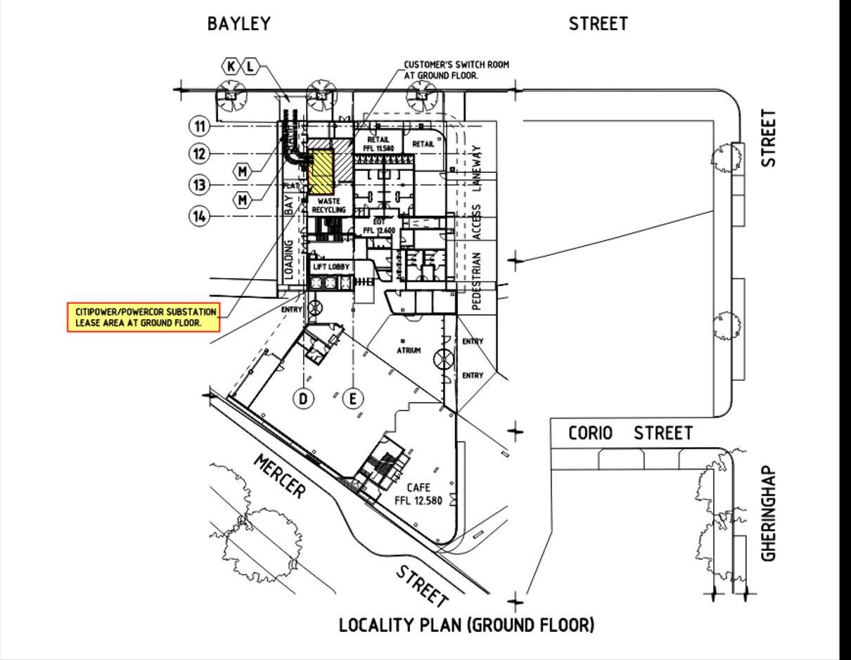
Source: |
Customer & Corporate Services – Property, Procurement and Assets |
Director: |
Michael Dugina |
To seek Council approval to initiate the statutory process for the proposed sale of 2 Bayley Street, Geelong.
The City purchased the property at 2 Bayley Street, Geelong to ensure any future development of this site does not compromise the Council’s investment in the new Civic Precinct.
The property includes 4 residential units which are currently tenanted.
The property includes 2 lots and common property, being certificate of title volume 10934 folio 696, lot 1 PS504306 and certificate of title volume 10934 folio 697, lot 2 PS504306 and common property no 1 on plan of subdivision 504306.
Now that the design of the Civic Precinct is finalised, the City can confirm that the property at 2 Bayley Street, Geelong is not required for the development.
To ensure the protection of the integrity of the Civic Precinct, if the property is determined to be sold, the City may impose some restrictions on the title to guide future development at 2 Bayley Street before selling the property.
The Council will need to consider whether it should sell the property by completing the public notice process required of section 223 of the Local Government Act 1989 (LGA1989).
Councillor Murrihy moved, Councillor Harwood seconded -
That Council:
Give notice in accordance with section 223 of the Local Government Act 1989 and the City’s Community Engagement Policy of its intention to sell the land, which is 2 Bayley Street, Geelong, being certificate of title volume 10934 folio 696, lot 1 PS504306 and certificate of title volume 10934 folio 697, lot 2 PS504306 and common property no 1 on plan of subdivision 504306;
Appoint a Submissions Review Panel to hear any submission if any person wishes to appear in person or be represented by a person specified in support of a submission; and
Note that a further report will be presented to Council to consider the outcomes of the Submissions Review Panel and/or the proposed sale of the land.
Carried.
There are no financial implications of completing the submissions process for the sale of the property.
If the Council resolves to sell the property, the financial return may be influenced by any restrictions imposed on the property title.
A public submissions process in accordance with s223 of LGA1989 and the Community Engagement Policy is required to consider the proposed sale of the property. This provides an opportunity for the community to provide its feedback to Council on the proposal to assist in further consideration.
Any person will have an opportunity to make a written submission on the proposed sale. A submitter is entitled to request in the submission that the person wishes to appear or be represented by a person specified in the submission, at a meeting to be heard in support of their submission.
There are no adverse social equity issues created by the recommendation to give public notice and invite submissions for the proposed sale of the property.
Council must comply with sections 189 and 223, LGA1989 by giving notice of the proposed sale of the property to inform decision making on whether to resolve to sell the property.
A person may make a submission under section 223 of LGA1989 on the proposal and, also, request to be heard by a Submissions Review Panel in respect to their submission.
As at 1 July 2020, the Local Government Act 2020 will impact the sections governing the proposed sale of land. To comply with this in the transitional period, the City will undertake engagement in accordance with its Community Engagement Policy.
The proposal aligns with the objective of organisational leadership, strategy and governance where one of the key priorities is proactively managing assets, including land holdings.
There is no identified conflict of interest, general or material for any officer involved in the preparation of the sale of land or the submissions process.
There are no other notable risks associated with the implementation of the recommendation to give public notice to sell the land.
The risk impact of potentially selling the land has been assessed as part of the overall Civic Precinct project.
There are no environmental implications to this proposal.
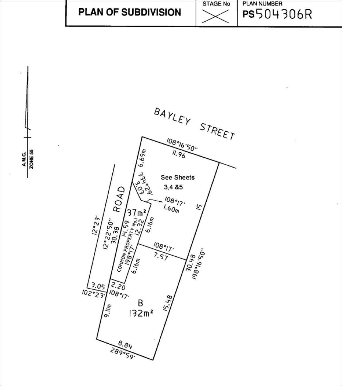
Source: |
Customer & Corporate Services – Property, Procurement and Assets |
Director: |
Michael Dugina |
To seek Council approval to initiate the statutory process for the proposed sale or lease of 151 Mercer Street, Geelong.
The City purchased the property at 151 Mercer Street, Geelong to enable part of the property to be included in the development of the Civic Precinct at 137-149 Mercer Street, Geelong.
The property includes a building which has local heritage significance, and while it had previously been extended, the extensions have been removed and the original footprint building retained.
The remaining building envelope is surplus to the Civic Precinct and will be subdivided from the balance of the land which will be included in the Civic Precinct.
Lot 3 of Plan of Subdivision 83401OW is being created for 151 Mercer Street Geelong and will comprise a land area of 189m2 as shown on Attachment 2.
The City has no identified use for the remaining building but does desire the building to remain and honour its heritage value and the opportunity for it to be redeveloped into a use which will complement the precinct.
To achieve this, the Council could seek expressions of interest from parties to lease or purchase the property, with submissions outlining the proposed uses, development plans (including addressing heritage requirements) and commercial terms.
This could also enable an opportunity to seek the community’s feedback on desired uses and retention or restoration of the heritage fabric and this process would be completed in accordance with the City’s Community Engagement Policy.
To allow for the full examination of this process, the Council will need to consider whether it should lease or sell the property by completing the public notice process required of section 223 of the Local Government Act 1989 (LGA1989).
Councillor Murrihy moved, Councillor Harwood seconded -
That Council:
Give notice in accordance with section 223 of the Local Government Act 1989 and the City’s Community Engagement Policy of its intention to sell or lease the land, which is part 151 Mercer Street, Geelong, being Lot 3 of Plan of Subdivision 83401OW (unregistered);
Appoint a Submissions Review Panel to hear any submission if any person wishes to appear in person or be represented by a person specified in support of a submission; and
Note that a further report will be presented to Council to consider the outcomes of the Submissions Review Panel and/or the proposed sale or lease of the land.
Carried.
There are no financial implications of completing the submissions process for the sale or lease of the property.
If the Council resolve to sell or lease the property, the financial implications of any proposals for the purchase of lease of the property will be considered as part of their assessment.
A public submissions process in accordance with s223 of LGA1989 and the Community Engagement Policy is required to consider the proposed sale or lease of the property. This provides an opportunity for the community to provide its feedback to Council on the proposal to assist in further consideration.
Any person will have an opportunity to make a written submission on the proposed sale or lease. A submitter is entitled to request in the submission that the person wishes to appear or be represented by a person specified in the submission, at a meeting to be heard in support of their submission.
If the Council resolve to sell or lease the property, more extensive engagement will be undertaken to seek the community’s feedback and submissions for complementing uses and development of the building.
There are no adverse social equity issues created by the recommendation to give public notice and invite submissions for the proposed sale or lease of the property.
Council must comply with sections 189, 190 and 223, LGA1989 by giving notice of the proposed sale or lease of the property to inform decision making on whether to resolve to sell or lease the property.
A person may make a submission under section 223 of LGA1989 on the proposal and, also, request to be heard by a Submissions Review Panel in respect to their submission.
As at 1 July 2020, the Local Government Act 2020 will impact the sections governing the proposed sale of land or lease of land. To comply with this in the transitional period, the City will undertake engagement in accordance with its Community Engagement Policy.
The proposal aligns with the objective of organisational leadership, strategy and governance where one of the key priorities is proactively managing assets, including land holdings.
There is no identified conflict of interest, general or material for any officer involved in the preparation of the sale or lease of land or the submissions process.
There are no other notable risks associated with the implementation of the recommendation to give public notice to sell or lease the land.
The risk impact of potentially selling or leasing the land has been assessed as part of the overall Civic Precinct project.
If the land is determined to be sold or leased following completion of the statutory process, risk assessments will be included in the consideration of any proposals for the future of the site.
There are no environmental implications to this proposal.
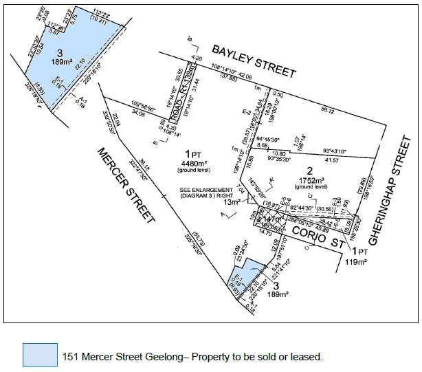
Source: |
Customer & Corporate Services – Property, Procurement and Assets |
Director: |
Michael Dugina |
To seek Council approval to initiate the statutory process for the proposed discontinuance and sale of approximately 108m2 of road reserve abutting 4 Cleveland Court, Corio as shown in Attachment 2.
The property owner abutting 4 Cleveland Court, Corio, has requested the opportunity to purchase approximately 108m2 of land within a road reserve at 4 Cleveland Court, Corio. See Attachment 2 for location.
The section of road proposed to be discontinued and sold is an extension from a court bowl.
The section of road is not on the Municipal Road Register and is not used for vehicle access, parking or pedestrian access.
Councillor Grzybek moved, Councillor Aitken seconded -
That Council:
Give notice in accordance with section 223 of the Local Government Act 1989 and the Community Engagement Policy of its intention to discontinue and sell the land which is represented as a road running off Cleveland Court and abuts the properties at 3 and 4 Cleveland Court, Corio;
Appoint a Submissions Review Panel to hear any submission if any person wishes to appear in person or be represented by a person specified in support of a submission; and
Note that a further report will be presented to Council to consider the outcomes of the Submissions Review Panel and/or the road discontinuance and sale of the land.
Carried.
If the proposed road discontinuance and sale is approved, the land will be sold at market valuation.
The purchaser will be required to reimburse the City for all costs incurred by the City for the road discontinuance and the sale process.
A public submissions process in accordance with s223 of Local Government Act 1989 (LGA89) and the Community Engagement Policy, will be required for the proposed discontinuance and sale outlined in this report. This provides an opportunity for the community to provide its feedback to Council on the proposed discontinuance and sale.
Any person will have an opportunity to make a written submission on the proposed discontinuance and sale. A submitter is entitled to request in the submission that the person wishes to appear or be represented by a person specified in the submission, at a meeting to be heard in support of their submission.
There are no adverse social equity issues created as a result of this road discontinuance and sale.
Council has the power to discontinue a road in accordance with Clause 3 of Schedule 10 of LGA89, by notice published in the Government Gazette.
A person may make a submission in accordance with Section 223 of LGA 1989 on the proposed exercise of the power to discontinue a road under Clause 3 of Schedule 10.
A person may make a submission in accordance with the Community Engagement Policy on the proposed sale of the land.
The proposal aligns with the objective of organisational leadership, strategy and governance where one of the key priorities is proactively managing assets, including land holdings.
There is no identified conflict of interest, general or material for any officer involved in the preparation of the road discontinuance and sale of the land.
Internal consultation with key stakeholders including Engineering, Social Planning and Infrastructure Planning has been undertaken as part of the risk assessment process, as has consultation with external authorities such as Barwon Water, Telstra, Powercor and VicRoads.
Internal stakeholders support the commencement of the process to discontinue this laneway.
There are no other notable risks associated with the implementation of the recommendations.
There are no environmental implications to this proposal.
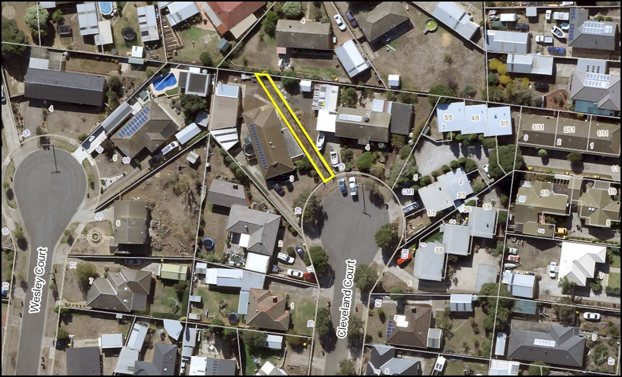
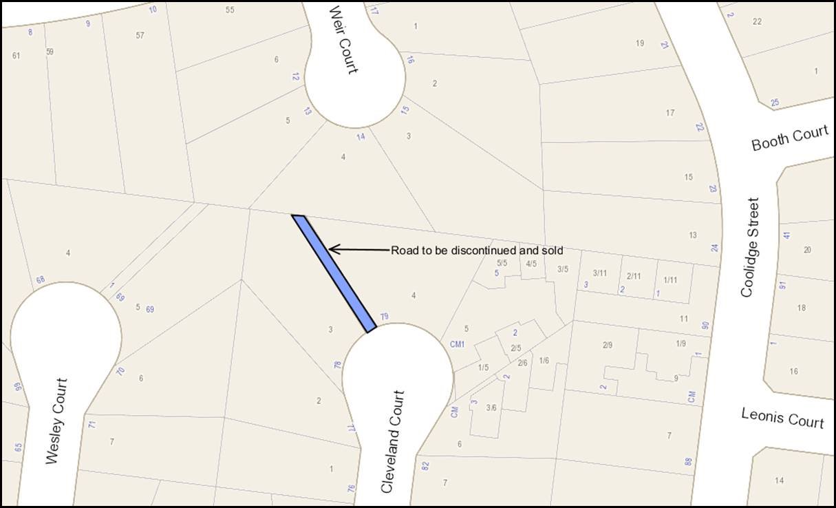
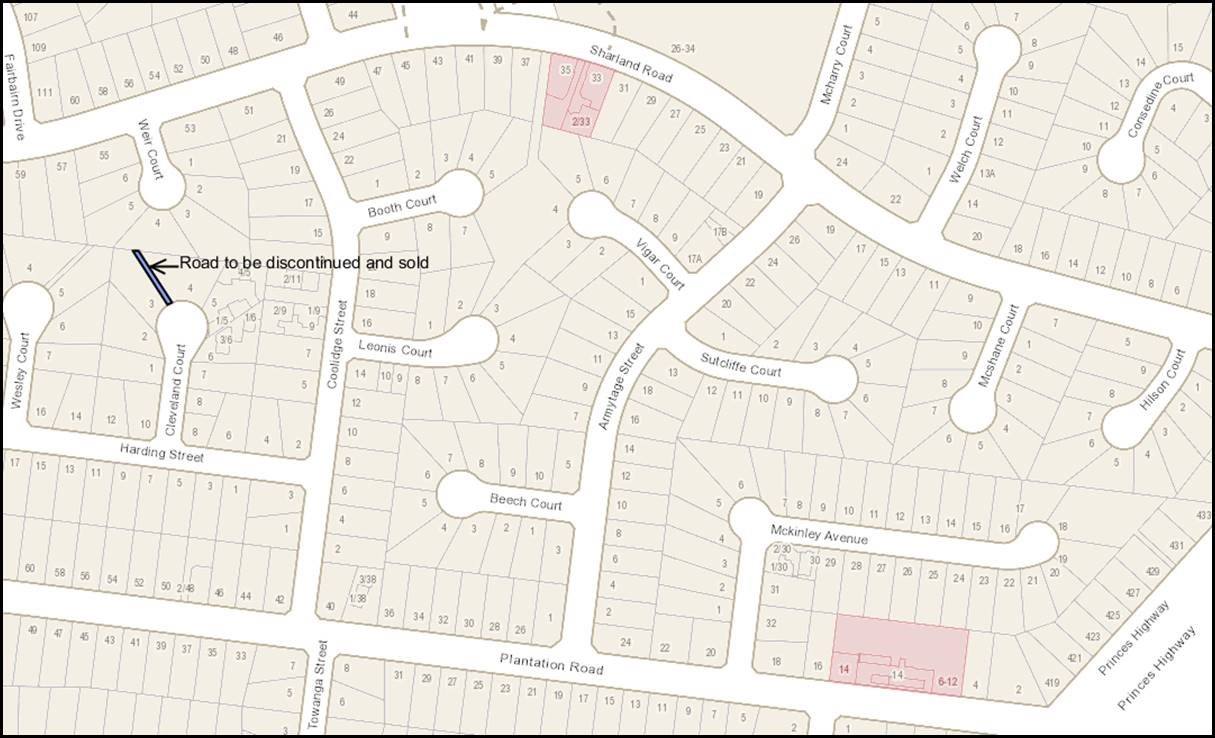
Source: |
City Services – Engineering Services |
Director: |
Guy Wilson-Browne |
To revoke Council’s designation of 12 December 2006 of flood affected land at Anchoridge, Stages 8A, 8B and 9 as liable to flooding pursuant to regulation 153 of the Building Regulations 2018.
Council has a statutory obligation under the Building Regulations 2018 to designate land as liable to flooding where it reasonably knows it to be prone to flooding. Conversely, there is an obligation to remove the encumbrance of designation from land that is no longer considered to be flood prone.
The current designated flood mapping (Attachment 2) was designated by Council at its meeting of 12 December 2006.
This revocation will result in another stage of new lots in Anchoridge Estate fronting 892-958 Barwon Heads Road, Armstrong Creek being free of their flood prone status, paving the way for owners to build homes on their land.
The flood mapping is subject to a revision due to the subdivision and development at 892-958 Barwon Heads Road, Armstrong Creek, Prior to subdivision the parent lot was considered to be liable to flooding. This development site, which is also known as Anchoridge Estate, Stages 8A, 8B and 9 achieves flood immunity for newly created lots for flood events up to and including the 100-year Average Recurrence Interval (ARI) event due to approved internal earthworks.
The recommendation by City engineers that the flood prone status can be removed includes assessment of internal drainage, road construction and earthworks to contain potential floodwaters from the 100-year ARI event within road and drainage reserves (Attachment 3).
It should be noted that designation is separate to the creation of flood overlays within the Planning Scheme, which generally follows designation. In the case of this development, the planning scheme amendment to create post-development flood zones or overlays is proposed after the design of the proposed precincts.
Councillor Nelson moved, Councillor Harwood seconded -
That Council revoke the Council designation of 12 December 2006 of flood affected land at Anchoridge Estate Stages 8A, 8B and 9 as liable to flooding pursuant to regulation 153 of the Building Regulations 2018.
Carried.
There are no financial implications arising from the subject of this report.
A revocation of designation does not warrant public consultation as it constitutes the removal of an encumbrance on land.
Relevant City databases and flood maps will be revised and updates sent to the Corangamite Catchment Management Authority and Building Control Commission.
Council has a responsibility to the community to provide the best possible information on areas that are flood prone. The removal of flood prone designation allows owners to build on their land without a special permit from the City, and without raising the floor level of their home. It also reduces the cost of property insurance.
The City has various statutory responsibilities for drainage management and flood management (prevention, response and recovery) as set out in the Local Government Act 1989, Local Government Regulations 1990, Planning and Environment Act 1987, Building Regulations 2018, Water Act 1989, Subdivision Act 1988 and Emergency Management Act 1986.
The works have resulted in the lots being protected from flooding during a major storm event that has a one per cent probability of occurring in any one year, and occurs on average once in 100 years. This is the required standard for new subdivisions.
The recommendations of this report are consistent with Council Plan 2018-2022, in relation to planned sustainable development.
No City officers or contractors who have provided advice in relation to this report have declared a conflict of interest regarding the matter under consideration.
The City also has some risk exposure with any failure to disclose the flood-prone status of a property in a Land Information Certificate.
The revocation of the designation is the final step in minimising Council’s risk.
The revocation of flood-prone areas designation and designation of revised flood data through the design of this stage is considered unlikely to result in any known adverse environmental impacts.
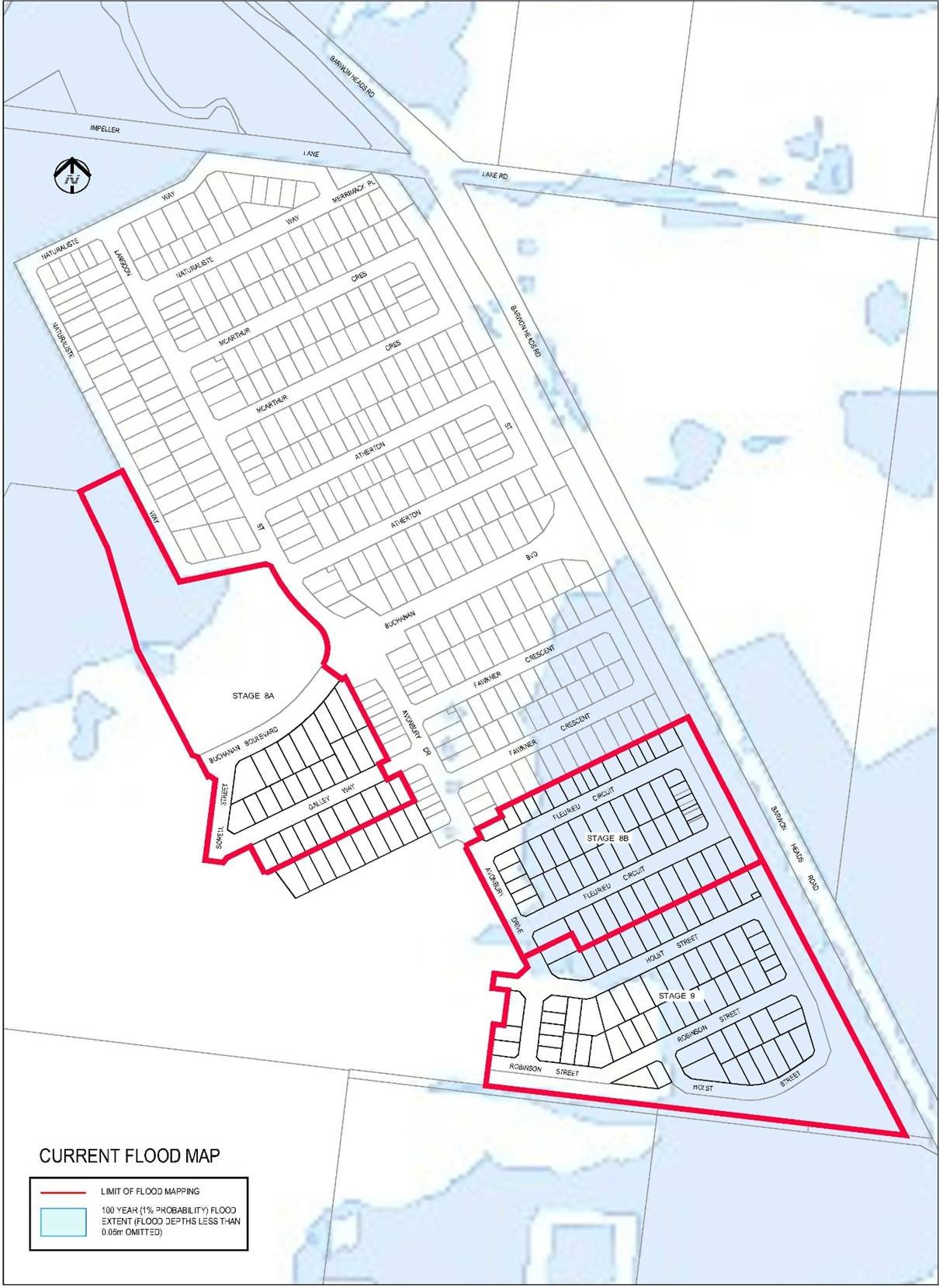
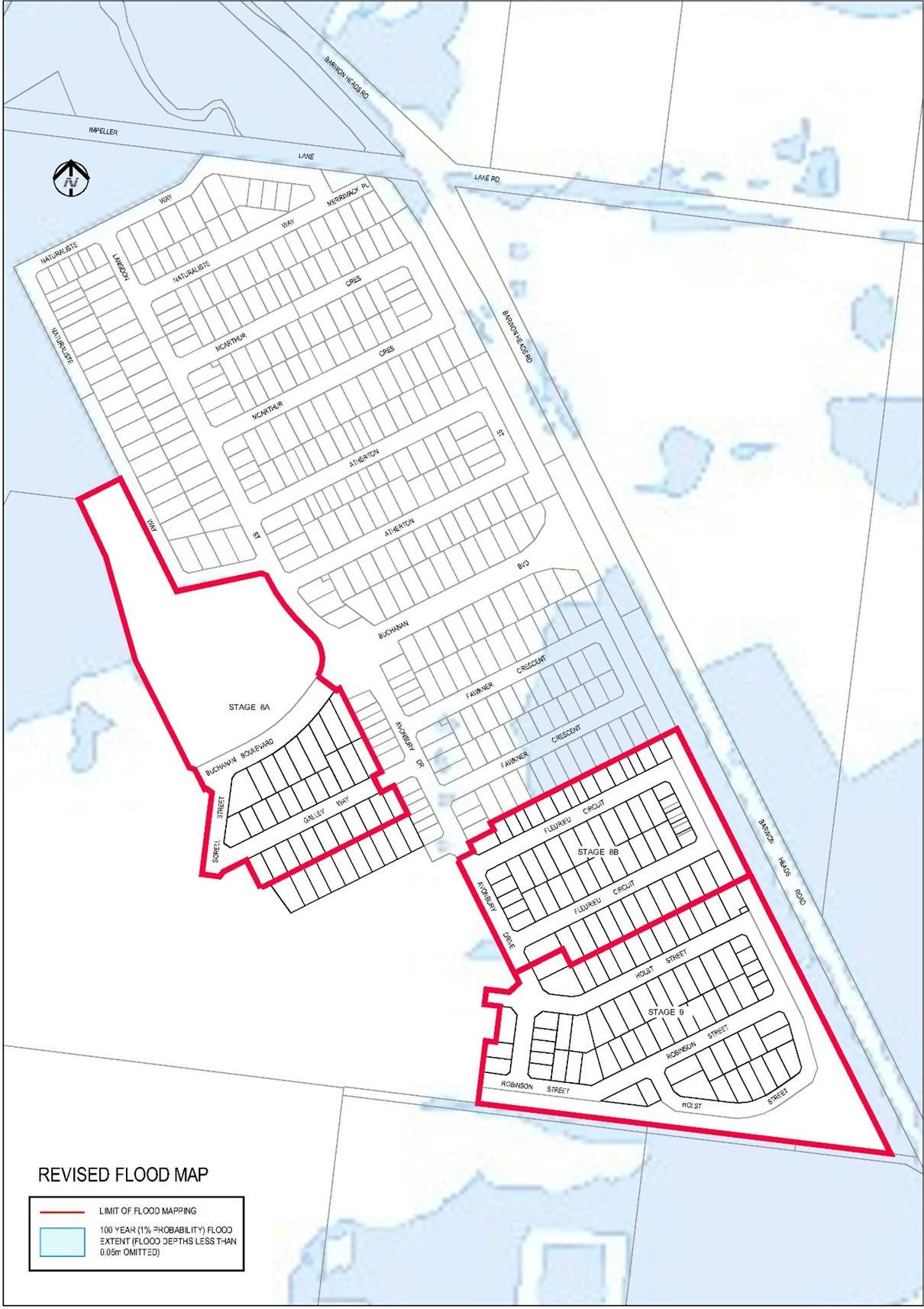
Source: |
Planning, Design & Development – Strategic Planning |
Director: |
Gareth Smith |
|
Source: |
City Services – Engineering Services |
|
Director: |
Guy Wilson-Browne |
To revoke Council’s designation of 12 December 2006 of flood affected land at Warralily Grange, Stage 21 as liable to flooding pursuant to regulation 153 of the Building Regulations 2018.
Council has a statutory obligation under the Building Regulations 2018 to designate land as liable to flooding where it reasonably knows it to be prone to flooding. Conversely, there is an obligation to remove the encumbrance of designation from land that is no longer considered to be flood prone.
The current designated flood mapping (Attachment 2) was designated by Council at its meeting of 12 December 2006.
This revocation will result in another stage of new lots in Warralily Grange fronting 110A Boundary Road, Mount Duneed being free of their flood prone status, paving the way for homes to be built on this land.
The flood mapping is subject to a revision due to the subdivision and development at 110A Boundary Road, Mount Duneed. Prior to subdivision the parent lot was considered liable to flooding. This development site, which is also known as Warralily Grange, Stage 21 achieves flood immunity for newly created lots for flood events up to and including the 100-year Average Recurrence Interval (ARI) event due to the completion of approved internal works.
The recommendation by City engineers that the flood prone status can be removed includes assessment of internal drainage, road construction and earthworks to contain potential floodwaters from the 100-year ARI event within road and drainage reserves (Attachment 3).
It should be noted that designation is separate to the creation of flood overlays within the Planning Scheme, which generally follows designation. In the case of this development, the planning scheme amendment to create post-development flood zones or overlays is proposed after the design of the proposed precincts.
Councillor Moloney moved, Councillor Harwood seconded -
That Council revoke the Council designation of 12 December 2006 of flood affected land at Warralily Grange Mt Duneed, Stage 21 as liable to flooding pursuant to regulation 153 of the Building Regulations 2018.
Carried.
There are no financial implications arising from the subject of this report.
A revocation of designation does not warrant public consultation as it constitutes the removal of an encumbrance on land.
Relevant City databases and flood maps will be revised and updates sent to the Corangamite Catchment Management Authority and Building Control Commission.
The City has a responsibility to the community to provide the best possible information on areas that are flood prone. The removal of flood prone designation allows owners to build on their land without a special permit from the City, and without raising the floor level of their home. It also reduces the cost of property insurance.
The City has various statutory responsibilities for drainage management and flood management (prevention, response and recovery) as set out in the Local Government Act 1989, Local Government Regulations 1990, Planning and Environment Act 1987, Building Regulations 2018, Water Act 1989, Subdivision Act 1988 and Emergency Management Act 1986.
The works have resulted in the lots being protected from flooding during a major storm event that has a one per cent probability of occurring in any one year, and occurs on average once in 100 years. This is the required standard for new subdivisions.
The recommendations of this report are consistent with Council Plan 2018-2022, in relation to planned sustainable development.
No City officers or contractors who have provided advice in relation to this report have declared a conflict of interest regarding the matter under consideration.
The City has some risk exposure with any failure to disclose the flood-prone status of a property in a Land Information Certificate.
The revocation of the designation is the final step in minimising the City’s risk.
The revocation of flood-prone areas designation, and designation of revised flood data through the design of this stage is considered unlikely to result in any known adverse environmental impacts.
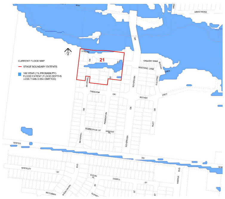
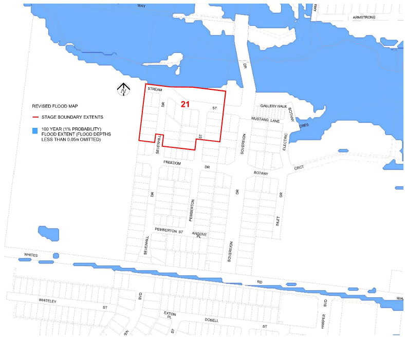
Source: |
Community Life – Leisure and Recreation Services |
Director: |
Robyn Stevens |
Councillor Aitken moved, Councillor Grzybek seconded -
That Council consider this report at the conclusion of the meeting as it is designated confidential by the Chief Executive Officer for the purposes of section 3(1) of the Local Government Act 2020 because it relates to Council business information, being information that would prejudice Council's position in commercial negotiations if prematurely released. This ground applies because there is potential for future commercial negotiations.
Carried.
Source: |
Customer & Corporate Services |
Director: |
Michael Dugina |
Report To: |
Council Meeting |
Councillor Grzybek moved, Councillor Sullivan seconded -
That Council consider this report at the conclusion of the meeting as it is designated confidential by the Chief Executive Officer for the purposes of section 3(1) of the Local Government Act 2020 because it is Council business information, being information that would prejudice Council's position in commercial negotiations if prematurely released. This ground applies because of the sensitive and varied nature of the information received and considered by the Audit & Risk Committee from time-to-time which can pertain to external stakeholders also.
Carried.
Source: |
Customer & Corporate Services |
Director: |
Michael Dugina |
Councillor Sullivan moved, Councillor Mason seconded -
That Council consider this report at the conclusion of the meeting as it is designated confidential by the Chief Executive Officer for the purposes of section 3(1) of the Local Government Act 2020 because it is Council business information, being information that would prejudice Council's position in commercial negotiations if prematurely released. This ground applies because of the sensitive and varied nature of the information received and considered by the Audit & Risk Committee from time-to-time which can pertain to external stakeholders also.
Carried.
Source: |
Customer & Corporate Services |
Director: |
Michael Dugina |
Councillor Mason moved, Councillor Mansfield seconded -
That Council consider this report at the conclusion of the meeting as it is designated confidential by the Chief Executive Officer for the purposes of section 3(1) of the Local Government Act 2020 because it relates to Council business information, being information that would prejudice Council's position in commercial negotiations if prematurely released. This ground applies because there is potential for future commercial negotiations.
Contents | Previous Page: Section A - Procedural Matters | Next Page: Section C - Record of informal meetings of councillors
