
Council Minutes - Section B: Reports - 9 April 2013
Contents | Previous Page: Section A - Procedural Matters | Next Page: Section C - Notice of Motions
Contents | Previous Page: Section A - Procedural Matters | Next Page: Section C - Notice of Motions
Reports tabled at the Ordinary Meeting of Council on Tuesday date held at City Hall, Little Malop Street in Geelong.
Amendment C240 - Armstrong Creek West Precinct Development Contributions Plan
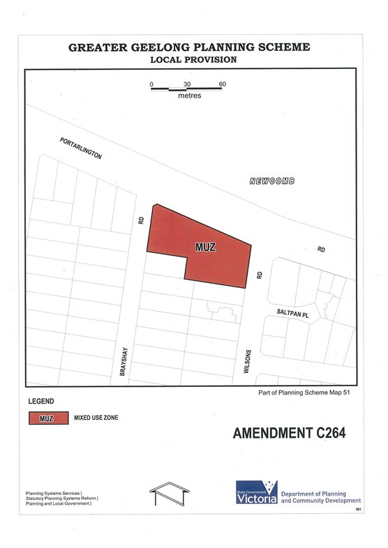
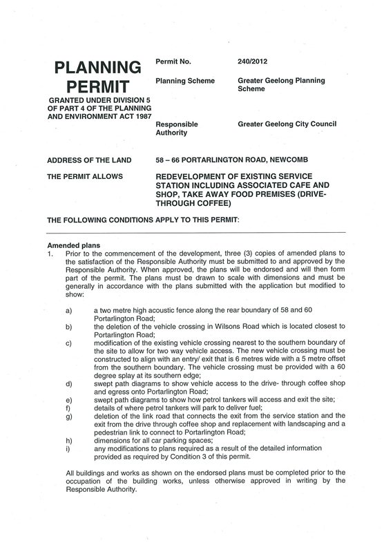
Amendment C264 and Planning Permit 240/2012 APCO Service Station 58-66 Portarlington Road, Newcomb
Geelong Major Events – July to December 2012 Half Yearly Report
Australian Local Government Association – National General Assembly 16-19 June 2013
Portfolio: |
Planning - Cr Macdonald |
Source: |
Economic Development, Planning and Tourism |
General Manager: |
Peter Bettess |
Index Reference: |
Armstrong Creek West Precinct |
Armstrong Creek growth corridor was established in 2008 with the rezoning of the entire growth corridor to an urban growth zone and the adoption of the Armstrong Creek Urban Growth Plan and Framework Plan.
The development across the growth corridor is being delivered on a precinct by precinct basis with individual Precinct Structure Plans and development contribution plans (DCP) being developed in a collaborative manner with consortiums of landowners across each precinct.
The Minister for Planning has approved Amendment C240 and the amendment was gazetted on 7 March 2013. The Advisory Committee report for the Amendment was publicly released on 21 March 2013.
The Minister’s approval of the amendment followed negotiations on the content of the amendment. The Council sought to achieve a similar model for the West Precinct DCP to what the Minister approved for the Armstrong Creek East Precinct DCP.
Villawood supported a similar dollar figure per hectare to the Armstrong Creek East Precinct DCP which effectively resulted in a reduced contribution by landowners due to variations in the number of lots and infrastructure requirements between the West and East Precincts.
The Minister having considered both the Council’s and Villawood’s positions decided on 8 November 2012 to follow the recommendations of the Advisory Committee for the Armstrong Creek West Precinct. The position would have set a DCP levy of $234,674 per hectare.
While there would have been significant financial implications in adopting the Advisory Committee recommendations (Minister’s position) and a model which is at odds with the earlier model established in the Armstrong Creek East Precinct, this is a better outcome for the Council than if the Villawood position had been adopted.
Council continued its regular discussions with the Department of Planning and Community Development (DPCD) regarding a few notable differences between the Minister’s position and the East Precinct DCP which created inconsistency in the growth areas DCP funding model. Two examples of these were the Minister’s exclusion of the multipurpose stadium from the West Precinct DCP and the low funding allowance in for the Regional Active Open Space.
In February 2013, DPCD confirmed an agreement to provide consistency between the two DCPs, however this would be achieved within the proposed levy set by the Minister’s letter dated 8 November 2012 and required some adjustment to a few projects to reallocated funds.
The final West Precinct DCP and Precinct Structure Plan has now been approved by the Minister with a DCP levy set at $234,747 per hectare, inclusive of Multi Purpose Stadium (jointly funded by CoGG, Department of Education and the DCP, as per the East Precinct DCP) and Regional Active Open Space - $8.4M (increased from $7.3M under Minister’s original position).
It is further recommended that Council continue to make representations through the Advisory Committee appointed by the Minister for Planning to review the Development Contribution Planning system across Victoria, to ensure that there continues to be an equitable development contribution system to support the provision of required infrastructure in new growth areas across Geelong. A separate report is being prepared for Council on this Advisory Committee.
Cr Macdonald moved, Cr Richards seconded –
That Council:
notes the approval of the Armstrong Creek West Precinct Structure Plan and Development Contributions Plan (C240);
continues to represent Geelong’s interest in the Advisory Committee proceedings reviewing the developer contribution system for Victoria to ensure that an equitable regime is maintained for the provision of infrastructure via developer contributions.
Carried.
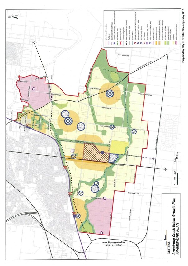
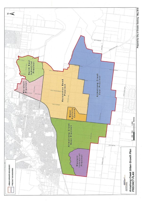
The Armstrong Creek Growth Area was initiated via the approval of the Armstrong Creek Urban Growth Plan (May 2010) Framework Plan for the growth corridor, which further defined the seven individual precincts across Armstrong Creek which were generally defined on natural drainage lines, major roads and reflective of the typography of the overall growth corridor. (Ref Appendix 1-1 – Armstrong Creek Framework Plan and Precinct Plan).
Following the adoption of the initial planning scheme amendment and rezoning of the growth corridor to an urban growth zone, an integrated infrastructure delivery plan was developed for the growth corridor to define the specific civil and social infrastructure required to service this new community.
Further, a methodology was established requiring the formation of a consortium across each precinct with control – 70% of land ownership within the consortium; capability – demonstrated experience in Precinct Structure Planning and delivery of development on the ground; and capacity – ability to act promptly in the delivery of development on the ground. These criteria have been maintained with the consortiums having to demonstrate compliance with these 3C principles in order to be given the status as a consortium to lead a Precinct Structure Plan process.
Status of individual precincts involved:
Armstrong Creek East Precinct – approved Precinct Structure Plan and Development Contribution Plan, with development progressing on multiple fronts from Barwon Heads Road and Surf Coast Highway.
North-East Industrial Precinct (Keystone) – approved Precinct Structure Plan approved Development Contribution Plan, initial earth works now underway for this precinct.
Armstrong Creek West Precinct – pending approval of Precinct Structure Plan and Development Contribution Plan via ministerial advisory committee with the Minister decision in relation to this matter pending.
Major Activity Centre Precinct (Town Centre Precinct) – Precinct Structure Plan and Development Contribution Plan to go to exhibition in April 2013.
Horseshoe Bend Precinct – Precinct Structure Plan and Development Contribution Plan to go on exhibition in April/May 2013.
Western Industrial Precinct – preliminary work undertaken in relation to native vegetation; however no formal steps taken to progress Precinct Structure Plan or Development Contribution Plan at this stage. Consortiums that have control of 70% of land interest across this precinct are in ongoing communication with the Armstrong Creek Urban Growth team.
Marshall Precinct – preliminary work undertaken in relation with the drainage and native vegetation, however no formal steps progressed in relation to the Precinct Structure Plan or Development Contribution Plan. Envisage that Council will take a role in 2013/14 to progress this precinct given the multiple land ownership across the precinct and the unlikelihood of a consortium to be established to meet the criteria as detailed above.
Council on 25 October 2011 invited the Minister for Planning to act as planning authority for the planning scheme amendment C240 for the Armstrong Creek West Precinct Structure Plan and Development Contribution Plan. This approach was adopted with the intent to expedite the delivery of this precinct and to provide for a further development front and additional competition across the growth corridor as a priority.
The Minister for Planning confirmed agreement to progress the amendment in this manner, and advised of a willingness to work with Council accordingly.
In his letter agreeing to be the planning authority, the Minister confirmed “The ACWP Amendment will include a DCP and due to potential budgetary implications for Council arising from the DCP I have decided to allow Council to make comments on the Advisory Committee report prior to my making a decision on the adoption and approval of the Amendment”.
The Precinct Structure Plan and related documentation was exhibited in late 2011 with an Advisory Committee hearing all submitters in February/March 2012.
The Advisory Committee having heard submissions formally reported to the Minister for Planning (acting as a planner authority under the Planning and Environment Act 1987) eight weeks after the closure of submissions to the Advisory Committee (report dated 10 April 2012). The Advisory Committee report was publicly released on 21 March 2013.
On 13 August 2012, DPCD advised the Council that the Minister, after considering the Advisory Committee recommendations, requested modifications of the Precinct Structure Plan and Development Contribution Plan to facilitate the formal adoption of this planning scheme amendment to allow development to commence. In relation to the DCP the letter stated “Amend the West DCP to accord with the East DCP”.
The Advisory Committee made a number of recommendations for modification of both the Precinct Structure Plan and Development Contribution Plan, with the majority of these being agreed through the course of the Advisory Committee hearing, with some additional recommendations by the Advisory Committee review post hearing.
Specifically, the Minister for Planning’s delegate, in providing direction for the preparation of final documents for adoption, supported a position on the Development Contribution Plan for this West Precinct in line with the earlier Ministerial decision approving the Armstrong Creek East Precinct DCP (C214). In the correspondence referred to above the Minister’s delegate made it clear that the position for the Development Contribution Plan in the West would be the same as for the East Precinct.
Council commenced discussion with Villawood Properties as the lead of the developer consortium in accordance Ministerial direction to work with Villawood Properties to have the Precinct Structure Plan and Development Contribution Plan amended in accordance with the directions for formal approval of the amendment.
Following these discussions, the developer consortium led by Villawood Properties then sought to significantly modify the Development Contribution Plan position adopted by the Minister for Planning by seeking a significant departure from the model adopted in the Armstrong Creek East Precinct.
It is understood that Villawood argued for the same dollar amount per hectare as the East Precinct irrespective of the differences in infrastructure requirements between the two precincts. These differences include:
The East Precinct being significantly larger (7,300 lots), compared to 5,700 lots in the West Precinct.
A significant difference in the drainage regime for the two precincts, with the West Precinct required to commit significant additional land to provide for flood mitigation due to the well-established existing Creek line, in the East Precinct the re-establishment of a new Creek alignment was able to minimise the specific land allocated to drainage management.
The West Precinct has significantly enhanced exposure to intersection works with the VicRoads assets, with the northern exposure to the 4C Ring Road extension, and the eastern exposure of the precinct for the entire length of the Surf Coast Highway. This has meant a number of additional Vic Roads intersections with civil works and signalisation required which has again increased the costs to the West Precinct compared to the East Precinct.
Having heard the positions of Villawood, and Council in defence of the earlier position of the Minister, the Minister wrote to Council adopting an alternate position to that of the original direction. The Minister’s new position was to adopt the Advisory Committee recommendations in relation to the Development Contribution Plan with a 10% reduction in intersection costs.
Adopting the Advisory Committee recommendations in relation to the Development Contribution Plan would have resulted in the following key changes being required.
Reduction in the Regional Active Open Space from approximately $12M to $7.3M (remove play field costs)
Deletion of the multipurpose stadium ($4.3M)
Adding a new drainage project for the North-East drainage catchment of the Precinct.
Reducing the cost of Community Complexes as resolved during the Advisory Committee hearing (reduction of approximately $1.6M from two complexes)
This was a significant change in the Development Contributions made for the Armstrong Creek West Precinct, specifically in relation to the provision of playing fields within the Precinct’s major active open space reserve located on Ghazeepore Road.
The Minister’s direction reduces the Development Contributions within the major recreation reserve such that only civil site works are provided for under the contribution from developers, with the installation of playing fields, lights, and affectively all improvements to deliver actual recreation facilities would rest with the Council. In short the Minister’s direction means a reduction from a $12 million contribution (as part of the overall DCP) for this major recreation reserve to $7.3 million. This position results in a DCP levy of $234,674 per hectare for residential development.
The Council adopted the Armstrong Creek Integrated Infrastructure Delivery Plan (Feb 2009) for the entirety of the growth corridor prior to embarking on the individual Precinct Structure Planning process and has used this plan consistently in infrastructure planning to support each precinct, and has been informed by the approach adopted by the Growth Areas Authority (State Government agency) in the preparation of Development Contribution Plans, with unique Geelong circumstances reflective in the individual Precinct Structure Plans and Development Contribution Plans.
Early in 2013 Council officers worked with the DPCD to deliver a more consistent DCP model across the growth area (e.g.: East verse West) as well maximising the amount of funds available to deliver the Precinct’s critical regional active open space.
An outcome of this engagement has been the approval of the Amendment C240 with a few notable changes to the DCP to reflect Council concerns.
These changes have included the re-inclusion of the multi purpose stadium ($4.3M) and an increase in the Regional Active Open Space from $7.3M to $8.4, however these changes were made on the basis of fitting within the DCP levy set by the Minister letter dated 8 November 2012 (i.e.: a DCP levy of $234,674 / ha). This “cap” has required the re-scoping of a greenway improvement project along with the removal of a pedestrian railway overpass.
A summary of this final position is detailed below, along with comparison with the exhibited DCP and Minister Position (8 Nov 2012).
Table 1 - Armstrong Creek West DCP Comparison
|
|
Exhibited DCP |
Minister’s Position (8 Nov 12) |
Approved DCP (Feb 2013) |
|
DCP Levy ($ 2011) |
$248,653 / ha |
$ 234,675 / ha |
$ 234,747 / ha |
|
Total DCP Funding |
$98.1 M |
$91.1 M |
$ 91.2 M |
The above Table 1 details a $6.9M difference in DCP contribution for the Armstrong Creek West DCP (exhibited verse approved), however this reduction reflects predominately a re-scoping of projects to receive lower contributions than exhibited as apposed to projects being removed (e.g.: reduction in regional active open space and greenway improvements). The only project to be removed from the DCP is the railway pedestrian overpass.
In the case of the regional active open space that was reduced by $4.3M, and in essence any active open space within a DCP, Council does have discretion to review of scope of these projects to deliver these recreation facilities. An example would be an 8 hectare sports reserve having two AFL ovals identified within the DCP then at the stage of delivery being re-scoped to deliver two senior soccer pitches. This would need to be based on community consultation or identified changes in sport participation across the Precinct and / or growth area. The change would also need to demonstrate a like for like expenditure of DCP funds.
Another factor in the funding gaps discussed above, is that the dominate contribution required by Council is the $4.3M reduction in regional active open space which is not required until approximately 75% through the development and is not mandatory under the DCP (i.e. this is simply a Council desire to increase the standard of the regional open space facilities / playing fields). The only project that has a mandatory Council funding requirement is the multipurpose stadium ($1.3M Council and $1.7M Department of Education).
Minister’s Review of Development Contributions System
In September 2012 the Minister appointed an Advisory Committee to review Victoria’s development contribution system and advise him on improvements to the system and to recommend key actions.
Council officers have made representation to this Advisory Committee via written submission and formal presentation, and have advocated the need to ensure an equitable approach to infrastructure funding (particularly in regional and rural Victoria).
Preliminary findings from the Advisory Committee have recommended providing a fixed contribution for Community and Recreation infrastructure, greater guidance on what infrastructure can by funded via DCPs and a fix “off the shelf” levy for small scale developments to enable a simplistic funding mechanism.
The early concerns raised by Council officers have included transition issues from the existing system to the new, the capping of the community and recreation components of DCPs (particularly if the figure is set to low) and the exclusion of critical projects in the list of allowable DCP projects. A further report on the Advisory Committee is being prepared for Council.
Council officers will continue to stay actively involved in the review process and present matters of concern that would have an adverse impact on Council’s ability to appropriately fund growth area infrastructure.
The environmental implications of this planning scheme amendment have been addressed through the native vegetation precinct plan which forms part of the amendment package. Further other environmental implications namely via the health of Armstrong Creek have been addressed through the specific infrastructure planning which forms part of the overall Precinct Structure Plan package.
As it has been discussed within the body of this report there have been a few changes to the Armstrong Creek West Development Contribution Plan that impact on Council long-term funding of infrastructure in the growth area.
The final approved Development Contribution Plan for the West Precinct will see a shortfall from the anticipated funding, with the most notable reduction being $4.3 M for the Precinct’s Regional Active Open Space. This facility will require a combination external grant and Council funding to make up this shortfall but is not mandatory under the approved DCP.
This shortfall will require Council’s long term financial plan to be updated to reflect this critical funding requirement, along with Council’s mandatory funding requirement for the Precinct’s multipurpose stadium ($1.3M).
The approved Amendment C240 strengthens the DCP funding model for the total Armstrong Creek growth area, and beyond, via the adoption of consistent project inclusions and funding apportionment to that reflected in the Armstrong Creek East DCP.
The Minister for Planning has initiated a holistic review of Development Contribution Planning and Council has made submissions to the Advisory Committee which is advising the Minister in respect to this major policy area within growth area planning. Officers will continue to represent Councils interest in this process to ensure that there is ongoing equity in the provision of development contributions for the delivery of infrastructure across growth areas.
No council officer involved in the development of this report have a direct or indirect interest in the issue, in accordance to section 80 (C) of Local Government Act, to which the report relates.
The approved DCP provides a more consistent and equitable outcome compared to the already approved Armstrong Creek East DCP, and supports the DCP funding model adopted across the growth area as well in the Lara West DCP. The primary risk to Council is financial as discussed in the report.
The provision of social infrastructure / community infrastructure across the precinct is clearly relevant and the necessity to ensure appropriate level of amenity for future residents is paramount in the planning for new precincts across all the growth areas. The implication in this instance is that Council will be required to allocate resources to provide for the recreational needs of the community of this precinct, which has the potential to impact broader funding for communities beyond Armstrong Creek.
A press release will be prepared detailing the outcome of Amendment C240 – Armstrong Creek West Precinct Structure Plan and Development Contribution Plan.
The approval of Amendment C240 allows development of 5,700 lots across the precinct and will provide greater opportunities for completion in the Armstrong Creek growth area and greater buyer choice.
In relation to the Minister review of the State’s DCP system, Council officers will continue to work with the Advisory Committee appointed to the review the system to ensure that Council's position in respect to the delivery of an equitable system ongoing is clearly understood.
Cr Farrell declared an Indirect Interest in Agenda Item 2 - Amendment C264 – APCO Service Station Rezoning, Portarlington Road, Newcomb – Adoption in that Cr Farrell provides contract services to one of the APCO franchisees and left the meeting room prior to discussion at 7.31pm.
Cr Heagney declared an indirect Interest in Agenda Item 2 - Amendment C264 – APCO Service Station Rezoning, Portarlington Road, Newcomb – Adoption in that Cr Heagney’s family business is a major service provider to APCO and left the meeting room prior to discussion at 7.31pm.
Portfolio: |
Planning – Cr Macdonald |
Source: |
Economic Development, Planning and Tourism – Strategic Implementation |
General Manager: |
Peter Bettess |
Index Reference: |
Application: C264 Rezoning and Planning Permit 240/2012 58 – 66 Portarlington Rd Newcomb |
Amendment C264 and planning permit application 240/2012 were lodged by Roy Costa & Associates on behalf of APCO Petrol Stations.
The Amendment will:
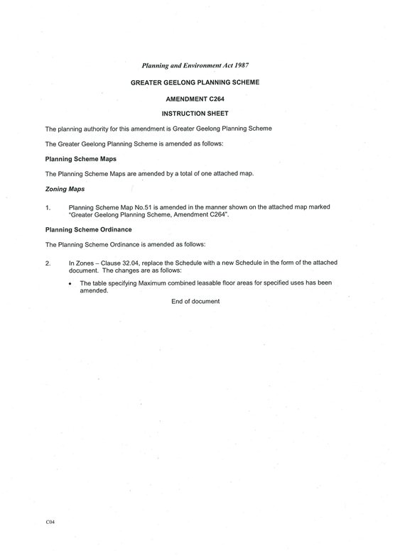
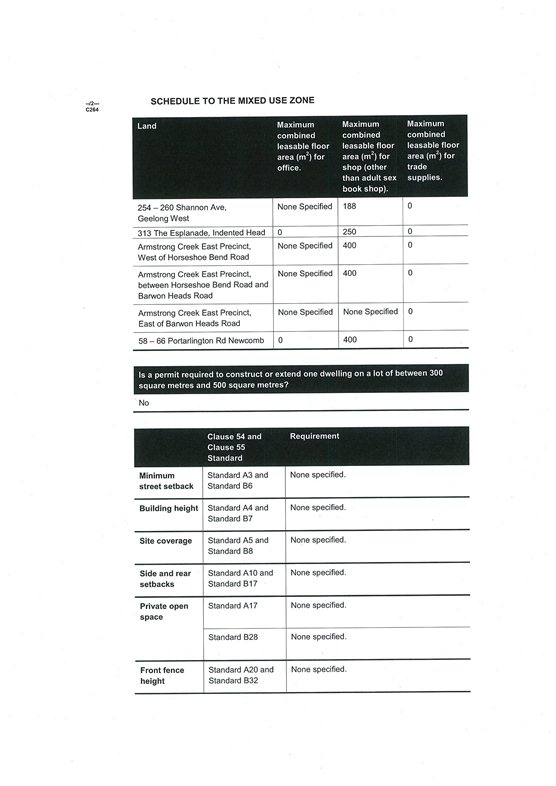
Re-zone land from Residential 1 Zone (R1Z) to Mixed Use Zone (MUZ), and
Apply a cap of 500 square metres to the use of ‘Shop’ on this land in the schedule to the MUZ.
The planning permit will allow the redevelopment of an existing service station including associated take away food premises (drive-through coffee).
Exhibition of the amendment and Planning Permit resulted in the receipt of a total of 4 submissions. All submissions were from public authorities which did not object to the Amendment.
As the Amendment has been exhibited and no objecting submissions were received, Council can decide to adopt the amendment, without the need to request the Minister to appoint a Planning Panel.
It is recommended that the Amendment be adopted as described in this report and forward the Amendment and Draft Planning Permit to the Minister.
Cr Macdonald moved, Cr Harwood seconded -
That Council:
adopt Amendment C264 in the form as outlined in Appendix 2-1 (A) – (C) to this report;
submit the adopted Amendment together with the prescribed information to the Minister for Planning requesting approval; and
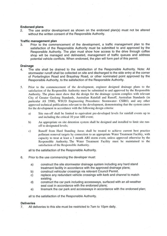
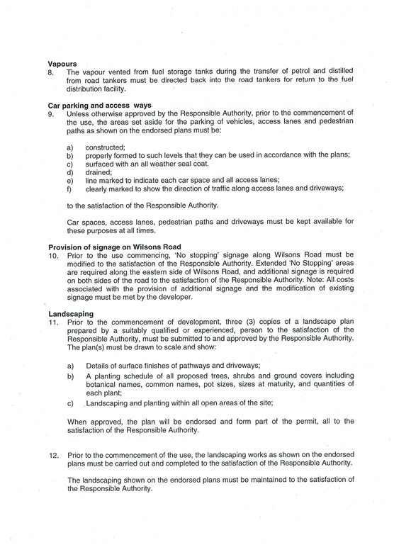
recommend to the Minister that a Permit be granted pursuant to Section 96G of the Planning and Environment Act 1987 (Planning Permit No. 240/2012 is contained in Appendix 2-2.)
Carried.
Amendment C264 and the permit application are proposed to facilitate the re-development of the land at 58 – 66 Portarlington Road as a service station. As the total area of the site is in excess of the maximum 3000 square metre use for service station in the Residential 1 zone (R1Z), it is proposed to re-zone the land to the Mixed Use zone (MUZ).
A map showing the changes to the application of MUZ is provided at Appendix 2-1(C).
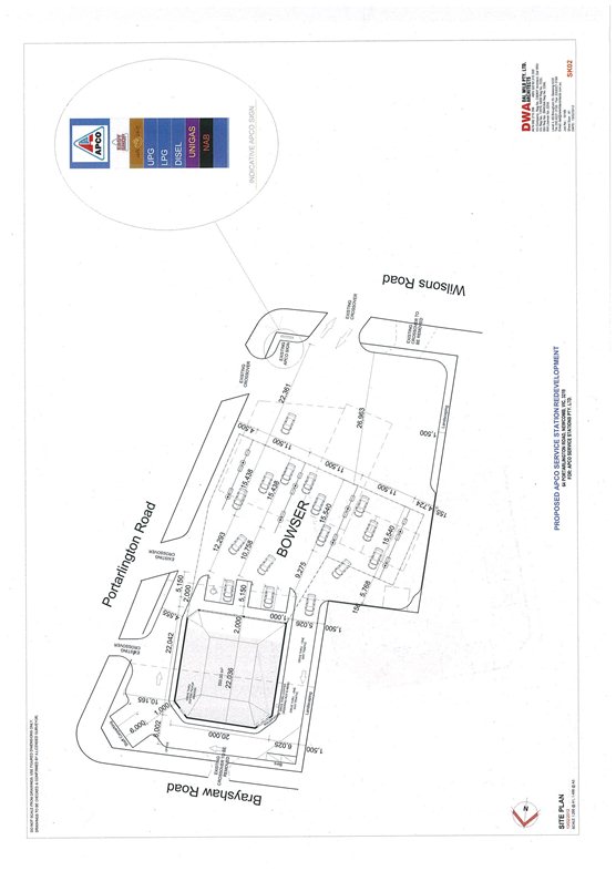
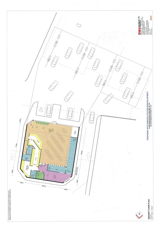
The proposed changes to the planning scheme, together with the conditions contained in the planning permit, will facilitate the re-development of the existing APCO service station and adjoining vacant land for a new service station and associated drive-through coffee shop in a manner which protects the amenity of the surrounding established residential area. The exhibited plans, included as Appendix 2-4.
The ‘coffee shop’ will be located on vacant land at the northern end of the site, on the south west corner of Brayshaw and Portarlington Roads, previously occupied by two dwellings, since demolished.
The proposed re-development provides for landscaping on the western boundary of the site, where it abuts dwellings in the residential 1 zone (R1Z). The redevelopment will also provide for improved set-backs from Dwellings in Wilsons Road.
Authorisation to exhibit the Amendment was sought under delegation by Council officers – i.e. without a report to Council – and, following receipt of Authorisation from the Minister for Planning, the Amendment and Planning Permit were exhibited from 20 December 2012 to 4 February 2013. Notice of the amendment and Planning Permit were given to owners and occupiers of affected land and to relevant authorities and Ministers in accordance with the req`uirements of the Planning and Environment Act 1987.
Four (4) submissions were received in response from the following public Authorities:
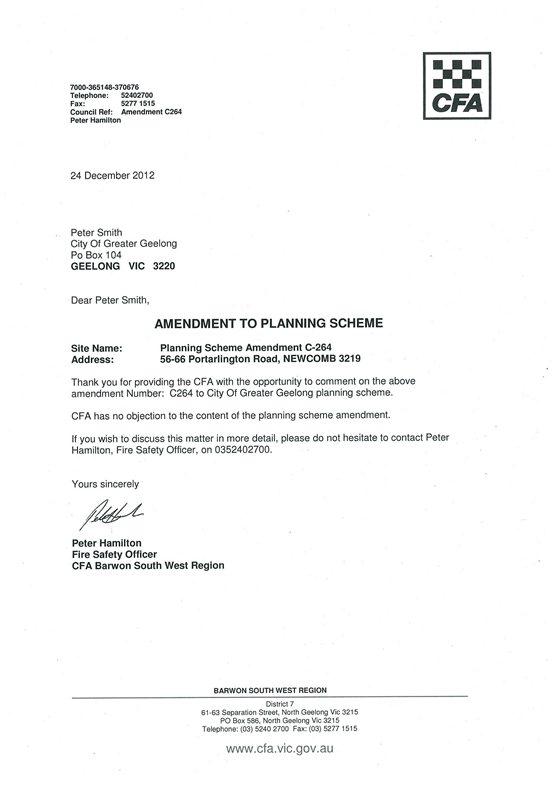
The Country Fire Authority (CFA);
The Environment Protection Authority (EPA).
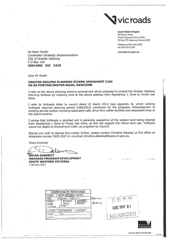
VicRoads; and
The Department of Sustainability and Environment (DSE);
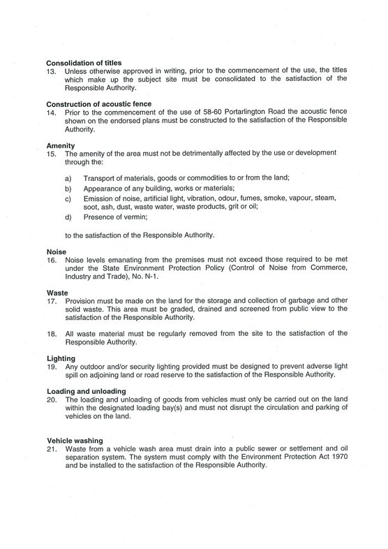
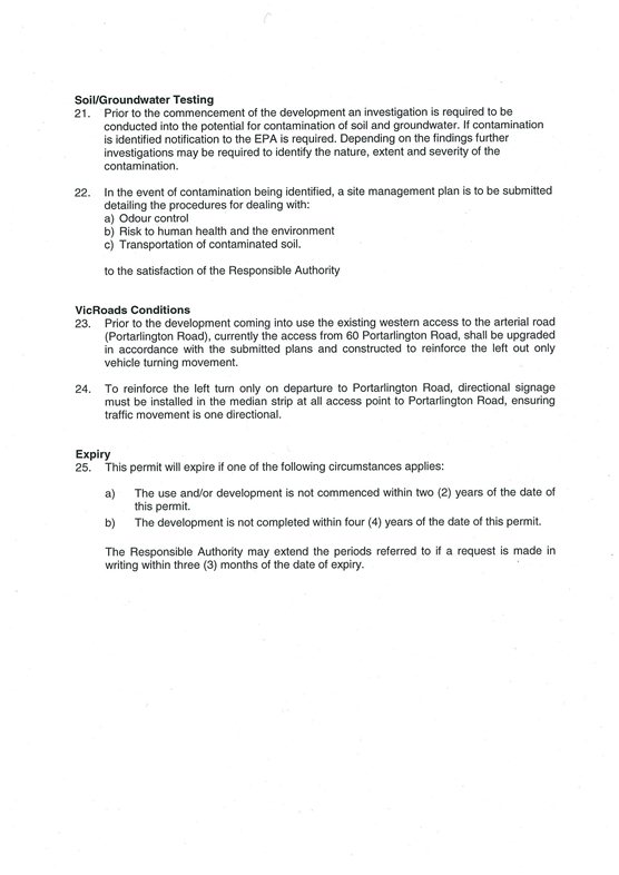
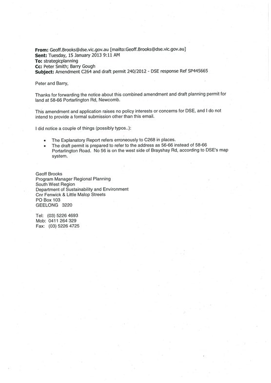
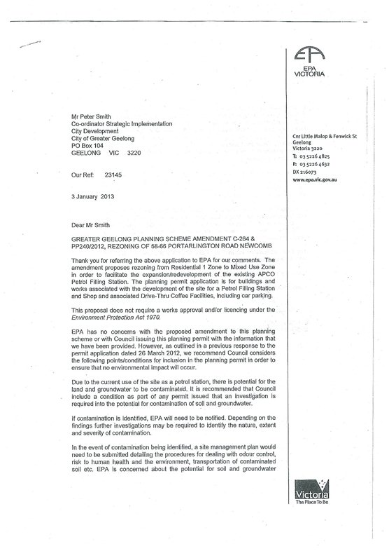
None of the authorities objected to the Amendment or the Planning Permit. Permit conditions specified by both VicRoads and the EPA have been included as part of the planning permit. These submissions are included as Appendix 2-3(A) – (D).
No submissions were received from members of the public.
As no objecting submissions were received Council is able to adopt the amendment and refer the amendment and planning permit to the Minister for approval of the amendment and the issuing of the planning permit.
The changes to the planning scheme will not have any adverse environmental implications.
The changes to the planning scheme will have no adverse financial implications for Council.
The amendment is considered to be consistent with State and Local planning policies as set out in the Explanatory Report, which forms part of the amendment documentation.
No Council officers involved in the preparation of this report have a direct or indirect interest, in accordance with Section 80(c) of the Local Government Act, to the matters to which this amendment relates.
There are no risks to Council associated with the application of the revised planning controls.
The amendment is expected to result in net community benefit, through the provision of a modern service station and coffee shop, in accordance with current community expectations.
Amendment C264 and Planning Permit 240/2012 have been through a formal exhibition process, as a result of which no objecting submissions were received.
Crs Farrell and Heagney re-entered the meeting room at 7:33pm
[Back to List]Portfolio: |
Planning – Cr Macdonald |
Source: |
Economic Development, Planning & Tourism – Strategic Implementation |
General Manager: |
Peter Bettess |
Index Reference: |
Subject: Council Reports 2013 |
Amendment C67 resulted from an application from CPG Consulting on behalf of the Lonsdale Golf Club for a combined planning scheme amendment/planning permit to:
Rezone land to Special Use Zone 3 (Private Golf Courses) & Residential 1 Zone and accompanying Development Plan Overlay to provide for a major extension of the Lonsdale golf course onto land to the north, west and south of the current course extending around the edges of Lake Victoria. It will also facilitate the development of some 100 residential lots on the land fronting Fellows Road;
Provide for 2 two lot subdivisions to facilitate the club’s acquisition of adjoining rural land and excise the Residential 1 land being rezoned; and
Provide for a Section 173 Agreement between the golf club and Council.
Amendment C67 has been processed concurrently with an Environmental Effects Statement (EES). The EES is called for under the Environment Effects Act, 1978 as the proposed development if located in a highly environmentally sensitive setting. The purpose of the EES is to provide a detailed description of the proposal and its potential effects on the environment, including associated economic and social effects, in order to facilitate the Minister for Planning’s consideration of the proposal.
The combined Amendment C67/Planning Permit/EES were exhibited jointly for a 6 week period between 18 August 2011 and 3 October 2011 resulting in the receipt of 166 submissions, 140 of which supported the proposal and 26 submissions which either objected to the proposal or raised some issue of concern.
The Council considered the submissions on 22 November 2011 and decided the club’s proposals warranted referral to an Inquiry/Independent Panel pursuant to both the Environmental Effects Act and the Planning and Environment Act.
The Panel conducted a 7 day hearing in February 2012 in Geelong and Point Lonsdale. During the course of the hearing the Golf Club made a number of important concessions and new initiatives particularly in response to the environmental concerns raised in the submissions.
The Panel’s report was received on 31 May 2012. Its key finding of the Panel is that the likely environmental impacts of the proposed development on State and national environmental matters are acceptable. It also endorsed improved Development Plan Overlay provisions resulting from a “without prejudice” discussion of parties participating at the hearing.
The Panel agreed with Council’s submission that the proposed amendment is consistent with State and Council strategic planning policies. This assessment has been further strengthened by the Minister’s recent approval of Amendment C165 which includes the adopted Point Lonsdale Structure Plan into the Planning Scheme. This Structure Plan is supportive of the club’s proposal.
The Minister for Planning has considered the Panel Report and has provided an Assessment of the proposal in his role as Minister responsible for the Environment Effects Act. The Assessment which was released in mid-October 2012, provides the Minister’s evaluation, findings and advice to statutory decision makers on the environmental effects of the Lonsdale Golf Club’s proposals.
The Minister’s Assessment is supportive of the golf club’s proposals as outlined in this report. The Assessment supports each of the Inquiry/Panel’s nineteen detailed recommendations as contained in the panel report.
The Amendment recommended for adoption and the accompanying Section 173 Agreement encapsulate the modifications to the exhibited documentation as recommended by the Inquiry/Panel and supported in the Minister’s Assessment.
Cr Macdonald moved, Cr Farrell seconded -
That Council:
adopts Amendment C67 as contained in Appendix 11 of this report;
recommends to the Minister for Planning that a permit be granted pursuant to Section 96G of the Planning and Environment Act 1987 (the permit is included as Appendix 12);
signs and seals the accompanying Section 173 Agreement ;
submits the adopted Amendment together with the prescribed information to the Minister for Planning requesting approval.
Cr Fisher left the meeting room at 7:38pm
Carried.
Amendment C67 resulted from a combined planning scheme amendment/permit application by CPG Consulting on behalf of the Lonsdale Golf Club, to provide for a major redevelopment of the Lonsdale Golf Course and residential development in Fellows Road, Point Lonsdale. In general terms, the proposal is to provide for a residential development on the higher, more elevated golf course land fronting Fellows Road to allow for the development of some 100 residential allotments together with an extension of the existing golf course. This is proposed on land to the north, west and the south of the current course extending around the edges of Lake Victoria.
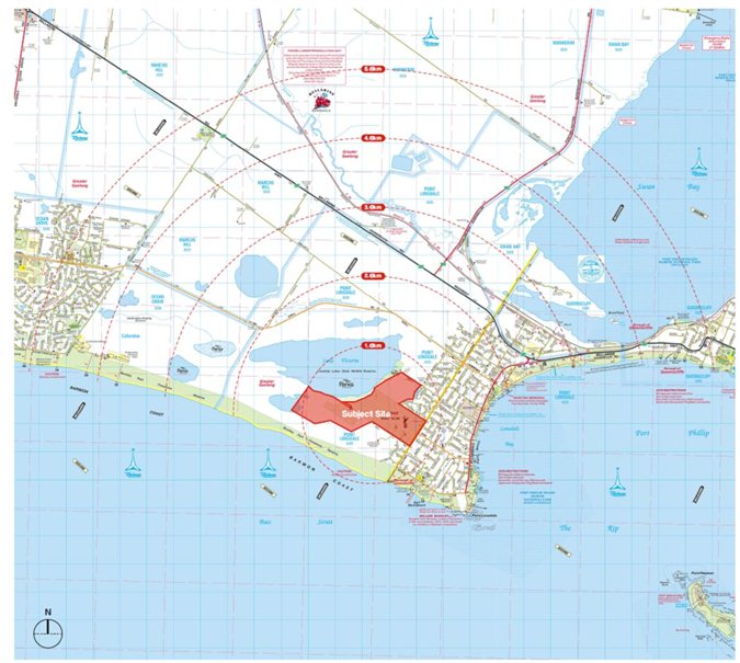
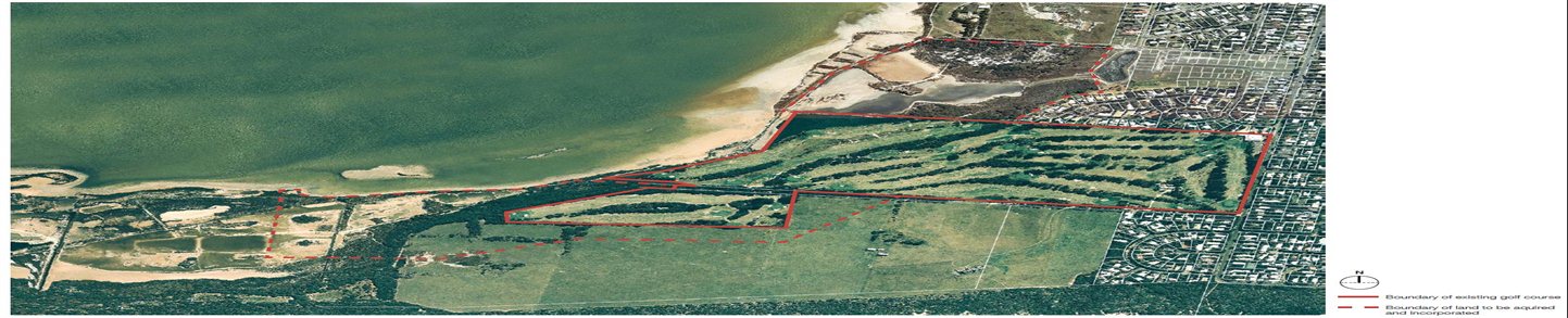
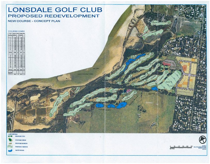
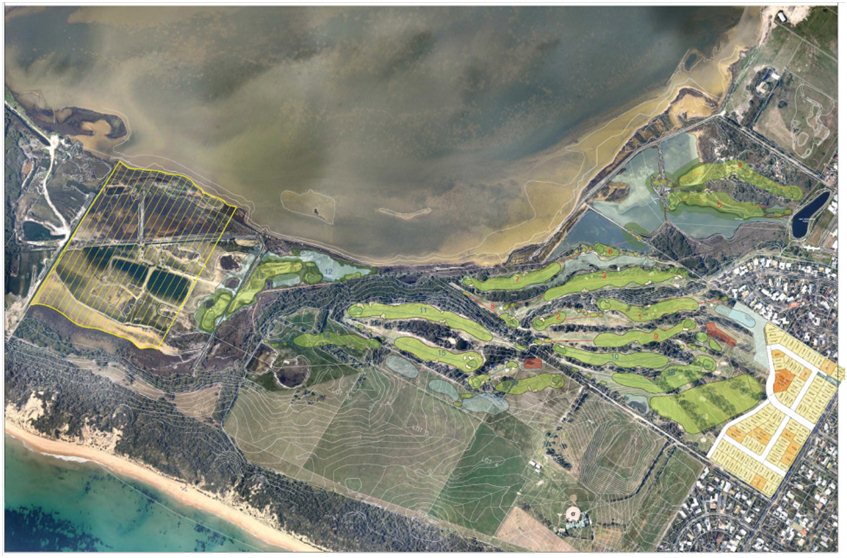
The proposal will also involve a substantial extension and reconstruction of the existing golf course, the removal of some existing vegetation for both the golf course extension and the residential subdivision and the replanting/rehabilitation of land not affected by fairways and greens. See Appendix 1 for the location of the subject site and Appendix 2 for an aerial photo of the site context. Appendix 3 is the exhibited proposal for redevelopment of the golf course site.
This application was made by the Club to ensure its long term sustainability as a well established focus of recreation and community activity within Point Lonsdale and the Bellarine Peninsula.
To remain viable, the club believes a substantial financial injection is required to upgrade the golf course, its design, land management and landscape which cannot be achieved through its membership fees, hence the proposal to realise income from the proposed residential subdivision along the Fellows Road frontage of the site.
The proposed amendment seeks to:
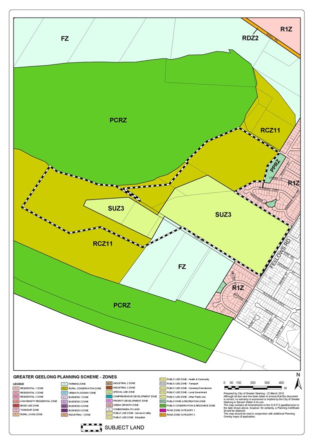
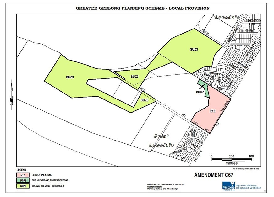
Rezone part of the existing golf course (approx 7.7ha) from Special Use Zone Schedule 3 (SUZ3) to Residential 1 zone (R1Z) to facilitate residential development.
Rezone part of the existing golf course (0.8ha) from Special Use Zone Schedule 3 (SUZ3) to Public Park and Recreation zone (PPRZ), to provide public open space for the new residential development;
Rezone land adjacent the existing golf course from Rural Conservation Zone Schedule 11 (RCZ11) to Special Use Zone – Schedule 3 (SUZ3) to facilitate the extended boundaries and redevelopment of the Lonsdale Golf Course;
Apply a new Development Plan Overlay (DPO) to the whole of the application site, to ensure that the whole of the land is developed in accordance with an approved Development Plan.
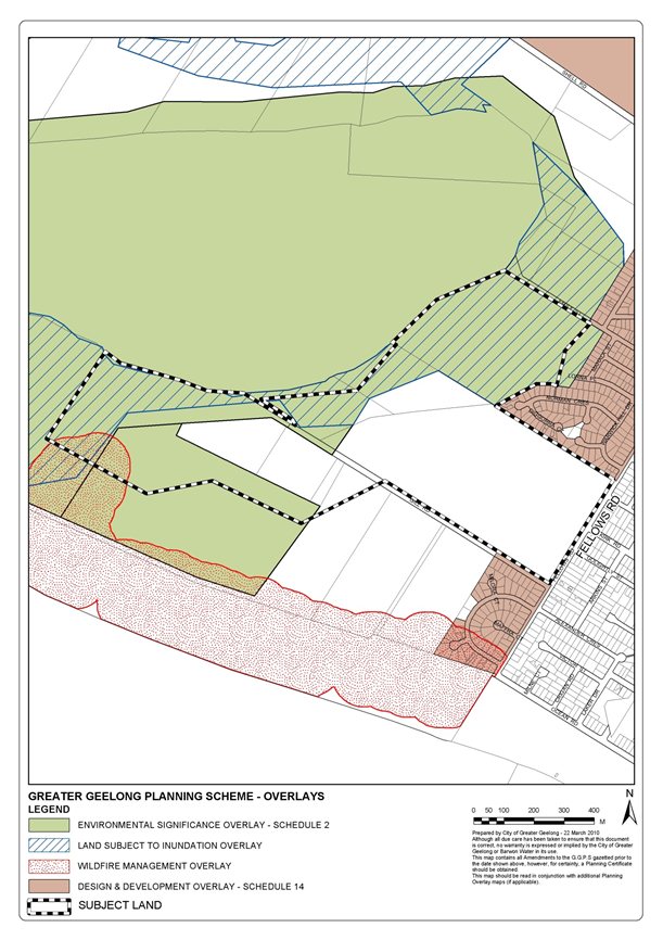
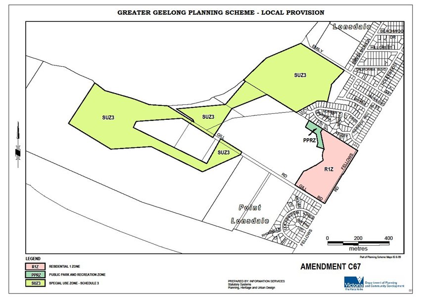
Appendix 4 shows the Existing zonings, Appendix 5 shows Existing Overlays; and
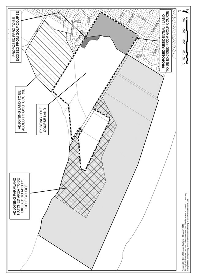
Appendix 6 shows the exhibited rezonings as described above.
The proposed planning permit 1313/2009 seeks to:
Subdivide part of the subject site to excise the proposed future residential land to facilitate its development;
Subdivide rural land adjacent to the existing golf course to facilitate its inclusion within the extended Lonsdale Golf Course.
See Appendix 7 for Plan of Proposed Subdivision.
A Section 173 Agreement to be entered into between the golf club and the Council was exhibited with the Amendment. It includes issues such as the provision and development of local open space, upgrading the Fellows Road intersection, contribution of $900 per lot for community infrastructure and making provision for other local infrastructure.
The planning scheme amendment/planning permit application has been prepared concurrently with an Environmental Effects Statement (EES). The EES is called for under the Environment Effects Act, 1978 as the proposed development is located in a highly environmentally sensitive setting. On 16 May 2003 the Minister for Planning decided that an EES is required for this proposal. The proposal is also a controlled action under the Commonwealth Environment Protection and Biodiversity Conservation Act, 1999 (EPBC Act).
The Commonwealth Delegate has agreed to accredit the Victorian EES process to meet the assessment requirements under the EPBC Act. Once the EES process is complete, the Commonwealth will decide whether to approve the proposal under the EPBC Act.
The purpose of the EES is to provide a detailed description of the proposal and its potential effects on the environment, including associated economic and social effects, in order to facilitate the decision making process under both the Planning and Environment Act 1987, and the EPBC Act, 1999.
The EES process has involved a lengthy consultation/review process overseen by a Technical Reference Group on which all relevant stakeholders have been represented including Council Officers.
While the amendment and EES are separate documents, they have been processed in a coordinated fashion. While the combined amendment and planning permit and the EES were authorised separately (Council has obtained Ministerial authorisation to exhibit the amendment, while the EES is prepared in accordance with Terms of Reference set by the Government, overseen by a Government-appointed Technical Reference Group, and then authorised by the Minister), they were exhibited jointly.
The combined exhibition process between 18 August 2011 and 3 October 2011 resulted in the receipt of 166 submissions, 140 of which either supported the Amendment/EES or offered no objection and 26 submissions which either objected to the Amendment/EES or raised some issue of concern.
The Council considered the submissions at its meeting on 22 November 2011 and decided the club’s proposals warranted referral to an Inquiry/Independent Panel appointed by the Minister for Planning pursuant to the Environment Effects Act and the Planning and Environment Act.
The Panel conducted a 7 day hearing in February 2012 mostly at City Hall with the final day at Point Lonsdale.
During the course of the hearing the golf club proposed a number of important initiatives and concessions including:
Preparation of a Revised Landscape Masterplan to substantially reduce the need for clearing of vegetation to construct new golf holes.
Increased distance of set back of tees from the edge of Lake Victoria.
Of particular importance, the proposal to secure a conservation covenant over adjoining privately owned land to be improved and protected by the club as a permanent bird habitat.
Appendix 8 is the revised golf course layout presented by the club at the hearing which also shows the proposed covenanted area referred to above.
The Panel’s report was received by Council on 31 May 2012. Its key finding is that:
Based on material presented in the EES and supporting documentation, the Revised Landscape Masterplan of 22 February 2012 and proposed Environmental Management Framework, the likely environmental impacts of the proposed redevelopment on state and national environmental matters are acceptable.
Accordingly, the Panel recommends:
Subject to the recommendations in this report, Amendment C67 to the Greater Geelong Planning Scheme be adopted and a permit issued for Planning Permit Application 1313/2009.
Appendix 9 is a summary of the of the findings and recommendations of the Panel. These findings make reference to the key issues which were raised during the hearing and the Panel’s response to them. They also refer to the initiatives and concessions made by the Golf Club during the course of the hearing which received favourable support. The Panel has also endorsed improved DPO provisions resulting from a “without prejudice” discussion of parties participating at the hearing, together with some suggested changes from individual submitters.
The further formal consideration of this Amendment by Council required receipt of the Minister’s Assessment pursuant to the Environment Effect Act, which was released in mid-October 2012. This Assessment provides the Minister’s evaluation, findings and advice to Statutory decision-makers on the environmental effects of the golf club’s proposals.
The Minister’s overall assessment is that:
The potential environmental effects of the proposed development are acceptable and generally of minor significance, providing that identified management and mitigation measures consistent with the findings of this Assessment and the Inquiry’s recommendations are implemented, in particular the creation of a protected conservation reserve. Further reduction of impacts and improved mitigation will also be addressed through the detailed design phase.
The proposed LGCR project, with some minor modifications in accordance with the findings of this Assessment, will provide improved golfing facilities and an infill residential development that are consistent with the Point Lonsdale Structure Plan.
The Ministerial Assessment provides a discussion on all of the major issues which have been raised during the processing of this Amendment within the context of all relevant legislation and policy. The Assessment supports each of the 19 specific recommendations which have been made by the Inquiry/Panel.
The following sections of the report will:
Outline the main issues raised in the submissions;
Indicate the Panel’s findings on these issues; and
Provide an officer response together with an outline indicating how recommendations made by the Panel will be incorporated into the amendment documentation.
It should be noted that this report was originally scheduled to be considered by Council at its January 2012 meeting. It was deferred at the request of the Golf Club to enable negotiations re land transfer with the adjoining neighbour to be finalised.
Supporting Submissions
Issue
The vast bulk of the submissions received expressed support for the amendment and the plans put forward by the Golf Club. In particular they emphasised the important role the club plays in the sporting, social and community life of Point Lonsdale and surrounds. They highlighted the need for the club to remain financially viable and be able to upgrade its facilities to continue to attract members and visitors, its importance for tourism and local employment. That the proposed residential component is consistent with the Point Lonsdale Structure Plan was seen as providing strong planning justification for the project.
Panel findings
The main findings on these issues made by the Panel are as follows:
The proposed redevelopment of the golf course and residential subdivision will result in a net community benefit.
The redevelopment of the golf course will have a positive social impact.
The Lonsdale Golf Club has provided adequate justification for the rationale of the proposed development.
The proposal to redevelop the Lonsdale Golf Course has State and Local strategic planning justification.
Officer response
The Panel’s recommendations are consistent with Council’s presentation at the Panel hearing.
Objecting submissions re Proposed Residential Rezoning
Issue
Twenty submissions, predominantly from residents adjoining the club’s northern boundary or opposite and nearby in Fellows and Gill Road, objected to the proposed residential rezoning or raised issues resulting from the rezoning. Issues include:
Loss of amenity, in particular the change in appearance of the site from an attractive golf course to a conventional residential subdivision.
Impact on existing views currently available across the golf course.
Loss of vegetation in particular established trees both on the subject land and within the Fellows Road and Gill Road reserves.
Impact of additional traffic using Fellows Road and associated safety issues.
Detailed comments on subdivision design and layout e.g. requesting a service road along Fellows Road frontage, one access only to the new subdivision from Fellows Road (i.e. no direct access for residential properties), proposed grid layout not imaginative and out of character with Point Lonsdale subdivisions.
Impact on the character of Fellows Road.
Whether Point Lonsdale has sufficient infrastructure to cope with the additional population generated by both the Stocklands and golf course developments.
Six of these submitters appeared before the Panel.
Panel findings
Chapter 9 of the Panel report headed “Will the proposal have acceptable amenity impacts on surrounding residents?” addressed the above issues in considerable detail.
The Panel “accepts that there will be changes to the local visual environment along the boundaries of the LGC and the interfaces with adjoining existing residential development” and recognises the importance of the DPO Schedule in “developing a design which respects and reflects the existing character of the Point Lonsdale area.” (page 63 of Panel Report).
Officer response
The exhibited DPO Schedule contains a range of provisions aimed at ensuring protection of existing amenity and in particular ensuring retention of on-site vegetation and remnant vegetation in Fellows Road and Gill Road reserves. During the course of the hearing the Council suggested additional DPO and Section 173 Agreement provisions to further provide for the protection of vegetation, access arrangements, buffer areas, construction of Gill Road etc which were specifically raised in the submissions.
The Panel has essentially supported the incorporation of these changes in the DPO and has also made a number of other findings/recommendations including:
The DPO Schedule should provide for a further opportunity for nearby neighbours to participate in an informal consultation process “to ensure that mutually beneficial outcomes are achieved for the design of the new residential subdivision”. (page 66 of the Panel Report)
There should be no service road along the Fellows Road frontage incorporated into the design of the residential subdivision.
The direct local road access to the new residential subdivision from Gill Road can be removed.
Further details about the future development of the clubhouse precinct needs to be included in the DPO Schedule, also providing nearby residents with an opportunity for further informal consultation.
The proposed Residential 1 zone forming part of this Amendment falls inside the Settlement Boundary of the adopted Point Lonsdale Structure Plan. The Panel’s finding that the golf club’s proposal has “strong state and local strategic planning support” has been further strengthened by the Minister’s subsequent approval of Amendment C165 which includes the adopted Point Lonsdale Structure Plan into the Planning Scheme.
Objecting submissions re Environmental Impacts of Golf Course Expansion
Issue
Objecting submissions including from environmental groups Bellarine Catchment Network, Geelong Field Naturalists, Birds Australia, Geelong Environment Council etc expressed serious concerns about the golf club’s proposals to construct new fairways and holes in existing highly significant wetlands around the edge of Lake Victoria. It is submitted these works would result in a serious loss of biodiversity values i.e. plant communities, vegetation and threatened bird habitat (including Orange Bellied Parrot and Hooded Plover). It is claimed the EES lacks significant detail and does not adequately recognise the importance of some environmental issues and the likely impact of the construction of golf holes and on-going golfing activities.
In summary, the key issues raised in the environmental submissions were:
Inadequate recognition has been given to the biodiversity values of the site generally and the regional environmental context of the Ramsar listed wetland system on the Bellarine Peninsula.
There will be a loss of biodiversity values resulting from the construction of 5 golf holes (numbers 4,5,13,14, & 15) of the exhibited masterplan in sensitive wetland areas.
There will be a serious impact on bird habitat (breeding, foraging, roosting, migration) including Orange Bellied Parrot, Hooded Plovers and other waders and water birds.
Major earthworks will affect salt marsh vegetation and potentially cause pollution to Lake Victoria and the adjoining wetlands.
There will be an impact on endangered and significant Coastal Moonah Woodland where vegetation needs to be removed to create hole 15 as shown on the exhibited masterplan.
There will be human disturbance to the significant bird populations as a result of the increased numbers of people being present in sensitive areas.
The potential for pollution from fertilizers and pesticides used on the Golf Course and the spread of introduced grasses and weeds into environmentally sensitive areas.
The proposal does not comply with State and Council planning policies, the existing Overlay controls (ESO2) contained in the planning scheme, the Native Vegetation Management Framework as applied in recent VCAT decisions and the EPBC Act.
There are less sensitive sites available to enable the golf club to redevelop its course (on its own site and adjoining cleared Farming zoned land).
The major issues raised in DSE’s submission were that the EES document does not adequately address options to avoid the need to clear vegetation of very high and high conservation significance as required under the Native Vegetation Framework and that there will be a need to restrict the impact on bird habitat in preparing future Environment Management Plans. At the hearing DSE strengthened its opposition to the club’s proposals by indicating it no longer supported construction of new golf holes around the edge of Lake Victoria.
The EPA considered more detailed work is required on the club’s options for augmentation of the golf course watering system, the means of managing acid sulphate soils if they are encountered during construction and addressing an historic tip site.
Panel’s findings
A brief summary of key findings/recommendations of the Panel regarding environmental issues are:
The revised Landscape Masterplan of 22 February 2012 needs to form the basis of further detailed planning.
The proposal to burden additional land with a conservation covenant is critical in getting the proposal “over the line” by providing permanent critical avifauna habitat.
Environmental outcomes. The EMF needs to include mitigation measures from the EES technical reports and expert witness reports.
Mitigation measures and habitat enhancement will significantly mitigate the potential for impacts on the Orange Bellied parrot.
The Lonsdale Golf Club needs to allocate sufficient resources and employ the necessary expertise to ensure all environmental recommendations are implemented.
The Lonsdale Golf Club should be encouraged to involve and use the local detailed knowledge and expertise from community environmental groups.
Officer response
Environmental issues occupied the vast majority of the hearing time. The Department of Sustainability and Environment and various Environmental groups made presentations including Geelong Field Naturalists Club, Birdlife Australia, Bellarine Catchment Network, Geelong Environment Council and Queenscliff Environment Forum. The Golf Club offered a number of major concessions to the proposed golf course layout as outlined earlier which would significantly reduce the amount of native vegetation to be removed and also to increase buffer distances between important bird foraging and nesting sites. It also put forward the proposal for the creation of a perpetual conservation reserve on private land immediately abutting the western boundary of the extended golf course which is an area of existing and potentially further improved bird habitat. Such a covenant would include a management plan to exclude stock, undertake rabbit/vermin and weed control and measures to improve habitat.
The Ministerial Assessment of the EES supports the recommendations of the Panel. All of these recommendations, which are supported by Council officers, will be incorporated into a modified DPO Schedule and/or Section 173 Agreement as outlined in the next section of this report. Appendix 10 is a table showing how each of the Panel’s 19 detailed recommendations have been addressed or where appropriate included in the amendment documentation.
Development Plan Overlay (DPO) Schedule and accompanying S173 Agreement.
The exhibited Amendment C67 included a new DPO Schedule setting out the further detailed work to be implemented by the Golf Club and approved by Council prior to the issue of permits for both the proposed residential subdivision and new golf holes. It is important to ensure the DPO Schedule makes provision for all recommendations of the EES to be fully implemented. The accompanying S173 Agreement is generally directed at ensuring delivery of infrastructure items and developer contributions in the residential subdivision component of the project.
At the Panel hearing the Council put forward a number of revisions to the exhibited DPO to provide for further protection of vegetation, access arrangements, buffer areas, construction of Gill Road etc to address issues specifically raised in the submissions. During the course of the hearing further changes were suggested and discussed by the Panel and the parties at the hearing.
As a result the Panel has recommended that the further updated DPO presented by Council on 7 February 2012 should be incorporated into the final version of the DPO.
The DPO recommended for adoption includes all of the Panel’s findings and recommendations, supported by the Ministerial Assessment, including:
Reference to the updated Revised Landscape Masterplan of 22 February 2012.
Evidence that a private conservation reserve has been created on land adjoining the extended south west boundary of the golf course, as described above.
Measures to ensure that the contents of the Environmental Management Framework identified in the EES will be implemented.
A requirement that a detailed layout plan of the clubhouse precinct and car parking area and related landscaping and proposed built form of the club house form part of the approved development plan.
A requirement that the Council should conduct further informal consultation with nearby landowners and occupiers in approving the subdivision development and plans for the clubhouse precinct.
Amendment for Adoption
Amendment C67, including the DPO Schedule described above, which is recommended for adoption in accordance with the Panel recommendations and Ministerial Assessment of the EES is Appendix 11.
The permit 1313/2009 to be recommended for approval is Appendix 12. It has not been changed from the exhibited version.
The Section 173 Agreement is to be signed by the Golf Club prior to adoption of the Amendment. It provides for the delivery of infrastructure items for the residential subdivision as outlined earlier in this report.
The environmental implications of this project have warranted it being the subject of an Environment Effects Statement. This process has now been completed with the receipt of the Ministerial Assessment.
The Panel has provided an expert review of all environmental issues raised in the submissions and made recommendations to ensure an acceptable environmental outcome is achieved.
The Ministerial Assessment has fully supported the Panel’s recommendations.
All necessary upgrading to the infrastructure to serve the residential component of this project will be funded by the developer.
There are not expected to be any significant costs arising out of this project other than the further detailed planning approval processes and the ongoing monitoring of implementation measures.
The issue of whether or not the proposed expansion of the golf course around the edge of Lake Victoria is consistent with State and Council planning policies was thoroughly debated during the course of the hearing. The Panel’s finding is that the golf course redevelopment has State and Local Strategic planning policy justification.
The residential rezoning component falls inside the settlement boundary of the adopted Point Lonsdale Structure Plan which has been included in the Planning Scheme following approval of Amendment C165 – Appendix 13
No Council staff involved in the preparation of this report have direct or indirect interest in the matter to which this report relates.
There are not expected to be any notable risks associated with either implementing or not implementing the recommendations contained in this report.
The EES concludes that the proposal will produce a range of community benefits such as providing enhanced community and recreation facilities for local residents, enhancing open space linkages, strengthening the club as a community focal point and providing additional housing opportunities within the township.
The Panel and Ministerial Assessment of the EES concur that the golf course redevelopment will have a positive social impact and that the project will result in a net community benefit.
It is noted that the township vision detailed in the Bellarine Peninsula Strategic Plan provides a clear indication that the community supports this project.
Amendment C67/Planning Permit/EES have been subject to a comprehensive public exhibition and a consultation process. All submittors have had an opportunity to present their views to an Independent Panel appointed by the Minister for Planning. Regular articles in Geelong and local newspapers have kept the wider public informed of the long running planning process.
In finalising its recommendations for the Lonsdale Golf Course (LGC), the Inquiry is cognisant that the EES makes numerous findings and recommendations about the management of the environmental effects of the redevelopment of the proposed golf course in particular. The Inquiry expects that the Government and the LGC will ensure that the issues raised throughout the EES and the recommendations made in response, will be implemented in good faith within the planning framework of the Greater Geelong Planning Scheme and relevant legislation. Many of these recommendations are about adhering to various state standards (e.g. DSE requirements and the like), while others are specific recommendations from specific consultants. The Inquiry expects that as far as practicable, the EES and the recommendations contained within it will provide the foundation for the successful design, construction and management of the redeveloped LGC.
The Inquiry considers that potential amenity and traffic impacts associated with the residential subdivision identified in submissions are likely to be such that they should be able to be ‘designed out’ through the Development Plan process and any residual impacts managed appropriately through the various plans to be produced pursuant to the DPO Schedule.
The Inquiry makes the following findings:
General
Based on material presented in the EES and supporting documentation, the Revised Landscape Masterplan of 22 February 2012 and proposed Environmental Management Framework, the likely environmental impacts of the proposed redevelopment on state and national environmental matters, are acceptable.
Project Rationale
The LGC has provided an adequate justification for the rationale of the proposed redevelopment.
Decision-making framework
The proposal should be assessed having regard to the net community benefit concept in relation to the planning issues and principles of sustainable development in relation to the environmental impacts.
Strategic Planning
The proposal to redevelop the Lonsdale Golf Course has State and local strategic planning policy justification.
Amenity impacts
A service road is not a required or appropriate solution for the Fellows Road frontage.
The amendments to the DPO Schedule proposed by COGG (as presented in the version presented on 7 February 2012) should be incorporated into the final version.
Traffic impacts
There are unlikely to be any significant adverse traffic impacts of the proposed development subject to an appropriately designed roundabout provided as the main access point to Fellows Road from the LGC and the residential subdivision at Kirk Road.
Subdivisions
The proposed two two lot subdivision is acceptable and appropriate to facilitate implementation of the proposed LGC development.
Social impact
The redevelopment of the golf course will have a positive social impact.
Assessment of net community benefit
The proposed rezoning and application of a new DPO to facilitate redevelopment of the Lonsdale Golf Course and development of a 100 lot residential subdivision will result in a net community benefit.
Flora and fauna impacts
The Revised Landscape Masterplan, the proposal for a conservation covenant on land abutting the western boundary and the proposed mitigation measures are all essential elements that combine to provide an acceptable environmental outcome for LGC’s proposed redevelopment.
Acquiring the right to burden additional land to the west of the golf course with a covenant for conservation in perpetuity has been a critical change that gets the proposal ‘over the line’ because it provides potential critical avifauna habitat by improvements to management and rehabilitation of this land.
Water quality impacts
The hydrological and water quality impacts are acceptable and the issues can be managed through nominated additions to the proposed Environmental Management Framework.
Commonwealth matters
In relation to the Orange-bellied Parrot, the Revised Landscape Masterplan, with the proposed conservation covenant on private property abutting the proposed extension of the golf course in the south west, will significantly mitigate the potential for impacts on this species. The Inquiry sees this as being achieved through both the protection of existing habitat and, most importantly, the capacity for habitat enhancement. In addition, the application of a conservation covenant to control land use on this private land will be consistent with conservation of the Orange-bellied Parrot in the long term.
In relation to Listed Migratory Species, this proposal will not seriously threaten an ecologically significant proportion of the populations of the migratory birds using Lake Victoria.
Overall environmental management
The Revised Landscape Masterplan represents an opportunity to provide a significant additional area of suitable land for the protection and enhancement of habitat for the Orange-bellied Parrot in perpetuity and subsequently lowering the risk of habitat loss and disturbance by the proposal to an acceptable level.
The proposal, as modified, does not represent an unacceptable risk to the Orange-bellied Parrot.
Environmental mitigation
The creation of a private conservation reserve to the south west of the expanded Lonsdale Golf Course will be a major mitigation measure pivotal to achieving acceptable environmental outcomes for the proposal.
In conjunction with DPO26 and tied to the approval of planning permit with relevant conditions, the Environmental Management Framework structure, as described for the Stockland Point Lonsdale development, will provide a sound approach for achieving acceptable environmental outcomes. The content of the Environmental Management Framework will need to incorporate the environmental management strategies in the Environmental Management Plan Guidelines and the mitigation measures identified in the EES technical and expert witness reports and during the Inquiry hearing.
The Inquiry makes the following recommendations:
General
Subject to the recommendations in this report, Amendment C67 to the Greater Geelong Planning Scheme be adopted and a permit issued for Planning Permit Application 1313/2009.
Amenity impacts
COGG undertakes an informal consultation process with adjoining property owners in relation to the detailed provisions to be included in the various plans required under the DPO Schedule to ensure that mutually beneficial outcomes are achieved for the design of the new residential subdivision.
The amendments to the DPO Schedule proposed by the COGG (as presented in the version presented to the Inquiry on 7 February 2012) should be incorporated into the final version of this Schedule.
The following wording be included in the DPO Schedule in relation to the Golf Course Layout and Landscape Masterplan:
A detailed layout plan of the clubhouse precinct and car parking area and related landscaping and proposed built form of the clubhouse.
Prior to the approval of the Development Plan, COGG should conduct informal consultation with nearby landowners and occupiers.
Traffic impacts
The vehicular access point to the proposed residential subdivision from Gill Road be deleted and a pedestrian/cycle and potentially emergency access point be provided at this location in a manner that respects the existing vegetated character of Gill Road
Subdivisions
The reference to the endorsed plans in any Planning Permit issued be updated to reflect the most up to date plans.
An amendment be made to Amendment C67 to include a site specific reference in Schedule 11 to the Rural Conservation Zone to Lot 2 in the Rural Subdivision Plan as being exempt from the minimum subdivision size.
Flora and fauna impacts
Approval of the Lonsdale Golf Club proposal be subject to the creation of a private conservation reserve in perpetuity involving an agreement between the Lonsdale Golf Club and the Estate of Marjorie Susan McNaught, being part of land described in Lot 1 on TP822391, and that the agreement include a management plan to exclude stock, undertake rabbit/vermin and weed control, and other appropriate measures to improve habitat.
The Lonsdale Golf Club’s Revised Landscape Masterplan, as tabled at the Inquiry Hearing on 22 February 2012 be adopted as the basis for further detailed project planning.
The mitigation measures as presented by Mr Brett Lane in expert evidence be incorporated into the development of the Environment Management Framework.
The Lonsdale Golf Club allocate sufficient resources and employ the necessary expertise to protect and enhance remnant vegetation and habitat and further refine mitigation measures for avifauna for screening to minimise disturbance of avifauna for the proposed golf course redevelopment and the proposed private conservation reserve.
Hole 5 on the redeveloped golf course be located 15m north from the adjacent pond to reduce the impact on the coastal saltmarsh and bird habitat.
Water quality impacts
The following elements be added to the to the Environmental Management Framework for the proposed Lonsdale Golf Course redevelopment:
Groundwater monitoring of water quality be undertaken and mitigation measures identified to address any decrease in water quality;
A Stormwater Drainage Masterplan be prepared and approved;
A Coastal Acid Sulfate Soil Hazard Assessment be undertaken in accord with DSE’s Victorian Best Practice Guide for Assessing and Managing Coastal Acid Sulfate Soils (October 2010);
A Nutrient and Irrigation Management Plan be prepared that will enable a systematic response to any surface and groundwater monitoring that indicates any increase in nutrients load to the ponds and Lake Victoria; and
Any fill to be imported to the site be subject to the approval of DSE and EPA.
Commonwealth matters
In relation to the Orange-bellied Parrot, approval of the proposal should be subject to:
Completion of a conservation covenant on land abutting the south west boundary of the expanded golf course;
Documentation of the proposed mitigation measures for protection and enhancement of Orange-bellied Parrot habitat;
Inclusion in the Environmental Management Framework of mitigation measures for the protection and regeneration of Coastal Saltmarsh vegetation as habitat for the Orange-bellied Parrot, introduction of screening between the new Holes 4, 5, 12 and 13 and Lake Victoria to reduce potential for disturbance by golfers, and exclusion of public access to the south west ponds area.
Environmental mitigation
An Environmental Management Framework structure generally consistent with that shown in Appendix B be adopted by the Proponent.
The Environmental Management Framework for the proposed Lonsdale Golf Course redevelopment include a Native Vegetation and Fauna Habitat Management Plan based on DSE’s Native Vegetation Precinct Plan that includes the incorporation of mitigation measures from the EES technical reports and expert witness reports and during the Inquiry hearing in relation to:
Protection and enhancement of the connectivity of the Coastal Alkaline Scrub from Emily Street in the north to the coastal dunes in the south.
Protection and enhancement of salt marsh and waterbird habitat within the golf course redevelopment area.
Reduction of potential disturbance to waterbirds on the former shell grit ponds and Lake Victoria.
Protection of the Orange-bellied Parrot habitat on the south west ponds.
Development of a monitoring program and reporting procedures for flora and fauna management.
The Environmental Management Framework include a monitoring program for water quality that also sets performance indicators and mitigation procedures in the event of non-compliance.
The Environmental Management Framework include a programmed audit including timing and triggers for non-compliance.
The Proponent be encouraged to involve and use the local detailed knowledge and expertise from community environmental groups such as the Geelong Field Naturalists Club.
|
Panel Recommendation |
Minister’s EES Assessment |
Recommended Response |
|
It is my assessment that this recommendation be supported.
|
That the adopted amendment be approved by the Minister and the permit issued. |
|
Amenity impacts
Traffic impacts
Subdivisions
|
It is my assessment that this recommendation be supported.
It is my assessment that this recommendation be supported.
It is my assessment that this recommendation be supported.
It is my assessment that this recommendation be supported.
It is my assessment that this recommendation be supported.
It is my assessment that this recommendation be supported.
|
Included as a new requirement in the DPO Schedule under Decision Guidelines. Done Included as new requirements in DPO Schedule in Golf Course Layout & Landscape Masterplan & Decision Guidelines. Included as new requirement in DPO Schedule in Urban Design Masterplan. No change to exhibited plans are proposed. The inclusion of Clause 64.03 into the Planning Scheme on 18/6/2010 makes further amendment to AM C67 unnecessary. |
|
Flora and fauna impacts
|
It is my assessment that this recommendation be supported.
It is my assessment that this recommendation be supported.
It is my assessment that this recommendation be supported.
It is my assessment that this recommendation be supported.
It is my assessment that this recommendation be supported. |
Included as new requirement in DPO Schedule in Urban Design Masterplan. To be created prior to approval of the golf course extension development plan. Done, referred to in DPO Schedule. Included as a new requirement in DPO Schedule – expanded EMF provision and reference to specific inquiry recommendations. Included as new requirement in DPO Schedule in expanded EMF provision. New DPO Schedule requirement in Golf Course Layout and Landscape Plan. |
|
It is my assessment that this recommendation be supported. |
Expanded EMF provision DPO Schedule includes reference to specific panel recommendation to incorporate all these elements. |
|
Commonwealth matters
|
It is my assessment that this recommendation be supported.
It is my assessment that this recommendation be supported. It is my assessment that this recommendation be supported.
|
Conservation covenant addressed in recommendation 8. Expanded EMF provision in DPO Schedule makes reference to this specific panel recommendation. |
|
It is my assessment that this recommendation be supported. It is my assessment that this recommendation be supported.
It is my assessment that this recommendation be supported.
It is my assessment that this recommendation be supported. It is my assessment that this recommendation be supported. |
An EMF as per the nearby recently approved Stockland Pt Lonsdale development is to be applied as per the Panel’s recommendation. The expanded EMF provision on the DPO Schedule makes reference to these specific Panel recommendations. The expanded EMF provision on the DPO Schedule makes reference to these specific Panel recommendations. The expanded EMF provision on the DPO Schedule makes reference to these specific Panel recommendations. Included as a new requirement in DPO Schedule in expanded EMF provision. |
Planning and Environment Act 1987
GREATER GEELONG PLANNING SCHEME
AMENDMENT C67
INSTRUCTION SHEET
The planning authority for this amendment is Greater Geelong City Council.
The Greater Geelong Planning Scheme is amended as follows:
Planning Scheme Maps
The Planning Scheme Maps are amended by a total of two (2) attached maps.
Zoning Maps
Planning Scheme Map Nos. 83 and 89 are amended in the manner shown on the attached map marked “Greater Geelong Planning Scheme, Amendment C67”.
Overlay Maps
Planning Scheme Map No. 83DPO is amended in the manner shown on the attached map marked “Greater Geelong Planning Scheme, Amendment C67”.
Insert a new Planning Scheme Map No. 89DPO in the manner shown on the attached map marked “Greater Geelong Planning Scheme, Amendment C67”.
Planning Scheme Ordinance
The Planning Scheme Ordinance is amended as follows:
In Overlays – following Clause 43.04, insert a new Schedule 26 in the form of the attached document.
In General Provisions – Clause 61.03, replace the schedule with a new schedule in the form of the attached document.
End of document
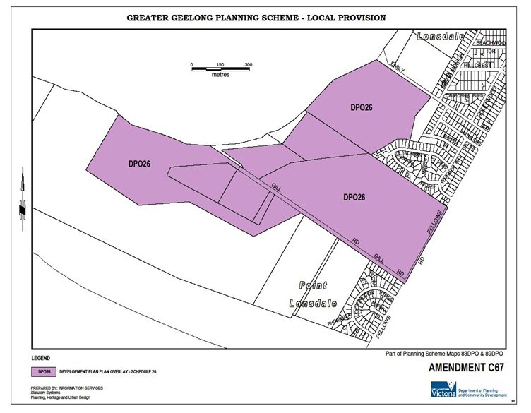
Shown on the planning scheme map as DPO26
LONSDALE GOLF COURSE & RESIDENTIAL DEVELOPMENT
This Schedule applies to the Residential 1 Zone and the adjoining Special Use Zone 3 west of Fellows Road Point Lonsdale comprising the redevelopment of the Lonsdale Golf Course.
The schedule is required to ensure that the new residential area is planned and developed in a fully integrated manner and that the golf course expansion provides for the protection and enhancement of the natural environment and implements the recommendations of the environmental assessment process.
1.0 Requirement before a permit is granted.
Before a Development Plan has been approved by the responsible authority, a permit may be granted for:
Any buildings or works associated with the operation of the existing golf course (including relocation of course maintenance facilities).
Two 2-lot subdivisions generally in accordance with planning application number 1313/2009.
2.0 Conditions and Requirements for Permits
A planning permit allowing for the subdivision of the land into residential lots must include, as appropriate, conditions relating to:
Compliance with and implementation of the Urban Design Master Plan, Landscape Master Plan and the Stormwater Drainage Master Plan forming part of the approved Development Plan.
A Construction Management Plan.
A detailed Tree Protection Plan in accordance with AS4970-2009 including trees in the Fellows Road and Gill Road road reserves.
A Native Vegetation Off-Set Plan if remnant vegetation is to be removed.
A requirement to enter into Agreements pursuant to Section 173 of the Planning and Environment Act 1987, containing requirements for the construction and maintenance of all dwellings to comply with the Building and Landscape Guidelines forming part of the approved Development Plan.
A planning permit allowing development of the golf course area must include, as appropriate, conditions relating to:
Compliance with and implementation of the Golf Course Layout and Landscape Master Plan and Environmental Management Framework forming part of the approved Development Plan.
A Project Environmental Management Plan.
Landscape and revegetation plans generally in accordance with the Landscape Master Plan forming part of the approved Development Plan;
Stormwater Management Plans generally in accordance with the Stormwater Drainage Master Plan forming part of the approved Development Plan for the Residential Subdivision Area.
A Native Vegetation Off-Set Plan.
A Maintenance Schedule for the ongoing maintenance of all landscaped and natural areas.
Coastal Acid Sulphate Soils Management Plan to the satisfaction of the Department of Sustainability and Environment and the Environment Protection Authority.
Details of a layer of clean fill to be placed over the historic tip site adjacent to the fourth hole to the satisfaction of the Environment Protection Authority.
An Earthworks Master Plan.
3.0 Requirements for Development Plan
The Development Plan must be generally in accordance with:
The Lonsdale Golf Club Environment Effects Statement and Technical Appendices A-I (Jan 2011).
The Minister’s Assessment under the Environment Effects Act 1978 of the Lonsdale Golf Club development.
The revised Landscape Masterplan and revised golf course layout as contained in Figures 2 & 3 respectively of the Minister’s Assessment.
Separate Development Plans may be prepared and approved for the Residential Subdivision area and the Golf Course Area in order that the residential subdivision can precede the golf course works.
A development plan may be amended with the approval of the responsible authority.
Residential Subdivision Area
An Urban Design Master Plan must be prepared for the residential subdivision that includes:
A detailed site analysis plan showing existing conditions on the subject land and adjoining and opposite properties, contours at 0.5 metres and existing vegetation.
A Subdivision layout that:
Creates a safe, convenient and legible street layout design that ensures development fronts streets and public open space.
Provides for a minimum of 100 residential lots including a mix of lot sizes to provide for multi dwelling residential development.
Shows key surface stormwater drainage elements including stormwater/irrigation basins, treatment areas, outfalls and overland flow paths to protect existing and future residential developments.
Provides a road network and hierarchy providing two access points to Fellows Road, the primary access to be opposite Kirk Road.
A concept for the intersection treatment of the primary access road, Fellows Road and Kirk Road.
Provides no direct road access from Gill Road other than pedestrian/cycle access to the residential area and clubhouse precinct.
Shows proposed pedestrian networks providing permeability through the site including access to the future clubhouse precinct and through the golf course area at the rear of properties fronting Diggorra Court and Norman Crescent to the Emily Street reserve.
Shows the primary open space area and any associated area set aside for stormwater management adjacent to the future clubhouse precinct and minor open spaces providing connection to Fellows Road.
Provides for a 5 metre widening of the Gill Road and Fellows Road reserves where appropriate in order to protect existing roadside vegetation.
Shows a lot layout along the Fellows and Gill Road frontages which provides for common access-ways where necessary to avoid removal of trees designated for retention in the Landscape Master Plan.
Retains significant vegetation as shown on the Landscape Master Plan.
Shows staging of development.
A Landscape Master Plan must be prepared for the residential subdivision area that includes:
Detailed tree retention and tree removal plans which aim to retain existing trees where practicable.
The provision of a 5 metre landscape buffer along the north boundary of the site adjoining the existing residential properties.
Measures by which all the 5 metre landscape buffer areas along the northern boundary is to be protected by title restrictions or Section 173 Agreements.
Landscaping details for public open space areas (including all playgrounds, earthworks, seats, bollards and fencing), road reserves and the 5 metres landscape buffer strip along the northern boundary.
Details of plant species to be used including extensive use of local indigenous species within open space areas and where suitable within nature strips or street trees throughout the development.
Landscaping treatment of the Fellows Road and Gill Road reserves designating trees to be removed, retained and re-established using local indigenous species.
Implementation measures which need to be taken to ensure protection of trees designated for protection from damage caused by residential building construction and creation of access-ways on residential lots and by the provision of services in road reserves.
Provision of pedestrian walkways throughout the residential area to the future clubhouse/open space precinct and an unsealed path along the Fellows Road frontage of the site.
Building and Landscape Design Guidelines. The guidelines should have regard to the Building Siting and Design Guidelines – Point Lonsdale Coastal Area – Borough of Queenscliffe.
A Stormwater Drainage Master Plan must be prepared for the residential subdivision area that:
Caters for the entire site and existing areas draining to the site.
Is designed in accordance with the following reference documents:
WSUD Engineering Procedures: Stormwater, CSIRO Publishing, 2005.
City of Greater Geelong Stormwater Management Plan, 2002.
City of Greater Geelong Standard Specification for Roadworks and Drainage – Part 6 – Engineering Design Guidelines.
Infrastructure Design Manual.
Provides for the collection, treatment and disposal of stormwater runoff which reflects best practice in water sensitive ‘urban’ design, in particular the manner in which stormwater excess from the residential component is harvested for golf course irrigation;
Provides a detailed written description and concept plans of the proposed system of stormwater quality treatment measures. This should include suitable sized areas to be set aside for features such as wetlands, vegetated swales, bio-retention systems, gross pollutant traps and water detention/sedimentation basins. Stormwater quality treatment measures are to be assessed using the MUSIC (Model for Urban Stormwater Improvement Conceptualisation) program to determine whether the proposed treatments meet the water quality objectives listed in the State Environment Protection Policy (Waters of Victoria) and CSIRO Urban Stormwater Best Practice Guidelines;
Demonstrates that there will be no decrease in run-off water quality and that existing downstream flows are restricted to pre-development levels to prevent impacts on the surrounding sensitive environments, including Lake Victoria;
Provides for the design of overflow paths for a 1:100 year flood event to protect existing and future residential development and which takes account of erosion impacts;
Provides for the staging of construction of stormwater infrastructure having regard to the proposed staging of residential subdivision.
Outlines in detail the construction and maintenance requirements of the wetland and detention/sedimentation basins, in particular while development is proceeding and post construction when the wetland plants are establishing.
Golf Course Area
Conservation Covenant Area Agreement
Before a development plan concerning the Golf Course Area which includes proposed holes 4, 5, 12 and 13 is approved, an arrangement or agreement must be demonstrated to the satisfaction of Council securing a conservation reserve in perpetuity over the land shown cross-hatched in yellow on the revised golf course concept plan, being part of the land described in Lot 1 on TP822391 (and identified in Figure 3 of the Minister’s Assessment under the Environment Effects Act 1978). The agreement or arrangement must include a requirement that the golf club prepares and implements a management plan to exclude stock, undertake rabbit, vermin and weed control and other appropriate measures and works to improve bird habitat on the reserve land.
A Golf Course Layout and Landscape Master Plan must be prepared for the golf course area and include:-
A detailed site analysis plan showing existing conditions on the subject land and adjoining properties.
A detailed course layout plan including:
All earthworks, tees, fairways, greens and clubhouse precinct.
Hole 5 to be located 15 metres north of the adjacent pond and Tees 12 & 13 to be set back minimum distances of 27 metres and 45 metres respectively from the southern shore of Lake Victoria.
Earth mounding and vegetation screening measures to minimise disturbance to avifauna adjoining proposed golf holes around the edge of Lake Victoria.
Stormwater overland flow paths, storage and detention basins and treatment wetlands.
Concept plans of the proposed system of course irrigation.
The location of any public pedestrian paths through the golf course land.
Areas of restricted access to golfers.
Details of fencing to regulate human access to restricted areas or reduce the likelihood of errant golf balls entering restricted access areas or adjoining land e.g. Emily Street Reserve.
A layout plan of the clubhouse precinct and car parking area and related landscaping and proposed built form of the clubhouse.
Vegetation communities to be removed, retained and established on the land and details of plant species to be used including extensive use of local indigenous species.
Environment Management Framework
An Environmental Management Framework must be prepared (based on the Stocklands Point Lonsdale development model) incorporating:
The environmental management strategies in the Environmental Management Plan Guidelines, Environment Efffects Statement Technical Appendix C;
All mitigation and management measures contained in Table 16-1 of the Environmental Effects Statement; and
All issues raised in recommendations 10, 13, 14, 16, 17 & 18 of the Environment Effects Statement Inquiry Report dated 30 May 2012.
The golf club must:
Provide evidence that it intends to allocate sufficient resources and employ the necessary expertise to implement the Environmental Management Framework for the proposed golf course redevelopment and the proposed private conservation reserve; and
Indicate how it intends to liaise with and utilise the knowledge of community environmental groups in implementing the Environmental Management Framework.
Decision Guidelines
In deciding whether or not to approve or amend a development plan, the responsible authority must consider:
The requirements of this Schedule.
The State and Local Planning Policy Frameworks.
The Minister’s Assessment under the Environment Effects Act 1978.
The views of the Borough of Queenscliffe Council, Department of Sustainability and Environment and any other relevant government agency and statutory authority.
In deciding whether or not to approve or amend a development plan, the responsible authority may consider:
For the Residential Subdivision Area, the views of land owners and occupiers adjoining the northern boundary of the Residential 1 zoned land in relation to the Landscape Master Plan and Building and Landscape Design Guidelines requiring approval.
For the Golf Course Layout and Landscape Masterplan, the views of nearby landowners and occupiers at 29 – 33 Norman Crescent (inclusive) and 4 – 18 Diggorra Court (inclusive) about the clubhouse precinct and associated car parking approvals.
|
PLANNING PERMIT GRANTED UNDER DIVISION 5 OF PART 4 OF THE PLANNING AND ENVIRONMENT ACT 1987
|
Permit No.: 1313/2009 |
|
ADDRESS OF THE LAND: |
31-69 FELLOWS ROAD, POINT LONSDALE AND 19-73 GILL ROAD, POINT LONSDALE |
|
THE PERMIT ALLOWS: |
SUBDIVISION OF LAND GENERALLY IN ACCORDANCE WITH THE ENDORSED PLANS |
THE FOLLOWING CONDITIONS APPLY TO THIS PERMIT:
Layout
The layout and site dimensions of the proposed subdivision as shown on the endorsed plans (referred to as Figure 7 & 8 in the Planning Report prepared by CPG dated June 2011) shall not be altered or modified without the written consent of the Responsible Authority. There are no requirements to alter or modify the endorsed plan if a plan is certified under the provisions of the Subdivision Act 1988 that is generally in accordance with the endorsed plans.
Conditions Required by Clause 66.01-1
The owner of the land must enter into agreements with the relevant authorities for the provision of water supply, drainage, sewerage facilities, electricity, gas and telecommunication services to each lot shown on the endorsed plan in accordance with the authority’s requirements and relevant legislation at the time.
All existing and proposed easements and sites for existing or required utility services and roads on the land must be set aside in the plan of subdivision submitted for certification in favour of the relevant authority for which the easement or site is to be created.
The plan of subdivision submitted for certification under the Subdivision Act 1988 must be referred to the relevant authority in accordance with Section 8 of that Act.
Expiry
The permit will expire if the plan of subdivision is not certified within 2 years from the date of this permit and if a statement of compliance is not issued within 5 years of the date of certification of that plan.
Note: This permit does not authorise the construction of any buildings or works including the removal of vegetation.
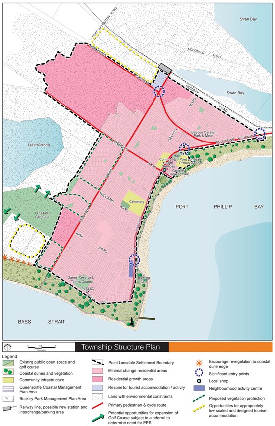
Portfolio: |
Planning – Cr Macdonald |
Source: |
Planning Strategy and Economic Development |
General Manager: |
Peter Bettess |
Index Reference: |
Council Reports 2013 |
At the Council meeting on 26 February 2013 Council resolved to make a submission to the State Government about the Discussion Paper for the new Metropolitan Planning Strategy “Melbourne lets talk about the future”.
The submission at Appendix 1 will be sent to the Department of Planning and Community Development as Council’s submission.
Six key points are addressed in the letter:
Support for closer links between Melbourne and regional cities and the need for additional investment in infrastructure particularly public transport;
Support for the location of an employment cluster in Melbourne’s west which would benefit from the proximity of Avalon Airport, the Port of Geelong and the accessibility provided by the Geelong Ring Road, Princes Highway and the standard and broad gauge rail lines;
Acknowledgement of the Metropolitan Planning Strategy identifying the need for integration between the G21 Regional Growth Plan and the Metropolitan Strategy particularly on interface issues;
The benefits that Geelong and the region can offer residents in the west of Melbourne in terms of service provision particularly in health and education, and the importance of ensuring infrastructure investment in health and education services in Geelong keeps pace with population growth in Geelong and west Melbourne;
The continued support for transport projects including the east west link as an alternative to the West Gate Bridge and the rail link to Avalon;
The support and the need to consolidate investment in Avalon in advance of the development of a third airport for Victoria.
Cr Harwood moved, Cr Ansett seconded -
That the report be deferred.
Cr Fisher re-entered the meeting room at 7:40pm
Carried.
Portfolio: |
Sport & Recreation - Cr Irvine |
Source: |
Projects, Recreation & Central Geelong - Sport & Recreation |
General Manager: |
Dean Frost |
Index Reference: |
Subject: Sport Leisure & Recreation / Reports |
Armstrong Creek is one of the largest strategic planning projects ever undertaken by the City of Greater Geelong. The Armstrong Creek Sports Development Plan investigates and outlines how sport and associated partners can make a positive contribution towards delivering an active and healthy community ensuring that sporting infrastructure created is embraced and fully utilised by the new community.
The Sports Development Plan takes a strategic approach for the future provision of sport in the Armstrong Creek growth area including recommendations for the establishment and enhancement of sporting opportunities having regard to participation trends, barriers to participation, support structures and consultation with state and local sporting bodies.
The recommendations Armstrong Creek Sports Development Plan have been designed to apply to other growth areas across the municipality and to work in with Council’s existing processes and networks. Other key areas include Lara, Fyansford, Highton, Leopold, Clifton Springs, Ocean Grove and Point Lonsdale.
Key recommendations critical in the Plan that were identified include:
The provision of dedicated sports development staffing resources
Securing partnership commitment from state sporting bodies and agencies
Engagement and commitment of local schools in developing sport
The connection of Armstrong Creek to existing sporting systems, structures and programs currently activated for existing sports clubs across the municipality
A focus on developing new sporting clubs to service community sport and recreation demands at Armstrong Creek
The success of the delivery of these actions will ultimately determine the growth, development and sustainability of sport throughout Armstrong Creek. Existing sports clubs within City of Great Geelong will continue to be supported through existing sport development resources. Failure to implement the Sports Development Plan will lead to the slow engagement and inhibited growth of local sports participation and physical activity, leading to ad-hoc development and a disconnect in the community.
Cr Irvine moved, Cr Richards seconded -
That Council:
note the Draft Armstrong Creek Sports Development Plan, and
release the Draft Armstrong Creek Sports Development Plan for public comment for a period of four (4) weeks.
Carried.
Armstrong Creek is one of the largest strategic planning projects ever undertaken by the City of Greater Geelong. As part of the planning process for the infrastructure it became evident that to achieve the desired community outcomes and achieve high levels of sporting uptake, Council would need to do more than provide the facilities. Council will be required to support the creation of new clubs and engage with sports to deliver a coordinated sporting offer.
The Sports Development Plan outlines how sport and associated partners can make a positive contribution towards delivering an active and healthy community.
Sport in Geelong is an essential part of its culture and is highly valued by the existing community. Commitment to supporting sport in Geelong is also evidenced through a range of municipal and regional planning studies, development of infrastructure of regional, state, national and international quality, the attraction of large scale events and the establishment of Sports House within Simonds Stadium.
The Armstrong Creek Sports Development Plan seeks to build on this historical commitment and grow the City’s involvement in sport to progress and develop its new communities. The Armstrong Creek Sports Development Plan is not about infrastructure, but with substantial infrastructure planned for the Armstrong Creek development area and significant population growth projected, a Sports Development Plan is required to facilitate the establishment and sustainable delivery of sport for the emerging community.
The recommendations Armstrong Creek Sports Development Plan have been designed to apply to other growth areas across the municipality and to work in with Council’s existing processes and networks. Other key areas include Lara, Fyansford, Highton, Leopold, Clifton Springs, Ocean Grove and Point Lonsdale.
In addition to lost opportunities, failure to act on and successfully implement the Armstrong Creek Sports Development Plan will likely lead to the slow engagement and inhibited growth of local sports participation and physical activity, significantly restrict the consistent delivery of programs and activities (leading to ad-hoc development) and ultimately fail to attract the ongoing connectivity, support and ownership of key stakeholders in an exciting new initiative.
The Armstrong Creek Sports Development Plan identifies the best way(s) to make sport function within the defined infrastructure framework developed.
It focuses on ensuring the delivery of sport from the outset, in order to engage the local community in the establishment of sport and its future growth and development.
Historically, sports development has not rated highly in the establishment of new communities compared to the urgency surrounding the provision of essential infrastructure. However, the rapid growth of new communities drives the need to focus on early planning for the delivery of sport and recreation facilities and to provide appropriate specialised sports development resources to engage with sport and communities early in the planning stages.
A key focus of the Armstrong Creek Sports Development Plan is to set the criteria and a framework for the birthing of new sporting clubs within each key recreation reserve throughout the development area. Armstrong Creek provides new opportunities for growth and engagement and is not viewed as an opportunity to resolve existing local sport development, club congestion and diminishing catchment issues. The focus of the plan relates to the development of social capital for the new residential community.
The plan identifies a number of critical challenges for the future development of sport in Armstrong Creek. The key challenge being that it is much harder, and therefore less appealing, to deliver on sports development objectives than deliver on tangible infrastructure projects. Sports development is also much more difficult to measure and attract funds and resources for, yet the successful delivery of sports development initiatives has the ability to deliver more significant social, economic and participation (sport and community) benefits.
The Armstrong Creek Sports Development Plan can also be applied to the growth areas across the municipality and is designed to work in with Council’s existing processes and networks.
The Sports Development Plan takes a strategic approach for the future provision of sport in the Armstrong Creek growth area including recommendations for the establishment and enhancement of sporting opportunities, having regard to participation trends, barriers to participation, support structures, site analysis and consultation with State and local sporting bodies.
Key recommendations critical in the plan include:
The provision of dedicated sports development staff resources;
Securing partnership commitment from state sporting bodies and agencies;
Engagement and commitment of local schools in developing sport;
The connection of Armstrong Creek to existing sporting systems, structures and programs and
A focus on developing new sporting clubs to service community sport and recreation demands at Armstrong Creek
The Armstrong Creek Sports Development Plan encourages and promotes sport, physical activity, social interaction, health and wellbeing and community participation. In lieu of an existing community, the Sports Development Plan creates a road map for sport provision and delivery and a model that will lead growth area development in sport.
The proposal does not have an impact on the environment.
The implementation plan provides a broad estimate of costs specific to each of the recommended actions. These actions are assessed as Mandatory, Critical, High, Medium and Low to guide Council decision making in terms of development. There are no mandatory works connected with the draft plan. The total cost of all works is estimated at $454,000 and is represented below in the prioritised breakdown.
Mandatory $Nil
Critical $290,000
High $35,000
Medium $64,000
Low $65,000
Total $454,000
Where implementation of specific recommendations requires a new budget allocation from Council, these will be presented and considered as part of the overall annual budget process. Opportunities for co-contributions from State Sporting Bodies, VicHealth, Leisure Networks, Developers and Sport and Recreation Victoria are listed against specific actions in the Plan.
The Armstrong Creek Sports Development Plan recognises that all community members have equal rights to participate in and enjoy the benefits of sport and physical activity. The development of sport will consider solutions to help facilitate access for all.
No Council staff or persons engaged under contract have a direct or indirect interest in the development of the Armstrong Creek Sports Development Plan.
There are no immediate risks associated with this report. Appropriate risk management measures will be put in place when implementing the recommendations of the report.
The Armstrong Creek Sports Development Plan recognises that supporting formal sporting clubs in not just about participation in physical activity.
Sporting clubs are recognised as providing a range of broader benefits to the community, including contributions to social capital, community cohesiveness, community connection and building local leaders.
The preparation of the Armstrong Creek Sports Development Plan has been managed by a three-tiered management structure:
Project Control Group (PCG) consisting of key representatives from Recreation & Open Space, Urban Growth Team and Sport & Recreation Victoria. The PCG provided high level strategic direction on key issues and opportunities.
Project Steering Group (PSG) consisting of Council officers and senior management from the following organisations:
Sport & Recreation Victoria (SRV)
Department of Planning & Community Development
Department of Education & Early Childhood Development
VicSport
AFL Victoria
Cricket Victoria
Football Federation Victoria
Netball Victoria
Tennis Victoria
Tennis Australia
VicHealth
Steering group engaged the major outdoor sports however included agencies such as VicSport to represent other sports not involved.
Project Reference Group (PRG) consisting of representatives from:
Football & Netball Geelong
Geelong & District Football League
Geelong Football Umpires League
Geelong Football League Netball Association
Bellarine Football League Netball Association
Tennis Geelong
Geelong Lawn Tennis Club
Geelong Cricket Association
Barwon Cricket Association
Geelong Bowls Region
Hockey Geelong
Victorian Country Football League (now AFL Victoria)
In addition, the following government departments, agencies and organisations were consulted in the preparation of the Armstrong Creek Sports Development Plan:
Sport & Recreation Victoria
Department of Planning & Community Development (DPCD)
Department of Education & Early Childhood Development
Surf Coast Shire
City of Casey
City of Wyndham
City of Melton
City of Whittlesea
Cardinia Shire
Leisure Networks
Barwon Sports Academy
Armstrong Creek developers
Although not current residents, initial land purchasers of Warralily Estate were also consulted to capture their views.
The planning process involved a comprehensive review of background material and the establishment of the stakeholder reference groups as outlined above to guide the planning process. The project has involved extensive consultation with stakeholders, Council staff and key community groups.
The main consultation tasks have included:
Establishment of the PCG, PSG and PRG. These groups have met on a minimum of three occasions each in the lead up to this report
Meetings with the Growth Area Councils
Meetings with DEECD
An online survey with land purchasers at the Warralily Estate
All avenues of local media will be utilised to highlight the public exhibition of the draft Sports Development Plan. This includes a media release, Community Update, notification and promotion to all key stakeholders.
Portfolio: |
Tourism and Major Events – Cr Nelson |
Source: |
Projects, Recreation and Central Geelong |
General Manager: |
Dean Frost |
Index Reference: |
Subject: Events / Geelong Major Events Issues |
Council established the Geelong Major Events (GME) committee in August 1998 pursuant to Section 86 of the Local Government Act.
GME strives to stimulate and encourage major events that offer the best opportunity to provide measurable economic benefits potential to market Geelong outside the municipality and enhance local community life through participation of residents.
GME supports the development and improvement of hallmark, major and developing events whilst focusing its activities on a clearly defined strategic program.
GME has established and maintains strong links with the private sector, government and our communities to achieve high levels of stakeholder investment and activity required to realise the events potential of Geelong.
Council have endorsed Cr Ron Nelson (Chair), Cr Keith Fagg, Cr Bruce Harwood and Cr Kylie Fisher as the councillor representatives on the GME Committee for the period 2012/2013.
This report provides an overview of GME activities for the period July 1 to December 31 2012 which included:
7 major events successfully hosted in the Geelong Region including the IBF World Titleweight Eliminator boxing event, Toast to the Coast, Geelong’s Streets Are Alive, Death of a Salesman, Australian Water Ski Championships, Just Cars Geelong Revival (Motorsport) and the New Year’s Eve Pier Festival.
Those events stimulated economic activity and provided social benefits to our community. Approximately $9.6million of event expenditure was generated in our region from local and non local sources which is the equivalent of 75 full time jobs in the region.
Those events provided additional social benefits for the local community through participation and spectator opportunities with a number of our major events offering free public access and entertainment for all ages. An estimated 100,000 spectators attended the 7 events staged in the half-year ending 31 December 2012.
Cr Nelson moved, Cr Harwood seconded -
That Council notes the report detailing the activities of GME for the period July 1 to December 31 2012.
Cr moved, Cr seconded -
That Council note the Geelong Gallery 2011-2012 Annual Report and the 2011-2012 Evaluation Report.
Carried.
Council, in August 1998, established a Section 86 Committee under the provisions of the Local Government Act known as Geelong Major Events (GME) as a means of stimulating and encouraging events within the municipality.
In line with the GME Terms of Reference, an annual report will be presented to Council at the conclusion of the financial year. This report provides an update on the activities supported by GME for the period 1 July to 31 December 2012.
Meetings
GME convened six ordinary meetings in the period between 1 July 2012 and 31 December 2012.
Meetings are currently scheduled for the third Monday of each month commencing at 4.00pm, held at City Hall. GME meetings are open to the public.
Strategic Outcomes
Key outcomes achieved for the period include:
Following lengthy negotiations, Geelong secured the 2013 – 2015 Victorian Open Golf Tournament to be held at 13th Beach Links.
On 27 November 2012, Council approved the ‘Councillor Portfolios’ & ‘Committee Representation for 2012/13. Council endorsed Cr Ron Nelson (Chair), Cr Keith Fagg, Cr Bruce Harwood and Cr Kylie Fisher as the councillor representatives on the GME Committee for the period 2012/2013.
The Royal Geelong Yacht Club supported by GME was successful in securing the 2014 Melges 24 Sailing World Championship for Geelong for January 2014.
Details of GME funding decisions for the period
|
Event Title |
Date |
Funding Amount |
|
2013 Super Rugby Melbourne Rebels @ Simonds Stadium |
Feb 2013 |
$25,000 (underwriting) |
|
2012 & 2013 The Pier (New Years Eve) Festival |
Dec 2012 |
$75,000 |
|
Extravaganza 2013 – Geelong’s Regional Food & Wine Event |
July 2013 |
$15,000 |
|
2014 Melges 24 Sailing World Championship |
Jan 2014 |
$30,000 |
|
2013 and 2014 Weet-Bix Kids Tryathlon |
March 2013 |
$5,000 |
|
2012 Australian Water Ski Championships |
Nov 2012 |
$10,000 |
Details of major events staged during the period
|
Event Title |
Date |
Funding Amount |
Estimated Economic Benefit |
|
IBF World Title Weight Eliminator boxing event** |
24 Aug |
$15,000 |
$455k |
|
Toast to the Coast |
3-4 Nov |
$30,000 |
$1.9mill |
|
Geelong’s Streets Are Alive |
10-11 Nov |
$50,000 |
$424k |
|
Death of a Salesman |
8-11 Nov |
$20,000 |
$271k |
|
Australian Water Ski Championships |
24-25 Nov |
$10,000 |
$1.5mill |
|
Just Cars Geelong Revival (Motorsport) |
1-2 Dec |
$120,000 |
$4.2mill |
|
New Year’s Eve Pier Festival |
31 Dec |
$75,000 |
$906k |
** The Final post event evaluation has not been completed for this event, therefore the pre-event estimated economic benefits has been used for this report.
GME has adopted a methodology for assessing event funding applications and event evaluations. This methodology measures the triple bottom line effect; Economic Impact, Social Impact and Environmental Impact.
Each GME funding application is assessed according to the methodology and a value is attributed to the perceived Environmental benefit relative to the environmental negative impacts associated with the event.
Considerations of positive and negative impact include energy usage, and use of renewable sources, water usage, waste and or recycling generated, traffic congestion, use of non-powered transport options, pollution, destruction or damage to natural environments, event legacies of new or reinvigorated nature and resources.
The environmental impact for each event is assessed and where appropriate actions are identified to protect the environment.
Given the nature of events and the variety of events staged within the Geelong region via GME support, some are environmentally friendly while others manage the environmental impacts as well as possible.
The City plays a leading role in working with external agencies and event organisers to ensure that environmental implications are appropriately managed.
Where practicable, event organisers are encouraged or incentivised to implement a variety of environmentally positive programs such as waste-wise and carbon offsets.
The events staged in this period implemented a range of programs to minimise their environmental impacts and to proactively provide positive legacies from their events. They included shuttle bus services to minimise traffic to and from the event, the use of recycled water for filling of traffic barriers and a carbon neutral tree planting program.
The funding commitments of $320,000 approved during the period were within the allocated GME budget.
The Event Expenditure estimated to be generated by the seven events staged during the period July 1 2012 to December 31 2012 is estimated to be $9.6million. This event expenditure is estimated to support the equivalent of 75* full-time jobs in Greater Geelong.
*EFT calculation is based on GOT accepted methodology and sourced from the Tourism Research & Impact Assessment for the Geelong Otway Region, Feb 2007.
In supporting major events contractual relationships are entered into generally based on a standard contracted prepared by the City’s solicitors.
No Council officers involved in the preparation of this report have direct or indirect interest in matters for consideration.
The management of risks associated with events is an important aspect to protect the community and the City’s assets. Particular attention is undertaken to identify potential risks with each event and ensure that the appropriate risk management treatments are in place.
All high risk major events are required to present event plans to the Events Multi Agency Working Group, coordinated via the City’s Events Services Unit. Feedback and advice is given to event organisers from the represented agencies and stakeholders on the working group.
The expertise within the City’s Risk Management Business Unit is drawn upon to support events as and when required.
GME makes a significant contribution to the social, environmental and economic well being of the community. The major events often provide a legacy for future events and community use such as redeveloped or newly constructed infrastructure.
The events staged within this period provided social benefits for the local community through participation and spectator opportunities with five of these major events offering free public access and entertainment for all ages.
The New Years Eve Festival and the Geelong Streets Are Alive Festival were, in particular, celebrations of Geelong’s culture and were staged strategically in open public spaces to provide free, family entertainment and activity that is accessible for all.
An estimated 100,000 spectators attended the 7 events staged in the half-year ending 31 December 2012.
The achievements of Council and GME in supporting events and the associated benefits provided are communicated via a range of mediums.
Portfolio: |
Environment & Sustainability – Cr Richards |
Source: |
City Services- Environment & Natural Resources |
General Manager: |
Gary Van Driel |
Index Reference: |
Subject: Environment- Waterways
|
Jerringot Wetland is an 18 hectare freshwater wetland on the Belmont Common, which provides significant environmental values within urban Geelong. It adjoins the Barwon Valley Golf Course to the east, the City’s Belmont depot to the south, Settlement Road and Barwon Heads Road to the west and Belmont Common to the north.
The Reserve consists of two main wetland areas which are linked to the Barwon River floodplain. The Reserve is Crown Land with the City acting as Committee of Management. The Geelong Field Naturalists Club (GFNC) has been a caretaker of the Reserve since 1972. The wetland and surrounding reserve provides a home for over 100 resident and migratory bird species, a number of which are rare or threatened, including the internationally significant Latham’s Snipe, which arrives each year in spring on a migratory route from Japan.
The Wetland provides excellent habitat for frogs, including the endangered Growling Grass Frog. Native fish such as the Common and Spotted Galaxias and the rare Australian Mudfish also use this wetland complex.
The wetland and surrounding reserve provides a unique natural asset in urban Geelong and receives numerous visitors, including schools which participate in the annual GFNC Snipe festival and other activities throughout the year.
Following a written request from the GFNC Council began the development of a Masterplan for the Reserve in 2011. The aim of the Masterplan is to provide recommendations to guide Council, the GFNC and other key stakeholders regarding the on-going management of the Reserve as well as advise what infrastructure and works are required to protect and enhance the Reserve.
A Project Working Group (PWG) was established with all the key stakeholders to oversee the development of the Masterplan. Specialist consultants, Thompson Berrill Landscape Design were appointed and a meeting was held in May 2012 to brief key stakeholders and ascertain what issues were of most interest/concern to them. Site inspections were also held with the GFNC and Barwon Valley Golf Club.
Following feedback from the workshop with the PWG, a working draft Masterplan was developed. The working draft was then circulated back to the PWG seeking their comments and feedback. The City received feedback from six external and two internal members of the PWG. The comments received were very positive and there were only minor text changes requested. The draft Masterplan has been amended to incorporate these changes.
The draft Masterplan is now recommended to be placed on public exhibition for a six week period enabling the wider community the opportunity to assess the Masterplan and provide comments.
Cr Harwood moved, Cr Richards seconded -
That Council:
note the ongoing development of the Jerringot Wetland Masterplan, and
support the public exhibition of the draft Jerringot Wetland Masterplan.
Carried.
The Jerringot Wetland Reserve is located on Belmont Common within the natural floodplain of the Barwon River in urban Geelong. The wetland directly adjoins Settlement Road and Barwon Heads Road to the west, playing fields to the north, the Barwon Valley Golf Club and driving range to the east and the Council’s Belmont Depot to the south.
The wetland may retain aspects of the natural floodplain morphology and old river courses, however the area has been subject to substantial modification associated with previous uses of Belmont Common. These modifications have included:
Potential drainage channel and filling works associated with its use as an airfield (now occupied by the golf course and driving range).
The model railway period with tracks still evident on the site today providing separation between the central and northern wetland cells.
The establishment of Settlement Road which separates areas now occupied by the Criterion Track and Belmont Sunday Market from the larger natural floodplain of Belmont Common
The Golf Course access road which runs directly through the wetland and separates the southern and central wetland cells.
Installation of the underground trunk sewer along Barwon Heads Road.
The establishment of the Belmont Depot and associated bund wall which now define the southern end of the wetland.
Despite previous historical disturbance and the ad hoc nature of modifications to the form of the natural floodplain the current Jerringot Wetland provides habitat for a range of birds, amphibians and mammals which historically would have occupied the natural floodplain of the Barwon River. The Wetland also provides an important function in pre-treatment of stormwater to improve water quality prior to discharge to the Barwon River and the downstream RAMSAR listed Lake Connewarre system.
For a number of years the Geelong Field Naturalists Club (GFNC) has been undertaking a caretaker role for this wetland reserve in collaboration with the City. The City has undertaken numerous rehabilitation projects in this Reserve including weed removal, exotic tree removal and revegetation works.
The City received a written request from the Geelong Field Naturalists Club for a Masterplan to be prepared for this Crown Land reserve which will guide its on-going management and enhancement.
The request by the GFNC for the City to prepare a Masterplan was considered timely and one which can address a number of interrelated issues regarding the overall management of this important reserve. There were also outstanding issues to resolve regarding clarification of the operational boundaries and land use activities on the adjoining Barwon Valley Golf Club.
Prior to proceeding further with the request the City sought and obtained consent from DSE to prepare a new Masterplan for this Crown Land Reserve. Following this consent the City engaged landscape architects Thompson Berrill Landscape Design (TBLD) to prepare the new Masterplan. TBLD engaged specialist sub-consultants, Aquatic Systems Management Pty Ltd and Ecology and Heritage Partners to assess the Reserve and prepare detailed technical reports to inform and guide the development of the draft Masterplan.
A key part of developing the new Masterplan was liaising with the key stakeholders. A Project Working Group (PWG) was established comprising Cr Bruce Harwood and representatives from the Geelong Field Naturalists Club, Barwon Valley Golf Club, Parks Victoria, Corangamite Catchment Management Authority, Wathaurung Aborginal Corporation, Geelong Environment Council, Department of Sustainability and Environment, Vic Roads, and officers from various Council Units.
A workshop was held in May 2012 at the Barwon Valley Golf Club which briefed the PWG about the project, the process of developing the Masterplan and the timelines. The specialist consultants provided an outline of the preliminary site analysis and there was group discussion to identify the key site values and strengths, the key issues and opportunities to be addressed in the Masterplan. As part of this workshop representatives from both the GFNC and Barwon Valley Golf Club walked the site with the specialist consultants.
The protection and rehabilitation of Jerringot Wetland so as to remain a key fauna wetland reserve in urban Geelong was agreed to be of paramount importance. It is also a key statutory requirement of the City being the Committee of Management over this Crown Land. Jerringot Wetland Reserve is surrounded by a diverse range of land uses each of which place significant pressures on the ecological and hydrological function of the wetland. The Masterplan will guide and inform both short and long term actions to assist with its protection, enhancement and rehabilitation.
The key features of the draft Masterplan are:
Installation of a gross pollutant & hydrocarbon trap within the Belmont depot at the east end of the depot carpark;
Construction of small sediment traps at each of the stormwater outlets entering the wetland;
Installation of gross pollutant traps to collect litter from the commercial areas west of Settlement Road;
Investigate establishing a new weir with removable plate to control water levels upstream of the existing weir and establish a new low levee along the south side of the main outfall drain;
Establish a new bund and weir next to the shared pathway to formalise water level control at the outlet of the southern part of the wetland;
Extend the off road shared pathway along the golf course access road including provision for a designated pedestrian/cyclist crossing point;
Investigate construction of a new bird hide overlooking the central wetland;
Undertake on-going weed control and revegetation activities and
Establish close liaison with the Barwon Valley Golf Club regarding the rationalising of the boundary between the wetland and the golf club operational areas.
A working draft Masterplan was prepared following the PWG workshop incorporating the feedback and suggestions from this meeting. The working draft was then circulated to the PWG for its comments and feedback. Comments were received from the GFNC, Barwon Valley Golf Club, GEC, DSE, Wathaurung Aboriginal Corporation, and two Council Units.
The feedback received overall was positive with support for the various actions proposed and the overall intent of the Masterplan. There were a number of minor suggested text changes which were supported and have been incorporated into the draft Masterplan. There was however one specific issue raised by DSE and the GEC in respect to Action No. 12 which states - Liaise with Vic Roads to investigate the opportunity to extend the off road shared path along the east side of Settlement Road from Barwon Heads Roads and connect through to Belmont Common. DSE advised that it generally doesn’t support the establishment of a track in this section of the Reserve as it is important to provide an environment that allows migratory birds to rest and feed without human interaction. Accordingly DSE doesn’t want to see an increase in the disturbance to birds in this part of the Reserve. A similar concern was raised by the GEC regarding the proximity of the pathway to the birds in the wetland. The City had forwarded a copy of the working draft Masterplan to Vic Roads for comment, but none were received. A subsequent telephone discussion was held with Vic Roads regarding the proposed action and it has advised that it can see the strategic merit in such a linkage but would need any such pathway to be located well down the Settlement Road embankment so as to not create a safety issue or impede any future roadworks on this major arterial.
The concerns raised by both DSE and the GEC are acknowledged and warrant further detailed consideration. The proposed outcome, agreed to by the respective parties, is to amend the draft Masterplan slightly to better reflect the intent of the action by removing the yellow dashed line along the Settlement Road road reserve and replace this with an arrow just north of where the existing pathway ends. After the public exhibition period this action can be assessed and discussed in more detail by the Project Working Group, in particular DSE, the GEC and Vic Roads, as part of the development of the final Masterplan.
A copy of the draft Masterplan with the minor changes outlined above is attached as Attachment A.
It is recommended that the draft Masterplan be placed on public exhibition for six weeks. It is proposed that this will involve, but not be limited to, the following activities:
Providing for comment on the Have Your Say page on geelongaustralia.com;
Sending letters and a copy of the draft Masterplan to the property owners and occupiers opposite the Reserve;
Placing public notices in the Geelong Advertiser, The Geelong News and The Independent;
Erecting an information board on-site and at the Belmont Customer Service Centre;
Placing notices and copies of the draft Masterplan in the Barwon Valley Golf Club and
Sending copies of the draft Masterplan to the Project Working Group.
Following this consultation period a detailed assessment of the submissions/comments received will be made. A report will be prepared and a meeting of the Project Working Group convened to review the submissions and the recommended actions. A final report will then be presented to Council seeking the adoption of the final Masterplan with any alterations included.
Many of the recommended actions within the Masterplan will result in long term protection and enhancement of the biodiversity values within this Reserve, in particular the protection of rare and threatened fauna species. Through the implementation of the Masterplan the environmental obligations on Council, via its role as Committee of Management will also be appropriately delivered.
The project will involve financial costs associated with the implementation of the Masterplan. There will be costs associated with the installation of the gross pollutant traps and hydrocarbon trap, sediment traps, new weir and bund wall as well as the bird hide. At this stage the anticipated costs associated with the project are approximately $300,000 over five to seven years. Funding will be sought via Council’s annual budget process. There is likely to be some minor assistance received for certain parts of the project (i.e. revegetation) through local service clubs and environment groups.
A number of the bird and frog species that reside or frequent this waterway are protected under Federal and State legislation. The Council has a statutory obligation to protect these rare and threatened fauna species. Under the terms of the Committee of Management responsibilities the City is also responsible for protecting these birds and other protected fauna. The preparation and implementation of the Masterplan will address this statutory requirement.
There is no officer direct or indirect interests associated with this project.
There is a strong desire from the GFNC and Barwon Valley Golf Club for the Masterplan to be developed and as the pressures from the growth of urban Geelong continues the impacts on threatened species at the Reserve will increase. The development and implementation of the Masterplan will significantly reduce these risks.
The project will involve the on-going close liaison with the key stakeholders, including the GFNC, Barwon Valley Golf Club, registered aboriginal party and Vic Roads. The wider community will have the opportunity to provide input into the final design through the proposed extensive public consultation process.
There will be an extensive public consultation process undertaken with the local community and key stakeholders providing the opportunity for feedback on the draft Masterplan.
Portfolio: |
Arts & Culture - Cr Heagney |
Source: |
Community Services |
General Manager: |
Jenny McMahon |
Index Reference: |
Subject: Arts & Culture/Multi Arts Facilities |
The purpose of this report is to provide Council with information relating to the Potato Shed’s activities over the 2011/2012 period.
The Potato Shed is a multi-arts venue: it presents performing arts, art exhibitions, educational and public programmes to residents and visitors to the Bellarine. Council, Bellarine Secondary College and St Ignatius College Geelong all make annual contributions to the operation of the Potato Shed based on a Joint Use Agreement.
The Potato Shed continued to experience a high level of community demand in 2011/2012. It operated close to capacity and was not able to accommodate all bookings. Over the last eleven years of operation it has experienced a steady increase in visitation rates.
A total of 112,704 visits were made to the Potato Shed in 2011/2012. General public visits decreased by 6,500 in the 2011/2012 year due to the change in venue for the 2011 Festival of Glass. The 2010 Festival attracted over 10,000 people and the Potato Shed was deemed too small for the event.
Diverse community engagement activities in 2011/2012 included 88 theatre, dance and music performances, seven all-age music events and two youth arts festivals. A number of original works were presented, along with multiple forums, seminars and workshops, and weekly classes in dance, drama and music..
School visitor numbers increased by over 5,000 in the 2011/2012 year to be recorded at 47,454. This shows showing increased use by both partner schools, with a diverse curriculum of classes and activities in all parts of the venue, as well as special productions, events and exams.
Achievements for 2011/2012 included the culmination of the “Join the Party” Subscription Season in 2011, and first half of the “Elements” Season. The latter featured a diverse array of performances, dance works and original productions. This included high profile touring product from Hit Productions, Regional Arts Victoria, 6PAC and prominent independent presenters.
Other highlights included a sell-out Morning Showtime series, attendances of 3,300 at the 2011 Family Fun Day, and Children’s Week Prep Workshops, which attracted participation of most primary schools on the Bellarine.
The key challenge facing the venue continues to be managing the needs and expectations of the schools, hirers and community group’s increasing demand.
Cr Farrell moved, Cr Heagney seconded -
That Council celebrate the report.
Carried.
The Potato Shed was built as a joint venture by the City of Greater Geelong, Bellarine Secondary College and St Ignatius College Geelong (formerly Catholic Regional College) with the State Government providing additional funding from the Community Support Fund. Council established a Committee of Management under Section 86 of the Local Government Act, and a Development and Joint Use Agreement was signed. The venue opened on 15 March.
A total of 112,704 visits were made to the Potato Shed in 2011/2012. General public attendance totalled 65,250, and school attendances 47,454.
Throughout the 2011/2012 period the Potato Shed once again experienced a high level of community demand. The Potato Shed operated to near capacity, seven days a week, 14 hours a day, and was not able to accommodate all bookings. The key challenge facing the venue was managing the needs and expectations of the schools, hirers and community group’s increasing demand.
Programme highlights over 2011/2012 included several sell out performances including popular satirist Austen Tayshus; “Let the Sunshine” by David Williamson which resulted in two sold out performances and audiences delighting in seeing Peter Phelps on stage; Damian Callinan in his comedy hit “The Merger”; and Australian Musical legend Deborah Conway with “Man and Woman”. The popular Morning Showtime Season featured regular local performers from Drop of a Hat productions along with favourites, the Australian Army Band Melbourne.
A number of new original works were presented over this period, including a self-devised new work “Trapped” by innovative dance group Collision. Potato Shed also hosted “Cannibal Rapture”, the world premiere of a new musical, funded by Council’s Community Arts Grants. The production was developed and presented to sell out crowds. Local company Theatre 3triple2 developed and presented new productions by local emerging writers, as well as a weekend of one-act plays at the Winter Solstice Festival.
Other highlights included the ongoing successes of Crash Course Productions (CCP) with all-age events. CCP is an award-winning youth-operated production group which comprises members aged between 14 and 24 years. They stage fully supervised and strictly smoke, drug and alcohol-free events for the youth of Geelong and the Bellarine Peninsula. CCP has become a positive model for other youth groups.
Aside from one-off events, a snapshot of regular weekly bookings reveals an impressive array of community usage which included: multiple ballet classes; martial arts classes; a range of contemporary dance classes; regular rehearsals for amateur theatre companies; significant community engagement workshops; youth focused activities and band practices. These activities were all conducted within the facility outside school hours and were in addition to the school use during Monday to Friday class times.
The Shed has also played host to a number of key events and non-theatre related activities, hosting four conferences and events over this period. People of all abilities are welcomed and encouraged to participate in all the activities at the venue and view performances and events.
User satisfaction was still high in spite of capacity usage. However as the venue operates at near capacity there was very little scope for the inclusion of new groups and activities. As the community grows, along with the interest in the venue, some groups may need to find larger or alternative spaces to accommodate their needs. Losing the Festival of Glass is one such example – after attracting 10,000 visitors in its extremely successful inaugural year at the Potato Shed, organisers had to relocate the event to a larger venue to accommodate its needs.
An accredited Waste Wise process was implemented in 2008 and continued successfully. The Potato Shed encouraged all users and hirers to be waste wise and banned the use of all polystyrene products in the venue. Since commencing the waste wise process, general waste has decreased dramatically. The community, through events and functions have responded particularly well, and this response was evident at the major events at the facility.
The Potato Shed took a proactive approach in working to continually improve in this area. Sponsorship for the Family Fun Day and Children’s Week workshops included funded Green Power being used to offset greenhouse emissions. Local high school students continued to plan and design dry spell gardens and wetlands adjacent to the facility.
The Potato Shed also re-used resources and materials from other Council departments. With the refurbishment of the Drysdale Library occurring in 2011 the Potato Shed seized the opportunity to recycle the old counter and early 2011 saw the counter re-installed at the Potato Shed, to be used as a bar area for evening events.
The Potato Shed is subject to the terms and conditions of a Joint Use Agreement between the City of Greater Geelong, Bellarine Secondary College School Council and The Roman Catholic Trusts Corporation for the Diocese of Melbourne. Under this agreement a formula dictates all parties contribution to the daily operation of the facility.
Council’s contribution to the operation of the Potato Shed in 2011/2012 was $159,554 with an additional $26,646 allocated to capital and building maintenance. In addition to Council’s contribution, Bellarine Secondary College and St Ignatius College Geelong contributed $57,656 to the operating costs and an additional $16,945 towards capital and building maintenance.
Through a series of resolutions dating back to 1997, Council agreed to participate as a joint venture partner with both the Bellarine Secondary College and the Roman Catholic Trusts Corporation for the Diocese of Melbourne (representing St Ignatius College Geelong) in the development of the multi-arts facility at the Bellarine Sub-Regional Centre, Drysdale, known as the Potato Shed. The Potato Shed is an important community cultural facility, particularly to the Bellarine Peninsula community.
Cr. Jan Farrell (Chair) was the nominated Council representative on the Potato Shed Committee of Management in the 2011/12 financial year.
There is no direct or indirect interest by Council Officers involved in the preparation of this report.
The Potato Shed has obligations under OH&S legislation to provide appropriate equipment and training for manual handling and to ensure that work stations meet Worksafe requirements.
The Potato Shed consistently operated close to capacity. The steady increase in visitation rates presented some risk challenges managing the needs and expectations of the schools, hirers and community groups high level of usage raising the issue of sustainability of the venue.
In 2011/12 the Potato Shed again provided a valuable resource for the Bellarine. The multi-purpose nature of the venue means the Potato Shed played a significant role in the cultural, social and educational development of the community. The venue has a reputation as being an affordable and accessible community resource.
The partnership model between Council and two Secondary schools is widely admired, with other local governments and schools periodically visiting to learn from this successful experience.
The Potato Shed embraced diversity and encouraged participation from all sectors of the community and was a vital hub of arts, social and educational activity for people of all ages and abilities on the Bellarine. The venue’s resident groups often collaborate to create positive outcomes within the community.
Collision Dance, Crash Course Productions, Bellarine Jongleurs and Theatre 3triple2 are all excellent examples of how the Potato Shed functioned as a model for social inclusion, providing independent ways for school students (outside of school hours) and other young people to benefit from the venue.
Family Fun Day and Children’s Week Prep Workshops formed an important part of the cultural life on the Bellarine Peninsula.
The Arts and Culture Department, in consultation with Marketing and Administration will be responsible to communicate this report.



Portfolio: |
Governance – Mayor |
Location: |
Municipality |
Source: |
Corporate Services – Customer Service & Councillor Support |
General Manager: |
Jeff Wall |
Index Reference: |
Subject/Council Governance |
The Council’s Policy on Councillors’ Expenses and Facilities provides for the attendance by Councillors at conferences, training programs, meeting, etc relative to the functions of civic office
Within the Policy there is a $3,000 limit per financial year for such attendances. Council approval is required once the $3,000 limit is exceeded.
The Australian Local Government Association has advised of the National General Assembly of Local Government, which is to be held in Canberra from 16 to 19 June 2013. This report addresses the issue of attendance by Cr Jan Farrell at this Conference and other associated events.
Cr Farrell moved, Cr Richards seconded -
That having regard to the Councillors’ Expenses and Facilities Policy, Council authorise Cr Jan Farrell to attend the Australian Local Government Association’s National General Assembly of Local Government, Regional Development Forum and Australian Local Government Women’s Association Annual Breakfast, to be held in Canberra from 16 – 19 June 2013.
Procedural Motion:
Cr S Kontelj moved, Cr Ansett seconded –
That the motion be put.
The original motion was then voted on and Carried.
Division Requested:
For: Crs Ansett, Harwood, Nelson, Ellis, Fisher, Fagg, Macdonald, Richards, Heagney, Farrell, Irvine
Against: Crs E Kontelj, S Kontelj
The Australian Local Government Association is the peak body representing the interests of Local Government at a national level. It conducts an annual conference, known as the National General Assembly of Local Government (NGA 13), the details of which are outlined in this report.
The Councillors’ Expenses and Facilities Policy provides for the attendance by Councillors at training programs, meetings, conferences or functions to a maximum of $3,000 in a financial year. Where the cost exceeds the $3,000 threshold or any one function attendance exceeds $3,000, the application is subject to Council approval.
It is proposed that the City of Greater Geelong will have representation by the Mayor, Cr Keith Fagg. Beangala Ward Councillor, Cr Jan Farrell also wishes the opportunity to attend this conference. The broad ranging issues to be considered at this conference is beneficial to all attending Councillors within their key role on Council.
In conjunction with NGA 13, a Regional Co-operation and Development Forum will be held, as well as the Australian Local Government Women’s Association Annual Breakfast. Cr Farrell proposes to take the opportunity to attend both of these functions.
The NGA 13 provides an opportunity to contribute to the national debate on governance and inter-governmental relations, transport and environment. The theme for NGA 13 is ‘Foundations for the Future’ and will focus on stimulating delegates to capture the opportunities of the federal election, to be held in September 2013.
Key speakers include:
Hon Simon Crean, Federal Minister for Regional Development & Local Government
Hon Warren Truss, Leader of Nationals
Senator Barnaby Joyce, Shadow Minister for Regional Development & Local Government
Senator Christine Milne, Leader of the Australian Greens
Fred Chaney Former MP and active with indigenous affairs
Peter Fitzsimons, Journalist & Author
The Regional Co-operation and Development Forum is a networking opportunity for Local Government and Regional Development Australia to discuss regional and economic issues, with keynote speakers focussing on policy findings that build on the work commenced by National Economics in 2012. This is scheduled to be held on Sunday 16 June. The Australian Local Government Women’s Association will also hold their Annual Breakfast during the period of the National General Assembly.
Nil.
The approximate cost associated with attendance at the Assembly is as follows:
Conference Registration a General Assembly Dinner $1,030.00
Regional Development Forum $ 195.00
Australian Local Government Women’s Association Function $ 70.00
Travel and Accommodation $1,215.00
Ad hoc expenses/transfers $ 100.00
Total $2,610.00
The Councillors’ Expenses and Facilities Policy provides for approval by Council for attendance at conferences, seminars and meetings, where the total expenses exceed $3,000 in a financial year or where any single function costs in excess of $3,000. The estimated cost of $2,610 will put Cr Farrell over the $3,000 threshold.
No officers involved in the preparation of this report have any direct or indirect interest in the content of this report.
There are no social considerations arising from this report.
There are no social considerations arising from this report.
As required by the Policy, the attending Councillor must provide a report on the salient outcomes of the event within one month of returning, as well as submitting a Certification of Expenditure on all costs associated with the attendance of the Conference.
Councillor expenses are published on the Council’s website twice per year, to provide for transparency for all expenses by Councillors in undertaking their representative duties.
Contents | Previous Page: Section A - Procedural Matters | Next Page: Section C - Notice of Motions
