
Contents | Previous Page: Section A - Procedural Matters | Next Page: Section C - Notice of Motion
Reports tabled at the Ordinary Meeting of Council on Tuesday date held at Portarlington Cricket and Football Club, 4-46 Province Boulevard in Highton.
Sale of Land to Roman Catholic Trust – Peninsula Drive, Drysdale
2016 General Valuations – Compliance with Valuation of Land Act 1960
2015 National General Assembly of Local Government – Call for Motions
Submission to Senate Inquiry into the Future Role and Contribution of Regional Capitals to Australia
Consideration of Tender T1400059 – Provision of Infringement Administration Services
Consideration of Tender T1500013 – Council Facilities Recycling and Waste Collection Services
Portfolio: |
Planning- Cr Heagney |
Source: |
Planning and Tourism - City Development |
General Manager: |
Peter Bettess |
Index Reference: |
Application: C276 |
The purpose of this report is to consider submissions to Amendment C276 to the Greater Geelong Planning Scheme and refer them to an Independent Panel.
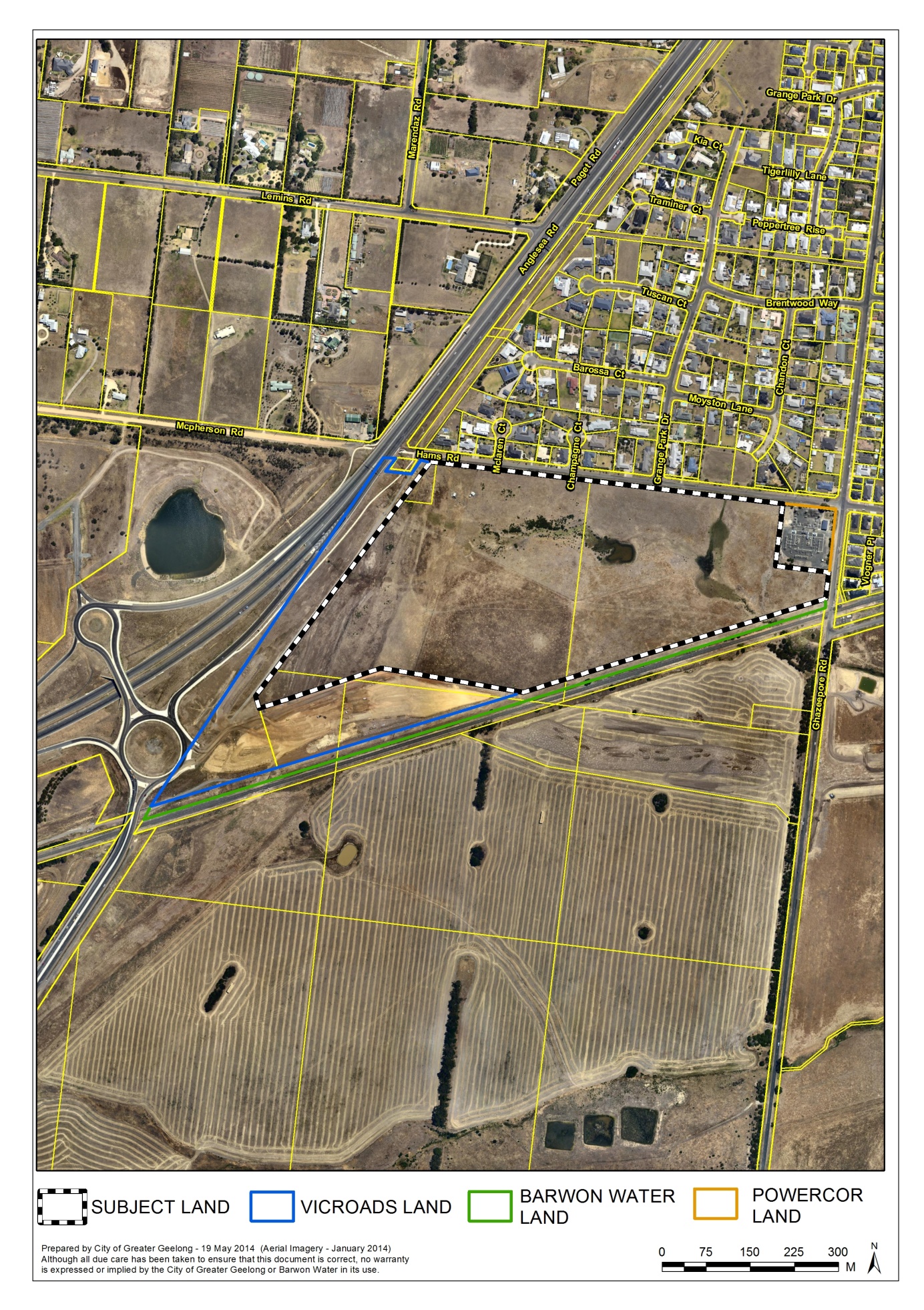
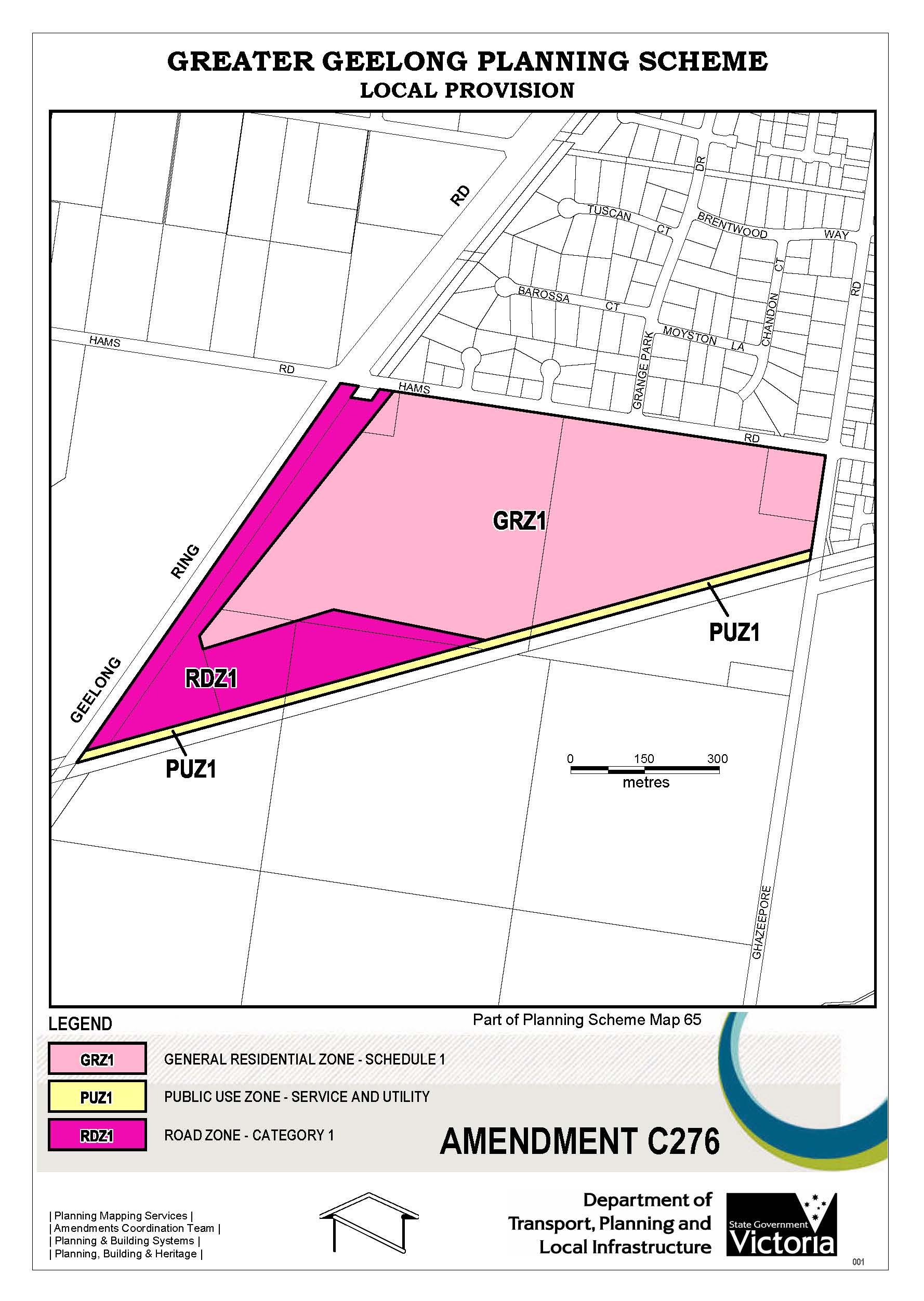
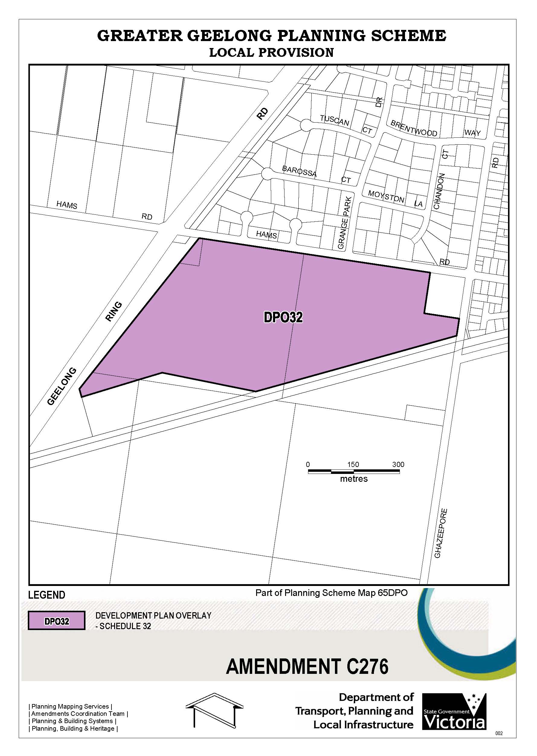
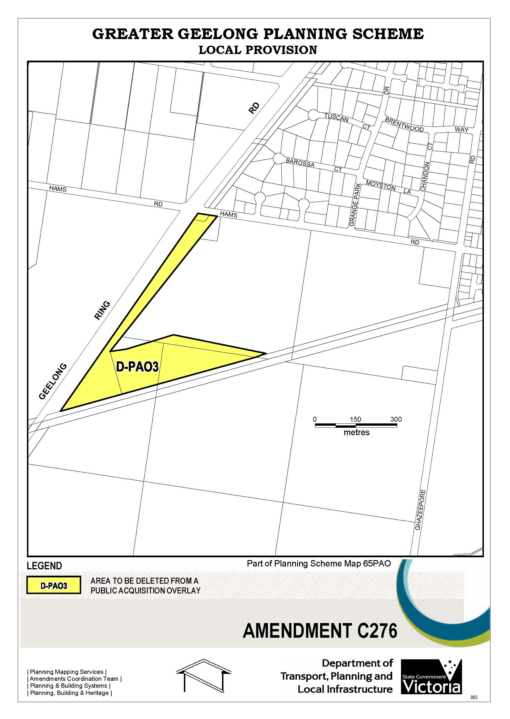
Amendment C276 proposes to rezone land at 35 Hams Road and 151-229 Anglesea Road, Waurn Ponds, from Farming Zone to General Residential Zone Schedule 1, apply the Development Plan Overlay and delete the Public Acquisition Overlay 3 (VicRoads) from the affected part of the site. The amendment also includes minor zoning changes to other areas of land adjoining the primary site.
The site is bounded by Hams Road to the north, Ghazeepore Road to the east, the Geelong/Warrnambool railway line and the Baanip Boulevard to the south and the Princes Freeway (Geelong Ring Road) to the west.
Strategic justification for the amendment is provided by the Armstrong Creek Urban Growth Plan (Adopted May 2008; Amended May 2010), the G21 Regional Growth Plan and State and Local Planning Policy.
At its meeting on 24 June 2014, Council resolved to request the Minister for Planning to prepare and exhibit the amendment. The amendment was exhibited between 7 August 2014 and 8 September 2014.
A total of 26 submissions were received including 11 late submissions. Six submissions were from referral authorities and 20 objections were from local residents in the Grange Park Estate to the north.
A number of referral authorities, including the Corangamite Catchment Management Authority (CCMA) and VicRoads, requested changes to the exhibited Development Plan Overlay schedule. The former Department of State Development, Business and Innovation (DSDBI) provided Council with comments about the potential impact of the Boral limestone quarry south of the subject land and associated separation distances.
The objecting submissions from residents were focussed on the possible increase in traffic through the Grange Park Estate and the associated loss of amenity from traffic noise, road safety, and impacts on the local road network. Concerns were raised about the level of development which residents described as being medium to high density development, the impact on the neighbourhood character of the Grange Park Estate, on-site environmental significance (flora and fauna, including the protection of the natural waterway), and the potential impact of the Boral quarry.
After exhibition a residents group was formed and a public meeting held on 17th October 2014. A petition of 242 signatures objecting to the proposal was provided to Council.
On 28 October 2014, Council considered a report on the submissions which recommended they be referred to a Panel. The officer’s report was similar in content to this current report. Council resolved that the report be deferred.
This followed a request from the proponent to defer consideration of the matter so that specialist consultants could be engaged to undertake a more detailed analysis of issues raised in submissions.
Between November 2014 and March 2015 the proponent’s consultants prepared three reports: a Planning Review, a Traffic Impact Assessment Report and Surveys of Growling Grass Frog, Natural Spring and Bird Habitat.
In the same period two meetings have been held with representatives of the residents from the adjoining Grange Park Estate. The meetings included the proponent, Council officers and the Ward Councillor and occurred both before and after the further consultant’s work was commissioned.
The results of the further studies are outlined in this report. Changes have been made to the Development Plan Overlay Schedule to address some of the issues raised by submitters. However, there are still outstanding issues that have not been resolved.
In accordance with the Planning and Environment Act 1987, Council must now either: change the amendment in the manner requested by the objecting submissions; refer submissions to an Independent Panel appointed by the Minister for Planning; or abandon the amendment or part of the amendment.
It is recommended that the submissions be referred to an Independent Panel appointed by the Minister for Planning.
A Panel hearing will provide a forum for all parties (submitters, the proponent and Council) to put their views forward to independent and impartial panel members who will then make recommendations back to Council as the Planning Authority.
Cr Richards moved, Cr E Kontelj seconded -
That Council having considered all submissions to Amendment C276 to the Greater Geelong Planning Scheme, resolve to abandon the Amendment.
Carried.
Division Requested:
For: Crs Ansett, Harwood, Nelson, E Kontelj, Ellis, Lyons, Richards, Farrell, Irvine
Against: Crs Fisher, Heagney, Macdonald
Amendment C276 has been prepared by SMEC Urban consulting group on behalf of the landowners Waurn Ponds Trust and Echin Pty Ltd.
The amendment seeks to rezone land at 35 Hams Road and 151-229 Anglesea Road, Waurn Ponds, from Farming Zone to General Residential Zone Schedule 1, apply the Development Plan Overlay to the land and delete the Public Acquisition Overlay 3 (VicRoads) from the affected part of the site.
In addition to the proposed rezoning of land at 35 Hams Road and 151-229 Anglesea Road, Waurn Ponds, Council officers propose to:
rezone the Powercor substation at 25 Hams Road, Waurn Ponds, from Farming Zone to General Residential Zone Schedule 1;
rezone the VicRoads land to the south and west of the site from Farming Zone to Road Zone Category 1;
rezone the Barwon Water land between the site and the Geelong/Warrnambool railway from Farming Zone to Public Use Zone 1; and
delete the Public Acquisition Overlay 3 from the affected land in this area.
On 24 June 2014, Council resolved to exhibit the amendment, subject to authorisation from the Minister for Planning.
On 1 July 2014, Council wrote to the Minister for Planning requesting authorisation to prepare and exhibit the amendment. In accordance with the Planning and Environment Act 1987, Council prepared the amendment without authorisation after 16 July 2014.
A notice of preparation of the amendment appeared in the Victorian Government Gazette on 7 August 2014. Notices also appeared in the City News section of the Independent on 1 August 2014 and the Geelong Advertiser on 2 August 2014. Letters and notices were sent to nearby landowners and occupiers on 30 July 2014 and relevant Ministers and referral authorities on 31 July 2014.
The amendment was exhibited from 7 August 2014 to 8 September 2014.
The exhibition resulted in a total of 26 submissions (including 11 late submissions made in October 2014). A map showing the location of submitters proximate to the subject land is shown in Appendix 5.
Six referral authorities provided comments on the amendment. No objections were received from referral authorities.
The coordinated response from the former Department of Transport, Planning and Local Infrastructure (DTPLI), VicRoads and Public Transport Victoria (PTV) did not object to the amendment provided that the VicRoads recommended changes to the schedule to the Development Plan Overlay were made. The changes requested related to road names and the requirement for an acoustic survey. These changes will be discussed later in this section.
DSDBI provided an informal response in relation to the proximity of the subject land to the Boral quarry. An extension of time was subsequently requested by DSDBI to provide Council with a formal response.
The CCMA requested one change to the schedule to the Development Plan Overlay in the form of a requirement for Flood/Hydraulic analysis.
Other relevant referral authority submissions will be discussed later in this report.
All objections to the exhibited amendment were received from residents of the Grange Park Estate, which is located to the north of the subject land. Key issues raised by submitters can be grouped as follows:
Need/justification for rezoning farmland;
Traffic impact and associated issues;
Environmental issues;
Proposed subdivision and development of the subject land- Impact on neighbourhood character;
Boral Quarry;
CCMA;
DTPLI (VicRoads);
Consultation.
A schedule of submitters and summary of submissions is provided in Appendix 6. A Council officer response to each individual submission is also included.
The following section discusses the key themes raised in submissions and provides a detailed council officer response, beyond the responses provided in Appendix 6. In the event that Council resolves to request the Minister for Planning to appoint an Independent Panel, this section will form the basis of Council’s submission to the Panel.
Justification
A number of objectors questioned the need to rezone the subject land. Submissions generally focused on the loss of farmland and associates rural character, existing on-site constraints and adjoining land use constraints.
Council officer response:
It is important to outline the strategic basis for the rezoning application, which will provide a background as to why the subject land is being considered for residential use.
Strategic justification
The planning report states:
“The subject site provides an ‘infill’ development opportunity to consolidate the existing urban area of Waurn Ponds and make efficient use of surrounding physical and community infrastructure.”
The planning report goes on to state:
“The subject site is the last remaining piece of Farming Zone land in the Waurn Ponds area. It is a fragmented piece of farm land and is not of a size and nature which is suitable for the majority of agricultural practices.”
Council officers agree with the proponent’s Planning report in so far as the subject land represents an ‘infill’ residential development opportunity that will consolidate the existing urban area and make efficient use of surrounding physical and community infrastructure. It is agreed that the subject land forms the last remaining wedge of fragmented farming land in the Waurn Ponds area. The loss of fragmented farming zone land is not considered a significant issue that would warrant the abandonment of the amendment. It is also noted that the land is only used for minor cattle grazing.
The Armstrong Creek Urban Growth Plan (UGP) (Adopted 13 May 2008; Amended May 2010) specifically refers to the site, being land “Northwest of Growth Area”. The UGP states:
“An isolated area of rural-zoned land is located north west of the growth area at 151-229 Anglesea Road and 35 Hams Road, Waurn Ponds. The land is between the future quarry area, the railway line and residential land, and is likely to be affected by the link road that will link the Geelong Ring Road to Surf Coast Highway via Anglesea Road.
It is recommended that land on the northern side of the proposed east-west link road that is not required for road purposes be considered for future residential and/or recreation zoning. This may add to the existing residential area to the north and increase the population within the catchment of the proposed Rossack Drive Railway Station and associated local activity centre.
The future of this land should be confirmed after the alignment of the link road is determined by VicRoads and take into account amenity issues created by the road. Land that falls outside (south) of the proposed east-west link should be reviewed at the same time.” (Emphasis added)
The UGP outlines the strategic approach for the consideration of the site, being investigating the potential rezoning of farming land for residential purposes. Given that the new road alignment for the Section 4C Baanip Boulevard has been determined and is now under construction, it is appropriate to consider the land for residential development - Amendment C276 comprises the formal assessment of the site.
The G21 Regional Plan (April 2013) and the G21 Residential Land Supply Monitoring Project (October 2013) are also important considerations in the strategic justification for rezoning the site.
The G21 Regional Plan seeks to deliver co-ordinated growth in the region to the year 2051 and make land supply available to provide for the predicted population target of 500,000 people. In responding to these considerations, the G21 Regional Plan seeks to minimise the continued expansion of the urban footprint and provides for a mix of infill development and targeted new development areas in suitable locations. The Regional Growth Plan defines urban Geelong as being the urban area within the Geelong Ring Road extending southwards from Norlane and inclusive of the Armstrong Greek Urban Growth Area. The subject land is considered to fall within this area.
The G21 Residential Land Supply Monitoring Project also identifies the site as ‘potential residential’ land.
Rezoning of the subject land for residential purposes will assist in implementing the objectives of the G21 Regional Plan by delivering residential land supply to accommodate for future population growth. It will also assist in maintaining an adequate supply of residential land within the municipality and assist in minimising the urban footprint.
The amendment will facilitate the rezoning of the site in accordance with Regional and Council strategic directions for this area. Further consideration of the Greater Geelong Planning Scheme provisions is provided in the Policy section of this report.
The amendment will also provide a range of net community benefits such as retention of the waterway, public open space, housing options, cycle and pedestrian links and a contribution toward regional community infrastructure. This will result in a positive planning outcome for Geelong and is a logical land use proposal for the site.
Traffic
The majority of submissions focused on the impact of increased traffic on the Grange Park Estate, the limited access to the subject land from Ghazeepore Road, the new intersection at Hams Rd/Ghazeepore Rd and the cumulative impact of development in the area on the surrounding road network.
Council officer response:
Grange Park Estate local road network
The extent to which vehicles will use the Grange Park Estate as a thoroughfare to Ghazeepore Road is difficult to determine at the rezoning stage as a development plan or subdivision layout have not been prepared. However, it is expected that the new intersection arrangement at Hams Rd/Ghazeepore Rd junction will be the principal access to and from the subject land.
It is acknowledged that the Grange Park Estate road network is designed to suit a more low density style residential subdivision and does not include typical General Residential Zone subdivision infrastructure such as footpaths or cycle lanes. Notwithstanding this, it is noted that the carriageway width of Grange Park Drive is similar to that found in other subdivisions in the general area, for example on the opposite side of Ghazeepore Road at Oakwood Cr.
A Development Plan Overlay will be applied to the subject land, which will require the proponent to prepare a development plan that will establish a framework for future subdivision and development of the land. It will also look at issues external to the subject land that must be addressed as a consequence of the development, such as traffic impact.
The Development Plan will include a Road Network and Traffic Management Plan, which will require a detailed traffic impact assessment. The exhibited DPO schedule confirms the following:
“The Road Network and Traffic Management Plan is to address all off-site traffic infrastructure requirements associated with the development of the site.”
Consequently, the traffic impact assessment will fully consider the impact of the residential development of the subject land on the surrounding road network and provide measures to ensure that the road network can manage the increase in vehicle movements.
In specific terms, the traffic impact assessment will need to look at the two proximate junctions to the subject land, being Hams Rd/Ghazeepore Rd and Hams Rd/Grange Park Dr. The traffic impact assessment will need to look at the likely vehicle movements at these junctions and determine the extent of upgrade works necessary, if any, to ensure they continue to operate at an acceptable standard.
Road safety/Pedestrian safety
The issue of road safety/pedestrian safety raised by submitters from the Grange Park Estate is a valid concern. Given the existing road network in the Estate does not provide footpaths or cycle lanes and that residents are required to use the road carriageway as their footpath, this raises issues of safety in both the current context and future context as a result of potential increase in vehicle movements through the Estate from the subject land.
As outlined previously, the traffic impact assessment will look at the surrounding road network and determine if any traffic management improvements are required to the surrounding road network as a consequence of the residential development of the subject land. Notwithstanding this, the schedule to Development Plan Overlay requires that:
“The Road Network and Traffic Management Plan must be accompanied by a Road Safety Audit prepared by an appropriately qualified person and must address any safety issues raised in the Audit which arise as a consequence of the development of the land.”
The requirements of the exhibited schedule to the Development Plan Overlay in relation to road network and traffic management matters are considered reasonable and fit for purpose.
In discussion with Council’s transport engineers, it is considered that detailed issues in relation to potential traffic implications on the surrounding local road network can be dealt with at the Development Plan stage. At that point, it will be possible to undertake a detailed assessment of likely vehicle movements arising from the subdivision of the subject land.
Access to the subject land and new intersection at Hams Rd/Ghazeepore Rd
Submitters raised concern about the limited access options to the subject land from Ghazeepore Road and how an increase in traffic would create issues at the Hams Rd/Ghazeepore Rd junction - the result of this being more traffic through the Grange Park Estate. Some submitters also questioned the effectiveness of a roundabout intersection at this junction.
Vehicle access to the subject land from Ghazeepore Road is limited to the Hams Rd/Ghazeepore Rd junction. It will not be possible to provide additional vehicle access points off Ghazeepore Road given the location of the Powercor substation and the proximity of the subject land to the Geelong/Warrnambool railway line level crossing.
Council has not determined the type of intersection to be provided at the Hams Road/Ghazeepore Road intersection. This will be finalised by the road network and traffic management plan. However, Council traffic engineers have discussed the possibility of a roundabout intersection at the Hams Rd/Ghazeepore Rd junction. The upgrade of the intersection at Hams Rd/Ghazeepore Rd will need to be of a standard suitable to accommodate the majority of vehicle users requiring access to Ghazeepore Road and the wider road network. There are a number of benefits to upgrading the intersection at Hams Rd/Ghazeepore Rd in the form of a roundabout. They can be summarised as follows:
Balanced turning and through movements is an ideal environment for a roundabout;
Is an appropriate intersection treatment for the intersecting road categories;
Introduces a slow point in Ghazeepore Rd where speeding is a source of resident complaints;
Reduces the amount of conflict points;
Provides reasonable pedestrian amenity (splitter islands that act as pedestrian refuges so that they can cross one carriageway at a time);
Continues a theme along Sugar Gum Dr where there will be roundabouts at each end, with two midblock;
It has an adequate distance from the level crossing so as any queues that form from northbound traffic at the roundabout will not extend that far;
It should act as a deterrent to trucks using Ghazeepore Rd and especially Sugar Gum Dr.
It is considered that an upgraded intersection arrangement at the Hams Rd/Ghazeepore Rd junction would be sufficient to accommodate the increased traffic arising from the subject land and minimise any use of the Grange Park Estate as an alternative route, albeit elongated, to Ghazeepore Rd. In discussion with Council traffic engineers, it is considered unlikely that there would be any real traffic implications from the upgraded intersection at Hams Rd/Ghazeepore Rd- this includes the cumulative impact arising from surrounding developments.
Cumulative traffic impact
A number of submitters raised concern about the cumulative impact of developments in the area, including the proposed rezoning of the subject land. Submitters discussed the detrimental impact on Ghazeepore Road- a road that already carries large volumes of traffic and is hindered, in parts, by on-road car parking.
As a result of the residential development of the subject land, traffic volumes on Ghazeepore Road will increase. The actual traffic volume figures will be dependent on the extent of subdivision of the subject land. It is expected that traffic volumes will also increase in Sugar Gum Drive and Monterey Drive.
In addition to the potential increase in traffic from the residential development of the subject land, Council officers are fully aware of ongoing developments in the vicinity including the new Waurn Ponds railway station to the east, the new Baanip Boulevard to the south, both of which are currently under construction, and the subdivision of land within the Grange Park Estate (45 Grange Park Drive; Permit ref: PP420/2014).
It is understood that the railway station will be limited to 292 car parking spaces and consequently, 600-700 vehicle movements are expected per day. The Baanip Boulevard will provide a new signalised intersection giving access to the Surf Coast Hwy, Anglesea Road, Princes Hwy and the Geelong Bypass. The subdivision at 45 Grange Park Drive is currently being considered by Council and is likely to require upgrades to the local road network (Grange Park Drive) and traffic management measures.
Council officers acknowledge that the cumulative impact of developments in the area is a consideration in terms of the impact on the road network. A further assessment of the proposed development and its contribution to the cumulative impact on the surrounding road network will be considered at the detailed development plan/planning permit stage.
Environmental concerns
Submitters raised a number of environmental concerns. Submitters considered that the site provides a habitat for a range of species including growling grass frog and that development of the land will lead to the destruction of vegetation and animals. Submitters stated that it is important to address the ecological importance of the site during the rezoning stage and stressed the importance of the waterway for biodiversity. One submitter raised an issue about the site previously containing a livestock dip.
Council officer response:
Fauna
The supporting Flora and Fauna Assessment considered the potential of the site to provide fauna habitat. It advised that the site contains patches of low quality vegetation with little habitat for significant species (degraded habitat). The report also stated that the waterway contains the most environmental sensitive areas within the site and requires careful consideration to avoid adverse impacts at the design stage.
The report did not identify any fauna of state or national significance during the site inspection.
Notwithstanding the findings of the flora and fauna assessment, Council officers consider it prudent to adequately address Clause 12.01 Biodiversity and Clause 21.05-3 Biodiversity of the Planning Scheme. This can be achieved by including a requirement in the schedule to the Development Plan Overlay for a detailed fauna assessment to be undertaken.
The purpose of the detailed fauna investigation will be to determine the use of habitat on site by significant fauna species, assess potential habitat and provision of measures required to mitigate impacts arising from development. Importantly, this requirement is also in response to the concerns raised by submitters in terms of the perceived ecological value of the site, the waterway and the indication of specific species seen on site, being growling grass frog and other significant species.
The requirement for a detailed fauna survey is further supported by the intention to carry out works to the waterway, which will be principally overseen by the CCMA. It would be beneficial to undertake the detailed fauna assessment during the preparation of the Development Plan to provide for an informed process prior to subdivision and development. (See Appendix 8 for the updated schedule to the Development Plan Overlay).
When dealing with relatively unknown technical issues such as on site biodiversity, it is important to exercise the precautionary principle through the strategic planning process. It is considered that the rezoning of the subject land can continue to be progressed on the basis that the above requirement is included in the schedule to the Development Plan Overlay.
Waterway
The retention of the waterway through the subject land has been a long standing objective of Council and the CCMA. The exhibited schedule to the Development Plan Overlay requires the retention of the designated waterway, both the length and alignment, a vegetated buffer of no less than 20 metres on both sides of the waterway and also, the preparation of a waterway management plan. In addition to this, Council officers will now be seeking a detailed fauna assessment of the subject land to ensure there are no adverse impacts on biodiversity.
The above requirements are considered sufficient to ensure appropriate treatment to the designated waterway and associated environmental/ecological matters.
Potential contamination
One submitter made reference to the subject land containing an historical livestock dip. The dip is not apparent when out on site and the submitter has not provided any factual information to confirm the statement. Council officers have sought additional information from the submitter and proponent and are waiting for information to be provided.
Given the historical agricultural land use of the site, there is potential for a livestock dip to have been used in the past. In discussion with Council’s Environmental Health unit, it is considered that it would be in Council’s interest to require an environmental assessment as part of the Development Plan. This will ensure that before a sensitive use commences, in this case being a residential use, the land must be deemed suitable for that sensitive use. (See Appendix 9 for updated schedule to the Development Overlay). The environmental assessment will require the proponent to confirm the extent and location of contamination on site, if any. Where significant contamination is identified, further works will be required to confirm the ability of the subject land to be used for residential purposes.
This issue will be further discussed during the weeks preceding and during the Panel Hearing to ensure the appropriate requirement/tool is used - the provision of further information from the submitter is crucial to determining the level of action required by Council.
Proposed Subdivision and Development - Impact on Neighbourhood character
Numerous submitters raised concerns about the extent of development on the subject land and described it as ‘overdevelopment’ and ‘high density development’. Submitters also requested that the future subdivision of the subject land should match the subdivision layout/character of the Grange Park Estate.
Council officer response:
Subdivision layout
The request for the subject land to be subdivided in manner that matches that of the Grange Park Estate is considered to have limited justification.
The Grange Park Estate, whilst affected by a number of covenants (as advised by submitters), is not safeguarded by any planning control in relation to neighbourhood character or heritage.
Council officers acknowledge that the Estate is rather unique in comparison to other subdivisions in the surrounding area. It is not representative of a typical General Residential Zone subdivision layout. It contains large lots and has an internal road layout that has similar characteristics to that found in a low density residential subdivision.
Council officers consider that there is planning merit in requiring the subject land to be subdivided along its frontage to Hams Road in a manner that provides a transition between the existing Grange Park Estate subdivision.
This requirement can be achieved using the schedule to the Development Plan Overlay in clause 3.0 Urban Design. A requirement will be included in the schedule to ensure that land fronting Hams Road is subdivided using a ‘conventional residential layout’. This will ensure that there is a relative transition between land uses to the north and south. (Conventional residential layout is generally considered to range between 500-1000 sq. metres lots.)
Council officers consider this will lead to a good planning outcome and should provide submitters with a reasonable level of comfort in terms of issues raised about the impact on neighbourhood character.
Overdevelopment/High Density Development
Concerns about overdevelopment and high density development are noted. However, the rezoning stage does not normally stipulate density requirements. This is a matter that is considered as part of the approval of the Development Plan and permits for subdivision.
Submitters have compared the potential subdivision layout of the subject land to the low density style subdivision layout found in the Grange Park Estate. In comparative terms, submitters have suggested that the future subdivision of the subject land will be ‘high density’. Given the relative large sized lots in the Grange Park Estate, it is understandable that submitters from this area have raised concerns.
The schedule to the Development Plan Overlay will require a general subdivision layout that seeks a range of lot sizes and densities to provide for a range of housing types. It is highly unlikely that the subject land will contain what is known in the planning profession as ‘high density development’, which is generally the provision of lots at a density of 40 dwellings per hectare. The subdivision of the land is likely to predominantly consist of ‘conventional style housing’ with some areas of medium density housing.
Some submitters also raised issues about the draft concept plan that was included in the Council report of 24 June 2014. This plan was originally submitted to Council with the rezoning application. It was prepared for discussion purposes only and is not intended to represent the final layout or lot yield for the subject land. It simply demonstrates how the subject could be dealt with in terms of road layout, open space, drainage and density. The planning application also talks about an estimated lot yield of around 400 units. As discussed above, in comparison to the Grange Park Estate, this would be seen by submitters from the Grange Park Estate as ‘high density’ but in planning terms, this is not considered ‘high density’ and importantly, is not being proposed as part of the rezoning application.
Boral Quarry
A key issue in the consideration of the rezoning application is the proximity of the Boral limestone quarry and associated separation distances for non-blasting quarrying operations.
The EPA advises that residential encroachment on industry is one of EPA’s top 6 key focus areas. With residential developments being built closer to existing industry, this can cause health and amenity impacts on the community and can affect industry viability. The EPA recommends that Council consider whether the General Residential Zone is an appropriate interface to the Boral Quarry (interface being land uses that are located within the separation distance between industrial land uses and sensitive land uses.) The EPA advises that sensitive land uses that require a separation distance are discouraged by EPA’s separation distance guidelines. The EPA recommends that Council seek DSDBI’s input on the amendment, specifically in relation to the potential impacts to residential development at this separation distance.
DSDBI provided Council with an informal response to the exhibition of the amendment.
DSDBI advised that the quarry extraction limit is in the process of being revised due to the proximity of the new Baanip Boulevard. The revised location of the extraction limit will enable DSDBI to assess the suitability of the separation distance between the quarry and the proposed residential zoning, being Amendment C276. DSDBI advised that a dust study was being prepared by VicRoads to assist in the determination of a suitable extraction limit with respect to the new road..
DSDBI advised that should discussions between VicRoads, Boral and DSDBI not be finalised prior to the exhibition closing date (8 September 2014), it will request additional time to provide Council with a formal response.
DSDBI followed up with an email of 24 October 2014. The email included a map showing an approximate location of the potential southern boundary of sensitive locations (including residences) in the land immediately north of Baanip Boulevard.by measuring a distance of 250 metres (in accordance with EPA requirements) from the proposed new extraction limit. The new extraction limit is approximately 20 metres south of the Baanip Boulevard road reserve. Based on this information Council officers prepared the map in Appendix 7. The map shows the area of the proposed C276 residential rezoning that is affected by the 250 metre buffer from the new extraction limit of the Boral quarry.
The area affected is approximately 6ha which is 25% of the total 24 hectare site proposed for the General Residential Zone.
The proponent has advised Council that they will seek to address this matter prior to and during the course of the Panel Hearing.
Corangamite Catchment Management Authority (CCMA)
The CCMA has recommended that an additional requirement be included in the schedule to the Development Plan Overlay (clause 3.0 Flooding, Stormwater and Drainage Management Plan) in relation to flooding. The CCMA states that land within the affected area is subject to flooding to an ‘unknown extent’. This request is considered logical in so far as determining the extent of the flooding on land that is being proposed for future residential use.
The CCMA has provided wording for inclusion in the schedule to the Development Plan Overlay (Refer to CCMA’s submission (Submission No.1)).
Council officers consider that the CCMA’s wording can be shortened and summarised as follows:
“A Flood Impact Report.”
Council officers have also updated clause 4.0 Decision Guidelines of the schedule to the Development Plan Overlay. The change reflects the requirement for the flood impact report and for Council to seek the views of the CCMA in the assessment of the report given the CCMA is the managing authority for this designated waterway.
DTPLI (VicRoads)
The coordinated response by DTPLI on behalf of VicRoads has requested that the schedule to the Development Plan Overlay be updated to reflect the correct road names for the Princes Freeway and Baanip Boulevard. Council officers have made the relevant changes the schedule.
VicRoads also requested that the schedule to the Development Plan Overlay be updated in relation to the Acoustic survey. VicRoads proposed the following wording:
“Acoustic noise measurements and modelling must be undertaken to determine whether any proposed residential property is predicted to have noise level exceeding 63dBA (L1018hr) based on predicted traffic volumes 10 years hence from the Princes Freeway (Geelong Ring Road) and Baanip Boulevard. The Acoustic Report must include recommendations and conclusions about the extent of any works necessary to mitigate noise impacts to the satisfaction of VicRoads and the Responsible Authority.”
Council officers originally included the requirement for an acoustic survey for the Baanip Boulevard. The acoustic assessment prepared in support of the rezoning application considered the Princes Freeway (Geelong Ring Road) and determined that no measures were necessary to mitigate against noise. Hence, Council officers request for only the Baanip Boulevard to be surveyed.
Council officers have sought clarification from VicRoads regarding their request to change the schedule to the Development Plan Overlay in relation to this issue. Council officers will give further consideration about updating the schedule once VicRoads has responded.
Subsequent changes have been made to clause 4.0 Decision Guidelines to ensure the views of VicRoads are sought in relation to any noise mitigation works.
Consultation
A number of submitters raised concern about the limited consultation undertaken and that the proponent should undertake a full consultation exercise to ensure that everyone in the Grange Park Estate knows about the proposed rezoning.
Council officer response:
Council officers notified affected properties fronting Hams Road and properties extending into the Grange Park Estate. Amendment notices were also placed in the Geelong Independent and Advertiser. It is noted that submissions were received from residents in the Grange Park Estate who did not receive direct notification. This may have been as a consequence of word of mouth or resident handouts.
Given the recurring theme of submissions raised by submitters from the Grange Park Estate, Council officers consider that all relevant issues have been raised and as such will be given due consideration as part of the rezoning process.
In response to a number of submitters, Council officers have offered meetings to discuss the proposed rezoning application. After exhibition a residents group was formed and a public meeting held on 17th October 2014. A petition of 242 signatures objecting to the proposal was provided to Council.
On 28 October 2014, Council considered a report on the submissions which recommended they be referred to a Panel. Council resolved that the report be deferred following a request from the proponent so that specialist consultants could be engaged to undertake a more detailed analysis of issues raised in submissions. These reports are described below.
In the same period two meetings have been held with representatives of the residents from the adjoining Grange Park Estate. The meetings included the proponent, Council officers and the Ward Councillor and occurred both before and after the further consultant’s work was commissioned.
Additional Consultant Reports
Between November 2014 and April 2015 the proponent’s consultants prepared three reports:
Planning Review - 35 & 69-93 Hams Road, Waurn Ponds, 1 April 2015 (SMEC)
Traffic Impact Assessment Report - 35 & 69-93 Hams Road, Waurn Ponds, March 2015 (SMEC)
Fauna Survey - Growling Grass Frog, Natural Spring, and Bird Habitat Survey, Feb 2915 (Practical Ecology)
The Planning Review conclusions include:
“The subject site is capable of accommodating residential development being largely unconstrained, topographically suitable, serviceable and easily accessed. The site is immediately abutting existing residential land and is clearly defined adjacent rail and road networks, and thus is does not give any rise to issues of sprawl or need for consideration in that regard. The principle of the development of the land for residential purposes is sound.”
In relation to impacts on the Grange park Estate, the review states:
“The issues of impacts to immediate residents to the north will be addressed through the provision of larger lots to that interface, providing a respectful response and appropriate transition in lot sizes across Hams Road.”
The review includes a plan showing larger lots (in the order of 750 square metres or larger) fronting Hams Rd. This plan is in Appendix 8. Council officers propose a change to the Development Plan Overlay (DPO) schedule to reflect this outcome (see next section of this report).
The Traffic Impact Assessment Report investigates proposed access arrangements to the site and assesses the traffic and safety implications of its development on the existing surrounding area and transport network. The report also considers the potential for “rat-running” along Grange Park Drive to access Ghazeepore Road and travel north of the site. Based on the findings of this report, SMEC is of the opinion that the proposed residential development of the site will not have an adverse impact on the operation of the surrounding road network. However, the report outlines a variety of options for “Local area traffic management treatments” (LATM) to limit “rat running” through the Grange Park estate, these include:
Diversion Devices – e.g. Full road closure, Half road closure, Diagonal road closure, Modified T-intersection (as a traffic calming measure or to change priority) and Left in/ left out islands;
Horizontal & Vertical Deflection Devices – e.g. Lane narrowings/ kerb extensions, Slow points, Centre blister islands, Midblock median treatments and Roundabouts, Road humps (to be installed as part of the Chablis Park Estate development), Road cushions, Flat top road humps and Raised pavements;
Signs and Linemarking
The DPO has been changed to require LATM, the details of which will need to be resolved with Council traffic engineers.
The additional fauna survey report by Practical Ecology was intended to address community concerns regarding the rezoning while also guiding a decision on whether a referral is required for the threatened Growling Grass Frog (GGF) Litoria raniformis under the Commonwealth Environment Protection and Biodiversity Conservation Act 1999 (EPBC Act).
Three waterbodies were surveyed for the presence of the GGF and suitable habitat. No GGF were detected over two nights of surveys. The report found that the significance of these waterbodies to the GGF is low and a referral is not recommended.
Proposed changes to the amendment
Council officers have amended the exhibited version of schedule 32 to the Development Plan Overlay in response to submissions and the additional consultant reports. A copy of the updated schedule 32 to the Development Plan Overlay is provided at Appendix 9 (track changes shown).
The post-exhibition changes are summarised below.
The “Urban Design Master Plan” includes an additional requirement for residential lots of a minimum 750 square metres in area along the frontage to Hams Road to address the interface with the Grange Park Estate to the north.
The “Road Network and Traffic Management Plan” includes two additional requirements:
Local area traffic management treatments to minimise vehicles from the development ‘rat-running’ or short cutting through Grange Park Drive and Brentwood Way to access Ghazeepore Road.
Vehicle access to the site to be limited to two access points on Hams Road only with no direct access to Ghazeepore Road
The “Flooding, Stormwater and Drainage Management Plan” includes an additional requirement for a Flood/Hydraulic Analysis
A requirement has been added for a detailed “Fauna assessment”
A requirement has been added for an “Environmental Assessment” to assess the level and location of any soil contamination including from the former cattle dipping spray race adjoining the electrical sub-station.
In clause 4.0 of the schedule- update the clause to reflect the requirement for relevant authorities to consider additional requirements outlined in clause 3.0.
Various name changes have been made to roads as requested by Vic Roads.
The site is in the Farming Zone, it contains approximately 4.8 ha of native vegetation, is traversed by a designated waterway that is considered to have high ecological value (in parts) and is proximate to the Boral quarry and associated buffer requirements.
The rezoning of the site for residential purposes will remove one of the last parcels of Farming Zone land in the Waurn Ponds area. The site is not used for intensive agricultural purposes but rather for limited animal grazing. It is of a size that is considered to be inappropriate for intensive agricultural operations. Consequently, the loss of this land from an agricultural perspective is not considered a significant issue.
Native vegetation will be removed from the site to enable residential development and off-set requirements are likely to be provided off-site. The provision of off-set requirements off-site is considered a good planning and environmental outcome given the on-site constraints and future subdivision requirements.
The schedule to the Development Plan Overlay requires the proponent to undertake a detailed Fauna assessment. This will ensure that the site and in particular, the natural waterway, have been suitably addressed from an ecological perspective prior to subdivision.
In terms of the designated waterway, the CCMA has advised that a vegetated buffer will be required on both sides of the waterway and that its alignment and length should be retained. It is considered that the creation of a linear open space reserve incorporating the waterway, vegetated buffers and open space requirements will result in a good planning and environmental outcome. It will contribute to the rehabilitation of the waterway and formalise this part of the site as a recreational and ecological corridor similar to the approach adopted in the Armstrong Creek Urban Growth Area.
The supporting SWMS advises that potential issues relating to flood and stormwater can be mitigated through the provision of an appropriate retardation management system that will limit any off-site impacts downstream.
Proximity to the Boral quarry and associated potential amenity issues affecting the site will continue to be a consideration through the rezoning of the land. Until the Works Authority for the Boral quarry has been amended and approved, the site will continue to be affected by the industrial air emissions buffer requirements, as per the EPA Guidelines. This matter will be an on-going consideration during the amendment process.
Beyond the administrative processing of the planning scheme amendment, there will be no financial implications for Council. Should an Independent Panel be appointed by the Minster for Planning, the proponent will bear the costs for this process.
The strategic justification for the proposed rezoning of the site has been confirmed in previous sections of this report. The Armstrong Creek Urban Growth Plan (Adopted 13 May 2008, Amended May 2010) provides the strategic basis to undertake an assessment as to the suitability of the site for residential purposes.
The G21 Regional Growth Plan and associated background material further provides support for the potential residential use of the land and in a broader context the development of infill sites.
Clause 11.02-1 Supply of urban land seeks to ensure a sufficient supply of land is available for a number of land uses, including residential. To achieve this objective, it is necessary to ensure the ongoing provision of land supporting infrastructure to support sustainable urban development. The proposed rezoning application can facilitate this objective.
Clause 21.06 Settlement and Housing discusses the importance of urban consolidation unless otherwise directed to designated growth areas. Locating development in areas that are well serviced and that have the capacity to accommodate sustainable development. The rezoning of the site from Farming Zone to General Residential 1 Zone will assist in meeting urban consolidation objectives. The site is clearly contained by existing and proposed infrastructure to the south and west. The rezoning of the site will effectively lead to the development of a greenfield site contained within an otherwise urban area.
The proposed General Residential Zone Schedule 1 is considered appropriate for the rezoning of the subject land for residential purposes. The General Residential Zone Schedule 1 will replace the Residential 1 Zone from July 2014. The General Residential 1 Zone is very similar to the Residential 1 Zone in terms of land uses and building and works requirements.
The proposed rezoning of land owned by Barwon Water, VicRoads and Powercor will result in a good planning outcome and will accurately reflect existing land uses and remove the Farming Zone from this general area.
The deletion of the Public Acquisition Overlay 3 is logical in so far as its purpose is no longer relevant due to the acquisition of the affected land by VicRoads.
Other provisions of the Greater Geelong Planning Scheme are relevant in so far as guiding the rezoning and future subdivision of the subject land- in particular, Clause 14.02-1 Catchment planning and management; Clause 52.01 Public Open Space Contribution and Subdivision and Clause 52.10 Uses with Adverse Amenity Potential are of importance in the assessment of the land proposed for residential use.
The report aligns with the City Plan’s strategic direction Sustainable Built and Natural Environment. This direction seeks to protect and enhance natural ecosystems and to encourage sustainable design and reduced resource consumption. Specific priorities of the strategic direction included: Enhance and protect natural areas and ecosystems (including waterways); Advocate for and promote sustainable design and development (including the assistance of the planning system).
No Council officers involved in the proposed rezoning application have a direct or indirect interest in matters contained in this report.
There are no notable risks that would inhibit the use of the land for residential purposes. The technical assessments prepared in support of the rezoning application outline the necessary steps required to inform the preparation of the Development Plan and subsequent permits for subdivision to ensure potential risks are dealt with appropriately.
It is noted that the land is currently identified as Bushfire Prone. However, the land is not affected by the Bushfire Management Overlay (BMO). The Minister for Planning has determined that specific areas are designated bushfire prone areas for the purposes of the building control system. However, this is matter that will need to be considered during the detailed design and construction stage. The subject land is relatively sheltered in this respect with established residential development to the north, the elevated Geelong Ring Road Section 4B to the west, the under construction Geelong Ring Road to the south and Ghazeepore Road to the east.
The amendment will result in the rezoning of land for residential purposes proximate to a number of potential amenity constraints such as the Powercor substation, the Geelong/Warrnambool railway, relevant sections of the Geelong Ring Road and the Boral quarry to the south. The rezoning application has sought to deal with these matters and has provided recommendations for future residential subdivision with regard to mitigating any identified issues. It is considered that the land is suitable for residential purposes subject to incorporating the recommendations contained in the relevant supporting technical reports and the advice provided by relevant Council officers and external referral bodies.
The subject land will deliver a sizeable area of linear open space on both sides of the designated waterway. This area will be used for open space purposes and will incorporate a shared path connecting to the existing VicRoads shared path and underpass to the west of the site and to Ghazeepore Road to the east allowing for future connection to the wider regional open space network that will be delivered through the Armstrong Creek Urban Growth Area. This will result in a good outcome for the community.
The Amendment will not impact on any basic rights, freedoms, and responsibilities as set out in the Charter. Planning legislation ensures an open community consultation process occurs enabling people to freely express their views and if necessary, obtain a fair hearing before an Independent Planning Panel.
The amendment has been exhibited for 30 calendar days and provided affected property owners and service authorities an opportunity to submit comments for consideration.
Council officers have now considered all submissions and recommend that an Independent Panel be appointed by the Minster for Planning to hear the submissions. This forum will provide submitters with an opportunity to be heard by an independent panel of planning experts. Should Council resolve to request the Minister for Planning to appoint an Independent Panel, Planning Panels Victoria will contact submitters to inform them of the panel process.
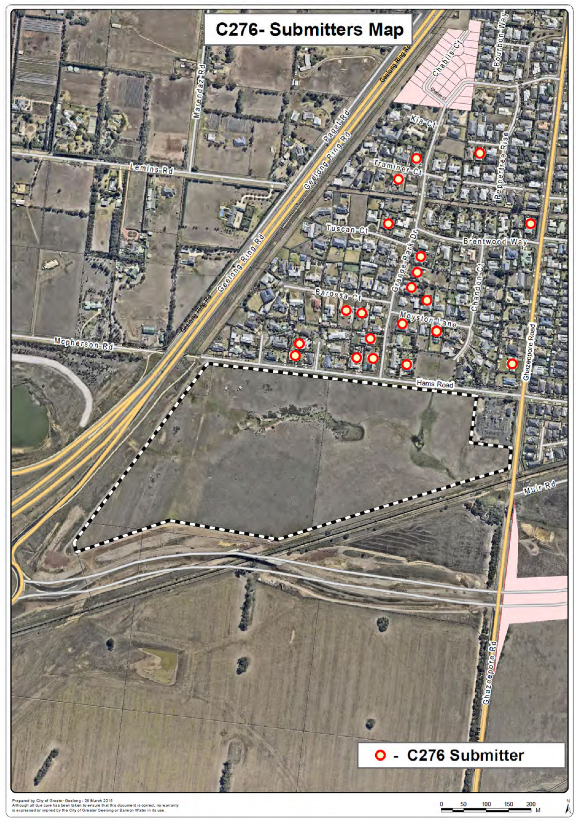
(Note: Some details of private submitters have been removed)
No. |
Surname |
Name |
Address |
Suburb |
Type |
Summary of Submission |
Council officer response |
1. |
Corangamite Catchment Management Authority (CCMA) |
Dr Geoff Taylor |
PO Box 159 |
COLAC VIC 3250 |
Submission |
|
CCMA’s comments are noted and supported. The DPO schedule has been updated to include a requirement for a Flood/Hydraulic Analysis under the Flooding, Stormwater and Drainage Management Plan. |
2. |
Department of Environment and Primary Industries (DEPI) |
Geoff Brooks |
PO Box 10 |
GEELONG VIC 3220 |
Submission |
|
DEPI comments are noted in relation to Native Vegetation. The proponent will be required to submit a permit for the removal of native vegetation at a later stage in the planning process. |
3. |
Department of State Development, Business and Innovation (DSDBI) |
Andrew Scott |
121 Exhibition Street |
MELBOURNE VIC 3000 |
Informal submission |
|
A formal response from DSDBI is anticipated no later than 20 October 2014. This timeline is predicated on VicRoads providing their Dust Study to DSDBI prior to 6 October. Detailed discussion of this issue is provided in the Council report. |
4. |
Department of Transport, Planning and Local Infrastructure (DTPLI) |
Jozef Vass |
PO Box 775 |
GEELONG VIC 3220 |
Submission |
|
The DPO schedule has been updated to reflect the correct road names for the Princes Hwy and Baanip Blvd. The request to change the wording for the acoustic survey is currently being discussed between Council and VicRoads. Further clarification is sought from VicRoads as to their review of the noise assessment prepared in support of the rezoning application. The DPO schedule has been updated to reflect the changes to the Decision Guidelines clause. |
5. |
Environment Protection Agency (EPA) |
Joanne Coupar |
Cnr Little Malop & Fenwick Strs |
GEELONG VIC 3220 |
Submission |
|
Council officers acknowledge the EPA as an important stakeholder in the rezoning process and consequently, the comments about the 250 metre separation distance from the quarry extraction limit are noted. Council are waiting for DSDBI’s formal response about the amendment to the quarry extraction limit and will ensure that further discussions are held with DSDBI regarding the impact of the finalised extraction limit and 250 metre separation instance on the subject land. Detailed discussion regarding the proximity of the Boral Quarry is provided in the Council report. |
6. |
Hudson |
|
Moyston Lane |
WAURN PONDS |
Objection |
|
The objector is correct in so far as the rezoning application will lead to the eventual subdivision of the land for residential purposes. A further consequence of this will be that the objector’s current view of farmland will change to one of urban development. The loss of views in this respect are not considered a significant barrier to the rezoning of the land. The issue of devaluation of property is not a planning consideration. The objector’s lack of knowledge of the rezoning application when they purchased their property 12 months ago is an unfortunate circumstance. The rezoning application was submitted to Council in November 2013. There will be an increase in traffic. The extent to which this will affect the Grange Park Estate has not been determined but will be considered in detail at the development plan stage. The issue of traffic and congestion will be dealt with in the Council report. The potential increase in crime is a subjective issue that is not a consideration as part of the rezoning. |
7. |
Kelly |
|
Grange Park Drive |
WAURN PONDS |
Objection |
|
Council officers notified landowners within the vicinity of the subject land. It is considered that landowners who may be impacted by the proposed rezoning have been notified. Notification was also advertised in the Geelong Independent and Geelong Advertiser. Council officers acknowledge that this submission is not a result of direct notification. Council officers acknowledge the objector’s recognition of the developer’s aspirations. It is acknowledged that access options to the subject land are limited and that principal access will be taken off Ghazeepore Road. The development of the land for residential purposes will increase the number of vehicles on Hams Road, Ghazeepore Road and most likely through the Grange Park Estate. Consequently, the Road Network and Traffic Management Plan, to be prepared as part of the Development Plan, will need to have regard to these issues by way of a traffic impact assessment. Issues of pedestrian safety are an important consideration for existing residents in the Grange Park Estate. Consideration of traffic calming measures may be a response to resolving these concerns. As above, this will need to be considered as part of the Road Network and Traffic Management Plan. In terms of the intersection upgrade works at Hams Rd/Ghazeepore Rd, should a roundabout be considered the best option, it is likely that this would enable a relative free-flow of traffic rather then requiring a signalised intersection that would require vehicles to become stationary. (Further discussion is included in the Council report.) The presumption that future residents of the subject land may use the Grange Park Estate as an alternative route to access Ghazeepore Rd and associated issues about pedestrian safety are valid concerns. This is a consideration that will be discussed further in the Council report. Issues in relation to subsidence are noted. The issue of net community benefit is one of balance, which requires the consideration of a range of existing and future physical, social and environmental issues and determining the level of net benefit to the community. The request for the subject land to be subdivided at a similar level to the Grange Park Estate is noted. However, the Grange Park Estate is not the only subdivision close to this land and consequently, the subdivision layout of the Grange Park Estate is not a determining factor in how this land should be subdivided. Nonetheless, it is acknowledged that the Grange Park Estate is different to a typical General Residential Zone subdivision in terms of lot sizes. In recognition of the character found in the Grange Park Estate in terms of its large lot sizes and low density residential development layout, it is considered a reasonable approach to request that the subject land be subdivided along its frontage to Hams Road using a conventional residential subdivision layout to establish a relative transition between the existing and future subdivisions. The Development Overlay Schedule has been updated to reflect this requirement. The said covenants are only applicable to land within the Grange Park Estate. The subject land is not affected by these covenants. It is a case for the landowner/proponent to consider the merit of imposing covenants of a similar style on the future subdivision of the subject land. |
8. |
Maiolo |
|
Moyston Lane |
WAURN PONDS |
Objection |
|
As mentioned above, it is acknowledged that the Grange Park Estate is different to the typical General Residential Zone subdivision found on the opposite side of Ghazeepore Rd to the subject land. The supporting transport assessment is “preliminary” and precludes the requirement for a full traffic impact assessment, as required by the Development Plan Overlay Schedule. The preliminary transport assessment considers that there will be no upgrade requirements to the intersections along Hams Road as it is anticipated that they will carry minimal additional traffic arising from the subject land. However, Council officers acknowledge the concerns of submitters and acknowledge that this will need to be addressed as part of a more detailed assessment. Potential noise increase arising from additional traffic is acknowledged. However, it is difficult at this stage to determine the level of impact on existing residents in the Grange Park Estate. The proposition of a roundabout intersection at Hams Rd/Ghazeepore Rd intersection is considered a logical proposal, albeit, the intersection arrangement is yet to be determined. The benefits of a roundabout intersection have been outlined above and are discussed in detail in the Council report. It is considered that principal access/egress from Hams Road will be via the new intersection as opposed to an elongated route via Grange Park Drive Estate. Again, it is acknowledged that Grange Park Estate will inevitably be subject to additional traffic, the extent to which is unknown. |
9. |
McVey |
|
Brentwood Way |
WAURN PONDS |
Objection |
|
The objector’s concerns in relation to increased traffic in Brentwood Way are noted and also, the issues of safety at the junction with Ghazeepore Rd. The requirement for a full traffic impact assessment at the rezoning stage is considered unnecessary and will be required as part of the Development Plan process. Issues relating to the Boral Quarry will be discussed in detail in the Council report, which will cover the majority of matters raised by the objector. It is noted that parts of the Grange Park Estate and subdivision at Sugar Gum Drive are located within a 1 km radius of the current Boral Work Authority. Consequently, the objector’s statement is considered inaccurate about residential properties being within 1km of a quarry. The Boral Works Authority is being reviewed as a consequence of the new Baanip Boulevard. The implications of a revised Works Authority will be relevant to the assessment of the rezoning application. Extinguishing the Works Authority is not an option as part of the rezoning of the subject land. There is potential for dust emissions from the quarrying of land to the south of the subject land. The extent to which this will be an issue is currently being determined and is likely to be an ongoing consideration in the assessment of the rezoning application through to the Panel Hearing. The rezoning application is supported by a Surface Water Management Strategy. This considers the implications of the development of the land, associated issues of stormwater drainage and the surrounding land uses and natural waterways. The proposed strategy is considered acceptable subject to further detailed investigations that will be required as part of the Development Plan process. The issue of oversupply is noted. However, there is strategic justification in the Armstrong Creek Urban Growth Plan to investigate this area for future residential development. The rezoning application is now undertaking that work. Council has a number of growth areas that will deliver residential housing over time, such as the Armstrong Creek Urban Growth Area. These areas are very strategic and will be developed over a long period. It is understood that the subject land will be advanced after rezoning and is likely to be on-line to deliver housing to meet the needs of residents in the short - medium term. The rezoning application is supported by a flora and fauna assessment, which is considered sufficient for this stage of the planning process. A further requirement has been included in the DPO schedule requiring the detailed assessment of fauna on site. This is a direct response to the concerns raised by submitters. Council officers are not aware of a historical cattle dip on the site. Council officers have requested information from the objector and also, the proponent, in order to investigate this matter further. A requirement for an Environmental assessment has been included in the DPO schedule in the interests of precaution. This matter can be considered further as part of the Panel process. As discussed in other responses, in recognition of the character found in the Grange Park Estate in terms of its large lot sizes and low density residential development style, it is considered a reasonable approach to request that the subject land be subdivided along its frontage to Hams Road in a conventional residential development style to establish a relative transition between the existing Grange Park subdivision and future subdivision. The key issues for this site are being considered as part of the rezoning process. The rezoning stage is the first step in a lengthy process that leads to subdivision and development of land. It sets the framework for which further detailed assessment is required. The rezoning stage fleshes out key issues that would be of a magnitude sufficient to warrant the abandonment of an amendment and consequently, the subdivision and development of land. In terms of consultation, Council has undertaken notification in line with the requirements of the Planning and Environment Act 1987. Council officers have also offered this objector an opportunity to meet to discuss matters further. |
10. |
Pecchiari |
|
Grange Park Drive |
WAURN PONDS |
Objection |
|
It is acknowledged that the Grange Park Estate is on the urban edge of Geelong currently adjacent to the farming land that is subject to this rezoning application. Detailed discussion of traffic related issues will be discussed further in the Council report. Issues in relation to the current state of the road network in the Grange Park Estate/Hams Road are noted. Hams Road will be upgraded and widened as part of the subdivision of the land. This will result in a good outcome for car users, cyclists and pedestrians. Costs for the upgrade works to Hams Road and Ghazeepore Road will be burdened by the developer. |
11. |
Smigowski |
|
Hams Road |
WAURN PONDS |
Objection |
|
The rezoning application is supported by a flora and fauna assessment. The assessment acknowledges the waterway as being the most environmentally sensitive area within the site and that it will require careful consideration during the detailed design. Council has considered this issue and has included an additional requirement in the schedule to the Development Plan Overlay requiring a detailed fauna assessment to be undertaken. It is unlikely that the subdivision of the land will match that of the Grange Park Estate. Council officers support a transition between the existing Estate and the new subdivision, as outlined in previous responses. The waterway that traverses the site is designated under the Waterway Act. Consequently, the CCMA will require a permit for works in, on or over the waterway. CCMA require that the natural alignment and length of the waterway be retained and that a minimum 20 metre vegetated buffer be provided on both sides of the waterway. This should ensure that existing environmental conditions are considered as part of the preparation of the development. The retention of the natural waterway should also ensure that existing water flows are retained. In general terms, given the size and fragmented nature of the subject land, its viability for intensive agricultural production is considered limited. The objector’s presumption that the land’s limited viability for intensive agricultural use relates to arable farming is incorrect. The objector’s reference to ‘high-density’ density is ambiguous. It is considered that this statement refers to the relative high density likely to occur on the subject land compared to the Grange Park Estate, which is very much a low density style residential subdivision. The delivery of what is known industry wide as ‘high density’ (40 dwellings per hectare) on the subject land is unlikely to occur but rather conventional to medium density development. It is an unfortunate situation that misinformation was provided by the estate agent at the time the objector purchased his property. The objector’s reference to frog population is noted- it is unclear as to what species of frog. As outlined above, the flora and fauna assessment has considered the likely of the site being used by significant fauna species. Further assessment will be required as part of the Development Plan process. Council’s role is to assess the merits of the rezoning of the land as suitable for residential development. Issues relating to integrity are not relevant in this case. The application before Council seeks to rezone the land for residential purposes not for recreational use. The Armstrong Creek Urban Growth Plan discusses the potential of the subject land to be considered for future residential and/or recreation zoning. This may add to the existing residential area to the north and increase the population within the catchment of the proposed Rossack Drive Railway Station and associated local activity centre. |
12. |
Smith |
|
Grange Park Drive |
WAURN PONDS |
Objection |
|
Traffic through the Grange Park Estate is likely to increase, the extent to which is unknown. However, it is considered that the majority of vehicles will utilise the new intersection at Hams Rd/Ghazeepore Rd to gain access to the wider road network. It is difficult to determine the increase in vehicle movements as a result of the completed development of the subject land. It is also considered highly unlikely that all cars exiting from the subject land would utilise the Grange Park Estate to access Ghazeepore Road. On the basis that the objector would not want to try to protect pedestrian safety in the Grange Park Estate because it may dramatically alter the amenity and character of the neighbourhood, is a difficult situation for Council officers to address. It is considered that the objector would like to see no increase in vehicles in the Grange Park Estate beyond those of existing residents- this would be unrealistic. The preliminary transport assessment does discuss the new railway station. However, not to the extent where it considers the impact of on Ghazeepore Rd and the new intersection to be delivered at Hams Rd/Ghazeepore Rd. Impact on property value is not a planning consideration. A variety of housing densities will be encouraged on the subject land. It has been outlined above that a requirement will be included in the Development Plan Overlay schedule to consider the transition in built form between the Grange Park Estate and the subdivision of land fronting Hams Road on the south side. The supporting flora and fauna assessment considers potentially occurring significant fauna species, including the growling grass frog. The report states that ‘no recent records, degraded habitat on site- may be seasonal movement.’ Notwithstanding this, a requirement for a detailed fauna assessment has been included in the schedule to the Development Plan Overlay. |
13. |
SP AusNet |
Deepank Gupta |
Level 30, 2 Southbank Boulevard |
SOUTHBANK VIC 3006 |
Submission |
|
SP AusNet’s comments are noted and supported, as per the terms of the Safety Management Study undertaken for the rezoning application. |
14. |
Strickland |
|
Grange Park Drive |
WAURN PONDS |
Objection |
Gross overdevelopment |
The existing character of the Grange Park Estate is acknowledged. There is strategic justification to review the subject land for residential development, as outlined in previous responses. The likely density to be provided on the amendment land will be conventional to medium density housing, representative of typical subdivisions in the General Residential Zone and as found in nearby subdivisions on Sugar Gum Drive. Traffic implications will be discussed in detail in the Council report and matching concerns have been discussed in previous responses. Existing parking issues on Ghazeepore Road are acknowledged. This is an issue beyond the scope of the rezoning application but is acknowledged in so far as the proposed site will increase numbers of traffic users on Ghazeepore Road. The noise assessment was prepared after the Ring Road was opened. The assessment considers the Geelong Ring Road (Section 4B) in terms of potential noise impact on the future subdivision of the amendment land. A noise assessment of the new Baanip Boulevard will be required in the schedule to the Development Plan. Council officers are not aware of a natural spring located on the site. The designated waterway that traverses the site will be retained and will include vegetated buffers on both sides to protect the waterway. The Powercor substation is being zoned General Residential as it is the most suitable land use zone. Minor utility installations such as this one are permitted in the General Residential Zone and exempt from permit requirements for buildings and works, as provided for in the Planning Scheme. |
15. |
Williams |
|
Champagne Court |
WAURN PONDS |
Objection |
|
The objector’s request to stop the rezoning is noted but not supported. The existing character of the Grange Park Estate is acknowledged. As discussed previously, high density development is not being proposed for the subject land. It is considered that the objector is speaking in relative terms to the large lots subdivided in the Grange Park Estate. The subdivision of the subject land is likely to be different to the Grange Park Estate, albeit, Council officers will endeavour to establish a transition between the Grange Park Estate and the subject land along Hams Road. There will be an increase in light from the future development of the land. It is not considered that this would be detrimental to the amenity of existing residents in the Grange Park Estate. Hams Road will be upgraded and widened and connect with the existing court bowl at the western extent of Hams Road and with the intersection at Ghazeepore Road. It will be capable of accommodating the increase in traffic from the residential development of the subject land. The proposed number of dwellings that are discussed in the Council’s report of 24 June 2014 are conceptual and unlikely to be achieved once detailed design is undertaken and on-site constraints addressed. Principal access to the subject land will be via Hams Road. Other access points on Ghazeepore Road are not viable due to the location of the Powercor Station and the level crossing. The existing road set-up in the Grange Park Estate is noted. It is suited to a more low density style of development and it is likely to be used by some vehicle users from the subject land. The extent to which the Grange Park Estate may be used as a thoroughfare is unknown until detailed assessment is undertaken. As mentioned in previous responses, the CCMA are responsible for designated waterways. It is considered that subject to further detailed considerations, the retention of the waterway and requirement for vegetated buffers on both sides of the waterway, including a waterway management plan, will lead to a good outcome. The inclusion of a shared path along the waterway will provide good connections to the existing wider shared path network and bring activity to the waterway reserve. The extent of fauna listed by the objector is noted. As above, an additional requirement has been included in the schedule to the Development Plan Overlay for this issue. The cost implications for the proponent are not a consideration for Council. |
ADDITIONAL LATE SUBMISSIONS |
|||||||
16. |
Black |
|
Grange Park Drive |
WAURN PONDS |
Objection |
NOTE: Submissions 16 to 26 have not been summarised in this report. The submissions raise issues that are the generally the same issues already raised in the other submissions. All the key issues are addressed in the body of this Council report. A full summary of the submissions will be prepared for the Panel Hearing
|
|
17. |
Cooper |
|
Barossa Court |
WAURN PONDS |
Objection |
||
18. |
Cronin |
|
Grange Park Drive |
WAURN PONDS |
Objection |
||
19. |
Haigh |
|
Tuscan Court |
WAURN PONDS |
Objection |
||
20. |
Monea |
|
Hams Road |
WAURN PONDS |
Objection |
||
21. |
Mountjoy |
|
Grange Park Drive |
WAURN PONDS |
Objection |
||
22. |
Nott |
|
Ghazeepore Road |
WAURN PONDS |
Objection |
||
23. |
Simpson |
|
Traminer Court |
WAURN PONDS |
Objection |
||
24. |
Smith |
|
Tigerlilly Lane |
WAURN PONDS |
Objection |
||
25. |
Spronken |
|
Barossa Court |
WAURN PONDS |
Objection |
||
26. |
Trigg |
|
Hams Road |
WAURN PONDS |
Objection |
||
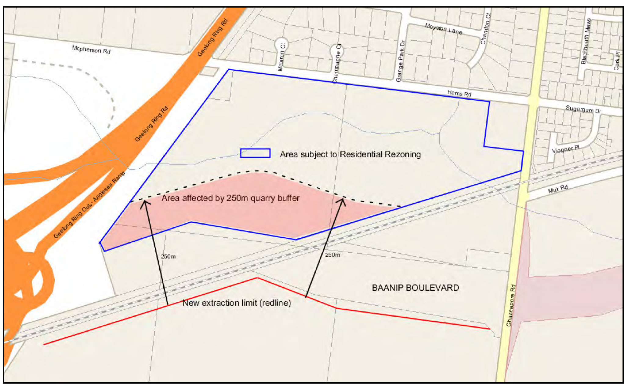
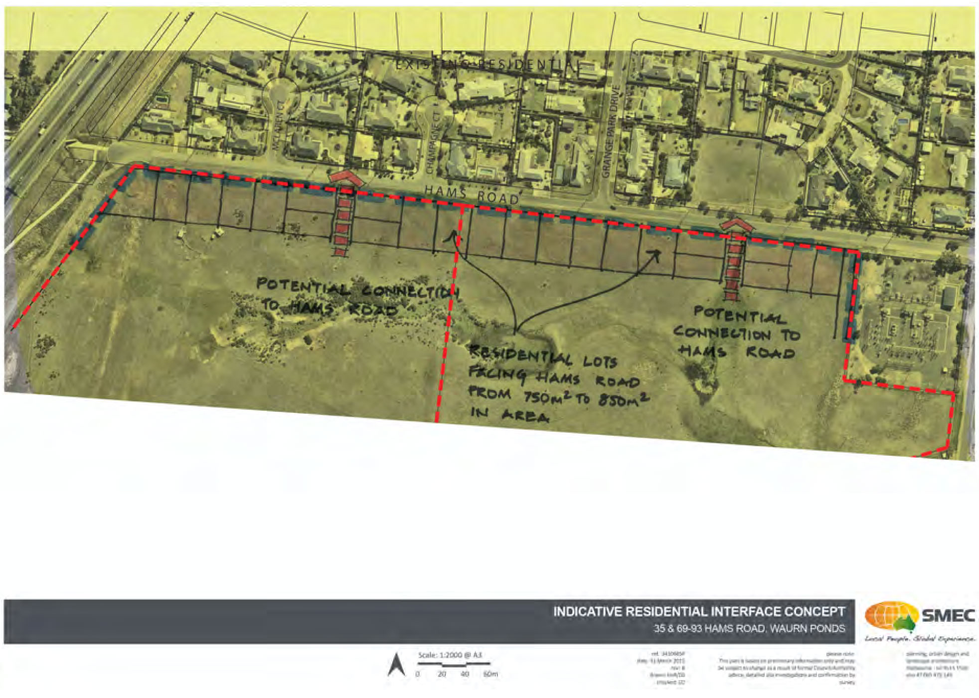
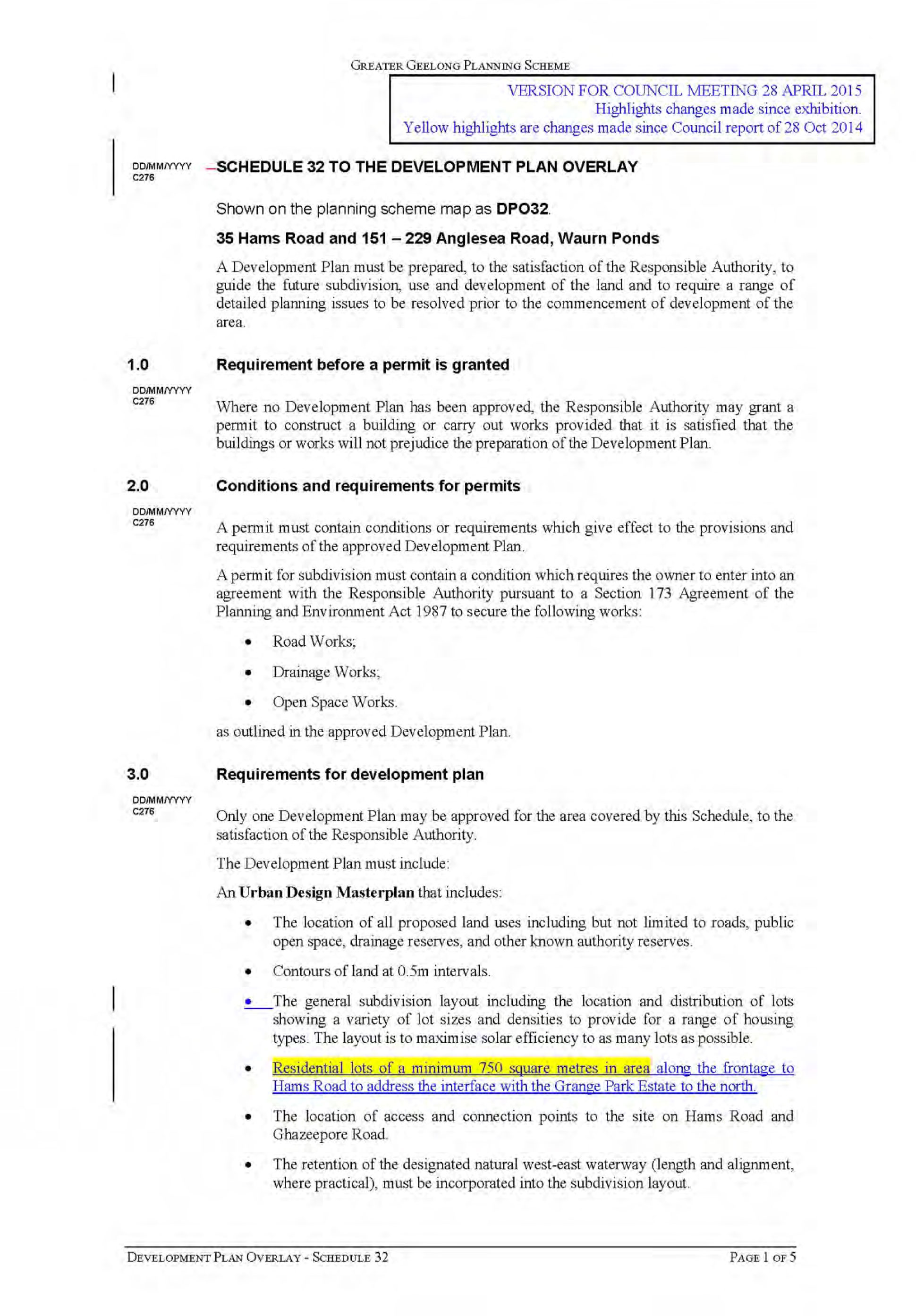
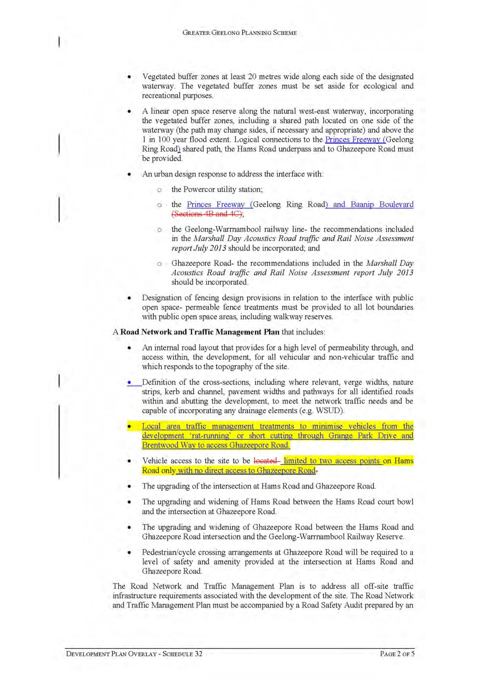
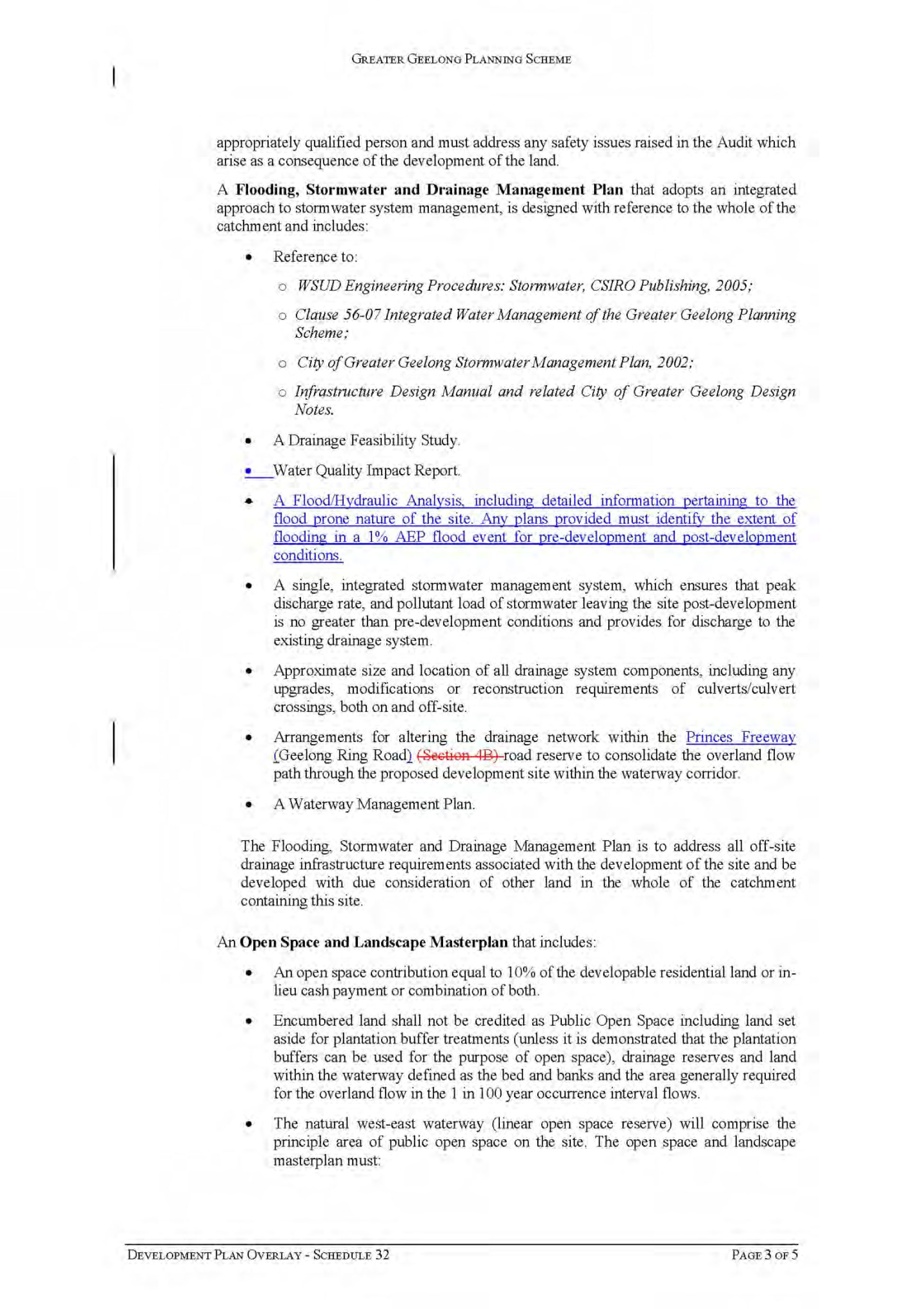
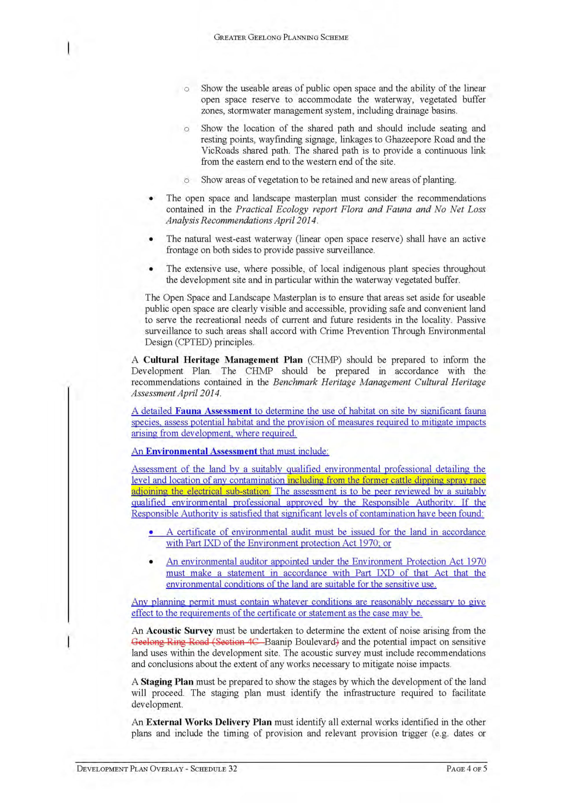
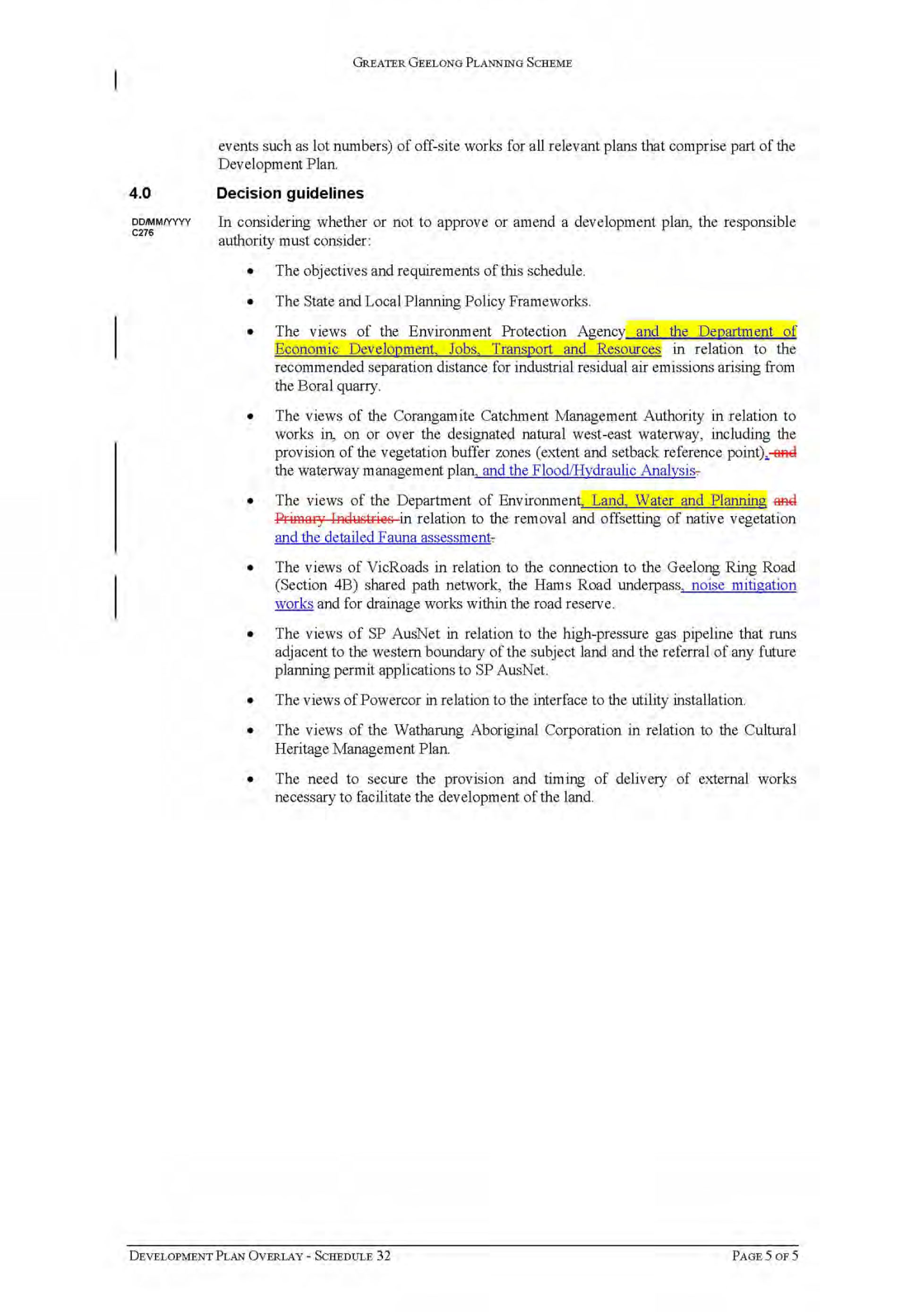
Portfolio: |
Central Geelong and Planning - Cr Heagney |
Source: |
Planning and Tourism |
General Manager: |
Peter Bettess |
Index Reference: |
Project: Incremental Change Area Review 2015 |
The purpose of this report is for Council to adopt the findings and recommendations of the Incremental Change Area Review 2015 and to give them statutory effect by including them in the Greater Geelong Planning Scheme.
In 2007 Council adopted a Housing Diversity Strategy (HDS). The HDS identified three approaches to deliver housing diversity across Geelong; Key Development Areas, Increased Housing Diversity Areas and Incremental Change Areas.
The Residential Zone Reform undertaken through Amendment C300 introduced a further work Clause into the Planning Scheme at Clause 21.06-6, to undertake further work to review the implementation of areas identified for incremental change in the Housing Diversity Strategy, to consider the application of General Residential Zone Schedule 2 (GRZ2).
Council officers undertook a review of existing incremental change areas, that is land in the General Residential Zone Schedule 1 (GRZ1) to determine if any of these locations exhibited a garden character and therefore should be rezoned to GRZ2.
The review considered the following elements contributed to an area having a garden character; building age, lot size, site coverage, and street tree density. State Government housing development data from 2005-12 was also reviewed to determine the locations where medium density housing growth is occurring.
The review determined that there were 4 locations within the GRZ2 that exhibited a garden character; these include Bell Post Hill, North Geelong, Newcomb and Point Lonsdale.
It is recommended that these areas be rezoned to the General Residential Zone Schedule 2 to ensure that the planning controls in these areas provide greater protection of the existing neighbourhood character. This is done by varying the requirements for open space, landscaping, building height and subdivision.
Cr Heagney moved, Cr Harwood seconded -
That Council:
adopt the recommendations of the Incremental Change Area Review 2015 including rezoning the four identified garden character areas at Bell Post Hill, North Geelong, Newcomb and Point Lonsdale to the General Residential Zone Schedule 2 and
seek authorisation from the Minister for Planning to prepare a planning scheme amendment to implement the recommendations of the review into the Greater Geelong Planning Scheme.
Carried.
In 2007 Council adopted a Housing Diversity Strategy (HDS). The HDS identified three development fronts to deliver housing diversity across Geelong;
Key Development Areas; being large existing and future development areas that have the potential to accommodate significant amounts of new medium and higher density housing, including mixed use development;
Increased Housing Diversity Areas; being areas where a mix of high, medium and conventional density housing will be encouraged, with the density of development being highest within the commercial core of the area and lower at the edge of the area; and
Incremental Change Areas; being residential areas where the majority of new development will be in keeping with Geelong’s traditional suburban character.
Incremental changes areas are zoned either GRZ1 or GRZ2. The existing incremental change areas that have been zoned GRZ2 were identified as areas exhibiting a more refined garden character.
Submissions made to the recent Residential Zone Review (Amendment C300) suggested there were other locations across Geelong that exhibited a garden character and should be zoned GRZ2. In response to submissions Council supported the inclusion of a further work requirement at Clause 21.06-6 of the Geelong Planning Scheme to undertake further work to review the implementation of areas identified for incremental change in the Housing Diversity Strategy, to consider the application of General Residential Zone Schedule 2.
Council officers undertook a review of existing General Residential Zone Schedule 1 (GRZ1) land to determine if any of these locations exhibited a garden character and therefore should be rezoned to GRZ2. A map showing the location of the study area is at Appendix 1.
General Residential Zone
Within the Greater Geelong Planning Scheme the General Residential Zone has two schedules. Council’s Housing Diversity Strategy forms the policy basis to support where each schedule has been applied. A schedule allows for certain planning application requirements to be varied from the standard requirements. In relation to the General Residential Zone this generally allows for variations to the standard Clause 54 and 55 (Rescode) requirements.
Schedule 1 is the default schedule applied to all residential land within Greater Geelong. This schedule does not vary any of the planning application requirements.
Schedule 2 was applied to areas where only incremental change is intended or planned to occur. This schedule varies application requirements relating to the size of open space, landscaping, building height and subdivision. These variations seek to ensure the scale and space around new buildings is in keeping with the garden character of these suburbs.
Appendix 2 is a copy of the General Residential Zone and Schedules.
Garden Character
A desktop review of the study area was undertaken. It was considered the following elements contributed to an area having a garden character; building age, lot size, site coverage, and street tree density. State Government housing development data from 2005-12 was also reviewed to determine the locations where the city was experiencing medium density housing growth.
From this initial assessment 75 areas were identified as exhibiting potential garden character elements. Appendix 3 shows the locations of these further investigation areas.
To further refine whether these areas had a garden character site visits were undertaken. During the site visits the following filters were observed;
Setting or space around buildings, providing an opportunity for planting.
On site vegetation or an established garden was present
Condition and appearance of buildings including the approximate age of the buildings
Presence of a nature strip and footpath.
Confirmation of street tree planting, new or recently established plantings.
From the site visits it was determined that there were 4 areas which exhibited a garden character including areas at Bell Post Hill, North Geelong, Newcomb and Point Lonsdale. Within these areas there are approximately 4330 lots which are recommended to be rezoned from General Residential Zone Schedule 1 to General Residential Zone Schedule 2. Appendix 4 shows the location of the 4 areas.
Impact on Housing Development and Diversity
The introduction of additional General Residential 2 zoned land will improve housing diversity within the municipality. It will reinforce Councils preferred location for different types of housing particularly medium density housing. The rezoning of land will help to protect the existing garden character established suburbs. The application of the GRZ2 will ensure that where new multi dwelling development occurs there is a requirement to provide a more spacious setting, helping to protect the existing garden character of these areas.
The introduction of additional GRZ2 land will not significantly impact on the ability of Council to meet housing demand or housing choice across the municipality. The majority of this demand will be met within the Armstrong Creek, Lara, Leopold, Clifton Springs, Ocean Grove and Fyansford growth areas. Infill development will continue to occur in established areas at varying development densities based on the direction established through planning policy and the new residential zone reforms.
The introduction of additional GRZ2 land will not significantly result in a reduced number of infill development opportunities within these locations. The State Government housing development data 2005-12 suggests that the majority of lots within the 4 proposed GRZ2 areas would typically yield 1 to 2 dwellings. The changes to the zone schedule may result in reduced building footprints to accommodate larger open space areas but still result in the development of up to 2 dwellings.
This review and subsequent planning scheme amendments will result in minimal environmental impacts. The review recommends the retention of larger open space areas at 4 locations within the municipality helping to retain existing vegetation and reduce the amount of hard surfaces, reducing storm water run off.
This review recommends that Council prepare a planning scheme amendment to rezone land to the GRZ2. The costs associated with this amendment process will need to be met by Council through the planning scheme amendment budget allocation.
The Amendment is consistent with the State Planning Policy implementing the objectives and strategies of Clause 11 Settlement and Clause 16 Housing.
The amendment is also consistent with the Local Planning Policy Framework; in particular Clause 21.06 Settlement & Housing which seeks to provide an appropriate range of development densities and urban consolidation opportunities. It supports Clause 21.06-4 Neighbourhood Character which seeks to protect areas with a significant garden character.
The review supports the Sustainable Built and Natural Environment strategic directions of City Plan. The recommendations of the review will help new development retain existing vegetation in the established suburbs as well as minimising hard surface areas and reducing storm water run off.
No Council Officers involved in the preparation of this report, have any direct or indirect interest, in the matter to which this report relates in accordance with Section 80 (c) of the Local Government Act.
There are minimal risks to Council in adopting the recommendations of this review and implementing them through a planning scheme amendment process. Affected property owners will be given an opportunity to comment on the proposed zone changes as part of the planning scheme amendment process.
Social considerations were considered as part of submissions to Amendment C300 which recommended that this review be undertaken to reassess the previous recommendations of Council’s adopted Councils Housing Diversity Strategy 2007.
The proposal does not impact on any human rights and responsibilities set out in the Charter. Planning legislation ensures an open community consultation process occur enabling people to freely express their views on an Amendment and if necessary, obtain a fair hearing before an Independent Panel.
Affected property owners will be given an opportunity to comment on the proposed changes during the planning scheme amendment process in accordance with the provisions of the Planning and Environment Act 1987. All affected property owners will be notified by mail and public notices will be place in the local papers.
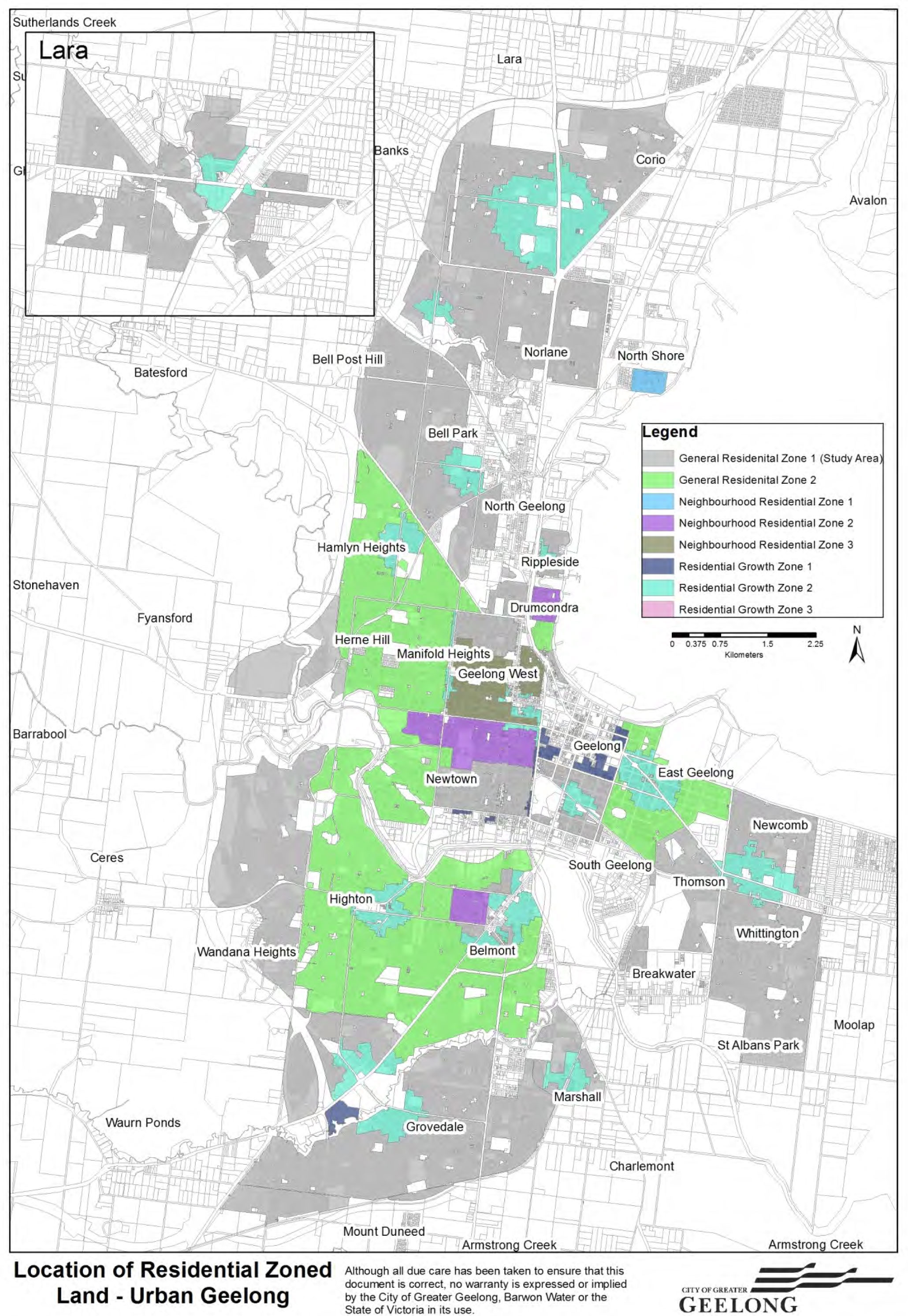
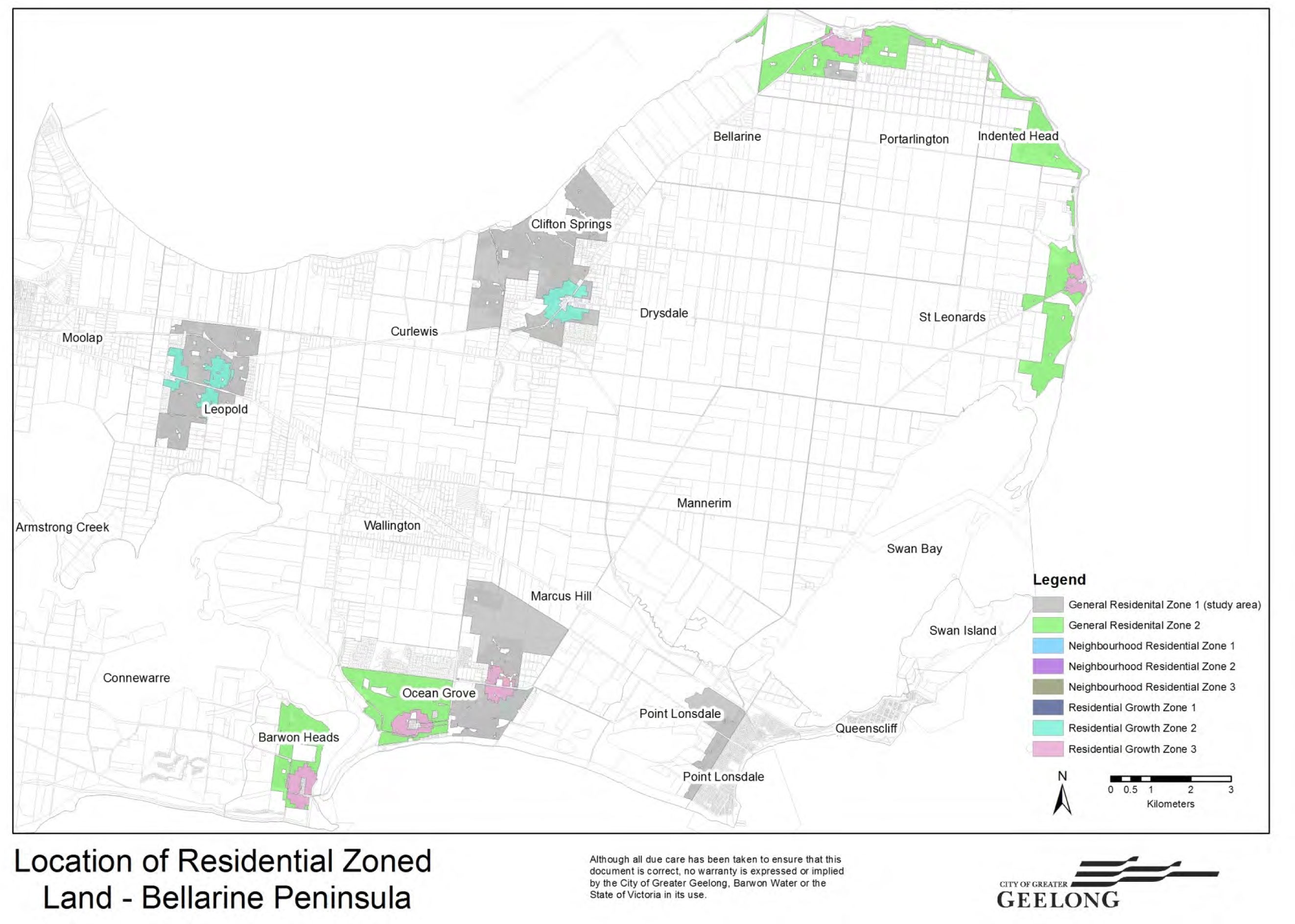
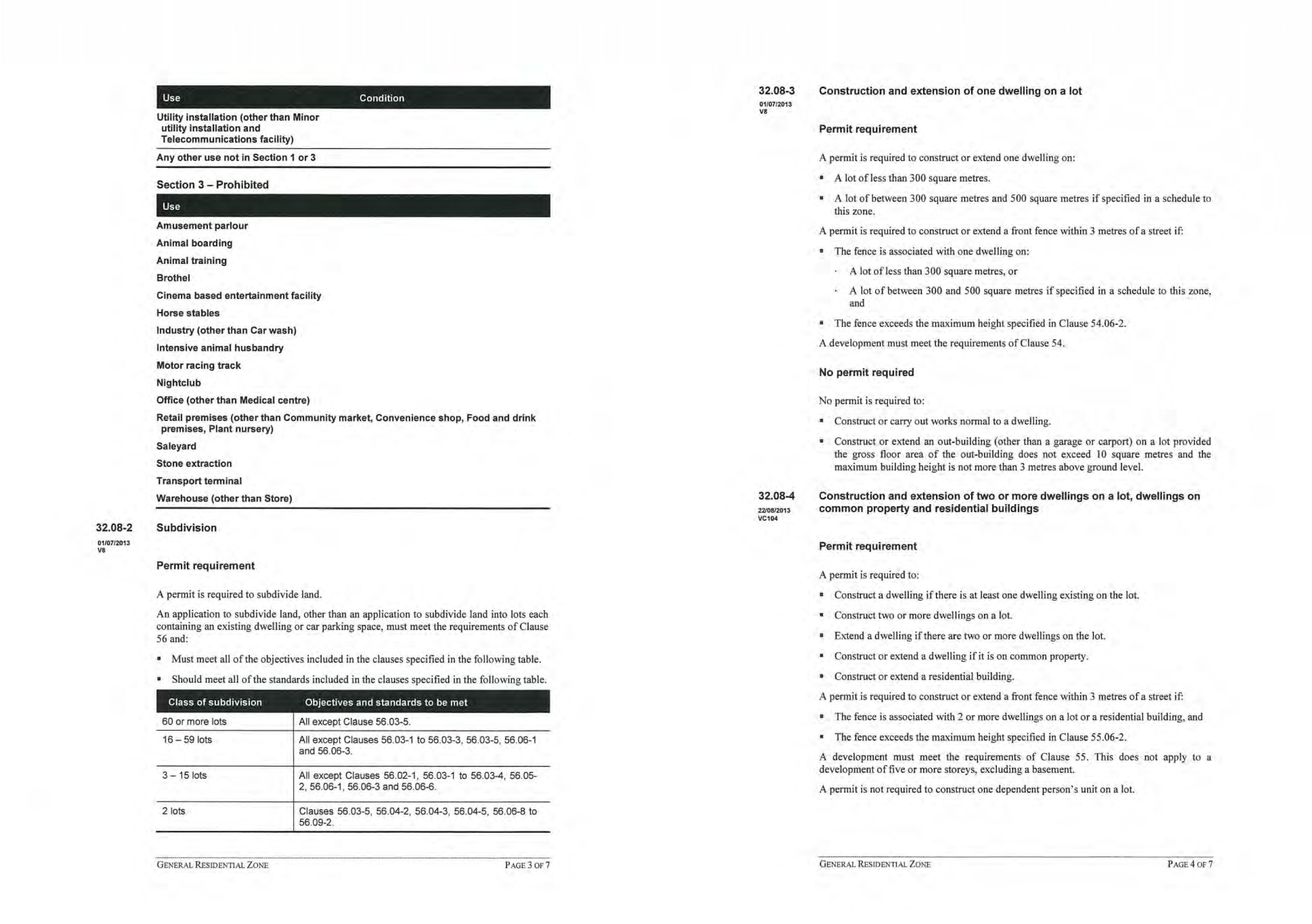
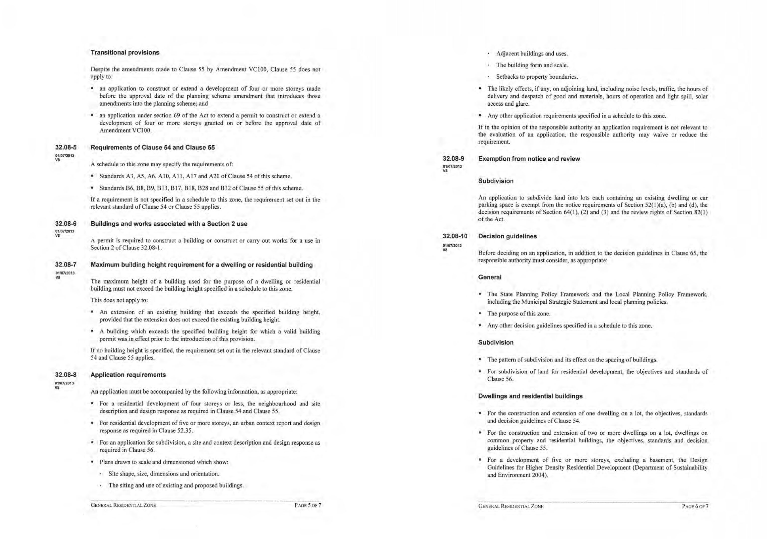
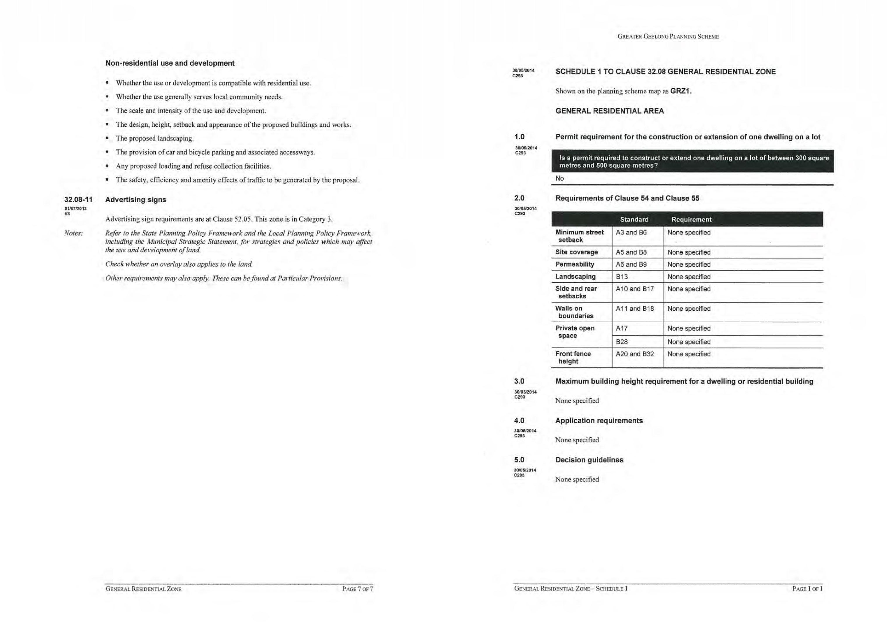
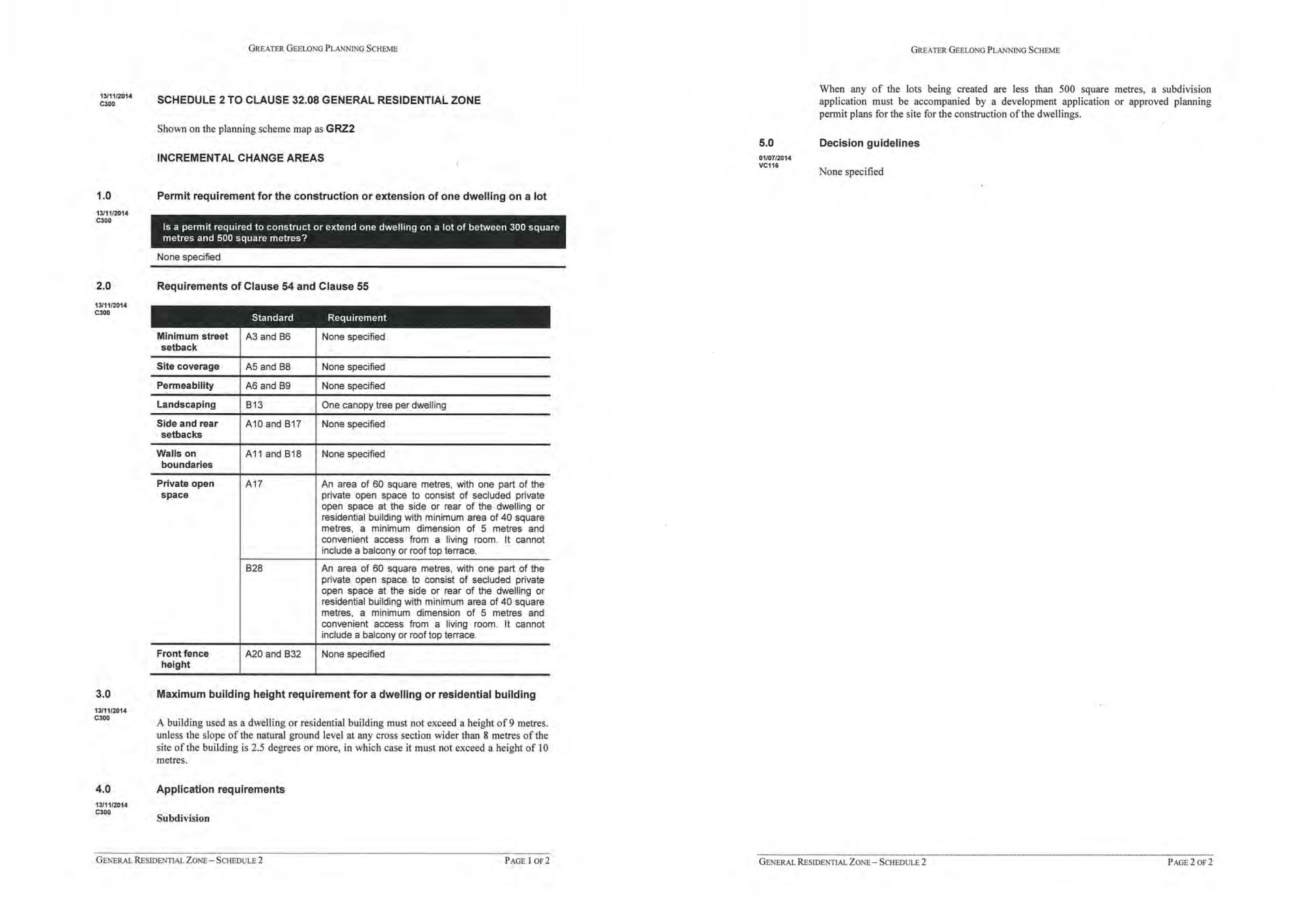
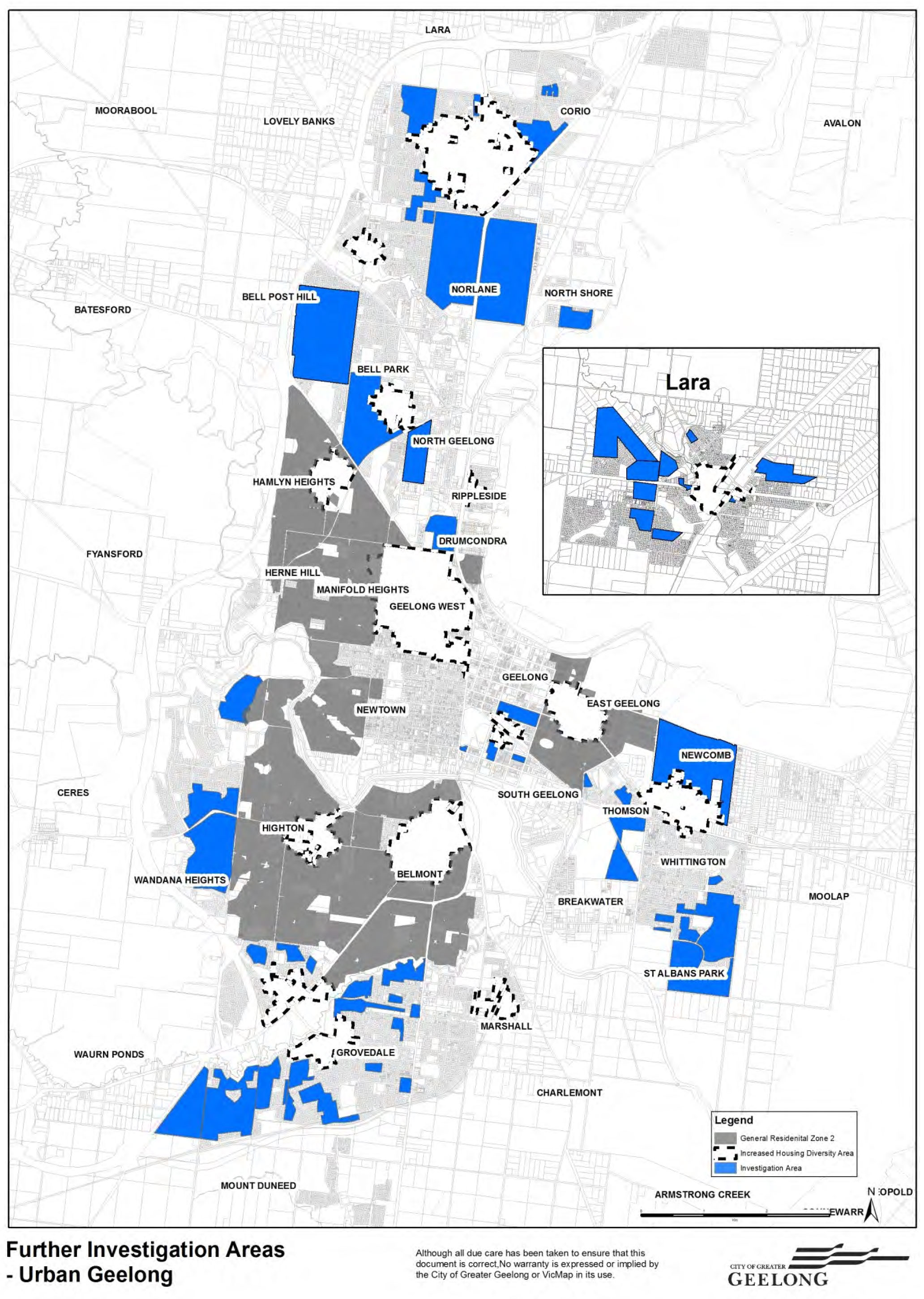
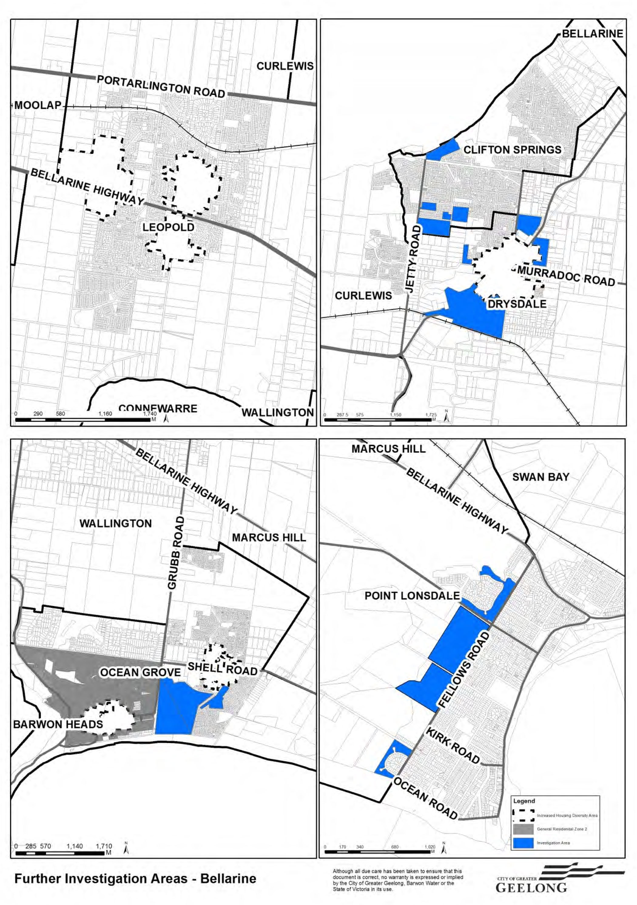
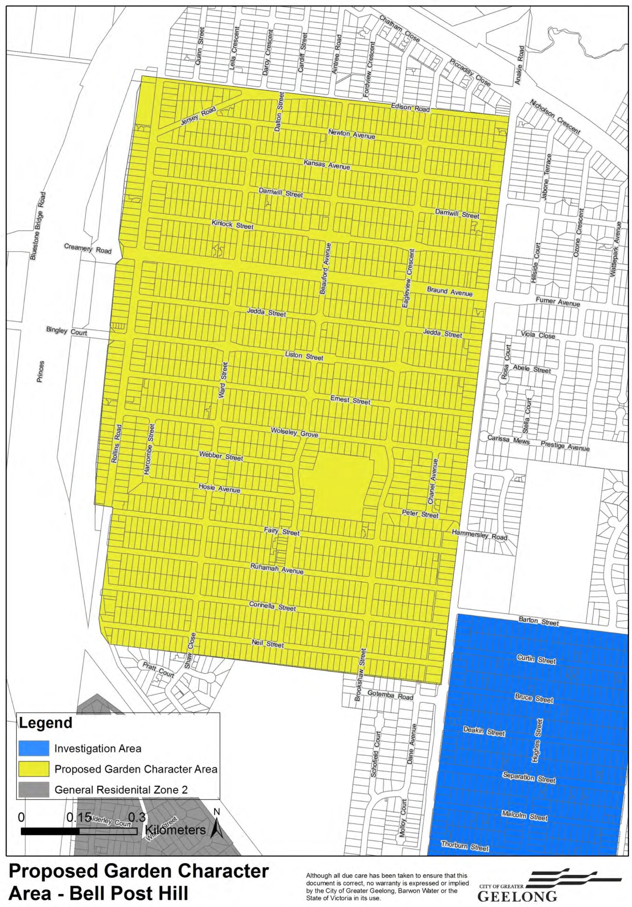
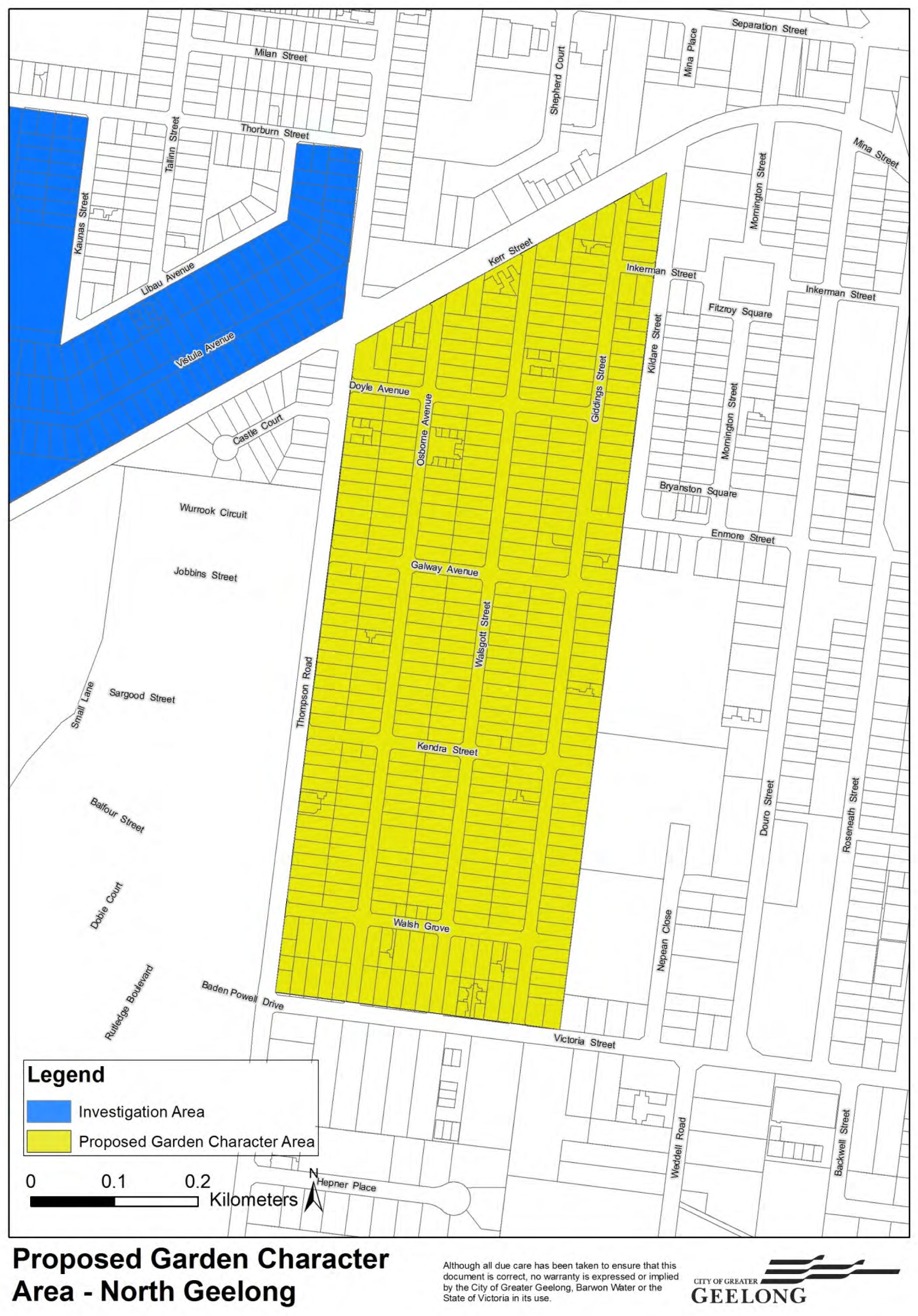
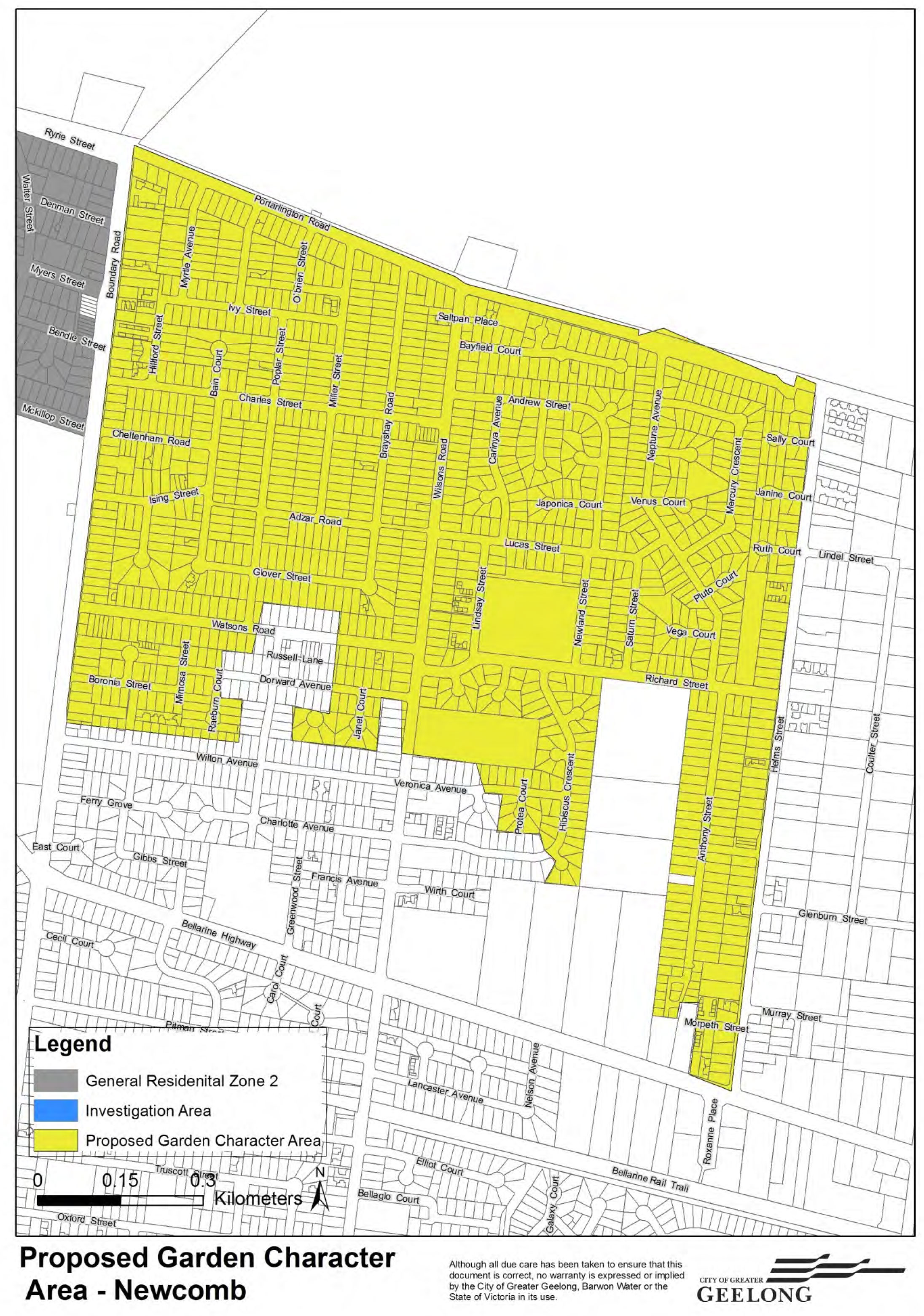
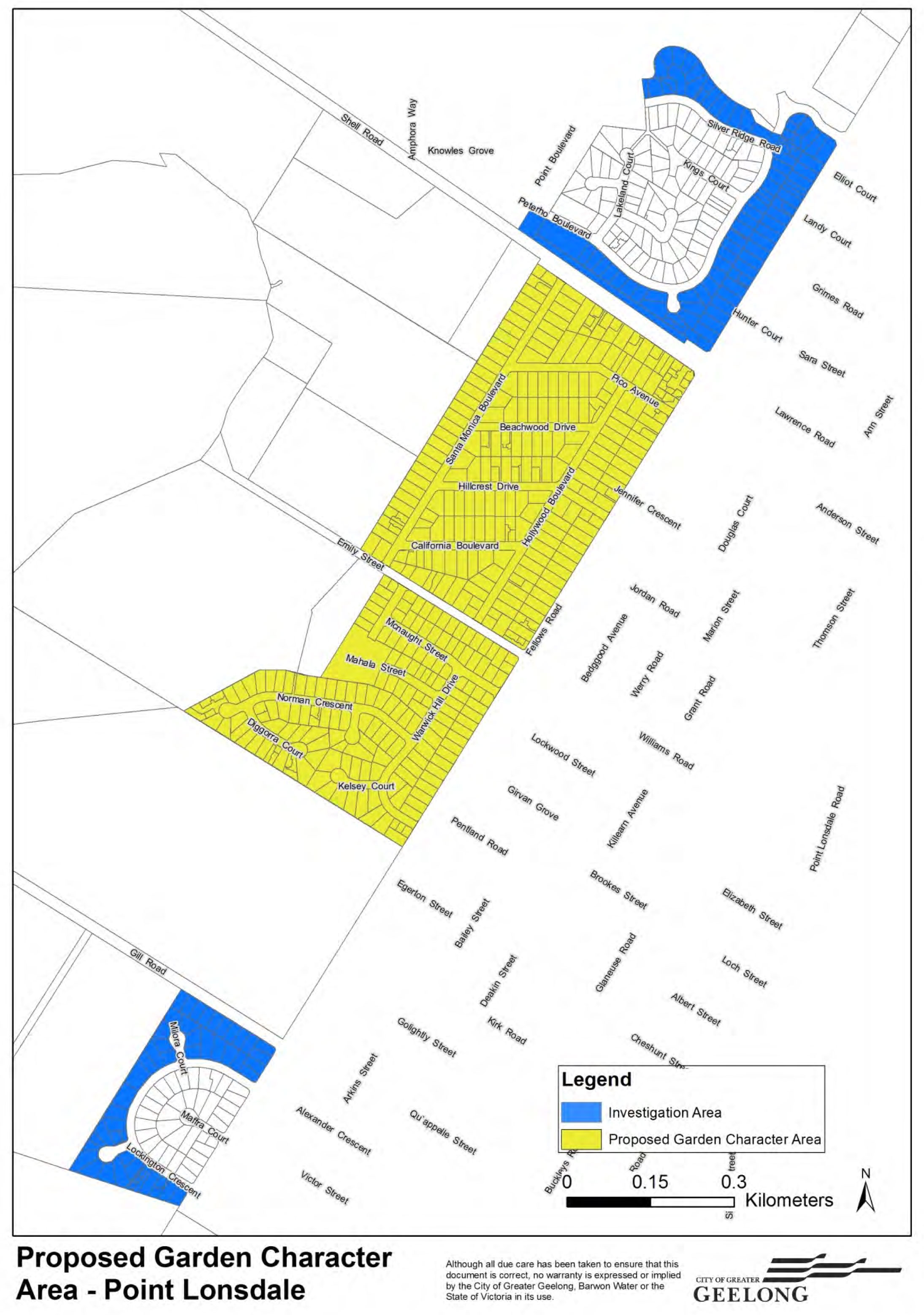
Portfolio: |
Finance - Cr Lyons (Mayor), Cr Farrell, Cr E Kontelj |
Source: |
Strategy & Performance – Property Management |
General Manager: |
Dean Frost |
Index Reference: |
Sale of land |
The purpose of this report is to consider submissions received to the proposed sale of the Old Geelong Gaol (“the Gaol”) and to recommend that the Council call for expressions of interest for the sale of the Gaol.
The Council became the owner of the Gaol in 1994 when the State Government’s sale process failed to secure a private purchaser. The Council was at the time under the control of government appointed Commissioners and purchased the property with a government loan which has not been repaid.
Since purchase the Gaol has been leased to Geelong Rotary which operates the old cell block as a museum and leases out parts of the complex to tenants. Apart from limited maintenance expenditure the Gaol is essentially unimproved since purchase and has a significant and mounting maintenance backlog program. There is no forward master plan for the improvement and operation of the complex.
On 25 June 2013 the Council resolved that its preferred option was to sell the gaol and established a Reference Group to look at potential future uses.
At its meeting on 10 June 2014 the Council, having considered the findings of the Reference Group, resolved to give notice of intention to sell the Old Geelong Gaol under s189 of the Local Government Act. 13 submissions were received 5 of which were heard by the Submissions Review Panel. The report of the Panel, consisting of minutes of its meetings, is in Attachment 2.
Each of the individual submissions is summarised in Attachment 3. Four core submissions emerge from all submissions as follows:
Continued ownership of the Gaol by Council will ensure preservation of its buildings and heritage values.
Submissions in support of more investment by the Council in developing and operating the Gaol as a tourist attraction.
Rotary proposes formation of a Project Planning Group to develop a new business model and plan over a 6-12 month period.
Submissions relating to the interests of tenant.
Responses are provided to these core submissions in the attached report.
The Submissions Review Panel recommends that the Council, over a six month period, investigate alternative ways of Council retaining ownership while funding the maintenance program and achieving its tourism potential including partnerships with other groups and entities.
It is recommended that the Gaol be sold by expressions of interest which will be assessed by a panel to report back to Council on the recommended purchaser.
Cr Ansett moved, Cr Farrell seconded -
That:
Council, over a six month period, investigate alternative ways of retaining ownership while funding the maintenance program and achieving its tourism potential including partnerships with other groups and entities;
A report to be brought back to Council with recommendations in November.
Carried.
Division Requested:
For: Crs Ansett, Harwood, Nelson, Ellis, Richards, Farrell, Irvine
Against: Crs E Kontelj, Lyons, Heagney, Fisher, Macdonald
In 1991 the State Government decommissioned the Old Geelong Gaol and offered the property for sale by tender in 1994. The Council, under the control of Commissioners, supported a private tender to purchase and use it for a car museum, however the tenderer withdraw shortly after acceptance.
After giving consideration to the Government’s conditions of release for the private tenderer, the Council stepped in as purchaser using an interest free Government loan to purchase the property. Soon after purchase in November 1994 the Council installed Geelong Rotary as the head tenant which in turn has sub-let parts to a range of tenants. The main cell block continues to be operated by Rotary as a tourist attraction.
The title to the Gaol consists of a Crown Grant of estate in fee simple meaning that the land is owned freehold by the Council which may dispose of the property. The Minister for Planning has indicated that the outstanding loan is payable upon disposal of the property.
Over the last seven financial years the average annual rent to Council from Rotary has been $35,700 and the average annual maintenance expenditure for the same period has been $30,700. Apart from replacement of the main gates maintenance expenditure has been minimal and no improvements of any significance have been implemented since the Gaol was decommissioned. Parts of the complex have been shut down due to structural deterioration, non compliance with building regulations and safety risks. The built infrastructure continues to deteriorate, mainly in the non masonry elements.
At present the income from sub tenancies to Rotary is approximately $76,000 per year and under the lease Rotary is responsible for operating and utility costs.
On 25 June 2013 a report on the future of the Gaol was presented and the Council resolved to:
Note the cost projections for the continued ownership of the Gaol;
Note that the projections will fund some outstanding maintenance and achieve a modest level of compliance without providing any improvements that will allow the property to be used for alternative uses;
(Recognise) that the preferred option is that Council does not wish to retain ownership of the subject property;
Establish the Old Geelong Gaol reference group for the purposes of receiving a report on potential future uses by a third party, prior to proceeding with the sale or transfer of ownership.
Having considered the findings of the Reference Group, on 10 June 2014 the Council resolved to:
Commence the procedures to sell the Gaol by expressions of interest;
Give notice under section 189 of the Local Government Act 1989 (“the Act”) of its intention to sell the Gaol and that public notice of and the right of a person to make a submission be given in the Geelong Advertiser and the Geelong Independent;
Appoint the Submissions Review Panel to hear any submissions and report to the Council on any submissions received;
Make the Conservation Management Plan review publically available when the property goes on the market.
Consideration of Submissions
Following the advertising period 13 written submissions were received and the Submissions Hearing Panel convened on 2 December 2014 to hear 5 of those submissions. The Panel re-convened on 24 February 2015 to further consider its position. The report of the Submissions Hearing Panel is in Attachment 2 and a summary of all submissions is in Attachment 3.
This section of the report sets out and responds to the four main points made by many of the submitters.
Continued ownership of the Gaol by the Council will ensure preservation of buildings and heritage values.
The Old Geelong Gaol is included on the Victorian Heritage Register (H991) and is within a Heritage Overlay (HO143) in the Greater Geelong Planning Scheme. Heritage Victoria has control over changes to the building fabric including demolition and those controls remain in place no matter who owns the property.
A Conservation Management Plan May 2014 (CMP) has been prepared for the site by Council’s consultant Ivar Nelson, and that document will be the key reference point for any changes to the building fabric. In relation to management and ownership of the site the CMP states “…While public ownership appears to provide a degree of community comfort, it does not guarantee the resources or investment to responsibly manage the physical fabric of the Gaol. The conservation of the Gaol is more an issue of resources and investment, than it is of public or private ownership.”
There are sufficient statutory controls on use and development over the site to ensure that the significant buildings are protected and that any modifications to these buildings are carried out in a manner that retains and enhances its heritage values.
Submissions in support of more investment by the Council in developing and operating the Gaol as a tourist attraction.
Comment:
The Gaol is currently operated as a low level tourist attraction by the head tenant Rotary using all volunteer resources with an estimated modest visitation of 10,000 pa.
In order to determine if the site has the potential to develop into a viable and significant tourist attraction research was carried out into 11 other disused jails within Australia.
That research concluded that there are a number of similar facilities which have been adapted as tourist attraction with limited success and both State and Local government authorities have disposed of jails with varying results.
One essential characteristic of jails that have become successful tourist attractions is that they are of high national and international significance and draw considerable interest from tourists for this reason. Of particular note are the Old Melbourne Gaol, Port Arthur and the Fremantle Jail.
The Freemantle Jail is of particular interest as it operates relatively successfully as a tourist attraction and to some extent the City of Freemantle shares the second city characteristics of Geelong. The Freemantle facility is owned and managed by the State and operated directly by its Finance Department. Recurrent income is about $5m from 190,000 visits ($3m), events and rents, and recurrent expenditure is about the same as recurrent income, including salaries ($2.5m), maintenance, utilities and other costs. In the period 2001 to 2008 the facility received about $10m in capital funding for building improvements and now receives capital funding on an as needs basis. It is a world heritage listed site and as such has received modest grants from the Commonwealth on a 50/50 basis. There are no volunteer staff and all are trained and paid by the department and visitor numbers have steadily built up in response to improvements in the quality of the experience.
In contrast to the Fremantle facility is the Adelaide Gaol which like Fremantle is now owned and operated by the State, having previously experimented with a volunteer operator. The facility attracts 15,000 visitors pa, is operated by 2 full time staff and, with annual revenue of $232,000, it operates at a recurrent loss. Recent capital expenditure of $646,000 has been allocated and allocations are subject to the State annual budget process.
The Old Geelong Gaol, while of interest for its former use and relatively intact fabric, is not of national or international significance and has no specific point of interest to give it the advantages it would need to become a successful tourist attraction in itself.
Head tenant Rotary has proposed that a Project Planning Group be established to develop a new business model and plan over a 6-12 month period. The Group would consist of Rotary personnel with a range of diverse business backgrounds.
Comment:
In June 2013 when Council first decided that it would review its ownership of the Gaol, Rotary approached the then Mayor and sought a review of the operation of the facility. Council’s response was to defer consideration of the sale of the property and establish a Reference Group consisting of Councillors, staff, Rotary and people with skills in tourism and heritage place management.
The Reference Group met twice and reported to the Council on its findings. It did not identify a clear direction for the future of the facility and was open to investigating what sort of response would be received from alternative owners under a sale by EOI process.
Given the current knowledge and work carried out to date, the proposal to establish a Project Planning Group does not provide a clear case for Council to invest the considerable recurrent and capital resources required to lift the facility to a level that justifies the resources required. Further, if such a case exists, there is no necessary relationship between successful operation and Council ownership.
Submissions relating to the interests of the tenants.
Comment:
There are submissions relating to the future of services for people with disabilities which have been provided from the site by St Laurence Services. Those submissions were made just prior to St Laurence vacating the site and relocating those services. Karingal has back filled part of the premises formerly occupied by St Laurence however Karingal is using the space as offices and not for the provision of on site disability services.
Other tenants including Barwon Health (offices, storage and parking), Diversitat (hostel), and Protective Services (offices) are all occupying space on short term leases in recognition of the pending decision by the Council regarding the future ownership of the site.
Rotary being the head tenant is beneficiary of the subtenant’s rent after the rent to Council has been paid, and those funds are retained by Rotary in pursuit of its charitable objectives. If the property is sold Rotary’s income may be at risk depending on their role in the future management of the Gaol.
Maintenance Projections
Technical reports commissioned indicate that known maintenance and compliance works required are expected to cost $1,559,000. The actual maintenance cost will exceed this amount as the estimates were obtained using non invasive walk through techniques and do not account for contingencies relating to lack of documentation and conservation restrictions.
If the maintenance works were implemented much of the deteriorating elements of the complex will be stabilised and increased allocations for recurrent maintenance budgets will be required to ensure that maintenance backlogs do not re-accumulate. These works will only stabilise the existing infrastructure and will not upgrade the complex to allow any new or innovative uses. No estimates of capital works for adaptive or conservation works have been prepared however the resources required for such work are likely to be considerable.
Conservation Management Plan (CMP)
Conservation consultant Ivar Nelson was engaged to prepare a review of the CMP (now complete). The purpose of the review was to take the original 1997 CMP and identify the significance of the structures and parts of structures within the complex.
The following table provides a snapshot of the allocation of significance levels of the building elements by the CMP.
Level of Significance |
Elements Included in level |
Significant Fabric |
Original fabric and changes up to 1900 including:
|
Fabric of some value |
|
Fabric of little or no significance |
|
The CMP must be interpreted as a whole to understand how the future of the complex is to be managed to retain, maintain and enhance its heritage values. Significantly the review states:
“The conservation of the Geelong gaol must give due regard to its on going and sustainable use and maintenance when considering changes to its fabric.
Change is inevitable. It is not necessarily a threat to conservation but, if directed appropriately, can contribute to the ongoing and sustainable use and maintenance of the Gaol.
Change can be minor changes to Significant Fabric, the removal of Fabric of Some Value and/or the introduction of new fabric to contribute to the use and future of the Gaol.”
The CMP review provides a progressive overview of the complex and provides a framework for change to encourage sustainability and viability of the complex.
The Cost of Continued Ownership
The Council is free to consider its options for future ownership of the Old Geelong Gaol including on going ownership or sale.
Should the Council continue to own the complex and not fund the works backlog, access to various parts of the complex over time will be further prevented including the main cell block where the central wooden skylight structure continues to deteriorate. At a minimum it is likely that unsupervised public access to the main cell block will be restricted. This option does not present a sustainable approach to the ownership of the facility.
Council could continue to own the Gaol and fund maintenance and compliance works from internal and external sources. External funding sources include State and Federal Government grant programs, however funding from these sources is likely to be limited with the Council remaining exposed to most of the costs and risks.
On going ownership will mean that in addition to the identified works, the cost of unidentified maintenance, changes to compliance requirements and any future conservation works will remain the prime responsibility of the Council. As noted above the cost of unidentified works, including capital improvements for alternative use, is likely to be substantial.
On going ownership will also expose the Council to operating costs. If an experience is to be offered to enhance visitation, it will need to be professionally managed and may not include volunteer resources, if the experiences at Freemantle and Adelaide are relevant.
Conclusion
The option of on going arms length management of the Gaol by the Council through a head and sub lease structure, while convenient, is neither generating sufficient funds to meet maintenance and compliance requirements, nor does it represent a sustainable model for long term management.
Ongoing ownership of similar disused prisons in Victoria have not been supported either by State or Councils, with the State Government having sold many to private owners and Mt Alexander Shire Council having disposed of the Castlemaine Gaol in 2012. It is difficult to reconcile ownership of a disused Gaol with Council’s primary role as a local government authority.
Any plans to develop the Gaol as a significant tourist attraction, in addition to the cost, introduces business risks evidenced by comparison with other successful Australian tourism based gaols which have either national or international recognition of their heritage fabric. The Old Geelong Gaol is not significant at this level and is not unique within Victoria. Without this basic criteria of significance or uniqueness there is doubt that the Gaol will, even with the considerable investment in staffing, marketing, maintenance and capital, achieve a level of visitation and income to justify the application of resources. It is however acknowledged that visits could experience a modest increase through improved marketing and professional tours.
The main cell block is unable to be substantially modified for alternative uses due to restrictions on demolition and major internal reconstruction. The future of the property is likely to see the use of the main cell block as a tourist attraction with some scope to host events. To support that use there is a need to find adaptive uses other than car parking for the other spaces and buildings particularly the development of new buildings in the courtyard spaces which is recognised in the CMP. A future in that form is not aligned with the Council’s needs and requires investment from other sources, particularly the private sector.
Sale by EOI Process
A sale by EOI as described below is recommended under a process that will allow the Council realistically test the potential for private investment in the site. As a market testing exercise, it needs to be acknowledged that while some interest has been expressed over recent years in the site, there are no existing documented proposals.
Provide an EOI document to the market based on the Council’s standard EOI format including contents:
Geelong Community Profile
Tourism Visitation
The Land
Title Particulars
Head Lease and Sub Leases
Council Requirements
Information Sought
Conservation Management Plan
Planning Controls
Commercial Issues
Native Title
Evaluation
Advertised and marketed through an appointed estate agent.
Information Sought
Price
Maintenance program
How will public access to the cell block be provided?
Broad concept description (master plan)
Experience capability of purchaser
Contract conditions requested
Council Requirements.
Cell block open to the public.
Implementation of minimum maintenance program.
EOI’s assessed by an assessment panel consisting of the Ward Councillor, General Manager – Strategy and Performance and Manager – Corporate Strategy and Property Management.
Assessment panel recommends to Council a preferred purchaser. The EOI assessment process may be a single or two stage process depending on the number of responses and the level of information provided.
Evaluation criteria will include
Response to Council requirements
Experience and capability
Master Plan
Purchase price
The EOI process described is a guide to Council’s requirements and how the process will be conducted. The Council may vary the terms and conditions of the EOI depending upon responses.
Report by Submissions Review Panel
The Submissions Review Panel recommends that the Council, over a six month period, investigate alternative ways of Council retaining ownership while funding the maintenance program and achieving its tourism potential including partnerships with other groups and entities.
The recommendations of this report have no environmental implications.
The Minister for Planning in June 2013 advised the Council that the interest free Government loan of $360,000 taken out by the Council in 1996 for the purchase of the Gaol shall be repayable in full upon sale of the asset. However the Minister also advised that upon repayment of the loan consideration will be given to establishing a Geelong Heritage Restoration Fund for the conservation of heritage places in the City of Greater Geelong.
The Local Government Best Practice Guideline for the Sale and Exchange of Land recommends that where ever possible land be sold by a public process such as public auction or listing.
Section 189 of the Local Government Act (“LG Act”) requires that Council obtain a certified valuation dated not more than six months prior to the sale of the land being the date of the contract of sale. A valuation will be obtained and used as a basis for setting a price.
Under the same section of the LG Act the Council is required to give public notice of its intention to sell the land and consider any submissions received. If any submissions are received they will be heard by the Submissions Review Panel followed by a report to Council. If no submissions are received the land will be sold by listing with an estate agent.
The recommendation supports the action priority relating to Responsible and Sustainable Financial Management by avoiding significant maintenance and capital costs through the continued ownership of the Old Geelong Gaol.
No officers or contractors involved in the preparation of this report have a direct or indirect interest in matters to which this report relates.
On going ownership and arms length management of the property by the Council in the absence of a commitment to fund maintenance and improvements represents an unacceptable risk.
Should the Council continue to own the property it will be accepting risks relating to the use of buildings for which they were not designed along with growing and unavoidable cost of maintenance and capital improvements.
The risks associated with the sale of the complex can be managed by obtaining appropriate advice and following normal management procedures.
The effects on any of the tenants or subtenants will be taken into account when the EOI’s are assessed and recommendations of the assessment panel will be taken into account when the Council considers the panel’s recommendation.
The recommendations of this report and the subsequent sale process have no implications relating to the Human Rights Charter.
The tenants have been kept informed of Council’s intentions in relation to the future ownership of the property.
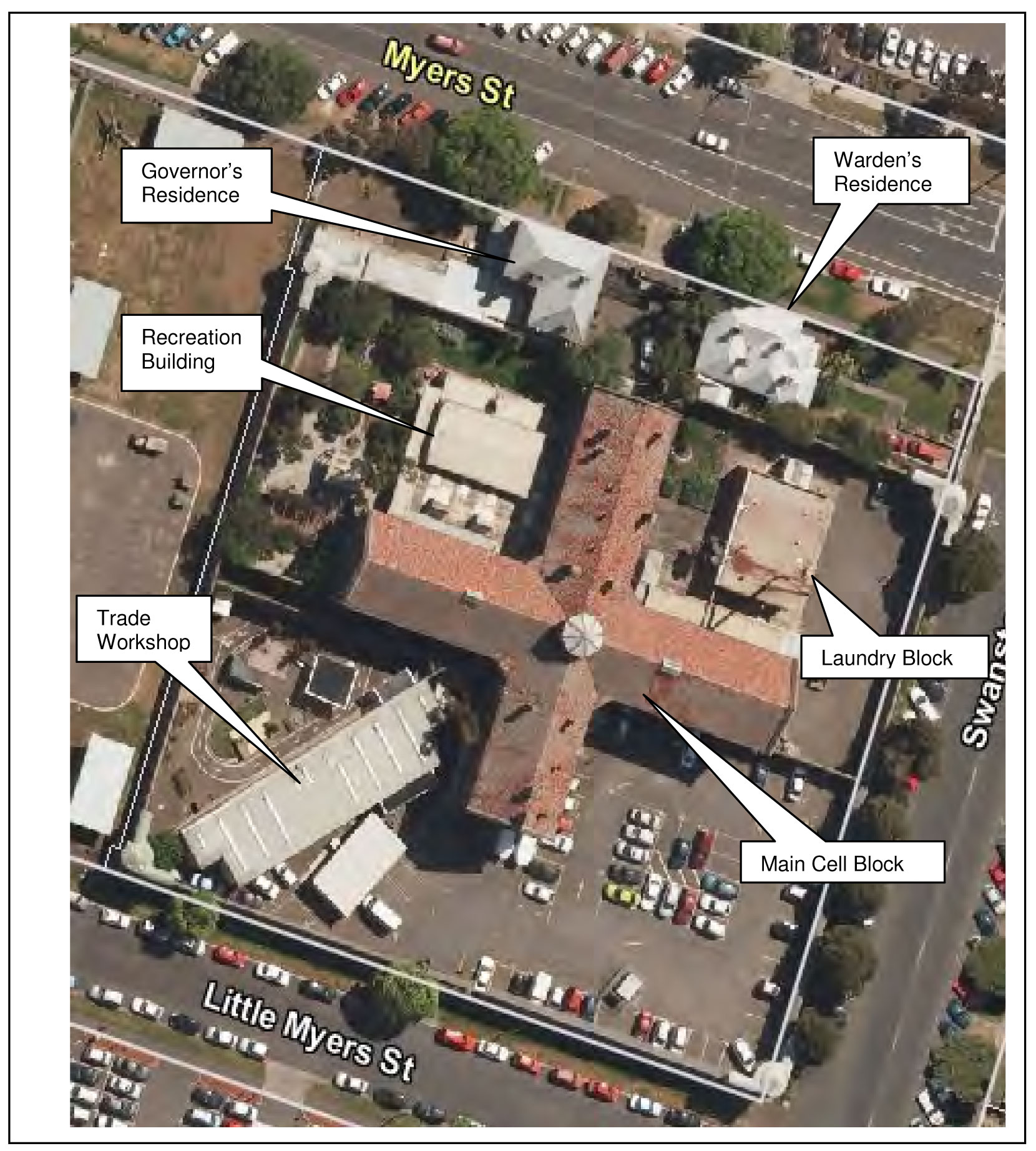
Time and Venue: 5pm, 2 December, 2014. Rm 3, City Hall, Little Malop St
Present: Cr Heagney (Chair) and Crs Lyons, Ansett, Farrell and Ellis
Also Present: Lindsay Allan, Alan Grant
Apologies: Crs E Kontelj, Irvine, Macdonald, Fisher and Nelson. It is noted that Cr Fisher attended but did not participate as a member of the Panel.
Declarations of Interest or Conflicts of Interest: Nil
Items for consideration:
Hearing of Submissions
All submitters being heard have provided written submissions which are separately summarised. The following are key points of submissions made at the hearing.
Geelong Rotary. Presentation by Barry White (President) and other members.
The Rotary submission followed a Power Point presentation the main points of which were:
Existing management of property is unsustainable and Rotary proposes a new business model to focus on development as a tourist precinct.
Objectives of new business model are to ensure appropriate maintenance, generate employment and revenue, attract visitors and provide involvement of and benefits to the community.
Propose establishment of a project group to develop a new business model over 6-12 months.
National Trust Geelong Branch. Presented by Jennifer Bantow.
Heritage Victoria is greatly reduced and local government offers the best protection for heritage places.
Conservation of the Gaol is best served if it remains in public ownership.
Council subsidises community activities and cultural activities should be treated the same way.
Mentioned legal agreements on title, assistance of National Trust, support from community, further heritage assessments, involvement of individuals and private companies.
Robin Povey
Has experience with visitors to the Gaol and what motivates visits.
Freemantle Gaol is successful.
Mentioned the use of technology to enhance tourism experience.
Other Gaols in private ownership have fallen into disrepair.
If sold there needs to be a return in terms of maintenance, use and public access.
Margaret Wedding
Points to Inverarary Jail in Scotland as successful example.
Importance of convict stories and heritage.
Integration with other regional attractions.
Alec Hand
Expressed importance of retaining the buildings.
Support for submission by Rotary.
The Panel met immediately following the hearings and discussed the potential sale of the property. The Panel decided to reconvene at a later date to consider its preferred position.
Hearing Closed at 6:00pm
Panel discussions concluded at 6:25pm
Panel Reconvened at 5.30pm Tuesday 24 February 2015.
Panel members present Cr Heagney (Chairperson), and Crs Farrell, Ansett and Ellis. Apology from Cr Lyons (Mayor).
Also Present: Lindsay Allan, Alan Grant
Following discussions between Panel members the Panel considers that retaining Council ownership of the Gaol will:
Ensure protection of heritage elements; and
Ensure community access to the site.
The Panel also noted that the Council did form a Reference Group to examine alternative uses for the Gaol however that group did not provide viable alternative ownership and management model for the facility.
The Submissions Review Panel recommends that the Council, over a six month period, investigate alternative ways of Council retaining ownership while funding the maintenance program and achieving its tourism potential including partnerships with other groups and entities.
# |
Submitter |
Submission Summary |
1 |
Diana Daley |
|
2 |
Sean Middleton |
|
3 |
Beverly Segon |
|
4 |
Ian Trezise MP |
|
5 |
Jennifer Adler |
|
6 |
Anton Van Doornik |
|
7 |
R & D Povey |
|
8 |
Mandy Oldham |
|
9 |
Margaret Wedding |
|
10 |
Geelong Historical Society |
|
11 |
Alec Hand |
|
12 |
Rotary Club of Geelong |
|
13 |
National Trust |
|
Cr Nelson declared an Indirect Interest by a Conflicting Duty in that during his election campaign he had a regular and close association with the school listed in the report and left the meeting room at 8.52pm prior to discussion.
Portfolio: |
Finance - Cr Lyons (Mayor), Cr Farrell & Cr E Kontelj |
Source: |
Strategy & Performance - Property Management |
General Manager: |
Dean Frost |
Index Reference: |
Land Sale |
To recommend that the Council sell approximately 2.6ha of land at Peninsula Drive, Drysdale to the Roman Catholic Trust for the expansion of St Ignatius Secondary College.
The Council owns approximately 45 ha of vacant land located in the vicinity of Peninsula Drive, Drysdale which was part of a larger parcel purchased by the former Shire for urban development.
The Catholic Archdiocese in 2011 approached the Council to purchase vacant Council land to the east of the Potato Shed for the expansion of Saint Ignatius Secondary College which is located on adjoining land to the north at 9-27 Peninsula Drive (refer to Attachment 1).
There is insufficient space at Saint Ignatius College to meet projected growth in student numbers. Further space is required to meet the needs of a projected 11% growth in students in the next 3 years and to provide learning rooms, sport and physical education areas.
The Council land containing the Potato Shed is a Reserve of 5.01ha and is zoned Special Uses Zone 13 being a zone that provides for education use along with recreation and community uses.
There is a master plan for the expansion of the Potato Shed (refer to Attachment 3). If the eastern part of the Reserve of approximate area 2.6ha is sold to the Roman Catholic Trust (“RC Trust”) there is sufficient land remaining in Council’s ownership to achieve the expansion of the Potato Shed as well as any long term future plans relating to this use.
The large area of vacant Council land to the west of Peninsula Drive is similarly zoned Special Uses Zone 13 and the Drysdale Clifton Springs Sports Precinct Masterplan designates the majority of this land for sporting ovals, grounds, parking and pavilions (refer to Attachment 2).
Since discussions commenced with the Archdiocese about the Potato Shed land the Council has identified a future need for a children’s services facility at St Leonards, and land owned by the RC Trust in Murradoc Rd St Leonard's was been identified as a possible site.
Discussions with the Archdiocese and local parish have been proceeding since late 2013 to try to achieve a land exchange where simultaneous contracts of sale would apply to both the Drysdale and St Leonards land.
The College has now received a $2m Federal Capital Grant towards the construction of a new Year 9 centre and needs to confirm a site and commence development.
In relation to the St Leonards land the Archdiocese has informed the Council that while the parish is willing to continue discussions about the future of this land, the timeframe for a resolution of that site is outside that for the College to commence its year 9 centre.
It is recommended that the Council proceed to sell 2.6ha of land in Peninsula Drive to the RC Trust for $700,000 plus GST being the Council’s valuation. Any costs associated with the subdivision of the land will be met by the purchaser.
Prior to selling the land Council is required to give public notice of its intention to do so under s189 of the Local Government Act and allow for the hearing of submissions. If submissions are received they will be heard by the Submissions Review Panel and a further report will be put to Council. If no submissions are received the land will be subdivided and sold.
Any sale of part of this land for a school requires that the land be subdivided and the Reserve restriction be removed from the title.
Cr Ellis moved, Cr Farrell seconded -
That Council:
Commence the procedures to sell land of approximately 2.6ha (“the land”) located at 29-39 Peninsula Drive, Drysdale to the Roman Catholic Trust Corporation on the following terms:
The price being $700,000 plus GST if applicable;
Settlement to occur upon registration of a plan of subdivision of the land;
Other appropriate terms and conditions; and
Purchase from the Roman Catholic Trust Corporation approximately 2,500m2 of land at 1343-1349 Murradoc Road, St Leonards on the following terms:
The price being no more than the Council’s certified valuation of the land;
Settlement to occur upon registration of a plan of subdivision of the land;
Other appropriate terms and conditions; and
Requires that an exchange of land agreement be entered into where the contracts for the sale and purchase of land referred to in 1) and 2) above be entered into and settled simultaneously;
Commence the procedures under section 189 of the Local Government Act 1989 (“the Act”) to sell the land and that public notice of and the right of a person under section 223 of the Act to make a submission in relation to the proposed sale be given in the Geelong Advertiser and Geelong Independent; and
Appoint the Submissions Review Panel to hear and report to the Council on any submissions in relation to the proposed sale; and
In the event that no submissions are received sell the land at Peninsula Drive, Drysdale to and purchase the land at Murradoc Road, St Leonards from the Roman Catholic Trust Corporation; and
Authorise the General Manager – Strategy and Performance to execute the Contract of Sale.
Carried.
Division Requested:
For: Crs Ansett, Harwood, Ellis, Lyons, Heagney, Fisher, Richards, Farrell, Irvine
Against: Cr E Kontelj, Macdonald
The Catholic Archdiocese of Melbourne approached the Council in 2011 to purchase land at the rear of the Potato Shed, Drysdale to expand St Ignatius College.
The Council is the owner of approximately 45ha of undeveloped vacant land in the vicinity of Grubb Road and Peninsula Drive, Drysdale which was part of a larger parcel of land purchased by the former Shire of Bellarine for urban development purposes. Approximately 16 years ago parts of the larger parcel were sold to the Roman Catholic.
Trust Corporation and Department of Education for the schools currently located on Peninsula Drive (refer to Attachment 1).
The Council’s multi arts facility, the Potato Shed, is located on a 5.010ha Reserve on the eastern side of Peninsula Drive between the schools and includes a bus interchange and car park.
The rest of the Council’s land to the east of Peninsula Drive is either vacant or leased to various users including the Education Department or used for grazing purposes.
The Council’s land is zoned Special Uses Zone 13 being a zone that allows for a range of civic, community, education and recreation activities. This zone was introduced in 2011 under amendment C194 to the Planning Scheme. Previously the land was more widely zoned for general urban development including residential development, and while the current zone considerably restricts permitted uses it continues to recognize educational use.
The RC Trust is the owner of land at 1343-1349 Murradoc Road St Leonards part of which has become of interest to the Council for a children’s services facility.
St Ignatius College is seeking to expand its campus at this location to provide more general purpose and specialist learning rooms, and sport and physical education areas. Student numbers have almost doubled since 2007 and are projected to grow by 11% in the next 3 years, and the College requires additional land as its current site is fully developed.
Much of the College’s building stock consists of re-locatable buildings and additional land will allow permanent classrooms to be built without the prior demolition of the re-locatable classrooms they are intended to replace.
The College has recently received a $2m Federal Government Capital Grant to support the construction of a new year 9 centre and needs to confirm a site and commence construction in the short term.
Council’s intentions for its vacant land in this area have in recent years been expressed in 2 strategic plans.
Attachment 2. In 2011 the Council adopted the Drysdale Clifton Springs Sports master plan which establishes a concept plan for the use of the vacant Council land to the west of Peninsula Drive for a series of sports grounds and Council uses.
Attachment 3. The Potato Shed has a master plan that shows future expansion of the facility including additional theatre space, music labs, recording space, exhibition space and general purpose areas.
The eastern portion of the Council’s Reserve containing the Potato Shed, being the land proposed to be sold, has not been designated for any purpose under either of the above master plans.
If the land of area 2.6ha at the eastern end of the Reserve was sold for the expansion of Saint Ignatius College that would leave approximately 2.4ha of land in Council’s ownership around the Potato Shed providing sufficient land to accommodate the expansion of the facility as envisaged in the master plan as well as yet to be determined long term future plans.
The Potato Shed master plan also proposes a relocation of the current car park and bus interchange to the western side of Peninsula Drive which would provide greater land for expansion if required.
The Council land is the preferred location for the expansion of Saint Ignatius College. The alternative is for the school to purchase land to the east of Gillies Road which would require an eastern extension of urban zones into land currently zoned rural and would require the relocation of Gillies Road to avoid having a road through the school campus.
The Council in 2013 identified a future need for a site in St Leonards for a children’s services facility consisting of a kindergarten, MCH and community rooms. The RC Trust is the owner of land at 1343-1349 Murradoc Road which has the potential to provide a site suitable for Council’s requirements. The timing of the requirement for this facility has not been defined and will depend on future demand.
Discussions have been held over the past 18 months to attempt to agree an exchange of land between the parties where contracts of sale for both parcels of land would be settled simultaneously. These discussions have been held between Councillors and various sections of the church including local parish representatives.
Following those discussions the Council has been advised that while the parish is willing to continue discussions about the future of this land, the timeframe for a resolution of that site is outside that for the College to commence its year 9 centre.
There are no environmental implications associated with the recommendation of this report.
A certified valuation of the land dated January 2015 has been obtained which is the agreed sale price.
Advice has been received from Council’s engineering consultant that costs of approximately $55,000 will be incurred in subdividing the land. Those costs, in addition to any valuation and survey costs, will be met by the purchaser.
The Local Government Best Practice Guideline for the Sale and Exchange of Land recommends that where ever possible land be sold by a public process such as auction or listing. In this case a direct sale to the Roman Catholic Trust is recommended to assist with its expansion plans.
Section 189 of the Local Government Act (“LG Act”) requires that Council obtain a certified valuation dated not more than six months prior to the sale of the land being the date of the contract of sale.
Under the same section of the LG Act the Council is required to give public notice of its intention to sell the land and consider any submissions received. If any submissions are received they will be heard by the Submissions Review Panel followed by a report to Council. If no submissions are received the land will be sold to the Roman Catholic Trust.
The Council land is a Reserve which is a restriction on the title that needs to be removed prior to sale, and a planning permit is required for this purpose. In addition the land requires subdivision prior to sale.
The sale of the land will provide the best option for the expansion of St Ignatius College to meet its projected demands for education.
No officers or contractors involved in the preparation of this report have a direct or indirect interest in matters to which this report relates.
The risks associated with the subdivision and sale of this land are able to be managed following normal management procedures and processes.
With the sale of the land to the Roman Catholic Trust the Council still has sufficient land in around the Potato Shed and to the west of Peninsula Drive to cater for the medium to long term community and sporting needs of Drysdale and the wider Peninsula.
No human rights will be affected by the recommendation of this report.
The relevant internal departments have been consulted in the preparation of this report. Public submissions on the proposed sale will be invited as described above.
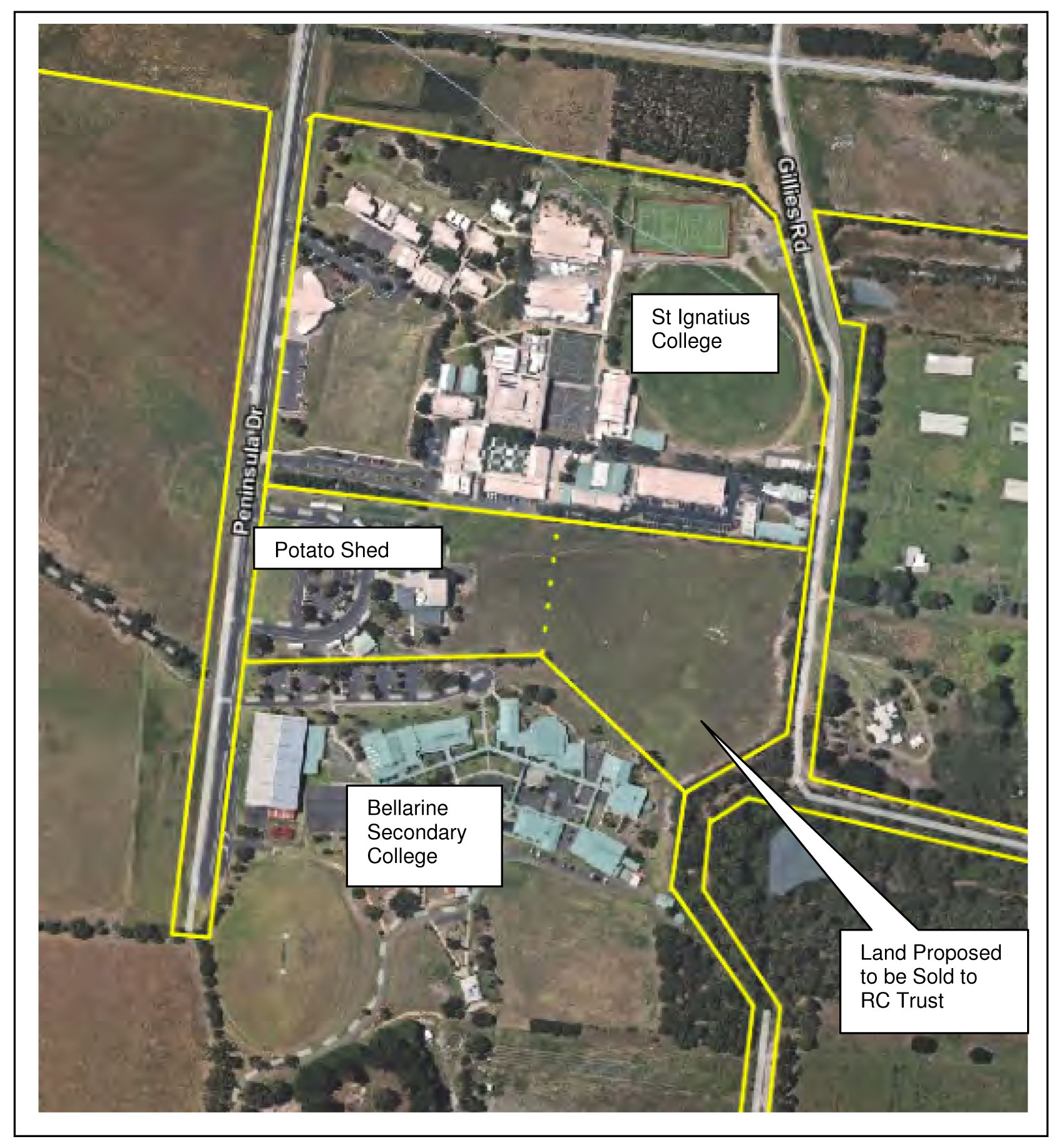
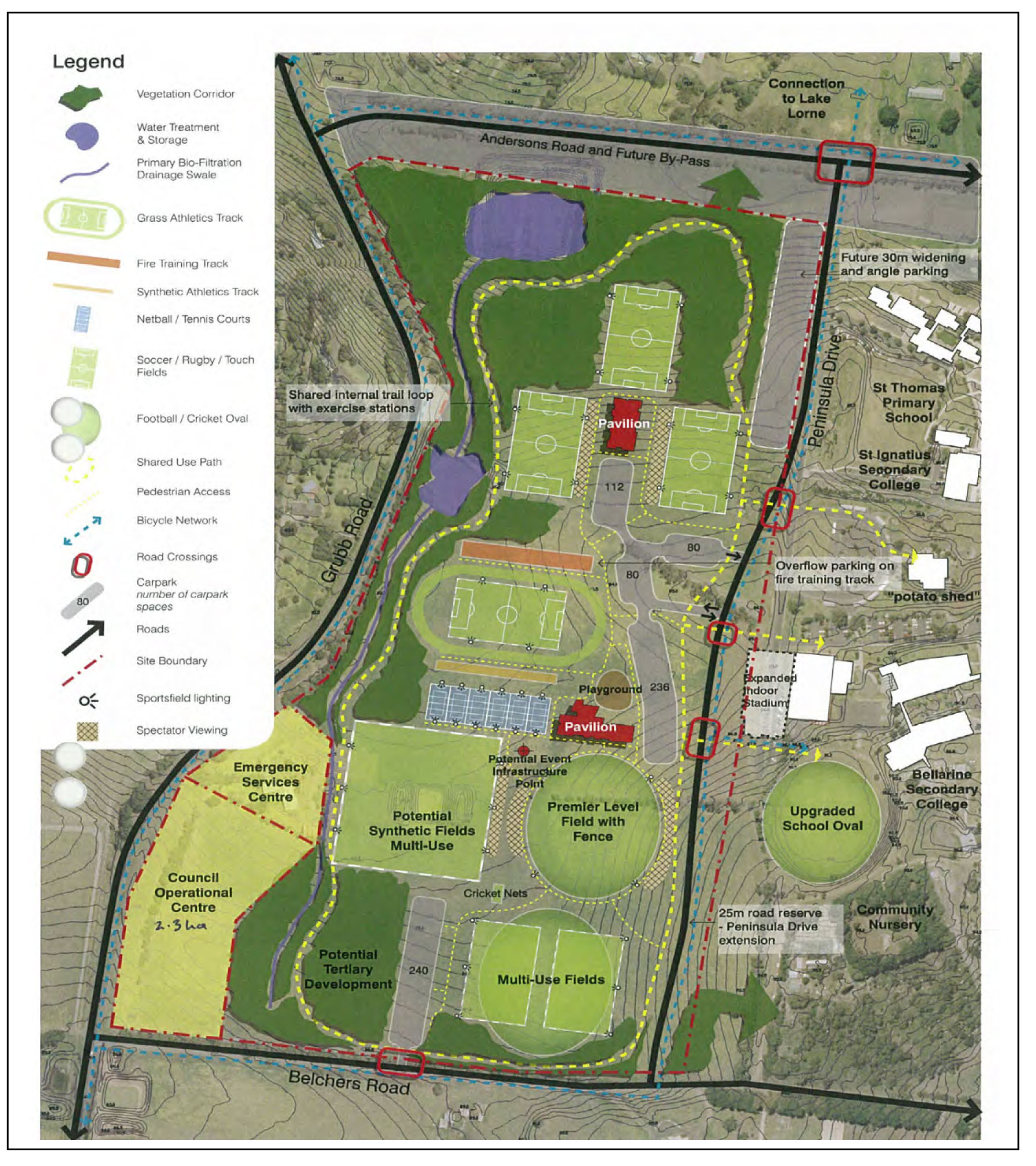
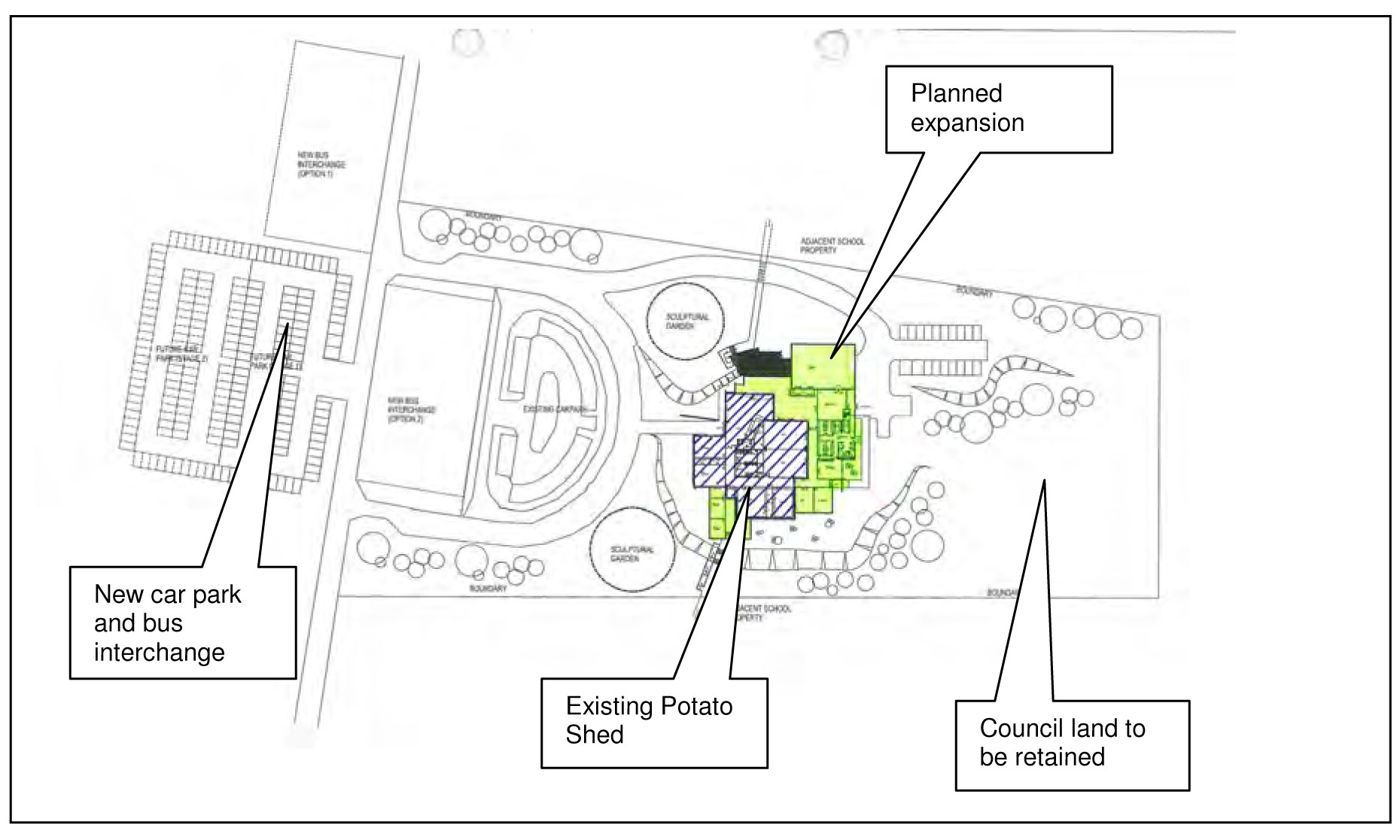
Cr Nelson re-entered the meeting room at 9:07pm
Portfolio: |
Finance - Cr Lyons (Mayor), Cr E Kontelj & Cr J Farrell |
Source: |
Strategy & Performance - Financial Services |
General Manager: |
Dean Frost |
Index Reference: |
Financial Management / Reporting |
The purpose of this report is to ensure legislative administrative matters are completed.
Council has contracted Westlink Consulting to undertake the 2016 general valuation.
To comply with the Valuation of Land Act 1960 certain administrative matters require resolving by Council, namely:
For Council to resolve that a general valuation be undertaken, as the valuation authority responsible for the municipal area.
Advise every other rating authority within its area of Council’s resolution to cause a general valuation to be made.
Note the statutory declaration by the appointed Valuer that the valuation and return will be impartial and true.
Cr E Kontelj moved, Cr Farrell seconded -
That Council in accordance with the Valuations of Land Act 1960, as the valuation authority resolves to:
Undertake the 2016 General Valuation;
Give the necessary notice to other statutory authorities, and;
Note receipt of the Contract Valuer’s statutory declaration.
The Mayor vacated the Chair at 9:07pm
Cr Heagney assumed the Chair at 9:07pm
Carried.
Council is required under the Valuation of Land Act 1960 to conduct bi-annual valuations. The 2016 Revaluation will be the ninth since bi-annual valuations were introduced in 2000 by the Valuer-General Victoria. To date, five of the previous bi-annual valuations (2000, 2002, 2004, 2006, & 2008) for Council have been conducted by Southern Cross Property Services. Our current Contractor Westlink Consulting have completed the 2010, 2012 and the 2014 General Valuations.
Following the 2012 General Valuation the Fire Services Property Act 2012 was introduced with the requirement that Council, as the valuation authority for the municipality, also include all non-rateable leviable land (as defined by that Act) in its General Valuations.
The 2014 General Revaluation Contract C1300003 was awarded to Westlink Consulting. A tender report recommending Westlink Consulting was adopted by Council on 13 November 2012. This contract allowed for an option to extend the contract for the 2016 General Revaluation. This option was exercised in August 2014.
Appointing Westlink Consulting the contract does not fully satisfy all requirements under the Valuation of Land Act 1960 for undertaking municipal General Valuations and this report is required to satisfy compliance requirements.
In accordance with the Valuation of Land Act 1960 certain administrative matters should be noted and recorded in the minutes of Council.
The Valuation of Land Act 1960, Section’s 11, 13 DC and 13H outline Council’s obligations as a valuation and rating authority in regards to the conducting of General Valuations of property. The Sections explain that a valuation authority, for the purposes of the Local Government Act 1989 and the Fire Services Property Levy Act 2012, must cause a valuation of all rateable land and non-rateable leviable land within its municipal district to be made as at 1 January of every even calendar year and returned to the valuation authority before 30 June in that year.
Section 6(1) of the Valuation of Land Act 1960 requires a rating authority to give to the Valuer-General Victoria, the State Revenue Office and every other rating authority within its area not less than one months notice of its resolution to cause such a General Valuation to be made.
Section 13DH (2) of the Valuation of Land Act 1960 requires the appointed Valuer “to make a statutory declaration that the valuation and return will be impartial and true and to the best of that person’s judgement and will be made by that person or under that person’s immediate personal supervision”.
A copy of the Valuer’s declaration is provided in Attachment A.
There are no environmental impacts arising from this report.
The 2016 General Valuation including objections is to be conducted in accordance with Contract Number C1300003 by Westlink Consulting.
Funding is available in the current approved budget.
All municipal rating valuations must comply with the Valuation of Land Act 1960, the Local Government Act 1989 and the Fire Services Property Levy Act 2012.
This report is aligned in Council’s City Plan objective on ‘How We Do Business’.
There is no Officer direct or indirect interest involved in this report.
Compliance with statute negates any risk.
There are no social implications arising from this report.
There are no known positive or negative effects.
The Valuer-General Victoria, the State Revenue Office and the following neighbouring municipalities will be advised of Council’s resolution:
Surf Coast Shire Council
Wyndham City Council
Golden Plains Shire Council
Borough of Queenscliff
Moorabool Shire Council
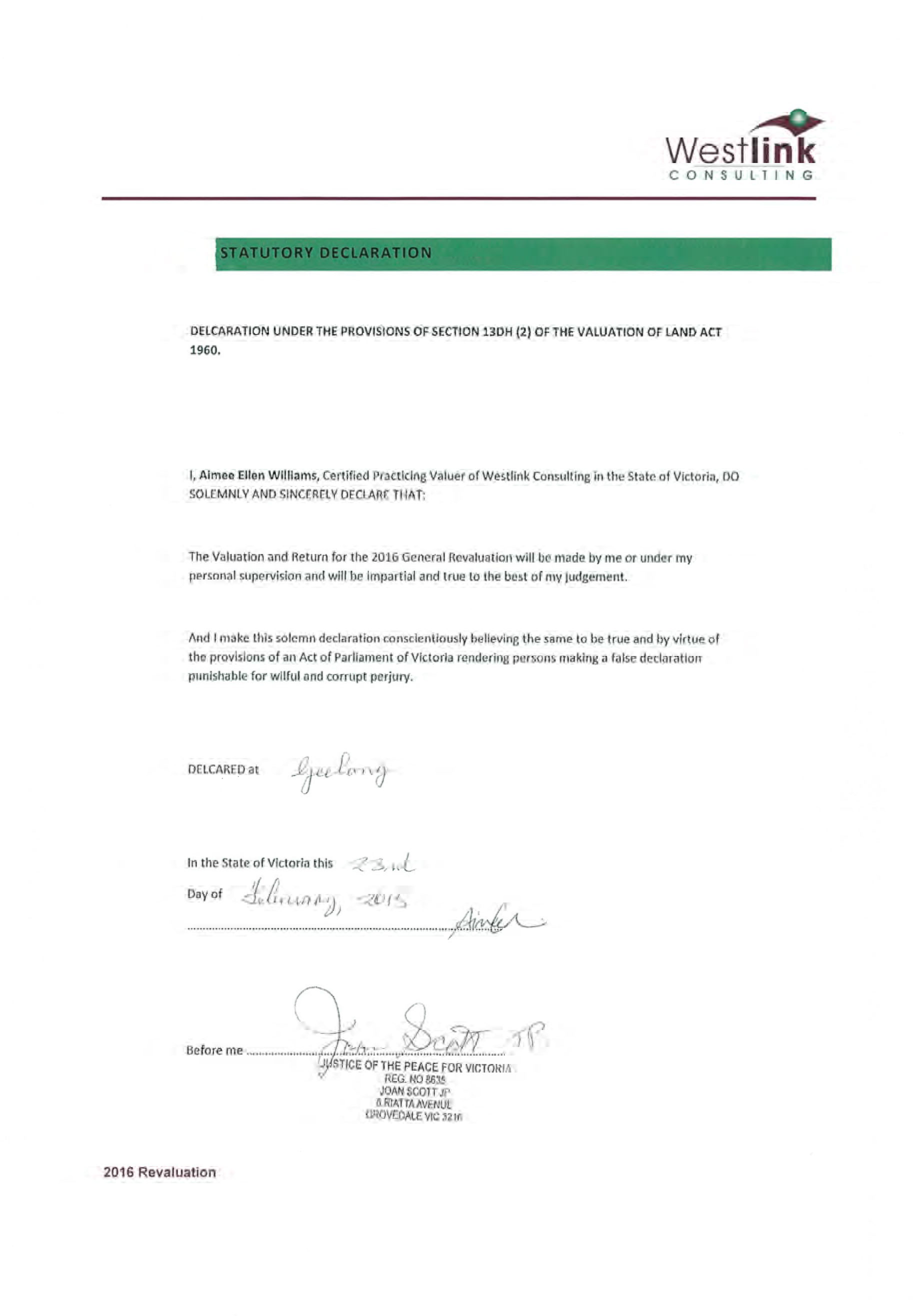
Portfolio: |
Arts & Culture – Cr Richards |
Source: |
Community Services – Arts & Culture |
A/General Manager: |
Linda Quinn |
Index Reference: |
Subject: Arts & Culture/Reports |
The purpose of this report is to advise Council of the community response to the preferred option for the redevelopment of the Geelong Gallery.
The Gallery is a pivotal component of Geelong’s Cultural Precinct and has been identified as having the greatest potential as an arts/cultural tourism attractor for Geelong and the region. It possesses one of the finest collections in regional Australia.
The Gallery’s capacity to contribute to the region’s economic and cultural renewal is compromised by its current physical limitations of space and layout, severely constraining its ability to properly showcase the valuable permanent Collection, and to attract popular, large scale touring exhibitions as well as to develop major in-house exhibitions.
In 2014 Council and the Geelong Gallery were successful in securing funding from the State Government under Regional Development Victoria to undertake a Business Case that identified and assessed options for the Gallery’s future redevelopment and expansion options, and to provide a platform for prospective future funding bids.
Ten redevelopment options were assessed including several within the Gallery’s current location, as well as alternative locations. Spatial massing designs and costs estimates were undertaken for each.
At 9 December 2014 meeting, Council noted Option 4 as the preferred option for the Geelong Gallery redevelopment.
In Option 4, the Gallery expands from its current (2,200m2) footprint eastwards and upwards into the driveway and footprint of the conference centre/meeting room annex of City Hall. Option 4 includes funding for reclamation of lost space to Council.
Option 4 requires a one off total capital investment in the order of $40m with an estimated increase in recurrent operating costs of $800k including $450k for programme and exhibition development and $350k for annual maintenance. It would provide the Gallery with sufficient space (5,400m2) to develop and secure major (‘blockbuster’) ticketed exhibitions; increase the percentage of collection items on display; increase capacity to deliver public and education programmes; enhance essential visitor amenities including the Gallery Shop; develop a café/restaurant; and, provide crucial exhibition preparation and storage areas.
As part of any such development, the Gallery would need to undergo a fundamental repositioning, substantially broadening and deepening its programming mix and target markets. This is anticipated to lead over time to a tripling of annual visits from around 60,000 to up to 200,000, bringing significant economic, social, cultural and community benefits to Geelong and region.
1290 community surveys were completed during the community comment period. Based on the responses received 98.6% rated the importance of the expansion as “very important” or “important” with 98.9% agreeing that the Geelong Gallery plays an “absolutely vital” role in the City’s cultural wellbeing and is one of Geelong’s major cultural attractions. 98.3% believe a redeveloped Gallery is “absolutely vital or “important” to the appeal and success of the Cultural Precinct. 93.9% rated Option 4 as “a very good idea” or “a reasonable idea”. In addition hundreds of respondents provided detailed and overwhelmingly positive comments on the importance of the Geelong Gallery and its development to the City and the region.
Cr Richards moved, Cr Ansett seconded -
That Council:
note the outcome of the community comment process;
endorse Option 4, the Gallery expanding eastwards and upwards into the driveway and conference centre/meeting room annex of City Hall as the preferred option for the redevelopment of the Geelong Gallery;
receive a further report detailing the next steps for the redevelopment of the Geelong Gallery.
Cr Fisher left the meeting room at 9:10pm
Cr Fisher re-entered the meeting room at 9:12pm
The Mayor re-entered the meeting room at 9:14pm
Amendment
Cr Harwood moved, Cr E Kontelj seconded –
note the outcome of the community comment process;
receive a further report detailing the next steps for the redevelopment of the Geelong Gallery.
Lost.
The motion was then put and carried.
Division Requested:
For: Crs Ansett, Ellis, Lyons, Heagney, Fisher, Macdonald, Richards, Farrell, Irvine
Against: Crs Harwood, Nelson, E Kontelj
As the City’s cultural institution with the potential to become its most significant arts tourism draw-card, and custodian of a nationally significant collection of works of art, consideration of the Geelong Gallery’s future is crucial. No major development has occurred since 1971 although some minor upgrading of the facility took place in 2001.
The Geelong Cultural Precinct Masterplan (December 2007) recognised that the Precinct had significant potential as a major contributor to Central Geelong, with associated cultural, social and economic benefits to the G21 region.
In 2014 Council and the Geelong Gallery were successful in securing funding from the State Government under Regional Development Victoria to undertake a Business Case, essential to determine the future options for the Gallery’s development.
Opportunities for the Geelong Gallery’s future direction were considered through a process of demographic, existing and potential market opportunities, and both gap and SWOT analysis. A benchmarking study with other galleries identified that 5,400m2 was required for the Geelong Gallery to adequately service the residents of Greater Geelong and the region, as well as enabling it to develop into a significant cultural tourism draw-card.
In order to safeguard the major Collection on behalf of the Geelong community, to maximise its tourism potential and to vastly enhance and develop the visitor experience, it is necessary to establish the best option for the Geelong Gallery’s future development.
The Business Case identified ten options (including do nothing) for consideration. All options were systematically evaluated against objectives as well as the additional consideration of achievability – important in the context of likely funding constraints for both capital and operation. Option 4 was assessed as the preferred option. In this option the Gallery expands eastwards and upwards into the driveway and conference centre/meeting room annex of City Hall. The option includes an allowance to replace the 700m2 of the City Hall annex on the same or an alternative site to ensure Council business is not disadvantaged.
The existing Gallery site of 2,200 m2, plus a new 3,200m2 addition made up of multi floor expansion into the driveway – including 700m2 of the conference/meeting room annex of City Hall – would provide the Gallery with a total area of 5,400m2. In this option potential also exists for further Gallery expansion if/when required. This option was presented for community comment in the form of a survey.
1290 surveys were completed, considered a very high response. Demographics indicate that 69% of respondents were from the Geelong region; 15% Metropolitan Melbourne, 11% regional Victoria; 3% interstate and 1% overseas while 1% didn’t provide a postcode.
Based on the responses received, 98.6% rated the importance of the expansion as “very important” or “important” with 98.9% agreeing that the Geelong Gallery plays a vital role in the City’s cultural wellbeing and is one of Geelong’s major cultural attractions. 98.3% believe a redeveloped Gallery is “absolutely vital” or “important” to the appeal and success of the Cultural Precinct. 93.9% rated Option 4 as “a very good idea” or “a reasonable idea”.
Hundreds of comments were also provided which were overwhelmingly supportive of the redevelopment of the Gallery in recognition of its existing reputation and its ability to contribute to tourism and the cultural and economic future of the City and region.
As part of any such development, the Gallery would need to undergo a fundamental repositioning, substantially broadening and deepening its programming mix and target markets. The re-development would provide the Gallery with sufficient space to develop and secure major (‘blockbuster’) ticketed exhibitions; increase the percentage of collection items on display; grow its Education and Public programme; enhance essential visitor amenities including the Gallery Shop; develop a café/restaurant; and provide crucial exhibition preparation and storage areas. This is anticipated to lead over time to a tripling of annual visits, from around 60,000 to up to 200,000, having a significant impact on Geelong’s economy.
The Gallery Board and staff are already extending their programming initiatives to respond to the growing population and to reach a wider audience, including whole-of-life education, and to further attract the tourism market.
Option 4 brings direct economic benefits and job creation. The construction phase would provide an additional 67 regional jobs (direct and indirect). An additional 51 ongoing regional jobs (direct and indirect) would be created once a redeveloped Gallery is operational. Once completed the project would increase regional output (conservatively) by $13.3m annually (direct and indirect). Over the first ten years it would contribute $133m to the Geelong economy.
Option 4 requires a one off total capital investment in the order of $40m (rounded off) with an increase in recurrent operating costs around $800,000 with an additional $350k for annual maintenance. The Geelong Gallery is confident it can make a significant financial contribution to major exhibitions through fundraising, corporate and business sponsorships and the sourcing of grants. To realise the capital development, investment would be required in partnership with Council from Federal and State Governments as well as the Geelong Gallery.
A further report is proposed to be brought back to Council outlining next steps for the redevelopment of the Geelong Gallery. This would include a strategy for implementation of Option 4, including how the project could be phased to ensure it has the best opportunity for partner investment.
The development of the Business Case included a review of current environmental issues as well as consideration of best practice for future development. Council’s Sustainable Buildings Policy has been referenced along with other relevant documents such as the Environment Management Strategy. There is currently an allowance in construction costs of 3% for ESD works. Additional financing would be required to bring the Gallery to green star rating. Option 4 utilises the existing gallery negating the need for a complete rebuild.
The Geelong Gallery redevelopment would need to be considered with regard to Council’s existing commitments and future budgets. A financial partnership between the Federal and State Governments, the City of Greater Geelong and the Geelong Gallery would be required for the capital delivery. Up to $15m would be required by Council for capital with the remainder to be sought from project partners. An increase in recurrent operating costs would be required in the order of $800,000 (rounded off). This includes an increase of $450k for programme and exhibition costs and an average annual maintenance of $350k, based on 1% of the construction cost. If 2% of the construction cost were to be applied, maintenance costs would increase accordingly. The Gallery anticipates it would make significant financial contribution toward major exhibition development.
The Geelong Art Gallery is located on Crown Land with a lease period of 999 years due to expire on the 16th June 2854. The Building is a Council asset, operated by the Geelong Art Gallery Incorporated, as a not-for-profit body associated for artistic and cultural purposes. The Board is elected each year at the Annual General Meeting. The Board operates under a Charter. The Portfolio Holder for Arts & Culture is currently Council’s representative on the Geelong Gallery Board.
A Project Steering Group was established to oversee the development of the Business Case. It is composed of three representatives (each) from Council, the Geelong Gallery Board and the State Government. A Working Group composed of staff of the Geelong Gallery and City of Greater Geelong has provided advice to the Steering Group.
The development of a Business Case aligns with multiple City Plan Strategic Directions and Priorities.
Community Wellbeing:
Connected, creative and strong communities.
Growing Our Economy:
Support existing businesses and encourage new and emerging growth sectors;
A successful and vibrant City Centre;
A leading city for tourism, arts, culture and events.
How We Do Business:
Lead by advocating and collaborating on issues important to the Greater Geelong community.
The Business Case will respond to key principles embodied in multiple Council strategies, including:
Central Geelong Action Plan;
Implementation of the Cultural Precinct Masterplan;
Council’s current Cultural Strategy Creativity +;
Geelong Major Events Strategy.
There is no officer direct or indirect interest in this project.
The Business Case incorporates a well developed risk analysis with all foreseen risks listed with rankings and mitigating actions to be taken.
The Gallery has a reputation as a leading regional gallery to maintain and enhance. To do so it must be able to continue to develop its exhibition and educational/public programmes and activities, particularly to attract the tourism market and to substantially fulfil its cultural, community and education responsibilities and its overall mission. The physical constraints, making the hosting or development of large-scale temporary exhibitions extremely challenging, and limiting the percentage of Collection able to be seen, put at risk the Gallery’s operations in general - as well as its state, national and international reputation. At times, opportunities will simply be lost, while on other occasions alternative, non-arts venues, not suitable or appropriate, will be used as a last resort to host large-scale exhibitions, reducing audiences and costing Council and/or other parties funds and resources to adapt.
Galleries play a significant role in the cultural, social, educational and economic development of the city and region. The Geelong Gallery plays an important role in the collection, conservation and exhibition of the Region’s cultural heritage as expressed in works of art. The Gallery’s programmes are similarly a contributor to community wellbeing. The reputation of the Gallery, as one of the finest regional galleries in Australia, is a source of civic pride for many and has the potential to be for considerably more. The Galleries exhibitions, educational and public programmes as well as curatorial services are highly valued and sought-after resources. The opportunities that the Gallery provides for our emerging and established artists are vital to the Region’s cultural development. All these however are currently compromised by the Gallery’s physical limitations.
Cultural facilities, cultural programming, cultural collaboration, cultural heritage and cultural identity bring a city alive, day and night, for locals and for visitors. Cultural investment renews and regenerates more than just the economy.
The focus on audience for the Gallery is critical. One of the great challenges for some cultural venues is finding the right mix and balance of programming for broader audience appeal – this is where the provision of space and facilities which give flexibility becomes so necessary and why major upgrades of galleries have proved so beneficial as evidenced by state, national and international experiences. Vibrant Galleries with a range of education programmes not only directly enhance young people’s experiences and knowledge they also contribute to a community’s sense of identity, self-esteem and place. International experience demonstrates children, like university students, are more likely to want to stay in their city if they have wonderful cultural experiences in that place.
Responding to immigration, refugees and new arrivals with democracy and equality is an important issue for cultural organisations. Galleries, like other cultural institutions can make an important, even vital contribution to the perception and experience of new arrivals to this City as a welcoming, compassionate and appealing place.
As the project is a partnership between Council and the Geelong Gallery, the recommendations within this report will be communicated by the Arts & Culture Department with the Communication & Marketing Department, and by the Geelong Gallery.
The Mayor assumed the Chair at 9:27pm.
Portfolio: |
Governance – Cr Lyons (Mayor) |
Source: |
Strategy & Performance - Administration & Governance |
General Manager: |
Dean Frost |
Index Reference: |
Subject: ALGA |
To have Council endorse a motion for inclusion on the agenda for the 2015 National General Assembly of Local Government Conference.
The Australian Local Government Association (ALGA) is calling for motions for the for the 2015 National General Assembly of Local Government conference under the theme of “Closest to the Community".
Cr Richards moved, Cr E Kontelj seconded -
That Council endorse the proposed motion set out in Appendix 1 of this report to be submitted to ALGA for possible inclusion on the agenda for the 2015 National General Assembly of Local Government conference.
Carried.
The theme “Closest to the Community” for the conference, reflects the renewed focus across all levels of government and respect to the overlap of the roles and responsibilities between spheres of government. The Commonwealth Government has invited all interested parties to consider potential reform of the Federation and taxation.
ALGA is seeking motions that:
are relevant to the work of local government nationally;
complement or build on the policy objectives of respective State and Territory local government associations, and
proposes a clear action or outcome.
The Federal Government is inviting Councils to reflect on the roles and responsibilities of local government, it’s funding and relative place in the Federation.
The Commonwealth has released five White Papers which discuss key issues: They are:
A Federation for Our Future
Roles and Responsibilities in Housing and Homelessness
Roles and Responsibilities in Health
Roles and Responsibilities in Education
COAG and Federal Financial Relations
Two other White Papers in progress are on Taxation and Reform of the Federation.
The Reform of Federation paper will discuss reducing overlap within all tiers of government, redefining roles and responsibilities of the tiers; and how to achieve equity and sustainability in the funding of programmes.
The motion proposed by the City of Greater Geelong is set out in appendix 1 of this report.
Motions must relevant to the work of local government nationally and complement or build on the policies of State and Territory local government associations.
Not applicable
There are no financial implications in presenting a motion to ALGA. Notwithstanding this, if a motion is successful then financial benefits may result.
If a motion is supported by ALGA they will be debated on the floor of the National General Assembly.
How We Do Business
No officer involved in the preparation of this report has any direct or indirect interest.
There are no risks associated with endorsement of the motion.
Nil
The outcome of the motion may have a positive impact on human rights.
The outcome of the National General Assembly is intended to contribute to Commonwealth, State, Territory and Local Government policy, roles and responsibilities and funding reforms.
| MOTION COST SHIFTING AND FREEZING INDEXATION OF FEDERAL ASSISTANCE GRANTS |
| Submitted by: City of Greater Geelong |
MOTION: That ALGA calls on the Federal Government for improved recognition of Local Government and cessation of divestment of responsibility without appropriate maintenance or commitment to ongoing funding strategies. |
National Objective (Max 100 Words) It has been evident for many years that funding of Federal and State programs typically encompasses funding for a limited period then it either reduces or is withdrawn, leaving local government to decide its future. While there has been discussion around achieving rationalisation of roles and responsibilities between the levels of government, better use of resources and better quality services for local communities, little progress has been achieved and in the decline in funding is causing substantial hardship on local government. The most recent examples are freezing indexation of local government financial assistance grants and the recent uncertainty in respect to continued funding of universal access to early childhood funding. |
Summary of Key Arguments Max 300 words Background information In May 2002, House of Representatives Standing Committee on Economics, Finance and Public Administration (Parliament of Australia) resolved to inquire into the cost shifting to Local Government. In addition, various reports and discussion papers have been prepared for consideration. These reports and papers established overwhelmingly evidence of cost shifting to Local Government from all levels of government. Supporting arguments Through the peak bodies local government has sought to achieve recognition of several key issues:
|
Portfolio: |
Planning – Cr Heagney |
Source |
Planning & Tourism |
General Manager: |
Peter Bettess |
Index Reference |
Council Reports 2015 |
To consider and endorse a submission to the Senate Inquiry into the future role and contribution of regional capitals to Australia.
On 11 February 2015, the Senate moved that the future role and contribution of regional capitals to Australia be referred to the Senate Rural and Regional Affairs and Transport References Committee for inquiry and report by 1 December 2015. Submissions are requested by 30 April 2015.
Cr Macdonald moved, Cr Farrell seconded -
That Council endorses the submission to the Senate Inquiry into the future role and contribution of regional capitals to Australia.
Cr Heagney left the meeting room at 9:29pm
Cr Heagney re-entered the meeting room at 9:31pm
Carried.
On 11 February 2015, the Senate moved that the following matters be referred to the Senate Rural and Regional Affairs and Transport References Committee for inquiry and report by 1 December 2015.
The future role and contribution of regional capitals to Australia, including:
an assessment of current demographic trends and the changing role of regional capitals;
an analysis of current funding provided to regional capitals;
an analysis of the benefit of additional funding regional capitals could receive based on population, demand for services and their strategic importance for the region, state or country;
investment challenges and opportunities to maintain or grow regional capitals, including infrastructure, community and human services, communications and natural resources;
incentives and policy measures that would support sustainable growth in regional capitals;
the impact the changing environment will have on regional capitals; and
any other related matters.
The Senate Standing Committee on Rural and Regional Affairs conducting the Inquiry comprises:
Senator Glenn Sterle, Australian Labor Party, NSW, Chair
Senator the Hon Bill Heffernan, Liberal Party of Australia, NSW, Deputy Chair
Senator Joe Bullock, Australian Labor Party, WA
Senator Sue Lines, Australian Labor Party, WA
Senator Peter Whish-Wilson, Australian Greens, Tas
Senator John Williams, The Nationals, NSW
Regional Capitals Australia (RCA), of which the City of Greater Geelong is a member, has lobbied for greater recognition at Federal Government level of the role that regional capitals can play in Australia’s future development. The Senate Inquiry provides an opportunity for regional capital issues to be considered by the Federal Government.
RCA has engaged with key Senators and Ministerial staff since the announcement of the Inquiry to better understand how best to submit to the Inquiry. The key points arising from this engagement are:
The major political parties are likely to develop a “regional capitals” policy position for the upcoming Federal election;
submissions need to provide the rationale for future strategic investment in regional capitals rather than a ‘wish-list’ of projects.
Key issues to be addressed are social and economic matters in regional capitals, including policies/strategies to encourage employment, business migration, secondary freight route infrastructure and health and education services.
The Inquiry is most likely to be influenced by submissions from a number of bodies in a regional city rather than a single one. The aim being to get the Inquiry to visit the region.
Council officers have liaised with the Committee for Geelong, G21 and Deakin University in preparing this submission.
This report has no environmental implications. The inquiry is addressing any impact of the changing environment will have on regional capitals.
There are no direct financial implications in this report. The inquiry is considering the implications from a federal funding policy perspective.
The submission to the Inquiry will assist in shaping national regional capitals’ policy.
Federal government recognition of Geelong’s needs as a regional capital is consistent with the strategic directions of City Plan.
No Council officers have any direct or indirect interest in accordance with section 80C of the Local Government Act.
There are no risks associated with making a submission to the Inquiry.
The Inquiry will be considering the investment challenges and opportunities to address social issues in regional capitals.
The submission to the inquiry does not impact on any basic rights, freedoms and responsibilities as set out in the Charter.
The council submission to the inquiry will be public and will be considered as part of the public process of the inquiry. The submission has been prepared in consultation with the committee for Geelong and G 21.
Portfolio: |
Governance - Cr Lyons (Mayor) |
Source: |
Community Services |
Act/General Manager: |
Linda Quinn |
Index Reference |
Project: T1400059 |
To provide Council with the requisite information in order to facilitate the approval of the Tender Evaluation Panel’s recommendation in relation to the Provision of Infringement Administration Services.
Council has sought tenders from experienced providers for the provision of infringement administration services for a period of three (3) years with an option to extend the contract by a period of two (2) years (1 X 1) at the sole discretion of Council. The service is planned to commence 1 May 2015 following expiration of the existing contract arrangement.
The object of the proposed service is to provide a comprehensive and consolidated solution to the management of infringements and the collection of debt subsequent to their issue.
City of Greater Geelong is a statutory body empowered to issue infringements under both local and state legislation. Council currently issues a variety of infringement notices and has a relationship with an external provider for a range of services relating to the management of infringements after they have been issued. This includes dealing with enquiries, appeals, nominated driver requests, penalty reminders, Infringements Court lodgements, fine payment plans, receiving payments, withdrawing infringements and all associated documentation.
The provision of infringement administrative services applies to all program areas throughout the municipality, which involve the issuing of infringements for parking, animal, local laws, health and fire prevention offences.
Following the invitation of public tenders, one (1) tender submission was received, that being from Tenix Solutions Pty Ltd.
A full evaluation of the tender submission has been undertaken by an evaluation panel of Council officers as identified in the body of this report.
Following a detailed evaluation by the Evaluation Panel, it is considered that the tender submission of Tenix Solutions Pty Ltd meets tender requirements.
Cr Farrell moved, Cr Ellis seconded -
That Council:
accept the tender submission from Tenix Solutions Pty Ltd for Tender No T1400059 – Provision of Infringement Administration Services for the fixed price fee per infringement & associated schedule of rates as submitted exclusive of GST;
sign and seal the contract documents.
Carried.
Tenders for the provision of infringement administration services were invited via public advertisement in the Geelong Advertiser and The City News on Saturday 18 October 2014.
At the close of tenders on Wednesday 12 November 2014, the following tender submission was received:
Tenix Solutions Pty Ltd
The tender submission was evaluated by a panel consisting of:
Steve Sodomaco |
Manager Health & Local Laws |
Kathy Fulton |
Co-ordinator Financial Reporting |
Mark Stevens |
Co-ordinator Revenue Property & Valuations |
Peter Walker |
Senior Contracts Officer – Procurement Services (non voting member) |
As required, the submission responded to the requirements set down in the tender documents and assessment was based on the respondent’s performance in the following areas:
Criteria |
Weighting |
Acquisition Costs |
40% |
Service Requirements & Processes |
20% |
Capability & Past Performance |
15% |
Proposed Staffing |
10% |
Methodology and Innovation |
10% |
Quality Management |
3% |
Economic Contribution to the Geelong Region (*) |
2% |
Total |
100% |
(*) Prior to inviting tenders, the panel surveyed the market and determined that there are no local suppliers with the relevant capabilities and experience to undertake the specified works. The panel sought an extension to the existing contract in the belief that a new ‘provider’ would enter the market place that might have an economic benefit to the region. However no submission was lodged in response to the tender.
A number of meetings were held with representatives from the sole tenderer, Tenix Solutions Pty Ltd and CoGG, to review the terms and conditions of the Contract together with refining the reporting processes. Both parties are now in agreement to terms and conditions of Contract.
The Evaluation Panel considers that Tenix have demonstrated a proven technical capability to meet the needs of COGG's service specifications, which includes a comprehensive knowledge of the infringements enforcement lifecycle, strong relationships within the industry and the provision of contemporary and quality systems to provide the necessary services required by Council. Tenix Solutions Pty Ltd is suitably resourced with highly skilled and dedicated staff at both the technical expertise and management levels.
Tenix Solutions Pty Ltd has excellent quality assurance programs that ensures service is delivered in accordance with policies and procedures to a high standard. Tenix Solutions continues to invest in innovative developments of program areas such as advanced hand-held infringement issuing devices, debt collection systems/strategies, aged receivables, ‘blue-tooth’ integration, favourable on line payment options including Australia Post and the ability to pre pay for infringements prior to the infringement being uploaded to the system.
The price tendered is considered to be comparable to the existing rates for such services under the current contractual arrangement provided by Tenix Solutions. In evaluating this tender, service enhancements have been incorporated into the tender and agreed to as part of the response and evaluation process.
There are no environmental issues relating to the award of this tender.
The rate submitted by Tenix Solutions per infringement unit compared favourably to those rates that would apply to the service being delivered in-house.
The funding for this service is through recurrent Health and Local Law budget allocations.
The requirements of Section 186 of the Local Government Act have been complied with for this tender. There is no other policy, legal or statutory implications associated with this tender process.
The provision of this service has a positive impact on all key City Plan objectives.
No officers or contractors involved in the preparation of this report have a direct or indirect interest in matters to which this report relates.
There are not considered to be any risks associated with the acceptance of this tender that cannot be managed through the contract conditions.
There are no social implications that will arise from the acceptance of this tender.
There are no Human Rights Charter implications that will arise from the acceptance of this tender.
Health and Local Laws will manage the infringements administration contract. Communication with Customer Service, Finance and IT will be undertaken throughout the Contract with Health and Local Laws taking the lead role.
Portfolio: |
Governance – Cr Lyons (Mayor) |
Source: |
Strategy & Performance - Procurement |
General Manager: |
Dean Frost |
Index Reference: |
Project T1500013 |
To inform and seek Council approval in respect to the tender evaluation panel’s recommendation in relation to the Recycling & Waste Collection Services from Council Facilities.
Council provides a wide variety of services to the Geelong Region. A large number of these services generate a significant amount of waste which is not of a domestic nature / size. Councils recycling & waste collection services currently operate in a decentralised manner. Council in the past has managed this service through a combination of site and service specific Council contract arrangements.
A review of the Service was undertaken by Council. The review identified an opportunity for Council to improve its recycling & waste collection services by establishing a clear management structure and standardising bin requirements. The review has confirmed the need for Council to engage a Panel of Contractors to undertake the Service.
Council has sought tenders for the supply, delivery and clearance of Bins at various Council Locations and Serviced Sites including and disposal of materials to waste disposal or recycling processing facilities. This service requires a variety of bin sizes and incorporates general waste, commingled recycling (plastic, glass, aluminium, paper) and cardboard waste collection.
The term of the Panel Contract for the provision of this service shall be for an initial period of two (2) years with a further three (3), one (1) year options available at the sole discretion of Council.
A total of four companies have provided tender submissions for the panel arrangement for the Recycling & Waste Collection Services of Council Facilities. Tender submissions include an extensive schedule of rates for the supply of a range of bins and the removal of general waste, commingled recycling and cardboard waste collection.
The estimated annual value of the services associated with this contract $500,000.
A detailed evaluation of all tender submissions has been undertaken by an evaluation panel of Council officers, as identified in the body of this report.
Following an evaluation of each of the submissions the following suppliers have been recommended for inclusion to the panel of preferred suppliers:-
Corio Waste Management Pty Ltd
Sita Australia Pty Ltd
Transpacific Cleanaway Pty Ltd
Cr Ellis moved, Cr Richards seconded -
That Council:
accept the tender submissions from:
Corio Waste Management Pty Ltd
Sita Australia Pty Ltd
Transpacific Cleanaway Pty Ltd
for Tender No T1500013 – Panel arrangement for the supply, delivery and clearance of Bins at various Council Locations and Serviced Sites including and disposal of materials to waste disposal facility or a recycling processing facility.
sign and seal the contract documents.
Carried.
The City of Greater Geelong invited tenders for the Recycling & Waste Collection Services of Council Facilities invited via public advertisement in Tenderlink and the Geelong Advertiser on Saturday 8 November 2014.
At the close of tenders on Wednesday 3 December 2015 the following tender submissions were received:
Tenderer |
Corio Waste Management Pty Ltd |
Sita Australia Pty Ltd |
Transpacific Cleanaway Pty Ltd |
Danroma Pty Ltd trading as Local Waste |
All tenders have been submitted rates exclusive of GST.
The tender submissions associated with this supply service were evaluated by a panel consisting of:
John Brown |
Manager Administration & Governance |
Richard Russell |
Team Leader – Waste Collection Management |
Matt Robb |
Venue Operations Co-ordinator Simonds Stadium |
Peter Walker |
Senior Contracts Officer (Non Voting) |
Stage One – Mandatory Criteria
OHS mandatory requirements applies to this Tender.
All submissions responded to all mandatory requirements set down in the Tender documents and are considered to conform.
Stage Two –Comparative Criteria
Tender submissions were assessed based on the respondent’s performance or tender response in the following areas:
Criteria |
Weighting |
Methodology/plan for performing the contract |
20% |
Capability and relevant experience, past performance over the last 3 years |
35% |
Staffing levels, plant and equipment |
25% |
Quality management |
10% |
Economic Contribution to the Region |
10% |
|
100% |
Following the evaluation of tenders against the technical criteria it was determined by the Evaluation Panel that the selected Tenderers offered Council value for money.
At the conclusion of the evaluation process the tenderers were ranked in the following order in accordance with the above criteria:
Tenderer |
Rank |
Corio Waste Management Pty Ltd |
1 |
Sita Australia Pty Ltd |
2 |
Transpacific Cleanaway Pty Ltd |
3 |
Danroma Pty Ltd trading as Local Waste |
4 |
It is preferred to appoint the three highest ranked companies to a panel contract arrangement; however Council warrants no volume of work to any of the three selected panel contractors. The Evaluation Panel is satisfied that the top three ranked tenderers can fully satisfy Council’s waste collection and recycling services from Council facilities.
The recommended tenderers satisfied all Councils requirements and adequately addressed all the above listed evaluation criteria and provided competitive pricing. Each of the three companies are well known to Council, are capable, experienced and local providers in the waste industry and have adequate resources (plant and personnel) to undertake the services required within the at various Council Locations and Serviced Sites.
The Evaluation Panel are satisfied that all the recommended tenderers will be able to successfully provide the range of services to Council.
This is a schedule of rates tender and it is incumbent on each service provider to make provision for the use recycling and waste collection services.
The requirements of Section 186 of the Local Government Act have been complied with for this tender. There is no other policy, legal or statutory implications associated with this tender process.
Sustainable Built and Natural Environment and How We Do Business
No officers or contractors involved in the preparation of this report have a direct or indirect interest in matters to which this report relates.
There are no known risks associated with the acceptance of this tender that cannot be managed through the contract conditions.
The recommended tenderers employ local people and support the local economy through sourcing services and materials from local suppliers.
There are no Human Rights Charter implications that will arise from the acceptance of this tender.
There is no communication issues associated with the acceptance of this tender.
Contents | Previous Page: Section A - Procedural Matters | Next Page: Section C - Notice of Motion
